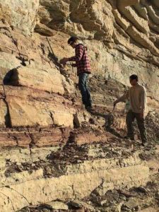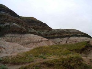
Researchers conducting fieldwork in Namibia as part of a previous study. Credit: Rachel Wood
Scientists are rethinking a major milestone in animal evolution, after gaining fresh insights into how life on Earth diversified millions of years ago.
Bursts of evolutionary activity that increased the number and variety of animals began earlier, occurred over a longer timeframe, and were more frequent than previously thought, researchers say.
Their findings challenge a long-held theory that suggests the huge expansion in the types of animals on the planet more than 500 million years ago was triggered by a single, rapid surge of evolution — known as the Cambrian Explosion.
Geoscientists from the University of Edinburgh re-assessed the timeline of early animal evolution by analysing records of fossil discoveries and environmental change.
Until now, the Cambrian Explosion — which took place between 540 and 520 million years ago — was thought to have given rise to almost all the early ancestors of present-day animals.
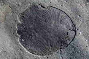
Scientists say, however, that it was probably just one in a series of similar events, the first of which took place at least 571 million years ago during the late Ediacaran Period.
These bursts of evolutionary activity may have coincided with dramatic fluctuations in the levels of oxygen and essential nutrients in the oceans, the team says.
The review is published in the journal Nature Ecology & Evolution. It was supported by the Natural Environment Research Council. The research also involved the Universities of Bristol, Cambridge and Helsinki, Tokyo Institute of Technology, Japan, and Memorial University of Newfoundland in Canada.
Professor Rachel Wood, of the University of Edinburgh’s School of GeoSciences, who led the study, said: “Integrating data from the fossil record with that of environmental changes that affected the whole planet is revealing the patterns and drivers of the rise of complex life on Earth. We used to think early animals emerged rapidly following a single evolutionary event, but our findings suggest it actually happened in stages.”
Reference:
Rachel Wood, Alexander G. Liu, Frederick Bowyer, Philip R. Wilby, Frances S. Dunn, Charlotte G. Kenchington, Jennifer F. Hoyal Cuthill, Emily G. Mitchell, Amelia Penny. Integrated records of environmental change and evolution challenge the Cambrian Explosion. Nature Ecology & Evolution, 2019; DOI: 10.1038/s41559-019-0821-6
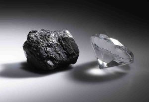
Representative Image, Opal found in Coober Pedy. Credit: PXHere
What is Sedimentary rock?
Sedimentary rocks are types of rock that are formed by the deposition and subsequent cementation of mineral or organic particles on the floor of oceans or other bodies of water at the Earth’s surface. Sedimentation is the collective name for processes that cause these particles to settle in place. The particles that form a sedimentary rock are called sediment, and may be composed of geological detritus (minerals) or biological detritus (organic matter). Before being deposited, the geological detritus was formed by weathering and erosion from the source area, and then transported to the place of deposition by water, wind, ice, mass movement or glaciers, which are called agents of denudation. Biological detritus was formed by bodies and parts (mainly shells) of dead aquatic organisms, as well as their fecal mass, suspended in water and slowly piling up on the floor of water bodies (marine snow). Sedimentation may also occur as dissolved minerals precipitate from water solution.
The sedimentary rock cover of the continents of the Earth’s crust is extensive (73% of the Earth’s current land surface), but the total contribution of sedimentary rocks is estimated to be only 8% of the total volume of the crust. Sedimentary rocks are only a thin veneer over a crust consisting mainly of igneous and metamorphic rocks. Sedimentary rocks are deposited in layers as strata, forming a structure called bedding. The study of sedimentary rocks and rock strata provides information about the subsurface that is useful for civil engineering, for example in the construction of roads, houses, tunnels, canals or other structures. Sedimentary rocks are also important sources of natural resources like coal, fossil fuels, drinking water or ores.
The study of the sequence of sedimentary rock strata is the main source for an understanding of the Earth’s history, including palaeogeography, paleoclimatology and the history of life. The scientific discipline that studies the properties and origin of sedimentary rocks is called sedimentology. Sedimentology is part of both geology and physical geography and overlaps partly with other disciplines in the Earth sciences, such as pedology, geomorphology, geochemistry and structural geology. Sedimentary rocks have also been found on Mars.
Sedimentary Cycle
The sedimentary cycle is the second largest cycle in mineral and rock formation. Sedimentary rocks are formed by erosion, transport in rivers, ice etc. and involve the decay and disintegration of a preexisting rock mass. Usually there are no new minerals formed, only found.
When these particles eventually settle, they form alluvial gravels, sands or clays. When they are either cemented or compressed, then they form sedimentary rocks such a conglomerations, sandstones and limestones.
Chemical action in the environment leads to some material dissolving in water. Eventually the water may evaporate and deposits of borax and other salt “evaporates” may form this way.
Plant and animal remains are commonly incorporated among the rock fragments and these may be preserved as fossils.
Many gemstones are found in “alluvial deposits”. These deposits have their origin in the destruction of the original rocks and the resulting materials by rivers, floods and glacial movement. During this movement the heavier minerals tend to remain relatively close to the source, whilst lighter minerals are carried further away.
The heavier and harder materials do not wear as much as the lighter ones and tend to retain more of their crystal shape. Stones such as sapphire and topaz do not show as much abrasion as softer minerals like quartz.
However, due to the continuous grinding and tumbling over a period of time, a large number of gem minerals are found as rounded “water-worn” pebbles. The gem gravels in Sri Lanka contain a wide variety of such minerals.
Because of their supreme hardness and density many diamonds survive the sedimentary processes and are frequently found in alluvial deposits.
Representative Image, Opal found in Coober Pedy. Credit: PXHere
What is Metamorphic rock?
Metamorphic rocks arise from the transformation of existing rock types, in a process called metamorphism, which means “change in form”. The original rock (protolith) is subjected to heat (temperatures greater than 150 to 200 °C) and pressure (100 megapascals (1,000 bar) or more), causing profound physical or chemical change. The protolith may be a sedimentary, igneous, or existing metamorphic rock.
Metamorphic rocks make up a large part of the Earth’s crust and form 12% of the Earth’s land surface. They are classified by texture and by chemical and mineral assemblage (metamorphic facies). They may be formed simply by being deep beneath the Earth’s surface, subjected to high temperatures and the great pressure of the rock layers above it. They can form from tectonic processes such as continental collisions, which cause horizontal pressure, friction and distortion. They are also formed when rock is heated by the intrusion of hot molten rock called magma from the Earth’s interior. The study of metamorphic rocks (now exposed at the Earth’s surface following erosion and uplift) provides information about the temperatures and pressures that occur at great depths within the Earth’s crust. Some examples of metamorphic rocks are gneiss, slate, marble, schist, and quartzite.
Metamorphic Cycle
The metamorphic cycle is the third largest cycle in mineral and rock formation. Metamorphism is the alteration of mineral paragenesis (the order of formation) after their deposition, by external action such as contact with magmetic rocks, regional changes in the pressure and temperature (e.g. contact metamorphosed limestones, crystalline schists, etc.). The consolidated rocks are altered in composition, texture or internal structure through pressure, heat and new chemical substances.
There are two kinds of metamorphism: Regional and Contact
Regional metamorphism is caused due to a rise in temperature and directed pressure, effecting the earth’s crust.
Contact metamorphism is caused when magma is intruded into a preexisting rock mass. The heat and pressure of this magma, causes a metamorphic change in the rock it intrudes.
Both igneous and sedimentary rocks can change in texture or chemical composition as the result of either contact or regional metamorphism. Thus existing rocks change into new types of rocks. They are usually harder and denser than the original material.
For example, shale may alter into slate and further metamorphose into schist. Limestone is converted into marble. Sometimes schists contain gem minerals like garnet, emerald and corundum.
Representative Image, Opal found in Coober Pedy. Credit: PXHere
Igneous Rocks
Igneous rock, or magmatic rock, is one of the three main rock types, the others being sedimentary and metamorphic. Igneous rock is formed through the cooling and solidification of magma or lava. The magma can be derived from partial melts of existing rocks in either a planet’s mantle or crust. Typically, the melting is caused by one or more of three processes: an increase in temperature, a decrease in pressure, or a change in composition. Solidification into rock occurs either below the surface as intrusive rocks or on the surface as extrusive rocks. Igneous rock may form with crystallization to form granular, crystalline rocks, or without crystallization to form natural glasses. Igneous rocks occur in a wide range of geological settings: shields, platforms, orogens, basins, large igneous provinces, extended crust and oceanic crust.
By the cooling down of magma, atoms are linked into crystalline patterns and subsequently different minerals are formed. When the formation takes place in the depths of the earth’s crust (approx. 33km deep) quite large rocks may be formed (for instance, granites).
Igneous rocks are formed and created by magmatic processes in the earth. To form very large crystals of rare minerals, exceptional conditions are needed. For instance, a rock called pegmatite is formed by the crystallization of magma enriched with water in the veins of other rocks, and may contain beryl, tourmaline and topaz.
Igneous rocks are divided into two types — volcanic rock (extrusive) and plutonic rock (intrusive) — depending on where the magma cools.
Volcanic or extrusive rock
This is rock that is formed on the surface of the earth. In contact with air or seawater, molten rock cools rapidly and either quenches to a glass (like obsidian) or forms small crystals (basalt). Volcanic rocks are usually finely grained or glassy in structure.
Basalt is an extrusive rock, finely grained due to its rapid cooling. It largely consists of tiny feldspar and pyroxene crystals (like diopside and enstatite). Some basalts contain gemstones like corundum, zircon and garnets.
Another volcanic rock is called kimberlite. Kimberlite pipes are the most major source of diamond.
Occasionally, varieties of volcanic glass, obsidian, are cut and fashioned as gemstones. Obsidian is an amorphous mineraloid with the hardness of approximately 5.5. Varieties of obsidian include:
Snowflake obsidian ( with inclusions of the mineral cristobalite)
Rainbow obsidian
Red mahogany obsidian
Silver sheen obsidian
Midnight lace obsidian
Pumpkin obsidian
“Apache tears” obsidian
Plutonic or intrusive rock
When molten rock solidifies within preexisting rock, it cools slowly, forming plutonic rocks with larger crystals. They tend to be coarse grained.
Granite is a coarse grained intrusive rock which contains the minerals quartz and feldspar, and usually carries mica or hornblende. In some circumstances, granite undergoes “fractional crystallization”, a process where slow cooling creates crystals of different minerals as they form at different temperatures.
Minerals of the pegmatite group are among the last to be formed, often occuring as veins penetrating their surroundings.
Associated minerals that find their origin in igneous rocks:
3. Pegmatite phase (rest crystallization) 700-400 degrees C:
The residual part of the magma, which is rich in fluxes, is known as the pegmatite stage. The melt becomes a watery solution as solidification proceeds. Because of this fluidity, the liquids can penetrate fissures and cracks in the surrounding rocks. Under the concentrated pressure and temperatures, individual crystals form that can measure several centimeters, and occasionally several meters! The prismatic crystals grow perpendicular to the walls of the vein. Pegmatite veins are some of the best examples of gemstone formation.
4. Pneumatolytic phase 500-300 degrees C:
Minerals formed in this phase form at lower temperatures and rising pressure. Superheated volatile components are involved. The most prominent of these components is water vapor, boron and fluorine gases. Under the influence of these vapors, other minerals are often formed in the contact zone of limestone.
5. Hydrothermal phase 400-50 degrees C:
This is a process associated with igneous activity that involves heated or super-heated water. Water at very high temperature and pressure is an exceedingly active substance, capable of breaking down silicates and dissolving many substances normally thought to be insoluble. This is the last stage of minerals that can be considered to be formed directly from magma.
Zircon forms in granites deep in the earth’s crust (plutonic rock). Through movement of tectonic plates, this granite is brought to the surface and starts mountain building. Through erosion, the granite (and the contained zircon) builds sediments which will eventually be buried deep enough to transform into metamorphic rocks.
Zircon has two important properties:
Relative high hardness
Resistance to chemical attacks
Due to its hardness of 7.5 on the scale of Mohs, the zircons usually survive the sedimentary process intact. Because of its resistance to chemical attacks, zircon will survive the contact metamorphism process which is trying to attack it with heat and pressure. The latter is important as the liquid mass surrounding the zircon will cause a new rim to be formed around the old zircon, just like the formation of tree rings. This first cycle usually will take hundreds of million years.
The old crystal with its newly formed rim is then pushed up again through tectonic plate interactions, then this geologic cycle repeats itself.
A third and well known property of zircon is that it can accommodate radioactive elements like uranium. Uranium has the ability to decay into lead at a fixed time rate. Calculation of the uranium-lead ratio may give a clue of the age of the zircon (and thus Earth’s age). However, lead may leak from the zircon, disturbing the uranium-lead ratio.
Fortunately, scientists found a new way of calculation by using isotopes. The uranium-238 isotope (with a half-life of 4.468 billion years) decays to lead-206, while uranium-235 (with a half-life of 703.8 million years) decays to lead-207. The “secondary ion mass spectrometry” (or SIMS) technique is used for this kind of measurement. By measuring both ‘parent-daughter’ decays of both these processes, an accurate age of the zircon can be calculated — that is, if both measurements are consistent (which is not always the case).
The Isua rocks on Greenland are a source for this way of dating the earth’s age. Current calculations indicate Earth is 4.6 billion years old.
Artist’s impression of a Galleonosaurus dorisae herd on a riverbank in the Australian-Antarctic rift valley during the Early Cretaceous, 125 million years ago. The newly-named, dinosaur wallaby-sized herbivorous dinosaur, was identified from five fossilized upper jaws in 125-million-year-old rocks from the Cretaceous period of Victoria, southeastern Australia. Credit: Image copyright James Kuether
A new, wallaby-sized herbivorous dinosaur has been identified from five fossilized upper jaws in 125 million year old rocks from the Cretaceous period of Victoria, southeastern Australia.
Reported in the Journal of Paleontology, the new dinosaur is named “Galleonosaurus dorisae,” and is the first dinosaur named from the Gippsland region of Australia in 16 years. According to Dr. Matthew Herne, a Postdoctoral Fellow at the University of New England, NSW, and lead author of the new study, “the jaws of Galleonosaurus dorisae include young to mature individuals—the first time an age range has been identified from the jaws of an Australian dinosaur.”
Galleonosaurus was a small-bodied herbivorous dinosaur within the large family called ornithopods. “These small dinosaurs would have been agile runners on their powerful hind legs,” explained Dr. Herne.
The name Galleonosaurus dorisae refers to the shape of the upper jaw, resembling the upturned hull of a sailing ship called a galleon, and also honours the work of Dr. Doris Seegets-Villiers, who produced her Ph.D. thesis on the palaeontology of the locality where the fossils were discovered.
Galleonosaurus is the fifth small ornithopod genus named from Victoria, which according to Dr. Herne, “confirms that on a global scale, the diversity of these small-bodied dinosaurs had been unusually high in the ancient rift valley that once extended between the spreading continents of Australia and Antarctica.” Small ornithopods appear to have thrived on the vast forested floodplain within the ancient rift valley.
At the time of Galleonosaurus, sediments were shed from a four thousand km long massif of large, actively erupting volcanoes that once existed along the eastern margin of the Australian continent. Some of these sediments were carried westward by large rivers into the Australian-Antarctic rift valley where they formed deep sedimentary basins. However, as these sediments washed down the rivers of the rift valley the bones of dinosaurs, such as Galleonosaurus and other vertebrates, along with the logs of fallen trees, became mixed in. According to Dr. Herne, “this land has now vanished, but as ‘time-travellers’ we get snapshots of this remarkable world via the rocks and fossils exposed along the coast of Victoria.”
The new article shows that Galleonosaurus dorisae is a close relative of Diluvicursor pickeringi; another small ornithopod named by Dr. Herne and his team in 2018, from excavations along the Otway coast to the west of the Gippsland region. Interestingly, “the jaws of Galleonosaurus and the partial skeleton of Diluvicursor were similarly buried in volcanic sediments on the floor of deep powerful rivers,” explained Dr. Herne. “However, Galleonosaurus is about 12 million years older than Diluvicursor, showing that the evolutionary history of dinosaurs in the Australian-Antarctic rift had been lengthy.”
The jaws of Galleonosaurus were discovered by volunteers of the Dinosaur Dreaming project during excavations near the town of Inverloch. The most complete jaw and the key specimen carrying the name Galleonosaurus dorisae was discovered in 2008 by the seasoned fossil hunter Gerrit (‘Gerry’) Kool, from the nearby town of Wonthaggi. Gerry and his wife Lesley have been instrumental in organizing the Dinosaur Dreaming excavations along the Victorian coast for 25 years.
Prior to discovery of Galleonosaurus dorisae, the only other ornithopod known from the Gippsland region was Qantassaurus intrepidus, named in 1999. However, Qantassaurus had a shorter more robust snout than that of Galleonosaurus, explained Dr. Herne, who added, “we consider that these two, similarly-sized dinosaurs fed on different plant types, which would have allowed them to coexist.”
The new study reveals that the ornithopods from Victoria are closely related to those from Patagonia in Argentina. “We are steadily building a picture of terrestrial dinosaur interchange between the shifting Gondwanan continents of Australia, South America and Antarctica during the Cretaceous period,” added Dr. Herne
These are exciting times for dinosaur research, explained Dr. Herne: “Using advanced techniques, such as 3-D micro-CT scanning and printing, new anatomical information is being revealed on dinosaurs such as Galleonosaurus dorisae. These techniques are helping us to delve deeper into the mysterious world of dinosaur ecology—what they ate, how they moved and how they coexisted—and their evolutionary relationships with dinosaurs from other continents.”
Reference:
New small-bodied ornithopods (Dinosauria, Neornithischia) from the Early Cretaceous Wonthaggi Formation (Strzelecki Group) of the Australian-Antarctic rift system, with revision of Qantassaurus intrepidus Rich and Vickers-Rich, 1999. Matthew C. Herne, Jay P. Nair, Alistair R. Evans, and Alan M. Tait. Journal of Paleontology (2019). DOI: 10.1017/jpa.2018.95
Copepods, the world’s most common animal, release unique substances into the oceans. Concentrations of these substances are high enough to affect the marine food web, according to new research from the University of Gothenburg. The studies also show that phytoplankton in the oceans detect the special scent of copepods and do their utmost to avoid being eaten. Credit: University of Gothenburg
Copepods, the world’s most common animal, release unique substances into the oceans. Concentrations of these substances are high enough to affect the marine food web, according to new research from the University of Gothenburg. The studies also show that phytoplankton in the oceans detect the special scent of copepods and do their utmost to avoid being eaten.
The substances that copepods release into seawater are called copepodamides.
When phytoplankton in the water sense copepodamides, they activate their defence mechanisms to avoid being eaten. Some phytoplankton then produce light, bioluminescence; other plankton use chemical warfare and produce toxins or shrink in size.
“Since the phytoplankton in the ocean are the basis of all marine life, the effects become large-scale,” says Erik Selander at the Department of Marine Sciences at the University of Gothenburg, who heads the research team.
Increased understanding of algal blooms
Selander compares the effect of copepodamides with the effect of hormones in the body.
“The substances are remarkably potent. Very small quantities produce large systemic effects. The amount of copepodamide that would fit in a grain of salt are enough to cause phytoplankton in a whole swimming pool to mobilise their defences. Some of the defences involve very strong toxins, and as a result copepodamides can have far-reaching effects such as toxic algal blooms.”
The article, which has now been published in Science Advances, also shows that copepodamides affect more of the ocean’s inhabitants than researchers previously recognised.
“Including a diatom that produces the domoic acid neurotoxin. It is toxic for many organisms and causes memory loss, among other things, in humans. Other diatoms respond by changing their appearance, going from long, contiguous chains of cells to shorter or single-celled variations.”
Size matters
Size is an important property in the ocean. When it changes, there are repercussions in a series of other processes.
“For example, the amount of carbon exported from the surface to deeper water or who eats whom in the plankton community.”
The new discoveries increase our understanding of the marine food web, and especially the mechanisms that lead to toxic algal blooms.
“We previously have not been able to understand why and when toxic algal blooms occur. Copepodamides seem to be an important and overlooked mechanism that contributes to the occurrence of toxic algal blooms by causing producers of toxins to produce as much as 10 times more toxins than normal.”
Reference:
E. Selander et al. Copepods drive large-scale trait-mediated effects in marine plankton, Science Advances (2019). DOI: 10.1126/sciadv.aat5096
A speleothem that Ibarra retrieved from a cave in the Philippines was brought to Stanford to undergo geochemistry testing. Credit: Daniel Ibarra
Scattered throughout the Philippines are many caves containing precious geological formations that hold key information about past climate. But due to local quarrying, some of these formations may be destroyed. Now, one Stanford scientist is on a mission to save them.
Daniel Ibarra, BS ’12, MS ’14, Ph.D. ’18, is a postdoctoral researcher in the Department of Geological and Environmental Sciences. He recently teamed up with Stanford alum Carlos Primo David, Ph.D. ’03, now a professor at the University of the Philippines at Diliman, to begin the process of retrieving these valuable climate archives. Ibarra is bringing them to Stanford where he will use sophisticated geochemistry techniques to reconstruct and extend past climate records.
“As climate scientists we have no way of baselining how climate has changed in the past beyond the instrumental record, except for using the geological record,” Ibarra said. “So we study archives like tree rings, ice cores, lakes, marine sediments and caves.”
Archival caves
One of the most important archives on land are cave deposits that contain large, icicle-shaped mineral deposits known as speleothems. Many of these caves are located in the Philippines. So in January, Ibarra traveled to Manila, where he met David and his graduate students. Together they explored a series of caves in Luzon to document and collect two types of speleothems: stalactites and stalagmites.
Stalactites form when water drips from the ceiling of a cave and slowly precipitates over time, leaving a climate record in the form of concentric circles similar to rings on a tree. Stalagmites form the same way, but grow upward from the floor and are the most useful of these cave deposits. Although these formations are estimated to be thousands of years old, very few have been studied in the Philippines. Because of industrial excavation occurring nearby, they could soon be gone forever.
“This is an area of active cement quarrying, so we only have a few years to get speleothems,” Ibarra said. “It’s a little bit of a rescue mission.”
After carefully removing the speleothems from the caves, Ibarra brings them to Stanford, where the samples are drilled and dated through a process – similar to carbon dating – using the radioactive decay chain of uranium, measured on a mass spectrometer. Ibarra uses detectors that measure the different ratios of thorium and uranium isotopes, which tell him the age of the sample. Similar mass spectrometry techniques using stable isotopes of oxygen and carbon are used to determine what the temperature and rainfall levels were at the time the speleothems formed – data that will improve scientists’ understanding of climate change.
“We’re focusing on samples that will extend the historic rainfall records back several hundred, maybe even a thousand years,” Ibarra said. “And we can use what we infer about climate from these samples to benchmark climate models that we also use to project future climate change.”
Weathering at Mount Pinatubo
Ibarra and David are simultaneously working on related research in the area around Mount Pinatubo, the active volcano about 100 miles northwest of Manila famous for its massive eruption in 1991. It’s there that the chemical breakdown of rocks on the Earth’s subsurface – a process known as weathering – is believed to occur at some of the fastest rates in the world.
The weathering of rocks is the primary way in which carbon dioxide is sequestered over geologic time, keeping the Earth habitable. Ibarra and David are measuring weathering rates by collecting water samples from rivers during different times of the year and measuring the chemical composition of the river waters for elements such as calcium, magnesium, sodium and silica – the main components of rocks.
“Chemical weathering and subsequent carbonate burial in ocean sediments sequester atmospheric CO2 back into the geologic carbon cycle,” Ibarra explained. “Weathering modulates Earth’s atmospheric CO2 levels from changes in volcanic degassing, or the long-term effects of human emissions, keeping temperatures regulated.”
Both research projects are supported by an award Ibarra received from the Department of Science and Technology Balik Scientist Program, which encourages scientists of Filipino descent to return to the Philippines to share their expertise. Through the program, he is hosted by the University of the Philippines’ National Institute for Geological Sciences and Professor David. In addition to conducting original research, Ibarra has given talks and lectures on climate science and geochemistry at the University of the Philippines.
Ibarra plans to return to the Philippines this spring to continue collecting cave deposits and river samples. He hopes this work will help people prepare for changes in the environment.
“Studying past climate gives us a roadmap for the kinds of changes we can expect in rainfall and temperature due to future changes in climate, which can inform adaptation strategies,” he said.
Chemical analysis of these shells (found in marine sediment below the Southern Ocean floor, and seen here under an electron microscope) enabled researchers to trace the evolution of water mixing, a crucial phenomenon in climate transitions. These foraminifera live either at the ocean bottom, or in the surface waters (picture). Credit: Adam Hasenfratz / University of Bern
Over the last million years, ice ages have intensified and lengthened. According to a study led by the University of Bern, this previously unexplained climate transition coincides with a diminution of the mixing between deep and surface waters in the Southern Ocean. The study confirms that the Antarctic region plays a crucial role during periods of climate change.
An analysis of marine sediments collected at a depth of more than 2 km has just provided an answer to one of the riddles of the earth’s climate history: the mid-Pleistocene transition, which began around one million years ago. Thereafter, ice ages lengthened and intensified, and the frequency of their cycles increased from 40,000 years to 100,000 years. The study, which appeared in the journal Science, shows one of the keys to this phenomenon lies in the deep waters of the Southern Ocean surrounding Antarctica.
Ocean waters contain 60 times more carbon than the atmosphere. Consequently, small variations in the carbon dioxide (CO2) concentration of the waters play a major role in climate transitions. Led by Samuel Jaccard, SNSF Professor at the University of Bern, the new study traced the evolution of mixing between deep and surface waters in the Southern Ocean. Mixing is a major factor in the global climate system, because it brings oceanic CO2 to the surface, where it escapes into the atmosphere.
The findings show that mixing was significantly reduced at the end of the Mid-Pleistocene Transition, about 600,000 years ago. Moreover, they explain how the reduced mixing diminished the amount of CO2 released by the ocean, which in turn reduced the greenhouse effect and intensified ice ages. The study thus sheds light on feedback mechanisms capable of significantly slowing or accelerating ongoing climate change.
“The dynamics of the global climate system are very complex”, says Samuel Jaccard. “Concentrations of atmospheric greenhouse gases, especially CO2, play an important role. They are obviously linked to emissions due to human activities, but also to natural phenomena and especially to degassing of carbon dioxide contained in the oceans. Mixing plays a very important role in this case, because it brings the dissolved CO2 from the deep waters to the surface, from where it is transferred to the atmosphere and contributes to the greenhouse effect. A better understanding of these phenomena is crucial, because they are also a factor in present-day global warming.”
Consequences for global warming
The researchers determined the difference in salinity and temperature between the surface and deep waters, because these two factors determine the intensity of mixing, among other things. The findings show that two opposing processes have intensified during the climate transition to longer ice ages: the surface waters became simultaneously colder and less salty.
As a result, the mixing of layers decreased considerably during ice ages. By reducing the amount of CO2 released by the oceans into the atmosphere, this phenomenon helped to lessen the greenhouse effect and prolong a cold climate, thus ushering in a period of “global cooling”, says Jaccard. “This is a typical example of a feedback loop: mixing diminishes, and precipitation and glacier melt accumulate at the surface of the ocean and stay there for a longer time; that in turn decreases the salinity and density at the water surface, reinforcing the attenuation of the mixing process.”
These results are relevant to the current situation, says Jaccard: “In recent decades we’ve observed more intense westerly winds as climate warms, which promotes mixing and thus release of oceanic CO2 into the atmosphere. But this trend could be compensated by other effects: for example, a warmer climate could increase precipitation and glacier melting, thereby adding freshwater to the surface. We cannot yet predict what will happen; we need climate simulations to better understand how the circulation dynamics of the Southern Ocean will evolve in the future.”
Getting down to the nitty-gritty
The historical reconstruction of the ocean mixing was done using a sediment core 169 metres long, taken from beneath the ocean floor at a depth of 2800 metres, some 2500 km off the coast of South Africa. The core was extracted during the 1990s as part of the International Ocean Drilling Project (IODP) and stored since then in Germany. The team had access to the core through Switzerland’s active participation in the IODP, which has been supported by the Swiss National Science Foundation.
During his Ph.D. at ETH Zurich, Adam Hasenfratz cut the core into thousands of centimetre-thick slices, each corresponding to roughly a century’s worth of deposits. From each slice, he isolated and analysed shells from foraminifera, protozoa with a calcite skeleton. The chemical composition of the shells depends on the marine conditions during the shells’ formation, in particular salinity and water temperature.
“At first, all the experts told us that our project was doomed because the number of foraminifera would be too small to carry out the necessary chemico-physical analyses”, says Samuel Jaccard. “But Adam succeeded in developing new techniques which allowed him to analyse very small quantities of material. This enabled us to trace the evolution of the salinity and the water temperature.” Hasenfratz identified two species that live either on the ocean floor (Melonis pompilioides) or at the ocean surface (Neogloboquadrina pachyderma). That enabled him to obtain information on the temperature and salinity of both deep and surface waters over a period of more than a million years.
As it happens, the ratio of magnesium to calcium present in a foraminifera shell depends on the temperature of the water as the shell is being formed. That bit of data makes it possible to deduce the salinity of the water based on the ratio of two isotopes of oxygen (O16 and O18) present in the calcite (CaCO3) shell, which reflects both the temperature and salinity of the water. Because seawater containing the light isotope O16 evaporates more readily, the ratio of the oxygen isotopes provides an indication of the rate of evaporation and consequently the salinity and temperature of the water.
The analysis shows that the surface waters cooled over the course of the last million years, especially during ice ages. This reduced the temperature difference between the surface and the cold, deep waters, which in principle should have intensified mixing. But this trend was reversed by the marked decrease in salinity of the surface waters, which became less dense and thus less susceptible to mixing with the deep layers. The study shows that mixing of the waters diminished significantly, which allowed the deep waters to sequester more dissolved CO2, with important consequences for climate evolution.
Reference:
Adam P. Hasenfratz et al. The residence time of Southern Ocean surface waters and the 100,000-year ice age cycle, Science (2019). DOI: 10.1126/science.aat7067 Adam P. Hasenfratz et al. The residence time of Southern Ocean surface waters and the 100,000-year ice age cycle, Science (2019). DOI: 10.1126/science.aat7067
Students examining a 3m wide intrusive basalt dike at Acadia National Park in Maine, USA. Credit: Zack Churchill
What is an intrusive igneous rock?
Intrusive, or plutonic, igneous rock forms when magma remains inside the Earth’s crust where it cools and solidifies in chambers within pre-existing rock. The magma cools very slowly over many thousands or millions of years until is solidifies. Slow cooling means the individual mineral grains have a very long time to grow, forming a rock with large, visible crystals
Acadia Bedrock Formation
The landscape that we know as Acadia had its beginnings more than 500 million years ago, when mud, sand, and volcanic ash were deposited in an early ocean. With time these sediments were buried, and pressure turned them to rock. Forces deep within the earth and tectonic (plate) activity deeply buried, heated, and squeezed this rock, changing it into the Ellsworth Schist, a metamorphic rock characterized by contorted, thin bands of white and gray quartz and feldspar, and green chlorite. It is the oldest rock known in the Mount Desert region.
The combined forces of erosion and the shifting of the rigid plates that make up the earth’s crust (tectonics) brought the deeply buried Ellsworth Schist to the earth’s surface. Approximately 450 million years ago, when a micro-terrane (mini-continent) called Avalonia collided with North America, this schist formed a platform on which sand and silt accumulated. Burial hardened these fine-grained deposits, creating the Bar Harbor Formation, a sequence of brown to gray bedded, or layered, sandstone and siltstones. Simultaneously with the creation of the Bar Harbor Formation, volcanoes erupted in the region. Volcanic flows and ash accumulated in the ocean basin, and formed the light-colored Cranberry Island Volcanics and deposited layers of ash in the developing Bar Harbor Formation.
A complex series of events led to the intrusion of several different types of molten, or igneous, rocks. The intrusive rocks cooled beneath the earth’s surface, allowing the crystals of various minerals to form and grow. Each rock type is composed of a unique set of minerals. The first and oldest is a gabbro. This rock is dark in color and is made up of iron-rich minerals.
The granites of Mount Desert Island are approximately 420 million years old. Because their mineralogy is so similar, the granites are identified by the size of individual mineral grains and the composition of the scattered dark minerals present. One of the oldest granites to appear was the Cadillac Mountain Granite, the largest granite body on the island. It oozed up through existing rocks, stressing and fracturing the overlying bedrock and causing large chunks to fall into the molten magma body. Some chunks of bedrock melted in the intense heat, while others were suspended in the magma. When the granite cooled deep in the earth, these blocks remained, surrounded by crystallized granite. This region of granite and broken rock, called the shatter zone, is still visible on the eastern side of the Cadillac Mountain Granite. A medium-grained granite formed to the west of the Cadillac Mountain Granite.
Later volcanic activity injected diabase, a fine-grained, black igneous rock into the granites and surrounding rocks. These diabase bodies, or dikes, can be seen along the road to the summit of Cadillac Mountain and on the Schoodic Peninsula.
Little record of the following several hundred million years remains. Erosion wore away the rocks covering the large granite bodies, bringing them to the earth’s surface. The same process removed much of the softer rock surrounding the granite, leaving behind resistant granitic mountains ringed by lowlands. Streams ran between the ridges, and a succession of plant and animal life inhabited the region.
Intrusive Basalt Dike
There are 2 rock types of rocks; granite and diabase. The larger, pale colored rock is a large granitic pluton. It formed as a massive, slow-cooling magma chamber in the Devonian Period. Granites in this area formed after the collision of an island arc with North America; this collision triggered one of the pulses of mountain-building represented in the Appalachians called the Acadian Orogeny.
The dark rock is a diabase, formed almost 200 million years later. After the Acadian Orogeny, North America collided with Europe and Africa to form the supercontinent Pangaea. Then, at the end of the Triassic, those continents pulled apart, opening up cracks in the crust that filled with mafic magmas. The dark rock here is called a diabase – a term for mafic rocks that formed small crystals as they were cooling. It cross cuts the granite, showing that the dike is the younger rock – the granite had to be there fore the dike to fracture it.
Photos
Intrusive Basalt Dike, Acadia National Park
1 of 7
Students examining a 3m wide intrusive basalt dike at Acadia National Park in Maine, USA. Credit: Zack Churchill
Dinosaurs were unaffected by long-term climate changes and flourished before their sudden demise by asteroid strike.
Scientists largely agree that an asteroid impact, possibly coupled with intense volcanic activity, wiped out the dinosaurs at the end of the Cretaceous period 66 million years ago.
However, there is debate about whether dinosaurs were flourishing before this, or whether they had been in decline due to long-term changes in climate over millions of years.
Previously, researchers used the fossil record and some mathematical predictions to suggest dinosaurs may have already been in decline, with the number and diversity of species falling before the asteroid impact.
Now, in a new analysis that models the changing environment and dinosaur species distribution in North America, researchers from Imperial College London, University College London and University of Bristol have shown that dinosaurs were likely not in decline before the meteorite.
Lead researcher Alessandro Chiarenza, a PhD student in the Department of Earth Science and Engineering at Imperial, said: “Dinosaurs were likely not doomed to extinction until the end of the Cretaceous, when the asteroid hit, declaring the end of their reign and leaving the planet to animals like mammals, lizards and a minor group of surviving dinosaurs: birds.
“The results of our study suggest that dinosaurs as a whole were adaptable animals, capable of coping with the environmental changes and climatic fluctuations that happened during the last few million years of the Late Cretaceous. Climate change over prolonged time scales did not cause a long-term decline of dinosaurs through the last stages of this period.”
The study, published today in Nature Communications, shows how the changing conditions for fossilisation means previous analyses have underestimated the number of species at the end of the Cretaceous.
The team focused their study on North America, where many Late Cretaceous dinosaurs are preserved, such as Tyrannosaurus rex and Triceratops. During this period, the continent was split in two by a large inland sea.
In the western half there was a steady supply of sediment from the newly forming Rocky Mountains, which created perfect conditions for fossilising dinosaurs once they died. The eastern half of the continent was instead characterised by conditions far less suitable for fossilisation.
This means that far more dinosaur fossils are found in the western half, and it is this fossil record that is often used to suggest dinosaurs were in decline for the few million years before the asteroid strike.
Co-author Dr Philip Mannion, from University College London, commented: “Most of what we know about Late Cretaceous North American dinosaurs comes from an area smaller than one-third of the present-day continent, and yet we know that dinosaurs roamed all across North America, from Alaska to New Jersey and down to Mexico.”
Instead of using this known record exclusively, the team employed ‘ecological niche modelling’. This approach models which environmental conditions, such as temperature and rainfall, each species needs to survive.
The team then mapped where these conditions would occur both across the continent and over time. This allowed them to create a picture of where groups of dinosaur species could survive as conditions changed, rather than just where their fossils had been found.
The team found habitats that could support a range of dinosaur groups were actually more widespread at the end of the Cretaceous, but that these were in areas less likely to preserve fossils.
Furthermore, these potentially dinosaur-rich areas were smaller wherever they occurred, again reducing the likelihood of finding a fossil from each of these areas.
Reference:
Alfio Alessandro Chiarenza, Philip D. Mannion, Daniel J. Lunt, Alex Farnsworth, Lewis A. Jones, Sarah-Jane Kelland, Peter A. Allison. Ecological niche modelling does not support climatically-driven dinosaur diversity decline before the Cretaceous/Paleogene mass extinction. Nature Communications, 2019; 10 (1) DOI: 10.1038/s41467-019-08997-2
In this Feb. 28, 2019 photo, a fossilized dinosaur footprints are shown on a paving stone at the Valley Forge National Historical Park in Valley Forge, Pa. A volunteer at the park outside Philadelphia recently discovered dozens of fossilized dinosaur footprints on flat rocks used to pave a section of hiking trail. Credit: AP Photo/Matt Rourke
The national park on the site where George Washington and the struggling Continental Army endured a tough winter during the American Revolution boasts a new feature that’s a couple of hundred million years old—dozens of fossilized dinosaur footprints discovered on rocks used to pave a section of hiking trail.
The trace fossils, as they are known, are scattered along a winding trail at Valley Forge National Historical Park, on slabs purchased in 2011 from a nearby commercial quarry.
To the untrained eye, they appear as indistinguishable bumps in the sandstone rock, with the largest about 9 inches long. On a recent weekday, hikers, joggers and dog walkers used the trail, oblivious to the marks of prehistoric animals beneath their feet.
Those marks drew the attention of Tom Stack not long after he began working as a volunteer park ambassador at Valley Forge in 2017.
Stack, who has a background in geology and paleontology, recognized the approximately 210 million-year-old rocks known as argillite as being similar in age and type to fossil-bearing rocks used to construct a 1930s-era bridge on the Gettysburg battlefield, about 100 miles (161 kilometers) to the west.
Most of the tracks left in what were once muddy flats consist of three-toed foot impressions from the early days of dinosaurs, although Stack also found footprints from a non-dinosaur reptile, a relative of the modern crocodile. The largest would have been a bipedal theropod that was 6 (1.8 meters) to 9 feet (2.7 meters) long and 4 (1.2 meters) to 6 feet (1.8 meters) high.
“They’re subtle, they’re not easy to spot, but once you learn the characteristics of them, given the right sunlight angle and, at times, the moisture on the rock, then they are easier to identify,” Stack said.
There are also distinctive patterns in the rock thought to be caused by the cracking of dried mud, and from the ripples of a lake or river.
The National Park Service requested the exact location of the rocks not be publicized, to help protect them from being damaged or removed. Officials said visitors will be told about the rocks and how park resources are protected, but not where to find them. The 5-square-mile (13 square kilometer) park has about 30 miles (48 kilometers) of trail.
The dinosaur footprints Stack found are not unique or even particularly rare, and don’t add to the body of scientific knowledge about the creatures, said National Park Service paleontology program coordinator Vince Santucci. They date from later in the Triassic period and before the Jurassic era that’s so familiar to moviegoers.
“There’s no question that they are” dinosaur trace fossils, said Santucci, who examined them in person last April. “They’re consistent with the tracks that occur in equivalent-age beds all over the East Coast.”
More than 270 National Park Service properties contain some sort of paleontological resource, from Dinosaur National Monument in Colorado and Utah to the fossils scattered in rock used to build the Lincoln Memorial and Capitol Reflecting Pool in Washington, D.C.
Most fossils found on Park Service land are still where they were discovered, in the original bedrock location. But others were moved by human activity, including a set of burrows from an ancient species that appear on the rock facade of a visitor’s center bathroom at Valley Forge. Those rocks originated outside the park.
There also happens to be a significant Ice Age fossil location beneath the Valley Forge park, the Port Kennedy bone cave. First discovered in 1871, it has produced fossils that include giant tapirs, ground sloths and saber-toothed cats. Port Kennedy is considered one of the most important mammal fossil sites in North America, with some findings having been displayed at the park visitor center, although most are at the Academy of Natural Sciences in Philadelphia. That 750,000-year-old site was lost after a quarry was filled—partly with asbestos—before being rediscovered by scientists in 2005. It is not accessible to the public.
There are at least 35 Park Service properties known to have fossil tracks of ancient vertebrates, and vandalism and theft have been a problem. Federal law prohibits visitors from disturbing park elements.
A park spokesman said there have been preliminary discussions about developing an interpretive program to give visitors information about the trace fossils. Stack said the park should consider removing rocks that contain the best fossils, to prevent damage or theft.
“I would think they are of value as an educational tool,” said Helen Delano, a senior scientist with the Pennsylvania Geologic Survey. “Dinosaurs are a wonderful way to hook people into paying attention to the geological environment. Every kid loves dinosaurs.”
Stack said the rocks are abundant, cheap and durable, so they have long been used for paving, sidewalks, garden walls and similar features in the Philadelphia area.
This is a tidal marsh in Maryland, on a tributary of Chesapeake Bay. Wetlands store carbon more efficiently than any other natural ecosystem, and a new study shows they store even more when sea level rises. Credit: Smithsonian Environmental Research Center
Some wetlands perform better under pressure. A new study revealed that when faced with sea-level rise, coastal wetlands respond by burying even more carbon in their soils.
Coastal wetlands, which include marshes, mangroves and seagrasses, already store carbon more efficiently than any other natural ecosystem, including forests. The latest study, published March 7 in the journal Nature, looked at how coastal wetlands worldwide react to rising seas and discovered they can rise to the occasion, offering additional protection against climate change.
“Scientists know a fair amount about the carbon stored in our local tidal wetlands, but we didn’t have enough data to see global patterns,” said Pat Megonigal, a co-author and soil scientist at the Smithsonian Environmental Research Center.
To get a global picture, scientists from Australia, China, South Africa and the U.S. pooled data from 345 wetland sites on six continents. They looked at how those wetlands stored carbon for up to 6,000 years and compared whether sea levels rose, fell or stayed mostly the same over the millennia.
For wetlands that had faced rising seas, carbon concentrations doubled or nearly quadrupled in just the top 20 centimeters of soil. When the scientists looked deeper, at 50 to 100 centimeters beneath the surface, the difference hit five to nine times higher.
The extra boost comes because the carbon added to wetland soils by plant growth and sediment is buried faster as wetlands become wetter. Trapped underwater with little to no oxygen, the organic detritus does not decompose and release carbon dioxide as quickly. And the higher the waters rise, the more underwater storage space exists for the carbon to get buried.
North America and Europe faced the most sea-level rise over the past 6,000 years. Melting glaciers from the last ice age caused water levels to rise, increasing coastal flooding. Continents in the southern hemisphere, by contrast, were largely glacier-free and experienced stable or even falling sea levels.
However, the scene is changing now. The steady march of climate change is exposing even wetlands farther south to accelerated sea-level rise.
“They may be the sleeping giants of global carbon sequestration,” said lead author Kerrylee Rogers of the University of Wollongong in Australia. Half of the world’s tidal marshland grows along the coastlines of southern Africa, Australia, China and South America. If those wetlands doubled their carbon sequestration — as other wetlands in the study did in response to sea-level rise — they could sequester another 5 million tons of atmospheric carbon every year. That is the equivalent of taking more than a million cars off the road.
The trick, of course, is to ensure wetlands do not drown and disappear if waters rise too quickly.
“Preservation of coastal wetlands is critical if they are to play a role in sequestering carbon and mitigating climate change,” Rogers said.
For coastal wetlands to survive, they need space to migrate inland. Whether they have enough space depends largely on how societies prioritize many competing goals. One thing is certain: With climate change ramping up, wetlands can protect people in more ways than one, if given enough breathing room.
Reference:
Kerrylee Rogers, Jeffrey J. Kelleway, Neil Saintilan, J. Patrick Megonigal, Janine B. Adams, James R. Holmquist, Meng Lu, Lisa Schile-Beers, Atun Zawadzki, Debashish Mazumder & Colin D. Woodroffe. Wetland carbon storage controlled by millennial-scale variation in relative sea-level rise. Nature, 2019 DOI: 10.1038/s41586-019-0951-7
A 2015 wildfire burns in the boreal forest of central Alaska. A recent study by Tyler Hoecker and Philip Higuera reconstructs fire history in a nearby boreal forest landscape and suggests that fire activity over the past several decades has been higher than at any time over the past 450 years. Credit: Philip Higuera
In a recent study, University of Montana researchers explored the ways forest succession and climate variability interacted and influenced fires in Alaska’s boreal forests over the past four centuries — from 1550 to 2015.
“We reconstructed fire activity over the last 450 years using lake-sediment records,” said Tyler Hoecker, the study’s lead author.
As part of his master’s thesis work in the Systems Ecology program in the W.A. Franke College of Forestry and Conservation, Hoecker collected lake-sediment cores near the Nowitna National Wildlife Refuge in central Alaska, a fire-prone area that also has many lakes.
“Charcoal produced by fires is blown into lakes and settles to the bottom, forming a stable record of the fire history in the layers of sediment, much like fire scars on tree rings,” Hoecker said. “By carefully measuring changes in charcoal through time, we deduced changes in fire activity. We paired fire history records from seven lakes with records of tree ages and a record of climate. Then, we compared these records, looking for patterns in how the processes interacted.”
Hoecker and co-author Phil Higuera, an associate professor of fire ecology in UM’s Department of Ecosystem and Conservation Sciences, found that years of extensive fire activity usually occurred several decades after trees established, suggesting that the development of mature forest across the study landscape was necessary to support widespread burning. They also saw that there was more fire activity in years when temperatures were higher, especially over the past 100 years.
“In the 20th century, fires and temperatures both increased significantly, beyond what either had been at any earlier point in our 450-year record,” Hoecker said. “This indicates that fires are happening more frequently than they have for many centuries and could cause big changes in the character of forests in Alaska.”
Boreal forests cover over 10 percent of the Earth’s land area, and because they store massive amounts of carbon, both above and below ground, they are partly responsible for regulating Earth’s climate. While wildfires have burned in boreal forests for millennia, changes in fire activity could alter the way these forests affect regional and global climates, the researchers said.
“Understanding how slowly varying processes like succession and climate affect fire activity is difficult to do in a single human lifetime,” Higuera said. “Paleoecological records, like the lake sediments used in this study, extend the window of observation further into the past, allowing scientists to understand long-term change and put ongoing change into context.”
Hoecker said the paper helps address a number of questions related to the impact of climate change on fire activity. First, it helps tease apart the roles climate and vegetation play.
“We found that both were players: Fires require abundant fuel and warm, dry climate years,” he said. “But when temperatures really started increasing in the 20th century, fire activity did too. This suggests that climate is a key limiting factor for extensive burning in Alaska’s boreal forest.”
The study also helps place this increase into the broader context of the past.
“The increases in fire activity we saw in the 20th century are particularly significant when you compare them to the previous several centuries,” Hoecker said. “That longer record suggests that the trajectory of increasing fire activity we are seeing in Alaska may be unprecedented over a very long period.”
Hoecker graduated from UM in 2017 with a master’s in systems ecology and is now a Ph.D. student at the University of Wisconsin, Madison.
Reference:
Tyler J. Hoecker, Philip E. Higuera. Forest succession and climate variability interacted to control fire activity over the last four centuries in an Alaskan boreal landscape. Landscape Ecology, 2019; DOI: 10.1007/s10980-018-00766-8
Scientists used the model to calculate seismic risk in the L.A. Basin. Credit: Juan Vargas, Jean-Philippe Avouac, Chris Rollins / Caltech
Geophysicists at Caltech have created a new method for determining earthquake hazards by measuring how fast energy is building up on faults in a specific region, and then comparing that to how much is being released through fault creep and earthquakes.
They applied the new method to the faults underneath central Los Angeles, and found that on the long-term average, the strongest earthquake that is likely to occur along those faults is between magnitude 6.8 and 7.1, and that a magnitude 6.8—about 50 percent stronger than the 1994 Northridge earthquake—could occur roughly every 300 years on average.
That is not to say that a larger earthquake beneath central L.A. is impossible, the researchers say; rather, they find that the crust beneath Los Angeles does not seem to be being squeezed from south to north fast enough to make such an earthquake quite as likely.
The method also allows for an assessment of the likelihood of smaller earthquakes. If one excludes aftershocks, the probability that a magnitude 6.0 or greater earthquake will occur in central LA over any given 10-year period is about 9 percent, while the chance of a magnitude 6.5 or greater earthquake is about 2 percent.
A paper describing these findings was published by Geophysical Research Letters on February 27.
These levels of seismic hazard are somewhat lower but do not differ significantly from what has already been predicted by the Working Group on California Earthquake Probabilities. But that is actually the point, the Caltech scientists say.
Current state-of-the-art methods for assessing the seismic hazard of an area involve generating a detailed assessment of the kinds of earthquake ruptures that can be expected along each fault, a complicated process that relies on supercomputers to generate a final model. By contrast, the new method—developed by Caltech graduate student Chris Rollins and Jean-Philippe Avouac, Earle C. Anthony Professor of Geology and Mechanical and Civil Engineering—is much simpler, relying on the strain budget and the overall earthquake statistics in a region.
“We basically ask, ‘Given that central L.A. is being squeezed from north to south at a few millimeters per year, what can we say about how often earthquakes of various magnitudes might occur in the area, and how large earthquakes might get?'” Rollins says.
When one tectonic plate pushes against another, elastic strain is built up along the boundary between the two plates. The strain increases until one plate either creeps slowly past the other, or it jerks violently. The violent jerks are felt as earthquakes.
Fortunately, the gradual bending of the crust between earthquakes can be measured at the surface by studying how the earth’s surface deforms. In a previous study (done in collaboration with Caltech research software engineer Walter Landry; Don Argus of the Jet Propulsion Laboratory, which is managed by Caltech for NASA; and Sylvain Barbot of USC), Avouac and Rollins measured ground displacement using permanent global positioning system (GPS) stations that are part of the Plate Boundary Observatory network, supported by the National Science Foundation (NSF) and NASA. The GPS measurements revealed how fast the land beneath L.A. is being bent. From that, the researchers calculated how much strain was being released by creep and how much was being stored as elastic strain available to drive earthquakes.
The new study assesses whether that earthquake strain is most likely to be released by frequent small earthquakes or by one very large one, or something in between. Avouac and Rollins examined the historical record of earthquakes in Los Angeles from 1932 to 2017, as recorded by the Southern California Seismic Network, and selected the scenario that best fit the region’s observed behavior.
“Estimating the magnitude and frequency of the most extreme events, which can’t be assumed to be known from history or instrumental observations, is very hard. Our method provides a framework to solve that problem and calculate earthquake probabilities,” says Avouac.
This new method of estimating earthquake likelihood can be easily applied to other areas, offering a way to assess seismic hazards based on physical principles. “We are now refining the method to take into account the time distribution of past earthquakes, to make the forecasts more accurate, and we are adapting the framework so that it can apply to induced seismicity,” Avouac says.
The study is titled “A geodesy- and seismicity-based local earthquake likelihood model for central Los Angeles.”
Reference:
Chris Rollins et al. A geodesy- and seismicity-based local earthquake likelihood model for central Los Angeles, Geophysical Research Letters (2019). DOI: 10.1029/2018GL080868
New research finds a geologic fault system in central Italy that produced a deadly earthquake in 2016 is also responsible for a fifth-century earthquake that damaged many Roman monuments, including the Colosseum. Credit: David Iliff, CC-BY-SA 3.0
A geologic fault system in central Italy that produced a deadly earthquake in 2016 is also responsible for a fifth-century earthquake that damaged many Roman monuments, including the Colosseum, according to new research.
The Mount Vettore fault system, which winds through Italy’s Apennine Mountains, ruptured in the middle of the night on August 24, 2016. The magnitude 6.2 earthquake it generated killed nearly 300 people and destroyed several villages in the surrounding region. The fault ruptured again in October 2016, producing two more earthquakes with magnitudes greater than 6.
Scientists had thought the Mount Vettore fault system was dormant until it ruptured in 2016. They knew it could produce earthquakes, but as far as anyone knew, this was the first time the fault had ruptured in recorded history.
But a new study in the AGU journal Tectonics combining geologic data with historical records shows the fault produced a major earthquake in 443 A.D. that damaged or destroyed many well-known monuments from Roman civilization.
Among the damaged buildings were the Colosseum, made famous by the Roman Empire’s gladiator contests, as well as Rome’s first permanent theater and several important early Christian churches.
The finding suggests dormant faults throughout the Apennines are a silent threat to Italians and the country’s numerous historical and cultural landmarks, according to the authors. Quiescent faults could be more destructive than active faults, because researchers don’t fully consider them when evaluating seismic hazards, said Paolo Galli, a geophysicist at Italy’s National Civil Protection Department in Rome and lead author of the new study.
Reconstructing Italy’s geologic past
Italy lies on the southern end of the Eurasian tectonic plate, close to where it meets the Adriatic, African, and Ionian Sea plates. The movement of these plates relative to each other created the Apennine mountains millions of years ago, and makes Italy seismically and volcanically active today.
Hundreds of kilometers of geologic faults snake through the Apennine Mountains. Seismologists consider some of these faults to be silent or dormant because they haven’t been linked to any known historical earthquakes.
Scientists thought Mount Vettore was one of these silent fault systems until it ruptured in 2016. After Galli and his colleagues mapped the fault’s rupture in 2016, they decided to look for evidence of it having ruptured in the past.
To do so, they dug deep trenches around parts of the fault system that ruptured in October 2016. The trenches allowed them to see the various sediment layers on either side of the fault and to determine whether the two sides of the fault had moved relative to each other at any other times in the past – in other words, if the fault had generated past earthquakes.
In the new study, Galli and his colleagues analyzed the sediment layers in the trenches and found the Mount Vettore system ruptured five other times in the past 9,000 years, in addition to 2016. One of those ruptures occurred in the middle of the fifth century, at the very end of the Roman period. Averaging the time between ruptures, they found the Mount Vettore system produces major earthquakes every 1,500 to 2,100 years.
Combining science and history
Using data from past archaeological digs in Italy and historical records from the Roman Empire, Galli and his colleagues matched the fifth-century rupture of Mount Vettore to an earthquake that rocked central Italy in 443 A.D., just three decades before the final Roman emperor was deposed.
The 443 earthquake destroyed many towns in the Italian countryside and damaged numerous landmarks in Rome, including the Colosseum and the Theater of Pompey, Rome’s first permanent theater. The earthquake also damaged several famous early Christian churches, such as Saint Paul’s Basilica and the Church of Saint Peter in Chains, currently home to Michelangelo’s statue of Moses. Inscriptions written by Pope Leo I, emperors Valentinianus III and Theodosius II in the fifth century refer to restorations made to these structures likely as a result of this earthquake.
The new study’s results suggest the 2016 earthquake was not as unexpected as scientists thought, and other Apennine faults considered dormant by scientists may in fact pose a seismic hazard to central Italy. Considering the immense historical and cultural value of Roman ruins in this region, Galli’s priority is to better understand the rest of the silent faults on the Italian peninsula.
Reference:
P. Galli et al. The Awakening of the Dormant Mount Vettore Fault (2016 Central Italy Earthquake, M w 6.6): Paleoseismic Clues on Its Millennial Silences, Tectonics (2019). DOI: 10.1029/2018TC005326
This story is republished courtesy of AGU Blogs (http://blogs.agu.org), a community of Earth and space science blogs, hosted by the American Geophysical Union.
Researchers have found a possible new source of rare earth elements — phosphate rock waste — and an environmentally friendly way to get them out, according to a study published in the Journal of Chemical Thermodynamics.
The approach could benefit clean energy technology, according to researchers at Rutgers University-New Brunswick and other members of the Critical Materials Institute, a U.S. Department of Energy effort aimed at bolstering U.S. supply chains for materials important to clean energy.
Rare earth elements like neodymium and dysprosium are essential for technologies such as solar and wind energy and advanced vehicles, along with modern electronics like smartphones. But a shortage of rare earth element production in the United States puts our energy security at risk. China produces roughly 90 percent of all such elements.
Recovering them from phosphogypsum — waste from phosphoric acid production — is a potential solution. Each year, an estimated 250 million tons of phosphate rock are mined to produce phosphoric acid for fertilizers. The U.S. mined approximately 28 million metric tons in 2017. Rare earth elements generally amount to less than 0.1 percent in phosphate rock. But worldwide, about 100,000 tons of these elements per year end up in phosphogypsum waste. That’s almost as much as the approximately 126,000 tons of rare earth oxides produced worldwide each year.
Conventional methods to extract rare earth elements from ores generate millions of tons of toxic and acidic pollutants. But instead of using harsh chemicals to extract the elements, another method might use organic acids produced by bacteria, said Paul J. Antonick and Zhichao Hu, co-lead authors of the study. They are members of the thermodynamics team led by senior author Richard E. Riman, a Distinguished Professor in the Department of Materials Science and Engineering in Rutgers’ School of Engineering.
The research team explored using mineral and organic acids, including a bio-acid mixture, to extract six rare earth elements (yttrium, cerium, neodymium, samarium, europium and ytterbium) from synthetic phosphogypsum. Scientists led by David Reed at Idaho National Laboratory produced the bio-acid mixture — consisting primarily of gluconic acid, found naturally in fruits and honey — by growing the bacteria Gluconobacter oxydans on glucose. The results suggest that the bio-acid did a better job extracting rare earth elements than pure gluconic acid at the same pH (2.1), or degree of acidity. The mineral acids (sulfuric and phosphoric) failed to extract any rare earth elements in that scenario. When the four acids were tested at the same concentration, only sulfuric acid was more effective than the bio-acid.
A next step would be to test bio-acid on industrial phosphogypsum and other wastes generated during phosphoric acid production that also contain rare earth elements. For their initial study, the researchers evaluated phosphogypsum made in the lab, so they could easily control its composition. Industrial samples are more complex.
Reference:
Paul J. Antonick, Zhichao Hu, Yoshiko Fujita, David W. Reed, Gaurav Das, Lili Wu, Radha Shivaramaiah, Paul Kim, Ali Eslamimanesh, Malgorzata M. Lencka, Yongqin Jiao, Andrzej Anderko, Alexandra Navrotsky, Richard E. Riman. Bio- and mineral acid leaching of rare earth elements from synthetic phosphogypsum. The Journal of Chemical Thermodynamics, 2019; 132: 491 DOI: 10.1016/j.jct.2018.12.034
Research shedding light on the internal “plumbing” of volcanoes may help scientists better understand volcanic eruptions and unrest.
The University of Queensland-led study analysed crystals in Italy’s famous Mount Etna to reveal how quickly magma moves to the surface.
Dr Teresa Ubide, from UQ’s School of Earth and Environmental Sciences, said the research would provide a better understanding of volcanic systems and improve frameworks for monitoring volcanoes.
“By looking at the so-called magma plumbing systems — I think of them as the ‘inner personalities’ of volcanoes — we can better interpret the signs of magma movement under our feet,” Dr Ubide said.
“The new information on magma transport prior to past volcanic eruptions can provide context to help better respond to future monitoring signals, like seismic measurements from earthquakes.”
Dr Ubide and her team have analysed variations in the chemical composition of volcanic crystals, which form in a chemical pattern known as “sector zoning.”
“Volcanologists and mineralogists have observed sector zoning in crystals for decades, noticing that it might develop when crystals form rapidly,” she said.
“But because the exact origin and implications of sector-zoned crystals in magma were poorly understood, they were typically disregarded in the study of pre-eruptive processes inside volcanoes.
“Now we’ve discovered that they not only record detailed magmatic histories and eruption triggers, but might also provide information on the velocity of magma transport to the surface.”
The research, which builds on previous work analysing volcanic crystals, used a high-tech ultraviolet laser — similar to the technology used for eye surgery — at UQ’s Radiogenic Isotope Facility.
“We’ve been using a ‘cold’ beam laser to remove a thin layer from the surface of the crystals,” Dr Ubide said.
“Then this tiny amount of material is put into a mass spectrometer, an instrument that measures the composition of ‘trace’ elements, reading elements that might weigh lower than 0.1 per cent of the original object.
“We found that the changes in the trace elements in these crystals are extremely sensitive to the processes that take place inside volcanoes, like magma storage and cooling, magma mixing, magma transport and magma’s ascent to the surface.
“It’s an amazing snapshot of what is happening inside volcanoes, providing key insights into their internal plumbing system and helping us better understand these incredible natural wonders.”
Reference:
Teresa Ubide, Silvio Mollo, Jian-xin Zhao, Manuela Nazzari, Piergiorgio Scarlato. Sector-zoned clinopyroxene as a recorder of magma history, eruption triggers, and ascent rates. Geochimica et Cosmochimica Acta, 2019; DOI: 10.1016/j.gca.2019.02.021
These three teeth depict more than 50 million years of megatooth shark evolution. Megalodon’s earliest ancestor, Otodus obliquus, from left, had smooth-edged teeth with a thick root and lateral cusplets, two “mini-teeth” flanking the main tooth. Another ancestor, Carcharocles auriculatus, had serrated teeth with lateral cusplets. Carcharocles megalodon had flattened bladelike teeth with uniform serrations and no cusplets. Credit: Florida Museum photo by Kristen Grace
Megalodon, the largest shark that ever lived, is known only from its gigantic bladelike teeth, which can be more than 7 inches long. But these teeth, described by some scientists as the “ultimate cutting tools,” took millions of years to evolve into their final, iconic form.
Megalodon’s earliest ancestor, Otodus obliquus, sported three-pronged teeth that could have acted like a fork for grasping and tearing fast-moving fishes. In later megatooth shark species, teeth flattened and developed serrated edges, transitioning to a knifelike shape for killing and eating fleshy animals like whales and dolphins.
But the final tooth evolution in this lineage of powerful predators still took 12 million years, a new study shows. An analysis of teeth from megalodon and its immediate ancestor, Carcharocles chubutensis, traced the unusually slow, gradual shift from a large tooth flanked by mini-teeth—known as lateral cusplets—to teeth without these structures.
“This transition was a very long, drawn-out process, eventually resulting in the perfect cutting tool—a broad, flat tooth with uniform serrations,” said study lead author Victor Perez, a doctoral student in geology at the Florida Museum of Natural History. “It’s not yet clear why this process took millions of years and why this feature was lost.”
Teeth can offer a wealth of information about an animal, including clues about its age, when it lived, its diet and whether it had certain diseases. Megalodon’s teeth suggest its hunting style was likely a single-strike tactic, designed to immobilize its prey and allow it to bleed out, Perez said.
“It would just become scavenging after that,” he said. “A shark wouldn’t want to grab and hold onto a whale because it’s going to thrash about and possibly injure the shark in the process.”
Perez and his collaborators carried out a “census of teeth,” analyzing 359 fossils with precise location information from the Calvert Cliffs on the western shore of Maryland’s Chesapeake Bay—an ocean in C. chubutensis and megalodon’s day. The cliffs provide an uninterrupted rock record from about 20 to 7.6 million years ago, a period that overlaps with these megatooth sharks.
The researchers noted a consistent decrease in the number of teeth with lateral cusplets over this timespan. About 87 percent of teeth from 20 to 17 million years ago had cusplets, falling to about 33 percent roughly 14.5 million years ago. By 7.6 million years, no fossil teeth had cusplets.
Adult C. chubutensis had cusplets while adult megalodon did not, but this feature is not a reliable identifier of which species a tooth belonged to, Perez said. Juvenile megalodon could have cusplets, making it impossible to discern whether a tooth with cusplets came from C. chubutensis or a young megalodon.
Some teeth analyzed for the study had tiny bumps or pronounced serrations where cusplets would be. A set of teeth from a single shark had cusplets on some, no cusplets on others and replacement teeth with reduced cusplets.
This is why paleontologists cannot pinpoint exactly when megalodon originated or when C. chubutensis went extinct, said Perez, who began the project as an intern at the Calvert Marine Museum.
“As paleontologists, we can’t look at DNA to tell us what is a distinct species. We have to make distinctions based off of physical characteristics,” he said. “We feel it’s impossible to make a clean distinction between these two species of sharks. In this study, we just focused on the evolution of this single trait over time.”
Lateral cusplets may have been used to grasp prey, Perez said, which could explain why they disappeared as these sharks shifted to a cutting style of feeding. Another possible function was preventing food from getting stuck between the sharks’ teeth, which could lead to gum disease. But if the cusplets served a purpose, why lose them?
“It’s still a mystery,” he said. “We’re wondering if something was tweaked in the genetic pathway of tooth development.”
Perez’s fascination with fossil sharks started at age 6 when he visited the Calvert Marine Museum.
“I got to take a shark tooth home from a discovery box. That set me off on the whole career path of studying fossils,” he said.
That first tooth spawned an obsession in Perez, who lived about an hour from the Calvert Cliffs. On family trips to the beaches on the north end of the cliffs, he spent his time combing the area for shark teeth.
“That was the only thing I wanted to do,” he said. “On a typical trip, I would leave with an average of 300 teeth.”
For this study, he relied on the efforts of fellow beachcombers: The vast majority of teeth analyzed in the study were discovered by amateur fossil collectors and donated to museum collections.
“This study is almost entirely built on the contributions of amateur, avocational paleontologists,” he said. “They are a valuable part of research.”
Reference:
Victor J. Perez et al, The transition between Carcharocles chubutensis and Carcharocles megalodon (Otodontidae, Chondrichthyes): lateral cusplet loss through time, Journal of Vertebrate Paleontology (2019). DOI: 10.1080/02724634.2018.1546732
The Tibetan Plateau lies between the Himalayan range to the south and the Taklamakan Desert to the north. Credit: Public domain
The Tibetan Plateau today is on average 4,500 meters above sea level. It is the biggest mountain-building zone on Earth. Most analyses to date indicated that, back in the Eocene period some 40 million years ago, the plateau was about as high as it is today. Dr. Svetlana Botsyun of the University of Tübingen’s Geoscience Department tested this theory using comprehensive tools. Working with an international team of colleagues, she made use of a wide range of palaeoclimate data and came to a surprising conclusion: The data showed that the plateau had an elevation of no more than 3,000 meters in the Eocene. This new scenario helps researchers to understand the geological forces involved in the formation of mountain ranges along the edges of tectonic plates. The study has been published in the latest edition of the journal Science.
The Tibetan Plateau is located on the border of the Eurasian continental plate, which is colliding with the Indian plate. This collision has led to the uplift of the plateau over millions of years. In order to determine the elevation of mountains over the course of Earth’s geological history, researchers often use a special geological archive – the water stored in the ground millions of years ago. The method is based on the relationship between various stable oxygen isotopes – oxygen atoms of differing mass.
The underlying theory says that rain contains fewer heavy isotopes the higher it falls. This means that geoscientists can draw conclusions about the previous altitude of the location from which the sample was taken. For the Tibetan Plateau, the samples yielded data for an altitude of about 4,000 meters in the Eocene. “We questioned these results because the distribution of the oxygen isotopes not only indicates the altitude above sea level, it also reflects the influence of palaeoclimate,” Svetlana Botsyun explains.
Interplay of many factors
In the Eocene – the geological period from about 56 to 33.9 million years ago – the concentration of carbon dioxide and other greenhouse gases in the atmosphere was far higher than it is today. Asia’s temperature distribution and geography were also very different. There was a large, shallow sea – which geologists call the Paratethys – bordering the Eurasian Plate. And the Indian continental plate was ten degrees latitude further south from its current position. “All these conditions in the Eocene had an effect on the proportion of oxygen isotopes, so we included them in our climate simulations,” Dr. Botsyun says. That resulted in a completely different picture.
“Our simulations showed that, due to Tibet’s more southerly position in the Eocene, the isotope relationships in rainwater were actually reversed. On the southern flank of Tibet, heavier water was precipitated at higher altitudes,” says Svetlana Botsyun. “Therefore we must abandon the conventional wisdom that there was a uniform relationship between the mountain elevation and the proportion of heavy oxygen isotopes in rainwater during earlier geological periods.”
The team’s new findings fit with a scenario in which the Tibetan Plateau appears to have been no more than 3,000 meters high. “In the future we will combine climate models with the isotopic data from the geological archives to obtain reliable data on elevation in earlier phases of the Earth’s history,” Dr. Botsyun explains.
Reference:
Svetlana Botsyun et al. Revised paleoaltimetry data show low Tibetan Plateau elevation during the Eocene, Science (2019). DOI: 10.1126/science.aaq1436
Capromyid or hutia fossils that were found digested by Cuban crocodiles, found in Queen Elizabeth II Botanic Park, Grand Cayman. Credit: New Mexico Museum of Natural History
Fossilised bones that appear to have been digested by crocodiles in the Cayman Islands have revealed three new species and subspecies of mammal that roamed the island more than 300 years ago.
An expert team led by international conservation charity ZSL (Zoological Society of London), the American Museum of Natural History, and the New Mexico Museum of Natural History studied the bones from collections in British and American museums including the Florida Museum of Natural History at the University of Florida. The bones had been previously collected from caves, sinkholes and peat deposits on the Cayman Islands between the 1930s and 1990s.
Published in the Bulletin of the American Museum of Natural History today (March 4, 2019), the team describe two new large rodents (Capromys pilorides lewisi and Geocapromys caymanensis), as well as a small shrew-like mammal named Nesophontes hemicingulus. Fossil remains of the land mammal have been previously reported from the Cayman Islands, but have not been scientifically described until now.
The three mammals were unique to the Cayman Islands, existing nowhere else in the world. The scientists calculated that they would have probably become extinct around the 1700s, likely due to the arrival of European settlers and introduced mammals such as rats, cats and dogs.
Professor Samuel Turvey, Senior Research Fellow at ZSL’s Institute of Zoology, and co-author of the paper, said: “Humans are almost certainly to blame for the extinction of these newly described mammals, and this represents just the tip of the iceberg for mammal extinctions in the Caribbean. Nearly all the mammal species that used to live on these tropical islands, including all of the native Caribbean sloths and monkeys, have recently disappeared.
“It’s vitally important to understand the factors responsible for past extinctions of island species, as many threatened species today are found on islands. The handful of Caribbean mammals that still exist today are the last survivors of a unique vanished world and represent some of the world’s top conservation priorities.”
Animals described as “coneys” and “little beasts like cats,” which were probably the now-extinct rodents Capromys or Geocapromys, were seen and recorded by Sir Francis Drake when he visited the Cayman Islands in 1586. Despite the major marine barrier separating the Cayman Islands from other Caribbean lands, the extinct mammals described in this study are similar to those on Cuba, and other subspecies of Capromys pilorides still survive on Cuba today. The Cayman Islands may have originally been colonised by mammals carried across from Cuba on floating rafts of vegetation, which in some cases have been documented to float as far as 100 kilometres in less than a week.
Professor Ross MacPhee of the American Museum of Natural History’s Mammalogy Department, a co-author of the study, said: “Although one would think that the greatest days of biological field discoveries are long over, that’s very far from the case. With only one possible sighting early in the course of European expansion into the New World, these small mammals from the Cayman Islands were complete unknowns until their fossils were discovered. Their closest relatives are Cuban; how and when did they manage a 250-km journey over open water?”
The Cayman Islands
The Cayman Islands consist of three islands (Grand Cayman, Little Cayman and Cayman Brac) in the north-western Caribbean Sea, separated by significant deeps of nearly 2000m of water for more than 20 million years.
Though it is rare that islands are successfully colonised by mammals other than bats, this is not the case for the West Indies — or the islands of the Caribbean Basin. During the late Quaternary record (i.e., 0.5-1.0 million years ago) the islands comprised of nearly 130 different species, including sloths, insect eating mammals, ancient mysterious monkeys, rodents and bats.
However, due to the arrival of European humans, only 13 endemic mammal species now survive in the West Indies, along with 60 species of bat. Calculations from the study indicate that several species might have survived into present day if they had not suffered at the hands of man — altering their habitat and introducing exotic creatures over the last 500 years.
Reference:
Morgan, Gary S.; MacPhee, R. D. E.; Woods, Roseina.; Turvey, Sam. Late Quaternary fossil mammals from the Cayman Islands, West Indies. Bulletin of the American Museum of Natural History, 2019 [link]