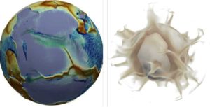
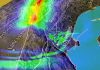
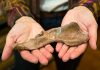
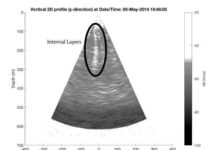
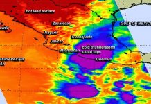
Images of the numerical solution at the moment when a supercontinent (left, in purplish grey) begins to break up. In the image on the left, the modelled fictional planet looks much like the Earth: its surface and mantle move spontaneously, at speeds close to those observed on Earth. The distribution of the plates (some of which are large, while many are small) is also similar, as is the topography: red hues represent shallow regions of the ocean (ridges), while blue indicates the deep seafloor. The deepest blue areas correspond to subduction trenches (where a plate is sinking into the mantle). The continents are shown in translucent white (and therefore appear purplish grey).The image on the right shows warm currents (plumes) rising from the bottom of the mantle. Credit: Nicolas Coltice
Do tectonic plates move because of motion in the Earth’s mantle, or is the mantle driven by the movement of the plates? Or could it be that this question is ill-posed? This is the point of view adopted by scientists at the École Normale Supérieure — PSL, the CNRS and the University of Rome 3, who regard the plates and the mantle as belonging to a single system. According to their simulations, published in Science Advances on October 30, 2019, it is mainly the surface that drives the mantle, although the dynamic balance between the two changes over supercontinent cycles.
Which forces drive tectonic plates? This has remained an open question ever since the advent of plate tectonic theory 50 years ago. Do the cold edges of plates slowly sinking into the Earth’s mantle at subduction zones cause the motion observed at the Earth’s surface? Or alternatively, does the mantle, with its convection currents, drive the plates? For geologists, this is rather like the problem of the chicken and the egg: the mantle apparently causes the plates to move, while they in turn drive the mantle…
To shed light on the forces at work, scientists from the Geology Laboratory of the École Normale Supérieure (CNRS/ENS — PSL), the Institute of Earth Sciences (CNRS/Universities Grenoble Alpes and Savoie Mont Blanc/IRD/Ifsttar) and the University of Rome 3 treated the solid Earth as a single indivisible system and carried out the most comprehensive modelling to date of the evolution of a fictional planet very similar to the Earth. The scientists first had to find the appropriate parameters, and then spend some nine months solving a set of equations with a supercomputer, reconstructing the evolution of the planet over a period of 1.5 billion years.
Using this model, the team showed that two thirds of the Earth’s surface moves faster than the underlying mantle, in other words it is the surface that drags the interior, while the roles are reversed for the remaining third. This balance of forces changes over geological time, especially for the continents. The latter are mainly dragged by deep motion within the mantle during the construction phases of a supercontinent, as in the ongoing collision between India and Asia: in such cases, the motion observed at the surface can provide information about the dynamics of the deep mantle. Conversely, when a supercontinent breaks up, the motion is mainly driven by that of the plates as they sink down into the mantle.
The computation contains a wealth of data that remains largely unexploited. The data obtained could help us to understand how mid-ocean ridges form and disappear, how subduction is triggered, or what determines the location of the plumes that cause vast volcanic outpourings.
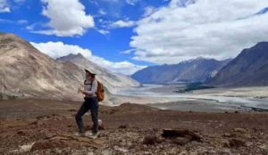
As part of MISTI-India, Megan Guenther, a junior in EAPS, records field notes about the landscape of the Kohistan-Ladakh region of the Himalayas in northern India. Credit: Craig Martin
According to Craig Martin, deciphering Earth’s geologic past is like an ant climbing over a car crash. “You’ve got to work out how the car crash happened, how fast the cars were going, at what angle they impacted,” explains Martin, a graduate student at MIT’s Department of Earth, Atmospheric and Planetary Sciences (EAPS). “You’re just a tiny ant wandering over this massive chaos,” he adds.
The crash site Martin is investigating is the Himalayas, a 1,400-mile mountain range that rose when the Indian and Eurasian tectonic plates scrunched together. “The mainstream idea is: There was Eurasia; there was India; and they collided 50 million years ago,” says Oliver Jagoutz, an associate professor in EAPS and Martin’s advisor. “We think it was much more complicated than that, because it’s always more complicated.”
Detective work at 11,000 feet
Eighty million years ago, India and Eurasia were 4,000 miles apart, separated by an ancient body of water that geologists call the Neotethys Ocean, but Jagoutz believes there was more than just seawater between the two. He’s not alone. Many geologists agree on the existence of an arc of volcanic islands that formed on the boundary of a smaller tectonic plate, similar to the Mariana Islands in the Pacific Ocean. However, there is debate on whether these islands first collided with the Eurasian plate to the north or the Indian plate to the south. Jagoutz’s hypothesis is the latter. “If I’m right, the arc sits near the equator. If the others are right, the fragments should be 20 degrees north,” he explains. “That’s how simple it is.” But it can mean a world of difference in terms of explaining the paleoclimate—not just in the Himalayas, but globally as well.
To test this hypothesis, Jagoutz and Martin turned to paleomagnetism. Some rock minerals, such as magnetite, contain iron and act as tiny bar magnets, orienting their magnetization along Earth’s magnetic field. At the Equator, magnetite in newly formed rocks will be magnetized parallel to the ground but the further north or south it is, the more inclined the magnetization will be. “We can measure, essentially, the latitude that a rock was formed at,” explains Martin.
If you were to take a slice of the Kohistan-Ladakh region of the Himalayas in northern India, you would see a succession of rock layers representing the India plate and the Eurasia plate, with the volcanic island arc sandwiched in between. “That’s why Ladakh is a really cool place to go to, because you can walk though this whole collision,” says Martin.
In summer 2018, Martin and Jade Fischer, a junior double-majoring in EAPS and physics, spent six weeks in Ladakh collecting samples from the volcanic rocks. Back at MIT, Martin measured the paleomagnetic signature of these rocks, and his results placed the Kohistan-Ladakh arc right at the equator, in agreement with Jagoutz’s theory.
A magnetic collaboration
Megan Guenther, a junior in EAPS, first heard about the opportunity to do field work in Ladakh when Martin gave a presentation about his research in her structural geology class last fall. “At the end, he told us he was probably going again and to let him know if we were interested,” Guenther explains. “I emailed him an hour later.”
Guenther had been looking for a chance to gain more field experience. She works on the compositions of lunar glasses with Tim Grove, the Robert R. Shrock Professor of Earth and Planetary Sciences, where the research takes place entirely in the lab. “You can’t really do field work on the moon,” she jokes.
This past summer, Guenther and Martin spent six weeks in Ladakh collecting rock samples from the Eurasian plate to prove that this was not also further south, mapping the region and doing structural analyses. Both Guenther and Martin were supported by MIT International Science and Technology Initiatives (MISTI) and the MISTI Global Seed Fund.
MISTI and Jagoutz go back a long time, with MISTI funding class excursions, department field trips, and a number of Jagoutz’s students. “MISTI-India has been good to us,” he says. “They financed the workshop where we came up with the whole concept of this work.” And, says Jagoutz, the students really love the experience. “They get influenced by it, and a lot of people chose their career paths after it,” says Jagoutz. “Ultimately, that’s what MISTI is all about: an experience that tells students they want to get into science.”
For Guenther, the trip was an essential part of her education as a geologist. “I feel much more confident as a field geologist, which is exactly what I wanted,” she says. It also impressed on her the titanic scale of geology. “The scale of everything is so crazy,” says Guenther. “You’re already at 11,000 feet, minimum, the whole time, and then these huge mountains tower above that.”
By solving the story of the collision that resulted in the Himalayas, Jagoutz and his team also shed light on its global implications. Large-scale collisions, Jagoutz explains, don’t just have local effects, and in the case of the Himalayas they can also explain some of Earth’s past glaciation events. “That’s the good thing about geology: the dimensions,” says Jagoutz. “You look at a magnetite crystal in a rock, and it tells you how global cooling works.”
A controversial theory that suggests an extraterrestrial body crashing to Earth almost 13,000 years ago caused the extinction of many large animals and a probable population decline in early humans is gaining traction from research sites around the world.
The Younger Dryas Impact Hypothesis, controversial from the time it was presented in 2007, proposes that an asteroid or comet hit the Earth about 12,800 years ago causing a period of extreme cooling that contributed to extinctions of more than 35 species of megafauna including giant sloths, sabre-tooth cats, mastodons and mammoths. It also coincides with a serious decline in early human populations such as the Clovis culture and is believed to have caused massive wildfires that could have blocked sunlight, causing an “impact winter” near the end of the Pleistocene Epoch.
In a new study published this week in Scientific Reports, a publication of Nature, UofSC archaeologist Christopher Moore and 16 colleagues present further evidence of a cosmic impact based on research done at White Pond near Elgin, South Carolina. The study builds on similar findings of platinum spikes — an element associated with cosmic objects like asteroids or comets — in North America, Europe, western Asia and recently in Chile and South Africa.
“We continue to find evidence and expand geographically. There have been numerous papers that have come out in the past couple of years with similar data from other sites that almost universally support the notion that there was an extraterrestrial impact or comet airburst that caused the Younger Dryas climate event,” Moore says.
Moore also was lead author on a previous paper documenting sites in North America where platinum spikes have been found and a co-author on several other papers that document elevated levels of platinum in archaeological sites, including Pilauco, Chile — the first discovery of evidence in the Southern Hemisphere.
“First, we thought it was a North American event, and then there was evidence in Europe and elsewhere that it was a Northern Hemisphere event. And now with the research in Chile and South Africa, it looks like it was probably a global event,” he says.
In addition, a team of researchers found unusually high concentrations of platinum and iridium in outwash sediments from a recently discovered crater in Greenland that could have been the impact point. Although the crater hasn’t been precisely dated yet, Moore says the possibility is good that it could be the “smoking gun” that scientists have been looking for to confirm a cosmic event. Additionally, data from South America and elsewhere suggests the event may have actually included multiple impacts and airbursts over the entire globe.
While the brief return to ice-age conditions during the Younger Dryas period has been well-documented, the reasons for it and the decline of human populations and animals have remained unclear. The impact hypothesis was proposed as a possible trigger for these abrupt climate changes that lasted about 1,400 years.
The Younger Dryas event gets its name from a wildflower, Dryas octopetala, which can tolerate cold conditions and suddenly became common in parts of Europe 12,800 years ago. The Younger Dryas Impact Hypothesis became controversial, Moore says, because the all-encompassing theory that a cosmic impact triggered cascading events leading to extinctions was viewed as improbable by some scientists.
“It was bold in the sense that it was trying to answer a lot of really tough questions that people have been grappling with for a long time in a single blow,” he says, adding that some researchers continue to be critical.
The conventional view has been that the failure of glacial ice dams allowed a massive release of freshwater into the north Atlantic, affecting oceanic circulation and causing the Earth to plunge into a cold climate. The Younger Dryas hypothesis simply claims that the cosmic impact was the trigger for the meltwater pulse into the oceans.
In research at White Pond in South Carolina, Moore and his colleagues used a core barrel to extract sediment samples from underneath the pond. The samples, dated to the beginning of the Younger Dryas with radiocarbon, contain a large platinum anomaly, consistent with findings from other sites, Moore says. A large soot anomaly also was found in cores from the site, indicating regional large-scale wildfires in the same time interval.
In addition, fungal spores associated with the dung of large herbivores were found to decrease at the beginning of the Younger Dryas period, suggesting a decline in ice-age megafauna beginning at the time of the impact.
“We speculate that the impact contributed to the extinction, but it wasn’t the only cause. Over hunting by humans almost certainly contributed, too, as did climate change,” Moore says. “Some of these animals survived after the event, in some cases for centuries. But from the spore data at White Pond and elsewhere, it looks like some of them went extinct at the beginning of the Younger Dryas, probably as a result of the environmental disruption caused by impact-related wildfires and climate change.”
Additional evidence found at other sites in support of an extraterrestrial impact includes the discovery of meltglass, microscopic spherical particles and nanodiamonds, indicating enough heat and pressure was present to fuse materials on the Earth’s surface. Another indicator is the presence of iridium, an element associated with cosmic objects, that scientists also found in the rock layers dated 65 million years ago from an impact that caused dinosaur extinction.
While no one knows for certain why the Clovis people and iconic ice-age beasts disappeared, research by Moore and others is providing important clues as evidence builds in support of the Younger Dryas Impact Hypothesis.
“Those are big debates that have been going on for a long time,” Moore says. “These kinds of things in science sometimes take a really long time to gain widespread acceptance. That was true for the dinosaur extinction when the idea was proposed that an impact had killed them. It was the same thing with plate tectonics. But now those ideas are completely established science.”
Reference:
Christopher R. Moore, Mark J. Brooks, Albert C. Goodyear, Terry A. Ferguson, Angelina G. Perrotti, Siddhartha Mitra, Ashlyn M. Listecki, Bailey C. King, David J. Mallinson, Chad S. Lane, Joshua D. Kapp, Allen West, David L. Carlson, Wendy S. Wolbach, Theodore R. Them, M. Scott Harris, Sean Pyne-O’Donnell. Sediment Cores from White Pond, South Carolina, contain a Platinum Anomaly, Pyrogenic Carbon Peak, and Coprophilous Spore Decline at 12.8 ka. Scientific Reports, 2019; 9 (1) DOI: 10.1038/s41598-019-51552-8
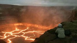
Brittany Erickson, an assistant professor in the Department of Computer and Information Science who studies geophysics and is a colleague of UO’s Leif Karlstrom, peers into the Halema’uma’u lava lake on Hawai’i’s Kiīlauea volcano. Credit: University of Oregon
“We’re Barely Listening to the U.S.’s Most Dangerous Volcanoes,” read the headline on a recent story in the New York Times, pointing to the dismal state of volcano monitoring in the Pacific Northwest.
UO earth scientist Leif Karlstrom believes that same headline could also be interpreted literally — he wants to teach others about volcanoes through an ambitious initiative he calls the Volcano Listening Project that seeks to express and understand volcanic data through sound.
As Karlstrom explains, the human brain has evolved to react to and interpret a world full of sounds. This is a practical survival skill when faced with the sound of a falling tree or an approaching city bus, and sound through music can be a compelling window into human emotion.
“Most people regularly listen to music, but rarely do we think of sound as a means of interpreting scientific data,” Karlstrom said. “My goal is to bring volcanoes — safely! — into public spaces, exploring complex scientific data in surprising and hopefully interesting ways.”
The project is part of Karlstrom’s Career Award from the National Science Foundation, which he received in spring 2019 and includes a five-year plan to further develop his Volcanic Listening Project to generate sounds from data recorded at erupting volcanoes. He will use this so-called “sonified” data to inform scientific interpretations, as well as to make and perform music.
A professor in the Department of Earth Sciences, Karlstrom characterizes his research as “fluid and solid mechanics applied to volcanoes and glaciers.” When a volcano erupts, Karlstrom says, scientists record ever-increasing amounts of information, which can include photographic or video imagery, gas emissions, deformation of the ground, subsurface earthquakes and chemical compositions of erupted lavas.
Karlstrom and his collaborators have developed computer programs that translate these volcanic data into sound, at which point Karlstrom puts on his music hat to examine the results. As a lifelong musician, he earned a degree in violin performance from the UO and has been playing professionally for nearly 20 years.
After earning his doctorate in earth and planetary science at the University of California, Berkeley, he helped start a number of groups in the San Francisco Bay Area. These include the band Front Country in 2012, now a full-time group based out of Nashville that tours internationally, and the duo Small Town Therapy.
For Karlstrom, combining scientific research with music doesn’t often happen, but with this new project he has found a pairing that he says makes sense.
“Sound provides emotional experiences as well as an intuitive way to grapple with the scientific goals of understanding patterns and peering through noisy data,” Karlstrom said, adding that he hopes to use these contrasting, biologically hardwired relationships to teach people about volcano science.
“Millions of people are affected by volcanoes and the hazards associated with them,” Karlstrom said. “We are exploring new ways to engage with awe-inspiring parts of the natural word, which operate on scales that are well outside the normal human experience. ”
Karlstrom will continue to build out his Volcano Listening Project to include learning materials for those interested in data sonification and visualization. He will also promote musical composition and performance based on volcanic data.
The first iteration of the Volcano Listening Project features a collaboration between Portland-based visual artist Zack Marlow-McCarthy and Karlstrom’s group Small Town Therapy. It includes the track “Hotel Kilauea” from their 2019 record. A merging of art and science, the track is a blend of acoustic instruments mixed with computer-generated sounds from data collected at Kilauea volcano in Hawaii between the years 2000-10.
‘Hotel Kilauea’ is UO earth scientist Leif Karlstrom’s multimedia work, which depicts 10 years of data collected at Hawaii’s Kilauea volcano, compressed into a little more than three minutes. Raw data associated with ground deformation and gas emissions are ‘sonified,’ then used as the basis for musical improvisation.
Computer sounds were used as the basis for free improvisation of the data by Karlstrom and three other musicians who formed an ensemble of two violins, guitar and upright bass. The performance follows in the footsteps of free jazz exemplified by artists like John Zorn or Ornette Coleman, known for their ability to stretch the conventional use of tempo, rhythm, and harmony and perform in a completely improvised manner.
“The challenge (of free improvisation) is, can you make art if there are no rules?” Karlstrom said. “Can you make it up on the spot? Is it still musical or is it just noise?”
The video released along with Hotel Kilauea is based both on the data and on musical performance. It animates the transformation of a volcano over time with an abstract touch, much as the music provides an abstract interpretation of the raw volcanic data. A detailed listener’s guide for the track is available on the project website.
Karlstrom is working on installations of the Volcano Listening Project that will debut nationally over the coming years, starting with the Centennial Theater at the American Geophysical Union Fall Meeting in San Francisco in December.
He also hopes that others will latch on to volcano music, which he views as a steppingstone for creating new ways to engage the public around science.
“Science is a creative enterprise, just like music,” Karlstrom said. “I am hoping that the Volcanic Listening Project can help generate new knowledge about volcanoes as well as compelling new art.”
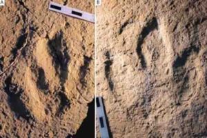
Photograph of the traces analyzed: : Megalosauripus transjuranicus (A) y Jurabrontes transjuranicus (B). Credit: Matteo Belvedere et al.
Dinosaur footprints found in several European countries, very similar to others in Morocco, suggest that they could have been dispersed between the two continents by land masses separated by a shallow sea more than 145 million years ago.
At the end of the Jurassic, as a consequence of the defragmentation of the Pangaea supercontinent, the countries that now form Europe were part of an archipelago surrounded by a shallow sea. In its interior, the Iberian Peninsula was located in the southernmost part, on the continent of Laurasia (which included present-day North America and Eurasia), but near Gondwana, the continent to the south.
Large predators strolled through these lands and their footprints have been found on different continents. Thus, for example, ichnites and bones of allosaurs and stegosaurs have been found in both North America and Portugal, suggesting that both territories were connected in some way.
In a new study, published in the Journal of African Earth Sciences, a team of European scientists, with Spanish participation, has now recognized two types of dinosaur footprints related to large Jurassic predators in today’s Switzerland, Portugal, Spain (which belonged to Laurasia) and Morocco (which was in Gondwana).
The marks, called Megalosauripus transjuranicus and Jurabrontes curtedulensis, belonged to carnivorous theropods similar to Tyrannosaurus rex. “On the one hand, we have identified a type of large and slender footprints with a size of 30-50 cm and, on the other hand, other gigantic and robust footprints measuring more than 50 cm,” as Diego Castanera, from the Miquel Crusafont Catalan Institute of Palaeontology (ICP) of the Autonomous University of Barcelona and co-author of the work, has explained to SINC.
Shallow water trails
In order to distinguish the types of footprints, the team used a novel software called DigTrace, which made it possible to virtually compare the fossilized footprints. “We can’t determine with certainty what animal left a particular footstep since different related dinosaurs could leave very similar footprints,” says Castanera.
However, this study confirms that the differences between the two groups of footprints identified are important enough for their originators to be different but closely related dinosaurs.
Scientists thus suggest that they probably belonged to Allosaurus and Torvosaurus, since their remains have been found in the Upper Jurassic of Portugal, indicating the presence of two super-predators in the terrestrial ecosystems of the late Jurassic.
To confirm these data, the group of researchers stresses that more studies are needed, especially to answer an important question: how did the dinosaurs pass between Laurasia and Gondwana? “The answer is problematic because geological studies indicate that there was a deep sea between the two continents,” stresses the scientist.
The presence of the same species in such distant places forces scientists to propose dispersal routes between continents during the Mesozoic, the time during which dinosaurs lived. These large animals were thus able to move between Africa and Europe on land masses with short emersion periods and through southern Italy and the Balkans or through Iberia (what is nowadays the Iberian Peninsula).
Reference:
Matteo Belvedere et al, Late Jurassic globetrotters compared: A closer look at large and giant theropod tracks of North Africa and Europe, Journal of African Earth Sciences (2019). DOI: 10.1016/j.jafrearsci.2019.103547
California is one of the richest states in mineral diversity.
Not unexpectedly, it has a good reputation when it comes to activities related to gold mining, but not only that; it is also home to a number of gemstone mines. Most of these mines are situated in the California southern region.
Locations of some of these gemstone mines:
Himalaya Mine, Mesa Grande District, California.
The Himalaya Tourmaline Mine is located near Santa Ysabel, CA at Lake Henshaw in the beautiful Mesa Grande is the best place for gem hunting in california. We offer a fun gem and crystal dig to the public. Visit our dig at Lake Henshaw Resort where you will dig and screen through ore from the world famous Himalaya Mine. Many minerals can be found including pink and green tourmaline, black tourmaline, quartz crystals, spessertine garnet, lepidolite, clevelandite, and a variety of others. Keep all you find.
Where are we located? Lake Henshaw 26439 Hwy 76, Santa Ysabel, CA 92070
When are we open? Open Thursday through Sunday 10am – 3pm. Reservations are not necessary.
Also, Mondays by reservation available
Cost: Adult Dig $75, youth 13 years old to 15 years old half price ($37.50), children 12 years old and under are free with paying adult. Additional children $20.
Discounts: Senior and active military rate $60. Rain day $10 off if it rains more than 75% of the day.
Adult Group Rates: Groups 20+ $50 per person, 10+ people $5 off
Children Group Rates: $20 per child, 12 and under
What to Bring: Sun hat or rain gear, muddy shoes, maybe some rubber gloves, tooth brush, baggie for your crystals and a small bucket, or bin, for specimens. Tissue paper for wrapping your crystals and specimens.
Accommodations: Lake Henshaw Resort Cabins, RV parking, and camping. Call 760-782-3501. Also in Julian (25 miles away) there are several hotels including the historic Gold Rush Hotel. And, there’s a casino, Rincon, I believe it is called.
Gold Prospecting Adventures, LLC has built a solid reputation throughout California’s Gold Country as the best of the best for gem hunting in california. We are the leading professionals in gold prospecting and gold rush history. That’s because we’ve spent the last 40 years perfecting our techniques, improving our knowledge, and tailoring our programs to meet the needs of the thousands of guests who visit our camp each year. Our guides, dressed in period costume, receive special training to insure that every individual enjoys a remarkably genuine and comprehensive gold rush experience. No other gold prospecting company can stake that claim!
We know (and will share) the real secrets of successful prospecting. And the gold is here, participants have taken out over 300 ounces of gold from the one hole at our Jimtown 1849 Gold Mining Camp.
Whether you are a family looking for a fun and interesing way to spend a few hours on your way to Yosemite, a real adventurer, seeking the true secrets to successful prospecting, or a group organize, planning your next tour. we have the trip for you.
Be our guest, come to Jamestown, live the adventure and take home some gold.
A visit to the Oceanview Mine allows you a unique view of the only actively working underground mine in the world famous Pala Gem mining district and a chance to find your own gems—tourmalines, kunzites, morganites and more so it is one of best places for gem hunting in california. Screen the dump piles of material we take out of our mine and find the gems we’ve missed—and we miss a lot! You get to keep everything you find at no extra charge; the standard dig fee allows you to keep all you find and you can take home one 5-gallon bucket of rocks that you have screened and washed. Guests also get a jeep tour of Chief Mountain where you can see all of the currently active mines and prospects, as well as views of the famous Pala Chief, Tourmaline Queen and other historic mines.
We’ve taken care of everything you need. We provide you with screens, water, buckets and shovels–and most importantly, a big pile of gem-rich dirt and gravel taken from our mines! After a brief training session, you have four hours to work the pile, looking for your gems. You get to keep everything you find at no extra charge; the standard dig fee allows you to keep all you find. In addition, you can take home one 5-gallon bucket of rocks that you have screened and washed if you want to more carefully sort through them at home. Guests also get a jeep tour of Chief Mountain where you can see all of the currently active mines and prospects, as well as views of the famous Pala Chief, Tourmaline Queen and other historic mines.
Location: 37304 Magee Rd, Pala, CA 92059 What You Might Find: Tourmaline (black, watermelon, and green), Kunzite, Aquamarine, Morganite, Lepidolite, Quartz, & more! Cost: Adults – $75 each) // 5-11 years old – $60 each // 4 and under are free
Opal Hill Mine, Mule Mountains District, Riverside Co., California.
Opal Hill, located in eastern California near the border of Arizona, is known for its beautiful opal eggs, quartz crystals, and wonderful fire agates so it is one of the best places for gem hunting in california. Sometimes called Coon Hollow, this site is located deep in the Mule Mountains not far from Palo Verde, CA.
To reach the site from Interstate 10, take Wiley Well Road exit and head south for approx. 17 miles, just past the BLM Coon Hollow Campround. Turn left on the small gravel road (high clearance vehicle recommended) at the Opal Hill Mine sign and drive east for another couple of miles to the mine site, which is located on the right.
Opal Hill has a long known history of quality fire agate production, having produced many wonderful gemstones over the years. The old original Opal Hill mining claim used to offers a pay to mine service during the cooler fall, winter and spring months (December 2015 Note: The mine has a new owner and it is unknown if it is any longer open to the public).
Location From Interstate 10, take Wiley Well Exit and head south on the graded dirt road for 11.86 miles. A dirt road leads to the claim; it’s no longer marked. (If you pass the entrance to the Coon Hollow Campground going south you’ve missed the road.) Go east on the cut off road and travel for a about 2.3 miles on the rough dirt and rocky road. A high clearance 4×4 vehicle is needed to navigate the last mile of rocky road to the mine. GPS 33°27’08.0″N 114°51’53.5″W
Gems of Pala, Magee Rd, Pala, California
Gems of Pala is a locally owned and operated business. Our owners Blue Sheppard and his wife Shannon are onsite to personally greet you. Blue has over 52 years of experience with gems and minerals. to share with you. We pride ourselves on quality pricing and superior customer service and especially for being the #1 choice in San Diego County for a true family mining adventure.
Gems of Pala gives you the educational experience and excitement of mining for precious gems from a real mine. Enjoy the thrill of searching for gems just like the miners of the 1800’s. You will be provided with all the tools of a gem hunter as well as a demonstration. No reservations required, except for large groups!
Location: 35940 Magee Rd, Pala, CA 92059 What You Might Find: Quartz, Lepidolite, Kunzite, Morganite, Tourmaline Cost: Gem Buckets that you dig from our pile are $30.00 each. Pre-Dug Gem Bags are $50.00 each. All Cash Only.
California State Gem Mine, Los Gatos Creek Rd, Coalinga, California
Here’s your chance to come find the state gemstone of California, Benitoite
A prospector, James Couch, was grubstaked by Roderick Dallas, and in February, 1907, and on his way to investigate some intriguing outcrops, found a small area littered with blue crystals which he thought might be blue sapphires. He collected several and rushed back to Coalinga. A claim was placed which was named the Dallas Gem mine. Dr. George Louderback, a professor of mineralogy at the University of California, Berkeley, was provided some of the stones. Dr. Louderback soon realized that they were not sapphires or spinel as some thought, but a new mineral not known to science. In July 1907 he published an article, naming the new mineral benitoite, named after San Benito County. The black mineral associated with the benitoite was initially called ‘carlosite’, named after the nearby San Carlos peak. However, he later discovered that this mineral was neptunite which had been discovered in Greenland in 1893.
When word got out of the new discovery, several people, including Dr. George Kunz from Tiffany’s of New York, rushed to the site to secure an exclusive marketing agreement with the miners. Mr. G. Eacret, of Shreve and Company in San Francisco won the marketing rights.
The mine owner, Mr. R.W. Dallas, built a mine camp and immediately expanded mining operations. The mine produced benitoite from an open cut in the hillside, as well as a short underground tunnel pushed into an outcrop of benitoite-bearing material called blueschist. For about 5 years, the blueschist layer yielded thousands of excellent gemstones.
Location: The Historic Old Road Camp – 48242 Los Gatos Rd. Coalinga, CA 93210 What You Might Find: Benitoite (the state gemstone) Cost: Adults – $70 person // 12 and younger – $20
Stewart Mine, Pala Mining District, San Diego County, California
Location: Tourmaline Queen Mountain (Pala Mtn; Queen Mtn), Pala, Pala Mining District, San Diego County, California, USA
In the world of treasures, few precious and desirable things can ever exceed the pink tourmaline of Pala, California it is one of best places for gem hunting in california. Gem quality natural pink tourmaline is five times as rare as gem diamond and more than ten times as valuable as gold in its pure form. Tourmaline is harder than quartz (Mohs 7.253), is highly refractive when cut, and produces exquisite gemstones.
The Stewart Mine will always be one of the great classic locations for mineralogists. The Stewart produces the world’s finest natural pink tourmaline, both for mineral specimens that spotlight the world’s museums and. also, for gemstones that highlight the World jewelry industry, but especially for the fabulous blue-capped rubellite specimens that hallmark Pala as the very crest of the best in tourmaline over the whole planet.
Tourmaline Queen Mine, Pala, Pala Mining District, San Diego County, California
Location: Tourmaline Queen Mountain (Pala Mtn; Queen Mtn), Pala, Pala Mining District, San Diego County, California, USA
For over a century the Tourmaline Queen mine near Pala, California has been known for large and beautiful crystals of tourmaline and morganite beryl, it is amazing place for gem hunting in california. The extraordinary blue-capped pink elbaites recovered in 1972 remain among the most famous mineral specimens of any kind ever found in California, and are surely the finest tourmalines ever recovered in North America. Here is the story behind this great locality, which today is once again producing fine specimens.
The Tourmaline Queen Mine located in Pala, San Diego County, California, has always inspired mineral collectors, high graders and geologists. It was originally claimed by Frank Salmons and Associates in March, 1903. Exploratory work yielded some 80 pounds of gem tourmaline. The Queen immediately became the leading producer of tourmaline in the Pala district during the period 1904 through 1914. With the collapse of the major Chinese market for tourmaline, due to the 1911 overthrow of the Imperial government, the mines soon became uneconomical. From about 1914 to 1971, the Queen was worked intermittently by high graders, with limited success.
Pala Properties International, Inc., became involved in the Pala mining district when Ed Swoboda purchased the Stewart Lithia, Tourmaline Queen and Pala Chief Mines. We had been mining the Stewart with mild success since 1968, when we decided that it was time to make the switch up the hill to the Tourmaline Queen. Originally our idea in mining the Stewart was to set up basic operations, learn the gem mining trade, and then move up to the Queen which we were sure was more promising. However, with the discovery of the famed lost tourmaline adit and initial production of a few fine tourmaline crystals, we overstayed these original plans. But without increased production, economics forced us to make the necessary move up the mountain.
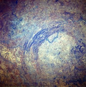
Vredefort Dome, Free State, South Africa. Credit: NASA
The Largest Verified Impact Crater on Earth
The Vredefort crater is the largest certified impact crater on Earth. In the present Free State Province of South Africa, what remains of it is more than 300 kilometers (190 mi) from when it was created.
It is named after the town of Vredefort, near its center. Although the crater itself has long been worn away, it is known as the Vredefort Dome or Vredefort impact structure that the remaining geological structures at its core are.
It is estimated that the crater is 2,023 billion years old (± 4 million years old), with an impact in the Paleoproterozoic period. It’s the Earth’s second oldest known crater.
In 2005, the Vredefort Dome was added to the list of UNESCO World Heritage sites for its geologic interest.
Where is the world’s oldest meteorite impact crater?
The Vredefort crater located in South Africa.
How big is the Vredefort crater?
The Vredefort Impact Crater is the largest asteroid impact site with an estimated initial diameter of 300 kilometers that still has visible evidence on Earth’s surface.
Who discovered the Vredefort crater?
Twenty years ago, the now professor of Western Earth Sciences first visited the core of the Vredefort impact crater in South Africa, discovering what he claimed to be some of the last remnants of a magma sea formed in a 300-kilometer-wide crater more than 2 billion years ago.
Vredefort crater Formation and structure
It is believed that the asteroid that struck Vredefort was one of the largest ever to hit Earth (at least since the Hadean Eon about four billion years ago), thought to be about 10–15 km in diameter (6.2–9.3 mi).
The main crater is measured to have a diameter of about 300 km (190 mi) but has been eroded. It would have been wider than the Sudbury Basin of 250 km (160 mi) and the Chicxulub crater of 180 km (110 mi). The resulting formation, the “Vredefort Dome,” consists of a small ring of 70 km (43 mi) in diameter of hills and is the remnants of a dome formed after the collision by the stone recovery below the impact site.
It is estimated that the age of the crater is 2 02 300 billion years (± 4 million years). It is the second-oldest known crater on Earth, slightly less than 300 million years younger than the Suavjärvi crater in Russia. In contrast, the effect of the Sudbury Basin is about 10% older (at 1,849 billion years).
The dome in the center of the crater was originally thought to have been created by a volcanic eruption, but in the mid-1990s, evidence showed that it was the site of a major bolide strike, as telltale shatter cones were found in the bed of the nearby Vaal River.
The crater site is one of the few craters on Earth that have multiple rings, though they are the most prominent in the solar system. Valhalla crater on Jupiter’s moon, Callisto is perhaps the most prominent example. There is also Earth’s Sun. The most multi-ring craters on Earth have been destroyed by geological processes, such as erosion and tectonic plates.
In 250 million years between 950 and 700 million years before the Vredefort impact, the effects warped Witwatersrand Basin.
The overlying lavas of Ventersdorp and Transvaal Supergroup were also skewed by the formation of the 300-km (190.000 mi) crater between 700 and 80 million years prior to the meteorite strike. The rocks are now partially clustered around the crater centre, with the youngest rocks of the Witwatersrand forming a half-circle of 25 miles. The Witwatersrand rocks contain multiple layers (e.g. quartzites and banded ironstones) of sediments that have been very strong, erosion prone, and form the prominent arc of hills in satellite picture above to the Northwest. Follow the rocks of the Witwatersrand, the lava of Ghaap Dolomites and the Pretoria Subgroup, which together form a 25-to-30-kilometer (16 to 19 mi) chain, follow at a distance of about 35 km from the middle and the Transvaal Subgroup, consisting of a small gang of the rocks of the Dolomites and of the Dolomites and Pretorias.
The order of the rocks is reversed from approximately halfway through the Pretoria subgroup of rocks around the crater centre. The Ghaap Dolomite band resurfaces from the middle at 60 km (37 mi), to the outer direction of where the crater rim used to be, followed by the Ventersdorp Lava arch, after which the Witwatersrand rocks are now a broken outcrop arc at 80-120 km (50 and 75 mi) from the core. The Johannesburg group is the most famous one because it was here that gold was discovered in 1886. It is thus possible that if it had not been for the Vredefort impact this gold would never have been discovered.
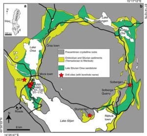
Maps of the Siljan impact structure and study locations. a Map of Sweden with the Siljan area indicated. b Geological map of the Siljan impact structure with locations of the cored boreholes and the quarry sampled for mineral coatings indicated, along with the sedimentary units in the crater depression, towns, lakes (white) and roads (black lines). Gas compositions exist from boreholes VM2 and VM5 (located adjacent to VM2). Credit: Nature Communications, 2019
Fractured rocks of impact craters have been suggested to host deep microbial communities on Earth, and potentially other terrestrial planets, yet direct evidence remains elusive. In a new study published in Nature Communications, a team of researchers shows that the largest impact crater in Europe, the Siljan impact structure, Sweden, has hosted long-term deep microbial activity.
Life thrives deep beneath our feet in a vast but underexplored environment coined the deep biosphere. Colonization of these deep environments—on Earth and potentially on other Earth-like planets—may have been sparked by meteorite impacts. Such violent events provide both space to microbial communities due to intense fracturing, and heat that drives fluid circulation favorable for deep ecosystems. Especially on planetary bodies that otherwise are geologically dead, such systems may have served as rare havens for life with considerable astrobiological implications.
At the scenic site of Siljan, in the heart of Sweden, an impressive impact structure of >50 km diameter formed almost 400 million years ago. Previous well-known drilling attempts for deep natural gas are now renewed, and from these newly retrieved drill cores, a team of researchers have found widespread evidence of deep ancient life.
Henrik Drake, of the Linnaeus University, Sweden, and lead author of the study, explains the discovery: “We examined the intensively fractured rock at significant depth in the crater and noted tiny crystals of calcium carbonate and sulphide in the fractures. When we analyzed the chemical composition within these crystals it became clear to us that they formed following microbial activity. Specifically, the relative abundance of different isotopes of carbon and sulfur within these minerals tells us that microorganisms that produce and consume the greenhouse gas methane have been present, and also microbes that reduce sulfate into sulfide. These are isotopic fingerprints for ancient life.”
Nick Roberts at the British Geological Survey, and co-author of the study, tells more about how the timing of the microbial activity could be estimated: “We applied newly developed radioisotopic dating techniques to the tiny calcite crystals formed following microbial methane cycling, and could determine that they formed in the interval 80 to 22 million years ago. This marks long-term ancient microbial activity in the impact crater, but also that the microbes lived up to 300 million years after the impact. Our study shows that detailed multi-method investigations are needed to understand the link between the impact and the colonization,” Henrik Drake continues. “At Siljan we see that the crater is colonized but that it has mainly occurred when conditions, such as temperature, became more favorable than at the impact event. The impact structure itself, with a ring zone of down-faulted Paleozoic sediments, has been optimal for deep colonization, because organics and hydrocarbons from shales have migrated throughout the fractured crater and have acted as energy sources for the deep microbial communities.”
Christine Heim, of University of Göttingen, Germany, co-author adds: “The preserved organic molecules that we could detect within the minerals give us additional evidence both for microbial activity in the crater, as we find molecules specific to certain microorganisms, but also for microbial biodegradation of shale-derived hydrocarbons, ultimately leading to production of secondary microbial methane at depth.”
“Detailed understanding of microbial colonization of impact craters has wide-ranging astrobiological implications. The methodology that we present should be optimal to provide spatiotemporal constraints for ancient microbial methane formation and utilization in other impact crater systems, such as the methane emitting craters on Mars,” Magnus Ivarsson, Swedish Museum of Natural History, a co-author of the study, adds.
Henrik Drake summarizes: “Our findings indeed confirm that impact craters are favorable microbial habitats on Earth and perhaps beyond.”
Reference:
Drake et al., Timing and origin of natural gas accumulation in the Siljan impact structure, Sweden, Nature Communications, 2019 DOI: 10.1038/s41467-019-12728-y
Much of our modern technology relies on the use of rare earth elements (REEs), and a key to finding more of them is to understand the processes that concentrate them in the Earth’s crust. In the ancient Bergslagen ore province of central Sweden lies a zone of Bastnäs-type rare earth element deposits, and in a new study, scientists from Uppsala University and the Geological Survey of Sweden (SGU) show how these deposits originally formed.
The increasing demand for REEs in a wide range of modern high-tech applications, including applications vital to achieving “fossil-free” transportation and energy production, has triggered a worldwide effort to discover new sources of these critical metals and therefore also a need to better understand how they formed. The Bastnäs-type REE deposits in the Bergslagen ore province in south central Sweden were the first hard-rock ores ever to be mined for REEs and played a key role in the original discovery of several rare earth elements (including cerium and lanthanum) and REE minerals (such as the mineral bastnäsite; see photo). These Palaeoproterozoic, skarn-hosted magnetite-REE deposits represent a large-scale (>100 km) feature of high-grade REE concentrations, the “REE line’ in Bergslagen, south central Sweden. An improved understanding of their origin could help to guide exploration for this type of REE mineralization here and elsewhere to secure the future supply of these critical commodities.
To unravel the formation of Bastnäs-type REE deposits, robust constraints on the nature of ore-forming processes and fluids were needed. To address this, a research team from Uppsala University, the Geological Survey of Sweden (SGU) and the University of Cape Town collected mineral oxygen and carbon isotope data from ten of the classic central Swedish Bastnäs-type deposits to assess their mode of origin. The results have now been published in Scientific Reports.
The new isotope data allowed the team to perform numerical models that, combined with existing geological observations, imply an origin in a sub-seafloor, shallow-marine back-arc setting where high-temperature magmatic fluids reacted with pre-existing limestone layers. The drastic changes in chemical environment experienced by the fluids during their interaction with the limestone led to localized skarn formation and magnetite-REE mineral precipitation. These results advance the long-standing debate on the origin of the Bastnäs-type REE deposits and provide new insights into geological processes that have the potential to produce high-grade REE mineralization.
Reference:
Fredrik Sahlström et al. Interaction between high-temperature magmatic fluids and limestone explains ‘Bastnäs-type’ REE deposits in central Sweden, Scientific Reports (2019). DOI: 10.1038/s41598-019-49321-8
Note: The above post is reprinted from materials provided by Uppsala University.
A new paper from scientists at The University of Manchester has discovered why some volcanic eruptions are more explosive than others.
Basaltic eruptions are the most common form of volcanic eruption, and for the most part, they involve relatively tame magma activity. Occasionally, however, the magma activity results in highly explosive and hazardous eruptions. The latter are known as Plinian eruptions, after the Ancient Roman writer who described the eruption of Mt Vesuvius in 79AD.
A new paper, “Magma fragmentation in highly explosive basaltic eruptions induced by rapid crystallization”, published in the journal Nature Geoscience, proposes an explanation for this discrepancy. When magma is rapidly expelled from a volcano, it undergoes rapid cooling. This induces the formation of crystals, resulting in a sudden increase in the viscosity of the magma. In turn, this produces magma fragmentation, creating a highly explosive eruption.
Dr. Fabio Arzilli, from The University of Manchester, and his colleagues discovered this process using a combination of numerical modeling and in situ and ex situ experiments. They also observed natural samples from previous highly explosive basaltic eruptions, such as the 1886 Tarawera eruption in New Zealand. The work was carried out with partners at the Oxfordshire-based Diamond Light Source.
Dr. Arzilli said; “We found that, under certain conditions consistent with highly explosive eruptions, crystallization can occur within a couple of minutes during magma ascent.”
Previous research into magma crystallization had led volcanologists to believe it occurred too slowly to be responsible for highly explosive eruptions.
Commenting on the findings of the paper, Dr. Arzilli said; “Our results imply that all basaltic systems on Earth have the potential to produce powerful explosive eruptions.”
He continued; “This has important implications for the volcanic hazard and risk, on not only the regional, but also the global scale. Indeed, Icelandic eruptions are recognized as one of the highest priority risks in the National Risk Register of Civil Emergencies for the UK population.”
Reference:
Fabio Arzilli et al. Magma fragmentation in highly explosive basaltic eruptions induced by rapid crystallization, Nature Geoscience (2019). DOI: 10.1038/s41561-019-0468-6
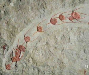
Ampyx priscus in linear formation (Moroccan Lower Ordovician Fezouata Shale). Credit: Jean Vannier, Laboratoire de Geologie de Lyon: Terre, Planètes, Environnement (CNRS / ENS de Lyon / Université Claude Bernard Lyon 1)
Ever felt like you’ve been queuing forever?
Scientists say fossils found in Morocco suggest the practice of forming orderly lines may date back 480 million years and could have had evolutionary advantages.
Their study, published Thursday in the journal Scientific Reports, describes groups of blind trilobites—known as Ampyx—all facing in the same direction, apparently maintaining contact via their long rearward spines.
The researchers from France, Switzerland and Morocco analyzed the fossils and concluded that the tiny trilobites, which look similar to modern horseshoe crabs, probably intentionally formed a queue as they swarmed along the prehistoric sea floor.
“Given the scale of the patterns seen, this consistent linearity and directionality is unlikely to be the result of passive transportation or accumulation by currents,” they said.
Jean Vannier, a researcher at the University of Lyon, France, who co-authored the study, said possible reasons for this group behavior include environmental stresses or reproduction.
Similar behavior is also found in modern-day members of the extended family of arthropods that trilobites belonged to, such as caterpillars, ants and lobsters, who band together for protection or to find mates.
“Living and moving in groups seems to have rapidly represented an evolutionary advantage among ancient animals,” Vannier said.
Lucy McCobb, a paleontologist at the National Museum Wales who wasn’t involved in the study, said that while similar ‘conga lines’ of fossilized Ampyx have been reported before, the researchers behind the study had built “a very strong case for the intentional lining up of the trilobites in response to some cue.”
“These fossils give us a wonderfully vivid glimpse into the lives of these very ancient but clearly sophisticated creatures,” she said.
Vannier said the findings support the idea that collective behavior like forming lines emerged around the same time or shortly after animals first developed sophisticated nervous systems and sensory organs. He and fellow researchers said re-examining 520 million-year-old fossils of shrimp-like creatures found in China could offer evidence that such behavior began even earlier.
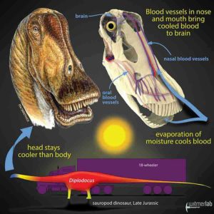
Gigantic dinosaurs like the sauropod Diplodocus, which weighed over 15 tons and was longer than an 18-wheeler truck, would have had problems with potentially lethal overheating. Hot blood from the body core would have been pumped to the head, damaging the delicate brain. New research shows that in sauropods, evaporation of moisture in the nose and mouth would have cooled extensive networks of venous blood destined for the brain. Other large dinosaurs evolved different brain-cooling mechanisms, but all involving evaporative cooling of blood in different regions of the head. Credit: Life restoration by Michael Skrepnick. Courtesy of WitmerLab at Ohio University.
Different dinosaur groups independently evolved gigantic body sizes, but they all faced the same problems of overheating and damaging their brains. Researchers from Ohio University’s Heritage College of Osteopathic Medicine show in a new article in the Anatomical Record that different giant dinosaurs solved the problem in different ways, evolving different cooling systems in different parts of the head.
“The brain and sense organs like the eye are very sensitive to temperature,” said Ruger Porter, Assistant Professor of Anatomical Instruction and lead author of the study. “Animals today often have elaborate thermoregulatory strategies to protect these tissues by shuttling hot and cool blood around various networks of blood vessels. We wanted to see if dinosaurs were doing the same things.”
Many of the famous gigantic dinosaurs—such as the long-necked sauropods or armored ankylosaurs— actually evolved those big bodies independently from smaller-bodied ancestors. “Small dinosaurs could have just run into the shade to cool off,” said study co-author Professor Lawrence Witmer, “but for those giant dinosaurs, the potential for overheating was literally inescapable. They must have had special mechanisms to control brain temperature, but what were they?”
The answer turned out to be based in physics, but still part of our everyday experience. “One of the best ways to cool things down is with evaporation,” Porter said. “The air-conditioning units in buildings and cars use evaporation, and it’s the evaporative cooling of sweat that keeps us comfortable in summer. To cool the brain, we looked to the anatomical places where there’s moisture to allow evaporative cooling, such as the eyes and especially the nasal cavity and mouth.”
To test that idea, the team looked to the modern-day relatives of dinosaurs—birds and reptiles—where studies indeed showed that evaporation of moisture in the nose, mouth, and eyes cooled the blood on its way to the brain.
Porter and Witmer obtained carcasses of birds and reptiles that had died of natural causes from zoos and wildlife rehabilitation facilities. Using a technique developed in Witmer’s lab that allows arteries and veins to show up in CT scans, they were able to trace blood flow from the sites of evaporative cooling to the brain. They also precisely measured the bony canals and grooves that conveyed the blood vessels.
“The handy thing about blood vessels is that they basically write their presence into the bones,” Porter said. “The bony canals and grooves that we see in modern-day birds and reptiles are our link to the dinosaur fossils. We can use this bony evidence to restore the patterns of blood flow in extinct dinosaurs and hopefully get a glimpse into their thermal physiology and how they dealt with heat.”
“The discovery that different dinosaurs cooled their brains in a variety of ways not only provides a window into the everyday life of dinosaurs, it also serves as an exemplar of how the physical constraints imposed by specific environmental conditions have shaped the evolution of this diverse and unique group,” said Sharon Swartz, a program director at the National Science Foundation, which funded the research. “Using a combination of technological innovation and biological expertise, these researchers were able to take a direct reading from the fossil record that provides new clues about how dinosaur skeletal form and function evolved.”
This team of current and former members of WitmerLab at Ohio University has previously looked at other cases of dinosaur physiology. In 2014 and 2018, former doctoral student Jason Bourke led projects involving Porter and Witmer on breathing and heat exchange in pachycephalosaurs and ankylosaurs, respectively. Most recently, former lab doctoral student Casey Holliday led a project with Porter and Witmer that explored blood vessels on the skull roof of T. rex and other dinosaurs that also might have had a thermoregulatory function.
The new study by Porter and Witmer is a more expansive, quantitative study that shows that “one size didn’t fit all” with regard to how large-bodied dinosaurs kept their brains cool. That is, they had different thermoregulatory strategies. The researchers looked at bony canal sizes in the dinosaurs to assess the relative importance of the different sites of evaporative cooling based on how much blood was flowing through them.
A key factor turned out to be body size. Smaller dinosaurs such as the goat-sized pachycephalosaur Stegoceras had a very balanced vascular pattern with no single cooling region being particularly emphasized. “That makes physiological sense because smaller dinosaurs have less of a problem with overheating,” Porter said. “But giants like sauropods and ankylosaurs increased blood flow to particular cooling regions of the head far beyond what was necessary to simply nourish the tissues.” This unbalanced vascular pattern allowed the thermal strategies of large dinosaurs to be more focused, emphasizing one or more cooling regions.
But although sauropods like Diplodocus and Camarasaurus and ankylosaurs like Euoplocephalus all had unbalanced vascular patterns emphasizing certain cooling regions, they still differed. Sauropods emphasized both the nasal cavity and mouth as cooling regions whereas ankylosaurs only emphasized the nose. “It’s possible that sauropods were so large—often weighing dozens of tons—that they needed to recruit the mouth as a cooling region in times of heat stress,” Porter said. “Panting sauropods may have been a common sight!”
One problem that the researchers encountered was that many of the theropod dinosaurs—such as the 10-ton T. rex—were also gigantic, but the quantitative analysis showed that they had a balanced vascular pattern, like the small-bodied dinosaurs.
“This finding had us scratching our heads until we noticed the obvious difference—theropods like Majungasaurus and T. rex had a huge air sinus in their snouts,” Witmer said. Looking closer, the researchers discovered bony evidence that this antorbital air sinus was richly supplied with blood vessels. Witmer had previously shown that air circulated through the antorbital air sinus like a bellows pump every time the animal opened and closed its mouth. “Boom! An actively ventilated, highlyvascular sinus meant that we had another potential cooling region. Theropod dinosaurs solved the same problem…but in a different way,” concluded Witmer.
The researchers are now expanding the project to include other dinosaur groups such as duck-billed hadrosaurs and horned ceratopsians like Triceratops to explore how thermoregulatory strategies varied among other dinosaurs and how these strategies may have influenced their behavior and even their preferred habitats.
Reference:
Wm. Ruger Porter, Lawrence M. Witmer. Vascular Patterns in the Heads of Dinosaurs: Evidence for Blood Vessels, Sites of Thermal Exchange, and Their Role in Physiological Thermoregulatory Strategies. The Anatomical Record, 2019; DOI: 10.1002/ar.24234
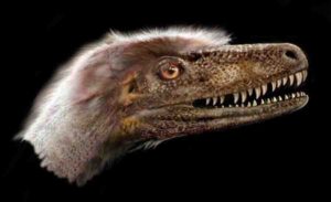
A small, feathered theropod dinosaur, Saurornitholestes langstoni was long thought to be so closely related to Velociraptor mongoliensis that some researchers called it Velociraptor langstoni—until now. Credit: Jan Sovak.
The discovery of a nearly complete dromaeosaurid Saurornitholestes langstoni specimen is providing critical information for the evolution of theropod dinosaurs, according to new research by a University of Alberta paleontologist.
The 76-million-year-old species was long thought to be so closely related to Velociraptor from Mongolia that some researchers even called it Velociraptor langstoni — until now.
The landmark discovery was made by paleontologists Philip Currie and Clive Coy from the University of Alberta and David Evans, James and Louise Temerty Endowed Chair of Vertebrate Palaeontology at the Royal Ontario Museum. The research illustrates how Saurornitholestes differs from Velociraptor. Importantly, the research also identifies a unique tooth evolved for preening feathers and provides new evidence that the dromaeosaurid lineage from North America that includes Saurornitholestes is distinct from an Asian lineage that includes the famous Velociraptor.
“Palaeontology in general is a gigantic puzzle where most of the pieces are missing. The discovery and description of this specimen represents the recovery of many pieces of the puzzle,” said Currie, professor in the Department of Biological Sciences and Canada Research Chair in Dinosaur Paleobiology. “This ranks in the top discoveries of my career. It is pretty amazing.”
Another piece of the puzzle
Saurornitholestes is a small, feathered carnivorous dinosaur within the dromaeosaurid family (also known as “raptors”) that was previously known from fragmentary remains. Discovered by Coy in Dinosaur Provincial Park in 2014, the new skeleton is remarkably complete and exquisitely preserved, with all the bones (except for the tail) preserved in life position. The new research, which focuses on the skull, shows that the North American form has a shorter and deeper skull than the Velociraptor. At the front of the skull’s mouth, the researchers also discovered a flat tooth with long ridges, which was likely used for preening feathers. The same tooth has since been identified in Velociraptor and other dromaeosaurids.
“Because of their small size and delicate bones, small meat-eating dinosaur skeletons are exceptionally rare in the fossil record. The new skeleton is by far the most complete and best-preserved raptor skeleton ever found in North America. It’s a scientific goldmine,” said Evans.
The study also establishes a distinction between dromaeosaurids in North America and Asia. “The new anatomical information we have clearly shows that the North American dromaeosaurids are a separate lineage from the Asian dromaeosaurids, although they do have a common ancestor,” said Currie. “This changes our understanding of intercontinental movements of these animals and ultimately will help us understand their evolution.”
Future research will investigate the remainder of the skeleton as well as additional analyses on the relationships between dromaeosaurids.
The paper, “Cranial Anatomy of New Specimens of Saurornitholestes langstoni (Dinosauria, Theropoda, Dromaeosauridae) from the Dinosaur Park Formation (Campanian) of Alberta,” was published in The Anatomical Record.
Reference:
Philip J. Currie, David C. Evans. Cranial Anatomy of New Specimens of Saurornitholestes langstoni (Dinosauria, Theropoda, Dromaeosauridae) from the Dinosaur Park Formation (Campanian) of Alberta. The Anatomical Record, 2019; DOI: 10.1002/ar.24241
The Sosnogorsk lagoon just before a deadly storm. Credit: Mikhail Shekhanov for the Ukhta Local Museum
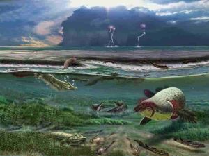
Superbly preserved fossils from Russia, excavated by an international team and reported in the journal Nature, casts new and surprising light on one of the earliest tetrapods—the group of animals that made the evolutionary transition from water to land, and ultimately became the ancestors of amphibians, reptiles, birds and mammals.
The first tetrapods evolved from fishes during the Devonian period, which ended about 360 million years ago. For many decades, our idea of what Devonian tetrapods were like has been based on just a few genera, chiefly Ichthyostega and Acanthostega, which are known from near-complete skeletons. Most other Devonian tetrapods are known only from a few scraps of jaws or limb bones—enough to show that they existed, but not really enough to tell researchers anything useful.
Furthermore, Ichthyostega and Acanthostega lived at the very end of the Devonian. Some of the fragmentary tetrapods are a lot older, up to 373 million years old, and the oldest fossil tetrapod footprints date back a whopping 390 million years. So Devonian tetrapods have a long early history about which researchers have known very little until now. This is a frustrating picture for paleontologists, considering that this represents one of the most important events in the history of the backboned animals.
The new Russian tetrapod, Parmastega aelidae, changes all this. At 372 million years old, its fossils are only marginally younger than the oldest fragmentary tetrapod bones. They come from the Sosnogorsk Formation, a limestone formed in a tropical coastal lagoon, which is now exposed on the banks of the Izhma River near the city of Ukhta in the Komi Republic of European Russia.
When the limestone is dissolved with acetic acid, perfectly preserved bones emerge from the head and shoulder girdle—more than 100 specimens, so far—which can be pieced together into a three-dimensional reconstruction of the animal, by far the earliest for any tetrapod. Large and small individuals are found, the biggest with a head length of about 27 cm. Fish-like characteristics in some bones indicate that this is not only the earliest but also the most primitive of the well-preserved Devonian tetrapods.
The researchers consider the animal to be unusual. Like other Devonian tetrapods, Parmastega is vaguely crocodile-like in shape, but its eyes are raised above the top of the head, and the curve of its snout and lower jaw create a disconcerting “grin” that reveals its formidable teeth. A clue to its lifestyle is provided by the lateral line canals, sensory organs for detecting vibrations in the water, which Parmastega inherited from its fish ancestors. These canals are well-developed on the lower jaw, the snout and the sides of the face, but not on top of the head behind the eyes.
This probably means that it spent a lot of time hanging around at the surface of the water, with the top of the head just awash and the eyes protruding from the water surface. But why? Crocodiles do this today as they watch for land animals to hunt. Researchers don’t know very much about the land that surrounded Parmastega’s lagoon, but there may have been large arthropods such as millipedes or “sea scorpions” to catch at the water’s edge. The slender, elastic lower jaw looks well-suited to scooping prey off the ground, its needle-like teeth contrasting with the robust fangs of the upper jaw that would have been driven into the prey by the body weight of Parmastega.
However, the fossil material springs one final surprise: The shoulder girdle was made partly from cartilage, which is softer than bone, and the vertebral column and limbs may have been entirely cartilaginous as they are not preserved. This strongly suggests that Parmastega, with its crocodile-like head and protruding eyes, never really left the water. Did it creep up on prey at the water’s edge and surge onto the shore to seize it in its jaws, only to then slide back into the supporting mass of the water? We don’t know. Far from presenting a natural progression of ever more land-adapted animals, the origin of tetrapods is looking more like a tangle of ecological experimentation.
Reference:
Morphology of the earliest reconstructable tetrapod Parmastega aelidae, Nature (2019). DOI: 10.1038/s41586-019-1636-y
Note: The above post is reprinted from materials provided by Uppsala University.
A new study led by Yale University confirms a long-held theory about the last great mass extinction event in history and how it affected Earth’s oceans. The findings may also answer questions about how marine life eventually recovered. Credit: Michael Henehan & Pincelli Hull
A new study led by Yale University confirms a long-held theory about the last great mass extinction event in history and how it affected Earth’s oceans. The findings may also answer questions about how marine life eventually recovered.
The researchers say it is the first direct evidence that the Cretaceous-Paleogene extinction event 66 million years ago coincided with a sharp drop in the pH levels of the oceans—which indicates a rise in ocean acidity.
The study appears in the online edition of the journal Proceedings of the National Academy of Sciences.
The Cretaceous-Paleogene die-off, also known as the K-Pg mass extinction event, occurred when a meteor slammed into Earth at the end of the Cretaceous period. The impact and its aftereffects killed roughly 75% of the animal and plant species on the planet, including whole groups like the non-avian dinosaurs and ammonites.
“For years, people suggested there would have been a decrease in ocean pH because the meteor impact hit sulphur-rich rocks and caused the raining-out of sulphuric acid, but until now no one had any direct evidence to show this happened,” said lead author Michael Henehan, a former Yale scientist who is now at GFZ German Research Centre for Geosciences in Potsdam, Germany.
Turns out all they had to do was look at the foraminifera.
Foraminifera are tiny plankton that grow a calcite shell and have an amazingly complete fossil record going back hundreds of millions of years. Analysis of the chemical composition of foraminifera fossils from before, during, and after the K-Pg event produced a wealth of data about changes in the marine environment over time. Specifically, measurements of boron isotopes in these shells allowed the Yale scientists to detect changes in the ocean’s acidity.
Previous K-Pg research had shown that some marine calcifiers—animal species that develop shells and skeletons from calcium carbonate—were disproportionately wiped out in the mass extinction. The new study suggests that higher ocean acidity (lower pH) may have prevented these calcifiers from creating their shells. This was important, researchers note, because these calcifiers made up an important part of the first rung on the ocean food chain, supporting the rest of the ecosystem.
“The ocean acidification we observe could easily have been the trigger for mass extinction in the marine realm,” said senior author Pincelli Hull, assistant professor of geology and geophysics at Yale.
Meanwhile, the team’s boron isotope analysis and modeling techniques may have reconciled some competing theories and puzzling facts relating to ocean life after the K-Pg event.
Why, for example, are carbon isotope signatures (analyzed from deep sea core samples) immediately after the K-Pg asteroid impact identical in fossil material from the sea floor and the surface waters, when normal carbon cycling in oceans should lead to different signatures?
One theory, the “Strangelove Ocean” theory, argued that for a time after K-Pg, the ocean was essentially dead and the normal carbon cycle just stopped. The problem with the “Strangelove Ocean,” according to some researchers, is that many organisms on the sea floor that rely on food sinking from the ocean’s surface continued unharmed across the K-Pg event—an unlikely occurrence in a dead ocean. Another popular theory, called the “Living Ocean,” suggested that K-Pg killed off larger plankton species, disrupting the carbon cycle by making it harder for organic matter to sink to the deep sea, but allowed for some marine life to survive.
The new study splits the difference. It says the oceans had a major, initial loss of species productivity—by as much as 50% —followed by a transitional period in which marine life began to recover.
“In a way, we reconciled both of these ‘Strangelove’ and ‘Living Ocean’ scenarios,” Henehan said. “Both of them were partially right; they just happened in sequence.”
The new study also may have settled a question regarding ocean pH levels leading up to K-Pg. Some researchers have theorized that volcanic eruptions starting hundreds of thousands of years before K-Pg had progressively made Earth more prone to a mass extinction event. This should be reflected in a steady decline in ocean pH levels up until the extinction.
“What we can show is that there is no real signal of gradual pH decline in the ocean in the lead-up to K-Pg,” Henehan said. “Our results do not support any major role for volcanic activity in priming the world for extinction.”
One offshoot from the study may be its ability to help understand early Earth atmosphere and climate. The boron isotopes from foraminifera in this study are an excellent proxy for estimating carbon dioxide levels in the geological past, the authors said.
Reference:
Michael J. Henehan el al., “Rapid ocean acidification and protracted Earth system recovery followed the end-Cretaceous Chicxulub impact,” PNAS (2019). www.pnas.org/cgi/doi/10.1073/pnas.1905989116
Note: The above post is reprinted from materials provided by Yale University.
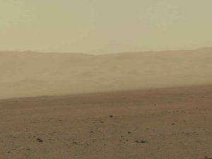
In this handout image provided by NASA/JPL-Caltech/MSSS, a color image from NASA’s Curiosity rover’s Mast Camera shows part of the wall of Gale Crater, the location on Mars where the rover landed August 5, 2012 on Mars. Credit: NASA via Getty Images
Mars once had salt lakes that are similar to those on Earth and has gone through wet and dry periods, according to an international team of scientists that includes a Texas A&M University College of Geosciences researcher.
Marion Nachon, a postdoctoral research associate in the Department of Geology and Geophysics at Texas A&M, and colleagues have had their work published in the current issue of Nature Geoscience.
The team examined Mars’ geological terrains from Gale Crater, an immense 95-mile-wide rocky basin that is being explored with the NASA Curiosity rover since 2012 as part of the MSL (Mars Science Laboratory) mission.
The results show that the lake that was present in Gale Crater over 3 billion years ago underwent a drying episode, potentially linked to the global drying of Mars.
Gale Crater formed about 3.6 billion years ago when a meteor hit Mars and created its large impact crater.
“Since then, its geological terrains have recorded the history of Mars, and studies have shown Gale Crater reveals signs that liquid water was present over its history, which is a key ingredient of microbial life as we know it,” Nachon said. “During these drying periods, salt ponds eventually formed. It is difficult to say exactly how large these ponds were, but the lake in Gale Crater was present for long periods of time — from at least hundreds of years to perhaps tens of thousands of years,” Nachon said.
So what happened to these salt lakes?
Nachon said that Mars probably became dryer over time, and the planet lost its planetary magnetic field, which left the atmosphere exposed to be stripped by solar wind and radiation over millions of years.
“With an atmosphere becoming thinner, the pressure at the surface became lesser, and the conditions for liquid water to be stable at the surface were not fulfilled anymore,” Nachon said. “So liquid water became unsustainable and evaporated.”
The salt ponds on Mars are believed to be similar to some found on Earth, especially those in a region called Altiplano, which is near the Bolivia-Peru border.
Nachon said the Altiplano is an arid, high-altitude plateau where rivers and streams from mountain ranges “do not flow to the sea but lead to closed basins, similar to what used to happen at Gale Crater on Mars,” she said. “This hydrology creates lakes with water levels heavily influenced by climate. During the arid periods Altiplano lakes become shallow due to evaporation, and some even dry up entirely. The fact that the Atliplano is mostly vegetation free makes the region look even more like Mars,” she said.”
Nachon added that the study shows that the ancient lake in Gale Crater underwent at least one episode of drying before “recovering.” It’s also possible that the lake was segmented into separate ponds, where some of the ponds could have undergone more evaporation.
Because up to now only one location along the rover’s path shows such a drying history, Nachon said it might give clues about how many drying episodes the lake underwent before Mars’s climate became as dry as it is currently.
“It could indicate that Mars’s climate ‘dried out’ over the long term, on a way that still allowed for the cyclical presence of a lake,” Nachon said. “These results indicate a past Mars climate that fluctuated between wetter and drier periods. They also tell us about the types of chemical elements (in this case sulphur, a key ingredient for life) that were available in the liquid water present at the surface at the time, and about the type of environmental fluctuations Mars life would have had to cope with, if it ever existed.”
Reference:
W. Rapin, B. L. Ehlmann, G. Dromart, J. Schieber, N. H. Thomas, W. W. Fischer, V. K. Fox, N. T. Stein, M. Nachon, B. C. Clark, L. C. Kah, L. Thompson, H. A. Meyer, T. S. J. Gabriel, C. Hardgrove, N. Mangold, F. Rivera-Hernandez, R. C. Wiens, A. R. Vasavada. An interval of high salinity in ancient Gale crater lake on Mars. Nature Geoscience, 2019; DOI: 10.1038/s41561-019-0458-8
Note: The above post is reprinted from materials provided by Texas A&M University. Original written by Keith Randall.
In this undated image provided by Kagin’s Inc., shows the Butte Nugget. Credit: AP/Kagin’s Inc.
Looking for gold? Every good explorer knows there’s no silver bullet in finding an ore deposit, but a University of South Australia researcher is hoping to change all that.
Dr. Caroline Tiddy, a senior research fellow in UniSA’s Future Industries Institute, has developed a suite of geochemical tools to more accurately target valuable mineral deposits and save drilling companies millions of dollars in the process.
The tools use data collected from analysing drilling materials in new ways to help locate undiscovered precious metals buried by younger sediment and identify the right drill holes.
“The global demand for copper and gold is growing, but it is getting increasingly hard to find these metals as companies are forced to drill deeper and deeper, costing them significant amounts of money,” Dr. Tiddy says.
“Diamond drilling, for example, costs up to $400 a metre and it is not uncommon to drill to depths of one to two kilometres. That amounts to an $800,000 bill with no guarantee of success, so it limits the number of drill holes. To add to the challenge, ore deposits are tiny compared to the search space. It’s a real life, global problem of looking for a needle in a haystack.”
Dr. Tiddy’s goal is to develop new technologies for faster, cheaper and more environmentally-friendly drilling.
By mapping out where key chemical elements are found in greater concentrations, Dr. Tiddy is creating geochemical algorithms that increase the chances of finding an ore deposit and decrease the cost of mineral exploration.
Using the exploration tools developed by Dr. Tiddy, exploration companies stand to vastly increase the return on their investment.
The tools have been successfully tested at Prominent Hill, an iron oxide-copper-gold deposit in the north of South Australia, increasing the footprint of their ore body fourfold. They have also been trialled in the Yorke Peninsula, highlighting unexplored areas of copper.
“South Australia has a reputation for its copper and gold deposits so these data-driven approaches to exploration are revealing important information about mineral exploration in the state.
“By using these geochemical tools, companies can better focus their drilling resources into lower risk areas. Finding an economically viable copper-enriched area has the potential to generate revenues of up to $175 million a year as well as creating more than 500 jobs,” she says.
The Ice Drilling Design and Operations (IDDO) group at the University of Wisconsin-Madison designed and built the South Pole Ice Core (SPICE) drilling system, called the Intermediate Depth Drill. Based on a Danish drill called the Hans-Taunsen drill, the Intermediate Depth Drill was purpose-built for coring 1,500 meters of ice. The ice cores collected at this depth (from the South Pole) contain atmospheric gases from the past 40,000 years, the time of transition from the last ice age to the present warm climate. Credit: T.J. Fudge
A new discovery by University of Maine researchers that challenges the established volcanic source of particles found in an ice core from the South Pole adds to the global record of volcanism and is relevant to several research disciplines.
Understanding how the Earth’s volcanic activity interacts with the climate system, as well as volcanic hazard mitigation studies and reconstructions of how past volcanic events have affected human history often rely on detailed records of past volcanic eruptions. Unfortunately, in many parts of the world, historical records are sporadic, short and not well documented, according to Andrei Kurbatov, associate professor at the University of Maine School of Earth and Climate Sciences and Climate Change Institute.
In the last decade, Kurbatov and Martin Yates, electron beam laboratory manager and instructor of Earth sciences at UMaine, in collaboration with Nelia Dunbar and Nels Iverson from the New Mexico Institute of Mining and Technology, developed a method of extracting volcanic ash particles from ice core samples to measure their geochemical composition.
The new methodology provides additional means to refine the history of global volcanism captured in polar ice core records, according to Kurbatov.
Laura Hartman, a graduate student at the CCI, used the methodology while examining microscopic volcanic ash particles in ice core samples from Antarctica’s South Pole. Hartman was advised by Kurbatov and Earth and Climate Sciences assistant professor Alicia Cruz-Uribe.
She found several particles from a volcanic interval that in the last three decades was attributed to a volcanic eruption from the Kuwae volcanic center in Vanuatu.
Hartman determined the geochemical signatures of the particles, that provide a unique volcanic source fingerprint, and compared the signatures with the known composition of Kuwae volcanic products.
She discovered the composition was similar to volcanic products from the South American volcano Reclus, not Kuwae.
“The discovery challenges the established volcanic source for one of the largest ice core sulfate signals from the last millennium,” Kurbatov says. “The new source location will impact how climate models calculate atmospheric loading and ultimately will guide how climate models determine the impact of this volcanic event on the climate system.”
The relatively young, unknown explosive volcanic eruption from Reclus volcano, located close to several national parks in South America, provides new important constraints for regional volcanic hazards assessments and air-traffic safety, Kurbatov says. The new data also question the existing paradigm on long-range transport of ultrafine volcanic particles in the atmosphere.
With funding from the National Science Foundation, Kurbatov and his team plan to continue to explore volcanic deposits in the South Pole ice core using the new methodology to further refine the global record of volcanism.
“Volcanic glass properties from 1459 C.E. volcanic event in South Pole ice core dismiss Kuwae caldera as a potential source” was published in Scientific Reports.
Reference:
Laura H. Hartman et al. Volcanic glass properties from 1459 C.E. volcanic event in South Pole ice core dismiss Kuwae caldera as a potential source, Scientific Reports (2019). DOI: 10.1038/s41598-019-50939-x
Siamraptor skull reconstruction. Credit: Chokchaloemwong et al., 2019
Fossils discovered in Thailand represent a new genus and species of predatory dinosaur, according to a study released October 9, 2019 in the open-access journal PLOS ONE by Duangsuda Chokchaloemwong of Nakhon Ratchasima Rajabhat University, Thailand and colleagues.
Carcharodontosaurs were a widespread and successful group of large predatory dinosaurs during the Jurassic and Cretaceous Periods and were important members of ecosystems on multiple continents. However, the fossil record of these animals is notably lacking from the Early Cretaceous of Asia, with no definite carcharodontosaurs known from Southeast Asia.
In this study, Chokchaloemwong and colleagues describe fossil material from the Khok Kruat geologic formation in Khorat, Thailand, dating to the Early Cretaceous. These fossils include remains of the skull, backbone, limbs, and hips of at least four individual dinosaurs, and morphological comparison with known species led the authors to identify these remains as belonging to a previously unknown genus and species of carcharodontosaur which they named Siamraptor suwati.
Phylogenetic analysis indicates that Siamraptor is a basal member of the carcharodontosaurs, meaning it represents a very early evolutionary split from the rest of the group. It is also the first definitive carcharodontosaur known from Southeast Asia, and combined with similarly-aged finds from Europe and Africa, it reveals that this group of dinosaurs had already spread to three continents by the Early Cretaceous.
The authors summarize their work as follows: “A Siam predator: New carnivorous dinosaur Siamraptor suwati discovered in Thailand.
Reference:
Chokchaloemwong D, Hattori S, Cuesta E, Jintasakul P, Shibata M, Azuma Y (2019) A new carcharodontosaurian theropod (Dinosauria: Saurischia) from the Lower Cretaceous of Thailand. PLoS ONE 14(10): DOI:10.1371/journal.pone.0222489
Ancient fossils reveal fresh clues about early life on land
Slime has been present on Earth for a very long time—almost 2 billion years, according to a recent reassessment of fossil evidence.
In a study published this month in the journal Palaeogeography, Palaeoclimatology, Palaeoecology, UO geologist Greg Retallack and Xuegang Mao of China’s Fujian Normal University confirm that a fossil from Western Australia is the planet’s oldest known land-dwelling slime mold.
The fossil in question, Myxomitodes stirlingensi, is a hairpin-shaped trace of biological activity found in the rocks of the Stirling Range, a mountain region 200 miles southeast of Perth. Long the subject of scholarly controversy, the fossil has sparked debate both about the specific life form it represents as well as the paleoenvironment it inhabited.
“They have been interpreted as trails of metazoan animals and often as marine organisms,” said Retallack, who is director of the Condon Fossil Collection at the Museum of Natural and Cultural History. “Though they resemble animal trails they probably were not. Slime molds make similar trails but lack any animal organization: no mouth, no gut, no anus, no nerves, no veins. And we are seeing these fossils at the surface of ancient terrestrial soils, making them additional evidence of life on land during the Paleoproterozoic Period.”
Retallack said that while slime molds are not themselves multicellular, they might hold important clues about how multicellular organisms evolved.
“Myxomitodes were amoebae that live dispersed in soil, but these traces of their movement demonstrate that they could coalesce into a slug that wandered over the soil as a unit, possibly to sense better feeding opportunities or a place to sporulate, and then disaggregate once again into single cells,” he said. “This may demonstrate an early stage in the evolution of multicellular creatures, bridging the gap between microbes and more complex life forms.”
Reference:
Gregory J. Retallack et al. Paleoproterozoic (ca. 1.9 Ga) megascopic life on land in Western Australia, Palaeogeography, Palaeoclimatology, Palaeoecology (2019). DOI: 10.1016/j.palaeo.2019.109266
Note: The above post is reprinted from materials provided by University of Oregon.