The Jefferson River is a tributary of the Missouri River, approximately 83 miles (134 km) long, in the U.S. state of Montana. The Jefferson River and the Madison River form the official beginning of the Missouri at Missouri Headwaters State Park near Three Forks. It is joined 0.6 miles (1.0 km) downstream (northeast) by the Gallatin.
From broad valleys to a narrow canyon, the Jefferson River passes through a region of significant geological diversity, with some of the oldest and youngest rocks of North America and a diversity of igneous, metamorphic, and sedimentary formations.
The region was only intermittently inhabited by Native Americans until relatively recent times, and no single tribe had exclusive use of the Jefferson River when the Lewis and Clark Expedition first ascended the river in 1805. Today, the Jefferson River retains much of its scenic beauty and wildlife diversity from the days of Lewis and Clark, yet is threatened by water use issues and encroaching development. The Jefferson is a segment of the Lewis and Clark National Historic Trail, administered by the National Park Service.
Course
From the Rocky Mountains of southwestern Montana, three small rivers converge to form the headwaters of the Jefferson River. The longest begins at Brower’s Spring, 9,030 feet (2,750 m) above sea level, on the northern flank of the Centennial Mountains. The site is marked by pile of rocks. The water flows west then north as Hell Roaring Creek before merging with Rock Creek and flowing west through Upper and Lower Red Rock Lakes. Here it becomes the Red Rock River, flowing west through Lima Reservoir and then northwest into Clark Canyon Reservoir near Dillon. Below the dam, the river is known as the Beaverhead River. It is joined by the Ruby River above the town of Twin Bridges and converges with the Big Hole River to form the Jefferson about two miles downstream from town.
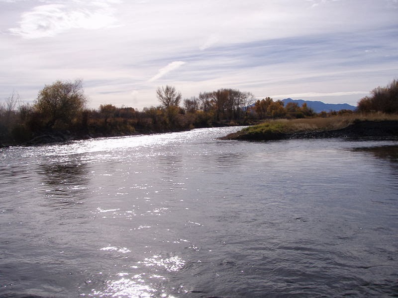
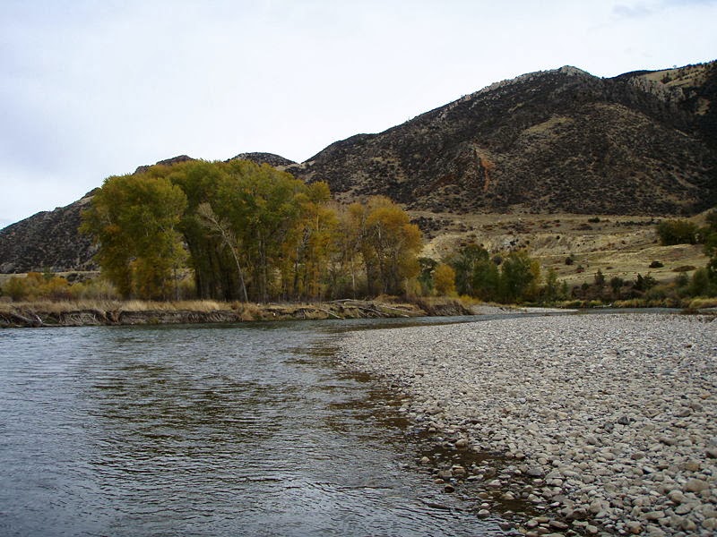
The Jefferson River flows north through the Jefferson Valley towards Whitehall and then east, where it is joined by the Boulder River before passing through the narrow Jefferson River canyon near Lewis and Clark Caverns State Park. After the canyon, the river passes into a broad valley again near Willow Creek. The Jefferson converges with the Madison River at Missouri Headwaters State Park near Three Forks to form the Missouri River, joined a short distance downstream by the Gallatin River.
Geology
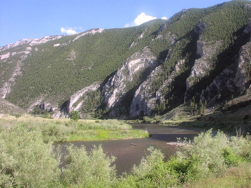
A new sea encroached on the land, depositing sedimentary layers of limestone, dolomite, shale, and sandstone over several hundred million years. Limestone is generally made of calcium from marine animals that have been compacted and cemented together. Dolomite is similar but has more magnesium. Shale is formed from fine-grained mud, silts, and clays that have been compacted and cemented together. The sandstone is made up of quartz and feldspar.By the Mississippian Period, 340 million years ago, much of western North America was covered with a warm, shallow sea, much like the Gulf Coast of Florida today. Small marine fossils can be found in the Madison Group limestone that makes up the steep, narrow section of the Jefferson River canyon today.
Gentle uplift eventually raised the region above sea level again. Rainwater percolated down through cracks in the limestone, dissolving rock and creating caves such as those found at Lewis and Clark Caverns State Park.
Local mountains, such as the Tobacco Roots were formed from the Boulder Batholith. The batholith is composed of at least seven, and possibly as many as fourteen, discrete igneous rock masses called plutons, which formed beneath the Earth’s surface during a period of magma intrusion about 73 to 78 million years ago during the Late Cretaceous. The rising buoyant plutons resulted from subduction along what was then the west coast of North America. Regional uplift brought the deep-seated granite to the surface, where erosion exposed the rocks and the mineral veins they contained. The granite generally consists of quartz, hornblende, and feldspars. Gold, silver, and other semi precious minerals are also associated with batholiths.
The ancient metamorphic and more recent sedimentary layers above the batholiths eroded away as the magma pushed up through the crust. Thus, the granite batholiths are typically found at the center of local mountain ranges, while the much older metamorphic gneiss is usually found lower in the mountains, and limestone layers are mostly found in the foothills nearest the Jefferson River.
The Rocky Mountains began a new and continuing phase of crustal stress 5 to 10 million years ago as tectonic forces began to pull the region apart. Blocks of earth dropped down to form valleys, and the Jefferson River eroded a channel through rock to form the Jefferson River canyon.


 long, in the U.S. state of Montana. The Jefferson Riv)