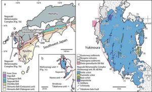
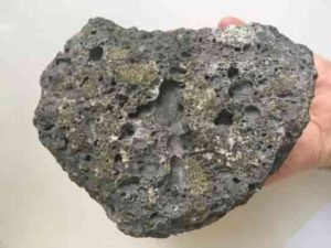
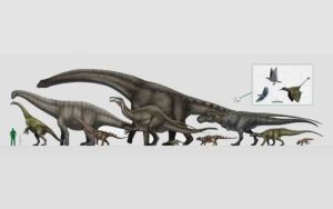
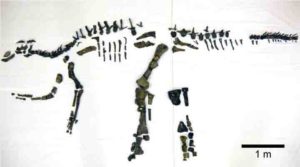
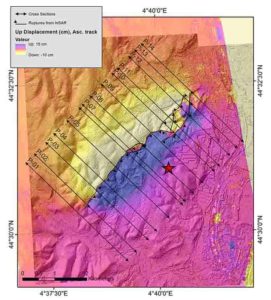
Location and geological map of Yukinoura district, Saikai City, Nagasaki Prefecture, Japan. Credit: Professor Tadao Nishiyama
A collaboration of researchers based in Kumamoto University, Japan have discovered microdiamonds in the Nishisonogi metamorphic rock formation in Nagasaki Prefecture, Japan. Microdiamonds in metamorphic rocks are important minerals because they form in continental collision zones and show that the crust has penetrated deeper than 120 km below the surface. This is the second area in the world, after the Italian Alps, that shows microdiamonds can form in metamorphic rock through subduction of oceanic plates.
In recent years, microdiamonds have received a great deal of attention because they have been discovered in metamorphic rocks around the world and it has become clear that they are formed in collisions between continents. It was thought that Japan would not produce such microdiamonds because it is not a continental collision zone, but an oceanic plate subduction zone. However, the first microdiamonds from metamorphic rocks in Japan were found in the Nishisonogi metamorphic rock formation in the west coast of Nagasaki Prefecture.
The area where the microdiamonds were discovered is an approximately 100-million-year-old Cretaceous metamorphic rock formation. On the west coast of Saikai City in Nagasaki Prefecture, blocks of pelitic and basic schist are scattered amongst serpentinite that was created from mantle material. Such rocks are called a serpentinite mélange and indicate that they have risen from deep in the subduction zone. Researchers found microdiamonds here, in the serpentinite mélange. Their formation conditions have been estimated to be a temperature of about 450 °C and a pressure of about 2.8 GPa, which makes them the coldest diamonds ever formed. It has been thought that the Nishisonogi metamorphic rock was formed under a pressure of about 1 GPa, but it is now clear that they were ultrahigh-pressure metamorphic rocks that rose after subducting to 120 km — a very unexpected discovery.
“The discovery of microdiamonds from Japan’s first metamorphic rocks will rewrite Japan’s geological history,” said Professor Tadao Nishiyama, the leader of this study. “Until now, the Nagasaki metamorphic rocks were said to belong to a low-temperature, high-pressure-type metamorphic rock belt, the “Sanbagawa Belt,” which crosses the Japanese mainland. It has become clear, however, that they are independently-formed ultrahigh-pressure metamorphic rocks. I expect that there will be many discussions about what kind of plate movement created this formation.”
Reference:
Tadao Nishiyama, Hiroaki Ohfuji, Kousuke Fukuba, Masami Terauchi, Ukyo Nishi, Kazuki Harada, Kouhei Unoki, Yousuke Moribe, Akira Yoshiasa, Satoko Ishimaru, Yasushi Mori, Miki Shigeno, Shoji Arai. Microdiamond in a low-grade metapelite from a Cretaceous subduction complex, western Kyushu, Japan. Scientific Reports, 2020; 10 (1) DOI: 10.1038/s41598-020-68599-7
A huge mammoth graveyard has been uncovered at the site of Mexico City’s new airport
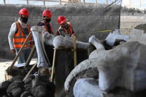
Archaeologists in hard hats and face masks carefully remove earth from around enormous bones at the site of Mexico City’s new airport, where construction work has uncovered a huge trove of mammoth skeletons.
The remains of dozens of the extinct giants and other prehistoric creatures have been found in Zumpango on the northern edge of the capital, which sits on an ancient lake bed.
“More than 100 individual mammoths, individual camels, horses, bison, fish, birds, antelopes and rodents have already been recovered,” said army captain Jesus Cantoral, who heads the excavation team.
In total remains have been found at 194 spots across the site since the first discoveries were made in October last year during work on a fuel terminal, he told AFP.
Most of the animals are believed to have roamed the Earth between 10,000 and 25,000 years ago.
Experts worked painstakingly to extract the bones of a one of the mammoth skeletons, taking care not to disturb a mound of earth supporting another specimen.
At the same time thousands of construction workers continued to labor away across the site as dozens of excavators and trucks shifted earth and transported building materials.
The authorities say they have kept a careful watch to ensure the precious remains are preserved during work on the airport, which President Andres Manuel Lopez Obrador has promised will be inaugurated in March 2022.
Stuck in mud
Experts believe the mammoths were drawn to the area by food and water provided by a lake that existed in prehistoric times.
“The place had a lot of natural resources, enough for these individuals to survive for a long time and for many generations,” said archaeologist Araceli Yanez.
In winter the lake area became muddy, trapping the giant mammals who starved, she said.
“It attracted a large number of mammoths, and they got stuck, as is the case with this individual, and died here,” Yanez added.
The lake was also very good for preserving the remains.
Mexico has been the scene of surprising mammoth discoveries before.
In the 1970s, workers building the Mexico City subway found a mammoth skeleton while digging on the capital’s north side.
In 2012, workers digging to build a wastewater treatment plant outside the capital discovered hundreds of bones belonging to mammoths and other Ice Age animals.
And last year archaeologists found the skeletons of 14 mammoths in Tultepec, near the site of the new airport.
Some bore signs that the animals had been hunted, leading experts to conclude at the time that they had found “the world’s first mammoth trap.”
The government began construction of the new aviation hub in 2019 at the Santa Lucia military airbase, months after canceling work on another partially completed airport.
Lopez Obrador, who ran on a pro-austerity, anti-graft platform, had criticized that project championed by his predecessor Enrique Pena Nieto as an unnecessary mega-project marred by corruption.
His administration has tasked the military with overseeing construction of the new airport, which will house a museum showcasing the mammoth skeletons and other ancient remains.
Note: The above post is reprinted from materials provided by AFP.
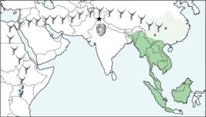
Map illustrating the location of Kapi (black star) relative to modern (dark green) and historical (light green) populations of lesser apes and the approximate distribution of early fossil apes in East Africa (blue triangles). Green triangles mark the location of previously discovered fossil gibbons. The new fossil is millions of years older than any previously known fossil gibbon and highlights their migration from Africa to Asia. Credit: Luci Betti-Nash.
A 13-million-year-old fossil unearthed in northern India comes from a newly discovered ape, the earliest known ancestor of the modern-day gibbon. The discovery by Christopher C. Gilbert, Hunter College, fills a major void in the ape fossil record and provides important new evidence about when the ancestors of today’s gibbon migrated to Asia from Africa.
The findings have been published in the article “New Middle Miocene ape (primates: Hylobatidae) from Ramnagar, India fills major gaps in the hominoid fossil record” in the Proceedings of the Royal Society B.
The fossil, a complete lower molar, belongs to a previously unknown genus and species (Kapi ramnagarensis) and represents the first new fossil ape species discovered at the famous fossil site of Ramnagar, India, in nearly a century.
Gilbert’s find was serendipitous. Gilbert and team members Chris Campisano, Biren Patel, Rajeev Patnaik, and Premjit Singh were climbing a small hill in an area where a fossil primate jaw had been found the year before. While pausing for a short rest, Gilbert spotted something shiny in a small pile of dirt on the ground, so he dug it out and quickly realized he’d found something special.
“We knew immediately it was a primate tooth, but it did not look like the tooth of any of the primates previously found in the area,” he said. “From the shape and size of the molar, our initial guess was that it might be from a gibbon ancestor, but that seemed too good to be true, given that the fossil record of lesser apes is virtually nonexistent. There are other primate species known during that time, and no gibbon fossils have previously been found anywhere near Ramnagar. So we knew we would have to do our homework to figure out exactly what this little fossil was.”
Since the fossil’s discovery in 2015, years of study, analysis, and comparison were conducted to verify that the tooth belongs to a new species, as well as to accurately determine its place in the ape family tree. The molar was photographed and CT-scanned, and comparative samples of living and extinct ape teeth were examined to highlight important similarities and differences in dental anatomy.
“What we found was quite compelling and undeniably pointed to the close affinities of the 13-million-year-old tooth with gibbons,” said Alejandra Ortiz, who is part of the research team. “Even if, for now, we only have one tooth, and thus, we need to be cautious, this is a unique discovery. It pushes back the oldest known fossil record of gibbons by at least five million years, providing a much-needed glimpse into the early stages of their evolutionary history.”
In addition to determining that the new ape represents the earliest known fossil gibbon, the age of the fossil, around 13 million years old, is contemporaneous with well-known great ape fossils, providing evidence that the migration of great apes, including orangutan ancestors, and lesser apes from Africa to Asia happened around the same time and through the same places.
“I found the biogeographic component to be really interesting,” said Chris Campisano. “Today, gibbons and orangutans can both be found in Sumatra and Borneo in Southeast Asia, and the oldest fossil apes are from Africa. Knowing that gibbon and orangutan ancestors existed in the same spot together in northern India 13 million years ago, and may have a similar migration history across Asia, is pretty cool.”
Reference:
New Middle Miocene Ape (Primates: Hylobatidae) from Ramnagar, India Fills Major Gaps in the Hominoid Fossil Record, Proceedings of the Royal Society B (2020). rspb.royalsocietypublishing.or … .1098/rspb.2020.1655
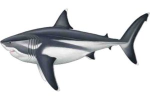
Palaeoartist reconstruction of a 16 m adult Megalodon. Credit: Reconstruction by Oliver E. Demuth
To date only the length of the legendary giant shark Megalodon had been estimated. But now, a new study led by the University of Bristol and Swansea University has revealed the size of the rest of its body, including fins that are as large as an adult human.
There is a grim fascination in determining the size of the largest sharks, but this can be difficult for fossil forms where teeth are often all that remain.
Today, the most fearsome living shark is the Great White, at over six metres (20 feet) long, which bites with a force of two tonnes.
Its fossil relative, the big tooth shark Megalodon, star of Hollywood movies, lived from 23 to around three million years ago, was over twice the length of a Great White and had a bite force of more than ten tonnes.
The fossils of the Megalodon are mostly huge triangular cutting teeth bigger than a human hand.
Jack Cooper, who has just completed the MSc in Palaeobiology at the University of Bristol’s School of Earth Sciences, and colleagues from Bristol and Swansea used a number of mathematical methods to pin down the size and proportions of this monster, by making close comparisons to a diversity of living relatives with ecological and physiological similarities to Megalodon.
The project was supervised by shark expert Dr Catalina Pimiento from Swansea University and Professor Mike Benton, a palaeontologist at Bristol. Dr Humberto Ferrón of Bristol also collaborated.
Their findings are published today in the journal Scientific Reports.
Jack Cooper said: “I have always been mad about sharks. As an undergraduate, I have worked and dived with Great whites in South Africa — protected by a steel cage of course. It’s that sense of danger, but also that sharks are such beautiful and well-adapted animals, that makes them so attractive to study.
“Megalodon was actually the very animal that inspired me to pursue palaeontology in the first place at just six years old, so I was over the moon to get a chance to study it.
“This was my dream project. But to study the whole animal is difficult considering that all we really have are lots of isolated teeth.”
Previously the fossil shark, known formally as Otodus megalodon, was only compared with the Great White. Jack and his colleagues, for the first time, expanded this analysis to include five modern sharks.
Dr Pimiento said: “Megalodon is not a direct ancestor of the Great White but is equally related to other macropredatory sharks such as the Makos, Salmon shark and Porbeagle shark, as well as the Great white. We pooled detailed measurements of all five to make predictions about Megalodon.”
Professor Benton added: “Before we could do anything, we had to test whether these five modern sharks changed proportions as they grew up. If, for example, they had been like humans, where babies have big heads and short legs, we would have had some difficulties in projecting the adult proportions for such a huge extinct shark.
“But we were surprised, and relieved, to discover that in fact that the babies of all these modern predatory sharks start out as little adults, and they don’t change in proportion as they get larger.”
Jack Cooper said: “This means we could simply take the growth curves of the five modern forms and project the overall shape as they get larger and larger — right up to a body length of 16 metres.”
The results suggest that a 16-metre-long Otodus megalodon likely had a head round 4.65 metres long, a dorsal fin approximately 1.62 metres tall and a tail around 3.85 metres high.
This means an adult human could stand on the back of this shark and would be about the same height as the dorsal fin.
The reconstruction of the size of Megalodon body parts represents a fundamental step towards a better understanding of the physiology of this giant, and the intrinsic factors that may have made it prone to extinction.
Reference:
Jack A. Cooper, Catalina Pimiento, Humberto G. Ferrón, Michael J. Benton. Body dimensions of the extinct giant shark Otodus megalodon: a 2D reconstruction. Scientific Reports, 2020; 10 (1) DOI: 10.1038/s41598-020-71387-y
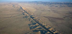
Aerial photo of the San Andreas Fault in the Carrizo Plain, northwest of Los Angeles. Credit: Wikipedia.
Rock-melting forces occurring much deeper in the Earth than previously understood appear to drive tremors along a notorious segment of California’s San Andreas Fault, according to new USC research that helps explain how quakes happen.
The study from the emergent field of earthquake physics looks at temblor mechanics from the bottom up, rather than from the top down, with a focus on underground rocks, friction and fluids. On the segment of the San Andreas Fault near Parkfield, Calif., underground excitations—beyond the depths where quakes are typically monitored—lead to instability that ruptures in a quake.
“Most of California seismicity originates from the first 10 miles of the crust, but some tremors on the San Andreas Fault take place much deeper,” said Sylvain Barbot, assistant professor of Earth sciences at the USC Dornsife College of Letters, Arts and Sciences. “Why and how this happens is largely unknown. We show that a deep section of the San Andreas Fault breaks frequently and melts the host rocks, generating these anomalous seismic waves.”The newly published study appears in Science Advances. Barbot, the corresponding author, collaborated with Lifeng Wang of the China Earthquake Administration in China.
The findings are significant because they help advance the long-term goal of understanding how and where earthquakes are likely to occur, along with the forces that trigger temblors. Better scientific understanding helps inform building codes, public policy and emergency preparedness in quake-ridden areas like California. The findings may also be important in engineering applications where the temperature of rocks is changed rapidly, such as by hydraulic fracturing.
Parkfield was chosen because it is one of the most intensively monitored epicenters in the world. The San Andreas Fault slices past the town, and it’s regularly ruptured with significant quakes. Quakes of magnitude 6 have shaken the Parkfield section of the fault at fairly regular intervals in 1857, 1881, 1901, 1922, 1934, 1966 and 2004, according to the U.S. Geological Survey. At greater depths, smaller temblors occur every few months.So what’s happening deep in the Earth to explain the rapid quake recurrence?
USC researchers seek to understand rocks beneath the San Andreas Fault
So what’s happening deep in the Earth to explain the rapid quake recurrence?
Using mathematical models and laboratory experiments with rocks, the scientists conducted simulations based on evidence gathered from the section of the San Andreas Fault extending up to 36 miles north of—and 16 miles beneath—Parkfield. They simulated the dynamics of fault activity in the deep Earth spanning 300 years to study a wide range of rupture sizes and behaviors.
The researchers observed that, after a big quake ends, the tectonic plates that meet at the fault boundary settle into a go-along, get-along phase. For a spell, they glide past each other, a slow slip that causes little disturbance to the surface.
But this harmony belies trouble brewing. Gradually, motion across chunks of granite and quartz, the Earth’s bedrock, generates heat due to friction. As the heat intensifies, the blocks of rock begin to change. When friction pushes temperatures above 650 degrees Fahrenheit, the rock blocks grow less solid and more fluid-like. They start to slide more, generating more friction, more heat and more fluids until they slip past each other rapidly—triggering an earthquake.
“Just like rubbing our hands together in cold weather to heat them up, faults heat up when they slide. The fault movements can be caused by large changes in temperature,” Barbot said. “This can create a positive feedback that makes them slide even faster, eventually generating an earthquake.”
It’s a different way of looking at the San Andreas Fault. Scientists typically focus on movement in the top of Earth’s crust, anticipating that its motion in turn rejiggers the rocks deep below. For this study, the scientists looked at the problem from the bottom up.
“It’s difficult to make predictions,” Barbot added, “so instead of predicting just earthquakes, we’re trying to explain all of the different types of motion seen in the ground.”
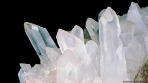
Quartz is one of the most common crystals on Earth (Credit: Sinclair Stammers/SPL)
When a meteorite hurtles through the atmosphere and crashes to Earth, how does its violent impact alter the minerals found at the landing site? What can the short-lived chemical phases created by these extreme impacts teach scientists about the minerals existing at the high-temperature and pressure conditions found deep inside the planet?
New work led by Carnegie’s Sally June Tracy examined the crystal structure of the silica mineral quartz under shock compression and is challenging longstanding assumptions about how this ubiquitous material behaves under such intense conditions. The results are published in Science Advances.
“Quartz is one of the most abundant minerals in Earth’s crust, found in a multitude of different rock types,” Tracy explained. “In the lab, we can mimic a meteorite impact and see what happens.”
Tracy and her colleagues — Washington State University’s (WSU) Stefan Turneaure and Princeton University’s Thomas Duffy, a former Carnegie Fellow — used a specialized cannon-like gas gun to accelerate projectiles into quartz samples at extremely high speeds — several times faster than a bullet fired from a rifle. Special x-ray instruments were used to discern the crystal structure of the material that forms less than one-millionth of a second after impact. Experiments were carried out at the Dynamic Compression Sector (DCS), which is operated by WSU and located at the Advanced Photon Source, Argonne National Laboratory.
Quartz is made up of one silicon atom and two oxygen atoms arranged in a tetrahedral lattice structure. Because these elements are also common in the silicate-rich mantle of the Earth, discovering the changes quartz undergoes at high-pressure and -temperature conditions, like those found in the Earth’s interior, could also reveal details about the planet’s geologic history.
When a material is subjected to extreme pressures and temperatures, its internal atomic structure can be re-shaped, causing its properties to shift. For example, both graphite and diamond are made from carbon. But graphite, which forms at low pressure, is soft and opaque, and diamond, which forms at high pressure, is super-hard and transparent. The different arrangements of carbon atoms determine their structures and their properties, and that in turn affects how we engage with and use them.
Despite decades of research, there has been a long-standing debate in the scientific community about what form silica would take during an impact event, or under dynamic compression conditions such as those deployed by Tracy and her collaborators. Under shock loading, silica is often assumed to transform to a dense crystalline form known as stishovite — a structure believed to exist in the deep Earth. Others have argued that because of the fast timescale of the shock the material will instead adopt a dense, glassy structure.
Tracy and her team were able to demonstrate that counter to expectations, when subjected to a dynamic shock of greater than 300,000 times normal atmospheric pressure, quartz undergoes a transition to a novel disordered crystalline phase, whose structure is intermediate between fully crystalline stishovite and a fully disordered glass. However, the new structure cannot last once the burst of intense pressure has subsided.
“Dynamic compression experiments allowed us to put this longstanding debate to bed,” Tracy concluded. “What’s more, impact events are an important part of understanding planetary formation and evolution and continued investigations can reveal new information about these processes.”
This research was supported by the Defense Threat Reduction Agency and the NSF. Washington State University (WSU) provided experimental support through awards from the U.S. Department of Energy (DOE)/National Nuclear Security Agency (NNSA).
This work is based on experiments performed at the Dynamic Compression Sector, operated by WSU under a DOE/ NNSA award. This research used the resources of the Advanced Photon Source, a Department of Energy Office of Science User Facility operated for the DOE Office of Science by the Argonne National .
Reference:
Sally June Tracy, Stefan J. Turneaure, Thomas S. Duffy. Structural response of α-quartz under plate-impact shock compression. Science Advances, 2020; 6 (35): eabb3913 DOI: 10.1126/sciadv.abb3913
An incredibly rare dinosaur embryo discovered perfectly preserved inside its egg has shown scientists new details of the development and appearance of sauropods which lived 80 million years ago.
Sauropods were the giant herbivores made famous as being ‘veggie-saurs’ in the 1993 film Jurassic Park. The incredible new find of an intact embryo has shown for the first time that these dinosaurs had stereoscopic vision and a horn on the front of the face which was then lost in adulthood.
The international research team say that this is the most complete and articulate skull known from any titanosaur, the last surviving group of long-necked sauropods and largest land animals known to have ever existed.
The sauropod egg was discovered in Patagonia, Argentina, in an area not previously known to provide evidence of dinosaur fossils. It was imperative the egg was repatriated to Argentina however as it is illegal to permanently remove fossils from the country.
Dr John Nudds from The University of Manchester said: “The preservation of embryonic dinosaurs preserved inside their eggs is extremely rare. Imagine the huge sauropods from Jurassic Park and consider that the tiny skulls of their babies, still inside their eggs, are just a couple of centimetres long.
“We were able to reconstruct the embryonic skull prior to hatching. The embryos possessed a specialised craniofacial anatomy that precedes the post-natal transformation of the skull in adult sauropods. Part of the skull of these embryonic sauropods was extended into an elongated snout or horn, so that they possessed a peculiarly shaped face.”
The examination of the amazing specimen enabled the team to revise opinions of how babies of these giant dinosaurs may be hatched and to test previously held ideas about sauropodomorph reproduction. The elongated horn is now thought to have been used as an ‘egg tooth’ on hatching to allow babies to break through their shell.
The findings, published today in Current Biology, were the result of a novel technique to reveal embryonic dinosaurs in their shells. The embryo within the egg was revealed by carefully dissolving the egg around it using an acid preparation. The team were then able to perform a virtual dissection of the specimen at the European Synchrotron Radiation Facility (ESRF) in Grenoble.
Sauropod embryology remains one of the least explored areas of the life history of dinosaurs. The first definitive discovery of sauropod embryos came with the finding of an enormous nesting ground of titanosaurian dinosaurs discovered in Upper Cretaceous deposits of northern Patagonia, Argentina, 25 years ago. This new discovery however, is the first time a fully intact embryo has been able to be studied.
Other eggs were also found at the Argentinian site which the scientists now aim to examine in a similar fashion. It is thought that some of the eggs could contain well-preserved dinosaur skin which could help further piece together the mysteries of some of the most fascinating animals to ever walk the Earth.
Reference:
Martin Kundrát, Rodolfo A. Coria, Terry W. Manning, Daniel Snitting, Luis M. Chiappe, John Nudds, Per E. Ahlberg. Specialized Craniofacial Anatomy of a Titanosaurian Embryo from Argentina. Current Biology, 2020; DOI: 10.1016/j.cub.2020.07.091
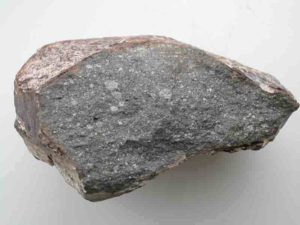
Piece of the meteorite Sahara 97096 (about 10 cm long), an enstatite chondrite that contains about 0.5 weight % of water. If Earth formed entirely of this material, it would have received 23 times the total mass of water present in the Earth’s oceans. Credit: L. Piani, Museum of Natural History in Paris
A new study finds that Earth’s water may have come from materials that were present in the inner solar system at the time the planet formed — instead of far-reaching comets or asteroids delivering such water. The findings published Aug. 28 in Science suggest that Earth may have always been wet.
Researchers from the Centre de Recherches Petrographiques et Geochimiques (CRPG, CNRS/Universite de Lorraine) in Nancy, France, including one who is now a postdoctoral fellow at Washington University in St. Louis, determined that a type of meteorite called an enstatite chondrite contains sufficient hydrogen to deliver at least three times the amount of water contained in the Earth’s oceans, and probably much more.
Enstatite chondrites are entirely composed of material from the inner solar system — essentially the same stuff that made up the Earth originally.
“Our discovery shows that the Earth’s building blocks might have significantly contributed to the Earth’s water,” said lead author Laurette Piani, a researcher at CPRG. “Hydrogen-bearing material was present in the inner solar system at the time of the rocky planet formation, even though the temperatures were too high for water to condense.”
The findings from this study are surprising because the Earth’s building blocks are often presumed to be dry. They come from inner zones of the solar system where temperatures would have been too high for water to condense and come together with other solids during planet formation.
The meteorites provide a clue that water didn’t have to come from far away.
“The most interesting part of the discovery for me is that enstatite chondrites, which were believed to be almost ‘dry,’ contain an unexpectedly high abundance of water,” said Lionel Vacher, a postdoctoral researcher in physics in Arts & Sciences at Washington University in St. Louis.
Vacher prepared some of the enstatite chondrites in this study for water analysis while he was completing his PhD at Universite de Lorraine. At Washington University, Vacher is working on understanding the composition of water in other types of meteorites.
Enstatite chondrites are rare, making up only about 2 percent of known meteorites in collections.
But their isotopic similarity to Earth make them particularly compelling. Enstatite chondrites have similar oxygen, titanium and calcium isotopes as Earth, and this study showed that their hydrogen and nitrogen isotopes are similar to Earth’s, too. In the study of extraterrestrial materials, the abundances of an element’s isotopes are used as a distinctive signature to identify where that element originated.
“If enstatite chondrites were effectively the building blocks of our planet — as strongly suggested by their similar isotopic compositions — this result implies that these types of chondrites supplied enough water to Earth to explain the origin of Earth’s water, which is amazing!” Vacher said.
The paper also proposes that a large amount of the atmospheric nitrogen — the most abundant component of the Earth’s atmosphere — could have come from the enstatite chondrites.
“Only a few pristine enstatite chondrites exist: ones that were not altered on their asteroid nor on Earth,” Piani said. “In our study we have carefully selected the enstatite chondrite meteorites and applied a special analytical procedure to avoid being biased by the input of terrestrial water.”
Coupling two analytical techniques — conventional mass spectrometry and secondary ion mass spectrometry (SIMS) — allowed researchers to precisely measure the content and composition of the small amounts of water in the meteorites.
Prior to this study, “it was commonly assumed that these chondrites formed close to the sun,” Piani said. “Enstatite chondrites were thus commonly considered ‘dry,’ and this frequently reasserted assumption has probably prevented any exhaustive analyses to be done for hydrogen.”
Reference:
Laurette Piani, Yves Marrocchi, Thomas Rigaudier, Lionel G. Vacher, Dorian Thomassin, Bernard Marty. Earth’s water may have been inherited from material similar to enstatite chondrite meteorites. Science, 2020 DOI: 10.1126/science.aba1948
Basalt, the most-common rock on Earth’s surface, encases green crystals–a geologic “nesting doll” phenomenon called a xenolith. Basalts such as this one derive from a section of the mantle that has been depleted in incompatible trace elements, which is usually attributed to continental crust formation. In their work, Tucker and his collaborators propose another mechanism that would impart this signature. Credit: Carnegie Institution for Science
The composition of Earth’s mantle was more shaped by interactions with the oceanic crust than previously thought, according to work from Carnegie’s Jonathan Tucker and Peter van Keken along with colleagues from Oxford that was recently published in Geochemistry, Geophysics, Geosystems.
During its evolution, our planet separated into distinct layers—core, mantle, and crust. Each has its own composition and the dynamic processes through which these layers interact with their neighbors can teach us about Earth’s geologic history.
Plate tectonic processes allow for continuous evolution of the crust and play a key role in our planet’s habitability. Earth has two kinds of tectonic plates: those that host continents, which have survived for billions of years, and those that are mostly covered by oceans. Oceanic plates are created by the upward motion of mantle material that occurs when plates spread apart. They are destroyed by sliding under continental plates and back into the mantle, a process that also forms new continental crust.
“The chemical composition of the mantle is influenced by continent formation and geoscientists can read chemical markers left behind by this process,” Tucker explained.
For example, some of the elements found in crustal rocks don’t play nicely with the mantle’s minerals. When continental crust formation draws these elements out of the mantle, they leave behind a depleted residue, like sucking the juice out of a Sno-Cone and leaving just ice. This is referred to as crust extraction and is usually thought to create “scars” that are easy to spot and identify in rocks. It also leaves behind distinct zones in the mantle that are depleted of these particular elements.
“It’s long been thought that these chemical scars are the product of crust formation,” Tucker explained. “But mantle’s inaccessibility means that it’s difficult to know for sure using rock and mineral samples alone.”
To probe the question of the origin of these depleted reservoirs in the mantle, Tucker, van Keken, and their Oxford colleagues Rosemary Jones and Chris Ballentine developed a new model, which showed that the “scar-forming” process of sequestering of incompatible elements from the rest of the mantle is occurring not just in the crust but independently in the deep mantle thanks to old oceanic plates that were drawn all the way down.
“Our work demonstrates that the processes determining the mantle’s composition are more complicated than we previously thought,” Tucker concluded.
Reference:
Jonathan M. Tucker et al. A Role for Subducted Oceanic Crust in Generating the Depleted Mid‐Ocean Ridge Basalt Mantle, Geochemistry, Geophysics, Geosystems (2020). DOI: 10.1029/2020GC009148
The largest and the smallest: dinosaurs reached an amazing range in size through the Mesozoic Era. Credit: Vitor Silva
How do you weigh a long-extinct dinosaur? A couple of ways, as it turns out, neither of which involve actual weighing — but according to a new study, different approaches still yield strikingly similar results.
New research published September 1 in the journal Biological Reviews involved a review of dinosaur body mass estimation techniques carried out over more than a century.
The findings should give us some confidence that we are building an accurate picture of these prehistoric animals, says study leader Dr. Nicolás Campione — particularly our knowledge of the more massive dinosaurs that have no correlates in the modern world.
“Body size, in particular body mass, determines almost at all aspects of an animal’s life, including their diet, reproduction, and locomotion,” said Dr. Campione, a member of the University of New England’s Palaeoscience Research Centre.
“If we know that we have a good estimate of a dinosaur’s body mass, then we have a firm foundation from which to study and understand their life retrospectively.”
Estimating the mass of a dinosaur like the emblematic Tyrannosaurus rex is no small feat — it is a creature that took its last breath some 66 million years ago and, for the most part, only its bones remain today. It is a challenge that has taxed the ingenuity of palaeobiologists for more than a century. Scientific estimates of the mass of the biggest land predator of all time have differed substantially, ranging from about three tonnes to over 18 tonnes.
The research team led by Dr. Campione compiled and reviewed an extensive database of dinosaur body mass estimates reaching back to 1905, to assess whether different approaches for calculating dinosaur mass were clarifying or complicating the science.
Although a range of different methods to estimating body mass have been tried over the years, they all come down to two fundamental approaches. Scientists have either measured and scaled bones in living animals, such as the circumference of the arm (humerus) and leg (femur) bones, and compared them to dinosaurs; or they have calculated the volume of three-dimensional reconstructions that approximate what the animal may have looked like in real life. Debate over which method is ‘better’ has raged in the literature.
The researchers found that once scaling and reconstruction methods are compared en masse, most estimates agree. Apparent differences are the exception, not the rule.
“In fact, the two approaches are more complementary than antagonistic,” Dr. Campione said.
The bone scaling method, which relies on relationships obtained directly from living animals of known body mass, provides a measure of accuracy, but often of low precision; whereas reconstructions that consider the whole skeleton provide precision, but of unknown accuracy. This is because reconstructions depend on our own subjective ideas about what extinct animals looked like, which have changed appreciably over time.
“There will always be uncertainty around our understanding of long-extinct animals, and their weight is always going to be a source of it,” said Dr. David Evans, Temerty Chair of Vertebrate Palaeontology at the Royal Ontario Museum in Toronto, senior author on the new paper. “Our new study suggests we are getting better at weighing dinosaurs, and it paves the way for more realistic dinosaur body mass estimation in the future.”
The researchers recommend that future work seeking to estimate the sizes of Mesozoic dinosaurs, and other extinct animals, need to better-integrate the scaling and reconstruction approaches to reap their benefits.
Drs. Campione and Evans suggest that an adult T. rex would have weighed approximately seven tonnes — an estimate that is consistent across reconstruction and limb bone scaling approaches alike. But the research emphasizes the inaccuracy of such single values and the importance of incorporating uncertainty in mass estimates, not least because dinosaurs, like humans, did not come in one neat package. Such uncertainties suggest an average minimum weight of five tonnes and a maximum average weight of 10 tonnes for the ‘king’ of dinosaurs.
“It is only through the combined use of these methods and through understanding their limits and uncertainties that we can begin to reveal the lives of these, and other, long-extinct animals,” Dr Campione said.
Reference:
Nicolás E. Campione, David C. Evans. The accuracy and precision of body mass estimation in non‐avian dinosaurs. Biological Reviews, 2020; DOI: 10.1111/brv.12638
Male lions typically have manes. Male peacocks have six-foot-long tail feathers. Female eagles and hawks can be about 30% bigger than males. But if you only had these animals’ fossils to go off of, it would be hard to confidently say that those differences were because of the animals’ sex. That’s the problem that paleontologists face: it’s hard to tell if dinosaurs with different features were separate species, different ages, males and females of the same species, or just varied in a way that had nothing to do with sex. A lot of the work trying to show differences between male and female dinosaurs has come back inconclusive. But in a new paper, scientists show how using a different kind of statistical analysis can often estimate the degree of sexual variation in a dataset of fossils.
“It’s a whole new way of looking at fossils and judging the likelihood that the traits we see correlate with sex,” says Evan Saitta, a research associate at Chicago’s Field Museum and the lead author of the new paper in the Biological Journal of the Linnean Society. “This paper is part of a larger revolution of sorts about how to use statistics in science, but applied in the context of paleontology.”
Unless you find a dinosaur skeleton that contains the fossilized eggs that it was about to lay, or a similar dead giveaway, it’s hard to be sure about an individual dinosaur’s sex. But many birds, the only living dinosaurs, vary a lot between males and females on average, a phenomenon called sexual dimorphism. Dinosaurs’ cousins, the crocodilians, show sexual dimorphism too. So it stands to reason that in many species of dinosaurs, males and females would differ from each other in a variety of traits.
But not all differences in animals of the same species are linked to their sex. For example, in humans, average height is related to sex, but other traits like eye color and hair color don’t neatly map onto men versus women. We often don’t know precisely how the traits we see in dinosaurs relate to their sex, either. Since we don’t know if, say, larger dinosaurs were female, or dinosaurs with bigger crests on their heads were male, Saitta and his colleagues looked for patterns in the differences between individuals of the same species. To do that, they examined measurements from a bunch of fossils and modern species and did a lot of math.
Other paleontologists have tried to look for sexual dimorphism in dinosaurs using a form of statistics (called significance testing, for all you stats nerds) where you collect all your data points and then calculate the probability that those results could have happened by pure chance rather than an actual cause (like how doctors determine whether a new medicine is more helpful than a placebo). This kind of analysis sometimes works for big, clean datasets. But, says Saitta, “with a lot of these dinosaur tests, our data is pretty bad” — there aren’t that many fossil specimens, or they’re incomplete or poorly preserved. Using significance testing in these cases, Saitta argues, results in a lot of false negatives: since the samples are small, it takes an extreme amount of variation between the sexes to trigger a positive test result. (Significance testing isn’t just a consideration for paleontologists — concerns over a “replication crisis” have plagued researchers in psychology and medicine, where certain studies are difficult to reproduce.)
Instead, Saitta and his colleagues experimented with another form of stats, called effect size statistics. Effect size statistics is better for smaller datasets because it attempts to estimate the degree of sex differences and calculate the uncertainty in that estimate. This alternative statistical method takes natural variations into account without viewing dimorphism as black-or-white-many sexual dimorphisms can be subtle. Co-author Max Stockdale of the University of Bristol wrote the code to run the statistical simulations. Saitta and his colleagues uploaded measurements of dinosaur fossils to the program, and it yielded estimates of body mass dimorphism and error bars in those estimates that would have simply been dismissed using significance testing.
“We showed that if you adopt this paradigm shift in statistics, where you attempt to estimate the magnitude of an effect and then put error bars around that, you can often produce a fairly accurate estimate of sexual variation even when the sexes of the individuals are unknown,” says Saitta.
For instance, Saitta and his colleagues found that in the dinosaur Maiasaura, adult specimens vary a lot in size, and the analyses show that these are likelier to correspond to sexual variation than differences seen in other dinosaur species. But while the current data suggest that one sex was about 45% bigger than the other, they can’t tell if the bigger ones are males or females.
While there’s a lot of work yet to be done, Saitta says he’s excited that the statistical simulations gave such consistent results despite the limits of the fossil data.
“Sexual selection is such an important driver of evolution, and to limit ourselves to ineffective statistical approaches hurts our ability to understand the paleobiology of these animals,” he says. “We need to account for sexual variation in the fossil record.”
“I’m happy to play a small part in this sort of statistical revolution,” he adds. “Effect size statistics has a major impact for psychological and medical research, so to apply it to dinosaurs and paleontology is really cool.”
Reference:
Evan T Saitta, Maximilian T Stockdale, Nicholas R Longrich, Vincent Bonhomme, Michael J Benton, Innes C Cuthill, Peter J Makovicky. An effect size statistical framework for investigating sexual dimorphism in non-avian dinosaurs and other extinct taxa. Biological Journal of the Linnean Society, 2020; DOI: 10.1093/biolinnean/blaa105
Surface displacement mapped using InSAR satellite imaging data. Along the fault, the ground was either raised (southeast) or collapsed (northwest). The star designates the epicentre. Credit: Jean-François RITZ et al
On 11 November 2019, a magnitude 5 earthquake occurred near the village of Le Teil in the Rhône River Valley in southern France producing an unexpected surface rupture with ground displacement.
For the first time in France, the CNRS, IRSN, IRD, Université de Montpellier, Université Côte d’Azur and Terradue (1) had the opportunity to use all modern seismological, geodetical (2), and geological techniques available to study this historically unprecedented seismic event. The data, published on 27 August 2020 in Communications Earth & Environment, reveals that the earthquake was caused by the reactivation of the ancient La Rouvière fault. The fault formed during an extensional tectonic period some 20-30 million years ago during the Oligocene epoch, and was no longer considered to be active.
During the Le Teil earthquake, the fault experienced a reverse faulting movement (compression) with an average surface displacement of about 10cm both vertically and horizontally. Scientists estimate that the event nucleated at a shallow focal depth of approximately 1km, which explains why the rupture along the fault was able to reach the surface and cause considerable damage despite the moderate-magnitude (3) (the accurate position of the earthquake’s focus is presently being studied by another research team).
The results raise the possibility that other faults could be reactivated in France and Western Europe and produce surface displacements, whereas the risk of earthquakes with surface rupture was until now considered as highly improbable. To better assess the probability of such events, several teams of scientists in France are performing palaeoseismological investigations looking for evidence of past earthquakes along such faults.
Notes:
(1) Members of Géosciences Montpellier (CNRS/Université de Montpellier/Université des Antilles), Géoazur (CNRS/Observatoire de la Côte d’Azur/IRD/Université Côte d’Azur), Isterre (CNRS/IRD/Université Grenoble Alpes/Université Savoie Mont Blanc/Université Gustave Eiffel) laboratories participated in this study, along with IRSN (France) and the company Terradue (Italy).
(2) Geodesy is the study, usually with the aid of satellite observations, of the shape and deformations of the surface of the Earth.
(3) Only 10% of earthquakes of this magnitude cause surface rupture.
Reference:
Jean-François Ritz, Stéphane Baize, Matthieu Ferry, Christophe Larroque, Laurence Audin, Bertrand Delouis, Emmanuel Mathot. Surface rupture and shallow fault reactivation during the 2019 Mw 4.9 Le Teil earthquake, France. Communications Earth & Environment, 2020; 1 (1) DOI: 10.1038/s43247-020-0012-z
Note: The above post is reprinted from materials provided by CNRS.
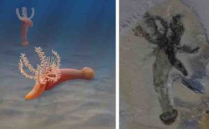
New research undertaken by scientists at the Smithsonian National Museum of Natural History, Royal Ontario Museum (ROM) and University of Montreal, has uncovered fossils of a new species of marine animal, Gyaltsenglossus senis, (pronounced Gen-zay-gloss-us senis) that provides new evidence in the historical debate among zoologists: how the anatomies of the two main types of an animal group called the hemichordates are related. The fossils are over half-a-billion years old and were discovered at a Burgess Shale site in the Canadian Rockies. This discovery was published August 27, 2020, in the science journal Current Biology.
With the early evolution of hemichordates being contentious among researchers the discovery of Gyaltsenglossus senis is significant. It provides direct fossil evidence connecting the two major groups of hemichordates: the enteropneusta and pterobranchia.
Although enteropneusts and pterobranchs appear to be quite different types of animals they are closely related. This close relationship is supported by DNA analysis of present-day species. More broadly, the role of Gyaltsenglossus in understanding hemichordate evolution helps us understand the origins of a larger group of animals called deuterostomes (which includes humans) by clarifying what characteristics they may have shared with hemichordates early in their history.
The enteropneusta are a group of animals known commonly as acorn worms, which are long, mostly mud-burrowing animals, that can be found today in oceans around the world from the tropics to Antarctic. The other main group of animals within hemichordates are pterobranchs, which are microscopic animals that live in colonies, each protected by tubes they construct and which feed on plankton using a crown of tentacled arms.
“Acorn worms and pterobranchs look so different from each other that understanding the origins of their evolutionary relationship has been a major historical question in zoology,” said Dr. Karma Nanglu, Peter Buck Deep Time post-doctoral fellow at the Smithsonian National Museum of Natural History and lead author on this paper. “Answering this question has been made much harder by the extreme lack of fossils of these soft-bodied hemichordates. Throughout the half-billion-year-long history of hemichordates you can count on one hand the number of exceptional preserved fossil species.”
Despite being just two centimeters in length, the remarkably preserved soft tissues of the Gyaltsenglossus fossils reveal incredibly detailed anatomical structures. These details include the oval-shaped proboscis of acorn worms and a basket of feeding tentacles similar to those of pterobranchs. The age of these fossils, combined with the unique morphological combination of the two major hemichordate groups, makes this discovery a critical find for understanding early hemichordate evolution.
“An ancient animal with an intermediary anatomy between acorn worms and pterobranchs had been hypothesized before but this new animal is the clearest view of what the ancestral hemichordate may have looked like,” says Dr. Christopher Cameron, Associate Professor at the University of Montreal and a co-author on this study. “It’s exciting to have so many new anatomical details to help drive new hypotheses about hemichordate evolution.”
In the case of Gyaltsenglossus, the exceptional preservation of these fine details can be attributed to the unique environmental conditions of the Burgess Shale, which rapidly entombed ancient animals in underwater mudslides. Through a combination of factors, including slowing the rate of bacteria decaying the entombed animals’ bodies, the fossils of the Burgess Shale are preserved with far greater fidelity than typical fossil sites.
“The Burgess Shale has been pivotal in understanding early animal evolution since its discovery over 100 years ago,” says co-author Dr. Jean-Bernard Caron, Richard M. Ivey Curator of Invertebrate Palaeontology at the ROM and Associate Professor at the University of Toronto. Dr. Caron led the field expedition in 2010 which collected the 33 fossils of Gyaltsenglossus.
“In most localities, you would be lucky to have the hardest parts of animals, like bones and teeth, preserved, but at the Burgess Shale even the softest body parts can be fossilized in exquisite detail,” says Dr. Caron. “This new species underscores the importance of making new fossil discoveries to shine light on the most stubborn evolutionary mysteries.”
In this particular case, Gyaltsenglossus suggests that the ancestral hemichordate may have been able to use the feeding strategies of both of the modern groups. Like acorn worms, the long proboscis may have been used to feed on nutrient-filled marine mud, while at the same time, and like the pterobranchs, the array of six feeding arms was probably used to grab suspended food particles directly from the water above where it was crawling.
Hemichordates belong to a major division of animal life called Deuterostomia, which includes chordates like fish and mammals, and not the division of animal life called Protostomia, that includes arthropods such as insects and annelids such as earthworms. Dr. Nanglu explains, when looking at Gyaltsenglossus, we’re actually looking at a very, very distant relative of our own branch of vertebrate and human evolution.
“The close relationship between hemichordates and our own evolutionary group, the chordates, is one of the first things that made me excited to research them,” Nanglu explains. “Understanding the ancient connections that join animals like fish and even humans to their distant cousins like sea urchins and acorn worms is such an interesting area on the evolutionary tree and Gyaltsenglossus helps bring that link into focus a little bit more clearly.”
The original 1909 discovery and research about the Burgess Shale was made by Charles Walcott, who was Secretary of the Smithsonian Institution at the time. The Burgess Shale fossil sites are located within Yoho and Kootenay National Parks and are managed by Parks Canada.
Reference:
Cambrian Tentaculate Worms and the Origin of the Hemichordate Body Plan . Current Biology (2020). DOI: 10.1016/j.cub.2020.07.078
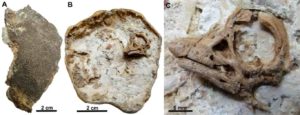
The Titanosaurian embryo skull along with a skull and head reconstruction. Credit: Kundrat et al. /Current Biology
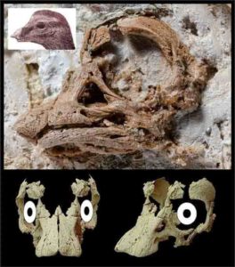
About 25 years ago, researchers discovered the first dinosaur embryos in an enormous nesting ground of titanosaurian dinosaurs that lived about 80 million years ago in a place known as Auca Mahuevo in Patagonia, Argentina. Now, researchers reporting in the journal Current Biology on August 27 describe the first near-intact embryonic skull. The finding adds to our understanding of the development of sauropod dinosaurs, a group characterized by the long neck and tails and small heads perhaps most familiar in the Brontosaurus, and suggests that they may have had specialized facial features as hatchlings that changed as they grew into adults.
“The specimen studied in our paper represents the first 3-D preserved embryonic skull of a sauropod sauropodomorph,” says Martin Kundrat of the PaleoBioImaging Lab at Pavol Jozef Šafárik University, Slovak Republic. “The most striking feature is head appearance, which implies that hatchlings of giant dinosaurs may differ in where and how they lived in their earliest stages of life. But because it differs in facial anatomy and size from the sauropod embryos of Auca Mahuevo, we cannot rule out that it may represent a new titanosaurian dinosaur.”
The new embryonic dinosaur specimen also is from Patagonia, although its precise origin isn’t known. That’s because the egg was illegally exported from the country and brought to researchers’ attention only later. When Terry Manning, a co-author on the study from Arizona, realized the unique preservation and scientific importance of the specimen, he agreed to send this unique fossil back to Argentina for further study. It’s now housed with other titanosaurian embryos from Auca Mahuevo under curation of Rodolfo Coria at the Museo Municipal Carmen Funes in Plaza Huincul.
In the new study, Kundrat’s team used a new imaging technology called synchrotron microtomography to study the inner structure of bones, teeth, and soft tissues of the embryonic dinosaur. The scans allowed Kundrat and co-author Daniel Snitting, Uppsala University, Sweden, to find hidden details, including tiny teeth preserved deeply in tiny jaw sockets. They also found partly calcified elements of the embryonic braincase and what appear to be the remains of temporal muscles.
The scans allowed the researchers to reconstruct the most plausible appearance of the skull in titanosaurian sauropods before hatching. Those details are useful for taxonomic or developmental comparisons among related dinosaurs.
The findings also suggest that the baby sauropods may have hatched out of the egg with the help of a thickened prominence rather than a boney “egg-tooth.” They uncovered evidence as well that the embryonic dinosaurs used calcium derived from the eggshell long before they were ready to hatch.
They report that the titanosaurian hatchlings emerged with a temporary moncerotid (single-horned) face. They also had retracted openings on the nose (nares) and early binocular vision. “We suggest an alternative head appearance for babies of these Patagonian giants,” Kundrat says.
The findings suggest that the young sauropods had a specialized head and face that transformed as the young dinosaurs grew and matured into adults. The findings have implications for our understanding of the dinosaurs and how they lived, the researchers say. “Dinosaur eggs are for me like time capsules that bring a message from the ancient time,” Kundrat says. “This was the case of our specimen that tells a story about Patagonian giants before they hatched.
“Our study revealed several new aspects about the embryonic life of the largest herbivorous dinosaurs that lived on our planet,” he adds. “A horned faced and binocular vision are features quite different from what we expected in titanosaurian dinosaurs.”
Kundrat says he’ll continue to study embryonic dinosaurs from other continents using the synchrotron technology.
Reference:
Current Biology, Kundrat et al.: “Specialized Craniofacial Anatomy of a Titanosaurian Embryo from Argentina” DOI: 10.1016/j.cub.2020.07.091
Note: The above post is reprinted from materials provided by Cell Press.
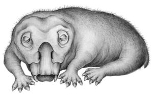
Life restoration of Lystrosaurus in a state of torpor. Credit: Crystal Shin
Hibernation is a familiar feature on Earth today. Many animals — especially those that live close to or within polar regions — hibernate to get through the tough winter months when food is scarce, temperatures drop and days are dark.
According to new research, this type of adaptation has a long history. In a paper published Aug. 27 in the journal Communications Biology, scientists at the University of Washington and its Burke Museum of Natural History and Culture report evidence of a hibernation-like state in an animal that lived in Antarctica during the Early Triassic, some 250 million years ago.
The creature, a member of the genus Lystrosaurus, was a distant relative of mammals. Antarctica during Lystrosaurus’ time lay largely within the Antarctic Circle, like today, and experienced extended periods without sunlight each winter.
The fossils are the oldest evidence of a hibernation-like state in a vertebrate animal, and indicates that torpor — a general term for hibernation and similar states in which animals temporarily lower their metabolic rate to get through a tough season — arose in vertebrates even before mammals and dinosaurs evolved.
“Animals that live at or near the poles have always had to cope with the more extreme environments present there,” said lead author Megan Whitney, a postdoctoral researcher at Harvard University who conducted this study as a UW doctoral student in biology. “These preliminary findings indicate that entering into a hibernation-like state is not a relatively new type of adaptation. It is an ancient one.”
Lystrosaurus lived during a dynamic period of our planet’s history, arising just before Earth’s largest mass extinction at the end of the Permian Period — which wiped out about 70% of vertebrate species on land — and somehow surviving it. The stout, four-legged foragers lived another 5 million years into the subsequent Triassic Period and spread across swathes of Earth’s then-single continent, Pangea, which included what is now Antarctica.
“The fact that Lystrosaurus survived the end-Permian mass extinction and had such a wide range in the early Triassic has made them a very well-studied group of animals for understanding survival and adaptation,” said co-author Christian Sidor, a UW professor of biology and curator of vertebrate paleontology at the Burke Museum.
Paleontologists today find Lystrosaurus fossils in India, China, Russia, parts of Africa and Antarctica. These squat, stubby, creatures — most were roughly pig-sized, but some grew 6 to 8 feet long — had no teeth but bore a pair of tusks in the upper jaw, which they likely employed to forage among ground vegetation and dig for roots and tubers, according to Whitney.
Those tusks made Whitney and Sidor’s study possible. Like elephants, Lystrosaurus tusks grew continuously throughout their lives. The cross-sections of fossilized tusks can harbor life-history information about metabolism, growth and stress or strain. Whitney and Sidor compared cross-sections of tusks from six Antarctic Lystrosaurus to cross-sections of four Lystrosaurus from South Africa.
Back in the Triassic, the collection sites in Antarctica were at about 72 degrees south latitude — well within the Antarctic Circle, at 66.3 degrees south. The collection sites in South Africa were more than 550 miles north during the Triassic at 58-61 degrees south latitude, far outside the Antarctic Circle.
The tusks from the two regions showed similar growth patterns, with layers of dentine deposited in concentric circles like tree rings. But the Antarctic fossils harbored an additional feature that was rare or absent in tusks farther north: closely-spaced, thick rings, which likely indicate periods of less deposition due to prolonged stress, according to the researchers.
“The closest analog we can find to the ‘stress marks’ that we observed in Antarctic Lystrosaurus tusks are stress marks in teeth associated with hibernation in certain modern animals,” said Whitney.
The researchers cannot definitively conclude that Lystrosaurus underwent true hibernation — which is a specific, weeks-long reduction in metabolism, body temperature and activity. The stress could have been caused by another hibernation-like form of torpor, such as a more short-term reduction in metabolism, according to Sidor.
Lystrosaurus in Antarctica likely needed some form of hibernation-like adaptation to cope with life near the South Pole, said Whitney. Though Earth was much warmer during the Triassic than today — and parts of Antarctica may have been forested — plants and animals below the Antarctic Circle would still experience extreme annual variations in the amount of daylight, with the sun absent for long periods in winter.
Many other ancient vertebrates at high latitudes may also have used torpor, including hibernation, to cope with the strains of winter, Whitney said. But many famous extinct animals, including the dinosaurs that evolved and spread after Lystrosaurus died out, don’t have teeth that grow continuously.
“To see the specific signs of stress and strain brought on by hibernation, you need to look at something that can fossilize and was growing continuously during the animal’s life,” said Sidor. “Many animals don’t have that, but luckily Lystrosaurus did.”
If analysis of additional Antarctic and South African Lystrosaurus fossils confirms this discovery, it may also settle another debate about these ancient, hearty animals.
“Cold-blooded animals often shut down their metabolism entirely during a tough season, but many endothermic or ‘warm-blooded’ animals that hibernate frequently reactivate their metabolism during the hibernation period,” said Whitney. “What we observed in the Antarctic Lystrosaurus tusks fits a pattern of small metabolic ‘reactivation events’ during a period of stress, which is most similar to what we see in warm-blooded hibernators today.”
If so, this distant cousin of mammals isn’t just an example of a hearty creature. It is also a reminder that many features of life today may have been around for hundreds of millions of years before humans evolved to observe them.
The research was funded by the National Science Foundation.
Reference:
Megan R. Whitney, Christian A. Sidor. Evidence of torpor in the tusks of Lystrosaurus from the Early Triassic of Antarctica. Communications Biology, 2020; 3 (1) DOI: 10.1038/s42003-020-01207-6
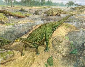
The first complete dinosaur skeleton ever identified has finally been studied in detail and found its place in the dinosaur family tree, completing a project that began more than a century and a half ago. Credit: John Sibbick
The first complete dinosaur skeleton ever identified has finally been studied in detail and found its place in the dinosaur family tree, completing a project that began more than a century and a half ago.
The skeleton of this dinosaur, called Scelidosaurus, was collected more than 160 years ago on west Dorset’s Jurassic Coast. The rocks in which it was fossilised are around 193 million years old, close to the dawn of the Age of Dinosaurs.
This remarkable specimen—the first complete dinosaur skeleton ever recovered—was sent to Richard Owen at the British Museum, the man who invented the word dinosaur.
So, what did Owen do with this find? He published two short papers on its anatomy, but many details were left unrecorded. Owen did not reconstruct the animal as it might have appeared in life and made no attempt to understand its relationship to other known dinosaurs of the time. In short, he ‘re-buried’ it in the literature of the time, and so it has remained ever since: known, yet obscure and misunderstood.
Over the past three years, Dr. David Norman from Cambridge’s Department of Earth Sciences has been working to finish the work which Owen started, preparing a detailed description and biological analysis of the skeleton of Scelidosaurus, the original of which is stored at the Natural History Museum in London, with other specimens at Bristol City Museum and the Sedgwick Museum, Cambridge.
The results of Norman’s work, published as four separate studies in the Zoological Journal of the Linnean Society of London, not only reconstruct what Scelidosaurus looked like in life, but reveal that it was an early ancestor of ankylosaurs, the armour-plated ‘tanks’ of the Late Cretaceous Period.
For more than a century, dinosaurs were primarily classified according to the shape of their hip bones: they were either saurischians (‘lizard-hipped’) or ornithischians (‘bird-hipped’).
However, in 2017, Norman and his former Ph.D. students Matthew Baron and Paul Barrett argued that these dinosaur family groupings needed to be rearranged, re-defined and re-named. In a study published in Nature, the researchers suggested that bird-hipped dinosaurs and lizard-hipped dinosaurs such as Tyrannosaurus evolved from a common ancestor, potentially overturning more than a century of theory about the evolutionary history of dinosaurs.
Another fact that emerged from their work on dinosaur relationships was that the earliest known ornithischians first appeared in the Early Jurassic Period. “Scelidosaurus is just such a dinosaur and represents a species that appeared at, or close to, the evolutionary ‘birth’ of the Ornithischia,” said Norman, who is a Fellow of Christ’s College, Cambridge. “Given that context, what was actually known of Scelidosaurus? The answer is remarkably little!”
Norman has now completed a study of all known material attributable to Scelidosaurus and his research has revealed many firsts.
“Nobody knew that the skull had horns on its back edge,” said Norman. “It had several bones that have never been recognised in any other dinosaur. It’s also clear from the rough texturing of the skull bones that it was, in life, covered by hardened horny scutes, a little bit like the scutes on the surface of the skulls of living turtles. In fact, its entire body was protected by skin that anchored an array of stud-like bony spikes and plates.”
Now that its anatomy is understood, it is possible to examine where Scelidosaurus sits in the dinosaur family tree. It had been regarded for many decades as an early member of the group that included the stegosaurs, including Stegosaurus with its huge bony plates along its spine and a spiky tail, and ankylosaurs, the armour-plated ‘tanks’ of the dinosaur era, but that was based on a poor understanding of the anatomy of Scelidosaurus. Now it seems that Scelidosaurus is an ancestor of the ankylosaurs alone.
“It is unfortunate that such an important dinosaur, discovered at such a critical time in the early study of dinosaurs, was never properly described,” said Norman. “It has now—at last! – been described in detail and provides many new and unexpected insights concerning the biology of early dinosaurs and their underlying relationships. It seems a shame that the work was not done earlier but, as they say, better late than never.”
Reference:
David B Norman, Scelidosaurus harrisonii (Dinosauria: Ornithischia) from the Early Jurassic of Dorset, England: biology and phylogenetic relationships, Zoological Journal of the Linnean Society (2020). DOI: 10.1093/zoolinnean/zlaa061
Scientists are finding that Earth’s mantle may have generated the planet’s early magnetic field. Credit: Naeblys
By creating conditions akin to the center of the Earth inside a laboratory chamber, researchers have improved the estimate of the age of our planet’s solid inner core, putting it at 1 billion to 1.3 billion years old.
The results place the core at the younger end of an age spectrum that usually runs from about 1.3 billion to 4.5 billion years, but they also make it a good bit older than a recent estimate of only 565 million years.
What’s more, the experiments and accompanying theories help pin down the magnitude of how the core conducts heat, and the energy sources that power the planet’s geodynamo — the mechanism that sustains the Earth’s magnetic field, which keeps compasses pointing north and helps protect life from harmful cosmic rays.
“People are really curious and excited about knowing about the origin of the geodynamo, the strength of the magnetic field, because they all contribute to a planet’s habitability,” said Jung-Fu Lin, a professor at The University of Texas at Austin’s Jackson School of Geosciences who led the research.
The results were published on Aug.13 in the journal Physical Review Letters.
The Earth’s core is made mostly of iron, with the inner core being solid and the outer core being liquid. The effectiveness of the iron in transferring heat through conduction — known as thermal conductivity — is key to determining a number of other attributes about the core, including when the inner core formed.
Over the years, estimates for core age and conductivity have gone from very old and relatively low, to very young and relatively high. But these younger estimates have also created a paradox, where the core would have had to reach unrealistically high temperatures to maintain the geodynamo for billions of years before the formation of the inner core.
The new research solves that paradox by finding a solution that keeps the temperature of the core within realistic parameters. Finding that solution depended on directly measuring the conductivity of iron under corelike conditions — where pressure is greater than 1 million atmospheres and temperatures can rival those found on the surface of the sun.
The researchers achieved these conditions by squeezing laser-heated samples of iron between two diamond anvils. It wasn’t an easy feat. It took two years to get suitable results.
“We encountered many problems and failed several times, which made us frustrated, and we almost gave up,” said article co-author Youjun Zhang, an associate professor at Sichuan University in China. “With the constructive comments and encouragement by professor Jung-Fu Lin, we finally worked it out after several test runs.”
The newly measured conductivity is 30% to 50% less than the conductivity of the young core estimate, and it suggests that the geodynamo was maintained by two different energy sources and mechanisms: thermal convection and compositional convection. At first the geodynamo was maintained by thermal convection alone. Now, each mechanism plays about an equally important role.
Lin said that with this improved information on conductivity and heat transfer over time, the researchers could make a more precise estimate of the age of the inner core.
“Once you actually know how much of that heat flux from the outer core to the lower mantle, you can actually think about when did the Earth cool sufficiently to the point that the inner core starts to crystalize,” he said.
This revised age of the inner core could correlate with a spike in the strength of the Earth’s magnetic field as recorded by the arrangement of magnetic materials in rocks that were formed around this time. Together, the evidence suggests that the formation of the inner core was an essential part of creating today’s robust magnetic fields.
The National Science Foundation and the National Natural Science Foundation of China supported the research.
Reference:
Youjun Zhang, Mingqiang Hou, Guangtao Liu, Chengwei Zhang, Vitali B. Prakapenka, Eran Greenberg, Yingwei Fei, R. E. Cohen, Jung-Fu Lin. Reconciliation of Experiments and Theory on Transport Properties of Iron and the Geodynamo. Physical Review Letters, 2020; 125 (7) DOI: 10.1103/PhysRevLett.125.078501
Closeup of the stomach area of a fossil ichthyosaur, Guizhouichthyosaurus, showing part of the body of another large marine reptile. The ichthyosaur had swallowed its prey shortly before it died and was fossilized. This is the oldest known direct evidence of megapredation, or a large animal eating another large animal. (Da-Yong Jiang, et al.)
Some 240 million years ago, a dolphin-like ichthyosaur ripped to pieces and swallowed another marine reptile only a little smaller than itself. Then it almost immediately died and was fossilized, preserving the first evidence of megapredation, or a large animal preying on another large animal. The fossil, discovered in 2010 in southwestern China, is described in a paper published Aug. 20 in the journal iScience.
The ichthyosaurs were a group of marine reptiles that appeared in the oceans after the Permian mass extinction, about 250 million years ago. They had fish-like bodies similar to modern tuna, but breathed air like dolphins and whales. Like modern orca or great white sharks, they may have been apex predators of their ecosystems, but until recently there has been little direct evidence of this.
When a specimen of the ichthyosaur Guizhouichthyosaurus was discovered in Guizhou province, China in 2010, researchers noticed a large bulge of other bones within the animal’s abdomen. On examination, they identified the smaller bones as belonging to another marine reptile, Xinpusaurus xingyiensis, which belonged to a group called thalattosaurs. Xinpusaurus was more lizard-like in appearance than an ichthyosaur, with four paddling limbs.
“We have never found articulated remains of a large reptile in the stomach of gigantic predators from the age of dinosaurs, such as marine reptiles and dinosaurs,” said Ryosuke Motani, professor of earth and planetary sciences at the University of California, Davis, and coauthor on the paper. “We always guessed from tooth shape and jaw design that these predators must have fed on large prey but now we have direct evidence that they did.”
The Guizhouichthyosaurus was almost five meters (15 feet) long, while the researchers calculate its prey was about four meters (12 feet) long, although thalattosaurs had skinnier bodies than ichythyosaurs. The predator’s last meal appears to be the middle section of the thalattosaur, from its front to back limbs. Interestingly, a fossil of what appears to be the tail section of the animal was found nearby.
Predators that feed on large animals are often assumed to have large teeth adapted for slicing up prey. Guizhouichthyosaurus had relatively small, peg-like teeth, which were thought to be adapted for grasping soft prey such as the squid-like animals abundant in the oceans at the time. However, it’s clear that you don’t need slicing teeth to be a megapredator, Motani said. Guizhouichthyosaurus probably used its teeth to grip the prey, perhaps breaking the spine with the force of its bite, then ripped or tore the prey apart. Modern apex predators such as orca, leopard seals and crocodiles use a similar strategy.
Reference:
Da-Yong Jiang, Ryosuke Motani, Andrea Tintori, Olivier Rieppel, Cheng Ji, Min Zhou, Xue Wang, Hao Lu, Zhi-Guang Li. Evidence Supporting Predation of 4-m Marine Reptile by Triassic Megapredator. iScience, 2020; 101347 DOI: 10.1016/j.isci.2020.101347
Vertebrae from the torso of the long-necked dinosaur “Arapahoe”: This dinosaur skeleton, at 27 meters the longest ever exhibited in Europe, is currently on display at the Museum Koenig in Bonn. The ball-and-socket joint between two vertebrae can be seen next to the measuring tape. Credit: Martin Sander/Uni Bonn
The intervertebral discs connect the vertebrae and give the spine its mobility. The disc consists of a cartilaginous fibrous ring and a gelatinous core as a buffer. It has always been assumed that only humans and other mammals have discs. A misconception, as a research team under the leadership of the University of Bonn has now discovered: Even Tyrannosaurus rex could have suffered a slipped disc. The results have now been published in the journal “Scientific Reports.”
Present-day snakes and other reptiles do not have intervertebral discs; instead, their vertebrae are connected with so-called ball-and-socket joints. Here, the ball-shaped end surface of a vertebra fits into a cup-shaped depression of the adjacent vertebra, similar to a human hip joint. In-between there is cartilage and synovial fluid to keep the joint mobile. This evolutionary construction is good for today’s reptiles, because it prevents the dreaded slipped disc, which is caused by parts of the disc slipping out into the spinal canal.
“I found it hard to believe that ancient reptiles did not have intervertebral discs,” says paleontologist Dr. Tanja Wintrich from the Section Paleontology in the Institute of Geosciences of the University of Bonn. She noticed that the vertebrae of most dinosaurs and ancient marine reptiles look very similar to those of humans — that is, they do not have ball-and-socket joints. She therefore wondered whether extinct reptiles had intervertebral discs, but had “replaced” these with ball-and-socket joints in the course of evolution.
Comparison of the vertebrae of dinosaurs with animals still alive today
To this end, the team of researchers led by Tanja Wintrich and with the participation of the University of Cologne and the TU Bergakademie Freiberg as well as researchers from Canada and Russia examined a total of 19 different dinosaurs, other extinct reptiles, and animals still alive today. The researchers concluded that intervertebral discs not only occur in mammals. For these investigations, vertebrae still in connection were analyzed using various methods.
Surprisingly, Dr. Wintrich has now also been able to demonstrate that remnants of cartilage and even other parts of the intervertebral disc are almost always preserved in such ancient specimens, including marine reptiles like ichthyosaurs and dinosaurs like Tyrannosaurus. She then traced the evolution of the soft tissues between the vertebrae along the family tree of land animals, which 310 million years ago split into the mammalian line and the dinosaur and bird line.
Intervertebral discs emerged several times during evolution
It was previously unknown that intervertebral discs are a very ancient feature. The findings also show that intervertebral discs evolved several times during evolution in different animals, and were probably replaced by ball-and-socket joints twice in reptiles. “The reason why the intervertebral disc was replaced might be that it is more susceptible to damage than a ball-and-socket joint,” says Dr. Wintrich. Nonetheless, mammals have always retained intervertebral discs, repeating the familiar pattern that they are rather limited in their evolutionary flexibility. “This insight is also central to the medical understanding of humans. The human body is not perfect, and its diseases reflect our long evolutionary history,” adds paleontologist Prof. Dr. Martin Sander from the University of Bonn.
In terms of research methods, the team drew not only on paleontology, but also on medical anatomy, developmental biology and zoology. Under the microscope, dinosaur bones cut with a rock saw and then ground very thinly provide information comparable to histological sections of fixed and embedded tissue of extant animals. This makes it possible to bridge the long periods of evolution and identify developmental processes. Prof. Sander remarks: “It’s truly amazing that the cartilage of the joint and apparently even the disc itself can survive for hundreds of millions of years.”
Dr. Wintrich, who now works at the Institute of Anatomy of the University of Bonn, is pleased about the cooperation between the fields that has made this interdisciplinary understanding possible in the first place: “We found that even Tyrannosaurus rex was not protected against slipped discs.” Only bird-like predatory dinosaurs then evolved ball-and-socket joints as well and saddle joints, still seen in today’s birds. Likewise, such ball-and-socket joints were a decisive advantage for the stability of the spine of the largest dinosaurs, the long-necked dinosaurs.
This bridge between paleontology and medicine is seminal in Germany. The anatomist Prof. Dr. Karl Schilling from the University of Bonn, who was not involved in the new study, reports: “In the USA, in contrast, dinosaur researchers and evolutionary biologists are often closely involved in medical training, especially in anatomy and embryology. This gives young doctors a perspective that is becoming increasingly important in a rapidly changing environment.”
Reference:
Tanja Wintrich, Martin Scaal, Christine Böhmer, Rico Schellhorn, Ilja Kogan, Aaron van der Reest, P. Martin Sander. Palaeontological evidence reveals convergent evolution of intervertebral joint types in amniotes. Scientific Reports, 2020; 10 (1) DOI: 10.1038/s41598-020-70751-2
Paleontological research has confirmed a series of recently discovered fossils tracks are the oldest recorded tracks of their kind to date within Grand Canyon National Park. In 2016, Norwegian geology professor, Allan Krill, was hiking with his students when he made a surprising discovery. Lying next to the trail, in plain view of the many hikers, was a boulder containing conspicuous fossil footprints. Krill was intrigued, and he sent a photo to his colleague, Stephen Rowland, a paleontologist at the University of Nevada Las Vegas.
The trailside tracks have turned out to be even more significant than Krill first imagined. “These are by far the oldest vertebrate tracks in Grand Canyon, which is known for its abundant fossil tracks” says Rowland. “More significantly,” he added, “they are among the oldest tracks on Earth of shelled-egg-laying animals, such as reptiles, and the earliest evidence of vertebrate animals walking in sand dunes.”
The track-bearing boulder fell from a nearby cliff-exposure of the Manakacha Formation. The presence of a detailed geologic map of the strata along the Bright Angel Trail, together with previous studies of the age of the Manakacha Formation, allowed the researchers to pin down the age of the tracks quite precisely to 313 +/- 0. 5 million years.
The newly discovered tracks record the passage of two separate animals on the slope of a sand dune. Of interest to the research team is the distinct arrangement of footprints. The researchers’ reconstruction of this animal’s footfall sequence reveals a distinctive gait called a lateral-sequence walk, in which the legs on one side of the animal move in succession, the rear leg followed by the foreleg, alternating with the movement of the two legs on the opposite side. “Living species of tetrapods―dogs and cats, for example―routinely use a lateral-sequence gait when they walk slowly,” says Rowland. “The Bright Angel Trail tracks document the use of this gait very early in the history of vertebrate animals. We previously had no information about that.” Also revealed by the trackways is the earliest-known utilization of sand dunes by vertebrate animals.
Reference:
Stephen M. Rowland, Mario V. Caputo, Zachary A. Jensen. Early adaptation to eolian sand dunes by basal amniotes is documented in two Pennsylvanian Grand Canyon trackways. PLOS ONE, 2020; 15 (8): e0237636 DOI: 10.1371/journal.pone.0237636