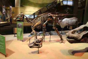
The structure of the trabecular, or spongy bone that forms in the interior of bones, is unique within dinosaurs, according to a recent study by SMU paleontologists and others.
Weighing up to 8,000 pounds, hadrosaurs, or duck-billed dinosaurs were among the largest dinosaurs to roam the Earth. How did the skeletons of these four-legged, plant-eating dinosaurs with very long necks support such a massive load?
New research recently published in PLOS ONE offers an answer. A unique collaboration between paleontologists, mechanical engineers and biomedical engineers revealed that the trabecular bone structure of hadrosaurs and several other dinosaurs is uniquely capable of supporting large weights, and different than that of mammals and birds.
“The structure of the trabecular, or spongy bone that forms in the interior of bones we studied is unique within dinosaurs,” said Tony Fiorillo, SMU paleontologist and one of the study authors. The trabecular bone tissue surrounds the tiny spaces or holes in the interior part of the bone, Fiorillo says, such as what you might see in a ham or steak bone.
“Unlike in mammals and birds, the trabecular bone does not increase in thickness as the body size of dinosaurs increase,” he says. “Instead it increases in density of the occurrence of spongy bone. Without this weight-saving adaptation, the skeletal structure needed to support the hadrosaurs would be so heavy, the dinosaurs would have had great difficulty moving.”
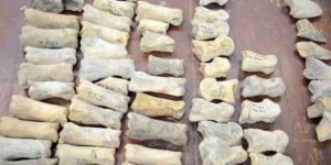
The interdisciplinary team of researchers used engineering failure theories and allometry scaling, which describes how the characteristics of a living creature change with size, to analyze CT scans of the distal femur and proximal tibia of dinosaur fossils.
The team, funded by the National Science Foundation Office of Polar Programs and the National Geographic Society, is the first to use these tools to better understand the bone structure of extinct species and the first to assess the relationship between bone architecture and movement in dinosaurs. They compared their findings to scans of living animals, such as Asian elephants and extinct mammals such as mammoths.
“Understanding the mechanics of the trabecular architecture of dinosaurs may help us better understand the design of other lightweight and dense structures,” said Trevor Aguirre, lead author of the paper and a recent mechanical engineering Ph.D. graduate of Colorado State University.
The idea for the study began ten years ago, when Seth Donahue, now a University of Massachusetts biomedical engineer and expert on animal bone structure, was invited to attend an Alaskan academic conference hosted by Fiorillo and other colleagues interested in understanding dinosaurian life in the ancient Arctic. That’s where Fiorillo first learned of Donahue’s use of CT scans and engineering theories to analyze the bone structure of modern animals.
“In science we rarely have lightning bolt or ‘aha’ moments,” Fiorillo says. “Instead we have, ‘huh?’ moments that often are not close to what we envisioned, but instead create questions of their own.”
Applying engineering theories to analyze dinosaur fossils and the subsequent new understanding of dinosaurs’ unique adaptation to their huge size grew from the ‘huh?’ moment at that conference.
Reference:
Trevor G. Aguirre, Aniket Ingrole, Luca Fuller, Tim W. Seek, Anthony R. Fiorillo, Joseph J. W. Sertich, Seth W. Donahue. Differing trabecular bone architecture in dinosaurs and mammals contribute to stiffness and limits on bone strain. PLOS ONE, 2020; 15 (8): e0237042 DOI: 10.1371/journal.pone.0237042
A re-analysis of fossils from one of Europe’s most significant paleontological sites reveals a wide diversity of animal species, including a large terrestrial monkey, short-necked giraffe, rhinos and saber-toothed cats.
These and other species roamed the open grasslands of Eastern Europe during the early Pleistocene, approximately 2 million years ago. Ultimately, the researchers hope the fossils will provide clues about how and when early humans migrated to Eurasia from Africa. Reconstructions of past environments like this also could help researchers better understand future climate change.
“My colleagues and I are excited to draw attention back to the fossil site of Grăunceanu and the fossil potential of the Olteţ River Valley of Romania,” said Claire Terhune, associate professor of anthropology at the University of Arkansas. “It’s such a diverse faunal community. We found multiple animals that hadn’t been clearly identified in the area before, and many that are no longer found in Europe at all. Of course, we think these findings alone are interesting, but they also have important implications for early humans moving into the continent at that time.”
About 124 miles west of the Romanian capital of Bucharest, the Olteţ River Valley, including the the important site of Grăunceanu, is one of Eastern Europe’s richest fossil deposits. Many Olteţ Valley fossil sites, including Grăunceanu, were discovered in the 1960s after landslides caused in part by deforestation due to increased agricultural activity in the area.
Archeologists and paleontologists from the Emil Racoviţă Institute of Speleology in Bucharest excavated the sites soon after they were discovered. Fossils were recovered and stored at the institute, and scholarly publications about the sites flourished in the 1970s and 1980s. But interest in these fossils and sites waned over the past 20 to 30 years, in part because many records of the excavations and fossils were lost.
Since 2012, the international team, including Terhune and researchers from Romania, the United States, Sweden and France, has focused on this important fossil region. Their work has included extensive identification of fossils at the institute and additional field work.
In addition to the species mentioned above, the researchers identified fossil remains of animals similar to modern-day moose, bison, deer, horse, ostrich, pig and many others. They also identified a fossil species of pangolin, which were thought to have existed in Europe during the early Pleistocene but had not been solidly confirmed until now. Today, pangolins, which look like the combination of an armadillo and anteater and are among the most trafficked animals in the world, are found only in Asia and Africa.
Reference:
Claire E. Terhune, Sabrina Curran, Roman Croitor, Virgil Drăgușin, Timothy Gaudin, Alexandru Petculescu, Chris Robinson, Marius Robu, Lars Werdelin. Early Pleistocene fauna of the Olteţ River Valley of Romania: Biochronological and biogeographic implications. Quaternary International, 2020; DOI: 10.1016/j.quaint.2020.06.020
Scientists identified a new ichnospecies from the shell of an extinct marine turtle fossil, the first known species coexisting on living marine vertebrates
While paleontologists have a wealth of vertebrate fossils at their disposal, their knowledge of the ecology of ancient extinct species, particularly regarding their relationship with invertebrate species, is relatively poor. As bones and hard shells “fossilize” much better than soft tissues and cartilage, scientists are limited in their ability to infer the presence of parasitic or symbiotic organisms living in or on these ancient vertebrates. As a result, relatively little is known about the evolutionary relationships between these ancient “clades” and their modern descendants.
All hope is not lost, though, as researchers can infer the presence of these small organisms from the footprints they left behind. These records are called trace fossils, or ichnofossils. One clear example of such ichnofossils is the boreholes that many mollusks make in the turtle shell remains and whale and fish bones on the ocean floor. However, to this date, there have been no indications that such species also lived in the shell while the turtle was alive and well.
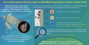
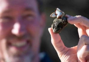
In their recent study published in the journal Palaios, Assistant Professor Kei Sato from Waseda University and Associate Professor Robert G Jenkins from Kanazawa University focused on the trace evidence left on the carapace (shell) of an extinct basal leatherback marine turtle (Mesodermochelys sp.). The fossil was recovered from an Upper Cretaceous formation in Nio River, Japan, and the evidence in question were 43 tiny, flask-shaped boreholes all over the turtle shell fossil.
Eager to learn more about the organisms responsible for this, the scientists formulated a hypothesis, based on previous borehole evidence found on ancient marine turtle shells. After observing the fossil up close and measuring the morphological characteristics of the boreholes, they produced a 3-dimensional reconstruction of the carapace and the cross-section of one of the boreholes, which allowed them to observe the intricate details left by the species.
Sato, who is the lead author of this study, elaborates on the surprising evidence they found, “We saw that there were signs of healing around the mouth of boreholes, suggesting that the turtle was alive when the organisms settled on the carapace.” Based on the morphology and positioning of the boreholes, they determined that the likely culprits for these boreholes were “bivalves” from the superfamily Pholadoidea, creatures similar to the modern clams. These “sessile” (or immobile) organisms normally require a stable substrate to bore into, and the turtle carapace was a suitable host. The fact that the host animal was swimming around freely probably helped, as this allowed exposure to new environments.
Sato and Jenkins identified the boreholes called Karethraichnus; however, they were unable to match the characteristics of the boreholes they found with those made by any currently described species. This only meant one thing: that they had stumbled onto a completely new species! They have accordingly named this new species as Karethraichnus zaratan.
Sato is excited about the implications of their findings, stating, “This is the first study to report this unique behavior of boring bivalves as a symbiont of living marine vertebrate, which is a significant finding for the paleoecology and evolution of ancient boring bivalve clades.” Previously, no such species had been shown to live on the carapace of living vertebrates. Instead, they were often reported to occur on the remains of marine turtles and other vertebrates, laying on the ocean floor alongside various decomposing organisms. By attaching themselves on a live, free-swimming substrate, such as the carapace of a marine turtle, these pholadoid bivalves may have paved the way for a novel, yet-unknown evolutionary path of accessing previously unexplored niches and diversifying into new species. As the tracemaker bivalves of Karethraichnus zaratan are considered to belong to one of the basal groups for Pholadoidea, this knowledge is crucial for understanding the evolutionary history of extant organisms in this group.
Reference:
Robert G. Jenkins, Kei Sato. Mobile Home for Pholadoid Boring Bivalves: First Example from a Late Cretaceous Sea Turtle in Hokkaido Japan. PALAIOS, 2020; 35 (5): 228 DOI: 10.2110/palo.2019.077
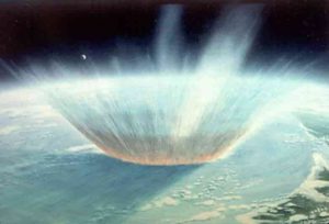
Representative Image : Roughly 66 million years ago an asteroid slammed into the Yucatan peninsula. New research shows darkness, not cold, likely drove a mass extinction after the impact. Credit: NASA
Reduced resilience of plant biomes in North America could be setting the stage for the kind of mass extinctions not seen since the retreat of glaciers and arrival of humans about 13,000 years ago, cautions a new study published August 20 in the journal Global Change Biology.
The warning comes from a study of 14,189 fossil pollen samples taken from 358 locations across the continent. Researchers at the Georgia Institute of Technology used data from the samples to determine landscape resilience, including how long specific landscapes such as forests and grasslands existed — a factor known as residence time — and how well they rebounded following perturbations such as forest fires — a factor termed recovery.
“Our work indicates that landscapes today are once again exhibiting low resilience, foreboding potential extinctions to come,” wrote authors Yue Wang, Benjamin Shipley, Daniel Lauer, Roseann Pineau and Jenny McGuire. “Conservation strategies focused on improving both landscape and ecosystem resilience by increasing local connectivity and targeting regions with high richness and diverse landforms can mitigate these extinction risks.”
The research, supported by the National Science Foundation, is believed to be the first to quantify biome residence and recovery time over an extended period of time. The researchers studied 12 major plant biomes in North America over the past 20,000 years using pollen data from the Neotoma Paleoecology Database.
“We find that the retreat of North American glaciers destabilized ecosystems, causing large herbivores — including mammoths, horses and camels — to struggle for food supplies,” said McGuire, an assistant professor in Georgia Tech’s School of Biological Sciences and School of Earth and Atmospheric Sciences. “That destabilization combined with the arrival of humans in North America to land a one-two punch that resulted in the extinction of large terrestrial mammals on the continent.”
The researchers found that landscapes today are experiencing resilience lower than any seen since the end of the Pleistocene megafauna extinctions.
“Today, we see a similarly low landscape resilience, and we see a similar one-two punch: humans are expanding our footprint and climates are changing rapidly,” said Wang, a postdoctoral researcher who led the study. “Though we know that strategies exist to mitigate some of these effects, our findings serve as a dire warning about the vulnerability of natural systems to extinction.”
By studying the mix of plants represented by pollen samples, the researchers found that over the past 20,000 years, forests persisted for longer than grassland habitats — averaging 700 years versus about 360 years, though they also took much longer to re-establish after being perturbed — averaging 360 years versus 260 years. “These findings were somewhat surprising,” said McGuire. “We had expected biomes to persist much longer, perhaps for thousands of years rather than hundreds.”
The research also found that forests and grasslands transition quickly when temperatures are changing fast, and that they recover most rapidly if the ecosystem contains high plant biodiversity. Yet not all biomes recover; the study found that only 64% regain their original biome type through a process that can take up to three centuries. Arctic systems were least likely to recover, the study found.
Landscape resilience, the ability of habitats to persist or quickly rebound in response to disturbances, have helped maintain terrestrial biodiversity during periods of climactic and environmental changes, the researchers noted.
“Identifying the tempo and mode of landscape transitions and the drivers of landscape resilience is critical to maintaining natural systems and preserving biodiversity given today’s rapid climate and land use changes,” the authors wrote. “However, resilient landscapes are difficult to recognize on short time scales, as perturbations are challenging to quantify and ecosystem transitions are rare.”
Contrary to prevailing ecological theory, the researchers found that pollen richness — indicating diversity of species — did not necessarily correlate with residence time. Ecological theory suggests that biodiversity increases ecosystem resilience by improving “functional redundancy,” allowing a system to maintain stability even if a single or several species are lost. “But species richness does not necessarily reflect functional redundancy, and as a result may not be correlated with ecosystem stability,” the researchers wrote.
The study used pollen data from five forest types — forest/tundra, conifer/hardwood, boreal forest, deciduous forest, and coastal forest, five shrub/herb biome types — Arctic vegetation, desert, mountain vegetation, prairies, and Mediterranean vegetation, and two no?analog biome types — spruce parkland and mixed parkland.
The Neotoma Paleoecology Database contains fossil pollen and spores that are ubiquitous in lake and mire sediments. Collected through core sampling, the samples represent a wide diversity of plant taxa and cover an extended period of time.
Though the effects of climate change and human environmental impacts don’t bode well for the future of North American plant biomes, there are ways to address it, Wang said. “We know that strategies exist to mitigate some of these effects, such as prioritizing biodiverse regions that can rebound quickly and increasing the connectivity between natural habitats so that species can move in response to warming.”
Reference:
Yue Wang, Benjamin R. Shipley, Daniel A. Lauer, Rozenn Pineau, Jenny L. McGuire. Plant biomes demonstrate that landscape resilience today is the lowest it has been since end‐Pleistocene megafaunal extinctions. Global Change Biology, 2020; DOI: 10.1111/gcb.15299
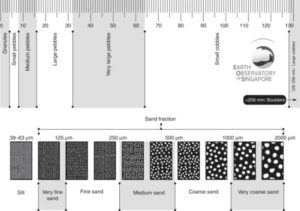
-A grain-size comparator chart (to scale). The chart shows the different size fractions from silt (63 µm) through to large cobbles (128256 mm). Such charts are useful for field comparisons.
What is Grain Size?
Grain size is the diameter of singular sediment grains, or the lithified particles in clastic rocks. The term may apply to other granular materials, too. This differs from the size of a crystallite, which refers to the size of a single crystal within a particle or grain. Many crystals can be composed of a single grain. Granular material can vary from very small colloidal particles to boulders, through clay , silt , sand, gravel, and cobbles.
The size of a compact, three-dimensional object such as a sedimentary grain might be indexed by some measure of its volume, or by some linear measure of its geometry. For geometrically regular objects, either carries equivalent information. For irregular objects, including sediment grains, they do not. Both approaches have been used for characterizing grain size.
Size and shape are fundamental properties of clastic sediments. The distributions of size and shape in sediment deposits influence and index other important physical properties of the sediment, such as porosity, permeability, and surface roughness, they carry important information about the origin of a deposit, they affect the stability of the deposit, and they influence habitat quality for small organisms.
How is grain size measured?
The analysis of the grain size is a typical laboratory test carried out in the field of soil mechanics. The purpose of the analysis is to deduct the distribution of soil particle size.
The analysis is carried out using two techniques. Sieve Grain Size Analysis can measure the particle size ranging from 0.075 mm to 100 mm. Any grain categorization greater than 100 mm will be conducted visually whereas particles smaller than 0.075 mm can be distributed using the Hydrometer Method.
Sieve Grain Size Analysis is the experiment done using a set of sieves with varying mesh sizes. Each sieve has openings of a certain size with squared shapes. The sieve separates larger particles from smaller ones, and the soil sample is distributed in 2 quantities. The sieve retains the grains with diameters larger than the size of the openings, while the sieve passes through smaller-diameter grains. The test is conducted by placing a series of sieves with progressively smaller mesh sizes on top of each other and passing the soil sample through the stacked sieve “tower”. Therefore, the soil particles are distributed as they are retained by the different sieves. A pan is also used to collect those particles that pass through the last sieve (No. 200).
what grain size can streams transport?
Sediment moved by water can be larger than sediment moved by air because water has both a higher density and viscosity. In typical rivers the largest carried sediment is of sand and gravel size, but larger floods can carry cobbles and even boulders.
In a stream, the most easily eroded particles are small sand grains between 0.2 mm and 0.5 mm. Anything smaller or larger requires a higher water velocity to be eroded and entrained in the flow.
Grain Size International scale
ISO 14688-1:2002, establishes the basic principles for the identification and classification of soils on the basis of those material and mass characteristics most commonly used for soils for engineering purposes. ISO 14688-1 is applicable to natural soils in situ, similar man-made materials in situ and soils redeposited by people.
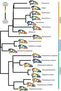
Phenotypic difference between each specimen for each landmark in the 11-module dataset and the mean skull shape.For each specimen, the mean landmark configuration is plotted with points coloured relative to the Procrustes distance between the position of that point in the mean shape and in that specimen. Warmer colours denote landmarks having higher displacement from the mean, and cooler colours are more similar to the mean shape. Data and code archived at www.github.com/rnfelice/Dinosaur_Skulls . Credit: Felice et al, 2020 (PLOS Biology, CC BY 4.0)
From emus to woodpeckers, modern birds show remarkable diversity in skull shape and size, often hypothesized to be the result of a sudden hastening of evolution following the mass extinction that killed their non-avian dinosaur cousins at the end of the Cretaceous 66 million years ago. But this is not the case according to a study by Ryan Nicholas Felice at University College London, publishing August 18, 2020 in the open-access journal PLOS Biology. In the most detailed study yet of bird skull morphology, Felice and an international team of researchers show that the rate of evolution actually slowed in birds compared to non-avian dinosaurs.
The researchers used high-dimensional 3-D geometric morphometrics to map the shape of 354 living and 37 extinct avian and non-avian dinosaurs in unprecedented detail and performed phylogenetic analyses to test for a shift in the pace of evolution after the origin of birds. They found that all regions of the skull evolved more rapidly in non-avian dinosaurs than in birds, but certain regions showed rapid pulses of evolution in particular lineages.
For example, in non-avian dinosaurs, rapid evolutionary changes in the jaw joint were associated with changes in diet, while accelerated evolution of the roof of the skull occurred in lineages that sported bony ornaments such as horns or crests. In birds, the most rapidly evolving part of the skull was the beak, which the authors attribute to adaptation to different food sources and feeding strategies.
The authors say that overall slower pace of evolution in birds compared to non-avian dinosaurs calls into question a long-standing hypothesis that the diversity seen in modern birds resulted from rapid evolution as part of an adaptive radiation following the end-Cretaceous extinction event.
Reference:
Felice RN, Watanabe A, Cuff AR, Hanson M, Bhullar B-AS, Rayfield ER, et al. (2020) Decelerated dinosaur skull evolution with the origin of birds. PLoS Biol 18(8): e3000801. doi.org/10.1371/journal.pbio.3000801
A team of researchers led by professor Brian Fields hypothesizes that a supernova about 65 light-years away may have contributed to the ozone depletion and subsequent mass extinction of the late Devonian Period, 359 million years ago. Pictured is a simulation of a nearby supernova colliding with and compressing the solar wind. Earth’s orbit, the blue dashed circle, and the Sun, red dot, are shown for scale. Graphic courtesy Jesse Miller
Imagine reading by the light of an exploded star, brighter than a full moon — it might be fun to think about, but this scene is the prelude to a disaster when the radiation devastates life as we know it. Killer cosmic rays from nearby supernovae could be the culprit behind at least one mass extinction event, researchers said, and finding certain radioactive isotopes in Earth’s rock record could confirm this scenario.
A new study led by University of Illinois, Urbana-Champaign astronomy and physics professor Brian Fields explores the possibility that astronomical events were responsible for an extinction event 359 million years ago, at the boundary between the Devonian and Carboniferous periods.
The paper is published in the Proceedings of the National Academy of Sciences.
The team concentrated on the Devonian-Carboniferous boundary because those rocks contain hundreds of thousands of generations of plant spores that appear to be sunburnt by ultraviolet light — evidence of a long-lasting ozone-depletion event.
“Earth-based catastrophes such as large-scale volcanism and global warming can destroy the ozone layer, too, but evidence for those is inconclusive for the time interval in question,” Fields said. “Instead, we propose that one or more supernova explosions, about 65 light-years away from Earth, could have been responsible for the protracted loss of ozone.”
“To put this into perspective, one of the closest supernova threats today is from the star Betelgeuse, which is over 600 light-years away and well outside of the kill distance of 25 light-years,” said graduate student and study co-author Adrienne Ertel.
The team explored other astrophysical causes for ozone depletion, such as meteorite impacts, solar eruptions and gamma-ray bursts. “But these events end quickly and are unlikely to cause the long-lasting ozone depletion that happened at the end of the Devonian period,” said graduate student and study co-author Jesse Miller.
A supernova, on the other hand, delivers a one-two punch, the researchers said. The explosion immediately bathes Earth with damaging UV, X-rays and gamma rays. Later, the blast of supernova debris slams into the solar system, subjecting the planet to long-lived irradiation from cosmic rays accelerated by the supernova. The damage to Earth and its ozone layer can last for up to 100,000 years.
However, fossil evidence indicates a 300,000-year decline in biodiversity leading up to the Devonian-Carboniferous mass extinction, suggesting the possibility of multiple catastrophes, maybe even multiple supernovae explosions. “This is entirely possible,” Miller said. “Massive stars usually occur in clusters with other massive stars, and other supernovae are likely to occur soon after the first explosion.”
The team said the key to proving that a supernova occurred would be to find the radioactive isotopes plutonium-244 and samarium-146 in the rocks and fossils deposited at the time of extinction. “Neither of these isotopes occurs naturally on Earth today, and the only way they can get here is via cosmic explosions,” said undergraduate student and co-author Zhenghai Liu.
The radioactive species born in the supernova are like green bananas, Fields said. “When you see green bananas in Illinois, you know they are fresh, and you know they did not grow here. Like bananas, Pu-244 and Sm-146 decay over time. So if we find these radioisotopes on Earth today, we know they are fresh and not from here — the green bananas of the isotope world — and thus the smoking guns of a nearby supernova.”
Researchers have yet to search for Pu-244 or Sm-146 in rocks from the Devonian-Carboniferous boundary. Fields’ team said its study aims to define the patterns of evidence in the geological record that would point to supernova explosions.
“The overarching message of our study is that life on Earth does not exist in isolation,” Fields said. “We are citizens of a larger cosmos, and the cosmos intervenes in our lives — often imperceptibly, but sometimes ferociously.”
Also participating in the study were scientists from the University of Kansas; Kings College, UK; the European Organization for Nuclear Research, Switzerland; the National Institute of Chemical Physics and Biophysics, Estonia; the United States Air Force Academy; and Washburn University.
The Science and Technology Facilities Council and the Estonian Research Council supported this study.
Reference:
Brian D. Fields, Adrian L. Melott, John Ellis, Adrienne F. Ertel, Brian J. Fry, Bruce S. Lieberman, Zhenghai Liu, Jesse A. Miller, Brian C. Thomas. Supernova triggers for end-Devonian extinctions. Proceedings of the National Academy of Sciences, 2020; 202013774 DOI: 10.1073/pnas.2013774117
Combing through historical seismic data, researchers using a machine learning model have unearthed distinct statistical features marking the formative stage of slow-slip ruptures in the earth’s crust months before tremor or GPS data detected a slip in the tectonic plates. Given the similarity between slow-slip events and classic earthquakes, these distinct signatures may help geophysicists understand the timing of the devastating faster quakes as well.
“The machine learning model found that, close to the end of the slow slip cycle, a snapshot of the data is imprinted with fundamental information regarding the upcoming failure of the system,” said Claudia Hulbert, a computational geophysicist at ENS and the Los Alamos National Laboratory and lead author of the study, published today in Nature Communications. “Our results suggest that slow-slip rupture may well be predictable, and because slow slip events have a lot in common with earthquakes, slow-slip events may provide an easier way to study the fundamental physics of earth rupture.”
Slow-slip events are earthquakes that gently rattle the ground for days, months, or even years, do not radiate large-amplitude seismic waves, and often go unnoticed by the average person. The classic quakes most people are familiar with rupture the ground in minutes. In a given area they also happen less frequently, making the bigger quakes harder to study with the data-hungry machine learning techniques.
The team looked at continuous seismic waves covering the period 2009 to 2018 from the Pacific Northwest Seismic Network, which tracks earth movements in the Cascadia region. In this subduction zone, during a slow slip event, the North American plate lurches southwesterly over the Juan de Fuca plate approximately every 14 months. The data set lent itself well to the supervised-machine learning approach developed in laboratory earthquake experiments by the Los Alamos team collaborators and used for this study.
The team computed a number of statistical features linked to signal energy in low-amplitude signals, frequency bands their previous work identified as the most informative about the behavior of the geologic system. The most important feature for predicting slow slip in the Cascadia data is seismic power, which corresponds to seismic energy, in particular frequency bands associated to slow slip events. According to the paper, slow slip often begins with an exponential acceleration on the fault, a force so small it eludes detection by seismic sensors.
“For most events, we can see the signatures of impending rupture from weeks to months before the rupture,” Hulbert said. “They are similar enough from one event cycle to the next so that a model trained on past data can recognize the signatures in data from several years later. But it’s still an open question whether this holds over long periods of time.”
The research team’s hypothesis about the signal indicating the formation of a slow-slip event aligns with other recent work by Los Alamos and others detecting small-amplitude foreshocks in California. That work found that foreshocks can be observed in average two weeks before most earthquakes of magnitude greater than 4.
Hulbert and her collaborators’ supervised machine learning algorithms train on the seismic features calculated from the first half of the seismic data and attempts to find the best model that maps these features to the time remaining before the next slow slip event. Then they apply it to the second half of data, which it hasn’t seen.
The algorithms are transparent, meaning the team can see which features the machine learning uses to predict when the fault would slip. It also allows the researchers to compare these features with those that were most important in laboratory experiments to estimate failure times. These algorithms can be probed to identify which statistical features of the data are important in the model predictions, and why.
“By identifying the important statistical features, we can compare the findings to those from laboratory experiments, which gives us a window into the underlying physics,” Hulbert said. “Given the similarities between the statistical features in the data from Cascadia and from laboratory experiments, there appear to be commonalities across the frictional physics underlying slow slip rupture and nucleation. The same causes may scale from the small laboratory system to the vast scale of the Cascadia subduction zone.”
The Los Alamos seismology team, led by Paul Johnson, has published several papers in the past few years pioneering the use of machine learning to unpack the physics underlying earthquakes in laboratory experiments and real-world seismic data.
Reference:
Claudia Hulbert, Bertrand Rouet-Leduc, Romain Jolivet, Paul A. Johnson. An exponential build-up in seismic energy suggests a months-long nucleation of slow slip in Cascadia. Nature Communications, 2020; 11 (1) DOI: 10.1038/s41467-020-17754-9
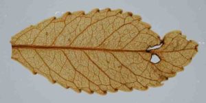
A 23-million-year-old leaf preserved in a onetime New Zealand lake bed, key to past atmospheric conditions. One can see veins, glands along the teeth, and holes gnawed by insects, with resulting stunted growth and scar tissue. Credit: Jennifer Bannister/University of Otago
Scientists studying leaves from a 23-million-year-old forest have for the first time linked high levels of atmospheric carbon dioxide with increased plant growth, and the hot climate off the time. The finding adds to the understanding of how rising CO2 heats the Earth, and how the dynamics of plant life could shift within decades, when CO2 levels may closely mirror those of the distant past.
Scientists retrieved the leaves from a unique onetime New Zealand lake bed that holds the remains of plants, algae, spiders, beetle, flies, fungi and other living things from a warm period known as the early Miocene. Scientists have long postulated that CO2 was high then, and some plants could harvest it more efficiently for photosynthesis. This is the first study to show that those things actually happened in tandem. The findings were published this week in the journal Climate of the Past.
“The amazing thing is that these leaves are basically mummified, so we have their original chemical compositions, and can see all their fine features under a microscope,” said lead author Tammo Reichgelt, an adjunct scientist at Columbia University’s Lamont-Doherty Earth Observatory and assistant professor of geosciences at the University of Connecticut. “Evidence has been building that CO2 was high then, but there have been paradoxes.”
The so-called “carbon fertilization effect” has vast implications. Lab and field experiments have shown that when CO2 levels rise, many plants increase their rate of photosynthesis, because they can more efficiently remove carbon from the air, and conserve water while doing so. Indeed, a 2016 study based on NASA satellite data shows a “global greening” effect mainly due to rising levels of human-made CO2 over recent decades; a quarter to a half of the planet’s vegetated lands have seen increases in leaf volume on trees and plants since about 1980. The effect is expected to continue as CO2 levels rise.
This might seem like good news, but the reality is more complex. Increased CO2 absorption will not come close to compensating for what humans are pouring into the air. Not all plants can take advantage, and among those who do, the results can vary depending on temperature and availability of water or nutrients. And, there is evidence that when some major crops photosynthesize more rapidly, they absorb relatively less calcium, iron, zinc and other minerals vital for human nutrition. Because much of today’s plant life evolved in a temperate, low-CO2 world, some natural and agricultural ecosystems could be upended by higher CO2 levels, along with the rising temperatures and shifts in precipitation they bring. “How it plays out is anyone’s guess,” said Reichgelt. “It’s another layer of stress for plants. It might be great for some, and horrible for others.”
The deposit is located in a small, long-extinct volcanic crater now located on a farm near the southern New Zealand city of Dunedin. The crater, about a kilometer across, once held an isolated lake where successive layers of sediments built up from the surrounding environment. The feature was recognized only within about the last 15 years; scientists dubbed it Foulden Maar. Recognizing it as a scientific gold mine, they have been studying it ever since. Some have also been fighting an actual mining company that wants to strip the deposit for livestock feed.
In the new study, the researchers took samples from a 2009 drill core that penetrated 100 meters to near the bottom of the now-dry lake bed. Larded in between whitish annual layers of silica-rich algae that bloomed each spring for 120,000 years are alternating blackish layers of organic matter that fell in during other seasons. These include countless leaves from a subtropical evergreen forest. They are preserved so perfectly that scientists can see microscopic veins and stomata, the pores by which leaves take in air and concurrently release water during photosynthesis. Unlike most fossils, the leaves also retain their original chemical compositions. It is the only such known deposit in the Southern Hemisphere, and far better preserved than the few similar ones known from the north.
The Miocene has long been a source of confusion for paleoclimate researchers. Average global temperatures are thought to have been 3 to 7 degrees C hotter than today, and ice largely disappeared at the poles. Yet many proxies, mainly derived from marine organisms, have suggested CO2 levels were only about 300 parts per million-similar to those of preindustrial human times, and not enough to account for such warming. With evidence of high CO2 elusive, scientists have speculated that previous proxy measurements must be off.
Based on the new study and a related previous one also at Foulden Maar, the researchers were able to get at this conundrum. They analyzed the carbon isotopes within leaves from a half-dozen tree species found at various levels in the deposit. This helped them zero in on the carbon content of the atmosphere at the time. They also analyzed the geometry of the leaves’ stomata and other anatomical features, and compared these with modern leaves. By combining all the data into a model, they found that atmospheric CO2 was not 300ppm, but about 450-a good match for the temperature data. Second, they showed that the trees were super-efficient at sucking in carbon through the stomata, without leaking much water through the same route-a factor that all plants must account for. This allowed them to grow in marginal areas that otherwise would have been too dry for forests. The researchers say this higher efficiency was very likely mirrored in forests across the northern temperate latitudes, with their far greater landmasses.
Human emissions have now pushed CO2 levels to about 415 parts per million, and they will almost certainly reach 450 by about 2040-identical to those experienced by the Foulden Maar forest. Estimates of the resulting temperature increases over decades and centuries vary, but the new study suggests that most are in the ballpark.
“It all fits together, it all makes sense,” said study coauthor William D’Andrea, a paleoclimate scientist at Lamont-Doherty. In addition to showing how plants might react directly to CO2, “this should give us more confidence about how temperatures will change with CO2 levels,” he said.
Study coauthor Daphne Lee, a paleontologist at New Zealand’s University of Otago, led the charge to study Foulden Maar’s rich ecosystem after it came to light. More recently, she became an unexpected defender of the maar, when a company with owners in Malaysia and the United Kingdom announced plans to strip-mine the deposit for use as a feed additive for for pigs, ducks and other intensively farmed animals. With many more discoveries probably to be made, scientists were horrified, and allied themselves with locals who feared noise and dust. The Dunedin city council is now looking into buying the land to protect it.
The study was also coauthored by Ailín del Valdivia-McCarthy, a former intern at Lamont-Doherty; Bethany Fox of the University of Huddersfield; Jennifer Bannister of the University of Otago; John Conran of the University of Adelaide; and William Lee of the University of Auckland.
Reference:
Tammo Reichgelt, William J. D’Andrea, Ailín del C. Valdivia-McCarthy, Bethany R. S. Fox, Jennifer M. Bannister, John G. Conran, William G. Lee, Daphne E. Lee. Elevated CO2, increased leaf-level productivity, and water-use efficiency during the early Miocene. Climate of the Past, 2020; 16 (4): 1509 DOI: 10.5194/cp-16-1509-2020
Professor Scott Bryan recovering pumice. Credit: QUT
The giant pumice raft created by an underwater volcanic eruption last August in Tonga has begun arriving on the Australian eastern seaboard, delivering millions of reef-building organisms that researchers say could be a ‘vitamin boost’ for the Great Barrier Reef.
Associate Professor Scott Bryan, who has been studying the impact of pumice rafts for nearly 20 years, was part of an international team that earlier this year used underwater robots with cameras and sampling gear to collect material from the volcano near Tonga that produced the raft that at one stage was twice the size of Manhattan.
The unnamed volcano, which is known only as Volcano F or 0403-091, became the center of international headlines last year when Shannon Lenz’s video footage of the giant pumice raft, and the first-hand accounts of Australian sailors Michael Hoult and Larissa Brill, went viral.
Pumice, a lightweight bubble-rich rock that can float in water, forms when frothy magma cools rapidly.
Professor Bryan said the pumice had started arriving on Australia’s shoreline by April, and had spread out along an area from about Townsville to northern New South Wales.
“Pumice rafts alone won’t help mitigate directly the effects of climate change on the Great Barrier Reef,” Professor Bryan said.
“This is about a boost of new recruits, of new corals and other reef-building organisms, that happens every five years or so. It’s almost like a vitamin shot for the Great Barrier Reef.”
Professor Bryan published world-first research in 2004 of a previous eruption from the same volcano and last month published research in the journal Frontiers in Earth Science examining pumice rafts following the 2012 eruption of the Havre volcano.
Professor Bryan described the process of the pumice raft boosting the Great Barrier Reef as part of a “very ancient process” in which oceans and volcanoes have likely combined to transfer marine life around the Earth for hundreds of millions of years.
“This shows that the Great Barrier Reef has connections to coral reefs that are thousands of kilometers further east,” he said.
“In terms of the health of the Great Barrier Reef, it’s also important that these distant reefs are taken care of.”
Earlier this year, Professor Bryan was part of an international research team, including Professor Matt Dunbabin from QUT’s Center for Robotics, which received funding from the National Environment Research Council UK (nerc.ukri.org/funding/availabl … earchgrants/urgency/) to explore the underwater volcano and examine the eruption site.
“It was really our first chance to go and explore the summit of this underwater volcano,” Professor Bryan said.
“We were able to send underwater robots down with cameras and sampling gear to collect material from the actual volcano that produced this pumice raft last year.
“It’s allowed us to see what these volcanoes look like underwater.
“It’s a volcano that’s getting close to breaching the surface and will become an island in years to come.
“We’ve been able to see how life has come back to the summit of this volcano after this eruption, and see that restoration of life,” he said.
“One of the advantages of our trip to Tonga is that for the first time we’ve been able to collect samples from the vent, from the seafloor so soon after the eruption.”
Professor Bryan now has four groups of pumice from the August eruption to study and compare: the pumice collected from the sea by the Australian sailors shortly after the eruption; the pumice that sunk directly at the eruption site; pumice that washed up in Fiji a month later, and the pumice that has traveled more than 3000 km to land on Australia’s coastline.
“We don’t understand why some pumice sinks during the eruption at the location and others can float for many months and years on the world’s oceans,” Professor Bryan said.
“This will help us understand the mechanisms and dynamics of these explosive eruptions and understand better why these eruptions produce potentially hazardous pumice rafts.”
Professor Bryan published world-first research in 2004 of a previous eruption from the same volcano. The research shows how pumice waves from the south-west Pacific could not only be something that helps the Great Barrier Reef but also supported earlier ideas on how the reef was formed in the first place.
Professor Bryan has been collecting pieces of pumice from the eruption as they arrive on the beaches in south-east Queensland, and is examining the marine organisms to determine when in the journey they latched on for the ride.
“Overall, we’ve identified more than one hundred different species attached to the pumice—a tremendous diversity of plants and animals,” Professor Bryan said.
“Anything that is looking for a home out in the ocean tends to find a home on this pumice.
“Each piece of pumice has its own little community that has been transported across the world’s oceans—and we have had trillions of pieces of this pumice floating out there following the eruption.
“Each piece of pumice is a home, and a vehicle for an organism, and it’s just tremendous. The sheer numbers of individuals and this diversity of species is being transported thousands of kilometers in only a matter of months is really quite phenomenal.”
Professor Bryan said the tools to track pumice rafts had changed dramatically since he began exploring this area of research.
“How I got into this was walking along a beach in 2002 and seeing a line of pumice that had washed up on the shore thinking this had come from an eruption but I don’t know where,” he said.
With this most recent eruption, unlike in 2002, he was able to work with QUT spatial scientist Dr. Andrew Fletcher to use high-resolution daily satellite images to follow the pumice raft for weeks after the eruption.
Part of the research project ahead will be to examine the chemical composition of the pumice from the 2019 eruption, and compare it to the pumice produced in the 2001 eruption.
“Given the volcano erupted 18 years ago, we want to know whether this is left-over magma from 2001 that has erupted now, or is it a totally new batch of magma that has arrived at the volcano causing the eruption,” Professor Bryan said. “This can then give us insights into how volcanoes work and what the triggers are for eruption.”
Reference:
oseph Knafelc et al, Defining Pre-eruptive Conditions of the Havre 2012 Submarine Rhyolite Eruption Using Crystal Archives, Frontiers in Earth Science (2020). DOI: 10.3389/feart.2020.00310
Minerals inside tiny crystals could reveal how Earth’s crust began moving. Credit: Luca Galuzzi/Wikimedia Commons, licensed under CC 2.5
Minerals trapped inside tiny crystals that have survived the grinding of the continents over billions of years may help to reveal the origins of plate tectonics and perhaps even provide clues about how complex life sprang up on Earth.
The theory of plate tectonics—which describes how the Earth’s crust is separated into plates that float and slide on a layer of malleable rock below—became widely accepted by science around 50 years ago. The process is believed to have largely shaped the world around us by enabling continents to form, throwing up enormous mountain ranges when they collide, creating volcanic islands and triggering catastrophic earthquakes.
But there is still debate about exactly how and when in our planet’s 4.5-billion-year history the plates formed, estimates vary from less than one billion to 4.3 billion years ago.
It is also unclear exactly how quickly plate tectonics evolved, says Dr. Hugo Moreira, a geologist at the University of Montpellier in France. Did Earth’s crust split abruptly into multiple plates and start moving over just tens of millions of years, or was the process far more gradual, taking hundreds of millions of years or more?
Understanding this could prove crucial for understanding not just how the planet itself has evolved, but also how life may have been kickstarted on Earth. The conditions created by plate tectonics are thought to have helped make Earth hospitable to life in the first place and also provided vital nutrients needed for complex multicellular life to prosper.
Crystal time capsules
Dr. Moreira and his colleagues are seeking answers to these questions inside tiny zircon crystals, which are time capsules of Earth’s distant past due to their extreme robustness. They are often found preserved in rock despite the action of continual weathering and geological events.
Many of these crystals have previously been dated by analysing the radioactive decay of isotopes—different forms of elements—that they contain. Some have been found to date as far back as 4.4 billion years ago, the earliest known fragments of Earth’s crust.
“That’s why zircon’s amazing, because although the rocks that compose the continents were destroyed, the zircon survived in the sedimentary record,” said Dr. Moreira. Scientists have previously used zircon crystals to study the history of the Earth’s continental crust, but it has not yet been enough to provide a definitive consensus for how plate tectonics started, he says.
“After analysing hundreds of thousands of them, we still do not have an agreement,” said Dr. Moreira, a member of the MILESTONE project being led by Dr. Bruno Dhuime, a geosciences researcher for the French National Centre for Scientific Research also at the University of Montpellier.
The researchers are hoping to use these crystals—which typically measure about a tenth of a millimetre, or roughly the thickness of a human hair—to improve our insight into the timing and evolution of plate tectonics.
The MILESTONE group will drill down to an even tinier scale—about a hundredth of a millimetre—to examine traces of apatite and feldspar minerals trapped inside the zircon crystals. Strontium and lead isotopes in these ‘inclusions’ can add unprecedented detail on the zircon’s source of formation and whether this occurred in the varying types of magma below stagnant or moving plates, says Dr. Moreira.
“It will be a critical step towards a better understanding of how our planet evolved,” he said. “If we manage to measure the isotopic composition of these tiny inclusions, we might tell what was the composition of the rock from which the zircon crystallised. We can perhaps understand how evolved the crust was at that point and in which type of tectonic settings the magma was formed.”
This tiny-scale analysis been made possible by the set-up of a laboratory containing a specialised, highly sensitive mass spectrometer, equipment that measures the characteristics of atoms.
The team hopes to start analysing samples next month, ultimately investigating inclusions in more than 5,000 zircons of varying age from all over the world to build up a wide-scale picture. “What we want to do is pinpoint when plate tectonics went global instead of when it was localised in isolated points here and there,” said Dr. Moreira.
Underground structures
At the opposite end of the scale, other researchers have been seeking clues to the origins of plate tectonics in two massive continent-sized structures found deep underground beneath the Pacific and African plates.
These ‘thermochemical piles,” mysterious structures located about 2,900 kilometres below the surface at the boundary between Earth’s core and mantle, were discovered in the 1990s with the aid of seismic tomography—imaging from seismic waves produced by earthquakes or explosions. They were detected as potentially warmer areas of material in which seismic waves travel at different speeds than in the surrounding mantle, but there is still much debate about exactly what they are, including their composition, longevity, shape and origins.
Over the past couple of decades, a ‘fiery’ debate has arisen over their proposed link to movements on the planet’s surface and so their potential involvement in the emergence of plate tectonics, explained Dr. Philip Heron, a geoscientist who studied the structures as lead researcher on the TEROPPLATE project at Durham University.
“These piles are thought to have an impact on how material moves within the planet, and therefore how the surface behaves over time,” he said. Events on the surface may in turn drive their activity.
One theory is that these piles are stable for long geological periods and their edges correspond with the position of key features involved in plate tectonics on Earth’s surface, such as supervolcanoes.
However, their extreme depth makes these piles difficult to observe directly. “Given that these structures are in places 100 times higher than Mount Everest, they may be the largest things in our planet that we know the least about,” said Dr. Heron.
Supercomputer power
The TEROPPLATE project harnessed supercomputer power to investigate. Using more than 1,000 computers working in tandem, the team developed 3-D models of Earth to show how the assumed chemical composition of large hot regions deep underground might influence the formation and location of deep mantle plumes.
However, their models indicated that the piles may be more passive in plate tectonics than initially thought and that the world would still form similar geological features without them. “When looking at the positioning of large plumes of material that form supervolcanoes, our numerical simulations indicated that the chemical piles were not the controlling factor in this,” said Dr. Heron.
But he added that these findings were not fully conclusive and have also opened the door to other interesting avenues for research—such as exploring the implications that these structures are constantly moving through the mantle rather than being largely stationary.
“It gives weight to the theory that the chemical piles may not be rigid and fixed in our planet, and that the deep Earth may evolve as readily as the continents on our surface move around,” he said. “It’s a push to start looking deeper.”
Some of TEROPPLATE’s results also indicate that the piles may have been robust enough to survive Earth’s earliest beginnings. That makes it feasible for them to have been around for the start of plate tectonics and thus to have had roles in the process that we don’t yet know about, adds Dr. Heron.
All of this could have implications for understanding our own place on Earth too. If, for instance, plate tectonics evolved rapidly early in Earth’s history, it may raise questions such as why complex life didn’t emerge earlier or just how closely the two are linked, says Dr. Moreira.
“To fundamentally understand where plate tectonics comes from is potentially the essence of life,” added Dr. Heron. “On Earth, there’s not a thing that hasn’t been impacted by it.”
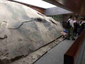
The ichthyosaur specimen with its stomach contents visible as a block that extrudes from its body. Credit: Ryosuke Motani
When paleontologists digging in a quarry in southwestern China uncovered the nearly complete skeleton of a giant, dolphin-like marine reptile known as an ichthyosaur, they didn’t expect to find another fossil in its stomach. This second skeleton belonged to a four-meter-long, lizard-like aquatic reptile known as a thalattosaur and is one of the longest fossils ever found in the stomach of a prehistoric marine reptile. While the researchers can’t say for sure whether the thalattosaur was scavenged or preyed upon, their work could be the oldest direct evidence that Triassic marine reptiles like ichthyosaurs—previously thought to be cephalopod feeders—were apex megapredators. The findings appear August 20th in the journal iScience.
“If you look across all the similar marine reptiles that lived in the age of dinosaurs, we’ve actually never found something articulated like this in the stomach,” says co-author Ryosuke Motani, a professor of paleobiology at the University of California, Davis. “Our ichthyosaur’s stomach contents weren’t etched by stomach acid, so it must have died quite soon after ingesting this food item. At first, we just didn’t believe it, but after spending several years visiting the dig site and looking at the same specimens, we finally were able to swallow what we were seeing.”
Because stomach contents are rarely found in marine fossils, researchers rely on tooth and jaw shapes to learn what prehistoric species may have eaten. While prehistoric apex predators are typically thought to have large teeth with sharp cutting edges, some modern predatory species like crocodiles use blunt teeth to consume large prey items with grasping force instead of cutting. Ichthyosaurs share these blunter teeth, but with no direct evidence of large prey consumption in these prehistoric marine reptiles, scientists believed that they fed on small prey like cephalopods.
However, the discovery of the giant thalattosaur in the stomach of the ichthyosaur found by Motani, Da-Yong Jiang, a paleontologist at Peking University in China, and their team suggests that this was not the case. “Now, we can seriously consider that they were eating big animals, even when they had grasping teeth,” says Motani. “It’s been suggested before that maybe a cutting edge was not crucial, and our discovery really supports that. It’s pretty clear that this animal could process this large food item using blunt teeth.”
While the researchers now know that the ichthyosaur could eat animals as large as the thalattosaur, they don’t know if it killed this individual, or simply scavenged it. “Nobody was there filming it,” says Motani. However, there is reason to believe this was not a case of scavenging: modern marine decomposition studies suggest that if left to decay, the thalattosaur’s limbs would disintegrate and detach before the tail. Instead, the researchers found the opposite in these fossils. The thalattosaur’s limbs were at least partially attached to its body in the stomach, while a disconnected tail was found many yards away, leading the researchers to believe it was ripped off and left behind by a predator like the ichthyosaur.
Whether or not the ichthyosaur killed its last meal, the fossil provides the oldest direct evidence that these giant marine reptiles consumed animals larger than humans. “We now have a really solid articulated fossil in the stomach of a marine reptile for the first time,” Motani says. “Before, we guessed that they must have eaten these big things, but now, we can say for sure that they did eat large animals. This also suggests that megapredation was probably more common than we previously thought.”
The team is still excavating the site where the pair of fossils were found, which has now been turned into a museum. “We’ve been digging in that particular quarry for more than ten years now, and still, new things are coming out,” says Motani. “At this point, it’s beyond our initial expectations, and we’ll just have to see what we’ll discover next.”
Reference:
iScience, Jiang et al.: “Evidence supporting predation of 4-meter marine reptile by Triassic megapredator.” DOI: 10.1016/j.isci.2020.101347
Note: The above post is reprinted from materials provided by Cell Press.
Artists impression of the dinosaur’s final moments. Credit: Trudie Wilson
A new study by Palaeontologists at the University of Southampton suggests four bones recently found on the Isle of Wight belong to new species of theropod dinosaur, the group that includes Tyrannosaurus rex and modern-day birds.
The dinosaur lived in the Cretaceous period 115 million years ago and is estimated to have been up to four metres long.
The bones were discovered on the foreshore at Shanklin last year and are from the neck, back and tail of the new dinosaur, which has been named Vectaerovenator inopinatus.
The name refers to the large air spaces in some of the bones, one of the traits that helped the scientists identify its theropod origins. These air sacs, also seen in modern birds, were extensions of the lung, and it is likely they helped fuel an efficient breathing system while also making the skeleton lighter.
The fossils were found over a period of weeks in 2019 in three separate discoveries, two by individuals and one by a family group, who all handed in their finds to the nearby Dinosaur Isle Museum at Sandown.
The scientific study has confirmed the fossils are very likely to be from the same individual dinosaur, with the exact location and timing of the finds adding to this belief.
Robin Ward, a regular fossil hunter from Stratford-upon-Avon, was with his family visiting the Isle of Wight when they made their discovery. He said: “The joy of finding the bones we discovered was absolutely fantastic. I thought they were special and so took them along when we visited Dinosaur Isle Museum. They immediately knew these were something rare and asked if we could donate them to the museum to be fully researched.”
James Lockyer, from Spalding, Lincolnshire was also visiting the Island when he found another of the bones. Also a regular fossil hunter, he said: “It looked different from marine reptile vertebrae I have come across in the past. I was searching a spot at Shanklin and had been told and read that I wouldn’t find much there. However, I always make sure I search the areas others do not, and on this occasion it paid off.”
Paul Farrell, from Ryde, Isle of Wight, added: “I was walking along the beach, kicking stones and came across what looked like a bone from a dinosaur. I was really shocked to find out it could be a new species.”
After studying the four vertebrae, paleontologists from the University of Southampton confirmed that the bones are likely to belong to a genus of dinosaur previously unknown to science. Their findings will be published in the journal Papers in Palaeontology, in a paper co-authored by those who discovered the fossils.
Chris Barker, a PhD student at the university who led the study, said: “We were struck by just how hollow this animal was — it’s riddled with air spaces. Parts of its skeleton must have been rather delicate.
“The record of theropod dinosaurs from the ‘mid’ Cretaceous period in Europe isn’t that great, so it’s been really exciting to be able to increase our understanding of the diversity of dinosaur species from this time.
“You don’t usually find dinosaurs in the deposits at Shanklin as they were laid down in a marine habitat. You’re much more likely to find fossil oysters or drift wood, so this is a rare find indeed.”
It is likely that the Vectaerovenator lived in an area just north of where its remains were found, with the carcass having washed out into the shallow sea nearby.
Chris Barker added: “Although we have enough material to be able to determine the general type of dinosaur, we’d ideally like to find more to refine our analysis. We are very grateful for the donation of these fossils to science and for the important role that citizen science can play in palaeontology.”
The Isle of Wight is renowned as one of the top locations for dinosaur remains in Europe, and the new Vectaerovenator fossils will now go on display at the Dinosaur Isle Museum at Sandown, which houses an internationally important collection.
Museum curator, Dr Martin Munt, said: “This remarkable discovery of connected fossils by three different individuals and groups will add to the extensive collection we have and it’s great we can now confirm their significance and put them on display for the public to marvel at.
“We continue to undertake public field trips from the museum and would encourage anyone who finds unusual fossils to bring them in so we can take a closer look. However, fossil hunters should remember to stick to the foreshore, and avoid going near the cliffs which are among the most unstable on the Island.”
Isle of Wight Council Cabinet member for environment and heritage, Councillor John Hobart, said: “This is yet another terrific fossil find on the Island which sheds light on our prehistoric past — all the more so that it is an entirely new species. It will add to the many amazing items on display at the museum.”
Reference:
Chris Barker et al. A highly pneumatic ‘mid Cretaceous’ theropod from the British Lower Greensand. Papers in Palaeontology, 2020
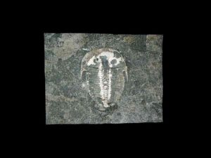
The trilobite Aulacopleura kionickii (Barrande, 1846), size: c 1cm. Credit: Brigitte Schoenemann.
An exquisitely well preserved 429-million-year-old eye from a marine creature that went extinct before dinosaurs even existed had vision comparable to modern-day bees and dragonflies, researchers said Thursday.
Fossilized trilobites, formidable-looking arthropods with segmented bodies and sturdy exoskeletons, are found all over the world.
The creatures crawled across ancient seabeds during the Paleozoic Era, which came to and end about 252 million years ago during the “great dying”, an extinction event that wiped out 95 percent of life on Earth.
The specimen detailed in the journal Scientific Reports is just one to two millimeters high and has two protruding semi-oval eyes on the back of its head, one of which had broken off.
Using digital microscopy, researchers from Germany and Britain found internal structures remarkably similar to those of the compound eyes of modern insects and crustaceans, which see through a honeycomb of small lenses each with a separate visual unit that takes in a small patch of light.
“In this little trilobite, the compound eye is almost the same as that of bees, dragonflies of today, and many modern diurnal (day active) crustaceans,” said co-author Brigitte Schoenemann, of the zoology department at the University of Cologne.
“So this system seems to be very efficient, very old,” she told AFP.
While it was previously known that trilobites had these compound eyes, older specimens had “slit formed” eyes, “just scanning the horizon” and without lenses on the visual units.
“In this trilobite the view widens, the eye also looks partly upwards,” she said.
Human eyes have a single lens and tens of millions of light-sensitive cells, giving an advanced level of image formation.
Schoenemann said that in a compound eye, each visual unit works separately to provide a single pixel, “like in a computer graphic”.
The trilobite studied had just 200 of these, giving it a mosaic vision that would have enabled it to see “obstacles, shelters” and most importantly, predators like the ancient cephalopod—distant ancestor of the nautilus and octopus.
For comparison, she said the honey bee has several thousand of these “pixels”, while a dragonfly has up to 30,000 per eye.
“So the resolution differs, but not the functional principle.”
Because each of the lenses in the trilobite’s eye was small (35 micrometers in diameter), the researchers concluded that it lived in shallow, light-flooded waters, like certain modern-day shore crabs.
‘Breathtaking’
The trilobite in question was first discovered in 1846 near Lodenice, in the Czech Republic.
Schoenemann said the specimen was not otherwise unusual, suggesting that further study of existing fossils may uncover delicate structures that until recently were assumed to have disappeared over time.
“I simply liked this trilobite with its big head, and big eyes. But when I looked through the microscope, it was breathtaking what I saw,” she said.
“Not long ago people still thought that in fossils just teeth, bones and such could be preserved, but never cellular structures. This has changed obviously.”
Trilobites first started to appear during the so-called Cambrian Explosion—a surge in biological diversity more than half-a-billion years ago—and they populated the oceans for some 250 million years.
Dinosaurs emerged later and survived for some 180 million years.
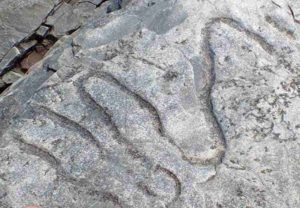
A fossilized meandering grazing trail from the Cambrian era. Credit: Luis Buatois
If you could dive down to the ocean floor nearly 540 million years ago just past the point where waves begin to break, you would find an explosion of life — scores of worm-like animals and other sea creatures tunneling complex holes and structures in the mud and sand — where before the environment had been mostly barren.
Thanks to research published today in Science Advances by a University of Saskatchewan (USask)-led international research team, this rapid increase in biodiversity — one of two such major events across a 100-million-year timespan 560 to 443 million years ago — is part of a clearer picture emerging of Earth’s ancient oceans and life in them.
“We can see from the trace fossils — tracks, trails, borings, and burrows animals left behind — that this particular environment of the ocean floor, the offshore, served as a ‘crucible’ for life,” said USask paleobiologist Luis Buatois, lead author of the article. “Over the next millions of years, life expanded from this area outwards into deeper waters and inwards into shallower waters.”
The research is the culmination of over 20 years of work from Buatois and the team which examined hundreds of rock formations in locations across every continent.
“Until now, these two events — the Cambrian Explosion and the Great Ordovician Biodiversification Event — have been understood mostly through the study of body fossils — the shells, carapaces and the bones of ancient sea creatures,” said Buatois. “Now we can confidently say that these events are also reflected in the trace fossil record which reveals the work of those soft-bodied creatures whose fleshy tissues rot very quickly and so are only very rarely preserved.”
For the first time, the team has shown evidence of animals actively “engineering” their ecosystem — through the construction of abundant and diverse burrows on the sea floor of the world’s oceans in this ancient time.
“Never underestimate what animals are capable of doing,” said USask paleobiologist Gabriela Mángano, co-author of the paper. “They can modify their physical and chemical environment, excluding other animals or allowing them to flourish by creating new resources. And they were definitely doing all these things in these ancient seas.”
The trace fossil-producing animals’ engineering efforts may have laid the foundation for greater diversity in marine life. The researchers identified a 20-million-year time lag during the Cambrian Explosion (the time when most of the major groups of animals first appear in the fossil record) between diversification in trace fossils and in animal body fossils, suggesting the later animals exploited changes which enabled them to diversify even more.
The research also helps resolve a big question from the geochemical record, which indicated much of the ancient ocean was depleted of oxygen and unsuitable for life. Like oceans today, the Cambrian ocean had certain areas that were full of life, while others lacked the necessary conditions to support it.
“The fact that trace fossil distribution shows that there were spots where life flourished adjacent to others devoid of animal activity all through the early Cambrian period is a strong argument in favor of the idea that zones with enough oxygen to sustain a diversity of animals co-existed with oxygen-depleted waters in deeper areas,” said Mángano. “It’s a situation similar to what happens in modern oceans with oxygen minimum zones in the outer part of the continental shelf and the upper part of the continental slope, but oxygenated ones in shallower water.”
The research could provide new insights from an evolutionary perspective into the importance of extensive rock formations of a similar vintage found in Canada and elsewhere, and help society to prepare for coming challenges.
“Understanding changes that took place early in the history of our planet may help us to face present challenges in modern oceans, particularly with respect to oxygen changes,” said Buatois.
Other members of the team are: USask PhD student Kai Zhou, University of Portsmouth researcher Nic Minter, Senckenberg am Meer institute (Hamburg) researcher Max Wisshak, College of Wooster (Ohio) paleontologist Mark Wilson, and statistician Ricardo Olea of the United States Geological Survey.
The research was funded by grants from Canada’s Natural Sciences and Engineering Research Council awarded to Buatois and Mángano.
Reference:
Luis A. Buatois, M. Gabriela Mángano, Nicholas J. Minter, Kai Zhou, Max Wisshak, Mark A. Wilson, Ricardo A. Olea. Quantifying ecospace utilization and ecosystem engineering during the early Phanerozoic—The role of bioturbation and bioerosion. Science Advances, 2020; 6 (33): eabb0618 DOI: 10.1126/sciadv.abb0618
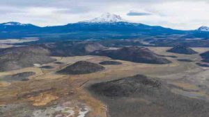
Northern California’s Mount Shasta is among the largest and most active volcanoes in the Cascade Range.
Volcanic eruptions in the Cascade Range of the Pacific Northwest over the last 2.6 million years are more numerous and closely connected to subsurface signatures of currently active magma than commonly thought, according to newly published research.
A synthesis of volcanic vents on the surface and data that probes the structure and composition of the crust to a depth of 20 kilometers (12.4 miles) makes clear new connections between surface and subsurface evidence of past volcanic eruptions. The activity has stretched far beyond the 11 well known stratovolcanoes lining the Cascade Arc between northern California and northern Washington.
The study, led by University of Oregon scientists, catalogued almost 3,000 volcanoes associated with the mountain range. It was published July 13 in the journal Geology.
The research reveals new details about the complex and time-evolving patterns of rising magma in the region, said study co-author Leif Karlstrom, a professor in the UO Department of Earth Sciences and Oregon Center for Volcanology.
“Anyone who has ever flown between San Francisco and Seattle has probably marveled at the massive stratovolcanoes lined up between northern California and southern British Columbia,” he said. “Remarkably, these landforms represent less than 1 percent of the volcanoes in the Cascades that have erupted in the geologically recent past.”
The three-member research team examined 2,835 vents. They used freely available satellite-derived 3D digital terrain models to update estimates of eruption rates and synthesize subsurface observations over recent decades to map where signs of active magma in the crust correlates with edifices on the surfaces around the region’s volcanos.
Edifices refer to the main portion of volcanoes built by erupted lava, rock projectiles, mud and debris flows, and mixture of rock fragments, gas and ash.
The 3D models allowed the research team to associate volcanic edifices with underlying seismic velocities, heat flow, gravity and deformation that are sensitive to the presence of magma, Karlstrom said. The work, he added, showed where surface vents seem to overlay currently active magma transport structures in the crust.
“Previous studies have analyzed single volcanoes or volcanic clusters with satellite data, but this is the first study to constrain volcano geometries over an entire arc in a self-consistent manner,” said the study’s lead author, Daniel O’Hara, a UO doctoral student. “We estimate that volcanic edifices represent about 50 percent of total volcanic output during the time-period we examined.”
The research, he added, indicated a systematic decrease in the strength of these relationships, suggesting that eruptions as well as their underlying plumbing systems have migrated during the past 2.6 million years.
The National Science Foundation-funded research can help guide more in-depth studies of distributed volcanic vents and in assessing hazards and risks to people and infrastructure, said co-author David W. Ramsey of the U.S. Geological Survey’s Cascades Volcano Observatory in Vancouver, Washington.
Distributed volcanic vents are associated with small cinder cones that cover much of the central Oregon Cascades, and area such as the Boring Lava Field in the city of Portland and the Medicine Lake volcano in California.
“This research used a consistent methodology to analyze volcanic vents spanning the entire U.S. Cascade Range over the last 2.6 million years,” Ramsay said. “It helps to highlight recently active volcanic vents, particularly in central Oregon and northern California, and shows that the locations of potential future eruptions are not limited to the snow-capped stratovolcanoes on the horizon.”
The region’s major stratovolcanoes stretch along the junction of the Juan de Fuca and North American plates. From north to south, they are Mount Baker, Glacier Peak, Mount Rainier, Mount St. Helens, Mount Adams, Mount Hood, Mount Jefferson, Three Sisters, Crater Lake/Mount Mazama, Mount Shasta and Lassen Peak.
Reference:
David W. Ramsey, Leif Karlstrom, Daniel O’Hara. Time-evolving surface and subsurface signatures of Quaternary volcanism in the Cascades arc. Geology, 2020; DOI: 10.1130/G47706.1
Scientists have tracked a ‘boomerang’ earthquake in the ocean for the first time, providing clues about how they could cause devastation on land.
Earthquakes occur when rocks suddenly break on a fault — a boundary between two blocks or plates. During large earthquakes, the breaking of rock can spread down the fault line. Now, an international team of researchers have recorded a ‘boomerang’ earthquake, where the rupture initially spreads away from initial break but then turns and runs back the other way at higher speeds.
The strength and duration of rupture along a fault influences the among of ground shaking on the surface, which can damage buildings or create tsunamis. Ultimately, knowing the mechanisms of how faults rupture and the physics involved will help researchers make better models and predictions of future earthquakes, and could inform earthquake early-warning systems.
The team, led by scientists from the University of Southampton and Imperial College London, report their results today in Nature Geoscience.
While large (magnitude 7 or higher) earthquakes occur on land and have been measured by nearby networks of monitors (seismometers), these earthquakes often trigger movement along complex networks of faults, like a series of dominoes. This makes it difficult to track the underlying mechanisms of how this ‘seismic slip’ occurs.
Under the ocean, many types of fault have simple shapes, so provide the possibility get under the bonnet of the ‘earthquake engine’. However, they are far from large networks of seismometers on land. The team made use of a new network of underwater seismometers to monitor the Romanche fracture zone, a fault line stretching 900km under the Atlantic near the equator.
In 2016, they recorded a magnitude 7.1 earthquake along the Romanche fracture zone and tracked the rupture along the fault. This revealed that initially the rupture travelled in one direction before turning around midway through the earthquake and breaking the ‘seismic sound barrier’, becoming an ultra-fast earthquake.
Only a handful of such earthquakes have been recorded globally. The team believe that the first phase of the rupture was crucial in causing the second, rapidly slipping phase.
First author of the study Dr Stephen Hicks, from the Department of Earth Sciences and Engineering at Imperial, said: “Whilst scientists have found that such a reversing rupture mechanism is possible from theoretical models, our new study provides some of the clearest evidence for this enigmatic mechanism occurring in a real fault.
“Even though the fault structure seems simple, the way the earthquake grew was not, and this was completely opposite to how we expected the earthquake to look before we started to analyse the data.”
However, the team say that if similar types of reversing or boomerang earthquakes can occur on land, a seismic rupture turning around mid-way through an earthquake could dramatically affect the amount of ground shaking caused.
Given the lack of observational evidence before now, this mechanism has been unaccounted for in earthquake scenario modelling and assessments of the hazards from such earthquakes. The detailed tracking of the boomerang earthquake could allow researchers to find similar patterns in other earthquakes and to add new scenarios into their modelling and improve earthquake impact forecasts.
The ocean bottom seismometer network used was part of the PI-LAB and EUROLAB projects, a million-dollar experiment funded by the Natural Environment Research Council in the UK, the European Research Council, and the National Science Foundation in the US.
Reference:
Stephen P. Hicks, Ryo Okuwaki, Andreas Steinberg, Catherine A. Rychert, Nicholas Harmon, Rachel E. Abercrombie, Petros Bogiatzis, David Schlaphorst, Jiri Zahradnik, J-Michael Kendall, Yuji Yagi, Kousuke Shimizu, Henriette Sudhaus. Back-propagating supershear rupture in the 2016 Mw 7.1 Romanche transform fault earthquake. Nature Geoscience, 2020; DOI: 10.1038/s41561-020-0619-9
Blue diamond is a type of diamond which exhibits all of the mineral ‘s inherent properties except with the stone’s additional element of blue colour. They are colored blue by trace amounts of boron which contaminate the structure of the crystalline lattice. Blue diamonds belong to a diamond subcategory called fancy color diamonds, the generic name for diamonds displaying intense colour. Blue diamonds range from Flawless to Included in grade as is the case with white diamonds.
The diamond, named “The Oppenheimer Blue” in honor of its previous owner, sold for a final price of $57.5 million. While the Pink Star diamond broke its record for most expensive jewel ever sold, the blue diamond holds the record for the most valuable price per carat at $3.93 million.
2. Jadeite – $3 million per carat
Jadeite
Jadeite is the purest, rarest, and most vivid gemstone in the Jade family. Jadeite is a pyroxene mineral with composition NaAlSi2O6. It is monoclinic. It has a Mohs hardness of about 6.5 to 7.0 depending on the composition. The mineral is dense, with a specific gravity of about 3.4.
The “Hutton-Midivani Necklace”, which consists of 27 large, top quality jadeite beads, did just that. After twenty minutes of intense bidding from eight potential buyers, the piece sold for $27.44 million to Cartier, the original designer of the necklace.
3. Pink Diamond – $1.19 million per carat
Australia’s largest pink diamond Source: Rio Tinto
Pink diamonds are extremely rare. Only 0.0001% of the diamonds in existence are pink. It is a gemstone that would give beauty and harmony to the world. Just like white diamonds, pink diamonds can range from flawless to (heavily) included. The Pink Star is the only pink diamond in the world that is completely flawless.
In 2017, a stunning pink diamond weighing 59.60-carats was sold at a Sotheby’s auction in Hong Kong for a record-breaking $71.2 million. That’s $1.19 million per carat. Known as the “Pink Star” diamond, it’s the largest Fancy Vivid Pink diamond ever graded as Internally Flawless by the Gemological Institute of America.
4. Red Diamond – $1,000,000 per carat
Very rare Argyle Cardinal Fancy Red diamond
Red Diamond is a diamond with the same mineral properties as colorless diamonds, displaying red color. They are commonly known as the world’s most expensive and rare color of diamonds, more so than pink diamonds or blue diamonds.
It is like pink diamonds, are highly debated as to the source of their color, but the gemological community most frequently attributes both colors to gliding atoms in the structure of the diamond as it undergoes tremendous pressure during its formation.
5. Emerald – $305,000 per carat
Emerald
Emerald is a gemstone and a variety of the mineral beryl (Be3Al2(SiO3)6) colored green by trace amounts of chromium and sometimes vanadium. Beryl has a hardness of 7.5–8 on the Mohs scale. Most emeralds are highly included, so their toughness (resistance to breakage) is classified as generally poor.
At the Christie’s auction, it was purchased for $5.5 million, or $305,000 per carat. That made it the most expensive emerald per carat ever sold.
6. Taaffeite – $35,000 per carat
Taaffeite
Taaffeite BeMgAl4O8 is a mineral named after its discoverer Richard Taaffe (1898–1967) who found the first sample, a cut and polished gem, in Dublin , Ireland, in October 1945. As such, this is the only gemstone that was first identified from a faceted stone. Most of the gem pieces had been misidentified as spinel, prior to Taaffe. It was only known in a few samples for many years after, and it is still one of the world’s rarest gemstone minerals.
Chemical and X-ray analysis confirmed taaffeite ‘s main constituents as beryllium, magnesium and aluminum in 1951, making taaffeite the first mineral to contain both beryllium and magnesium as essential components.
The confusion between spinel and taaffeite is understandable, as certain structural characteristics in both are identical. Anderson et al., classified taaffeite as a spinel-to-chrysoberyl intermediate mineral. Unlike spinel, taaffeite displays the double refraction property which allows distinguishing between these two minerals.
7. Grandidierite – $20,000 per carat
Grandidierite is a rare mineral originally discovered in southern Madagascar in 1902. The mineral was named to honor French explorer Alfred Grandidier (1836–1912) who studied Madagascar’s natural history.
The more iron (Fe) they contain, the more grandidierites appear bluer in colour. The Fe-analog (Fe, Mg) to grandidierite (Mg, Fe) is a recently discovered gemstone, blue ominelite.
Grandidierites display strong trichroic pleochroism. That means that depending on the viewing angle, they can show three different colors: dark blue-green, colorless (sometimes very light yellow), or dark green.
8. Serendibite – $18,000 per carat
Serendibite
Serendibite is an extremely rare mineral of silicate first discovered by Dunil Palitha Gunasekera in Sri Lanka in 1902 and named after Serendib, the old Arabic name for Sri Lanka.
The mineral is found in skarns associated with boron metasomatism of carbonate rocks where intruded by granite. Minerals occurring with serendibite include diopside, spinel, phlogopite, scapolite, calcite, tremolite, apatite, grandidierite, sinhalite, hyalophane, uvite, pargasite, clinozoisite, forsterite, warwickite and graphite.
9. Diamond – $15,000 per carat
Diamond
In mineralogy, diamond is a metastable allotrope of carbon, where the carbon atoms are arranged in a variation of the face-centered cubic crystal structure called a diamond lattice. Diamond is less stable than graphite, but the conversion rate from diamond to graphite is negligible at standard conditions.
Diamond is renowned as a material with superlative physical qualities, most of which originate from the strong covalent bonding between its atoms. In particular, diamond has the highest hardness and thermal conductivity of any bulk material. Those properties determine the major industrial application of diamond in cutting and polishing tools and the scientific applications in diamond knives and diamond anvil cells.
10. Black Opal – $15,000 per carat
Black Opal
Australian black opals are the most valuable and widely known type of opal. Black opal is characterised by a dark body tone which can range from dark grey to jet black. (See the following chart). However this refers only to the general body tone of the stone, and is not related to the rainbow or spectral colours present in the opal. Some people expect a black opal to be completely black (in which case it would be completely worthless).
Unlike ordinary opals, black opals have carbon and iron oxide trace elements present, which cause the unusual darkness of the stone. Because of their dark body tone, the rainbow colours in a black opal stand out much better than lighter opals.
By comparison, black opals are the most valuable form of opal – due to their dark body tone and the resulting vibrant play of colour. Top of the range gem quality black opal can fetch prices up to AUD $15,000 per carat. However, just because an opal is black doesn’t make it valuable. There are many factors including brightness and pattern which determine the overal value of opal. Read more in our article on the value of opal.
Alexandrite (BeAl2O4) is a type of chrysoberyl found during the 1830’s in the Ural Mountains, Russia. You may have seen this mineral ‘s incredibly changing color where it seems to be emerald in light and ruby red in darkness.
The variety of alexandrite shows a change of color depending on the nature of ambient lighting, called metamerism. Metamerism is the phenomenon of an observed change in color from greenish to reddish with a change in source illumination. Alexandrite results from the small-scale replacement of aluminum by chromium ions in the crystal structure, which causes intense light absorption over a narrow range of wavelengths in the yellow region (580 nm) of the visible light.
12. Red Beryl – $10,000 per carat
Red Beryl Crystals from Utah. Credit: Treasure Mountain Mining
Red beryl (formerly known as “bixbite” and marketed as “red emerald” or “scarlet emerald” but notes that both latter terms involving “Emerald” terminology are now prohibited under the Federal Trade Commission Regulations in the United States) is a red variety of beryl. It was first described at Maynard ‘s Claim (Pismire Knolls), Thomas Range, Juab County, Utah, for an occurrence, its type locality, in 1904.
Red beryl is very rare and has been reported only from a handful of locations: Wah Wah Mountains, Beaver County, Utah; Paramount Canyon and Round Mountain, Sierra County, New Mexico, although the latter locality does not often produce gem grade stones; and Juab County, Utah.
13. Musgravite – $6,000 per carat
This 0.86 ct gray musgravite displays an unusual iridescent phenomenon that is clearly visible in the table facet. Photo by Kevin Schumacher.
Musgravite or magnesiotaaffeite-6N’3S is a rare oxide mineral used as a gemstone. Its type locality is the Ernabella Mission, Musgrave Ranges, South Australia, for which it was named following its discovery in 1967. It is a member of the taaffeite family of minerals, and its chemical formula is Be(Mg, Fe, Zn)2Al6O12. Its hardness is 8 to 8.5 on the Mohs scale. Due to its rarity, the mineral can sell for roughly USD$35,000 per carat.
14. Benitoite – $4,000 per carat
Benitoite crystals under UV light. Dallas Gem Mine (Benitoite Mine ; Benitoite Gem Mine ; Gem Mine), Dallas Gem Mine area, San Benito River headwaters area, New Idria District, Diablo Range, San Benito Co., California, USA. Photo Credit: Parent Géry
Benitoite is a rare blue titanium cyclosilicate barium, found in serpentinite altered by hydrothermal conditions. It forms at convergent plate boundaries in low temperature , high pressure environments typical of the subduction zones. Benitoite fluoresces under ultraviolet light of short wave, which appears bright blue to bluish white in colour. The more rarely seen clear to white benitoite crystals fluoresce red under long-wave UV light.
Benitoite typically occurs with an unusual set of minerals, along with minerals that make up its host rock. Frequently associated minerals include: natrolite, neptunite, joaquinite, serpentine and albite.
Benitoite is a rare mineral found in very few locations including San Benito County, California, Japan and Arkansas. In the San Benito occurrence, it is found in natrolite veins within glaucophane schist within a serpentinite body. In Japan, the mineral occurs in a magnesio-riebeckite-quartz-phlogopite-albite dike cutting a serpentinite body.
15. Poudretteite – $3,000 per carat
Poudretteite
Poudretteite is an extremely rare mineral and gemstone that was first discovered as minute crystals in Mont St. Hilaire, Quebec, Canada, during the 1960s. The mineral was named for the Poudrette family because they operated a quarry in the Mont St. Hilaire area where poudretteite was originally found.
16. Fire Opal – $2,300 per carat
Multicolor rough crystal opal from Coober Pedy, South Australia, expressing nearly every color of the visible spectrum. Credit: Dpulitzer
Fire opal is a translucent opal with warm body colors ranging from yellow to orange to gold. Even though it usually doesn’t show any color play, sometimes a stone will show bright green flashes. Querétaro in Mexico is the most popular supplier of fire opals; these opals are commonly referred to as Mexican fire opals.
Opal is a hydrated amorphous type of silica (SiO2·nH2O); its water content can differ by weight from 3 to 21%, but is typically between 6 and 10%. It is known as a mineraloid because of its amorphous nature, unlike crystalline types of silica, classified as minerals. It is deposited at a relatively low temperature and can occur in nearly any rock fissures, most commonly found in limonite, sandstone, rhyolite, marl, and basalt. Opal is Australia’s largest gemstone.
17. Jeremejevite – $2,000 per carat
Jeremejevite
Jeremejevite is a rare aluminium borate mineral with variable fluoride and hydroxide ions. Its chemical formula is Al6(BO3)5(F,OH)3.
It was first described in 1883 for an occurrence on Mt. Soktui, Nerschinsk district, Adun-Chilon Mountains, Siberia. It was named after Russian mineralogist Pavel Vladimirovich Eremeev (Jeremejev, German) (1830–1899).
It occurs as a late hydrothermal phase in granitic pegmatites in association with albite, tourmaline, quartz and rarely gypsum. It has also been reported from the Pamir Mountains of Tajikistan, Namibia and the Eifel district, Germany.
The Dipping Moho is a sign of one continent being thrust over another. Credit: IGG
Today, the entire globe is broken up into tectonic plates that are shifting past each other, causing the continents to drift slowly but steadily. But this has not always been the case.
The earliest evidence for plate tectonic features which could have been localized does not signify when plate tectonics became a global phenomenon. So, when did plate tectonics go global?
A research team led by Dr. Wan Bo from the Institute of Geology and Geophysics (IGG) of the Chinese Academy of Sciences has revealed that plate tectonics went global 2 billion years ago. The study was published in Science Advances on August 5.
The Earth is 4.56 billion years old. Although geologists have argued for plate tectonics being operational as early as 4 billion years ago, this is the first study to provide global evidence.
Subduction, the pushing of one plate beneath another when two plates converge, is one of the telltale signs of plate tectonics. Usually dense ocean crust is pushed back into the deep Earth as continents ride high. But when two continents collide, something is gonna happen.
The best known continental collision on Earth today is the Himalayan Mountains: as India slams into Eurasia, the smaller continent of India is pushed beneath the megacontinent. Geologists can image this collision with seismology: waves from earthquakes show Eurasia ramping up on top of India.
The IGG researchers designed a seismological study to investigate the structure of ancient crust at one of the oldest and most stable region, Ordos. Now, it is mostly flat without any high mountains. However, they found essentially the same deep structure. “Even though the dipping structure we found was identical to what we see in the Himalaya today, what we were looking at was 2 billion years old,” said Dr. Wan.
On top of their evidence of ancient subduction in China, the researchers demonstrated that several continents with seismological studies showed similar dipping structures 2 billion years ago too.
“The authors do a very nice job of describing their results and placing them into a larger scale context,” said Prof. Peter Cawood, an expert in ancient plate tectonics at Monash University who wasn’t involved in the study.
Even though subduction may have occurred here or there on Earth early on, it was not until 2 billion years ago that we can say plate tectonics became a global network.
“It’s like the invention of the world wide web,” said co-author Dr. Ross Mitchell of IGG. “Even though the internet existed in some form or another for decades, it wasn’t until the 1990s that the Information Age began.” So it was with plate tectonics.
Seismic evidence of subduction from six continents at this age is interpreted as the oldest evidence of global plate tectonics. The continental connections identified can be linked in a plate network that resulted in the assembly of Nuna, likely Earth’s first supercontinent.
“Immediately following plate tectonics going global, Earth formed arguably its first supercontinent,” said Dr. Mitchell. “This coincidence is too compelling to ignore.”
Reference:
“Seismological evidence for the earliest global subduction network at 2 Ga” Science Advances (2020). DOI: 10.1126/sciadv.abc5491
Ol Doinyo Lengai volcano in Tanzania, a source of carbonate-rich magma. Photo by Tobias Fischer, University of New Mexico, 2005 / Courtesy of the National Science Foundation.
Geologists from Florida State University’s Department of Earth, Ocean and Atmospheric Science have discovered how carbon-rich molten rock in the Earth’s upper mantle might affect the movement of seismic waves.
The new research was coauthored by EOAS Associate Professor of Geology Mainak Mookherjee and postdoctoral researcher Suraj Bajgain. Findings from the study were published in the journal Proceedings of the National Academy of Sciences .
“This research is quite important since carbon is a crucial constituent for the habitability of the planet, and we are making strides to understand how solid earth may have played a role in storing and influencing the availability of carbon in the Earth’s surface,” Mookherjee said. “Our research gives us a better understanding of the elasticity, density and compressibility of these rocks and their role in Earth’s carbon cycle.”
Carbon, one of the primary building blocks for life, is widely distributed throughout the Earth’s upper mantle and is mostly stored in forms of carbonate minerals as accessory minerals in mantle rocks. When carbonate-rich magma erupts on the surface, it is notable for its unique, mud-like appearance. These types of eruptions occur at specific locations around the world, such as at the Ol Doinyo Lengai volcano in Tanzania.
Experts believe that the presence of carbonates in rocks significantly lowers the temperature at which they melt. Carbonates that sink to the Earth’s interior, via a process known as subduction, likely cause this low-degree melting of the Earth’s upper mantle rocks, which plays an important role in the planet’s deep carbon cycle.
“Earth’s mantle has less free oxygen available at increasing depths,” Mookherjee said. “As the mantle upwells through a process of mantle convection, the slowly moving rocks that were reduced, or had less oxygen, at a greater depth become progressively more oxidized at shallower depth. The carbon in the mantle is likely to be reduced deeper in the Earth and get oxidized as the mantle upwells.”
This change in depth-dependent oxidation state is likely to cause melting of mantle rocks, a process called redox melting, which could produce carbon-rich molten rock, also known as melts. These melts are likely to affect the physical property of a rock, which can be detected using geophysical probes such as seismic waves, he said.
Prior to this study, geologists had poor knowledge of the elastic properties of these carbonate-induced partial melts, which made them difficult to directly detect.
One set of clues that geologists use to better understand their science are measurements of seismic waves as they move through the layers of the Earth. A type of seismic wave known as a compressional wave is faster than another type known as a shear wave, but at depths of around 180 to 330 kilometers into the Earth, the ratio of their speeds is even higher than is typical.
“This elevated ratio of compressional waves to the shear waves has been a puzzle, and using the findings from our study, we are able to explain this perplexing observation,” Mookherjee said.
Minor quantities of carbon-rich melts, approximately 0.05 percent, might be dispersed pervasively through the Earth’s deep upper mantle, and that may lead to the elevated ratio of compressional to shear sound velocity, researchers explained.
To conduct the study, researchers took high-pressure ultrasonic measurements and density measurements on cores of the carbonate mineral dolomite. These experiments were complemented by theoretical simulations to provide a new understanding of the fundamental physical properties of carbonate melts.
“We have been trying to understand the elastic and transport properties of aqueous fluids, silicate melt and metallic melt properties, to gain better insight into the mass of volatiles stored in the deep solid earth,” Bajgain said.
These findings mean the partially molten rocks in the mantle could hold as much as 80 to 140 parts per million of carbon, which would be 20 to 36 million gigatons of carbon in the deep upper mantle region, making it a substantial carbon reservoir. In comparison, Earth’s atmosphere contains just over 410 ppm of carbon, or around 870 gigatons.
Reference:
Man Xu, Zhicheng Jing, Suraj K. Bajgain, Mainak Mookherjee, James A. Van Orman, Tony Yu, Yanbin Wang. High-pressure elastic properties of dolomite melt supporting carbonate-induced melting in deep upper mantle. Proceedings of the National Academy of Sciences, 2020; 202004347 DOI: 10.1073/pnas.2004347117