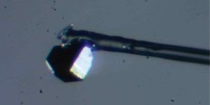
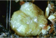
A tiny sample of goldschmidtite found inside a diamond by U of A PhD student Nicole Meyer. The newly discovered mineral has high concentrations of elements seldom found in Earth’s mantle, suggesting it formed under extreme conditions. Credit: Nicole Meyer
A Ph.D. student at the University of Alberta has discovered a new and curious mineral inside a diamond unearthed from a mine in South Africa.
The mineral—named goldschmidtite in honor of Victor Moritz Goldschmidt, the founder of modern geochemistry—has an unusual chemical signature for a mineral from Earth’s mantle, explained Nicole Meyer, a graduate student in the Diamond Exploration Research and Training School.
“Goldschmidtite has high concentrations of niobium, potassium and the rare earth elements lanthanum and cerium, whereas the rest of the mantle is dominated by other elements, such as magnesium and iron,” said Meyer.
“For potassium and niobium to constitute a major proportion of this mineral, it must have formed under exceptional processes that concentrated these unusual elements.”
The researchers estimate the diamond containing the goldschmidtite formed about 170 kilometers beneath Earth’s surface, at temperatures reaching nearly 1,200 C.
Because it is so difficult to drill down through Earth’s crust to reach the mantle, scientists rely on tiny mineral inclusions within diamonds to learn more about Earth’s chemistry deep beneath the surface.
“(The discovery) gives us a snapshot of fluid processes that affect the deep roots of continents during diamond formation,” said Meyer’s co-supervisor, Graham Pearson, who added there have been several attempts to name new minerals after Goldschmidt, but previous ones have been discredited. “This one is here to stay.”
“The work that goes into finding a new mineral is not done by one person,” said Meyer, who is also studying under the supervision of Thomas Stachel, professor and Canada Research Chair in Diamonds. “It has been an interdisciplinary collaboration with mineralogist Andrew Locock, crystallographers from Northwestern University, my advisers Thomas and Graham, and technicians.”
The study, “Goldschmidtite, (K,REE,Sr)(Nb,Cr)O3: a New Perovskite Supergroup Mineral Found in Diamond from Koffiefontein, South Africa,” was published in American Mineralogist.
Reference:
Nicole A. Meyer et al. Goldschmidtite, (K,REE,Sr)(Nb,Cr)O3: A new perovskite supergroup mineral found in diamond from Koffiefontein, South Africa, American Mineralogist (2019). DOI: 10.2138/am-2019-6937
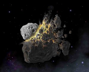
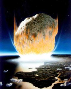
Illustration of the giant asteroid collision in outer space that produced the dust that led to an ice age on Earth. Credit: (c) Don Davis, Southwest Research Institute
About 466 million years ago, long before the age of the dinosaurs, the Earth froze. The seas began to ice over at the Earth’s poles, and the new range of temperatures around the planet set the stage for a boom of new species evolving. The cause of this ice age was a mystery, until now: a new study in Science Advances argues that the ice age was caused by global cooling, triggered by extra dust in the atmosphere from a giant asteroid collision in outer space.
There’s always a lot of dust from outer space floating down to Earth, little bits of asteroids and comets, but this dust is normally only a tiny fraction of the other dust in our atmosphere such as volcanic ash, dust from deserts and sea salt. But when a 93-mile-wide asteroid between Mars and Jupiter broke apart 466 million years ago, it created way more dust than usual. “Normally, Earth gains about 40,000 tons of extraterrestrial material every year,” says Philipp Heck, a curator at the Field Museum, associate professor at the University of Chicago, and one of the paper’s authors. “Imagine multiplying that by a factor of a thousand or ten thousand.” To contextualize that, in a typical year, one thousand semi trucks’ worth of interplanetary dust fall to Earth. In the couple million years following the collision, it’d be more like ten million semis.
“Our hypothesis is that the large amounts of extraterrestrial dust over a timeframe of at least two million years played an important role in changing the climate on Earth, contributing to cooling,” says Heck.
“Our results show for the first time that such dust, at times, has cooled Earth dramatically,” says Birger Schmitz of Sweden’s Lund University, the study’s lead author and a research associate at the Field Museum. “Our studies can give a more detailed, empirical-based understanding of how this works, and this in turn can be used to evaluate if model simulations are realistic.”
To figure it out, researchers looked for traces of space dust in 466-million-year-old rocks, and compared it to tiny micrometeorites from Antarctica as a reference. “We studied extraterrestrial matter, meteorites and micrometeorites, in the sedimentary record of Earth, meaning rocks that were once sea floor,” says Heck. “And then we extracted the extraterrestrial matter to discover what it was and where it came from.”
Extracting the extraterrestrial matter — the tiny meteorites and bits of dust from outer space — involves taking the ancient rock and treating it with acid that eats away the stone and leaves the space stuff. The team then analyzed the chemical makeup of the remaining dust. The team also analyzed rocks from the ancient seafloor and looked for elements that rarely appear in Earth rocks and for isotopes — different forms of atoms — that show hallmarks of coming from outer space. For instance, helium atoms normally have two protons, two neutrons, and two electrons, but some that are shot out of the Sun and into space are missing a neutron. The presence of these special helium isotopes, along with rare metals often found in asteroids, proves that the dust originated from space.
Other scientists had already established that our planet was undergoing an ice age around this time. The amount of water in the Earth’s oceans influences the way that rocks on the seabed form, and the rocks from this time period show signs of shallower oceans — a hint that some of the Earth’s water was trapped in glaciers and sea ice. Schmitz and his colleagues are the first to show that this ice age syncs up with the extra dust in the atmosphere. “The timing appears to be perfect,” he says. The extra dust in the atmosphere helps explain the ice age — by filtering out sunlight, the dust would have caused global cooling.
Since the dust floated down to Earth over at least two million years, the cooling was gradual enough for life to adapt and even benefit from the changes. An explosion of new species evolved as creatures adapted for survival in regions with different temperatures.
Heck notes that while this period of global cooling proved beneficial to life on Earth, fast-paced climate change can be catastrophic. “In the global cooling we studied, we’re talking about timescales of millions of years. It’s very different from the climate change caused by the meteorite 65 million years ago that killed the dinosaurs, and it’s different from the global warming today — this global cooling was a gentle nudge. There was less stress.”
It’s tempting to think that today’s global warming could be solved by replicating the dust shower that triggered global cooling 466 million years ago. But Heck says he would be cautious: “Geoengineering proposals should be evaluated very critically and very carefully, because if something goes wrong, things could become worse than before.”
While Heck isn’t convinced that we’ve found the solution to climate change, he says it’s a good idea for us to be thinking along these lines.
“We’re experiencing global warming, it’s undeniable,” says Heck. “And we need to think about how we can prevent catastrophic consequences, or minimize them. Any idea that’s reasonable should be explored.”
Reference:
Birger Schmitz, Kenneth A. Farley, Steven Goderis, Philipp R. Heck, Stig M. Bergström, Samuele Boschi, Philippe Claeys, Vinciane Debaille, Andrei Dronov, Matthias Van Ginneken, David A.t. Harper, Faisal Iqbal, Johan Friberg, Shiyong Liao, Ellinor Martin, Matthias M. M. Meier, Bernhard Peucker-Ehrenbrink, Bastien Soens, Rainer Wieler and Fredrik Terfelt. An extraterrestrial trigger for the mid-Ordovician ice age: Dust from the breakup of the L-chondrite parent body. Science Advances, 2019 DOI: 10.1126/sciadv.aax4184
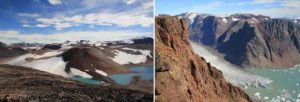
Photographs of alkaline magmatic intrusions in Greenland. The region was volcanically and tectonically active around 1.2 billion years ago. Although no longer active, it is of major interest to geologists because the subsequent uplift and glacial erosion have cut deep into the rift and exposed the magma chambers that once lay well below the surface. Greenland’s magmas were sourced from a mantle that was enriched and contaminated by ancient crustal materials. Credit: University of St Andrews
Ancient volcanoes dating back billions of years could provide new insights into how the Earth’s surface is recycled, according to scientists at the University of St Andrews.
A study, published today in Nature Communications, reveals the fate of the Earth’s ancient crust and could help solve the mystery of how the Earth’s surface and mantle are connected.
The Earth’s outermost layer is made up of rigid tectonic plates which move around and collide at regions called subduction zones.
In areas of collision, crustal materials get transported into the deep mantle, and one of the grand challenges in Earth Sciences is to understand what happens to this crust and how long it resides in the mantle.
At a few volcanoes on Earth geologists can find traces of these ancient crustal materials in the erupted lava. To date most of this work has focused on oceanic islands like Hawaii or the Canaries.
However, oceanic islands are only present at the surface of the Earth for a few million years before they themselves subside and are subducted back into the mantle, and so can only provide a tiny snapshot of crustal recycling over the four billion years of Earth history.
The St Andrews team investigated a suite of alkaline magmas erupted in continental rifts similar to the modern day East African rift.
Although these magmas have very unusual chemistries, they show many similarities with those oceanic lavas and, crucially, are found throughout Earth’s geological record.
The team focused on an alkaline province in south-west Greenland using cutting-edge isotope techniques to chemically fingerprint ancient crustal material in the source of these magmas.
Through a combination of remote field work (by boat and helicopter) and careful chemical analysis the team was able to show that these magmas were tapping into ancient crust subducted into the mantle 500 million years before the volcanoes started erupting.
Once the team understood these processes in Greenland they compiled a global data on alkaline magma chemistry and were surprised to find that the vast majority contained a recycled crustal component in their magma source.
Lead author Dr. Will Hutchison, from the School of Earth and Environmental Sciences at the University, said: “Our key result is that the isotopes of alkaline magmas are highly variable and this suggests that their recycled crustal sources have changed through geological time.
“The beauty of our global dataset is that it extends back over two billion years and so these unique alkaline rocks represent an extremely powerful record for understanding crustal recycling over Earth history.”
“By carefully bringing together the igneous and sedimentary isotope records, this might allow us to understand how changing crustal input is tied to volcanic output, and ultimately build a much better understanding of what happens to tectonic plates once they get transported into the deep Earth.”
Reference:
William Hutchison et al. Sulphur isotopes of alkaline magmas unlock long-term records of crustal recycling on Earth, Nature Communications (2019). DOI: 10.1038/s41467-019-12218-1
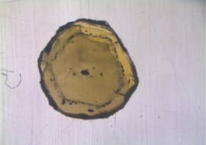
The mineral olivine contains melt inclusions (black dots), just a few micrometers in size. The geochemists isolated these inclusions and investigated the isotopic composition with mass spectrometers. Credit: Münster University – Felix Genske
What is the chemical composition of the Earth’s interior? Because it is impossible to drill more than about ten kilometres deep into the Earth, volcanic rocks formed by melting Earth’s deep interior often provide such information. Geochemists at the Universities of Münster (Germany) and Amsterdam (Netherlands) have investigated the volcanic rocks that build up the Portuguese island group of the Azores. Their goal: gather new information about the compositional evolution of the Earth’s mantle, which is the layer roughly between 30 and 2,900 kilometres deep inside the Earth. Using sophisticated analytical techniques, they discovered that the composition of the mantle below the Azores is different than previously thought—suggesting that large parts of it contain surprisingly few so-called incompatible elements. These are chemical elements which, as a result of the constant melting of the Earth’s mantle, accumulate in the Earth’s crust, which is Earth’s outermost solid layer.
The researchers conclude that, over Earth’s history, a larger amount of Earth’s mantle has melted—and ultimately formed the Earth’s crust—than previously thought. “To sustain the material budget between Earth’s mantle and crust, mass fluxes between the surface and Earth’s interior must have operated at a higher rate,” says Münster University’s Prof. Andreas Stracke, who is heading the study.
As the material below the Azores rises from very deep within Earth’s mantle—and is unexpectedly similar to most of its upper part—the composition of Earth’s entire mantle may differ from current thinking. “Our results have opened up a new perspective,” says Andreas Stracke, “because we will now have to reassess the composition of the largest part of the Earth—after all, Earth’s mantle accounts for over 80 percent of Earth’s volume.” The study has been published in the journal Nature Geoscience.
Background and method
In their study, the geochemists examined the mineral olivine and its melt inclusions, i.e. magma encapsulated during the crystallisation of olivine before the lavas erupted. The researchers isolated these melt inclusions, just a few micrometers in size, dissolved them chemically and separated certain chemical elements. These elements are altered by radioactive decay during their lifetime and ascent from Earth’s interior—travelling over thousands of kilometres for hundreds or even thousands of millions of years.
The researchers analysed the isotopic composition of the melts with highly sensitive mass spectrometers. Such methods allow measurement of the relative abundance of different atoms in an element—so-called isotopes. “Owing to the high efficiency of our measurements, we were able to analyse the isotopic composition of one billionth of a gram of the element,” says co-author Dr. Felix Genske from the University of Münster’s Institute of Mineralogy, who carried out most of the analytical work. In this way, the researchers indirectly obtained information on the composition of the material in the Earth’s mantle: the isotope analyses showed that it contains far fewer rare Earth elements such as samarium and neodymium, but also of chemically similar elements such as thorium and uranium.
“On the basis of similar geochemical data in volcanic rocks from different regions, e.g. Hawaii, other parts of the Earth’s mantle may also contain a higher proportion of material that is strongly depleted in incompatible elements,” says Andreas Stracke. The researchers presume that this global deficit may be compensated by a higher rate of recycling Earth’s incompatible element-rich crust back into Earth’s mantle. With their continuing studies the researchers want to confirm their working hypothesis by investigating samples from other volcanic islands across the globe.
Reference:
Andreas Stracke et al, Ubiquitous ultra-depleted domains in Earth’s mantle, Nature Geoscience (2019). DOI: 10.1038/s41561-019-0446-z
An artist’s interpretation of the asteroid impact that wiped out all non-avian dinosaurs. Credit: NASA/Don Davis.
When the asteroid that wiped out the dinosaurs slammed into the planet, the impact set wildfires, triggered tsunamis and blasted so much sulfur into the atmosphere that it blocked the sun, which caused the global cooling that ultimately doomed the dinos.
That’s the scenario scientists have hypothesized. Now, a new study led by The University of Texas at Austin has confirmed it by finding hard evidence in the hundreds of feet of rocks that filled the impact crater within the first 24 hours after impact.
The evidence includes bits of charcoal, jumbles of rock brought in by the tsunami’s backflow and conspicuously absent sulfur. They are all part of a rock record that offers the most detailed look yet into the aftermath of the catastrophe that ended the Age of Dinosaurs, said Sean Gulick, a research professor at the University of Texas Institute for Geophysics (UTIG) at the Jackson School of Geosciences.
“It’s an expanded record of events that we were able to recover from within ground zero,” said Gulick, who led the study and co-led the 2016 International Ocean Discovery Program scientific drilling mission that retrieved the rocks from the impact site offshore of the Yucatan Peninsula. “It tells us about impact processes from an eyewitness location.”
The research was published in the Proceedings of the National Academy of Sciences on Sept. 9 and builds on earlier work co-led and led by the Jackson School that described how the crater formed and how life quickly recovered at the impact site. An international team of more than two dozen scientists contributed to this study.
Most of the material that filled the crater within hours of impact was produced at the impact site or was swept in by seawater pouring back into the crater from the surrounding Gulf of Mexico. Just one day deposited about 425 feet of material — a rate that’s among the highest ever encountered in the geologic record. This breakneck rate of accumulation means that the rocks record what was happening in the environment within and around the crater in the minutes and hours after impact and give clues about the longer-lasting effects of the impact that wiped out 75% of life on the planet.
Gulick described it as a short-lived inferno at the regional level, followed by a long period of global cooling.
“We fried them and then we froze them,” Gulick said. “Not all the dinosaurs died that day, but many dinosaurs did.”
Researchers estimate the asteroid hit with the equivalent power of 10 billion atomic bombs of the size used in World War II. The blast ignited trees and plants that were thousands of miles away and triggered a massive tsunami that reached as far inland as Illinois. Inside the crater, researchers found charcoal and a chemical biomarker associated with soil fungi within or just above layers of sand that shows signs of being deposited by resurging waters. This suggests that the charred landscape was pulled into the crater with the receding waters of the tsunami.
Jay Melosh, a Purdue University professor and expert on impact cratering, said that finding evidence for wildfire helps scientists know that their understanding of the asteroid impact is on the right track.
“It was a momentous day in the history of life, and this is a very clear documentation of what happened at ground zero,” said Melosh, who was not involved with this study.
However, one of the most important takeaways from the research is what was missing from the core samples. The area surrounding the impact crater is full of sulfur-rich rocks. But there was no sulfur in the core.
That finding supports a theory that the asteroid impact vaporized the sulfur-bearing minerals present at the impact site and released it into the atmosphere, where it wreaked havoc on the Earth’s climate, reflecting sunlight away from the planet and causing global cooling. Researchers estimate that at least 325 billion metric tons would have been released by the impact. To put that in perspective, that’s about four orders of magnitude greater than the sulfur that was spewed during the 1883 eruption of Krakatoa — which cooled the Earth’s climate by an average of 2.2 degrees Fahrenheit for five years.
Although the asteroid impact created mass destruction at the regional level, it was this global climate change that caused a mass extinction, killing off the dinosaurs along with most other life on the planet at the time.
“The real killer has got to be atmospheric,” Gulick said. “The only way you get a global mass extinction like this is an atmospheric effect.”
The research was funded by a number of international and national support organizations, including the National Science Foundation.
Reference:
Sean P. S. Gulick, Timothy J. Bralower, Jens Ormö, Brendon Hall, Kliti Grice, Bettina Schaefer, Shelby Lyons, Katherine H. Freeman, Joanna V. Morgan, Natalia Artemieva, Pim Kaskes, Sietze J. de Graaff, Michael T. Whalen, Gareth S. Collins, Sonia M. Tikoo, Christina Verhagen, Gail L. Christeson, Philippe Claeys, Marco J. L. Coolen, Steven Goderis, Kazuhisa Goto, Richard A. F. Grieve, Naoma McCall, Gordon R. Osinski, Auriol S. P. Rae, Ulrich Riller, Jan Smit, Vivi Vajda, Axel Wittmann, and the Expedition 364 Scientists. The first day of the Cenozoic. PNAS, 2019 DOI: 10.1073/pnas.1909479116
A newly identified species of pterosaur is among the largest ever flying animals, according to a new study from Queen Mary University of London.
Cryodrakon boreas, from the Azhdarchid group of pterosaurs (often incorrectly called ‘pterodactyls’), was a flying reptile with a wingspan of up to 10 metres which lived during the Cretaceous period around 77 million years ago.
Its remains were discovered 30 years ago in Alberta, Canada, but palaeontologists had assumed they belonged to an already known species of pterosaur discovered in Texas, USA, named Quetzalcoatlus.
The study, published in the Journal of Vertebrate Paleontology, reveals it is actually a new species and the first pterosaur to be discovered in Canada.
Dr David Hone, lead author of the study from Queen Mary University of London, said: “This is a cool discovery, we knew this animal was here but now we can show it is different to other azhdarchids and so it gets a name.”
Although the remains — consisting of a skeleton that has part of the wings, legs, neck and a rib — were originally assigned to Quetzalcoatlus, study of this and additional material uncovered over the years shows it is a different species in light of the growing understanding of azhdarchid diversity.
The main skeleton is from a young animal with a wingspan of about 5 metres but one giant neck bone from another specimen suggests an adult animal would have a wingspan of around 10 metres.
This makes Cryodrakon boreas comparable in size to other giant azhdarchids including the Texan Quetzalcoatlus which could reach 10.5 m in wingspan and weighed around 250 kg.
Like other azhdarchids these animals were carnivorous and predominantly predated on small animals which would likely include lizards, mammals and even baby dinosaurs.
Dr Hone added: “It is great that we can identify Cryodrakon as being distinct to Quetzalcoatlus as it means we have a better picture of the diversity and evolution of predatory pterosaurs in North America.”
Unlike most pterosaur groups, azhdarchids are known primarily from terrestrial settings and, despite their likely capacity to cross oceanic distances in flight, they are broadly considered to be animals that were adapted for, and lived in, inland environments.
Despite their large size and a distribution across North and South America, Asia, Africa and Europe, few azhdarchids are known from more than fragmentary remains. This makes Cryodrakon an important animal since it has very well preserved bones and includes multiple individuals of different sizes.
Reference:
David W. E. Hone, Michael B. Habib, François Therrien. Cryodrakon boreas, gen. et sp. nov., a Late Cretaceous Canadian azhdarchid pterosaur. Journal of Vertebrate Paleontology, 2019; e1649681 DOI: 10.1080/02724634.2019.1649681
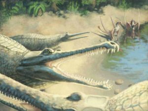
Jurassic crocodile. Artist’s impression (credit: Julia Beier)
A prehistoric crocodile that lived around 180 million years ago has been identified — almost 250 years after the discovery of it fossil remains.
A fossil skull found in a Bavarian town in the 1770s has been recognised as the now-extinct species Mystriosaurus laurillardi, which lived in tropical waters during the Jurassic Period.
For the past 60 years, it was thought the animal was part of a similar species, known as Steneosaurus bollensis, which existed around the same time, researchers say.
Palaeontologists identified the animal by analysing fossils unearthed in the UK and Germany.
The team, which included scientists from the University of Edinburgh, also revealed that another skull, discovered in Yorkshire in the 1800s, belongs to Mystriosaurus laurillardi.
The marine predator — which was more than four metres in length — had a long snout and pointed teeth, and preyed on fish, the team says. It lived in warm seas alongside other animals including ammonites and large marine reptiles, called ichthyosaurs.
The discovery of fossils in present-day Germany and the UK shows that the species could easily swim between islands, much like modern saltwater crocodiles, researchers say.
The study, led by Naturkunde-Museum Bielefeld in Germany, is published in the journal Acta Palaeontologica Polonica, It was supported by the Palaeontographical Society, Leverhulme Trust and the Natural Sciences and Engineering Research Council of Canada.
Sven Sachs, of the Naturkunde-Museum Bielefeld, who led the study, said: “Mystriosaurus looked like a gharial but it had a shorter snout with its nasal opening facing forwards, whereas in nearly all other fossil and living crocodiles the nasal opening is placed on top of the snout.”
Dr Mark Young, of the University of Edinburgh’s School of GeoSciences, who was involved in the study, said: “Unravelling the complex history and anatomy of fossils like Mystriosaurus is necessary if we are to understand the diversification of crocodiles during the Jurassic. Their rapid increase in biodiversity between 200 and 180 million years ago is still poorly understood.”
Reference:
Sven Sachs, Michela M. Johnson, Mark T. Young, and Pascal Abel. The mystery of Mystriosaurus: Redescribing the poorly known Early Jurassic teleosauroid thalattosuchians Mystriosauruslaurillardi and Steneosaurus brevior. Acta Palaeontol., Pol. 64 (3): 565%u2013579, 2019 DOI: 10.4202/app.00557.2018
A new study by Yale scientists provides a key insight into a milestone event in the early evolution of life on Earth — the origin of the cell nucleus and complex cells called eukaryotes.
While simple prokaryotic bacteria formed within the first billion years of the Earth, the origin of eurkaryotes, the first cells with nuclei, took much longer. Dating back to between 1.7 and 2.7 billion years ago, an ancient prokaryote was first transformed with a compartment, the nucleus, designed to keep their DNA material more protected from the environment (such as harmful UV damage). From this ancient event, relatively simple organisms, such as bacteria were transformed into more sophisticated ones that ultimately gave rise to all modern animals, plants and fungi.
The details of this key event have remained elusive for many years because not a single transitional fossil has been found to date.
Now, in a study led by Dr. Sergey Melnikov, from the Dieter Söll Laboratory in the Department of Molecular Biophysics and Biochemistry at Yale University, has finally found these missing fossils. To do so, they relied not on unearthing clay or rocks but peering deep inside current living cells, known as Archaea — the organisms that are believed to most closely resemble the ancient intermediates between bacteria and the more complex cells that we now know as eukaryotic cells.
These transitional forms are nothing like the traditional fossils we think of, such as dinosaur bones deposited in the ground or insects trapped in amber. Known as ribosomal proteins, these particular transitional forms are about 100-million times smaller than our bodies. Melnikov and his colleagues discovered that ribosomal proteins can be used as living “molecular fossils,” whose ancient origin and structure may hold the key to understanding the origin of the cell nucleus.
“Simple lifeforms, such as bacteria, are analogous to a studio apartment: they have a single interior space which is not subdivided into separate rooms or compartments. By contrast, more complex organisms, such as fungi, animals, and plants, are made up of cells that are separated into multiple compartments,” explained Melnikov. “These microscopic compartments are connected to one another via ‘doors’ and ‘gates.’ To pass through these doors and gates, the molecules that inhabit living cells must carry special ID badges, some of which are called nuclear localization signals, or NLSs.”
Seeking to better understand when NLS-motifs might have emerged in ribosomal proteins, the Yale team assessed their conservation among ribosomal proteins from the three domains of life.
To date, NLS-motifs have been characterized in ten ribosomal proteins from several eukaryotic species. They compared all of the NLS-motifs found in eukaryotic ribosomal proteins (from 482 species) and tried to find a match in bacteria (2,951 species) and Archaea (402 species).
Suprisingly, they found four proteins — uL3, uL15, uL18, and uS12 — to have NLS-type motifs not only in the Eukarya but also in the Archaea. “Contrary to our expectations, we found that NLS-type motifs are conserved across all the archaeal branches, including the most ancient superphylum, called DPANN,” said Melnikov.
But since Archaea don’t have nuclei, the logical question which then arose was, why do they have these IDs? And what was the original biological function of these IDs in non-compartmentalized cells?”
“If you think about an equivalent to our discovery in the macroscopic world, it is similar to discoveries made during the last century of bird-like dinosaurs such as Caudipteryx zoui,” said Melnikov. “These ancient flightless birds have illustrated that it took multiple millions of years for dinosaurs to develop wings. Yet, strikingly, for the first few million years their wings were not good enough to support flight.”
Similarly, the study by Melnikov and colleagues suggests that, even though NLSs may not initially have emerged to allow cellular molecules to pass through microscopic doors and gates between cellular compartments, they could have emerged to fulfill a similar biological function — to help molecules get to their proper biological partners.
As Melnikov explains: “Our analysis shows that in complex cells the very same IDs that allow proteins to pass through the microscopic gates are also used to recognize biological partners of these proteins. In other words, in complex cells, the IDs fulfill two conceptually similar biological functions. In the Archaea, however, these IDs play just one of these functions — these IDs, or NLSs, help proteins to recognize their biological partners and distinguish them from the thousands of other molecules that float in a cell.”
But what led to the evolution of these IDs among cellular proteins in the first place?
As Melnikov explains, “When life first emerged on the face of our planet, the earliest life forms were likely made of a very limited number of molecules. Therefore, it was relatively easy for these molecules to find one specific partner among all the other molecules in a living cell. However, as cells grew in size and complexity, it is possible, even probable, that the old rules of specific interactions between cellular molecules had to be redefined, and this is how the IDs were introduced into the structure of cellular proteins — to help these proteins identify their molecular partners more easily in the complex environment of a complex cell. Coming back to the analogy with bird-like dinosaurs, our study illustrates the remarkable similarity between how evolution happens in the macroscopic world and how evolution happens in the world that Darwin never saw — the microscopic world of invisible molecules that inhabit living cells.”
Reference:
Sergey Melnikov, Hui-Si Kwok, Kasidet Manakongtreecheep, Antonia van den Elzen, Carson C Thoreen, Dieter Söll. Archaeal ribosomal proteins possess nuclear localization signal-type motifs: implications for the origin of the cell nucleus. Molecular Biology and Evolution, 2019; DOI: 10.1093/molbev/msz207
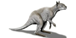
An in-depth analysis of the skull biomechanics of a giant extinct kangaroo indicates that the animal had a capacity for high-performance crushing of foods, suggesting feeding behaviors more similar to a giant panda than modern-day kangaroo.
The new findings, published in PLOS ONE, support the hypothesis that some short-faced kangaroos were capable of persisting on tough, poor-quality vegetation, when more desirable foods were scarce because of droughts or glacial periods.
“The skull of the extinct kangaroo studied here differs from those of today’s kangaroos in many of the ways a giant panda’s skull differs from other bears,” said Rex Mitchell, post-doctoral fellow in the Department of Anthropology at the University of Arkansas. “So, it seems that the strange skull of this kangaroo was, in a functional sense, less like a modern-day kangaroo’s and more like a giant panda’s.”
Mitchell used computed tomography scans to create three-dimensional models of the skull of Simosthenurus occidentalis, a well-represented species of short-faced kangaroo that persisted until about 42,000 years ago. Working with the models, Mitchell performed bite simulations to examine biomechanical performance. The resulting forces at the jaw joints and biting teeth were measured, as well as stress experienced across the skull during biting.
Mitchell compared the findings from the short-faced kangaroo to those obtained from models of the koala, a species alive today with the most similar skull shape. These comparisons demonstrated the importance of the extinct kangaroo’s bony, heavily reinforced skull features in producing and withstanding strong forces during biting, which likely helped the animal crush thick, resistant vegetation such as the older leaves, woody twigs and branches of trees and shrubs. This would be quite different than the feeding habits of modern Australian kangaroos, which tend to feed mostly on grasses, and would instead be more similar to how giant pandas crush bamboo.
“Compared to the kangaroos of today, the extinct, short-faced kangaroos of ice age Australia would be a strange sight to behold,” Mitchell said.
They included the largest kangaroo species ever discovered, with some species estimated to weigh more than 400 pounds. The bodies of these kangaroos were much more robust than those of today — which top out at about 150 pounds — with long muscular arms and large heads shaped like a koala’s. Their short face offered increased mechanical efficiency during biting, a feature usually found in species that can bite harder into more resistant foods. Some species of these extinct kangaroos had massive skulls, with enormous cheek bones and wide foreheads.
“All this bone would have taken a lot of energy to produce and maintain, so it makes sense that such robust skulls wouldn’t have evolved unless they really needed to bite hard into at least some more resistant foods that were important in their diets,” Mitchell said.
The short face, large teeth, and broad attachment sites for biting muscles found in the skulls of the short-faced kangaroo and the giant panda are an example of convergent evolution, Mitchell said, meaning these features probably evolved in both animals for the purpose of performing similar feeding tasks.
Mitchell is also affiliated with the University of New England in Armidale, Australia, where he performed the analyses during his doctoral studies.
Reference:
D. Rex Mitchell. The anatomy of a crushing bite: The specialised cranial mechanics of a giant extinct kangaroo. PLOS ONE, 2019; 14 (9): e0221287 DOI: 10.1371/journal.pone.0221287
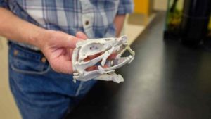
Prof. Michael Coates holds a 3-D printed model of the Tristychius skull and jaws. Photo courtesy of Matt Wood
Researchers from the University of Chicago have used tools developed to explore 3D movements and mechanics of modern-day fish jaws to analyze a fossil fish for the first time. Combined with CT imaging technology able to capture images of the fossil while it is still encased in rock, the results reveal that the 335-million-year-old shark had sophisticated jaws capable of the kind of suction feeding common to bony fishes like bass, perch, carp and also modern-day nurse sharks.
Remarkably, these ancient shark jaws are some 50 million years older than the earliest evidence of similar jaws adapted for suction feeding in bony fishes. This shows both the evolutionary versatility of sharks, and how sharks responded quickly to new ecological opportunities in the aftermath of one of the five big extinctions in Earth’s history.
“Among today’s aquatic vertebrates, suction feeding is widespread, and is often cited as a key factor contributing to the spectacular evolutionary success of ray-finned fishes,” said Michael Coates, PhD, professor of organismal biology and anatomy at the University of Chicago and senior author of the new study. “But here we show that high-performance aquatic suction feeding first appeared in one of the earliest known sharks.”
A complete construction kit to rebuild a shark
The study, published this week in Science Advances, describes the fossil of Tristychius arcuatus, a 2-foot long shark similar to a dogfish. It was first discovered by Swiss biologist Louis Agassiz in 1837, and later described in detail by John Dick, a former classmate of Coates’, in 1978. Tristychius, and other Devonian period sharks like it, are found in ironstone rock nodules along the shores of the Firth of Forth near Edinburgh, Scotland.
Shark fossils are rare because their cartilage skeleton usually rots away before there’s any chance of fossilization. For decades, researchers studying ancient sharks have been limited to isolated teeth and fin spines. Even if they do find a more complete skeleton, it’s usually flattened, or, if it’s encased in one of these stones, it crumbles when they try to remove it.
Coates and his lab have been leading the field in applying modern imaging technology and software to study these challenging fossils. CT scanning allows them to create 3D images of any fossilized cartilage and the impressions it left while still encased in the stone. Then, using sophisticated modeling software originally developed to study structure and function in modern-day fish, they can recreate what the complete skeleton looked like, how the pieces fit together and moved, and what that meant for how these sharks lived.
“These new CT methods are releasing a motherlode of previously inaccessible data,” Coates said.
His team started reexamining some of the same fossils Dick studied, as well as specimens left untouched in earlier research. “Some of this is superbly preserved,” Coates said. “We realized that when we got all the parts out [virtually], we had the complete construction kit to rebuild our shark in 3D.”
Beating underwater physics
That virtual construction kit also allowed them to create 3D plastic printouts of the cartilages that build a shark’s skull. These, in turn, allowed Coates and his team to model movements and connections, both physically and virtually, to see how the skull worked.
Fish that use suction feeding essentially suck water in through their mouths to catch elusive prey, such as worms, crustaceans and other invertebrates from the ocean floor. To do so, they have to draw water in when they open their mouth, but not force it back out when they close it.
Suction feeders overcome these challenging physics by funneling the water back out through their gills. The amount of suction they create can be enhanced by flexible arches and joints that expand the cheeks and the volume inside the mouth to draw the water through (imagine the feeling when you hold your hands together underwater and slowly pull your palms apart).
Today’s fish have perfected this process, but Tristychius had a similar feeding apparatus that could expand as it opened and closed its mouth to control the flow of water (and food). Crucially, this included a set of cartilages around the mouth that limited the size of the opening to control the amount of suction. The circular mouth was pushed forward at the end of its muzzle like a modern-day carpet shark or nurse shark, not a gaping, toothy maw like a great white.
While other sharks at the time did have the more typical snapping jaws, the combination of expanding cheeks and a carefully controlled mouth aperture provided Tristychiuswith access to previously untapped food resources, such as prey taking refuge in shallow burrows or otherwise difficult-to-capture schools of shrimp or juvenile fish, around 50 million years before bony fish caught on to the same technique.
“The combination of both physical and computational models has allowed us to explore the biomechanics in a Paleozoic shark in a way that’s never been done before,” Coates said. “These particular sharks were doing something sophisticated and new. Here we have the earliest evidence of this key innovation that’s been so important for multiple groups of fishes and has evolved repeatedly.”
Additional authors for the study include Kristen Tietjenfrom the University of Chicago, Aaron M. Olsenfrom Brown University, and John A. Finarelli from University College Dublin, Ireland.
Reference:
Michael I. Coates, Kristen Tietjen, Aaron M. Olsen and John A. Finarelli. High-performance suction feeding in an early elasmobranch. Science Advances, 2019 DOI: 10.1126/sciadv.aax2742
Two palaeontologists working on the world-renowned Burgess Shale have revealed a new species, called Mollisonia plenovenatrix, which is presented as the oldest chelicerate. This discovery places the origin of this vast group of animals — of over 115,000 species, including horseshoe crabs, scorpions and spiders — to a time more than 500 million years ago. The findings are published in the journal Nature on September 11, 2019.
Mollisonia plenovenatrix would have been a fierce predator — for its size. As big as a thumb, the creature boasted a pair of large egg-shaped eyes and a “multi-tool head” with long walking legs, as well as numerous pairs of limbs that could all-together sense, grasp, crush and chew. But, most importantly, the new species also had a pair of tiny “pincers” in front of its mouth, called chelicerae. These typical appendages give the name to the group of scorpions and spiders, the chelicerates, which use them to kill, hold, and sometimes cut, their prey.
“Before this discovery, we couldn’t pinpoint the chelicerae in other Cambrian fossils, although some of them clearly have chelicerate-like characteristics,” says lead author Cédric Aria, a member of the Royal Ontario Museum’s Burgess Shale expeditions since 2012, and is presently a post-doctoral fellow at the Nanjing Institute of Geology and Palaeontology (China). “This key feature, this coat of arms of the chelicerates, was still missing.”
Other features of this fossil, including back limbs likened to gills, further suggest that Mollisonia was not some “primitive” version of a chelicerate, but that it was in fact already close morphologically to modern species.
“Chelicerates have what we call either book gills or book lungs,” explains Aria. “They are respiratory organs are made of many collated thin sheets, like a book. This greatly increases surface area and therefore gas exchange efficiency. Mollisonia had appendages made up with the equivalent of only three of these sheets, which probably evolved from simpler limbs.”
The authors believe that Mollisonia preferentially hunted close to the sea floor, thanks to its well-developed walking legs, a type of ecology called benthic predation. Because Mollisonia is so modern-looking, chelicerates seem therefore to have prospered quickly, filling in an ecological niche that was otherwise left poorly attended to by other arthropods at that time. The authors conclude that the origin of the chelicerates must lie even deeper within the Cambrian, when the heart of the “explosion” really took place.
“Evidence is converging towards picturing the Cambrian explosion as even swifter than what we thought,” says Aria. “Finding a fossil site like the Burgess Shale at the very beginning of the Cambrian would be like looking into the eye of the cyclone.”
The importance of the Burgess Shale and similar deposits, such as the Chengjiang biota in China, lies in their exceptional preservation of the earliest marine animal communities at a time of uniquely rapid diversification of body forms called the “Cambrian explosion.” Fossil animals from these sites are notable for preserving an extensive array of morphological features, such as limbs and eyes, but also guts and, much more rarely, nervous system tissues.
Mollisonia was first described more than a century ago by the discoverer of the Burgess Shale, Charles Doolittle Walcott. However, so far, only rare exoskeletons of this animal were known. “It is the first time that evidence of the limbs and other soft-tissues of this type of animal are described, which were key to revealing its affinity,” says co-author Jean-Bernard Caron, Richard M. Ivey Curator of Invertebrate Palaeontology at the Royal Ontario Museum (Canada). The exceptionally well-preserved fossils come from a new Burgess Shale sites near Marble Canyon, in Kootenay National Park, British Columbia.
“Marble Canyon is the biggest spotlight of my career so far. This area keeps giving us wonderful treasures year after year,” says Caron, who has been leading the Royal Ontario Museum’s Burgess Shale expeditions for the past 10 years. “I would not have imagined that we could, in a way, rediscover the Burgess Shale like this, a hundred years later, with all the new species we are finding.”
The specimens of Mollisonia plenovenatrix described in this new research are better preserved than the ones found at the original Walcott quarry that is located about 40 kilometers northwest of the Marble Canyon quarry. Many other fossils found at Marble Canyon and surrounding areas have already played a critical role in our understanding of the early evolution of many animal groups. These notably include the vertebrates, our own lineage, thanks to numerous and exceptionally well-preserved specimens of the primitive fish Metaspriggina walcotti. Many new species await to be described; the latest one, a “flying saucer-like” new predatory arthropod with huge rake-like claws called Cambroraster falcatus, was just recently published on July 31, 2019.
The Burgess Shale fossil sites are located within Yoho and Kootenay national parks and are managed by Parks Canada. Parks Canada is proud to work with leading scientific researchers to expand knowledge and understanding of this key period of earth history and to share these sites with the world through award-winning guided hikes. The Burgess Shale was designated a UNESCO World Heritage Site in 1980 due to its outstanding universal value and is now part of the larger Canadian Rocky Mountain Parks World Heritage Site.
Mollisonia will be among the many exceptional fossils from the Burgess Shale planned to be on display in the ROM’s future new gallery, The Willner Madge Gallery, Dawn of Life, scheduled to open in 2021.
Reference:
Cédric Aria, Jean-Bernard Caron. A middle Cambrian arthropod with chelicerae and proto-book gills. Nature, 2019; DOI: 10.1038/s41586-019-1525-4
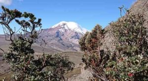
The volcano Chimborazo, Ecuador, that Alexander von Humboldt surveyed in 1802. Photo: Spyros Theodoridis/CMEC
What determines global patterns of biodiversity has been a puzzle for scientists since the days of von Humboldt, Darwin, and Wallace. Yet, despite two centuries of research, this question remains unanswered. The global pattern of mountain biodiversity, and the extraordinarily high richness in tropical mountains in particular, is documented in two companion Science review papers this week. The papers focus on the fact that the high level of biodiversity found on mountains is far beyond what would be expected from prevailing hypotheses.
“The challenge is that, although it is evident that much of the global variation in biodiversity is so clearly driven by the extraordinary richness of tropical mountain regions, it is this very richness that current biodiversity models, based on contemporary climate, cannot explain: mountains are simply too rich in species, and we are falling short of explaining global hotspots of biodiversity,” says Professor Carsten Rahbek, lead author of both review papers published in Science.
To confront the question of why mountains are so biologically diverse, scientists at the Center for Macroecology, Evolution and Climate (CMEC) at the GLOBE Institute of the University of Copenhagen work to synthesize understanding and data from the disparate fields of macroecology, evolutionary biology, earth sciences, and geology. The CMEC scientists are joined by individual collaborators from Oxford University, Kew Gardens, and University of Connecticut.
Part of the answer, these studies find, lies in understanding that the climate of rugged tropical mountain regions is fundamentally different in complexity and diversity compared to adjacent lowland regions. Uniquely heterogeneous mountain climates likely play a key role in generating and maintaining high diversity.
“People often think of mountain climates as bleak and harsh,” says study co-leader Michael K. Borregaard. “But the most species-rich mountain region in the world, the Northern Andes, captures, for example, roughly half of the world’s climate types in a relatively small region — much more than is captured in nearby Amazon, a region that is more than 12 times larger.”
Stressing another unique feature of mountain climate, Michael explains, “Tropical mountains, based in fertile and wet equatorial lowlands and extending into climatic conditions superficially similar to those found in the Arctic, span a gradient of annual mean temperatures over just a few km as large as that found over 10,000 km from the tropical lowlands at Equator to the arctic regions at the poles. It’s pretty amazing if you think about it.”
Another part of the explanation of the high biodiversity of certain mountains is linked to the geological dynamics of mountain building. These geological processes, interacting with complex climate changes through time, provide ample opportunities for evolutionary processes to act.
“The global pattern of biodiversity shows that mountain biodiversity exhibits a visible signature of past evolutionary processes. Mountains, with their uniquely complex environments and geology, have allowed the continued persistence of ancient species deeply rooted in the tree of life, as well as being cradles where new species have arisen at a much higher rate than in lowland areas, even in areas as amazingly biodiverse as the Amazonian rainforest,” says Professor Carsten Rahbek.
From ocean crust, volcanism and bedrock to mountain biodiversity
Another explanation of mountain richness, says the study, may lie in the interaction between geology and biology. The scientists report a novel and surprising finding: the high diversity is in most tropical mountains tightly linked to bedrock geology — especially mountain regions with obducted, ancient oceanic crust. To explain this relationship between geology and biodiversity, the scientists propose, as a working hypothesis, that mountains in the tropics with soil originating from oceanic bedrock provide exceptional environmental conditions that drive localized adaptive change in plants. Special adaptations that allow plants to tolerate these unusual soils, in turn, may drive speciation cascades (the speciation of one group leading to speciation in other groups), all the way to animals, and ultimately contribute to the shape of global patterns of biodiversity.
The legacy of von Humboldt — his 250th anniversary
The two papers are part of Science’s celebration of Alexander von Humboldt’s 250th birth anniversary. In 1799, Alexander von Humboldt set sail on a 5-year, 8000-km voyage of scientific discovery through Latin America. His journey through the Andes Mountains, captured by his famous vegetation zonation figure featuring Mount Chimborazo, canonized the place of mountains in understanding Earth’s biodiversity.
Acknowledging von Humboldt’s contribution to our understanding of the living world, Professor Carsten Rahbek, one of the founding scientists of the newly established interdisciplinary GLOBE Institute at the University of Copenhagen says:
“Our papers in Science are a testimony to the work of von Humboldt, which truly revolutionized our thinking about the processes that determine the distribution of life. Our work today stands on the shoulders of his work, done centuries ago, and follows his approach of integrating data and knowledge of different scientific disciplines into a more holistic understanding of the natural world. It is our small contribution of respect to the legacy of von Humboldt.”
References:
Carsten Rahbek, Michael K. Borregaard, Robert K. Colwell, Bo Dalsgaard, Ben G. Holt, Naia Morueta-Holme, David Nogues-Bravo, Robert J. Whittaker, Jon Fjelds�. Humboldt’s enigma: What causes global patterns of mountain biodiversity? Science, 2019 DOI: 10.1126/science.aax0149
Carsten Rahbek, Michael K. Borregaard, Alexandre Antonelli, Robert K. Colwell, Ben G. Holt, David Nogues-Bravo, Christian M. Ø. Rasmussen, Katherine Richardson, Minik T. Rosing, Robert J. Whittaker, Jon Fjeldså. Building mountain biodiversity: Geological and evolutionary processes. Science, 2019 DOI: 10.1126/science.aax0151
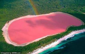
Pink Lake is a salt lake in Western Australia’s Goldfields-Esperance region. Even if the lake’s waters were visibly pink historically, they were no rose since 2017 for over ten years. The concentration of salt in Pink Lake is essential to the pink color and, as conditions alter, Pink Lake could turn pink. It is located approximately 3 km (2 mi) south of Esperance, and the South Coast Highway binds eastwards.
It’s very complicated the dynamics of why a river turns rose. The pond color may be affected by external modifications and climate circumstances. The Pink Lake of Esperance has lost its blue color owing to modifications in the salinity resulting from human activities.
John Septimus Roe, a resident magister in Albany who contributed to the early formation of the colony of West Australia, named Spencer Waterway in 1848 after Sir Richard Spencer. Lake Warden, next door, is reported to be named after Lady Ann Warden Spencer, Sir Richard Spencer’s spouse.
The Lake in the past had a distinct pink hue and was colloquially referred to as Pink Lake until 1966 when the Shire president, Cr W S Paterson, submitted a successful request to the Committee on Geographic Names, which resulted in Lake Spencer becoming officially a Pink Lake. The Pink Lake has been a tourist attraction for many years in the Esperance region, with its surroundings, its arteries and the local companies.
Historically, Pink Lake was the terminal lake in the Lake Warden wetland scheme, where water from the main lake suite (Wheatfield, Woody and Windabout) and Lake Warden would pour periodically into Pink Lake, adding salts to the atmosphere.
Increasing salt concentrations coupled with reducing evaporation water levels during the summer cause the appearance of purple hue that can be seen throughout the nation in ponds. With the building of the railway line and South Coast Highway, Pink Lake lost its link to Lake Warden and the southern lakes.
Commercial salt mining, which started in 1896 and stopped lowering salt concentrations in the lake in 2007. Due to drying in the catchment area connected with neighboring estates, further decreases in the salt concentration of the lake are created by freshwater reaching the scheme through a mixture of surface water inflow and enhanced groundwater inflow.
Where Pink Lake?
Location: Goldfields-Esperance, Western Australia
Basin countries: Australia
Area: 99 ha
Max. width: 2 km (1 mi)
Max. length: 4 km (2 mi)
What causes Pink Lake in Australia?
Due to the green alga Dunaliella salina, halobacterium Halobacteria cutirubrum and/or elevated quantity of brine prawn, the unique color of the water modifications. Once the lake water hits a amount of salinity higher than sea water, the temperature is sufficiently elevated and sufficient light requirements are supplied, the alga starts to produce the red pigment beta carotene. The purple halobacterium grows at the bottom of the lake in the salt crust.
Scientists discovered that pink water bodies such as Lake Hillier contain both halobacteria and a sort of algae called Dunaliella salina that thrives in cold settings such as pink rivers. The red carotenoid pigments that Halobacteria and d have secreted. Salina is accountable for the otherworldly colours of the purple waters. In the Dead Sea, too, these same algae thrive.
Building a highway and a railway line is thought to have changed the flow of water into the lake, decreasing its salinity, which is why it no longer looks purple (as of 2017).
When Pink Lake is Pink?
A pink lake is a red or rose-colored lake. This is often triggered by the existence of algae, such as Dunaliella salina, which generates carotenoids. Due to modifications in natural water stream, decreased evaporation, and salt production, the distinctive color has disappeared — a practice that finished in 2007. But now, in a venture thought to be an Australian first, a group of researchers will explore how to restore the lake to its blue glory.
In fact, swimming in the water of the lake is safe and fun, but for normal tourists it is impossible to do it as the lake can not be visited.
Is there any other Pink Lakes?
Yes. Australia is fortunate enough to have a lot of these natural wonders.
In the distant south of Victoria, a collection of salt lakes in the hot weather transform a beautiful deep pink.
Lakes Crosbie, Becking, Kenyon and Hardy are famous tourist sights in Murray Sunset National Park.
Pink Lake close Dimboola is of special significance to the individuals of Wotjobaluk and the salt is collected by side and marketed there.
Lake Tyrrell, close to Sea Lake, is the biggest salt lake in Victoria and draws tourists from all over the globe as a star-watching place.
There are several purple lakes in Western Australia. The most well-known are Lake Hillier close Esperance and Hutt Lagoon in the midwest of the state.
Every year, Hutt Lagoon draws hundreds of visitors and has become famous with Chinese travelers in particular as touring the lake has become a status symbol in China.
How many Pink Lake in Australia?
There are over 10 pink lakes in Australia, There are four rose beaches in Victoria’s Murray-Sunset National Park, Lake Crosbie, Lake Becking, Lake Kenyon and Lake Hardy, as well as a purple inlet in Western Australia, called Hutt Lagoon, between Geraldton and Kalbarri.
Emerald is a gemstone and a range of green-colored mineral beryl (Be3Al2(SiO3)6) by trace quantities of chromium and sometimes vanadium. On Mohs scale, Beryl has a durability of 7.5–8. Included are the most emeralds, so their toughness (crash resistance) is usually considered poor. The emerald is cyclosilicates. Emerald is an emerald.
The term “emerald” is obtained from Vulgar Latin (via Old French: esmeraude and Middle English: emeraude): esmaralda / esmaraldus, a version of Latin smaragdus which emerged in Ancient Greek (smaragdos).
Emeralds, like all colored gemstones, are graded using four fundamental parameters–the four Cs of knowledge: colour, clarity, cut and weight of the carat. Normally, color is the most significant factor in the grading of colored gemstones. However, transparency is regarded to be a near second in the grading of emeralds. A good emerald must have as outlined below not only a sheer green hue, but also a large degree of transparency to be regarded a top gem.
Emerald’s Color
Color is split into three parts in gemology: hue, saturation, and tone. Emeralds are present in hues varying from yellow-green to blue-green, the main hue being green. The standard secondary hues observed in emeralds are yellow and blue. Emeralds are regarded only gems that are medium to light in color; light-tone gems are regarded as green beryl instead.
On a scale where 0 percent color is colorless and 100 percent opaque white, the best emeralds are about 75 percent color. Moreover, it will saturate a good emerald and have a bright (vivid) colour. Gray is the ordinary modifier of saturation or mask discovered in emeralds; a dull-green hue is a grayish-green hue.
Emerald in the United States
North Carolina and South Carolina
In the United States very few emeralds were mined. Since the late 1800s, North Carolina was a sporadic producer of small amounts of emeralds from a few mines.
Tiffany and Company and a number of landowners operated the Crabtree Emerald mine from 1894 to the 1990s. Many fine, transparent emeralds have been developed and tonnes, slabbed and cabochon cutting, of smart pegmatitis have been marketed as a “emerald matrix.”
In a white matrix of glass and feldspath the cabochons had jade and tourmaline prisms. This page displays a sample of the Crabtree Pegmatite.
North American
A tiny mine close Hiddenite, North America Emerald Mines works in North Carolina. Between 1995 and 2010, the Houston Museum of Natural Science manufactured over 20,000 carats of emeraldean, including six inch length 1.869-carat crystal valuable at $3.5 million.
On the same premises a crushed stone quarry is run by employees watching for hydrothermal vein signs and bags that contain emeralds at times. It is one of the world’s only precious mines that sells rural rock.
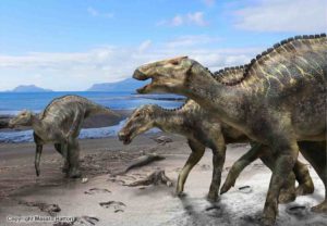
A reconstruction of Kamuysaurus japonicus. Credit: Kobayashi Y., et al, Scientific Reports, September 5, 2019
The dinosaur, whose nearly complete skeleton was unearthed from 72 million year old marine deposits in Mukawa Town in northern Japan, belongs to a new genus and species of a herbivorous hadrosaurid dinosaur, according to the study published in Scientific Reports. The scientists named the dinosaur Kamuysaurus japonicus.
A partial tail of the dinosaur was first discovered in the outer shelf deposits of the Upper Cretaceous Hakobuchi Formation in the Hobetsu district of Mukawa Town, Hokkaido, in 2013. Ensuing excavations found a nearly complete skeleton that is the largest dinosaur skeleton ever found in Japan. It’s been known as “Mukawaryu,” nicknamed after the excavation site.
In the current study, a group of researchers led by Professor Yoshitsugu Kobayashi of the Hokkaido University Museum conducted comparative and phylogenetic analyses on 350 bones and 70 taxa of hadrosaurids, which led to the discovery that the dinosaur belongs to the Edmontosaurini clade, and is closely related to Kerberosaurus unearthed in Russia and Laiyangosaurus found in China.
The research team also found that Kamuysaurus japonicus, or the deity of Japanese dinosaurs, has three unique characteristics that are not shared by other dinosaurs in the Edmontosaurini clade: the low position of the cranial bone notch, the short ascending process of the jaw bone, and the anterior inclination of the neural spines of the sixth to twelfth dorsal vertebrae.
According to the team’s histological study, the dinosaur was an adult aged 9 or older, measured 8 meters long and weighed 4 tons or 5.3 tons (depending on whether it was walking on two or four legs respectively) when it was alive. The frontal bone, a part of its skull, has a big articular facet connecting to the nasal bone, suggesting the dinosaur may have had a crest. The crest, if it existed, is believed to resemble the thin, flat crest of Brachylophosaurus subadults, whose fossils have been unearthed in North America.
The study also shed light on the origin of the Edmontosaurini clade and how it might have migrated. Its latest common ancestors spread widely across Asia and North America, which were connected by what is now Alaska, allowing them to travel between the two continents. Among them, the clade of Kamuysaurus, Kerberosaurus and Laiyangosaurus inhabited the Far East during the Campanian, the fifth of six ages of the Late Cretaceous epoch, before evolving independently.
The research team’s analyses pointed to the possibility that ancestors of hadrosaurids and its subfamilies, Hadrosaurinae and Lambeosaurinae, preferred to inhabit areas near the ocean, suggesting the coastline environment was an important factor in the diversification of the hadrosaurids in its early evolution, especially in North America.
Reference:
Yoshitsugu Kobayashi, Tomohiro Nishimura, Ryuji Takasaki, Kentaro Chiba, Anthony R. Fiorillo, Kohei Tanaka, Tsogtbaatar Chinzorig, Tamaki Sato & Kazuhiko Sakurai. A new Hadrosaurine (Dinosauria: Hadrosauridae) from the Marine Deposits of the Late cretaceous Hakobuchi formation Yezo Group, Japan. Scientific Reportsvolume, 2019 DOI: 10.1038/s41598-019-48607-1
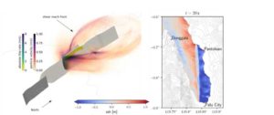
Visualization of the modelled coupled earthquake and tsunami across Palu Bay, from Ulrich et al., 2019: Left: Seismic waves being generated while the earthquake propagates southward in a ‘superfast’ manner. Warm colours denote higher movements across the geological faults and higher ground shaking (snapshot after 15 seconds of earthquake simulation time). Right: The movements of the earthquake beneath the bathtub shaped Palu Bay generate a ‘surprise’ tsunami (snapshot of the water waves aftee 20s of simulation time of the tsunami scenario). Image credit: LMU.
In newly published research, an international team of geologists, geophysicists, and mathematicians show how coupled computer models can accurately recreate the conditions leading to the world’s deadliest natural disasters of 2018, the Palu earthquake and tsunami, which struck western Sulawesi, Indonesia in September last year. The team’s work was published in Pure and Applied Geophysics.
The tsunami was as surprising to scientists as it was devastating to communities in Sulawesi. It occurred near an active plate boundary, where earthquakes are common. Surprisingly, the earthquake caused a major tsunami, although it primarily offset the ground horizontally — normally, large-scale tsunamis are typically caused by vertical motions.
Researchers were at a loss — what happened? How was the water displaced to create this tsunami: by landslides, faulting, or both? Satellite data of the surface rupture suggests relatively straight, smooth faults, but do not cover areas offshore, such as the critical Palu Bay. Researchers wondered — what is the shape of the faults beneath Palu Bay and is this important for generating the tsunami? This earthquake was extremely fast. Could rupture speed have amplified the tsunami?
Using a supercomputer operated by the Leibniz Supercomputing Centre, a member of the Gauss Centre for Supercomputing, the team showed that the earthquake-induced movement of the seafloor beneath Palu Bay itself could have generated the tsunami, meaning the contribution of landslides is not required to explain the tsunami’s main features. The team suggests an extremely fast rupture on a straight, tilted fault within the bay. In their model, slip is mostly lateral, but also downward along the fault, resulting in anywhere from 0.8 metres to 2.8 metres vertical seafloor change that averaged 1.5 metres across the area studied. Critical to generating this tsunami source are the tilted fault geometry and the combination of lateral and extensional strains exerted on the region by complex tectonics.
The scientists come to this conclusion using a cutting-edge, physics-based earthquake-tsunami model. The earthquake model, based on earthquake physics, differs from conventional data-driven earthquake models, which fit observations with high accuracy at the cost of potential incompatibility with real-world physics. It instead incorporates models of the complex physical processes occurring at and off of the fault, allowing researchers to produce a realistic scenario compatible both with earthquake physics and regional tectonics.
The researchers evaluated the earthquake-tsunami scenario against multiple available datasets. Sustained supershear rupture velocity, or when the earthquake front moves faster than the seismic waves near the slipping faults, is required to match simulation to observations. The modeled tsunami wave amplitudes match the available wave measurements and the modeled inundation elevation (defined as the sum of the ground elevation and the maximum water height) qualitatively match field observations. This approach offers a rapid, physics-based evaluation of the earthquake-tsunami interactions during this puzzling sequence of events.
“Finding that earthquake displacements probably played a critical role generating the Palu tsunami is as surprising as the very fast movements during the earthquake itself,” said Thomas Ulrich, PhD student at Ludwig Maximilian University of Munich and lead author of the paper. “We hope that our study will launch a much closer look on the tectonic settings and earthquake physics potentially favouring localized tsunamis in similar fault systems worldwide.”
Reference:
T. Ulrich, S. Vater, E. H. Madden, J. Behrens, Y. van Dinther, I. van Zelst, E. J. Fielding, C. Liang, A.-A. Gabriel. Coupled, Physics-Based Modeling Reveals Earthquake Displacements are Critical to the 2018 Palu, Sulawesi Tsunami. Pure and Applied Geophysics, 2019; DOI: 10.1007/s00024-019-02290-5
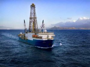
Research vessel JOIDES Resolution off the coast of Hawaii. Credit: International Ocean Discovery Program.
A day is the time for Earth to make one complete rotation on its axis, a year is the time for Earth to make one revolution around the Sun — reminders that basic units of time and periods on Earth are intimately linked to our planet’s motion in space relative to the Sun. In fact, we mostly live our lives to the rhythm of these astronomical cycles.
The same goes for climate cycles. The cycles in daily and annual sunlight cause the familiar diel swings in temperature and the seasons. On geologic time scales (thousands to millions of years), variations in Earth’s orbit are the pacemaker of the ice ages (so-called Milankovitch cycles). Changes in orbital parameters include eccentricity (the deviation from a perfect circular orbit), which can be identified in geological archives, just like a fingerprint.
The dating of geologic archives has been revolutionized by the development of a so-called astronomical time scale, a “calendar” of the past providing ages of geologic periods based on astronomy. For example, cycles in mineralogy or chemistry of geologic archives can be matched to cycles of an astronomical solution (calculated astronomical parameters in the past from computing the planetary orbits backward in time). The astronomical solution has a built-in clock and so provides an accurate chronology for the geologic record.
However, geologists and astronomers have struggled to extend the astronomical time scale further back than about fifty million years due to a major roadblock: solar system chaos, which makes the system unpredictable beyond a certain point.
In a new study published in the journal Science, Richard Zeebe from the University of Hawai’i at Manoa and Lucas Lourens from Utrecht University now offer a way to overcome the roadblock. The team used geologic records from deep-sea drill cores to constrain the astronomical solution and, in turn, used the astronomical solution to extend the astronomical time scale by about 8 million years. Further application of their new method promises to reach further back in time still, one step and geologic record at a time.
On the one hand, Zeebe and Lourens analyzed sediment data from drill cores in the South Atlantic Ocean across the late Paleocene and early Eocene, ca. 58-53 million years ago (Ma). The sediment cycles displayed a remarkable expression of one particular Milankovitch parameter, Earth’s orbital eccentricity. On the other hand, Zeebe and Lourens computed a new astronomical solution (dubbed ZB18a), which showed exceptional agreement with the data from the South Atlantic drill core.
“This was truly stunning,” Zeebe said. “We had this one curve based on data from over 50-million-year-old sediment drilled from the ocean floor and then the other curve entirely based on physics and numerical integration of the solar system. So the two curves were derived entirely independently, yet they looked almost like identical twins.”
Zeebe and Lourens are not the first to discover such agreement — the breakthrough is that their time window is older than 50 Ma, where astronomical solutions disagree. They tested 18 different published solutions but ZB18a gives the best match with the data.
The implications of their work reach much further. Using their new chronology, they provide a new age for the Paleocene-Eocene boundary (56.01 Ma) with a small margin of error (0.1%). They also show that the onset of a large ancient climate event, the Paleocene-Eocene Thermal Maximum (PETM), occurred near an eccentricity maximum, which suggests an orbital trigger for the event. The PETM is considered the best paleo-analog for the present and future anthropogenic carbon release, yet the PETM’s trigger has been widely debated. The orbital configurations then and now are very different though, suggesting that impacts from orbital parameters in the future will likely be smaller than 56 million years ago.
Zeebe cautioned, however, “None of this will directly mitigate future warming, so there is no reason to downplay anthropogenic carbon emissions and climate change.”
Regarding implications for astronomy, the new study shows unmistakable fingerprints of solar system chaos around 50 Ma. The team found a change in frequencies related to Earth’s and Mars’ orbits, affecting their amplitude modulation (often called a “beat” in music).
“You can hear amplitude modulation when tuning a guitar. When two notes are nearly the same, you essentially hear one frequency, but the amplitude varies slowly — that’s a beat,” Zeebe explained. In non-chaotic systems, the frequencies and beats are constant over time, but they can change and switch in chaotic systems (called resonance transition). Zeebe added, “The change in beats is a clear expression of chaos, which makes the system fascinating but also more complex. Ironically, the change in beats is also precisely what helps us to identify the solution and extend the astronomical time scale.”
Reference:
Richard E. Zeebe, Lucas J. Lourens. Solar System chaos and the Paleocene–Eocene boundary age constrained by geology and astronomy. Science, 2019; 365 (6456): 926 DOI: 10.1126/science.aax0612
Earth’s mantle (dark red) lies below the crust (brown layer near the surface) and above the outer core (bright red). Credit: CC image by Argonne National Laboratory via Flickr
Two McGill University astronomers have assembled a “fingerprint” for Earth, which could be used to identify a planet beyond our Solar System capable of supporting life.
McGill Physics student Evelyn Macdonald and her supervisor Prof. Nicolas Cowan used over a decade of observations of Earth’s atmosphere taken by the SCISAT satellite to construct a transit spectrum of Earth, a sort of fingerprint for Earth’s atmosphere in infrared light, which shows the presence of key molecules in the search for habitable worlds. This includes the simultaneous presence of ozone and methane, which scientists expect to see only when there is an organic source of these compounds on the planet. Such a detection is called a “biosignature.”
“A handful of researchers have tried to simulate Earth’s transit spectrum, but this is the first empirical infrared transit spectrum of Earth,” says Prof. Cowan. “This is what alien astronomers would see if they observed a transit of Earth.”
The findings, published Aug. 28 in the journal Monthly Notices of the Royal Astronomical Society, could help scientists determine what kind of signal to look for in their quest to find Earth-like exoplanets (planets orbiting a star other than our Sun). Developed by the Canadian Space Agency, SCISAT was created to help scientists understand the depletion of Earth’s ozone layer by studying particles in the atmosphere as sunlight passes through it. In general, astronomers can tell what molecules are found in a planet’s atmosphere by looking at how starlight changes as it shines through the atmosphere. Instruments must wait for a planet to pass — or transit — over the star to make this observation. With sensitive enough telescopes, astronomers could potentially identify molecules such as carbon dioxide, oxygen or water vapour that might indicate if a planet is habitable or even inhabited.
Cowan was explaining transit spectroscopy of exoplanets at a group lunch meeting at the McGill Space Institute (MSI) when Prof. Yi Huang, an atmospheric scientist and fellow member of the MSI, noted that the technique was similar to solar occultation studies of Earth’s atmosphere, as done by SCISAT.
Since the first discovery of an exoplanet in the 1990s, astronomers have confirmed the existence of 4,000 exoplanets. The holy grail in this relatively new field of astronomy is to find planets that could potentially host life — an Earth 2.0.
A very promising system that might hold such planets, called TRAPPIST-1, will be a target for the upcoming James Webb Space Telescope, set to launch in 2021. Macdonald and Cowan built a simulated signal of what an Earth-like planet’s atmosphere would look like through the eyes of this future telescope which is a collaboration between NASA, the Canadian Space Agency and the European Space Agency.
The TRAPPIST-1 system located 40 light years away contains seven planets, three or four of which are in the so-called “habitable zone” where liquid water could exist. The McGill astronomers say this system might be a promising place to search for a signal similar to their Earth fingerprint since the planets are orbiting an M-dwarf star, a type of star which is smaller and colder than our Sun.
“TRAPPIST-1 is a nearby red dwarf star, which makes its planets excellent targets for transit spectroscopy. This is because the star is much smaller than the Sun, so its planets are relatively easy to observe,” explains Macdonald. “Also, these planets orbit close to the star, so they transit every few days. Of course, even if one of the planets harbours life, we don’t expect its atmosphere to be identical to Earth’s since the star is so different from the Sun.”
According to their analysis, Macdonald and Cowan affirm that the Webb Telescope will be sensitive enough to detect carbon dioxide and water vapour using its instruments. It may even be able to detect the biosignature of methane and ozone if enough time is spent observing the target planet.
Prof. Cowan and his colleagues at the Montreal-based Institute for Research on Exoplanets are hoping to be some of the first to detect signs of life beyond our home planet. The fingerprint of Earth assembled by Macdonald for her senior undergraduate thesis could tell other astronomers what to look for in this search. She will be starting her Ph.D. in the field of exoplanets at the University of Toronto in the Fall.
Reference:
Evelyn J R Macdonald, Nicolas B Cowan. An empirical infrared transit spectrum of Earth: opacity windows and biosignatures. Monthly Notices of the Royal Astronomical Society, 2019; 489 (1): 196 DOI: 10.1093/mnras/stz2047
UH geologists have discovered 10 million years of silence in a chain of volcanoes between Northeast Asia and Russia.
From his geology lab at the University of Houston, Jonny Wu has discovered that a chain of volcanoes stretching between Northeast Asia and Russia began a period of silence 50 million years ago, which lasted for 10 million years. In the journal Geology, Wu, assistant professor of structural geology, tectonics and mantle structure, is reporting that one of the most significant plate tectonic shifts in the Pacific Ocean forced the volcanoes into dormancy.
At the end of the Cretaceous Period, shortly after dinosaurs disappeared, the Pacific Plate, the largest tectonic plate on Earth, mysteriously changed direction. One possible result was the formation of a prominent bend in the Hawaiian Islands chain, and another, just discovered by Wu, was the volcanic dormancy along a 900-mile stretch between Japan and the remote Sikhote-Alin mountain range in Russia in what is known as the Pacific Ring of Fire, where many volcanoes form.
“Around the time of the volcano dormancy, a crack in the Pacific Ocean Plate subducted, or went below, the volcanic margin. The thin, jagged crack in the seafloor was formed by plates moving in opposing directions and when they subduct, they tend to affect volcanic chains,” reports Wu.
When the volcanoes revived 10 million years later, the radiogenic isotopes within the magma were noticeably different.
“The productivity of magma within the once-violent chain of volcanoes was only one-third its previous level,” said Wu, who has linked this phenomenon to the subduction of the Pacific-Izanagi mid-ocean ridge, an underwater mountain.
Scientists have long understood that volcanic activity above subduction zones, where one tectonic plate converges towards and dives beneath another, is driven by water brought deep within the Earth by the diving subducting plate. When the water reaches depths of around 65 miles, it causes the solid mantle to partially melt and produces magma that may rise and feed volcanoes.
“However, in the case of the East Asian volcanoes, subduction of the immense seafloor crack interrupted its water-laden conveyor belt into the deep Earth. As a result, the volcanoes turned off,” said Wu.
Wu and UH doctoral student Jeremy Tsung-Jui Wu, who is not related to Jonny Wu, discovered the dormancy — and the reason for it — after examining a magmatic catalog of 900 igneous rock radio-isotopic values from the Cretaceous to Miocene eras. They also found evidence that the crack in the Pacific Plate was about 50% shorter than originally believed.
Reference:
Jeremy Tsung-Jui Wu, Jonny Wu. Izanagi-Pacific ridge subduction revealed by a 56 to 46 Ma magmatic gap along the northeast Asian margin. Geology, 2019; DOI: 10.1130/G46778.1
Kīlauea lava entry on the southeast coastline of Hawai’i Island as seen from UH research vessel Kaimikai o Kanaloa. Credit: Ryan Tabata, UH.
When Kīlauea Volcano erupted in 2018, it injected millions of cubic feet of molten lava into the nutrient-poor waters off the Big Island of Hawai’i. The lava-impacted seawater contained high concentrations of nutrients that stimulated phytoplankton growth, resulting in an extensive plume of microbes that was detectable by satellite.
A study led by researchers at the University of Hawai’i (UH) at Mānoa and University of Southern California (USC) and published today in the journal Science revealed that this biological response hinged on unexpectedly high concentrations of nitrate, despite the negligible amount of nitrogen in basaltic lava. The research team determined that nitrate was brought to the surface ocean when heat from the substantial input of lava into the ocean warmed nutrient-rich deep waters and caused them to rise up, supplying the sunlit layer with nutrients.
After observing the phytoplankton bloom in satellite images, the UH Mānoa Center for Microbial Oceanography: Research and Education (C-MORE) organized a rapid response oceanographic expedition on UH research vessel Ka’imikai-O-Kanaloa from July 13 to 17, 2018—in the thick of Kilauea’s activity. The team conducted round-the-clock operations in the vicinity of the lava entry region to test water chemistry and the biological response to the dramatic event.
Co-lead authors Sam Wilson at C-MORE and Nick Hawco, a USC researcher who will be joining the UH Mānoa Oceanography Department in January 2020, tested the hypothesis that lava and volcanic dust would stimulate microorganisms that are limited by phosphate or iron, which are chemicals found in lava.
As it turned out, since there was so much lava in the water, the dissolved iron and phosphate combined into particles, making those nutrients unavailable for microbes. Further, deep, heated seawater became buoyant and brought up nitrate which caused other classes of phytoplankton to bloom.
It is possible that this mechanism has led to similar ocean fertilization events in the past associated with the formation of the Hawaiian Islands and other significant volcanic eruptions, the authors suggest. Depending on their location, sustained eruption on this scale could also facilitate a large flux of nitrate from the deep ocean and perturb larger scale ocean circulation, biology and chemistry.
“The expedition in July 2018 provided a unique opportunity to see first-hand how a massive input of external nutrients alters marine ecosystems that are finely attuned to low-nutrient conditions,” said Wilson. “Ecosystem responses to such a substantial addition of nutrients are rarely observed or sampled in real time. UH has a strong tradition of not only volcanic research, but also looking at its impacts on the surrounding environment such as the ocean, groundwater, atmosphere. This latest piece of research improves our understanding of lava-seawater interactions within the much broader context of land-ocean connections.”
“Science is a team sport,” said Dave Karl, senior author and co-director of the UH Mānoa Simons Collaboration on Ocean Processes and Ecology (SCOPE). “SCOPE emphasizes collaboration, where scientists with complementary skills came together to complete this unique, interdisciplinary project.”
In the future, the team hopes to sample the newly-formed ponds at the bottom of the Halema’uma’u crater and further investigate lava-seawater interactions in the laboratory.