Home Blog Page 7

Ancient trilobite limbs reveal unique walking and burrowing abilities in prehistoric seas

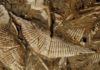
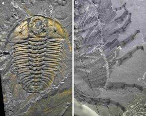
a, A complete specimen with antennae and limbs (USNM PAL 65510). b, Limbs of GSC 34695a showing various degrees of flexure and extension. Credit: Sarah R. Losso

The Burgess Shale in British Columbia is renowned for its exceptional preservation of soft tissues in fossils, including limbs and guts. While trilobites are abundant in the fossil record thanks to their hard exoskeleton, their soft limbs are rarely preserved and poorly understood. However, Olenoides serratus, a particularly abundant and well-preserved Burgess Shale trilobite, offers a unique opportunity to study these appendages.

In a new study published in BMC Biology, researchers led by Sarah Losso, postdoctoral fellow in the Department of Organismic and Evolutionary Biology (OEB) at Harvard, analyzed 156 limbs from 28 O. serratus fossil specimens to reconstruct the precise movement and function of these ancient arthropod appendages—shedding light on one of the planet’s earliest and most successful animals.

“Understanding behavior and movement of fossils is challenging, because you cannot observe this activity like in living animals,” said Losso. “Instead, we had to rely on carefully examining the morphology in as many specimens as possible, as well as using modern analogs to understand how these ancient animals lived.”

Arthropods have jointed legs composed of multiple segments that can reach upwards (extend) or downwards (flex). The range of motion depends on the difference between how far each joint can reach in either direction. This range, along with the leg and shape of each segment, determines how the animal uses the limb for walking, grabbing, and burrowing.

Horseshoe crabs, common arthropods found along the eastern shore of North America, are frequently compared to trilobites even though they are not closely related. Horseshoe crabs belong to a different branch of the arthropod tree, more closely related to spiders and scorpions, whereas trilobites’ family ties remain uncertain. The comparison is due to the similarity in that both animals patrol the ocean floor on jointed legs. The results, however, showed less similarity between the two animals.

Unlike horseshoe crabs, whose limb joints alternate in their specialization for flexing and extending—a pattern that facilitates both feeding and protection—O. serratus displayed a simpler, but highly functional limb design.

“We found that the limbs of O. serratus had a smaller range of extension and only in the part of the limb farther from the body,” explained Losso. Although their limbs were not used in exactly the same way as horseshoe crabs, Olenoides could walk, burrow, bring food towards its mouth, and even raise its body above the seafloor.

To bring their findings to life, the team created sophisticated 3D digital models based on hundreds of fossil images preserved at different angles. Because fossilized trilobite limbs are usually squashed flat, reconstructing them in three-dimensions posed a challenge.

“We relied on exceptionally well-preserved specimens, comparing limb preservation across many angles and filling in missing details using related fossils,” said senior author Professor Javier Ortega-Hernández, also in OEB.

The team compared the shape of trace fossils with the movement of the limbs.

“Olenoides serratus could create trace fossils of different depths using different movements,” Losso explained. “They could raise their body above the sediment in order to walk over obstacles or to move more efficiently in fast-flowing water.”

Surprisingly, the researchers discovered that the male species also had specialized appendages used for mating, and that each leg also had a gill used for breathing.

While more than 22,000 species of trilobites have been described, less than 0.2% show any trace of legs at all. Nevertheless, lack of preservation does not imply these ancient arthropods went legless—rather, their soft limbs simply seldom survived the fossilization process. The rare conditions of the Burgess Shale—a fast burial by underwater landslides cutting off oxygen—were key to capturing such fleeting biological details.

The study provides a rare window into a more dynamic picture of life more than half a billion years ago, as trilobites like Olenoides serratus scuttled across the seabed with sophisticated limbs that could burrow and foraged through prehistoric seas, revealing not just how they survived, but how they thrived.

Reference:
Sarah R. Losso et al, Quantification of leg mobility in the Burgess Shale Olenoides serratus indicates functional differences between trilobite and xiphosuran appendages, BMC Biology (2025). DOI: 10.1186/s12915-025-02335-3

Note: The above post is reprinted from materials provided by Harvard University.
Fossilized reindeer tooth reveals glacial-era fauna in ancient Iberian Peninsula

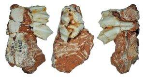
The Atapuerca Reindeer Fossil: an Upper Deciduous Third Molar from a Juvenile . Credit: Jan van der Made

A fossilized tooth recovered from the Galería site in the Sierra de Atapuerca (Burgos, Spain) confirms that reindeer (Rangifer) inhabited this area of the Iberian Peninsula between 243,000 and 300,000 years ago. It represents one of the southernmost reindeer remains ever found in Eurasia and constitutes the earliest record of glacial fauna in the Iberian Peninsula, according to a study published today in the journal Quaternary.

The presence of cold-adapted species such as reindeer at these latitudes indicates that the climate at that time was glacial. The fossil was uncovered in Galería’s GIIIa unit, in the same layer as a human cranial fragment and numerous lithic artifacts, confirming that this species coexisted with early human populations.

This discovery, carried out by researchers from the Museo Nacional de Ciencias Naturales (MNCN-CSIC); the Centro Nacional de Investigación sobre la Evolución Humana (CENIEH), and the Institut Català de Paleoecologia Humana i Evolució Social (IPHES-CERCA), demonstrates that glacial fauna extended into the Iberian Peninsula, which—like other southern European peninsulas—served as a refuge for species not adapted to cold climates.

“This fossil helps to refine the dating of the site’s stratigraphic levels, but it also provides evidence of the intensity of the glacial periods that affected the peninsula’s inhabitants during the Pleistocene,” explains Jan van der Made, a researcher at MNCN-CSIC. “The presence of this reindeer at such a latitude indicates that extreme cold may have impacted Iberian fauna earlier and more severely than previously thought,” he adds.

The most recent glaciations expanded the ecosystem known as the “Mammoth Steppe,” which hosted not only these large proboscideans but also woolly rhinoceroses and reindeer. Some of these species reached as far south as Madrid and even Granada, well below the latitude of Atapuerca.

“This work highlights the importance of studying the biogeographic patterns of glacial fauna, allowing us to better understand the adaptive capacity of human populations during the Middle Pleistocene, roughly between 125,000 and 800,000 years ago,” concludes Ignacio Aguilar Lazagabaster, a researcher at CENIEH.

Reference:
Jan van der Made et al, Southernmost Eurasian Record of Reindeer (Rangifer) in MIS 8 at Galería (Atapuerca, Spain): Evidence of Progressive Southern Expansion of Glacial Fauna Across Climatic Cycles, Quaternary (2025). DOI: 10.3390/quat8030043

Note: The above post is reprinted from materials provided by Spanish National Research Centre for Human Evolution.

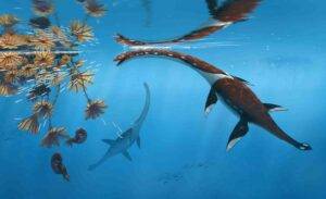
New long-necked marine reptile species discovered in Germany’s famous Jurassic fossil beds

Plesionectes longicollum. Credit: Peter Nickolaus

Paleontologists have identified a new species of ancient marine reptile from Germany’s world-renowned Posidonia Shale fossil beds, expanding our understanding of prehistoric ocean ecosystems that existed nearly 183 million years ago.

An article detailing the discovery has been published in PeerJ.

The newly classified species, named Plesionectes longicollum (“long-necked near-swimmer”), represents a previously unknown type of plesiosauroid—the group of long-necked marine reptiles that inhabited Earth’s oceans during the age of dinosaurs.

The specimen is a nearly complete skeleton that even preserves remnants of fossilized soft tissue. It was originally excavated in 1978 from a quarry in Holzmaden, Southwest Germany, but its unique anatomical features have only now been fully recognized through comprehensive scientific analysis.

“This specimen has been in collections for decades, but previous studies never fully explored its distinctive anatomy,” said Sven Sachs of the Naturkunde-Museum Bielefeld, the study’s lead author. “Our detailed examination revealed an unusual combination of skeletal features that clearly distinguish it from all previously known plesiosaurs.”

The research, published by Sven Sachs and co-author Dr. Daniel Madzia from the Polish Academy of Sciences, demonstrates that the Posidonia Shale—already famous for its exceptionally preserved fossils—contained even greater marine reptile diversity than previously recognized.

The Plesionectes specimen is particularly significant as it represents the oldest known plesiosaur from the Holzmaden area. Despite being an immature individual, its distinctive anatomical characteristics were not significantly affected by its developmental stage, warranting classification as an entirely new genus and species.

“This discovery adds another piece to the puzzle of marine ecosystem evolution during a critical time in Earth’s history,” explained Dr. Madzia. “The early Toarcian period when this animal lived was marked by significant environmental changes, including a major oceanic anoxic event that affected marine life worldwide.”

The fossil is permanently housed at the Staatliches Museum für Naturkunde Stuttgart (Stuttgart State Museum of Natural History) where it is cataloged as specimen SMNS 51945.

The Posidonia Shale at Holzmaden has previously yielded five other plesiosaur species, including representatives from all three major plesiosaur lineages. This new addition further cements the formation’s status as one of the world’s most important windows into Jurassic marine life.

Reference:
An unusual early-diverging plesiosauroid from the Lower Jurassic Posidonia Shale of Holzmaden, Germany, PeerJ (2025). DOI: 10.7717/peerj.19665

Note: The above post is reprinted from materials provided by PeerJ.

Tiny fossils lead to smarter robots with automated sorting

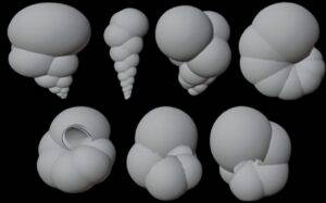
Credit: Sanjana Banerjee, NC State University

Researchers have demonstrated a technique that geometrically models organic objects and creates photorealistic, three-dimensional (3D) images of those objects. These mathematically precise images can be used to engineer robotic systems capable of identifying and sorting these complex shapes autonomously.

The technique was created to improve robotic systems that sort and identify microscopic marine fossils used in climate research, but could serve as a blueprint for applications in a range of other fields.

The paper, “Foram3D: A Pipeline for 3D Synthetic Data Generation and Rendering of Foraminifera for Image Analysis and Reconstruction,” is published in the journal Marine Micropaleontology.

“We demonstrated the functionality of this technique in two ways: in a robotic system for 3D imaging of these microscopic marine fossils and in a robotic system for identification of the fossils,” says Edgar Lobaton, co-author of a paper on the work and a professor of electrical and computer engineering at North Carolina State University. “And identifying these fossils is very challenging, which is what led us to this work in the first place.”

At issue are foraminifera, or forams, which have been prevalent in Earth’s oceans for more than 100 million years. Forams are protists, neither plant nor animal, and when they die, they leave behind their tiny shells. These shells give scientists insights into the characteristics of the oceans as they existed when the forams were alive.

For example, different types of foram species thrive in different kinds of ocean environments, and chemical measurements can tell scientists about everything from the ocean’s chemistry to its temperature when the shell was being formed.

However, evaluating foram shells and fossils is both tedious and time consuming—imagine sorting through hundreds of similarly shaped objects that are less than a millimeter wide. This is why paleontology researchers want to automate the process. And the nature of the challenge caught the interest of Lobaton.

“We had already developed a fully functional robotic system for identifying and sorting forams, called Forabot,” Lobaton says. “And creating Forabot taught us that the most time-consuming aspect of the process is fine-tuning the hardware and how it is laid out.

“What size should each component be? What is the best configuration of components? There are a million variations you may want to tweak. The work we’re sharing here was developed specifically to address that challenge, because we wanted to find a more efficient way to improve Forabot.”

By capturing 3D facsimiles of these fossils with incredible precision, the researchers can use those facsimiles in simulations of the robotic system.

“You can make adjustments in the simulation far more easily than when working with actual hardware,” Lobaton says. “And once you have optimized the configuration of the system in the simulation, the process of fine-tuning the hardware in the real world is vastly easier—you already know how it should be set up.”

For this work, the researchers modified a mathematical model so that it can produce detailed 3D facsimiles of the fossils. Lobaton’s team then worked with a paleontologist to ensure the facsimiles corresponded to the characteristics of seven representative species of foraminifera.

The researchers then turned to a simulation of Forabot. Using the newly captured 3D facsimiles to explore modifications to Forabot’s system, the researchers were able to improve its accuracy from 82% to 89%—without having to go through the time-consuming process of repeatedly reconfiguring the hardware in their lab.

“Using our synthetic dataset, we were able to test how state-of-the-art AI models can reconstruct 3D shapes from just a sparse set of 2D images,” says Sanjana Banerjee, corresponding author of the paper and a Ph.D. student at NC State.

“These simulations helped us understand the best imaging conditions and are now guiding the development of a new robotic system focused on 3D reconstruction—an essential step toward further automating the identification of these microfossils.”

“Our work provides a strong foundation for studying the growth and morphology of a wide range of foraminifera species,” Banerjee says. “It also tackles major challenges in micropaleontology, such as limited data availability and accurate shape recovery.”

“More broadly, the approach we took here could be used to develop or optimize any robotic system that identifies or sorts objects with complex shapes,” Lobaton says. “Potential use cases include microbe and pathogen isolation at the microscopic scale and sorting of agricultural produce at a larger scale.”

The researchers have made the code base used in this work open source, so other researchers can make use of it. That can be found at: https://github.com/ARoS-NCSU/Forams-3DGeneration.

The paper was co-authored by Turner Richmond, a former Ph.D. student at NC State; Michael Daniele, an associate professor of electrical and computer engineering at NC State; and Thomas Marchitto, a professor of geological sciences at the University of Colorado, Boulder.

Reference:
Sanjana Banerjee et al, Foram3D: A pipeline for 3D synthetic data generation and rendering of foraminifera for image analysis and reconstruction, Marine Micropaleontology (2025). DOI: 10.1016/j.marmicro.2025.102486

Note: The above post is reprinted from materials provided by North Carolina State University.

Clues for dinosaurs’ diets found in the chemistry of their fossil teeth

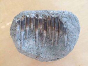
A set of Diplodocus teeth sampled by researcher Liam Norris. Credit: Liam Norris

You are what you eat, it turns out—even if your last meal was 150 million years ago.

While the grub itself may be long gone, a record of dinosaurs’ favorite foods has been stowed away in their ancient tooth enamel over the last eon. When researchers at The University of Texas at Austin took a close look, they discovered that some dinosaurs were discerning eaters, with different species preferring different plant parts.

Tooth enamel contains calcium isotopes that reflect the range of foods the dinosaurs ate; different types of plants have different chemical signatures, and discrete parts of trees—from buds to bark—can also have unique signatures. According to the study’s lead author Liam Norris, the results help explain how so many behemoth creatures all lived together in the same area at the same time.

“The ecosystem that I studied has been a mystery for a long time because it has these giant herbivores all coexisting,” said Norris, a recent doctoral graduate at UT’s Jackson School of Geosciences. “The idea is that they were all eating different things, and now we have found proof of that.”

The findings are published in Palaeogeography, Palaeoclimatology, Palaeoecology.

Norris inspected teeth from four dinosaur species and one crocodyliform, both herbivores and carnivores, that roamed the Western U.S. during the Late Jurassic. The plant-eaters are the long-necked Camarasaurus; the short-armed Camptosaurus; and the trunk-legged Diplodocus. The meat-eaters are the bipedal Allosaurus and the comparatively small, crocodile-like Eutretauranosuchus. The bones and teeth of these ancient creatures were all found in the Carnegie Quarry deposit in northeast Utah, which is thought to have formed during an extreme drought in as little as six months to a few thousand years.

“We were very lucky to be able to study fossils of dinosaurs that lived together and were all rapidly preserved in a single deposit,” said Rowan Martindale, an associate professor at the Jackson School’s Department of Earth and Planetary Sciences. “The Jurassic tomb preserved a unique paleontological gem and these skeletons are beautifully displayed at Dinosaur National Monument.”

Norris, who now works at the Texas Science & Natural History Museum, studied teeth from 17 individual animals across these five species. The specimens were loaned by the Utah Field House of Natural History State Park Museum or accessed in the field at Dinosaur National Monument. He shaved off a dusting of their enamel, which he took back to the Jackson School for calcium isotope analysis. Jackson School Professor John Lassiter and Radiogenic Isotope Laboratory Manager Aaron Satkoski, both co-authors on the paper, helped to analyze and interpret these data.

Previously, scientists believed that large herbivorous dinosaurs coexisted by munching on different levels of the tree canopy according to height. However, Norris’s research shows that plant height wasn’t the only factor driving the differentiation of their diets—instead, it was specific plant parts.

For example, Norris found that the Camptosaurus was a rather discerning eater, preferring softer, more nutritious plant parts such as leaves and buds. The Camarasaurus ate mostly conifers, with a preference for woody plant tissues. The Diplodocus ate more of a mixed diet that included soft ferns and horsetail plants lower to the ground, as well as tougher plant parts.

“This differentiation in diet makes sense with what we see from the morphology of these animals: the different heights, the different snout shapes. Then, we bring in this geochemical data, which is a very concrete piece of evidence to add to that pot,” Norris said.

This research also provides interesting food for thought for a theory about long-necked dinosaurs having flexible necks that could be used to reach many areas of vegetation without having to expend the energy to move the rest of their bodies. This research, which shows that the dinosaurs ate from different levels of the tree canopy, furthers that line of thinking.

The carnivores in the study—the Allosaurus and Eutretauranosuchus—had an overlap in calcium isotope values, which could mean that they ate some of the same things. However, the results also showed that the Eutretauranosuchus is more likely to have eaten fish, while the Allosaurus primarily ate herbivorous dinosaurs—possibly including the three other dinosaur species mentioned in this study.

For this ancient ecosystem to have supported so many enormous dinosaurs with such specific dietary proclivities helps to paint a picture of the vegetation and plant productivity of the time.

“It’s really just more proof that this ecosystem was as spectacular as we thought it was,” Norris said.

Henry Fricke of Colorado College also co-authored the study.

Reference:
Liam Norris et al, Calcium isotopes reveal niche partitioning within the dinosaur fauna of the Carnegie Quarry, Morrison Formation, Palaeogeography, Palaeoclimatology, Palaeoecology (2025). DOI: 10.1016/j.palaeo.2025.113103Liam Norris et al, Calcium isotopes reveal niche partitioning within the dinosaur fauna of the Carnegie Quarry, Morrison Formation, Palaeogeography, Palaeoclimatology, Palaeoecology (2025). DOI: 10.1016/j.palaeo.2025.113103

Note: The above post is reprinted from materials provided by University of Texas at Austin

Recreating Mazon Creek’s 300-million-year-old ecosystem

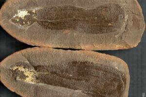
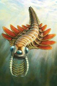
A Tully Monster (Tullimonstrum gregarium). Credit: University of Missouri

More than 300 million years ago, during the Carboniferous Period, much of northern Illinois outside Chicago — including what is now the Mazon Creek (“muh-ZAHN”) fossil site — was alive with ancient creatures thriving in lush, tropical swamps, river deltas and shallow seas.

Now, researchers at the University of Missouri’s College of Arts and Science are collaborating with geologist Gordon Baird to reanalyze his massive fossil collection from Mazon Creek — currently housed at the Field Museum in Chicago — which includes 300,000 siderite concretions from around 350 different localities.

The Mazon Creek fossil beds are renowned for their exceptional preservation of both plants and animals, made possible by their unique geological setting. The fossils are encased in siderite — an iron carbonate mineral — forming abundant concretions that have become a treasure trove for scientists and avocational fossil hunters alike.

Thanks to decades of research at Mazon Creek, including foundational fieldwork by Baird and colleagues in the late 1970s, we now have an extraordinary view of life along that ancient coast.

A snapshot of ancient life

Baird’s original work at the Mazon Creek fossil site helped distinguish two major faunal assemblages, or groups of animal remains. These assemblages helped scientists understand the ancient environments where the fossils originated. They were a marine assemblage comprised of life in offshore coastal waters, and a mixed assemblage from a river delta along the shoreline, where freshwater organisms and washed-in terrestrial plants and animals were preserved together.

Now, Mizzou’s team has confirmed a slightly more nuanced view of Baird’s original findings, using modern data analysis techniques coupled with advanced imaging at Mizzou’s X-ray Microanalysis Core.

“We found three readily identifiable paleoenvironments, including the unique characteristics of a benthic marine assemblage representing a transitional habitat between the nearshore and offshore zones,” said Jim Schiffbauer, Marie M. and Harry L. Smith Endowed Professor of Geological Sciences. “These ancient environments were each dominated by specific groups of animals, for example freshwater animals nearest to shore, jellyfish and sea anemones further offshore, and marine clams and worms in the transitional zone.”

The fossils formed during a phase of sea-level rise and flooding of what used to be large coal swamps.

“The different environments affected how quickly and deeply organisms were buried, and in what specific geochemical conditions fossilization may have started,” Schiffbauer said. “That, in turn, shaped where certain microbes lived and helped form the minerals that make up the concretions surrounding these fossils today.”

Next steps

In current and future research, Schiffbauer and Baird are using this information to create a sedimentological model to show how the Mazon Creek ecosystem connects to the Colchester coal layers below — where coal mining led to the fossil site’s original discovery.

“Given that multiple episodes of rapid coastal drowning events occurred in the U.S. midcontinent during the Carboniferous Period, refinement of information from the Mazon Creek locality will lead to a deeper understanding of similar deposits in other coal basins,” said Baird, who is now an emeritus professor at State University of New York at Fredonia.

Mizzou’s new collaborative analysis with Baird, colleagues from the private sector and the University of Toronto is the most comprehensive and data-driven picture of what Mazon Creek’s ancient ecosystem looked like long ago. This knowledge contributes significantly to our understanding of the Carboniferous Period’s biodiversity and paleoecology.

“It offers a real snapshot of the incredible diversity present in the late Carboniferous Period and allows for inferences about the complexity of food chains and how this ecosystem functioned,” Schiffbauer said. “Now, we have an unparalleled and statistically supported look at the interconnected terrestrial, estuarine and marine life of the Carboniferous Period.”

The study, “283,821 concretions, how do you measure the Mazon Creek? Assessing the paleoenvironmental and taphonomic nature of the Braidwood and Essex assemblages,” was published in the journal Paleobiology.

Other co-authors are John Warren Huntley and Tara Selly at Mizzou; Charles Chabica at Northeastern Illinois University; Marc Laflamme at University of Toronto Mississauga; and A. Drew Muscente at Princeton Consultants, Inc.

Reference:
James Schiffbauer, Gordon C. Baird, John Warren Huntley, Tara Selly, Charles W. Shabica, Marc Laflamme, A. Drew Muscente. 283,821 concretions, how do you measure the Mazon Creek? Assessing the paleoenvironmental and taphonomic nature of the Braidwood and Essex assemblages. Paleobiology, 2025; 1 DOI: 10.1017/pab.2025.10045

Note: The above post is reprinted from materials provided by University of Missouri-Columbia.

Ancient predators and giant amphibians found in African fossil treasure trove

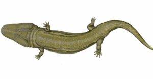
The tracks may have been made by a giant temnospondyl like Uranocentrodon senekalensis. Image © Dmitry Bogdanov, licensed under CC BY 3.0 via Wikimedia Commons

An international team of paleontologists has spent more than 15 years excavating and studying fossils from Africa to expand our understanding of the Permian, a period of Earth’s history that began 299 million years ago and ended 252 million years ago with our planet’s largest and most devastating mass extinction. Led by researchers at the University of Washington and the Field Museum of Natural History, the team is identifying the animals that thrived in southern Pangea — the planet’s single supercontinent at the time — just before the so-called “Great Dying” wiped out about 70% of terrestrial species, and an even larger fraction of marine ones.

“This mass extinction was nothing short of a cataclysm for life on Earth, and changed the course of evolution,” said Christian Sidor, a UW professor of biology and curator of vertebrate paleontology at the UW Burke Museum of Natural History & Culture. “But we lack a comprehensive view of which species survived, which didn’t, and why. The fossils we have collected in Tanzania and Zambia will give us a more global perspective on this unprecedented period in our planet’s natural history.”

Sidor and Kenneth Angielczyk, curator of paleomammalogy at the Field Museum, are co-editors of a 14-article series published Aug. 7 in the Journal of Vertebrate Paleontology featuring the team’s recent discoveries about the myriad of animals that made Permian Africa their home. These include saber-toothed predators, burrowing foragers and a large, salamander-like creature.

All these finds were excavated in three basins across southern Africa: the Ruhuhu Basin in southern Tanzania, the Luangwa Basin in eastern Zambia and the Mid-Zambezi Basin in southern Zambia. Most were discovered by team members on multiple, month-long excavation trips to the region over the past 17 years. Others were analyses of specimens dug up decades prior that had been stored in museum collections.

“These parts of Zambia and Tanzania contain absolutely beautiful fossils from the Permian,” said Sidor. “They are giving us an unprecedented view of life on land leading up to the mass extinction.”

Starting in 2007, Sidor and his team, including UW students and postdoctoral researchers, made five trips to the Ruhuhu Basin and four to the Mid-Zambezi and Luangwa basins, all in cooperation with the Tanzanian and Zambian governments. The researchers trekked between field sites miles apart to collect fossils. They stayed in villages or camped in the open — once waking during the night to the ground-quaking stomps of a nearby elephant herd. All fossils collected by the team will be returned to Tanzania and Zambia after researchers have completed their analyses.

The Permian is the endpoint of what paleontologists call the Paleozoic Era. During this time, animal life — which evolved first in Earth’s oceans — began to colonize land and complex terrestrial ecosystems developed. By the Permian, a diverse array of amphibian and reptile-like creatures roamed environments ranging from early forests to arid valleys. The end-Permian mass extinction — whose precise cause scientists are still debating — obliterated many of these ecosystems and ushered in the Mesozoic Era, which saw the evolution of dinosaurs, as well as the first birds, flowering plants and mammals.

For decades, scientists’ best understanding of the Permian, the Great Dying and the start of the Mesozoic came from the Karoo Basin in South Africa, which contains a near-complete fossil record of periods before and after the mass extinction. But beginning in the 1930s, paleontologists realized that basins in Tanzania and Zambia contain fossil records of this time range that are almost as pristine as the Karoo’s. The excavation trips by Sidor, Angielczyk and their colleagues represent the largest analysis to date of the region’s fossil record from before and after the Great Dying. In 2018, they published a comprehensive analysis of the post-Permian animals of the Ruhuhu and Luangwa basins. These new papers look further back into the Permian.

“The number of specimens we’ve found in Zambia and Tanzania is so high and their condition is so exquisite that we can make species-level comparisons to what paleontologists have found in South Africa,” said Sidor. “I know of no better place on Earth for getting sufficient detail of this time period to make such detailed conclusions and comparisons.”

The team’s papers describe a number of new species of dicynodonts. These small, burrowing, reptile-like herbivores first evolved in the mid-Permian. By the time of the mass extinction, dicynodonts — many of whom sported a beak-like snout with two small tusks that likely aided burrowing — were the dominant plant-eaters on land. The team’s findings also include several new species of large, saber-toothed predators called gorgonopsians, as well as a new species of temnospondyl, a large salamander-like amphibian.

“We can now compare two different geographic regions of Pangea and see what was going on both before and after the end-Permian mass extinction,” said Sidor. “We can really start to ask questions about who survived and who didn’t.”

In addition to the UW and the Field Museum, the team includes scientists from the University of Chicago, Loyola University Chicago, Idaho State University, the National Museum of Natural History in Paris, Carleton University, the University of Southern California, the University of the Witwatersrand in South Africa, the Iziko South African Museum, Southern Methodist University, the North Carolina Museum of Natural Sciences, the Museum for Natural History in Berlin, the U.S. Geological Survey, the University of Oklahoma, the National Heritage Conservation Commission in Lusaka, Virginia Tech, and the Chipembele Wildlife Education Center in Mfume, Zambia. Seven of these scientists are former UW postdoctoral researchers, doctoral students or undergraduate students. The research was funded by the U.S. National Science Foundation and the National Geographic Society.

References:

  1. Christian A. Sidor, Kenneth D. Angielczyk. Introduction to vertebrate evolution in the Permian rift basins of Tanzania and Zambia. Journal of Vertebrate Paleontology, 2025; 45 (sup1) DOI: 10.1080/02724634.2024.2446616
  2. Roger M. H. Smith, Christian A. Sidor, Kenneth D. Angielczyk, Sterling J. Nesbitt, J-Sébastien Steyer, Neil J. Tabor. Origin of conglomerate-hosted bonebeds at the base of the upper Permian Usili Formation, Ruhuhu Basin, Tanzania. Journal of Vertebrate Paleontology, 2025; 45 (sup1) DOI: 10.1080/02724634.2025.2466442
  3. J.-Sébastien Steyer, Christian A. Sidor. The first Paleozoic temnospondyl from Zambia: a new species of Rhineceps from the Permian Madumabisa Mudstone Formation, Mid-Zambezi Basin. Journal of Vertebrate Paleontology, 2025; 45 (sup1) DOI: 10.1080/02724634.2025.2451312
  4. Xavier A. Jenkins, Claire Browning, Jonah Choiniere, Brandon R. Peecook. A new moradisaurine captorhinid from the Upper Permian (Lopingian) upper Madumabisa Mudstone Formation (Luangwa Basin) of Zambia. Journal of Vertebrate Paleontology, 2025; 45 (sup1) DOI: 10.1080/02724634.2024.2427529
  5. Christian F. Kammerer, Kenneth D. Angielczyk, Jörg Fröbisch. Permian origins of the Lystrosauridae (Therapsida: Dicynodontia). Journal of Vertebrate Paleontology, 2025; 45 (sup1) DOI: 10.1080/02724634.2025.2451813
  6. Henry N. Thomas, Kenneth D. Angielczyk, Brandon R. Peecook. The first geikiid dicynodont, Aulacephalodon kapoliwacela , sp. nov. (Therapsida, Anomodontia), from the upper Madumabisa Mudstone Formation, Zambia. Journal of Vertebrate Paleontology, 2025; 45 (sup1) DOI: 10.1080/02724634.2024.2446603
  7. Kenneth D. Angielczyk, Benjamin K. A. Otoo. A new cryptodont dicynodont (Therapsida, Anomodontia) from the Lopingian Usili Formation, Ruhuhu Basin, Tanzania. Journal of Vertebrate Paleontology, 2025; 45 (sup1) DOI: 10.1080/02724634.2024.2441898
  8. Brenlee K. Shipps, Christian A. Sidor, Kenneth D. Angielczyk. Dicynodontoides kubwa , sp. nov. (Synapsida: Anomodontia), a new large emydopoid from the base of the Usili Formation (Ruhuhu Basin, Tanzania). Journal of Vertebrate Paleontology, 2025; 45 (sup1) DOI: 10.1080/02724634.2024.2440112
  9. Caroline P. Abbott, Selena A. Martinez, Jacqueline K. Lungmus, Isaac Magallanes, Kenneth D. Angielczyk. The postcranial anatomy of Kembawacela kitchingi (Therapsida, Anomodontia) and the functional diversity of cistecephalid forelimbs. Journal of Vertebrate Paleontology, 2025; 45 (sup1) DOI: 10.1080/02724634.2025.2486068
  10. Zoe T. Kulik. Bone histology of a gorgonopsian skeleton from the upper Madumabisa Mudstone Formation, Zambia. Journal of Vertebrate Paleontology, 2025; 45 (sup1) DOI: 10.1080/02724634.2025.2490799
  11. Alex Acker, Brandon R. Peecook, Christian A. Sidor, Megan R. Whitney. The first occurrence of Cyonosaurus (Therapsida, Gorgonopsia) from the Luangwa Basin of Zambia. Journal of Vertebrate Paleontology, 2025; 45 (sup1) DOI: 10.1080/02724634.2024.2444407
  12. Arjan Mann, Christian A. Sidor. Arctops umulunshi , sp. nov. (Therapsida: Gorgonopsia) from the upper Madumabisa Mudstone Formation of Zambia, with new information on gorgonopsian postcranial anatomy. Journal of Vertebrate Paleontology, 2025; 45 (sup1) DOI: 10.1080/02724634.2024.2444405
  13. Adam K. Huttenlocker, Claire Browning, Brandon R. Peecook, Roger M. H. Smith, Pia A. Viglietti. The stratigraphic record of the therocephalian Theriognathus (Synapsida) and its utility as a biostratigraphic index in Karoo-Aged basins. Journal of Vertebrate Paleontology, 2025; 45 (sup1) DOI: 10.1080/02724634.2024.2441899
  14. Brandon R. Peecook, Christian A. Sidor, Julia A. McIntosh, Pia A. Viglietti, Roger M. H. Smith, Neil J. Tabor, Christian F. Kammerer, Jacqueline K. Lungmus, Joseph Museba, Stephen Tolan, Megan R. Whitney, Kenneth D. Angielczyk. Successive assemblages of upper Permian vertebrates in the upper Madumabisa Mudstone Formation of the Luangwa Basin, Zambia. Journal of Vertebrate Paleontology, 2025; 45 (sup1) DOI: 10.1080/02724634.2025.2486065

Note: The above post is reprinted from materials provided by University of Washington.

332 colossal canyons just revealed beneath Antarctica’s ice

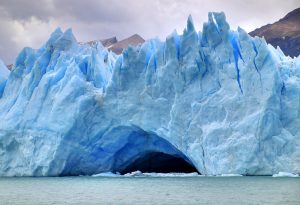
Representative Image: A Glacier cave on Perito Moreno Glacier, in Los Glaciares National Park, southern Argentina. Credit: Martin St-Amant/Wikipedia

Submarine canyons are among the most spectacular and fascinating geological formations to be found on our ocean floors, but at an international level scientists have yet to uncover many of their secrets, especially of those located in remote regions of the Earth like the North and South Poles. Now, an article published in the journal Marine Geology has brought together the most detailed catalogue to date of Antarctic submarine canyons, identifying a total of 332 canyon networks that in some cases reach depths of over 4,000 meters.

The catalogue, which identifies five times as many canyons as previous studies had, was produced by the researchers David Amblàs, of the Consolidated Research Group on Marine Geosciences at the Faculty of Earth Sciences of the University of Barcelona, and Riccardo Arosio, of the Marine Geosciences Research Group at University College Cork. Their article shows that Antarctic submarine canyons may have a more significant impact than previously thought on ocean circulation, ice-shelf thinning and global climate change, especially in vulnerable areas such as the Amundsen Sea and parts of East Antarctica.

Submarine canyons: the differences between East and West Antarctica

The submarine canyons that form valleys carved into the seafloor play a decisive role in ocean dynamics: they transport sediments and nutrients from the coast to deeper areas, they connect shallow and deep waters and they create habitats rich in biodiversity. Scientists have identified some 10,000 submarine canyons worldwide, but because only 27% of the Earth’s seafloor has been mapped in high resolution the real total is likely to be higher. And despite their ecological, oceanographic, and geological value, submarine canyons remain underexplored, especially in polar regions.

“Like those in the Arctic, Antarctic submarine canyons resemble canyons in other parts of the world,” explains David Amblàs. “But they tend to be larger and deeper because of the prolonged action of polar ice and the immense volumes of sediment transported by glaciers to the continental shelf.” Moreover, the Antarctic canyons are mainly formed by turbidity currents, which carry suspended sediments downslope at high speed, eroding the valleys they flow through. In Antarctica, the steep slopes of the submarine terrain combined with the abundance of glacial sediments amplifies the effects of these currents and contributes to the formation of large canyons.

The new study by Amblàs and Arosio is based on Version 2 of the International Bathymetric Chart of the Southern Ocean (IBCSO v2), the most complete and detailed map of the seafloor in this region. It uses new high-resolution bathymetric data and a semi-automated method for identifying and analysing canyons that was developed by the authors. In total, it describes 15 morphometric parameters that reveal striking differences between canyons in East and West Antarctica.

“Some of the submarine canyons we analyzed reach depths of over 4,000 meters,” explained David Amblàs. “The most spectacular of these are in East Antarctica, which is characterized by complex, branching canyon systems. The systems often begin with multiple canyon heads near the edge of the continental shelf and converge into a single main channel that descends into the deep ocean, crossing the sharp, steep gradients of the continental slope.”

Riccardo Arosio noted that “It was particularly interesting to see the differences between canyons in the two major Antarctic regions, as this hadn’t been described before. East Antarctic canyons are more complex and branched, often forming extensive canyon-channel systems with typical U-shaped cross sections. This suggests prolonged development under sustained glacial activity and a greater influence of both erosional and depositional sedimentary processes. In contrast, West Antarctic canyons are shorter and steeper, characterized by V-shaped cross sections.”

According to David Amblàs, this morphological difference supports the idea that the East Antarctica Ice Sheet originated earlier and has experienced a more prolonged development. “This had been suggested by sedimentary record studies,” Amblàs said, “but it hadn’t yet been described in large-scale seafloor geomorphology.”

About the research, Riccardo Arosio also explained that “Thanks to the high resolution of the new bathymetric database — 500 meters per pixel compared to the 1-2 kilometres per pixel of previous maps — we could apply semi-automated techniques more reliably to identify, profile and analyse submarine canyons. The strength of the study lies in its combination of various techniques that were already used in previous work but that are now integrated into a robust and systematic protocol. We also developed a GIS software script that allows us to calculate a wide range of canyon-specific morphometric parameters in just a few clicks.”

Submarine canyons and climate change

As well as being spectacular geographic accidents, the Antarctic canyons also facilitate water exchange between the deep ocean and the continental shelf, allowing cold, dense water formed near ice shelves to flow into the deep ocean and form what is known as Antarctic Bottom Water, which plays a fundamental role in ocean circulation and global climate.

Additionally, these canyons channel warmer waters such as Circumpolar Deep Water from the open sea toward the coastline. This process is one of the main mechanisms that drives the basal melting and thinning of floating ice shelves, which are themselves critical for maintaining the stability of Antarctica’s interior glaciers. And as Amblàs and Arosio have explained, when the shelves weaken or collapse, continental ice flows more rapidly into the sea and directly contributes to the rise in global sea level.

Amblàs and Arosio’s study also highlights the fact that current ocean circulation models like those used by the Intergovernmental Panel on Climate Change do not accurately reproduce the physical processes that occur at local scales between water masses and complex topographies like canyons. These processes, which include current channeling, vertical mixing and deep-water ventilation, are essential for the formation and transformation of cold, dense water masses like Antarctic Bottom Water. Omitting these local mechanisms limits the ability that models have to predict changes in ocean and climate dynamics.

As the two researchers conclude, “That’s why we must continue to gather high-resolution bathymetric data in unmapped areas that will surely reveal new canyons, collect observational data both in situ and via remote sensors and keep improving our climate models to better represent these processes and increase the reliability of projections on climate change impacts.”

Reference:
Riccardo Arosio, David Amblas. The geomorphometry of Antarctic submarine canyons. Marine Geology, 2025; 488: 107608 DOI: 10.1016/j.margeo.2025.107608

Note: The above post is reprinted from materials provided by University of Barcelona.

Scientists just found a massive earthquake threat hiding beneath Yukon

Advanced satellite and lidar mapping has uncovered signs that the Tintina fault in Canada's Yukon may be primed for a powerful earthquake. (Image credit: Pierre Longnus via Getty Images)
Advanced satellite and lidar mapping has uncovered signs that the Tintina fault in Canada’s Yukon may be primed for a powerful earthquake. (Image credit: Pierre Longnus via Getty Images)

New research led by the University of Victoria (UVic) has illuminated a significant and previously unrecognized source of seismic hazard for the Yukon Territory of northwestern Canada.

The Tintina fault is a major geologic fault approximately 1,000 km long that trends northwestward across the entire territory. It has slipped laterally a total of 450 km in its lifetime but was previously believed to have been inactive for at least 40 million years. However, using new high-resolution topographic data collected from satellites, airplanes and drones, researchers have identified a 130-km-long segment of the fault near Dawson City where there is evidence of numerous large earthquakes in the much more recent geologic past (the Quaternary Period, 2.6 million years to present), indicating possible future earthquakes.

“Over the past couple of decades there have been a few small earthquakes of magnitude 3 to 4 detected along the Tintina fault, but nothing to suggest it is capable of large ruptures,” says Theron Finley, recent UVic PhD graduate and lead author of the recent article in Geophysical Research Letters. “The expanding availability of high-resolution data prompted us to re-examine the fault, looking for evidence of prehistoric earthquakes in the landscape.”

Currently, the understanding of earthquake rates and seismic hazard in much of Canada is based on a catalogue of earthquakes from oral Indigenous accounts, written historical records and modern seismic monitoring networks. Collectively, these records only cover the last couple hundred years. However, for many active faults, thousands of years can elapse between large ruptures.

When earthquakes are large and/or shallow, they often rupture the Earth’s surface and produce a linear feature in the landscape known as a fault scarp. These features, which can persist in the landscape for thousands of years, are typically tens to hundreds of kilometers long, but only a few metres wide and tall. They are difficult to detect in heavily forested regions like Canada, and require extremely high-resolution topographic data to identify.

The team, consisting of researchers from UVic, the Geological Survey of Canada and University of Alberta, used high resolution topographic data from the ArcticDEM dataset from satellite images, as well as from light detection and ranging (lidar) surveys conducted with airplanes and drones. They identified a series of fault scarps passing within 20 km of Dawson City.

Crucially, they observed that glacial landforms 2.6 million years in age are laterally offset across the fault scarp by 1000 m. Others, 132,000 years old, are laterally offset by 75 m. These findings confirm that the fault has slipped in multiple earthquakes throughout the Quaternary period, likely slipping several meters in each event. What’s more, landforms known to be 12,000 years old are not offset by the fault, indicating no large ruptures have occurred since that time. The fault continues to accumulate strain at an average rate of 0.2 to 0.8 millimetres per year, and therefore poses a future earthquake threat.

“We determined that future earthquakes on the Tintina fault could exceed magnitude 7.5,” says Finley. “Based on the data, we think that the fault may be at a relatively late stage of a seismic cycle, having accrued a slip deficit, or build-up of strain, of six meters in the last 12,000 years. If this were to be released, it would cause a significant earthquake.”

An earthquake of magnitude 7.5 or greater would cause severe shaking in Dawson City and could pose a threat to nearby highways and mining infrastructure. Compounding the hazard from seismic shaking, the region is prone to landslides, which could be seismically triggered. The Moosehide landslide immediately north of Dawson City and the newly discovered Sunnydale landslide directly across the Yukon River both show ongoing signs of instability.

Canada’s National Seismic Hazard Model (NSHM) includes the potential for large earthquakes in central Yukon Territory, but the Tintina fault is not currently recognized as a discrete seismogenic fault source. The recent findings by this team will ultimately be integrated into the NSHM, which informs seismic building codes and other engineering standards that protect human lives and critical infrastructure. The findings will also be shared with local governments and emergency managers to improve earthquake readiness in their communities.

This research occurred on the territory of the Tr’ondëk Hwëch’in and Na-Cho Nyäk Dun First Nations

Reference:
Theron Finley, Edwin Nissen, John F. Cassidy, Guy Salomon, Lucinda J. Leonard, Duane Froese. Large Surface‐Rupturing Earthquakes and a >12 kyr, Open Interseismic Interval on the Tintina Fault, Yukon. Geophysical Research Letters, 2025; 52 (14) DOI: 10.1029/2025GL116050

Note: The above post is reprinted from materials provided by University of Victoria.

Dinosaurs could hold key to cancer discoveries

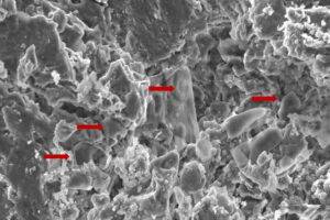
An image of fossilised erythrocyte-like structures

New techniques used to analyse soft tissue in dinosaur fossils may hold the key to new cancer discoveries, according to a new study published in the journal Biology.

Researchers from Anglia Ruskin University (ARU) and Imperial College London analysed dinosaur fossils using advanced paleoproteomic techniques, a method that holds promise for uncovering molecular data from ancient specimens.

The researchers discovered red blood cell-like structures in a fossil while studying a Telmatosaurus transsylvanicus, a duck-billed, plant eating “marsh lizard” that lived between 66-70 million years ago in the Hateg Basin in present-day Romania.

The new study used Scanning Electron Microscopy (SEM) techniques to identify low-density structures resembling erythrocytes, or red blood cells, in the fossilised bone.

The findings raise the possibility that soft tissue and cellular components are more commonly preserved in ancient remains than previously thought.

By identifying preserved proteins and biomarkers, scientists believe they can gain insights into the diseases that affected prehistoric creatures, including cancer, potentially influencing future treatments for humans.

The authors of the new study highlight the necessity of prioritising the collection and preservation of fossilised soft tissue, rather than just dinosaur skeletons, as future advancements in molecular techniques will enable deeper insights into disease evolution.

A separate study had previously identified evidence of cancer in Telmatosaurus transsylvanicus, indicating its deep evolutionary roots.

Senior author Justin Stebbing, Professor of Biomedical Sciences at Anglia Ruskin University, said: “Dinosaurs, as long-lived, large-bodied organisms, present a compelling case for investigating how species managed cancer susceptibility and resistance over millions of years.

“Proteins, particularly those found in calcified tissues like bone, are more stable than DNA and are less susceptible to degradation and contamination. This makes them ideal candidates for studying ancient diseases, including cancer, in paleontological specimens.

“Unlike skeletal structures alone, soft tissues contain proteins that provide molecular information that can reveal the underlying biological mechanisms of disease.

“Our research, using relatively underused methods, invites further exploration that could hold the key to future discoveries that could benefit humans. However, it is crucial that long-term fossil conservation efforts are co-ordinated to ensure that future researchers have access to specimens suitable for cutting-edge molecular investigations.”

Note: The above post is reprinted from materials provided by Anglia Ruskin University.

New velvet worm species a first for the arid Karoo

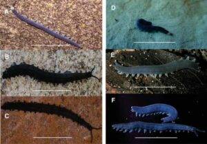
Photographic images of the dorsal aspect of selected live velvet worm species from the Western Cape province, South Africa (A–F). Peripatopsis balfouri s.s. from Bats Cave ravine, Cape Peninsula, Table Mountain range (A). P. palmeri sp. nov., from 22 Waterfalls, Porterville (B). P. barnardi sp. nov., from the Groot Swartberg Mountains, Little Karoo (C). P. landroskoppie sp. nov., from Landroskop (B) outside Grabouw (D). P. fernkloofi sp. nov., from Fernkloof Nature Reserve, Hermanus (E) and P. limietbergi sp. nov., from Mitchell's Pass (F). Scale bar = 10 mm.
Photographic images of the dorsal aspect of selected live velvet worm species from the Western Cape province, South Africa (A–F). Peripatopsis balfouri s.s. from Bats Cave ravine, Cape Peninsula, Table Mountain range (A). P. palmeri sp. nov., from 22 Waterfalls, Porterville (B). P. barnardi sp. nov., from the Groot Swartberg Mountains, Little Karoo (C). P. landroskoppie sp. nov., from Landroskop (B) outside Grabouw (D). P. fernkloofi sp. nov., from Fernkloof Nature Reserve, Hermanus (E) and P. limietbergi sp. nov., from Mitchell’s Pass (F). Scale bar = 10 mm.

In March 2022, Stellenbosch University (SU) student Rohan Barnard was out and about on a farm in the Swartberg Mountains between Calitzdorp and Oudtshoorn, flipping over rocks looking for ants, reptiles and other critters, when he stumbled upon the finding of a lifetime.

Buried deep in the moist sand below a pile of leaf litter at the periphery of a small river, he found a slate black velvet worm. Being familiar with how rare velvet worms are, he took a specimen and also posted an image of it to the biodiversity observation app, iNaturalist.

“I had a basic knowledge of the Cape velvet worms, having found one for the first time on Table Mountain in 2019. My older brother was under assignment from his zoology lecturer, Prof. Savel Daniels, to collect velvet worms. With my interest in ants, I gladly assisted him in this task,” Rohan, now a third year BSc student in Conservation Ecology and Entomology, explains.

Velvet worms’ lineage date back to over 500 million years ago, making it a living relic of the Cambrian period. With their soft bodies and non-jointed legs, these critters have changed little over millions of years, earning them the title of “living fossils.”

Little did Rohan know at the time that he had just found a new species of velvet worm, now aptly named Rohan’s velvet worm or, in scientific terms, Peripatopsis barnardi.

Even more remarkable is the fact that it represents the first ever species from the little Karoo, which indicates that the area was historically more forested than at present. In other words, with prehistorical climate changes, and aridification, the species became isolated and underwent speciation.

According to Prof. Daniels, an evolutionary biologist from SU’s Department of Botany and Zoology and one of South Africa’s foremost specialists on velvet worms, it is utterly remarkable that such a prehistorical lineage is still around today. After viewing this rare find on iNaturalist, he visited the same area in July 2022 and collected a paratype and another nine specimens for analysis.

The results of his analysis, and the announcement of seven new species of velvet worms, were published in the journal Ecology and Evolution recently. Daniels, the first author on the paper, says South Africa’s velvet worms are mainly found in prehistoric Afro temperate forest patches that persist in deep gorges in the Cape Fold Mountains

“The origin of these forest patches can be traced to the early Miocene, about 23 to 15 million years ago, when the region used to be temperate and sub-tropical. During the late Miocene, however, the region underwent significant climatic changes, with a decrease in rainfall due to the advent of the proto Benguela current along the West Coast, and two geotectonic uplifting events. These events resulted in a complex mosaic of habitat connectivity and isolation, what we know today as the Cape Fold Mountains, driving the speciation of habitat specialists such as velvet worms,” he explains.

Daniels used new mitochondrial and nuclear DNA sequencing techniques, combined with morphological analysis and scanning electron microscopy (SEM), to determine that P. barnardi diverged from its most recent common ancestor about 15.2 million years ago. Another novel finding from the Cederberg Mountains, P. cederbergiensis, can trace its lineage to 12.47 million years ago.

Daniels welcomes the efforts of citizen scientists to share their findings on biodiversity apps: “It is thanks to citizen science data that we were able to identify the new species. In the Cape Fold Mountains, we now know that every mountain peak has an endemic species. This suggests that in unsampled areas there are likely to be additional novel diversity, waiting to be found.”

Most importantly, though, it means that we must conserve these prehistoric forest fragments to limit extinction.

To Rohan, it still feels surreal to have such a fossil-like creature named after him: “It is incredible to realise that I’ve uncovered a living fossil. It is as if I have found a missing link that we did not even know about. It gives me hope that there is still so much left to discover. But it also makes me worried for the future, that we will lose animals and plants to extinction that we did not even know existed,” he warns.

The seven new species are P. fernkloofi, P. jonkershoeki, P. kogelbergi, P. landroskoppie, P. limietbergi and P. palmeri. Apart from P. barnardi, all the new species were named after their places of origin.

Why are velvet worms unique?

Like the indestructible water bears (Tardigrades), modern velvet worms are looked on as a separate line of evolution (and placed in a distinct phylum) that arose independently from some long forgotten marine ancestor — probably the Hallicogenia. Fossils show that velvet worms have not changed much since they diverged from their ancient relative about 540 million years ago. This means Onycophorans have been living on Earth ever since what is called the Cambrian period of prehistory. Today, modern velvet worms live on land and are found only in damp, moist habitats in areas that were originally part of the ancient supercontinent Gondwana.

Reference:
Savel R. Daniels, Aaron Barnes. Perched on the Plateau: Speciation in a Cape Fold Mountain Velvet Worm Clade, With the Description of Seven New Species (Onychophora: Peripatopsidae: Peripatopsis) From South Africa. Ecology and Evolution, 2025; 15 (4) DOI: 10.1002/ece3.71256

Note: The above post is reprinted from materials provided by Stellenbosch University. Original written by Wiida Fourie-Basson.

Watch the Earth split in real time: Stunning footage reveals a 2.5-meter fault slip in seconds

During the midday Friday prayer hours on March 28, 2025, a magnitude 7.7 earthquake struck central Myanmar along the Sagaing Fault. With an epicenter close to Mandalay, the country’s second-largest city, it was the most powerful earthquake to strike Myanmar in more than a century and the second deadliest in its modern history.

The cause was a strike-slip fault, in which two masses of earth “slip” past each other horizontally along a vertical fault plane. To an observer, it would look like the ground were split in two along a defined line, with both sides being wrenched past each other in opposite directions.

Previous seismological studies have inferred pulse-like rupture behavior and curved slip paths from the analysis of seismic data. However, because the recording instruments were at a considerable distance from the fault itself, these findings were indirect.

This time, however, a CCTV camera caught this slip in action, presenting a unique opportunity for a team researchers at Kyoto University to study the fault motion in real time. (See video link at bottom of article.)

The team applied a technique known as pixel cross-correlation to the CCTV footage to analyze the fault’s movement frame-by-frame. Their analysis reveals that the fault slipped sideways 2.5 meters in just 1.3 seconds, with a maximum speed of 3.2 meters per second. The total sideways movement recorded during this earthquake is typical of strike-slip ruptures, but the short duration of the fault slip is a major discovery.

“The brief duration of motion confirms a pulse-like rupture, characterized by a concentrated burst of slip propagating along the fault, much like a ripple traveling down a rug when flicked from one end,” says corresponding author Jesse Kearse.

The team’s analysis also proves that the slip path was subtly curved, a finding which aligns with previous geological observations from faults around the world. This may suggest that such slips are typically curved, as opposed to being completely linear.

The study demonstrates that video-based monitoring of faults is a powerful tool for seismology, enabling unprecedented insights into earthquake behavior. Capturing this level of detail is fundamental to improving our understanding of earthquake processes and enhancing our ability to anticipate the ground shaking expected in future large events.

“We did not anticipate that this video record would provide such a rich variety of detailed observations. Such kinematic data is critical for advancing our understanding of earthquake source physics,” says Kearse.

The next phase of their research will utilize physics-based models to investigate the factors that control fault behavior as revealed by this analysis.

Reference:
Jesse Kearse, Yoshihiro Kaneko. Curved Fault Slip Captured by CCTV Video During the 2025 Mw 7.7 Myanmar Earthquake. The Seismic Record, 2025; 5 (3): 281 DOI: 10.1785/0320250024

Note: The above post is reprinted from materials provided by Kyoto University.

AI uncovers 86,000 hidden earthquakes beneath Yellowstone’s surface

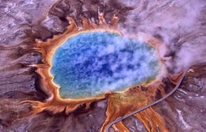
Hot Springs in Yellowstone National Park
Extremophiles, such as the thermophiles that give the microbial mats such vivid colors in the hot springs in Yellowstone National Park, are a hot topic of study amongst astrobiologists in the UK. IMAGE CREDIT: JIM PEACO/NATIONAL PARK SERVICE.

Yellowstone, a popular tourist destination and namesake of an equally popular TV show, was the first-ever national park in the United States. And bubbling beneath it – to this day – is one of Earth’s most seismically active networks of volcanic activity.

In a new study, published July 18 in the high impact journal Science Advances, Western engineering professor Bing Li and his collaborators at Universidad Industrial de Santander (Industrial University of Santander) in Colombia and the United States Geological Survey used machine learning to re-examine historical earthquake data from the Yellowstone caldera over a 15-year period. The team was able to retroactively detect and assign magnitudes to approximately 10 times more seismic events, or earthquakes, than previously recorded.

A caldera – like the one at Yellowstone Park spanning parts of Wyoming, Idaho and Montana – is a large depression or hollow formed when a volcano erupts and the magma chamber beneath it empties, leading to the collapse of the land above. This is different than a volcanic crater, which is formed by outward blasting.

The historical catalogue for the Yellowstone caldera now contains 86,276 earthquakes spanning the years 2008 to 2022, significantly improving previous understanding of volcanic and seismic systems through better data collection and systematic analyses.

A key finding in the study is that more than half of the earthquakes recorded in Yellowstone were part of earthquake swarms – groups of small, interconnected earthquakes that spread and shift within a relatively small area over a relatively short period of time. This is unlike an aftershock, which is a smaller earthquake that follows a larger mainshock in the same general area.

“While Yellowstone and other volcanoes each have unique features, the hope is that these insights can be applied elsewhere,” said Li, an expert in fluid-induced earthquakes and rock mechanics. “By understanding patterns of seismicity, like earthquake swarms, we can improve safety measures, better inform the public about potential risks, and even guide geothermal energy development away from danger in areas with promising heat flow.”

Molten-detecting machines

Prior to the application of machine learning, earthquakes were generally detected through manual inspection by trained experts. This process takes time, is cost-intensive and often detects fewer events than possible now with machine learning. Machine learning has sparked a data-mining gold rush in recent years as seismologists revisit the wealth of historical waveform data stored in datacenters across the world and learn more about current and previously unknown seismic regions around the world.

“If we had to do it old school with someone manually clicking through all this data looking for earthquakes, you couldn’t do it. It’s not scalable,” said Li.

The study also shows that earthquake swarms beneath the Yellowstone caldera have occurred along relatively immature, rougher fault structures, compared to more typical mature fault structures seen in regions such as southern California and even immediately outside the caldera.

The roughness was measured by characterizing earthquakes as fractals, which are geometric shapes that exhibit self-similarity, meaning they appear similar at different scales. First visualized by Benoit Mandelbrot in 1980, fractal patterns are seen in coastlines, snowflakes, broccoli, and even the branching of blood vessels. The fractal-based models, targeting roughness versus regularity, were able to characterize these earthquake swarms, which the researchers believe were caused by the mix of slowly moving underground water and sudden bursts of fluid.

“To a large extent, there is no systematic understanding of how one earthquake triggers another in a swarm. We can only indirectly measure space and time between events,” said Li. “But now, we have a far more robust catalogue of seismic activity under the Yellowstone caldera, and we can apply statistical methods that help us quantify and find new swarms that we haven’t seen before, study them, and see what we can learn from them.”

Reference:
Manuel A. Florez, Bing Q. Li, David R. Shelly, Mia V. Angulo, José D. Sanabria-Gómez. Long-term dynamics of earthquake swarms in the Yellowstone caldera. Science Advances, 2025; 11 (29) DOI: 10.1126/sciadv.adv6484

Note: The above post is reprinted from materials provided by University of Western Ontario.

Scientists Find the First Ice Core From the European Alps That Dates Back to the Last Ice Age

An ice sample on the melter during continuous ice core chemical analyses in the lab (credit: Sylvain Masclin).

Glaciers hold layers of history preserved in ice, offering unique insights into Earth’s past that can also help us interpret the future. Trapped amidst the frozen water are microscopic deposits of dust, pollen, and even pollutants that scientists can use to examine environmental changes through time. DRI’s Ice Core Lab has used this technique to highlight atmospheric lead pollution and economic turbulence in Ancient Rome. Now, their latest study found that a glacier in the French Alps dates back to the last Ice Age – the oldest known glacier ice in the region. Serving as a record that spans through the development of agriculture in Western Europe and the advent of industrialization, the glacier holds insights into an era of rapid change.

The new study, published in the June issue of PNAS Nexus, examines a 40-meter long ice core from Mont Blanc’s Dôme du Goûter. Using radiocarbon dating techniques, the research team found that the glacier provides an intact record of aerosols and climate dating back at least 12,000 years. Aerosols are small droplets and particles in the air such as desert dust, sea salts, sulfur from volcanic eruptions, soot from forest fires, as well as pollutants and other emissions from human activities. Glacier ice offers the most detailed record of past atmospheric aerosols, and this is the first ice core record from the European region that extends back to the last climatic transition. Aerosols play an important role in regional climate through their interactions with clouds and solar radiation, and the insights offered by the ice record can help inform accurate climate modeling for both the past and future.

“For the first time, we have a fairly complete Alpine record of atmospheric and precipitation chemistry going all the way back to the Mesolithic Period,” said Joe McConnell, Director of DRI’s Ice Core lab who co-authored the study. “And that’s a big deal, because you have two major climate states – glacial and interglacial – and to get a record of atmospheric precipitation chemistry across that huge climate change tells you the most extreme natural aerosol concentrations that you’d expect. On top of that, you have humans going from hunter-gatherers with a very low population through the development of agriculture, domestication of animals, mining, etc, and then a vast population increase and the clearing of land. All of that is happening around this ice core site. It spans the full range of natural and anthropogenic change, and it’s right in the center of Europe – where much of Western civilization evolved.”

The glacier’s location in the Alps is important because it serves as a more intact record of Europe’s local climate than those found in distant Arctic ice. Many aerosols play important roles in driving Earth’s climate, so scientists would like to know how sources and concentrations in the air have varied in the past.

“Ice cores collected from glaciers and ice sheets can provide such information, but since these droplets and particles stay in the air only for a few days to maybe a week, records developed from glaciers close to the sources often are the most informative,” said lead author, Michel Legrand.

The ice core analyzed in this study was first collected in 1999 by some of the study’s French authors. It was stored in a freezer in France for more than 20 years before McConnell and his team brought it to DRI’s Ice Core Lab in Reno, Nevada, where specialized equipment and methods known as continuous flow analysis allowed it to be melted down and the chemistry measured, layer by icy layer.

“Determining what year or period of time a layer in the ice represents can be challenging, so here we used a unique combination of radiometric methods to establish the chronology in the ice,” said coauthor Werner Aeschbach.

“We were relieved to find that even under the unusually warm climate of the 20th century, the cold temperatures at over 14,000 feet near Mont Blanc’s peak had preserved the glacier so that the ice record hadn’t yet been impacted by melting,” said co-author Nathan Chellman.

The historic age of the ice at the base of the core, around 40 meters deep into the glacier, surprised the researchers. Another core collected from a glacier located less than 100 meters away at Col du Dome was found to contain ice only about a century old, despite being much deeper. The scientists attribute this to the strong wind patterns found on Mont Blanc.

“It’s exciting to find the first ice core from the European Alps containing an intact record of climate that extends back through the current ten-thousand-year warm period and into the very different climate of the last ice age,” said coauthor Susanne Preunkert, who was a member of the field team that collected the ice core in 1999.

Insights into Europe’s Past Climate

The uniquely detailed ice record revealed a temperature difference of about 3 degrees Celsius between the last Ice Age and the current Holocene Epoch. Using pollen records embedded in the ice, reconstructions of summer temperatures during the last Ice Age were about 2 degrees Celsius cooler throughout western Europe, and about 3.5 degrees Celsius cooler in the Alps.

The phosphorous record also told researchers the story of vegetation changes in the region over the last 12,000 years. Phosphorous concentrations in the ice were low during the last Ice Age, increased dramatically during the early to mid-Holocene, and then decreased steadily into the late Holocene. This is consistent with the spread of forests under the warmer climate, and their decline following the proliferation of modern society and the land-clearing that resulted from agriculture and the spread of industry.

Insights into Europe’s Past Climate

The uniquely detailed ice record revealed a temperature difference of about 3 degrees Celsius between the last Ice Age and the current Holocene Epoch. Using pollen records embedded in the ice, reconstructions of summer temperatures during the last Ice Age were about 2 degrees Celsius cooler throughout western Europe, and about 3.5 degrees Celsius cooler in the Alps.

The phosphorous record also told researchers the story of vegetation changes in the region over the last 12,000 years. Phosphorous concentrations in the ice were low during the last Ice Age, increased dramatically during the early to mid-Holocene, and then decreased steadily into the late Holocene. This is consistent with the spread of forests under the warmer climate, and their decline following the proliferation of modern society and the land-clearing that resulted from agriculture and the spread of industry.

Uncovering More Stories Entombed in the Ice

This study is only the beginning of the Mont Blanc ice record’s story, as the researchers plan to continue analyzing it for indicators of human history. The first step in uncovering every ice core’s record is to use isotopes and radiocarbon dating to establish how old each layer of ice is. Now, with that information, the scientists can take an even deeper look at what it can tell us about past human civilizations and their impact on the environment.

“Now we can start to interpret all these other records that we have of lead and arsenic and other things like that, in terms of human history,” said McConnell.

The information can also be used to help interpret how changes in aerosols impact the climate and improve modeling to help us understand current and future climatic shifts.

“If you’re really going to go back and examine all possible climate states, past and future, you need a model that captures true climate variability,” McConnell said. “It’s a laudable goal, but to evaluate how good the models are, you’ve got to be able to compare them to observations, right? And that’s where the ice cores come in.”

Reference:
Michel Legrand, Joseph R McConnell, Susanne Preunkert, David Wachs, Nathan J Chellman, Kira Rehfeld, Gilles Bergametti, Sophia M Wensman, Werner Aeschbach, Markus K Oberthaler, Ronny Friedrich. Alpine ice core record of large changes in dust, sea-salt, and biogenic aerosol over Europe during deglaciation. PNAS Nexus, 2025; 4 (6) DOI: 10.1093/pnasnexus/pgaf186

Note: The above post is reprinted from materials provided by Desert Research Institute.

A giant pulse beneath Africa could split the continent — and form an ocean

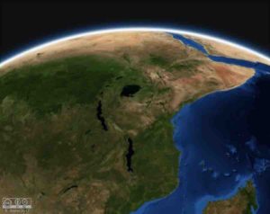
The East African Rift System
The East African Rift System is currently the largest in the world. Yet, the global rift network 130 and 50 million years ago was more than 5 times longer. Credit: Brune, Nasa WorldWind

Research led by Earth scientists at the University of Southampton has uncovered evidence of rhythmic surges of molten mantle rock rising from deep within the Earth beneath Africa.

These pulses are gradually tearing the continent apart and forming a new ocean.

The findings, published in Nature Geoscience, reveal that the Afar region in Ethiopia is underlain by a plume of hot mantle that pulses upward like a beating heart.

The team’s discovery reveals how the upward flow of hot material from the deep mantle is strongly influenced by the tectonic plates — the massive solid slabs of Earth’s crust — that ride above it.

Over millions of years, as tectonic plates are pulled apart at rift zones like Afar, they stretch and thin — almost like soft plasticine — until they rupture. This rupturing marks the birth of a new ocean basin.

Lead author Dr Emma Watts, who conducted the research at the University of Southampton and is now based at Swansea University, said: “We found that the mantle beneath Afar is not uniform or stationary — it pulses, and these pulses carry distinct chemical signatures. These ascending pulses of partially molten mantle are channelled by the rifting plates above. That’s important for how we think about the interaction between Earth’s interior and its surface.”

The project involved experts from 10 institutions, including the University of Southampton, Swansea University, Lancaster University, the Universities of Florence and Pisa, GEOMAR in Germany, the Dublin Institute for Advanced Studies, Addis Ababa University, and the GFZ German Research Centre for Geosciences.

A window into Earth’s interior

The Afar region is a rare place on Earth where three tectonic rifts converge: the Main Ethiopian Rift, the Red Sea Rift, and the Gulf of Aden Rift.

Geologists have long suspected that a hot upwelling of mantle, sometimes referred to as a plume, lies beneath the region, helping to drive the extension of the crust and the birth of a future ocean basin. But until now, little was known about the structure of this upwelling, or how it behaves beneath rifting plates.

The team collected more than 130 volcanic rock samples from across the Afar region and the Main Ethiopian Rift.

They used these, plus existing data and advanced statistical modelling, to investigate the structure of the crust and mantle, as well as the melts that it contains.

Their results show that underneath the Afar region is a single, asymmetric plume, with distinct chemical bands that repeat across the rift system, like geological barcodes. These patterns vary in spacing depending on the tectonic conditions in each rift arm.

Tom Gernon, Professor of Earth Science at the University of Southampton and co-author of the study, said: “The chemical striping suggests the plume is pulsing, like a heartbeat. These pulses appear to behave differently depending on the thickness of the plate, and how fast it’s pulling apart. In faster-spreading rifts like the Red Sea, the pulses travel more efficiently and regularly like a pulse through a narrow artery.”

Links to volcanism and earthquakes

This new research shows that the mantle plume beneath the Afar region is not static, but dynamic and responsive to the tectonic plate above it.

Dr Derek Keir, Associate Professor in Earth Science at the University of Southampton and the University of Florence, and co-author of the study, said: “We have found that the evolution of deep mantle upwellings is intimately tied to the motion of the plates above. This has profound implications for how we interpret surface volcanism, earthquake activity, and the process of continental breakup.”

“The work shows that deep mantle upwellings can flow beneath the base of tectonic plates and help to focus volcanic activity to where the tectonic plate is thinnest. Follow on research includes understanding how and at what rate mantle flow occurs beneath plates,” added Keir.

Dr Watts added: “Working with researchers with different expertise across institutions, as we did for this project, is essential to unravelling the processes that happen under Earth’s surface and relate it to recent volcanism. Without using a variety of techniques, it is hard to see the full picture, like putting a puzzle together when you don’t have all the pieces.”

Reference:
Emma J. Watts, Rhiannon Rees, Philip Jonathan, Derek Keir, Rex N. Taylor, Melanie Siegburg, Emma L. Chambers, Carolina Pagli, Matthew J. Cooper, Agnes Michalik, J. Andrew Milton, Thea K. Hincks, Ermias F. Gebru, Atalay Ayele, Bekele Abebe, Thomas M. Gernon. Mantle upwelling at Afar triple junction shaped by overriding plate dynamics. Nature Geoscience, 2025; DOI: 10.1038/s41561-025-01717-0

Note: The above post is reprinted from materials provided by University of Southampton.

The first pandemic? Scientists find 214 ancient pathogens in prehistoric DNA

A research team led by Eske Willerslev, professor at the University of Copenhagen and the University of Cambridge, has recovered ancient DNA from 214 known human pathogens in prehistoric humans from Eurasia.

The study shows, among other things, that the earliest known evidence of zoonotic diseases — illnesses transmitted from animals to humans, like COVID in recent times — dates back to around 6,500 years ago, with such diseases becoming more widespread approximately 5,000 years ago. It is the largest study to date on the history of infectious diseases and has just been published in the scientific journal Nature.

The researchers analyzed DNA from over 1,300 prehistoric individuals, some up to 37,000 years old. The ancient bones and teeth have provided a unique insight into the development of diseases caused by bacteria, viruses, and parasites.

The results suggest that humans’ close cohabitation with domesticated animals — and large-scale migrations of pastoralist from the Pontic Steppe — played a decisive role in the spread of these diseases.

“We’ve long suspected that the transition to farming and animal husbandry opened the door to a new era of disease — now DNA shows us that it happened at least 6,500 years ago,” says Professor Eske Willerslev. “These infections didn’t just cause illness — they may have contributed to population collapse, migration, and genetic adaptation.”

World’s oldest trace of the plague

In the study, the researchers found 214 pathogens. A remarkable finding is the world’s oldest genetic trace of the plague bacterium Yersinia pestis, identified in a 5,500-year-old sample. The plague is estimated to have killed between one-quarter and one-half of Europe’s population during the Middle Ages.

Could have implications for future vaccines

The findings could be significant for the development of vaccines and for understanding how diseases arise and mutate over time.

“If we understand what happened in the past, it can help us prepare for the future, where many of the newly emerging infectious diseases are predicted to originate from animals,” says Associate Professor Martin Sikora, the study’s first author.

“Mutations that were successful in the past are likely to reappear. This knowledge is important for future vaccines, as it allows us to test whether current vaccines provide sufficient coverage or whether new ones need to be developed due to mutations,” adds Eske Willerslev.

Reference:
Martin Sikora, Elisabetta Canteri, Antonio Fernandez-Guerra, Nikolay Oskolkov, Rasmus Ågren, Lena Hansson, Evan K. Irving-Pease, Barbara Mühlemann, Sofie Holtsmark Nielsen, Gabriele Scorrano, Morten E. Allentoft, Frederik Valeur Seersholm, Hannes Schroeder, Charleen Gaunitz, Jesper Stenderup, Lasse Vinner, Terry C. Jones, Björn Nystedt, Karl-Göran Sjögren, Julian Parkhill, Lars Fugger, Fernando Racimo, Kristian Kristiansen, Astrid K. N. Iversen, Eske Willerslev. The spatiotemporal distribution of human pathogens in ancient Eurasia. Nature, 2025; DOI: 10.1038/s41586-025-09192-8

Note: The above post is reprinted from materials provided by University of Copenhagen – The Faculty of Health and Medical Sciences.

Palaeontologists discover 506-million-year-old predator

Life reconstruction of Mosura fentoni, art by Danielle Dufault © ROM

Palaeontologists at the Manitoba Museum and Royal Ontario Museum (ROM) have discovered a remarkable new 506-million-year-old predator from the Burgess Shale of Canada. The results are announced in a paper in the journal Royal Society Open Science.

Mosura fentoni was about the size of your index finger and had three eyes, spiny jointed claws, a circular mouth lined with teeth and a body with swimming flaps along its sides. These traits show it to be part of an extinct group known as the radiodonts, which also included the famous Anomalocaris canadensis, a meter-long predator that shared the waters with Mosura.

However, Mosura also possessed a feature not seen in any other radiodont: an abdomen-like body region made up of multiple segments at its back end.

“Mosura has 16 tightly packed segments lined with gills at the rear end of its body. This is a neat example of evolutionary convergence with modern groups, like horseshoe crabs, woodlice, and insects, which share a batch of segments bearing respiratory organs at the rear of the body,” says Joe Moysiuk, Curator of Palaeontology and Geology at the Manitoba Museum, who led the study.

The reason for this intriguing adaptation remains uncertain, but the researchers postulate it may be related to particular habitat preference or behavioural characteristics of Mosura that required more efficient respiration.

With its broad swimming flaps near its midsection and narrow abdomen, Mosura was nicknamed the “sea-moth” by field collectors based on its vague appearance to a moth. This inspired its scientific name, which references the fictional Japanese kaiju also known as Mothra. Only distantly related to real moths — as well as spiders, crabs, and millipedes — Mosura belongs on a much deeper branch in the evolutionary tree of these animals, collectively known as arthropods.

“Radiodonts were the first group of arthropods to branch out in the evolutionary tree, so they provide key insight into ancestral traits for the entire group. The new species emphasizes that these early arthropods were already surprisingly diverse and were adapting in a comparable way to their distant modern relatives.” says study co-author Jean-Bernard Caron, Richard M. Ivey Curator of Invertebrate Palaeontology at ROM.

Several fossils of Mosura additionally show details of internal anatomy, including elements of the nervous system, circulatory system, and digestive tract.

“Very few fossil sites in the world offer this level of insight into soft internal anatomy. We can see traces representing bundles of nerves in the eyes that would have been involved in image processing, just like in living arthropods. The details are astounding,” Caron adds.

Instead of having arteries and veins like we do, Mosura had an “open” circulatory system, with its heart pumping blood into large internal body cavities called lacunae. These lacunae are preserved as reflective patches that fill the body and extend into the swimming flaps in the fossils.

“The well-preserved lacunae of the circulatory system in Mosura help us to interpret similar, but less clear features that we’ve seen before in other fossils. Their identity has been controversial,” adds Moysiuk, who is also a Research Associate at ROM. “It turns out that preservation of these structures is widespread, confirming the ancient origin of this type of circulatory system.”

Of the 61 fossils of Mosura, all except one were collected by ROM between 1975 and 2022, mostly from the Raymond Quarry in Yoho National Park, British Columbia. Some also came from new areas around Marble Canyon in Kootenay National Park, 40 km to the southeast, which have revealed spectacular new Burgess Shale fossils, including other radiodonts: Stanleycaris, Cambroraster and Titanokorys. One previously unpublished specimen of Mosura was also studied that had been collected by Charles Walcott, the discoverer of the Burgess Shale.

“Museum collections, old and new, are a bottomless treasure trove of information about the past. If you think you’ve seen it all before, you just need to open up a museum drawer,” Moysiuk says.

The Burgess Shale fossil sites are located within Yoho and Kootenay National Parks and are managed by Parks Canada. Parks Canada is proud to work with leading scientific researchers to expand knowledge and understanding of this key period of Earth’s history and to share these sites with the world through award-winning guided hikes. The Burgess Shale was designated a UNESCO World Heritage Site in 1980 due to its outstanding universal value and is now part of the larger Canadian Rocky Mountain Parks World Heritage Site.

Many radiodont fossils can be seen on display in ROM’s Willner Madge Gallery, Dawn of Life, in Toronto, and a specimen of Mosura will be exhibited for the first time at the Manitoba Museum in Winnipeg later this year.

For 50 years, ROM has been at the forefront of Burgess Shale research, uncovering dozens of new fossil sites and species. Located in the Canadian Rocky Mountain Parks of British Columbia, the Burgess Shale fossils are exceptionally preserved and provide one of the best records of marine life during the Cambrian period anywhere.

Reference:
Joseph Moysiuk, Jean-Bernard Caron. Early evolvability in arthropod tagmosis exemplified by a new radiodont from the Burgess Shale. Royal Society Open Science, 2025; 12 (5) DOI: 10.1098/rsos.242122

Note: The above post is reprinted from materials provided by Royal Ontario Museum.

Fossil tracks revise march of early life on Earth

Professor Long compares the trackways with a modern Iguana foot.

The origin of reptiles on Earth has been shown to be up to 40 million years earlier than previously thought — thanks to evidence discovered at an Australian fossil site that represents a critical time period.

Flinders University Professor John Long and colleagues have identified fossilised tracks of an amniote with clawed feet — most probably a reptile — from the Carboniferous period, about 350 million years ago.

“Once we identified this, we realised this is the oldest evidence in the world of reptile-like animals walking around on land — and it pushes their evolution back by 35-to-40 million years older than the previous records in the Northern Hemisphere,” says Professor Long, Strategic Professor in Palaeontology at Flinders.

Published today in the journal Nature, this discovery indicates that such animals originated in the ancient southern supercontinent of Gondwana, of which Australia was a central part

The fossil tracks, discovered in the Mansfield district of northern Victoria in Australia, were made by an animal that Professor Long predicts would have looked like a small, stumpy, Goanna-like creature.

“The implications of this discovery for the early evolution of tetrapods are profound,” says Professor Long.

“All stem-tetrapod and stem-amniote lineages must have originated during the Devonian period — but tetrapod evolution proceeded much faster, and the Devonian tetrapod record is much less complete than we have believed.”

Fossil records of crown-group amniotes — the group that includes mammals, birds and reptiles — begin in the Late Carboniferous period (about 318 million years old), while previously the earliest body fossils of crown-group tetrapods were from about 334 million years ago, and the oldest trackways about 353 million years old.

This had suggested the modern tetrapod group originated in the early Carboniferous period, with the modern amniote group appearing in the early part of the Late Carboniferous period.

“We now present new trackway data from Australia that falsify this widely accepted timeline,” says Professor Long, who worked with Australian and international experts on the major Nature journal paper.

“My involvement with this amazing fossil find goes back some 45 years, when I did my PhD thesis on the fossils of the Mansfield district, but it was only recently after organizing palaeontology field trips to this area with Flinders University students that we got locals fired up to join in the hunt for fossils.

“Two of these locals — Craig Eury and John Eason (coauthors on the paper) — found this slab covered in trackways and, at first, we thought they were early amphibian trackways, but one in the middle has a hooked claw coming off the digits, like a reptile — an amniote, in fact.

“It was amazing how crystal clear the trackways are on the rock slab. It immediately excited us, and we sensed we were onto something big — even though we had no idea just how big it is.”

The Flinders palaeontology team working on this project included Dr Alice Clement, who scanned the fossil footprints to create digital models that were then analysed in detail, working closely with a team from Uppsala University led by Professor Per Erik Ahlberg, a member of the Royal Swedish Academy of Sciences.

“We study rocks and fossils of the Carboniferous and Devonian age with specific interest to observe the very important fish-tetrapod transition,” says Dr Clement.

“We’re trying to tease apart the details of how the bodies and lifestyles of these animals changed, as they moved from being fish that lived in water, to becoming tetrapods that moved about on land.”

Another coauthor Dr Aaron Camens, who studies animal trackways from around Australia, produced heatmaps that explain details of the fossil footprints much more clearly.

“A skeleton can tell us only so much about what an animal could do, but a trackway actually records its behaviour and tells us how this animal was moving,” says Dr Camens.

Because Professor Long had been studying ancient fish fossils of this area since 1980, he had a clear idea of the age of rock deposits in the Mansfield district — from the Carboniferous period, which started about 359 million years ago.

“The Mansfield area has produced many famous fossils, beginning with spectacular fossil fishes found 120 years ago, and ancient sharks. But the holy grail that we were always looking for was evidence of land animals, or tetrapods, like early amphibians. Many had searched for such trackways, but never found them — until this slab arrived in our laboratory to be studied.

“This new fossilised trackway that we examined came from the early Carboniferous period, and it was significant for us to accurately identify its age — so we did this by comparing the different fish faunas that appear in these rocks with the same species and similar forms that occur in well-dated rocks from around the world, and that gave us a time constraint of about 10 million years.”

La Trobe University’s Dr Jillian Garvey, who liaised with the Taungurung Land and Waters Council for the study, has researched in the Mansfield basin since the early 2000s.

“This discovery rewrites this part of evolutionary history,” Dr Garvey says. “It indicates there is so much that has happened in Australia and Gondwana that we are still yet to uncover.”

Reference:
John A. Long, Grzegorz Niedźwiedzki, Jillian Garvey, Alice M. Clement, Aaron B. Camens, Craig A. Eury, John Eason, Per E. Ahlberg. Earliest amniote tracks recalibrate the timeline of tetrapod evolution. Nature, 2025; DOI: 10.1038/s41586-025-08884-5

Note: The above post is reprinted from materials provided by Flinders University.

Australia’s oldest prehistoric tree frog hops 22 million years back in time

Artist’s reconstruction of the new species Litoria tylerantiqua (right) and previously described species Platyplectrum casca (left) from Murgon, south-eastern QueenslandCredit: Samantha Yabsley,
Artist’s reconstruction of the new species Litoria tylerantiqua (right) and previously described species Platyplectrum casca (left) from Murgon, south-eastern Queensland
Credit: Samantha Yabsley,

Newly discovered evidence of Australia’s earliest species of tree frog challenges what we know about when Australian and South American frogs parted ways on the evolutionary tree.

Previously, scientists believed Australian and South American tree frogs separated from each other about 33 million years ago.

But in a study published today in Journal of Vertebrate Palaeontology, palaeontologists from UNSW Sydney say the new species, Litoria tylerantiqua, is now at about 55 million years old, the earliest known member of the pelodryadid family of Australian tree frogs.

The study is based on fossils unearthed from Murgon on the traditional lands of the Waka Waka people of south-eastern Queensland. The new species, Litoria tylerantiqua, is named in honour of the late Michael Tyler, a renowned Australian herpetologist globally celebrated for his research on frogs and toads.

“It is only fitting to name Australia’s earliest tree frog in honour of a man who was a giant in Australian frog research and in particular the first to explore the fossil record for Australian frogs,” says study lead author Dr Roy Farman, an adjunct associate lecturer with UNSW School of Biological, Earth & and Environmental Sciences.

Evolutionary history of Australian tree frogs

Around 55 million years ago, Australia, Antarctica and South America were linked together as the last remnants of the southern supercontinent Gondwana. Global climates were warmer during this period, while a forested corridor linked South America and Australia.

Up until now, it was thought the earliest Australian tree frogs came from the Late Oligocene (about 26 million years ago) and the Early Miocene (23 million years ago). Fossils of the Late Oligocene were found at Kangaroo Well in the Northern Territory and Etadunna Formation at Lake Palankarinna, South Australia, while the Riversleigh World Heritage Area in Queensland revealed tree frogs from the Early Miocene.

But the new species extends the fossil record of pelodryadids by approximately 30 million years, to a time potentially close to the divergence of Australian tree frogs from the South American tree frogs.

Previous estimates based on molecular clock studies — a method scientists use to figure out when different species split from a common ancestor by looking at the rate of genetic changes over time — suggested that Australian and South American tree frogs separated from each other at about 33 million years ago.

“Our research indicates that that date is at least 22 million years too young,” Dr Farman says.

“While molecular studies are important for understanding the evolutionary relationships of different groups of animals, these studies should be calibrated using knowledge from the fossil record and in this case the fossil record provides a more accurate time for separation of the southern world’s tree frogs.”

Using new technology to study ancient frogs

To conduct this research, the authors used CT scans of spirit-preserved frogs from Australian museum collections to compare the three-dimensional shape of the fossil bones with those of living species. The technique — called three-dimensional geometric morphometrics — has only been used on fossil frogs once before. Using these new methods, they were able to unravel the relationships of these fossils to all other groups of frogs living and extinct.

“We had a real problem at the start of this study because the pelvic bones of most living frogs were invisible inside whole pickled frogs rather than available for study as skeletons,” Dr Farman says.

“Museums understandably want to ensure these often unique or rare pickled specimens remain intact for molecular studies because DNA can be obtained from their soft tissues. This meant that instead of skeletonising these specimens, we needed instead to make CT scans of them, enabling us to create 3D models of their otherwise invisible skeletons.

“Using these cutting-edge investigative methods, we were able to determine from the shape of the fossil ilia — one of three bones that make up each side of the pelvis — that this new Murgon species of frog is more closely related to the Australian tree frogs (pelodryadids) than the South American tree frogs (phyllomedusids).”

Seasoned survivors that outlasted the dinosaurs

Litoria tylerantiqua joins the only other Murgon frog, the ground-dwelling Platyplectrum casca (previously described as Lechriodus casca), as the oldest frogs known from Australia. Both have living relatives in Australia and New Guinea demonstrating remarkable resilience over time.

“Despite their delicate nature, frogs have been surprisingly successful at surviving several mass extinction events since their origins about 250 million years ago, including the mass extinction 66 million years ago that took out the non-flying dinosaurs,” Dr Farman says.

“Although global extinction events triggered by human activities — such as rapid climate change and the spread of chytrid fungus — may be among the worst challenges frogs have had to face, the fossil record could reveal how some frog groups overcame previous challenges, perhaps by adapting to new, less-threatening habitats. This could provide clues about how we might be able to help by translocating some threatened frogs into more future-secure habitats.”

Frogs such as the southern corroboree frog are threatened in their current habitats which have become more hostile due to climate change. The authors say that if the fossil record shows physically similar frogs living in very different habitats, today’s frogs may benefit by being reintroduced into similar environments.

Reference:
roy M. Farman, Michael Archer, Suzanne J. Hand. Early Eocene pelodryadid from the Tingamarra Local Fauna, Murgon, southeastern Queensland, Australia, and a new fossil calibration for molecular phylogenies of frogs. Journal of Vertebrate Paleontology, 2025; DOI: 10.1080/02724634.2025.2477815

Note: The above post is reprinted from materials provided by University of New South Wales.

Digital reconstruction reveals 80 steps of prehistoric life

An image from the reconstruction of the dinosaur's movements. Image: Dr A Romilio
An image from the reconstruction of the dinosaur’s movements. Image: Dr A Romilio

A dinosaur’s 40-second journey more than 120 million years ago has been brought back to life by a University of Queensland-led research team using advanced digital modelling techniques.

Dr Anthony Romilio from UQ’s Dinosaur Lab analysed and reconstructed the Phoenix Trackway, the longest documented set of footprints made by a predator walking on two legs in East Asia.

“For the first time this dinosaur’s movements have been reconstructed step by step, revealing how it walked, changed pace and responded to its environment,” Dr Romilio said.

“This sequence of 80 consecutive footprints extends for 70 metres in Sichuan Province, China and is a fleeting moment frozen in stone.

“Through digital animation, we can observe that moment as it unfolded, getting unprecedented insights into the animal’s behaviour and biomechanics.”

Using trackway measurements, the research team has revealed the dinosaur walked on two legs, stood 1.13 metres tall at the hip and weighed up to 292 kilograms.

“The footprints show this dinosaur moved at a steady 5.3 km/h which is equivalent to a brisk human walk and then briefly accelerated into a light trot before returning to its regular pace,” Dr Romilio said.

“This wasn’t just a dinosaur wandering aimlessly, it was moving with purpose in a nearly perfectly straight line.”

Local folklore once attributed the footprints to a mythical phoenix, but scientific analysis reveals it was an ancient predator, similar in size to the feathered Yutyrannus which lived in northeastern China in the early Cretaceous period.

“Trackways can reveal behavioural information and stories that fossilised bones alone cannot provide,” Dr Romilio said.

“But long trackways such as this have historically been understudied due to the logistical difficulties of measuring them in detail in the field.

“Our entirely digital approach allows us to capture, interpret and preserve all the measurements and calculations of fossil track sites on computer to provide a glimpse into the dynamic life of an ancient creature.”

The study was co-authored by Dr Lida Xing of China University of Geosciences, Beijing.

The research is published in Geosciences.

Reference:
Anthony Romilio, Lida Xing. A Digital Analysis of the ‘Phoenix Trackway’ at the Hanxi Cretaceous Dinosaur Tracksite, China. Geosciences, 2025; 15 (5): 165 DOI: 10.3390/geosciences15050165

Note: The above post is reprinted from materials provided by University of Queensland.

MOST POPULAR

MORE ARTICLES