Home Blog Page 53

New pieces of evidence found in the Alborán Sea possibly related to the megaflood that refilled the Mediterranean 5.3 million years ago

Isobath map of the eastern Alborán basin with the volcanic edifice location. Orange lines show the main flood paths. (Image: García-Castellanos et al, 2020, Earth-Sciences Reviews)

Under the waters of the eastern Alborán Sea and buried at the shadow of an old volcanic edifice lies a body of sediments that may have been originated by a massive flood that refilled a partially desiccated Mediterranean 5.3 million years ago. This mass of sediments, seen in seismic reflection profiles, represents new possible megaflood deposit of the so-called Zanclean flood, according to a new article published in “Earth-Science Reviews” journal.

This review study summarises the latest stratigraphic pieces of evidence published suporting the Zanclean flood hypothesis. Zanclean flood is an event proposed for the termination of the Messinian Salinity Crisis, during which the Mediterranean Sea underwent a period of isolation from the Atlantic Ocean evolving into giant saline sea about 6 million years ago.

“The identified sediments are compatible with a megaflood event refilling the Mediterranean Sea through the Strait of Gibraltar. It’s an enlarged body deposited in the protected area at the lee side of a submarine volcano”, said Daniel García-Castellanos, researcher at Institute of Earth Sciences Jaume Almera of the Spanish Scientific Research Council (ICTJA-CISC) and leading author of the study.

According to the research, the newly identified deposits form an elongated body up to 163 m thick, 35 km long and 7 km wide. The identification of these deposits is based on seismic reflection profiles of the sea subsurface of the eastern Alborán basin. This deposit is parallel to the main flood erosive channel which was identified in 2009 in the Alborán basin.

This erosive channel extends along 390 km from the Gulf of Cadiz (Atlantic Ocean) until the Algerian Basin, through the Strait of Gibraltar and crossing the deepest parts of the Alboran Sea. An outburst flood erosion may have eroded the channel due to the breaching of the Strait of Gibraltar once the connection between the Atlantic Ocean and the Mediterranean Sea was restored about 5,3 million years ago.

Once the massive inflow of water entered in the Alboran basin, the channel split into two branches to overcome the topographic obstacles in its path. The volcanic edifice may have been one of these topographic obstacles during the flood leading to the deposition of the recently identified sediments along the seamount lee side.
Other pieces of evidence in the Eastern Mediterranean:

These sediments identified in the Alborán Sea can be added to the rest of evidence found and published in recent years that support the hypothesis of a massive flood and are summarised in the present article.

The Noto Canyon, in the northern Malta Escarpment, and a body of sediments of up to 860 m in thickness buried at the east of this canyon are two of the other pieces of evidence proposed in this article that may sustain the megaflood hypothesis. Both parts of evidence were analysed in a previous study published in Scientific Reports in 2018.

However, and despite all summarised pieces of evidence, Daniel García-Castellanos is cautious. “Ten years after publishing the first observations that were related with the Zanclean flood we are still finding new evidences to sustain it, but they are not conclusive. All of the evidences that have been summarised in this article may have other possible interpretations and, before convincing the scientific community it will be necessary to have other studies that consider the hypothesis from other angles”, said García-Castellanos.

Researchers from the University of Malta, the Helmholtz Centre for Ocean Research (GEOMAR), the Instituto de Ciencias del Mar (ICM-CSIC), IstitutoNazionale di oceanografia e di geofisicaSperimentale (OGS) and the University of Sevilla also participated in the study.

Reference:
Garcia-Castellanos, D., Micallef, A., Estrada, F., Camerlenghi, A., Ercilla, G., Periáñez, R., & Abril, J. M. (2020). The Zancleanmegaflood of the Mediterranean – Searching for independent evidence.Earth-Science Reviews, 201, 103061. https://doi.org/10.1016/j.earscirev.2019.103061

Note: The above post is reprinted from materials provided by Institue of Earth Sciences Jaume Almera(ICTJA-CSIC).

Oldest known record of amphibian tracks in the UK

NHMUK PV R 9372, Palaeosauropus sp., (a) colour photograph of the original sandstone slab and tracks, (b) 3D digital render of the plaster cast of the sandstone slab and tracks and (c) black and white photograph of the original sandstone slab and tracks. In (b), left manus and pes prints are denoted a and b respectively, the right pes prints c and e, with print d being the right manus. The indented area left of print e is identified as damage to the specimen rather than a footprint impression.

A new paper has revealed an ancient trackway, found imprinted on a block of sandstone from the base of Hardraw Force Waterfall in Wensleydale, North Yorkshire, is the oldest record of amphibian tracks in the UK dating back 340 million years.

The trace fossil, currently on display at the Natural History Museum, was 3-D scanned in order to visualise it in further detail as part of a research project by a previous undergraduate student from the University of Birmingham, Hannah Bird. The tracks belong to the earliest relatives of modern amphibians called temnospondyls, specifically the edopoids, or “glutton-faced animals.”

Hannah Bird elaborated: “We used scanning and photography to make a 3-D digital model, allowing us to better visualise and identify the footprints and invertebrate traces. Determining whether individual prints were made by hands or feet, as well as the direction of movement, certainly proved troublesome at times but we were finally able to reconstruct how this amphibian might have moved in life.”

Edopoids were crocodile-like animals, at least two metres in length. It was revealed that the edopoid walked across the sandy bed of river delta along with contemporary invertebrate animals including arthropods, worms and molluscs.

The study has presented a rare insight into the early Carboniferous period and tetrapod diversification in the United Kingdom as well as how temnospondyls spread across Euramerica.

Scientific Associate of the Natural History Museum Angela Milner said: “Although this specimen has been in the Natural History Museum’s collection for a long time, modern 3-D scanning techniques have revealed a wealth of detail that was almost impossible to see on the original tracks.”

Abstract

The ichnological fossil record has previously provided key evidence for the diversification of land vertebrates (tetrapods) during the Carboniferous Period, following the invasion of the land. Within the UK, tetrapod ichnofossils from the late Carboniferous of the English Midlands are well documented, but few such fossils are known from earlier in the period. We present a rare ichnological insight into early Carboniferous tetrapod diversification in the United Kingdom based on a Visean-aged specimen collected from an interdistributary trough palaeoenvironment at Hardraw Scar, Wensleydale, North Yorkshire. This specimen represents the stratigraphically oldest known tetrapod trackway from the UK. We refer this specimen to Palaeosauropus sp., providing the earliest known occurrence of an edopoid temnospondyl. Supplementing the sparse record of contemporary body fossils from the early Carboniferous, this provides further insights into the diversification of temnospondyl amphibians across Euramerica.

Refrence:
Hannah C. Bird et al. A lower Carboniferous (Visean) tetrapod trackway represents the earliest record of an edopoid amphibian from the UK, Journal of the Geological Society (2019). DOI: 10.1144/jgs2019-149

Note: The above post is reprinted from materials provided by The Geological Society.

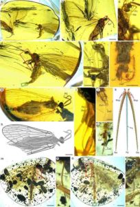
Fossilized insect from 100 million years ago is oldest record of primitive bee with pollen

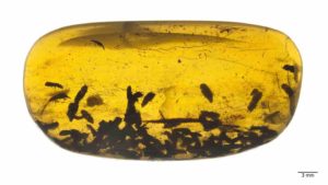
100-million-year-old Discoscapa apicula. The bee is carrying four beetle triungulins. Credit: George Poinar Jr., OSU College of Science.

Beetle parasites clinging to a primitive bee 100 million years ago may have caused the flight error that, while deadly for the insect, is a boon for science today.

The female bee, which became stuck in tree resin and thus preserved in amber, has been identified by Oregon State University researcher George Poinar Jr. as a new family, genus and species.

The mid-Cretaceous fossil from Myanmar provides the first record of a primitive bee with pollen and also the first record of the beetle parasites, which continue to show up on modern bees today.

The findings, published in BioOne Complete, shed new light on the early days of bees, a key component in evolutionary history and the diversification of flowering plants.

Insect pollinators aid the reproduction of flowering plants around the globe and are also ecologically critical as promoters of biodiversity. Bees are the standard bearer because they’re usually present in the greatest numbers and because they’re the only pollinator group that feeds exclusively on nectar and pollen throughout their life cycle.

Bees evolved from apoid wasps, which are carnivores. Not much is known, however, about the changes wasps underwent as they made that dietary transition.

Poinar, professor emeritus in the OSU College of Science and an international expert in using plant and animal life forms preserved in amber to learn more about the biology and ecology of the distant past, classified the new find as Discoscapa apicula, in the family Discoscapidae.

The fossilized bee shares traits with modern bees — including plumose hairs, a rounded pronotal lobe, and a pair of spurs on the hind tibia — and also those of apoid wasps, such as very low-placed antennal sockets and certain wing-vein features.

“Something unique about the new family that’s not found on any extant or extinct lineage of apoid wasps or bees is a bifurcated scape,” Poinar said, referring to a two-segment antennae base. “The fossil record of bees is pretty vast, but most are from the last 65 million years and look a lot like modern bees. Fossils like the one in this study can tell us about the changes certain wasp lineages underwent as they became palynivores — pollen eaters.”

Numerous pollen grains on Discoscapa apicula show the bee had recently been to one or more flowers.

“Additional evidence that the fossil bee had visited flowers are the 21 beetle triungulins — larvae — in the same piece of amber that were hitching a ride back to the bee’s nest to dine on bee larvae and their provisions, food left by the female,” Poinar said. “It is certainly possible that the large number of triungulins caused the bee to accidently fly into the resin.”

Reference:
George Poinar. Discoscapidae fam. nov. (Hymenoptera: Apoidea), a new family of stem lineage bees with associated beetle triungulins in mid-Cretaceous Burmese amber. Palaeodiversity, 2020; 12 (1): 1 DOI: 10.18476/pale.v13.a1

Note: The above post is reprinted from materials provided by Oregon State University. Original written by Steve Lundeberg.

Argentine researchers find distant Tyrannosaurus relative

The new dinosaur is called Tralkasaurus, which means "thunder reptile" in the indigenous Mapuche language common in Patagonia. In this file photo, a boy in Melbourne, Australia inspects the teeth of a theropod dinosaur
The new dinosaur is called Tralkasaurus, which means “thunder reptile” in the indigenous Mapuche language common in Patagonia. In this file photo, a boy in Melbourne, Australia inspects the teeth of a theropod dinosaur

The remains of a 90-million-year-old carnivorous dinosaur distantly related to Tyrannosaurus rex has been discovered in Argentine Patagonia by a team of paleontologists.

The four-meter-long (13-foot-long) theropod was discovered in February 2018 in the central Argentine province of Rio Negro.

Scientists have christened it Tralkasaurus cuyi, the National University of La Matanza’s Scientific Disclosure Agency said on Thursday.

Tralkasaurus means “thunder reptile” in the indigenous Mapuche language common in Patagonia. Cuyi relates to the place the fossil remains were found, El Cuy.

Tralkasaurus would have been dwarfed by its distant cousin Tyrannosaurus rex which could grow to 14 meters in length.

“The size of the Tralkasaurus body is smaller than other carnivores in its group—the abelisaurids,” said Dr Federico Agnolin, an investigator from the Argentine Museum of Natural Sciences.

Other abelisaurids usually measured seven to 11 meters.

This “demonstrates that the group of abelisaurid theropods encompassed a much wider ecological niche than we thought,” said Mauricio Cerroni, another researcher.

The team found a skull, teeth, ribs and part of the hip and tail.

Just like Tyrannosaurus, it was a short-necked and muscular biped with four claws on each of its hind legs, and arms that were very short in comparison to the rest of its body. The bones of its extremities were light and hollow.

“This new discovery helps us to define the ecological habits of carnivorous dinosaurs as well as herbivores,” said Cerroni.

According to the researchers, Tralkasaurus possibly fed on small herbivore dinosaurs called iguanodonts that have been found nearby by the same team of researchers.

Note: The above post is reprinted from materials provided by AFP .

5,200-year-old grains in the eastern Altai Mountains redate trans-Eurasian crop exchange

A photo of the stone men (Chimulchek Culture) in the steppe area of Altai Mountains. These figures are characteristic of the peoples who lived in the area around the time of occupation at Tongtian. These specific examples are located at the Chimulchek site (ca. 4000 years old) and not far from Tongtian Cave. Ceramic sherds from the cave suggest that the occupants in the cave shared similar cultural traits to other people in the region. Credit: Jianjun Yu

Most people are familiar with the historical Silk Road, but fewer people realize that the exchange of items, ideas, technology, and human genes through the mountain valleys of Central Asia started almost three millennia before organized trade networks formed. These pre-Silk Road exchange routes played an important role in shaping human cultural developments across Europe and Asia, and facilitated the dispersal of technologies such as horse breeding and metal smelting into East Asia. One of the most impactful effects of this process of ancient cultural dispersal was the westward spread of northeast Asian crops and the eastward spread of southwest Asian crops. However, until the past few years, a lack of archaeobotanical studies in Central Asia left a dearth of data relating to when and how this process occurred.

This new study, led by scientists from the Chinese Academy of Sciences and the Max Planck Institute for the Science of Human History, provides details of recently recovered ancient grains from the far northern regions of Inner Asia. Radiocarbon dating shows that the grains include the oldest examples of wheat and barley ever recovered this far north in Asia, pushing back the dates for early farming in the region by at least a millenium. These are also the earliest domesticated plants reported from the northern half of Central Asia, the core of the ancient exchange corridor. This study pulls together sedimentary pollen and ancient wood charcoal data with archaeobotanical remains from the Tiangtian archaeological site in the Chinese Altai Mountains to reveal how humans cultivated crops at such northern latitudes. This study illustrates how adaptable ancient crop plants were to new ecological constraints and how human cultural practices allowed people to survive in unpredictable environments.

The Northern Dispersal of Cereal Grains

The ancient relatives of wheat and barley plants evolved to grow in the warm and dry climate of the eastern Mediterranean and southwest Asia. However, this study illustrates that ancient peoples were cultivating these grasses over five and a half thousand kilometers to the northeast of where they originally evolved to grow. In this study, Dr. Xinying Zhou and his colleagues integrate paleoenvironmental proxies to determine how extreme the ecology was around the archaeological cave site of Tangtian more than five millennia ago, at the time of its occupation. The site is located high in the Altai Mountains on a cold,dry landscape today; however, the study shows that the ecological setting around the site was slightly warmer and more humid at the time when people lived in and around this cave.

The slightly warmer regional conditions were likely the result of shifting air masses bringing warmer, wetter air from the south. In addition to early farmers using a specific regional climate pocket to grow crops in North Asia, analysis showed that the crops they grew evolved to survive in such northern regions. The results of this study provide scholars with evidence for when certain evolutionary changes in these grasses occurred, including changes in the programed reliance of day length, which signals to the plant when to flower, and a greater resistance to cold climates.

The Trans-Eurasian Exchange and Crop Dispersal

The ancient dispersal of crops across Inner Asia has received a lot of attention from biologists and archaeologists in recent years; as Dr. Spengler, one of the study’s lead authors, discusses in his recent book Fruit from the Sands, these ancient exchange routes shaped the course of human history. The mingling of crops originating from opposite ends of Asia resulted in the crop-rotation cycles that fueled demographic growth and led to imperial formation. East Asian millets would become one of the most important crops in ancient Europe and wheat would become one of the most important crops in East Asia by the Han Dynasty. While the long tradition of rice cultivation in East Asia made rice a staple of the Asian kitchen, Chinese cuisine would be unrecognizable without wheat-based food items like steamed buns, dumplings, and noodles. The discovery that these plants dispersed across Eurasia earlier than previously understood will have lasting impacts on the study of cultivation and labor practices in ancient Eurasia, as well as the history cultural contact and shifts in culinary systems throughout time.

These new discoveries provide reason to question these views, and seem to suggest that mixed small-scale human populations made major contributions to world history through migration and cultural and technological exchange. “This study not only presents the earliest dates for domesticated grains in far North Asia,” says Professor Xiaoqiang Li, director of the Institute of Vertebrate Paleontology and Paleoanthropology in Beijing, “it represents the earliest beginning of a trans-Eurasian exchange that would eventually develop into the great Silk Road.”

Dr. Xinying Zhou, who headed the study and directs a research team at the IVPP in Beijing, emphasizes that “this discovery is a testament to human ingenuity and the amazing coevolutionary bond between people and the plants that they maintain in their cultivated fields.”

Reference:
Xinying Zhou, Jianjun Yu, Robert Nicholas Spengler, Hui Shen, Keliang Zhao, Junyi Ge, Yige Bao, Junchi Liu, Qingjiang Yang, Guanhan Chen, Peter Weiming Jia, Xiaoqiang Li. 5,200-year-old cereal grains from the eastern Altai Mountains redate the trans-Eurasian crop exchange. Nature Plants, 2020; DOI: 10.1038/s41477-019-0581-y

Note: The above post is reprinted from materials provided by Max Planck Institute for the Science of Human History.

Boom and bust for ancient sea dragons

This very complete specimen of the ichthyosaur Suevoleviathan is from the Early Jurassic of Germany. Many excellently preserved ichthyosaur fossils are known from this time and have been collected from the UK and Germany. Mary Anning from Lyme Regis is intimately associated with fossil collection and found the first recognized ichthyosaur fossils in 1810. Credit: Dr Ben Moon & Dr Tom Stubbs

Ichthyosaurs were fish-like reptiles that first appeared about 250 million years ago and quickly diversified into highly capable swimmers, filling a broad range of sizes and ecologies in the early Mesozoic oceans. However, this rapid pace didn’t last long and an evolutionary bottleneck 200 million years ago, through which only one lineage of ichthyosaurs survived, led to much slower evolution in much of their long history.

Dr Ben Moon, who led the research, published in the journal Communications Biology, said: “Ichthyosaurs are a fascinating group of animals to work on because they evolved so many adaptations for living in water very quickly: a fish-like body and tail fin, giving birth to live young rather than laying eggs, and lots of different feeding styles.

“Because of this we expected to see a rapid evolution early after ichthyosaurs first appeared, but we were staggered by just how big this early burst was and how relatively short it was.”

There are over 100 known species of ichthyosaur from between 250-90 million years ago in the Mesozoic Era, when the infamous dinosaurs ruled the land and the seas were full of marine reptiles, the top predators that filled comparable roles to dolphins, orcas, and sharks in modern seas.

The study used state-of-the-art computational methods and looked at two types of data, one covering skull size and the other including many features of ichthyosaurs’ skeleton. All methods show an ‘early burst’ of evolution in ichthyosaurs, with high rates and rapid variation soon after the appearance of the group, that quickly diminishes later on.

Co-author Dr Tom Stubbs said: “Ichthyosaurs really dominated early in the Triassic (252-201 million years ago), rapidly evolving in an ocean with few predators soon after the largest known mass extinction in Earth’s history. However, the seas quickly became more crowded and competitive, and ichthyosaurs lost their top position in the Jurassic (201-145 million years ago) to other marine reptiles like plesiosaurs and pliosaurs.

“It may well have been the ichthyosaurs’ decreasing evolutionary rates which made them less able to adapt quickly, and therefore less diverse and competitive, allowing other marine reptiles to take over as the top predators.”

Despite slower evolution and going through a bottleneck at the end of the Triassic period, ichthyosaurs remained a common group but had less variation between them. These are perhaps best known ichthyosaurs, found in several UK locations, including Lyme Regis in Dorset, and first collected by Mary and Joseph Anning.

Dr Ben Moon added: “Even though ichthyosaurs were evolving more slowly in their last 100 million years, they are still known from many species, but with less variety between them.

“It’s possible that we might find more ichthyosaurs out there that buck this trend, but it seems that this lack of variety was eventually the cause of their extinction when global conditions became less favourable around 90 million years ago. Ichthyosaurs were simply unable to adapt.”

Reference:
Benjamin C. Moon, Thomas L. Stubbs. Early high rates and disparity in the evolution of ichthyosaurs. Communications Biology, 2020; 3 (1) DOI: 10.1038/s42003-020-0779-6

Note: The above post is reprinted from materials provided by University of Bristol

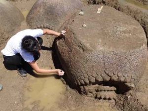
Extinct giant turtle had horned shell of up to three meters

A graphic reconstruction of the giant turtle Stupendemys geographicus: male (front) and female individual (left) swimming in freshwater. Credit: Artwork: Jaime Chirinos

The tropical region of South America is one of the world’s hot spots when it comes to animal diversity. The region’s extinct fauna is unique, as documented by fossils of giant rodents and crocodylians -including crocodiles, alligators, caimans and gavials — that inhabited what is today a desert area in Venezuela. Five to ten million years ago, this was a humid swampy region teeming with life. One of its inhabitants was Stupendemys geographicus, a turtle species first described in the mid-1970s.

Giant turtle 100 times heavier than its closest relative

Researchers of the University of Zurich (UZH) and fellow researchers from Colombia, Venezuela, and Brazil have now reported exceptional specimens of the extinct turtle recently found in new locations across Venezuela and Colombia. “The carapace of some Stupendemys individuals reached almost three meters, making it one of the largest, if not the largest turtle that ever existed,” says Marcelo Sánchez, director of the Paleontological Institute and Museum of UZH and head of the study. The turtle had an estimated body mass of 1,145 kg — almost one hundred times that of its closest living relative, the big-headed Amazon river turtle.

Males carried horns on their carapace

In some individuals, the complete carapace showed a peculiar and unexpected feature: horns. “The two shell types indicate that two sexes of Stupendemys existed — males with horned shells, and females with hornless shells,” concludes Sánchez. According to the paleobiologist, this is the first time that sexual dimorphism in the form of horned shells has been reported for any of the side-necked turtles, one of the two major groups of turtles world-wide.

Despite its tremendous size, the turtle had natural enemies. In many areas, the occurrence of Stupendemys coincides with Purussaurus, the largest caimans. This was most likely a predator of the giant turtle, given not only its size and dietary preferences, but also as inferred by bite marks and punctured bones in fossil carapaces of Stupendemys.

Turtle phylogeny thoroughly revised

Since the scientists also discovered jaws and other skeleton parts of Stupendemys, they were able to thoroughly revise the evolutionary relationships of this species within the turtle tree of life. “Based on studies of the turtle anatomy, we now know that some living turtles from the Amazon region are the closest living relatives,” says Sánchez. Furthermore, the new discoveries and the investigation of existing fossils from Brazil, Colombia and Venezuela indicate a much wider geographic distribution of Stupendemys than previously assumed. The animal lived across the whole of the northern part of South America.

Reference:
E-A. Cadena, T. M. Scheyer, J. D. Carrillo-Briceño, R. Sánchez, O. A Aguilera-Socorro, A. Vanegas, M. Pardo, D. M. Hansen, M. R. Sánchez-Villagra. The anatomy, paleobiology and evolutionary relationships of the largest side-necked extinct turtle. Science Advances, 2020 DOI: 10.1126/sciadv.aay4593

Note: The above post is reprinted from materials provided by University of Zurich.

Heat transport property at the lowermost part of the Earth’s mantle

Calculated lattice thermal conductivity of MgSiO3 postperovskite (PPv) and bridgmanite (Brg) under the Earth’s lowermost mantle conditions. Credit: Ehime University

Lattice thermal conductivities of MgSiO3 bridgmanite and postperovskite (PPv) phases under the Earth’s deepest mantle conditions have been determined by quantum mechanical computer simulations. Researchers at Ehime University found a substantial increase in the conductivity associated with the phase change. This indicates that the PPv phase boundary is the boundary not only of the mineralogy but also the thermal conductivity. The effect of anisotropy on the conductivity of PPv in the heat transport properties at the lowermost mantle was also found to be minor.

Heat transport in the deep Earth controls its thermal evolution. Determination of the thermal conductivity of the lower mantle is one of the central issues for a better understanding of deep Earth phenomena, such as the style of mantle convection, the evolution of the magnetic field, and inner core growth. However, it is poorly understood because deep mantle pressure and temperature conditions are quite difficult to replicate in laboratory experiments. In the new study, the researchers determined the thermal conductivity of MgSiO3 postperovskite, the most abundant mineral at the bottom of the mantle, which is transformed from MgSiO3 bridgmanite,under the lowermost mantle conditions based on quantum mechanical computations without any empirical parameters.

The scientists found a jump in the thermal conductivity associated with the phase transition, indicating that the postperovskite phase boundary is the boundary not only of the mineralogy but also the thermal conductivity (Figure 1). The phase change produces larger lateral variation in heat flux across the core-mantle boundary (CMB). Also, they examined the effects of anisotropy on the thermal conductivity of the CMB heat flux and found that it to be minor with the crystal orientation of postperovskite. This may explain how seismic anisotropy observed at the base of the mantle is developed.

Reference:
Haruhiko Dekura et al. Lattice Thermal Conductivity of MgSiO 3 Postperovskite Under the Lowermost Mantle Conditions From Ab Initio Anharmonic Lattice Dynamics, Geophysical Research Letters (2019). DOI: 10.1029/2019GL085273

Note: The above post is reprinted from materials provided by Ehime University.

As groundwater depletes, arid American West is moving east

Horseshoe Bend, Arizona

Even under modest climate warming scenarios, the continental United States faces a significant loss of groundwater — about 119 million cubic meters, or roughly enough to fill Lake Powell four times or one quarter of Lake Erie, a first-of-its-kind study has shown.

The results, published today in Nature Communications, show that as warming temperatures shift the balance between water supply and demand, shallow groundwater storage can buffer plant water stress — but only where shallow groundwater connections are present, and not indefinitely. As warming persists, that storage can be depleted — at the expense of vital connections between surface water, such as rivers, streams and water reservoirs underground.

“Even with a 1.5 degrees Celsius warming case, we’re likely to lose a lot of groundwater,” said Reed Maxwell, professor of hydrology at the Colorado School of Mines, who co-authored the paper with Laura Condon of the University of Arizona and Adam Atchley of Los Alamos National Laboratory. “The East Coast could start looking like the West Coast from a water standpoint. That’s going to be a real challenge.”

Most global circulation models don’t take into account the lateral movement of water in the subsurface. Typically, they only include limited up-and-down movement, such as rain percolating from vegetation into the soil and roots pulling up water from the ground. In addition, these models tend to limit their scope to mere meters above or below ground.

This new study goes beyond that to simulate how water moves in the subsurface and connects with the land surface.

“We asked what would the response look like if we included the entire complexity of subsurface water movement in a large-scale simulation, and we think this is the first time this has been done,” said Condon, lead author of the paper and assistant professor of hydrology and atmospheric sciences at the University of Arizona.

The calculations revealed a direct response of shallow groundwater storage to warming that demonstrates the strong and early effect that even low to moderate warming may have on groundwater storage and evapotranspiration.

In the western U.S., changes in groundwater storage may remain masked for a long time, the study revealed, because the groundwater there is already deep, and dropping levels would not have as great an effect on surface waters. Additionally, the region’s vegetation is already largely water limited and adapted to being disconnected from deep groundwater sources.

However, the eastern U.S. will be much more sensitive to a lowering of the water table. Groundwater and surface water are more closely linked, and depleting the groundwater will be more disruptive to vegetation, streams and rivers. Many of the systems that have been put in place in the western U.S. for handling and managing water shortage are lacking in the eastern part of the country, as well.

The study revealed that regions in the eastern U.S. may reach a tipping point sooner rather than later, when vegetation starts to lose access to shallow groundwater as storage is depleted with warming.

“Initially, plants might not be experiencing stress because they still have existing shallow groundwater available, but as we continue to have warmer conditions, they can compensate less and less, and changes are more dramatic each year,” Condon said. “In other words, shallow groundwater is buffering the response to warming, but when it’s depleted, it can’t do that anymore.”

The study’s simulations were set up to keep precipitation patterns the same and only increase atmospheric temperatures according to projections ranging from 1.5 to 4 degrees Celsius. Even with a modest 1.5 degrees Celsius of warming, 119 million cubic meters of storage were lost from groundwater — or four times the volume of Lake Powell, the largest reservoir in the Upper Colorado basin. At 4 degrees Celsius, groundwater losses were projected at 324 million cubic meters — roughly 10 times the volume of Lake Powell or enough to fill nearly three-quarters of Lake Erie.

“We are facing a crisis in global groundwater storage,” Condon said. “Huge groundwater reservoirs are drying up at an alarming rate, and that’s a problem because they nourish major growing regions around the world.”

Reference:
Laura E. Condon, Adam L. Atchley, Reed M. Maxwell. Evapotranspiration depletes groundwater under warming over the contiguous United States. Nature Communications, 2020; 11 (1) DOI: 10.1038/s41467-020-14688-0

Note: The above post is reprinted from materials provided by University of Arizona. Original written by Daniel Stolte.

NASA flights detect millions of Arctic methane hotspots

The image shows a thermokarst lake in Alaska. Thermokarst lakes form in the Arctic when permafrost thaws. Credit: NASA/JPL-Caltech

Knowing where emissions are happening and what’s causing them brings us a step closer to being able to forecast the region’s impact on global climate.

The Arctic is one of the fastest warming places on the planet. As temperatures rise, the perpetually frozen layer of soil, called permafrost, begins to thaw, releasing methane and other greenhouse gases into the atmosphere. These methane emissions can accelerate future warming—but to understand to what extent, we need to know how much methane may be emitted, when and what environmental factors may influence its release.

That’s a tricky feat. The Arctic spans thousands of miles, many of them inaccessible to humans. This inaccessibility has limited most ground-based observations to places with existing infrastructure—a mere fraction of the vast and varied Arctic terrain. Moreover, satellite observations are not detailed enough for scientists to identify key patterns and smaller-scale environmental influences on methane concentrations.

In a new study, scientists with NASA’s Arctic Boreal Vulnerability Experiment (ABoVE), found a way to bridge that gap. In 2017, they used planes equipped with the Airborne Visible Infrared Imaging Spectrometer—Next Generation (AVIRIS—NG), a highly specialized instrument, to fly over some 20,000 square miles (30,000 square kilometers) of the Arctic landscape in the hope of detecting methane hotspots. The instrument did not disappoint.

“We consider hotspots to be areas showing an excess of 3,000 parts per million of methane between the airborne sensor and the ground,” said lead author Clayton Elder of NASA’s Jet Propulsion Laboratory in Pasadena, California. “And we detected 2 million of these hotspots over the land that we covered.”

The paper, titled “Airborne Mapping Reveals Emergent Power Law of Arctic Methane Emissions,” was published Feb. 10 in Geophysical Research Letters.

Within the dataset, the team also discovered a pattern: On average, the methane hotspots were mostly concentrated within about 44 yards (40 meters) of standing bodies of water, like lakes and streams. After the 44-yard mark, the presence of hotspots gradually became sparser, and at about 330 yards (300 meters) from the water source, they dropped off almost completely.

The scientists working on this study don’t have a complete answer as to why 44 yards is the “magic number” for the whole survey region yet, but additional studies they’ve conducted on the ground provide some insight.

“After two years of ground field studies that began in 2018 at an Alaskan lake site with a methane hotspot, we found abrupt thawing of the permafrost right underneath the hotspot,” said Elder. “It’s that additional contribution of permafrost carbon—carbon that’s been frozen for thousands of years—that’s essentially contributing food for the microbes to chew up and turn into methane as the permafrost continues to thaw.”

Scientists are just scratching the surface of what is possible with the new data, but their first observations are valuable. Being able to identify the likely causes of the distribution of methane hotspots, for example, will help them to more accurately calculate this greenhouse gas’s emissions across areas where we don’t have observations. This new knowledge will improve how Arctic land models represent methane dynamics and therefore our ability to forecast the region’s impact on global climate and global climate change impacts on the Arctic.

Elder says the study is also a technological breakthrough.

“AVIRIS-NG has been used in previous methane surveys, but those surveys focused on human-caused emissions in populated areas and areas with major infrastructure known to produce emissions,” he said. “Our study marks the first time the instrument has been used to find hotspots where the locations of possible permafrost-related emissions are far less understood.”

Reference:
More information on ABoVE can be found here: https://above.nasa.gov/ Clayton D. Elder et al. Airborne Mapping Reveals Emergent Power Law of Arctic Methane Emissions, Geophysical Research Letters (2020). DOI: 10.1029/2019GL085707

Note: The above post is reprinted from materials provided by Jet Propulsion Laboratory.

One single primitive turtle resisted mass extinction in the northern hemisphere

A reconstruction of Laurasichersis relicta which lived in the northen hemisphere 66 millons years ago. Credit: José Antonio Peñas (SINC)

Sixty-six million years ago, in the emerged lands of Laurasia—now the northern hemisphere—a primitive land tortoise, measuring about 60 cm, managed to survive the event that killed the dinosaurs. It was the only one to do so in this area of the world, according to a Spanish palaeontologist who has analysed its peculiar fossils, found in France.

All turtle species we know of today are descendants of two lineages that separated during the Jurassic, more than 160 million years ago. But their members were not the only ones that existed. There had been many groups of primitive tortoises before them, in an earlier evolutionary position.

Some of these ancient reptiles managed to survive at a time when dinosaurs dominated the Earth. However, virtually all of the early groups of turtles disappeared after an asteroid impact that took place 66 million years ago and wiped out 70% of life on the planet.

Only the so-called “horned turtles” or meiolaniids managed to hold out, more specifically in Gondwana, the current southern hemisphere, according to fossils found in Oceania and South America. Their last representatives managed to co-exist relatively recently with humans, who hunted them to extinction. No other primitive turtle had appeared in the records of the last 66 million years.

After 10 years of study, the palaeontologist Adán Pérez García, from the Evolutionary Biology Group of the National University of Distance Education (UNED, Spain), now confirms that, in the northern hemisphere, on the ancient continent called Laurasia, a primitive land turtle also survived the mass extinction of the late Cretaceous period.

This was Laurasichersis relicta, an extinct turtle genus and species that corresponds to a new form, with very peculiar anatomical characteristics, and whose lineage evolved independently from that of the Gondwana tortoises, from which it separated 100 million years earlier.

“The reason why Laurasichersis survived the great extinction, while none of the other primitive North American, European or Asian land turtles managed to do so, remains a mystery,” Pérez García, the sole author of the paper published in Scientific Reports magazine, has confided to Sinc.

All turtle species we know of today are descendants of two lineages that separated during the Jurassic, more than 160 million years ago. But their members were not the only ones that existed. There had been many groups of primitive tortoises before them, in an earlier evolutionary position.

Some of these ancient reptiles managed to survive at a time when dinosaurs dominated the Earth. However, virtually all of the early groups of turtles disappeared after an asteroid impact that took place 66 million years ago and wiped out 70% of life on the planet.

Only the so-called “horned turtles” or meiolaniids managed to hold out, more specifically in Gondwana, the current southern hemisphere, according to fossils found in Oceania and South America. Their last representatives managed to co-exist relatively recently with humans, who hunted them to extinction. No other primitive turtle had appeared in the records of the last 66 million years.

After 10 years of study, the palaeontologist Adán Pérez García, from the Evolutionary Biology Group of the National University of Distance Education (UNED, Spain), now confirms that, in the northern hemisphere, on the ancient continent called Laurasia, a primitive land turtle also survived the mass extinction of the late Cretaceous period.

This was Laurasichersis relicta, an extinct turtle genus and species that corresponds to a new form, with very peculiar anatomical characteristics, and whose lineage evolved independently from that of the Gondwana tortoises, from which it separated 100 million years earlier.

“The reason why Laurasichersis survived the great extinction, while none of the other primitive North American, European or Asian land turtles managed to do so, remains a mystery,” Pérez García, the sole author of the paper published in Scientific Reports magazine, has confided to Sinc.

A special turtle

The shell of the newly discovered turtle was just over 60 cm long during adulthood and, like other primitive reptiles, it could not retract its neck into its shell to conceal its head from predators. This physical limitation allowed it to develop other protective mechanisms such as an armor with large, mutually linked spikes, which were hard structures located on the neck, legs and tail.

Its peculiar shell is one of the most remarkable features of this reptile and one of the characteristics that make it unique. This complex structure was made up of numerous plates. “Although the number of plates is usually the same in most turtles, the ventral shell region of the new species was provided with a greater number of these elements than those known in any other turtle,” Pérez García stresses.

After the 10-km-diameter meteorite hit the Earth, the large dinosaurs ceased to be part of the landscape, but the turtle, which lived in humid environments with forest areas, coexisted with new predators. The latter quickly dominated the positions of the food chain that had remained available when most animals disappeared.

Reference:
Adán Pérez García. Surviving the cretaceouspaleogene mass extinction event: A terrestrial stem turtle in the cenozoic of Laurasia. Scientific Reports January 30th 2020

Note: The above post is reprinted from materials provided by Spanish Foundation for Science and Technology (FECYT).

New thalattosaur species discovered in Southeast Alaska

The fossil of Gunakadeit joseeae, which was found in Southeast Alaska. About two thirds of the tail had already eroded away when the fossil was discovered. Credit: University of Alaska Museum of the North

Scientists at the University of Alaska Fairbanks have identified a new species of thalattosaur, a marine reptile that lived more than 200 million years ago.

The new species, Gunakadeit joseeae, is the most complete thalattosaur ever found in North America and has given paleontologists new insights about the thalattosaurs’ family tree, according to a paper published today in the journal Scientific Reports. Scientists found the fossil in Southeast Alaska in 2011.

Thalattosaurs were marine reptiles that lived more than 200 million years ago, during the mid to late Triassic Period, when their distant relatives — dinosaurs — were first emerging. They grew to lengths of up to 3-4 meters and lived in equatorial oceans worldwide until they died out near the end of the Triassic.

“When you find a new species, one of the things you want to do is tell people where you think it fits in the family tree,” said Patrick Druckenmiller, the paper’s lead author and director and earth sciences curator at the University of Alaska Museum of the North. “We decided to start from scratch on the family tree.”

Prior to the discovery of Gunakadeit joseeae, it had been two decades since scientists had thoroughly updated thalattosaur interrelationships, Druckenmiller said. The process of re-examining a prehistoric animal’s family tree involves analyzing dozens and dozens of detailed anatomical features from fossil specimens worldwide, then using computers to analyze the information to see how the different species could be related.

Druckenmiller said he and collaborator Neil Kelley from Vanderbilt University were surprised when they identified where Gunakadeit joseeae landed.

“It was so specialized and weird, we thought it might be out at the furthest branches of the tree,” he said. Instead it’s a relatively primitive type of thalattosaur that survived late into the existence of the group.

“Thalattosaurs were among the first groups of land-dwelling reptiles to readapt to life in the ocean,” Kelley said. “They thrived for tens of millions of years, but their fossils are relatively rare so this new specimen helps fill an important gap in the story of their evolution and eventual extinction.”

That the fossil was found at all is a remarkable. It was located in rocks in the intertidal zone. The site is normally underwater all but a few days a year. In Southeast Alaska, when extreme low tides hit, people head to the beaches to explore. That’s exactly what Jim Baichtal, a geologist with the U.S. Forest Service’s Tongass National Forest, was doing on May 18, 2011, when low tides of -3.7 feet were predicted.

He and a few colleagues, including Gene Primaky, the office’s information technology professional, headed out to the Keku Islands near the village of Kake to look for fossils. Primaky saw something odd on a rocky outcrop and called over Baichtal, “Hey Jim! What is this?” Baichtal immediately recognized it as a fossilized intact skeleton. He snapped a photo with his phone and sent it to Druckenmiller.

A month later, the tides were forecasted to be almost that low, -3.1 feet, for two days. It was the last chance they would have to remove the fossil during daylight hours for nearly a year, so they had to move fast. The team had just four hours each day to work before the tide came in and submerged the fossil.

“We rock-sawed like crazy and managed to pull it out, but just barely,” Druckenmiller said. “The water was lapping at the edge of the site.”

Once the sample was back at the UA Museum of the North, a fossil preparation specialist worked in two-week stints over the course of several years to get the fossil cleaned up and ready for study.

When they saw the fossil’s skull, they could tell right away that it was something new because of its extremely pointed snout, which was likely an adaptation for the shallow marine environment where it lived.

“It was probably poking its pointy schnoz into cracks and crevices in coral reefs and feeding on soft-bodied critters,” Druckenmiller said. Its specialization may have been what ultimately led to its extinction. “We think these animals were highly specialized to feed in the shallow water environments, but when the sea levels dropped and food sources changed, they had nowhere to go.”

Once the fossil was identified as a new species, it needed a name. To honor the local culture and history, elders in Kake and representatives of Sealaska Corp. agreed the Tlingit name “Gunakadeit” would be appropriate. Gunakadeit is a sea monster of Tlingit legend that brings good fortune to those who see it. The second part of the new animal’s name, joseeae, recognizes Primaky’s mother, Joseé Michelle DeWaelheyns.

Reference:
Patrick S. Druckenmiller, Neil P. Kelley, Eric T. Metz, James Baichtal. An articulated Late Triassic (Norian) thalattosauroid from Alaska and ecomorphology and extinction of Thalattosauria. Scientific Reports, 2020; 10 (1) DOI: 10.1038/s41598-020-57939-2

Note: The above post is reprinted from materials provided by University of Alaska Fairbanks.

‘Oldest bamboo’ fossil from Eocene Patagonia turns out to be a conifer

The holotype of the species Retrophyllum oxyphyllum (comb. nov.), previously thought to be the oldest known bamboo. Credit: Peter Wilf

A fossilised leafy branch from the early Eocene in Patagonia described in 1941 is still often cited as the oldest bamboo fossil and the main fossil evidence for a Gondwanan origin of bamboos. However, a recent examination by Dr. Peter Wilf from Pennsylvania State University revealed the real nature of Chusquea oxyphylla. The recent findings, published in the paper in the open-access journal Phytokeys, show that it is actually a conifer.

The corrected identification is significant because the fossil in question was the only bamboo macrofossil still considered from the ancient southern supercontinent of Gondwana. The oldest microfossil evidence for bamboo in the Northern Hemisphere belongs to the Middle Eocene, while other South American fossils are not older than Pliocene.

Over the last decades, some authors have doubted whether the Patagonian fossil was really a bamboo or even a grass species at all. But despite its general significance, modern-day re-examinations of the original specimen were never published. Most scientists referring to it had a chance to study only a photograph found in the original publication from 1941 by the famous Argentine botanists Joaquín Frenguelli and Lorenzo Parodi.

In his recent study of the holotype specimen at Museo de La Plata, Argentina, Dr. Peter Wilf revealed that the fossil does not resemble members of the Chusquea genus or any other bamboo.

“There is no evidence of bamboo-type nodes, sheaths or ligules. Areas that may resemble any bamboo features consist only of the broken departure points of leaf bases diverging from the twig. The decurrent, extensively clasping leaves are quite unlike the characteristically pseudopetiolate leaves of bamboos, and the heterofacially twisted free-leaf bases do not occur in any bamboo or grass,” wrote Dr. Wilf.

Instead, Wilf linked the holotype to the recently described fossils of the conifer genus Retrophyllum from the same fossil site, the prolific Laguna del Hunco fossil lake-beds in Chubut Province, Argentina. It matches precisely the distichous fossil foliage form of Retrophyllum spiralifolium, which was described based on a large set of data — a suite of 82 specimens collected from both Laguna del Hunco and the early middle Eocene Río Pichileufú site in Río Negro Province.

Retrophyllum is a genus of six living species of rainforest conifers. Its habitat lies in both the Neotropics and the tropical West Pacific.

The gathered evidence firmly confirms that Chusquea oxyphylla has nothing in common with bamboos. Thus, it requires renaming. Preserving the priority of the older name, Wilf combined Chusquea oxyphylla and Retrophyllum spiralifolium into Retrophyllum oxyphyllum.

The exclusion of a living New World bamboo genus from the overall floral list for Eocene Patagonia weakens the New World biogeographic signal of the late-Gondwanan vegetation of South America, which already showed much stronger links to living floras of the tropical West Pacific.

The strongest New World signal remaining in Eocene Patagonia based on well-described macrofossils comes from fossil fruits of Physalis (a genus of flowering plants including tomatillos and ground cherries), which is an entirely American genus, concludes Dr. Wilf.

Reference:
Peter Wilf. Eocene “Chusquea” fossil from Patagonia is a conifer, not a bamboo. PhytoKeys, 2020; 139: 77 DOI: 10.3897/phytokeys.139.48717

Note: The above post is reprinted from materials provided by Pensoft Publishers. The original story is licensed under a Creative Commons License.

A twist in the story of volcanic eruptions and mass extinctions

The Siberian Traps, the scene of ancient volcanic eruptions 252 million years ago that led to a massive extinction of life on Earth. CCNY researchers Ellen Gales and Benjamin Black obtained samples for their study there.
The Siberian Traps, the scene of ancient volcanic eruptions 252 million years ago that led to a massive extinction of life on Earth. CCNY researchers Ellen Gales and Benjamin Black obtained samples for their study there. Credit: B. Black and L.T. Elkins-Tanton.

An emerging scientific consensus is that gases—in particular carbon gases–released by volcanic eruptions millions of years ago contributed to some of Earth’s greatest mass extinctions. But new research at The City College of New York suggests that that’s not the entire story.

“The key finding of our research is that carbon from massive, ancient volcanic eruptions does not line up well with the geochemical clues that tell us about how some of Earth’s most profound mass extinctions occurred,” said Benjamin Black, assistant professor in CCNY’s Division of Science, whose expertise includes effects of volcanism on climate and mass extinctions.

The study by Black with his M.S. in geology student Ellen Gales, the lead author, is entitled “Carbonatites as a record of the carbon isotope composition of large igneous province outgassing.” It appears in the current issue of the journal Earth and Planetary Science Letters, and is a product of Gales’ thesis work.

The new data does not rule out volcanism as the culprit in driving past mass extinctions, the article points out. But it does conclude that there must have been something extra at work.

“Ellen’s work is new in that scientists have previously guessed what the geochemical fingerprint of CO2 from these giant eruptions might be, but our findings are some of the first direct measurements of this fingerprint,” said Black.

“Our finding challenges the idea that carbon from this kind of eruption might be special, and therefore capable of easily matching changes in the carbon cycle during mass extinctions. It also helps us understand how volcanic eruptions move carbon—a key ingredient for life and climate—around inside the Earth and between the solid Earth and the atmosphere,” said Gales.

In addition, the CCNY research also offers insights into Earth’s current climate. “Right now, people are releasing large quantities of CO2 into the atmosphere. In a way, we are heading into almost uncharted territory,” noted Black. “This scale of CO2 release has only happened a few times in Earth’s history, for example during rare, enormous volcanic eruptions like the ones we studied.”

Consequently, Black pointed out, even though volcanic eruptions on the scale of these enormous volcanic provinces are not expected any time soon, understanding the environmental changes triggered by prodigious volcanic CO2 release in the deep past is important for understanding how Earth’s climate could change in the coming centuries.

The researchers used samples collected from ancient volcanic eruptions including the 252-million-year-old Siberian Traps. They included data collected at Columbia University’s Lamont-Doherty Earth Observatory.

Reference:
Ellen Gales et al. Carbonatites as a record of the carbon isotope composition of large igneous province outgassing, Earth and Planetary Science Letters (2020). DOI: 10.1016/j.epsl.2020.116076

Note: The above post is reprinted from materials provided by The City University of New York.

New species of Allosaurus discovered in Utah

Allosaurus jimmadseni
Allosaurus jimmadseni, a new species of dinosaur discovered in Utah, has a distinctive crest that runs from the eyes to the nose. Credit: Todd Marshall

A remarkable new species of meat-eating dinosaur has been unveiled at the Natural History Museum of Utah. Paleontologists unearthed the first specimen in early 1990s in Dinosaur National Monument in northeastern Utah. The huge carnivore inhabited the flood plains of western North America during the Late Jurassic Period, between 157-152 million years ago, making it the geologically oldest species of Allosaurus, predating the more well-known state fossil of Utah, Allosaurus fragilis. The newly named dinosaur Allosaurus jimmadseni, was announced today in the open-access scientific journal PeerJ.

The species belongs to the allosauroids, a group of small to large-bodied, two-legged carnivorous dinosaurs that lived during the Jurassic and Cretaceous periods. Allosaurus jimmadseni, possesses several unique features, among them a short narrow skull with low facial crests extending from the horns in front of the eyes forward to the nose and a relatively narrow back of the skull with a flat surface to the bottom of the skull under the eyes. The skull was weaker with less of an overlapping field of vision than its younger cousin Allosaurus fragilis. Allosaurus jimmadseni evolved at least 5 million years earlier than fragilis, and was the most common and the top predator in its ecosystem. It had relatively long legs and tail, and long arms with three sharp claws. The name Allosaurus translates as “different reptile,” and the second part, jimmadseni, honors Utah State Paleontologist James H. Madsen Jr.

Following an initial description by Othniel C. Marsh in 1877, Allosaurus quickly became the best known—indeed the quintessential—Jurassic theropod. The taxonomic composition of the genus has long been a debate over the past 130 years. Paleontologists argue that there are anywhere between one and 12 species of Allosaurus in the Morrison Formation of North America. This study recognizes only two species—A. fragilis and A. jimmadseni.

“Previously, paleontologists thought there was only one species of Allosaurus in Jurassic North America, but this study shows there were two species—the newly described Allosaurus jimmadseni evolved at least 5 million years earlier than its younger cousin, Allosaurus fragilis,” said co-lead author Mark Loewen, research associate at the Natural History Museum of Utah, and associate professor in the Department of Geology and Geophysics at the University of Utah led the study. “The skull of Allosaurus jimmadseni is more lightly built than its later relative Allosaurus fragilis, suggesting a different feeding behavior between the two.”

“Recognizing a new species of dinosaur in rocks that have been intensely investigated for over 150 years is an outstanding experience of discovery. Allosaurus jimmadseni is a great example of just how much more we have to learn about the world of dinosaurs. Many more exciting fossils await discovery in the Jurassic rocks of the American West,” said Daniel Chure, retired paleontologist at Dinosaur National Monument and co-lead author of the study.

George Engelmann of the University of Nebraska, Omaha initially discovered the initial skeleton of the new species within Dinosaur National Monument in 1990. In 1996, several years after the headless skeleton was collected, the radioactive skull belonging to the skeleton using a radiation detector by Ramal Jones of the University of Utah. Both skeleton and skull were excavated by teams from Dinosaur National Monument.

“Big Al,” another specimen belonging to the new species, was discovered in Wyoming on United States Bureau of Land Management (BLM) land in 1991 and is housed in the collections of the Museum of The Rockies in Bozeman, Montana. Previously thought to belong to Allosaurus fragilis, “Big Al” was featured in the BBC’s 2001 “Walking with Dinosaurs: Ballad of Big Al” video. Over the last 30 years, crews from various museums have collected and prepared materials of this new species. Other specimens include “Big Al Two” at the Saurier Museum Aathal in Switzerland and Allosaurus material from the Dry Mesa Quarry of Colorado at Brigham Young University.

“This exciting new study illustrates the importance of continued paleontological investigations on public lands in the West. Discovery of this new taxon of dinosaur will provide important information about the life and times of Jurassic dinosaurs and represents another unique component of America’s Heritage,” said Brent Breithaupt, BLM regional paleontologist.

Early Morrison Formation dinosaurs were replaced by some of the most iconic dinosaurs of the Late Jurassic

Allosaurus jimmadseni lived on the semi-arid Morrison Formation floodplains of the interior of western North America. The older rocks of the Morrison Formation preserve a fauna of dinosaurs distinct from the iconic younger Morrison Formation faunas that include Allosaurus fragilis, Diplodocus and Stegosaurus. Paleontologists have recently determined that specimens of this new species of dinosaur lived in several places throughout the western interior of North America (Utah, Colorado and Wyoming).

Study summary

Dinosaurs were the dominant members of terrestrial ecosystems during the Mesozoic. However, the pattern of evolution and turnover of ecosystems during the middle Mesozoic remains poorly understood. The authors report the discovery of the earliest member of the group of large-bodied allosauroids in the Morrison Formation ecosystem that was replaced by Allosaurus fragilis and illustrate changes acquired in the genus over time. The study includes an in-depth description of every bone of the skull and comparisons with the cranial materials of other carnivorous dinosaurs. Finally, the study recognizes just two species of Allosaurus in North America with Allosaurus fragilis replacing its earlier relative Allosaurus jimmadseni.

Fact sheet: Major points of the paper

  • A remarkable new species of meat-eating dinosaur, Allosaurus jimmadseni, is described based on two spectacularly complete skeletons. The first specimen was unearthed in Dinosaur National Monument, in northeastern Utah.
  • Allosaurus jimmadseni is distinguished by a number of unique features, including low crests running from above the eyes to the snout and a relatively narrow back of the skull with a flat surface to the bottom of the upper skull under the eyes. The skull was weaker with less of an overlapping field of vision than its younger cousin Allosaurus fragilis.
  • At 155 million years old, Allosaurus jimmadseni is the geologically-oldest species of Allosaurus predating the more well-known State Fossil of Utah Allosaurus fragilis.
  • Allosaurus jimmadseni was the most common and the top predator in its ecosystem. It had relatively long legs and tail, and long arms with three sharp claws.

Study design

  • Comparison of the bones with all other known allosauroid dinosaurs indicate that the species possessed unique features of the upper jaw and cheeks (maxilla and jugal) and a decorative crest stretching from just in front of the eyes to the nose.
  • Many of the comparisons were made with the thousands of bones of Allosaurus fragilis collected from the famous Cleveland-Lloyd Dinosaur Quarry administered by the Bureau of Land Management that are housed in the collections of the Natural History Museum of Utah.
  • On the basis of these features, the scientific team named it a new genus and species of dinosaur, Allosaurus jimmadseni (translating to “Jim Madsen’s different reptile”).
  • Allosaurus jimmadseni is particularly notable for its slender, narrow skull with short sharp nasal crests compared to its close relative and successor Allosaurus fragilis.
  • The study was funded in part by the University of Utah, the National Park Service and the National Science Foundation.

New dinosaur name: Allosaurus jimmadseni

  • The first part of the name, Allosaurus, (a·luh·SAW·ruhs) can be translated from Greek as the “other”, “strange” or “different” and “lizard” or “reptile” literally to “different reptile”. The second part of the name jimmadseni (gym-MAD-sehn-eye) honors the late Utah State Paleontologist James Madsen Jr. who excavated and studied tens of thousands of Allosaurus bones from the famous Cleveland-Lloyd Dinosaur Quarry in central Utah and contributed greatly to the knowledge of Allosaurus.

Size

  • Allosaurus jimmadseni was approximately 26 to 29 feet (8-9 meters) long.
  • Allosaurus jimmadseni weighed around 4000 lbs. (1.8 metric tonnes).

Relationships

  • Allosaurus jimmadseni belongs to a group of carnivorous dinosaurs called “allosauroids,” the same group as the famous Allosaurus fragilis.
  • Other dinosaurs found in rocks containing Allosaurus jimmadseni include the carnivorous theropods Torvosaurus and Ceratosaurus; the long-necked sauropods Haplocanthosaurus and Supersaurus; and the plate-backed stegosaur Hesperosaurus.
  • Allosaurus jimmadseni is closely related to the State Fossil of Utah, Allosaurus fragilis.

Anatomy

  • Allosaurus jimmadseni was a two-legged carnivore, with long forelimbs and sharp, recurved claws that were likely used for grasping prey.
  • Like other allosauroid dinosaurs, Allosaurus jimmadseni had a large head full of 80 sharp teeth. It was also the most common carnivore in its ecosystem.

Age and geography

  • Allosaurus jimmadseni lived during the Kimmeridgian stage of the Late Jurassic period, which spanned from approximately 157 million to 152 million years ago.
  • Allosaurus jimmadseni lived in a semi-arid inland basin filled with floodplains, braided stream systems, lakes, and seasonal mudflats along the western interior of North America.
  • Allosaurus jimmadseni represents the earliest species of Allosaurus in the world.

Discovery

  • Allosaurus jimmadseni can be found in a geologic unit known as the Salt Wash Member of the Morrison Formation and its equivalents exposed in Colorado, Wyoming, and Utah.
  • The first specimen of Allosaurus jimmadseni was discovered in the National Park Service administered by Dinosaur National Monument in Uintah County, near Vernal, Utah.
  • Allosaurus jimmadseni was first discovered by George Engelmann of the University of Nebraska, Omaha on July 15, 1990 during a contracted paleontological inventory of the Morrison Formation of Dinosaur National Monument.
  • Another specimen of Allosaurus jimmadseni known as “Big Al,” was found on land administered by the U.S. Department of the Interior’s Bureau of Land Management in Wyoming.
  • Further specimens of Allosaurus jimmadseni have been subsequently recognized in the collections of various museums.
  • Allosaurus jimmadseni specimens are permanently housed in the collections of Dinosaur National Monument, Utah; the Museum of the Rockies, Bozeman, Montana; the Saurier Museum of Aathal, Switzerland; the South Dakota School of Mines, Rapid City, South Dakota; Brigham Young University’s Museum of Paleontology, Provo, Utah; and the United States National Museum (Smithsonian) Washington D.C.
  • These discoveries are the result of a continuing collaboration between the Natural History Museum of Utah, the National Park Service, and the Bureau of Land Management.

Excavation

  • The first skeleton of Allosaurus jimmadseni was excavated during the summers of 1990 to 1994 by staff of the National Park Service’s Dinosaur National Monument. The skeleton block was so heavy it required the use of explosives to remove surrounding rock and a helicopter to fly out the 2700 kg block. The head of the skeleton was missing
  • The first bones of Allosaurus jimmadseni discovered included toes and some tail vertebrae. Later excavation revealed most of an articulated skeleton missing the head and part of the tail.
  • The radioactive skull of the first specimen of Allosaurus jimmadseni, which had previously eluded discovery, was found in 1996 by Ramal Jones of the University of Utah using a radiation detector.

Preparation

  • It required seven years to fully prepare all of the bones of Allosaurus jimmadseni.
    Much of the preparation was done by then Dinosaur National Monument employees Scott
  • Madsen and Ann Elder, with some assistance from Dinosaur National Monument volunteers and students at Brigham Young University.

Other

  • The Natural History Museum of Utah houses the world’s largest collection of Allosaurus fossils, which are frequently studied by researchers from around the world.
  • More than 270 National Park Service (NPS) areas preserve fossils even though only 16 of those were established wholly or in part for their fossils. Fossils in NPS areas can be found in the rocks or sediments of a park, in museum collections, and in cultural contexts (building stones, artifacts, historical legends, and documents).
  • The United States Bureau of Land Management manages more land—247 million acres—than any other federal agency, and manages paleontological resources using scientific principles and expertise.

Reference:
Daniel J. Chure et al, Cranial anatomy of Allosaurus jimmadseni, a new species from the lower part of the Morrison Formation (Upper Jurassic) of Western North America, PeerJ (2020). DOI: 10.7717/peerj.7803

Note: The above post is reprinted from materials provided by University of Utah.

Hidden past of Earth’s oldest continents unearthed

Credit: University of St Andrews

New international research led by the University of St Andrews presents a novel way to understand the structure and formation of our oldest continents.

The research, published in the journal Earth and Planetary Science Letters reveals how the team from St Andrews, Greenland, Australia, Denmark, and Canada, used magmatic rocks, sourced from deep within the Earth, to sample the interior of cratons as a means to understand how they were formed.

Cratons are the ancient, stable, heart of the Earth’s continents, and their formation was a prerequisite for the evolution of complex life. The North Atlantic Craton extends from Northern Scotland through Greenland to North America, and contains the oldest crust known on Earth—up to 3.8 billion years old. How these ancient cratons were built is a major scientific debate, informing on one of the most fundamental questions in Earth science: when did plate tectonics begin operating?

Plate tectonics—the cycle of rigid tectonic plates in constant horizontal motion across the surface of the planet—makes Earth unique within the rocky planets of the solar system. Plate tectonics started at some point after the Earth formed 4.6 billion years ago, but it is unclear exactly when. Some scientists believe craton formation occurred as a result of plate tectonics, whereby they were assembled via horizontal stacking of crust. Others believe cratons were formed through non-plate tectonic processes, growing via so-called “vertical tectonics.”

The ability to understand the architecture of cratons and therefore how and when they were formed is, however, problematic, due to the difficulty in sampling rocks from within the deep crust and mantle, which in West Greenland is up to 250 km thick.

To address this, the research team used deep-sourced magmatic rocks known as kimberlites to sample the deep parts of the North Atlantic Craton. Kimberlites, which are famous for bringing diamonds to the surface, originate from the upper mantle, more than 100 km below Earth’s surface. As they ascend through the craton, their magma collects pieces of crust along the way, pieces that are hidden at the surface. In this way, kimberlites can sample parts of the deep continent that are otherwise inaccessible.

The researchers sampled a kimberlite from the coast of West Greenland, near Maniitsoq, and extracted from it microscopic zircon grains, each less than the width of a human hair, originating from crust deep within the craton. The team analysed these grains using high-precision laser ablation mass spectrometry.

Analysis revealed the age and chemistry of the zircon grains, which suggested that beneath the 3.0 billion-years old crust which today forms the Maniitsoq region, lies much older 3.8 billion-year-old crust. This older crust is today only found at the surface 150 km south of the kimberlite locality. Therefore, for it to have been sampled by the kimberlite, parts of it must have been transported laterally beneath the crust that is now at the surface, sometime after 3.0 billion years ago.

Lead scientist Dr. Nick Gardiner of the School of Earth and Environmental Sciences, University of St Andrews, said: “The kimberlite sample offers up these ancient zircon grains which imply the North Atlantic Craton was assembled by horizontally stacking different-aged slices of continental crust, likely in the late Archaean Eon after 3.0 billion years ago. These findings imply some cratons were formed through plate tectonic processes.”

The paper, “North Atlantic Craton architecture revealed by kimberlite-hosted crustal zircons,” is published in Earth and Planetary Science Letters

Reference:
Nicholas J. Gardiner et al. North Atlantic Craton architecture revealed by kimberlite-hosted crustal zircons, Earth and Planetary Science Letters (2020). DOI: 10.1016/j.epsl.2020.116091

Note: The above post is reprinted from materials provided by University of St Andrews.

Icelandic volcano swell signals potential eruption

For nearly a week, a series of earthquakes have been shaking the area around Grindavik, not far from the steaming waters of the "Blue Lagoon," a popular geothermal spa in southwestern Iceland on the Reykjanes Peninsula
For nearly a week, a series of earthquakes have been shaking the area around Grindavik, not far from the steaming waters of the “Blue Lagoon,” a popular geothermal spa in southwestern Iceland on the Reykjanes Peninsula

Small earthquakes and a so-called “inflation” of the mountain, signalling a potential volcanic eruption, have been reported near Iceland’s famous “Blue Lagoon,” local authorities said Monday.

The Icelandic Met Office declared a state of uncertainty over the weekend, following days of several smaller earthquakes and a swelling of the mountain.

Alert levels for aviation were also raised from “green” to “yellow,” defined as when a volcano “is experiencing signs of elevated unrest above known background levels.”

For nearly a week, a series of earthquakes have been shaking the area around Grindavik, not far from the steaming waters of the “Blue Lagoon,” a popular geothermal spa in southwestern Iceland on the Reykjanes Peninsula.

The largest recorded quake had a magnitude of 3.7.

Swarms of earthquakes are not unusual in the area, but the fact that they were occurring alongside an “unusually fast” inflation of Mount Thorbjorn, a few kilometres (miles) from Grindavik, was “a cause for concern and closer monitoring,” according to the Icelandic Met Office.

A rise of about 3.0-4.0 millimetres a day has been detected, totalling 2.0 centimetres on Sunday, and is suspected to be from magma accumulation a few kilometres under ground.

Depending on the cause, a few scenarios are being considered.

If the rise is due to accumulation of magma in the volcano, it could either simply cease or continue to build up, potentially leading to an eruption.

But if the rise is due to tectonic activity, it could signal more powerful earthquakes in store.

The peninsula is located on the Mid-Atlantic Ridge, where the North American and Eurasian tectonic plates diverge.

“It’s too soon to try to distinguish which (scenario) is the most likely,” Pall Einarsson, professor of geophysics at the Faculty of Earth Sciences at the University of Iceland, told AFP.

Einarsson said that in the event of an eruption it would be “the most peaceful kind you can think of.”

“We always have to plan for the worst, so we are planning for an eruption, but the most likely scenario is that this event will just stop,” said Rognvaldur Olafsson, chief inspector at the Department of Civil Protection and Emergency Management.

New measuring instruments were due to be installed on Monday to monitor the activity more closely.

In 2010, eruptions at Eyjafjallajokull sent a huge cloud of smoke and ash over Europe, resulting in the cancellation of more than 100,000 flights, stranding some eight million passengers.

The last known eruption on the Reykjanes Peninsula was nearly 800 years ago.

However, according to Einarsson, eruptions in this region of Iceland are “effusive” with a narrow flow of lava and a small amount of ash, meaning they are not likely to cause harm to people.

Note: The above post is reprinted from materials provided by AFP.

Seismic biomarkers in Japan Trench fault zone reveal history of large earthquakes

Core samples from the fault zone of the Japan Trench were recovered by the JFAST project and analyzed for evidence of past large earthquakes.

In the aftermath of the devastating Tohoku-Oki earthquake that struck off the coast of Japan in March 2011, seismologists were stunned by the unprecedented 50 meters of shallow displacement along the fault, which ruptured all the way to the surface of the seafloor. This extreme slip at shallow depths exacerbated the massive tsunami that, together with the magnitude 9.1 earthquake, caused extensive damage and loss of life in Japan.

In a new study, published January 27 in Nature Communications, researchers used a novel technique to study the faults in the Japan Trench, the subduction zone where the Tohoku-Oki earthquake struck. Their findings reveal a long history of large earthquakes in this fault zone, where they found multiple faults with evidence of more than 10 meters of slip during large earthquakes.

“We found evidence of many large earthquakes that have ruptured to the seafloor and could have generated tsunamis like the one that struck in 2011,” said coauthor Pratigya Polissar, associate professor of ocean sciences at UC Santa Cruz.

Japanese researchers looking at onshore sediment deposits have found evidence of at least three similar tsunamis having occurred in this region at roughly 1,000-year intervals. The new study suggests there have been even more large earthquakes on this fault zone than those that left behind onshore evidence of big tsunamis, said coauthor Heather Savage, associate professor of Earth and planetary sciences at UC Santa Cruz.

Savage and Polissar have developed a technique for assessing the history of earthquake slip on a fault by analyzing organic molecules trapped in sedimentary rocks. Originally synthesized by marine algae and other organisms, these “biomarkers” are altered or destroyed by heat, including the frictional heating that occurs when a fault slips during an earthquake. Through extensive laboratory testing over the past decade, Savage and Polissar have developed methods for quantifying the thermal evolution of these biomarkers and using them to reconstruct the temperature history of a fault.

The Japan Trench Fast Drilling Project (JFAST) drilled into the fault zone in 2012, extracting cores and installing a temperature observatory. UCSC seismologist Emily Brodsky helped organize JFAST, which yielded the first direct measurement of the frictional heat produced by the fault slip during an earthquake (see earlier story). This heat dissipates after the earthquake, however, so the signal is small and transient.

“The biomarkers give us a way to detect permanent changes in the rock that preserve a record of heating on the fault,” Savage said.

For the new study, the researchers examined the JFAST cores, which extended through the fault zone into the subducting plate below. “It’s a complex fault zone, and there were a lot of faults throughout the core. We were able to say which faults had evidence of large earthquakes in the past,” Savage said.

One of their goals was to understand whether some rock types in the fault zone were more prone to large slip in an earthquake than other rocks. The cores passed through layers of mudstones and clays with different frictional strengths. But the biomarker analysis showed evidence of large seismic slip on faults in all the different rock types. The researchers concluded that differences in frictional properties do not necessarily determine the likelihood of large shallow slip or seismic hazard.

Savage and Polissar began working on the biomarker technique as postdoctoral researchers at UC Santa Cruz, publishing their first paper on it with Brodsky in 2011. They continued developing it as researchers at the Lamont-Doherty Earth Observatory of Columbia University, before returning to UC Santa Cruz as faculty members in 2019. Hannah Rabinowitz, the first author of the new paper, worked with them as a graduate student at Columbia and is now at the U.S. Department of Energy.

“We’ve tested this technique in different rocks with different ages and heating histories, and we can now say yes, there was an earthquake on this fault, and we can tell if there was a large one or many small ones,” Savage said. “We can now take this technique to other faults to learn more about their histories.”

In addition to Rabinowitz, Savage, and Polissar, the coauthors of the paper include Christie Rowe and James Kirkpatrick at McGill University. This work was funded by the National Science Foundation. The JFAST project was sponsored by the International Ocean Drilling Program (IODP).

Reference:
Hannah S. Rabinowitz, Heather M. Savage, Pratigya J. Polissar, Christie D. Rowe, James D. Kirkpatrick. Earthquake slip surfaces identified by biomarker thermal maturity within the 2011 Tohoku-Oki earthquake fault zone. Nature Communications, 2020; 11 (1) DOI: 10.1038/s41467-020-14447-1

Note: The above post is reprinted from materials provided by University of California – Santa Cruz. Original written by Tim Stephens.

Researchers find evidence to explain behavior of slow earthquakes

A map of Vancouver Island showing the locations of seismic instruments considered by the research group. The grey shaded region delineates where slow earthquakes occur.
A map of Vancouver Island showing the locations of seismic instruments considered by the research group. The grey shaded region delineates where slow earthquakes occur. Credit: University of Ottawa

A team of researchers at the University of Ottawa has made an important breakthrough that will help better understand the origin and behavior of slow earthquakes, a new type of earthquake discovered by scientists nearly 20 years ago.

These earthquakes produce movement so slow—a single event can last for days, even months—that they are virtually imperceptible. Less fearsome and devastating than regular earthquakes, they do not trigger seismic waves or tsunamis. They occur in regions where a tectonic plate slides underneath another one, called ”subduction zone faults”, adjacent but deeper to where regular earthquakes occur. They also behave very differently than their regular counterparts. But how? And more importantly: why?

Pascal Audet, Associate Professor in the Department of Earth and Environmental Sciences at uOttawa, along with his seismology research group (Jeremy Gosselin, Clément Estève, Morgan McLellan, Stephen G. Mosher and former uOttawa postdoctoral student Andrew J. Schaeffer), were able to find answers to these questions.

“Our work presents unprecedented evidence that these slow earthquakes are related to dynamic fluid processes at the boundary between tectonic plates,” said first author and uOttawa Ph.D. student, Jeremy Gosselin. “These slow earthquakes are quite complex, and many theoretical models of slow earthquakes require the pressure of these fluids to fluctuate during an earthquake cycle.”

Using a technique similar to ultrasound imagery and recordings of earthquakes, Audet and his team were able to map the structure of the Earth where these slow earthquakes occur. By analyzing the properties of the rocks where these earthquakes happened, they were able to reach their conclusions.

In fact, in 2009, Professor Audet had himself presented evidence that slow earthquakes occurred in regions with unusually high fluid pressures within the Earth.

“The rocks at those depths are saturated with fluids, although the quantities are minuscule,” explained Professor Pascal Audet. “At a depth of 40 km, the pressure exerted on the rocks is very high, which normally tends to drive the fluids out, like a sponge that someone squeezes. However, these fluids are imprisoned in the rocks and are virtually incompressible; the fluid pressure therefore rises to very high values, which essentially weakens the rocks and generates slow earthquakes.”

Several studies over the past years had suggested these events are related to dynamic changes in fluid pressure, but until now, no conclusive empirical evidence had been established. “We were keen to repeat Professor Audet’s previous work to look for time-varying changes in fluid pressures during slow earthquakes,” explained Jeremy Gosselin. “What we discovered confirmed our suspicions and we were able to establish the first direct evidence that fluid pressures do, in fact, fluctuate during slow earthquakes.”

Reference:
Jeremy M. Gosselin et al, Seismic evidence for megathrust fault-valve behavior during episodic tremor and slip, Science Advances (2020). DOI: 10.1126/sciadv.aay5174

Note: The above post is reprinted from materials provided by University of Ottawa.

Earth’s oldest asteroid strike linked to ‘big thaw’

The Yarrabubba Impact Structure.
The Yarrabubba Impact Structure. CREDIT: Google Earth

Curtin University scientists have discovered Earth’s oldest asteroid strike occurred at Yarrabubba, in outback Western Australia, and coincided with the end of a global deep freeze known as a Snowball Earth.

The research, published in the leading journal Nature Communications, used isotopic analysis of minerals to calculate the precise age of the Yarrabubba crater for the first time, putting it at 2.229 billion years old — making it 200 million years older than the next oldest impact.

Lead author Dr Timmons Erickson, from Curtin’s School of Earth and Planetary Sciences and NASA’s Johnson Space Center, together with a team including Professor Chris Kirkland, Associate Professor Nicholas Timms and Senior Research Fellow Dr Aaron Cavosie, all from Curtin’s School of Earth and Planetary Sciences, analysed the minerals zircon and monazite that were ‘shock recrystallized’ by the asteroid strike, at the base of the eroded crater to determine the exact age of Yarrabubba.

The team inferred that the impact may have occurred into an ice-covered landscape, vaporised a large volume of ice into the atmosphere, and produced a 70km diameter crater in the rocks beneath.

Professor Kirkland said the timing raised the possibility that the Earth’s oldest asteroid impact may have helped lift the planet out of a deep freeze.

“Yarrabubba, which sits between Sandstone and Meekatharra in central WA, had been recognised as an impact structure for many years, but its age wasn’t well determined,” Professor Kirkland said.

“Now we know the Yarrabubba crater was made right at the end of what’s commonly referred to as the early Snowball Earth — a time when the atmosphere and oceans were evolving and becoming more oxygenated and when rocks deposited on many continents recorded glacial conditions.”

Associate Professor Nicholas Timms noted the precise coincidence between the Yarrabubba impact and the disappearance of glacial deposits.

“The age of the Yarrabubba impact matches the demise of a series of ancient glaciations. After the impact, glacial deposits are absent in the rock record for 400 million years. This twist of fate suggests that the large meteorite impact may have influenced global climate,” Associate Professor Timms said.

“Numerical modelling further supports the connection between the effects of large impacts into ice and global climate change. Calculations indicated that an impact into an ice-covered continent could have sent half a trillion tons of water vapour — an important greenhouse gas — into the atmosphere. This finding raises the question whether this impact may have tipped the scales enough to end glacial conditions.”

Dr Aaron Cavosie said the Yarrabubba study may have potentially significant implications for future impact crater discoveries.

“Our findings highlight that acquiring precise ages of known craters is important — this one sat in plain sight for nearly two decades before its significance was realised. Yarrabubba is about half the age of the Earth and it raises the question of whether all older impact craters have been eroded or if they are still out there waiting to be discovered,” Dr Cavosie said.

Reference:
Timmons M. Erickson, Christopher L. Kirkland, Nicholas E. Timms, Aaron J. Cavosie, Thomas M. Davison. Precise radiometric age establishes Yarrabubba, Western Australia, as Earth’s oldest recognised meteorite impact structure. Nature Communications, 2020; 11 (1) DOI: 10.1038/s41467-019-13985-7

Note: The above post is reprinted from materials provided by Curtin University. Original written by Lucien Wilkinson.

Related Articles