The AMNH course The Dynamic Earth: A Course for Educators provides students with an overview of the origin and evolution of the Earth. Informed by the recently released Next Generation Science Standards, this course examines geological time scales, radiometric dating, and how scientists “read the rocks.” We will explore dramatic changes in the Earth over the last 4 billion years, including how the evolution of life on Earth has affected its atmosphere. In addition to looking at geology on a global scale, participants will take to their own backyards to explore and share their local geologic history. Course participants will bring their understanding of the dynamic Earth – along with content resources, discussion questions, and assignments – into their own teaching.
Offered by: American Museum of Natural History
The American Museum of Natural History is one of the world’s preeminent scientific, educational and cultural institutions. Since its founding in 1869, the Museum has advanced its global mission to discover, interpret, and disseminate information about human cultures, the natural world, and the universe through a wide-ranging program of scientific research, education, and exhibition.
What you will learn from this course
Introduction & The Mystery of Geologic Time
You will explore the ways scientists study the rock record to determine the geologic history of the Earth.
Evolution of the Atmosphere
You will learn how the evolution of photosynthetic life changed the concentration of oxygen in the oceans and atmosphere, and how this is reflected in the rock record. You will also become familiar with how the Next Generation Science Standards connect to this week’s content. Finally, you will complete a written assignment: an analysis of a local geologic feature.
Plate Tectonics: Mountain Building
You will learn how convection causes solid rock to flow in the Earth’s mantle and how the movement of the Earth’s tectonic plates forms mountains. You will also learn how to identify and address common student misconceptions about plate tectonics.
Plate Tectonics: Earthquakes
You will learn about earthquake risk. Using a multimedia teaching case about earthquake risk in Bangladesh, you will learn how scientists define and assess the risk from geologic events. You will also learn how to implement this or similar teaching cases with your students.
Welcome to this Big History course! In this course, renowned scientists and scholars from the University of Amsterdam and beyond will take you on a journey from the Big Bang until today while addressing key questions in their fields. After completing this journey you will have developed a better understanding of how you and everything around you became the way they are today. You will also have gained an understanding of the underlying mechanisms that have helped shape the history of everything and how they wil help shape the future. Last but not least, you will have developed the skill to use this knowledge to put smaller subjects into a bigger perspective with the aid of the little big history approach, which can help you develop some new ideas on these smaller subjects.
Offered by: University of Amsterdam
A modern university with a rich history, the University of Amsterdam
(UvA) traces its roots back to 1632, when the Golden Age school Athenaeum Illustre was established to train students in trade and philosophy. Today, with more than 30,000 students, 5,000 staff and 285 study programmes (Bachelor’s and Master’s), many of which are taught in English, and a budget of more than 600 million euros, it is one of the largest comprehensive universities in Europe. It is a member of the League of European Research Universities and also maintains intensive contact with other leading research universities around the world.
Mountains 101 is a broad and integrated overview of the mountain world. This 12-lesson course covers an interdisciplinary field of study focusing on the physical, biological, and human dimensions of mountain places in Alberta, Canada, and around the world. Specifically, we’ll study the geological origins of mountains, how they’re built-up and worn-down over time; we’ll learn about their importance for biodiversity and water cycles, globally and locally; we’ll explore their cultural significance to societies around the globe, and how that relationship has evolved over time; and we’ll learn how mountains are used, how they’re protected, and how today they’re experiencing rapid change in a warming climate.
At the end of each lesson, Mountains 101 will also provide learners with some smart tricks — Tech Tips — to safely enjoy time in the high alpine environment: from how to pick the best footwear for hiking to making smart decisions in avalanche terrain.
We’ll be delivering your online lessons from valley bottoms to mountaintops, from museums and labs, to alpine huts and other spectacular alpine sites, and we’ll do so with the help of a whole host of experts.
We invite you to join us for this online adventure!
Offered by: University of Alberta
UAlberta is considered among the world’s leading public research- and teaching-intensive universities. As one of Canada’s top universities, we’re known for excellence across the humanities, sciences, creative arts, business, engineering and health sciences.
What you will learn from this course
Lesson 1: Why Mountains Matter
In this introductory lesson, you will learn why mountain environments are relevant to people all around the globe. We’ll also define just what a “mountain” is in order to show why it is useful to think about mountains from various perspectives. TechTip: Your feet are your vehicle
Lesson 2: Origins
In Lesson 2, we discuss why mountains are located where they are. How did they get there? We’ll explore the physical origins of mountains, theories of mountain building, and how our changing ideas about mountains and their genesis have shaped our engagement with them. TechTip: Dress for success
Lesson 3: Climate
Mountains influence climate and weather at both global and local scales. In Lesson 3, we will examine how elevation affects atmospheric processes, and discuss an ecological manifestation of mountain climate: the alpine tree line. TechTip: What goes in your pack?
Lesson 4: Bodies at Altitude
Lesson 4 explores some of the physiological responses that allow humans to visit higher altitudes, as well as the unique genetic adaptations that permit long-time exposure to the world’s high places. TechTip: Stay found – preparation
Lesson 5: Water Towers
Lesson 5 focuses on mountain hydrology. We’ll discuss the ways that water moves through the mountain landscape, how water shapes and changes mountain landscapes, and we’ll introduce some hazards associated with water, such as glacial lake outburst floods. TechTip: Stay found – in the field
Lesson 6: Glaciers
Lesson 6 focuses exclusively on glaciers, their physical composition and processes, how they form and move, and how they modify the landscape. We’ll also examine how our changing understandings of glaciers have shaped the ways people have engaged with mountain landscapes over the past few centuries. TechTip: Stay safe – from falling
Lesson 7: Imagination
In Lesson 7, we examine some of the ways people have imagined mountains throughout time, and try to place those ideas and attitudes in their respective cultural contexts. Appreciating the diversity of views – their reception in oral traditions, art, literature, architecture, and other cultural forms – gives us some context for the more dominant ways we think about and celebrate mountains today. TechTip: Stay safe – winter challenges
Lesson 8: Hazards
Mountain hazards are the focus of Lesson 8, specifically snow avalanches, landslides, and volcanoes. We will examine the physical processes that lead to instability in mountain landscapes and consider how risks associated with hazards can be managed. TechTip: Stay safe – avalanche safety (know before you go)
Lesson 9: Mountain Biodiversity and Adaptations of Plants
In this Lesson 9, we discuss the ecological and evolutionary processes that account for the remarkable biodiversity of species living in mountain environments. Then, we explore some of the unique adaptations that plants have for coping with extreme conditions, including cold, intense solar radiation, and short growing seasons. TechTip: Go farther – camping
Lesson 10: Animal Adaptations
Animals living in mountains have evolved morphological, behavioural, and physiological adaptations to survive under extreme conditions. In Lesson 10, we will focus on how several species deal with the cold and conclude with a peek at the adaptations of fish living in mountain lakes. TechTip: Go farther – cooking
Lesson 11: Use and Preservation
How are mountains used? How are they preserved? In Lesson 11, we examine the often conflicting demands of using mountains, and preserving and managing the integrity of mountain environments, cultures and economies. TechTip: Go softly – mountain ethics
Lesson 12: Future Mountains
In Lesson 12, we will look forward and consider some possible future scenarios for mountains. How is our changing climate affecting these places? What are the indicators of change? What lessons can we learn from the past and present to inform decisions for tomorrow?
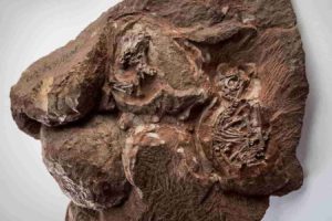
Manchestercarpa vancouverensis. Credit: Brian Atkinson
You might own something made from mahogany like furniture, paneling or a musical instrument.
Mahogany is a commercially important wood, valued for its hardness and beauty. The United States is the world’s top importer of the tropical timber from leading producers like Peru and Brazil. Unfortunately, mahogany is harvested illegally a lot of the time.
For science, mahogany is important, too — the fossil presence of the mahogany family is a telltale of where tropical forests once stood. Until recently, paleobotanists had only found evidence the mahogany family extended back to the Paleocene (about 60 million years ago).
Now, a new paper written by University of Kansas researcher Brian Atkinson in the American Journal of Botany shows the mahogany family goes back millions of years more, to the last hurrah of the dinosaurs, the Cretaceous.
“For understanding when many of the different branches of the tree of life evolved, we’re primarily dependent on the fossil record,” said Atkinson, an assistant professor of ecology & evolutionary biology and curator in the Biodiversity Institute’s Division of Paleobotany. “In this case, Meliaceae, the mahogany family, is an ecologically and economically important group of trees. A lot of researchers have used this group as a study system to better understand the evolution of tropical rainforests. This work is the first definitive evidence that the tropically important trees were around during the Cretaceous period, when we first start to see the modernization of ecosystems and modern groups of plants.”
Atkinson’s new work pushes back the fossil record for Meliaceae by 15 to 20 million years, the Campanian stage of the Late Cretaceous, from between 72-79 million years ago. The well-preserved mahogany specimen Atkinson analyzed was discovered just off Vancouver Island in Canada.
“The rock that contained the specimen was collected by a local fossil collector, Graham Beard, who is the director of the Qualicum Beach Museum of Natural History,” Atkinson said. “He collected it years ago, but I was actually interested in the rock that has this fossil in it for something else. And as I kept preparing this rock, more for the other fossils were in there, this thing showed up by surprise. So, it was kind of found by accident.”
To pinpoint the fossil’s identity, Atkinson carefully studied the structure of the fossilized fruit and also analyzed phylogenetic information to figure out its relationship to other species in the mahogany family.
“I combined the molecular data from living representatives of the mahogany family with the morphology of the fossil, as well as the morphology of living species,” he said. “And then I subjugated that combined dataset to phylogenetic analyses, which allows us to reconstruct evolutionary relationships. Based on this analysis, we found the fossil is closely related to this genus called Melia, which is living today.”
The KU researcher gave the oldest-known mahogany fossil the scientific name Manchestercarpa vancouverensis — the species name signifies where the specimen was discovered, and the genus is named after an esteemed colleague in the field.
“I named it after a prolific paleobotanist who’s really improved our understanding of the evolution of flowering plants through the fossil record,” Atkinson said. “So, I named it in honor of Steve Manchester, who’s at the University of Florida Museum of Natural History.”
While it’s noteworthy that Atkinson has pushed back the origin story of mahogany, he stressed it also helps improve our understanding of the rate of early flowering plant evolution and, in turn, our grasp of larger modern ecosystems.
“They’re our most diverse group of plants on Earth, and so there’s a whole lot to explore,” he said. “And there are some cool things you can do methodologically that you might not be able to do with other groups of plants. I can really ask some exciting paleontological and general evolutionary questions with this group.”
Reference:
Brian A. Atkinson. Fossil evidence for a Cretaceous rise of the mahogany family. American Journal of Botany, 2020; 107 (1): 139 DOI: 10.1002/ajb2.1416
Earth’s molten core may be leaking iron, according to researchers who analyzed how iron behaves inside our planet.
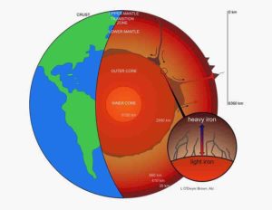
The boundary between the liquid iron core and the rocky mantle is located some 1,800 miles (2,900 km) below Earth’s surface. At this transition, the temperature drops by more than a thousand degrees from the hotter core to the cooler mantle.
The new study suggests heavier iron isotopes migrate toward lower temperatures — and into the mantle — while lighter iron isotopes circulate back down into the core. (Isotopes of the same element have different numbers of neutrons, giving them slightly different masses.) This effect could cause core material infiltrating the lowermost mantle to be enriched in heavy iron isotopes.
“If correct, this stands to improve our understanding of core–mantle interaction,” said Charles Lesher, lead author, professor emeritus of geology at UC Davis and professor of earth system petrology at Aarhus University in Denmark.
Leaky at the core
Understanding the physical processes operating at the core–mantle boundary is important for interpreting seismic images of the deep mantle, as well as modeling the extent of chemical and thermal transfer between the deep Earth and surface of our planet, Lesher said.
Lesher and his colleagues analyzed how iron isotopes move between areas of different temperatures during experiments conducted under high temperature and pressure. Their findings can explain why there are more heavy iron isotopes in mantle rocks than in chondrite meteorites, the primordial material from the early solar system, Lesher said.
“If true, the results suggest iron from the core has been leaking into the mantle for billions of years,” he said.
Computer simulations performed by the research team show this core material can even reach the surface, mixed with and transported by hot, upwelling mantle plumes. Some lavas erupted at oceanic hot spots such as Samoa and Hawaii are enriched in heavy iron isotopes, which Lesher and the team propose could be a signature of a leaky core.
The study was published April 6 in the journal Nature Geoscience.
This research was funded by the National Science Foundation, the Niels Bohr Professorship in Geoscience from the Danish National Research Foundation, and The Natural Sciences and Engineering Research Council of Canada.
Reference:
Charles E. Lesher, Juliane Dannberg, Gry H. Barfod, Neil R. Bennett, Justin J. G. Glessner, Daniel J. Lacks, James M. Brenan. Iron isotope fractionation at the core–mantle boundary by thermodiffusion. Nature Geoscience, 2020; DOI: 10.1038/s41561-020-0560-y
Earth’s atmosphere is made up of 78% nitrogen and 21% oxygen, a mixture that is unique in the solar system. The oxygen was produced by some of the first living organisms. But where did the nitrogen come from? Did it escape from Earth’s mantle through volcanic activity?
To try to answer these questions, Jabrane Labidi, a CNRS researcher at the Institut de Physique du Globe de Paris (CNRS/IPGP/IGN) and his colleagues collected samples of gas from several volcanic sites on our planet.
Their study, published on 16 March 2020 in the journal Nature, shows that nitrogen from magma formed within the mantle does not have the same isotopic composition as atmospheric nitrogen, implying that the latter does not come from degassing of the mantle.
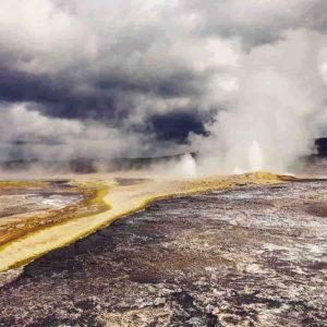
However, the team were able to use these measurements to identify, in geysers, fumaroles and other phenomena involving volcanic gases, the contribution of the atmosphere (in the form of heated rainwater) and that of Earth’s mantle (magmatic gas): for instance, small amounts of magmatic gas were detected in geysers in Yellowstone National Park, indicating renewed activity. This highly precise data could therefore help to predict future volcanic eruptions.
Samples continue to be collected at Yellowstone, and more sampling will be carried out in fumaroles on the Mayotte islands, near which a new submarine volcano recently emerged.
As for the origin of atmospheric nitrogen, it remains a mystery… for now.
Reference:
Hydrothermal 15N15N abundances constrain the origins of mantle nitrogen, Nature (2020). DOI: 10.1038/s41586-020-2173-4
Note: The above post is reprinted from materials provided by CNRS.
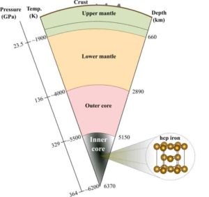
The inner core is likely composed of the hexagonal close packed phase of iron and located at the center of the Earth at pressures between 329 and 364 GPa and temperatures of ~5000 to ~6000 K. Credit: Ehime University
A theoretical mineral physics approach based on the ab initio methods was adopted to determine the viscosity of hexagonal, close-packed iron at the extreme pressures and temperatures corresponding to the Earth’s inner core. The results are found to deny geophysical observations of large fluctuations in the inner core rotation rate. The obtained viscosity also rules out inner core translation and provides support that the dynamics of the inner core may be governed by solid-state convection.
The Earth’s inner core, hidden 5150 km below our feet, is primarily composed of solid iron and is exposed to pressures between 329 and 364 GPa (which are ~3.3 to 3.6 million times that of atmospheric pressure) and temperatures of ~5000 to ~6000 K (Image 1). Seismological observations previously revealed that the velocity of seismic waves produced by earthquakes depend strongly on their direction when traveling through the inner core, a phenomenon known as “seismic anisotropy.” This is due to the alignment of the iron crystals, something that may be caused by deformation inside the inner core. More specific variations in seismic anisotropy between the eastern and western hemisphere of the inner core have also been reported. Other seismic studies furthermore suggest “distinct fluctuations in the inner core rotation rate” with respect to that of the Earth’s crust and mantle. Although previous geodynamic modelings predict that the hemispherical asymmetry of the seismic anisotropy structure can be explained by “a translational motion of the inner core” and that variations in the length of a day can be explained by the gravitational coupling between the mantle and a weak inner core, the causes and mechanisms of these enigmatic features remain unclear because their modelings rely on the poorly constrained “viscous strength” of iron at the extreme conditions of the Earth’s center.
The viscosity of the materials depends on the way iron crystals undergo plastic deformation in response to a mechanical stress, and deformation mechanisms called “creep” are generally expected under high-temperature and small stress conditions. Creep of solid crystals is generally accommodated by the motion of imperfect arrangements of atoms in the crystal structures called “lattice defects” and is particularly limited by “atomic diffusion” under the conditions of the inner core. Such conditions impose technical difficulties on laboratory experiments making measurements of the inner core viscosity currently impossible. Instead, Dr. Sebastian Ritterbex, a post-doctoral researcher, and Prof. Taku Tsuchiya from the Geodynamics Research Center, Ehime University, applied atomic scale computer simulations based on quantum mechanics theory, called “the ab initio methods,” to quantify atomic diffusion in hexagonal close packed (hcp) iron, the most likely phase of iron stable in the inner core.
This theoretical mineral physics approach can compute electronic properties and chemical bondings highly accurately and thus is quite powerful in investigating material properties in extreme conditions which are difficult to handle by experiments. In this study, the technique was applied to compute iron self-diffusion through energetics of the formation and migration of point defects. Results are applied to macroscopic models of intracrystalline plasticity to compute the rate-limiting creep behavior of hcp iron numerically. The modeling provides evidence that the viscosity of hcp iron is lower than postulated in the previous geophysical modelings and determined by the transport of shear through the crystal lattice, a plastic deformation mechanism known as “dislocation creep”, which can lead to the formation of crystallographic preferred orientations. This suggests that plastic flow of hcp iron might indeed contribute to the crystal alignment and thus the seismic anisotropy in the inner core.
The results shed new light on the enigmatic properties of the inner core. The researchers demonstrate that the low viscosity of hcp iron derived from the theoretical mineral physics approach is consistent with a strong coupling between the inner core and mantle compatible with geophysical observations of small fluctuations in the inner core rotation rate. The results furthermore predict that the inner core is too weak to undergo translational motion, meaning that the hemispherical asymmetric structure is likely to have another, yet unknown, origin. Instead, mechanical stresses of tens of Pa are sufficient to deform hcp iron by dislocation creep at extremely low strain rates, comparable to the candidate forces able to drive inner core convection. The associated viscosity is not a constant but instead depends on the mechanical stress applied to the inner core, a behavior known as “non-Newtonian rheology.” This nonlinear deformation behavior is therefore expected to govern the dynamics of the Earth’s inner core.
In the future, more quantitative modelings using the viscous properties of hcp iron obtained in this study could enhance the understanding of the Earth’s inner core.
The study is published in Scientific Reports.
Reference:
Sebastian Ritterbex et al. Viscosity of hcp iron at Earth’s inner core conditions from density functional theory, Scientific Reports (2020). DOI: 10.1038/s41598-020-63166-6
Note: The above post is reprinted from materials provided by Ehime University .
The early Earth was hotter than it is today and this affected the strength of the crust and mantle.
An international study led by Monash University has revealed a new mechanism that may have changed the state of the Earth’s crust some 2.5 billion years ago.
The study, involving researchers from Ruhr-Universität Bochum (Germany) and ETH Zürich (Switzerland) is published in a recent edition of Earth and Planetary Science Letters.
The crust of the modern Earth is in constant slow motion—it moves at about the rate at which our finger nails grow, explains lead study author Dr. Priyadarshi Chowdhury, a Research Fellow at the Monash University School of Earth, Atmosphere and Environment.
“This has resulted in oceans opening (sea-floor spreading) and continents drifting apart through a process, known as ‘plate tectonics,'” he said.
“Some key features that result from the present-day style of plate tectonics were not found in the older rocks, and this is a dilemma.
“Our work shows that the early Earth, sometime prior to 2.5 billion years, operated by a mechanism different than present-day plate tectonics.”
Dr. Chowdhury, is part of the Monash “Pulse of the Earth’ project led by Monash ARC Laureate Fellow Professor Peter Cawood. The project aims to establish the origin and evolution of the continental crust and its role in the long-term development of the Earth system.
The continental crust hosts the resources on which we depend, and its evolution controls the environment in which we live. The crust’s most fundamental feature is that its record (including resources) is episodic in space and time, yet the origin of this periodicity is unresolved.
“The early Earth was hotter than it is today and this affected the strength of the crust and mantle,” said Dr. Chowdhury.
“Our study shows that under these conditions the lower crust peeled off and sank back into the hotter mantle,” he said.
“Importantly, this process explains the characteristics of such ancient rocks, which remained enigmatic.
“We think the ‘peel-back process’ was also the seed for our planet to develop modern plate tectonics.”
The research team used mathematical modelling to map the dynamics of this peel-back process.
They simultaneously tracked the pressure and temperature conditions in different segments of the crust through this process.
This helped them to predict the kinds of igneous and metamorphic rocks that would form, and these predictions were compared with observed rock records on the early Earth.
“These changes set the course of Earth’s evolution that eventually led to its present-day state, which is characterised by continents with thick silicic crust and oceans with thin mafic crust, as well as the presence of an oxygenated atmosphere and the proliferation of life,” Dr. Chowdhury said.
The sparse geological record of the early Earth is a major impediment for unravelling the tectonic setting that triggered these changes.
Numerical modelling fills this gap by allowing geologists to understand the processes that operated at the time and how they provided the stepping-stone for the planet we live on today.
“Our research has been able to identify the tectonic setting that operated billions of years ago that may have set the Earth on a voyage towards the present day planet, which provides the environment for life and the resources on which we depend,” Dr. Chowdhury said.
Reference:
Priyadarshi Chowdhury et al. Peel-back controlled lithospheric convergence explains the secular transitions in Archean metamorphism and magmatism, Earth and Planetary Science Letters (2020). DOI: 10.1016/j.epsl.2020.116224
Reconstruction of the giant pterosaur Hatzegopteryx launching into the air, just after the forelimbs have left the ground. Credit: Mark Witton
Pterosaurs were the largest animals ever to fly. They soared the skies for 160 million years — much longer than any species of modern bird. Despite their aeronautic excellence, these ancient flyers have largely been overlooked in the pursuit of bioinspired flight technologies. In a review published April 15 in the journal Trends in Ecology and Evolution researchers outline why and how the physiology of fossil flyers could provide ancient solutions to modern flight problems, such as aerial stability and the ability of drones to self-launch.
“There’s a lot of really cool stuff in the fossil record that goes unexplored because engineers generally don’t look to paleontology when thinking about inspiration for flight,” says first author Liz Martin-Silverstone (@gimpasaura), a post-doctoral researcher and paleontologist at the University of Bristol. “If we’re only looking at modern animals for inspiration, we’re really missing a large degree of the morphology out there and ignoring a lot of options that I think could be useful.”
Previously, engineers have largely focused on the physiology of modern birds and insects when designing aeronautic technology like drones and planes; they might not think to examine fossils that — by their nature — are often incomplete. However, Martin-Silverstone says there are a select few pterosaur fossils that provide extraordinarily deep insight into the anatomy of their wings, which is essential for understanding their flight capabilities.
“There are two or three absolutely amazingly preserved pterosaur fossils that let you see the different layers within the wing membrane, giving us insight into its fibrous components. Also, some fossils are preserved enough to show the wing attachments beneath the hip,” she says. “While you don’t know exactly the shape of the wing, by knowing the membrane attachments you can model the effectiveness of different wing shapes and determine which would have performed best in natural conditions.” Analyzing the morphology and predicted flight mechanics of these ancient creatures has revealed novel tactics that don’t exist in modern flyers.
Becoming airborne is one example. Launching into the air through a leap or jump, also known as ballistic launch, is standard throughout the animal kingdom. However, larger birds require a running start to gain enough momentum for lift-off. Pterosaurs, on the other hand, may have developed a method to launch from a stationary position despite some specimens weighing nearly 300 kilograms. One hypothesis, proposed by review co-author Mike Habib (@aeroevo) of the Dinosaur Institute at the Natural History Museum of Los Angeles County, suggests that the wing membrane and the robust muscle attachments in the wings allowed pterosaurs to generate a high-powered leap off of their elbows and wrists, giving them enough height to become airborne.
“Today, something like a drone requires a flat surface to launch and is quite restricted on how it actually gets into the air. The unique launch physiology of pterosaurs might be able to help solve some of these problems,” Martin-Silverstone says.
Pterosaurs can also provide insights on how to prevent flight instability once in the air. Contrary to how sails can become unstable in a strong wind, pterosaurs evolved strategies to resist flutter of their broad wings. “So far we’ve struggled to design things like flight suits that can resist the pressures of flight. If we can understand how pterosaurs did it, for instance by understanding how their wing membrane was actually structured, then that’s something we can use to answer modern engineering questions,” she says.
These unique physiological elements aren’t limited to pterosaurs, either. Other ancient flyers, like Microraptor, had feathered wings on both their arms and legs, while newly discovered dinosaur, Yi qi, had wings that combine feathers with a bat-like membrane — a body plan that has never been repeated since their extinction. As such, the authors say many flight strategies remain to be properly explored.
Martin-Silverstone suggests that if we combine our knowledge from flyers both living and extinct, we will have a much better chance of overcoming the hurdles still hindering human-made flight. She says: “We want biologists and engineers alike to reach out to paleontologists when they are looking to solving flight problems, as there might be something extinct that could help. If we limit ourselves to looking at the modern animals, then we’re missing out on a lot of diversity that might be useful.”
Reference:
Elizabeth Martin-Silverstone, Michael B. Habib, David W.E. Hone. Volant Fossil Vertebrates: Potential for Bioinspired Flight Technology. Trends in Ecology & Evolution, 2020; DOI: 10.1016/j.tree.2020.03.005
Note: The above post is reprinted from materials provided by Cell Press.
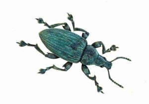
Artistic reconstruction of the type of weevil studied. Credit: James McKay
Researchers from Yale-NUS College in Singapore and University College Cork (UCC) in Ireland have analysed preserved scales from wing cases of two fossil weevils from the Late Pleistocene era (approx. 13,000 years ago) to better understand the origin of light-scattering nanostructures present in present-day insects.
The researchers, led by Yale-NUS Assistant Professor of Science (Life Sciences) Vinod Kumar Saranathan and UCC paleobiologists Drs Luke McDonald and Maria McNamara, found that the wing cases of the fossil weevils contained preserved photonic ‘diamonds’, one of the many types of crystal like nanoscopic structure that interacts with light to produce some of the brightest and purest colours in nature.
The outer coverings of many insects comprise repeating units arranged in a crystalline formation that interact with visible light to produce structural colours, which typically have a metallic, iridescent appearance. For many of these insects, the iridescent colours perform a variety of functions including camouflage, signalling potential mates, and warning off predators. To date, the evolutionary history of these complex tissue structures has not been clearly defined. This study highlights the great potential of the fossil record as a means to unearth the evolutionary history of structural colours, not only in weevils but also in other insects, and paves the way for further research on the development of these light-scattering nanostructures and the vibrant colours they give rise to.
The researchers used powerful electron microscopes and state-of-the-art synchrotron X-ray scattering and optical modelling techniques to identify and characterise a rare 3D photonic crystal nanostructure in the fossil weevil scales — whose blue and green hues are very similar to those of modern weevils from the same genus — revealing a diamond-like arrangement. Instances of 3D nanostructures are extremely rare in the fossil record. This study marks the second time such nanostructures have been found. The only other instance of such nanostructures found in the fossil record of another weevil was also discovered by Asst Prof Saranathan and Dr McNamara.
The fact that very similar substrate-matching green colours have been maintained over hundreds of thousands of generations suggest that the same selective pressures for camouflage have been acting on these weevils. This is consistent with a recent study by Asst Prof Saranathan and weevil systematist Dr Ainsley Seago that suggests the weevils’ colours evolved initially for camouflage amongst their leafy background, before diversifying for other functions such as to signal potential mates or deter predators.
Asst Prof Saranathan, who holds a concurrent appointment at the National University of Singapore’s Department of Biological Sciences, said, “It is very interesting to discover that insects first seem to evolve complex 3D nanoscale architectures in order to escape predators by blending in with their background (usually brown or green). Only later do these colours diverge for other uses, such as signalling potential mates or as a warning to predators that the insect is not worth eating.”
Reference:
Luke T. McDonald, Suresh Narayanan, Alec Sandy, Vinodkumar Saranathan, Maria E. McNamara. Brilliant angle-independent structural colours preserved in weevil scales from the Swiss Pleistocene. Biology Letters, 2020; 16 (4): 20200063 DOI: 10.1098/rsbl.2020.0063
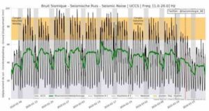
Things are really quieting down on planet Earth. Credit: The Royal Observatory of Belgium.
As COVID-19 continues to wreak its viral havoc on the human population of Earth, governments around the world have closed their schools, shut down non-essential businesses, and told their citizens to stay at home as much as possible. In other words, there’s a lot less human activity on our planet, and it’s led to a detectable drop in seismic activity.
And while a single footfall or lonely truck rumbling down the highway isn’t exactly Earth-shaking, the combined vibrations from millions of feet and wheels can be detected by the world’s most sensitive seismographs, adding to a continual background hum in the detectors—a background that has dropped by over 30%, according to scientists at both the Royal Observatory of Belgium in Brussels and the California Institute of Technology in Pasadena.
This reduction is usually only seen around the Christmas holiday, and for a much briefer time. But ever since the mid-March shutdowns around the globe, the Earth is a little less noisy.
Not all stations will see such a dramatic shift, however. The seismographs located well beyond urban centers and/or buried deep underground are already well-insulated from all that background hustle. But the lowering of the human-related noise means that city-based stations can now catch the much fainter signals that are usually obscured by the commotion.
The cleaner data at urban seismograph stations allows scientists to study fainter tremors in the Earth’s crust, and could lead to a better understanding of everything from volcanic activity to changes in the Earth’s water table—an unexpected side-effect of a good chunk of humanity having to work from home.
Researchers at Woods Hole Oceanographic Institution (WHOI), the University of California Los Angeles (UCLA) and their colleagues used a new geochemical tool to shed light on the origin of nitrogen and other volatile elements on Earth, which may also prove useful as a way to monitor the activity of volcanoes. Their findings were published April 16, 2020, in the journal Nature.
Nitrogen is the most abundant gas in the atmosphere, and is the primary component of the air we breathe. Nitrogen is also found in rocks, including those tucked deep within the planet’s interior. Until now, it was difficult to distinguish between nitrogen sources coming from air and those coming from inside the Earth’s mantle when measuring gases from volcanoes.
“We found that air contamination was masking the pristine ‘source signature’ of many volcanic gas samples,” says WHOI geochemist Peter Barry, a coauthor of the study.
Without that distinction, scientists weren’t able to answer basic questions like: Is nitrogen left over from Earth’s formation or was it delivered to the planet later on? How is nitrogen from the atmosphere related to nitrogen coming out of volcanoes?
Barry and lead author Jabrane Labidi of UCLA, now a researcher at Institut de Physique du Globe de Paris, worked in partnership with international geochemists to analyze volcanic gas samples from around the globe — including gases from Iceland and Yellowstone National Park — using a new method of analyzing “clumped” nitrogen isotopes. This method provided a unique way to identify molecules of nitrogen that come from air, which allowed the researchers to see the true gas compositions deep within Earth’s mantle. This ultimately revealed evidence that nitrogen in the mantle has most likely been there since our planet initially formed.
“Once air contamination is accounted for, we gained new and valuable insights into the origin of nitrogen and the evolution of our planet,” Barry says.
While this new method helps scientists understand the origins of volatile elements on Earth, it may also prove useful as a way of monitoring the activity of volcanoes. This is because the composition of gases bellowing from volcanic centers change prior to eruptions. It could be that the mix of mantle and air nitrogen could one day be used as a signal of eruptions.
This study was supported by the Deep Carbon Observatory and the Alfred P. Sloan Foundation. The research team also included colleagues David Bekaert and Mark Kurz from WHOI, scientists from several other U.S.-based universities, and from France, Canada, Italy, the United Kingdom and Iceland.
Reference:
J. Labidi, P. H. Barry, D. V. Bekaert, M. W. Broadley, B. Marty, T. Giunta, O. Warr, B. Sherwood Lollar, T. P. Fischer, G. Avice, A. Caracausi, C. J. Ballentine, S. A. Halldórsson, A. Stefánsson, M. D. Kurz, I. E. Kohl, E. D. Young. Hydrothermal 15N15N abundances constrain the origins of mantle nitrogen. Nature, 2020; 580 (7803): 367 DOI: 10.1038/s41586-020-2173-4
A new study finds volcanic activity played a direct role in triggering extreme climate change at the end of the Triassic period 201 million year ago, wiping out almost half of all existing species. The amount of carbon dioxide released into the atmosphere from these volcanic eruptions is comparable to the amount of CO2 expected to be produced by all human activity in the 21st century.
The end-Triassic extinction has long been thought to have been caused by dramatic climate change and rising sea levels. While there was large-scale volcanic activity at the time, known as the Central Atlantic Magmatic Province eruptions, the role it played in directly contributing to the extinction event is debated. In a study for Nature Communications, an international team of researchers, including McGill professor Don Baker, found evidence of bubbles of carbon dioxide trapped in volcanic rocks dating to the end of the Triassic, supporting the theory that volcanic activity contributed to the devastating climate change believed to cause the mass extinction.
The researchers suggest that the end-Triassic environmental changes driven by volcanic carbon dioxide emissions may have been similar to those predicted for the near future. By analysing tiny gas exsolution bubbles preserved within the rocks, the team estimates that the amount of carbon emissions released in a single eruption — comparable to 100,000 km3 of lava spewed over 500 years — is likely equivalent to the total produced by all human activity during the 21st century, assuming a 2C rise in global temperature above pre-industrial levels.
“Although we cannot precisely determine the total amount of carbon dioxide released into the atmosphere when these volcanoes erupted, the correlation between this natural injection of carbon dioxide and the end-Triassic extinction should be a warning to us. Even a slight possibility that the carbon dioxide we are now putting into the atmosphere could cause a major extinction event is enough to make me worried,” says professor of earth and planetary sciences Don Baker.
Reference:
Manfredo Capriolo, Andrea Marzoli, László E. Aradi, Sara Callegaro, Jacopo Dal Corso, Robert J. Newton, Benjamin J. W. Mills, Paul B. Wignall, Omar Bartoli, Don R. Baker, Nasrrddine Youbi, Laurent Remusat, Richard Spiess, Csaba Szabó. Deep CO2 in the end-Triassic Central Atlantic Magmatic Province. Nature Communications, 2020; 11 (1) DOI: 10.1038/s41467-020-15325-6
Texas is a huge state with incredibly diverse geographical features, from sandy beaches and lush hill country to dry, scrubby desert. In all of Texas there are a wide range of gems and minerals and fossils. Remember that there are almost no public lands in Texas, so permission for gems to be excavated on private lands is necessary. Some digging sites require you to pay a day’s cost for digging different gems and minerals.
Where are Rare Gems & Minerals found in Texas?
Amber
Rich brown to yellowish amber has been found near Eagle Pass, Maverick County, in Cretaceous coal and on Terlingua Creek, Brewster County. Although much of this material is translucent and the quality suitable for lapidary purposes, the pieces are seldom more than a fraction of an inch in diameter.
Occasional finds of poor quality brownish amber have been reported from the
Tertiary formations of the Gulf Coastal Plain, but thus far no gem quality material has been found.
The softness of amber limits its use to brooches, necklaces,and other jewelry that is relatively safe from abrasion.
Augite
Augite of gem quality occurs near Eagle Flat, Hudspeth County, Texas. Although this material is very dark greenish brown and not commonly thought of as a gemstone, lapidaries have used it to fashion black faceted stones and cabochons that resemble obsidian. Most of the augite occurs as loose pieces and crystal fragments that have weathered out of nearby igneous rocks; the augite can also be found in situ in the igneous rocks.
Specimen sand pieces of cutting quality 1 inch in diameter are common, and fragments over 2 inches in diameter have been found. The augite is associated with black spinel and some dark gray to black pieces of natural glass. Although the faceted and cabochon-cut stones are not particularly attractive, some of the larger pieces of augite might be utilized for carving.
Beryl
Beryl crystals have been found in pegmatite dikes in Llano, Blanco, and Gillespie counties. These crystals are commonly several inches long and exceed 1 inch in diameter but are very badly fractured. Most of the beryl crystals do not approach gem quality and are entirely unsuitable for any lapidary use. The color of the crystals found thus far is bluish,greenish, pinkish brown, yellowish, and colorless. Some very tiny colorless beryl crystals have been found that are transparent,but thus far such crystals have been too small to be cut into gems.
Fine blue beryl crystals have been found in the Franklin Mountains near El Paso, Texas. Unfortunately, these crystals are so badly flawed and fractured that they are not suitable for lapidary use.
It seems likely that careful prospecting of Texas pegmatites will reveal at least some gem-quality beryl.
Celestite
Celestite is very seldom cut into gems. Being very soft, brittle, and having three cleavages, celestite is completely unsuitable for jewelry. These same properties make this mineral exceedingly difficult to facet; however, faceted stones are seen in large collections.
Fine crystals of colorless and blue gem quality celestite have been found at Mount Bonnell and other localities west of Austin, Travis County. The celestite crystals occur in vugs or geodes in limestone. The crystals are mostly white or colorless and fractured near the base or where attached, but the tips of the crystals are commonly clear celestine blue and completely free of flaws.
Crystals several inches in length have been found, but the average size is about 1 inch. The smaller crystals are frequently more transparent and consequently better suited for cutting. It is very difficult to obtain crystals that will allow the cutting of flaw less stones of more than 4 or 5 carats.
Bluish and colorless celestite of gem quality and fine crystals have been found near Lampasas, Lampasas County, and near Brown wood, Brown County, but neither of these localities has been very productive of good gem material.
Celestite geodes have been found in parts of Coke, Fisher,and Nolan counties, but these geodes contain little gem material.
Diamond
There is only one well-authenticated find of diamond in Texas. A small brownish diamond was found in1911on section 64, block 44, Foard County. The exact weight of the stone has not been recorded, but one authority estimated that it was of sufficient size and clarity to yield a cut stone of about one-quarter carat.
The only diamond-bearing rocks known in the United States are in Pike County, Arkansas. Although many other diamonds have been found in the United States, all were loose in gravels or streams except for some stones at the Arkansas locality. The fact that one diamond was found in Foard County does not mean that the prospects of finding more diamonds in Texas are much better there than anywhere else in the State. It is highly unlikely that more than a very few diamonds will ever be found in Texas, and any stones that may be found in the future are likely to be widely scattered.
Epidote
Llano County has furnished some green and brownish-green epidote that is suitable for cutting into cabochons. Most of the material that approaches gem quality has come from contact metamorphic zones and is associated with garnet,quartz,and some scheelite. Some small cavities in the rocks contain tiny transparent crystals of gem quality, but the largest obtainable flaw less faceted stones would probably be less than 15 points.
Faceted stones of epidote are sometimes known as pistacite owing to their common pistachio-green color.
Fluorite
Very fine green, transparent fluorite has been found near Voca, Mason County.The fluorite occurs as vug fillings in pegmatites, associated with crystals of pink microcline and colorless quartz. Most of the vugs have been completely filled by the fluorite; therefore, crystals of the fluorite are not too common. Masses of fluorite several pounds in weight, rich green, and quite transparent have been found near Voca. Transparent pieces an inch or more in diameter are common.
Fluorite is much too soft for everyday use in jewelry and because of the low refractive index does not yield brilliant faceted stones. The perfect four-directional cleavage, relative softness, and brittle tenacity of the mineral make it difficult to facet. Faceted stones are seldom seen outrside of collections. Cabochons are also difficult to cut from this material, but the rich color obtained is ample reward for the time and care necessary in cutting.
Fluorite occurs at several other localities in Texas, notably in Hudspeth, Brewster, Presidio, Llano, and Burnet counties, but not commonly in gem quality or colors that warrant its use as gem material.
Gadolinite
Gadolinite as a cut gemis not seen outside of large collections; however, it can be faceted into black opaque stones of little beauty but of great interest to collectors. The best known locality of this mineral in the United States is Baringer Hill,Llano County, Texas. Unfortunately, this locality was completely flooded by the completion of Buchanan Dam in 1938. Masses and rough crystals of gadolinite weighing over 100 pounds were mined from this locality.
The gadolinite occurred in a large, very coarse-grained pegmatite dike associated with quartz, microcline, and fluorite, as well as allanite, fergusonite, nivenite, cyrtolite, thorogummite, and various other rare minerals. Some of the minerals in the dike occurred in very large masses. One quartz mass over 40 feet in diameter was noted,and microcline masses up to 30 feet in diameter were not uncommon. Much of the gadolinite was used by industrial firms as a source of thorium compounds, although some specimen and gem material found its way into museums and private collections. Because the locality was worked mostly from 1910 to about 1925 and because since 1938 the waters of Lake Buchanan have completely flooded the entire area, material from this locality is now exceedingly difficult to obtain. The collection of the Smithsonian Institution, Washington, D.C., contains a cut and polished gem of Baringer Hill gadolinite that weighs 8.6 carats.
Garnet
The garnet group of minerals is variable in composition. Listed below are the pure members of this group, but garnets found in nature are usually a mixture of two or more of these end members.
Good crystals of gem-quality almandite garnet have been found in Llano, Blanco, Burnet, and Gillespie counties. In southeast Llano County, northwest Blanco County, and northeast Gillespie County, the stones mostly occur in stream gravels where they have collected after being weathered out of compact mica schists.
Owing to the fact that most of the garnets have not been transported very far from their source, the stones commonly show good crystal form. All of the garnets from one locality commonly do not have exactly the same crystal form. The garnets are mostly widely scattered in the stream gravels but can be found concentrated behind rocks and on small gravel bars.
Many of the crystals are less than one eighth inch in diameter; however, good crystals one-fourth to one-half inch in diameter are common.Most of the stones are too fractured or have too many inclusions to yield gems,but many transparent stones have been found. The transparent crystals usually yield flawless deep red faceted stones of 2 carats or less. Some of the stones that contain too many inclusions to facet are cut as cabochons and are then often known as carbuncle.
Small garnet fragments have been found in streams and in gneisses and pegmatites near Castell, Llano County, but they are not commonly of gem quality.
Occasional small gem-quality garnets have been found in pegmatites and contact metamorphic zones in Burnet County. Garnets have also been found in several other counties, notably Mason, El Paso, Hudspeth, and Culberson, but no stones of facet quality have been reported.
Labradorite
Very fine facet-quality labradorite has been found about 20 miles south of Alpine, Brewster County. The labradorite occurs loose in the soil as slightly weathered or frosted cleavage fragments, commonly showing one or more crystal faces. The pale-yellow or straw-yellow color of these fragments, as well as their lack of internal imperfections, makes these stones excellent gem material. Individual pieces that exceed three-fourths inch in their longest dimensions are rare. Cut stones of more than 5 or 6 carats from this locality are scarce. The source of this material is uncertain, but it is probably weathering out of an underlying igneous rock.
Microcline
Very fine crystals of blue microcline have been found east of Packsaddle Mountain and near Kings land in Llano County. Crystals exceeding 1foot in length have been found,although most are only a few inches long. The color of the microcline is mostly pale blue, but some crystals are darker. Microcline crystals associated with milky or vein quartz, smoky quartz, some biotite, and rarely cassiterite occur in pegmatite dikes which vary in size from a few inches to several feet in thickness.
The color of this microcline is pale in comparison to microcline from someother localities in the United States, but the Texas blue microcline does yield pleasing cabochons. Perfect crystals of this material are prized by collectors. Blue or greenish microcline is often called amazonite or amazon stone.
Bluish microcline associated with quartz and topaz has also been reported near Katemcy, Mason County.
Red microcline is common in several central Texas counties and is a primary constituent of many of the igneous rocks in those counties. Large crystals of perthitic red microcline occur in pegmatite dikes of Mason,Llano, Burnet,and Gillespie counties. Any feldspar quarry or other pegmatite mining operation in anyof these counties is likely to containlarge red microcline crystals and fragments. Unfortunately, the good crystals that may have been present are often shattered by blasting during quarrying operations.
Obsidian
Gem-quality black and dark-gray obsidian has been found in Presidio County associated with extrusive igneous rocks. The obsidian in this area is too opaque to serve as attractive faceted stones but is found in pieces of sufficient size and quality to yield nice cabochons. Some of the small weathered pieces of this material resemble tektite in out ward appearance; in fact, the “valverdites” mistaken originally for tektites are pebbles of weathered obsidian in terrace gravel of Val Verde County. Obsidian takes a high polish but is very sensitive to heat. Stones that are slightly over heated during grinding or sanding will quickly shatter. Obsidian of gem quality has been reported also in Brewster County.
Opal
Opal other than as fossil or opalized wood occurs at the following several localities in Texas. Approximately 16 miles southof Alpine, Brewster County, precious opal occurs in very small seams and as cavity fillings in very hard pinkish-brown rhyolite. This opal is milky or bluish and commonly exhibits small flashes of blue, green,red, and orange fire. Individual pieces of this opal are mostly quite small, rarely over one fourth inch in diameter, and very difficult to remove from the tough rhyolite matrix.
Pearl
Pearls are the result of the secretion of calcium carbonate by various shellfish around sand grains, parasitic organisms, shell fragments, or other foreign objects that have in some way entered the body cavity of the shellfish. Since the shellfish is unable to expel these irritating particles or organisms, it deposits successive layers of calcium carbonate around the foreign substance to make it smoother and less irritating. Although pearls are principally calcium carbonate, they also contain small amounts of an organic substance, called conchiolin,and water.Pearls are found in shellfish that live in either fresh or salt water
Quartz
The quartz family gemstones can be divided into two groups for purposes of description. The first group is the crystalline varieties,or those quartz varieties that commonly occur in distinct crystals. The second group is the cryptocrystalline varieties, or those quartz varieties that occur as irregular masses that are composed of many microscopic crystals. The crystalline varieties are usually much more transparent and are most often seen as faceted stones. The cryptocrystalline varieties vary from sub-transparent to opaque and are almost always cut as cabochrons.
Topaz
In central Texas, in the Llano River area, particularly near the city of Mason and in the hills of Mason County, many exceptional specimens of blue topaz are found.
The few areas where blue topaz takes place in Texas are private, but you can check for topace specimens for a small cost at several fee digging locations. The Lindsay Ranch, Seaquist Ranch and Bar M Ranch are among the most famous locations.
Topaz screens are usually available at prices between $15 and $25 a day.
The colorless crystals and light-blue shades of topaz are found. Most crystals are small, but over the years some of the better sites have recovered big, quality pieces.
Amethyst
The Amethyst Mountains are known to have a deposit of the crystal however the amount or quality of the amethyst found there has not been recorded. The name of the mountain was suggested by the Geological department of the United States after an expedition to its summit as amethyst was found there.
Chalcedony
Two forms of chalcedony or cryptocrystalline formations are agate and jasper. In Brewster County, near the western town of Alpine, is available Moss agate that looks like a blue cheese, red and black agate. In the western central county of San Saba, in San McCulloch, and the north panhandle of the Moore County jasper, the shape of the jasper is typically red, green, yellow or gray.
Reference:
Texas Gemstones By Elbert A.King, Jr., The University of Texas at Austin, Austin,Texas.
Some of the world’s oldest known dinosaur eggs and embryos. The clutch of Massospondylus carinatus eggs discovered in 1976 in Golden Gate Highland National Park, South Africa. Credit: Brett Eloff
An international team of scientists led by the University of the Witwatersrand in South Africa, has been able to reconstruct, in the smallest details, the skulls of some of the world’s oldest known dinosaur embryos in 3D, using powerful and non-destructive synchrotron techniques at the ESRF, the European Synchrotron in France. They found that the skulls develop in the same order as those of today’s crocodiles, chickens, turtles and lizards. The findings are published today in Scientific Reports.
University of the Witwatersrand scientists publish 3D reconstructions of the ~2cm-long skulls of some of the world’s oldest dinosaur embryos in an article in Scientific Reports. The embryos, found in 1976 in Golden Gate Highlands National Park (Free State Province, South Africa) belong to South Africa’s iconic dinosaur Massospondylus carinatus, a 5-meter long herbivore that nested in the Free State region 200 million years ago.
The scientific usefulness of the embryos was previously limited by their extremely fragile nature and tiny size. In 2015, scientists Kimi Chapelle and Jonah Choiniere, from the University of Witwatersrand, brought them to the European Synchrotron (ESRF) in Grenoble, France for scanning. At the ESRF, an 844 metre-ring of electrons travelling at the speed of light emits high-powered X-ray beams that can be used to non-destructively scan matter, including fossils. The embryos were scanned at an unprecedented level of detail — at the resolution of an individual bone cell. With these data in hand, and after nearly 3 years of data processing at Wits’ laboratory, the team was able to reconstruct a 3D model of the baby dinosaur skull. “No lab CT scanner in the world can generate these kinds of data,” said Vincent Fernandez, one of the co-authors and scientist at the Natural History Museum in London (UK). “Only with a huge facility like the ESRF can we unlock the hidden potential of our most exciting fossils. This research is a great example of a global collaboration between Europe and the South African National Research Foundation,” he adds.
Up until now, it was believed that the embryos in those eggs had died just before hatching. However, during the study, lead author Chapelle noticed similarities with the developing embryos of living dinosaur relatives (crocodiles, chickens, turtles, and lizards). By comparing which bones of the skull were present at different stages of their embryonic development, Chapelle and co-authors can now show that the Massospondylus embryos were actually much younger than previously thought and were only at 60% through their incubation period.
The team also found that each embryo had two types of teeth preserved in its developing jaws. One set was made up of very simple triangular teeth that would have been resorbed or shed before hatching, just like geckos and crocodiles today. The second set were very similar to those of adults, and would be the ones that the embryos hatched with. “I was really surprised to find that these embryos not only had teeth, but had two types of teeth. The teeth are so tiny; they range from 0.4 to 0.7mm wide. That’s smaller than the tip of a toothpick!,” explains Chapelle.
The conclusion of this research is that dinosaurs developed in the egg just like their reptilian relatives, whose embryonic developmental pattern hasn’t changed in 200 million years. “It’s incredible that in more than 250 million years of reptile evolution, the way the skull develops in the egg remains more or less the same. Goes to show — you don’t mess with a good thing!,” concludes Jonah Choiniere, professor at the University of Witwatersrand and also co-author of the study.
The team hopes to apply their method to other dinosaur embryos to estimate their level of development. They will be looking at the rest of the skeleton of the Massospondylus embryos to see if it also shares similarities in development with today’s dinosaur relatives. The arms and legs of the Massospondylus embryos have already been used to show that hatchlings likely walked on two legs.
Main findings:
High powered X-rays were used to reconstruct the skulls of some of the world’s oldest known dinosaur embryos.
The skull could be seen in 3D at an unprecedented level of detail.
Dinosaur embryo skulls appear to develop in the same order as those of today’s crocodiles, chickens, turtles and lizards.
These dinosaur embryos appear to have been fossilised at approximately 60% through their incubation period. This is much earlier than previously thought.
The dinosaur embryos have two types of teeth that range in size from 0.4 to 0.7mm wide. One of these sets would have been shed or resorbed before hatching.
References:
Kimberley E. J. Chapelle, Vincent Fernandez, Jonah N. Choiniere. Conserved in-ovo cranial ossification sequences of extant saurians allow estimation of embryonic dinosaur developmental stages. Scientific Reports, 2020; 10 (1) DOI: 10.1038/s41598-020-60292-z
Kimberley E. J. Chapelle, Roger B. J. Benson, Josef Stiegler, Alejandro Otero, Qi Zhao, Jonah N. Choiniere. A quantitative method for inferring locomotory shifts in amniotes during ontogeny, its application to dinosaurs and its bearing on the evolution of posture. Palaeontology, 2020; 63 (2): 229 DOI: 10.1111/pala.12451
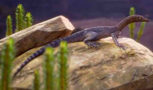
Life restoration of Elessaurus gondwanoccidens, from the Sanga do Cabral Formation (Lower Triassic), Brazil. Credit: Márcio L. Castro
A new species of Triassic reptile from Brazil is a close cousin of a mysterious group called tanystropheids, according to a study published April 8, 2020 in the open-access journal PLOS ONE by Tiane De-Oliviera of the Federal University of Santa Maria, Brazil and colleagues.
After the Permian mass extinction, 250 million years ago, reptiles took over global ecosystems. Among the early groups to appear after this extinction event were the tanystropheids, a group of long-necked animals whose lifestyles are still mysterious, but who were nonetheless successful in the Triassic Period. However, the early evolution of this group is poorly understood, as their remains are very rare from the Early Triassic.
In this study, De-Oliviera and colleagues describe a new specimen of reptile from Early Triassic rocks of the Sanga do Cabral Formation in southern Brazil. Skeletal comparison indicates this specimen, known from remains of the hind leg, pelvis, and tail, is the closest known relative of tanystropheids. The researchers identified these remains as belonging to a new species, which they named Elessaurus gondwanoccidens. The name derives in part from the Elvish name (Elessar) of a character from Lord of the Rings also known as Aragorn or Strider, chosen as a reference to the fossil animal’s long legs.
Most tanystropheid fossils are found in Middle to Late Triassic rocks of Europe, Asia, and North America, and often in marine sediments. The presence of Elessaurus in continental deposits of Early Triassic South America suggests that the origins of this group may lie in the southern continents, and that their ancestors may have lived on land before later species adapted to aquatic life. A clearer view of the group’s origins will rely on more rare fossils from this early time in their evolution.
Reference:
Tiane M. De-Oliveira, Felipe L. Pinheiro, Átila Augusto Stock Da-Rosa, Sérgio Dias-Da-Silva, Leonardo Kerber. A new archosauromorph from South America provides insights on the early diversification of tanystropheids. PLOS ONE, 2020; 15 (4): e0230890 DOI: 10.1371/journal.pone.0230890
Note: The above post is reprinted from materials provided by PLOS.
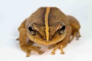
The common name “coquí” describes various species of frogs in the genus Eleutherodactylus and is derived from two species’ distinctive chirping calls. The common coquí, Eleutherodactylus coquí, is the national symbol of Puerto Rico. Photo courtesy of Alberto Lopez Torres
The bright chirp of the coquí frog, the national symbol of Puerto Rico, has likely resounded through Caribbean forests for at least 29 million years.
A new study published in Biology Letters describes a fragmented arm bone from a frog in the genus Eleutherodactylus, also known as rain frogs or coquís. The fossil is the oldest record of frogs in the Caribbean and, fittingly, was discovered on the island where coquís are most beloved.
“It’s a national treasure,” said David Blackburn, Florida Museum curator of herpetology and the study’s lead author. “Not only is this the oldest evidence for a frog in the Caribbean, it also happens to be one of the frogs that are the pride of Puerto Rico and related to the large family Eleutherodactylidae, which includes Florida’s invasive greenhouse frogs.”
Jorge Velez-Juarbe, associate curator of marine mammals at the Natural History Museum of Los Angeles County, found the fossil on a river outcrop in the municipality of San Sebastian in northwestern Puerto Rico. Velez-Juarbe and his collaborators’ previous collecting efforts at the site uncovered fossil seeds, sea cows, side-necked turtles and the oldest remains of gharials and rodents in the Caribbean, dating to the early Oligocene Epoch, about 29 million years ago.
Still, “there have been many visits from which I have come out empty-handed over the last 14 years,” he said. “I’ve always kept my expectations not too high for this series of outcrops.”
On this trip in 2012, he combed the deposits for half a day without much luck when a small bone, partially exposed in the sediment, caught his eye. He examined it with his hand lens.
“At the moment, I couldn’t wrap my mind as to what it was,” Velez-Juarbe said. “Then once I got back home, cleaned around it with a needle to see it better and checked some references, I knew I had found the oldest frog in the Caribbean.”
The ancient coquí displaces an amber frog fossil discovered in the Dominican Republic in 1987 for the title of oldest Caribbean frog. While the amber fossil was originally estimated to be 40 million years old, scientists now date Dominican amber to about 20 million to 15 million years ago, Blackburn said.
Based on genetic data and family trees, scientists had hypothesized rain frogs lived in the Caribbean during the Oligocene, but lacked any fossil evidence. The small, lightweight bones of frogs often do not preserve well, especially when combined with the hot, humid climate of the tropics.
Matching a single bone fragment to a genus or species “is not always an easy process,” Velez-Juarbe said. It can also depend on finding the right expert. His quest for help identifying the fossil turned up empty until a 2017 visit to the Florida Museum where he had once been a postdoctoral researcher.
“I got to talk with Dave about projects, and the rest is now history,” he said.
Possibly first arriving in the Caribbean by rafting from South America, frogs in the genus Eleutherodactylus, which encompasses some 200 species, dominate the region today.
“This is the most diverse group by two orders of magnitude in the Caribbean,” Blackburn said. “They’ve diversified into all these different specialists with various forms and body sizes. Several invasive species also happen to be from this genus. All this raises the question of how they got to be this way.”
One partial arm bone may not tell the whole story of coquí evolution — but it’s a start.
“I am thrilled that, little by little, we are learning about the wildlife that lived in Puerto Rico 29-27 million years ago,” Velez-Juarbe said. “Finds like this help us unravel the origins of the animals we see in the Caribbean today.”
Reference:
David C. Blackburn, Rachel M. Keeffe, María C. Vallejo-Pareja, Jorge Vélez-Juarbe. The earliest record of Caribbean frogs: a fossil coquí from Puerto Rico. Biology Letters, 2020; 16 (4): 20190947 DOI: 10.1098/rsbl.2019.0947
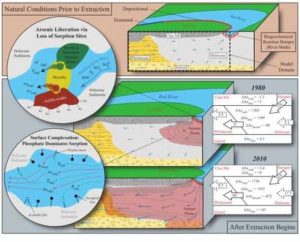
These are figures from the Nature Geoscience groundwater aquifer paper. Credit: Wallis et al
Naturally occurring (geogenic) groundwater arsenic contamination is a problem of global significance, with noteworthy occurrences in large parts of the alluvial and deltaic aquifers in South and Southeast Asia. To address this problem tremendous research efforts have been dedicated over the last two decades to better understand the sources and distribution of arsenic-polluted groundwater. Now, an Australian team of scientists from Flinders University, CSIRO and the University of Western Australia, together with their colleagues at the Swiss Federal Institute of Aquatic Science and Technology (Eawag), have used computer modelling to integrate much of what has been learned over the years into computer simulations that mimic the complex interactions between groundwater flow, solute transport and geochemical reaction mechanisms. Such models are important to analyse field observations, to unravel which chemical and physical processes play a role, and to predict the behaviour of arsenic within aquifers — where and when pollution may occur in the future. The results of their study have now been published in the latest issue of Nature Geoscience.
Reconstructing the past to predict future arsenic behaviour
The research team selected a highly arsenic polluted site near Hanoi (Vietnam) to develop and test their computer model. In a first step they used the tiny concentrations of tritium that had entered the groundwater system from the atmosphere during the times of nuclear bomb testing, and its decay product helium, a noble gas, to reconstruct how fast and where the groundwater was moving over the last 5 decades. Once the model simulations were able to match the concentrations that were measured, additional complexity was added to the model in order to simulate how arsenic was mobilised and transported in the Holocene aquifer.
The river-groundwater interface acts as reaction hotspot
At the study site, changes in groundwater flow occurred over the past 50 years since the city of Hanoi markedly increased the extraction of groundwater to satisfy its steadily increasing water demand; this showed to be the main trigger for arsenic pollution in the aquifer. The computer modelling allowed the researchers to pinpoint the source of arsenic down to the river muds that are regularly deposited at the more slow-flowing zones of the Red River. The organic matter contained in those muds fuelled a biogeochemical reaction that led to the release of arsenic and its km-long transport into the aquifer underlying the Van Phuc village, a process that continues to this day. Employing their developed computer model in predictive mode the researchers were able to illustrate the interplay of four key factors on the evolution and longevity of arsenic release at surface water/groundwater interfaces, (i) the abundance of reactive organic matter; (ii) the abundance of iron oxides; (iii) the magnitude of groundwater flow; and (iv) river mud deposition rate.
Reference:
Ilka Wallis, Henning Prommer, Michael Berg, Adam J. Siade, Jing Sun, Rolf Kipfer. The river–groundwater interface as a hotspot for arsenic release. Nature Geoscience, 2020; DOI: 10.1038/s41561-020-0557-6
This visualization shows the magnetic field around Earth, or the magnetosphere. Earth’s magnetic field origins are still a mystery, a new MIT study finds. Credit: Greg Shirah and Tom Bridgman, The existence of a magnetic field beyond 3.5 billion years ago is still up for debateNASA/Goddard Space Flight Center Scientific Visualization Studio.
Microscopic minerals excavated from an ancient outcrop of Jack Hills, in Western Australia, have been the subject of intense geological study, as they seem to bear traces of the Earth’s magnetic field reaching as far back as 4.2 billion years ago. That’s almost 1 billion years earlier than when the magnetic field was previously thought to originate, and nearly back to the time when the planet itself was formed.
But as intriguing as this origin story may be, an MIT-led team has now found evidence to the contrary. In a paper published in Science Advances, the team examined the same type of crystals, called zircons, excavated from the same outcrop, and have concluded that zircons they collected are unreliable as recorders of ancient magnetic fields.
In other words, the jury is still out on whether the Earth’s magnetic field existed earlier than 3.5 billion years ago.
“There is no robust evidence of a magnetic field prior to 3.5 billion years ago, and even if there was a field, it will be very difficult to find evidence for it in Jack Hills zircons,” says Caue Borlina, a graduate student in MIT’s Department of Earth, Atmospheric, and Planetary Sciences (EAPS). “It’s an important result in the sense that we know what not to look for anymore.”
Borlina is the paper’s first author, which also includes EAPS Professor Benjamin Weiss, Principal Research Scientist Eduardo Lima, and Research Scientist Jahandar Ramezan of MIT, along with others from Cambridge University, Harvard University, the University of California at Los Angeles, the University of Alabama, and Princeton University.
A field, stirred up
Earth’s magnetic field is thought to play an important role in making the planet habitable. Not only does a magnetic field set the direction of our compass needles, it also acts as a shield of sorts, deflecting away solar wind that might otherwise eat away at the atmosphere.
Scientists know that today the Earth’s magnetic field is powered by the solidification of the planet’s liquid iron core. The cooling and crystallization of the core stirs up the surrounding liquid iron, creating powerful electric currents that generate a magnetic field stretching far out into space. This magnetic field is known as the geodynamo.
Multiple lines of evidence have shown that the Earth’s magnetic field existed at least 3.5 billion years ago. However, the planet’s core is thought to have started solidifying just 1 billion years ago, meaning that the magnetic field must have been driven by some other mechanism prior to 1 billion years ago. Pinning down exactly when the magnetic field formed could help scientists figure out what generated it to begin with.
Borlina says the origin of Earth’s magnetic field could also illuminate the early conditions in which Earth’s first life forms took hold.
“In the Earth’s first billion years, between 4.4 billion and 3.5 billion years, that’s when life was emerging,” Borlina says. “Whether you have a magnetic field at that time has different implications for the environment in which life emerged on Earth. That’s the motivation for our work.”
“Can’t trust zircon”
Scientists have traditionally used minerals in ancient rocks to determine the orientation and intensity of Earth’s magnetic field back through time. As rocks form and cool, the electrons within individual grains can shift in the direction of the surrounding magnetic field. Once the rock cools past a certain temperature, known as the Curie temperature, the orientations of the electrons are set in stone, so to speak. Scientists can determine their age and use standard magnetometers to measure their orientation, to estimate the strength and orientation of the Earth’s magnetic field at a given point in time.
Since 2001, Weiss and his group have been studying the magnetization of the Jack Hills rocks and zircon grains, with the challenging goal of establishing whether they contain ancient records of the Earth’s magnetic field.
“The Jack Hills zircons are some of the most weakly magnetic objects studied in the history of paleomagnetism,” Weiss says. “Furthermore, these zircons include the oldest known Earth materials, meaning that there are many geological events that could have reset their magnetic records.”
In 2015, a separate research group that had also started studying the Jack Hills zircons argued that they found evidence of magnetic material in zircons that they dated to be 4.2 billion years old — the first evidence that Earth’s magnetic field may have existed prior to 3.5 billion years ago.
But Borlina notes that the team did not confirm whether the magnetic material they detected actually formed during or after the zircon crystal formed 4.2 billion years ago — a goal that he and his team took on for their new paper.
Borlina, Weiss, and their colleagues had collected rocks from the same Jack Hills outcrop, and from those samples, extracted 3,754 zircon grains, each around 150 micrometers long — about the width of a human hair. Using standard dating techniques, they determined the age of each zircon grain, which ranged from 1 billion to 4.2 billion years old.
Around 250 crystals were older than 3.5 billion years. The team isolated and imaged those samples, looking for signs of cracks or secondary materials, such as minerals that may have been deposited on or within the crystal after it had fully formed, and searched for evidence that they were significantly heated over the last few billion years since they formed. Of these 250, they identified just three zircons that were relatively free of such impurities and therefore could contain suitable magnetic records.
The team then carried out detailed experiments on these three zircons to determine what kinds of magnetic materials they might contain. They eventually determined that a magnetic mineral called magnetite was present in two of the three zircons. Using a high-resolution quantum diamond magnetometer, the team looked at cross-sections of each of the two zircons to map the location of the magnetite in each crystal.
They discovered magnetite lying along cracks or damaged zones within the zircons. Such cracks, Borlina says, are pathways that allow water and other elements inside the rock. Such cracks could have let in secondary magnetite that settled into the crystal much later than when the zircon originally formed. Either way, Borlina says the evidence is clear: These zircons cannot be used as a reliable recorder for Earth’s magnetic field.
“This is evidence we can’t trust these zircon measurements for the record of the Earth’s magnetic field,” Borlina says. “We’ve shown that, before 3.5 billion years ago, we still have no idea when Earth’s magnetic field started.”
Despite these new results, Weiss stresses that previous magnetic analyses of these zircons are still highly valuable.
“The team that reported the original zircon magnetic study deserves a lot of credit for trying to tackle this enormously challenging problem,” Weiss says. “As a result of all the work from both groups, we now understand much better how to study the magnetism of ancient geological materials. We now can begin to apply this knowledge to other mineral grains and to grains from other planetary bodies.”
This research was supported, in part, by NASA.
Reference:
Cauê S. Borlina, Benjamin P. Weiss, Eduardo A. Lima, Fengzai Tang, Richard J. M. Taylor, Joshua F. Einsle, Richard J. Harrison, Roger R. Fu, Elizabeth A. Bell, Ellen W. Alexander, Heather M. Kirkpatrick, Matthew M. Wielicki, T. Mark Harrison, Jahandar Ramezani and Adam C. Maloof. Reevaluating the evidence for a Hadean-Eoarchean dynamo. Science Advances, 2020 DOI: 10.1126/sciadv.aav9634
The ash plume from the Kilauea volcano on the big island of Hawaii was pictured May 12, 2018, from the International Space Station. Credit: NASA
Instead of looking up to the sky for bright bursts of fiery color, a research team spent Fourth of July 2018 peering down at fiery globs of molten lava from a sky-diving airplane. Bolted to their plane was a new NASA instrument designed to detect each time the volcano took a breath, as its caldera swelled and deflated.
The team flew multiple flights above the Kīlauea Volcano in Hawaii Volcanoes National Park from July 3 to 5, 2018, to demonstrate how a new instrument could pave the way for a future constellation of small satellites dedicated to monitoring impacts from volcanic activity, earthquakes and changes in land surfaces, said Lauren Wye, the principal investigator who led and recently concluded the instrument’s development at SRI International in Menlo Park, California.
A global map detailing land elevation changes over time can help scientists pinpoint ground motion before, during and following earthquakes and volcanic eruptions, and help identify impacts from floods and groundwater pumping. “The CubeSat Imaging Radar for Earth Sciences, or CIRES, can help decision-makers and emergency managers obtain observations sooner after a hazardous event so that they are better prepared to deal with disaster relief,” Wye said.
Although Kīlauea’s eruption impacted over 50 square miles of land, ground deformation, or a change in land elevation, is not always perceptible to the human eye. Highly specialized technology like Wye’s new instrument can pinpoint and record these changes.
CIRES is equipped with an S-band Interferometric Synthetic Aperture Radar (InSAR). The S-band radar is able to penetrate through vegetation and reach the ground. CIRES takes two radar images of a specific area from approximately the same position in space at two different times and then processes the two images to determine the difference between them.
The National Academies of Sciences, Engineering and Medicine’s 2017 Decadal Survey, “Thriving on Our Changing Planet: A Decadal Strategy for Earth Observations from Space,” recommends that NASA use InSAR measurements to help address the dynamics of earthquakes, volcanoes, landslides, glaciers, groundwater and Earth’s interior.
A constellation of small InSAR satellites could work in tandem with the NASA-ISRO SAR Mission (NISAR), which is NASA’s first dedicated InSAR satellite currently in development. Multiple small satellites could collect frequent data over rapidly evolving processes, like volcanic eruptions, earthquakes and landslides, adding to NISAR’s systematic global data.
Once upon a radar
Traditionally, researchers monitor ground deformation with on-the-ground sensors and the Global Positioning System (GPS). InSAR measurements are complementary to ground measurements and can often guide how ground sensors are installed. “InSAR data have revolutionized how we look at earthquakes and volcanoes,” Kyle Anderson, a geophysicist at the U.S. Geological Survey, said.
In orbit, a series of small InSAR satellites could peer down and record changes in ground deformation. “Volcanoes will often inflate with magma before they erupt,” Anderson said. Anderson worked with the CIRES team at Kīlauea. “Although it’s difficult to predict how big or how long the eruption will be, we can say, this volcano started inflating and there’s a higher probability of it erupting.”
The CIRES project began in January 2015 at SRI International with funding from NASA’s Earth Science Technology Office to develop the instrument’s radar electronics hardware over two years. It then received an additional three years of funding to prepare the radar for space, demonstrate the imaging capabilities via aircraft, including both on-board and remotely piloted aircraft, and advance a space-deployable antenna to complete the instrument.
“InSAR has been particularly useful for better understanding volcanoes in remote areas,” Anderson said. For example, the technology helped scientists notice deformation near the Three Sisters cluster of volcanoes in central Oregon from 1997 to 2001. InSAR pinpointed deformation in an area that last saw an eruption 1,500 years ago. Because of the observed changes, the USGS installed seismometers, GPS stations and gas-monitoring equipment to check for other signs of activity. In 2004, those instruments detected a swarm of 300 small earthquakes.
“InSAR allows you to get wide areas of coverage and see how one part of the volcano’s caldera is changing relative to another part,” Patrick Rennich, the CIRES signal processing and experiment design lead, said. Typically, researchers place a limited number of GPS sensors on specific parts of the volcano to monitor any movement. “CIRES should be able to cover the entire caldera,” Rennich said.
Steps to space
During development, “the team ran into a lot of hiccups,” Wye said. However, with each hiccup, like a delayed test flight, the team got innovative. “It led to a lot of fun exercises,” Wye said.
One of those exercises saw the team strapping the instrument to a moving car. They drove the car, which they dubbed “CarSAR,” along elevated roads in the Bay Area of Northern California in early 2018 to see how CIRES would pick up information in a valley below. “But we really needed to get higher to test our data,” Wye said.
When the Kīlauea Volcano started erupting in May 2018, they saw their opportunity. On July 4, 2018, lava was flowing and the volcano’s caldera was collapsing. CIRES successfully obtained SAR, or snapshot imagery, but wasn’t able to obtain InSAR, or comparison images, over Kīlauea, in part because, “It was difficult to fly on the exact same path every day,” Rennich said.
The flights over Kīlauea, among other field tests, helped the team learn what worked and didn’t work as they developed the instrument. They were able to optimize CIRES to improve its power management, size, sensor capabilities and ability to withstand heat.
In December 2019, the team again strapped CIRES, with updated hardware and software, to an airplane usually reserved for commercial skydiving and flew 10,000 feet above an army training facility in Indiana. “It turns out that skydiving operators are very comfortable flying with an open door,” Rennich said.
The team flew CIRES above a simulated flooded village at the Muscatatuck Urban Training Center to better understand radar signatures in a flooded urban environment. The flight also produced data that could improve algorithms that quantify the extent of flooding and related damage. NASA’s Earth Science Technology Office and Disasters Program helped fund the flights and analysis of the CIRES data.
“By mounting CIRES on an airplane, we could fly at different angles and see how different building orientations affect how they appear in radar images due to flooding,” Sang-Ho Yun, a geophysicist and coinvestigator of this project at NASA’s Jet Propulsion Laboratory in Pasadena, California, said. “Flooding is like a ghost,” Yun said; its ephemeral nature makes it difficult to assess the accuracy of flood mapping techniques.
The team also performed an experiment where they controlled motion on the ground to test CIRES. During the Indiana flight, “One of our colleagues on the ground would raise silvery metal reflectors by half a centimeter to a centimeter to show that we can detect that level of change,” Rennich said. This helped prove that CIRES collected accurate InSAR data.
The flights were successful in part because the team was able to fly CIRES along the same path multiple times in a row, which they weren’t able to do in Hawaii. “We implemented a better pilot navigation system,” Rennich said, which allowed the team to fly within a few feet of where they had flown the previous day. In Hawaii, the they flew approximately 500 feet from the previous day’s course.
“When you’re in space, trajectory is much more repeatable,” Rennich said, because each satellite is on a predictable, traceable course.
For the team to make CIRES, or a CIRES-like instrument work in space, they would need to significantly extend its antenna, from two feet across to 10 feet across, Rennich said. “Everything else pretty much stays the same,” he said.
“Small satellites, similar in scope to CIRES, can be a dream system from a rapid disaster response point of view,” Yun said. Although small satellites, like CIRES, won’t be able to obtain the same accuracy as larger systems, they could obtain data more frequently when a disaster hits. “With small satellites, we can cost effectively achieve that goal,” Yun said.