Home Blog Page 158

When Magma Meets Water

Scientists are trying to determine the potential dangerous effects of introducing water into a pressurized pocket of magma underground.

Case of Earth’s missing continental crust solved: It sank

Palaeo-geographic and -thickness reconstructions of the Himalaya–Tibet orogen.

How do you make half the mass of two continents disappear? To answer that question, you first need to discover that it’s missing.

That’s what a trio of University of Chicago geoscientists and their collaborator did, and their explanation for where the mass went significantly changes prevailing ideas about what can happen when continents collide. It also has important implications for our understanding of when the continents grew to their present size and how the chemistry of Earth’s interior has evolved.

The study, published online Sept. 19 in Nature Geoscience, examines the collision of Eurasia and India, which began about 60 million years ago, created the Himalayas and is still in (slow) progress. The scientists computed with unprecedented precision the amount of landmass, or “continental crust,” before and after the collision.

“What we found is that half of the mass that was there 60 million years ago is missing from Earth’s surface today,” said Miquela Ingalls, a graduate student in geophysical sciences who led the project as part of her doctoral work.

The result was unexpectedly large. After considering all other ways the mass might be accounted for, the researchers concluded that so huge a mass discrepancy could only be explained if the missing chunk had gone back down into Earth’s mantle — something geoscientists had considered more or less impossible on such a scale.

When tectonic plates come together, something has to give. According to plate tectonic theory, the surface of Earth comprises a mosaic of about a dozen rigid plates in relative motion. These plates move atop the upper mantle, and plates topped with thicker, more buoyant continental crust ride higher than those topped with thinner oceanic crust. Oceanic crust can dip and slide into the mantle, where it eventually mixes together with the mantle material. But continental crust like that involved in the Eurasia-India collision is less dense, and geologists have long believed that when it meets the mantle, it is pushed back up like a beach ball in water, never mixing back in.

Geology 101 miscreant

“We’re taught in Geology 101 that continental crust is buoyant and can’t descend into the mantle,” Ingalls said. The new results throw that idea out the window.

“We really have significant amounts of crust that have disappeared from the crustal reservoir, and the only place that it can go is into the mantle,” said David Rowley, a professor in geophysical sciences who is one of Ingalls’ advisors and a collaborator on the project. “It used to be thought that the mantle and the crust interacted only in a relatively minor way. This work suggests that, at least in certain circumstances, that’s not true.”

The scientists’ conclusion arose out of meticulous calculations of the amount of mass there before and after the collision, and a careful accounting of all possible ways it could have been distributed. Computing the amount of crust “before” is a contentious problem involving careful dating of the ages of strata and reconstructions of past plate positions, Ingalls said. Previous workers have done similar calculations but have often tried to force the “before” and “after” numbers to balance, “trying to make the system match up with what we think we already know about how tectonics works.”

Ingalls and collaborators made no such assumptions. They used recently revised estimates about plate movements to figure out how large the two plates were at the onset of collision, and synthesized more than 20 years’ worth of data on the geology of various regions of Earth to calculate how thick the crust would have been.

“By looking at all of the relevant data sets, we’ve been able to say what the mass of the crust was at the beginning of collision,” Rowley said.

Limited options

There were only a few places for the displaced crust to go after the collision: Some was thrust upward, forming the Himalayas, some was eroded and deposited as enormous sedimentary deposits in the oceans, and some was squeezed out the sides of the colliding plates, forming Southeast Asia.

“But accounting for all of these different types of mass loss, we still find that half of the continental crust involved in this collision is missing today,” Ingalls said. “If we’ve accounted for all possible solutions at the surface, it means the remaining mass must have been recycled wholesale into the mantle.”

If large areas of continental crust are recycled back into the mantle, scientists can at last explain some previously puzzling geochemistry. Elements including lead and uranium are periodically erupted from the mantle through volcanic activity. Such elements are relatively abundant in continental crust, but scarce in the mantle. Yet the composition of some mantle-derived rocks indicates that they have been contaminated by continental crust. So how did continental material mix back into the mantle?

“The implication of our work is that, if we’re seeing the India-Asia collision system as an ongoing process over Earth’s history, there has been a continuous mixing of the continental crustal elements back into the mantle,” said Rowley. “And they can then be re-extracted and seen in some of those volcanic materials that come out of the mantle today.”

Reference:
Miquela Ingalls, David B. Rowley, Brian Currie, Albert S. Colman. Large-scale subduction of continental crust implied by India–Asia mass-balance calculation. Nature Geoscience, 2016; DOI: 10.1038/ngeo2806

Note: The above post is reprinted from materials provided by University of Chicago.

Blind dates in the amber world

The biting midge is encased in amber: The “pockets”, which presumably served as pheromone evaporators, can be seen as dark dots on the wings. Credit: Frauke Stebner/Steinmann Institute, Uni Bonn
The biting midge is encased in amber: The “pockets”, which presumably served as pheromone evaporators, can be seen as dark dots on the wings.
Credit: Frauke Stebner/Steinmann Institute, Uni Bonn

“Old” doesn’t always have to mean “primitive”: paleontologists at the University of Bonn have discovered a tiny biting midge no larger than one millimeter in 54 million-year-old amber. The insect possesses a vesicular structure at the front edge of the wings. The researchers assume that these “pockets” were used by the female midge to collect store and spray disseminate pheromones in an unusually efficient way in order to attract sexual partnersmales. Today’s biting midges use significantly simpler attractant evaporators structures for pheromone release on their abdomen. The results are now being presented in the journal Scientific Reports.

Everyone is familiar with the tiny midges that pounce on you in swarms in a forest or in meadows and whose bites are incredibly painful. Biting midges are diverse and found all over the world. More than 190 species have been identified in Germany. Paleontologists at the University of Bonn, together with scientists from the Alexander Koenig Research Museum in Bonn as well as the Universities of Kassel, Gdańsk (Poland) and Lucknow (India) with the Museum for Materials Research at the Helmholtz-Zentrum Geesthacht, have now discovered and described a new species in 54 million-year-old amber.

Frauke Stebner, PhD student at the Steinmann Institute at the University of Bonn, dug for amber in India. In doing so, she came across the fossilized tree resin with its unusual, barely one millimeter-long inclusion. “Often, the insects in amber can only be identified as black marks,” reports the scientist. Raw amber is as opaque as a malt lozenge. Only elaborate grinding and polishing work allowed the tiny creature to be seen. The insect could be viewed through the microscope as if through an amber window.

Researchers “X-ray” the fossil using the electron synchrotron

The tiny creature’s unusual structures only revealed themselves in detail when the amber went under the microscope at the German electron synchrotron (DESY). As a three-dimensional digital model of the female biting midge shows, it possesses a unique, vesicular structure at the front edge of both of its wings. “Biting midge species alive today do not have these ‘pockets’ on their wings,” reports Stebner. Following extensive literature research, the scientists are certain: a biting midge with this kind of wing structure has never been described before.

The structure protrudes from the wings like a bubble that is open at the bottom with an edge made from fine hairs. The scientists puzzled over the significance of this fossil, and compared it to other speciesinsects. They only found what they were looking for in highly developed butterflies. “These have very similar pockets on their front wings, which they use to spray pheromones into the air in order to attract a mate,” reports Stebner. The position at the edge of the wing makes it possible to spray the messenger substance as widely as possible into the surrounding air. The small hairs clearly ensure, via turbulence, that the distribution is even more successful.

“Attractant concert” in the 54 million-year old primeval forest

Present-day biting midges use attractants for their “blind dates” — however, they do not distribute the substances from their wings but instead from their abdomen. “It is noticeable that the pheromone evaporators in the fossil are much more complex than in present-day biting midges,” says Prof. Jes Rust, who supervised the dissertation by Frauke Stebner. The environmental conditions in the 54 million-year-old primeval forests in present-day India clearly made such an adaptation necessary. Presumably there were various species of insect at that time that all wanted to attract their sexual partners using pheromones. Unusually effective distribution techniques were probably necessary in order to thrive in this “pheromone concert.”

Reference:
Frauke Stebner, Ryszard Szadziewski, Peter T. Rühr, Hukam Singh, Jörg U. Hammel, Gunnar Mikalsen Kvifte, Jes Rust. A fossil biting midge (Diptera: Ceratopogonidae) from early Eocene Indian amber with a complex pheromone evaporator. Scientific Reports, 2016; 6: 34352 DOI: 10.1038/srep34352

Note: The above post is reprinted from materials provided by Universität Bonn.

Research to Answer a Crushing Evolutionary Question

The skull of a placodont - Placodus gigas - clearly showing upper and lower teeth well suited to crushing the shells of creatures that were a primary source of food. Credit: New Jersey Institute of Technology
The skull of a placodont – Placodus gigas – clearly showing upper and lower teeth well suited to crushing the shells of creatures that were a primary source of food.
Credit: New Jersey Institute of Technology

Studying the physical features of long-extinct creatures continues to yield surprising new knowledge of how evolution fosters traits desirable for survival in diverse environments. Placodonts are a case in point—specifically, the placodont teeth that Stephanie Crofts, an NJIT post-doctoral researcher, has written about in an article recently published in the journal Paleobiology. Now working with Assistant Professor of Biological Sciences Brooke Flammang in her Central King Building lab, Crofts is the co-author of “Tooth occlusal morphology in the durophagous marine reptiles, Placodontia (Reptilia: Sauropterygia).”

Placodonts, a group of extinct marine reptiles, lived at the beginning of the Triassic Period, the beginning of the age of dinosaurs, some 250 million years ago. They thrived in the shallows of the sea that split the ancient supercontinent Pangea. Their fossils have been found in Germany, Switzerland and Italy, and new specimens are being discovered in China.

All placodonts have teeth on their upper and lower jaws, as well as a set of teeth lining the roof of the mouth. But over their evolutionary history, Crofts explains, placodonts developed specialized “crushing” teeth well-suited for eating the “hard prey” creatures that shared their environment—creatures with thick shells, like clams or mussels.

The evolutionary ancestors of placodonts had long, pointy teeth, even on the roof of the mouth, especially suitable for catching soft-bodied prey. In contrast, placodonts are easily identified by their crushing teeth, bulbous in early placodonts and flattened in species that occur later in the evolutionary lineage. The basic question for Crofts: How well did these teeth function, and did later placodonts achieve an “optimal” crushing tooth?

International Investigation

Working with and international team of colleagues she met before joining NJIT in 2016, Crofts, traveled to museums throughout Europe to collect data on the shape of placodont teeth. Crofts’ collaborators were James Neenan, a research fellow at the Oxford Museum of Natural History in England, Torsten Scheyer, associate professor at the University of Zurich’s Palaeontological Institute and Museum, and Adam Summers, professor in the University of Washington’s Department of Biology and head of the comparative vertebrate biomechanics lab at the university’s marine field station, Friday Harbor Laboratories. Their investigative effort was made possible by funding from the Society of Vertebrate Paleontology, the University of Washington, the National Science Foundation and Swiss National Science Foundation.

In the course of her travel, Crofts compared the shapes of placodont teeth in the museum collections to models that tested how efficiently the teeth would break shells and how well they resisted breaking under pressure. Based on these models, Crofts and her team were able to predict that placodonts should have evolved a slightly rounded tooth surface, which would break shells efficiently without damaging the tooth itself. While some later occurring placodonts did just that, evolution equipped the latest known occurrences of these creatures with teeth that had quite different and very intriguing characteristics.

Instead of the predicted optimal tooth, this group of placodonts developed a complex tooth surface with a shallow, crescent-shaped furrow surrounding a small cusp on the principal crushing teeth. As Crofts and her collaborators suggest in the Paleobiology article, this tooth structure may have worked in a way similar to the function proposed for early hominin molars—with the furrow holding prey in place while the small cusp applies the force needed to break through the prey’s shell. Further, Neenan and Scheyer have demonstrated that there is a slower rate of tooth replacement in this same group of placodonts, likely because changes in tooth shape protect the tooth from failure.

Palaeontological Perspectives

Crofts, who completed her Ph.D. at the University of Washington in 2016, brings a paleontological perspective and interest in the evolution of functional morphology to the increasing range of research under way in Flammang’s Fluid Locomotion Laboratory. Flammang is the founding director of the lab, and with the assistance of Crofts and other colleagues is taking a multidisciplinary look at nature’s marine propulsion systems. Crofts became interested in the postdoc position available at NJIT when she met Flammang while both were taking a course at Brown University on X-Ray Reconstruction of Moving Morphology (XROMM), an advanced technique for producing highly detailed 3D video of skeletal movement.

Crofts’ current work at NJIT integrates comparative anatomy and physiology, biomechanics, hydrodynamics, and the use of biologically inspired robotic devices to investigate how aquatic organisms interact with their environment and drive the evolution of morphology and function. In addition to increasing the fund of basic scientific knowledge, it’s work that has implications for the design of various types of submersible vehicles, including fully autonomous vehicles.

Reflecting on her research involving placodonts, Crofts says that it is a “window into the complexities and possibilities” inherent to the process of evolution. The placodonts she studied and wrote about surprised with teeth differing very significantly from those which evolved in other related species. At NJIT, Crofts is continuing the search for new insights into how evolution shapes the functional relationship of all creatures—including humans—with the surrounding world.

Reference:
Stephanie B. Crofts et al, Tooth occlusal morphology in the durophagous marine reptiles, Placodontia (Reptilia: Sauropterygia), Paleobiology (2016). DOI: 10.1017/pab.2016.27

Note: The above post is reprinted from materials provided by New Jersey Institute of Technology.

How evolution has equipped our hands with five fingers

Our hand is from the fin of the fish. The transition from fin hand, however, did not occur suddenly. Credit: Andrew Gehrke and Marie Kmita
Our hand is from the fin of the fish. The transition from fin hand, however, did not occur suddenly.
Credit: Andrew Gehrke and Marie Kmita

Have you ever wondered why our hands have exactly five fingers? Dr. Marie Kmita’s team certainly has. The researchers at the Institut de recherches cliniques de Montréal and Université de Montréal have uncovered a part of this mystery, and their remarkable discovery has just been published in the journal Nature.

A matter of evolution

We have known for several years that the limbs of vertebrates, including our arms and legs, stem from fish fins. The evolution that led to the appearance of limbs, and in particular the emergence of fingers in vertebrates, reflects a change in the body plan associated with a change of habitat, the transition from an aquatic environment to a terrestrial environment. How this evolution occurred is a fascinating question that goes all the way back to the work of Charles Darwin.

This August, researchers in Chicago, Dr. Neil Shubin and his team, demonstrated that two genes — hoxa13 and hoxd13 — are responsible for the formation of fin rays and our fingers. “This result is very exciting, because it clearly establishes a molecular link between fin rays and fingers,” said Yacine Kherdjemil, a doctoral student in Marie Kmita’s laboratory and first author of the article published in Nature.

However, the transition from fin to limb was not accomplished overnight. The fossil record indicates that our ancestors were polydactyl, meaning that they had more than five fingers, which raises another key question. Through what mechanism did evolution favor pentadactyly (five fingers) among current species?

One observation in particular caught the attention of Dr. Kmita’s team: “During development, in mice and humans, the hoxa11 and hoxa13 genes are activated in separate domains of the limb bud, while in fish, these genes are activated in overlapping domains of the developing fin,” said Marie Kmita, Director of the Institut de recherches cliniques de Montréal’S Genetics and Development research unit and Associate Research Professor in the Department of Medicine at the Université de Montréal.

In trying to understand the significance of this difference, Yacine Kherdjemil demonstrated that by reproducing the fish-type regulation for the hoxa11 gene, mice develop up to seven digits per paw, i.e., a return to ancestral status. Dr. Marie Kmita’s team also discovered the sequence of DNA responsible for the transition between fish- and mouse-type regulation for the hoxa11 gene. “It suggests that this major morphological change did not occur through the acquisition of new genes but by simply modifying their activities,” added Dr. Marie Kmita.

From a clinical point of view, this discovery reinforces the notion that malformations during fetal development are not only due to mutations in the genes and may come from mutations in sequences of DNA known as regulatory sequences. “At present, technical constraints do not allow for identifying this type of mutation directly in patients, hence the importance of basic research using animal models,” said Marie Kmita.

Reference:
Yacine Kherdjemil, Robert L. Lalonde, Rushikesh Sheth, Annie Dumouchel, Gemma de Martino, Kyriel M. Pineault, Deneen M. Wellik, H. Scott Stadler, Marie-Andrée Akimenko, Marie Kmita. Evolution of Hoxa11 regulation in vertebrates is linked to the pentadactyl state. Nature, 2016; DOI: 10.1038/nature19813

Note: The above post is reprinted from materials provided by Université de Montréal.

Ancient Japan ‘more cosmopolitan’ than thought

Ancient Japan may have been far more cosmopolitan than previously thought, archaeologists say Credit: AFP Photo/Toshifumi Kitamura
Ancient Japan may have been far more cosmopolitan than previously thought, archaeologists say
Credit: AFP Photo/Toshifumi Kitamura

Ancient Japan may have been far more cosmopolitan than previously thought, archaeologists said Wednesday, pointing to fresh evidence of a Persian official working in the former capital Nara more than 1,000 years ago.

Present-day Iran and Japan were known to have had direct trade links since at least the 7th century, but new testing on a piece of wood—first discovered in the 1960s—suggest broader ties, the researchers said.

Infrared imaging revealed previously unreadable characters on the wood—a standard writing surface in Japan before paper—that named a Persian official living in the country.

The official worked at an academy where government officials were trained, said Akihiro Watanabe, a researcher at the Nara National Research Institute for Cultural Properties.

The official may have been teaching mathematics, Watanabe added, pointing to ancient Iran’s expertise in the subject.

“Although earlier studies have suggested there were exchanges with Persia as early as the 7th century, this is the first time a person as far away as Persia was known to have worked in Japan (during the period),” he said.

“And this suggests Nara was a cosmopolitan city where foreigners were treated equally.”

Nara was the capital of Japan from around 710 AD to around 784 AD before it was moved to Kyoto and later present-day Tokyo.

The discovery comes after another team of researchers last month unearthed ancient Roman coins at the ruins of an old castle in Okinawa in southern Japan.

It was the first time coins from the once mighty empire have been discovered in Japan, thousands of kilometres from where they were likely minted.

Note: The above post is reprinted from materials provided by AFP.

Volcano Lava

Get immersed in a volcanic landscape with bubbling lava, spewing eruptions, and colliding rivers of fire.

Paleontologists found a big mammoth bones

Credit: Tomsk State University

Over a month, scientists and students ofTomsk State University (Russia) conducted an excavation in the Novosibirsk Region at one of the largest mammoth graveyards in Eurasia. Remnants of these ancient animals abound in the Wolf Mane area. But this time, researchers stumbled upon a very deep level of bones whose existence no one had suspected. At a depth of about 1.7 to 2.1 meters, paleontologists discovered the bones of young and adult mammoths.

“Initially, we opened two bone levels—that is typical for Wolf Mane. We found many interesting instances, and it seemed that there was nothing more,” says Sergey Leshchinskiy, head of TSU’s Laboratory of Mesozoic and Cenozoic Continental Ecosystems. “A week later, we were going to go home, but there is an unspoken rule to check the underlying sediments for at least two shovel depths. We opened one place, then another and realized that we would have 10 days more to dig.”

Digging deeper, the paleontologists discovered bone-bearing sediments with such a high number of residues that were not known either for Wolf Mane or for another mammoth site in Russia. The concentration per square meter, with a thickness of sediments to half a meter, exceeded 100 samples in some places. The researchers uncovered vertebrae, ribs, limb bones, and other parts.

According to the scientist, the remains of wooly mammoths that have been found at such a deep level at Wolf Mane have a very good state of preservation. They were buried under a layer of clay and sand in a small wash several years after the death of the animals. Notably, the researchers found a relatively large amount of anatomic articulation, which will help paleontologists to learn more about the place, find the causes of death of individuals, and determine their age, size, and other characteristics.

Paleontologists believe that the bones of the lowest level belong to the animals that came to Wolf Mane several thousand years before the mammoths, the remains of which other scientists began to find in the 1960s.

“Among the largest pieces is a thigh with the length of almost 1 meter 15 centimeters,” says Leshinskiy. “Probably, it belonged to a male mammoth aged 45 to 50 years, which weighed five to six tons or more, and its height with account of the soft tissues exceeded three meters. Its remains, perhaps, laid in the formation for 20 to 25 or even 30 millennia. We can determine it more precisely with the help of the radiocarbon analysis.”

According to scientists, a large difference in size between the mammoths of the lower and higher levels is explained by the fact that at the final period of its existence, this species had powerful pressure from unfavorable environmental factors. Judging by the fact that the signs of osteodystrophy are present in many remains of later mammoths, the animals were suffering from mineral starvation. That is what led them to animal black alkali soils, like Wolf Mane, where dozens of millennia later, TSU paleontologists found the remains of the largest mammals on the planet.

At Wolf Mane, scientists and students have revealed not only the remains of at least eight mammoths. Of 785 discovered findings, some teeth and bones belong to bison, horses, predators (probably fox or polar fox) and rodents. According to the researchers, this is only a small part of what Wolf Mane hides. In fact, as a mineral oasis for mammoths, it may yet hide the remains of hundreds or even thousands of individuals.

Note: The above post is reprinted from materials provided by Tomsk State University.

Magnetic oceans and electric Earth

The magnetic field and electric currents in and around Earth generate complex forces that have immeasurable impact on every day life. The field can be thought of as a huge bubble, protecting us from cosmic radiation and charged particles that bombard Earth in solar winds. Credit: ESA/ATG medialab
The magnetic field and electric currents in and around Earth generate complex forces that have immeasurable impact on every day life. The field can be thought of as a huge bubble, protecting us from cosmic radiation and charged particles that bombard Earth in solar winds.
Credit: ESA/ATG medialab

Oceans might not be thought of as magnetic, but they make a tiny contribution to our planet’s protective magnetic shield. Remarkably, ESA’s Swarm satellites have not only measured this extremely faint field, but have also led to new discoveries about the electrical nature of inner Earth.

The magnetic field shields us from cosmic radiation and charged particles that bombard Earth from the Sun. Without it, the atmosphere as we know it would not exist, rendering life virtually impossible.

Scientists need to learn more about our protective field to understand many natural processes, from those occurring deep inside the planet, to weather in space caused by solar activity. This information will then yield a better understanding of why Earth’s magnetic field is weakening.

Although we know that the magnetic field originates in different parts of Earth and that each source generates magnetism of different strengths, exactly how it is generated and why it changes is not fully understood.

This is why, in 2013, ESA launched its trio of Swarm satellites.

While the mission is already shedding new light on how the field is changing, this latest result focuses on the most elusive source of magnetism: ocean tides.

When salty ocean water flows through the magnetic field, an electric current is generated and this, in turn, induces a magnetic response in the deep region below Earth’s crust – the mantle.  Because this response is such a small portion of the overall field, it was always going to be a challenge to measure it from space.

Last year, scientists from the Swiss Federal Institute of Technology, ETH Zurich, showed that if it could be measured from space – never done before – it should also tell us something about Earth’s interior. However, this all remained a theory – until now.

Thanks to Swarm’s precise measurements along with those from Champ – a mission that ended in 2010 after measuring Earth’s gravity and magnetic fields for more than 10 years – scientists have not only been able to find the magnetic field generated by ocean tides but, remarkably, they have used this new information to image the electrical nature of Earth’s upper mantle 250 km below the ocean floor.

Alexander Grayver, from ETH Zurich, said, “The Swarm and Champ satellites have allowed us to distinguish between the rigid ocean ‘lithosphere’ and the more pliable ‘asthenosphere’ underneath.”

The lithosphere is the rigid outer part of the earth, consisting of the crust and upper mantle, while the asthenosphere lies just below the lithosphere and is hotter and more fluid than the lithosphere.

“Effectively, ‘geo-electric sounding from space’, this result is a first for space exploration,” he continues.

“These new results are important for understanding plate tectonics, the theory of which argues that Earth’s lithosphere consists of rigid plates that glide on the hotter and less rigid asthenosphere that serves as a lubricant, enabling plate motion.”

Roger Haagmans, ESA’s Swarm mission scientist, explained, “It’s astonishing that the team has been able to use just two years’ worth of measurements from Swarm to determine the magnetic tidal effect from the ocean and to see how conductivity changes in the lithosphere and upper mantle.

“Their work shows that down to about 350 km below the surface, the degree to which material conducts electric currents is related to composition.

“In addition, their analysis shows a clear dependence on the tectonic setting of the ocean plate. These new results also indicate that, in the future, we could get a full 3D view of conductivity below the ocean.”

Rune Floberghagen, ESA’s Swarm mission manager, added, “We have very few ways of probing deep into the structure of our planet, but Swarm is making extremely valuable contributions to understanding Earth’s interior, which then adds to our knowledge of how Earth works as a whole system.”

Reference:
A. V. Grayver et al. Satellite tidal magnetic signals constrain oceanic lithosphere-asthenosphere boundary, Science Advances (2016). DOI: 10.1126/sciadv.1600798

Note: The above post is reprinted from materials provided by European Space Agency.

Fossil from oldest ancestor of modern sea turtles

Silhouette of Ctenochelys acris overlaid with some of the fossils used to reconstruct the species. Credit: Drew Gentry, UAB
Silhouette of Ctenochelys acris overlaid with some of the fossils used to reconstruct the species.
Credit: Drew Gentry, UAB

Several 80-million-year-old fossils found in Alabama are from a species of sea turtle that is the oldest known member of the lineage that gave rise to all modern species of sea turtle, according to new research from the University of Alabama at Birmingham.

Researchers from the College of Arts and Sciences’ Department of Biology worked with two relatively complete turtle skeletons, along with several smaller pieces, that are housed at Birmingham’s McWane Science Center, to unearth the evolutionary clues tying the ancient turtles to modern sea turtles, and confirm the existence of that ancient species, previously known only from a few isolated fragments.

The McWane fossils help solve a long-standing debate as to whether this animal was a unique species. They also provide insights into the evolutionary history of living species of sea turtles, including the Kemp’s Ridley, Loggerhead and the endangered Green sea turtle.

According to research published in the Journal of Systematic Palaeontology, the fossils belong to Ctenochelys (tee-no-key-lees) acris, a marine-adapted turtle that lived in the shallow, subtropical sea that once covered most of Alabama. By dating the rock formation from which these fossils were recovered, C. acris is presumed to have lived more than 80 million years ago, during the Late Cretaceous, a period of time when sea turtle diversity was at an all-time high.

“Climatic warming during the mid-Cretaceous resulted in elevated sea levels and temperatures that, in turn, provided an abundance of new niches for marine turtles to invade,” said Drew Gentry, a UAB biology doctoral student and the lead researcher on the project. “Represented today by only seven living species, sea turtles were once one of the most diverse lineages of marine reptiles. Before the cataclysm that claimed the dinosaurs, there may have been dozens of specialized species of sea turtle living in different oceanic habitats around the world.”

Before this research, so little fossil evidence for C. acris had been documented that most paleontologists doubted the species was real. Not only do the newly discovered fossils prove C. acris existed, they may also be a critical piece in a much larger puzzle of sea turtle evolution.

“There is strong evidence which indicates freshwater turtles may have evolved to occupy marine environments at several points in the past,” Gentry said. “But most of those lineages went extinct, making the exact origins of living or ‘true’ sea turtles somewhat of a mystery.”

Evidence gathered from the fossils of C. acris suggests the earliest ancestors of modern sea turtles may have come from the Deep South. By comparing the skeleton of C. acris with those of both extinct and living species of turtles, Gentry discovered that C. acris possessed traits of both sea turtles and their closest living turtle relatives, snapping turtles.

“This animal was a bottom-dwelling sea turtle that fed primarily on mollusks and small invertebrates,” he said. “Unlike the ‘rudder-like’ hind-limbs of today’s sea turtles, C. acris had large, powerful hind-limbs to help push it through the water, a lot like a modern-day snapping turtle.

“Data from C. acris tell us not only that marine turtles are capable of occupying specialized oceanic niches, but also that many of the sea turtles we know today may have gotten their evolutionary start as something similar to an oversized snapping turtle in what eventually became the southeastern United States.”

Studying the diversity and evolutionary history of sea turtles during previous periods of climate change can provide meaningful insights into what effects climate and environmental changes might have on modern marine turtle populations.

“An important, yet often overlooked, aspect of sea turtle research is their evolutionary history,” Gentry said. “By analyzing the remains of fossil species, we can begin to understand the origins of these animals and how they’ve adapted to different environments over time.”

The fossils that led to this research were discovered in 1986 and contributed to what was then the Red Mountain Museum. The McWane Science Center was founded in 1998 by the merger of the Red Mountain Museum and a nearby children’s museum, Discovery Place.

The paleontological and archaeological collection at McWane is one of the largest in the southeastern U.S. and houses a number of significant finds from across Alabama, including the recently announced Eotrachodon, a type of duck-billed dinosaur.

“We are always making discoveries from the specimens housed at McWane that give us new respect for the individuals who contributed to this collection,” Gentry said.

Reference:
Andrew D. Gentry. New material of the Late Cretaceous marine turtleCtenochelys acrisZangerl, 1953 and a phylogenetic reassessment of the ‘toxochelyid’-grade taxa. Journal of Systematic Palaeontology, 2016; 1 DOI: 10.1080/14772019.2016.1217087

Note: The above post is reprinted from materials provided by University of Alabama at Birmingham.

New fault discovered in earthquake-prone Southern California region

Scripps geologist Neal Driscoll taking measurements of the onshore sediment layers along the eastern edge of the Salton Sea.

A swarm of nearly 200 small earthquakes that shook Southern California residents in the Salton Sea area last week raised concerns they might trigger a larger earthquake on the southern San Andreas Fault. At the same time, scientists from Scripps Institution of Oceanography at the University of California San Diego and the Nevada Seismological Laboratory at the University of Nevada, Reno published their recent discovery of a potentially significant fault that lies along the eastern edge of the Salton Sea.

The presence of the newly mapped Salton Trough Fault, which runs parallel to the San Andreas Fault, could impact current seismic hazard models in the earthquake-prone region that includes the greater Los Angeles area. Mapping of earthquake faults provides important information for earthquake rupture and ground-shaking models, which helps protect lives and reduce property loss from these natural hazards.

The National Science Foundation (NSF)-funded study appears in the Oct. 2016 issue of the journal Bulletin of the Seismological Society of America.

“To aid in accurately assessing seismic hazard and reducing risk in a tectonically active region, it is crucial to correctly identify and locate faults before earthquakes happen,” said Valerie Sahakian, a Scripps alumna, and lead author of the study.

The research team used a suite of instruments, including multi-channel seismic data, ocean-bottom seismometers, and light detection and ranging, or lidar, to precisely map the deformation within the various sediment layers in and around the sea’s bottom. They imaged the newly identified strike-slip fault within the Salton Sea, just west of the San Andreas Fault.

“The location of the fault in the eastern Salton Sea has made imaging it difficult and there is no associated small seismic events, which is why the fault was not detected earlier,” said Scripps geologist Neal Driscoll, the lead principal investigator of the NSF-funded project, and coauthor of the study. “We employed the marine seismic equipment to define the deformation patterns beneath the sea that constrained the location of the fault.”

Recent studies have revealed that the region has experienced magnitude-7 earthquakes roughly every 175 to 200 years for the last thousand years. A major rupture on the southern portion of the San Andreas Fault has not occurred in the last 300 years.

“The extended nature of time since the most recent earthquake on the Southern San Andreas has been puzzling to the earth sciences community,” said Nevada State Seismologist Graham Kent, a coauthor of the study and former Scripps researcher. “Based on the deformation patterns, this new fault has accommodated some of the strain from the larger San Andreas system, so without having a record of past earthquakes from this new fault, it’s really difficult to determine whether this fault interacts with the southern San Andreas Fault at depth or in time.”

The findings provide much-needed information on the intricate structure of earthquake faults beneath the sea and what role it may play in the earthquake cycle along the southern end of the San Andreas Fault. Further research will help provide information into how the newly identified fault interacts with the southern San Andreas Fault, which may offer new insights into the more than 300-year period since the most recent earthquake.

“We need further studies to better determine the location and character of this fault, as well as the hazard posed by this structure,” said Sahakian, currently a postdoctoral fellow at the U.S. Geological Survey’s Earthquake Science Center. “The patterns of deformation beneath the sea suggest that the newly identified fault has been long-lived and it is important to understand its relationship to the other fault systems in this geologically complicated region.”

Scripps researcher Alistair Harding and Nevada Seismological Laboratory seismologist and outreach specialist Annie Kell also contributed to the study.

Note: The above post is reprinted from materials provided by University of California – San Diego.

Earth Sciences student research on metamorphic rock in North China

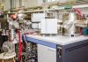
Miss Jessie Kwan Long-ching (left), under the supervision of Professor Zhao Guochun, conducts her research with the aid of the Electron Probe Micro-Analyzer (EPMA). Credit: The University of Hong Kong
Miss Jessie Kwan Long-ching (left), under the supervision of Professor Zhao Guochun, conducts her research with the aid of the Electron Probe Micro-Analyzer (EPMA).
Credit: The University of Hong Kong

Miss Jessie Kwan Long-ching, a year-4 undergraduate student in the Department of Earth Sciences, the University of Hong Kong (HKU), has just published a paper entitled “Metamorphic P-T path of mafic granulites from Eastern Hebei: Implications for the Neoarchean tectonics of the Eastern Block, North China Craton” in Gondwana Research, a leading peer-reviewed international journal (2015 SCI impact factor = 8.743). Jessie’s paper was produced from the result of her Final Year Project in which she carried out a detailed pressure-temperature evolution study on the ~2.5 billion year old high-grade metamorphic rocks (called granulites) from Eastern Hebei Province (China). The result shows that the ~2.5 billion year old mafic granulites from the Taipingzhai area experienced metamorphism that is characterized by an anticlockwise P-T path involving isobaric cooling, reflecting an origin related to the underplating of mantle-derived magmas, not consistent with subduction and collision processes under a plate tectonics regime. Jessie’s achievement will further inspire HKU undergraduate students’ interest in doing scientific research and having their research outputs published in international journals.

Jessie’s research was supervised by Professor Zhao Guochun, who is an outstanding researcher in the supercontinent and metamorphic petrology fields, and has published more than 260 papers cited 18000 times. Professor Zhao won the State Natural Science Award (Second Prize) in 2014 and was selected as the Laureate of the 29th Khwarizmi International Award in 2016. (For details, please see the following links.)

As one of three major types of rocks (igneous, sedimentary and metamorphic rocks), metamorphic rocks are formed from the transformation of existing rock types, in a process called metamorphism that happens in the deep earth due to the change of pressure, temperature and other physical and chemical conditions. Jessie has become very interested in the tectonic setting and process of metamorphic rocks since she took the course “Metamorphic Petrogenesis” taught by Professor Zhao, leading her to take metamorphic study as her research topic. She invited Professor Zhao to be her supervisor of her final year project entitled “Metamorphic P-T path of mafic granulites from Eastern Hebei: Implications for the Neoarchean tectonics of the Eastern Block, North China Craton”.

Situated about 200 km east of Beijing and covering an area of more than 10,000 square meters, Eastern Hebei is considered as one of the most ideal high-grade terranes to study the formation and evolution of Precambrian (>542 million years ago) crust as it consists of voluminous Archean (?2.5 billion years ago) rocks. Previously, geologists carried out extensive investigations on metamorphic terranes in North China, including Eastern Hebei. However, former studies were mainly based on inconsistent and conventional methods (geothermobarometric calculations) to determine the pressure-temperature conditions of metamorphic terranes, which may result in large errors. It therefore remains highly controversial whether these findings reflect the true metamorphic history of the area instead of artifacts of traditional calculations.

This forms the justification for Jessie’s research in which she applied the THMOCALC phase-equilibrium modeling technique to pressure-temperature calculations of different mineral assemblages and metamorphic stages recognized in the Eastern Hebei mafic granulites, which yielded accurate results of metamorphic pressure-temperature conditions.

Under Professor Zhao’s supervision, Jessie designed detailed research plans which include thin-section examination under the microscope, mineral composition analysis using new EPMA machine in the department, data processing, thermodynamic modelling and finally geological map drawing.

Reflecting on her recent research experience, Jessie said: “Besides the supervision of Professor Zhao, the Earth Sciences Department and the Faculty of Science have fully supported my research by providing research funds as well as advanced equipment such as petrological microscopes and Electron Probe Micro-Analyzer (EPMA) which was newly introduced to the Department and is the only one of its kind in Hong Kong. The data used in this particular research was the first batch of dataset successfully released by this machine. HKU has always encouraged research not only at the postgraduate level but also for undergraduates. As a beginner to the world of academic research who knows little about mineralogy, research and equipment, I am grateful to the tutors, postgraduate students and lab technicians in the department for their generous help and support.”

As her supervisor, Professor Guochun Zhao is very satisfied with Jessie’s achievement and hopes more and more HKU undergraduate students can publish their research outcomes in international journals in future.

Note: The above post is reprinted from materials provided by The University of Hong Kong.

How Nature’s ‘Dislocations’ Occur

The ripplocation phenomenon can help explain the behavior of materials when they bend and break — everything from a nanoscale material to massive geological formations.

Every material can bend and break. Through nearly a century’s worth of research, scientists have had a pretty good understanding of how and why. But, according to new findings from Drexel University materials science and engineering researchers, our understanding of how layered materials succumb to stresses and strains was lacking. The report suggests that, when compressed, layered materials — everything from sedimentary rocks, to beyond-whisker-thin graphite — will form a series of internal buckles, or ripples, as they deform.

The finding was published in the journal Scientific Reports by a team of researchers from Drexel’s College of Engineering, led by Michel W. Barsoum, PhD, distinguished professor and head of the MAX/MXene Research Group, along with Garritt J. Tucker, PhD, an assistant professor, and Mitra Taheri, PhD, Hoeganaes associate professor, all in the Department of Materials Science and Engineering.

“Dislocation theory – in which the operative deformation micromechanism is a defect known as a dislocation – is very well established and has been spectacularly successful in our understanding the deformation of metals,” Tucker said. “But it never really accurately accounted for the rippling and kink band formation observed in most layered solids.”

Barsoum had observed the latter phenomena during his studies of layered materials such as the MAX phases, mica and graphite. So when a paper published, in early 2015, by a group at the Massachusetts Institute of Technology suggested a new deformation micromechanism — best described as an atomic scale ripple — occurring near the surface of layered materials, he realized that the defect, dubbed a “ripplocation,” had much broader implications.

“The MIT work showed that while the end result of the motion of dislocations and ripplocations is the same: one atomic layer moves relative to another, their physics were distinctly different and were thus totally and fundamentally different entities,” Barsoum said.

According to dislocation theory, when the planes of layered solid materials are loaded and unloaded edge-on they will either bounce back, and return to their original form — if it’s an elastic material — or it will be permanently indented.

Ripplocation behavior explains the third observed option, which is the material returning to its original form while dissipating considerable amounts of energy.

The latter effect was labeled “kinking nonlinear elasticity” by Barsoum about a decade ago, because it involved the formation of kink bands — permanent buckles in the layers. When ripplocation was suggested, everything fell into place for Barsoum, who had been working toward an explanation of non-linear elastic behavior within the constraints of dislocation theory.

With this new paradigm in mind, Barsoum’s team set about proving that ripplocation exists, not only in near surface layers of 2D materials — as suggested by the MIT paper — but throughout the internal layers of thicker — “bulk” — layered materials as well. Through a careful examination of computer models – wherein graphitic atomic layers were compressed edge on, the researchers saw that the deformation was indeed consistent with the atomic-level rippling effect.

“We ran atomistic simulations on a bulk sample of graphite, because it is a layered material that has been studied quite a bit and it is used in a number of applications where it is loaded,” said Jacob Gruber, a doctoral candidate in the College of Engineering and first author on the paper. “By constraining the edges of the sample while compressing the material, we observed the nucleation and motion of a multitude of ripplocations that self-assemble into kink boundaries. The observation is significant because these are the same sort of kink bands that are ubiquitous in geologic formations and layered solids that have been deformed.”

This confinement of the material, according to Tucker, is both key to ripplocation behavior and almost always present in nature when materials are being stressed, whether it’s in power plants or plate tectonics.

“What is interesting about kinking nonlinear elasticity is that it is a strong function of confinement,” Tucker said. “Take a deck of cards. If you try to push a pencil parallel to the cards, without constraining them, the deck will simply split into two smaller stacks. If however, you apply pressure perpendicular to the deck of cards, confining them, then the pencil will leave an indentation mark as near surface layers buckle under the tip of the pencil.”

To get a better look at the behavior in the lab, the researchers examined samples of a layered ceramic known as a MAX phase, in which the layers were loaded with a spherical indenter.

“When we obtained high resolution transmission electron microscope images of the defects that formed as a result of the deformation we were not only able to show that they were not dislocations, but as importantly, they were also consistent with what ripplocations would look like,” Taheri said. “We now have evidence for a new defect in solids; in other words we have doubled the deformation micromechanisms known.”

According to Barsoum, ripplocation and its role in the deformation of layered solids is an important scientific finding because it applies to most layered materials, including — quite possibly — geologic formations.

“There are many layered solids, in both nature and the built environment, that are technologically important, so it’s essential to understand their behavior,” Barsoum said. “This new finding will require us to reexamine past findings and reinterpret results that to date were incorrectly explained using dislocation theory.”

Barsoum plans to work through many of his seminal MAX phase papers, as well as examining new materials through the lens of ripplocation.

Video

Note: The above post is reprinted from materials provided by Drexel University.

Study Reveals New Earthquake Hazard in Afghanistan-Pakistan Border Region

Figure 1: a) Western India plate boundary zone, includes the Chaman fault and Kabul and b) ground velocity field of the Ghazaband fault and Quetta obtained from SAR imagery of the Envisat satellite.

University of Miami (UM) Rosenstiel School of Marine and Atmospheric Science scientists have revealed alarming conclusions about the earthquake hazard in the Afghanistan-Pakistan border region. The new study focused on two of the major faults in the region— the Chaman and Ghazaband faults.

“Typically earthquake hazard research is a result of extensive ground-based measurements,” said the study’s lead author Heresh Fattahi, a UM Rosenstiel School alumni. “These faults, however, are in a region where the political situation makes these ground-based measurements dangerous and virtually impossible.”

Using satellite data from 2004-2011acquired by the European Space Agency satellite Envisat, and interferometry, the researchers were able to measure the relative motion of the ground and then model the movement of the underlying faults with an accuracy of just a few millimeters. Using data for a seven-year timeframe using time-series analysis techniques increases the confidence in their results.

The new study shows that the Ghazaband fault is accommodating more than half of the relative motion between the Indian and Eurasian tectonic plates, which indicates that the fault accumulates stress and the potential for a high magnitude earthquake is much higher than previously thought.

Quetta, the capital of Pakistan’s Balochistan province and located close to the Ghazaband Fault, lost nearly half of its population following a magnitude 7.7 earthquake in 1935.

“Quetta’s population of more than one million is in serious danger if an earthquake were to strike,” said Falk Amelung, a UM Rosenstiel School professor of geophysics and a coauthor of the study. “Earthquake-proof construction is vital in avoiding earthquake disasters. Quetta, as well as other cities in the region, is completely unprepared.”

The research team also studied the Chaman Fault, the largest fault in the region, running from southern Pakistan to north of Kabul, Afghanistan’s capital. This fault was thought to accommodate the lion’s share of the relative plate motion, but the satellite data reveal that it may account for only about one third of it.

“We have to rethink the tectonics of the region,” said Amelung.

The researchers also found a creeping segment, where the rock masses slide against each other without accumulating any stress that would lead to earthquakes. The creeping fault extends for 340 kilometers (211 miles).

“This is the longest creeping fault ever reported,” said Fattahi.

The slower than expected fault rate and the presence of the long creeping segment explains why the region has not, for over 500 years, experienced major earthquakes with fault ruptures from several tens to several hundreds of kilometers. However, they warn, this does not mean there is no hazard.

Note: The above post is reprinted from materials provided by University of Miami.

Slow slip events can trigger earthquakes

One permanent GPS station at the center of the Guerrero seismic gap, overlooking Acapulco bay (ACAP). Credit: NathalieCotte / CNRS.
One permanent GPS station at the center of the Guerrero seismic gap, overlooking Acapulco bay (ACAP).
Credit: NathalieCotte / CNRS.

In subduction zones, where one tectonic plate slides beneath another, slow, imperceptible slip, known as ‘slow earthquakes’ or ‘slow slip events’, can trigger powerful quakes a little further away. This has just been shown by researchers from CNRS, Université Grenoble Alpes and IRD, in collaboration with colleagues at the National Autonomous University of Mexico. Their paper is published in the journal Nature Geoscience on 3 october 2016.

Discovered twenty years ago, slow earthquakes are imperceptible slip events that last several weeks or months, do not generate seismic waves and cause no damage. However, they can release as much energy as a magnitude 7.5 earthquake. Understanding such slow slip events and their relationship to ordinary earthquakes is therefore of fundamental importance in better assessing seismic risk. Now, researchers have for the first time shown that a slow slip event can trigger a conventional earthquake. Researchers at the Institut des Sciences de la Terre (CNRS/Université Grenoble Alpes/IRD/Université Savoie Mont Blanc/IFSTTAR), together with colleagues from the National Autonomous University of Mexico, have shown that the magnitude 7.3 quake that struck Papanoa on 18 April 2014 was caused by a slow slip event that had begun two months earlier in the region of Acapulco in the Mexican state of Guerrero.

The geophysicists who made the discovery have been working for many years in this coastal region, where the oceanic Cocos plate slides beneath the North American plate. This phenomenon, known as subduction, is usually accompanied by earthquakes, since rather than sliding past each other seamlessly, the two plates deform and build up energy which is then released, causing the quakes. However, the area under study has not experienced any major quakes since 1912, and is thus known as a ‘seismic gap’. In addition, the installation of permanent GPS stations from 1997 onwards made it possible to detect slow earthquakes: although the Cocos and North American plates are converging at a speed of 5-6 cm/yr, every four years the gap zone experiences six-month-long periods when slip occurs in the opposite direction, with displacements reaching 15 cm.

By studying the GPS data, the researchers showed that, in the Guerrero seismic gap, slow slip events release part of the accumulated strain, making a major earthquake less likely. However, the slow slip event initiated in February 2014 transferred strain to a neighboring, seismogenic region, triggering a magnitude 7.3 earthquake on 18 April 2014 near the town of Papanoa.

This study enhances understanding of the relationship between slow slip events and conventional earthquakes in a subduction zone. The research has major societal implications, since around 20 million people would be directly affected by the devastating impact of a major earthquake on Mexico’s Pacific seaboard. The study shows that there is a greater risk of earthquakes during slow slip episodes. More generally, it highlights the importance of studying deformation signals in the days and weeks preceding major quakes. Consolidating networks of permanent GPS stations, as well as developing GPS networks on the seabed in the vicinity of areas where earthquakes initiate, will in the future make for increasingly accurate detection of the characteristics of slow slip events that may precede ordinary quakes.

Reference:
M. Radiguet et al. Triggering of the 2014 Mw7.3 Papanoa earthquake by a slow slip event in Guerrero, Mexico, Nature Geoscience (2016). DOI: 10.1038/ngeo2817

Note: The above post is reprinted from materials provided by CNRS.

New large lineage of prehistoric shark discovered

The new shark species named 'paradoxodon,' or paradoxical teeth, comes from the fact that the shark appears to have emerged suddenly in the geologic record with a yet unresolved nearly 45-million-year gap from when Megalolamna possibly split from its closest relative Otodus. The international research team who based their discovery on fossilized teeth up to 4.5 centimeters (1.8 inches) tall found the teeth in California and North Carolina, Peru and Japan. Credit: Kenshu Shimada/DePaul University
The new shark species named ‘paradoxodon,’ or paradoxical teeth, comes from the fact that the shark appears to have emerged suddenly in the geologic record with a yet unresolved nearly 45-million-year gap from when Megalolamna possibly split from its closest relative Otodus. The international research team who based their discovery on fossilized teeth up to 4.5 centimeters (1.8 inches) tall found the teeth in California and North Carolina, Peru and Japan.
Credit: Kenshu Shimada/DePaul University

Megalolamna paradoxodon is the name of a new extinct shark described by an international research team who based their discovery on fossilized teeth up to 4.5 centimeters (1.8 inches) tall found from the eastern and western United States (California and North Carolina), Peru and Japan.

The newly identified fossil shark lived during the early Miocene epoch about 20 million years ago and belongs to a shark group called Lamniformes, which includes the modern-day great white and mako sharks.

More specifically, it belongs to Otodontidae, which contains the iconic extinct superpredator ‘megalodon’ or the ‘megatoothed’ shark, and as an otodontid, Megalolamna paradoxodon represents a close cousin of the megatoothed lineage, said Kenshu Shimada, a paleobiologist at DePaul University and research associate at the Sternberg Museum in Kansas.

Certain dental features suggest its otodontid affinity, but in many other aspects, teeth of the new fossil shark look superficially like over-sized teeth of the modern-day salmon shark that belongs to the genus Lamna — hence the new genus Megalolamna, the researchers noted. The new species name ‘paradoxodon,’ or paradoxical teeth, comes from the fact that the shark appears to emerge suddenly in the geologic record with a yet unresolved nearly 45-million-year gap from when Megalolamna possibly split from its closest relative Otodus.

Although smaller than members of the megatoothed lineage containing ‘megalodon’ that reached well over 10 meters (33 feet), Megalolamna paradoxodon is still an impressive shark estimated to be minimally equivalent to the size of a typical modern-day great white, roughly 4 meters (13 feet) in length. Living in the same ancient oceans megatoothed sharks inhabited, Megalolamna paradoxodon had grasping-type front teeth and cutting-type rear teeth likely used to seize and slice medium-sized fish.

“It’s quite remarkable that such a large lamniform shark with such a global distribution had evaded recognition until now, especially because there are numerous Miocene localities where fossil shark teeth are well sampled,” said Shimada, lead author of the study.

In classifying the new fossil shark, the research team also came to a conclusion that members of the megatoothed lineage, including ‘megalodon,’ ought to be classified into the genus Otodus, and not to its traditional genus Carcharocles.

“The idea that megalodon and its close allies should be placed in Otodus is not new, but our study is the first of its kind that logically demonstrates the taxonomic proposition,” Shimada noted. Because the megatoothed shark lineage simply represents a subset of Otodus, excluding megatoothed sharks would not reflect a full lineage for Otodus — an uncomfortable taxonomic condition referred to as ‘non-monophyletic.’ The inclusion of megatoothed sharks into Otodus would make the genus a much preferred complete lineage referred to as a ‘monophyletic group’ that is considered to be a next of kin to the new genus Megalolamna.

Reference:
Kenshu Shimada, Richard E. Chandler, Otto Lok Tao Lam, Takeshi Tanaka, David J. Ward. A new elusive otodontid shark (Lamniformes: Otodontidae) from the lower Miocene, and comments on the taxonomy of otodontid genera, including the ‘megatoothed’ clade. Historical Biology, 2016; 1 DOI: 10.1080/08912963.2016.1236795

Note: The above post is reprinted from materials provided by DePaul University.

Magma build-up at active Japanese volcano poses threat to ‘Naples of the Eastern World’

Sakurajima Volcano with Lightning Credit & Copyright: Martin Rietze (Alien Landscapes on Planet Earth)
Sakurajima Volcano with Lightning
Credit & Copyright: Martin Rietze (Alien Landscapes on Planet Earth)

One of Japan’s most active volcanoes could be close to a major eruption, threatening the safety of hundreds and thousands of residents of a nearby city, a new study has shown.

A team of experts developed pioneering techniques to map the natural ‘plumbing system’ of Sakurajima volcano, on the south-west tip of the East Asian country, to discover a substantial growing magma reserve.

The magma build-up could see the volcano repeat its deadly eruption of 1914, which killed 58 people and caused widespread flooding in the nearby city of Kagoshima – dubbed the ‘Naples of the Eastern World’.

The team believe the ground-breaking study could help improve eruption forecasting and hazard assessment at volcanoes across the world, providing an enhanced early-warning system for potential eruptions.

The pivotal study is published in respected scientific journal, Scientific Reports, on Tuesday, 13 September 2016.

Dr James Hickey, lead author of the study and who is now at the Camborne School of Mines, at Exeter’s Penryn Campus, Cornwall, said: “What we have discovered is not just how the magma flows into the reservoir, but just how great the reservoir is becoming.

We believe that this new approach could help to improve eruption forecasting and hazard assessment at volcanoes not just in this area, but worldwide. We know that being forewarned means we are forearmed and providing essential information for local authorities who can potentially help save lives if an eruption was imminent.”

The international team of scientists focused their study around Aira caldera – a large, submerged crater caused by the violent explosion and subsequent collapse of a voluminous magma reservoir.

This vast crater acts as a magma storage zone that feeds the nearby Sakurajima volcano, one of the island’s most active volcanoes with small, localised eruptions occurring nearly every day.

The team, which included experts from the University of Bristol and the Sakurajima Volcano Research Centre in Japan, studied surface deformation in and around the caldera and volcano.

By combining recent GPS deformation measurements with other geophysical data and advanced 3D computer models, the team were able to reconstruct the magma plumbing system beneath the caldera.

The study showed that the volcano is being supplied with around 14 million cubic metres of magma each year – which equates to roughly three-and-a-half times the volume of Wembley Stadium.

Crucially, the research also indicates magma is being supplied to the system at a faster rate than it can be released through regular, small eruptions from Sakurajima volcano.

The team believe that this excessive build-up of magma may indicate there is growing potential for a larger eruption.

Dr Hickey, who carried out the research while at the University of Bristol, added: “The 1914 eruption measured about 1.5 kilometres cubed in volume – a massive event. From our data we think it would take around 130 years for the volcano to store the same amount of magma for another eruption of a similar size – meaning we are around 25 years away.”

“By identifying a timeframe over which we may see an increase in the level of activity at the volcano our colleagues at the Sakurajima volcano research centre can plan accordingly. The numerical constraints we were able to put on the magma supply conditions can also be used to assist with probabilistic and quantitative eruption forecasting.”

Co-author Dr Joachim Gottsmann, from the University of Bristol added: “A thorough understanding of the rate and volume of magma supply and accumulation, and their thermomechanical controls, is essential for continued monitoring and eruption forecasting at Sakurajima volcano, and volcanoes worldwide.”

Dr Haruhisa Nakamichi, Associate Professor at the Disaster Prevention Research Institute, Kyoto University, and co-author, said: “It is already passed by 100 years since the 1914 eruption, less than 30 years is left until a next expected big eruption, Kagoshima city office has prepared a new evacuation plan from Sakurajima, after experiences of evacuation of the recent crisis in August 2015.”

Reference:
James Hickey, Joachim Gottsmann, Haruhisa Nakamichi & Masato Iguchi. Thermomechanical controls on magma supply and volcanic deformation: application to Aira caldera, Japan. DOI:10.1038/srep32691

Note: The above post is reprinted from materials provided by University of Exeter.

Geologic imaging technique measures strength of Earth’s outer shell

A composite image of a topographical map covers portions of Nevada and Utah and the corresponding magnetotelluric image reveals where magma upwelling and weak spots in the crust correlate to topographical features on the surface. Credit: Image by Lijun Liu
A composite image of a topographical map covers portions of Nevada and Utah and the corresponding magnetotelluric image reveals where magma upwelling and weak spots in the crust correlate to topographical features on the surface.
Credit: Image by Lijun Liu

An advanced imaging technique used to map Earth’s outer shell also can provide a measure of strength, finding weak spots and magma upwellings that could point to volcanic or earthquake activity, according to a new study by geologists at the University of Illinois at Urbana-Champaign and the University of Adelaide in Australia.

The researchers developed a method for measuring strength and finding weak spots in the lithosphere, the outer layers of earth that include the crust and the outer mantle — the molten rock lurking just under the surface that can well up and create volcanoes. The researchers found that calculating lithosphere strength using magnetotelluric imaging maps of the southwestern United States can more accurately describe the rough terrain and volcanic and seismic activity observed on the surface than can standard geologic models.

The study by U. of I. geology professor Lijun Liu and Adelaide professor Derrick Hasterok is reported in the journal Science.

“According to plate tectonics, the standard theory of earth science, the lithosphere is supposed to be rigid. But we know that is not the case,” Liu said. “We know that a lot of places like the western U.S. have frequent fault-slip earthquakes and very rough surface topography, and are tectonically active. In this paper, we propose a new way to describe the mechanical properties of Earth’s lithosphere.”

Magnetotelluric imaging is a high-resolution mapping technique that the National Science Foundation has used to scan the lithosphere beneath much of the U.S. It provides information about the electrical conductivity of the lithosphere, which Liu and Hasterok were able to use to calculate strength and its variations from place to place.

“The same factors that affect electrical conductivity — temperature, water content and the presence of molten material — also affect the viscosity or strength. The hotter, wetter or more molten, the weaker the structure,” Liu said.

The detailed models produced using the MT imaging data of the southwestern U.S. more accurately portrayed surface structures at a scale of less than 100 kilometers, Liu said, which is important because features like volcanoes and faults are localized phenomena that are harder to predict using larger-scale models. The models depicted upwellings in the mantle and peaks in the topography that correlated to features in the terrain and active volcanoes.

The researchers believe that analyzing lithosphere strength using MT images now being collected around the world can open new avenues of understanding the dynamic mechanisms of the Earth and its seismic activity.

“This method will aid our understanding of the processes that cause earthquakes and volcanic activity,” Hasterok said. “We’ll be able to see why earthquakes and volcanoes have occurred in the past and look for places where they might potentially happen in the future.”

Reference:
L. Liu, D. Hasterok. High-resolution lithosphere viscosity and dynamics revealed by magnetotelluric imaging. Science, 2016; 353 (6307): 1515 DOI: 10.1126/science.aaf6542

Note: The above post is reprinted from materials provided by University of Illinois at Urbana-Champaign.

230-million-year-old Texas reptile had bizarre ‘dinosaurian’ features

A screen shot of an animation describing the partial skull and brain endocast of the dome-headed basal archosaur Triopticus primus from the Upper Triassic Otis Chalk localties of Howard County, Texas. Credit: Stocker et al.
A screen shot of an animation describing the partial skull and brain endocast of the dome-headed basal archosaur Triopticus primus from the Upper Triassic Otis Chalk localties of Howard County, Texas.
Credit: Stocker et al.

A newly described species of extinct reptile that roamed in Texas more than 200 million years ago had a strikingly dome-shaped head, much like that of dinosaurs that lived 100 million years or so later. Like the wings of pterosaurs and birds and the limblessness of snakes and some amphibians, the study reported in the Cell Press journal Current Biology on September 22 offers an example of convergent evolution between distantly related species of vertebrates.

“We were surprised to find something like Triopticus primus at all!” says Michelle Stocker of Virginia Polytechnic Institute and State University. “There was nothing else like that known from the Triassic period, and we wouldn’t have guessed that we would find something that looked like that outside of the Cretaceous period. Our team was also surprised that the internal structure of the skull of Triopticus was similar to pachycephalosaur dinosaurs–it wasn’t just an external similarity.”

Inside Triopticus’ domed head composed of thickened bone, CT scans revealed internal partitions or zones. Stocker says that it’s hard to say what advantage the reptile’s head structure would have offered, but it’s clear that none of its close relatives had a similar appearance.

The dinosaurs that would have lived alongside Triopticus in the Triassic period were small, lightweight, and carnivorous, she adds. They also walked on two legs.

Interestingly, the long-lost reptile is just one of many other taxa found in the well-preserved Otis Chalk assemblage in Texas that show a resemblance to post-Triassic dinosaurs.

“The Triassic period may have been a time of experimentation with respect to body plans,” Stocker says. “Reptiles were diversifying after the end-Permian mass extinction, and this may have been an opportunity for evolution to operate quickly and with few constraints.”

At the same time, however, such adaptive radiations of new species might reach an “early saturation of possible shapes, which then delimit what may be possible and are later repeated,” she says.

Reference:
Current Biology, Stocker et al.: “A Dome-Headed Stem Archosaur Exemplifies Convergence among Dinosaurs and Their Distant Relatives” DOI: 10.1016/j.cub.2016.07.066

Note: The above post is reprinted from materials provided by Cell Press.

Ice cores reveal a slow decline in atmospheric oxygen over the last 800,000 years

Princeton University researchers used ice cores collected in Greenland to study 800,000 years of atmospheric oxygen. Image source: Stolper, et al.

Princeton University researchers have compiled 30 years of data to construct the first ice core-based record of atmospheric oxygen concentrations spanning the past 800,000 years, according to a paper in the journal Science.

The record shows that atmospheric oxygen has declined 0.7 percent relative to current atmospheric-oxygen concentrations, a reasonable pace by geological standards, the researchers said. During the past 100 years, however, atmospheric oxygen has declined by a comparatively speedy 0.1 percent because of the burning of fossil fuels, which consumes oxygen and produces carbon dioxide.

Curiously, the decline in atmospheric oxygen over the past 800,000 years was not accompanied by any significant increase in the average amount of carbon dioxide in the atmosphere, though carbon dioxide concentrations do vary over individual ice age cycles. To explain this apparent paradox, the researchers called upon a theory for how the global carbon cycle, atmospheric carbon dioxide and Earth’s temperature are linked on geologic timescales.

“The planet has various processes that can keep carbon dioxide levels in check,” said first author Daniel Stolper, a postdoctoral research associate in Princeton’s Department of Geosciences. The researchers discuss a process known as “silicate weathering” in particular, wherein carbon dioxide reacts with exposed rock to produce, eventually, calcium carbonate minerals, which trap carbon dioxide in a solid form. As temperatures rise due to higher carbon dioxide in the atmosphere, silicate-weathering rates are hypothesized to increase and remove carbon dioxide from the atmosphere faster.

Stolper and his co-authors suggest that the extra carbon dioxide emitted due to declining oxygen concentrations in the atmosphere stimulated silicate weathering, which stabilized carbon dioxide but allowed oxygen to continue to decline.

“The oxygen record is telling us there’s also a change in the amount of carbon dioxide [that was created when oxygen was removed] entering the atmosphere and ocean,” said co-author John Higgins, Princeton assistant professor of geosciences. “However, atmospheric carbon dioxide levels aren’t changing because the Earth has had time to respond via increased silicate-weathering rates.

“The Earth can take care of extra carbon dioxide when it has hundreds of thousands or millions of years to get its act together. In contrast, humankind is releasing carbon dioxide today so quickly that silicate weathering can’t possibly respond fast enough,” Higgins continued. “The Earth has these long processes that humankind has short-circuited.”

The researchers built their history of atmospheric oxygen using measured ratios of oxygen-to-nitrogen found in air trapped in Antarctic ice. This method was established by co-author Michael Bender, Princeton professor of geosciences, emeritus.

Because oxygen is critical to many forms of life and geochemical processes, numerous models and indirect proxies for the oxygen content in the atmosphere have been developed over the years, but there was no consensus on whether oxygen concentrations were rising, falling or flat during the past million years (and before fossil fuel burning). The Princeton team analyzed the ice-core data to create a single account of how atmospheric oxygen has changed during the past 800,000 years.

“This record represents an important benchmark for the study of the history of atmospheric oxygen,” Higgins said. “Understanding the history of oxygen in Earth’s atmosphere is intimately connected to understanding the evolution of complex life. It’s one of these big, fundamental ongoing questions in Earth science.”

Reference:
Daniel A. Stolper, Michael L. Bender, Gabrielle B. Dreyfus, Yuzhen Yan, and John A. Higgins. 2016. A Pleistocene ice core record of atmospheric oxygen concentrations. Science. Article published online Sept. 22, 2016. DOI: 10.1126/science.aaf5445

Note: The above post is reprinted from materials provided by Princeton University.

Related Articles