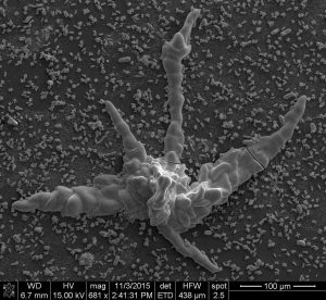
Silica carbonate biomorphs grown with natural water from Ney spring. Credit: García-Ruiz et al. Sci. Adv. 2017;3:e1602285
An international team of researchers discovered that inorganic chemicals can self-organize into complex structures that mimic primitive life on Earth.
Florida State University Professor of Chemistry Oliver Steinbock and Professor Juan Manuel Garcia-Ruiz of the Consejo Superior de Investigaciones Cientificas (Spanish National Research Council) in Granada, Spain published an article in Wednesday’s edition of Science Advances that shows fossil-like objects grew in natural spring water abundant in the early stages of the planet. But they were inorganic materials that resulted from simple chemical reactions.
This complicates the identification of Earth’s earliest microfossils and redefines the search for life on other planets and moons.
“Inorganic microstructures can potentially be indistinguishable from ancient traces of life both in morphology and chemical composition,” Garcia-Ruiz said.
Scientists had seen hints of this in past lab work, but now through Steinbock and Garcia-Ruiz’s research, it is clear that this also happened in nature.
To do this work, the team of scientists collected and analyzed an extreme form of soda water from the Ney Springs in Northern California. Today this type of water is found in only a few spots worldwide, but it was widespread during the early stages of Earth’s existence.
By addition of just one other ubiquitous chemical—calcium or barium salt—this water produces tiny structures, such as tubes, helices, and worm-like objects that are reminiscent of the shapes of primitive organisms. The water also generates complex mineral structures that are similar to nacre—the shiny substance of sea shells.
The similarities between actual fossils and these inorganic structures go beyond appearance and extend to their chemical nature. This will make it even more complicated for scientists examining early evidence of life on Earth.
“Our findings reveal an unusual convergence of simple biological shapes and complex inorganic structures and make the job of identifying earliest microfossils on Earth and life on other planets even harder,” Steinbock said. “It’s fascinating. How could I identify a fossil if I went to Mars? How could I convince myself that it was once alive? In the future, scientists will need to be even more alert that everything that looks like life is not necessarily life.”
During the ice ages, an unidentified regulatory mechanism prevented atmospheric CO2 concentrations from falling below a level that could have led to runaway cooling, reports a study conducted by researchers of the ICTA-UAB and published online in Nature Geoscience this week. The study suggests the mechanism may have involved the biosphere, as plants and plankton struggled to grow under very low CO2 levels.
Atmospheric CO2 concentrations swung over a range of 100 ppm (parts per million, by volume) during the ice ages. The exact processes behind this variation have been difficult to pinpoint, but it is known that changes in the storage of carbon by photosynthetic organisms played an important role.
“When we took a close look at measurements from ice cores, we noticed that atmospheric CO2 concentrations hovered close to 190 ppm during much of the past 800,000 years, but very rarely fell any lower,” said Sarah Eggleston, a researcher at the Institut of Environmental Science and Technology (ICTA-UAB) and co-author of the study. “This was surprising, because it suggests that these very low CO2 concentrations were quite stable. What’s more, we know that CO2 was often very high in the distant geological past, but we have no evidence that CO2 concentrations were ever lower than 190 ppm.”
“We know that, over hundreds of thousands of years, CO2 is regulated by slowly reacting with exposed rocks” explained Eric Galbraith, lead author of the study and an ICREA professor at ICTA-UAB. “But this would be too slow to explain the stability during periods of only a few thousand years, as we see in the ice cores. So it must have been some other mechanism that kicked in at very low CO2.”
The authors suggest that it was most likely the biosphere that maintained habitable temperatures, since at very low CO2 levels, plants and phytoplankton struggle to photosynthesize. Slower growth of these organisms would have meant less carbon in the soils and deep ocean leaving more in the atmosphere, and preventing CO2 concentrations from falling further. This might have prevented extreme cooling that would have led to Earth freezing over as a ‘snowball’.
However, the study did not reveal a corresponding regulation during the warm portions of the ice age cycles, suggesting that the Earth does not have a similar mechanism to prevent rapid warming.
Reference:
E. D. Galbraith et al. A lower limit to atmospheric CO2 concentrations over the past 800,000 years, Nature Geoscience (2017). DOI: 10.1038/ngeo2914
Recently published research from Victoria University of Wellington and GNS Science has provided a unique insight into the hydrological effects of earthquakes in New Zealand.
Led by Victoria alumnus Grant O’Brien for his Master’s thesis, the research highlights the impact earthquakes can have on groundwater systems hundreds of kilometres away.
The research was based in the Cromwell Gorge and made use of a large hydrological dataset that has recorded groundwater responses to a series of earthquakes that have occurred in the region over the past few decades.
This is the first time that the landslide monitoring data set, provided by Contact Energy Clyde Dam, has been analysed to determine the effects of earthquake shaking on sensitive groundwater systems.
“The data set used in this study is of rare international size and scope and as far as we can tell is unique in spanning multiple sites and multiple earthquakes over such a long period of time (23 years). This means we have been able to construct a detailed picture of the behaviour of different groundwater systems in response to earthquakes, ongoing engineering activities and other factors such as intense rainfall,” says Mr O’Brien.
The study was supervised by Dr Simon Cox from GNS Science and Professor John Townend from Victoria’s School of Geography, Environment and Earth Sciences, and funded by the Earthquake Commission and the Marsden Fund managed by the Royal Society of New Zealand.
The study, published in the Journal of Geophysical Research, shows the sensitivity of groundwater systems to seismic waves at distances well beyond areas of obvious shaking and surface ground damage.
“Our research showed that groundwater systems within seven large landslides in the Cromwell Gorge are surprisingly susceptible to seismic shaking, with the pressures and flow rates responding systematically to large earthquakes at distances of several hundred kilometres,” says Mr O’Brien.
Differences in the type of earthquake shaking—in particular, the duration, amount and frequency of shaking—result in different groundwater responses. The Cromwell Gorge data show that these changes are triggered by stresses associated with the passage of the seismic waves from the earthquake.
“We found that long-duration earthquakes producing seismic waves with a broad range frequencies cause larger groundwater responses that die away more quickly than those produced by short, sharp earthquakes.”
While scientists have yet to examine the effect of the 2016 magnitude 7.8 Kaikoura earthquake on the groundwater systems at Cromwell Gorge, Mr O’Brien expects the monitoring equipment will have recorded a response.
This finding highlights how components of New Zealand’s engineering infrastructure that are dependent on groundwater, such as dams or irrigation schemes, are affected by earthquakes happening in other parts of the country.
“Although the groundwater changes did not affect the motion of Cromwell Gorge landslides, which are engineered to stop movement, the monitoring by Contact Energy provides an incredible record for application elsewhere.
“The different ways groundwater systems respond to the type of earthquake shaking we have observed is critical to understanding how landslides evolve in both the short and long term.”
Reference:
Grant A. O’Brien et al. Spatially and temporally systematic hydrologic changes within large geoengineered landslides, Cromwell Gorge, New Zealand, induced by multiple regional earthquakes, Journal of Geophysical Research: Solid Earth (2016). DOI: 10.1002/2016JB013418
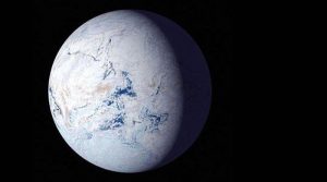
About 700 million years ago, runaway glaciers covered the entire planet in ice. Harvard researchers modeled the conditions that may have led to this so-called ‘snowball Earth. Credit: Image courtesy of NASA
What caused the largest glaciation event in Earth’s history, known as ‘snowball Earth’? Geologists and climate scientists have been searching for the answer for years but the root cause of the phenomenon remains elusive.
Now, Harvard University researchers have a new hypothesis about what caused the runaway glaciation that covered Earth pole-to-pole in ice.
The research is published in Geophysical Research Letters.
Researchers have pinpointed the start of what’s known as the Sturtian snowball Earth event to about 717 million years ago — give or take a few 100,000 years. At around that time, a huge volcanic event devastated an area from present-day Alaska to Greenland. Coincidence?
Harvard professors Francis Macdonald and Robin Wordsworth thought not.
“We know that volcanic activity can have a major effect on the environment, so the big question was, how are these two events related,” said Macdonald, the John L. Loeb Associate Professor of the Natural Sciences.
At first, Macdonald’s team thought basaltic rock — which breaks down into magnesium and calcium — interacted with CO2 in the atmosphere and caused cooling. However, if that were the case, cooling would have happened over millions of years and radio-isotopic dating from volcanic rocks in Arctic Canada suggest a far more precise coincidence with cooling.
Macdonald turned to Wordsworth, who models climates of non-Earth planets, and asked: could aerosols emitted from these volcanos have rapidly cooled Earth?
The answer: yes, under the right conditions.
“It is not unique to have large volcanic provinces erupting,” said Wordsworth, assistant professor of Environmental Science and Engineering at the Harvard John A. Paulson School of Engineering and Applied Science. “These types of eruptions have happened over and over again throughout geological time but they’re not always associated with cooling events. So, the question is, what made this event different?”
Geological and chemical studies of this region, known as the Franklin large igneous province, showed that volcanic rocks erupted through sulfur-rich sediments, which would have been pushed into the atmosphere during eruption as sulfur dioxide. When sulfur dioxide gets into the upper layers of the atmosphere, it’s very good at blocking solar radiation. The 1991 eruption of Mount Pinatubo in the Philippines, which shot about 10 million metric tons of sulfur into the air, reduced global temperatures about 1 degree Fahrenheit for a year.
Sulfur dioxide is most effective at blocking solar radiation if it gets past the tropopause, the boundary separating the troposphere and stratosphere. If it reaches this height, it’s less likely to be brought back down to earth in precipitation or mixed with other particles, extending its presence in the atmosphere from about a week to about a year. The height of the tropopause barrier all depends on the background climate of the planet — the cooler the planet, the lower the tropopause.
“In periods of Earth’s history when it was very warm, volcanic cooling would not have been very important because Earth would have been shielded by this warm, high tropopause,” said Wordsworth. “In cooler conditions, Earth becomes uniquely vulnerable to having these kinds of volcanic perturbations to climate.”
“What our models have shown is that context and background really matters,” said Macdonald.
Another important aspect is where the sulfur dioxide plumes reach the stratosphere. Due to continental drift, 717 million years ago, the Franklin large igneous province where these eruptions took place was situated near the equator, the entry point for most of the solar radiation that keeps Earth warm.
So, an effective light-reflecting gas entered the atmosphere at just the right location and height to cause cooling. But another element was needed to form the perfect storm scenario. After all, the Pinatubo eruption had similar qualities but its cooling effect only lasted about a year.
The eruptions throwing sulfur into the air 717 million years ago weren’t one-off explosions of single volcanoes like Pinatubo. The volcanoes in question spanned almost 2,000 miles across Canada and Greenland. Instead of singularly explosive eruptions, these volcanoes can erupt more continuously like those in Hawaii and Iceland today. The researchers demonstrated that a decade or so of continual eruptions from this type of volcanoes could have poured enough aerosols into the atmosphere to rapidly destabilize the climate.
“Cooling from aerosols doesn’t have to freeze the whole planet; it just has to drive the ice to a critical latitude. Then the ice does the rest,” said Macdonald.
The more ice, the more sunlight is reflected and the cooler the planet becomes. Once the ice reaches latitudes around present-day California, the positive feedback loop takes over and the runaway snowball effect is pretty much unstoppable.
“It’s easy to think of climate as this immense system that is very difficult to change and in many ways that’s true. But there have been very dramatic changes in the past and there’s every possibility that as sudden of a change could happen in the future as well,” said Wordsworth.
Understanding how these dramatic changes occur could help researchers better understand how extinctions occurred, how proposed geoengineering approaches may impact climate and how climates change on other planets.
“This research shows that we need to get away from a simple paradigm of exoplanets, just thinking about stable equilibrium conditions and habitable zones,” said Wordsworth. “We know that Earth is a dynamic and active place that has had sharp transitions. There is every reason to believe that rapid climate transitions of this type are the norm on planets, rather than the exception.”
Reference:
F. A. Macdonald, R. Wordsworth. Initiation of Snowball Earth with volcanic sulfur aerosol emissions. Geophysical Research Letters, 2017; DOI: 10.1002/2016GL072335
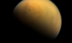
A new research paper describes a period more than 2.4 billion years ago, when Earth’s atmosphere was filled with a thick, methane-rich haze much like Saturn’s moon Titan, seen here in an image taken by NASA’s Cassini spacecraft in 2013. Credit: NASA/JPL-Caltech/Space Science Institute
More than 2.4 billion years ago, Earth’s atmosphere was inhospitable, filled with toxic gases that drove wildly fluctuating surface temperatures. Understanding how today’s world of mild climates and breathable air took shape is a fundamental question in Earth science.
New research from the University of Maryland, the University of St. Andrews, NASA’s Jet Propulsion Laboratory, the University of Leeds and the Blue Marble Space Institute of Science suggests that long ago, Earth’s atmosphere spent about a million years filled with a methane-rich haze. This haze drove a large amount of hydrogen out of the atmosphere, clearing the way for massive amounts of oxygen to fill the air. This transformation resulted in an atmosphere much like the one that sustains life on Earth today.
The group’s results, published March 13, 2017 in the early online edition of the Proceedings of the National Academy of Sciences, propose a new contributing cause for the Great Oxidation Event, which occurred 2.4 billion years ago, when oxygen concentrations in the Earth’s atmosphere increased more than 10,000 times.
“The transformation of Earth’s air from a toxic mix to a more welcoming, oxygen-rich atmosphere happened in a geological instant,” said James Farquhar, a professor of geology at UMD and a co-author of the study. Farquhar also has an appointment at UMD’s Earth System Science Interdisciplinary Center. “With this study, we finally have the first complete picture of how methane haze made this happen.”
The researchers used detailed chemical records and sophisticated atmospheric models to reconstruct atmospheric chemistry during the time period immediately before the Great Oxidation Event. Their results suggest that ancient bacteria—the only life on Earth at the time—produced massive amounts of methane that reacted to fill the air with a thick haze, resembling the modern-day atmosphere of Saturn’s moon Titan.
Previous studies by many of the same researchers had identified several such haze events early in Earth’s history. But the current study is the first to show how rapidly these events began and how long they lasted.
“High methane levels meant that more hydrogen, the main gas preventing the build up of oxygen, could escape into outer space, paving the way for global oxygenation,” said Aubrey Zerkle, a biogeochemist at the University of St. Andrews and a co-author of the study. “Our new dataset constitutes the highest resolution record of Archean atmospheric chemistry ever produced, and paints a dramatic picture of Earth surface conditions before the oxygenation of our planet.”
The methane haze persisted for about a million years. After enough hydrogen left the atmosphere, the right chemical conditions took over and the oxygen boom got underway, enabling the evolution of all multicellular life.
The key to the researchers’ analysis was the discovery of anomalous patterns of sulfur isotopes in the geochemical records from this time. Sulfur isotopes are often used as a proxy to reconstruct ancient atmospheric conditions, but previous investigations into the time period in question had not revealed anything too unusual.
“Reconstructing the evolution of atmospheric chemistry has long been the focus of geochemical research,” said Gareth Izon, lead author of the study, who contributed to the research while a postdoctoral researcher at St. Andrews and is now a postdoctoral researcher at the Massachusetts Institute of Technology. “Our new data show that the chemical composition of the atmosphere was dynamic and, at least in the prelude to the Great Oxidation Event, hypersensitive to biological regulation.”
The research paper, “Biological regulation of atmospheric chemistry en route to planetary oxygenation,” Gareth Izon, Aubrey Zerkle, Kenneth Williford, James Farquar, Simon Poulton, and Mark Claire, was published March 13, 2017 in the Proceedings of the National Academy of Sciences.
Reference:
Biological regulation of atmospheric chemistry en route to planetary oxygenation, PNAS, DOI: 10.1073/pnas.1618798114
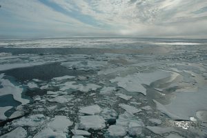
Arctic sea ice, as seen from an ice breaker ship in 2014. Credit: Bonnie Light/University of Washington
Arctic sea ice in recent decades has declined even faster than predicted by most models of climate change. Many scientists have suspected that the trend now underway is a combination of global warming and natural climate variability.
A new study finds that a substantial chunk of summer sea ice loss in recent decades was due to natural variability in the atmosphere over the Arctic Ocean. The study, from the University of Washington, the University of California Santa Barbara and federal scientists, is published March 13 in Nature Climate Change.
“Anthropogenic forcing is still dominant — it’s still the key player,” said first author Qinghua Ding, a climate scientist at the University of California Santa Barbara who holds an affiliate position at the UW, where he began the work as a research scientist in the UW’s Applied Physics Laboratory. “But we found that natural variability has helped to accelerate this melting, especially over the past 20 years.”
The paper builds on previous work by Ding and other UW scientists that found changes in the tropical Pacific Ocean have in recent decades created a “hot spot” over Greenland and the Canadian Arctic that has boosted warming in that region.
The hot spot is a large region of higher pressure where air is squeezed together so it becomes warmer and can hold more moisture, both of which bring more heat to the sea ice below. The new paper focuses specifically on what this atmospheric circulation means for Arctic sea ice in September, when the ocean reaches its maximum area of open water.
“The idea that natural or internal variability has contributed substantially to the Arctic sea ice loss is not entirely new,” said second author Axel Schweiger, a University of Washington polar scientist who tracks Arctic sea ice. “This study provides the mechanism and uses a new approach to illuminate the processes that are responsible for these changes.”
Ding designed a new sea ice model experiment that combines forcing due to climate change with observed weather in recent decades. The model shows that a shift in wind patterns is responsible for about 60 percent of sea ice loss in the Arctic Ocean since 1979. Some of this shift is related to climate change, but the study finds that 30-50 percent of the observed sea ice loss since 1979 is due to natural variations in this large-scale atmospheric pattern.
“What we’ve found is that a good fraction of the decrease in September sea ice melt in the past several decades is most likely natural variability. That’s not really a surprise,” said co-author David Battisti, a UW professor of atmospheric sciences.
“The method is really innovative, and it nails down how much of the observed sea ice trend we’ve seen in recent decades in the Arctic is due to natural variability and how much is due to greenhouse gases.”
The long-term natural variability is ultimately thought to be driven by the tropical Pacific Ocean. Conditions in the tropical Pacific set off ripple effects, and atmospheric waves snake around the globe to create areas of higher and lower air pressure.
Teasing apart the natural and human-caused parts of sea ice decline will help to predict future sea ice conditions in Arctic summer. Forecasting sea ice conditions is relevant for shipping, climate science, Arctic biology and even tourism. It also helps to understand why sea ice declines may be faster in some decades than others.
“In the long term, say 50 to 100 years, the natural internal variability will be overwhelmed by increasing greenhouse gases,” Ding said. “But to predict what will happen in the next few decades, we need to understand both parts.”
What will happen next is unknown. The tropical Pacific Ocean could stay in its current phase or it could enter an opposite phase, causing a low-pressure center to develop over Arctic seas that would temporarily slow the long-term loss of sea ice due to increased greenhouse gases.
“We are a long way from having skill in predicting natural variability on decadal time scales,” Ding said.
Reference:
Qinghua Ding, Axel Schweiger, Michelle L’Heureux, David S. Battisti, Stephen Po-Chedley, Nathaniel C. Johnson, Eduardo Blanchard-Wrigglesworth, Kirstin Harnos, Qin Zhang, Ryan Eastman, Eric J. Steig. Influence of high-latitude atmospheric circulation changes on summertime Arctic sea ice. Nature Climate Change, 2017; DOI: 10.1038/nclimate3241
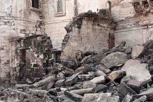
Damage caused by the Bhuj earthquake in 2001, for which many aftershocks nucleated in the lower crust. Credit: University of Plymouth
The mechanisms which cause earthquake cycles to begin up to 40km below the earth’s surface in the interior of the continents are to be explored in a new research project led by the University of Plymouth.
Such earthquakes account for around 30 per cent of intracontinental seismic activity, but very little is presently known about what causes them and the geological effects they leave behind.
Now academics from the School of Geography, Earth and Environmental Sciences have been awarded £451,340 by the Natural Environment Research Council to develop greater understanding about the short and long term behaviour of the lower crust.
In doing so, they hope to increase knowledge of the geological processes, but also to make at-risk communities more aware of the dangers posed by such activity.
Dr Luca Menegon, Lecturer in Structural Geology and Tectonics, is principal investigator of the research with Professor of Geoscience Communication Iain Stewart among the co-investigators.
Dr Menegon said:
“Earthquakes in the continental interiors are often devastating and, over the past century, have killed significantly more people than earthquakes occurring at plate boundaries. However those emanating in the lower crust are difficult to study directly, given that the deepest portions of the crust are very rarely exposed at the Earth’s surface and inaccessible for drilling projects, and as a result we have a very poor understanding of them. By combining geological and satellite observations with laboratory work and imaging, we hope to go some way to changing that.”
A significant proportion of seismicity in the Himalaya as well as aftershocks associated with the 2001 Bhuj earthquake in India, which killed around 20,000 people, nucleate in the lower crust.
For this research project – which also involves academics from the University of Leeds, University of Milan-Bicocca, the University of Cardiff, the University of Edinburgh, and the University of Liverpool – scientists will conduct an integrated, multi-disciplinary study of a network of brittle-viscous shear zones on the Lofoten Islands in northern Norway. It is home to one of the few well-exposed large sections of exhumed continental lower crust in the world, exposed during the opening of the North Atlantic Ocean.
The study will link structural geology, petrology, geochemistry and experimental rock deformation, providing a novel, clear picture of the mechanical behaviour of the continental lower crust during the earthquake cycle.
It is anticipated it will culminate in the production of a series of educational material for schools and the general public, but also suitable for global decision makers in areas potentially affected by such hazards.
Dr Menegon added:
“At the moment, we do not fully know how to predict earthquakes but perhaps that is because we do not fully understand the signals which rock deformation is sending us. Developing a greater understanding of both the chemical composition and microstructures involved will certainly help us enhance our knowledge of why these earthquakes are occurring. That in turn will help scientists to enhance their work with at-risk communities to mitigate the potentially devastating threats that earthquakes can pose across the world.”
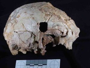
A large international research team, directed by the Portuguese archaeologist João Zilhão and including Binghamton University anthropologist Rolf Quam, has found the oldest fossil human cranium in Portugal, marking an important contribution to knowledge of human evolution during the middle Pleistocene in Europe and to the origin of the Neandertals.
The cranium represents the westernmost human fossil ever found in Europe during the middle Pleistocene epoch and one of the earliest on this continent to be associated with the Acheulean stone tool industry. In contrast to other fossils from this same time period, many of which are poorly dated or lack a clear archaeological context, the cranium discovered in the cave of Aroeira in Portugal is well-dated to 400,000 years ago and appeared in association with abundant faunal remains and stone tools, including numerous bifaces (handaxes).
“This is an interesting new fossil discovery from the Iberian Peninsula, a crucial region for understanding the origin and evolution of the Neandertals,” said Quam, an associate professor of anthropology at Binghamton University, State University of New York. “The Aroeira cranium is the oldest human fossil ever found in Portugal and shares some features with other fossils from this same time period in Spain, France and Italy. The Aroeria cranium increases the anatomical diversity in the human fossil record from this time period, suggesting different populations showed somewhat different combinations of features.”
The cranium was found on the last day of the 2014 field season. Since the sediments containing the cranium at the Aroeira site were firmly cemented, the cranium was removed from the site in a large, solid block. It was then transported to the restoration laboratory at the Centro de Investigacion sobre la Evolucion y Comportamiento Humanos, a paleoanthropology research center in Madrid, Spain, for preparation and extraction, a painstaking process which took two years.
“The results of this study are only possible thanks to the arduous work of numerous individuals over the last several years,” said Quam. “This includes the archaeologists who have excavated at the site for many years, the preparator who removed the fossil from its surrounding breccia, researchers who CT scanned the specimen and made virtual reconstructions and the anthropologists who studied the fossil. This study truly represents an international scientific collaboration, and I feel fortunate to be involved in this research.”
“I have been studying these sites for the last 30 years and we have recovered much important archaeological data, but the discovery of a human cranium of this antiquity and importance is always a very special moment,” said Zilhão.
The new fossil will form the centerpiece of an exhibit on human evolution in October at the Museu Nacional de Arqueologia in Lisbon, Portugal.
The study, titled “New Middle Pleistocene hominin cranium from the Gruta da Aroeira (Portugal),” appears this week in the Proceedings of the National Academy of Sciences.
Reference:
New Middle Pleistocene hominin cranium from Gruta da Aroeira (Portugal) , PNAS, DOI: 10.1073/pnas.1619040114
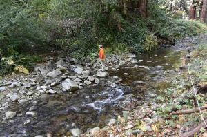
Geologist Noah Finnegan in Boulder Creek in California’s Santa Cruz Mountains. Rivers in steep landscapes like the Santa Cruz Mountains transport lots of sediment and do not conform to ‘threshold channel’ assumptions that apply to gravel-bedded rivers in other parts of the country. Credit: Allison Pfeiffer
The seemingly simple question of what governs the shapes of river channels has been a longstanding challenge for geologists and civil engineers. A new study led by scientists at UC Santa Cruz shows that the amount of sediment a river transports is a key factor in determining river channel geometry and the size of the sediment grains on the riverbed.
The findings, published March 13 in the Proceedings of the National Academy of Sciences, undermine a common assumption about gravel-bedded rivers. The idea, supported by decades of observations, is that gravel-bedded rivers reach an equilibrium, called a threshold channel, where the median-sized grains on the riverbed only start to move when the channel is full (the “bankfull flow” stage, just short of flooding).
“If all channels are threshold channels, that’s convenient because it helps us make predictions for management decisions and for modeling landscape evolution,” said first author Allison Pfeiffer, a doctoral candidate in Earth and planetary sciences at UC Santa Cruz.
But Pfeiffer found that the assumption does not hold for rivers in regions with high erosion rates leading to large amounts of sediment moving through the river channels. These conditions are common in the steep, tectonically active landscapes found along the West Coast of North America. When Pfeiffer analyzed data on channel geometries and erosion rates for gravel-bedded rivers throughout North America, she found most of the rivers that violate the threshold assumption are on the West Coast.
“Rivers in steep landscapes like the Santa Cruz Mountains transport lots of sediment compared to rivers in, say, Michigan or upstate New York,” Pfeiffer said. “These rivers with high sediment supplies have adjusted their geometry to transport sediments at more moderate flows, so it doesn’t take a flood event to move a lot of sediment.”
As a result, the sediment on the riverbed is much finer than would be predicted by the threshold channel model. Coauthor Noah Finnegan, associate professor of Earth and planetary sciences at UC Santa Cruz, explained that threshold channels may only develop in settings where a low sediment supply allows the smaller grains to be swept away and not replaced. Left behind is a layer of “armoring” on the riverbed consisting of larger grains that might only move at the highest flow rates.
“West Coast rivers tend to have a less well-developed armor layer,” Finnegan said. “If you change the sediment supply, the quickest thing to adjust will be the grain size in the armor layer.”
When he and his students take measurements in local rivers, he said, the results typically do not conform to the threshold channel paradigm. Pfeiffer encountered this in the course of a project to predict the distribution of salmon spawning habitat in the Santa Cruz Mountains. Salmon need gravel in a certain size range to build their nests. Using the threshold assumption, Pfeiffer’s predictions of gravel size were off by a factor of three.
“That can be a huge difference for a Coho salmon,” she said. “Now we know that the sediment supply is a key factor that has to be taken into consideration if we’re trying to predict salmon habitat.”
The findings may also have practical implications for the design of river restoration projects. Rivers are self-forming systems, and their channels form and reform with every flood event. Efforts to impose human designs on them are not always successful.
“Rivers are tricky puzzles that continue to bring us new challenges,” Pfeiffer said. “The importance of the sediment supply has perhaps gone underappreciated. We don’t yet have the kind of theoretical model of river channels that we’d like to have, but this study shows that the sediment supply is a variable that has to be included in the model.”
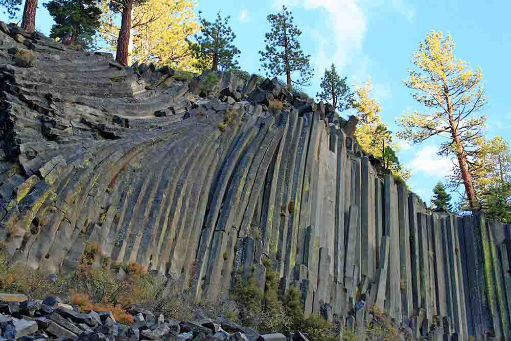
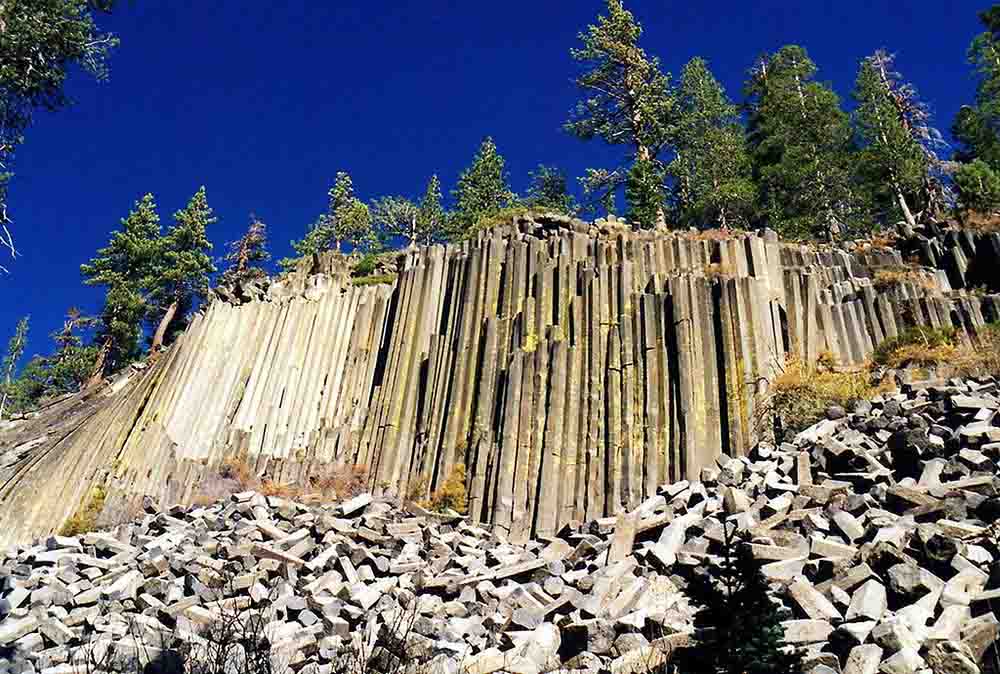
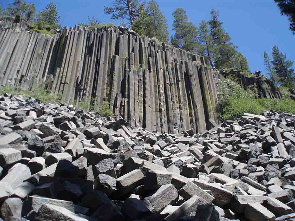
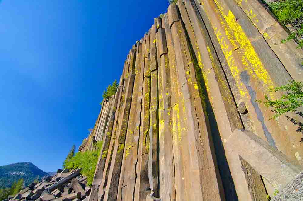
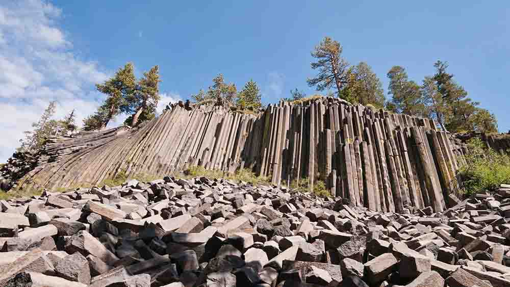
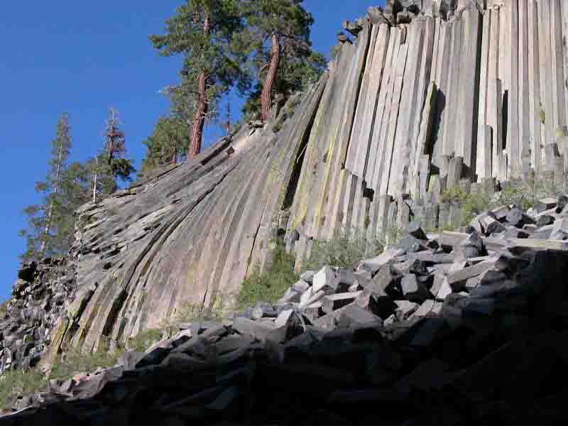
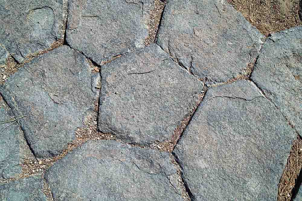
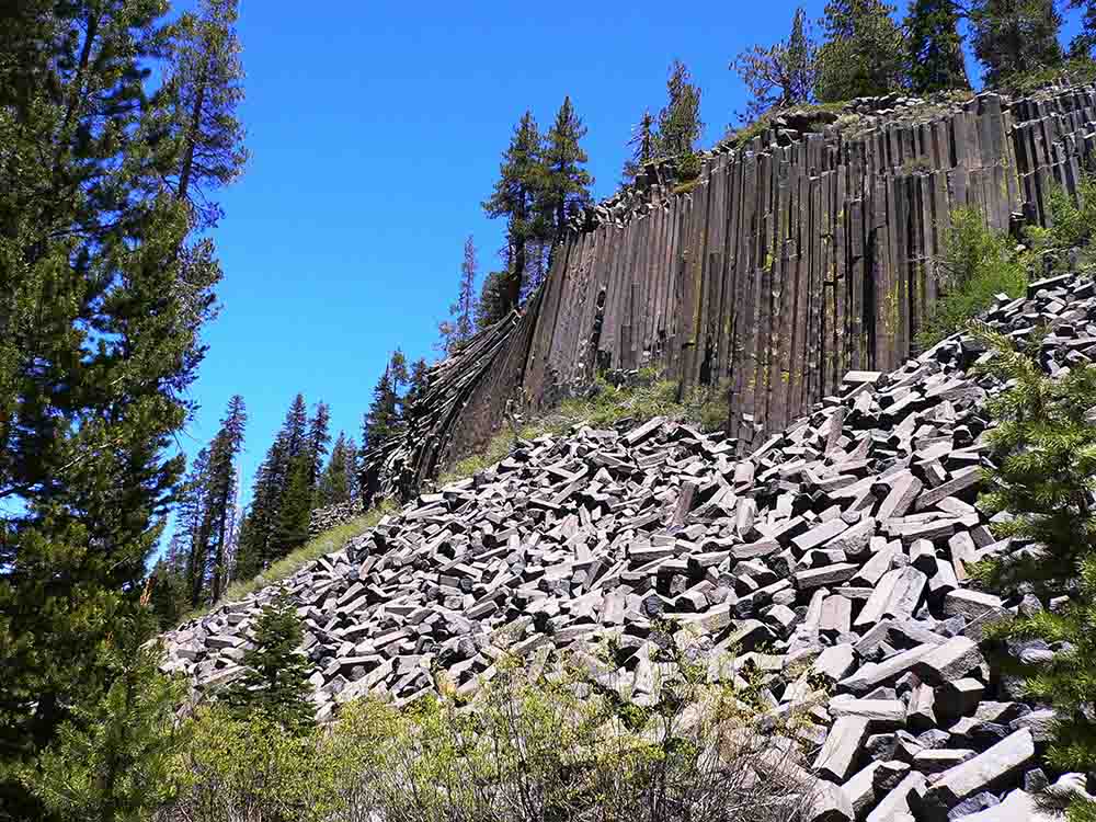
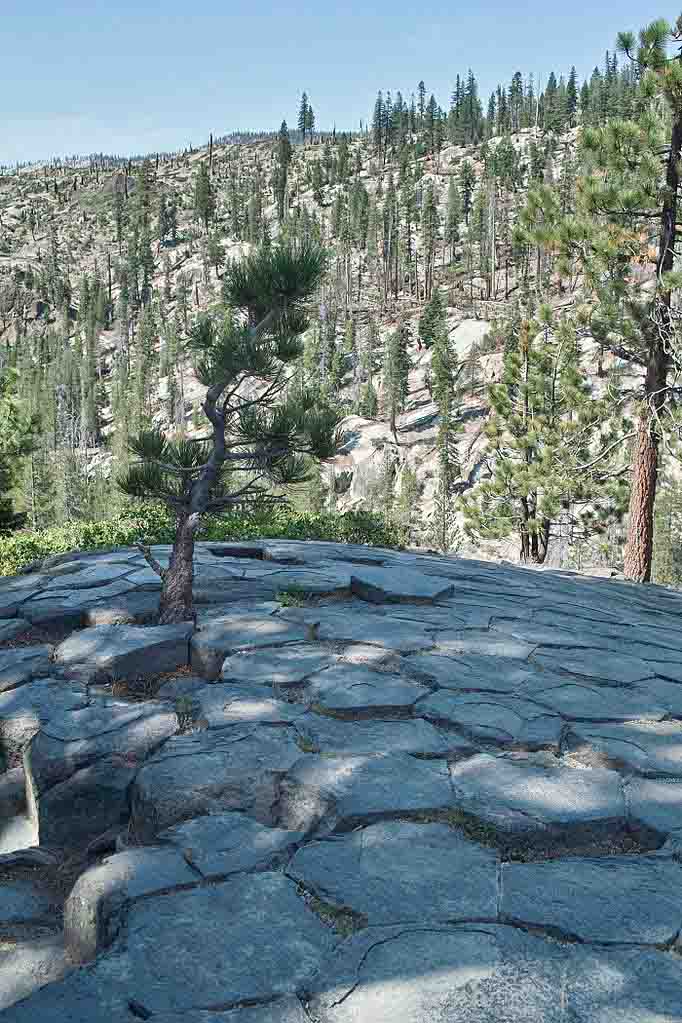
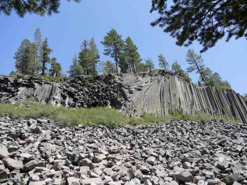
Devils Postpile National Monument is located near Mammoth Mountain in eastern California. The national monument protects Devil’s Postpile, an unusual rock formation of columnar basalt. Devils Postpile National Monument encompasses 798 acres (323 ha) and includes two main tourist attractions: the Devil’s Postpile formation and Rainbow Falls, a waterfall on the Middle Fork of the San Joaquin River. In addition, the John Muir Trail and Pacific Crest Trail merge into one trail as they pass through the monument. Excluding a small developed area containing the monument headquarters, visitor center and a campground; the National Monument lies within the borders of the Ansel Adams Wilderness.
History
It was created in 1911 as Devil Postpile National Monument, and has forever been widely referred to as Devil’s Postpile National Monument; but it has been officially styled as plural without the apostrophe since the 1930s.
The monument was once part of Yosemite National Park, but discovery of gold in 1905 near Mammoth Lakes prompted a boundary change that left the Postpile on adjacent public land. Later, a proposal to build a hydroelectric dam called for blasting the Postpile into the river. Influential Californians, including John Muir, persuaded the federal government to stop the demolition and, in 1911, President William Howard Taft protected the area as a National Monument.
It’s the largest meteorite ever found in North Dakota. Credit: University of North Dakota
UND welcomed an alien invader Friday.
The 84-pound space monster was on campus for just a few hours, but it left behind a small slice of history.
“Colgate” came to campus with Alexander Erickson, a computer science junior from Colgate, N.D.
It’s Colgate’s second visit to UND. Erickson’s father, who found it while moving boulders to build a new home, brought it to Nels Forsman, assistant professor in the Harold Hamm School of Geology and Geological Engineering. Forsman identified it as a meteorite in 1999.
It’s the largest meteorite ever found in North Dakota, said Forsman. He added that meteorites are named for the location near where they are found, and this one has been dubbed “Colgate.”
Erickson brought the rock in for a second visit so students and scientists could slice a sample and study it.
“My dad always wanted to get it classified and in the books,” said Erickson, whose father has since passed away. “I wanted to make sure this was done.”
Erickson said he and his family will keep Colgate as a family heirloom.
“I grew up with it,” he said. “It was always around. Not a lot of people can say they have a meteorite.”
Colgate is estimated to be about 4.6 billion years old – as old as Earth and more ancient than any rock on this planet. It’s part of an asteroid that broke up on entering Earth’s atmosphere.
Justin Germann, a geology senior from Bowman, N.D., and Forsman used a specialized saw to slice a piece of the rock for further study.
“It was incredible to see the inside of the rock,” said Erickson, who watched as Forsman and Germann took the sample.
“You can see the fractures from when it entered the atmosphere,” Germann said, pointing to the rock, which is dark charcoal with indentations.
Forsman said that asteroids start to vaporize upon entry, forming a fusion crust with dimples. The interior of the rock has bits of nickel-iron that “sparkle.”
It’s a chondrite, one of the more common types of meteorites. “That means it has circular minerals, which are only found in meteorites,” said Germann.
Germann will work with the section using an electron microprobe, and will cut very thin sections of the sample to identify minerals in the rock. It will be the basis of his senior thesis.
Forsman and Germann will work separately when classifying the section to ensure their findings are correct.
And they will examine it to see if they can discover new information about how the solar system was formed.
“It’s fascinating. You can get new and surprising information when you look at meteorites,” said Forsman. who wrote Meteorites in North Dakota with co-author Ed Murphy, now head of the North Dakota Geological Survey in Bismarck. He plans to add this meteorite to the next edition of the book.
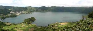
Panorámica del Lago Azul, Isla de São Miguel (Islas Azores) Credit: Santiago Giralt, ICTJA-CSIC
The Portuguese settled the Azores archipelago in 1449, according to the official chronology. But the analysis of the pollen present in the sediments of Lake Azul, in the São Miguel Island, suggests that the first settlers arrived to the archipelago, at least, 150 years before. This is the main conclusion of a study carried out by an international team of scientists that has been recently published in the journal Quaternary Science Reviews.
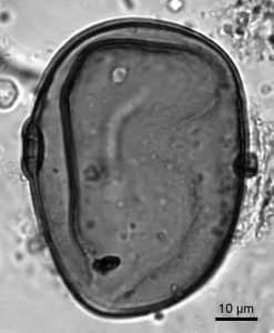
The researchers extracted a sedimentary core from Lake Azul, in the São Miguel Island, from which they took about 60 samples for pollen analysis. “In the samples studied, we found pollen of rye and other cereals and also spores from fungi characteristic of the feces of domestic animals,” says Valentí Rull, researcher at the Institute of Earth Sciences Jaume Almera (ICTJA-CSIC), and Arantzazu Lara, from the Botanic Institute of Barcelona (IBB-CSIC), who carried out the pollen analyses and the vegetation reconstruction.
Carbon-14 dating allowed researchers to know the age of samples containing the first evidence of human presence, which resulted to date back to year 1300, almost a century and a half before the onset of the Portuguese colonization. Some maps from the XIV century already documented the existence of the archipelago, but it was considered still uninhabited.
“The pollen and fungal spores found in the sediments corresponding to year 1300 suggest us that there was already some small-scale farming and livestock activity around the lake by that time. It is possible that sailors made frequent stops in the island or that there were already small permanent or intermittent settlements around Lake Azul”, adds Valentí Rull.
These settlements would have been established shortly after the last volcanic eruption, which occurred in the island around 1280. It is not known yet if humans inhabited the island before the eruption, an issue that should be verified in future studies.
Detail of rye pollen grain recovered from the sediments of Lago Azul. Credit: Valentí Rull, ICTJA-CSIC
The impact of colonization
The paper presents a reconstruction of the landscape and the vegetation of the São Miguel island during the last 700 years using the sediments of Lake Azul. Gonzalo Velho Cabral took possession of Santa María and São Miguel islands in 1432 but it was not until 1449 that the Kingdom of Portugal officially ordered the large-scale colonization of the archipelago.
Until then, the São Miguel landscape was dominated by dense laurisilva forests, characteristic of the Azores.The deforestation and further introduction of exotic species began after the arrival of the Portuguese settlers. This resulted in the total disappearance of the original laurisilvas. Nowadays, the island’s forests are dominated by exotic trees brought from Japan, Australia and the Mediterranean.
“In the samples corresponding to the period previous to the Portuguese settlement, we found at the same time the pollen corresponding to cereals and to laurisilva species. This indicates that the first settlements established in the island would not have modified the original vegetation, as it happened after 1449 “, says Valentí Rull.
The island of São Miguel is part of the eastern group of the Azores and is the largest and most populated island of the archipelago with more than 125,000 inhabitants.
The present study was carried out by researchers from ICTJA-CSIC, IBB-CSIC, the University of Barcelona (UB), the Institute of Environmental Science and Technology of the Autonomous University of Barcelona (ICTA-UAB) and the University of La Coruña, in conjunction with researchers from the universities of the Azores and Lisbon, and two Australian universities.
Reference:
Rull, V., et al. (2017), Vegetation and landscape dynamics under natural and anthropogenic forcing on the Azores Islands: A 700-year Pollen record from the São Miguel Island, Quaternary Science Reviews, 159, 155-168, DOI:10.1016 / j.quascirev.2017.01.021.
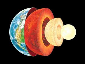
Inner Earth. Credit: Gary Hincks/Science Photo Library
1. In 1692 Edmond Halley (of comet fame) proposed that the Earth is hollow. Below the outer crust where we live, he pictured two concentric shells and a core about the size of Mercury, all floating in a luminous gas.
2. Helloooo down there: Halley even imagined that these shells might be inhabited. Jules Verne riffed on this idea in his classic Journey to the Center of the Earth.
3. Halley was right about the planet-size core, at least. At Earth’s center is an iron-rich orb more than 4,000 miles wide—bigger than Mercury, actually—closer to our feet than L.A. is to New York.
4. Its outer part is molten. Its inner part is a solid hunk of metal that spins independently of the rest of the planet.
5. Earthquake waves that pass through the inner core travel faster north-south than they do east-west. One theory: The inner core consists of metallic crystals aligned with Earth’s poles, and the waves move more rapidly when they go with the grain.
6. The inner core is nearly as hot as the surface of the sun, and the pressure down there is 3 million times what it is on the surface.
7. Earth’s solid and liquid cores together generate the magnetic field that keeps the solar wind—a nonstop, 250-mile-per-second stream of charged particles emitted by the sun—from stripping away our atmosphere.
8. Earth’s mini-me: A group at the University of Wisconsin is attempting to model Earth’s field by bottling 500,000-degree plasma in a 10-foot-wide aluminum sphere with really solid walls. The currents inside should mimic flows in the outer core.
9. The deepest place ever reached by human technology is the Kola Superdeep Borehole near Murmansk, Russia, the product of a Cold War inner-space race.
10. Bacteria have been discovered in the cavities and cracks of gold mines 2.4 miles beneath Earth’s surface. They live on hydrogen and sulfates, and their primary source of energy is radiation, not the sun. Yum.
11. Microbiologist James Holden of the University of Massachusetts at Amherst speculates that our planet’s deep biomass could weigh as much as all the things living up here on the surface.
12. According to NASA scientists, life on Mars may be huddling out of sight in a similar deep, hot biosphere.
13. Change is inevitable, even in the core. Examining paleomagnetic data, geoscientists at Johns Hopkins University suggest that the eastern and western halves of Earth’s core take turns growing and melting.
14. That may be why the axis of Earth’s magnetic field is cockeyed, leaning these days to the east, while a few geologic eyeblinks ago it tilted to the west.
15. The Johns Hopkins researchers think the axis gets anchored in the growing half. Which could account for our planet’s weird history of magnetic field reversals, with north and south poles swapping places.
16. Such magnetic field quirks might also be explained by pandemonium at the boundary between the molten core and the overlying mantle.
17. Berkeley physicist Richard Muller speculates that oxygen, silicon, and sulfur are being squeezed out of the inner core and floating up to the core-mantle boundary, where they collect into hot, slushy dunes. Every once in a while, one dune may violently tumble into the mantle, revving up convection and disturbing the magnetic field.
18. Reduce, reuse, recycle. The slow churn of plate tectonics pulls crust into the interior, where any plant and animal life in it gets trapped and cooked. Organic material eventually resurfaces in lava and volcanic gases, including atmosphere-warming carbon dioxide.
19. Such cycling, and the protective magnetic field generated by the core, keep our planet at the perfect temperature for life.
20. Look at Venus, with its 900-degree Fahrenheit days and nights. If not for our planet’s restless insides, that could be us.
Note: The above post is reprinted from materials provided by Discover Magazine. The original article was written by Rebecca Coffey.
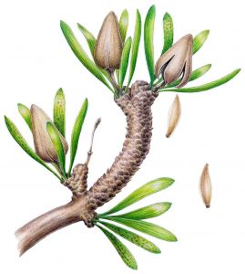
Reconstruction of the ancient, dinosaur-era relative of today’s Ginkgo biloba plant. Credit: Fabiany Herrera & Patrick Herendeen
A discovery of well-preserved fossil plants by paleontologists from the United States, China, Japan, Russia and Mongolia has allowed researchers to identify a distant relative of the living plant Ginkgo biloba.
The find helps scientists better understand the evolution and diversity of ancient seed plants.
The fossils, from the species Umaltolepis mongoliensis, date back to the early Cretaceous Period (some 100-125 million years ago). Scientists discovered the fossils in ancient peat deposits at the Tevshiin Govi mine in the steppes of central Mongolia. Results of the research, supported by the National Science Foundation (NSF), are published in this week’s issue of the journal Proceedings of the National Academy of Sciences (PNAS).
“The stems and leaves are similar to the ginkgo tree, but the seeds, and especially the structures they are born in, are unlike any other known plant, living or extinct,” says scientist Patrick Herendeen of the Chicago Botanic Garden, co-author of the PNAS paper. “Finding something like this does not happen very often.”
Scientists had previously uncovered fossils of U. mongoliensis, but those were in poor condition, making them difficult to study. Hundreds of better-preserved new fossils show that features of the stems and leaves are similar to those of living ginkgo.
However, the seed-bearing structures are not like those of today’s ginkgo tree, Herendeen says. Ginkgo has large seeds with a fleshy outer covering, but U. mongoliensis has small, winged seeds.
As they developed, U. mongoliensis seeds were protected inside a tough, resinous, umbrella-like outer covering, which stayed almost completely closed, opening only to release the seeds.
The key to determining how U. mongoliensis is related to other seed plants lies in understanding its strange seed-bearing capsules.
While the U. mongoliensis seeds are dissimilar to those of any other living or extinct plant, preliminary comparisons connect them with the seed-bearing structures of two groups of extinct plants that may be part of the ginkgo lineage.
These comparisons and the unique features of U. mongoliensis indicate that ginkgo is the last living member of a group of plants that was much more diverse and important in the past.
“Ginkgo biloba, primarily known today as a dietary supplement to enhance memory, also plays an important role in the understanding of seed plant evolution,” says Simon Malcomber, program director in NSF’s Division of Environmental Biology. “This research expands our understanding of the diversity in this enigmatic group, in addition to helping clarify relationships among seed plants more generally.”
In addition, the researchers collected other fossils from the Tevshiin Govi mine, including seed plants related to modern pines, spruces, swamp cypresses and redwoods.
Also present in the ancient swamp forests of central Mongolia were a variety of extinct plants thought to be early conifers, but that have no clear living relatives.
“Knowing the diversity of plants in Cretaceous environments provides a better understanding of potential food sources for animals such as plant-eating dinosaurs,” says Judy Skog, program director for paleontology in NSF’s Division of Earth Sciences. “Once the diversity of plants decreases, as this paper indicates is true for the relatives of ginkgo, animal life also declines.”
Scientists have long known about dinosaurs from the Cretaceous of Mongolia, but only now are the plants that supported those extinct animals coming into sharper focus.
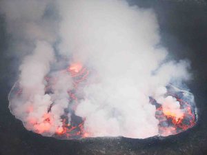
Lava lake in the crater of Mount Nyiragongo in the Democratic Republic of the Congo. June, 2007. Credits: Simon Carn / Michigan Technological University
Volcanoes erupt, they spew ash, their scarred flanks sometimes run with both lava and landslides. But only occasionally. A less dramatic but important process is continuous gas emissions from volcanoes; in other words, as they exhale. A number of volcanoes around the world continuously exhale water vapor laced with heavy metals, carbon dioxide, hydrogen sulfide and sulfur dioxide, among many other gases. Of these, sulfur dioxide is the easiest to detect from space.
In a new study published in Scientific Reports this week, a team led by researchers from Michigan Technological University created the first, truly global inventory for volcanic sulfur dioxide emissions, using data from the Dutch-Finnish Ozone Monitoring Instrument on NASA’s Earth Observing System Aura satellite launched in 2004. They compiled emissions data from 2005 to 2015 to produce annual estimates for each of 91 presently emitting volcanoes worldwide. The data set will help refine climate and atmospheric chemistry models and provide more insight into human and environmental health risks.
“Many people may not realize that volcanoes are continuously releasing quite large amounts of gas, and may do so for decades or even centuries,” says volcanologist Simon Carn, an associate professor at Michigan Tech in Houghton, Michigan, and the lead author of the new study. “Because the daily emissions are smaller than a big eruption, the effect of a single plume may not seem noticeable, but the cumulative effect of all volcanoes can be significant. In fact, on average, volcanoes release most of their gas when they’re not erupting.”
Carn and his team found that each year volcanoes collectively emit 20 to 25 million tons of sulfur dioxide into the atmosphere. While this number is higher than the previous estimate made in the late 1990s based on ground measurements, the new research includes data on more volcanoes, including some that scientists have never visited, and it is still lower than human emissions of sulfur dioxide pollution levels.
Human activities emit about two times as much sulfur dioxide into the atmosphere, according to co-author Vitali Fioletov, an atmospheric scientist at Environment and Climate Change Canada in Toronto, Ontario. He led the effort to catalogue sulfur dioxide emissions sources from human activities and volcanoes and to trace emissions derived from the satellite observations back to their source by using wind data.
Human emissions however are on the decline in many countries due to more strict pollution controls on power plants like burning low-sulfur fuel and technological advances to remove it during and after combustion. As they decrease, the importance of persistent volcanic emissions rises. Volcanoes provide natural background levels of sulfur dioxide that need to be taken into account when studying the global atmosphere and regional effects.
Atmospheric processes convert the gas into sulfate aerosols–small suspended particles in the atmosphere–that reflect sunlight back into space, causing a cooling effect on climate. Sulfate aerosols near the land surface are harmful to breathe. In addition, sulfur dioxide is the primary source of acid rain and is a skin and lung irritant. Health concerns with sulfur dioxide plumes are ongoing in communities on the slopes of persistently degassing volcanoes like Kilauea in Hawaii and Popocatepetl in Mexico.
With daily observations, tracking sulfur dioxide emissions via satellite can also help with eruption forecasting. Along with measuring seismic activity and ground deformation, scientists monitoring satellite data can potentially pick up noticeable increases in gas emissions that may precede eruptions.
“It’s complementary to ground-based monitoring,” Carn says, adding that his team says both are needed. “Ground-based measurements of volcanic gases that are more difficult to measure from space, such as carbon dioxide, are crucial. But the satellite data could allow us to target new ground-based measurements at unmonitored volcanoes more effectively, leading to better estimates of volcanic carbon dioxide emissions.”
Ground-based data are more detailed, and in areas like Central America where large sulfur dioxide-emitting volcanoes are close together, they better distinguish which specific volcano gas plumes come from. However, while field measurements of sulfur dioxide emissions are increasing, they still remain too sparse to piece together a cohesive global picture.
That’s where this new inventory is handy; it reaches as far as the remote volcanoes of the Aleutian Islands and provides consistent measurements over time from the world’s biggest emitters, including Ambrym in Vanuatu and Kilauea in Hawaii.
“Satellites provide us with a unique ‘big picture’ view of volcanic emissions that is difficult to obtain using other techniques,” Carn says. “We can use this to look at trends in sulfur dioxide emissions on the scale of an entire volcanic arc.”
The work highlights the necessity of consistent long-term data, according to co-author Nick Krotkov, an atmospheric scientist at NASA’s Goddard Space Flight Center in Greenbelt, Maryland, which produces the sulfur dioxide data from the Aura satellite. “If you want to look at trends or do other science, the longer time-series is really critical. The value of the data increases with its duration,” he said.
The new volcanic emissions information pulls together opportunities to improve monitoring of natural hazards, human health risks and climate processes–one volcanic breath at a time.
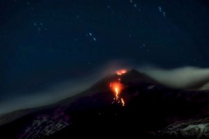
Mount Etna. Credit: Angelo T. La Spina, Lizenz: CC BY-SA 4.0
Scientists made a surprising discovery on their mission to find better indicators for impending volcanic eruptions: it looks like tree rings may be able to predict eruptions, report the Swiss Federal Institute for Forest, Snow and Landscape Research WSL and the ETH Zurich.
Nicolas Houlié, a geophysicist at ETH Zurich, first came to know about this potential early warning system in 2001. While looking at a satellite image, he noticed a three kilometres long green line on the north-east flank of Mount Etna. The line reflects the Normalised Difference Vegetation Index (NDVI): the higher the value, the more vegetation is thriving in the area. But what made the discovery really astonishing is the fact that the volcano erupted along that exact line just one year later.
Volcanologists and dendrochronologists join forces
Dendrochronologists agree that NDVI values are connected to tree growth, and thus reflected in tree-ring width. With that in mind, geographer Ruedi Seiler, a PhD student at WSL, and dendrologist Paolo Cherubini, Head of Dendrochronology at WSL, teamed up with Nicolas Houlié four years ago to embark upon a cross-disciplinary research project funded by the Swiss National Science Foundation. Their unusual idea — namely that tree rings give information about volcanic processes prior to eruptions — has now been published in the journal Scientific Reports.
The rings formed in tree trunks during trees’ growth periods are valuable repositories of environmental information: the ring width reflects the tree’s growth conditions, which are a combination of the temperature, precipitation and nutrient conditions during a given growing season. “The ring width may also be influenced by volcanic activity on Mount Etna and in other volcanic regions,” speculates Seiler.
Short pre-eruptive phase?
Under Cherubini’s direction, the researchers conducted their initial fieldwork alongside the lava flows that ran down Mount Etna’s west flank in January 1974. This was the location where Italian researchers also spotted an anomaly on satellite images in 1973, prior to the eruption.
Seiler took over fifty tree samples in the aim of identifying any pre-eruptive signals in the tree rings. However, the researchers found that the tree rings for summer 1973 were neither exceptionally wide nor exceptionally narrow.
“If volcanic activity does influence tree rings, then the pre-eruptive phase of the 1974 eruption can only have begun when the trees had already ceased their seasonal growth,” concludes Seiler. That said, the calculated duration of the pre-eruptive phase — which would be just a few months in this case — is actually consistent with the results of earlier geochemical and geophysical studies.
Restricted growth following an eruption
Although there were no changes to the trees’ growth before the 1974 eruption, the researchers’ article in Scientific Reports points out that the trees grew less in the two summers following the eruption than in other years. “I see great potential in this observation: we may be able to use tree rings to reliably date minor flank eruptions,” says volcanologist Houlié. This is significant because a volcano’s past behaviour can provide information about its future activities and thus contribute to improving measures to protect the population.
Thanks to real-time monitoring with GPS, seismometers and gas monitoring devices, the eruptions of the last twenty years are well documented. By contrast, volcanic eruptions occurring in the 2,000 years before that cannot be dated reliably, while the dates of even older volcanic events can be determined relatively accurately using the C14 method. Houlié is optimistic: “Tree ring data could help to close the information gap for the period stretching from 20 to 2,000 years ago.” In any case, the researchers want to continue their investigations into whether tree rings may be helpful in predicting volcanic eruptions.
Reference:
Ruedi Seiler, Nicolas Houlié, Paolo Cherubini. Tree-ring width reveals the preparation of the 1974 Mt. Etna eruption. Scientific Reports, 2017; 7: 44019 DOI: 10.1038/srep44019
A pioneering new computer model has been developed to simulate the whole chain of hazard events triggered by offshore mega subduction earthquakes, by a team involving UCL and Bristol engineers.
It is the first model to do this and has the potential to reduce losses to life and property caused by disasters like the huge earthquake and tsunami that struck Japan six years ago this Saturday (11 March).
The project, called CRUST (Cascading Risk and Uncertainty Assessment of Earthquake Shaking and Tsunami) and funded by the Engineering and Physical Sciences Research Council (EPSRC), involves an international team spearheaded by engineers from the University of Bristol, in collaboration with UCL EPICentre and supported by testing at HR Wallingford.
Designed to be used in any part of the world potentially vulnerable to offshore subduction earthquakes (where one tectonic plate is forced beneath another), such as Japan, New Zealand, the Pacific Northwest (US and Canada), Mexico, Chile and Indonesia, the model integrates every aspect of an undersea earthquake – including tsunamis, aftershocks and landslides – into a single multi-hazard simulation tool.
The CRUST project looks to generate more comprehensive, more accurate maps of all potential hazards stemming from off-shore earthquakes.
Professor Tiziana Rossetto, Co-Investigator on CRUST (UCL Civil, Environmental & Geomatic Engineering), said: “The model gives us a much greater understanding of how events are connected with one other. Knowing this is key to strengthening emergency planning, improving evacuation strategies, enabling engineers to calculate buildings’ resilience more realistically and helping the insurance industry produce more reliable financial risk analyses.”
In the past, hazards posed by earthquakes and by the different threats associated with them have been modelled separately, based on different methods, data and assumptions varying from one part of the world to another. This lack of integration and lack of a standard approach has limited models’ real-world value as well as the benefits of information sharing between countries.
With its ability to produce a more reliable and realistic picture of the entire sequence of hazard events and to generate multi-hazard maps, the model will enable governments, emergency services, the financial industry and others to explore alternative disaster scenarios in detail.
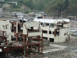
Dr Katsu Goda of the University of Bristol, who has led the CRUST team, said: “The magnitude nine Tōhoku earthquake and resulting tsunami waves that hit the east coast of Japan on 11 March, 2011 caused around 19,000 deaths plus economic damage estimated at $300 billion. We hope our simulation tool will secure wide rollout around the world and will be used to inform decision-making and boost resilience to these frequently devastating events.”
Professor Rossetto added: “The next steps are to integrate within the model novel relationships we are developing for predicting damage to the built environment from the hazards. This will enable better estimates not only of the hazards, but of their consequences.”
Reference:
Shunichi Koshimura et al. The impact of the 2011 Tohoku earthquake tsunami disaster and implications to the reconstruction, Soils and Foundations (2014). DOI: 10.1016/j.sandf.2014.06.002
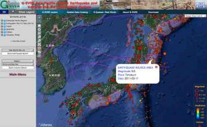
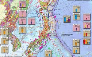
Figure 2: Hazard information system on a website. The map is created using high resolution digital data making it possible for users can zoom in to a region to find more detailed information. Credit: Advanced Industrial Science and Technology
Shinji Takarada and members of the Caldera Volcano Research Group, the Research Institute of Earthquake and Volcano Geology, the Geological Survey of Japan, the National Institute of Advanced Industrial Science and Technology, have created the “Eastern Asia Earthquake and Volcanic Hazards Information Map” summarizing past disaster information on large-scale earthquakes, volcanic eruptions and the tsunamis that they triggered.
The “Eastern Asia Earthquake and Volcanic Hazards Information Map” summarizes past disaster information on large-scale earthquakes, volcanic eruptions and the tsunamis that they triggered on a single geological map. Displaying the disaster scale, and the number and causes of fatalities on the map in icons enable the viewers to have a good grasp of the hazard situation of a particular area at a glance. The map is expected to raise risk management awareness among corporations and travelers in East Asia. It can also be used as basic data for disaster mitigation planning and hazard map creation. The map in image format has been made public on the Geological Survey of Japan website (https://www.gsj.jp/HomePageJP.html) since May 20, 2016 and will be distributed to relevant institutions and researchers worldwide. There are also plans to publish the hazard information map in GIS digital format on the G-EVER Asia-Pacific Region Earthquake and Volcanic Hazard Information System website, making it possible to overlay this data with other information such as population for other type of research.
The hazard information map will be presented at the meeting of Japan Geoscience Union members in Makuhari Messe, Chiba City, Chiba Prefecture on May 22 to 26, 2016, and at the most important international conference in the field of geoscience, the 35th International Geological Congressin Cape Town, South Africa on August 27 to September 4, 2016.
Eastern Asia covering countries like Japan, Indonesia and the Philippines is one of the regions of the world most frequently struck by large-scale natural disasters such as earthquakes, volcanic eruptions, and the tsunamis that they triggered. In the present global society, occurrence of large-scale disaster which affects factories could have devastating effect not only in the affected region but the entire world. For this reason, countries around the world are deeply concerned about disaster mitigation measures in East Asia, which hosts many production sites that are exposed to the aforementioned disasters. The Great East Japan Earthquake on March 11, 2011 strongly reminds society that large-scale disasters could bring unimaginable destruction and human suffering, even if they are infrequent and preparing for such disasters is very important.
However, until now, information on large-scale disasters is owned by various countries and there is nothing with which people could see the overall Eastern Asian hazard information in detail.
AIST formed the Asia-Pacific Region Earthquake and Volcanic Eruption Risk Management (G-EVER) Promotion Team in the Geological Survey of Japan in 2012, during the first anniversary of the Great East Japan Earthquake, and launched the “Eastern Asia Earthquake and Volcanic Hazards Information Map” project. The geological surveys and related research institutes in East Asia participated in this project which aims to mitigate disasters caused by earthquakes and volcanic eruptions. The participating organizations provided disaster information about large-scale earthquakes, volcanic eruptions and the triggered tsunamis like the disaster scale and the number and causes of fatalities, with the aim of displaying the information in an easy to understand format on a single map.
Figure 1: Japan area of the Eastern Asia Earthquake and Volcanic Hazards Information Map. Number and causes of fatalities from disasters are displayed in color coded icons. Credit: Advanced Industrial Science and Technology
Earthquakes and volcanic eruptions after 1850AD and 1400AD, respectively, are collated and displayed on a single map. Information about tsunamis triggered by volcanic eruptions and earthquakes like heights and the areas affected, which have been given great attention after the Great East Japan Earthquake, are displayed on the map. Also included are the locations of active faults and distribution of volcanic ash. The number and causes of fatalities due to disasters are determined and displayed on the map using color coded icons to be easily understood by viewers (Fig. 1).
Earthquake information displayed on the map includes magnitude, location and depth of epicenters, source regions and triggered tsunamis. The causes of earthquake fatalities are classified into fire, tsunami, building collapse, landslide and others. These types of information are displayed on the map in color coded icons. Locations of active volcanoes and the areas covered by large-scale pyroclastic flows and ash fall, which are indicated in broken lines, are also displayed. The causes of volcanic fatalities are classified into pyroclastic flows, ballistics, lahar, ash fall, tsunami, and others. These types of information are displayed on the map in color coded icons.
Figure 2: Hazard information system on a website. The map is created using high resolution digital data making it possible for users can zoom in to a region to find more detailed information. Credit: Advanced Industrial Science and Technology
Displaying hazard information on a single map makes it possible to easily determine the relationship between geology and hazards. It is clearly shown on the map that volcanic eruptions and earthquakes seldom happen in relatively old-age geological regions. It is also possible to know the disaster-prone areas, the scale and type of disasters and the areas affected by tsunamis and volcanic ash falls at a glance. The map could be easily understood by experts and non-technical people making it very useful for disaster mitigation measures in East Asia. Detailed data that cannot be fully displayed on the information map is written at the back of the map in Japanese and English. It is expected that various agencies will use it in conjunction with the detailed earthquake and volcanic hazard information. The “Eastern Asia Earthquake and Volcanic Hazards Information Map” in image format was available for download at the geological map catalog (geoscience map of Asia) page on the Geological Survey of Japan website (https://www.gsj.jp/HomePageJP.html) since May 20, 2016.
The original data of the “Eastern Asia Earthquake and Volcanic Hazards Information Map” were created in digital in GIS format and the researchers plan to make it accessible on the G-EVER Asia-Pacific Region Earthquake and Volcanic Hazard Information System, where users can zoom in to the area they wish to see, such as Japan, and acquire more detailed information (Fig. 2). Earthquake information is updated in real time in the system making the users view the latest disaster information. Using the search function, it is possible to query the system’s database based on the date and region where they occurred, the disaster scale, or the number of fatalities.
By investigating the affected areas and causes of damage due to earthquakes, volcanic eruptions, and the triggered tsunamis, and providing the results in GIS format, important information processing could further be implemented. By combining hazard data with various information including population and transportation network, it is possible to evaluate the hazard risks that might be caused by future earthquakes, volcanic eruptions and tsunamis. Furthermore, government agencies and local governments responsible for disaster mitigation in various countries will be able to create hazard maps based on the data. It can also be used for disaster mitigation research by universities and research institutions. In addition, it is expected that the data will be used as reference materials for educational institutions to provide disaster mitigation education. It could be a source of information for companies operating in Japan and abroad to formulate measures against disasters and business continuity plans (BCP), and reference data for tourists.
Currently, the “Eastern Asia Earthquake and Volcanic Hazards Information Map” is displayed in English, but in the future it will be published using the languages of various countries, including Japanese. Furthermore, Eikichi Tsukuda, Director General of the Geological Survey of Japan, who promoted the “Eastern Asia Earthquake and Volcanic Hazards Information Map” project, serves as the Asian representative to the Commission for the Geological Map of the World (CGMW) under the umbrella of UNESCO. As such, AIST has plans to distribute Eastern Asia earthquake and volcanic hazard information around the world using the “Eastern Asia Earthquake and Volcanic Hazards Information Map.”
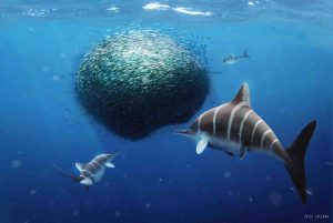
Artwork with ‘bait ball’ Ichthyosaur. Credit: Julio Lacerda
Ichthyosaurs, which are similar-shaped to dolphins and sharks, but are reptiles, swam the seas for millions of years during the Triassic, Jurassic and Cretaceous periods. They were the first, large extinct reptiles brought to the attention of the scientific world.
Dean Lomax, a palaeontologist and Honorary Scientist at The University of Manchester, working with Professor Judy Massare of Brockport College, New York, have studied thousands of ichthyosaur fossils and have delved through hundreds of years of records to solve an ancient mystery.
Many ichthyosaur fossils were found in England during the early 19th century, but it was not until 1821 that the first ichthyosaur species was described — called Ichthyosaurus communis. This species has become one of the most well-known and iconic of all the British fossil reptiles. A sea of Ichthyosaurus fossils can be seen on display at the Natural History Museum, London.
In 1822, three other species were described, based on differences in the shape and structure of their teeth. Two of the species were later re-identified as other types of ichthyosaur, whereas one of these species, called Ichthyosaurus intermedius, was still considered closely related to I. communis.
In the years that followed, many eminent scientists, including Sir Richard Owen (the man who coined the word dinosaur), studied ichthyosaur fossils collected from Dorset, Somerset, Yorkshire and other locations in England. Their studies and observations of Ichthyosaurus communis and I. intermedius resulted in confusion with the species, with many skeletons identified on unreliable grounds.
Lomax said, “The early accounts of ichthyosaurs were based on very scrappy, often isolated, remains. This resulted in a very poor understanding of the differences between species and thus how to identify them. To complicate matters further, the original specimen of Ichthyosaurus communis is lost and was never illustrated.
Similarly, the original specimen of I. intermedius is also lost, but an illustration does exist. This has caused a big headache for palaeontologists trying to understand the differences between the species.”
In the mid-1970s, palaeontologist, Dr Chris McGowan was the first to suggest that Ichthyosaurus communis and I. intermedius may represent the same species. He could not find reliable evidence to separate the two species. Subsequent studies argued for and against the separation of the species.
In this new study, the duo have reviewed all of the research for and against the separation of the two species. This is the most extensive scientific study ever published comparing the two. The duo confirm the species are the same and that features of Ichthyosaurus intermedius can be found in other ichthyosaur species, including I. communis.
In recent years, the duo have described three new species and have provided a reassessment of historical species. Their work has provided a far superior understanding of the species than has ever been produced.
The research has been published in Journal of Systematic Palaeontology.
Reference:
Judy A. Massare, Dean R. Lomax. A taxonomic reassessment of Ichthyosaurus communis and I. intermedius and a revised diagnosis for the genus. Journal of Systematic Palaeontology, 2017; 1 DOI: 10.1080/14772019.2017.1291116