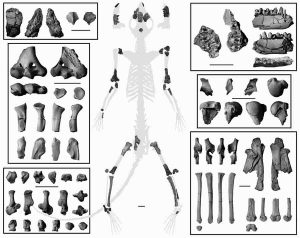
A new analysis of this 62-million-year-old partial skeleton of Torrejonia, a small mammal from an extinct group of primates called plesiadapiforms, had skeletal features adapted for living in trees. Credit: 2017 Stephen Chester. Published by the Royal Society under the terms of the Creative Commons Attribution License
Earth’s earliest primates dwelled in treetops, not on the ground, according to an analysis of a 62-million-year-old partial skeleton discovered in New Mexico—the oldest-known primate skeleton.
The skeleton was discovered in the San Juan Basin by Thomas Williamson, curator of paleontology at the New Mexico Museum of Natural History & Science, and his twin sons, Taylor and Ryan.
The study shows that Torrejonia, a small mammal from an extinct group of primates called plesiadapiforms, had skeletal features adapted to living in trees, such as flexible joints for climbing and clinging to branches. Previously, researchers had proposed that plesiadapiforms in Palaechthonidae, the family to which Torrejonia belongs, were terrestrial based on details from cranial and dental fossils consistent with animals that nose about on the ground for insects.
“This is the oldest partial skeleton of a plesiadapiform, and it shows that they undoubtedly lived in trees,” said lead author Stephen Chester, an assistant professor at Brooklyn College, City University of New York, and curatorial affiliate of vertebrate paleontology at the Yale Peabody Museum, who began this collaborative research while at Yale University studying for his Ph.D. “We now have anatomical evidence from the shoulder, elbow, hip, knee, and ankle joints that allows us to assess where these animals lived in a way that was impossible when we only had their teeth and jaws.”
The study, which will be published on May 31 in online edition of Royal Society Open Science, supports the hypothesis that plesiadapiforms, which first appear in the fossil record shortly after the extinction of non-avian dinosaurs, were the earliest primates. The researchers also contend that the new data provide additional evidence that all of the geologically oldest primates known from skeletal remains, encompassing several species, were arboreal.
The partial skeleton consists of over 20 separate bones, including parts of the cranium, jaws, teeth, and portions of the upper and lower limbs. The presence of associated teeth allowed Williamson, a co-author of the study, to identify the specimen as Torrejonia because the taxonomy of extinct mammals is based mostly on dental traits, said Eric Sargis, professor of anthropology at Yale University, and senior author of the study.
“To find a skeleton like this, even though it appears a little scrappy, is an exciting discovery that brings a lot of new data to bear on the study of the origin and early evolution of primates,” said Sargis, a curator of vertebrate paleontology and vertebrate zoology at Yale’s Peabody Museum of Natural History, where the partial skeleton was molded and casted for further study.
Palaechthonids, and other plesiadapiforms, had outward-facing eyes and relied on smell more than living primates do today—details suggesting that plesiadapiforms are transitional between other mammals and modern primates, Sargis said.
The site where the partial skeleton was discovered, known as the Torrejon Fossil Fauna Area, is a remote area in northwestern New Mexico administered by the federal Bureau of Land Management. These public lands are managed to protect the scientific value of the paleontological resources found there. The collection of the Torrejonia partial skeleton was done under a permit from the agency.
Reference:
Oldest skeleton of a plesiadapiform provides evidence for an exclusively arboreal radiation of stem primates in the Paleocene, Royal Society Open Science, DOI: 10.1098/rsos.170329
New geological evidence suggests that massive volcanism caught Earth’s climate in a peculiarly unstable state at the end of the Ordivician geological period, triggering rapid climate fluctuations that led to a mass extinction. Credit: Shutterstock
Anyone concerned by the idea that people might try to combat global warming by injecting tons of sulfate aerosols into Earth’s atmosphere may want to read an article in the May 1, 2017 issue of the journal Geology.
In the article, a Washington University scientist and his colleagues describe what happened when pulses of atmospheric carbon dioxide and sulfate aerosols were intermixed at the end of the Ordivician geological period more than 440 million years ago.
The counterpart of the tumult in the skies was death in the seas. At a time when most of the planet north of the tropics was covered by an ocean and most complex multicellular organisms lived in the sea, 85 percent of marine animal species disappeared forever. The end Ordivician extinction, as this event was called, was one of the five largest mass extinctions in Earth’s history.
Although the gases were injected into the atmosphere by massive volcanism rather than prodigious burning of fossil fuels and under circumstances that will never be exactly repeated, they provide a worrying case history that reveals the potential instability of planetary-scale climate dynamics.
Figuring out what caused the end Ordivician extinction or any of the other mass extinctions in Earth’s history is notoriously difficult, said David Fike, associate professor of earth and planetary sciences in Arts & Sciences and a co-author on the paper.
Because the ancient atmospheres and oceans have long since been altered beyond recognition, scientists have to work from proxies, such as variations in oxygen isotopes in ancient rock, to learn about climates long past. The trouble with most proxies, said Fike, who specializes in interpreting the chemical signatures of biological and geological activity in the rock record, is that most elements in rock participate in so many chemical reactions that a signal can often be interpreted in more than one way.
But a team led by David Jones, an earth scientist at Amherst College, was able to bypass this problem by measuring the abundance of mercury. Today, the primary sources of mercury are coal-burning power plants and other anthropocentric activities; during the Ordivician, however, the main source was volcanism.
Volcanism coincides with mass extinctions with suspicious frequency, Fike said. He is speaking not about an isolated volcano but rather about massive eruptions that covered thousands of square kilometers with thick lava flows, creating large igneous provinces (LIPs). The most famous U.S. example of a LIP is the Columbia River Basalt province, which covers most of the southeastern part of the state of Washington and extends to the Pacific and into Oregon.
Volcanoes are plausible climate forcers, or change agents, because they release both carbon dioxide that can produce long-term greenhouse warming and sulfur dioxide that can cause short-term reflective cooling. In addition, the weathering of vast plains of newly exposed rock can draw down atmospheric carbon dioxide and bury it as limestone minerals in the oceans, also causing cooling.
When Jones analyzed samples of rock of Ordivician age from south China and the Monitor Range in Nevada, he found anomalously high mercury concentrations. Some samples held 500 times more mercury than the background concentration. The mercury arrived in three pulses, before and during the mass extinction.
But what happened? It had to have been an unusual sequence of events because the extinction (atypically) coincided with glaciation and also happened in two pulses.
As the scientists began to piece together the story, they began to wonder if the first wave of eruptions didn’t push Earth’s climate into a particularly vulnerable state, setting it up for a climate catastrophe triggered by later eruptions.
The first wave of eruptions laid down a LIP whose weathering then drew down atmospheric carbon dioxide. The climate cooled and glaciers formed on the supercontinent of Gondwana, which was then located in the southern hemisphere.
The cooling might have lowered the tropopause, the boundary between two layers of the atmosphere with different temperature gradients. The second wave of volcanic eruptions then injected prodigious amounts of sulfur dioxide above the tropopause, abruptly increasing Earth’s albedo, or the amount of sunlight it reflected.
This led to the first and largest pulse of extinctions. As ice sheets grew, sea level dropped and the seas became colder, causing many species to perish.
During the second wave of volcanism, the greenhouse warming from carbon dioxide overtook the cooling caused by sulfur dioxide and the climate warmed, the ice melted and sea levels rose. Many of the survivors of the first pulse of extinctions died in the ensuing flooding of habitat with warmer, oxygen-poor waters.
The take-home, said Fike, is that the different factors that affect Earth’s climate can interact in unanticipated ways and it is possible that events that might not seem extreme in themselves can put the climate system into a precarious state where additional perturbations have catastrophic consequences.
“It’s something to keep in mind when we contemplate geoengineering schemes to mitigate global warming,” said Fike, who teaches a course where students examine such schemes and then evaluate their willingness to deploy them.
Reference:
David S. Jones, Anna M. Martini, David A. Fike, Kunio Kaiho. A volcanic trigger for the Late Ordovician mass extinction? Mercury data from south China and Laurentia. Geology, 2017; G38940.1 DOI: 10.1130/G38940.1
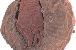
Detail from an embryo of the scalidophoran Markuelia from the Middle Cambrian of Australia. Credit: Philip Donoghue – University of Bristol
The origin of animals was one of the most important events in the history of Earth. Beautifully preserved fossil embryos suggest that our oldest ancestors might have existed a little more than half a billion years ago.
Yet, fossils are rare, difficult to interpret, and new, older fossils are constantly discovered.
An alternative approach to date the ‘tree of life’ is the molecular clock, introduced in the early 1960s by twice Nobel Laureate Linus Pauling, which uses genetic information.
Early molecular clock studies assumed that mutation accumulated at a fixed rate across all species and concluded that our oldest ancestor might have existed around 1.5 billions of years ago, a date that is almost three-times as old as the oldest fossil evidence of animal life.
These results sparked heated, scientific debates that only eased off in the last decade when a new generation of more realistic “relaxed” clock methods, that do not assume constancy of the mutation rate, started to close the gap between molecules and fossils indicating that animals are unlikely to be older than around 850 million of years.
However, using a recently developed relaxed molecular clock method called RelTime, a team of scientists at Oakland (Michigan) and Temple (Philadelphia) dated the origin of animals at approximately 1.2 billion years ago reviving the debate on the age of the animals.
Puzzled by the results of the American team, researchers from the University of Bristol and Queen Mary University of London decided to take a closer look at RelTime and found that it failed to relax the clock. Their findings are published in the journal Genome Biology and Evolution.
Professor Philip Donoghue from the University of Bristol’s School of Earth Sciences, said: “What caught our attention was that results obtained using RelTime were in strong disagreement with a diversity of different studies, from different research groups and that used different software and data, all of which broadly agreed that animals are unlikely to be older than approximately 850 million years.”
Dr Mario dos Reis, a co-author from London, added: “Generally scientists use Bayesian methods to relax the clock. These methods use explicit probability models to account for the uncertainty in the fossil record and in the mutation rate.
“Bayesian methods borrow tools from financial mathematics to model variation in mutation rate in a way that is similar to that used to model the stochastic variation in stock prices with time.
“By applying these sophisticated mathematical tools, Bayesian methods relax the clock and estimate divergence times. However, RelTime is not a Bayesian method.”
Dr Jesus Lozano-Fernandez, also from the University of Bristol, added: “Estimating divergence times is difficult and different relaxed molecular clock methods use different approaches to do so. However, we discovered that the RelTime algorithm failed to relax the clock along the deepest branches of the animal tree of life.”
Bristol’s Professor Davide Pisani concluded: “Current Bayesian methods date the last common animal ancestor to less than approximately 850 millions of years ago, in relatively good agreement with the fossil record.
“RelTime suggested that animals are much older but it turned out that it suffers from the same problems of the early clock methods.
“This clearly indicates that older ideas suggesting that animals might be twice or three times as old as the oldest animal fossil are erroneous and only emerge when changes in mutation rate are incorrectly estimated.
“RelTime results sounded like a blast from the past, but their provably erroneous nature ended up blasting these same old ideas that they were trying to revive.”
Reference:
Jesus Lozano-Fernandez, Mario dos Reis, Philip C.J. Donoghue, Davide Pisani. RelTime Rates Collapse to a Strict Clock When Estimating the Timeline of Animal Diversification. Genome Biology and Evolution, 2017; 9 (5): 1320 DOI: 10.1093/gbe/evx079
Tohoku University researchers and their international collaborators have identified a possible genetic mechanism underlying the evolution of birds, according to a recently published study in Nature Communications.
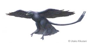
Studies of dinosaur fossils that show bird-like traits, such as feathers, light bones, air sacs and three-digit forelimbs, clarified the evolutionary kinship of birds and dinosaurs. However, identifying genomic DNA changes during this evolutionary transition has remained a challenge. Evolutionary biologists have suspected that anatomical differences within and between species are caused by cis-regulatory elements (CREs). CREs are regions of genome DNA that do not code for proteins, and control morphology and other traits by regulating genes.
The international group of researchers analyzed the genomes of 48 avian species that represent the evolutionary history of modern birds and compared them to many other vertebrates to find DNA sequences specific to avians. They identified millions of genomic regions named ‘avian-specific highly conserved elements’ (ASHCEs) that appeared to function as CREs. They found certain modifications in histones associated with the ASHCEs; histone modifications are known to indicate active and repressed states of corresponding DNA regions.
They also analyzed the ASHCEs sequences and found they are very similar. This means the emergence of ASHCEs can possibly be traced back all the way to the era of dinosaurs. ASHCEs also appear to be linked with evolution and development of bird-specific traits. For example, the researchers showed that a gene known as Sim1, which contains an ASHCE, may be associated with the evolution of flight feathers. The ASHCE functions as an enhancer that regulates Sim1 gene expression in an avian-specific manner.
Because the ASHCEs in genes such as Sim1 were highly conserved and therefore largely unchanged by evolution since the dinosaur era, this suggests CREs such as ASHCEs were vital in developing bird-specific traits and may have driven the transition of dinosaurs to birds.
Reference:
Ryohei Seki et al. Functional roles of Aves class-specific cis-regulatory elements on macroevolution of bird-specific features, Nature Communications (2017). DOI: 10.1038/ncomms14229
The earliest metabolisms of the Archaea were based on the anaerobic reduction of carbon dioxide, and likely evolved during the earliest period of Earth’s evolutionary history. Credit: Tim Bertelink
A team of scientists led by the University of Bristol has provided new insights into the origins of the Archaea, the group of simple cellular organisms that are the ancestors of all complex life.
The Archaea are one of the Earth’s most genetically and ecologically diverse groups of micro-organisms.
They thrive in a bewildering variety of habitats, from the familiar – soils and oceans – to the inhospitable and bizarre, such as the boiling acid pools of Yellowstone National Park.
The research provides a new evolutionary tree for the Archaea that will help to make sense of their biodiversity, and provides a new window into the early history of life on Earth that is not preserved in the fossil record. The work is published in PNAS.
With the development of new technologies for sequencing genomes directly from the environment, many new groups of Archaea have been discovered.
Dr Tom Williams from the School of Earth Sciences, said: “But while these genomes have greatly improved our understanding of the diversity of Archaea, they have so far failed to bring clarity to the evolutionary history of the group.
“This is because, like other micro-organisms, Archaea frequently obtain DNA from distantly related organisms by lateral gene transfer, which can greatly complicate the reconstruction of evolutionary history.”
However, in their new work, Dr Williams and colleagues use a new statistical approach that combines information from thousands of genes found in many different archaeal genomes to show that events of lateral gene transfer can actually be used to orient the tree in time, resolving the deepest relationships in the evolutionary tree.
By determining which genes appeared first during the evolution of the Archaea, the new tree makes clear predictions about the basic biochemistry of the earliest Archaea, cells which may have lived over 3.5 billion years ago: these cells likely made energy using the Wood-Ljungdahl pathway, a biochemical pathway that today is found not only in Archaea but also in Bacteria, another major group of micro-organisms.
Reference:
‘Integrative modelling of gene and genome evolution roots the archaeal tree of life’ by T. Williams, G. Szollosi, A. Spang, T. Ettema, P. Foster, S. Heaps, T. Martin-Embley and B. Boussau in PNAS. DOI: 10.1073/pnas.1618463114
This rocky outcrop at Sudbury is where the crystals of baddeleyite came from — crystals that are now being used in a new technology to help date when meteorite strikes took place. Credit: Des Moser/Western University
Almost two billion years ago, a 10-kilometre-wide chunk of space slammed down into rock near what is now the city of Sudbury. Now, scientists from Western University and the University of Portsmouth are marrying details of that meteorite impact with technology that measures surrounding crystal fragments as a way to date other ancient meteorite strikes.
The pioneering technique is helping add context and insight into the age of meteor impacts. And ultimately, it provides new clues into the beginnings of life on this planet and others, said Desmond (Des) Moser, associate professor in the Departments of Earth Sciences and Geography at Western.
“The underlying theme is, when did life begin? We know that it couldn’t happen as long as the surface was being periodically vaporized by meteorite strikes during the solar system’s early years and youth — so if we can figure out when those strikes stopped, we can then understand a bit more about how we got here, and when.”
In this instance, researchers have been able to use new imaging techniques to measure the atomic nanostructure of ancient crystals at impact locations, using the 150-kilometre-wide crater at Sudbury as a test site.
Shock waves from that meteorite impact deformed the minerals that made up the rock beneath the crater, including small, tough crystals that contain trace amounts of radioactive uranium and lead. “These can be used as tiny clocks that are the basis for our geologic time scale,” Moser said. “But because these crystals are a banged-up mess, conventional methods won’t help in extracting age data from them.”
An international team using specialized instruments at Western’s Zircon and Accessory Phase Laboratory (ZAPLab) and a new instrument called the atom probe, at CAMECA Laboratories in the US, have made that job easier. With the probe, researchers are able to slice and lift out tiny pieces of crystal baddeleyite which is common in terrestrial, Martian and lunar rocks and meteorites.
Then Moser’s team — including researcher Lee White and co-supervisor James Darling of the University of Portsmouth — measured the deformation in the crystals after sharpening and polishing the pieces into extremely fine needles, then evaporated and identified the atoms and their isotopes layer by layer. The result is a 3D model of the atoms and their positions.
“Using the atom probe to go from the rock to the crystal to its atomic level is like zooming in with the ultimate Google Earth,” Moser says. This atomic-scale approach holds great potential in establishing a more accurate chronology of the formation and evolution of planetary crusts.
The team’s findings are published in the journal Nature Communications.
Reference:
L. F. White, J. R. Darling, D. E. Moser, D. A. Reinhard, T. J. Prosa, D. Bullen, D. Olson, D. J. Larson, D. Lawrence, I. Martin. Atomic-scale age resolution of planetary events. Nature Communications, 2017; 8: 15597 DOI: 10.1038/ncomms15597
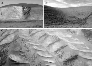
Photographs highlighting (A) arroyos, (B) colluvial hollows, and (C) the asymmetric distribution of these features within the landscape. Photos A and B are looking approximately north and south, respectively. The hillslopes in photos A and B are approximately 100 m and 30 m tall, respectively. Photograph C is looking to the west and was provided courtesy of Juan C. Fernandez Diaz. The bottom of C spans ~1 km. Credit: GSA Bulletin, S.A. Johnstone et al., and Photograph C provided courtesy of Juan C. Fernandez Diaz.
If you ever fly from L.A. to San Francisco, California, you may notice the Gabilan Mesa off to the east as you begin your descent into San Francisco International Airport. If you look carefully, you might notice two strange things: a series of bleach-white scars, where rock outcrops disrupt the smooth, grassy hillslopes, and a strong asymmetry in the orientation of tributaries, with many flowing south and few flowing north.
What you can’t see is the few feet of soil that would lie beneath your feet if you were standing on the surface — but it turns out that soil column may have a lot to do with shaping your 10,000-foot view.
Over long time scales, the transition from hillslopes to channels is controlled by the relative efficiencies of soil transport and channel erosion. This transition usually remains stable when erosion rates change, because increases in erosion rate would typically expose rocks that are stronger than the overlying weathered soils, thereby slowing any further increase in erosion rate. But what would happen if the opposite were true, if increases in erosion rates exposed highly vulnerable rocks, causing an unstable increase in erosion rate?
In this scenario, the shape of the landscape would be fragile — susceptible to major reconfigurations in the face of small changes in erosion rate. In their paper for the Geological Society of America Bulletin, Samuel Johnstone and colleagues demonstrate that this may be the case in landscapes developed in rock types that are susceptible to slaking, a process that pervasively fractures these rocks when they are exposed to wetting and drying cycles.
Using laboratory measures of rock strength, Johnstone and colleagues demonstrate that soils in the Gabilan Mesa, California, are actually stronger than the rocks from which they were derived, once those parent rocks have been exposed to a single wetting and drying cycle.
Within the Gabilan Mesa, these rocks are typically covered in soil, but can be exposed in dramatic erosional channel features called arroyos. The morphology of arroyos and their position in the landscape suggests that they form by aggressively cutting uphill into the soil mantled hillslopes. Theory predicts that this behavior would be expected in an unstable erosion scenario.
What is perhaps most interesting is how climate influences the fragile landscape response recorded by arroyos. Arroyos are exclusively found within south-flowing catchments, and Johnstone and colleagues reason that this is the consequence of the thinner layer of soil that forms on these sunnier, drier, more poorly vegetated slopes. These thin soils allow highly erodible bedrock to be more readily accessed by erosive processes, and arroyos to be triggered more easily. This asymmetric triggering of headward (upslope) channel growth appears to drive profound topographic asymmetry, in which drainages are densely packed on south-facing slopes and nearly absent on north-facing slopes. This pattern is observable at the scale of entire drainage basins. The team’s observations suggest that this large-scale reorganization of the Gabilan Mesa landscape starts with the soils, and the unusual combination of relatively strong soils forming from easily weakened rocks.
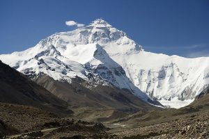
Mount Everest North Face as seen from the path to the base camp, Tibet. Credit: Luca Galuzzi/Wikipedia
Sediment that eroded from the Himalayas and Tibetan plateau over millions of years was transported thousands of kilometers by rivers and in the Indian Ocean — and became sufficiently thick over time to generate temperatures warm enough to strengthen the sediment and increase the severity of the catastrophic 2004 Sumatra earthquake.
The magnitude 9.2 earthquake on Dec. 26, 2004, generated a massive tsunami that devastated coastal regions of the Indian Ocean. The earthquake and tsunami together killed more than 250,000 people making it one of the deadliest natural disasters in history.
An international team of scientists that outlined the process of sediment warming says the same mechanism could be in place in the Cascadia Subduction Zone off the Pacific Northwest coast of North America, as well as off Iran, Pakistan and in the Caribbean.
Results of the research, which was conducted as part of the International Ocean Discovery Program, are being published this week in the journal Science.
“The 2004 Indian Ocean tsunami was triggered by an unusually strong earthquake with an extensive rupture area,” said expedition co-leader Lisa McNeill, an Oregon State University graduate now at the University of Southampton. “We wanted to find out what caused such a large earthquake and tsunami, and what it might mean for other regions with similar geological properties.”
The research team sampled for the first time sediment and rocks from the tectonic plate that feeds the Sumatra subduction zone. From the research vessel JOIDES Resolution, the team drilled down 1.5 kilometers below the seabed, measured different properties of the sediments, and ran simulations to calculate how the sediment and rock behaves as it piles up and travels eastward 250 kilometers toward the subduction zone.
“We discovered that in some areas where the sediments are especially thick, dehydration of the sediments occurred before they were subducted,” noted Marta Torres, an Oregon State University geochemist and co-author on the study. “Previous earthquake models assumed that dehydration occurred after the material was subducted, but we had suspected that it might be happening earlier in some margins.
“The earlier dehydration creates stronger, more rigid material prior to subduction, resulting in a very large fault area that is prone to rupture and can lead to a bigger and more dangerous earthquake.”
Torres explained that when the scientists examined the sediments, they found water between the sediment grains that was less salty than seawater only within a zone where the plate boundary fault develops, some 1.2 to 1.4 kilometers below the seafloor.
“This along with some other chemical changes are clear signals that it was an increase in temperature from the thick accumulation of sediment that was dehydrating the minerals,” Torres said.
Lead author Andre Hüpers of the University of Bremen in Germany said that the discovery will generate new interest in other subduction zone sites that also have thick, hot sediment and rock, especially those areas where the hazard potential is unknown.
The Cascadia Subduction Zone is one of the most widely studied sites in the world and experts say it may have experienced as many as two dozen major earthquakes over the past 10,000 years.
The sediment at the Cascadia deformation front is between 2.5 and 4.0 kilometers thick, which is somewhat less than the 4-5 kilometer thickness of the Sumatra region. However, because the subducting plate at Cascadia is younger when the plate arrives at the subduction zone, the estimated temperatures at the fault surface are about the same in both regions.
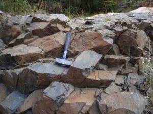
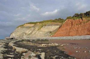
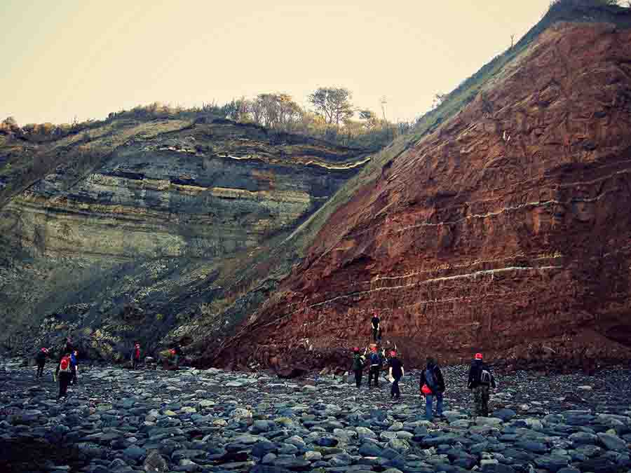
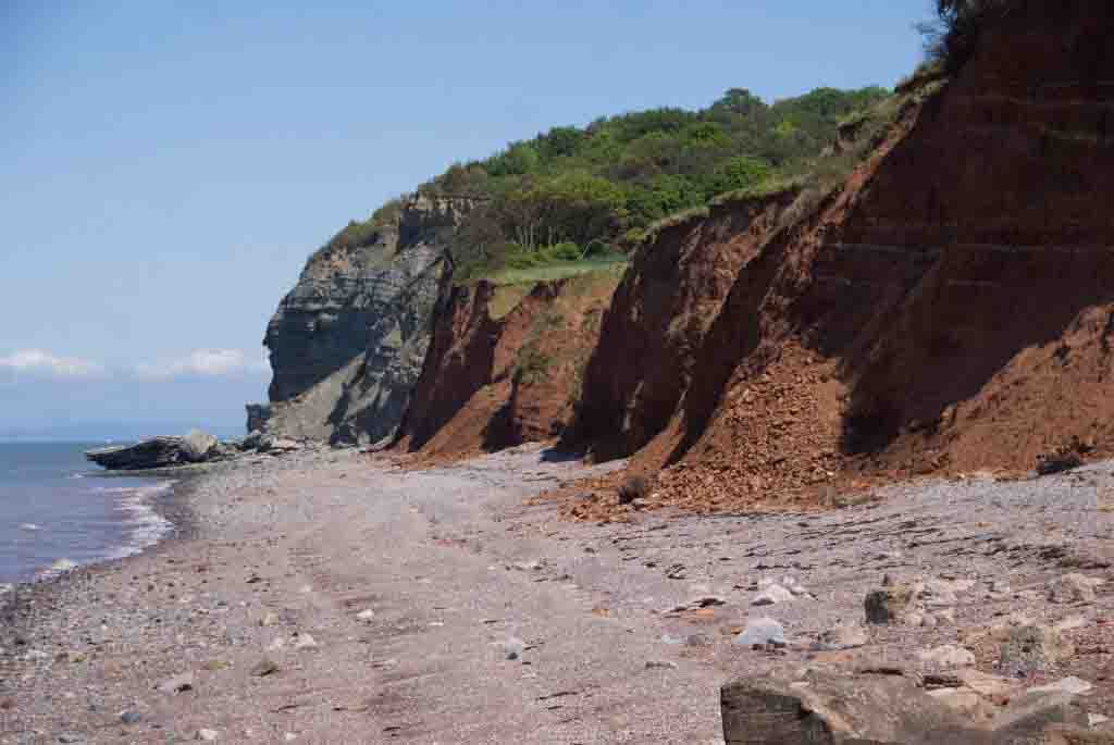
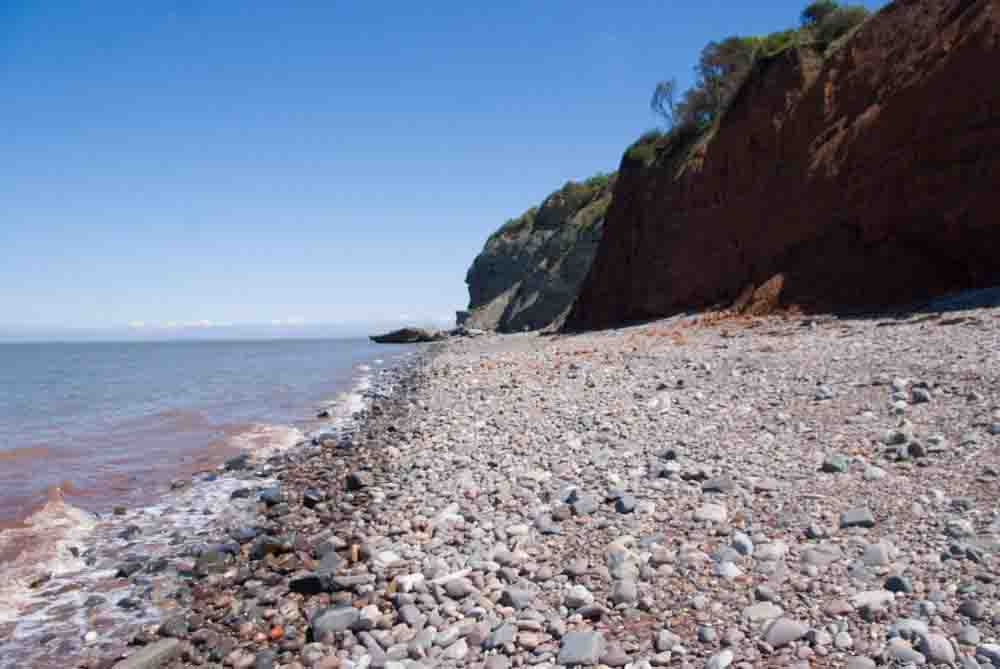
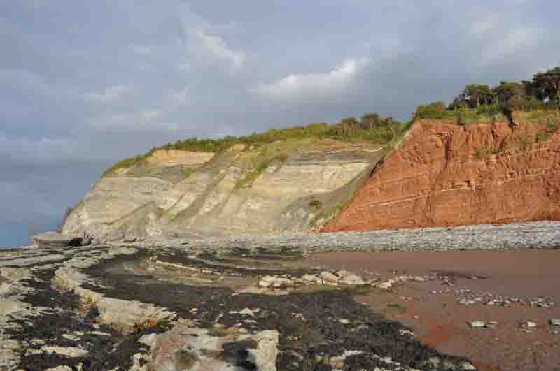
Found on the Somerset coast in England, this crack in the rocks is a normal fault, where younger rocks have been downthrown by tectonic forces as the crust pulled apart to sit alongside older rocks.
The red rock with reduction horizons is Triassic Merica mudstone (MMS), to the left is Jurassic interbedded marls and muds (with evapourites like gypsum). You can tell this is a normal fault because the Jurassic strata is younger than the MMS. This means the Jurassic strata has slid downwards to sit beside the MMS. Also near the fault in the MMS the lighter reduction horizons are dipping downwards probably due to marginal drag.
The line of the fault runs along the beach, shown by the rock/sand divide.
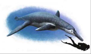
This is an artistic reconstruction of Luskhan itilensis. Credit: Copyright Andrey Atuchin, 2017
A new species of a fossil pliosaur (large predatory marine reptile from the ‘age of dinosaur’) has been found in Russia and profoundly change how we understand the evolution of the group, says an international team of scientists.
Spanning more than 135 Ma during the ‘Age of Dinosaurs’, plesiosaur marine reptiles represent one of longest-lived radiations of aquatic tetrapods and certainly the most diverse one. Plesiosaurs possess an unusual body shape not seen in other marine vertebrates with four large flippers, a stiff trunk, and a highly varying neck length. Pliosaurs are a special kind of plesiosaur that are characterized by a large, 2m long skull, enormous teeth and extremely powerful jaws, making them the top predators of oceans during the ‘Age of Dinosaurs’.
In a new study to be published today in the journal Current Biology, the team reports a new, exceptionally well-preserved and highly unusual pliosaur from the Cretaceous of Russia (about 130 million years ago). It has been found in Autumn 2002 on right bank of the Volga River, close to the city of Ulyanovsk, by Gleb N. Uspensky (Ulyanovsk State University), one of the co-authors of the paper. The skull of the new species, dubbed “Luskhan itilensis,” meaning the Master Spirit from the Volga river, is 1.5m in length, indicating a large animal. But its rostrum is extremely slender, resembling that of fish-eating aquatic animals such as gharials or some species of river dolphins. “This is the most striking feature, as it suggests that pliosaurs colonized a much wider range of ecological niches than previously assumed” said Valentin Fischer, lecturer at the Université de Liège (Belgium) and lead author of the study.
By analysing two new and comprehensive datasets that describe the anatomy and ecomorphology of plesiosaurs with cutting edge techniques, the team revealed that several evolutionary convergences (a biological phenomenon where distantly related species evolve and resemble one another because they occupy similar roles, for example similar feeding strategies and prey types in an ecosystem) took place during the evolution of plesiosaurs, notably after an important extinction event at the end of the Jurassic (145 million years ago). The new findings have also ramifications in the final extinction of pliosaurs, which took place several tens of million years before that of all dinosaurs (except some bird lineages). Indeed, the new results suggest that pliosaurs were able to bounce back after the latest Jurassic extinction, but then faced another extinction that would — this time — wipe them off the depths of ancient oceans, forever.
Reference:
Fischer Valentin, Benson Roger B J, Zverkov Nikolai G, Soul Laura C, Arkhangelsky Maxim S, Lambert Olivier, Stenshin Ilya M, Uspensky Gleb N & Druckenmiller Patrick S. Plasticity and convergence in the evolution of short-necked plesiosaurs. Current Biology, 2017 DOI: 10.1016/j.cub.2017.04.052
Note: The above post is reprinted from materials provided by University of Liege.
A ‘free-fall funnel’, part of the drilling process. Credit: Tim Fulton, IODP / JRSO
An international team of scientists has found evidence suggesting the dehydration of minerals deep below the ocean floor influenced the severity of the Sumatra earthquake, which took place on December 26, 2004.
The earthquake, measuring magnitude 9.2, and the subsequent tsunami, devastated coastal communities of the Indian Ocean, killing over 250,000 people.
Research into the earthquake was conducted during a scientific ocean drilling expedition to the region in 2016, as part of the International Ocean Discovery Program (IODP), led by scientists from the University of Southampton and Colorado School of Mines.
During the expedition on board the research vessel JOIDES Resolution, the researchers sampled, for the first time, sediments and rocks from the oceanic tectonic plate which feeds the Sumatra subduction zone. A subduction zone is an area where two of the Earth’s tectonic plates converge, one sliding beneath the other, generating the largest earthquakes on Earth, many with destructive tsunamis.
Findings of a study on sediment samples found far below the seabed are now detailed in a new paper led by Dr Andre Hüpers of the MARUM-Center for Marine Environmental Sciences at University of Bremen – published in the journal Science.
Expedition co-leader Professor Lisa McNeill, of the University of Southampton, says: “The 2004 Indian Ocean tsunami was triggered by an unusually strong earthquake with an extensive rupture area. We wanted to find out what caused such a large earthquake and tsunami and what this might mean for other regions with similar geological properties.”
The scientists concentrated their research on a process of dehydration of sedimentary minerals deep below the ground, which usually occurs within the subduction zone. It is believed this dehydration process, which is influenced by the temperature and composition of the sediments, normally controls the location and extent of slip between the plates, and therefore the severity of an earthquake.
In Sumatra, the team used the latest advances in ocean drilling to extract samples from 1.5 km below the seabed. They then took measurements of sediment composition and chemical, thermal, and physical properties and ran simulations to calculate how the sediments and rock would behave once they had travelled 250 km to the east towards the subduction zone, and been buried significantly deeper, reaching higher temperatures.
The researchers found that the sediments on the ocean floor, eroded from the Himalayan mountain range and Tibetan Plateau and transported thousands of kilometres by rivers on land and in the ocean, are thick enough to reach high temperatures and to drive the dehydration process to completion before the sediments reach the subduction zone. This creates unusually strong material, allowing earthquake slip at the subduction fault surface to shallower depths and over a larger fault area – causing the exceptionally strong earthquake seen in 2004.
Dr Andre Hüpers of the University of Bremen says: “Our findings explain the extent of the large rupture area, which was a feature of the 2004 earthquake, and suggest that other subduction zones with thick and hotter sediment and rocks, could also experience this phenomenon.
“This will be particularly important for subduction zones with limited or no historic subduction earthquakes, where the hazard potential is not well known. Subduction zone earthquakes typically have a return time of a few hundred to a thousand years. Therefore our knowledge of previous earthquakes in some subduction zones can be very limited.”
Similar subduction zones exist in the Caribbean (Lesser Antilles), off Iran and Pakistan (Makran), and off western USA and Canada (Cascadia). The team will continue research on the samples and data obtained from the Sumatra drilling expedition over the next few years, including laboratory experiments and further numerical simulations, and they will use their results to assess the potential future hazards both in Sumatra and at these comparable subduction zones.
Reference:
Andre Hüpers, Marta E. Torres, et al. Sediments tell a tsunami story. Science, 2017 DOI: 10.1126/science.aal3429
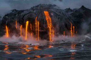
Mauna Loa is one of five volcanoes that form the Island of Hawaii in the U.S. state of Hawaiʻi in the Pacific Ocean. The largest subaerial volcano in both mass and volume, Mauna Loa has historically been considered the largest volcano on Earth. It is an active shield volcano with relatively gentle slopes, with a volume estimated at approximately 18,000 cubic miles (75,000 km3), although its peak is about 120 feet (37 m) lower than that of its neighbor, Mauna Kea. Lava eruptions from Mauna Loa are silica-poor and very fluid, and they tend to be non-explosive.
Mauna Loa has probably been erupting for at least 700,000 years, and may have emerged above sea level about 400,000 years ago. The oldest-known dated rocks are not older than 200,000 years. The volcano’s magma comes from the Hawaii hotspot, which has been responsible for the creation of the Hawaiian island chain over tens of millions of years. The slow drift of the Pacific Plate will eventually carry Mauna Loa away from the hotspot within 500,000 to one million years from now, at which point it will become extinct.
Films of Mauna Loa volcano and Kilauea volcano in Hawaii erupting in the 1930s and 1940s. Includes the second black and white film ever produced of an erupting volcano and the earliest color film of an erupting volcano. Comes in five “chapters.” Significant footage of flowing lava.
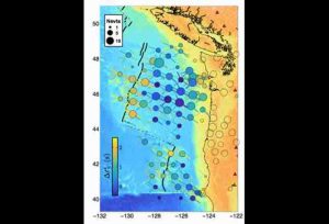
These are the attenuation values recorded at ocean-bottom stations. Radial spokes show individual arrivals at their incoming azimuth; central circles show averages at each station. Credit: UCSB
Several hundred miles off the Pacific Northwest coast, a small tectonic plate called the Juan de Fuca is slowly sliding under the North American continent. This subduction has created a collision zone with the potential to generate huge earthquakes and accompanying tsunamis, which happen when faulted rock abruptly shoves the ocean out of its way.
In fact, this region represents the single greatest geophysical hazard to the continental United States; quakes centered here could register as hundreds of times more damaging than even a big temblor on the San Andreas Fault. Not surprisingly, scientists are interested in understanding as much as they can about the Juan de Fuca Plate.
This microplate is “born” just 300 miles off the coast, at a long range of underwater volcanoes that produce new crust from melt generated deep below. Part of the global mid-ocean ridge system that encircles the planet, these regions generate 70 percent of Earth’s tectonic plates. However, because the chains of volcanoes lie more than a mile beneath the sea surface, scientists know surprisingly little about them.
UC Santa Barbara geophysicist Zachary Eilon and his co-author Geoff Abers at Cornell University have conducted new research — using a novel measurement technique — that has revealed a strong signal of seismic attenuation or energy loss at the mid-ocean ridge where the Juan de Fuca Plate is created. The researchers’ attenuation data imply that molten rock here is found even deeper within Earth than scientists had previously thought. This in turn helps scientists understand the processes by which Earth’s tectonic plates are built, as well as the deep plumbing of volcanic systems. The results of the work appear in the journal Science Advances.
“We’ve never had the ability to measure attenuation this way at a mid-ocean ridge before, and the magnitude of the signal tells us that it can’t be explained by shallow structure,” said Eilon, an assistant professor in UCSB’s Department of Earth Science. “Whatever is down there causing all this seismic energy to be lost extends really deep, at least 200 kilometers beneath the surface. That’s unexpected, because we think of the processes that give rise to this — particularly the effect of melting beneath the surface — as being shallow, confined to 60 km or less.”
According to Eilon’s calculations, the narrow strip underneath the mid-ocean ridge, where hot rock wells up to generate the Juan de Fuca Plate, has very high attenuation. In fact, its levels are as high as scientists have seen anywhere on the planet. His findings also suggest that the plate is cooling faster than expected, which affects the friction at the collision zone and the resulting size of any potential megaquake.
Seismic waves begin at an earthquake and radiate away from it. As they disperse, they lose energy. Some of that loss is simply due to spreading out, but another parameter also affects energy loss. Called the quality factor, it essentially describes how squishy Earth is, Eilon said. He used the analogy of a bell to explain how the quality factor works.
“If I were to give you a well-made bell and you were to strike it once, it would ring for a long time,” he explained. “That’s because very little of the energy is actually being lost with each oscillation as the bell rings. That’s very low attenuation, very high quality. But if I give you a poorly made bell and you strike it once, the oscillations will die out very quickly. That’s high attenuation, low quality.”
Eilon looked at the way different frequencies of seismic waves attenuated at different rates. “We looked not only at how much energy is lost but also at the different amounts by which various frequencies are delayed,” he explained. “This new, more robust way of measuring attenuation is a breakthrough that can be applied in other systems around the world.
“Attenuation is a very hard thing to measure, which is why a lot of people ignore it,” Eilon added. “But it gives us a huge amount of new information about Earth’s interior that we wouldn’t have otherwise.”
Next year, Eilon will be part of an international effort to instrument large unexplored swaths of the Pacific with ocean bottom seismometers. Once that data has been collected, he will apply the techniques he developed on the Juan de Fuca in the hope of learning more about what lies beneath the seafloor in the old oceans, where mysterious undulations in Earth’s gravity field have been measured.
“These new ocean bottom data, which are really coming out of technological advances in the instrumentation community, will give us new abilities to see through the ocean floor,” Eilon said. “This is huge because 70 percent of Earth’s surface is covered by water and we’ve largely been blind to it — until now.
“The Pacific Northwest project was an incredibly ambitious community experiment,” he said. “Just imagine the sort of things we’ll find out once we start to put these instruments in other places.”
Reference:
Zachary C. Eilon and Geoffrey A. Abers. High seismic attenuation at a mid-ocean ridge reveals the distribution of deep melt. Science Advances, May 2017 DOI: 10.1126/sciadv.1602829
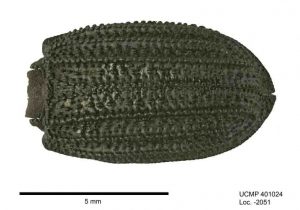
A photo of a darkling beetle fossil from the La Brea Tar Pits. Credit: CP image #0000 2222 9825 2094 provided by the Berkeley Fossil Insect PEN, photography by Rosemary Romero.
Research based on more than 180 fossil insects preserved in the La Brea Tar Pits of Los Angeles indicate that the climate in what is now southern California has been relatively stable over the past 50,000 years.
The La Brea Tar Pits, which form one of the world’s richest Ice Age fossil sites, is famous for specimens of saber-toothed cats, mammoths, and giant sloths, but their insect collection is even larger and offers a relatively untapped treasure trove of information. The new study, published today in the journal Quaternary Science Reviews, is based on an analysis of seven species of beetles and offers the most robust environmental analysis for southern California to date.
“Despite La Brea’s significance as one of North America’s premier Late Pleistocene fossil localities, there remain large gaps in our understanding of its ecological history,” said lead author Anna Holden, a graduate student at the American Museum of Natural History’s Richard Gilder Graduate School and a research associate at the La Brea Tar Pits and Museum. “Recent advances are now allowing us to reconstruct the region’s paleoenvironment by analyzing a vast and previously under-studied collection from the tar pits: insects.”
The new study focuses on ground beetles and darkling beetles, which are still present in and around the Los Angeles Basin today. Insects adapt to highly specific environmental conditions, with most capable of migrating when they or their habitats get too hot, too cold, too wet, or too dry. This is especially true for ground and darkling beetles, which are restricted to well-known habitats and climate ranges.
The researchers used radiocarbon dating to estimate the ages of the beetle fossils and discovered they could be grouped into three semi-continuous ranges: 28,000-50,000 years old, 7,500-16,000 years old, and 4,000 years old. Because the beetles stayed put for such a sustained period of time, evidently content with their environmental conditions, the study suggests that pre-historic Los Angeles was warmer and drier than previously inferred—very similar to today’s climate. In addition, insects that thrive in cooler environments, such as forested and canopied habitats, and are just as likely as the beetles to be preserved in the tar pits, have not been discovered at La Brea.
“With the exception of the peak of the last glaciers during the late Ice Age about 24,000 years ago, our data show that these highly responsive and mobile beetles were staples in Los Angeles for at least the last 50,000 years, suggesting that the climate in the area has been surprisingly similar.” Holden said. “We hope that insects will be used as climate proxies for future studies, in combination with other methods, to give us a complete picture of the paleoenvironment of Earth.”
Reference:
Anna R. Holden et al, A 50,000 year insect record from Rancho La Brea, Southern California: Insights into past climate and fossil deposition, Quaternary Science Reviews (2017). DOI: 10.1016/j.quascirev.2017.05.001
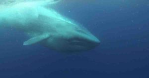
The blue whale, which uses baleen to filter its prey from ocean water and can reach lengths of over 100 feet, is the largest vertebrate animal that has ever lived. On the list of the planet’s most massive living creatures, the blue whale shares the top ranks with most other species of baleen whales alive today. According to new research from scientists at the Smithsonian’s National Museum of Natural History, however, it was only recently in whale’s evolutionary past that they became so enormous.
In a study reported May 24 in Proceedings of the Royal Society B, Nicholas Pyenson, the museum’s curator of fossil marine mammals, and collaborators Graham Slater at the University of Chicago and Jeremy Goldbogen at Stanford University, traced the evolution of whale size through more than 30 million years of history and found that very large whales appeared along several branches of the family tree about 2 to 3 million years ago. Increasing ice sheets in the Northern Hemisphere during this period likely altered the way whales’ food was distributed in the oceans and enhanced the benefits of a large body size, the scientists say.
How and why whales got so big has remained a mystery until now, in part because of the challenges of interpreting an incomplete fossil record. “We haven’t had the right data,” Pyenson said. “How do you measure the total length of a whale that’s represented by a chunk of fossil?” Recently, however, Pyenson established that the width of a whale’s skull is a good indicator of its overall body size. With that advance, the time was right to address the long-standing question.
The Smithsonian holds the largest and richest skull collections for both living and extinct baleen whales, and the museum was one of the few places that housed a collection that could provide the raw data needed to examine the evolutionary relationships between whales of different sizes. Pyenson and his colleagues measured a wide range of fossil skulls from the National Museum of Natural History’s collections and used those measurements, along with published data on additional specimens, to estimate the length of 63 extinct whale species. The fossils included in the analysis represented species dating back to the earliest baleen whales, which lived more than 30 million years ago. The team used the fossil data, together with data on 13 species of modern whales, to examine the evolutionary relationships between whales of different sizes. Their data clearly showed that the large whales that exist today were not present for most of whales’ history. “We live in a time of giants,” Goldbogen said. “Baleen whales have never been this big, ever.”
The research team traced the discrepancy back to a shift in the way body size evolved that occurred about 4.5 million years ago. Not only did whales with bodies longer than 10 meters (approximately 33 feet) begin to evolve around this time, but smaller species of whales also began to disappear. Pyenson notes that larger whales appeared in several different lineages around the same time, suggesting that massive size was somehow advantageous during that timeframe.
“We might imagine that whales just gradually got bigger over time, as if by chance, and perhaps that could explain how these whales became so massive,” said Slater, a former Peter Buck postdoctoral fellow at the museum. “But our analyses show that this idea doesn’t hold up — the only way that you can explain baleen whales becoming the giants they are today is if something changed in the recent past that created an incentive to be a giant and made it disadvantageous to be small.”
This evolutionary shift, which took place at the beginning of the Ice Ages, corresponds to climatic changes that would have reshaped whales’ food supply in the world’s oceans. Before ice sheets began to cover the Northern Hemisphere, food resources would have been fairly evenly distributed throughout the oceans, Pyenson said. But when glaciation began, run off from the new ice caps would have washed nutrients into coastal waters at certain times of the year, seasonally boosting food supplies.
At the time of this transition, baleen whales, which filter small prey, like krill, out of seawater, were well equipped to take advantage of these dense patches of food. Goldbogen, whose studies of modern whale foraging behavior have demonstrated that filter-feeding is particularly efficient when whales have access to very dense aggregations of prey, said the foraging strategy becomes even more efficient as body size increases.
What’s more, large whales can migrate thousands of miles to take advantage of seasonally abundant food supplies. So, the scientists said, baleen whales’ filter-feeding systems, which evolved about 30 million years ago, appear to have set the stage for major size increases once rich sources of prey became concentrated in particular locations and times of year.
“An animal’s size determines so much about its ecological role,” Pyenson said. “Our research sheds light on why today’s oceans and climate can support Earth’s most massive vertebrates. But today’s oceans and climate are changing at geological scales in the course of human lifetimes. With these rapid changes, does the ocean have the capacity to sustain several billion people and the world’s largest whales? The clues to answer this question lie in our ability to learn from Earth’s deep past — the crucible of our present world — embedded in the fossil record.”
Funding for this study was provided by the Smithsonian’s Remington Kellogg Fund and with support from the Basis Foundation.
Reference:
Graham J. Slater, Jeremy A. Goldbogen, Nicholas D. Pyenson. Independent evolution of baleen whale gigantism linked to Plio-Pleistocene ocean dynamics. Proceedings of the Royal Society B: Biological Sciences, 2017; 284 (1855): 20170546 DOI: 10.1098/rspb.2017.0546
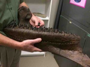
This is a tooth of a ceratopsid horned dinosaur from Mississippi, held next to a left lower jaw half of Triceratops from Montana. Credit: Photo by Jeremy Copley, MDWFP Museum of Natural Science
A chance discovery in Mississippi provides the first evidence of an animal closely related to Triceratops in eastern North America. The fossil, a tooth from rocks between 68 and 66 million years old, shows that two halves of the continent previously thought to be separated by seaway were probably connected before the end of the Age of Dinosaurs.
“The fossil is small, only the size of a quarter, but it packs a ton of information,” said Andrew Farke, a paleontologist at the Raymond M. Alf Museum of Paleontology at The Webb Schools in Claremont, California, and one of the authors of the paper announcing the discovery in the journal PeerJ.
“The shape of this tooth, with its distinctive split root, is absolutely unique among dinosaurs,” Farke continued. “We only have the one fossil, but it’s more than enough to show that an animal very similar to Triceratops-perhaps even Triceratops itself-made it into eastern North America.”
Horned dinosaurs, or ceratopsids, had previously only been found in western North America and Asia. A seaway down the middle of North America, which linked the Arctic Ocean and Gulf of Mexico, split the continent into eastern and western halves during much of the Late Cretaceous (around 95 to 66 million years ago). This means that animals that evolved in western North America after the split-including ceratopsids-were prevented from traveling east.
Due to a lack of preserved rock and fossils, scientists weren’t sure precisely when the seaway disappeared and animals could once again walk freely across North America. The newly described fossil strongly suggests that this happened when large dinosaurs such as Tyrannosaurus and Triceratops were still around, before the major global extinction 66 million years ago.
George Phillips, paleontology curator at the Mississippi Department of Wildlife, Fisheries, and Parks’ Museum of Natural Science and co-author of the paper, discovered the fossil in the Owl Creek Formation in northern Mississippi.
Phillips described the moment of discovery: “I was excited because I knew it was a dinosaur tooth, and dinosaur fossils are rare discoveries east of the Mississippi River. I called my volunteer, Michael Estes, over to share in the discovery, and he was beside me in seconds. I knew it wasn’t a duck-billed dinosaur, and within 30 minutes of having found it, I posted on Facebook that I’d collected some rare plant-eating dinosaur tooth. It was none other than my colleague Lynn Harrell who made the suggestion, within minutes of my post, that it looked like a ceratopsian tooth.”
Although previously known fragments indicated horned dinosaurs in Maryland and North Carolina, those fossils were of more “primitive” species that likely lived in the area well before it was separated from western North America.
“The discovery is shocking because fossils of ceratopsid horned dinosaurs had never been discovered previously from eastern North America. It’s certainly the most unique and important vertebrate fossil discovery I’ve ever made,” said Phillips.
The ceratopsid tooth, from the lower jaw of the animal, was found in the Owl Creek Formation in northern Mississippi. Although that part of the state was under water at the time, it was fairly close to land. Farke and Phillips speculate that the tooth probably washed out to sea from a horned dinosaur living along the coastline in that area.
The fossil is housed at the Mississippi Museum of Natural Sciences.
Reference:
Andrew A. Farke, George E. Phillips. The first reported ceratopsid dinosaur from eastern North America (Owl Creek Formation, Upper Cretaceous, Mississippi, USA). PeerJ, 2017; 5: e3342 DOI: 10.7717/peerj.3342
Note: The above post is reprinted from materials provided by PeerJ.
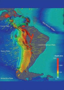
Researchers created a three-dimensional representation of predicted slab geometry and mantle flow. The image outlines areas with a temperature at 300 degrees Celsius cooler than the surrounding mantle, with different colors representing different depths. Oceanic plates and slabs are semi-transparent, and continents are entirely transparent. Green arrows represent velocity vectors inside the mantle. Credit: Lijun Liu, University of Illinois
Contrary to posters you may have seen hanging on the walls in science buildings and classrooms, Lijun Liu, professor of geology at Illinois, knows that Earth’s interior is not like an onion.
While most textbooks demonstrate the outer surface of the Earth as the crust, the next inner level as the mantle, and then the most inner layer as the core, Liu said the reality isn’t as clear-cut.
“It’s not just in layers, because the Earth’s interior is not stationary,” Liu said.
In fact, underneath our feet there’s tectonic activity that many scientists have been aware of, but Liu and his team have created a computer model to help better explain it — a model so effective that researchers believe it has the potential to predict where earthquakes and volcanoes will occur.
Using this model, Liu, along with doctoral student Jiashun Hu, and Manuele Faccenda from the University of Padua in Italy, recently published a research paper in the journal of Earth and Planetary Science Letters that focuses on the deep mantle and its relationship to plate tectonics.
“It’s well-known that there are plate tectonics driving the Earth’s evolution, but exactly how this process works is not entirely clear,” he said.
Liu and Hu looked specifically at the continent of South America to determine which tectonic factors contribute to the deformation, or the evolution, of the mantle.
To answer this question, the team created a data-centric model using the Blue Waters supercomputer at the National Center for Supercomputing Applications at Illinois. The sophisticated four-dimensional data-oriented geodynamic models are among the first of their kind.
“We are actually the first ones to use data assimilation models in studying mantle deformation, in an approach similar to weather forecasting,” Liu said. “We are trying to produce a system model that simultaneously satisfies all the observations we have. We can then obtain a better understanding about dynamic processes of the Earth evolution.”
While there are many debates in regards to how the Earth’s internal evolution is driven, the model created by the team seemed to find an answer that better fits available observations and underlying physics. The team found that the subducting slab — a portion of the oceanic plate that slides beneath a continental plate — is the dominant driving force behind the deformation of the mantle.
Essentially, the active subduction of the slab determines most other processes that happen as part of a chain reaction. “The result is game-changing. The driving force of mantle flow is actually simpler than people thought,” Liu said. “It is the most direct consequence of plate tectonics. When the slab subducts, it naturally controls everything surrounding it. In a way this is elegant, because it’s simple.”
By understanding this mechanism of Earth evolution, the team can make better predictions regarding the movement of the mantle and the lithosphere, or crust.
The team then evaluated the model’s predictions using other data. Hu, the lead author on the paper, said that by comparing the predictions to tectonic activities such as the formation of mountains and volcanoes, a clear consistency emerged.
“We think our story is correct,” Hu said.
Consequently, the model also provides interesting insight on the evolution of continents as far back as the Jurassic, when dinosaurs roamed the Earth on Pangaea, the only continent at the time. This is still the team’s ongoing research.
Liu said that in a separate paper that uses the same simulation, published by Liu and Hu in Earth and Planetary Science Letters in 2016, the model provided an accurate prediction for why earthquakes happen in particular locations below South America. He explained that earthquakes aren’t evenly spread within the subducting slab, meaning there are potentially areas where an earthquake is more or less likely to take place.
“We found that whenever you see a lack of earthquakes in a region, it corresponds to a hole in the slab,” Liu said. “Because of the missing slab in the hole, there’s no way to generate earthquakes, so we might be able to know where more earthquakes will take place.”
The model also explained why certain volcanoes might exist further inland and have different compositions, despite the common thought that volcanoes should exist solely along the coast, as a result of water coming off the down-going slab. As the model helps explain, a volcano can form inland if the slab subducts at a shallower angle, and a hole in the shallow slab allows for a special type of magma to form by melting of the crust.
“Ultimately this model will provide a promising way of solving the question of how and why continents move the way they do,” Liu said. “The answer should depend on what the mantle is doing. This is a way to much better understand Earth evolution.”
The team is currently expanding the model to analyze the entire globe.
“We are looking forward to more exciting results,” Liu said.
Reference:
Jiashun Hu, Manuele Faccenda, Lijun Liu. Subduction-controlled mantle flow and seismic anisotropy in South America. Earth and Planetary Science Letters, 2017; 470: 13 DOI: 10.1016/j.epsl.2017.04.027
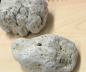
It’s true—some rocks can float on water for years at a time. And now scientists know how they do it, and what causes them to eventually sink.
X-ray studies at the Department of Energy’s Lawrence Berkeley National Laboratory (Berkeley Lab) have helped scientists to solve this mystery by scanning inside samples of lightweight, glassy, and porous volcanic rocks known as pumice stones. The X-ray experiments were performed at Berkeley Lab’s Advanced Light Source, an X-ray source known as a synchrotron.
The surprisingly long-lived buoyancy of these rocks—which can form miles-long debris patches on the ocean known as pumice rafts that can travel for thousands of miles—can help scientists discover underwater volcano eruptions.
And, beyond that, learning about its flotation can help us understand how it spreads species around the planet; pumice is nutrient rich and readily serves as a seafaring carrier of plant life and other organisms. Floating pumice can also be a hazard for boats, as the ashy mixture of ground-up pumice can clog engines.
“The question of floating pumice has been around the literature for a long time, and it hadn’t been resolved,” said Kristen E. Fauria, a UC Berkeley graduate student who led the study, published in Earth and Planetary Science Letters.
While scientists have known that pumice can float because of pockets of gas in its pores, it was unknown how those gases remain trapped inside the pumice for prolonged periods. If you soak up enough water in a sponge, for example, it will sink.
“It was originally thought that the pumice’s porosity is essentially sealed,” Fauria said, like a corked bottle floating in the sea. But pumice’s pores are actually largely open and connected—more like an uncorked bottle. “If you leave the cap off and it still floats … what’s going on?”
Some pumice stones have even been observed to “bob” in the laboratory—sinking during the evening and surfacing during the day.
To understand what’s at work in these rocks, the team used wax to coat bits of water-exposed pumice sampled from Medicine Lake Volcano near Mount Shasta in Northern California and Santa María Volcano in Guatemala.
They then used an X-ray imaging technique at the ALS known as microtomography to study concentrations of water and gas—in detail measured in microns, or thousandths of a millimeter—within preheated and room-temperature pumice samples.
The detailed 3-D images produced by the technique are very data-intensive, which posed a challenge in quickly identifying the concentrations of gas and water present in the pumice samples’ pores.
To tackle this problem, Zihan Wei, a visiting undergraduate researcher from Peking University, used a data-analysis software tool that incorporates machine learning to automatically identify the gas and water components in the images.
Researchers found that the gas-trapping processes that are in play in the pumice stones relates to “surface tension,” a chemical interaction between the water’s surface and the air above it that acts like a thin skin—this allows some creatures, including insects and lizards, to actually walk on water.
“The process that’s controlling this floating happens on the scale of human hair,” Fauria said. “Many of the pores are really, really small, like thin straws all wound up together. So surface tension really dominates.”
The team also found that a mathematical formulation known as percolation theory, which helps to understand how a liquid enters a porous material, provides a good fit for the gas-trapping process in pumice. And gas diffusion—which describes how gas molecules seek areas of lower concentration—explains the eventual loss of these gases that causes the stones to sink.
Michael Manga, a staff scientist in Berkeley Lab’s Energy Geosciences Division and a professor in the Department of Earth and Planetary Science at UC Berkeley who participated in the study, said, “There are two different processes: one that lets pumice float and one that makes it sink,” and the X-ray studies helped to quantify these processes for the first time. The study showed that previous estimates for flotation time were in some cases off by several orders of magnitude.
“Kristen had the idea that in hindsight is obvious,” Manga said, “that water is filling up only some of the pore space.” The water surrounds and traps gases in the pumice, forming bubbles that make the stones buoyant. Surface tension serves to keep these bubbles locked inside for prolonged periods. The bobbing observed in laboratory experiments of pumice floatation is explained by trapped gas expanding during the heat of day, which causes the stones to temporarily float until the temperature drops.
The X-ray work at the ALS, coupled with studies of small pieces of pumice floating in water in Manga’s UC Berkeley lab, helped researchers to develop a formula for predicting how long a pumice stone will typically float based on its size. Manga has also used an X-ray technique at the ALS called microdiffraction, which is useful for studying the origins of crystals in volcanic rocks.
Dula Parkinson, a research scientist at Berkeley Lab’s ALS who assisted with the team’s microtomography experiments, said, “I’m always amazed at how much information Michael Manga and his collaborators are able to extract from the images they collect at ALS, and how they’re able to join that information with other pieces to solve really complicated puzzles.”
The recent study triggered more questions about floating pumice, Fauria said, such as how pumice, ejected from deep underwater volcanoes, finds its way to the surface. Her research team has also conducted X-ray experiments at the ALS to study samples from so-called “giant” pumice that measured more than a meter long.
That stone was recovered from the sea floor in the area of an active underwater volcano by a 2015 research expedition that Fauria and Manga participated in. The expedition, to a site hundreds of miles north of New Zealand, was co-led by Rebecca Carey, a scientist formerly affiliated with the Lab’s ALS.
Underwater volcano eruptions are not as easy to track down as eruptions on land, and floating pumice spotted by a passenger on a commercial aircraft actually helped researchers track down the source of a major underwater eruption that occurred in 2012 and motivated the research expedition. Pumice stones spewed from underwater volcano eruptions vary widely in size but can typically be about the size of an apple, while pumice stones from volcanoes on land tend to be smaller than a golf ball.
“We’re trying to understand how this giant pumice rock was made,” Manga said. “We don’t understand well how submarine eruptions work. This volcano erupted completely different than we hypothesized. Our hope is that we can use this one example to understand the process.”
Fauria agreed that there is much to learn from underwater volcano studies, and she noted that X-ray studies at the ALS will play an ongoing role in her team’s work.
Reference:
Kristen E. Fauria et al, Trapped bubbles keep pumice afloat and gas diffusion makes pumice sink, Earth and Planetary Science Letters (2017). DOI: 10.1016/j.epsl.2016.11.055
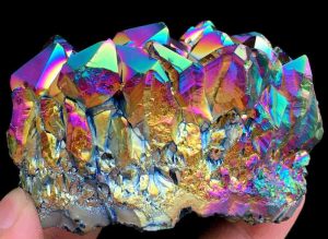
Metal-coated crystals “Aura” are natural crystals, such as quartz, whose surface has been coated with metal to give them an iridescent metallic sheen. Crystals treated this way are used as gemstones and for other decorative purposes. Possible coatings include gold (resulting in a stone called aqua aura), indium, titanium, niobium and copper. Other names for crystals treated so include; angel aura, flame aura, opal aura or rainbow quartz.
Aqua aura is created in a vacuum chamber from quartz crystals and gold vapour by vapour deposition. The quartz is heated to 871 °C (1600 °F) in a vacuum, and then gold vapor is added to the chamber. The gold atoms fuse to the crystal’s surface, which gives the crystal an iridescent metallic sheen. When viewed under a gemological microscope in diffused direct transmitted light, aqua aura displays the following properties:
A coppery surface iridescence in tangential illumination
Diffused dark outlines of some facet junctions
A patchy blue colour distribution on some facets
White facet junctions, irregular white abrasions and surface pits, where the treatment either did not “take” or had been abraded away.
Rainbow quartz have been treated with a combination of titanium and gold. Titanium molecules are bonded to the quartz by the natural electrostatic charge of the crystal in a process known as magnetron ionization. The brilliant color of flame aura is the result of optical interference effects produced by layers of titanium. Since only electricity is used to deposit the titanium layers and create these colors, very little heat is involved and the integrity of the crystal is maintained. The crystal does not become brittle or prone to breakage as with other treatments.