Home Blog Page 127

What is Aura? How it Formed?

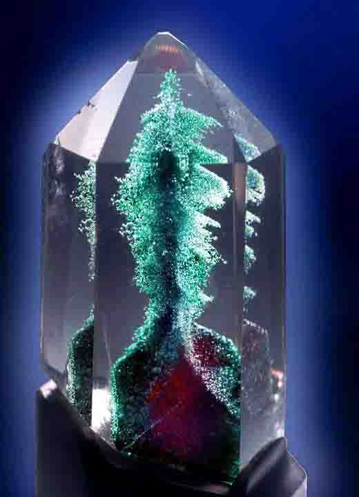
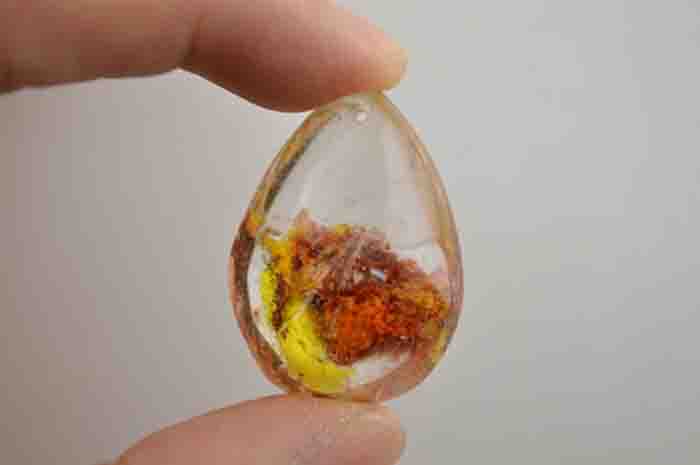
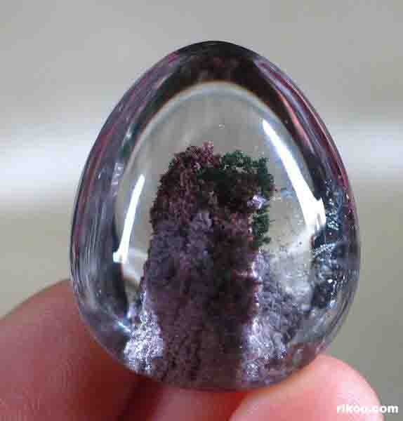
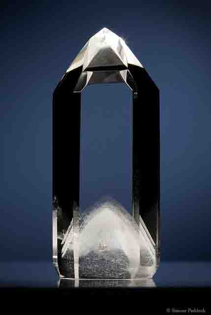
Metal-coated crystals “Aura” are natural crystals, such as quartz, whose surface has been coated with metal to give them an iridescent metallic sheen. Crystals treated this way are used as gemstones and for other decorative purposes. Possible coatings include gold (resulting in a stone called aqua aura), indium, titanium, niobium and copper. Other names for crystals treated so include; angel aura, flame aura, opal aura or rainbow quartz.

Aqua aura is created in a vacuum chamber from quartz crystals and gold vapour by vapour deposition. The quartz is heated to 871 °C (1600 °F) in a vacuum, and then gold vapor is added to the chamber. The gold atoms fuse to the crystal’s surface, which gives the crystal an iridescent metallic sheen. When viewed under a gemological microscope in diffused direct transmitted light, aqua aura displays the following properties:

  • A coppery surface iridescence in tangential illumination
  • Diffused dark outlines of some facet junctions
  • A patchy blue colour distribution on some facets
  • White facet junctions, irregular white abrasions and surface pits, where the treatment either did not “take” or had been abraded away.

Rainbow quartz have been treated with a combination of titanium and gold. Titanium molecules are bonded to the quartz by the natural electrostatic charge of the crystal in a process known as magnetron ionization. The brilliant color of flame aura is the result of optical interference effects produced by layers of titanium. Since only electricity is used to deposit the titanium layers and create these colors, very little heat is involved and the integrity of the crystal is maintained. The crystal does not become brittle or prone to breakage as with other treatments.

Researchers discover hottest lavas that erupted in past 2.5 billion years

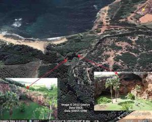
Representative Image: Advancing Pahoehoe toe, Kilauea Hawaii 2003 “Kohola breakouts and Highcastle ocean entry”. Credit: Hawaii Volcano Observatory (DAS)

An international team of researchers led by geoscientists with the Virginia Tech College of Science recently discovered that deep portions of Earth’s mantle might be as hot as it was more than 2.5 billion years ago.

The study, led by Esteban Gazel, an assistant professor with Virginia Tech’s Department of Geosciences, and his doctoral student Jarek Trela of Deer Park, Illinois, is published in the latest issue of Nature Geoscience. The study brings new, unprecedented evidence on the thermal evolution of the deep Earth during the past 2.5 billion years, Gazel said.

The Archean Eon—covering from 2.5 to 4 billion years ago—is one of the most enigmatic times in the evolution of our planet, Gazel said. During this time period, the temperature of Earth’s mantle—the silicate region between the crust and the outer core—was hotter than it is today, owing to a higher amount of radioactive heat produced from the decay of elements such as potassium, thorium, and uranium. Because Earth was hotter during this period, this interval of geologic time is marked by the widespread of occurrence of a unique rock known as komatiite.

“Komatiites are basically superhot versions of Hawaiian style lava flows,” Gazel said. “You can imagine a Hawaiian lava flow, only komatiites were so hot that they glowed white instead of red, and they flowed on a planetary surface with very different atmospheric conditions, more similar to Venus than the planet we live on today.”

Earth essentially stopped producing abundant hot komatiites after the Archean era because the mantle has cooled during the past 4.5 billion years due to convective cooling and a decrease in radioactive heat production, Gazel said.

However, Gazel and a team made what they call an astonishing discovery while studying the chemistry of ancient Galapagos-related lava flows, preserved today in Central America: a suite of lavas that shows conditions of melting and crystallization similar to the mysterious Archean komatiites.

Gazel and collaborators studied a set of rocks from the 90 million-year-old Tortugal Suite in Costa Rica and found that they had magnesium concentrations as high as Archean komatiites, as well as textural evidence for extremely hot lava flow temperatures.

“Experimental studies tell us that that the magnesium concentration of basalts and komatiites is related to the initial temperature of the melt,” Gazel said. “They higher the temperature, the higher the magnesium content of a basalt.”

The team also studied the composition olivine, the first mineral that crystallized from these lavas. Olivine—a light green mineral that Gazel has obsessively explored many volcanoes and magmatic regions to search for—is an extremely useful tool to study a number of conditions related to origin of a lava flow because it is the first mineral phase that crystallizes when a mantle melt cools. Olivines also carry inclusions of glass—that once was melt—and other smaller minerals that are helpful to decipher the secrets of the deep Earth.

“We used the composition of olivine as another thermometer to corroborate how hot these lavas were when they began to cool,” Gazel said. “You can determine the temperature that basaltic lava began crystallizing by analyzing the composition of olivine and inclusions of another mineral called spinel. At higher temperatures, olivine will incorporate more aluminum into its structure and spinel will incorporate more chromium. If you know how much of these elements are present in each mineral, then you know the temperature at which they crystallized.”

The team found that Tortugal olivines crystallized at temperature nearing 2,900 degrees Fahrenheit (1,600 degrees Celsius)—as high as temperatures recorded by olivines from komatiites—making this a new record on lava temperatures in the past 2.5 billion years.

Gazel and collaborators suggest in their study that Earth may still be capable of producing komatiite-like melts. Their results suggest that Tortugal lavas most likely originated from the hot core of the Galapagos mantle plume that started producing melts nearly 90 million years ago and has remained active ever since.

A mantle plume is a deep-earth structure that likely originates at the core-mantle boundary of the planet. When it nears the surface of the planet it begins to melt, forming features known as hotspots such as those found in Hawaii or Galapagos. Geologists can then study these hotspot lava flows and use their geochemical information as a window into the deep Earth.

“What is really fascinating about this study is that we show that the planet is still capable of producing lavas as hot as during Archean time period,” Gazel said. “Based on our results from Tortugal lavas, we think that mantle plumes are ‘tapping’ a deep, hot region of the mantle that hasn’t cooled very much since the Archean. We think that this region is probably being sustained by heat from the crystallizing core of the planet.”

“This is a really interesting discovery and we are going to keep investigating Tortugal,” said Trela, a doctoral student and the first author of the paper. “Although the Tortugal Suite was first discovered and documented more than 20 years ago, it wasn’t until now that we have the technology and experimental support to better understand the global implications of this location.”

Trela added, “Our new data suggest that this suite of rocks offers tremendous opportunity to answer key questions regarding the accretion of the Earth, its thermal evolution, and the geochemical messages that mantle plumes bring to the surface of the planet.”

Reference:
The hottest lavas of the Phanerozoic and the survival of deep Archaean reservoirs, Nature Geoscience (2017). DOI:10.1038/ngeo2954

Note: The above post is reprinted from materials provided by Virginia Tech.

Scientists find 7.2-million-year-old pre-human remains in the Balkans

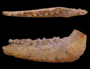
The lower jaw of the 7.175 million year old Graecopithecus freybergi (El Graeco) from Pyrgos Vassilissis, Greece (today in metropolitan Athens). Credit: Wolfgang Gerber, University of Tübingen

The common lineage of great apes and humans split several hundred thousand earlier than hitherto assumed, according to an international research team headed by Professor Madelaine Böhme from the Senckenberg Centre for Human Evolution and Palaeoenvironment at the University of Tübingen and Professor Nikolai Spassov from the Bulgarian Academy of Sciences. The researchers investigated two fossils of Graecopithecus freybergi with state-of-the-art methods and came to the conclusion that they belong to pre-humans. Their findings, published today in two papers in the journal PLOS ONE, further indicate that the split of the human lineage occurred in the Eastern Mediterranean and not – as customarily assumed – in Africa.

Present-day chimpanzees are humans’ nearest living relatives. Where the last chimp-human common ancestor lived is a central and highly debated issue in palaeoanthropology. Researchers have assumed up to now that the lineages diverged five to seven million years ago and that the first pre-humans developed in Africa. According to the 1994 theory of French palaeoanthropologist Yves Coppens, climate change in Eastern Africa could have played a crucial role. The two studies of the research team from Germany, Bulgaria, Greece, Canada, France and Australia now outline a new scenario for the beginning of human history.

Dental roots give new evidence

The team analyzed the two known specimens of the fossil hominid Graecopithecus freybergi: a lower jaw from Greece and an upper premolar from Bulgaria. Using computer tomography, they visualized the internal structures of the fossils and demonstrated that the roots of premolars are widely fused.

“While great apes typically have two or three separate and diverging roots, the roots of Graecopithecus converge and are partially fused – a feature that is characteristic of modern humans, early humans and several pre-humans including Ardipithecus and Australopithecus”, said Böhme.

The lower jaw, nicknamed ‘El Graeco’ by the scientists, has additional dental root features, suggesting that the species Graecopithecus freybergi might belong to the pre-human lineage. “We were surprised by our results, as pre-humans were previously known only from sub-Saharan Africa,” said Jochen Fuss, a Tübingen PhD student who conducted this part of the study.

Furthermore, Graecopithecus is several hundred thousand years older than the oldest potential pre-human from Africa, the six to seven million year old Sahelanthropus from Chad. The research team dated the sedimentary sequence of the Graecopithecus fossil sites in Greece and Bulgaria with physical methods and got a nearly synchronous age for both fossils – 7.24 and 7.175 million years before present. “It is at the beginning of the Messinian, an age that ends with the complete desiccation of the Mediterranean Sea,” Böhme said.

Professor David Begun, a University of Toronto paleoanthropologist and co-author of this study, added, “This dating allows us to move the human-chimpanzee split into the Mediterranean area.”

Environmental changes as the driving force for divergence

As with the out-of-East-Africa theory, the evolution of pre-humans may have been driven by dramatic environmental changes. The team led by Böhme demonstrated that the North African Sahara desert originated more than seven million years ago. The team concluded this based on geological analyses of the sediments in which the two fossils were found. Although geographically distant from the Sahara, the red-colored silts are very fine-grained and could be classified as desert dust. An analysis of uranium, thorium, and lead isotopes in individual dust particles yields an age between 0.6 and 3 billion years and infers an origin in Northern Africa.

Moreover, the dusty sediment has a high content of different salts. “These data document for the first time a spreading Sahara 7.2 million years ago, whose desert storms transported red, salty dusts to the north coast of the Mediterranean Sea in its then form,” the Tübingen researchers said. This process is also observable today. However, the researchers’ modelling shows that, with up to 250 grams per square meter and year, the amount of dust in the past considerably exceeds recent dust loadings in Southern Europe more than tenfold, comparable to the situation in the present-day Sahel zone in Africa.

Fire, grass, and water stress

The researchers further showed that, contemporary to the development of the Sahara in North Africa, a savannah biome formed in Europe. Using a combination of new methodologies, they studied microscopic fragments of charcoal and plant silicate particles, called phytoliths. Many of the phytoliths identified derive from grasses and particularly from those that use the metabolic pathway of C4-photosynthesis, which is common in today’s tropical grasslands and savannahs. The global spread of C4-grasses began eight million years ago on the Indian subcontinent – their presence in Europe was previously unknown.

“The phytolith record provides evidence of severe droughts, and the charcoal analysis indicates recurring vegetation fires,” said Böhme. “In summary, we reconstruct a savannah, which fits with the giraffes, gazelles, antelopes, and rhinoceroses that were found together with Graecopithecus,” Spassov added

“The incipient formation of a desert in North Africa more than seven million years ago and the spread of savannahs in Southern Europe may have played a central role in the splitting of the human and chimpanzee lineages,” said Böhme. She calls this hypothesis the North Side Story, recalling the thesis of Yves Coppens, known as East Side Story.

The findings are described in two studies pubished in PLOS ONE titled “Potential hominin affinities of Graecopithecus from the late Miocene of Europe” and “Messinian age and savannah environment of the possible hominin Graecopithecus from Europe.”

Reference:

  1. Potential hominin affinities of Graecopithecus from the Late Miocene of Europe, PLOS ONE (2017). journals.plos.org/plosone/article?id=10.1371/journal.pone.0177127
  2. Messinian age and savannah environment of the possible hominin Graecopithecus from Europe, PLOS ONE (2017). journals.plos.org/plosone/article?id=10.1371/journal.pone.0177347

Note: The above post is reprinted from materials provided by University of Toronto.

3.3 million-year-old fossil reveals origins of the human spine

Full skeleton of ‘Selam,’ a 3.3 million-year-old Australopithecus afarensis fossil discovered by Prof. Zeray Alemseged in 2000. Credit: Zeray Alemseged

Analysis of a 3.3 million-year-old fossil skeleton reveals the most complete spinal column of any early human relative, including vertebrae, neck and rib cage. The findings, published this week in the Proceedings of the National Academy of Sciences, indicate that portions of the human spinal structure that enable efficient walking motions were established millions of years earlier than previously thought.

The fossil, known as “Selam,” is a nearly complete skeleton of a 2½ year-old child discovered in Dikika, Ethiopia in 2000 by Zeresenay (Zeray) Alemseged, professor of organismal biology and anatomy at the University of Chicago and senior author of the new study. Selam, which means “peace” in the Ethiopian Amharic language, was an early human relative from the species Australopithecus afarensis—the same species as the famous Lucy skeleton.

In the years since Alemseged discovered Selam, he and his lab assistant from Kenya, Christopher Kiarie, have been preparing the delicate fossil at the National Museum of Ethiopia. They slowly chipped away at the sandstone surrounding the skeleton and used advanced imaging tools to further analyze its structure.

“Continued and painstaking research on Selam shows that the general structure of the human spinal column emerged over 3.3 million years ago, shedding light on one of the hallmarks of human evolution,” Alemseged said. “This type of preservation is unprecedented, particularly in a young individual whose vertebrae are not yet fully fused.”

Many features of the human spinal column and rib cage are shared among primates. But the human spine also reflects our distinctive mode of walking upright on two feet. For instance, humans have fewer rib-bearing vertebrae – bones of the back – than those of our closest primate relatives. Humans also have more vertebrae in the lower back, which allows us to walk effectively. When and how this pattern evolved has been unknown until now because complete sets of vertebrae are rarely preserved in the fossil record.

“For many years we have known of fragmentary remains of early fossil species that suggest that the shift from rib-bearing, or thoracic, vertebrae to lumbar, or lower back, vertebrae was positioned higher in the spinal column than in living humans. But we have not been able to determine how many vertebrae our early ancestors had,” said Carol Ward, a Curator’s Distinguished Professor of Pathology and Anatomical Sciences in the University of Missouri School of Medicine, and lead author on the study. “Selam has provided us the first glimpse into how our early ancestors’ spines were organized.”

In order to be analyzed, Selam had to take a trip. She traveled to the European Synchrotron Radiation Facility in Grenoble, France, where Alemseged and the research team used high-resolution imaging technology to visualize the bones.

“This technology provides the opportunity to virtually examine aspects of the vertebrae otherwise unattainable from the original specimen,” said coauthor of the study Fred Spoor, a professor of evolutionary anatomy in the Department of Biosciences at the University College London.

The scans indicated that Selam had the distinctive thoracic-to-lumbar joint transition found in other fossil human relatives, but the specimen is the first to show that, like modern humans, our earliest ancestors had only twelve thoracic vertebrae and twelve pairs of ribs. That is fewer than in most apes.

“This unusual early human configuration may be a key in developing more accurate scenarios concerning the evolution of bipedality and modern human body shape,” said Thierra Nalley, an assistant professor of anatomy at Western University of Health Sciences in Pomona, California, also an author on the paper.

This configuration marks a transition toward the type of spinal column that allows humans to be the efficient, athletic walkers and runners we are today.

“We are documenting for the first time in the fossil record the emergence of the number of the vertebrae in our history, when the transition happened from the rib-bearing vertebrae to lower back vertebrae, and when we started to extend the waist,” Alemseged said. “This structure and its modification through time is one of the key events in the history of human evolution.”

Reference:
Carol V. Ward el al., “Thoracic vertebral count and thoracolumbar transition in Australopithecus afarensis,” PNAS (2017). DOI:10.1073/pnas.1702229114

Note: The above post is reprinted from materials provided by University of Chicago Medical Center.

Weathering of rocks a poor regulator of global temperatures

A river runs through a valley in the Himalayan mountains. New results show the rate for chemical weathering of rocks is not as sensitive to global temperatures as geologists thought. Credit: Pixabay

A new University of Washington study shows that the textbook understanding of global chemical weathering—in which rocks are dissolved, washed down rivers and eventually end up on the ocean floor to begin the process again—does not depend on Earth’s temperature in the way that geologists had believed.

The study, published May 22 in the open-access journal Nature Communications, looks at a key aspect of carbon cycling, the process by which carbon atoms move between the air, rocks and the oceans. The results call into question the role of rocks in setting our planet’s temperature over long timescales.

“Understanding how the Earth transitioned from a hothouse climate in the age of the dinosaurs to today could help us better understand long-term consequences of future climate change,” said corresponding author Joshua Krissansen-Totton, a UW doctoral student in Earth and space sciences.

The current understanding is that Earth’s climate is controlled over periods of millions of years by a natural thermostat related to the weathering of rocks. Carbon dioxide is released into the air by volcanoes, and this gas may then dissolve into rainwater and react with silicon-rich continental rocks, causing chemical weathering of the rocks. This dissolved carbon then flows down rivers into the ocean, where it ultimately gets locked up in carbon-containing limestone on the seafloor.

As a potent greenhouse gas, atmospheric carbon dioxide also traps heat from the sun. And a warmer Earth increases the rate of chemical weathering both by causing more rainfall and by speeding up the chemical reactions between rainwater and rock. Over time, reducing the amount of carbon dioxide in the air by this method cools the planet, eventually returning the climate to more moderate temperatures—or so goes the textbook picture.

“The general idea has been that if more carbon dioxide is released, the rate of weathering increases, and carbon dioxide levels and temperature are moderated,” co-author David Catling, a UW professor of Earth and space sciences. “It’s a sort of long-term thermostat that protects the Earth from getting too warm or too cold.”

The new study began when researchers set out to determine conditions during the earliest life on Earth, some 3.5 billion to 4 billion years ago. They first tested their ideas on what they believed to be a fairly well-understood time period: the past 100 million years, when rock and fossil records of temperatures, carbon dioxide levels and other environmental variables exist.

Earth’s climate 100 million years ago was very different from today. During the mid-Cretaceous, the poles were 20 to 40 degrees Celsius warmer than the present. Carbon dioxide in the air was more than double today’s concentrations. Seas were 100 meters (330 feet) higher, and dinosaurs roamed near the ice-free poles.

The researchers created a computer simulation of the flows of carbon required to match all the geologic records, thus reproducing the dramatic transition from the warm mid-Cretaceous times to today.

“We found that to be able to explain all the data—temperature, CO2, ocean chemistry, everything—the dependence of chemical weathering on temperature has to be a lot weaker than was commonly assumed,” Krissansen-Totton said. “You also need to have something else changing weathering rates that has nothing to do with temperature.”

Geologists had previously estimated that a temperature increase of 7 C would double the rate of chemical weathering. But the new results show that more than three times that temperature jump, or 24 C, is required to double the rate at which rock is washed away.

“It’s just a much less efficient thermostat,” Krissansen-Totton said.

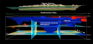
The authors suggest that another mechanism controlling the rate of weathering may be how much land is exposed above sea level and the steepness of Earth’s surface. When the Tibetan Plateau was formed some 50 million year ago, the steeper surfaces may have increased the global rate

of chemical weathering, drawing down more CO2 and bringing the climate down to today’s more moderate temperatures.

“In retrospect, our results make a lot of sense,” Catling said. “Rocks tell us that Earth has had large swings in temperature over geological history, so Earth’s natural thermostat can’t be a very tight one.”

Their calculations also indicate a stronger relationship between atmospheric CO2 and temperature, known as climate sensitivity. Doubling CO2 in the atmosphere eventually triggered an increase of 5 or 6 degrees Celsius in global temperatures, which is about twice the typical projections for temperature change over centuries for a similar doubling of CO2 due to human emissions.

Though not the final word, researchers said, these numbers are bad news for today’s climate shifts.

“What all this means is that in the very long term, our distant descendants can expect more warming for far longer if carbon dioxide levels and temperatures continue to rise,” Catling said.

The researchers will now apply their calculations to other periods of the geologic past.

“This is going to have implications for the carbon cycles for other times in Earth’s history and into its future, and potentially for other rocky planets beyond the solar system,” Krissansen-Totton said.

Reference:
Joshua Krissansen-Totton et al, Constraining climate sensitivity and continental versus seafloor weathering using an inverse geological carbon cycle model, Nature Communications (2017). DOI: 10.1038/ncomms15423

Note: The above post is reprinted from materials provided by University of Washington.

Research in Russia challenges widely held understanding of past climate history

Author Jonathan Baker and colleagues examine stalagmite KC-1 prior to collection. This stalagmite, which was analyzed at UNLV and UNM, had grown for approximately 10,000 years. Credit: Petr Yakubson

Things are heating up in Russia. UNLV Geoscience Ph.D. student Jonathan Baker has found evidence that shows nearly continuous warming from the end of the last Ice Age to the present in the Ural Mountains in central Russia.

The research, which was published today in top geoscience journal Nature Geoscience, shows continual warming over the past 11,000 years, contradicting the current belief that northern hemisphere temperatures peaked 6,000 to 8,000 years ago and cooled until the pre-Industrial period.

Baker’s research, done in conjunction with UNLV geoscientist Matthew Lachniet, Yemane Asmerom and Victor Polyak of the University of New Mexico, and Russian scientist Olga Chervyatsova, shows that winter temperature variations in continental Eurasia are warmer today than any time in the past 11,000 years.

This study contradicts previous work likely because those studies focused on summer temperature trends and not the more sensitive winter temperature variations that were not previously available, Baker said.

The new finding is based on precisely dated isotope temperature record and supports computer models for Eurasia that predicted continual warming. The research showed that disappearing ice in the Arctic regions of North America controlled the warming trend as the Ice Age glaciers retreated. Later, rising greenhouse gases, like carbon dioxide and methane, were likely responsible for the continued warming in the Ural Mountains.

The cave climate record has important implications for the future, Lachniet explained. “Because greenhouse gas concentrations are increasing at rates unprecedented for the past 800,000 years, human-caused warming will be superimposed on the ‘natural’ trend,” he said.

Baker added, “Over the past century, winters in continental Eurasia warmed 70 times faster than during the previous 7,000 years, according to our record. At this pace, the warming will continue to pose severe and detrimental impacts throughout the region.”

As modern temperatures are influenced in part by greenhouse gases, both summers and winters are expected to warm, whereas past temperatures in those seasons had opposing trajectories, Baker said.

Reference:
Jonathan L. Baker et al, Holocene warming in western continental Eurasia driven by glacial retreat and greenhouse forcing, Nature Geoscience (2017). DOI: 10.1038/ngeo2953

Note: The above post is reprinted from materials provided by University of Nevada, Las Vegas.

Half the world away: Kamchatkan volcanic ash travels half the world

Kamchatka Volcano

Geochemical fingerprinting links microscopic ash found on the bottom of a Svalbard lake to volcanic event happening 7000 years ago and 5000 km away.

Eruptions are cataclysmic events that may impact people living far from their volcanic sources. Just think back to the summer of 2010, when ash from an obscure Icelandic volcano blanketed European airspace, disrupting flights for weeks.

A new study now demonstrates that volcanic ash can travel even further, linking microscopic ash from an Arctic Lake to a 7000 year old eruption on Russia`s Kamchatka peninsula.

Beyond the usual suspects

This find, recently published in the scientific journal Quaternary Science Reviews, expands the known dispersal range of volcanic ash by thousands of kilometers.

“Being both volcanically active and lying nearby, I expected our ash to originate from Iceland: this study really highlights the need to look beyond the usual suspects in this line of research,” Willem van der Bilt, lead-author and researcher at the University of Bergen and the Bjerknes Centre for Climate Research points out. The results also raises questions about the factors influencing the dispersal of volcanic ash.

“The eruption that produced our ash was larger than most, but smaller than others who did not spread out their ash across the Hemisphere. Day-to-day shifts in weather factors like the speed and direction of winds surely helped this ash come such a long way,” van der Bilt says.

Electron beam bombardment

To find the ash, van der Bilt and his co-authors carried out a range of delicate lab procedures in various specialized labs across Europe.

“In the end, we found and analyzed 6 particles with less than half the width of a human hair: quite literally, more than meets the eye,” van der Bilt adds.

First, ash was separated from lake sediments — like skimming off foam from milk. Next, ash was identified under a microscope and extracted during a tricky maneuver with a 10 cm long needle. Finally, in a procedure that seems to come straight from a science-fiction movie, individual ash particles were bombarded by an electron beam to determine their chemistry.

“Like human DNA, the composition of volcanic ash is unique. Geochemical analysis help us fingerprint this signature and match it with an eruption,” says van der Bilt.

Time flies

But the implications of the paper go beyond challenging assumptions about the distance that volcanic ash clouds can travel. Most volcanic ash settles on the ground within weeks after an eruption, forming layers of identical age in geological records like the analyzed lake sediments.

“Thinking about the dispersal and deposition of such ash markers in this way, time quite literally flies. The ash we found travelled across three continents and allows synchronization of all the records taken from its vast fallout areas that contain it. If such records hold information on past climate change, our ash marker enables us to investigate cause-effect and lead-lag relationships in Earth`s climate system — information that is highly valuable to help understand processes driving climate changes like those seen today,” van der Bilt concludes.

Reference:
Willem G.M. van der Bilt, Christine S. Lane, Jostein Bakke. Ultra-distal Kamchatkan ash on Arctic Svalbard: Towards hemispheric cryptotephra correlation. Quaternary Science Reviews, 2017; 164: 230 DOI: 10.1016/j.quascirev.2017.04.007

Note: The above post is reprinted from materials provided by University of Bergen.

Giant Gold Nugget Found in California

In this undated image provided by Kagin’s Inc., shows the Butte Nugget. Credit: AP/Kagin’s Inc.

One of the largest gold nuggets in modern times pulled from Northern California’s Gold Country has sold to a secret buyer.

The new owner of the so-called Butte Nugget and its exact price will both remain mysteries at the buyer’s request, the San Francisco Chronicle reported Saturday.

But Don Kagin, the Tiburon-based coin dealer who brokered the deal, said that a “prominent Bay Area collector” paid about $400,000 for the nugget weighing 6.07 pounds. That wasn’t far off from the asking price, he said.

“Let’s just say it’s a win-win for everybody, Kagin said, adding that the nugget went up for sale Thursday with the deal finalized on Friday.

Historically, prospectors found giant gold nuggets in California during the 19th century Gold Rush days, including a 54-pound chunk found in Butte County in 1859. It has been decades since a report of anyone discovering a rock of 6 pounds or more in California.

The gold hunter who found the nugget found it in July in the mountains of Butte County. He also asked Kagin to keep his name and the location of the discovery a secret.

Reports of the nugget’s pending sale caused a near frenzy among gold and history buffs, with the newspaper reporting one bidder inquiring from Australia.

“We spoke with six different people who seemed to have a legitimate interest,” said David McCarthy, Kagin’s chief numismatist. “But he was the first person to make an offer and he had the right prices.”

Note: The above post is reprinted from materials provided by AP.

Life in the Precambrian may have been much livelier than previously thought

Fossil imprint of Parvancorina, which may have been the first species capable of orienting itself to face into an ocean current. Credit: Masahiro Miyasaka / Wikimedia Commons

The Garden of the Ediacaran was a period in the ancient past when Earth’s shallow seas were populated with a bewildering variety of enigmatic, soft-bodied creatures. Scientists have pictured it as a tranquil, almost idyllic interlude that lasted from 635 to 540 million years ago. But a new interdisciplinary study suggests that the organisms living at the time may have been much more dynamic than experts have thought.

Scientists have found It extremely difficult to fit these Precambrian species into the tree of life. That is because they lived in a time before organisms developed the ability to make shells or bones. As a result, they didn’t leave much fossil evidence of their existence behind, and even less evidence that they moved around. So, experts have generally concluded that virtually all of the Ediacarans — with the possible exception of a few organisms similar to jellyfish that floated about — were stationary and lived out their adult lives fixed in one place on the sea floor.

The new findings concern one of the most enigmatic of the Ediacaran genera, a penny-sized organism called Parvancorina, which is characterized by a series of ridges on its back that form the shape of a tiny anchor. By analyzing the way in which water flows around Parvancorina’s body, an international team of researchers has concluded that these ancient creatures must have been mobile: specifically, they must have had the ability to orient themselves to face into the current flowing around them. That would make them the oldest species known to possess this capability, which scientists call rheotaxis.

“Our analysis shows that the amount of drag produced with the current flowing from front to back is substantially less than that flowing from side to side,” said Simon Darroch, assistant professor of earth and environmental sciences at Vanderbilt University, who headed the study. “In the strong currents characteristic of shallow ocean environments, that means Parvancorina would have benefited greatly from adjusting its position to face the direction of the flow.”

The analysis, which used a technique borrowed from engineering called computational fluid dynamics (CFD), also showed that when Parvancorina faced into the current, its shape created eddy currents that were directed to several specific locations on its body. “This would be very beneficial to Parvancorina if it was a suspension feeder as we suspect because it would have concentrated the suspended organic material making it easier to consume,” Darroch said.

Details of the analysis are described in a paper titled “Inference of facultative mobility in the enigmatic Ediacaran organism Parvancorina” published online May 17 by the Royal Society journal Biology Letters.

These conclusions are reinforced by an independent study performed by a team of Australian researchers publishedMarch30 in the journal Scientific Reports. Analyzing an Ediacaran site in South Australia, they found that the Parvancorina fossils were preferentially aligned in the direction of the prevailing current and determined that this alignment was not passive but represented a rheotactic response at some point in the organism’s life history.

This is only the second time that CFD has been applied to study Ediacarans. In 2015, the same team of researchers applied this technique to analyze flow patterns around an organism called Tribrachidium heraldicum. This is a disk-shaped organism characterized by three spiraling ridges on its back. In this case, their analysis supported the conclusion that it was the oldest known suspension feeder, dating back to 555 million years.

“We decided to stop trying to figure out where these species fit in the tree of life and to try to determine how they were shaped by evolutionary forces,” said Darroch. “We wanted to understand how their weird architectures affected how they ate, reproduced and moved. Because they lived in a shallow sea environment, strong currents must have played a major role in their evolution. So computational fluid dynamics is the perfect tool for addressing this question.”

According to team member Imran Rahman, research fellow at the Oxford University Museum of Natural History, CFD has been used to analyze the design and optimize the performance of a wide variety of structures and machines, ranging from nuclear reactors to aircraft, but it is only in the last few years that they have begun applying it to study the fossil record: “CFD has the potential to transform our understanding of how ancient organisms fed and moved, so I would anticipate that many more paleontologists will start making use of the method in coming years.”

“When you sit back and think about it, we are virtually recreating ancient oceans, and populating them with digital representations of long extinct organisms that have defied our understanding for over 50 years in order to gain insight on how they lived their day to day lives,” added co-author Marc Laflamme, assistant professor of earth science at the University of Toronto Mississauga. “This kind of work would not have been feasible even a decade ago, and I believe it represents the direction that modern paleontology is forging.”

“The fact that we have now established that one Ediacaran species could move around suggests that our picture of this period may be fundamentally wrong,” said Darroch. “There may have been a lot more movement going on than we thought and we intend to apply this technique to other Ediacaran fossils to determine if that was the case.”

Reference:
Simon A. F. Darroch, Imran A. Rahman, Brandt Gibson, Rachel A. Racicot, Marc Laflamme. Inference of facultative mobility in the enigmatic Ediacaran organism Parvancorina. Biology Letters, 2017; 13 (5): 20170033 DOI: 10.1098/rsbl.2017.0033

Note: The above post is reprinted from materials provided by Vanderbilt University. Original written by David F Salisbury.

Rivers on three worlds tell different tales

Left to right: River networks on Mars, Earth, and Titan. Researchers report that Titan, like Mars but unlike Earth, has not undergone any active plate tectonics in its recent past. Credit: Benjamin Black/NASA/Visible Earth/JPL/Cassini RADAR team. Adapted from images from NASA Viking, NASA/Visible Earth, and NASA/JPL/Cassini RADAR team

The environment on Titan, Saturn’s largest moon, may seem surprisingly familiar: Clouds condense and rain down on the surface, feeding rivers that flow into oceans and lakes. Outside of Earth, Titan is the only other planetary body in the solar system with actively flowing rivers, though they’re fed by liquid methane instead of water. Long ago, Mars also hosted rivers, which scoured valleys across its now-arid surface.

Now MIT scientists have found that despite these similarities, the origins of topography, or surface elevations, on Mars and Titan are very different from that on Earth.

In a paper published in Science, the researchers report that Titan, like Mars but unlike Earth, has not undergone any active plate tectonics in its recent past. The upheaval of mountains by plate tectonics deflects the paths that rivers take. The team found that this telltale signature was missing from river networks on Mars and Titan.

“While the processes that created Titan’s topography are still enigmatic, this rules out some of the mechanisms we’re most familiar with on Earth,” says lead author Benjamin Black, formerly an MIT graduate student and now an assistant professor at the City College of New York.

Instead, the authors suggest Titan’s topography may grow through processes like changes in the thickness of the moon’s icy crust, due to tides from Saturn.

The study also sheds some light on the evolution of the landscape on Mars, which once harbored a huge ocean and rivers of water. The MIT team provides evidence that the major features of Martian topography formed very early in the history of the planet, influencing the paths of younger river systems, even as volcanic eruptions and asteroid impacts scarred the planet’s surface.

“It’s remarkable that there are three worlds in the solar system where flowing rivers have carved into the landscape, either presently or in the past,” says Taylor Perron, associate professor of geology in MIT’s Department of Earth, Atmospheric and Planetary Sciences (EAPS). “There’s this amazing opportunity to use the landforms the rivers have created to learn how the histories of these worlds are different.”

Perron and Black’s co-authors include former MIT undergraduate Elizabeth Bailey and researchers from the University of California at Berkeley, the University of California at Santa Cruz, and Stanford University.

Fuzzy flows

Since 2004, NASA’s Cassini spacecraft has been circling Saturn and sending back to Earth stunning images of the planet’s rings and moons. Images of Titan’s surface have given scientists a first view of the moon’s river valleys, rolling sand dunes, and active weather patterns. Cassini has also made rough measurements of Titan’s topography in some locations, though these measurements are much coarser in resolution.

Perron and Black wondered whether they might refine their view of Titan’s topography by applying what is known about the topography on Earth and Mars, and how their rivers have evolved.

For instance, on Earth, the process of plate tectonics has continuously reshaped the landscape, pushing mountain ranges up between colliding continental plates, and opening ocean basins as landmasses slowly pull apart. Rivers, therefore, are constantly adapting to changes in topography, sidestepping around growing mountain ranges to reach the ocean.

Mars, on the other hand, is thought to have been shaped mostly during the period of primordial accretion and the so-called Late Heavy Bombardment, when asteroids carved out massive impact basins and pushed up huge volcanoes.

Scientists now have well-resolved maps of river networks and topography on both Earth and Mars, along with a growing understanding of their respective histories. Perron and Black used this foundation to gain insight into Titan’s topographic history.

“We know something about rivers, and something about topography, and we expect that rivers are interacting with topography as it evolves,” Black says. “Our goal was to use those pieces to crack the code of what formed the topography in the first place.”

Conforming with topography

The team first compiled a map of river networks for Earth, Mars, and Titan. Such maps were previously made by others for Earth and Mars; Black generated a river map for Titan using images taken by Cassini. For all three maps, the researchers marked the direction each river appeared to flow.

They then compared topographic maps for all three planetary bodies, at varying degrees of resolution. Maps of Earth are sharp in detail, as are those for Mars, showing mountain peaks and impact basins in high relief. By contrast, due to Titan’s thick, hazy atmosphere, the global map of Titan’s topography is extremely fuzzy, showing only the broadest features.

In order to make direct comparisons between topographies, the researchers dialed down the resolution of maps for Earth and Mars, to match the resolution available for Titan. They then superimposed maps of each planetary body’s river networks, onto their respective topographies, and marked every river that appeared to flow downhill.

Of course, rivers only flow downhill. But the team observed that rivers might appear to flow uphill, simply because a map at low resolution may not capture finer details such as mountain ranges which would divert a river’s flow.

When the researchers tallied the percentage of rivers on Titan that appeared to flow downhill, the number more closely matched with Mars. They also compared what they called “topographic conformity”—the degree of divergence between a topography’s slope and the direction of a river’s flow. Here too, they found that Titan resembled Mars over Earth.

“One prediction we can make is that, when we eventually get more refined topographic maps of Titan, we will see topography that looks more like Mars than Earth,” Perron says. “Titan might have broad-scale highs and lows, which might have formed some time ago, and the rivers have been eroding into that topography ever since, as opposed to having new mountain ranges popping up all the time, with rivers constantly fighting against them.”

Filling in a picture

One last question the researchers looked to answer was how cratering due to asteroid impacts on Mars has reshaped its topography.

Black used a simulation that the group previously developed, to model river erosion on Mars with different impact cratering histories. He found that the pattern of river networks on Mars today limits the extent to which cratering has remodeled the surface of Mars. This suggests that the biggest impact craters formed very early in Mars’ history, and that later pummeling by asteroids mostly dented and dinged the surface.

As Cassini’s mission is scheduled to come to an end in September, Perron says further investigation of Titan’s surface will help to guide future missions to the distant moon.

“Any way of filling in the details of what Titan’s surface is like, beyond what we can see directly in the images and topography Cassini has collected, will be valuable for planning a return,” Perron says.

Reference:
B.A. Black at City University of New York in New York, NY el al., “Global drainage patterns and the origins of topographic relief on Earth, Mars, and Titan,” Science (2017). DOI: 10.1126/science.aag0171

Note: The above post is reprinted from materials provided by Massachusetts Institute of Technology.

Sea level as a metronome of Earth’s history

This is a view of the Mediano anticline, strata dipping to the left into the lake waters. This large-scale fold structure is a witness of ancient deformation associated with the rise of the Pyrenees in the middle Eocene, 45 Million years ago. Excellent exposure of rocks in this dry area allow today’s geologists to study the epic poem of the Earth written in its sedimentary archives. Credit: © UNIGE

Sedimentary layers record the history of Earth. They contain stratigraphic cycles and patterns that precisely reveal the succession of climatic and tectonic conditions that have occurred over millennia, thereby enhancing our ability to understand and predict the evolution of our planet. Researchers at the University of Geneva (UNIGE), Switzerland, — together with colleagues at the University of Lausanne (UNIL) and American and Spanish scientists — have been working on an analytical method that combines observing deep-water sedimentary strata and measuring in them the isotopic ratio between heavy and light carbon. They have discovered that the cycles that punctuate these sedimentary successions are not, as one might think, due solely to the erosion of mountains that surround the basin, but are more ascribable to sea level changes. This research, which you can read in the journal Geology, paves the way for new uses of isotopic methods in exploration geology.

The area south of the Pyrenees is particularly suitable for studying sedimentary layers. Rocks are exposed over large distances, allowing researchers to undertake direct observation. Turbidites can be seen here: large sediment deposits formed in the past by underwater avalanches consisting of sand and gravel. “We noticed that these turbidites returned periodically, about every million years. We then wondered what the reasons for this cyclicity were,” explains Sébastien Castelltort, professor in the department of earth sciences in UNIGE’s faculty of sciences.

The ups and downs of oceans regulate sedimentation cycles

The geologists focused their attention on Eocene sedimentary rocks (about 50 million years ago), which was particularly hot, and undertook the isotopic profiling of the sedimentary layers. “We took a sample every 10 metres,” says Louis Honegger, a researcher at UNIGE, “measuring the ratio between 13C (heavy carbon stable isotope) and 12C (light carbon stable isotope). The ratio between the two tells us about the amount of organic matter, the main consumer of 12C, which is greater when the sea level is high. The variations in the ratio helped us explore the possible link with the sea level.” The research team found that the turbidite-rich intervals were associated with high 12C levels, and almost always corresponded to periods when the sea level was low. It seems that sedimentary cycles are mainly caused by the rise and fall of the sea level and not by the episodic growth of mountains.

When the sea level is high, continental margins are flooded under a layer of shallow water. Since the rivers are no longer able to flow, they begin to deposit the sediments they carry there. This is why so little material reaches the deep basins downstream. When the sea level is low, however, rivers erode their beds to lower the elevation of their mouth; they transfer their sediment directly to the continental slopes of the deep basins, creating an avalanche of sand and gravel. Consequently, if the variations of the sea level are known, it is possible to predict the presence of large sedimentary accumulations created by turbidites, which often contain large volumes of hydrocarbons, one of the holy grails of exploration geology.

Measuring stable carbon isotopes: a new indicator of reservoir rocks

The research provides a new role for the use of carbon isotopes. “From now on, continues Castelltort, we know that by calculating the ratio between 13C and 12C sampled in similar slope deposits close to continents, we can have an indication of the sea level, which means it’s possible to better predict the distribution of sedimentary rocks in our subsurface.” In addition, this measurement is relatively simple to perform and it provides accurate data — a real asset for science and mining companies. The study also highlights the importance of sea levels, which are a real metronome for Earth’s sedimentary history. “Of course,” concludes Honegger, “tectonic deformation and erosion are important factors in the formation of sedimentary layers; but they play a secondary role in the formation of turbidite accumulations, which are mainly linked to changes in the sea level.”

Reference:
Sébastien Castelltort, Louis Honegger, Thierry Adatte, Julian D. Clark, Cai Puigdefàbregas, Jorge E. Spangenberg, Mason L. Dykstra, and Andrea Fildani. Detecting eustatic and tectonic signals with carbon isotopes in deep-marine strata, Eocene Ainsa Basin, Spanish Pyrenees. Geology, May 2017 DOI: 10.1130/G39068.1

Note: The above post is reprinted from materials provided by Université de Genève.

Rose-like Calcite With Rose Color

A flower like spray of late calcite blades are nestled above a pale blue fluorite .

The specimen comes from China

Photo Copyright © James Elliott/Fine Minerals International

Very Fine American Contra Luz Opal

Locality: Opal Butte, Oregon

Suitable for mounting as a stunning and unique pendant: the clear, transparent crystal body having a fine, firey play-of-color that is gem quality. The piece has a botryoidal jasper formation which forms a unique inclusion.

Weighing approximately 119.0 carats and measuring 46.0 x 44.0 x 10.1mm

‘The clear, transparent crystal body having a fine, firey play-of-color that is gem quality,’ the auction house said.

Contraluz is opal where you see the play of colors suspended inside by illuminating the back of the stone.

In most opal the light has to fall on the front of the stone to see the play of fire.

Study Sheds Light on Earth’s First Animals

Researchers at UC Riverside are studying the world’s oldest fossil animal, Dickinsonia, to learn more about the evolutionary history of animals. Credit: University of California, Riverside

More than 550 million years ago, the oceans were teeming with flat, soft-bodied creatures that fed on microbes and algae and could grow as big as bathmats. Today, researchers at the University of California, Riverside are studying their fossils to unlock the secrets of early life.

In their latest study, published today in the journal PLOS ONE, Scott Evans, a graduate student in the Department of Earth Sciences, and Mary Droser, a professor of paleontology, both in UCR’s College of Natural and Agricultural Sciences, show that the Ediacaran-era fossil animal Dickinsonia developed in a complex, highly regulated way using a similar genetic toolkit to today’s animals. The study helps place Dickinsonia in the early evolution of animal life, and showcases how the large, mobile sea creature grew and developed.

Dickinsonia was a flat, oval-shaped creature that ranged in size from less than an inch to several feet, and is characterized by a series of raised bands — known as modules — on its surface. These animals are of interest to paleontologists because they are the first to become large and complex, to move around, and form communities, yet little is known about them. For years, scientists have been debating the taxonomic status of Dickinsonia — placing it with fungi, marine worms and jellyfish, to name a few. It is now generally accepted that Dickinsonia was an animal, now extinct.

“Part of this study was trying to put Dickinsonia in context in the development of early life. We wanted to know if these creatures were part of a group of animals that survived or a failed evolutionary experiment. This research adds to our knowledge about these animals and our understanding of life on Earth as an artifact of half a billion years of evolution,” Droser said.

To study Dickinsonia, the researchers travelled to South Australia’s desert outback, which was once underwater and is now home to an abundance of Ediacaran fossils.

They measured the size, shape and structure of almost 1,000 specimens of Dickinsonia costata, paying attention to the number and size of the modules. The work was done in collaboration with James Gehling of the South Australian Museum in Adelaide, Australia, who is a coauthor on the paper.

The study showed that Dickinsonia’s development, and particularly that of the modules, was complex and systematic to maintain the oval shape of the animal. The accumulation of new modules, by a process called terminal addition, suggests that Dickinsonia developed in a related way to bilaterians, a complex group that display bilateral symmetry, including animals ranging from flies and worms to humans. However, the researchers do not believe Dickinsonia was ancestrally related to bilaterians, since it lacked other features that most bilaterians share, most notably a mouth, gut and anus.

“Although we saw some of the hallmark characteristics of bilateral growth and development, we don’t believe Dickinsonia was a precursor to today’s bilaterians, rather that these are two distinct groups that shared a common set of ancestral genes that are present throughout the animal lineage,” Evans said. “Dickinsonia most likely represents a separate group of animals that is now extinct, but can tell us a lot about the evolutionary history of animals.”

Reference:
Scott D. Evans, Mary L. Droser, James G. Gehling. Highly regulated growth and development of the Ediacara macrofossil Dickinsonia costata. Plos One, 2017 DOI: 10.1371/journal.pone.0176874

Note: The above post is reprinted from materials provided by University of California – Riverside. Original written by Sarah Nightingale.

Warm-bloodedness possibly much older than previously thought

Ophiacodon: was a warm-blooded predecessor to mammals. However, its appearance strongly resembled today’s lizards. Credit: Wikipedia

Warm-bloodedness in land animals could have developed in evolution much earlier than previously thought. This is shown by a recent study at the University of Bonn, which has now been published in the journal Comptes Rendus Palevol.

People who like watching lizards often get the best opportunity to do so in the morning, as they can usually be found sunbathing at this time of day. This is because they rely on an external energy supply to reach their operating temperature. However, mice and other mammals make themselves nice and cozy in a different way: they burn calories and can even keep themselves warm during a bitterly cold winter’s night.

Mammals are thus referred to as warm-blooded. Until now, it was thought that the “body heater” was invented in four-legged land animals around 270 million years ago. “However, our results indicate that warm-bloodedness could have been created 20 to 30 million years earlier,” explains Prof. Martin Sander from the Steinmann Institute for Geology, Mineralogy and Paleontology at the University of Bonn.

Bones as a thermometer

For long-extinct animals, it is naturally not possible to simply determine body temperature using a thermometer. However, warm-bloodedness leaves behind tell-tale signs in fossils. It not only means that the animal is not reliant on the ambient temperature, but also enables faster growth. “And this is shown in the structure of the bones,” explains Sander.

Bones are composites of protein fibers, collagen, and a biomaterial, hydroxyapatite. The more orderly the arrangement of the collagen fibers, the more stable the bone, but the more slowly it normally grows as well. The bones of mammals thus have a special structure. This allows them to grow quickly and yet remain stable. “We call this bone form fibrolamellar,” says the paleontologist.

Together with his PhD student Christen D. Shelton (now at the University of Cape Town), the scientist looked at humerus bones and femurs from a long-extinct land animal: the mammal predecessor Ophiacodon. This lived 300 million years ago. “Even in Ophiacodon, the bones grew as fibrolamellar bones,” says Sander to summarize the analysis results. “This indicates that the animal could already have been warm-blooded.”

Ophiacodon was up to two meters long, but otherwise resembled today’s lizards — and not without good reason: mammals and reptiles are related; they thus share a predecessor. In the family tree, Ophiacodon is very close to the place where these two branches separate.

Were the first reptiles warm-blooded?

However, lizards, turtles and other reptiles living today are cold-blooded. Until now, it has been assumed that this was the original form of the metabolism — i.e. that the shared ancestor of both animal groups was cold-blooded. Warm-bloodedness would thus be a further development, which arose over the course of mammalian evolution.

However, Ophiacodon appears a very short time after the division between mammals and reptiles. “This raises the question of whether its warm-bloodedness was actually a completely new development or whether even the very first land animals before the separation of both branches were warm-blooded,” says Sander. That is just speculation. However, if this theory is correct, we would have to drastically correct our image: the first reptiles would then also have been warm-blooded — and would have only discarded this type of metabolism later.

Reference:
Christen D. Shelton, Paul Martin Sander. Long bone histology of Ophiacodon reveals the geologically earliest occurrence of fibrolamellar bone in the mammalian stem lineage. Comptes Rendus Palevol, 2017; DOI: 10.1016/j.crpv.2017.02.002

Note: The above post is reprinted from materials provided by University of Bonn.

Scientists look to skies to improve tsunami detection

Real-time detection of perturbations of the ionosphere caused by the Oct. 27, 2012, Queen Charlotte Island tsunami off the coast of British Columbia, Canada, using the VARION algorithm. Credit: Sapienza University/NASA-JPL/Caltech

A team of scientists from Sapienza University in Rome, Italy, and NASA’s Jet Propulsion Laboratory in Pasadena, California, has developed a new approach to assist in the ongoing development of timely tsunami detection systems, based upon measurements of how tsunamis disturb a part of Earth’s atmosphere.

The new approach, called Variometric Approach for Real-time Ionosphere Observation, or VARION, uses observations from GPS and other global navigation satellite systems (GNSS) to detect, in real time, disturbances in Earth’s ionosphere associated with a tsunami. The ionosphere is the layer of Earth’s atmosphere located from about 50 to 621 miles (80 to 1,000 kilometers) above Earth’s surface. It is ionized by solar and cosmic radiation and is best known for the aurora borealis (northern lights) and aurora australis (southern lights).

When a tsunami forms and moves across the ocean, the crests and troughs of its waves compress and extend the air above them, creating motions in the atmosphere known as internal gravity waves. The undulations of internal gravity waves are amplified as they travel upward into an atmosphere that becomes thinner with altitude. When the waves reach an altitude of between 186 to 217 miles (300 to 350 kilometers), they cause detectable changes to the density of electrons in the ionosphere. These changes can be measured when GNSS signals, such as those of GPS, travel through these tsunami-induced disturbances.

VARION was designed under the leadership of Sapienza’s Mattia Crespi. The main author of the algorithm is Giorgio Savastano, a doctoral student in geodesy and geomatics at Sapienza and an affiliate employee at JPL, which conducted further development and validation of the algorithm. The work was outlined recently in a Sapienza- and NASA-funded study published in Nature’s Scientific Reports journal.

In 2015, Savastano was awarded a fellowship by Consiglio Nazionale degli Ingegneri (CNI) and Italian Scientists and Scholars in North America Foundation (ISSNAP) for a two-month internship at JPL, where he joined the Ionospheric and Atmospheric Remote Sensing Group under the supervision of Attila Komjathy and Anthony Mannucci.

“VARION is a novel contribution to future integrated operational tsunami early warning systems,” said Savastano. “We are currently incorporating the algorithm into JPL’s Global Differential GPS System, which will provide real-time access to data from about 230 GNSS stations around the world that collect data from multiple satellite constellations, including GPS, Galileo, GLONASS and BeiDou.” Since significant tsunamis are infrequent, exercising VARION using a variety of real-time data will help validate the algorithm and advance research on this tsunami detection approach.

Savastano says VARION can be included in design studies for timely tsunami detection systems that use data from a variety of sources, including seismometers, buoys, GNSS receivers and ocean-bottom pressure sensors.

Once an earthquake is detected in a specific location, a system could begin processing real-time measurements of the distribution of electrons in the ionosphere from multiple ground stations located near the quake’s epicenter, searching for changes that may be correlated with the expected formation of a tsunami. The measurements would be collected and processed by a central processing facility to provide risk assessments and maps for individual earthquake events. The use of multiple independent data types is expected to contribute to the system’s robustness.

“We expect to show it is feasible to use ionospheric measurements to detect tsunamis before they impact populated areas,” said Komjathy. “This approach will add additional information to existing systems, complementing other approaches. Other hazards may also be targeted using real-time ionospheric observations, including volcanic eruptions or meteorites.”

Observing the ionosphere, and how terrestrial weather below it interfaces with space above, continues to be an important focus for NASA. Two new missions—the Ionospheric Connection Explorer and the Global-scale Observations of the Limb and Disk—are planned to launch by early 2018 to observe the ionosphere, which should ultimately improve a wide array of models used to protect humans on the ground and satellites in space.

Note: The above post is reprinted from materials provided by Jet Propulsion Laboratory.

As continents continue moving, study suggests effects on biodiversity

Top line shows diversity of marine organisms, starting 541 million years ago, when multicellular life began the “Cambrian explosion.” Bottom line shows an index relating fragmentation and consolidation of continents, with greater fragmentation at top of graph. World maps represent condition of continents at different eras. Credit: ANDREW ZAFFOS

Continental drift and plate tectonics—the notion that large chunks of Earth’s crust slowly but inexorably shift positions—was proposed in 1912 but not accepted until the 1960s. These movements changed the face of the planet—pieces of the continents congealed into the “supercontinent” Pangaea about 335 million years ago and then separated about 175 million ago.

Scientists began to speculate about how these alterations would affect the formation and extinction of species and thus, what we call biodiversity. In 1970, James Valentine and Eldridge Moores of the University of California suggested that broken-up continents would create more ecological niches and promote favorable climate and environmental conditions that are conducive to biodiversity.

In the Proceedings of the National Academy of Sciences this week (May 15, 2017), two University of Wisconsin–Madison geoscientists have plumbed some of the broadest databases in geology and paleontology to show that their predecessors were on the right track: Marine species tend to become more numerous when the continents divide, and to stabilize—maybe even decline—when continents congeal.

Their report focused on fossilized marine species in sedimentary rock, which are more numerous and easier to study than species that lived on land.

Shanan Peters, a professor of geoscience, Andrew Zaffos, a postdoctoral researcher, and collaborator Seth Finnegan at the University of California, Berkeley, correlated the degree of continental fragmentation through time, starting 541 million years ago, with the diversity of multicellular life, which expanded during the “Cambrian explosion.”

The researchers created an index to show relative continental fragmentation and then compared that index to global fossil data in the Paleobiology Database.

The result was as originally predicted, with a few twists. During and after periods of fragmentation, marine diversity increases. During consolidation, the brakes seem to be put on diversification and marine biodiversity tends to plateau.

The study was unable to determine exactly why the movement of continents affected biodiversity, but plate tectonics has both direct and indirect effects, Peters says.

Conventional ecological theory says that an isolated population will diverge from the original population, forming new species as organisms enter empty niches and as an increasing number of generations separate them from their common ancestor. This is one reason why modern islands have so many unique species.

But the indirect effects could also be dramatic, Peters says. “People don’t think about it too much, but the arrangement of continents on Earth has a huge effect on ocean currents, atmospheric circulation, how strong the seasons are. A whole range of things about how Earth works is determined by the crust, and that crust moves on geological time scales.”

There is logic behind the idea that a consolidated continent would have lower diversity, says Zaffos. “The vast majority of marine diversity is on continental edges, in shallow seas. Before India slammed into Asia, there was more area of continental margin that could be occupied by marine life.” Fragmented continents also have more isolated animal populations and tend to have different climate regimes because the ocean, the source of water vapor, is closer.

There were plenty of complications in a study covering more than a half-billion years: The consolidation-fragmentation-consolidation cycle ran only one-and-a-half times; the asteroid impacts and climate changes that contributed to several mass extinctions also affected the number of marine species; and the increasing biodiversity in recent geologic times could be a reflection of better fossil preservation. However, Peters and Zaffos examined a database Peters spearheaded called Macrostrat that collates a vast number of geological studies of North America. “The North American sedimentary record provided a sanity check on our study, allowing us to control for potential rock record-related sampling effects,” says Zaffos.

“I was delighted,” says Valentine, first author of the 1970 study, who read a draft of the PNAS paper. “And by the way, the new study is a really fine paper, which adds satisfaction because those authors have put the concept on a very firm scientific basis and it seems unlikely that the basic idea can be successfully challenged now.”

Ironically, the study of marine fossils was a major springboard when Alfred Wegener developed the theory of plate tectonics early in the 20th century. In a delightful about-face, plate tectonics has now been used to explain changes in the diversity of marine animals over the last half-billion years.

When the linkage between tectonics and biodiversity was made in 1970, “it was largely a thought experiment,” says Peters. “There was some general information about the history of biodiversity, but there was very little data to test the idea. Only in the past decade or so have all the data come together in a way that makes a somewhat rigorous analysis possible.”

The trend in marine biodiversity started to fall a few million years ago, says Peters, who takes the long view of a geoscientist. “The fossil record of biodiversity seems to indicate that diversity has been decreasing for the past few million years, and that trend could continue. India has already collided with Asia, and Africa is impinging on Eurasia, so eventually the Mediterranean will close. If we lose a lot of species today, for whatever reason, on a geological time scale, it’s going to be harder to recover.”

Reference:
Andrew Zaffos el al., “Plate tectonic regulation of global marine animal diversity,” PNAS (2017). DOI: 10.1073/pnas.1702297114

Note: The above post is reprinted from materials provided by University of Wisconsin-Madison.

Comets contributed to Earth’s atmosphere, says study of 3 billion-year-old minerals

Sun and comet. Credit: University of Manchester

Scientists have revealed that some of Earth’s atmosphere may have been brought to the planet by comets billions of years ago.

The mystery of how the Earth’s atmosphere was formed has long baffled scientists. Some researchers think comets might have originally brought some of the water, organic and atmospheric molecules to Earth that now make up its life.

Now a new study, published in Nature Communications, by researchers from The University of Manchester, UK, Centre de Recherches Pétrographiques et Géochimiques (CRPG) and Université de Lorraine (Nancy, France), has found evidence to back up the theory.

The scientists have been analysing tiny samples of ancient air trapped in water bubbles found in the mineral, quartz, which dates back more than three billion years. The team found that the air in the rocks is partly made up of an extremely rare form of the chemical element, xenon. It is known as U-Xe and what makes it so rare is that it isn’t usually found on Earth. The component is not present in the Earth’s mantle, nor is it found in meteorites.

Therefore, the team believe that the U-Xe must have been added to the Earth after a primordial atmosphere had developed. Simply put, comets are the best candidates for carrying the U-Xe to the planet.

Co-author, Prof Ray Burgess, from Manchester’s School of Earth and Environmental Sciences explains: “The Earth formed too close to the Sun for volatile elements, such as U-Xe, to easily condense and they would have rapidly boiled off the surface and been lost to space.

“The reason that oceans and an atmosphere exist at all is because volatiles were still being added after the Earth formed. The puzzle is in identifying where the volatiles came from and what objects carried them to the early Earth.

“The difficulty is that many of the different volatile ingredients that were originally added have been thoroughly mixed together by geological processes during Earth’s long geological history.”

To combat this ‘mixing’ issue the team used tiny samples of ancient air trapped in water bubbles found in quartz in drill cores from the Barberton area of South Africa. The rocks from this region of the continent are extremely old and very well preserved. The team found that, in the Barberton quartz, 3.3 billion year old U-Xe has a composition very different from the xenon found in the Earth’s atmosphere today.

Lead author Dr Guillaume Avice from CRPG, said: “We measured the amount and isotopic abundance of xenon in the 3.3 billion year old air with unparalleled precision.

“Xenon is a noble gas which, being chemically inert and having nine isotopes, is an ideal element to reveal the xenon isotopic composition in the Earth’s primary atmosphere. This also makes it an ideal way of finding out where the atmosphere came from.”

Prof Bernard Marty, who initiated the study and who is also based as CRPG, said: “Our study reveals that 3 billion years ago there was already a xenon component in the Earth’s atmosphere different from solar gases and in asteroids. One possibility is that this xenon was from comets.”

But the discovery also shows the research possibilities of studying gases found trapped deep in the earth. Dr Avice added: “The study of gases trapped in ancient rocks opens new perspectives in our understanding of the origin and evolution of Earth’s volatile elements which are key factors for our planet’s habitability.”

Note: The above post is reprinted from materials provided by University of Manchester.

Scientists discover remains of a previously unknown mammal

Representative Image: The strange beast was named Baidabatyr.

During an expedition to the Krasnoyarsk Territory, scientists from Tomsk State University and St. Petersburg State University (TSU and SPBU), discovered the remains of a previously unknown mammal, the baidabatyr.

It is classified among multituberculates, one of the ancient taxa of mammals of the Middle Jurassic. The name derives from the structure of its teeth. These animals appeared in the Jurassic period and survived the mass extinction of species at the end of the Cretaceous. Some species of multituberculates survived into the Paleogene. Thus, this clade/group has existed for about 150 million years.

“Baidabatyr is a multituberculate mammal. We found only one tooth, and immediately realized that the characteristic number and location of the tubercles indicates that this is a species previously unknown to science. This is an important find for Western Siberia,” said Stepan Ivantsov, a TSU paleontologist.

He clarified that there are no present representatives of this order—they died out about 20 million years ago.

“Judging by the structure of the tooth, it was a herbivorous animal, and probably ate seeds. The size of the tooth is a couple of millimeters, which means that the animal was the size of a hamster or slightly larger. The name was composed of the words ‘bidarka’ (kayak)—because the site of the find can be reached only by kayak—and ‘batyr,’ which means ‘hero,’ in Turkish. The first representatives of this taxon were found in Mongolia, and the name of most species traditionally includes the Mongolian word ‘baatar.’ We decided to name it in Turkish, because it is one of the local languages,” said Stepan Ivantsov.

According to the scientist, the find was made on the Bolshoy Kemchug River in the remote taiga. The southeast of Western Siberia in the Early Cretaceous was a refugium—an area where some species of the Jurassic period were preserved into the Cretaceous, several million years longer than taxonomic relatives elsewhere on Earth.

The remains of the animal were discovered in the summer of 2015. However, before the scientists officially announced their discovery, they had to describe the find and publish an article in a leading international journal.

Reference:
Alexander Averianov et al, An enigmatic multituberculate mammal from the Early Cretaceous of Siberia, Russia, Journal of Vertebrate Paleontology (2017). DOI: 10.1080/02724634.2017.1293070

Note: The above post is reprinted from materials provided by National Research Tomsk State University.

Molten Paradise “Kilauea Volcano”

Twelve hundred degree centigrade glowing orange lava is cast as the main character in this exploration of volcano science. Beginning with the Mother’s Day 2002 eruption on the west flank of Kilauea Volcano the movie traces how scientists are monitoring this dynamic edifice. Tourists pour in to view lava oozing, steaming and exploding into the Pacific Ocean as scientists whiz about in choppers and probe the flows.

Video Copyright © U.S. Geological Survey

Related Articles