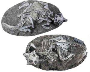
Two perfectly articulated skeletons of the sheep-size dinosaur Psittacosaurus, found in China’s Yixian Formation. New research suggests they died in burrow collapses, not via volcanism, as previously thought. (Jun Liu, Institute of Paleontology and Paleoanthropology, Chinese Academy of Sciences)
Between about 120 million and 130 million years ago, during the age of dinosaurs, temperate forests and lakes hosted a lively ecosystem in what is now northeast China. Diverse fossils from that time remained pretty much undisturbed until the 1980s, when villagers started finding exceptionally preserved creatures, which fetched high prices from collectors and museums. This started a fossil gold rush. Both locals and scientists have now dug so much, their work can be seen from space — perhaps the most extensive paleontological excavations anywhere.
By the 1990s, it was clear that the so-called Yixian Formation contained uniquely well preserved remains of dinosaurs, birds, mammals, insects, frogs, turtles and other creatures. Unlike the skeletal and often fragmentary fossils unearthed in most other places, many animals came complete with internal organs, feathers, scales, fur and stomach contents. It suggested some kind of sudden, unusual preservation process at work. The finds even included a cat-size mammal and a small dinosaur locked in mortal combat, stopped in mid-action when they died. The world’s first known non-avian feathered dinosaurs showed up — some so intact that scientists worked out the feathers’ colors. The discoveries revolutionized paleontology, clarifying the evolution of feathered dinosaurs, and proving without a doubt that modern birds are descended from them.
How did these fossils come to be so perfect? The leading hypothesis up to now has been sudden burial by volcanism, perhaps like the waves of hot ash from Mt. Vesuvius that entombed many citizens of Pompeii in A.D. 79. The Yixian deposits have been popularly dubbed the “Chinese Pompeii.”
A new study says the Pompeii idea is highly appealing — and totally wrong. Instead, the creatures were preserved by more mundane events including collapses of burrows and rainy periods that built up sediments that buried the dead in oxygen-free pockets. Earlier studies have suggested that multiple Pompeii-type events took place in pulses over about a million years. The current study uses newly sophisticated technology to date the fossils to a compact period of less than 93,000 years when nothing particular happened.
The study was just published in the journal Proceedings of the National Academy of Sciences.
“These are probably the most important dinosaur discoveries of the last 120 years,” said study coauthor Paul Olsen, a paleontologist at the Columbia Climate School’s Lamont-Doherty Earth Observatory. “But what was said about their method of preservation highlights an important human bias. That is, to ascribe extraordinary causes, i.e. miracles, to ordinary events when we don’t understand their origins. These [fossils] are just a snapshot of everyday deaths in normal conditions over a relatively brief time.”
The Yixian Formation fossils come in two basic varieties: intact, perfectly articulated 3D skeletons from deposits formed mainly on land, and flattened but highly detailed carcasses found in lake sediments, some containing soft tissues.
To come up with fossil ages, the study’s lead author, Scott MacLennan of South Africa’s University of the Witwatersrand, analyzed tiny grains of the mineral zircon, taken from both surrounding rocks and the fossils themselves. Within these, he measured ratios of radioactive uranium against lead, using a new, extremely precise method called chemical abrasion isotope dilution thermal ionization mass spectroscopy, or CA-ID-TIMS. The fossils and surrounding material consistently dated to 125.8 million years ago, centered around a period of less than 93,000 years, though the exact number is not clear.
Further calculations showed that this timeframe contained three periods controlled by variations in the Earth’s orbit when the weather was relatively wet. This caused sediments to build up in lakes and on land far more rapidly than previously had been thought. Many deceased creatures were quickly buried, and oxygen that normally would fuel decomposition was sealed out. The sealing effect was fastest in lakes, resulting in the preservation of soft tissues.
The researchers rule out volcanism on multiple counts. Some previous studies have suggested that creatures were encased by lahars, fast-moving concrete-like slurries of mud that flow off volcanoes following eruptions. But lahars are extremely violent, said Olsen, and apt to rip apart any living or dead thing they encounter, so this explanation does not work.
Others have said pyroclastic flows — fast-moving waves of searing ash and poisonous gases á la Mt. Vesuvius — were responsible. These struck down residents of Pompeii, then wrapped the bodies in protective layers of material that preserved them as they were at the moment of death. Even when remains decayed, voids in the ashes remained, from which investigators have made lifelike plaster casts. The remains characteristically are curled in so-called pugilistic positions, torturously doubled over and with limbs severely drawn up, as blood boiled and bodies crumpled in the explosive heat. Victims of modern fires exhibit similar poses.
While there are in fact layers of volcanic ash, lava and intrusions of magma in the Yixian Formation, the remains there don’t match those of the unfortunate Pompeiians. For one thing, feathers, fur and everything else would almost certainly have been burned in a pyroclastic flow. For another, the dinosaurs and other animals are not in pugilistic positions; rather, many are found with arms and tails tucked cozily around their bodies, as if they were sleeping, perhaps dreaming dinosaur dreams, when death found them.
The evidence points instead to sudden burrow collapses, say the researchers. Cores of rock surrounding the skeletonized fossils generally consist of coarse grains, but grains immediately around and within the skeletons tend to be much finer. The researchers interpret this to mean that there was enough oxygen around for a while for bacteria or insects to degrade at least the animals’ skin and organs, and as this happened, whatever fine grains were in the surrounding material preferentially seeped in and filled the voids; the more decay-resistant bones remained intact. Even today, burrow collapses are a common cause of death for birds such as penguins, said Olsen. The frozen-in-time mammal-dinosaur battle may well have happened as the mammal invaded the dinosaur’s burrow to try and eat it or its babies, he said.
As to what caused the burrow collapses, this is speculation, he said. One thought: bigger dinosaurs (whose remains don’t appear here but who were almost certainly around) could have squished burrows simply by tromping around. Exceptionally rainy times could have helped destabilize the ground.
Olsen believes the Yixian Formation is not unique. “It’s just that there is no place else where such intense collecting has been done in this kind of environment,” he said. China has tried to limit for-profit fossil sales, but the market is still thriving, and huge government resources are going into development of tourism around the fossil sites.
Olsen’s personal Holy Grail is feathered dinosaurs, but these are exceedingly rare even in the richest deposits, he pointed out. “You have to dig out, say, 100,000 fish to find one feathered dinosaur, and no one is digging on the Yixian scale,” he said. Just in the eastern United States, several places that once had environments similar to the Yixian could yield such fossils, Olsen said. These include a rock quarry straddling the North Carolina-Virginia border where he has found thousands of perfectly preserved insects; sites in Connecticut where small excavations have shown promise; and a former quarry in North Bergen, N.J., now sandwiched between a highway and a strip mall that in the past yielded fabulously preserved fish and reptiles. Systematic excavations of such spots are more or less the size of a bathroom, he said.
“It takes enormous effort, which is expensive. And land is valuable in these areas,” he said. “So no one is doing it. At least not yet.”
The study was coauthored by Sean Kinney and Clara Chang of Lamont-Doherty Earth Observatory, and researchers from the Nanjing Institute of Geology and Paleontology, the Institute of Paleontology and Paleoanthropology at the Chinese Academy of Sciences, and Princeton University.
Reference:
Scott A. MacLennan, Jingeng Sha, Paul E. Olsen, Sean T. Kinney, Clara Chang, Yanan Fang, Jun Liu, Bennett B. Slibeck, Elaine Chen, Blair Schoene. Extremely rapid, yet noncatastrophic, preservation of the flattened-feathered and 3D dinosaurs of the Early Cretaceous of China. Proceedings of the National Academy of Sciences, 2024; 121 (47) DOI: 10.1073/pnas.2322875121
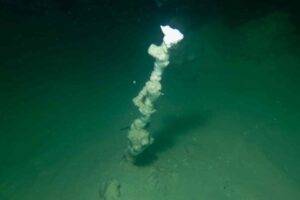
An individual submarine chimney at a depth of roughly 30 m. Photo: UFZ
In an interdisciplinary research project coordinated by the Helmholtz Centre for Environmental Research (UFZ), researchers have discovered meter-high chimneys on the floor of the Dead Sea. These are formed by the spontaneous crystallization of minerals from groundwater with an extremely high salt content flowing up out of the lake floor, they report in journal Science of the Total Environment. Discovered for the first time, these vents are an important early warning indicator for sinkholes. These subsidence craters form in the area surrounding the Dead Sea and pose a significant hazard to the population.
The Dead Sea is a highly dynamic system: Its level has been dropping by roughly one meter per year for more than 50 years, because it is cut off from key tributaries and is losing large quantities of water through evaporation as a result of drought and heat. The surface has thus dropped to roughly 438 meters below sea level. This decline in the lake, which borders Israel, Jordan and the West Bank under Palestinian administration, has significant consequences, especially for the groundwater. The groundwater level is falling, making it increasingly difficult for neighbouring countries to access groundwater resources. For many years, UFZ hydrogeologist Dr. Christian Siebert has been researching how the dynamics of the groundwater system in this region are changing and how aquifers are finding new paths in the rock strata both on land and below the Dead Sea. A team of divers he deployed has now discovered chimney-shaped vents on the lake floor that discharge a shimmering fluid.
“These bear a striking similarity to black smokers in the deep sea, but the system is completely different,” says the UFZ researcher. Scientists from the fields of mineralogy, geochemistry, geology, hydrology, remote sensing, microbiology and isotope chemistry from a total of ten research institutions were involved in investigating and analysing the phenomenon.
While black smokers along the mid-ocean ridge emit hot water containing sulphides at a depth of several thousand metres, the researchers in the Dead Sea discovered that highly saline groundwater flows out through the chimneys at the bottom of the lake. But where is the salt coming from? The explanation: The groundwater from the surrounding aquifers penetrates into the saline lake sediments, leaching out extremely old and thick layers of rock consisting mainly of the mineral halite. It then flows into the lake as brine.
“Because the density of this brine is somewhat lower than that of the water in the Dead Sea, it rises upwards like a jet. It looks like smoke, but it’s a saline fluid,” explains Christian Siebert.
Contact with the lake water causes the dissolved salts, especially the halite, to spontaneously crystallize after emerging from the lake bed, where it forms the vents observed for the first time in the world. These can grow by several centimetres within a single day. Many of the slender chimneys were one to two meters high, but they also include giants more than seven meters high, with a diameter of more than 2-3 meters. Minuscule traces of 36Cl, a radioisotope from space, and the genetic verification of freshwater microbes in the water from the chimneys have shown that the white smokers have their origin in the aquifers in the surrounding area. The salts were thus not absorbed until the last few meters before the water entered the Dead Sea.
These white smokers are especially important because they can serve as an early warning indicator for sinkholes. These are subsidence craters up to 100 meters wide and up to 20 meters deep, thousands of which have formed along the Dead Sea in recent decades. They are formed by karstification of the subsoil, i.e. by the dissolution of massive layers of salt. This forms giant cavities above which the ground can collapse at any time.
“To date, no one can predict where the next sinkholes will occur. They are also life-threatening and pose a threat to agriculture and infrastructure,” says Christian Siebert. The research team was able to show that the chimneys had formed wherever the land surface subsequently collapsed over a large area and the karstification process had apparently been especially efficient.
“This makes the white smokers an outstanding forecasting tool for locating areas that are at risk of collapse in the near future,” he says. Autonomous watercraft equipped with multibeam echosounders or side-scanning sonar systems could be used to map the chimneys to a high degree of precision. “This would be the only method to date, and a highly efficient one, for identifying regions at risk of imminent collapse.”
Reference:
C. Siebert, D. Ionescu, U. Mallast, S. Merchel, B. Merkel, P. Möller, S. Pavetich, T. Pohl, T. Rödiger, Y. Yechieli. A new type of submarine chimneys built of halite. Science of The Total Environment, 2024; 955: 176752 DOI: 10.1016/j.scitotenv.2024.176752
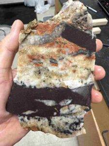
Reddish-brown bands of Tava sandstone cut through other rocks. (Credit: Liam Courtney-Davies)
Geologists have uncovered strong evidence from Colorado that massive glaciers covered Earth down to the equator hundreds of millions of years ago, transforming the planet into an icicle floating in space.
The study, led by the University of Colorado Boulder, is a coup for proponents of a long-standing theory known as Snowball Earth. It posits that from about 720 to 635 million years ago, and for reasons that are still unclear, a runaway chain of events radically altered the planet’s climate. Temperatures plummeted, and ice sheets that may have been several miles thick crept over every inch of Earth’s surface.
“This study presents the first physical evidence that Snowball Earth reached the heart of continents at the equator,” said Liam Courtney-Davies, lead author of the new study and a postdoctoral researcher in the Department of Geological Sciences at CU Boulder.
The team will publish its findings in the Proceedings of the National Academy of Sciences. Co-authors include Rebecca Flowers, professor of geological sciences at CU Boulder, and researchers from Colorado College, the University of California, Santa Barbara and University of California, Berkeley.
The study zeroes in on the Front Range of Colorado’s Rocky Mountains. Here, a series of rocks nicknamed the Tavakaiv, or “Tava,” sandstones hold clues to this frigid period in Earth’s past, Courtney-Davies said.
The researchers used a dating technique called laser ablation mass spectrometry, which zaps minerals with lasers to release some of the atoms inside. They showed that these rocks had been forced underground between about 690 to 660 million years ago — in all likelihood from the weight of huge glaciers pressing down above them.
Courtney-Davies added that the study will help scientists understand a critical phase in not just the planet’s geologic history but also the history of life on Earth. The first multicellular organisms may have emerged in oceans immediately after Snowball Earth thawed.
“You have the climate evolving, and you have life evolving with it. All of these things happened during Snowball Earth upheaval,” he said. “We have to better characterize this entire time period to understand how we and the planet evolved together.”
Searching for snow
The term “Snowball Earth” dates back to a paper published in 1992 by American geologist Joseph Kirschvink.
Despite decades of research, however, scientists are yet to agree whether the entire globe actually froze. Geologists, for example, have discovered the fingerprints of thick ice from this time period along ancient coastal areas, but not within the interior of continents close to the equator.
Which is where Colorado enters the picture. At the time, the region didn’t sit at the northern latitudes where it does today. Instead, Colorado rested over the equator as a landlocked part of the ancient supercontinent Laurentia.
If glaciers formed here, scientists believe, then they could have formed anywhere.
Going deep
The search for that missing piece of the puzzle brought Courtney-Davies and his colleagues to the Tava sandstones. Today, these features poke up from the ground in a few locations along Colorado’s Front Range, most notably around Pikes Peak. To the untrained eye, they might seem like ordinary-looking yellow-brown rocks running in vertical bands less than an inch to many feet wide.
But for geologists, these features have an unusual history. They likely began as sands at the surface of Colorado at some point in the past. But then forces pushed them underground — like claws digging into the Earth’s crust.
“These are classic geological features called injectites that often form below some ice sheets, including in modern-day Antarctica,” Courtney-Davies said.
He wanted to find out if the Tava sandstones were also connected to ice sheets. To do that, the researchers calculated the ages of mineral veins that sliced through those features. They collected tiny samples of the minerals, which are rich in iron oxide (essentially, rust), then hit them with a laser. In the process, the minerals released small quantities of the radioactive element uranium. Because uranium atoms decay into lead at a constant rate, the team could use them as a sort of timekeeper for the planet’s rocks.
It was a Eureka moment: The group’s findings suggest that the Tava sandstone had been pushed underground at the time of Snowball Earth. The group suspects that, at the time, thick ice sheets formed over Colorado, exposing the sands to intense pressures. Eventually, and with nowhere else to go, they pushed down into the bedrock below.
“We’re excited that we had the opportunity to unravel the story of the only Snowball Earth deposits that have so far been identified in Colorado,” Flowers said.
The researchers aren’t done yet: If such features formed in Colorado during Snowball Earth, they probably formed in other spots around North America, too, Courtney-Davies said:
“We want to get the word out so that others try and find these features and help us build a more complete picture of Snowball Earth.”
Reference:
Liam Courtney-Davies, Rebecca M. Flowers, Christine S. Siddoway, Adrian Tasistro-Hart, Francis A. Macdonald. Hematite U-Pb dating of Snowball Earth meltwater events. Proceedings of the National Academy of Sciences, 2024; 121 (47) DOI: 10.1073/pnas.2410759121
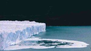
The research findings hint at vast rivers of glacial water rushing like a reverse tsunami from the land into the sea, then pooling on top of extra salty, extra dense ocean water. Photo courtesy of AdobeStock.
At the end of the last global ice age, the deep-frozen Earth reached a built-in limit of climate change and thawed into a slushy planet.
Results from a Virginia Tech-led study provide the first direct geochemical evidence of the slushy planet — otherwise known as the “plumeworld ocean” era — when sky-high carbon dioxide levels forced the frozen Earth into a massive, rapid melting period.
“Our results have important implications for understanding how Earth’s climate and ocean chemistry changed after the extreme conditions of the last global ice age,” said lead author Tian Gan, a former Virginia Tech postdoctoral researcher. Gan worked with geologist Shuhai Xiao on the study, which was released Nov. 5 in the Proceedings of the National Academy of Sciences journal.
Deep-frozen Earth
The last global ice age took place about 635 million to 650 million years ago, when scientists believe global temperatures dropped and the polar ice caps began to creep around the hemispheres. The growing ice reflected more sunlight away from the Earth, setting off a spiral of plunging temperatures.
“A quarter of the ocean was frozen due to extremely low carbon-dioxide levels,” said Xiao, who recently was inducted into the National Academy of Sciences.
When the surface ocean sealed, a chain of reactions stuttered to a stop:
The water cycle locked up. No evaporation and very little rain or snow.
Without water, there was a massive slowdown in a carbon-dioxide consuming process called chemical weathering, where rocks erode and disintegrate.
Without weathering and erosion, carbon dioxide began to amass in the atmosphere and trap heat.
“It was just a matter of time until the carbon-dioxide levels were high enough to break the pattern of ice,” Xiao said. “When it ended, it probably ended catastrophically.”
Plume world
Suddenly, heat started to build. The ice caps began to recede, and Earth’s climate backpedaled furiously toward the drippy and soupy. Over a mere 10 million years, average global temperatures swung from minus 50 to 120 degrees Fahrenheit (minus 45 to 48 degrees Celsius).
But the ice didn’t melt and remix with seawater at the same time. The research findings paint a very different world than what we can imagine: vast rivers of glacial water rushing like a reverse tsunami from the land into the sea, then pooling on top of extra salty, extra dense ocean water.
The researchers tested this version of the prehistoric world by looking at a set of carbonate rocks that formed as the global ice age was ending.
They analyzed a certain geochemical signature, the relative abundance of lithium isotopes, recorded within the carbonate rocks. According to plumeworld ocean theory, the geochemical signatures of freshwater would be stronger in rocks formed under nearshore meltwater than in the rocks formed offshore, beneath the deep, salty sea — and that’s exactly what the researchers observed.
The findings bring the limit of environmental change into better focus, said Xiao, but they also give researchers additional insight into the frontiers of biology and the resiliency of life under extreme conditions — hot, cold, and slushy.
Study collaborators include:
Ben Gill, Virginia Tech associate professor of sedimentary geochemistry
Morrison Nolan, former graduate student, now at Denison University
Collaborators from the Chinese Academy of Sciences, University of Maryland at College Park, University of Munich in Germany, University of North Carolina at Chapel Hill, and University of Nevada at Las Vegas
Reference:
Tian Gan, Meng Tian, Xi-Kai Wang, Shijie Wang, Xiao-Ming Liu, Ganqing Jiang, Benjamin C. Gill, Morrison Nolan, Alan J. Kaufman, Taiyi Luo, Shuhai Xiao. Lithium isotope evidence for a plumeworld ocean in the aftermath of the Marinoan snowball Earth. Proceedings of the National Academy of Sciences, 2024; 121 (46) DOI: 10.1073/pnas.2407419121
Note: The above post is reprinted from materials provided by Virginia Tech. Original written by Kelly Izlar.
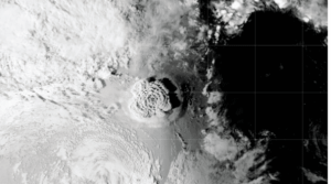
The origins of the massive January 2022 Hunga Tonga-Hunga Ha’apai volcanic eruption may have been detected in a seismic wave recorded 750 kilometers from the volcano, according to new research in Geophysical Research Letters. Credit: NASA
Fifteen minutes before the massive January 2022 eruption of the Hunga Tonga-Hunga Ha’apai volcano, a seismic wave was recorded by two distant seismic stations. Now, researchers argue that similar early signals could be used to warn of other impending eruptions in remote oceanic volcanoes.
The researchers propose that the seismic wave was caused by a fracture in a weak area of oceanic crust beneath the volcano’s caldera wall. That fracture allowed seawater and magma to pour into and mix together in the space above the volcano’s subsurface magma chamber, explosively kickstarting the eruption.
The research was published in Geophysical Research Letters, an open-access AGU journal that publishes high-impact, short-format reports with immediate implications spanning all Earth and space sciences.
The results build on the researchers’ previous work monitoring remote volcanoes. In this case, the Rayleigh wave, a type of seismic wave that moves through the Earth’s surface, was detected 750 kilometers (approximately 466 miles) from the volcano.
“Early warnings are very important for disaster mitigation,” said Mie Ichihara, a volcanologist at the University of Tokyo and one of the study’s coauthors. “Island volcanoes can generate tsunamis, which are a significant hazard.”
Silent precursor to a violent eruption
Hunga Tonga-Hunga Ha’apai is an oceanic volcano in the western Pacific Ocean in the Kingdom of Tonga. The seamount was created by the subduction of the Pacific Plate underneath the Australian Plate, a process that generates magma and leads to eruptions.
On January 15, 2022, the volcano erupted with record-breaking energy, injecting 58,000 Olympic swimming pools of water vapor into the stratosphere, setting off an unprecedented lightning storm and generating a tsunami. That massive eruption was preceded by a smaller eruption on January 14 and, before that, a month of eruptive activity.
Researchers still debate the exact start time of the eruption, though most agree that the eruption started shortly after 4:00 Coordinated Universal Time (UTC). The new study reports a Rayleigh wave that started around 3:45 UTC.
The researchers used seismic data to analyze the Rayleigh wave, which was detected by instruments, but not felt by humans, at seismic stations on the islands of Fiji and Futuna. While Rayleigh waves are a common feature of volcanic eruptions and earthquakes, the researchers believe that this wave signified a precursor event and possible cause of the massive eruption.
“Many eruptions are preceded by seismic activity,” said Takuro Horiuchi, a volcanology graduate student at the University of Tokyo and the lead author of the study. “However, such seismic signals are subtle and only detected within several kilometers of the volcano.”
In contrast, this seismic signal traveled a great distance, indicating a huge seismic event. “We believe unusually large movements started at the time of the precursor,” Horiuchi said.
Secrets of the seamount
Scientists may never know exactly what caused the gigantic, “caldera-forming” eruption, but Ichihara believes that the process was not instantaneous. Instead, she thinks that this precursor event was the start of an underground process that ultimately led to the eruption.
But it can be difficult to nail down the origins of these rare, colossal eruptions.
“There are very few observed caldera-forming eruptions, and there are even fewer witnessed caldera-forming eruptions in the ocean,” Ichihara said. “This gives one scenario about the processes leading to caldera formation, but I wouldn’t say that this is the only scenario.”
Regardless, detecting early eruption signals may give island nations and coastal areas more valuable time to prepare when faced with imminent tsunamis — even when the signal cannot be felt on the surface.
“At the time of the eruption, we didn’t think of using this kind of analysis in real-time,” Ichihara said. “But maybe the next time that there is a significant eruption underwater, local observatories can recognize it from their data.”
Reference:
Takuro Horiuchi, Mie Ichihara, Kiwamu Nishida, Takayuki Kaneko. A Seismic Precursor 15 min Before the Giant Eruption of Hunga Tonga‐Hunga Ha’apai Volcano on 15 January 2022. Geophysical Research Letters, 2024; 51 (21) DOI: 10.1029/2024GL111144
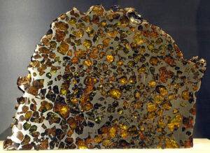
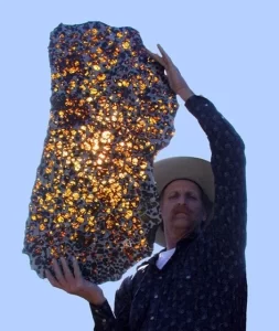
An example of a Pallasite meteorite (from the Esquel fall) on display in the Vale Inco Limited Gallery of Minerals at the Royal Ontario Museum. Credit: Captmondo
What’s Inside Meteorites? Exploring the Cosmic Composition
Meteorites are cosmic messengers, carrying clues about the formation of the solar system, planetary processes, and even the origins of life. These extraterrestrial fragments, which survive their fiery journey through Earth’s atmosphere, are scientifically invaluable due to their pristine preservation of ancient material. This article delves into the fascinating world of meteorites, revealing their compositions, structures, and the insights they provide into the cosmos.
Introduction to Meteorites
Meteorites are pieces of debris from celestial bodies like asteroids, comets, or planets that survive the descent through Earth’s atmosphere and land on its surface. They are classified into three primary categories based on their composition:
Stony Meteorites (Chondrites and Achondrites): These are the most common, making up about 94% of all known meteorites.
Iron Meteorites: Composed predominantly of iron and nickel alloys, they originate from the cores of differentiated planetary bodies.
Stony-Iron Meteorites: A rare blend of metal and silicate minerals, these meteorites offer a glimpse into the interface between core and mantle regions of planetesimals.
How Are Meteorites Formed?
Meteorites are fragments of larger celestial bodies ejected by high-energy collisions in space. These collisions may involve asteroids, comets, or proto-planetary bodies. Over millions of years, these fragments travel through space until gravitational interactions or orbital alignments direct them toward Earth.
Connection with Asteroids and Comets:
Asteroids: Many meteorites originate from asteroid belt objects, offering insights into primordial materials.
Comets: Cometary meteorites are rarer but provide information about volatile-rich regions of the solar system.
Types of Meteorites and Their Composition
Meteorites vary significantly in their composition and origin:
Chondrites:
These stony meteorites contain small, spherical particles known as chondrules, formed from molten droplets in the early solar nebula. They also include calcium-aluminum-rich inclusions (CAIs), which are among the oldest materials in the solar system.
Achondrites:
Unlike chondrites, these meteorites lack chondrules. They originate from differentiated parent bodies where melting and crystallization occurred.
Iron Meteorites:
Composed mainly of iron and nickel, they often display a unique Widmanstätten pattern, a crystalline structure visible upon etching.
Stony-Iron Meteorites:
These rare meteorites are a mix of metallic iron-nickel and silicate minerals, representing core-mantle boundaries of disrupted planetesimals.
Elemental and Mineralogical Composition
Meteorites contain a wide range of elements, including common terrestrial ones like silicon, oxygen, and iron, as well as rarer elements such as iridium, which is linked to the extinction event that ended the Cretaceous period.
Key Elements:
Iron and Nickel: Dominant in iron meteorites.
Magnesium and Silicon: Abundant in stony meteorites.
Iridium and Platinum: Found in trace amounts, these are significant in studying asteroid impacts.
Organic Compounds in Meteorites
Meteorites often harbor organic compounds, making them crucial for astrobiology. For instance, the Murchison meteorite contains amino acids, the building blocks of life. Complex molecules like PAHs (Polycyclic Aromatic Hydrocarbons) suggest that prebiotic chemistry might be widespread in the cosmos.
Isotopic Signatures and What They Reveal
Meteorites contain isotopic signatures that provide a timeline for the solar system. Radiometric dating techniques, such as uranium-lead or argon-argon dating, help determine the age of these space rocks, often placing them at over 4.5 billion years old.
Microscopic Structures in Meteorites
Advanced imaging techniques have uncovered intricate microscopic structures in meteorites:
Chondrules: Glassy spheres within chondrites.
CAIs: High-temperature inclusions.
Nanodiamonds: Microscopic diamonds formed under intense pressure.
FAQs
What is the most common type of meteorite?
Chondrites are the most common type, accounting for 85–90% of meteorite finds.
What elements are unique to meteorites?
Rare elements like iridium and platinum are often found in meteorites and are less common on Earth.
Can meteorites contain water?
Yes, some meteorites, particularly carbonaceous chondrites, contain hydrated minerals.
How are meteorites analyzed?
Techniques include spectroscopy, electron microscopy, and isotope ratio mass spectrometry.
What can meteorites tell us about asteroids?
Meteorites provide direct samples from asteroids, revealing their composition and history.
Are meteorites linked to the origins of life?
Yes, they contain organic molecules like amino acids, which are essential for life.
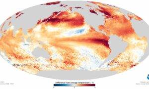
The August 2023 El Nino, as mapped from space. The huge mass of warm water against the coast of Ecuador and Peru exerts global influence on weather patterns. (Image: NOAA)
The El Niño event, a huge blob of warm ocean water in the tropical Pacific Ocean that can change rainfall patterns around the globe, isn’t just a modern phenomenon.
A new modeling study from a pair of Duke University researchers and their colleagues shows that the oscillation between El Niño and its cold counterpart, La Niña, was present at least 250 million years in the past, and was often of greater magnitude than the oscillations we see today.
These temperature swings were more intense in the past, and the oscillation occurred even when the continents were in different places than they are now, according to the study, which appears the week of Oct. 21 in the Proceedings of the National Academy of Sciences.
“In each experiment, we see active El Niño Southern Oscillation, and it’s almost all stronger than what we have now, some way stronger, some slightly stronger,” said Shineng Hu, an assistant professor of climate dynamics in Duke University’s Nicholas School of the Environment.
Climate scientists study El Niño, a giant patch of unusually warm water on either side of the equator in the eastern Pacific Ocean, because it can alter the jet stream, drying out the U.S. northwest while soaking the southwest with unusual rains. Its counterpart, the cool blob La Niña, can push the jet stream north, drying out the southwestern U.S., while also causing drought in East Africa and making the monsoon season of South Asia more intense.
The researchers used the same climate modeling tool used by the Intergovernmental Panel on Climate Change (IPCC) to try to project climate change into the future, except they ran it backwards to see the deep past.
The simulation is so computationally intense that the researchers couldn’t model each year continuously from 250 million years ago. Instead they did 10-million-year ‘slices’ — 26 of them.
“The model experiments were influenced by different boundary conditions, like different land-sea distribution (with the continents in different places), different solar radiation, different CO2,” Hu said. Each simulation ran for thousands of model years for robust results and took months to complete.
“At times in the past, the solar radiation reaching Earth was about 2% lower than it is today, but the planet-warming CO2 was much more abundant, making the atmosphere and oceans way warmer than present, Hu said.” In the Mezozoic period, 250 million years ago, South America was the middle part of the supercontinent Pangea, and the oscillation occurred in the Panthalassic Ocean to its west.
The study shows that the two most important variables in the magnitude of the oscillation historically appear to be the thermal structure of the ocean and “atmospheric noise” of ocean surface winds.
Previous studies have focused on ocean temperatures mostly, but paid less attention to the surface winds that seem so important in this study, Hu said. “So part of the point of our study is that, besides ocean thermal structure, we need to pay attention to atmospheric noise as well and to understand how those winds are going to change.”
Hu likens the oscillation to a pendulum. “Atmospheric noise — the winds — can act just like a random kick to this pendulum,” Hu said. “We found both factors to be important when we want to understand why the El Niño was way stronger than what we have now.”
“If we want to have a more reliable future projection, we need to understand past climates first,” Hu said.
This work was supported by the National Natural Science Foundation of China (42488201) and the Swedish Research Council Vetenskapsrådet (2022-03617). Simulations were conducted at the High-performance Computing Platform of Peking University.
Reference:
Xiang Li, Shineng Hu, Yongyun Hu, Wenju Cai, Yishuai Jin, Zhengyao Lu, Jiaqi Guo, Jiawenjing Lan, Qifan Lin, Shuai Yuan, Jian Zhang, Qiang Wei, Yonggang Liu, Jun Yang, Ji Nie. Persistently active El Niño–Southern Oscillation since the Mesozoic. Proceedings of the National Academy of Sciences, 2024; 121 (45) DOI: 10.1073/pnas.2404758121
Note: The above post is reprinted from materials provided by Duke University. Original written by Karl Leif Bates
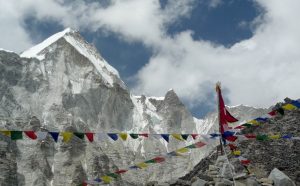
Mount Everest officially stands at 8,848 metres (29,029 feet) above sea level
Billions of years ago, long before anything resembling life as we know it existed, meteorites frequently pummeled the planet. One such space rock crashed down about 3.26 billion years ago, and even today, it’s revealing secrets about Earth’s past.
Nadja Drabon, an early-Earth geologist and assistant professor in the Department of Earth and Planetary Sciences, is insatiably curious about what our planet was like during ancient eons rife with meteoritic bombardment, when only single-celled bacteria and archaea reigned — and when it all started to change. When did the first oceans appear? What about continents? Plate tectonics? How did all those violent impacts affect the evolution of life?
A new study in Proceedings of the National Academy of Sciences sheds light on some of these questions, in relation to the inauspiciously named “S2” meteoritic impact of over 3 billion years ago, and for which geological evidence is found in the Barberton Greenstone belt of South Africa today. Through the painstaking work of collecting and examining rock samples centimeters apart and analyzing the sedimentology, geochemistry, and carbon isotope compositions they leave behind, Drabon’s team paints the most compelling picture to date of what happened the day a meteorite the size of four Mount Everests paid Earth a visit.
“Picture yourself standing off the coast of Cape Cod, in a shelf of shallow water. It’s a low-energy environment, without strong currents. Then all of a sudden, you have a giant tsunami, sweeping by and ripping up the sea floor,” said Drabon.
The S2 meteorite, estimated to have been up to 200 times larger than the one that killed the dinosaurs, triggered a tsunami that mixed up the ocean and flushed debris from the land into coastal areas. Heat from the impact caused the topmost layer of the ocean to boil off, while also heating the atmosphere. A thick cloud of dust blanketed everything, shutting down any photosynthetic activity taking place.
But bacteria are hardy, and following impact, according to the team’s analysis, bacterial life bounced back quickly. With this came sharp spikes in populations of unicellular organisms that feed off the elements phosphorus and iron. Iron was likely stirred up from the deep ocean into shallow waters by the aforementioned tsunami, and phosphorus was delivered to Earth by the meteorite itself and from an increase of weathering and erosion on land.
Drabon’s analysis shows that iron-metabolizing bacteria would thus have flourished in the immediate aftermath of the impact. This shift toward iron-favoring bacteria, however short-lived, is a key puzzle piece depicting early life on Earth. According to Drabon’s study, meteorite impact events — while reputed to kill everything in their wake (including, 66 million years ago, the dinosaurs) — carried a silver lining for life.
“We think of impact events as being disastrous for life,” Drabon said. “But what this study is highlighting is that these impacts would have had benefits to life, especially early on … these impacts might have actually allowed life to flourish.”
These results are drawn from the backbreaking work of geologists like Drabon and her students, hiking into mountain passes that contain the sedimentary evidence of early sprays of rock that embedded themselves into the ground and became preserved over time in the Earth’s crust. Chemical signatures hidden in thin layers rock help Drabon and her students piece together evidence of tsunamis and other cataclysmic events.
The Barberton Greenstone Belt in South Africa, where Drabon concentrates most of her current work, contains evidence of at least eight impact events including the S2. She and her team plan to study the area further to probe even deeper into Earth and its meteorite-enabled history.
Reference:
Nadja Drabon, Andrew H. Knoll, Donald R. Lowe, Stefano M. Bernasconi, Alec R. Brenner, David A. Mucciarone. Effect of a giant meteorite impact on Paleoarchean surface environments and life. Proceedings of the National Academy of Sciences, 2024; 121 (44) DOI: 10.1073/pnas.2408721121
Note: The above post is reprinted from materials provided by Harvard University. Original written by Anne J. Manning.
Reconstruction of an avisaurid (e.g., A. darwini). Morphology of the tarsometatarsus suggests that these large birds engaged in raptorial behavior and could carry proportionally large prey. Illustration done by Ville Sinkkonen. Credit Clark et al., 2024, PLOS ONE, CC-BY 4.0 (https://creativecommons.org/licenses/by/4.0/)
Newly discovered birds from Late Cretaceous North America were hawk-sized and had powerful raptor-like feet, according to a study published October 9, 2024 in the open-access journal PLOS ONE by Alexander Clark of the University of Chicago, U.S. and colleagues.
The most diverse birds during the Cretaceous Period were a now-extinct group called enantiornithines, known from all over the world during this time.
However, enantiornithines and other Mesozoic birds are mainly known from Lower Cretaceous deposits, with a relatively poor record from the Late Cretaceous.
Thus, there is a general lack of understanding of trends in bird evolution toward the end of the Mesozoic Era.
In this study, Clark and colleagues describe three new enantiornithine birds from fossils found in the Hell Creek Formation of Montana, dating to the latest Cretaceous Period (68 — 66 million years ago, shortly before the mass extinction that wiped out non-avian dinosaurs and enantiornithines). All three fossil birds are identified from lower leg bones.
Two are new species named Magnusavis ekalakaensis and Avisaurus darwini, while the third is an unnamed species of Avisaurus.
These birds are all larger than Early Cretaceous enantiornithines, with Avisaurus darwini estimated to have weighed over one kilogram, roughly the size of a large hawk.
Analysis of the leg bones of Avisaurus and its relatives reveals proportions and adaptations similar to hawks and owls, indicating powerful leg muscles and feet that could grip and potentially carry proportionally large prey, similar to some modern raptorial birds.
These fossils expand the known diversity of Late Cretaceous birds, confirm the trend toward large body size, and highlight how, over time, enantiornithines evolved a greater diversity of ecological roles.
This study emphasizes how even fragmentary fossils can reveal important ecological information and be used to clarify evolutionary trends.
The authors add: “Avisaurids, a group of enantiornithine birds from the latest Cretaceous, exhibit hindlimb features indicating strong ankle flexion, which suggests the ability to carry heavy prey and behaviors similar to living raptorial birds.”
Reference:
Alexander D. Clark, Jessie Atterholt, John B. Scannella, Nathan Carroll, Jingmai K. O’Connor. New enantiornithine diversity in the Hell Creek Formation and the functional morphology of the avisaurid tarsometatarsus. PLOS ONE, 2024; 19 (10): e0310686 DOI: 10.1371/journal.pone.0310686
Note: The above post is reprinted from materials provided by PLOS.
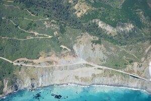
Paul’s Slide, at Post Mile 22, has been active for much of the history of Highway 1 on the Big Sur coast. (Photos by Kevin Schmidt/USGS)
Along coastal California, the possibility of earthquakes and landslides are commonly prefaced by the phrase, “not if, but when.” This precarious reality is now a bit more predictable thanks to researchers at UC Santa Cruz and The University of Texas at Austin, who found that conditions known to cause slip along fault lines deep underground also lead to landslides above.
The new study, led by UC Santa Cruz geologist Noah Finnegan, used detailed data from two landslide sites in Northern California that researchers have identified and closely monitored for years. Finnegan and his co-author then applied a model originally developed to explain slow fault slip and eventually landed on a striking result: The model worked just as well for landslides as it did for faults.
The finding is an important breakthrough suggesting that a model designed for faults can also be used to predict landslide behavior. And in California, where slow-moving slides are constant and cost hundreds of millions of dollars annually, this represents a major step forward in the ability to predict landslide movements — particularly in response to environmental factors like changes in groundwater levels.
According to Finnegan, landslides are essentially a “plumbing problem.” When rain saturates the ground, water pressure within rocks increases, and the friction that would otherwise work against slipping decreases, he explained.
“At a practical level, this study provides us with a framework for understanding how much motion to expect based on a change in rainfall, which leads to a change in water pressure in the ground that then translates into motion,” said Finnegan, a professor of earth and planetary sciences. “We have very few tools for thinking predictively, and this is an incremental step in that direction. It doesn’t solve the bigger problem, but it’s at least something that we can use now.”
In the world of earthquakes, especially in regions like California, one of the primary challenges is understanding the different behaviors of fault lines. Some faults are “locked” and only fail periodically, leading to large earthquakes. Others are constantly slipping, moving at a steady rate. Seismologists have spent decades trying to unravel why certain faults behave differently in order to better predict seismic activity and earthquake hazards.
Over the last two decades, researchers have begun to recognize that faults exhibit a wide range of slip behaviors. Some of these behaviors don’t produce noticeable earthquakes, but still influence fault mechanics. These quiet, “silent” slip events change the hazard landscape and present a puzzle because they are difficult to observe and understand.
Similarities between slides and quakes
Much like faults, landslides also behave differently. Some fail catastrophically, causing fatalities and widespread damage, while others creep slowly, causing chronic and cumulative infrastructure issues. A current example is the landslide in Rancho Palos Verdes, a city in northern L.A. County. There, the Portuguese Bend Landslide Complex has seen increased slippage over the last two years, resulting in utilities like gas and power being cut off to hundreds of homes due to safety concerns. Even though it’s a slow-moving landslide, the impact was still serious enough for Gov. Gavin Newsom to issue an emergency declaration.
“A fundamental question in landscape-hazards science is what controls the style of behavior. Why do some landslides creep and others fail rapidly and in a way that is much more destructive and hazardous?” said co-author Demian Saffer, director of the University of Texas Institute for Geophysics and a professor at UT Jackson School of Geosciences. “Landslide motion is analogous in many ways to tectonic faulting. If we can understand why some systems slip slowly and others fail catastrophically, it provides a window into the physics that control this style of behavior.”
Similar to the uncertainties in earthquake science, we have limited understanding of what controls the behavior of landslides — why some move slowly and steadily, while others fail suddenly. In earthquake science, friction’s effects are more clearly understood, particularly how friction changes as materials in the ground move. Scientists often distinguish between “static friction,” which keeps things at rest, and “dynamic friction,” which occurs when things are in motion. The challenge is that friction behaves differently under different conditions, and these changes are key to understanding how both earthquakes and landslides unfold.
For landslides, the study of friction is still in its early stages, but this paper presents a significant advance. The team found that friction affects faults and landslides in a similar fashion by using measurements of stress from instrumentation at the landslide sites, and tracking how fast they moved. They then compared this field data with friction experiments conducted in the lab. Specifically, they looked at how friction within the landslides changed with movement. The measurements from the field were found to align with the lab experiments, providing a consistent picture of how friction influences landslide motion.
Finnegan points to California’s iconic Highway 1 as a prime example of how insights from this study can have a positive, practical impact. “Caltrans is engaged in this constant battle to keep it open,” he said. “The benefit of this model lies in its ability to assist operational decisions on a more informed basis. It doesn’t just isolate data points but contextualizes them, enabling authorities to predict how changes in factors like rainfall can influence ground movement.”
Importance of material properties
A key part of the research focused on different types of rock and how their behavior under stress varies. For instance, clay-rich rocks tend to creep slowly and stably, while quartz-rich rocks are more likely to experience a sudden drop in friction when they start to slide, leading to catastrophic failure. This understanding could eventually allow scientists to predict how a landslide will behave based on the types of rock present in an area.
The researchers used field observations from two sites in Northern California. One is located just east of Fremont, which Finnegan first identified and has monitored for eight years. The other is in Humboldt County, far to the north, where observations were made by different scientists in the eighties. Both sites lie within the “Franciscan Melange,” a rock formation that is prone to slow-moving landslides. This formation is the remnant of an ancient subduction zone, where one tectonic plate slid beneath another, similar to what is happening today in the Cascadia region of Northern California.
According to Saffer, a key insight came when they connected field observations at the two sites with the kinds of data generated in rock-deformation experiments in the lab. They found that by thinking of the landslide itself as a large-scale “experiment,” the slides’ motion encoded clues about the material’s physics.
“It’s basically a giant rheology (rock deformation) experiment,” he said. “And it suggests that if we were to sample rocks in a region and take the reverse approach — by making detailed measurements of the rheology in the laboratory — we could in theory identify places where catastrophic rapid landslides are more likely and places where we expect the land to creep. That’s where we want to take this work next.”
Unlocking tectonic insights
One of the more abstract, but equally important, implications of this study is its relevance to plate tectonics and subduction zones. The rocks involved in the landslides being studied at one point existed at the interface of an ancient subduction zone, a setting that is notorious for producing devastating magnitude-9 earthquakes. These earthquakes are among the most destructive natural disasters on Earth.
Studying slow landslides in these types of rocks could offer valuable insights into the mechanics of slip processes in subduction zones. Due to the difficulty of taking direct measurements in these deep underwater fault environments, landslide research could illuminate how these plate interfaces behave under various conditions. In particular, understanding slip behavior in the fault zones at the seafloor could enhance predictions related to earthquake-triggered tsunamis, helping experts understand how and when these critical seismic events might occur.
“Apart from the practical value of this work, it’s also an example of how crossing disciplinary boundaries provides news insights on old problems,” Finnegan said. “In this case, we show how landslides — where it is relatively easy to make measurements — can provide a window into processes acting deep within faults, where measurements are nearly impossible but physical constraints are crucial for understanding hazards.”
Reference:
Noah J. Finnegan, Demian M. Saffer. Seasonal slow slip in landslides as a window into the frictional rheology of creeping shear zones. Science Advances, 2024; 10 (42) DOI: 10.1126/sciadv.adq9399
The Pinnacles are limestone formations within Nambung National Park, near the town of Cervantes, Western Australia.
Small iron-rich formations found within Western Australia’s Pinnacles, which are part of the world’s largest wind-blown limestone belt spanning more than 1000km, have provided new insights into Earth’s ancient climate and changing landscape.
The new research found the pinnacles were formed about 100,000 years ago during what was the wettest period in the past half-million years for the area, and very different from the Mediterranean climate Western Australia experiences today.
Lead author Dr Matej Lipar, Adjunct Research Fellow in Curtin’s School of Earth and Planetary Sciences, now at the Research Centre of the Slovenian Academy of Sciences and Arts (ZRC SAZU), said the spectacular finger-like stone pinnacles at Nambung National Park are a type of karst created by water dissolving rocks.
“These formations offer crucial insights into ancient climates and environments, but accurately dating them has been extremely challenging until now,” Dr Lipar said.
“Karst landscapes, like those in Nambung National Park, are found globally and serve as sensitive indicators of environmental change. Studying them within an accurate timeline helps us understand how Earth’s geological systems respond to climate shifts.
“We found tyhis period was locally the wettest in the past half-million years, distinct from other regions in Australia and far removed from Western Australia’s current Mediterranean climate.
“An abundance of water during this time caused the limestone to dissolve, forming the distinctive pillars of the Pinnacles and creating the ideal environment for the iron nodules to develop.”
Curtin co-author Associate Professor Martin Danišík, from the John de Laeter Centre, said the iron-rich nodules acted as geological clocks, trapping helium from the consistent radioactive decay of tiny quantities of naturally occurring uranium and thorium.
“Measuring this helium provides a precise record of when the nodules formed,” Dr Danišík said.
“The innovative dating techniques developed in this study reveal the nodules date back about one hundred thousand years, highlighting an exceptionally wet climate period.”
Study co-author Associate Professor Milo Barham, from Curtin’s Timescales of Mineral Systems Group in the School of Earth and Planetary Sciences, said being able to reconstruct past climate changes was important given the context it provides to understanding human evolution and ecosystems more broadly amid dramatic climate fluctuations over the past three million years.
“This new knowledge will enhance our understanding of global environments and ecosystems, helping us prepare for, and mitigate the impacts of, a warming planet,” Dr Barham said.
“This research not only advances scientific knowledge but also offers practical insights into climate history and environmental change, relevant to anyone concerned about our planet’s present and future.”
An international collaboration with ZRC SAZU, the research project was supported by the Slovenian Research and Innovation Agency.
Reference:
Matej Lipar, Milo Barham, Martin Danišík, Andrej Šmuc, John A. Webb, Kenneth J. McNamara, Aleš Šoster, Mateja Ferk. Ironing out complexities in karst chronology: (U-Th)/He ferricrete ages reveal wet MIS 5c. Science Advances, 2024; 10 (40) DOI: 10.1126/sciadv.adp0414
Note: The above post is reprinted from materials provided by Curtin University. Original written by Lucien Wilkinson.
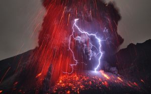
Sakurajima Volcano with Lightning Credit & Copyright: Martin Rietze (Alien Landscapes on Planet Earth)
The Hunga Tonga underwater volcano was one of the largest volcanic eruptions in history, and now, two years later, new research from The Australian National University (ANU) has revealed its main trigger.
Until now, the cause of the cataclysmic event has remained largely a mystery to the scientific community, yet a student-led team of ANU seismologists has been able to shed new light on the natural explosion that initiated the event.
The student researchers analysed the climactic event’s noisy but valuable seismic records to decipher its mysterious physical mechanism.
“Our findings confirm there was an explosion, possibly due to a gas-compressed rock, which released energy that equated to five of the largest underground nuclear explosions conducted by North Korea in 2017,” study co-author and ANU PhD student, Jinyin Hu, said.
“Our model suggests the event resulted from the gas-compressed rock being trapped underneath a shallow sea, like an overcooked pressure cooker.
“This would be surprising to many because it had been commonly thought that the interaction of hot magma with cold seawater caused such massive underwater volcanic eruptions.
“We used a technique previously developed to study underground explosions for this natural explosion.”
Study co-author, Dr Thanh-Son Pham, said the explosion caused a massive vertical push of water upwards into the atmosphere, causing tsunamis that reached as high as 45 metres at nearby islands.
“The water volume that was uplifted during the event was huge. Based on our estimates, there was enough water to fill about one million standard Olympic-sized swimming pools,” Dr Phạm said.
Study co-author, Professor Hrvoje Tkalčić, from ANU, added: “Using seismic waveform modelling, we observed a significant vertical force pointing upward during the event. At first, we were confused by it. But then we realised that the solid earth rebounded upwards after the water column got uplifted,” he said.
“A couple of weeks ago, we saw how seismology was used to explain an extraordinary sequence of events in Greenland that included a landslide due to glacial melting, a tsunami, and a seiche lasting for nine days observed globally.
“With Hunga Tonga, we have a relatively short-duration explosive event observed globally and, again, academically driven curiosity and forensic seismology at its best.”
According to the ANU seismologists, the Tonga eruption is the best instrumentally recorded event compared to events of similar sizes in the recent past.
“This is one of the largest events in our lifetime. Luckily, we had multiple ways to record the event, from data from satellite images to seismic sensors that record the sound waves and structure,” Mr Hu said.
“There was another event that happened in 1991 that was a similar size in Pinatubo in the Philippines, but back then, monitoring systems weren’t as sophisticated as they are now.”
The ANU seismologists believe that monitoring the release of gases and micro-seismicity from volcanic sites can help better prepare for future events.
Reference:
Jinyin Hu, Thanh‐Son Phạm, Hrvoje Tkalčić. A Composite Seismic Source Model for the First Major Event During the 2022 Hunga (Tonga) Volcanic Eruption. Geophysical Research Letters, 2024; 51 (18) DOI: 10.1029/2024GL109442
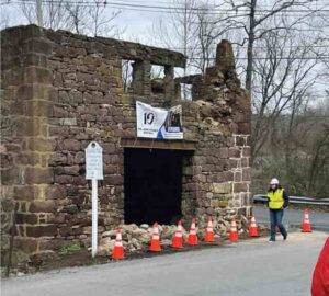
Photo of Taylor’s Mill in Readington Township, New Jersey after the 5 April 2024 earthquake. | GEER-NIST
The magnitude 4.8 Tewksbury earthquake surprised millions of people on the U.S. East Coast who felt the shaking from this largest instrumentally recorded earthquake in New Jersey since 1900.
But researchers noted something else unusual about the earthquake: why did so many people 40 miles away in New York City report strong shaking, while damage near the earthquake’s epicenter appeared minimal?
In a paper published in The Seismic Record, YoungHee Kim of Seoul National University and colleagues show how the earthquake’s rupture direction may have affected who felt the strongest shaking on 5 April.
Kim and her colleague and co-author Won-Young Kim of Lamont-Doherty Earth Observatory of Columbia University became curious about the strange pattern of shaking after visiting the epicenter area of the earthquake just eight hours after the mainshock.
“We expected some property damages — chimneys knocked down, walls cracked or plasters fallen to the ground — but there were no obvious signs of property damages,” the researchers said in an email. “Police officers within a couple of kilometers from the reported epicenter calmly talked about the shaking from the mainshock. It was a surprising response by the people and houses for a magnitude 4.8 earthquake in the region.”
“This contrasted with the wide and huge response from the residents in and around the New York City area, some 65 kilometers from the epicenter,” they added.
The earthquake garnered more than 180,000 felt reports — the largest number ever for a single earthquake received by the U.S. Geological Survey’s “Did You Feel It?” app and website, according to a second paper published in The Seismic Record by USGS seismologist Oliver Boyd and colleagues.
Boyd and colleagues said the earthquake was felt by an estimated 42 million people between Virginia and Maine.
The reports from people southwest of the epicenter, toward Washington, D.C., indicated “weak” shaking on the scale that the USGS uses to measure an earthquake’s intensity, while people reporting from northeast of the epicenter felt “light to moderate” shaking.
Based on previous models of magnitude and earthquake intensity developed for the eastern U.S., however, a magnitude 4.8 earthquake should produce very strong shaking within about 10 kilometers or about six miles from its epicenter.
With this pattern in mind, Kim and colleagues wanted to look closer at the directivity of the earthquake’s rupture. To model the rupture, they turned to a kind of seismic wave called Lg waves, due to the lack of nearby seismic observation at the time of the mainshock. Lg waves are shear waves that bounce back and forth within the crust between the Earth’s surface and the boundary between the crust and mantle.
The resulting model indicated the earthquake rupture had propagated toward the east-northeast and down on an east-dipping fault plane. The direction of the rupture might have funneled the earthquake’s shaking away from its epicenter and toward the northeast, the researchers concluded.
In general, earthquakes in the northeastern U.S. take place as thrust faulting along north-south trending faults. The New Jersey earthquake is unusual, Kim and colleagues noted, because it appears to have been a combination of a thrust and strike-slip mechanism along a possible north-northeast trending fault plane.
“Earthquakes in the eastern North America usually occur along the pre-existing zone of weakness — that is, existing faults,” the researchers explained. “In the Tewksbury area, a hidden fault plane trending north-northeast and dipping moderately can be mapped from the numerous small aftershocks detected and located” after the Tewksbury mainshock.
Boyd and colleagues noted that some damage was documented by a reconnaissance team deployed by the Geotechnical Extreme Events Reconnaissance Association and the National Institute of Standards and Technology. Along with cracks in drywall and objects falling from shelves, the team documented the partial collapse of the stone façade of Taylor’s Mill, a pre-Revolutionary War structure near the town of Lebanon, New Jersey.
The researchers have not yet attributed the earthquake to a particular fault but the locations of the mainshock and aftershocks suggest that the area’s well-known Ramapo fault system was not active during the earthquake.
The findings could “help us identify new earthquake sources and rethink how stress and strain are being accommodated in the eastern United States,” Boyd said.
He noted that some seismometers that were rapidly deployed to the region by the USGS will remain in place for at least five months.
“This can help us study, for example, mechanisms related to how the crust responds to the stress of a mainshock in the region, and how productive aftershock sequences can be in the eastern United States,” Boyd explained.
“Good station coverage can also allow us to observe how earthquake ground motions vary across the region as a function of magnitude, epicentral distance, and Earth structure. And each of these examples can help us better appreciate potential seismic hazards.”
Reference:
Sangwoo Han, Won-Young Kim, Jun Yong Park, Min-Seong Seo, YoungHee Kim. Rupture Model of the 5 April 2024 Tewksbury, New Jersey, Earthquake Based on Regional Lg-Wave Data. The Seismic Record, 2024; 4 (3): 214 DOI: 10.1785/0320240020
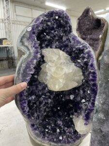
Amethyst-calcite geode from Los Catalanes already processed in the workshop and ready to sell. Photo: Fiorella Arduin Rode
Amethyst is a violet variety of quartz which has been used as a gemstone for many centuries and is a key economic resource in northern Uruguay. Geodes are hollow rock formations often with quartz crystals, such as amethyst, inside. Amethyst geodes in Uruguay have been found in cooled lava flows, which date from the original breakup of the supercontinent Gondwana around 134 million years ago. However, their formation has remained a mystery. So, a research team led by the University of Göttingen investigated using cutting-edge techniques. The researchers discovered that the amethyst geodes formed at unexpectedly low crystallisation temperatures of just 15 to 60 °C. Taken with their other results, researchers were able to propose a new model to explain their formation. The research was published in the journal Mineralium Deposita.
Amethyst has been mined for over 150 years in the Los Catalanes District of Uruguay, where the research was carried out.
This is an area renowned for the deep violet colour and high quality of its gems, as well as magnificent giant geodes sometimes over 5 m high.
The deposits here have been recognised as one of the top 100 geological heritage sites in the world, highlighting their scientific and natural value.
However, limited knowledge of how these geodes formed has made locating them challenging, relying largely on miners’ experience.
To address this, researchers conducted extensive geological surveys across more than 30 active mines, analysing geode minerals, geode-hosted water, and groundwater.
Using advanced techniques like nucleation-assisted microthermometry of initial one-phase fluid inclusion and triple-oxygen-isotope geochemistry, the team uncovered new insights into how these prized geodes formed.
As well as finding that the amethyst geodes formed at unexpectedly low crystallisation temperatures, the researchers also showed that the mineralising fluids had the low levels of salinity and proportion of isotopes consistent with water originating from the natural weather cycle, which probably came from groundwater held in nearby rocks.
“The precision and accuracy of these new techniques, allowed us to estimate with confidence the temperature and composition of the mineralizing fluids,” said Fiorella Arduin Rode, lead author and PhD researcher at Göttingen University’s Geoscience Centre.
“Our findings support the idea that these amethysts crystallised at low temperatures from groundwater-like fluids.” The study proposes a model where mineral phases like amethyst crystallise within volcanic cavities in a dark rock known as basalt, influenced by regional variations in temperature in the Earth’s crust.
Arduin Rode adds, “Understanding the conditions for amethyst formation — such as the temperature and composition of the mineralising fluid, as well as the silica source, the timing of the mineralisation, and its relationship with the host rocks — is crucial for unravelling the process. This could significantly improve exploration techniques and lead to sustainable mining strategies in the future.”
Funding for this research was provided by Research Grants — Doctoral Programmes in Germany, 2021/22 — 57552340 — Deutscher Akademischer Austauschdienst (DAAD)
Reference:
Fiorella Arduin-Rode, Graciela Sosa, Alfons van den Kerkhof, Yves Krüger, David Bajnai, Andreas Pack, Tommaso Di Rocco, Pedro Oyhantçabal, Klaus Wemmer, Daniel Herwartz, Swea Klipsch, Bettina Wiegand, Siegfried Siegesmund, Mathias Hueck. World-class amethyst-agate geodes from Los Catalanes, Northern Uruguay: genetic implications from fluid inclusions and stable isotopes. Mineralium Deposita, 2024; DOI: 10.1007/s00126-024-01310-2
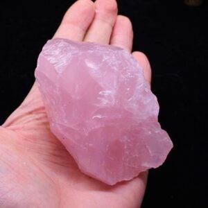
Rose Quartz is one of the most popular varieties of quartz, recognized for its soft pink hue that ranges from pale blush to a deeper rosy shade. As a member of the quartz family, Rose Quartz stands out for its aesthetic appeal and widespread availability, often used in decorative and industrial applications. This pink gemstone has captivated geologists, gemologists, and collectors for centuries due to its beauty and unique properties.
In this article, we will examine the geological aspects of Rose Quartz, from its formation and mineral composition to its key properties and modern uses.
Geological Formation of Rose Quartz
Rose Quartz, like other forms of quartz, is a silicon dioxide (SiO2) mineral that forms through a variety of geological processes. It typically forms in pegmatites, which are coarse-grained igneous rocks that form during the final stages of magma crystallization. Pegmatites often contain large crystals of quartz, feldspar, and mica, and provide the perfect environment for Rose Quartz to develop.
The Role of Trace Elements in Rose Quartz Color
The distinct pink coloration of Rose Quartz is attributed to trace amounts of titanium, iron, or manganese within the crystal structure. These elements become incorporated into the quartz during its formation, influencing the final hue of the gemstone. Recent studies also suggest that microscopic inclusions of fibrous minerals, such as dumortierite, may contribute to the cloudiness and unique pink color of some Rose Quartz specimens.
Physical and Chemical Properties of Rose Quartz
Rose Quartz shares the same fundamental properties as all members of the quartz family, which is composed of silicon and oxygen in a continuous framework of SiO4 silicon-oxygen tetrahedra.
Chemical Composition and Crystal Structure
Chemical Formula: SiO₂ (Silicon Dioxide)
Crystal System: Trigonal
Hardness: 7 on the Mohs scale
Density: 2.65 g/cm³
Luster: Vitreous to greasy
Cleavage: None (Quartz has conchoidal fracture)
Rose Quartz does not typically form in well-defined crystals like other quartz varieties (e.g., amethyst). Instead, it often occurs in massive form, with the pink coloration being distributed evenly throughout the mineral. Its transparency can range from transparent to translucent, with some specimens appearing more milky due to internal fractures and inclusions.
Durability and Weather Resistance
Quartz, including Rose Quartz, is highly durable, with a hardness of 7 on the Mohs scale, which makes it resistant to scratching and abrasion. This durability makes it suitable for various industrial applications, from construction materials to electronics. Additionally, Rose Quartz, like all quartz, is chemically stable, resisting weathering and most forms of chemical erosion.
Where Rose Quartz Is Found
Rose Quartz is found in a number of regions worldwide, particularly in large pegmatite deposits. Some of the most significant sources include:
Brazil: Brazil is one of the largest producers of Rose Quartz, with major deposits located in the states of Minas Gerais and Bahia. Brazilian Rose Quartz is known for its transparency and uniform color.
Madagascar: Another important source, Madagascar produces high-quality Rose Quartz with a more intense pink hue.
South Dakota, USA: The Black Hills region of South Dakota is renowned for its Rose Quartz deposits, where the stone is often found in pegmatite veins.
India: India is also home to significant Rose Quartz deposits, particularly in the states of Karnataka and Tamil Nadu.
South Africa: South Africa contributes to the global supply of Rose Quartz, often producing lighter-colored varieties.
Uses of Rose Quartz in Industry and Manufacturing
While Rose Quartz is primarily admired for its aesthetic qualities, it also serves important roles in various industries due to its physical properties.
Jewelry and Ornamental Uses
Rose Quartz is most commonly used in jewelry and as ornamental stones due to its appealing color and ability to be cut and polished into cabochons, beads, and other decorative pieces. Its relatively low cost, compared to other gemstones like diamonds or sapphires, makes it a popular choice for both fine and costume jewelry. Sculptors and artisans also use large masses of Rose Quartz to create carvings, statues, and decorative objects.
Construction and Architectural Uses
Quartz, including Rose Quartz, is often used in the construction industry for its durability and resistance to weathering. Crushed quartz is used in concrete, road construction, and as aggregate in various building materials. Additionally, quartz sand, which may include traces of Rose Quartz, is essential for producing glass, ceramics, and silicon-based materials used in electronics.
The Role of Quartz in Electronics
Quartz crystals have unique piezoelectric properties, meaning they generate an electrical charge when mechanical pressure is applied. This makes quartz essential for use in electronic components, particularly in oscillators, watches, and communication devices. While pure quartz crystals are typically preferred for these applications, the widespread use of quartz highlights the importance of the mineral in modern technology.
Rose Quartz in Geology and Gemology
In both geology and gemology, Rose Quartz holds significance for its formation process and its distinct color, which offers insight into the geological environments where it forms. Rose Quartz’s common association with pegmatites and hydrothermal veins points to the importance of these geological structures in mineral formation.
Gemological Classification
From a gemological perspective, Rose Quartz is classified as a semi-precious stone due to its abundance and affordability compared to other gemstones like emeralds or rubies. While its pink hue makes it highly desirable for decorative purposes, Rose Quartz’s massive form and lack of crystal points mean that it is often shaped into cabochons or beads rather than faceted gems. The rarity of faceted Rose Quartz pieces makes them particularly prized by collectors.
Varieties of Rose Quartz
There are a few notable variations within Rose Quartz that are of interest to collectors and gemologists.
Star Rose Quartz: A rare variety of Rose Quartz that exhibits asterism, or a star-like pattern, when light hits it. This phenomenon occurs due to needle-like inclusions of minerals such as rutile, which reflect light in a specific pattern.
Transparent Rose Quartz: Though most Rose Quartz is cloudy, transparent specimens are occasionally found. These pieces are often considered more valuable due to their rarity.
Milky Rose Quartz: A more opaque variety of Rose Quartz with a softer, milky appearance, which results from a higher density of internal fractures and inclusions.
Synthetic and Imitation Rose Quartz
As demand for gemstones increases, synthetic quartz, including Rose Quartz, is produced in laboratories for industrial use. These synthetic versions are chemically identical to natural quartz but are often purer and free of the inclusions that give natural Rose Quartz its cloudy or milky appearance.
Imitation Rose Quartz is also found in the market, typically made from dyed glass or other artificial materials designed to mimic the appearance of the natural gemstone. Buyers should be aware of these imitations, particularly when purchasing jewelry or high-quality decorative items.
Conclusion: Rose Quartz in Geology and Beyond
Rose Quartz is much more than just a beautiful pink stone; it is a geological marvel with a rich history and a wide range of applications. Its formation process, driven by the presence of trace elements and unique geological conditions, makes it a fascinating subject for geologists and gemologists alike. Whether adorning jewelry, decorating spaces, or serving practical roles in construction and technology, Rose Quartz continues to captivate for both its beauty and its versatility.
As science continues to explore the depths of Earth’s geological formations, Rose Quartz remains a symbol of the complexity and beauty found in nature.
FAQs: Frequently Asked Questions About Rose Quartz
What gives Rose Quartz its pink color?
The pink color of Rose Quartz is typically caused by trace amounts of titanium, iron, or manganese within the mineral’s structure. Recent studies suggest that inclusions of microscopic fibrous minerals like dumortierite may also play a role.
Where is Rose Quartz commonly found?
Rose Quartz is commonly found in pegmatite deposits across Brazil, Madagascar, the USA (South Dakota), India, and South Africa.
How is Rose Quartz used in industry?
Apart from its use in jewelry, Rose Quartz is used in the construction industry for concrete and road materials. Quartz is also vital in electronics due to its piezoelectric properties.
What is Star Rose Quartz?
Star Rose Quartz is a rare variety of Rose Quartz that exhibits asterism, a star-like effect on the surface of the stone caused by mineral inclusions reflecting light.
Can Rose Quartz form in crystal points?
While most Rose Quartz forms in massive shapes, it rarely forms in crystal points, making those rare specimens highly prized by collectors.
Is there synthetic Rose Quartz?
Yes, synthetic Rose Quartz is produced in laboratories for industrial applications. These synthetics are chemically identical to natural quartz but often have fewer inclusions.
Precious metals have been a cornerstone of human civilization for thousands of years. From ancient times to the present day, they have been used as currency, in the creation of jewelry, and for various industrial applications. But beyond their beauty and history, certain metals stand out for their immense value. Today, the conversation around precious metals extends beyond gold and silver to include lesser-known but significantly more expensive metals like rhodium and palladium.
What Are Precious Metals?
Precious metals are rare, naturally occurring metallic chemical elements of high economic value. Historically, gold and silver have been the most prominent, but metals like platinum, palladium, and rhodium have become increasingly valuable due to their rarity and industrial applications. These metals are often called “noble metals” because of their resistance to corrosion and oxidation, which increases their longevity and appeal.
The Role of Metals in Industry, Jewelry, and Technology
While precious metals are widely known for their use in luxury goods like jewelry, their role in modern industry is even more critical. Metals like rhodium and palladium are indispensable in the automotive industry, where they are used in catalytic converters to reduce vehicle emissions. Platinum and gold are heavily used in electronics and medical equipment, where their excellent conductivity and non-reactive properties are essential.
What Determines the Value of a Metal?
The value of metals is determined by a range of factors, including their rarity, demand, and the costs associated with extracting and refining them. The global supply of a metal and its applications across industries also play significant roles in setting its price. Understanding these factors can provide insight into why certain metals command higher prices than others.
Rarity and Availability
Rhodium, for example, is an extremely rare metal, with its annual global production barely exceeding a few tons. This rarity drives up its price significantly. Mining conditions and geopolitical factors also impact availability. Many of the world’s precious metals are mined in politically unstable regions, which can disrupt supply chains and cause prices to fluctuate.
Industrial Demand
The demand for metals in industries such as automotive manufacturing, electronics, and healthcare plays a crucial role in their market value. For instance, the use of palladium in catalytic converters for cars has surged due to stricter emission regulations, leading to a sharp increase in its price. Rhodium’s value similarly hinges on its crucial role in the auto industry.
Applications in Technology and Jewelry
Jewelry remains a significant driver of demand for metals like gold and platinum. However, the tech industry’s need for these metals, particularly for use in electronic components, is growing rapidly. Gold, known for its conductivity and resistance to corrosion, is widely used in computer processors and other electronics, adding to its demand beyond aesthetic purposes.
Overview of the World’s Most Expensive Metals
Many people are familiar with gold and platinum as valuable metals, but few know about the much higher prices of rhodium or palladium. Let’s compare some of the most expensive metals and understand what sets them apart from the rest.
A Comparison of Gold, Platinum, Rhodium, and Others
Gold: Always a classic, gold has been used as a store of value for centuries. Its price has historically been a barometer of economic health and is often considered a safe-haven asset during times of economic instability.
Platinum: With its stunning white luster and rarity, platinum has long been more expensive than gold, though it is also heavily used in industrial applications, particularly in catalytic converters.
Rhodium: The reigning champion in terms of price, rhodium is primarily used in the automotive industry, with very little availability from mining operations, making it the world’s most expensive metal today.
Palladium: This lesser-known metal has seen its value skyrocket due to its use in catalytic converters. Its price has risen faster than gold in recent years due to supply shortages and increased demand.
How Prices Are Determined and Tracked
The prices of these metals are determined by several factors, including supply and demand dynamics, geopolitical stability, mining output, and industrial usage. Commodities exchanges like the London Metal Exchange (LME) and New York Mercantile Exchange (NYMEX) track prices and facilitate the trading of metals, allowing investors to buy and sell these commodities in real-time.
The Rise of Rhodium: The Most Expensive Metal
Rhodium’s Journey to the Top
Rhodium, a member of the platinum group metals, has been a critical player in the automotive industry due to its effectiveness in reducing harmful emissions. In the 21st century, environmental regulations across the world have tightened, increasing demand for rhodium in catalytic converters. This surge in demand, combined with the metal’s rarity, has sent its price skyrocketing, surpassing that of both gold and platinum.
Why Rhodium Is So Valuable
The extreme rarity of rhodium is a primary factor in its high price. With only about 30 tons mined globally each year, rhodium is much scarcer than other precious metals like gold and silver. Its industrial utility in emission control systems for vehicles makes it indispensable, especially as global regulations continue to push for greener technologies.
Industrial and Commercial Applications of Rhodium
Rhodium’s primary application is in the automotive industry, where it is used in catalytic converters to reduce nitrogen oxide emissions from vehicles. It is also used in the production of glass and as an alloying agent in platinum and palladium to improve their corrosion resistance. Rhodium is highly reflective and resists tarnishing, which is why it is often used to plate jewelry, giving white gold its bright finish.
Rhodium’s Price Surge: A Historical Perspective
The Price Fluctuations of Rhodium Over Time
Rhodium prices have been historically volatile. After reaching record highs in the 2000s, its price crashed during the 2008 financial crisis, only to surge again in the 2020s as environmental regulations in Europe and China increased demand. Prices can rise or fall by thousands of dollars per ounce within short periods, reflecting its sensitivity to shifts in supply and demand.
The Supply and Demand Impact on Its Value
Rhodium’s price is driven largely by the supply from a small number of mines in South Africa, which produce around 80% of the global supply. Any disruption to these mines, whether due to labor strikes or geopolitical issues, can severely impact the global supply, leading to price spikes. Demand, on the other hand, is linked to the automotive industry’s need for emission-reducing technology.
Other Highly Valuable Metals
While rhodium takes the top spot, several other metals are close contenders in terms of price and rarity.
Platinum: A Close Contender
Platinum is another member of the platinum group metals (PGMs), known for its use in both jewelry and industry. While historically more expensive than gold, platinum’s price has fluctuated in recent years due to varying demand from the automotive and jewelry sectors. Platinum remains a key component in fuel cells and catalytic converters, ensuring its continued value.
Palladium: The Underrated Heavyweight
Palladium has recently surged in price, outperforming gold due to its critical role in catalytic converters for gasoline engines. The metal has become increasingly scarce as mining output struggles to meet the high demand, particularly as automakers pivot toward producing cleaner vehicles.
Gold: The Timeless Benchmark
While gold may not be the most expensive metal, it remains a benchmark for wealth and stability. Its cultural significance, combined with its use in electronics, jewelry, and finance, ensures that gold continues to hold immense value across the globe.
Industrial Applications of Expensive Metals
The utility of precious and expensive metals extends far beyond jewelry and coinage. Their unique physical and chemical properties make them indispensable in several industrial sectors. As technology advances, the demand for these metals in industries such as automotive, electronics, and aerospace has grown significantly.
How These Metals Are Used in Automotive, Electronics, and Aerospace Industries
Automotive Industry: The primary use of metals like rhodium, palladium, and platinum is in catalytic converters, which help reduce harmful emissions from internal combustion engines. These metals act as catalysts to convert toxic gases, such as nitrogen oxides, carbon monoxide, and hydrocarbons, into less harmful substances like carbon dioxide and water vapor. As global regulations on vehicle emissions have tightened, demand for these metals has surged, driving up their prices.
Electronics: Gold, platinum, and palladium are extensively used in the electronics industry due to their excellent conductivity and resistance to corrosion. Gold is commonly used in circuit boards, connectors, and memory chips, ensuring reliability and longevity in devices. Palladium’s ability to absorb hydrogen makes it useful in fuel cell technology, which is being explored as a potential energy source for the future.
Aerospace Industry: In the aerospace sector, where materials must withstand extreme temperatures and stress, platinum group metals (PGMs) play a crucial role. These metals are used in high-performance turbine engines and fuel cells. Their resistance to high temperatures and corrosion ensures that aerospace components function reliably over long periods, even in the harshest conditions.
Rhodium in Catalytic Converters
The Role of Rhodium in Emission Control
Rhodium is irreplaceable in the fight against air pollution due to its effectiveness in reducing nitrogen oxide (NOx) emissions, which are some of the most harmful pollutants from vehicle exhaust. NOx gases contribute to the formation of smog and acid rain, posing serious environmental and health risks. Rhodium, when used in catalytic converters, helps convert NOx into nitrogen and oxygen, which are harmless to the atmosphere.
Why the Auto Industry Drives Rhodium Demand
The automotive sector is the primary driver of rhodium demand, with over 80% of the global supply being used in catalytic converters. As governments around the world implement stricter environmental regulations, such as the Euro 6 standard in Europe and tighter fuel efficiency standards in the U.S. and China, automakers are increasingly reliant on rhodium to meet these requirements. This demand, combined with the metal’s rarity, has made rhodium the most expensive metal on the planet.
Rhodium in Jewelry and Investment
While rhodium’s primary use is industrial, it has also found a niche in the luxury goods market, particularly in jewelry.
Rhodium Plating and Its Role in Fine Jewelry
Rhodium is often used to plate white gold, giving it a bright, reflective finish and making the metal more durable and resistant to tarnishing. This practice is particularly common in engagement rings and other fine jewelry, where the rhodium layer enhances the appearance of the underlying gold or platinum. Despite its thin application, the rhodium plating is highly valued for its visual appeal and the prestige associated with the metal.
Investment Trends for Rhodium
Rhodium is also attracting attention from investors due to its extraordinary price increases in recent years. Unlike gold, silver, or platinum, rhodium has a smaller, more specialized market, which makes it both an attractive but highly volatile investment. Rhodium’s price can be influenced by shifts in industrial demand, geopolitical issues affecting supply, or changes in environmental regulations.
However, the rhodium market is not as liquid as gold or silver, meaning that buying and selling can be more challenging. Investors who choose rhodium should be aware of its price volatility and the potential for dramatic swings in value.
Environmental and Ethical Concerns
The Environmental Impact of Mining Expensive Metals
Mining for precious metals, especially rare ones like rhodium, platinum, and palladium, has significant environmental consequences. The extraction of these metals often involves deep mining operations that can lead to deforestation, water pollution, and habitat destruction. Mining for platinum group metals (PGMs) in South Africa, where most of the world’s supply is sourced, has raised concerns about land degradation and the health impacts on local communities.
Additionally, refining these metals is an energy-intensive process that contributes to greenhouse gas emissions. The environmental toll of mining and refining must be considered alongside the industrial benefits these metals provide.
Ethical Issues in Sourcing and Trading
Ethical concerns also arise in the sourcing of expensive metals, particularly when mining occurs in politically unstable regions. “Conflict minerals” is a term used to describe metals that are mined in conditions where profits from the trade support armed conflict or human rights abuses. While platinum and palladium are less frequently associated with conflict minerals compared to others like coltan or tungsten, the mining of these metals can still involve poor working conditions, child labor, and exploitation.
Consumers and investors are increasingly demanding that the metals they purchase be sourced ethically, prompting industries to adopt certification schemes and more transparent supply chains.
The Future of Metal Prices
Trends in Precious Metal Prices
The prices of precious metals are notoriously difficult to predict, but some trends are emerging based on shifts in technology, industry, and environmental policy. Metals like rhodium and palladium, which are essential for reducing vehicle emissions, are expected to remain in high demand as the world moves toward cleaner energy solutions.
Rhodium: Given the ongoing global efforts to reduce carbon emissions and air pollution, demand for rhodium in catalytic converters is likely to stay high, especially with the growing automotive markets in Asia.
Palladium: As a key metal in catalytic converters for gasoline engines, palladium’s price trajectory is closely linked to the global automotive industry. While electric vehicles (EVs) are on the rise, internal combustion engines still dominate the market, ensuring that palladium will remain valuable in the near future.
Platinum: Platinum’s price, long trailing behind rhodium and palladium, may see a resurgence due to its potential role in hydrogen fuel cell technology, which could be critical in the future of renewable energy.
Predictions for Rhodium and Other Expensive Metals
Experts predict that rhodium’s price will continue to fluctuate based on market demand and supply challenges. As more countries adopt stringent environmental regulations, the need for rhodium in catalytic converters could grow. However, advancements in electric vehicle technology, which doesn’t rely on catalytic converters, could dampen demand for rhodium over time, leading to price corrections.
Investing in Expensive Metals: Risks and Rewards
Why Investors Are Drawn to Expensive Metals
Precious and rare metals offer a unique investment opportunity due to their intrinsic value and use across industries. Metals like gold and platinum have long been considered safe-haven assets during times of economic uncertainty, while others, like rhodium, offer the potential for significant returns due to their rarity and industrial demand. Investors are drawn to these metals not just for their monetary value but for their tangibility and ability to retain worth even in volatile markets.
The Volatility of Metal Markets
The metal markets are notoriously volatile, and investing in expensive metals comes with risks. Rhodium, for instance, has experienced massive price swings in the past, sometimes doubling or halving in value over the course of a single year. This volatility is driven by supply chain disruptions, shifts in industrial demand, and global economic conditions. Investors must be prepared for the unpredictable nature of these markets and should diversify their portfolios to mitigate risks.
How to Buy and Store Precious Metals
Popular Platforms for Purchasing Metals
Investors looking to purchase expensive metals can do so through several platforms:
Commodities Markets: Precious metals like gold, silver, platinum, and rhodium can be traded on commodities exchanges such as the London Metal Exchange (LME) or New York Mercantile Exchange (NYMEX). These platforms allow for futures trading, which enables investors to speculate on the future price of metals.
Bullion Dealers: Many investors prefer to buy physical metals in the form of bullion or coins. Trusted bullion dealers, such as JM Bullion or APMEX, offer gold, silver, platinum, and rhodium bars and coins. Physical ownership can provide a sense of security, though it requires safe storage.
Secure Storage Solutions
Storing precious metals requires careful consideration. Physical metals should be stored in a secure location, such as a bank safety deposit box or a home safe. Some investors also use third-party vaulting services, which offer high-security storage and insurance for a fee. For those who trade in large quantities, professional storage options like the vaults provided by the Royal Canadian Mint or Brinks are essential.
The Role of Metals in Global Economies
How Expensive Metals Influence Global Markets
Precious metals are not just commodities; they are strategic assets that influence global markets. Central banks around the world hold large reserves of gold as part of their monetary policy, using it as a hedge against inflation and currency devaluation. Similarly, the supply and demand for metals like rhodium and palladium can affect national economies, especially in countries that rely on mining as a major part of their GDP.
For example, South Africa’s economy is closely tied to the mining of platinum group metals (PGMs), including rhodium and palladium. Disruptions in the mining industry due to strikes or political instability can ripple through the global supply chain, affecting prices and availability.
The Strategic Importance of Precious Metals
Beyond their economic value, precious metals play a strategic role in national security and technological innovation. Metals like platinum and palladium are used in military and aerospace applications, while others, like rhodium, are critical for maintaining environmental standards. As global industries evolve and the demand for cleaner technologies grows, the strategic importance of these metals will only increase.
Conclusion: Why Expensive Metals Will Always Fascinate Us
The allure of expensive metals is undeniable. From their role in shaping civilizations to their modern applications in technology and industry, these metals captivate us with their rarity, beauty, and utility. Rhodium, with its staggering price tag, highlights how essential these metals are in today’s world, particularly as we strive for a cleaner, more sustainable future. As technology evolves, the demand for precious metals will continue to grow, ensuring their place as valuable commodities in the global economy.
While investing in these metals comes with risks, their appeal as both luxury items and strategic assets will always attract those who seek to own a piece of the world’s most prized elements.
FAQs: Frequently Asked Questions About Expensive Metals
Why is rhodium more expensive than gold?
Rhodium is much rarer than gold and has specific industrial applications, particularly in catalytic converters for cars. Its limited supply and high demand from the automotive sector have driven its price above that of gold.
Can rhodium prices fall?
Yes, rhodium prices are highly volatile and can experience significant fluctuations due to changes in demand, supply disruptions, or shifts in environmental regulations affecting the automotive industry.
What is palladium used for?
Palladium is primarily used in catalytic converters for gasoline engines, helping reduce harmful emissions. It is also used in electronics, dentistry, and as a component in fuel cells.
Is investing in metals risky?
Investing in metals can be risky due to price volatility, supply chain disruptions, and changing industrial demand. However, many investors consider metals a hedge against inflation and currency devaluation.
What is the rarest metal on Earth?
The rarest metal on Earth is likely rhodium, given its extremely limited supply and high demand in industrial applications. Other rare metals include platinum group metals (PGMs) like palladium and osmium.
Why are some metals so expensive?
The price of metals is driven by a combination of factors, including rarity, difficulty in mining and refining, industrial demand, and geopolitical influences. Metals like rhodium and palladium are expensive because they are both rare and essential to key industries like automotive manufacturing.
Meteorites, fragments of celestial bodies that survive their journey through Earth’s atmosphere and land on the planet, offer a unique glimpse into the cosmos. These extraterrestrial rocks often date back to the formation of the solar system, making them invaluable to both scientists and collectors. But what exactly are meteorites, and what makes them so valuable? To appreciate the most expensive meteorite in history, one must first understand the basics of these fascinating space travelers.
What Are Meteorites?
Meteorites are solid pieces of debris from objects such as comets, asteroids, or meteoroids that originate in outer space and survive their passage through the atmosphere to reach Earth’s surface. When these objects enter Earth’s atmosphere, they become meteors or “shooting stars,” but only a fraction of them make it through the atmosphere to land on Earth.
Types of Meteorites: Stony, Iron, and Stony-Iron
Meteorites fall into three primary categories based on their composition:
Stony Meteorites – Composed mainly of silicate minerals, these are the most common type.
Iron Meteorites – Comprising mostly metallic iron and nickel, they are denser and much rarer.
Stony-Iron Meteorites – A mix of silicate minerals and metal, these are the rarest and most valuable, both scientifically and financially.
Understanding the classification of meteorites is essential to grasp why certain types are prized by collectors and scientists alike.
The Meteorite Market: Understanding the Value
While meteorites are scientifically priceless, they also carry significant monetary value. The price of a meteorite can vary dramatically, depending on several factors that collectors and dealers consider when determining its worth.
What Determines the Value of a Meteorite?
Several factors influence the market value of a meteorite:
Rarity – The rarer a meteorite, the more valuable it is. Stony-iron meteorites, for instance, are highly sought after due to their scarcity.
Size – Larger meteorites typically command higher prices due to their rarity and the logistical challenges of finding and recovering them.
Composition – Meteorites rich in metals like nickel and iron are often more valuable due to their durability and visual appeal.
Provenance – Meteorites with a documented history, especially those tied to significant scientific discoveries, are valued higher.
Rarity, Size, and Composition
Among all these factors, rarity plays the most crucial role in determining a meteorite’s price. A meteorite that is either unique in its composition or comes from an event with historical significance can fetch millions of dollars at auctions.
Notable Meteorite Sales in History
The meteorite market has seen some astonishing sales over the past few decades, with collectors and institutions vying for a piece of cosmic history. While most meteorites are sold for tens of thousands of dollars, a few have broken the million-dollar mark.
Famous Meteorite Auctions
Some of the most famous meteorites have fetched prices that rival fine art. In 2012, an auction held by Christie’s showcased meteorites as collectibles, with the most expensive item, a part of the Gibeon meteorite, selling for nearly $100,000.
Record-breaking Meteorites: A Detailed Look
One meteorite sale stands out above the rest — the sale of the Fukang meteorite, a stunning pallasite with translucent olivine crystals embedded in its iron-nickel matrix. The value and beauty of this meteorite shattered auction records, solidifying its place as the most expensive meteorite ever sold.
The Most Expensive Meteorite Ever Sold
The Sale of the Fukang Meteorite
The Fukang meteorite is a pallasite meteorite discovered in the mountains near Fukang, China, in 2000. With an estimated weight of around 1,003 kilograms, it is one of the most beautiful and scientifically significant meteorites ever found. In a 2008 auction, part of the Fukang meteorite was priced at an astronomical $2 million.
Price and Ownership
While the entire meteorite has not been sold as a single unit, fragments of the Fukang meteorite have been sold for as much as $1,000 per gram, placing the total value of the meteorite well into the millions.
What Makes Fukang Special?
The Fukang meteorite is particularly prized for its beauty and its rarity. Pallasites, which make up less than 1% of all known meteorites, contain large crystals of the mineral olivine embedded in an iron-nickel matrix. When polished, the olivine crystals become translucent, creating a striking appearance that resembles a stained-glass window. The aesthetic appeal, combined with its rarity, makes the Fukang meteorite a coveted piece among collectors.
Rarity and Uniqueness of the Fukang Meteorite
Origins and Discovery of the Fukang Meteorite
The Fukang meteorite was discovered by a hiker in the Gobi Desert, near Fukang, China, in 2000. This initial discovery led to further excavations, revealing a massive specimen weighing over a ton. Its origins trace back billions of years, offering scientists insights into the early solar system.
Its Size, Weight, and Composition
Weighing over 1,003 kilograms, the Fukang meteorite is enormous compared to most meteorites found on Earth. Its stunning olivine crystals are set within a metallic structure, making it both scientifically significant and aesthetically beautiful.
Other High-Value Meteorites in the World
While the Fukang meteorite holds the crown for the most expensive, other high-value meteorites have also made headlines for their unique characteristics and auction prices.
The Gibeon Meteorite
Discovered in Namibia in the 19th century, the Gibeon meteorite is an iron meteorite that fragmented over a vast area. Known for its beautiful Widmanstätten patterns, it has fetched high prices at auctions.
The Brenham Meteorite
The Brenham meteorite, a pallasite found in Kansas, USA, in 1882, is another example of a high-value meteorite due to its rarity and the beauty of its olivine crystals.
The Willamette Meteorite
The largest meteorite ever found in the United States, the Willamette meteorite weighs over 15 tons. Though not for sale, its cultural significance has made it a priceless artifact.
What Makes Meteorites So Valuable?
Scientific Importance of Meteorites
Meteorites serve as windows into the early solar system, offering clues about the formation of planets and the presence of water and organic compounds. For researchers, owning a piece of this cosmic history is invaluable for advancing scientific knowledge.
The Appeal to Private Collectors
For private collectors, meteorites represent not only a piece of history but also a unique work of art. Their rarity and beauty make them attractive to wealthy individuals looking for unique investments or showpieces.
Legal and Ethical Considerations in Meteorite Sales
Ownership Rights and Legal Frameworks
The sale and ownership of meteorites fall into a complex legal framework that varies significantly across different countries. In the United States, private ownership of meteorites found on privately owned land is allowed, provided permission from the landowner is granted. However, some countries, like Argentina and Australia, have strict regulations prohibiting the sale of meteorites, classifying them as national treasures. The United Nations’ Outer Space Treaty also influences the legal status of extraterrestrial objects, ensuring that no country can claim ownership of celestial bodies, but does not explicitly cover meteorites.
Collectors and dealers must navigate these legal frameworks, especially when purchasing meteorites from foreign countries or indigenous lands. Meteorites found on public land in many countries, including the U.S., may belong to the government, making unauthorized sales illegal. International treaties, national laws, and ethical concerns all intersect to create a sometimes murky marketplace for these cosmic treasures.
Ethical Issues in the Meteorite Trade
Beyond the legal issues, ethical concerns also arise when dealing with meteorites. For example, some meteorites are discovered on culturally or historically significant land, such as the Willamette Meteorite, found on land sacred to Native American tribes. Selling such artifacts can lead to tensions between collectors and indigenous communities.
Another issue is the growing practice of “meteorite hunting,” where individuals or corporations comb remote areas, particularly deserts, for meteorites to sell on the open market. While this may sound harmless, overzealous hunting can disrupt local ecosystems, and the commercialization of such activities raises concerns about the loss of scientifically valuable materials to private ownership.
The Role of Meteorites in Science and Research
Contributions to Space Science
Meteorites are more than just collectibles or symbols of wealth; they play a crucial role in advancing our understanding of the universe. These space rocks are the remnants of the early solar system, offering valuable clues about its formation, evolution, and the processes that shaped planets and moons. Many meteorites contain high concentrations of metal, rare isotopes, or even organic compounds like amino acids, which are the building blocks of life.
For instance, the Murchison meteorite, which fell in Australia in 1969, contains over 90 amino acids, many of which are not found on Earth. This discovery spurred significant research into the possibility that meteorites brought the necessary ingredients for life to Earth, supporting theories about panspermia.
Meteorites as Windows into the Early Solar System
Meteorites often contain chondrules, tiny, round grains that formed in the early solar nebula. Studying these chondrules helps scientists understand conditions that existed over 4.5 billion years ago, long before planets like Earth formed. Iron meteorites, which come from the cores of ancient, shattered asteroids, offer insight into the processes of planetary differentiation, where molten planets separated into layers of core, mantle, and crust.
In essence, meteorites act as time capsules, providing scientists with direct samples of celestial bodies and the material that formed our solar system.
Meteorites in Art and Culture
Artistic and Cultural Significance
Throughout history, meteorites have captured the human imagination, inspiring myths, legends, and artistic creations. Many ancient cultures viewed meteorites as gifts from the gods. In Egypt, meteoritic iron was used in the creation of ceremonial objects, such as King Tutankhamun’s famous iron dagger, which was crafted from iron believed to have come from a meteorite.
In modern times, artists have incorporated meteorites into their work, attracted by their otherworldly origins and striking appearances. Sculptors have used iron meteorites for both their physical beauty and their symbolic connection to space and time. Jewelry designers have also embraced meteorites, crafting rings, necklaces, and other accessories from pieces of cosmic debris.
Meteorites as Symbols of Power and Mystery
Meteorites have often been seen as symbols of power, mystery, and transcendence. Their origins in outer space make them inherently exotic, and their rarity only adds to their allure. Some collectors view owning a meteorite as a way to possess a piece of the universe, something that connects them directly to the cosmos.
The Future of the Meteorite Market
Trends in Meteorite Pricing
Meteorite prices have been steadily rising over the past few decades, driven by increased demand from collectors, institutions, and investors. As meteorites become more scarce and their scientific importance becomes better understood, their value is expected to continue climbing. Rare types, such as lunar and Martian meteorites, command especially high prices due to their rarity and the difficulty of obtaining samples from these celestial bodies.
Additionally, as space exploration continues to advance, more meteorites may be brought back from other planets and moons. These space-exploration-driven meteorites could lead to new market dynamics, though natural meteorites will always hold a special place due to their historical significance.
Predictions for Future Meteorite Sales
Experts predict that the meteorite market will continue to grow, especially as more people become interested in space and astronomy. High-profile auctions, like those held by Christie’s or Bonhams, bring attention to the investment potential of meteorites, encouraging more individuals to enter the market. However, with this growth comes the risk of market volatility. Like any collectible, the value of meteorites is subject to fluctuations based on demand, rarity, and global economic conditions.
Investing in Meteorites: Risks and Rewards
Understanding Market Volatility
Investing in meteorites can be lucrative, but it comes with its own set of risks. The value of a meteorite can vary greatly depending on market trends, scientific discoveries, and even public interest in space exploration. While some investors have made substantial profits, others have seen the value of their collections drop as new discoveries or market shifts impact demand.
Pros and Cons of Meteorite Investment
Investing in meteorites offers unique advantages, such as the potential for high returns and the thrill of owning a piece of cosmic history. However, it also comes with significant challenges, including the need for specialized knowledge to identify, authenticate, and properly care for meteorites. Fraud is a concern in the meteorite market, as fakes can be difficult for the untrained eye to spot.
How to Identify and Authenticate Meteorites
Common Techniques for Meteorite Identification
Identifying a genuine meteorite requires a keen understanding of its physical characteristics, including its weight, magnetic properties, and fusion crust (the outer layer formed as the meteorite burns through the atmosphere). Many meteorites also display a metallic luster or have a distinct Widmanstätten pattern, a crisscrossed design found in iron meteorites that forms over millions of years as the iron cools.
Experts often use more advanced techniques, such as isotopic analysis or scanning electron microscopy, to confirm a meteorite’s authenticity. These methods help determine the meteorite’s chemical composition, providing definitive proof of its extraterrestrial origin.
How to Avoid Fraud in Meteorite Purchases
With the rising value of meteorites, the market has seen a corresponding rise in forgeries. Unscrupulous sellers may attempt to pass off Earth rocks as meteorites or sell fragments of genuine meteorites at inflated prices. To avoid fraud, buyers should only purchase meteorites from reputable dealers or auctions and, if possible, obtain a certificate of authenticity from a qualified meteorite expert.
Where to Buy and Sell Meteorites
Popular Auction Houses and Online Platforms
For those looking to buy or sell meteorites, several reputable auction houses and online platforms specialize in meteorite transactions. Christie’s and Bonhams regularly feature meteorites in their natural history auctions, while online platforms like Heritage Auctions and specialized dealers such as Aerolite Meteorites offer a wide selection of meteorites for sale.
A Guide to Meteorite Dealers
It’s essential to work with experienced meteorite dealers who have a deep understanding of the market and offer guarantees of authenticity. Many dealers are also members of professional organizations like the International Meteorite Collectors Association (IMCA), which ensures a level of credibility and expertise in the field.
Conclusion: Why Meteorites Continue to Fascinate
Meteorites hold a unique position at the intersection of science, art, and investment. Their ability to unlock the secrets of the universe makes them scientifically priceless, while their rarity and beauty give them significant financial value. For private collectors, owning a meteorite is more than just an investment—it’s an opportunity to connect with the cosmos in a tangible way. As the world continues to look toward the stars, meteorites will undoubtedly remain a symbol of our enduring fascination with space and our place within it.
FAQs: Frequently Asked Questions About Meteorites
What is the rarest type of meteorite?
The rarest type of meteorite is the stony-iron pallasite, which makes up less than 1% of all known meteorites. Pallasites contain olivine crystals set in a nickel-iron matrix, making them highly prized for their beauty and rarity.
Can you legally own a meteorite?
Yes, in most countries, individuals can legally own meteorites, especially if they are found on private property. However, some countries have strict regulations, and it’s important to be aware of local laws before purchasing or collecting meteorites.
What is the largest meteorite ever found?
The largest meteorite ever found is the Hoba meteorite in Namibia, which weighs around 60 tons. It is so large that it has never been moved from its discovery site and remains a popular tourist attraction.
How are meteorites priced?
Meteorites are priced based on several factors, including their rarity, size, composition, and provenance. Rare types of meteorites, such as Martian or lunar samples, can fetch extremely high prices, while common stony meteorites are much less expensive.
Can meteorites be faked?
Yes, meteorites can be faked, and the market has seen an increase in fraudulent sales. Buyers should always work with reputable dealers and seek certificates of authenticity to ensure they are purchasing genuine meteorites.
Why are meteorites important for science?
Meteorites provide valuable insights into the formation of the solar system, planetary differentiation, and the presence of organic compounds in space. They are essential tools for researchers studying the history and composition of celestial bodies.
Ol Doinyo Lengai volcano spews extremely runny lava that turns bone white when it dries. (Image credit: Jean-Denis JOUBERT via Getty Images)
Introduction
Tucked away in the heart of Tanzania lies one of the most fascinating and unusual volcanoes on Earth—Ol Doinyo Lengai, often referred to as the “Mountain of God” by the local Maasai people. Unlike most volcanoes, this enigmatic mountain possesses characteristics that set it apart from the rest of the world’s volcanoes. Known for its rare carbonatite lava, which is cooler and flows faster than the usual silica-rich lava, Ol Doinyo Lengai offers a unique geological wonder that has baffled and intrigued scientists for decades.
In this article, we will explore what makes the Mountain of God so weird, from its unusual lava composition to its remarkable geological history. Let’s dive deep into the bizarre and awe-inspiring nature of this one-of-a-kind volcanic marvel.
Table of Contents
Location and Cultural Significance
Geography of Ol Doinyo Lengai
The Maasai and the “Mountain of God”
Unique Features of Ol Doinyo Lengai
Carbonatite Lava: The Key to Its Uniqueness
Cooling Temperatures and Fast Flowing Lava
Eruptions and Activity
Recent Eruptions
The Lava Fountain Phenomenon
Why Is Ol Doinyo Lengai Considered the Weirdest Volcano?
Uncommon Lava Composition
Unpredictable Eruptions
Formation of Unique Landscapes
FAQ Section
1. Location and Cultural Significance
Geography of Ol Doinyo Lengai
Ol Doinyo Lengai is located in northern Tanzania, near the eastern branch of the East African Rift Valley. It sits about 120 kilometers northwest of Arusha and is relatively close to the iconic Serengeti and Ngorongoro Crater. Towering at about 2,962 meters (9,718 feet), this active volcano overlooks the stunning landscape of the surrounding region, including the Lake Natron basin, known for its extreme alkalinity and flamingo populations.
The Maasai and the “Mountain of God”
The local Maasai people have revered Ol Doinyo Lengai for centuries, referring to it as the “Mountain of God” due to its mystical presence and the raw power of its eruptions. The Maasai hold the belief that the volcano is a sacred place where their deity resides, and as such, the mountain has immense spiritual significance. The unpredictable eruptions, rare lava, and its towering presence in the East African landscape have only added to its mythic status in the region.
2. Unique Features of Ol Doinyo Lengai
Carbonatite Lava: The Key to Its Uniqueness
The most striking feature that makes Ol Doinyo Lengai stand out is its carbonatite lava. Unlike typical lava, which is rich in silicate minerals and is extremely hot (about 1,000°C or more), the lava that flows from this volcano is unusually cool, with temperatures between 500°C and 600°C. It is the only active volcano in the world known to produce natrocarbonatite lava, a rare type of lava that contains sodium and potassium carbonate minerals.
Cooling Temperatures and Fast Flowing Lava
Because of its relatively low temperatures, carbonatite lava is much more fluid than silicate lava. It moves quickly, often resembling flowing mud rather than the sluggish movement of typical lava flows. Its dark, blackish-brown appearance when it emerges soon turns white as it cools due to the rapid weathering of its unique chemical composition. This rapid transition is caused by its reaction with moisture and CO2 in the atmosphere, resulting in the formation of white sodium carbonate crusts.
3. Eruptions and Activity
Recent Eruptions
Ol Doinyo Lengai has had a long history of volcanic activity, with eruptions recorded as far back as 1883. While many of its eruptions have been relatively small, larger and more violent eruptions have occurred as well, the most notable being in 2007-2008, when it released an explosive amount of carbonatite lava, along with ash plumes that rose as high as 15 kilometers into the atmosphere.
Its eruptions often alternate between effusive eruptions—where lava flows smoothly out of the crater—and explosive eruptions, where ash and rock are ejected. However, these transitions are highly unpredictable, adding to its mystique and reputation as one of the weirdest volcanoes in the world.
The Lava Fountain Phenomenon
Another bizarre feature of the Mountain of God is its lava fountains. Unlike the usual fiery displays seen in silicate-based volcanoes, the lava fountains at Ol Doinyo Lengai are much less violent, spewing black carbonatite lava that cools rapidly into fragile, needle-like formations. These formations are so delicate that they can disintegrate into fine powder with just a light touch.
4. Why Is Ol Doinyo Lengai Considered the Weirdest Volcano?
Uncommon Lava Composition
What truly sets Ol Doinyo Lengai apart is its natrocarbonatite lava, a geological oddity not found in any other active volcano on Earth. This rare type of lava is rich in sodium and potassium carbonates, which is a stark contrast to the silicate-rich lava produced by most volcanoes. Its chemical composition also causes it to react unusually fast with the atmosphere, creating the striking white crust on the cooled lava.
Unpredictable Eruptions
Ol Doinyo Lengai’s unpredictability further fuels its reputation as one of the weirdest volcanoes. While most volcanoes have eruption patterns that can be studied and forecasted, Ol Doinyo Lengai remains somewhat enigmatic in its behavior. It alternates between calm lava flows and sudden explosive eruptions, often without warning.
Formation of Unique Landscapes
The interaction between the alkaline lava and the surrounding environment leads to the formation of striking landscapes. Over time, the carbonatite lava creates otherworldly volcanic cones, lava plateaus, and caverns. The rapid weathering of the lava also contributes to the fertility of the surrounding soil, making the region home to unique plant species that thrive in the area’s rich volcanic ash.
5. FAQ Section
1. Why is Ol Doinyo Lengai called the “Mountain of God”?
The name comes from the local Maasai people, who have long believed that the mountain is the dwelling place of their deity. It holds spiritual significance due to its awe-inspiring eruptions and towering presence over the Tanzanian landscape.
2. What makes carbonatite lava so unique?
Carbonatite lava is rich in sodium and potassium carbonates, unlike typical silicate lava. It is much cooler, flows faster, and reacts quickly with the atmosphere to form a white crust as it cools, a process that makes it visually striking and geologically rare.
3. How often does Ol Doinyo Lengai erupt?
Ol Doinyo Lengai erupts frequently, with minor eruptions occurring regularly. Larger, more explosive eruptions are less frequent but have been recorded throughout its history. Its most recent significant eruption was in 2007-2008.
4. Can you visit the Mountain of God?
Yes, adventurous travelers and geologists often visit the region, and it has become a popular site for hikers and volcano enthusiasts. However, the climb is challenging, and safety precautions must be taken, especially considering the volcano’s unpredictable nature.
5. Is Ol Doinyo Lengai dangerous?
While Ol Doinyo Lengai’s eruptions are typically less violent than other volcanoes, it can still pose a threat due to its unpredictable eruptions. The volcanic gases and ash plumes can also affect air quality and visibility in the surrounding areas.
Conclusion
Ol Doinyo Lengai, the “Mountain of God,” is a geological marvel unlike any other. Its carbonatite lava, unpredictable eruptions, and spiritual significance make it one of the most mysterious and fascinating volcanoes in the world. Whether viewed from a scientific perspective or revered for its cultural importance, Ol Doinyo Lengai remains a symbol of the Earth’s powerful and unpredictable forces. As the only active volcano producing natrocarbonatite lava, it holds a unique place in the world of volcanology and continues to captivate the imagination of all who encounter it.
The Earth’s crust is a dynamic system that has evolved over millions of years, giving rise to different types of rocks. These rocks—sedimentary, igneous, and metamorphic—form the foundation of Earth’s geology and hold clues to its past. Each rock type is defined by its formation process, composition, and texture, which are directly related to the environments in which they form.
Understanding the differences between these three rock types is essential for geologists, students, and anyone interested in the Earth sciences. This article delves deep into each type, explaining how they form, what distinguishes them, and their key characteristics. By the end of this guide, you’ll have a comprehensive understanding of sedimentary, igneous, and metamorphic rocks, and the role they play in shaping our planet.
Table of Contents
What Are Sedimentary Rocks?
How Sedimentary Rocks Form
Types of Sedimentary Rocks
Characteristics of Sedimentary Rocks
Examples of Sedimentary Rocks
What Are Igneous Rocks?
How Igneous Rocks Form
Types of Igneous Rocks
Characteristics of Igneous Rocks
Examples of Igneous Rocks
What Are Metamorphic Rocks?
How Metamorphic Rocks Form
Types of Metamorphic Rocks
Characteristics of Metamorphic Rocks
Examples of Metamorphic Rocks
Key Differences Between Sedimentary, Igneous, and Metamorphic Rocks
Formation Process Comparison
Textural Differences
Composition and Mineralogy
Distribution and Occurrence
Economic and Environmental Importance
FAQ Section
1. What Are Sedimentary Rocks?
Sedimentary rocks are formed from the accumulation and cementation of mineral and organic particles, often referred to as sediments. These particles are typically transported by water, wind, or ice, and deposited in layers over time. This process of deposition is commonly associated with environments like rivers, lakes, and oceans, but it also occurs in deserts and other terrestrial landscapes.
How Sedimentary Rocks Form
The formation of sedimentary rocks involves a multi-step process:
Weathering: Rocks at the Earth’s surface are broken down into smaller particles through processes like mechanical weathering (physical breaking apart) and chemical weathering (dissolution of minerals).
Erosion and Transport: Once weathered, the particles are carried away by natural forces such as water, wind, and glaciers. These particles are often transported over long distances before being deposited.
Deposition: Sediments are deposited in layers in bodies of water or on land. As more layers accumulate over time, the weight of the upper layers compresses the lower layers, compacting the material.
Compaction and Cementation: With time, the buried sediments are compacted due to the weight of overlying layers. Minerals in groundwater precipitate and act as a cement, binding the particles together to form solid rock.
Types of Sedimentary Rocks
Sedimentary rocks can be classified into three main types:
Clastic Sedimentary Rocks: Formed from fragments of other rocks (clasts). Examples include sandstone, shale, and conglomerate.
Chemical Sedimentary Rocks: Formed by precipitation of minerals from water. Examples include limestone and evaporites like rock salt.
Organic Sedimentary Rocks: Composed of the remains of plants and animals. Examples include coal and certain forms of limestone formed from shells or coral.
Characteristics of Sedimentary Rocks
Layering: One of the most recognizable features is the presence of distinct layers, or strata, which result from the sequential deposition of sediments.
Fossils: Sedimentary rocks are the primary hosts of fossils, the preserved remains of ancient organisms, because the low-pressure environments where they form allow for fossilization.
Porosity: Sedimentary rocks often have high porosity due to the spaces between the particles, making them excellent reservoirs for water, oil, and gas.
Examples of Sedimentary Rocks
Sandstone: Composed primarily of sand-sized particles, often quartz.
Shale: Fine-grained rock made from silt and clay, often found in ancient marine environments.
Limestone: Formed from calcium carbonate, typically precipitated from water or from marine organisms’ remains.
2. What Are Igneous Rocks?
Igneous rocks form from the cooling and solidification of magma or lava. These rocks are the primary constituents of the Earth’s crust and represent the original form of solid rock on Earth. The word “igneous” comes from the Latin word for fire, reflecting their fiery origins deep within the Earth or at its surface through volcanic activity.
How Igneous Rocks Form
The process of igneous rock formation involves two major stages:
Melting: The rock material deep within the Earth melts due to intense heat and pressure, forming magma. This can occur in the mantle or lower crust.
Cooling and Solidification: Magma that reaches the Earth’s surface as lava cools and crystallizes to form extrusive igneous rocks. Magma that remains below the surface cools slowly and forms intrusive igneous rocks.
Types of Igneous Rocks
Igneous rocks are divided into two major categories:
Intrusive (Plutonic) Igneous Rocks: Formed when magma cools slowly beneath the Earth’s surface. The slow cooling allows large crystals to form. Examples include granite and diorite.
Extrusive (Volcanic) Igneous Rocks: Formed when magma erupts onto the surface as lava and cools rapidly. This quick cooling leads to smaller crystals. Examples include basalt, rhyolite, and andesite.
Characteristics of Igneous Rocks
Crystal Size: One of the key distinguishing features of igneous rocks is their crystal size. Intrusive igneous rocks have large, visible crystals, while extrusive rocks have small, fine-grained textures.
Mineral Composition: Igneous rocks are classified based on their mineral content. For example, rocks rich in silica are called felsic, while rocks with less silica and more iron and magnesium are termed mafic.
Texture: Igneous rocks can exhibit a range of textures, from glassy (such as obsidian) to porphyritic (where larger crystals are embedded in a finer-grained matrix).
Examples of Igneous Rocks
Granite: A coarse-grained intrusive rock, commonly used in construction.
Basalt: A fine-grained extrusive rock that makes up much of the ocean floor.
Obsidian: A naturally occurring volcanic glass, known for its smooth, glassy texture.
3. What Are Metamorphic Rocks?
Metamorphic rocks are formed from the transformation of existing rock types (whether igneous, sedimentary, or other metamorphic rocks) through high heat, pressure, and chemical processes. This transformation occurs without the rock melting; instead, it changes its mineral composition and texture in response to its new environmental conditions.
How Metamorphic Rocks Form
Metamorphism occurs in two primary settings:
Regional Metamorphism: Occurs over large areas due to tectonic forces. This is typical in mountain-building regions where rocks are buried deep underground and subjected to intense pressure and heat.
Contact Metamorphism: Occurs when rocks are heated by nearby magma or lava, leading to changes in the mineral structure of the rock.
Types of Metamorphic Rocks
Metamorphic rocks are broadly categorized into two types:
Foliated Metamorphic Rocks: These rocks have a layered or banded appearance due to the re-alignment of minerals under pressure. Examples include schist and gneiss.
Non-foliated Metamorphic Rocks: These rocks do not have a layered texture. Examples include marble and quartzite.
Characteristics of Metamorphic Rocks
Foliation: The development of a banded texture due to the alignment of minerals, which is common in rocks like schist and gneiss.
Recrystallization: The minerals within the rock may grow and change in response to heat and pressure without the rock melting.
Hardness and Density: Metamorphic rocks are generally harder and more dense than their original forms due to the intense conditions they endure.
Examples of Metamorphic Rocks
Marble: Formed from limestone under high pressure and temperature, marble is prized for its use in sculptures and building materials.
Slate: A fine-grained rock that originates from shale and is commonly used in roofing and flooring.
Schist: Known for its foliated texture, schist contains visible grains of mica and other minerals.
4. Key Differences Between Sedimentary, Igneous, and Metamorphic Rocks
While each type of rock forms under different conditions, they are interconnected through the rock cycle—the continuous process of transformation from one type of rock to another. Here’s a detailed comparison of the major differences:
1. Formation Process Comparison
Sedimentary Rocks: Formed from the accumulation and cementation of sediments.
Igneous Rocks: Formed from the cooling and solidification of molten rock (magma or lava).
Metamorphic Rocks: Formed from the transformation of existing rocks under heat and pressure.
2. Textural Differences
Sedimentary Rocks: Typically display layering and may have fossils.
Igneous Rocks: Characterized by crystal size—large in intrusive rocks, small or glassy in extrusive rocks.
Metamorphic Rocks: Often foliated (banded) but can also be non-foliated.
3. Composition and Mineralogy
Sedimentary Rocks: Composed of particles like sand, silt, clay, or organic material.
Igneous Rocks: Contain minerals like quartz, feldspar, and mica, with varying silica content.
Metamorphic Rocks: Contain re-crystallized minerals, often with banding or foliation.
4. Distribution and Occurrence
Sedimentary Rocks: Found in layers near the Earth’s surface, covering about 75% of the Earth’s continental surface.
Igneous Rocks: Make up the bulk of the Earth’s crust, especially beneath the ocean floors.
Metamorphic Rocks: Commonly found in regions of tectonic activity, like mountain ranges.
5. Economic and Environmental Importance
Sedimentary Rocks: Serve as reservoirs for fossil fuels like oil, gas, and coal.
Igneous Rocks: Provide valuable minerals and metals, such as granite for construction.
Metamorphic Rocks: Used in building materials (marble, slate) and as indicators of geological processes.
5. FAQ Section
1. Can one rock type transform into another?
Yes, through the rock cycle. Sedimentary rocks can become metamorphic rocks under heat and pressure. Metamorphic rocks can melt and become igneous rocks. Igneous rocks can weather and erode to form sedimentary rocks.
2. Why are fossils found mostly in sedimentary rocks?
Sedimentary rocks form in low-temperature environments, which are conducive to the preservation of fossils. The layers of deposited sediments often trap and preserve biological material.
3. What are common uses of these rock types?
Sedimentary rocks: Used in construction and as sources of fossil fuels.
Igneous rocks: Commonly used in construction, jewelry (e.g., diamonds), and industrial processes.
Metamorphic rocks: Used in sculpture, architecture, and construction due to their strength and beauty.
4. How can you tell the difference between rock types?
Look at their texture, crystal size, and mineral composition. Sedimentary rocks often have layers or fossils, igneous rocks have interlocking crystals, and metamorphic rocks show banding or foliation.
Conclusion
Sedimentary, igneous, and metamorphic rocks are integral to the structure of the Earth, each playing a unique role in its geological history. While their formation processes and characteristics differ significantly, these rocks are interconnected through the rock cycle, continuously transforming over millions of years. By understanding the distinctions between these three rock types, we gain insights into Earth’s dynamic processes and the history of our planet. Whether for academic study, industry, or pure curiosity, a solid grasp of these rock types is essential for appreciating the Earth’s geology.
1. Introduction: The Reality of Tornadoes in Florida
When people think of Florida’s natural disasters, hurricanes and tropical storms are usually the first events that come to mind. However, tornadoes are a significant threat in the Sunshine State, with more tornadoes per 10,000 square miles annually than any other state. While Florida’s tornadoes are typically weaker compared to those in the Midwest, they can still be highly destructive and dangerous. This article aims to provide a deep understanding of tornado formation, the factors contributing to tornadoes in Florida, and safety measures to protect yourself from these violent windstorms.
Key Statistics:
Florida averages 66 tornadoes per year.
Tornadoes in Florida are often smaller, but their frequency makes them a serious threat.
Tornadoes can occur year-round in Florida, with peak activity during spring and hurricane season.
2. Understanding Tornado Formation
What is a Tornado?
A tornado is a rapidly rotating column of air that extends from a thunderstorm to the ground. This violently spinning air mass, often visible as a funnel-shaped cloud, can produce winds in excess of 300 miles per hour, making tornadoes one of nature’s most destructive forces. The intense low pressure within a tornado can cause buildings to explode due to the rapid reduction in external pressure.
Key Characteristics:
Funnel Cloud: Tornadoes often manifest as funnel clouds before reaching the ground.
Rotation: The defining feature of a tornado is its intense, spiraling rotation.
Wind Speeds: Ranging from 65 to over 300 mph depending on the tornado’s intensity.
The Role of Thunderstorms in Tornado Development
Most tornadoes form during severe thunderstorms, specifically those known as supercells. Supercells are a special type of thunderstorm that possess a rotating updraft known as a mesocyclone. It is this rotating column of air within the storm that can eventually tighten and stretch into a tornado.
Key Elements of Thunderstorms that Contribute to Tornadoes:
Moisture: High levels of moisture in the lower atmosphere fuel thunderstorms.
Instability: Warm, moist air near the surface rising into cooler, dry air in the upper atmosphere creates instability.
Wind Shear: Differences in wind speed or direction at different altitudes help storms rotate and potentially form tornadoes.
Tornado Formation Stages
Mesocyclone Formation: A rotating storm forms due to wind shear.
Funnel Cloud: The mesocyclone strengthens, lowering the air pressure and stretching downward to form a funnel cloud.
Tornado Touchdown: Once the funnel cloud reaches the ground, it officially becomes a tornado.
3. Why Tornadoes Form in Florida
Geographic and Meteorological Factors
Florida’s unique geographic position between the Atlantic Ocean and the Gulf of Mexico makes it particularly vulnerable to tornadoes. The state lies in a region where cold air masses from the north collide with warm, moist air from the tropics, creating the perfect environment for thunderstorms and tornadoes.
Key Factors Leading to Tornado Formation:
Peninsular Geography: Surrounded by water on three sides, Florida’s weather is influenced by oceanic winds that create strong thunderstorms.
Sea Breezes: Converging sea breezes from the Gulf of Mexico and the Atlantic can enhance thunderstorm development and, by extension, tornado potential.
The Influence of Hurricanes on Tornado Development
Hurricanes are significant tornado producers, particularly in Florida. As these massive tropical cyclones move over land, they often spawn tornadoes in their outer rainbands. Tornadoes formed during hurricanes tend to be short-lived and weaker, but they still cause significant damage.
Key Insights:
Tornadoes often form in the northeast quadrant of a hurricane, where wind shear is greatest.
Florida’s frequent exposure to hurricanes and tropical storms increases the likelihood of tornado formation.
The Role of Jet Streams
Jet streams, fast-moving air currents high in the atmosphere, play a critical role in tornado formation. Florida, especially during the winter and early spring months, experiences interactions between the subtropical jet and the polar jet, enhancing the wind shear necessary for tornado development.
4. Tornadoes in Florida: A Historical Overview
Tornado Patterns and Seasons
Unlike the traditional “tornado alley” in the Midwest, tornadoes in Florida can occur at any time of the year. However, there are specific seasons where tornado activity is heightened:
Winter Tornadoes: December to February sees a peak in tornado activity due to cold fronts moving in from the north.
Spring Tornadoes: March to May is another active period, as warm moist air from the Gulf meets cold air from the north.
Hurricane Season: Tornadoes are most frequent during the Atlantic hurricane season, from June to November.
Notable Florida Tornadoes
Florida has experienced several devastating tornadoes throughout its history. Notable events include:
The Kissimmee Tornado Outbreak (1998): A series of deadly tornadoes swept across Central Florida, killing 42 people and causing millions in damage.
Hurricane Ivan Tornadoes (2004): As Hurricane Ivan made landfall, it spawned over 100 tornadoes across the southeastern U.S., with several hitting Florida.
5. Tornado Classifications: Understanding the EF Scale
The Enhanced Fujita Scale (EF Scale) is used to rate the intensity of tornadoes based on the damage they cause to structures and vegetation. The EF scale ranges from EF0 to EF5, with EF5 being the most destructive.
EF0: 65–85 mph winds; light damage such as broken branches.
EF1: 86–110 mph winds; moderate damage, including roof damage.
EF2: 111–135 mph winds; significant damage, such as destroyed roofs and overturned cars.
EF3: 136–165 mph winds; severe damage, with houses destroyed and trees uprooted.
EF4: 166–200 mph winds; devastating damage, with well-constructed homes leveled.
EF5: 200+ mph winds; incredible damage, where buildings are swept off foundations.
6. Precautions and Safety Tips During Tornadoes
Before a Tornado
Preparation is key when it comes to tornado safety. Knowing what to do before a tornado hits can save lives.
Key Precautions:
Create an Emergency Kit: Include essentials like water, non-perishable food, flashlights, and first-aid supplies.
Identify Safe Spaces: Safe rooms should be on the lowest floor, away from windows, and preferably in an interior room like a bathroom or closet.
Stay Informed: Pay attention to weather alerts, especially Tornado Watches (when conditions are favorable for tornadoes) and Tornado Warnings (when a tornado has been sighted).
During a Tornado
When a tornado is imminent, taking immediate action can be the difference between life and death.
Key Actions:
Take Shelter Immediately: Move to a pre-identified safe room, such as a basement or an interior room on the lowest floor.
Protect Your Head: Use a mattress, helmet, or heavy blankets to shield your head and neck from flying debris.
Avoid Windows: Windows are prone to shattering and can cause severe injuries.
After a Tornado
Once the storm has passed, it’s crucial to remain cautious and assess the situation.
Key Post-Tornado Safety Tips:
Check for Injuries: Administer first aid if needed, and seek medical help for serious injuries.
Stay Away from Damaged Buildings: Structures may be unstable and could collapse.
Watch for Hazards: Downed power lines, broken glass, and sharp debris are common hazards after tornadoes.
7. Tornado Preparedness for Florida Residents
Florida residents must be proactive in tornado preparedness due to the state’s vulnerability. Having a clear action plan is essential.
Tornado Warning Systems
NOAA Weather Radios: These devices provide up-to-date warnings from the National Weather Service.
Mobile Alerts: Download weather apps that provide real-time notifications of tornado activity.
Community Sirens: Many Florida counties have outdoor warning sirens to alert residents.
Home Safety Measures
Storm Shelters: Consider investing in a storm shelter or a reinforced safe room.
Strengthening Homes: Retrofit homes with hurricane straps or additional bracing to withstand strong winds.
Evacuation Plans
While most tornado safety advice emphasizes staying indoors, in certain cases (like mobile homes), evacuation may be the best option. Plan multiple evacuation routes and designate meeting points for your family.