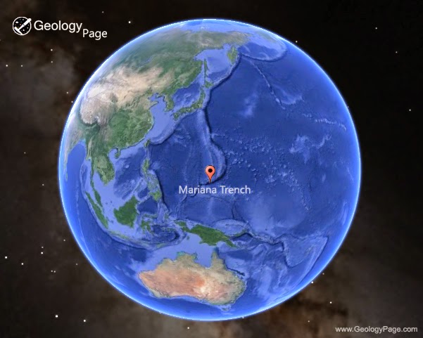
The Mariana Trench or Marianas Trench is the deepest part of the world’s oceans. It is located in the western Pacific Ocean, to the east of the Mariana Islands. The trench is about 2,550 kilometres (1,580 mi) long but has an average width of only 69 kilometres (43 mi). It reaches a maximum-known depth of 10,994 m (± 40 m) or 6.831 mi (36,070 ± 131 ft) at the Challenger Deep, a small slot-shaped valley in its floor, at its southern end, although some unrepeated measurements place the deepest portion at 11.03 kilometres (6.85 mi).
At the bottom of the trench the water column above exerts a pressure of 1,086 bars (15,750 psi), over 1000 times the standard atmospheric pressure at sea level. At this pressure the density of water is increased by 4.96%, making 95 litres of water under the pressure of the Challenger Deep contain the same mass as 100 litres at the surface. The temperature at the bottom is 1 to 4 °C.
The trench is not the part of the seafloor closest to the center of the Earth. This is because the Earth is not a perfect sphere: its radius is about 25 kilometres (16 mi) less at the poles than at the equator. As a result, parts of the Arctic Ocean seabed are at least 13 kilometres (8.1 mi) closer to the Earth’s center than the Challenger Deep seafloor.
Xenophyophores have been found in the trench by Scripps Institution of Oceanography researchers at a record depth of 10.6 km (6.6 mi) below the sea surface. On 17 March 2013, researchers reported data that suggested microbial life forms thrive within the trench.
Names
The Mariana Trench is named for the nearby Mariana Islands (in turn named Las Marianas in honor of Spanish Queen Mariana of Austria, widow of Philip IV of Spain). The islands are part of the island arc that is formed on an over-riding plate, called the Mariana Plate (also named for the islands), on the western side of the trench.
Geology
The Mariana Trench is part of the Izu-Bonin-Mariana subduction system that forms the boundary between two tectonic plates. In this system, the western edge of one plate, the Pacific Plate, is subducted (i.e., thrust) beneath the smaller Mariana Plate that lies to the west. Crustal material at the western edge of the Pacific Plate is some of the oldest oceanic crust on earth (up to 170 million years old), and is therefore cooler and more dense; hence its great height difference relative to the higher-riding (and younger) Mariana Plate. The deepest area at the plate boundary is the Mariana Trench proper.
The movement of the Pacific and Mariana plates is also indirectly responsible for the formation of the Mariana Islands. These volcanic islands are caused by flux melting of the upper mantle due to release of water that is trapped in minerals of the subducted portion of the Pacific Plate.
Measurements
The trench was first sounded during the Challenger expedition in 1875, which recorded a depth of 4,475 fathoms (8.184 km). In 1877 a map was published called Tiefenkarte des Grossen Ozeans by Petermann, which showed a Challenger Tief at the location of that sounding. In 1899 USS Nero, a converted collier, recorded a depth of 5269 fathoms (9,636 m, 31,614 ft). Challenger II surveyed the trench using echo sounding, a much more precise and vastly easier way to measure depth than the sounding equipment and drag lines used in the original expedition. During this survey, the deepest part of the trench was recorded when the Challenger II measured a depth of 5,960 fathoms (10,900 m, 35,760 ft) at 11°19′N 142°15′E, known as the Challenger Deep.
In 1957, the Soviet vessel Vityaz reported a depth of 11,034 m (36,201 ft), dubbed the Mariana Hollow.
In 1962, the surface ship M.V. Spencer F. Baird recorded a maximum depth of 10,915 m (35,840 ft), using precision depth gauges.
In 1984, the Japanese survey vessel Takuyō , collected data from the Mariana Trench using a narrow, multi-beam echo sounder; it reported a maximum depth of 10,924 m, also reported as 10,920 ± 10 metres.
Remotely Operated Vehicle KAIKO reached the deepest area of Mariana trench and made the deepest diving record of 10,911 m on March 24, 1995.
During surveys carried out between 1997 and 2001, a spot was found along the Mariana Trench that had depth similar to that of the Challenger Deep, possibly even deeper. It was discovered while scientists from the Hawaii Institute of Geophysics and Planetology were completing a survey around Guam; they used a sonar mapping system towed behind the research ship to conduct the survey. This new spot was named the HMRG (Hawaii Mapping Research Group) Deep, after the group of scientists who discovered it.
On 1 June 2009 sonar mapping of the Challenger Deep by the Simrad EM120 sonar multibeam bathymetry system for deep water (300–11,000 m) mapping aboard the RV Kilo Moana (mothership of the Nereus vehicle), has indicated a spot with a depth of 10,971 m (35,994 ft). The sonar system uses phase and amplitude bottom detection, with an accuracy of better than 0.2% of water depth across the entire swath (implying the depth figure is accurate to less than ± 22 metres).
In 2011, it was announced at the American Geophysical Union Fall Meeting that a US Navy hydrographic ship equipped with a multibeam echosounder conducted a survey which mapped the entire trench to 100 m resolution. The mapping revealed the existence of four rocky outcrops thought to be former seamounts.
The Mariana Trench is a site chosen by researchers at Washington University and the Woods Hole Oceanographic Institution in 2012 for a seismic survey to investigate the subsurface water cycle. Using seismometers and hydrophones the scientists are able to map structures as deep as 60 mi (97 km) beneath the surface.
How deep is the ocean?
The average ocean depth is 2.65 miles.
The average depth of the ocean is about 14,000 feet. The deepest part of the ocean is called the Challenger Deep and is located beneath the western Pacific Ocean in the southern end of the Mariana Trench, which runs several hundred kilometers southwest of the U.S. territorial island of Guam. Challenger Deep is approximately 36,200 feet deep. It is named after the HMS Challenger, whose crew first sounded the depths of the trench in 1875.
Map
Reference:
Wikipedia: Mariana Trench
National Ocean Service: How deep is the ocean?


