Geographic Resources Analysis Support System, commonly referred to as GRASS GIS, is a Geographic Information System (GIS) used for data management, image processing, graphics production, spatial modelling, and visualization of many types of data. It is Free (Libre) Software/Open Source released under GNU General Public License (GPL) >= V2. GRASS GIS is an official project of the Open Source Geospatial Foundation.
Originally developed by the U.S. Army Construction Engineering Research Laboratories (USA-CERL, 1982-1995, see history of GRASS 1.0-4.2 and 5beta), a branch of the US Army Corp of Engineers, as a tool for land management and environmental planning by the military, GRASS GIS has evolved into a powerful utility with a wide range of applications in many different areas of applications and scientific research. GRASS is currently used in academic and commercial settings around the world, as well as many governmental agencies including NASA, NOAA, USDA, DLR, CSIRO, the National Park Service, the U.S. Census Bureau, USGS, and many environmental consulting companies.
The GRASS Development Team has grown into a multi-national team consisting of developers at numerous locations.
In September 2006, the GRASS Project Steering Commitee was formed which is responsible for the overall management of the project. The PSC is especially responsible for granting SVN write access.
General GRASS GIS Features
GRASS GIS contains over 350 modules to render maps and images on monitor and paper; manipulate raster, and vector data including vector networks; process multispectral image data; and create, manage, and store spatial data. GRASS GIS offers both an intuitive graphical user interface as well as command line syntax for ease of operations. GRASS GIS can interface with printers, plotters, digitizers, and databases to develop new data as well as manage existing data.
GRASS GIS and support for teams
GRASS GIS supports workgroups through its LOCATION/MAPSET concept which can be set up to share data and the GRASS installation itself over NFS (Network File System) or CIFS. Keeping LOCATIONs with their underlying MAPSETs on a central server, a team can simultaneously work in the same project database.
GRASS GIS capabilities
- Raster analysis: Automatic rasterline and area to vector conversion, Buffering of line structures, Cell and profile dataquery, Colortable modifications, Conversion to vector and point data format, Correlation / covariance analysis, Expert system analysis , Map algebra (map calculator), Interpolation for missing values, Neighbourhood matrix analysis, Raster overlay with or without weight, Reclassification of cell labels, Resampling (resolution), Rescaling of cell values, Statistical cell analysis, Surface generation from vector lines
- 3D-Raster (voxel) analysis: 3D data import and export, 3D masks, 3D map algebra, 3D interpolation (IDW, Regularised Splines with Tension), 3D Visualization (isosurfaces), Interface to Paraview and POVray visualization tools
- Vector analysis: Contour generation from raster surfaces (IDW, Splines algorithm), Conversion to raster and point data format, Digitizing (scanned raster image) with mouse, Reclassification of vector labels, Superpositioning of vector layers
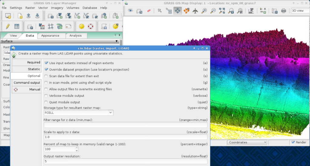
- Point data analysis: Delaunay triangulation, Surface interpolation from spot heights, Thiessen polygons, Topographic analysis (curvature, slope, aspect), LiDAR
- Image processing: Support for aerial and UAV images, satellite data (optical, radar, thermal), Canonical component analysis (CCA), Color composite generation, Edge detection, Frequency filtering (Fourier, convolution matrices), Fourier and inverse fourier transformation, Histogram stretching, IHS transformation to RGB, Image rectification (affine and polynomial transformations on raster and vector targets), Ortho photo rectification, Principal component analysis (PCA), Radiometric corrections (Fourier), Resampling, Resolution enhancement (with RGB/IHS), RGB to IHS transformation, Texture oriented classification (sequential maximum a posteriori classification), Shape detection, Supervised classification (training areas, maximum likelihood classification), Unsupervised classification (minimum distance clustering, maximum likelihood classification)
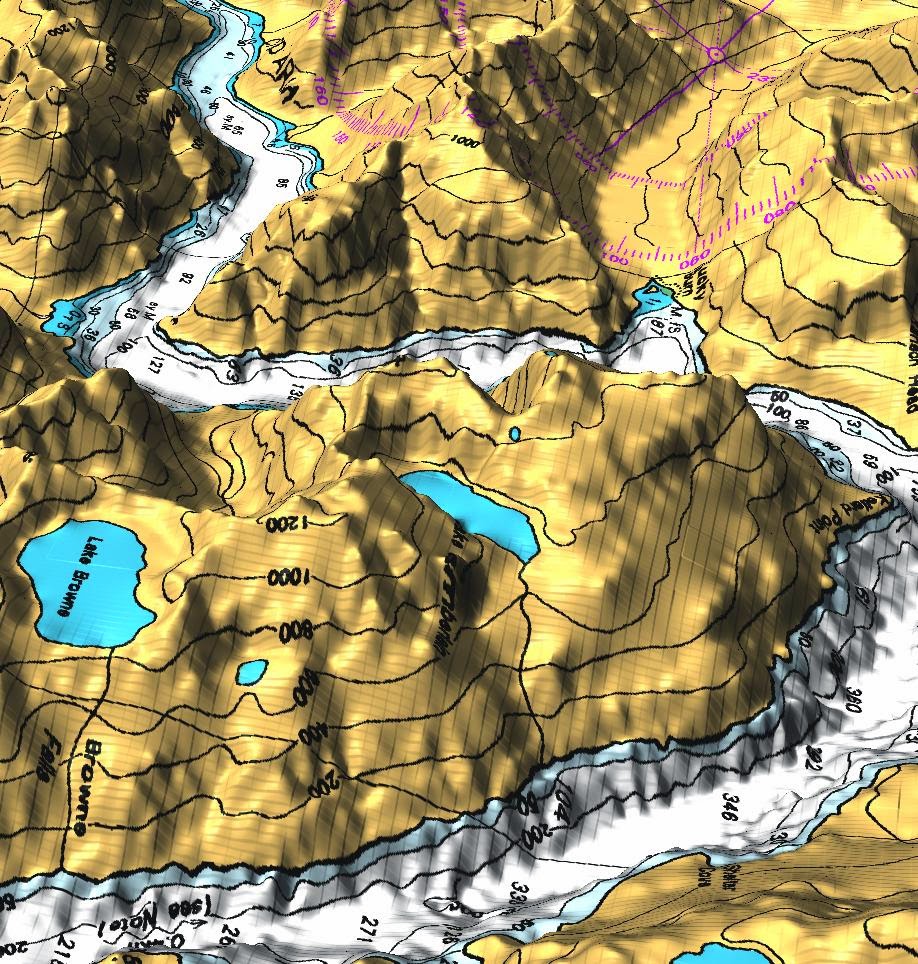
- DTM-Analysis: Contour generation, Cost / path analysis, Slope / aspect analysis, Surface generation from spot heigths or contours
- Geocoding: Geocoding of raster and vector maps including (LiDAR) point clouds
- Visualization: 3D surfaces with 3D query (NVIZ), Color assignments, Histogram presentation, Map overlay, Point data maps, Raster maps, Vector maps, Zoom / unzoom -function
- Map creation: Image maps, Postscript maps, HTML maps
- SQL-support: Database interfaces (DBF, SQLite, PostgreSQL, mySQL, ODBC)
- Geostatistics: Interface to “R” (a statistical analysis environment), Matlab, …
- Furthermore: Erosion modelling, Landscape structure analysis, Solution transport, Watershed analysis.
About GRASS GIS 6
The GRASS GIS 6 release introduced a new topological 2D/3D vector engine and support for vector network analysis. Attributes are managed in a SQL-based DBMS (PostgreSQL, mySQL, SQLite, ODBC, …), by default in DBF format. A new display manager has been implemented. The NVIZ visualization tool was enhanced to display 3D vector data and voxel volumes. Messages are partially translated (i18N) with support for FreeType fonts, including multibyte Asian characters. New LOCATIONs can be auto-generated eg. by EPSG code number using a location wizard. GRASS GIS is integrated with GDAL/OGR libraries to support an extensive range of raster and vector formats, including OGC-conformal Simple Features.
About GRASS GIS 7
GRASS GIS 7 is under development with a first releases in preparation (snapshots are already available). It offers large data support, an improved topological 2D/3D vector engine and much improved vector network analysis. Attributes are managed by default in SQLite format. The display manager has been improved for usability. The NVIZ visualization tool was completely rewritten. Image processing has also been improved. See more details at New Features.
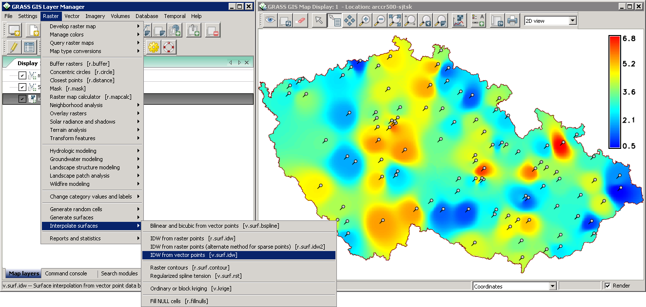
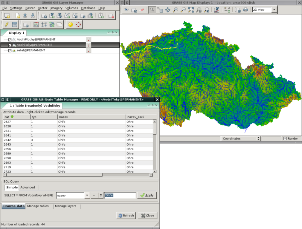
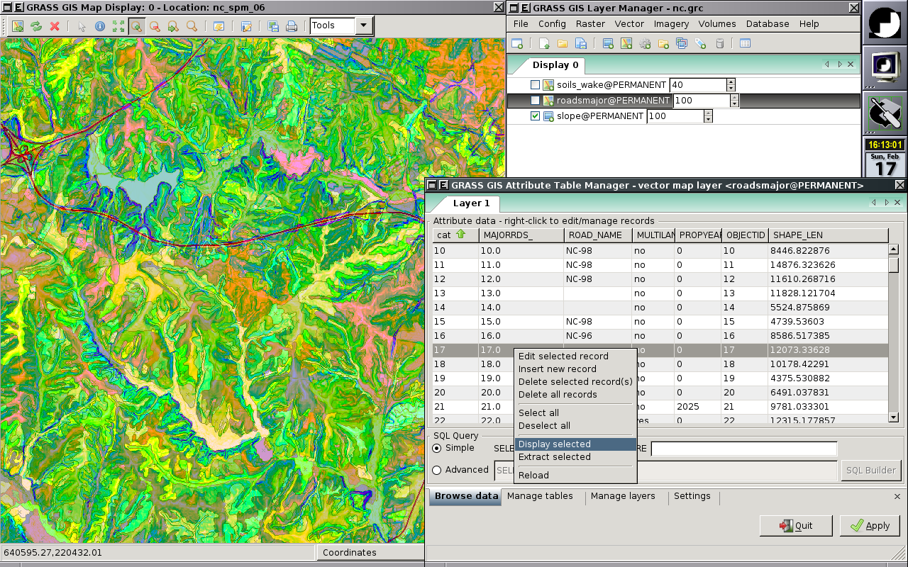
Screenshots
Tutorials
Go through Tutorial and Courses in various languages
Download
Copyright © 1998-2015, GRASS Development Team, CC-BY-SA


 used for data)