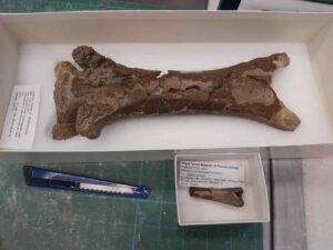
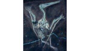
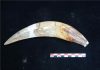
The juvenile vertebra of the pterosaur is seen in comparison to an adult-sized one. The bite occurred some 76 million years ago Credit: University of Reading
The fossilised neck bone of a flying reptile unearthed in Canada shows tell-tale signs of being bitten by a crocodile-like creature 76 million years ago, according to a new study published today [23 January] in the Journal of Palaeontology.
The juvenile pterosaur vertebra, discovered in Dinosaur Provincial Park, Alberta, bears a circular four-millimetre-wide puncture mark from a crocodilian tooth.
Researchers from the Royal Tyrrell Museum of Palaeontology (Canada), the University of Reading (UK) and the University of New England (Australia) say this rare evidence provides insight into predator-prey dynamics in the region during the Cretaceous Period.
The discovery was made during an international field course that took place in July 2023, led by Dr Brian Pickles from the University of Reading.
Dr Caleb Brown from the Royal Tyrrell Museum of Palaeontology is the lead author of the paper.
He said: “Pterosaur bones are very delicate — so finding fossils where another animal has clearly taken a bite is exceptionally uncommon. This specimen being a juvenile makes it even more rare.”
Dinosaur Provincial Park has produced some of the most important dinosaur fossil discoveries ever made.
The punctured vertebra belongs to a young Azhdarchid pterosaur (Cryodrakon boreas), with an estimated wingspan of two metres.
Adults of this species would have been as tall as a giraffe with a wingspan in the region of 10m.
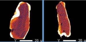
The researchers used micro-CT scans and comparisons with other pterosaur bones to confirm the puncture is not a result of damage during fossilisation or excavation, but an actual bite.
Dr Brian Pickles from the University of Reading and co-author of the paper said: “Bite traces help to document species interactions from this period. We can’t say if the pterosaur was alive or dead when it was bitten but the specimen shows that crocodilians occasionally preyed on, or scavenged, juvenile pterosaurs in prehistoric Alberta over 70 million years ago.”
The paper also shows that this new bone documents the first evidence in North America of ancient crocodilians opportunistically feeding on these giant prehistoric flying reptiles. Other examples of Azhdarchid bones with possible crocodilian bites have previously been found in Romania.
Reference:
Caleb M. Brown, Phil R. Bell, Holly Owers, Brian J. Pickles. A juvenile pterosaur vertebra with putative crocodilian bite from the Campanian of Alberta, Canada. Journal of Paleontology, 2025; 1 DOI: 10.1017/jpa.2024.12
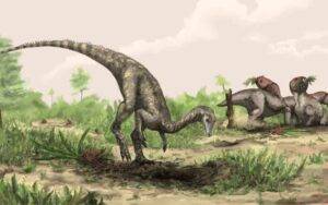
An artist’s illustration of Nyasasaurus, which could be the earliest known dinosaur, or else a close relative of early dinosaurs. Credit: Mark Witton/The Trustees of the Natural History Museum, London
The remains of the earliest dinosaurs may lie undiscovered in the Amazon and other equatorial regions of South America and Africa, suggests a new study led by UCL (University College London) researchers.
Currently, the oldest known dinosaur fossils date back about 230 million years and were unearthed further south in places including Brazil, Argentina and Zimbabwe. But the differences between these fossils suggest dinosaurs had already been evolving for some time, pointing to an origin millions of years earlier.
The new study, published in the journal Current Biology, accounted for gaps in the fossil record and concluded that the earliest dinosaurs likely emerged in a hot equatorial region in what was then the supercontinent Gondwana — an area of land that encompasses the Amazon, Congo basin, and Sahara Desert today.
Lead author and PhD student Joel Heath (UCL Earth Sciences and the Natural History Museum, London) said: “Dinosaurs are well studied but we still don’t really know where they came from. The fossil record has such large gaps that it can’t be taken at face value.
“Our modelling suggests that the earliest dinosaurs might have originated in western, low-latitude Gondwana. This is a hotter and drier environment than previously thought, made up of desert- and savannah-like areas.
“So far, no dinosaur fossils have been found in the regions of Africa and South America that once formed this part of Gondwana. However, this might be because researchers haven’t stumbled across the right rocks yet, due to a mix of inaccessibility and a relative lack of research efforts in these areas.”
The modelling study drew on fossils and evolutionary trees of dinosaurs and their close reptile relatives, as well as the geography of the period. It accounted for gaps in the fossil record by treating areas of the globe where no fossils had been found as missing information rather than areas where no fossils exist.
Initially, early dinosaurs were vastly outnumbered by their reptile cousins.
These included the ancestors of crocodiles, the pseudosuchians (an abundant group including enormous species up to 10 metres long), and pterosaurs, the first animals to evolve powered flight (flying by flapping wings rather than gliding), who grew as big as fighter jets.
By contrast, the earliest dinosaurs were much smaller than their descendants — more the size of a chicken or dog than a Diplodocus. They walked on two legs (were bipedal) and most are thought to have been omnivores.
Dinosaurs became dominant after volcanic eruptions wiped out many of their reptile relatives 201 million years ago.
The new modelling results suggested that dinosaurs as well as other reptiles may have originated in low-latitude Gondwana, before radiating outwards, spreading to southern Gondwana and to Laurasia, the adjacent northern supercontinent that later split into Europe, Asia and North America.
Support for this origin comes from the fact it is a midpoint between where the earliest dinosaurs have been found in southern Gondwana and where the fossils of many of their close relatives have been discovered to the north in Laurasia.
As there is uncertainty about how the most ancient dinosaurs were related to one another and to their close relatives, the researchers ran their model on three proposed evolutionary trees.
They found strongest support for a low-latitude Gondwanan origin of the dinosaurs in the model that counted silesaurids, traditionally regarded as cousins of dinosaurs but not dinosaurs themselves, as ancestors of ornithischian dinosaurs.
Ornithischians, one of the three main dinosaur groups that later included plant eaters Stegosaurus and Triceratops, are mysteriously absent from the fossil record of these early years of the dinosaur era. If silesaurids are the ancestors of ornithischians, this helps to fill in this gap in the evolutionary tree.
Senior author Professor Philip Mannion (UCL Earth Sciences) said: “Our results suggest early dinosaurs may have been well adapted to hot and arid environments. Out of the three main dinosaur groups, one group, sauropods, which includes the Brontosaurus and the Diplodocus, seemed to retain their preference for a warm climate, keeping to Earth’s lower latitudes.
“Evidence suggests the other two groups, theropods and ornithischians, may have developed the ability to generate their own body heat some millions of years later in the Jurassic period, allowing them to thrive in colder regions, including the poles.”
The earliest known dinosaurs include Eoraptor, Herrerasaurus, Coelophysis, and Eodromaeus.
Reference:
Joel A. Heath, Natalie Cooper, Paul Upchurch, Philip D. Mannion. Accounting for sampling heterogeneity suggests a low paleolatitude origin for dinosaurs. Current Biology, 2025; DOI: 10.1016/j.cub.2024.12.053
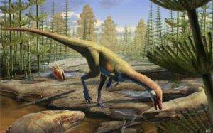
An artist’s rendering shows how Ahvaytum bahndooiveche may have appeared in a habitat dating to around 230 million years ago. Illustration by Gabriel Ugueto
How and when did dinosaurs first emerge and spread across the planet more than 200 million years ago? That question has for decades been a source of debate among paleontologists faced with fragmented fossil records. The mainstream view has held that the reptiles emerged on the southern portion of the ancient supercontinent Pangea called Gondwana millions of years before spreading to the northern half named Laurasia.
But now, a newly described dinosaur whose fossils were uncovered by University of Wisconsin-Madison paleontologists is challenging that narrative, with evidence that the reptiles were present in the northern hemisphere millions of years earlier than previously known.
The UW-Madison team has been analyzing the fossil remains since they were first discovered in 2013 in present-day Wyoming, an area that was near the equator on Laurasia. The creature, named Ahvaytum bahndooiveche, is now the oldest known Laurasian dinosaur, and with fossils estimated to be around 230 million years old, it’s comparable in age to the earliest known Gondwanan dinosaurs.
UW-Madison scientists and their research partners detail their discovery Jan. 8, 2025, in the Zoological Journal of the Linnean Society.
“We have, with these fossils, the oldest equatorial dinosaur in the world — it’s also North America’s oldest dinosaur,” says Dave Lovelace, a research scientist at the University of Wisconsin Geology Museum who co-led the work with graduate student Aaron Kufner.
Discovered in a layer of rock known as the Popo Agie Formation, it took years of careful work by Lovelace and his colleagues to analyze the fossils, establish them as a new dinosaur species and determine their estimated age.
While the team doesn’t have a complete specimen — that’s an exceedingly rare occurrence for early dinosaurs — they did find enough fossils, particularly parts of the species’ legs, to positively identify Ahvaytum bahndooiveche as a dinosaur, and likely as a very early sauropod relative. Sauropods were a group of herbivorous dinosaurs that included some famously gigantic species like those in the aptly named group of titanosaurs. The distantly related Ahvaytum bahndooiveche lived millions of years earlier and was smaller — much smaller.
“It was basically the size of a chicken but with a really long tail,” says Lovelace. “We think of dinosaurs as these giant behemoths, but they didn’t start out that way.”
Indeed, the type specimen of Ahvaytum bahndooiveche, which was full-grown but could have been slightly bigger at its maximum age, stood a little over one foot tall and was around three feet long from head to tail. Although scientists haven’t found its skull material, which could help illuminate what it ate, other closely related early sauropod-line dinosaurs were eating meat and would likely have been omnivorous.
The researchers found the few known bones of Ahvaytum in a layer of rock just a little bit above those of a newly described amphibian that they also discovered. The evidence suggests that Ahvaytum bahndooiveche lived in Laurasia during or soon after a period of immense climatic change known as the Carnian pluvial episode that has previously been connected to an early period of diversification of dinosaur species.
The climate during that period, lasting from about 234 to 232 million years ago, was much wetter than it had been previously, transforming large, hot stretches of desert into more hospitable habitats for early dinosaurs.
Lovelace and his colleagues performed high-precision radioisotopic dating of rocks in the formation that held Ahvaytum’s fossils, which revealed that the dinosaur was present in the northern hemisphere around 230 million years ago. The researchers also found an early dinosaur-like track in slightly older rocks, demonstrating that dinosaurs or their cousins were already in the region a few million years prior to Ahvaytum.
“We’re kind of filling in some of this story, and we’re showing that the ideas that we’ve held for so long — ideas that were supported by the fragmented evidence that we had — weren’t quite right,” Lovelace says. “We now have this piece of evidence that shows dinosaurs were here in the northern hemisphere much earlier than we thought.”
While the scientific team is confident they’ve discovered North America’s oldest dinosaur, it’s also the first dinosaur species to be named in the language of the Eastern Shoshone Tribe, whose ancestral lands include the site where the fossils were found. Eastern Shoshone tribal elders and middle school students were integral to the naming process. Ahvaytum bahndooiveche broadly translates to “long ago dinosaur” in the Shoshone language.
Several tribal members also partnered with Lovelace and his UW-Madison colleagues as the researchers sought to evolve their field practices and better respect the land by incorporating the knowledge and perspectives of the Indigenous peoples into their work.
“The continuous relationship developed between Dr. Lovelace, his team, our school district, and our community is one of the most important outcomes of the discovery and naming of Ahvaytum bahndooiveche,” says Amanda LeClair-Diaz, a co-author on the paper and a member of the Eastern Shoshone and Northern Arapaho Tribes. LeClair-Diaz is the Indian education coordinator at Fort Washakie school and coordinated the naming process with students and tribal elders — a process that started under her predecessor, Lynette St. Clair.
“Typically, the research process in communities, especially Indigenous communities, has been one sided, with the researchers fully benefiting from studies,” says LeClair-Diaz. “The work we have done with Dr. Lovelace breaks this cycle and creates an opportunity for reciprocity in the research process.”
Reference:
David Lovelace et al. Rethinking dinosaur origins: oldest known equatorial dinosaur-bearing assemblage (mid-late Carnian Popo Agie FM, Wyoming, USA). Zoological Journal of the Linnean Society, 2025 DOI: 10.1093/zoolinnean/zlae153
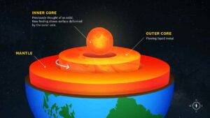
The near surface of the inner core may be changing. (USC Graphic/Edward Sotelo)
The surface of the Earth’s inner core may be changing, as shown by a new study from USC scientists that detected structural changes near the planet’s center, published today in Nature Geoscience.
The changes of the inner core has long been a topic of debate for scientists. However, most research has been focused on assessing rotation. John Vidale, Dean’s Professor of Earth Sciences at the USC Dornsife College of Letters, Arts and Sciences and principal investigator of the study, said the researchers “didn’t set out to define the physical nature of the inner core.”
“What we ended up discovering is evidence that the near surface of Earth’s inner core undergoes structural change,” Vidale said. The finding sheds light on the role topographical activity plays in rotational changes in the inner core that have minutely altered the length of a day and may relate to the ongoing slowing of the inner core.
Redefining the inner core
Located 3,000 miles below the Earth’s surface, the inner core is anchored by gravity within the molten liquid outer core. Until now the inner core was widely thought of as a solid sphere.
The original aim of the USC scientists was to further chart the slowing of the inner core. “But as I was analyzing multiple decades’ worth of seismograms, one dataset of seismic waves curiously stood out from the rest,” Vidale said. “Later on, I’d realize I was staring at evidence the inner core is not solid.”
The study utilized seismic waveform data — including 121 repeating earthquakes from 42 locations near Antarctica’s South Sandwich Islands that occurred between 1991 and 2024 — to give a glimpse of what takes place in the inner core. As the researchers analyzed the waveforms from receiver-array stations located near Fairbanks, Alaska, and Yellowknife, Canada, one dataset of seismic waves from the latter station included uncharacteristic properties the team had never seen before.
“At first the dataset confounded me,” Vidale said. It wasn’t until his research team improved the resolution technique did it become clear the seismic waveforms represented additional physical activity of the inner core.
Deformed inner core
The physical activity is best explained as temporal changes in the shape of the inner core. The new study indicates that the near surface of the inner core may undergo viscous deformation, changing its shape and shifting at the inner core’s shallow boundary.
The clearest cause of the structural change is interaction between the inner and outer core. “The molten outer core is widely known to be turbulent, but its turbulence had not been observed to disrupt its neighbor the inner core on a human timescale,” Vidale said. “What we’re observing in this study for the first time is likely the outer core disturbing the inner core.”
Vidale said the discovery opens a door to reveal previously hidden dynamics deep within Earth’s core, and may lead to better understanding of Earth’s thermal and magnetic field.
Reference:
John E. Vidale, Wei Wang, Ruoyan Wang, Guanning Pang, Keith Koper. Annual-scale variability in both the rotation rate and near surface of Earth’s inner core. Nature Geoscience, 2025; DOI: 10.1038/s41561-025-01642-2
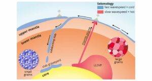
Schematic representation of the process of subduction of tectonic plates and of a mantle plume rising from an LLSVP. In the latter, the mineral grains are larger than those in the subducted plates.
Deeply hidden in Earth’s mantle there are two huge ‘islands’ with the size of a continent. New research from Utrecht University shows that these regions are not only hotter than the surrounding graveyard of cold sunken tectonic plates, but also that they must be ancient: at least half a billion years old, perhaps even older. These observations contradict the idea of a well-mixed and fast flowing Earth’s mantle, a theory that is becoming more and more questioned. “There is less flow in Earth’s mantle than is commonly thought.” This research will be published on January 22nd, 2025 in Nature.
Large earthquakes make the whole Earth ring like a bell with different tones, just like a musical instrument. Seismologists study Earth’s deep interior by investigating how much these tones are ‘out of tune’, because whole Earth oscillations will sound out of tune or less loud when they encounter anomalies. This way seismologists will be able to make images of the interior of our planet, just like a hospital doctor can ‘see’ through your body with X-rays. At the end of the last century, an analysis of these oscillations showed the existence of two subsurface ‘super-continents’: one under Africa and the other one under the Pacific Ocean, both hidden more than two thousand kilometres below the Earth’s surface. “Nobody knew what they are, and whether they are only a temporary phenomenon, or if they have been sitting there for millions or perhaps even billions of years,” says Arwen Deuss, seismologist and professor of Structure and composition of Earth’s deep interior at Utrecht University in the Netherlands. “These two large islands are surrounded by a graveyard of tectonic plates which have been transported there by a process called ‘subduction’, where one tectonic plate dives below another plate and sinks all the way from the Earth’s surface down to a depth of almost three thousand kilometres.”
Slow waves
“We have known for years that these islands are located at the boundary between the Earth’s core and mantle. And we see that seismic waves slow down there.” Earth scientists therefore call these regions ‘Large Low Seismic Velocity Provinces’ or LLSVPs. “The waves slow down because the LLSVPs are hot, just like you can’t run as fast in hot weather as you can when it’s colder.” Deuss and her colleague Sujania Talavera-Soza were keen to find out if they could discover more about these regions. “We added new information, the so-called ‘damping’ of seismic waves, which is the amount of energy that waves lose when they travel through the Earth. In order to do so, we did not only investigate how much the tones where out of tune, we also studied their sound volume.” Talavera-Soza adds: “Against our expectations, we found little damping in the LLSVPs, which made the tones sound very loud there. But we did find a lot of damping in the cold slab graveyard, where the tones sounded very soft. Unlike the upper mantle, where we found exactly what we expected: it is hot, and the waves are damped. Just like when the weather is hot outside and you go for a run, you don’t only slow down but you also get more tired than when it is cold outside.”
Grain size
Their colleague Laura Cobden, who specializes in the minerals that we find deep in the Earth, suggested to study the grain size of the LLSVPs. According to their American colleague Ulrich Faul, temperature alone cannot explain the absence of high damping in the LLSVPs. Deuss: “Grain size is much more important. Subducting tectonic plates that end up in the slab graveyard consist of small grains because they recrystallize on their journey deep into the Earth. A small grain size means a larger number of grains and therefore also a larger number of boundaries between the grains. Due to the large number of grain boundaries between the grains in the slab graveyard, we find more damping, because waves loose energy at each boundary they cross. The fact that the LLSVPs show very little damping, means that they must consist of much larger grains.”
Ancient
Those mineral grains do not grow overnight, which can only mean one thing: LLSVPs are lots and lots older than the surrounding slab graveyards. Even more so: the LLSVPs, with their much larger building blocks, are very rigid. Therefore, they do not take part in mantle convection (the flow in the Earth’s mantle). Thus, contrary to what the geography books teach us, the mantle cannot be well-mixed either. Talavera-Soza clarifies: “After all, the LLSVPs must be able to survive mantle convection one way or another.”
Engine
Knowledge of the Earth’s mantle is essential to understand the evolution of our planet. “And also to understand other phenomena at the Earth’s surface, such as vulcanism and mountain building,” Deuss adds. “The Earth’s mantle is the engine that drives all these phenomena. Take, for example, mantle plumes, which are large bubbles of hot material that rise from the Earth’s deep interior as in a lava lamp.” Once they finally reach the surface, they cause vulcanism, like under Hawaii. “And we think that those mantle plumes originate at the edges of the LLSVPs.”
Large earthquakes
In this type of research, seismologists make good use of oscillations caused by really large earthquakes, preferably quakes that take place at great depths, such as the great Bolivia earthquake of 1994. “It never made it into the newspapers, because it took place at a large depth of 650 km and luckily did not result in any damage or casualties at the Earth’s surface,” Deuss explains. The whole Earth oscillations, or tones, are mathematically described in such a way that we can easily ‘read’ the damping (i.e. how loud the oscillation is) due to a specific structure and separate it from the wave speed (i.e. how much out of tune it is). “Which is impressive, because the damping of the signal is only one-tenth of the total amount of information that we can unravel from these oscillations.” For this type of research, it is not necessary to wait until another earthquake occurs. The data from previous earthquakes is just as useful. “We can go back to 1975, because from that year onwards, seismometers became good enough to give us data of such high quality that they are useful for our research.”
Reference:
Sujania Talavera-Soza, Laura Cobden, Ulrich H. Faul, Arwen Deuss. Global 3D model of mantle attenuation using seismic normal modes. Nature, 2025; DOI: 10.1038/s41586-024-08322-y
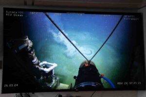
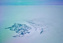
The underwater volcano Borealis Mud Volcano was discovered in the summer of 2023. Last year, the researchers were back at the volcano. Photo: Jørn Berger-Nyvoll / UiT
One would think that a volcano was not the most hospitable place for living organisms. However, the Borealis Mud Volcano, at 400 m water depth, acts as a sanctuary for a number of marine species.
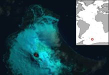
The underwater volcano Borealis Mud Volcano is located in the Barents Sea and was first discovered by researchers at UiT The Arctic University of Norway in 2023. The discovery received a lot of attention, and images of the volcano circulated around the world. Now researchers from UiT, in collaboration with REV Ocean, have finally published the results from an interdisciplinary investigation showing that Borealis mud volcano has a unique ecological role as a natural sanctuary for several marine species in the Barents Sea.
While some parts of the crater floor of Borealis appear inhospitable to a variety of organisms, the carbonate crusts — a type of mineral formed thousands of years ago — that characterized Borealis provide a suitably hard substrate for species of anemones, serpulids, demosponges, and sparse octocoral colonies.
“Important for maintaining biodiversity”
In addition, the carbonates offer both shelter and feeding opportunities, playing an important role in sustaining the local fish populations. The researchers observed large schools of commercially valuable species like saithe and various demersal species such as spotted wolffish, cod, four-bearded rockling, and redfish (Sebastes spp.) clustering around the jagged carbonate formations.
“The redfish, for instance, is red listed, and we don’t know the consequences if it would disappear. Borealis is an oasis where different species can thrive and flourish. Thus, preserving ecosystems such as the Borealis Mud Volcano is essential for maintaining biodiversity and understanding the interactions between geology, geochemistry and biology in marine environments. We need that understanding, among other things, considering that the Arctic seabed plays an important role in oil and gas extraction activities and the emerging deep-sea mining industry,” says Professor Giuliana Panieri, lead author of the study recently published in Nature Communications.
Methan has leaked out, probably for thousands of years
Onboard the research vessel Kronprins Haakon in May 2024, researchers confirmed the previous discoveries. Using the remotely operated vehicle, ROV Aurora, the research team was able to make a series of observations of the underwater volcano. Among other things, they saw that it warms the surroundings to 11.5 degrees Celsius, while the seabed usually has a temperature of around 4 degrees Celsius.
The researchers also found sediments containing extinct, microscopic marine organisms from up to 2.5 million years ago and that small “mud cones” in the volcanic system are emitting vigorous methane-rich liquids. The fact that the seabed around the volcano is also characterized by extensive carbonate deposits indicates that methane has leaked out, probably for thousands of years.
“The Borealis Mud Volcano is a unique geological and ecological phenomenon that provides a rare insight into the complex interactions between geological processes and marine ecosystems. It is important to preserve these unique habitats, which play a crucial role in maintaining marine biodiversity,” says Panieri.
She reminds that, in the longer term, Norway has committed to the 30×30 target (protecting 30 % of land and sea by 2030) for spatial conservation measures of representative marine ecosystems, including in the deep sea. Protecting large areas of the deep-sea floor along the Norwegian margin may result in seep refugia acting as source populations for wider recolonization and restoration of benthic biological communities.
“The new findings show the power of international cooperation and how such cooperation can contribute to increasing our understanding of the world’s oceans,” says Panieri.
Reference:
Panieri, G., Argentino, C., Savini, A. et al. Sanctuary for vulnerable Arctic species at the Borealis Mud Volcano. Nat Commun, 2025 DOI: 10.1038/s41467-024-55712-x
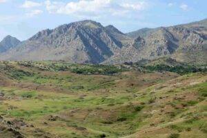
The Zagros Mountains and sediments that have accumulated over millions of years along the depression at the base of the mountains. Photo: Renas Koshnaw
An international research team led by the University of Göttingen has investigated the influence of the forces exerted by the Zagros Mountains in the Kurdistan region of Iraq on how much the surface of the Earth has bent over the last 20 million years. Their research revealed that in the present day, deep below the Earth’s surface, the Neotethys oceanic plate — the ocean floor that used to be between the Arabian and Eurasian continents — is breaking off horizontally, with a tear progressively lengthening from southeast Turkey to northwest Iran. Their findings show how the evolution of the Earth’s surface is controlled by processes deep within the planet’s interior. The research was published in the journal Solid Earth.
When two continents converge over millions of years, the oceanic floor between them slides to great depths beneath the continents.
Eventually, the continents collide, and masses of rock from their edges are lifted up into towering mountain ranges.
Over millions of years, the immense weight of these mountains causes the Earth’s surface around them to bend downward.
Over time, sediments eroded from the mountains accumulate in this depression, forming plains such as Mesopotamia in the Middle East.
The researchers modelled the downward bend of the Earth’s surfaces based on the Zagros Mountain’s load where the Arabian continent is colliding with Eurasia.
They combined the resulting size of the depression with the computed topography based on the Earth’s mantle to reproduce the unusually deep depression in the southeastern segment of the study area.
The researchers found that the weight of the mountains alone cannot account for the 3-4 km deep depression that has formed and been filled with sediment over the past 15 million years.
“Given the moderate topography in the north-western Zagros area, it was surprising to find out that so much sediment has accumulated in the part of the area we studied. This means the depression of the land is greater than could be caused by the load of the Zagros Mountains,” said Dr Renas Koshnaw, lead author and Postdoctoral Researcher at Göttingen University’s Department of Structural Geology and Geothermics.
Researchers propose that this is caused by the additional load of the sinking oceanic plate that is still attached to the Arabian plate.
Koshnaw adds: “This plate is pulling the region downward from below, making space for more sediment accumulation. Towards Turkey, the sediment-filled depression becomes much shallower, suggesting that the slab has broken off in this area, relieving the downward pull force.”
The geodynamic model developed in this research will benefit other fields as well.
“This research contributes to understanding how the Earth’s rigid outer shell functions,” explains Koshnaw.
Such research can lead to practical applications in the future by providing information for exploring natural resources such as sedimentary ore deposits and geothermal energy, and better characterization of the earthquake risks.
This research was made possible thanks to funding from the Alexander von Humboldt Foundation.
Reference:
Renas I. Koshnaw, Jonas Kley, Fritz Schlunegger. The Miocene subsidence pattern of the NW Zagros foreland basin reflects the southeastward propagating tear of the Neotethys slab. Solid Earth, 2024; 15 (11): 1365 DOI: 10.5194/se-15-1365-2024
QUT synthetic biologists have developed a prototype for an innovative biosensor that can detect rare earth elements and be modified for a range of other applications.
Lanthanides (Lns) are elements used in electronics, electric motors, and batteries.
The problem is that we can’t extract enough of them to meet the growing demand and current extraction methods are expensive and environmentally damaging.
Professor Kirill Alexandrov and colleagues, from the QUT Centre of Agriculture and Bioeconomy and the ARC Centre of Excellence in Synthetic Biology, engineered proteins to create molecular nanomachines that generate easily detectable signals when they selectively bind to Lns.
Along with Professor Alexandrov, the international research team involved QUT researchers Dr Zhong Guo, Patricia Walden and Dr Zhenling Cui, in collaboration with researchers from CSIRO Advanced Engineering Biology Future Science Platform and Clarkson University (USA).
Publishing their findings in Angewandte Chemie International, the team describe engineering a hybrid protein, or “chimera,” by combining a lanthanide-binding protein, LanM, with an antibiotic degrading enzyme called beta-lactamase.
This hybrid acts like a “switch” that becomes active only when lanthanides are present.
It can be used to detect and quantify Lns in liquids, producing a visible colour change or an electrical signal.
Impressively, bacteria modified with these chimeras were able to survive in the presence of antibiotics that otherwise would kill them — but only when lanthanides were present.
This highlights how precisely the proteins respond to these rare metals.
“This work opens up exciting possibilities for using biology to detect and recover rare earth metals,” Professor Alexandrov said.
“The prototype can also be modified for various biotechnological applications, including construction of living organisms capable of detecting and extracting valuable metals.”
The research team now plan to work on increasing the specificity of the molecular switch to better differentiate between closely related rare earth elements . It also explores the possibility of developing switches for other critical elements.
The team is in active discussions with potential industry partners who are interested in this technology.
“We also want to explore using the tool to engineer microbes that can directly extract rare earth minerals from ocean water,” Professor Alexandrov said.
“This is probably one of the best performing switches made and has given us a lot of insight into the mechanics of protein switches.”
Reference:
Kirill Alexandrov, Zhong Guo, Oleh Smutok, Raquel Aguiar Rocha, Patricia Walden, Evgeny Katz, Colin Scott, Chantal Ronacher, Zhenling Cui, Sergey Mureev. Lanthanide‐controlled protein switches: development and in vitro and in vivo applications. Angewandte Chemie International Edition, 2025; DOI: 10.1002/anie.202411584
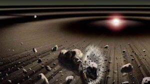
Planetesimal collisions during planet formation in the early solar system Image courtesy: ASU/Kouji Kanba
Understanding where Earth’s essential elements came from — and why some are missing — has long puzzled scientists. Now, a new study reveals a surprising twist in the story of our planet’s formation.
A new study led by Arizona State University’s Assistant Professor Damanveer Grewal from the School of Molecular Sciences and School of Earth and Space Exploration, in collaboration with researchers from Caltech, Rice University, and MIT, challenges traditional theories about why Earth and Mars are depleted in moderately volatile elements (MVEs). MVEs like copper and zinc play a crucial role in planetary chemistry, often accompanying life-essential elements such as water, carbon, and nitrogen.
Understanding their origin provides vital clues about why Earth became a habitable world.
Earth and Mars contain significantly fewer MVEs than primitive meteorites (chondrites), raising fundamental questions about planetary formation.
Published in Science Advances, the study takes a fresh approach by analyzing iron meteorites — remnants of the metallic cores of the earliest planetary building blocks — to uncover new insights.
“We found conclusive evidence that first-generation planetesimals in the inner solar system were unexpectedly rich in these elements,” said Grewal.
“This discovery reshapes our understanding of how planets acquired their ingredients.”
Until now, scientists believed that MVEs were lost either because they never fully condensed in the early solar system or escaped during planetesimal differentiation.
However, this study reveals a different story: many of the first planetesimals held onto their MVEs, suggesting that the building blocks of Earth and Mars lost theirs later — during a period of violent cosmic collisions that shaped their formation.
Surprisingly, the team found that many inner solar system planetesimals retained chondrite-like MVE abundances, showing that they accreted and preserved MVEs despite undergoing differentiation.
This suggests that the progenitors of Earth and Mars did not start out depleted in these elements, but instead, their loss occurred over a prolonged history of collisional growth rather than incomplete condensation in the solar nebula or planetesimal differentiation.
“Our work redefines how we understand the chemical evolution of planets,” Grewal explained. “It shows that the building blocks of Earth and Mars were originally rich in these life-essential elements, but intense collisions during planetary growth caused their depletion.”
Reference:
Damanveer S. Grewal, Surjyendu Bhattacharjee, Bidong Zhang, Nicole X. Nie, Yoshinori Miyazaki. Enrichment of moderately volatile elements in first-generation planetesimals of the inner Solar System. Science Advances, 2025; 11 (6) DOI: 10.1126/sciadv.adq7848
The magnitude 7.9 Bonin Islands earthquake sequence, which ruptured deep within the earth near the base of the upper mantle, did not include an aftershock that extended to record depths into the lower mantle, according to a study in The Seismic Record.
When Hao Zhang of the University of Southern California and colleagues re-examined the aftershock sequence of the May 2015 earthquake, they did not find evidence for a 751-kilometer-deep aftershock as reported by previous researchers. This aftershock has been called the deepest earthquake ever recorded.
Instead, their study found a distribution of aftershocks that is compatible with a 12-kilometer sliver of a mantle mineral called olivine that could shed light on how deep earthquakes can occur.
The Bonin Islands earthquake, which ruptured 1000 kilometers offshore of Japan in a remote part of the Pacific Ocean, is one of the deepest and largest earthquakes ever recorded. The earthquake took place within the Izu-Bonin subduction zone 680 kilometers below the Earth’s surface.
The mechanisms behind deep earthquakes — those occurring 500 kilometers or deeper — are something of a mystery to seismologists. Extremely high pressures and temperatures at these depths make rock more likely to bend or deform plastically, rather than break in the brittle fashion that causes earthquake rupture at shallower depths.
These earthquakes also typically produce few aftershocks, Zhang noted, which could provide useful data to understand how these deep events are generated at subduction zones.
Plastic deformation “limits the formation of extensive fracture networks that would typically generate aftershocks,” he said. “Additionally, the high confining pressures promote efficient redistribution of stress following the mainshock, further reducing the likelihood of subsequent seismic events.”
One previous study of the Bonin Islands earthquake reported a foreshock sequence for the event, while a second study detected a potentially record-breaking deep aftershock in the lower mantle.
“Both findings could significantly advance our understanding of deep earthquakes, if accurate,” said Zhang. “However, these two catalogs are inconsistent, and both have methodological limitations. Therefore, it is essential to re-examine the aftershock sequence using improved techniques.”
To gain a better look at the deep and remote earthquake, Zhang and colleagues turned to data collected by a dense seismic array in Japan called Hi-Net, using a combination of techniques to precisely locate seismic signals coming from the event.
Their new analysis detected no foreshocks but identified 14 aftershocks in the upper mantle within a 150-kilometer radius of the earthquake’s hypocenter. One set of aftershocks aligned with the rupture plane of the earthquake one week after the mainshock, with a second set dispersing over a wider area during the second week.
“While it remains challenging to definitely reject the existence of seismicity initiated in the lower mantle and its associated mechanisms, our results do reject the most compelling lower mantle seismicity claim to date,” the researchers write in their paper.
The aftershock pattern is compatible with the presence of a metastable olivine wedge or MOW, the researchers suggested. In a subducting slab, olivine can delay its transition into other mineral states under high temperature and pressure. “This delayed transformation may generate stress and release energy, potentially triggering deep earthquakes,” Zhang said.
With MOWs as potential earthquake nucleation sites, some researchers have proposed this mechanism of transformational faulting as one of the main ways that deep earthquakes occur, he added.
“Furthermore, MOWs offer insights into the thermal structure and behavior of subducting slabs, with colder slabs being more likely to preserve metastable olivine at greater depths,” Zhang added. “By studying MOWs, we can refine models of deep earthquake generation and improve our understanding of the dynamic processes in Earth’s interior.”
Reference:
Hao Zhang, John E. Vidale, Wei Wang. Aftershocks on the Planar Rupture Surface of the Deep-Focus Mw 7.9 Bonin Islands Earthquake. The Seismic Record, 2025; 5 (1): 35 DOI: 10.1785/0320240035
Eclogite Folds in Nordfjord, Norway: A Geomorphological Perspective
Introduction to Eclogite Folds in Nordfjord
Eclogite is a dense, mafic metamorphic rock characterized by a striking assemblage of red garnet (pyrope) and green clinopyroxene (omphacite). Its formation occurs under high-pressure and moderate-temperature conditions, typically exceeding 1.2 GPa and ranging between 400–600°C, corresponding to depths greater than 40 kilometers within subduction zones. The Nordfjord region in western Norway is renowned for its well-preserved eclogite exposures, particularly those exhibiting intricate folding patterns. These eclogite folds offer valuable insights into the tectonometamorphic history of the Scandinavian Caledonides and the dynamic processes that have shaped the Earth’s lithosphere.
Geological Formation of Eclogite
Eclogite forms through the metamorphism of basaltic rocks subjected to high-pressure conditions, typically within subduction zones where oceanic crust is forced deep into the mantle. The protoliths of eclogite are often mid-ocean ridge basalts (MORB) or similar mafic compositions. During subduction, these rocks undergo significant mineralogical transformations:
Plagioclase transforms into omphacite (a sodium-rich clinopyroxene).
Pyroxenes and amphiboles recrystallize into garnet (almandine-pyrope series).
This metamorphic process results in the distinctive mineralogy and high density of eclogite, which plays a crucial role in geodynamic processes such as slab pull during subduction.
Tectonic History of the Nordfjord Region
The Nordfjord area is part of the Western Gneiss Region (WGR) of Norway, which experienced significant tectonometamorphic events during the Caledonian orogeny (~490–390 million years ago). This orogeny resulted from the collision between the Laurentian and Baltican continents, leading to the closure of the Iapetus Ocean. The intense compressional forces during this period caused deep subduction of continental and oceanic crust, facilitating the formation of high-pressure and ultrahigh-pressure metamorphic rocks, including eclogite. Subsequent extensional tectonics and exhumation processes brought these deep-seated rocks back to the surface, where they are now exposed in regions like Nordfjord.
Structural Characteristics of Eclogite Folds
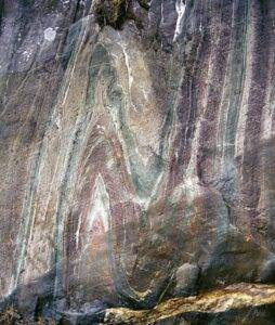
In Nordfjord, eclogite bodies often display complex folding patterns indicative of the intense deformation they have undergone. These folds vary in scale from microscopic to several meters and exhibit diverse geometries, including:
Isoclinal folds: Tight folds with parallel limbs.
Chevron folds: Characterized by sharp hinges and straight limbs.
The study of these folds provides insights into the deformation mechanisms, rheological properties of the rocks, and the stress regimes during metamorphism.
Metamorphic Conditions and Facies
Eclogite formation occurs under high-pressure (HP) and ultrahigh-pressure (UHP) conditions, with pressures exceeding 1.2 GPa (equivalent to depths greater than 40 km) and temperatures ranging from 400–800°C. In Nordfjord, eclogite facies metamorphism is a direct result of the deep subduction of the Baltican crust during the Caledonian orogeny.
Key Metamorphic Facies in Nordfjord:
Eclogite Facies: Defined by garnet + omphacite + kyanite mineral assemblages.
Granulite Facies: Represents the transition to lower-pressure, high-temperature conditions during exhumation.
Amphibolite Facies: Marks retrograde metamorphism as the rocks returned to shallower crustal levels.
Petrological studies of eclogites in Nordfjord suggest that these rocks were subjected to pressures as high as 3.0 GPa (equivalent to ~100 km depth) before being rapidly exhumed.
Petrography and Mineralogy of Nordfjord Eclogites
Nordfjord’s eclogites are characterized by their distinctive mineralogy, which provides valuable information on their pressure-temperature (P-T) history.
Primary Minerals in Eclogite:
Garnet (Almandine-Pyrope Series): Forms large, well-developed crystals with inclusion-rich cores.
Omphacite (Clinopyroxene): A Na-rich pyroxene, crucial for defining eclogite facies.
Kyanite: An indicator of high-pressure metamorphism.
Coesite: Found in ultrahigh-pressure (UHP) eclogites, indicating deep burial.
Retrograde Minerals (Lower Pressure Phases):
Amphibole (e.g., hornblende) forms during decompression.
Plagioclase replaces omphacite as pressure decreases.
Chlorite and Epidote are common signs of hydrothermal alteration.
The mineralogy of these eclogites provides crucial evidence of subduction zone processes and crustal recycling in deep Earth environments.
Geochronology and Age Determination of Eclogite Folds
To understand the timing and duration of eclogite metamorphism, geologists use various radiometric dating techniques:
Key Dating Methods:
U-Pb Dating on Zircon & Monazite: Provides precise ages of peak metamorphism.
Lu-Hf and Sm-Nd Isotopic Systems: Used to date garnet growth and determine the duration of high-pressure metamorphism.
Ar-Ar Dating on Micas: Useful for dating retrogression and exhumation.
Age of Eclogite Metamorphism in Nordfjord:
Peak eclogite metamorphism: 430–400 Ma (Caledonian orogeny).
Exhumation to crustal levels: 390–370 Ma.
Final cooling below ~300°C: 350 Ma.
These dates align with the subduction and exhumation cycles of the Baltican continental crust during the closure of the Iapetus Ocean.
Exhumation Processes of High-Pressure Rocks
One of the most intriguing geological questions is: How do eclogites, formed at depths of ~100 km, return to the surface?
In Nordfjord, exhumation occurred through a combination of:
Tectonic Uplift: Driven by buoyancy forces acting on subducted crust.
Extensional Faulting: Linked to the Nordfjord-Sogn Detachment Zone (NSDZ), a major low-angle normal fault that facilitated crustal thinning.
Erosion and Surface Denudation: Helped expose high-pressure rocks at Earth’s surface.
The Nordfjord-Sogn Detachment Zone played a key role in the exhumation of high-pressure metamorphic rocks, allowing geologists to study deep crustal processes in an accessible field setting.
Field Studies and Mapping of Eclogite Folds
Nordfjord is one of the best locations worldwide for studying eclogite folds in situ. Field geologists utilize structural mapping, petrography, and geochemical analysis to understand fold dynamics.
Key Localities for Eclogite Folds in Nordfjord:
Stadtlandet Peninsula: Displays spectacular recumbent folds in eclogite-bearing gneisses.
Hornelen Basin: Features large-scale synclinal and anticlinal folds in high-pressure rocks.
Western Gneiss Region: Contains some of the largest and best-preserved eclogite bodies in the world.
These field exposures provide natural laboratories for studying deep-crustal processes and tectonic evolution.
Geochemical Signatures and Provenance
Geochemical studies of eclogites in Nordfjord help determine their protolith origin and tectonic history.
Key Geochemical Techniques Used:
Major & Trace Element Analysis: Determines the original rock composition.
Isotopic Studies (Sr-Nd-Pb-Hf): Traces the sources of eclogite-forming material.
Rare Earth Element (REE) Patterns: Distinguishes between oceanic and continental sources.
Results indicate that Nordfjord eclogites were originally mafic rocks derived from an oceanic crustal setting, later subducted and metamorphosed during the Caledonian orogeny.
Comparison with Other Eclogite-Bearing Terranes
The Nordfjord eclogite folds are part of a global network of high-pressure terranes. Comparing them to other regions helps geologists understand subduction-exhumation processes worldwide.
World’s largest UHP terrane, with deep subduction evidence
Franciscan Complex, USA
Subduction Zone
Eclogite blocks in a mélange setting
These comparisons show that Nordfjord is unique due to its large-scale fold structures and strong association with extensional detachment faults.
Economic and Industrial Significance of Eclogite
Although not a major economic resource, eclogite has several industrial applications:
Crushed rock for road construction (due to its hardness and durability).
Dimension stone in decorative applications.
Source of garnet for use as an abrasive material.
Additionally, the study of eclogite-hosted mineral deposits can provide insights into deep-seated ore-forming processes.
Environmental and Geohazard Considerations
Eclogite-bearing terrains can present geohazards due to their brittle deformation history. Some key concerns in Nordfjord include:
Rockslides and Slope Instabilities: Due to the presence of highly deformed rocks.
Seismic Activity: Associated with past and present fault movements.
Proper geological assessments are crucial for land use planning and infrastructure development in these regions.
Conservation and Educational Value
Nordfjord’s eclogite folds serve as natural geological archives that should be preserved for scientific research and education. Universities and research institutions frequently conduct field excursions to these sites, allowing students and professionals to study high-pressure metamorphism in a real-world setting.
Future Research Directions in Nordfjord Eclogite Studies
Emerging techniques such as AI-based mineral mapping, high-resolution geochemical analysis, and geodynamic modeling are expected to revolutionize our understanding of eclogite formation and exhumation.
Future research may focus on:
The role of fluids in metamorphic reactions.
The kinematics of eclogite folding using 3D structural analysis.
Deep-Earth drilling to study eclogite-hosted mineral deposits.
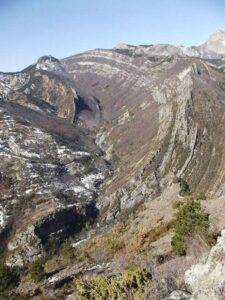
The Velodrome Recumbent Fold is a remarkable geological structure that exemplifies the extreme forces acting within the Earth’s crust. It is classified as a recumbent fold, meaning that its axial plane is nearly horizontal, causing its limbs to lie parallel to each other. Such folds are crucial in understanding compressional tectonic environments, where intense horizontal stress deforms rock layers over geological time scales.
This article explores the formation, structure, significance, and implications of the Velodrome Recumbent Fold, providing insights into its role in Earth’s tectonic history and resource potential.
What is a Recumbent Fold?
A recumbent fold is a specific type of fold where the axial plane is nearly horizontal, and the limbs are overturned to an extreme degree. This structure forms under intense compressional forces, which cause rock layers to deform plastically rather than fracturing.
Key Features of Recumbent Folds:
Axial Plane: Nearly horizontal
Fold Limbs: Overturned and lying subparallel
Formation Process: Result of prolonged compression and shearing forces
Common Location: Found in mountain belts and regions of strong tectonic deformation
Recumbent folds are often associated with thrust faulting and nappe structures, where large rock masses are displaced over long distances due to tectonic movement.
The Geological Context of The Velodrome Recumbent Fold
The Velodrome Recumbent Fold is situated in a highly deformed tectonic region, characterized by compressional stress and crustal thickening. The surrounding geology suggests that this fold developed during a major orogenic event, which involved the collision of tectonic plates.
Tectonic Setting:
Found in a convergent plate boundary where subduction and collision occurred.
Associated with high-pressure metamorphic rocks.
Frequently occurs within fold-and-thrust belts.
Structural Characteristics of The Velodrome Recumbent Fold
The Velodrome Recumbent Fold exhibits:
A horizontal axial plane, indicating extreme tectonic stress.
Highly deformed syncline and anticline structures.
A relationship with thrust faults, showing nappe formation.
Field observations and structural analysis reveal that this fold likely formed due to ductile deformation of sedimentary and metamorphic layers, which accommodated the intense pressure without fracturing.
Tectonic Forces Behind The Velodrome Recumbent Fold
The formation of this fold is attributed to:
Plate Convergence: Collision of tectonic plates led to intense crustal shortening.
Shear Stress: Lateral movements of crustal blocks contributed to its recumbent shape.
High-Temperature Deformation: Rocks underwent metamorphism, enhancing their ability to fold rather than break.
Dating and Age Determination
To determine the age of the Velodrome Recumbent Fold, geologists use:
Radiometric dating (U-Pb, Ar-Ar) on minerals such as zircon.
Fossil evidence within folded strata.
Relative dating techniques comparing cross-cutting relationships.
Results indicate that this fold formed during a significant orogenic event, correlating with major tectonic plate interactions.
Economic and Environmental Importance
The Velodrome Recumbent Fold holds geological significance due to:
Rich mineral deposits, including gold, copper, and rare earth elements.
Potential oil and gas reservoirs, trapped within its structural folds.
Environmental considerations, as regions with extreme folds can be prone to landslides and seismic activity.
Conclusion
The Velodrome Recumbent Fold serves as a testament to the powerful forces shaping our planet. Its intricate structure provides valuable insights into tectonics, resource distribution, and geological evolution. As new technologies emerge, further studies will enhance our understanding of such complex geological phenomena.
Frequently Asked Questions (FAQs)
What causes a recumbent fold?
Extreme compressional forces cause rock layers to fold horizontally.
Where are recumbent folds commonly found?
In orogenic belts, where tectonic collisions have deformed the crust.
What is the significance of the Velodrome Recumbent Fold?
It provides insights into tectonic evolution and resource distribution.
How do geologists study recumbent folds?
Using field mapping, seismic data, and petrographic analysis.
Can recumbent folds lead to earthquakes?
Yes, especially if associated with thrust faults and active tectonic zones.
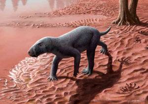
Reconstruction of the appearance in life of a gorgonopsian in a floodplain of the Permian of Mallorca. Credit: Henry Sutherland Sharpe
An international research team led by the Institut Català de Paleontologia Miquel Crusafont (ICP) and the Museu Balear de Ciències Naturals (MUCBO | MBCN) have described a fossil animal that lived between 270 and 280 million years ago in present-day Mallorca.
The discovery is exceptional, not only because of the number of fossil remains found, but also because it is the oldest known gorgonopsian on the planet, the lineage of saber-toothed predators that would eventually give rise to mammals. The research has been published in the journal Nature Communications.
Gorgonopsians are an extinct group of synapsids that lived during the Permian, between 270 and 250 million years ago. They belong to the evolutionary lineage that would give rise to the first mammals 50 million years later.
They were warm-blooded animals like modern mammals, but, unlike most of them, they laid eggs. They were carnivorous and were the first animals to develop the characteristic saber teeth. They were often the superpredators of the ecosystems in which they lived, and their appearance would be similar to a dog, but without ears or fur.
The remains recovered in Mallorca belong to a small to medium-sized animal, approximately one meter in length, and come from a site located in the municipality of Banyalbufar (Serra de Tramuntana, Mallorca). Excavations were carried out in three different campaigns during which a large quantity of material was recovered.
“The large number of bone remains is surprising. We have found everything from fragments of skull, vertebrae, and ribs to a very well-preserved femur. In fact, when we started this excavation, we never thought we would find so many remains of an animal of this type in Mallorca,” explains Rafel Matamales, curator of the Museu Balear de Ciències Naturals (MUCBO | MBCN), research associate at the ICP, and first author of the article.
Its location in the Balearic Islands is an unusual fact in itself. The known remains of gorgonopsians prior to this discovery belonged to very high latitudes such as Russia or South Africa. Its age has also surprised the researchers who conducted the study.
“It is most likely the oldest gorgonopsian on the planet. The one we found in Mallorca is at least 270 million years old, and the other records of this group worldwide are, at the very least, slightly younger,” points out Josep Fortuny, senior author of the article and head of the Computational Biomechanics and Evolution of Life History group at the Institut Català de Paleontologia Miquel Crusafont (ICP).
Among the excavated fossil remains, a nearly complete leg stands out, which has allowed researchers to study how the animal moved. Unlike reptiles, which have a more ancestral locomotion with their legs more spread out, gorgonopsians had their legs positioned more vertically and, therefore, moved in a way that was intermediate between reptiles and mammals. This system is more efficient for walking and especially for running.
The recovered saber teeth confirm its diet. “We know that this is a carnivorous animal, a characteristic shared by all gorgonopsians worldwide. The saber teeth are a common feature in large predators of ecosystems, and what we have found was likely one in the environment in which it lived,” emphasizes Àngel Galobart, researcher at the ICP and director of the Museu de la Conca Dellà.
When Mallorca was not an island
During the Permian, approximately 270 million years ago, Mallorca was not an island but was part of the supercontinent Pangea. It was located at an equatorial latitude, where countries like Congo or Guinea can be found today. The climate was monsoonal, alternating between wet and very dry seasons.
It has been found that the site where the fossils were found was a floodplain with temporary ponds where gorgonopsians and other fauna drank. Among the animals that cohabited in this ecosystem were moradisaurine captorhinids, an ancient group of herbivorous reptiles to which the Tramuntanasaurus tiai belongs, which may have been part of the gorgonopsians’ diet.
Despite the small area that they occupy, the Balearic Islands have an exceptional fossil record. The most studied and well-known fossils are from the Pleistocene and Holocene.
However, the fossil record from other periods is considerably less known. Nonetheless, remarkable fossils have been found, such as the world’s oldest mosquito, nearly a thousand species of ammonoids (cephalopods related to squids), ancestors of horses and hippos, giant sharks, and large coral reefs.
Reference:
Matamales-Andreu, R., et al. Early–middle Permian Mediterranean gorgonopsian suggests an equatorial origin of therapsids. Nature Communications. DOI: 10.1038/s41467-024-54425-5
An strange, extinct plant once thought to be related to modern ginseng is now considered the lone representative of an unknown family. Credit: Florida Museum of Natural History / Jeff Gage
In 1969, fossilized leaves of the species Othniophyton elongatum—which translates to “alien plant”—were identified in eastern Utah. Initially, scientists theorized the extinct species may have belonged to the ginseng family (Araliaceae). However, a case once closed is now being revisited. New fossil specimens show that Othniophyton elongatum is even stranger than scientists first thought.
Steven Manchester, curator of paleobotany at the Florida Museum of Natural History, has studied 47-million-year-old fossils from Utah for several years. While visiting the University of California, Berkeley, paleobotany collection, he came across an unidentified and unusually well-preserved plant fossil collected from the same area as the leaves of Othniophyton elongatum.
Manchester is the co-author of a new study in which he and his colleagues showed that the leaves in question belonged to a unique plant, with unusual flowers and fruits. The findings are published in the journal Annals of Botany.
Close observation revealed that the 1969 fossils and those later studied by Manchester at UC Berkeley were from the same plant species. But the leaves, fruits and flowers attached to the woody stem of the Berkeley fossils were nothing like those of the other plants in the ginseng family, to which that species had been originally assigned.
“This fossil is rare in having the twig with attached fruits and leaves. Usually those are found separately,” Manchester said.
The authors extensively analyzed physical features of the old and new fossils, then methodically searched for any living plant family to which they could belong. There are over 400 diverse families of flowering plants alive today, but the authors couldn’t match the fossils’ strange assortment of features with any of them.
Resisting the urge to tidily lump the obscure specimen in with a living group, the team then searched for extinct families it might have belonged to but came up empty-handed once again.
The authors say their results underscore what may be a pervasive problem in paleobotany. In many cases, extinct plants that existed less than 65 million years ago are placed within modern families, or genera—the taxonomic groups directly above the level of individual species. This can create a skewed estimate of biodiversity in ancient ecosystems.
“There are many things for which we have good evidence to put in a modern family or genus, but you can’t always shoehorn these things,” Manchester said.
The species does not belong to any living family or genus
The fossils were discovered in the Green River Formation near the ghost town of Rainbow in eastern Utah. Roughly 47 million years ago, the area was a tectonically active, massive inland lake system that provided the perfect conditions for fossil preservation. Low-oxygen lake sediments and showers of volcanic ash slowed the decomposition of many fish, reptiles, birds, invertebrates and plants, allowing some of them to be preserved in amazing detail.
Researchers who had studied the original leaf fossils of this species had very little to work with. Without flowers, fruits or branches, they were limited to analyzing the shape and vein patterns of the leaves. Based on the arrangement, researchers thought it might be a single leaf made up of multiple smaller leaflets. This type of compound leaf is a defining feature of several plants in the ginseng family.
But the new fossils had leaves that were directly attached to stems, which painted a very different picture of what the plant once looked like.
“The two twigs we found show the same kind of leaf attached, but they’re not compound. They’re simple, which eliminates the possibility of it being anything in that family,” Manchester said.
The fossil’s berries ruled out families like the grasses and magnolias. The flowers did resemble some modern groups, but other features ruled those out, too. Even with such a pristine fossil in their repertoire, researchers were left with more questions than before.
Researchers see the fossil in a new light
Stumped, the team set the fossil aside for several years. Then the Florida Museum hired a curator of artificial intelligence who established a new microscopy workstation. When viewed through the digital microscope’s powerful lens and computer-enhanced shadow effect illumination, the authors could see subtle peculiarities they’d missed during prior observations.
When they focused on the fossil’s minute fruits, they could see micro-impressions left behind by their internal anatomy, including features of the small, developing seeds.
“Normally we don’t expect to see that preserved in these types of fossils, but maybe we’ve been overlooking it because our equipment didn’t pick up that kind of topographic relief,” Manchester said.
One of the plant’s strangest newly seen features was its stamens, the male reproductive organs of the flower. In most plant species, once the flower is fertilized, the stamens detach along with petals and the rest of the flower parts, which are no longer needed for reproduction.
“Usually, stamens will fall away as the fruit develops. And this thing seems unusual in that it’s retaining the stamens at the time it has mature fruits with seeds ready to disperse. We haven’t seen that in anything modern,” Manchester said.
With all modern families ruled out, they compared the traits to extinct families. Once again, there was no match to be found.
Julian Correa-Narvaez, the lead author of the study and a doctoral student at the University of Florida, played a major role in gathering information to identify the fossils. “It’s important because it gives us a little bit of a clue about how these organisms were evolving and adapting in different places,” he said.
Plant families can contain astonishing amounts of diversity. Seemingly disparate plants like poison ivy, cashews and mangoes are all in the same family, along with over 800 other species. It’s unclear how much diversity in this mysterious extinct group has been lost to time.
This isn’t the only enigmatic species that has come out of the Green River Formation. Similar situations have unfolded when plant fossils from the locality surprised researchers, leading to the discovery of other extinct groups. “The book published in 1969 has all these interesting mysteries that remain,” Manchester said.
With digital access to museum specimens through tools like iDigBio, researchers can continue to study and understand the natural history of plant evolution.
Walter Judd of the Florida Museum of Natural History is also a co-author of the study.
Reference:
Steven R Manchester et al, Vegetative and reproductive morphology of Othniophyton elongatum (MacGinitie) gen. et comb. nov., an extinct angiosperm of possible caryophyllalean affinity from the Eocene of Colorado and Utah, USA, Annals of Botany (2024). DOI: 10.1093/aob/mcae196
Newly discovered insect fossils are so small they can barely be seen by the human eye but have been preserved in an “extraordinary” way.
Published in the journal Palaeobiodiversity and Palaeoenvironments, a new study reveals rare whitefly insect fossils have been found in Miocene age crater lake sediments at Hindon Maar, near Dunedin.
Adult whiteflies are tiny insects about 3mm in size, smaller if they are immature.
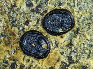
The fossils found at Hindon Maar are about 1.5mm by 1.25mm and have been preserved in the position they lived and died, attached to the underside of a fossil leaf.
Black with an oval-shaped body, they have some similarities to modern-day whiteflies — such as the shape and colour — but differ in that all the segments of the body are distinctly defined by deep sutures.
Co-author Dr Uwe Kaulfuss, of the University of Göttingen in Germany and former postdoctoral fellow in the University of Otago’s Department of Geology, discovered the tiny fossils during an excavation at Hindon earlier this year.
“Fossils of adult whitefly insects are not uncommon, but it takes extraordinary circumstances for the puparia — the protective shell the insect emerges from — to become fossilised,” Dr Kaulfuss says.
“Some 15 million years ago, the leaf with the puparia must have become detached from a tree, blown into the small lake and sank to the deep lake floor to be covered by sediment and become fossilised. It must have happened in rapid succession as the tiny insect fossils are exquisitely preserved.
“The new genus and species described in our study reveals for the first time that whitefly insects were an ecological component in ancient forests on the South Island.”
Study co-author Emeritus Professor Daphne Lee, of Otago’s Department of Geology, says they add to the expanding insect fauna revealed in the maar.
“It was difficult to see much with the naked eye but once the fossils were under a microscope, we could see the amazing detail,” she says.
“The fact that they are still in life position on the leaf is incredible and extremely rare. These little fossils are the first of their kind to be found in New Zealand and only the third example of such fossil puparia known globally.
“Until about 20 years ago, the total number of insects in the country older than the Ice Ages was seven and now we have 750. Almost all are housed in the Otago Geology Department collections.
“New discoveries such as these from fossil sites in Otago mean we’ve gone from knowing almost nothing about the role played by insects to a new appreciation of their importance in understanding New Zealand’s past biodiversity and the history of our forest ecosystems.”
Professor Lee says while most people are interested in big fossils — large charismatic ones — most animals in forests are insects.
“There are 14,000 insects in New Zealand and 90 per cent are found nowhere else in the world,” she says.
“Discovery of these minute fossils tells us this group of insects has been in Aotearoa New Zealand for at least 15 million years. This provides a well-dated calibration point for molecular phylogenetic studies.”
Other small fossils new to science have also been found at Otago sites this year, including the first dancefly, cranefly, phantom midge and marsh beetle fossils from New Zealand. These studies show the extent of Otago’s scientific collaborations around the world with co-authors of these papers coming from Germany, France, Spain, Poland and the USA.
Reference:
Jowita Drohojowska, Gregory A. Evans, Uwe Kaulfuss, Daphne E. Lee, Jacek Szwedo. First Miocene whiteflies and psyllids (Hemiptera: Sternorrhyncha: Aleyrodoidea and Psylloidea) from Aotearoa New Zealand. Palaeobiodiversity and Palaeoenvironments, 2024; DOI: 10.1007/s12549-024-00628-z
Note: The above post is reprinted from materials provided by University of Otago.
Geobiologist Shuhai Xiao (at left) and colleague in the field in Canada. Photo courtesy of Danielle Fitzgerald.
Ancient species may have evolved slower and lasted longer, but the pace of evolution accelerated after global ice ages, according to a new Virginia Tech analysis. The study, published in the journal Science, maps the rise and fall of ancient life many times older than the dinosaurs.
If all the world’s a stage and all the species merely players, then their exits and entrances can be found in the rock record.
Fossilized skeletons and shells clearly show how evolution and extinction unfolded over the past half a billion years, but anew Virginia Tech analysis extends the chart of life to nearly 2 billion years ago.
The chart shows the relative ups and downs in species counts, telling scientists about the origin, diversification, and extinction of ancient life.
With this new study, the chart of life now includes life forms from the Proterozoic Eon, 2,500 million to 539 million years ago. Proterozoic life was generally smaller and squishier — like sea sponges that didn’t develop mineral skeletons — and left fewer traces to fossilize in the first place.
Virginia Tech geobiologist Shuhai Xiao and collaborators published a high-resolution analysis of the global diversity of Proterozoic life based on a global compilation of fossil data, which was released Dec. 20 in the journal Science.
Xiao and his team looked specifically at records of ancient marine eukaryotes — organisms whose cells contain a nucleus. Early eukaryotes later evolved into the multicellular organisms credited for ushering in a whole new era for life on Earth, including animals, plants, and fungi.
“This is the most comprehensive and up-to-date analysis of this period to date,” said Xiao who recently was inducted into the National Academy of Sciences. “And more importantly, we’ve used a graphic correlation program that allowed us to achieve greater temporal resolution.”
The choreography of species offers critical insights into the parallel paths of the evolution of life and Earth.
Observed patterns and insights suggested by the analysis:
The first eukaryotes arose no later than 1.8 billion years ago and gradually evolved to a stable level of diversity from about 1,450 million to 720 million years ago, a period aptly known as the “boring billion,” when species turnover rates were remarkably low.
Eukaryotic species in the “boring billion” may have evolved slower and lasted longer than those came later.
Then cataclysm: Snowball Earth, a spiral of plunging temperatures, sealed the planet in ice at least twice between 720 million and 635 million years ago. When the ice eventually thawed, evolutionary activity picked up, and things weren’t so boring anymore.
“The ice ages were a major factor that reset the evolutionary path in terms of diversity and dynamics,” Xiao said. “We see rapid turnover of eukaryotic species immediately after glaciation. That’s a major finding.”
The patterns, Xiao said, raise a lot of interesting questions, including:
Why was eukaryotic evolution sluggish during the “boring billion”?
What factors contributed to the increased pace of evolution after snowball ice ages?
Was it environmental, such as climate changes and increases in atmospheric oxygen level?
Was it an evolutionary arms race between different organisms that could drive creatures to evolve quickly?
Future scientists can use the quantified pattern to answer these questions and better understand the complex interplay of life on Earth and the Earth itself.
Study collaborators include:
Qing Tang, first author, former graduate student and postdoctoral researcher, now at Nanjing University, as well as former graduate students Drew Muscente, now at Princeton Consultants, and Natalia Bykova, now at the University of Missouri, who worked in Xiao’s lab in the past decade
Researchers from the University of Hong Kong; University of California, Santa Barbara; Princeton Consultants; University of Missouri; Russian Academy of Sciences; University of California, Riverside; Chinese Academy of Sciences; and Northwest University (China)
Reference:
Qing Tang, Wentao Zheng, Shuhan Zhang, Junxuan Fan, Leigh Anne Riedman, Xudong Hou, A. D. Muscente, Natalia Bykova, Peter M. Sadler, Xiangdong Wang, Feifei Zhang, Xunlai Yuan, Chuanming Zhou, Bin Wan, Ke Pang, Qing Ouyang, N. Ryan McKenzie, Guochun Zhao, Shuzhong Shen, Shuhai Xiao. Quantifying the global biodiversity of Proterozoic eukaryotes. Science, 2024; 386 (6728) DOI: 10.1126/science.adm9137
Note: The above post is reprinted from materials provided by Virginia Tech. Original written by Kelly Izlar.
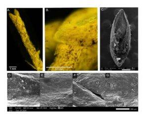
Fluorescent and scanning electron microscopy (SEM) of fossil and modern juniper leaves. (a, b) Fluorescent microscope imagery of fossil juniper branchlet (LACMHC 1469B). (b) Close-up of leaf scale with smooth leaf margins and acute-slightly obtuse apical shape. (c) SEM image of entire fossil leaf scale from adaxial (dorsal) perspective. (d–g) Close-up imagery of abaxial (ventral) side of modern (d) J. blancoi, (e) J. scopulorum, (f) J. virginiana, and (g) fossil juniper leaf (P23-47594).
La Brea Tar Pits scientists have identified a previously unknown juniper species to the La Brea Tar Pits as Juniperus scopulorum, commonly known as the Rocky Mountain juniper. The successful identification, along with the first-ever radiocarbon dating of these fossil plants in Southern California, expands our ability to track past environmental changes and highlights the vulnerability of junipers and the environments they shape in the face of modern climate change. Published in the journal New Phytologist, the study unlocks a key finding to understanding the megafaunal extinction at the Tar Pits and better understanding our own climate future.
The mammoths and saber-toothed cats that shape our imagination of Ice Age Los Angeles browsed, grazed, and hunted in juniper woodlands. More than just a source of food for giant herbivores, junipers were keystone trees and shrubs in the region, in turn shaping the landscape for at least 47,000 years before completely vanishing from the region in the same extinction event that erased most of the megafauna.
Researchers have long known that there are two different species of juniper found at the Tar Pits — the large-seeded J. californica (California juniper), and the small-seeded, mystery juniper. With distinct tolerances for temperature and drought, fossil junipers play a crucial role in understanding the changing climate of the last Ice Age, and how junipers can survive our climate future, but the identity of the mystery seed remained uncertain — until now.
“We set out to identify this mystery juniper, and in the process, we found a number of exciting things,” says Dr. Jessie George, postdoctoral researcher at La Brea Tar Pits, and lead author on the study. “Number one, we identified this juniper as Rocky Mountain juniper, and it is one of the most extreme examples of a plant going extinct locally. It’s not present anywhere in California today.”
As part of the study, George and the other Tar Pits researchers radiocarbon dated the two species of juniper, which led to the second exciting finding: “In the process of radiocarbon dating these juniper species, we found this really interesting pattern of reciprocal presence — either California juniper only or Rocky Mountain juniper only.”
Because each plant survives in specific conditions, its presence acts as a proxy for climate. George and her colleagues found that this dance between the two junipers coincided with long periods of drought and warm, dry weather that would otherwise be hidden in the fossil record. “California juniper is a much more drought tolerant species. It withstands moisture deficit way better than Rocky Mountain juniper,” says George. “Through these back-and-forth occurrences of the two species from the Tar Pits, we have this really fascinating record of aridity and drought that was previously undetected.”
The small size of the unknown juniper seed — about as big as Lincoln’s forehead on a penny — made it a difficult subject, especially since DNA has yet to be extracted from Tar Pits fossils. Instead, George compared the structure of seeds and branchlets to other juniper species — the only way to uncover its identity. It required careful comparison using advanced microscopy, image analysis, and species distribution modeling (SDM) until the team reached a definitive answer.
While climate definitely played an important role in their local extinction, the team thinks that the abrupt disappearance of Ice Age megafauna and fires started by humans may have also contributed, much like in the case of those iconic giant mammals. In a hotter, drier climate, even plants well-adapted to drought couldn’t survive the extra stress of human fires. This is especially true for plants that are not adapted to wildfire-unlike many other conifer species, juniper has little tolerance for surviving or re-growing following fires. The finding highlights the threat junipers continue to face from human-caused climate change and could inform conservation efforts going forward.
“We’re seeing events of really dramatic decline of these trees in the southwest today because of warming temperatures and increased wildfire caused by modern climate change. So a direct record of how this might have occurred in the past, what factors were at play, and where those boundaries occurred is incredibly important,” says George. “It gives us a better framework to understand a baseline of climate and environment to contextualize changes in other plant life and the fauna that we see during these periods of significant change in the past. As our ability to precisely date fossils improves, better and more detailed information is revealed from ancient life at La Brea.”
“Identification of fossil juniper seeds from Rancho La Brea (California, USA): drought and extirpation in the Late Pleistocene” was authored by Jessie George, Monica Dimson, Regan E. Dunn, Emily L. Lindsey, Aisling B. Farrell, Brenda Paola Aguilar, Glen M. MacDonald and was published in New Phytologist on December 10, 2024.
Reference:
Jessie George, Monica Dimson, Regan E. Dunn, Emily L. Lindsey, Aisling B. Farrell, Brenda Paola Aguilar, Glen M. MacDonald. Identification of fossil juniper seeds from Rancho La Brea (California, USA): drought and extirpation in the Late Pleistocene. New Phytologist, 2024; DOI: 10.1111/nph.20324
UV photography of Pterodactylus. Ultraviolet light reveals remarkable details of the fossil invisible under normal lighting. This famous specimen showcases preserved soft tissues, including the delicate wing membranes, which fluoresce vividly under UV illumination.
Christmas is the time for families to come together, and in the midst of the festive season University of Leicester paleontologists have announced that they have reunited a family that have been separated for 150 million years.
A new study published this week has found nearly 50 ‘hidden’ relatives of Pterodactylus, the first pterosaur, that will allow scientists to reconstruct this flying reptile’s life history from hatchling to adulthood.
Nearly 250 years ago, the very first pterosaur fossil was found in a quarry in northern Bavaria. Dubbed Pterodactylus, this 150-million-year-old fossil provided the first evidence for an extraordinary group of flying reptiles that filled the skies of the Mesozoic, soaring over the heads of dinosaurs on wings that could span up to 10 metres or more. While this first pterosaur was only the size of a turtle dove, it completely reshaped our understanding of prehistoric life.
Despite being the original ‘pterodactyl’, Pterodactylus was soon quite literally overshadowed in the public consciousness by more dramatic, giant pterosaurs like Pteranodon and Quetzalcoatlus, whichstole the spotlight. But Pterodactylus remained a favourite among pterosaur scientists.
Over the centuries, Pterodactylus and other similar pterosaurs from Bavaria have been central to ongoing scientific study, helping shape much of what we know about pterosaurs, from the shape of their wings and how they flew, to their diet and how they grew. But one question has always lingered: which of these many pterosaurs are truly Pterodactylus and which belong to completely different species? This confusion has persisted for centuries… until now. Thanks to a new study that analysed dozens of specimens of Pterodactylus in museums around the world, the mystery has been solved, and the true identity of these fossils has finally been uncovered.
Shining powerful UV torches on fossil bones to make them fluoresce, University of Leicester paleontologists Robert Smyth and Dr Dave Unwin were able to bring to light tiny near-invisible bony details that distinguish one kind of pterosaur from another. Using Pterodactylus’ unique features, found in the head, hips, hands and feet, Smyth and Unwin systematically checked other fossils from the same deposits and to their surprise discovered many other examples of Pterodactylus ‘hiding’ in among what were thought to be other species of pterosaur.
Lead author Robert Smyth, a doctoral researcher in the in the Centre for Palaeobiology and Biosphere Evolution (School of Geography, Geology and the Environment at the University of Leicester), explained: “By examining lots of fossils in collections across Europe we were able to reidentify more than forty specimens as Pterodactylus. UV stimulated fluorescence is astonishing in the amount of detail it can reveal. Features that were once hidden were glowing in plain sight.”
In an eyeblink the entire concept of Pterodactylus changed dramatically. With nearly 50 examples recognised so far, our knowledge of this most important of pterosaur has exploded. As co-author Dr David Unwin from the University of Leicester explained: “We can now construct a complete and highly detailed skeletal anatomy for this key pterosaur. Soft tissues are fossilised in more than twenty examples so we can also reconstruct head crests, body shape, foot webs and even the wings.”
The result? A sprawling family portrait of Pterodactylus, providing a unique opportunity to reconstruct its full life history. This spans from robin-sized hatchlings (affectionately dubbed ‘flaplings’) to ‘teenage’ Pterodactylus, all the way to raven-sized adults with wingspans nearly ten times larger.
Dr Unwin added: “UV stimulated fluorescence is a well-known technique, but the difference in this case is that we have been able to combine new high quality light sources with a systematic ‘catch-all’ approach, and it’s going to have a revolutionary impact on our understanding of pterosaurs.”
Reference:
Robert S. H. Smyth, David M. Unwin. Re-evaluation of Pterodactylus antiquus and Diopecephalus kochi two troublesome taxonomic concepts. Journal of Systematic Palaeontology, 2024; 22 (1) DOI: 10.1080/14772019.2024.2421845
Monazite crystals from samples associate professor Sean Regan gathered in the Coast Mountains near Juneau. Images courtesy of Sean Regan
New research shows that three sites spread along an approximately 620-mile portion of today’s Denali Fault were once a smaller united geologic feature indicative of the final joining of two land masses. That feature was then torn apart by millions of years of tectonic activity.
The work, led by associate professor Sean Regan at the University of Alaska Fairbanks Geophysical Institute and UAF College of Natural Science and Mathematics, is featured on the cover of the December edition of Geology, the journal of The Geological Society of America.
Regan is the research paper’s lead author. UAF co-authors include doctoral student McKenzie Miller, recent master’s graduate Sean Marble and research assistant professor Florian Hofmann. Other co-authors are from St. Lawrence University, South Dakota School of Mines and Technology and the University of California, Santa Barbara.
“Our understanding of lithospheric growth, or plate growth, along the western margin in North America is becoming clearer, and a big part of that is related to reconstruction of strike-slip faults such as the Denali Fault,” Regan said. “We’re starting to recognize those primary features involved in the stitching, or the suturing, of once-distant land masses to the North American plate.”
The research focused on formations at three locations: the Clearwater Mountains of Southcentral Alaska, the Kluane Lake region of Canada’s southwestern Yukon, and the Coast Mountains near Juneau. Previous thinking among geologists is mixed, with some suggesting the three locations formed individually.
Regan’s historical reconstruction of 300 miles of horizontal movement on the Denali Fault over millions of years found that the three locations at one time formed a terminal suture zone. A terminal suture zone represents the final integration of tectonic plates or crustal fragments into a larger mass.
Regan’s work defines one of several places where the Wrangellia Composite Terrane, an oceanic plate that originated far from its current position, accreted to the western edge of North America between 72 million and 56 million years ago.
“When you think about geologists crawling around Earth’s surface trying to understand what the heck happened, it makes some sense that they might not link things that are so far apart,” Regan said of the three sites he studied. “With different geologists working in different areas, the dots don’t really get connected until you can reconstruct deformation on the Denali Fault.”
Regan’s reconstruction focused on the three sites’ inverted metamorphism, a geological phenomenon where rocks formed under higher temperatures and pressures are found overlying rocks formed under lower temperatures and pressures. This is the reverse of the typical sequence observed in regional metamorphism, where temperature and pressure generally increase with depth.
Inverted metamorphism is a key indicator of tectonic complexity and helps geologists reconstruct the processes of crustal deformation and mountain building.
“We showed that each of these three independent inverted metamorphic belts all formed at the same time under similar conditions,” Regan said. “And all occupy a very similar structural setting. Not only are they the same age, they all behaved in a similar fashion. They decrease in age, structurally, downward.”
Regan connected the three locations by analyzing their monazite, which consists of the rare earth elements lanthanum, cerium, neodymium and sometimes yttrium. He collected monazite from the two Alaska locations and used Kluane data published earlier in the year by another scientist.
“It is just the most special little mineral,” Regan said. “It can participate in a lot of reactions, so we can use it as a way to track the mineralogical evolution of a rock.”
Regan began his quest after reading a 1993 paper by researchers at the University of Alberta and University British Columbia and published in Geology. That paper asserted similarities in the Denali Fault region later studied by Regan, but only went as far as labeling them as a single metamorphic-plutonic belt.
A metamorphic-plutonic belt is a region characterized by the close association of metamorphic rocks and plutonic rocks that form as a result of intense tectonic activity, typically during mountain-building processes. These belts are commonly found in areas where tectonic plates converge.
“It was amazing to me that the 1993 paper hadn’t caught more attention back in the day,” Regan said. “I had this paper hung up on my wall for the last four years, because I thought it was really ahead of its time.”
Reference:
Sean P. Regan, Mark E. Holland, Trevor S. Waldien, McKenzie Miller, Peter Taylor, Andrew Kylander-Clark, Sean Marble, Florian Hofmann. Orogen-scale inverted metamorphism during Cretaceous–Paleogene terminal suturing along the North American Cordillera, Alaska, USA. Geology, 2024; 52 (12): 933 DOI: 10.1130/G52614.1
By studying prehistoric rocks and fossils emerging from the side of Mount Ashibetsu in Japan, researchers have precisely refined the timing and duration of Ocean Anoxic Event 1a (OAE 1a), an extreme environmental disruption that choked oxygen from Earth’s oceans to cause significant extinction, especially among plankton.
Researchers have long suspected that massive volcanic eruptions undersea caused carbon dioxide (CO2) increases, global warming and depleted oxygen (called anoxia) in the ocean during the Mesozoic Period. Now, an international team of researchers, including Northwestern University Earth scientists, determined the precise timing of the volcanic eruption and OAE1a, which started 119.5 million years ago. The work adds to a growing volume of evidence that volcanic CO2 emissions directly triggered the anoxic event.
The new study also determined that OAE 1a lasted for just over 1.1 million years. This new information helps scientists better understand how the Earth’s climate and ocean system operates and responds to stress — especially as it relates to current warming.
The study was published late last month in the journal Science Advances. It marks the most detailed and highly resolved dating of an ocean anoxic event ever achieved.
“Ocean anoxic events occur in part as a consequence of climatic warming in a greenhouse world,” said Northwestern’s Brad Sageman, a senior author of the study. “If we want to make accurate predictions about what we will see in the decades ahead with human-caused warming, this information is invaluable. The best way to understand the future is to look at data from the past.”
An expert on ancient climates, Sageman is a professor of Earth, Environmental and Planetary Sciences at Northwestern’s Weinberg College of Arts and Sciences and a co-director of the Paula M. Trienens Institute for Sustainability and Energy.
A Northwestern connection
The Cretaceous Period experienced two major and several minor ocean anoxic events, with OAE 1a as one of the two largest. The most likely cause: volcanic eruptions rapidly injected massive amounts of CO2 into the ocean and atmosphere. These aren’t ordinary volcanoes but large igneous provinces that erupt up to a million cubic kilometers of basalt over several millions of years. When CO2 reacts with seawater, it forms a weak carbonic acid, which literally dissolves sea creatures’ shells. The acid, combined with low oxygen levels, has significant consequences for sea life.
Researchers first began pondering ocean anoxic events in the mid-1970s, after a discovery by Northwestern geologist Seymour Schlanger and Oxford professor Hugh Jenkyns. When examining sediment samples from the Pacific Ocean floor, Schlanger and Jenkyns discovered black, organic carbon-rich shales that matched samples — in composition and age — from both the Atlantic Ocean and rock formations in Italy.
Widespread lack of oxygen was the most likely explanation for these deposits. Anoxia prevents the breakdown of organic matter from dead plants and animals, leading to a global pattern of organic enrichment. Instead of decomposing, the settling plankton and other fossils accumulated to form organic carbon-rich strata scattered around the globe.
“How were black shales forming at the same time in the deep oceans and up on land?” Sageman asked. “Schlanger and Jenkyns realized there must have been a massive global event that caused oxygen to decrease from the ocean surface all the way down to the seafloor.”
History solidified in stone
In the new study, researchers looked not to the depths of the oceans but to ancient strata along the northwest edge of a mountain on Japan’s Hokkaido Island. The rocks, or tuffs, formed from volcanic ash that settled and solidified over time. Tectonic activity lifted these layers above sea level during formation of the Japanese islands, leaving them exposed and accessible where streams carve through the temperate rainforest of Hokkaido. By collecting and analyzing the tuffs, Sageman, his Ph.D. student, Luca Podrecca, and their collaborators gained a glimpse into geologic history.
“Magma comes out of a volcano in liquid form and then begins to cool,” Sageman said. “During this process, crystals start to form. By the time the tuff solidifies, the crystals become a tiny closed system. They lock in atoms, and some of those atoms, like uranium, start to decay, meaning they convert from one isotope to another. That provides a tool to date the eruption, and, thus, date a specific layer within a stack of sedimentary rock. While the expertise of team members from Tohuku University in Japan, Durham University in the U.K. and Northwestern focuses on the characterization and global correlation of the strata, our collaborators at the University of Wisconsin-Madison and Boise State University are experts in the geochronological analyses.”
The researchers also used other types of isotopes, such as carbon, which tracks synchronous changes in the carbon cycle, and osmium, which tracks volcanic activity and changes in ocean chemistry.
“These isotope systems provide tools for correlating the OAE1a interval between sites in Hokkaido, southern France and other sites all around the globe,” Sageman said. “They give us markers for instants in geologic time.”
Pinpointing the exact timeline
According to this evidence, an abrupt shift in carbon isotope ratios — caused first by the spike in volcanic CO2added to the carbon cycle (and later by the excess burial of organic matter) — occurred in the early Cretaceous at the beginning of OAE 1a. A concurrent shift in the isotopic ratios of osmium reflects a massive input of volcanic material into ocean waters. The timing of these events corresponds to eruption of the Ontong Java Nui complex, an enormous igneous province about the size of Alaska located in the southwestern Pacific Ocean.
Now that researchers know it took the oceans 1.1 million years to recover from the sharp increase in CO2, they have more insight into how long the effects of CO2-driven warming events might last and what the associated effects, such as ocean anoxia, may be.
“We’re already seeing zones with low oxygen levels in the Gulf of Mexico,” Sageman said. “The main difference is that past events unfolded over tens of thousands to millions of years. We’re driving roughly similar levels of warming (or more) but doing so in less than 200 years.”
Reference:
Youjuan Li, Brad S. Singer, Reishi Takashima, Mark D. Schmitz, Luca G. Podrecca, Bradley B. Sageman, David Selby, Toshiro Yamanaka, Michael T. Mohr, Keiichi Hayashi, Taiga Tomaru, Katarina Savatic. Radioisotopic chronology of Ocean Anoxic Event 1a: Framework for analysis of driving mechanisms. Science Advances, 2024; 10 (47) DOI: 10.1126/sciadv.adn8365