Home Blog Page 186

Scientists inch closer to predicting phreatic volcanic eruptions

Scientists inch closer to predicting-GeologyPage
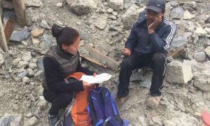
UNM Department of Planetary Sciences Professor Tobias Fischer (in orange) at Poás volcano in Costa Rica.

Throughout the centuries, volcanic eruptions have claimed hundreds of thousands of lives due in part to the lack of accurate signs indicating imminent eruptions. One type of a volcanic eruption, a phreatic eruption, which involves external water, is particularly energetic causing a disproportionate number of fatalities. Phreatic eruptions are extremely difficult to forecast, often occurring with little or no geophysical precursors.

Recently, researchers at the Deep Carbon Observatory (DCO), led by Maarten de Moor from the Observatorio Vulcanológico y Sismológico de Costa Rica, Universidad Nacional, Heredia, Costa Rica, (and postdoc at UNM) along with University of New Mexico Professor Tobias Fischer, Department of Planetary Sciences and chair of the Deep Earth Carbon Degassing initiative, measured gas emissions from crater lake at Poás volcano in Costa Rica, in an attempt to determine some of the precursors to major volcanic eruptions.

“The initial goal of the study was to quantify gas fluxes (CO2, SO2, H2S) from Poas volcano and to monitor changes in gas compositions,” said de Moor. “The motivation behind the measurements was firstly to provide robust constraints on gas fluxes as a contribution to global volcanic gas emissions to the atmosphere, and secondly to monitor degassing in order to track volcanic activity for hazard mitigation purposes.”

Excerpt from EPSL paper: “The Poás crater represents one of the most chemically extreme environments on Earth and Poás Volcano National Park was visited by more than 200,000 tourists in 2014. About 60 seismically registered phreatic blasts occurred from the lake during the same year, ranging from minor “gas bursts” to highly explosive jets ejecting ballistics, sediments, vapor and lake water to more than 400 meters above the lake surface. ”

In a new article, published in Earth and Planetary Science Letters recently, the results from a DECADE (Deep Earth Carbon Degassing initiative) project to investigate gas emissions at Poás have delivered promising results.

“Before this study, phreatic eruptions were primarily thought to be generated by changes in hydrothermal systems, and usually occur with no appreciable precursors,” said de Moor. “Our study shows that there are clear short-term changes in gas compositions prior to phreatic eruptions at Poás, and are generated by short-period changes in high temperature volcanic gas input from  the deep magmatic system.”

The team measured gas emissions from the crater lake in situ using a fixed multiple gas analyzer station (Multi-GAS) during a two month period of phreatic activity in 2014. The lake was the site of intense phreatic eruptive behavior between 2006 and 2014.

Both accuracy and precision are important in the Multi-GAS measurements. The Multi-GAS instrument measures gas ratios, such as SO2/ CO2 and H2S / SO2. Precision, or the reproducibility, of the Multi-GAS measurements is important when comparing data points within the researchers’ dataset.

“The accuracy, or proximity of the measured value to the true gas ratio, is most important for quantifying gas emission rates from the volcano and for comparing our measured gas compositions to those from other volcanoes or other studies at Poas,” said de Moor. “We did a series of laboratory tests using gas mixtures to estimate both accuracy and precision of the Multi-GAS measurements. These measurements give us confidence that the variations we see in the field data are real.”

“Diagnostic tests prove that the occurrence of eruptions and high SO2/ CO2 are statistically correlated, and that the occurrence of quiescence (no eruptions) and low SO2/ CO2 are also correlated. The results of these diagnostic tests from Poás show scientists that both true predicted values (successful “prediction” of eruption based on high SO2/CO2) and false predicted values (successful “prediction” of quiescence based on low SO2/CO2) are high, indicating strong evidential worth for the association between gas composition and eruptions.”

The gas composition data show significant variations in the ratio between SO2 and CO2, which are statistically correlated with both the occurrence and the size of phreatic eruptions. The scientists found that the composition of gas emitted directly from the lake approaches that of magmatic gas days before large phreatic eruptions.

“The changes in gas chemistry are due to the susceptibility of different gas species to reaction with hydrothermal fluids,” explained de Moor. “CO2 is essentially inert in ultra-acidic conditions and therefore passes through the hydrothermal system and acid lake with minimal modification. In contrast, SO2 is partially removed from the gas phase by hydrothermal reactions producing aqueous bisulfate and liquid/solid native sulfur.”

Excerpt from DCO report: “Gas flux measurements conducted using mini-DOAS (differential optical absorption spectroscopy) show that high emission rates of SO2 from the lake occur during eruptive activity and are also associated with high SO2/CO2.”

“We argued that the efficiency of S removal from the gas is inhibited with increasing gas flux through the hydrothermal system, resulting in increasing SO2/ CO2,” de Moor said. “Importantly, the results suggest that short-period pulses of magmatic gas and heat are directly responsible for generating individual phreatic eruptions.”

Excerpt from DCO report: “These promising results show that high-frequency gas monitoring may provide an effective means of forecasting phreatic eruptions. The biggest challenge to this monitoring approach is maintaining the Multi-GAS instrument in extremely harsh conditions. Peripheral components of the station were destroyed by a large eruption in June 2014, which spelled the end of the lake gas emission experiment. However, the instrument survived and is currently monitoring changes in fumarole gas composition.”

“My main concern is simply trying to keeping these instruments running at active volcanoes, because they are constantly being damaged by toxic gases and eruptions,” said de Moor. “If we can acquire good time-series data, we will learn a lot more about how volcanoes work, why they erupt, and how to predict explosions.

“There are still many things scientists do not know about the interactions between magmatic gases and hydrothermal systems. This study shows in particular that kinetics are very important in these systems. Most geochemical models that are used to understand volcanic degassing assume equilibrium conditions. ”

“Volcanoes are perhaps the most dynamic physical and chemical systems on Earth,” said de Moor. “Once we accept that kinetic factors are often more influential than equilibrium conditions, we will come closer to understanding volcanic degassing processes.”

Reference:
J.M. de Moor et al. Short-period volcanic gas precursors to phreatic eruptions: Insights from Poás Volcano, Costa Rica, Earth and Planetary Science Letters (2016). DOI: 10.1016/j.epsl.2016.02.056

Note: The above post is reprinted from materials provided by University of New Mexico.

Citizen seismologists multiply the impacts of earthquake studies

Citizen seismologists multiply-GeologyPage
A photo submitted through the LastQuake app from Sorong, Indonesia after a magnitude 6.6. earthquake on Sept. 2015, 35 kilometers from quake’s epicenter. Credit: Photo courtesy EMSC

From matchbook-sized sensors plugged into a desktop computer to location-tagged tweets, the earthquake data provided by “citizen seismologists” have grown in size and quality since 2000, according to the field’s researchers.

At a session at the Seismological Society of America’s (SSA) 2016 Annual Meeting April 20-22 in Reno, Nevada, seismologists from around the world will discuss how crowd-sourced information on felt earthquakes is increasingly integrated with data collected by seismometers, to provide a more complete picture of an earthquake event and its impacts.

“As researchers, we gain incredibly large amounts of data at very little cost from citizen seismology,” says Michelle Guy, a computer scientist at the U.S. Geological Survey. “But we also gain a new kind of data, since people are much more impact-oriented when it comes to earthquakes. We learn what people saw, what they felt, and what they went through as they experienced these seismic events.”

People have been reporting on the earthquakes they feel through dedicated websites such as the USGS’ Did You Feel It site since 2000, and online reporting of earthquakes has proliferated through social media sites such as Twitter and Facebook and through mobile phone apps such as LastQuake from the European Mediterranean Seismic Center (EMSC).

And in a way, says EMSC Secretary General Rémy Bossu, citizen seismology stretches back even further into the past, since personal, eyewitness reports provided most earthquake data before the development of modern seismic monitoring networks. “Thanks to Internet technologies, it is now easy to integrate human reports and they are fully complementary with what the seismic network provides: the latter provides information on the event, a hazard type of information, and the other provides information on its effects, or risk information.”

Even in places like Japan, a country densely covered with more than 5000 strong-motion seismic stations, seismologists are turning to a citizen-based seismic network to help refine their reports of real-time damage estimates, according SSA speaker Shohei Naito, a researcher at Japan’s National Research Institute for Earth Science and Disaster Prevention. Through apps installed on devices that contain acceleration sensors, such as some mobile phones and iPads, people transmit their shaking data to be combined with others into a larger seismic intensity map during an earthquake. The citizen-generated data can improve the accuracy and speed of damage estimates, Naito says.

Similar data are collected by CalTech’s Quake Catcher Network, using both embedded sensors in mobile devices, laptops and tablets as well as plug-in devices for desktop computers. Since 2008, these sensors installed everywhere from schools to homes have collected thousands of earthquake records, says SSA presenter Danielle Sumy of the Incorporated Research Institutions for Seismology (IRIS).

Since 2009, the U.S. Geological Survey has been crowd-sourcing tweets to locate and assess earthquakes worldwide, says Guy. The Twitter system can often detect small earthquakes before seismic instruments do in places around the world where seismometer coverage is sparse—sometimes within 20 seconds of an earthquake.

Earthquake data gleaned from social media come with a special set of challenges, she acknowledges. For instance, it can be difficult to connect a tweet with a specific location, although this is slowly changing with the advent of more GPS-tagged data posted from mobile phones. Originally only 3 to 5% of earthquake tweets were GPS-located, but that has grown to 15%, Guy said.

“We only hear about the earthquakes that people feel, so this is limited to a small subset of earthquakes that people actually feel,” she noted. “In no way does this do away with the need for more traditional instrumentation.”

Guy and Bossu suggest that one of the most exciting aspects of citizen seismology is the new window it opens on the aftermath or the impacts of earthquakes, especially when it comes to the impacts on infrastructure such as roads and buildings. “That’s one of the things that’s being tapped into with groups such FEMA,” says Guy, “to help them organize how they might respond to an earthquake, based on what people are experiencing and whether there are reports of fires, or damage to infrastructure.”

After the 2015 Gorkha earthquake in Nepal, Bossu and his colleagues surveyed LastQuake users in the region—downloads of the app went viral after the quake—and found that half of the users surveyed would also like more information from the app about what to do after strong shaking. He said LastQuake is being revised to deliver more “do’s and don’ts” after an earthquake.

Note: The above post is reprinted from materials provided by Seismological Society of America.

Tiny microbes could help mining remediation

Tiny microbes could hel-GeologyPage

Termite guts could contribute to mining site rehabilitation and pay big dividends for the planet, thanks to University of Queensland research.

UQ School of Earth Sciences researcher Dr Emma Gagen said termite guts were under the microscope in research investigating how microorganisms could help remediate iron ore sites once mining stops.

The research, with Brazilian miner Vale, is tackling how to promote formation of canga, a type of iron cement crust that naturally forms as a protective layer over the top of iron ores.

“Canga hosts very distinct ecosystems possessing unique endemic plant species, such as bromeliads, that are adapted to high iron concentrations and harsh conditions,” Dr Gagen said.

“During the mining process, canga is broken up and moved away to access the underlying ore, but the project is looking at ways to speed up its re-formation after mining.

“This would allow for specialised indigenous plants which grow on canga and are critical for biodiversity to be re-established faster.

“We are pursuing a number of lines of inquiry into microbe-mineral interactions, but one line investigates the gut of termites that build nests in and over canga.

“The gut of a termite has little oxygen, making it a great environment for microorganisms that can dissolve iron oxides in canga.

“I am looking at how canga microorganisms dissolve and reform iron oxides which are chemical compounds composed of iron and oxygen,” she said.

Dr Gagen said the team planned to establish a field trial in Brazil to develop a bio-remediation strategy for iron ores by re-establishing canga.

Professor Gordon Southam and Professor Paulo Vasconeclos of UQ’s School of Earth Sciences, and Professor Gene Tyson of UQ’s School of Chemistry and Molecular Biosciences lead the project.

Professor Southam said the university-industry collaboration would produce economic benefits for the world’s iron mining industry through advanced training in mining-related research, and through the completion of the mining life cycle by site remediation.

“This will enhance Australia’s position as a global leader in providing innovative solutions to today’s mining challenges,” he said.

Note: The above post is reprinted from materials provided by University of Queensland.

Preparations for a US west coast tsunami look to the past and future

Preparations for a US west coast-GeologyPage
Carlos Ruiz/ Flickr/ Creative Commons License 2.0

After the 2011 Tohoku earthquake and devastating tsunami in Japan, states such as California, Oregon, Washington and Alaska are looking to both the past and the future to prepare for a tsunami on the U.S. Pacific coastline.

Plans for managing tsunami risk on the West Coast are evolving, said scientists speaking at the Seismological Society of America’s (SSA) 2016 Annual Meeting, held April 20-22 in Reno, Nevada. These plans include everything from tsunami hazard maps that guide the development of personal and community evacuation routes to detailed “playbooks” that help harbor and port officials recommend specific action plans based on tsunami forecast data.

At the same time, geologists are searching for evidence of past tsunamis in the region to help them refine their estimates of tsunami risk. A SSA presentation by Robert Witter of the U.S. Geological Survey’s Alaska Science Center, for instance, will discuss the evidence for frequent and large earthquakes and tsunamis occurring within the past 2000 years in parts of the Eastern Aleutian Islands. There are signs that these earthquakes have spanned the boundary between the locked and creeping portions of the region’s megathrust fault. Earthquakes in the area could cause significant tsunami effects across the Pacific, especially in Hawaii and California.

“Despite the fact that we have learned a significant amount about the earthquake sources for tsunamis, there are gaps in our understanding of past tsunamis, especially prehistoric tsunamis,” says Rick Wilson, a senior engineering geologist with the California Geological Survey. “If we can demonstrate when and where tsunamis occurred in the past, that information will give us a better understanding of the return periods in these areas, and that can go into the probabilistic analyses that help us understand our hazard and risk better.”

Wilson, who also serves as the science coordinator for the State of California Tsunami Preparedness and Hazard Mitigation Program, noted that more than 440,000 people have died worldwide since 1850 as a result of tsunamis. The deadly tsunamis caused by the 2004 Sumatran earthquake and the 2011 Tohoku earthquake brought increased public attention to tsunami science, warning and preparation.

At the SSA meeting, Wilson will discuss how California officials used state tsunami response playbooks to respond to a tsunami advisory issued after the September 2015 magnitude 8.3 Illapel earthquake in Chile. The playbooks were created after the 2011 Tohoku earthquake, “when there was very little consistency between communities [in California] in what they did,” Wilson says. “Some evacuated their entire zone, some just evacuated their beaches.” The new playbooks offer a variety of action plans depending on the size of the tsunami from a distant source, Wilson says, “which gives officials more tools at the local level so that they can make these decisions, so that it’s not an all or nothing approach.”

The impact of the 2011 Tohoku tsunami lingers in other ways in California. In her SSA presentation, geophysicist Lori Dengler of Humboldt State University will discuss how “Kamome,” a Japanese boat caught in the 2011 tsunami that traveled across the ocean and beached near Crescent City, California in 2013, has become a powerful teaching tool in discussing earthquake and tsunami preparedness.

The future of tsunami response and preparedness might come from new technologies such as camera-bearing drones that send video messages of incoming waves to convince coastal dwellers to evacuate, says Masa Hayashi, a retired IBM engineer presenting at the SSA meeting.

And there’s also the remote possibility that the trigger for a tsunami might not come from an earthquake, but from an asteroid strike on the Earth. In an SSA talk, Lawrence Livermore National Laboratory researcher Souheil Ezzedine will share data from a study that models the effects of an asteroid-generated tsunami (including the potential wave heights), on several coastline cities in the U.S., depending on the asteroid’s impact off the U.S. East Coast, the Gulf of Mexico, and into the Pacific Ocean near San Francisco.

Note: The above post is reprinted from materials provided by Seismological Society of America.

Test aims to identify shale gas hazard in groundwater

Representative Image

A test has been developed to check for contamination of shallow groundwater from unconventional gas extraction techniques, such as fracking.

The development could help monitor the safety of shale gas and coal bed methane extraction, which has sparked debate because of the perceived risks of water contamination.

Methods used for shale gas extraction include hydraulic fracturing, commonly known as fracking, in which shale rocks below ground are split with high-pressure fluids to release gas that is recovered for fuel. Coal bed methane is extracted from deep coal seams by drilling into the coal to reduce the pressure and release gas.

The need for such a test was highlighted following allegations in the US that, following fracking operations, drinking water had become contaminated with large amounts of methane from deep below ground.

Groundwater often contains methane gas from shallow natural sources, which is harmless in small quantities. The researchers have developed a new way to fingerprint methane gas by identifying tiny traces of inactive natural gases, known as noble gases. These fingerprints vary depending on the origin and depth of the methane, and enable scientists to pinpoint its source.

The researchers, from the Universities of Edinburgh and Glasgow and the Scottish Universities Environmental Research Centre, have recorded these unique fingerprints in a number of exploratory shale gas and coal bed methane wells from around the UK. They are presenting these findings at the European Geosciences Union Conference in Vienna.

The fingerprint analysis can be used to determine the origin of methane at exploration sites. If levels of methane in groundwater are found to have changed following exploration activity, and the gas is traced to exploration or extraction activity, appropriate action can be taken.

Scientists developed the test by adapting a technique used for monitoring potential leaks of carbon dioxide gas from storage sites deep underground.

Dr Stuart Gilfillan, of the University of Edinburgh’s School of GeoSciences, who led the project, said: “Creating this fingerprint test will enable gas exploration and extraction to be carried out responsibly and should help address public concerns over this technology. It is important that careful monitoring of methane levels in nearby waters is carried out when commercial extraction begins.”

Note: The above post is reprinted from materials provided by University of Edinburgh.

Minerals reveal record of magnetic fields

Representative Image

Fresh discoveries about common minerals are helping scientists better understand the nature of Earth’s magnetic fields.

Hi-tech imaging technology is enabling researchers to study tiny magnetic spirals in grains of the naturally occurring mineral magnetite, found in rocks in the Earth’s crust.

They have found that these structural vortices – formed during the cooling of molten rock – are unaltered by temperature change, as so act as a record of the Earth’s magnetic field.

The discovery could help scientists document how the planet’s magnetic properties have changed over billions of years, and aid understanding of the Earth’s core and plate tectonics.

High-resolution images

A team of researchers led by University of Edinburgh and Imperial College London studied samples of magnetite.

They used a technology known as electron-holography which enables vortices – which measure about one-tenth of the thickness of spider silk – to be imaged while they are heated.

Their high-resolution scans have shown that although the magnetic vortices alter in strength when heated, they go back to their original state as they cool, resisting temperature changes.

Field variations

The Earth’s magnetic field protects the planet from charged particles from the sun and enables migratory animals to navigate.

It constantly changes intensity and direction, and can even reverse the magnetic north and south poles.

The study by the Universities of Edinburgh and Nottingham, Imperial College London and Forschungszentrum Jülich, was published in Science Advances.

It was funded by the UK’s Natural Environmental Research Council and European Research Council.

Note: The above post is reprinted from materials provided by University of Edinburgh.

Volcanoes tied to shifts in Earth’s climate over millions of years

Volcanoes tied to shifts in Earth's-GeologyPage
Volcano Licancabur, an active volcano in the Andean continental volcanic arc on the Chile-Bolivia border, looms above flamingos in a nearby lake. Credit: Brian Horton

A new study in the April 22 edition of Science reveals that volcanic activity associated with the plate-tectonic movement of continents may be responsible for climatic shifts from hot to cold over tens and hundreds of millions of years throughout much of Earth’s history.

The study, led by researchers at The University of Texas at Austin Jackson School of Geosciences, addresses why the Earth has fluctuated from periods when the planet was covered in ice to times when even the polar regions were ice-free.

The study explores very long-term shifts in Earth’s baseline climate, not short-term or human-induced climate change.

Lead researcher Ryan McKenzie said the team found that periods when volcanoes along continental arcs were more active coincided with warmer, or greenhouse, conditions over the past 720 million years. Conversely, periods when continental arc volcanos were less active coincided with colder, or icehouse, conditions.

Continental volcanic arc systems such as the Andes Mountains are created at active continental margins where two tectonic plates meet and the oceanic plate descends under the continental plate, forming a subduction zone. When this happens, magma mixes with carbon trapped in the Earth’s crust and releases carbon dioxide (CO2) gas into the atmosphere when volcanoes in the system erupt.

“Continental arc systems are plumbed through the Earth’s crust and they tend to interact with carbon reservoir rock preserved beneath the surface,” said McKenzie, who began the work as a postdoctoral researcher at the Jackson School and finished the study at Yale University.

Scientist have long known that the amount of carbon dioxide in the atmosphere influences the Earth’s climate, McKenzie said. The unanswered question is what caused the fluctuations in CO2 observed in the geologic record. Other theories have suggested that geological forces such as mountain building have, at different times in the planet’s history, introduced large amounts of new material to the Earth’s surface, and weathering of that material has drawn CO2 out of the atmosphere. The new study points to the amount of CO2 being released into the atmosphere, rather than the amount removed from it, as the primary driver of Earth’s climate.

Using nearly 200 published studies and their own fieldwork and data, researchers created a global database to reconstruct the volcanic history of continental margins over the past 720 million years.

“We studied sedimentary basins next to former volcanic arcs, which were eroded away over hundreds of millions of years,” said co-author Brian Horton, a professor in the Jackson School’s Department of Geological Sciences. “The distinguishing part of our study is that we looked at a very long geologic record — 720 million years — through multiple greenhouse-icehouse events.”

Specifically, researchers looked at the uranium-lead crystallization ages of the mineral zircon, which is largely created during continental volcanic arc activity. Zircon is less common in other types of volcanic settings, such as hot spots like Hawaii or island arc volcanoes such as the Marianas, so the mineral can be used to track continental arc volcanism. For the study, they looked at data for roughly 120,000 zircon grains from thousands of samples across the globe.

“We’re looking at changes in zircon production on various continents throughout Earth’s history and seeing how the changes correspond with the various icehouse and greenhouse transitions,” McKenzie said. “Ultimately, we find that during intervals of high zircon production we have greenhouse conditions, and as zircon production diminishes, we see a shift into our icehouse conditions.”

The cooler icehouse periods tended to correlate with the assembly of the Earth’s supercontinents, which was a time of diminished continental volcanism, Horton said. The warmer greenhouse periods correlated with continental breakup, a time of enhanced continental volcanism.

Jackson School researchers Shannon Loomis and Daniel Stockli, Yale University’s Noah Planavsky, and Rice University’s Cin-Ty Lee also worked on the study. The research was funded by the National Science Foundation.

Reference:
N. R. McKenzie, B. K. Horton, S. E. Loomis, D. F. Stockli, N. J. Planavsky, C.-T. A. Lee. Continental arc volcanism as the principal driver of icehouse-greenhouse variability. Science, 2016; 352 (6284): 444 DOI: 10.1126/science.aad5787

Note: The above post is reprinted from materials provided by University of Texas at Austin.

Fossil teeth suggest that seeds saved bird ancestors from extinction

Fossil teeth suggest that seeds-GeologyPage
A number of bird-like dinosaurs reconstructed in their environment in the Hell Creek Formation at the end of the Cretaceous. Middle ground and background: two different dromaeosaurid species hunting vertebrate prey (a lizard and a toothed bird). Foreground: hypothetical toothless bird closely related to the earliest modern birds. Credit: Danielle Dufault

When the dinosaurs became extinct, plenty of small bird-like dinosaurs disappeared along with giants like Tyrannosaurus and Triceratops. Why only some of them survived to become modern-day birds remains a mystery. Now, researchers reporting April 21 in Current Biology suggest that abrupt ecological changes following a meteor impact may have been more detrimental to carnivorous bird-like dinosaurs, and early modern birds with toothless beaks were able to survive on seeds when other food sources declined.

“The small bird-like dinosaurs in the Cretaceous, the maniraptoran dinosaurs, are not a well-understood group,” says first author Derek Larson, a paleontologist at the Philip J. Currie Dinosaur Museum in Alberta and PhD candidate at the University of Toronto. “They’re some of the closest relatives to modern birds, and at the end of the Cretaceous, many went extinct, including the toothed birds–but modern crown-group birds managed to survive the extinction. The question is, why did that difference occur when these groups were so similar?”

The team of researchers, which also included David Evans of the Royal Ontario Museum and the University of Toronto and Caleb Brown of the Royal Tyrrell Museum of Paleontology, began by investigating whether the extinction at the end of the Cretaceous was an abrupt event or a progressive decline simply capped off by the meteor impact. The fossil record holds evidence to support both scenarios, depending on which dinosaurs are being examined.

Delving into the bird-like dinosaurs, Larson collected data describing 3,104 fossilized teeth from four different maniraptoran families. Some were already published, but much of the information came from Larson’s own work at the microscope, cataloging the shape and size of each tooth.

Larson and his colleagues were looking for patterns of diversity in the teeth, which spanned 18 million years (up until the end of the Cretaceous). If the variation between teeth decreased over time, the team reasoned, this loss of diversity would indicate that the ecosystem was declining and may have paralleled a long-term species loss. If the teeth maintained their differences over time, however, that would indicate a rich and stable ecosystem over millions of years and suggest that these bird-like dinosaurs were abruptly killed off by an event at the end of the Cretaceous.

In the end, the tooth data favored the latter interpretation. “The maniraptoran dinosaurs maintained a very steady level of variation through the last 18 million years of the Cretaceous,” says Larson. “They abruptly became extinct just at the boundary.”

The team suspected that diet might have played a part in the survival of the lineage that produced today’s birds, and they used dietary information and previously published group relationships from modern-day birds to infer what their ancestors might have eaten. Working backwards, Larson and his colleagues hypothesized that the last common ancestor of today’s birds was a toothless seed eater with a beak.

Coupled with the tooth data indicating an abrupt Cretaceous extinction, the researchers suggest that a number of the lineages giving rise to today’s birds were those able to survive on seeds after the meteor impact. The strike would have affected sun-dependent leaf and fruit production in plants, but hardy seeds could have been a food source until other options became available again.

“There were bird-like dinosaurs with teeth up until the end of the Cretaceous, where they all died off very abruptly,” says Larson. “Some groups of beaked birds may have been able to survive the extinction event because they were able to eat seeds.”

Reference:
Larson et al. Dental disparity and ecological stability in bird-like dinosaurs prior to the end-Cretaceous mass extinction. Current Biology, 2016 DOI: 10.1016/j.cub.2016.03.039

Note: The above post is reprinted from materials provided by Cell Press.

Giant dinosaurs hatched with adult-like proportions

Giant dinosaurs hatched-GeologyPage
Baby Rapetosaurus is compared to neonatal mammals. Rapetosaurus was only 35 cm tall at the hip, and weighed around 40 kg when it died a few weeks after hatching. This body size is similar to that of some large-bodied mammalian newborns: Black rhinoceros calves are ~ 35?45 kg at birth and stand a little taller at the shoulder than UA 9998 at ~ 65 cm. African elephants are close to a meter high at the hip and weigh between 90 and 120 kg at birth. Hippo newborns are the closest in both height and mass to UA 9998, checking in between 24?45 kg at birth with a shoulder height of 37 cm. This material relates to a paper that appeared in the April 22, 2016 issue of Science, published by AAAS. The paper, by K.C. Rogers at Macalester College in St. Paul, MN, and colleagues was titled, “Precociality in a tiny titanosaur from the Cretaceous of Madagascar.” Credit: D. Vital
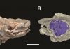
Analysis of a new dinosaur fossil suggests that the largest species ever known to walk the Earth was born with adult-like proportions, perhaps allowing it to be more independent than some other species of dinosaur.

While several fossils of the ginormous Rapetosaurus krausei have been analyzed to date, very little is known about this species around the time of hatching. R. krausei is a type of titanosaur, the largest land vertebrates to have evolved. It is estimated to have reached lengths of about 15 meters (49 feet), but even these giants had to start small.

Analysis of the new fossil by Kristina Curry-Rogers et al. suggests that the youngster they studied, who died (likely from starvation) between the age of 39 and 77 days, weighed roughly 3.4 kilograms (kg) when it hatched.

By the end of its brief life, it had reached a mass of roughly 40 kg and was 35 centimeters tall at the hip.

The researchers used bone histology and x-ray computed tomography to understand its growth pattern. Based on the compactness of its bones, the authors say that this dinosaur’s limbs likely remained similar in shape throughout its life.

This is in contrast to other dinosaur groups, such as theropods and ornithischians, whose limb proportions are different at birth than adulthood; evidence suggests that, in these latter cases, parental care was important.

Therefore, the authors propose that R. krausei infants may have been relatively independent after birth, compared to other species.

Reference:
K. Curry Rogers, M. Whitney, M. DEmic, B. Bagley. Precocity in a tiny titanosaur from the Cretaceous of Madagascar. Science, 2016; 352 (6284): 450 DOI: 10.1126/science.aaf1509

Note: The above post is reprinted from materials provided by American Association for the Advancement of Science.

Fossilised tooth of gigantic ‘killer’ whale found in Australia

Fossilised tooth of gigantic-GeologyPage
Erich Fitzgerald, a paleontologist at the Museum Victoria, holds an extinct sperm whale tooth found on a beach near Melbourne

A huge, five-million-year-old whale tooth has been discovered on an Australian beach, providing the first evidence of the now extinct killer sperm whale outside the Americas.

The 30-centimetre-long (12-inch) fossilised tooth, which is larger than that of a Tyrannosaurus rex, was found by a fossil enthusiast at Beaumaris Bay near Melbourne in February.

“After I found the tooth I just sat down and stared at it in disbelief,” Murray Orr said after the find was announced on Thursday by Museum Victoria, to whom he has donated the tooth.

“I knew this was an important find that needed to be shared with everyone.”

Museum Victoria said the unique fossil belonged to an extinct species of “killer sperm whale” which would have measured up to 18 metres (60 feet) in length and weighed some 40 tonnes.

It is the only example ever found outside the Americas, it added.

“Until this find at Beaumaris all fossils of giant killer sperm whales were found on the west coast of South and North America,” Erich Fitzgerald, a paleontologist at the museum, told the Australian Broadcasting Corporation.

The museum said the tooth, which dates from the Pliocene epoch of some five million years ago, was not only larger than those of a living sperm whale but also of a Tyrannosaurus rex.

Unlike today’s sperm whales, which eat a diet of squid and fish, their extinct relatives are thought to have used their bone-crushing teeth to prey on much larger animals, including fellow whales.

“If we only had today’s deep-diving, squid-sucking sperm whales to go on, we could not predict that just five million years ago there were giant predatory sperm whales with immense teeth that hunted other whales,” Fitzgerald said in a statement.

“Most sperm whales for the past 20 million years have been of the whale-killing kind. So, the fossil record reveals the living species to in fact be the exception to the rule, the oddball of the sperm whale family.”

Fitzgerald said Beaumaris Bay was one of Australia’s premier fossil sites, providing insights into the history of the continent’s marine megafauna.

Note: The above post is reprinted from materials provided by AFP.

From tiny to titan: Baby dinosaur fossils reveal megagrowth

This artist rendering provided by Science,  K. Curry Rogers, M. Whitney, M. D'Emic, and B. Bagley, shows a  titanosaur, a silhouette representing the size of a hatchling titanosaur, relationship to a human at birth, tiny titanosaur babies weigh about as much as average human babies, 6 to 8 pounds. But in just a few weeks, they're shedding the tiny descriptor and are at least the size of golden retrievers, weighing 70 pounds, knee-high to a person. And by age 20 or so, they're bigger than school buses. (Science/K. Curry Rogers, M. Whitney, M. D'Emic, and B. Bagley via AP)
This artist rendering provided by Science, K. Curry Rogers, M. Whitney, M. D’Emic, and B. Bagley, shows a titanosaur, a silhouette representing the size of a hatchling titanosaur, relationship to a human at birth, tiny titanosaur babies weigh about as much as average human babies, 6 to 8 pounds. But in just a few weeks, they’re shedding the tiny descriptor and are at least the size of golden retrievers, weighing 70 pounds, knee-high to a person. And by age 20 or so, they’re bigger than school buses. (Science/K. Curry Rogers, M. Whitney, M. D’Emic, and B. Bagley via AP)

Think your kids grow fast? Scientists say one dinosaur baby went from tiny to a true titan in the blink of a prehistoric eye.

At birth, titanosaur babies weighed about as much as average human babies, 6 to 8 pounds. But in just a few weeks, they were at least the size of golden retrievers, weighing 70 pounds.

And by age 20 or so, they were bigger than school buses.

That jump from something that you could hold in your hands to one of the largest creatures to ever roam Earth beats anything scientists have seen before in terms of growth, said paleontologist Kristi Curry Rogers of Macalester College in St. Paul, Minnesota. She is lead author of a new study on the baby dino fossils published Thursday in the journal Science.

By comparison, modern giants like whales, elephants and hippos are born much bigger than titanosaurs (Tie-TAN-O-SORES). Jeff Wilson of the University of Michigan who wasn’t part of the study said this is the paradox of this class of dinosaurs: They started out as tiny eggs and ended up as the largest animals on the planet.

Titanosaurs, plant-eating dinosaurs which lived about 67 million years ago, grew to be 15 feet tall, not including their necks and heads. They could stretch out to be 50 feet long. Looking through old bones stored in a museum after a dig in Madagascar, Rogers found enough small bone fossils to reconstruct a soon-after-hatching rapetosaurus (Ruh-PAY-too-SORE-us), a type of titanosaur. The baby dinosaur died of starvation during a drought that killed many others in the region, she said.

And yes, you could call it cute.

“There is no doubt that these baby titanosaurs would have had some of the features we would normally associate with cuteness or baby-ness: short snout, large eyes, big head for a body—like a puppy,” said Luis Chiappe, director of the Dinosaur Institute at the Natural History Museum of Los Angeles, who wasn’t part of the research but praised it.

The fossils confirmed that these creatures were precocious, Rogers said: They hatched from the egg pretty much ready to walk and live on their own.

It would have been hard for the giant parents to care for their babies. They had 20 to 30 softball size eggs in a nest and when they hatched, it would have been hard for the adults “to keep track of all the babies around their feet,” Rogers said. “It was just a free-for-all.”

Reference:
“Precociality in a tiny titanosaur from the Cretaceous of Madagascar,” Science, DOI: 10.1126/science.aaf1509

Note: The above post is reprinted from materials provided by The Associated Press.

Leg-wing cooperation in baby birds, dinosaurs is key transition in origin of flight

Leg-wing cooperation in baby birds-GeologyPage
X-ray studies reveal that baby birds flap their tiny wings to help them climb steep slopes. The force generated by flapping pushes them forward as well as upward, improving traction as they climb. Non-bird dinosaurs might have done the same thing with their ‘mini-wings’ before flight evolved. Credit: © Ashley Heers/Brown University XROMM Facility

New research based on high-resolution x-ray movies reveals that despite having extremely underdeveloped muscles and wings, young birds acquire a mature flight stroke early in their development, initially relying heavily on their legs and wings to work in tandem to power the strenuous movement. The new study, published today in the journal PLOS ONE, is important for understanding the development of flight in modern birds and reconstructing its origins in extinct dinosaurs.

“The transition from ground-living dinosaurs to flight-capable birds is one of the major evolutionary transitions in vertebrate history, because flight is the most physically demanding form of locomotion,” said lead author Ashley Heers, a postdoctoral researcher in the American Museum of Natural History’s Division of Paleontology. “The kind of flight that we normally think of in living birds—for example, what you might see in a pigeon or a robin—involved a huge evolutionary overhaul of the animal’s basic body plan over time. And although scientists have been studying flight for more a century, there’s actually a surprising amount that we don’t know about how birds fly.”

Adult birds have many anatomical features that presumably help meet the demands of flight. However, juvenile birds, like the first winged dinosaurs, lack many hallmarks of advanced flight. Instead of large wings, they have small “protowings,” and instead of robust, interlocking forelimb skeletons, their limbs are more gracile and their joints less constrained. These traits are often thought to preclude extinct theropods—the group of dinosaurs most closely related to modern birds—from powered flight, but young birds with similar rudimentary anatomies flap their wings as they run up slopes and even briefly fly, challenging longstanding ideas about the origin of flight.

To further explore this work, Heers and colleagues used a technique called x-ray reconstruction of moving morphology (XROMM)—which essentially produces a 3-D x-ray movie—to visualize skeletal movement in developing birds.

“For a long time, researchers weren’t able to tell how birds were moving their skeletons because, of course, they are covered in feathers and muscles,” Heers said. “This x-ray technique allows us to look at what’s happening inside of the animals as they’re performing different behaviors.”

At Brown University, the researchers used XROMM to look at Chukar partridges (Alectoris chukar) at a variety of ages as they flapped their wings to help climb steep slopes—a behavior scientists call wing-assisted incline running (WAIR). They found that when flap-running at similar levels of effort, juvenile and adult birds show similar patterns of joint movement. Despite their undeveloped anatomy, young birds can produce all of the elements of the avian flight stroke and modify their wing stroke for different behaviors, just like adults.

How is this possible? The study suggests that the cooperation between a juvenile bird’s legs and wings is key in early life: the force generated by flapping pushes the birds forward as well as upward, improving traction as they climb.

“When wings and legs are viewed in isolation, it is difficult to imagine how animals lacking flight adaptions could produce useful aerodynamic forces,” Heers said. “However, flapping behaviors that involve cooperative use of wings and legs, like WAIR, require less muscle power and less aerodynamic force than level flight. Transitional behaviors therefore allow flight-incapable juveniles to transition to flight-capable adults in a continuous fashion, supplementing their underdeveloped wings and flight muscles with their legs until the flight apparatus can fully support body weight.”

This wing-leg cooperation is a bridge between leg- and wing-based modes of locomotion. And the study indicates that extinct theropod dinosaurs might have done the same thing with their “mini-wings” before flight evolved.

“Baby birds anatomically look a lot like some of the dinosaur fossils that we see,” Heers said. “And so, by studying baby birds and looking at how they actually use these dinosaur-like anatomies, we can get a better sense of how these long-extinct animals might have been using their wings.”

Video

Reference:
Ashley M. Heers , David B. Baier, Brandon E. Jackson, Kenneth P. Dial. Flapping before Flight: High Resolution, Three-Dimensional Skeletal Kinematics of Wings and Legs during Avian Development. DOI: 10.1371/journal.pone.0153446

Note: The above post is reprinted from materials provided by American Museum of Natural History.

DNA proves mammoths mated beyond species boundaries

DNA proves mammoths mated-GeologyPage
Mammoth interbreeding common in North America. Credit: Copyright AMNH

Several species of mammoth are thought to have roamed across the North American continent. A new study in the open-access journal Frontiers in Ecology and Evolution, provides DNA evidence to show that these mammoths, which should only mate within their species boundaries, were in fact likely to be interbreeding.

A species can be defined as a group of similar animals that can successfully breed and produce fertile offspring. By using differences in the size and shape of their fossilized teeth, a number of North American mammoth species have been identified. But, some scientists are not confident this method of species categorization tells the whole story.

“Species boundaries can be very blurry. We might find differences in features of the teeth or skeleton that closely correspond to what we think are real species boundaries. But other features may not correspond to those boundaries, suggesting that what we formerly regarded as separate species are in fact not at all,” explains Hendrik Poinar, a Professor at McMaster University in Canada, who co-led the new study with his former graduate student Jake Enk and collaborator Ross MacPhee, a Professor at the American Museum of Natural History.

Professor Poinar and his co-authors used cutting-edge methods to distinguish species of North American mammoths. Tiny samples of fossilized mammoth bone, teeth and faeces, were generously donated by a number of museums across America and Canada. DNA was extracted from these samples in a specialized laboratory of the Ancient DNA centre at the McMaster University, and used to create a family tree of their evolution. The results proved to be very interesting.

North American mammoths such as the Columbian and Woolly Mammoths were historically thought to originate from two separate primitive species. However, this latest DNA analysis agrees with a more recent idea that all North American mammoths originated from a single primitive species, the Steppe Mammoth.

“Individuals of the Woolly and Columbian mammoths look like they represent different species in terms of their molar teeth, but their genetics say that they were not completely separate in the evolutionary sense and could successfully interbreed,” says Professor MacPhee.

Professor Poinar continues, “Mammoths were much better at adapting to new habitats than we first thought — we suspect that subgroups of mammoths evolved to deal with local conditions, but maintained genetic continuity by encountering and potentially interbreeding with each other where their two different habitats met, such as at the edge of glaciers and ice sheets.”

So, while mammoths clearly evolved differences in their physical appearance to deal with different environments, it did not prohibit them from cross-breeding and producing healthy offspring.

Despite this apparent adaptability, which should surely be a recipe for success, mammoths disappeared from the face of Earth 10,000 years ago. “Humans are suspected to be the cause, but this is not by any means proven. Explaining the loss of mammoths and a host of other Ice Age creatures continues to be a fascinating conundrum in paleobiology,” concludes Professor MacPhee.

As well as challenging the classic method of defining a species, the authors believe the findings of this study are just the start of understanding mammoth evolutionary history. Techniques to extract and analyse ancient DNA have undergone a tremendous improvement in recent years and as these technologies continue to improve we can expect further breakthroughs.

Reference:
Dan Fisher et al. Mammuthus Population Dynamics in Late Pleistocene North America: Divergence, Phylogeography and Introgression. Frontiers in Ecology and Evolution, April 2016 DOI: 10.3389/fevo.2016.00042

Note: The above post is reprinted from materials provided by Frontiers.

Paleontologists find first fossil monkey in North America – but how did it get here?

Paleontologists find first fossil monkey-GeologyPage
Stephenie Livingston Credit: University of Florida

Seven tiny teeth tell the story of an ancient monkey that made a 100-mile ocean crossing between North and South America into modern-day Panama – the first fossil evidence for the existence of monkeys in North America.

The find provides the oldest fossil evidence for the interchange of mammals between South and North America and challenges long-held views of South America as an island continent that evolved in isolation before the Isthmus of Panama was formed and animals began crossing between the continents about 3.5 million years ago, said Jonathan Bloch, curator of vertebrate paleontology at the Florida Museum of Natural History on the University of Florida campus. Study findings are detailed online today in the journal Nature.

Scientists uncovered the teeth belonging to the 21-million-year-old forest-dwelling primate during recent excavations related to the expansion of the Panama Canal. The new genus and species, dubbed Panamacebus transitus, received its name from the Latin word transit, meaning crossing.

It is somewhat of a mystery how P. transitus traveled across the sea dividing North and South America during the early Miocene. It may have swum across, but this would have required covering a distance of more than 100 miles, a difficult feat for even the most talented long-distance swimmers. It’s more likely P. transitus unintentionally rafted across on mats of vegetation, much like their ancestors who probably made their way from Africa to the New World in a similar fashion, Bloch said.

The unearthing of P. transitus – which probably looked a lot like a capuchin or “organ grinder” monkey – adds a new chapter to the “utterly bizarre” history of New World monkeys, Bloch said.

“Somehow they made a transoceanic journey from Africa, then they dispersed throughout South America,” Bloch said. “Now we see that they, as far as we know, are the only mammal that successfully crossed the early Miocene Central American Seaway into present day Panama. So how were monkeys able to do this? Hopefully future fossil discoveries will help us better understand this extraordinary history.”

The ocean-faring monkey suggests the modern diversification of New World monkeys happened in the ancient tropics. The surprising discovery of the first fossil monkey from North America extends the record for the beginning of the modern diversification of New World monkeys by more than 5 million years, Bloch said.

“Uncovering a monkey this old in Central America, at the southern-most point of the North American landmass, is similar in some ways to finding Homo erectus, an extinct human ancestor known only from Africa and Asia, in Australia,” Bloch said.

It also provides fossil evidence for a pattern previously documented by molecular scientists who have suggested for some time that a variety of animals, including amphibians, reptiles, freshwater fishes and insects made ocean crossings between North and South America during the early Miocene.

New World monkeys today are restricted to tropical forests from Brazil to southern Mexico, but during the early Miocene they were found throughout South America, including some of the continent’s highest latitudes. The new primate raises the question of why these monkeys are not found farther north once they crossed the seaway into Panama, said study co-author Aaron Wood, who discovered the first teeth belonging to P. transitus as a Florida Museum postdoctoral researcher in 2012.

“While the fossil mammals found with P. transitus include horses, camels and squirrels that look like what paleontologists have found in the early Miocene of Mexico, Texas and Florida, the new monkey was limited to the southernmost point of the continent,” said Wood, now a paleontologist with Iowa State University. “The ancient South American-derived forests found in Panama were absent in northern Central America at the time, preventing monkeys from moving north, even though climate and geographic barriers like oceans did not wholly restrict their northward movements.”

Bloch said maybe acorns in the northern forests just weren’t particularly tasty to a South American monkey used to eating tropical fruit.

But the same dense jungles that provide monkeys with the fruits and habitats they enjoy today also make it difficult to find fossils in the tropics, Bloch said.

“We hope to find more monkey fossils, but time is definitely a factor,” Bloch said. “We’re fighting against the forest that wants to grow over the rocks again. The expansion of the Panama Canal provides a once-in-a-century opportunity for these kinds of exciting discoveries. But we can’t assume we’ll always be able access these rock exposures.”

Note: The above post is reprinted from materials provided by University of Florida.

Paleontologist finds that ligaments in some dinosaurs’ necks helped them graze more efficiently

Paleontologist finds that ligaments-GeologyPage
MSU paleontologist Cary Woodruff’s findings about diplodocid sauropods were published recently in Historical Biology. Credit: MSU photo by Sepp Jannotta.

Ligaments in the long necks of certain sauropods probably helped them graze more efficiently, according to a Montana State University paleontologist.

MSU paleontologist Cary Woodruff said diplodocid sauropods had split spines that may have supported two elastic ligaments. When the dinosaurs extended their necks to feed on the left side, the ligament on the right side was stretched, storing energy. As the neck swung back to the right, that energy was released. The same recoil action happened when the sauropods swung their necks to the right.

Woodruff published his findings recently in “Historical Biology,” saying his research provides new support for the groundbreaking work of Oregon paleontologist Kent Stevens, who studies the structure of dinosaur skeletons.

Woodruff’s study also helped explain why diplodocid sauropods used a sweeping motion to eat, while sauropods with undivided spines moved their heads up and down, Woodruff said.

His work builds on efforts, too, to correct misconceptions about diplodocid sauropods. Textbook illustrations, for example, have shown the dinosaur eating foliage from the tops of trees. Toys have the dinosaur with a neck like a giraffe instead of one sticking straight out from its shoulders.

Woodruff said paleontologists used to study giraffes to better understand the necks of diplodocid sauropods, but there are no modern animals that closely compare. A better subject — one that Woodruff uses in his sauropod studies — is a breed of cattle known as the Ankole-Watusi. The animal originated in Africa, and its neck supports massive horns that can extend eight feet from tip to tip.

Diplodocid sauropods were among the most common dinosaur fossils found in the Morrison Formation in the western United States. Diplodocid sauropods are known for their long necks and tails, and some famous diplodocids are Apatosaurus and Diplodocus.

Stevens, a professor in the Department of Computer and Information Science at the University of Oregon, has spent more than two decades developing digital techniques to reconstruct and visualize the structure of dinosaur skeletons. After analyzing sauropod poses and the range of motion for various types of sauropod necks, he found that diplodocid sauropods had necks that stuck straight out from their shoulders and were more suited for sweeping sideways and downward than upward. They had teeth that indicated they were more likely to rake ferns from the ground than pull leaves from trees.

Woodruff specializes in the biomechanics and the growth of sauropods, although he has published numerous papers covering everything from the first burrowing dinosaurs to fossil manatees in ancient Egyptian catacombs.

A native of Bumpass, Virginia, Woodruff is an MSU graduate who earned his bachelor’s and master’s degrees in earth sciences from the MSU College of Letters and Science with an emphasis on paleontology. Studying under MSU paleontologist Jack Horner, he has led field crews at the O’Hair sauropod quarry near Livingston. He currently teaches paleontology at MSU and was recently named director of paleontology at the Great Plains Dinosaur Museum in Malta.

Reference:
D. Cary Woodruff. Nuchal ligament reconstructions in diplodocid sauropods support horizontal neck feeding postures. Historical Biology, 2016; 1 DOI: 10.1080/08912963.2016.1158257

Note: The above post is reprinted from materials provided by Montana State University. The original item was written by Evelyn Boswell.

Accounting for volcanoes using tools of economics

Accounting for volcanoes using-GeologyPage
Researchers have come up with a reliable new statistical method to spot past volcanic eruptions. Here, a typical temperature decline caused by particles and aerosols sent into the atmosphere. Credit: Pretis et al., Journal of Economic Surveys, 2016

When Mount Tambora erupted in 1815, it spewed dust and sulfate aerosols into the stratosphere with a force more powerful than any eruption since. As the aerosols and particulates circulated around the globe, they cooled the planet, disrupting agriculture and leading to what became known as the “year without a summer.”

Scientists can read old descriptions of eruptions like Tambora and analyze ash deposits captured in polar ice, but consistently estimating the climate impact of past eruptions has been difficult. A new technique may change that.

The method, described this week in the Journal of Economic Surveys, combines statistical approaches used in economics with volcano and climate science, with the intention of picking out past eruptions from tree-ring temperature reconstructions going back millennia, and gauging their impact on the climate. It arose from a chance meeting at a conference between climate scientist Jason Smerdon, who was working with graduate student Lea Schneider on the volcanic impact on climate, and econometrics expert Felix Pretis.

The method resulting from their collaboration may help separate volcanic impacts on climate from random climate variability, and improve understanding of the effects of aerosols on temperature. The method may have a wide range of policy and science applications beyond volcanic eruptions, from pollution controls and calibrating climate models to assessing forecasts made by central banks and studying the diffusion of innovations in medicine, said Pretis, co-director of the Climate Econometrics research project at the Economics Department of the University of Oxford.

“In a climate time series, you often have lots of ups and downs and wiggles,” said Smerdon, a professor at Columbia University’s Lamont-Doherty Earth Observatory and head of the PaleoDynamics Lab there. “Often times, you would like to sweep over that time series to identify things that don’t match what you would expect–breaks that stand out against the background wiggles as statistically significant.” The impact of a large volcanic eruption on temperature over time has a fairly distinct signature, similar to a cursive letter “v.” It starts with rapid cooling over about a year, followed by a relaxation back to previous mean levels over the next three to four years.

The new method uses what is known as indicator saturation. In a nutshell, the approach defines the basic shapes of possible breaks that might be in the time series and then removes all the additional wiggles except for those that resemble the signature shape in a statistically significant way. The size of the v, or the magnitude of the cold spike in the temperature time series, is related to the impact of the eruption on the climate, and ultimately the eruption’s size and location.

To test the approach, the scientists used a Northern Hemisphere mean temperature time series from a global climate model simulation spanning the last 1,200 years. The method identified the biggest eruptions in the climate model 100 percent of the time. It consistently detected 74 percent of eruptions that deposited over 20 million metric tons of sulfate aerosols on the polar ice, and 57 percent of all global eruptions, including several that had little impact on Northern Hemisphere temperature.

Smerdon, Pretis and Schneider,a Ph.D. student at Johannes Gutenberg University, Mainz, Germany, are now working on applying the method to a new temperature time series developed from tree-ring density records from across the Northern Hemisphere. The result may help pinpoint previously unknown volcanic eruptions and gauge their magnitude.

“This is a much more rigorous way of testing your assumptions than looking at a time series and saying, ‘Well, I think something happened here,’ ” said Smerdon. “Sometimes it’s obvious, but statistics allows you to ask those questions objectively to make sure that you aren’t deceiving yourself.”

Allegra LeGrande of the NASA Goddard Institute for Space Studies, who examines the impact of volcanic aerosols on climate and was not involved in the paper, said: “If a technique existed to automatically pick out all the volcanic events from proxy records, we would be able to significantly improve our reconstructions of past volcanism and extend this reconstruction far back in time. We could develop better statistics for the frequency of large events.” LeGrande is co-hosting a workshop on Volcanic Impacts on Climate and Society at Lamont-Doherty Earth Observatory in June.

The new statistical tools are available through the software package OxMetrics and in the open-source statistical software environment R, accessible through climateeconometrics.org/tools. David Hendry, co-director of the Program for Economic Modelling at the Institute for New Economic Thinking, Oxford Martin School, was a co-author of the paper.

The paper, “Detecting volcanic eruptions in temperature reconstructions by designed break-indicator saturation,” is available at http://www.economics.ox.ac.uk/materials/papers/14402/paper-780.pdf

Note: The above post is reprinted from materials provided by The Earth Institute at Columbia University.

First North American monkey fossils are found: New species named Panamacebus transitus

First North American monkey fossils-GeologyPage
This is a pen and ink drawing of Cebus capucinus by Martin Moynihan, former director of the Smithsonian Tropical Research Institute in Panama Credit: Martin Moynihan, STRI

Seven fossil teeth exposed by the Panama Canal expansion project are the first evidence of a monkey on the North American continent before the Isthmus of Panama connected it to South America 3.5 million years ago. A team including Carlos Jaramillo, staff scientist at the Smithsonian Tropical Research Institute (STRI), published this discovery online in the journal, Nature today. They named the new monkey species Panamacebus transitus in honor of Panama and the monkey’s movement across the ancient seaway that divided North and South America.

The 21 million-year-old teeth were found in the Las Cascadas Formation during a five-year intensive fossil salvage project by field crews from STRI, the University of Florida and the New Mexico Museum of Natural History and Science. Most of the mammal groups represented in the Las Cascadas formation have North American origins, despite the fact that South America is much closer, supporting the idea that Central America and western Panama represented a long peninsula extending south from North America.

During the salvage project, researchers rushed in behind engineers as they dynamited the steep canal banks. The researchers collected exposed fossils and described each location before heavy rains and fast-growing vegetation obscured evidence of the dramatic tectonic events that lifted the land bridge out of the sea to connect North and South America.

“I asked my boss for a million dollars to dig a hole in the ground,” said Jaramillo. “Then the Panamanian people voted for the Panama Canal Authority to spend $5.6 billion dollars to expand the Canal and unlocked a treasure trove for us, containing this new monkey species and many other fossils.”

“We suggest that Panamacebus was related to the capuchin (also known as “organ-grinder” monkeys) and squirrel monkeys that are found in Central and South America today,” said Jonathan Bloch, curator of vertebrate paleontology at the Florida Museum of Natural History on the University of Florida campus and lead author on the study. “Prior to this discovery, New World monkeys were thought to have evolved in isolation on South America, cut-off from North America by a wide seaway.”

Before the monkey teeth were discovered, the oldest evidence of movement of a mammal from South to North America are 8.5–9 million-year-old fossil remains of giant sloths. The authors of this report suggest two explanations: 1) that mammals from South America were more adapted to life in the South American derived forests still found in Panama and Costa Rica than to other forest types characteristic of Northern Central America or 2) that the lack of exposed fossil deposits throughout Central America means that evidence of these dispersals has yet to be revealed.

Reference:
Jonathan I. Bloch, Emily D. Woodruff, Aaron R. Wood, Aldo F. Rincon, Arianna R. Harrington, Gary S. Morgan, David A. Foster, Camilo Montes, Carlos A. Jaramillo, Nathan A. Jud, Douglas S. Jones, Bruce J. MacFadden. First North American fossil monkey and early Miocene tropical biotic interchange. Nature, 2016; DOI: 10.1038/nature17415

Note: The above post is reprinted from materials provided by Smithsonian Tropical Research Institute.

13-million-year-old ‘storyteller’ crocodylian fossils show evidence for parallel evolution

13-million-year-old 'storyteller-GeologyPage
Gryposuchus pachakamue mandible in the field. Credit: D. De Francesci; CCAL

The 13-million-year-old fossils of an extinct crocodylian, named ‘the storyteller,’ suggest that South American and Indian species evolved separately to acquire protruding, ‘telescoped’ eyes for river-dwelling, according to a study published April 20, 2016 in the open-access journal PLOS ONE by Rodolfo Salas-Gismondi from the University de Montpellier, France, and colleagues.

The gavialoids are a diversified group of mostly extinct long-snouted crocodylian species. Many of the evolutionary relationships between these species remain unclear; fossils of extinct gavialoids from South America and the extant Indian gharial gavialoid have similar telescoped eyes, but it was not known how these features evolved.

The authors of the present study examined Peruvian fossils from a 13-million-year-old South American species, the oldest known gavialoid crocodylian from the Amazon, which they named Gryposuchus pachakamue after Pachakamue, a pre-Hispanic South American ‘storyteller’ god thought to have knowledge about the origins of South American life. The fossils were dated as Middle Miocene and came from the Pebas Formation, which was likely made up of swampy waterways, suggesting that the crocodylian had a river-dwelling lifestyle. It had only slightly telescoped eyes. The researchers conducted phylogenetic and morphometric analysis to assess the likely evolutionary development of the protruding telescoped eyes of Indian and South American species.

Their analysis suggested that the ‘storyteller’ crocodylian with slightly telescoped eyes represents the ancestral condition from which the South American lineage evolved telescoped eyes. The eyes therefore evolved in parallel in South American and Indian lineages, at first showing partial telescoping as in the ‘storyteller’ crocodylian, and eventually becoming fully telescoped as seen in later-evolving species. Both South American and Indian species adopted a river-dwelling lifestyle, and it is likely that telescoped eyes were adaptive, helping them to catch fish in these habitats.

Although further research is needed, thibs study may further our understanding of both the ‘storyteller’ crocodylian and the evolution of all gavialoid crocodylians.

Reference:
Rodolfo Salas-Gismondi, John J. Flynn, Patrice Baby, Julia V. Tejada-Lara, Julien Claude, Pierre-Olivier Antoine. A New 13 Million Year Old Gavialoid Crocodylian from Proto-Amazonian Mega-Wetlands Reveals Parallel Evolutionary Trends in Skull Shape Linked to Longirostry. PLOS ONE, 2016; 11 (4): e0152453 DOI: 10.1371/journal.pone.0152453

Note: The above post is reprinted from materials provided by PLOS.

Seismic networks can be the backbone for 21st century firefighting

Seismic networks can be the-GeologyPage
AlertTahoe’s fire cameras captured the Washington Fire south of Lake Tahoe, Nevada in 2015. Credit: AlertTahoe/ NSL

On the YouTube video, the fire appears first as a small white dot among the trees, then as an unmistakable wisp of smoke curling up over a ridgeline. Wilderness high-definition (HD) cameras have caught the spark of a lightning strike in the Tahoe Basin, and are transmitting this time-lapsed live view to firefighters via a network built to detect earthquakes.

The same 21st century communications network used for real-time seismic monitoring in Nevada and parts of California can provide high-quality images like that of the Tahoe strike to help first responders catch fires before they grow costly and dangerous, says Graham Kent, director of the Nevada Seismological Laboratory (NSL) and professor in seismology at the University of Nevada, Reno.

Kent will be the featured public policy speaker at the Seismological Society of America’s (SSA) 2016 Annual Meeting held April 20-22 in Reno, Nevada. He said that seismic networks in place to provide earthquake early warning, if designed to sustain multi-hazard monitoring, can provide a robust data backbone for fire cameras that pan, tilt and zoom as they monitor wildfires and other extreme weather events like remote floods. And for Kent, the project is a bit personal: he’s had two homes–one in California and one in Nevada–burned over or threatened by wildfires.

The dual system has already been a success throughout parts of Nevada and eastern California, Kent said in a recent interview. During last year’s fire season in the state, the AlertTahoe platform and another platform in north-central Nevada helped to discover or provide early intelligence on more than 25 fires. This summer, AlertTahoe and the Bureau of Land Management (BLM) wildland fire camera programs will add 15 to 20 new HD cameras to increase its coverage of these areas.

According to Kent, the technology has the potential to remake firefighting in the West, moving away from massive “war-like” operations to more tactical suppression. “The old style of firefighting is like storming the beach at Normandy,” he said, “but if you can get on a fire early, with special tools, then it becomes more like a Special Forces situation.”

For seismologists, “all-hazards” networks like AlertTahoe represent a chance to fund and expand a robust and reliable earthquake early warning system. “If you build a network that’s putting out fires six months out of the year–a lot of them–that essentially pays for the deployment of the entire earthquake early warning network and operation costs for a decade or more in just one fire season,” Kent said.

“We feel like we’re doing a sustainable network design that allows you to monitor extreme weather, wildfires and earthquakes,” he added. “And of interest, about half of the damages that are estimated for a large earthquake event, like a major rupture on the San Andreas fault, are fire-related; so these camera systems can have a large impact after a damaging quake as well.”

The private, microwave-based seismic networks attached to the cameras offer an advantage over other communication networks such as cellular-based systems, which can become clogged with traffic during critical emergencies. The cameras and their installation are funded by both public sources like the U.S. Bureau of Land Management (BLM), U.S. Forest Service, and private donations through the Tahoe Prosperity Center.

The BLM, the U.S. Forest Service, the Camino Interagency Command Center, Sierra Front Interagency Dispatch Center, and local fire departments use the cameras routinely, and the public can also access the real-time images and on demand time-lapse images through the NSL website. Other agencies such as the National Weather Service use the cameras to monitor cloud formation (thunderstorm development) to track large and potentially damaging storms. The network is also monitoring climate along several critical transects in Nevada.

The fire cameras save time and especially money,since they give firefighters a chance to assess the size and potential growth of fires at early stages, before any people or equipment are sent to the fire. For instance, fire-spotting planes in the Tahoe Basin can cost up to $25,000 each time they take flight, Kent said. And resources and manpower can be stretched thin, especially during the summer fire season when firefighters may be deployed throughout the West.

“This allows you to scale your resources appropriately,” he noted. “Firefighters have to be careful that they don’t overrespond on one fire, and then have another larger fire within the hour or so and be positioned in the wrong place. Fire cameras help you understand how bad a fire is, and see how aggressive it is.”

Kent and his colleagues are also testing “machine vision” for the smart cameras, using computer programs that learn how to sift through the camera images to find signs of fire and smoke. The algorithms being developed use wintertime controlled burns in the Tahoe Basin to train their detection capabilities.

The Nevada Seismological Laboratory at the University of Nevada, Reno, manages the Nevada and eastern California networks. NSL is a partner with the University of California, San Diego on a larger project to build a common platform for early fire detection networks in other parts of the western U.S. The NSL project is an updated version of a California fire camera project, begun in 2002 by UC San Diego seismologist Frank Vernon and built on a large-scale wireless network in southern California called HPWREN.

The Southern California project, now dubbed AlertSoCal, is using the unique on-demand time-lapse interface developed for AlertTahoe fire cameras in San Diego, Riverside and Imperial Counties. Kent is also working with fire fighters in Idaho and Montana to potentially pair seismic networks and fire cameras in those states beginning in 2017.

The cameras even have their eye trained on urban areas, observing house and apartment fires in Reno. Information gleaned from these images could help researchers learn more about how fires move from rural to urban areas, and how urban areas might respond during earthquake-related fires.

Note: The above post is reprinted from materials provided by Seismological Society of America.

Alaskan seismologists re-evaluate region’s Earthquake potential after Iniskin

Alaskan seismologists re-evaluate-GeologyPage
This is a computer simulation of the M 7.1. Iniskin earthquake, showing its complex seismic wavefield. Credit: Simulation by Carl Tape/ University of Alaska Fairbanks, Research Computing Systems

January’s magnitude 7.1 Iniskin earthquake that shook the Cook Inlet region of Alaska was an unusual event, one that has seismologists in the area reconsidering the potential hazard from such quakes.

Unlike most of the large earthquakes that occur in shallow crust at the edge of the subducting Pacific Plate in this area, this earthquake happened at an unusual depth of about 123 kilometers below the surface, within the subducted portion of the Pacific Plate. Although the earthquake was felt throughout mainland Alaska, there were only minor amounts of damage from ground shaking.

“Had this earthquake actually occurred shallowly beneath Anchorage or someplace else like that, the ground shaking would have been ten times stronger,” says Alaska state seismologist Michael West of the University of Alaska Fairbanks.

West and colleagues will present new information about the Iniskin earthquake at a session at the Seismological Society of America’s (SSA) 2016 Annual Meeting, held April 20-22 in Reno, Nevada. The special session was added to the meeting’s agenda in the wake of the January 24 event.

The earthquake is the strongest one recorded to date by the extensive network of seismic stations around Anchorage, including seismic stations installed a few months before the quake as part of the EarthScope USArray project. USArray is a 15-year program to place portable and permanent seismographs across the continental United States.

The Iniskin earthquake is classified as an intermediate-depth earthquake, taking place well below the level expected for most large subduction zone earthquakes. These big earthquakes usually take place within the top 30 to 40 kilometers of the crust, West says, where tectonic plates grind against each other before the subducting plate completes its dive toward the mantle.

“Once that plate is down in the mantle, it isn’t rubbing against something else,” West says. “It’s under tremendous pressure and heat, and it may undergo little pops and creaks as it contorts itself. But there isn’t some massive fault down there.”

For these reasons, intermediate-depth earthquakes in the region “normally top out a bit above magnitude 6,” West says. “This was larger than we had seen for an intermediate-depth earthquake in this region of the Aleutian subduction zone, making it an earthquake that most people probably wouldn’t have anticipated would occur.”

The Iniskin event means that seismologists need to revise their estimates of the maximum possible intermediate-depth earthquakes in the area, which could affect future hazard risk estimates in southern Alaska. West cautions, however, that the public and policymakers shouldn’t assume that local infrastructure can withstand future magnitude 7 earthquakes with only the minimal damage seen during the Iniskin quake.

“The truth is that nobody was there to feel the actual brunt of this earthquake. Even if you were standing on the earth directly on top of it, you were still 120 kilometers away from it,” West notes.

At the SSA meeting, seismologists will present data on how several buildings in Anchorage and a Cook Inlet bridge fared during the earthquake, as well as new information about how the earthquake ground motion was affected by the types of sedimentary deposits in and around Anchorage, the state’s largest city.

Note: The above post is reprinted from materials provided by Seismological Society of America.

Related Articles