Scientists have directly measured the air that was breathed by Earth’s first animals for the first time. Credit: University of Aberdeen
The discovery of an atmospheric time capsule has allowed scientists to directly measure the air that was breathed by Earth’s first animals.
A team of international researchers, including geologists from the University of Aberdeen, made the discovery while analysing samples of halite – more commonly known as rock salt – dated 815 million years old.
The halite was found to contain traces of trapped atmospheric gas, from which measurements of oxygen were taken.
The analysis—which has been published in the Geology journal—found that the percentage of oxygen present in the atmosphere 815 million years ago was enough for animals to flourish. Some studies have suggested that the required level of oxygen would only have been present much later in the Earth’s history.
Professor John Parnell, from the University of Aberdeen’s School of Geosciences, took part in the study which involved a team of international researchers led by Dr Nigel Blamey from New Mexico Tech.
Professor Parnell said: “With this study, the oxygen in the air that allowed the earliest animals to breathe has been measured directly for the first time.
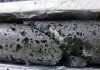
“We crushed samples of halite that were preserved in a drill core in Australia and removed the gases trapped in the salt crystals, which allowed us to measure the percentage of oxygen in the gases trapped 815 million years ago.
“We measured the oxygen at 10.3 to 13.4 per cent of the atmosphere, which would have been enough for animals to flourish. In comparison, the oxygen content of modern Earth’s atmosphere is 20.9 percent.
“What is especially significant in this study is that we actually discovered a real atmosphere sample, where previous estimates have been made using indirect modelling methods. We had a good idea about how to get at the ancient air, and it’s very pleasing that our hunch has paid off.”
Dr Blamey, who led the study, said the measurement was made possible by an international collaboration involving scientists from the UK, US, Canada, France, Australia and China. “This brought together expertise in technology, ancient rocks and the evolution of life, and built on years of experience crushing rocks exploring for gold, oil and gas,” he said.
Professor Uwe Brand from Brock University also took part in the study. He added: “This is really important evidence about the oxygen in the air, which helped one of the key events in the history of our planet, the rise of the animals.”
Reference:
Nigel J.F. Blamey et al. Paradigm shift in determining Neoproterozoic atmospheric oxygen, Geology (2016). DOI: 10.1130/G37937.1
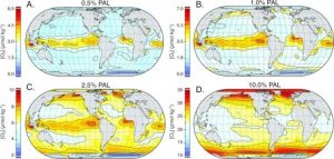
Reinhard used computational modeling to track oceanic dissolved oxygen concentrations globally. Credit: Chris Reinhard / Georgia Tech
A couple of times in four billion years, evolution has slowed to a crawl. And an eon or so has passed before more complex life forms, such as simple animals, could arise.
Evolution may have been waiting for a decent breath of oxygen, said researcher Chris Reinhard. And that was hard to come by. His research team is tracking down O2 concentrations in oceans, where earliest animals evolved.
By doing so, they have jumped into the middle of a heated scientific debate on what rising oxygen did, if anything, to charge up evolutionary eras. Reinhard, a geochemist from the Georgia Institute of Technology, is shaking up conventional thinking with the help of computer modeling.
Smash the beaker
That thinking goes like this: “Atmospheric oxygen had a value of ‘x’ back then, and so we just assume that the whole ocean is a beaker that equilibrates with that value,” Reinhard said. Then all evolving animals everywhere had the selfsame concentration of oxygen to live on.
But oceans are expansive and asymmetrical; deep here, shallower there, frosty at the poles, soupy at the girth. Turbulences, streams and temperatures distribute sediment, algae, salt — and gases like oxygen — into lopsided stores.
Oceans leave some areas teeming and others vacuous. Then they reshuffle their loads. Even today, concentrations of dissolved oxygen vary widely from ocean region to ocean region.
Equating the global ocean to a placid lab beaker? “This is an okay thought experiment to start with, but I think everybody would acknowledge over a beer that it’s simplistic,” said Reinhard, an assistant professor at Georgia Tech’s School of Earth and Atmospheric Sciences.
Create a stir
So, he and his team modeled how oxygen entered oceans from the atmosphere and from aquatic sources, and how oceans might have shuffled it around during the mid to late Proterozoic Eon. That was 0.6 to 1.8 billion years ago, when Earth’s atmosphere had only fraction of the breathable oxygen it does today.
In the model, the ocean didn’t share and share alike, but instead pushed dissolved O2 into areas of concentration that shifted starkly as corresponding concentrations in the atmosphere rose.
That has implications for the way scientists think about the timeframe for animal evolution on Earth and for future estimates for the probability of complex life on exoplanets.
The results and detailed modeling parameters appear in the Proceedings of the National Academy of Sciences. The research was funded by the National Science Foundation and the NASA Astrobiology Institute.
Be unreliable
Humans and today’s large animals would quickly suffocate in a Proterozoic-like world. And according to Reinhard’s research, its oceans may not have been as conducive to evolution as previously thought.
“What really matters for the early evolution of animals is ocean oxygen. To a certain degree, it’s really shallow sea floor oxygen that matters,” Reinhard said.
Those ocean shallows are called benthic regions, and in the Proterozoic Eon, they received plenty of sunlight and nutrients key to evolution. Even today, they’re teeming with life, which makes them popular places for snorkeling and fishing.
But the new model shows oxygen levels there may have been unreliable during the mid to late Proterozoic Eon.
Rob the rich
Earliest metazoans, the term for multicellular beings that are animals, may have done alright with scarce amounts and survived O2 droughts — periods of anoxia. But they also evolved into a world of rising breathable oxygen.
Reinhard’s computational model accounted for scenarios from atmospheric oxygen concentrations of 0.5 to 10 percent of today’s levels.
At low concentrations, the simulation showed oceanic oxygen building up around the equator, where hot spots in the water produced higher amounts of it. Then — as the atmosphere began filling with oxygen — in the oceans, it shifted toward the poles, where cold water was able to hold on to more of it.
Formerly oxygen-rich regions were robbed of conditions friendly to animal evolution.
In the beaker way of thinking, higher atmospheric oxygen should have meant evenly rising levels of oceanic oxygen for animals evolving everywhere, even in those depleted regions. “In reality, the ecology they would have been facing would have been pretty severe,” Reinhart said.
Follow dead animals
Reinhard’s team could have framed the study around other organisms but chose metazoans. “We focused on animals principally because that’s where we have the best empirical constraints for the oxygen levels that the organisms need,” he said.
Their evolution also left behind a calendar convenient to scientific study — a progressive fossil record that became more complex as oxygen levels rose.
In Earth’s roughly 3.7-billion-year history of life, animals turned up in about the most recent third. Furry, feathery and even scaly animals have only appeared in the last few hundred million years.
As oxygen became plentiful, critters got bigger, smarter, faster, and became predators and prey. Pursuit and flight accelerated as gasping lungs and gills pulled in more of the powerful oxidant to exponentially boost metabolism.
Evolution went into overdrive, diversifying the fossil record over time. But dive back down into it a billion or so years, to the mid to late Proterozoic, and animal fossils get smaller and simpler. You find little, squishy sponges and jellyfish.
Think (eco)logically
Their stony imprints mark the beginnings of that very complex evolution, and they may point to oxygen concentrations at the time.
“We were focusing on changes in atmospheric oxygen during the time period in which animals appear in the fossil record and trying to link that quantitatively to the oxygen levels early animals would have needed,” Reinhard said.
His computational oxygen distribution model was based on the current constellation of Earth’s continents — vastly different from that of the Proterozoic Eon.
But Reinhard said that difference would not change the conclusions. And the concepts they support should also apply to predictions about life on exoplanets with differing continental structures.
“The basic take-home — that we need to be thinking ecologically rather than just in terms of a single oxygen level — is going to prove to be pretty robust,” he said.
That beaker? May have just flown out the window.
A couple of times in four billion years, evolution has slowed to a crawl. And an eon or so has passed before more complex life forms, such as simple animals, could arise.
Evolution may have been waiting for a decent breath of oxygen, said researcher Chris Reinhard. And that was hard to come by. His research team is tracking down O2 concentrations in oceans, where earliest animals evolved.
By doing so, they have jumped into the middle of a heated scientific debate on what rising oxygen did, if anything, to charge up evolutionary eras. Reinhard, a geochemist from the Georgia Institute of Technology, is shaking up conventional thinking with the help of computer modeling.
Smash the beaker
That thinking goes like this: “Atmospheric oxygen had a value of ‘x’ back then, and so we just assume that the whole ocean is a beaker that equilibrates with that value,” Reinhard said. Then all evolving animals everywhere had the selfsame concentration of oxygen to live on.
But oceans are expansive and asymmetrical; deep here, shallower there, frosty at the poles, soupy at the girth. Turbulences, streams and temperatures distribute sediment, algae, salt — and gases like oxygen — into lopsided stores.
Oceans leave some areas teeming and others vacuous. Then they reshuffle their loads. Even today, concentrations of dissolved oxygen vary widely from ocean region to ocean region.
Equating the global ocean to a placid lab beaker? “This is an okay thought experiment to start with, but I think everybody would acknowledge over a beer that it’s simplistic,” said Reinhard, an assistant professor at Georgia Tech’s School of Earth and Atmospheric Sciences.
Create a stir
So, he and his team modeled how oxygen entered oceans from the atmosphere and from aquatic sources, and how oceans might have shuffled it around during the mid to late Proterozoic Eon. That was 0.6 to 1.8 billion years ago, when Earth’s atmosphere had only fraction of the breathable oxygen it does today.
In the model, the ocean didn’t share and share alike, but instead pushed dissolved O2 into areas of concentration that shifted starkly as corresponding concentrations in the atmosphere rose.
That has implications for the way scientists think about the timeframe for animal evolution on Earth and for future estimates for the probability of complex life on exoplanets.
The results and detailed modeling parameters appear in the Proceedings of the National Academy of Sciences. The research was funded by the National Science Foundation and the NASA Astrobiology Institute.
Be unreliable
Humans and today’s large animals would quickly suffocate in a Proterozoic-like world. And according to Reinhard’s research, its oceans may not have been as conducive to evolution as previously thought.
“What really matters for the early evolution of animals is ocean oxygen. To a certain degree, it’s really shallow sea floor oxygen that matters,” Reinhard said.
Those ocean shallows are called benthic regions, and in the Proterozoic Eon, they received plenty of sunlight and nutrients key to evolution. Even today, they’re teeming with life, which makes them popular places for snorkeling and fishing.
But the new model shows oxygen levels there may have been unreliable during the mid to late Proterozoic Eon.
Rob the rich
Earliest metazoans, the term for multicellular beings that are animals, may have done alright with scarce amounts and survived O2 droughts — periods of anoxia. But they also evolved into a world of rising breathable oxygen.
Reinhard’s computational model accounted for scenarios from atmospheric oxygen concentrations of 0.5 to 10 percent of today’s levels.
At low concentrations, the simulation showed oceanic oxygen building up around the equator, where hot spots in the water produced higher amounts of it. Then — as the atmosphere began filling with oxygen — in the oceans, it shifted toward the poles, where cold water was able to hold on to more of it.
Formerly oxygen-rich regions were robbed of conditions friendly to animal evolution.
In the beaker way of thinking, higher atmospheric oxygen should have meant evenly rising levels of oceanic oxygen for animals evolving everywhere, even in those depleted regions. “In reality, the ecology they would have been facing would have been pretty severe,” Reinhart said.
Follow dead animals
Reinhard’s team could have framed the study around other organisms but chose metazoans. “We focused on animals principally because that’s where we have the best empirical constraints for the oxygen levels that the organisms need,” he said.
Their evolution also left behind a calendar convenient to scientific study — a progressive fossil record that became more complex as oxygen levels rose.
In Earth’s roughly 3.7-billion-year history of life, animals turned up in about the most recent third. Furry, feathery and even scaly animals have only appeared in the last few hundred million years.
As oxygen became plentiful, critters got bigger, smarter, faster, and became predators and prey. Pursuit and flight accelerated as gasping lungs and gills pulled in more of the powerful oxidant to exponentially boost metabolism.
Evolution went into overdrive, diversifying the fossil record over time. But dive back down into it a billion or so years, to the mid to late Proterozoic, and animal fossils get smaller and simpler. You find little, squishy sponges and jellyfish.
Think (eco)logically
Their stony imprints mark the beginnings of that very complex evolution, and they may point to oxygen concentrations at the time.
“We were focusing on changes in atmospheric oxygen during the time period in which animals appear in the fossil record and trying to link that quantitatively to the oxygen levels early animals would have needed,” Reinhard said.
His computational oxygen distribution model was based on the current constellation of Earth’s continents — vastly different from that of the Proterozoic Eon.
But Reinhard said that difference would not change the conclusions. And the concepts they support should also apply to predictions about life on exoplanets with differing continental structures.
“The basic take-home — that we need to be thinking ecologically rather than just in terms of a single oxygen level — is going to prove to be pretty robust,” he said.
That beaker? May have just flown out the window.
Reference:
Christopher T. Reinhard, Noah J. Planavsky, Stephanie L. Olson, Timothy W. Lyons, and Douglas H. Erwin. Earth’s oxygen cycle and the evolution of animal life. Proceedings of the National Academy of Sciences, July 2016 DOI: 10.1073/pnas.1521544113
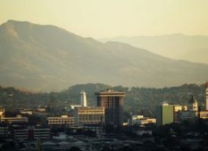
The city of San Salvador. Credit: University of Bristol
The build-up of magma six kilometres below El Salvador’s Ilopango caldera means the capital city of San Salvador may be at risk from future eruptions, University of Bristol researchers have found.
A caldera is a large cauldron-like volcanic depression or crater, formed by the collapse of an emptied magma chamber. The depression often originates from very big explosive eruptions. In Guatemala and El Salvador, caldera volcanoes straddle tectonic fault zones along the Central American Volcanic Arc (CAVA). The CAVA is 1,500 kilometres long, stretching from Guatemala to Panama.
The team, from the Volcanology research group at Bristol’s School of Earth Sciences and the Ministry of the Environment and Natural Resources in El Salvador, studied the density distribution beneath the Ilopango caldera and the role tectonic stresses – caused by the movement of tectonic plates along fault lines – have on the build-up of magma at depth. Their study is published today in the journal Nature Communications.
The Ilopango caldera is an eight km by 11 kilometre volcanic collapse structure of the El Salvador Fault Zone. The collapsed caldera was the result of at least five large eruptions over the past 80,000 years.
The last of these occurred about 1,500 years ago and produced enough volcanic ash to form a 15 centimetre thick layer across the entire UK. This catastrophic eruption destroyed practically everything within a 100 kilometre radius, including a well-developed native Mayan population, and significantly disturbed the Mayan populations as far as 200 kilometres away.
The most recent eruptions occurred in 1879–1880 and were on a much smaller scale than the previous one.
Project leader and co-author Dr Joachim Gottsmann said: “Most earthquakes take place along the edges of tectonic plates, where many volcanoes are also located. There is therefore a link between the breaking of rocks, which causes faults and earthquakes and the movement of magma from depth to the surface, to feed a volcanic eruption. The link between large tectonic fault zones and volcanism is, however, not very well understood.”
Existing studies show that magma accumulation before a large caldera-forming eruption, as well as the caldera collapse itself, may be controlled by fault structures.
“However, it is unclear to what extent regional tectonic stresses influence magma accumulation between large caldera-forming eruptions.”, co-author Professor Katharine Cashman said.
Lead author Jennifer Saxby, whose research towards a MSc in Volcanology contributed to the study, said: “Addressing this question is important not only for understanding controls on the development of magmatic systems, but also for forecasting probable locations of future eruptive activity from caldera-forming volcanoes.”
The team discovered that the current tectonic stress field promotes the accumulation of magma and hydrothermal fluids at shallow (< 6km) depth beneath Ilopango. The magma contains a considerable amount of gas, which indicates the system is charged to possibly feed the next eruption.
Dr Gottsmann said: “Our results indicate that localised extension along the fault zone controls the accumulation, ascent and eruption of magma at Ilopango. This fault-controlled magma accumulation and movement limits potential vent locations for future eruptions at the caldera in its central, western and northern part – an area that now forms part of the metropolitan area of San Salvador, which is home to 2 million people. As a consequence, there is a significant level of risk to San Salvador from future eruptions of Ilopango.”
Reference:
J. Saxby et al. Magma storage in a strike-slip caldera, Nature Communications (2016). DOI: 10.1038/ncomms12295
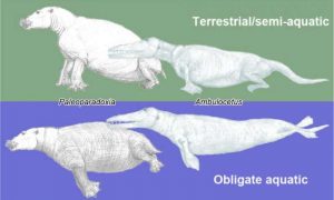
Paleoparadoxia (left: Desmostylia, Paenungulata) and Ambulocetus (right: Cetacea, Cetartiodactyla) in two different ways of reconstructions-top: terrestrial/semi-aquatic; bottom: obligate aquatic. Credit: Fujiwara(2016)
Researchers at Nagoya University establish a new index based on rib strength measurement, which can use fossil records to predict whether extinct mammalian species lived exclusively in the water, were occasionally on land, or were fully land-based.
Despite the extensive fossil record of mammals, it is often difficult to use fossil data to reconstruct the lifestyles and habitats of extinct species. The fact that some species spent all or part of their time underwater, respectively similar to modern-day whales and seals, further complicates this.
Konami Ando and Shin-chi Fujiwara, researchers at Nagoya University, addressed this by developing a new index for predicting if a species lived its entire life in the water. The index is based on how the ribs must be relatively strong for an animal to walk or crawl over land, but not for it to swim. After establishing the index via measurements of living terrestrial, semiaquatic, and exclusively aquatic species, Ando and Fujiwara used it to predict that some extinct species could not have supported themselves on land.
Although mammals originally evolved as terrestrial organisms, cladistics shows that some returned to aquatic lives, and that this sometimes occurred independently. Examples include whales, dolphins, and manatees, which never leave the water, and seals and hippopotamuses, which split time between land and water. Studies of fossils of extinct species also suggest some species spent all or some of their time in the water. However, inability to use fossil records alone to determine a species’ lifestyle has made this hard to confirm.
In their study, reported in the Journal of Anatomy, Ando and Fujiwara analyzed rib cages and their resistance to vertical compression in a range of mammalian species. This important factor represents an animal’s ability to support its body weight against gravity while walking or crawling; a trait aquatic organisms do not need. The researchers investigated 26 modern-day terrestrial, semiaquatic, and exclusively aquatic species, including the killer whale, polar bear, dugong, giraffe, and hippopotamus. They used their data to establish an index for differentiating between groups with different habitats. They then applied the index to four extinct mammalian species, all of which had retained their four limbs but showed signs of having been partially or completely aquatic, to shed light on their potential lifestyles.
“We selected mammals with different habitats from a range of taxa and analyzed fossils for which the bones in the thoracic region were well-preserved,” Fujiwara says. “We focused on the fracture loads of ribs. We found the sum of the fracture loads of all true ribs directly connected to the sternum divided by the body weight effectively separated the extant species groups by habitat. Exclusively aquatic species were clearly differentiated.”
After establishing that the index could correctly classify living species with known habitats and lifestyles, the researchers applied it to extinct groups: Ambulocetus, an early ancestor of whales, and three desmostylian species, which are the keens of elephants and sea cows. This was to confirm or reject earlier hypotheses about these groups’ lifestyles, which were based on other morphological findings.
“Our index lets us conclude that Ambulocetus and two desmostylians (Paleoparadoxia and Neoparadoxia) could not have supported themselves on land; they were exclusively aquatic,” Ando says. “But the findings were inconclusive for the third desmostylian (Desmostylus). We may need to perform additional studies on the intermediate group of semiaquatic species, include a bone density variable in our model, or improve our data on the body mass of extinct species to refine the index.”
The new index should help in both reconstructing the lifestyles and habitats of extinct mammals and clarifying anatomical changes associated with mammals shifting to a life partly or exclusively in the water.
Reference:
Konami Ando et al. Farewell to life on land – thoracic strength as a new indicator to determine paleoecology in secondary aquatic mammals, Journal of Anatomy (2016). DOI: 10.1111/joa.12518
Note: The above post is reprinted from materials provided by Nagoya University.
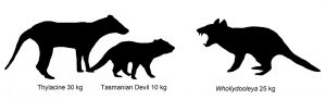
Illustration showing size comparison of Australian marsupials including new extinct species of carnivorous marsupial, Whollydooleya tomnpatrichorum, from New Riversleigh fossil site in Queensland. Credit: Illustration: Karen Black/UNSW
A new species of extinct flesh-eating marsupial that terrorised Australia’s drying forests about 5 million years ago has been identified from a fossil discovered in remote northwestern Queensland.
The hypercarnivore, which is thought to have weighed about 20 to 25 kilograms, is a distant and much bigger cousin of Australia’s largest living, flesh-eating marsupial, the Tasmanian Devil, which weighs in at about 10 kilogram.
Named Whollydooleya tomnpatrichorum, it is the first creature to be formally identified from a range of strange new animals whose remains have been found in a recently discovered fossil site in Queensland dubbed ‘New Riversleigh’.
A description of the new marsupial, based on its fossil molar tooth, is published in the Memoirs of Museum Victoria.
“W. tomnpatrichorum had very powerful teeth capable of killing and slicing up the largest animals of its day,” says study lead author UNSW Professor Mike Archer.
The late Miocene period between about 12 and 5 million years ago, when Australia began to dry out and the megafauna began to evolve, is one of the most mysterious and least well-understood periods in the continent’s past. Fossils of land animals from this period are extremely rare, because of the increasing aridity.
“Fortunately, in 2012, we discovered a whole new fossil field that lies beyond the internationally famous Riversleigh World Heritage Area fossil deposits in north-western Queensland,” says Professor Archer.
“This exciting new area – New Riversleigh – was detected by remote sensing using satellite data.”
With the help of ARC funding and a grant from the National Geographic Society, Professor Archer and his colleagues began to systematically explore New Riversleigh in 2013.
The new species’ highly distinctive molar was one of the first fossil teeth obtained from a particularly fossil-rich site in the area which was discovered by team member Phil Creaser and named Whollydooley Hill in honour of his partner and Riversleigh volunteer Genevieve Dooley.
“New Riversleigh is producing the remains of a bevy of strange new small to medium-sized creatures, with Whollydooleya tomnpatrichorum, the first one to be described,” says Professor Archer.
“These new discoveries are starting to fill in a large hole in our understanding about how Australia’s land animals transformed from being small denizens of its ancient wet forests to huge survivors on the second most arid continent on Earth.”
Team member UNSW Professor Suzanne Hand says medium to large-sized Australian Late Miocene animals have previously been known from fossil deposits in the Northern Territory, such as at Alcoota.
“But those deposits give almost no information about the small to medium-sized mammals that existed at the same time, which generally provide more clues about the nature of prehistoric environments and climates,” Professor Hand says.
Team member and UNSW postdoctoral researcher in palaeontology, Dr Karen Black, adds: “The small to medium-size mammals from the New Riversleigh deposits will reveal a great deal about how Australia’s inland environments and animals changed between 12 and 5 million years ago – a critical time when increasing dryness ultimately led to the Ice Ages of the Pleistocene.”
The Whollydooley Site deposit provides other exciting clues about how the environment was changing. For example, it contains the first signs of wind-blown sand grains, which are absent from the older Riversleigh World Heritage deposits.
And the teeth of the other animals in this deposit are unusual for Riversleigh, because they are more worn down. This suggests that the foods animals were eating in the late Miocene were perhaps tougher, more drought-resistant plants, and there was more abrasive dust in the environment.
“Although Whollydooleya terrorized the drying forests around 5 million years ago, its own days were numbered,” says Archer.
“While it was at least distantly related to living and recently living carnivorous marsupials such as Devils, Thylacines and Quolls, it appears to have represented a distinctive subgroup of hypercarnivores that did not survive into the modern world.
“Climate change can be a merciless eliminator of the mightiest of mammals,” he says.
Reference:
Archer, M.; Christmas, O.; Hand, S.J.; Black, K.H.; Creaser, P.; Godthelp, H.; Graham, I.; Cohen, D.; Arena, D.A.; Anderson, C.; Soares, G.; Machin, N.; Beck, R.M.D.; Wilson, L.A.B.; Myers, T.J.; Gillespie, A.K.; Khoo, B., and Travouillon, K.J.. Earliest known record of a hypercarnivorous dasyurid (Marsupialia), from newly discovered carbonates beyond the Riversleigh World Heritage Area, north Queensland. “museumvictoria”
A view over the bow of the U.S. Research Vessel IceBreaker Nathaniel B. Palmer in the Antarctic marginal ice zone during a voyage in February 2013 to study air-to-sea CO2 exchange. Credit: Cassandra Brooks
Those who are hostile to a buildup of carbon dioxide in the atmosphere have a friend in the ice and waves of the Earth’s coldest waters.
These two natural phenomena effectively gobble up a fourth or more of the planet’s CO2 and soak it into the sea. Discovering precisely how much of this air-to-sea exchange is occurring has a direct impact on global climate change models. But these air-sea fluxes, strongest near the Earth’s poles, have been poorly sampled, particularly in the Southern Ocean, due to data-gathering voyages being difficult, dangerous, and expensive.
Atmospheric scientist Scott Miller’s construction of equipment robust enough to withstand extreme environments in the Southern Ocean and Antarctic marginal ice zone has proved to be a significant advancement in gathering critical measurements. Now, air-sea exchange results from his team’s nine voyages over 18 months will be published on Aug. 16 by the journal Geophysical Research Letters (GRL).
“The main goal of our research was to determine how the efficiency of air-sea carbon dioxide exchange depends on wind-speed during high wind and wave conditions characteristic of the Southern Ocean,” said Miller. “Achieving this goal helps to improve the accuracy of calculated Southern Ocean—and global—carbon budgets.
“And, as it turned out, we also collected a lot of data in the Antarctic marginal ice zone. We were able to use the ice zone data to look at how gas transfer is affected by the presence of sea ice.”
The article, “Air-sea exchange of carbon dioxide in the Southern Ocean and Antarctic marginal ice zone,” is co-authored by Miller, a research associate in UAlbany’s Atmospheric Sciences Research Center, and doctoral candidate Brian Butterworth.
Since global climate models are extremely sensitive to how air-sea exchange is represented, Miller’s findings should ultimately increase all models’ accuracy. His team’s research upheld one long-term model on the rate of gas exchange that occurs during high wind and wave conditions over newer models which had suggested the rate of CO2 absorbed by the sea is much higher.
But his voyages also challenged some current models in another area. “In the sea ice zone, our results showed that gas exchange was in proportion to the amount of open water—data which did not support recent models suggesting that gas exchange is enhanced in the presence of sea ice,” he said.
The superior tools Miller and his team created for the voyages, conducted from January 2013 to June 2014 on the U.S. Research Vessel/Icebreaker Nathaniel B. Palmer, often operated unattended (without team members onboard), an approach never before achieved in the Antarctic. Fast-response sensors were placed 14 meters above the ocean surface, other monitors were located below deck at the bow, and several high-mounted cameras provided second-by-second photos that estimated ice cover.
Miller said his team now has a proposal to do similar work in the Arctic, except with higher resolution of the sea surface. “Also, we have proposed deploying a buoy-based system in the Southern Ocean as an alternative to using research vessels.”
Reference:
Brian J. Butterworth et al. Air-sea exchange of carbon dioxide in the Southern Ocean and Antarctic marginal ice zone, Geophysical Research Letters (2016). DOI: 10.1002/2016GL069581
The context of the rope-making tool at the time of discovery in August 2015 . Credit: University of Tübingen
Prof. Nicholas Conard and members of his team, present the discovery of a tool used to make rope in today’s edition of the journal: Archäologische Ausgrabungen Baden-Württemberg.
Rope and twine are critical components in the technology of mobile hunters and gatherers. In exceptional cases impressions of string have been found in fired clay and on rare occasions string was depicted in the contexts of Ice Age art, but on the whole almost nothing is known about string, rope and textiles form the Paleolithic.
A key discovery by Conard’s team in Hohle Fels Cave in southwestern Germany and experimental research and testing by Dr. Veerle Rots and her team form the University of Liège is rewriting the history of rope.
The find is a carefully carved and beautifully preserved piece of mammoth ivory 20.4 cm in length with four holes between 7 and 9 mm in diameter. Each of the holes is lined with deep, and precisely cut spiral incisions. The new find demonstrates that these elaborate carvings are technological features of rope-making equipment rather than just decoration.
Similar finds in the past have usually been interpreted as shaft-straighteners, decorated artworks or even musical instruments. Thanks to the exceptional preservation of the find and rigorous testing by the team in Liège, the researchers have demonstrated that the tool was used for making rope out of plant fibers available near Hohle Fels. “This tool answers the question of how rope was made in the Paleolithic”, says Veerle Rots, “a question that has puzzled scientists for decades.”
Excavators found the rope-making tool in archaeological horizon Va near the base of the Aurignacian deposits of the site. Like the famous female figurines and the flutes recovered from the Hohle Fels, the rope-making tool dates to about 40,000 years ago, the time when modern humans arrived in Europe. The discovery underlines the importance of fiber technology and the importance of rope and string for mobile hunters and gatherers trying to cope with challenges of life in the Ice Age.
Prof. Conard’s team has excavated at Hohle Fels over each of the last 20 years, and it is this long-term commitment that has over and over again paid off, to make Hohle Fels one of the best known Paleolithic sites worldwide. Hohle Fels and neighboring sites from the Ach and Lone Valleys have been nominated for UNESCO World Cultural Heritage status. The excavations at Hohle Fels near Schelklingen in the Ach Valley are funded by the HeidelbergCement AG, the Ministry of Science of Baden-Württemberg and the Heidelberger Academie of Sciences.
The rope-making tool will be on exhibit at the Urgeschichtliches Museum in Blaubeuren starting Saturday, July 23rd .
Reference:
Nicholas J. Conard, Maria Malina: Außergewöhnliche neue Funde aus den aurignacienzeitlichen Schichten vom Hohle Fels bei Schelklingen. Archäologische Ausgrabungen in Baden-Württemberg, S. 61-66, 22 July 2016.
A new study shows that teeth are not too good for you if you’re a dinosaur trying to not go extinct.
Around 66 million years ago, a time known as the end-Cretaceous, there was a massive extinction of life, with around 75% of all known species dying off. Perhaps most well-known at this time is the extinction of the non-bird line dinosaurs.
We’ve known about this extinction for decades now. But in spite of this, the causes, timing, and ecology of it still remain fairly elusive and highly debated. This is quite important for figuring out what triggered the origins of modern birds, as their radiation has been thought to be closely related to the extinction of their close dinosaurian cousins.
New research on maniraptoran dinosaurs, the group that includes Velociraptor and modern birds, shows that having a beak conferred a survival advantage by providing birds the ability to eat seeds. When animals around you are dying off in droves because meteor strike, this would have come in pretty handy by being able to exploit dwindling food resources.
Teeth are particularly handy for studies like this, as not only are they relatively frequent in the fossil record, but they also reveal to us much about the ecology of dinosaurs at this time, such as what they ate.
One way to measure ecology quantitatively is through something called disparity. This is a measure of the diversity of different types of anatomy, which can be related to specific functions. A simple measure of disparity might be the curvature of the tooth, or the distance from the root to the crown.
The team analysed more than 3100 of these teeth from different dinosaur groups to see how disparity changed through time coming up to the end-Cretaceous extinction boundary. What they found is that up until the extinction, disparity remained pretty high in theropod dinosaur groups such as dromaeosaurs and troodontids, including birds. This is what we might think of then as ‘ecosystem stability’, with consistency in the variation of maniraptorans throughout this time.
“We’ve used the teeth of these bird-like dinosaurs to show that these dinosaurs were a consistent and stable part of the ecosystem leading up to the end of the Cretaceous,” explained lead author of the study Derek Larson, assistant curator at the Philip J. Currie Dinosaur Museum and PhD candidate at the University of Toronto.
What this means is that the extinction was fairly instantaneous, and not drawn out over a long period of time. Therefore, it is more likely that aspects relating to this such as diet were more important, and in particular the evolution of the beak in birds.
In particular, one striking difference between small maniraptorans and early birds at this time is the presence of a keratin-sheathed beak in the latter group. In dinosaurs, the acquisition of a beak was a key characteristic in their survival and subsequent evolution. Even today, there are more than 10,000 species of bird, highlighting the success this evolutionary innovation gave to them.
Larson explained, “By analysing the known diets of modern birds, we can see many groups that probably survived the extinction could have survived by eating seeds, probably one of the few plentiful resources that were available in the climatic upheaval in the aftermath of the asteroid impact. Those dinosaurs without a beak and without the right teeth to access those resources, would have been relegated to extinction.”
This story based on fossils actually fits in quite nicely with what studies of the DNA of modern birds tells us. Using modelling approaches, we can tell that early birds around this time where granivorous, that is they ate seeds either entirely or as part of a mixed diet.
This is really important, as it shows that as food webs collapsed due to the end-Cretaceous meteor strike, being able to survive of seeds might have been critical in the survival of modern birds. This is similar to what we observe during forest fires, with some birds the first to recolonise damaged areas due to the abundance of left over seeds.
So I guess the real question now is, what if T. rex had a beak..?
Reference:
Derek W. Larson et al. Dental Disparity and Ecological Stability in Bird-like Dinosaurs prior to the End-Cretaceous Mass Extinction, Current Biology (2016). DOI: 10.1016/j.cub.2016.03.039
This is a historic photo of the San Francisco earthquake of 1906. Credit: USGS Earth Observatory
The triggering of small, deep earthquakes along California’s San Andreas Fault reveals depth-dependent frictional behavior that may provide insight into patterns signaling when a major quake could be on the horizon, according to a paper released this week by the Proceedings of the National Academy of Sciences (PNAS).
The study, which was led by the U.S. Geological Survey and Los Alamos National Laboratory, reports that the deepest part of California’s 800-mile-long San Andreas Fault is weaker than expected and produces small earthquakes in response to tidal forces.
“These findings provide previously inaccessible information about the San Andreas Fault activity and strength,” said Los Alamos National Laboratory’s Paul Johnson, a coauthor on the paper and geophysicist in the Lab’s Earth and Environmental Sciences Division. “The study’s discovery of low-frequency-earthquake (LFE) and tidal triggering of the San Andreas Fault gives seismologists new warning signals and information about slightly more predictable triggers of quakes to come.”
Los Alamos maintains technical expertise in seismology and the behavior of Earth’s crust as a part of its role monitoring underground nuclear testing globally and applies that expertise to other national challenges, including earthquakes.
The team used a data set of 81,000 LFEs since 2008 to match LFEs to tides. They determined in addition to being modulated with the semidiurnal (twice daily) tides, LFEs are also modulated by fortnightly tides. The contrasting relationship between the LFE responses observed at two different tidal timescales should serve as a powerful constraint on understanding frictional behavior and stress transfer on the deep San Andreas.
“The findings provide new information regarding the fault zone structure with depth,” Johnson said. The authors found that deep, small, low-frequency earthquakes (LFEs) on the San Andreas Fault are most likely to occur during the waxing period approaching a full or new moon within the fortnightly tide period of 14.7 days. The fortnightly tide modulates the semidiurnal (twice a day) tide. LFEs preferentially occur not when the tidal amplitude is highest, as might be expected, but when the tidal amplitude most exceeds its previous value, the authors found. LFEs correlate more strongly with larger-amplitude shear stress.
Previous studies have found stronger tidal semidiurnal variation for deeper, continuously active LFE families. The team used two models to explain variations: One, based on friction studies, posited LFEs occur when stress accelerates slip. The other model suggests LFEs occur by simple threshold failure but are driven indirectly by tidally modulated creep. Regardless of which tidal triggering model is correct, the inverse relationship between the strength of the semidiurnal and fortnightly modulations provides a key insight into the mechanics of LFEs and the structure of the deep fault, according to the paper.
“The pattern of LFEs tells us something about loading rates and stress conditions in the deep part of the fault,” said Andrew Delorey, a seismologist with Los Alamos. “We don’t know to what extent the deep part of the fault where LFEs occur is coupled to the shallow part of the fault where regular earthquakes occur. We may find that as stress increases and approaches failure in the shallow fault, where large earthquakes occur, it will affect the pattern of LFEs in a way that allows us to use LFE behavior to infer conditions in the shallow fault.”
While tidal triggering of earthquakes is found only for select environments, triggering of tremor has been found almost everywhere that tectonic tremor is observed, generating insights into the mechanics of the brittle transition zones. The response to the tidal stress carries otherwise inaccessible information about fault strength and rheology.
Reference:
Nicholas J. van der Elst, Andrew A. Delorey, David R. Shelly, and Paul A. Johnsonb. Fortnightly modulation of San Andreas tremor and low-frequency earthquakes. DOI: 10.1073/pnas.1524316113
Bishop Tuff in California, the site of a super-eruption Credit: U.S. Geological Survey
Super-eruptions — volcanic events large enough to devastate the entire planet — give only about a year’s warning before they blow.
That is the conclusion of a new microscopic analysis of quartz crystals in pumice taken from the Bishop Tuff in eastern California, which is the site of the super-eruption that formed the Long Valley Caldera 760,000 years ago.
The study is described in the paper “The year leading to a supereruption” by Guilherme Gualda, associate professor of earth and environment sciences at Vanderbilt University, and Stephen Sutton at the University of Chicago published July 20 in the journal PLOS One.
“The evolution of a giant, super-eruption-feeding magma body is characterized by events taking place at a variety of time scales,” said Gualda. Tens of thousands of years are needed to prime the crust to generate sufficient eruptible magma. Once established, these melt-rich, giant magma bodies are unstable features that last for only centuries to few millennia. “Now we have shown that the onset of the process of decompression, which releases the gas bubbles that power the eruption, starts less than a year before eruption.”
Gualda and Sutton analyzed dozens of small quartz crystals from the Bishop Tuff. Previous investigations of quartz crystals from several super-eruptions, including Long Valley, have noted that they have distinctive surface rims. These studies concluded that the rims formed in less than a century before eruption.
The new study uses a more accurate method for measuring rim growth times pinned on variations in the concentration of titanium in the crystal. Titanium is one of the few impurities that is incorporated into quartz in appreciable amounts and it diffuses fast enough to permit probing of time scales as short as minutes. However, it is extremely difficult to measure the small levels of titanium involved at sufficient spatial resolution. So the researchers established that the concentration of titanium in quartz directly correlates with the amount of light produced when a material is bombarded by electrons, an effect called cathodoluminescence. This allowed them to use cathodoluminescence images to make high-resolution measurements of variations in titanium concentration and, based on this, to determine rim growth times and growth rates.
“Maximum rim growth times span from approximately 1 minute to 35 years, with a median of approximately 4 days. More than 70 percent of rim growth times are less than 1 year, showing that quartz rims have mostly grown in the days to months prior to eruption… . Growth took place under conditions of high supersaturation suggesting that rim growth marks the onset of decompression and the transition from pre-eruptive to syn-eruptive conditions,” the paper summarized.
According to Gualda, the decompression period would likely be accompanied by the expansion of the magma body which should have detectable effects on the Earth’s surface. While more work is needed to understand what exactly the signs at the surface would be, the study suggests that signs of an impending super-eruption would start to be felt within a year of eruption, and they would intensify as the eruption neared.
Very large eruptions — including super-eruptions — have taken place in a number of places worldwide in the recent geological past. The Taupo Volcanic Zone in New Zealand was the site of the most recent super-eruption — the Oruanui eruption at 26,500 years — and it includes deposits from more than a dozen very large eruptions that took place in the last couple of million years. Campi Flegrei in Italy produced a very large eruption 40,000 years ago. Indonesia was the site of the Toba super-eruption in Sumatra 75,000 years ago and the Tambora eruption in 1815. In the United States, Yellowstone has experienced three super-eruptions over the last two million years. In light of this evidence, it seems inevitable that another super-eruption will strike the Earth in the future.
“As far as we can determine, none of these places currently house the type of melt-rich, giant magma body needed to produce a super-eruption,” said Gualda. “However, they are places where super-eruptions have happened in the past so are more likely to happen in the future.”
Gualda and Sutton’s study provides new insights into the timescales over which the initiation of such a potentially civilization-ending event would take place.
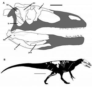
This is a skull and body reconstruction of the new dinosaur species, Murusraptor barrosaensis. Credit: Coria et al (2016); CCAL
A new species of megaraptorid dinosaur discovered in Patagonia may help discern the evolutionary origins of the megaraptorid clade, according to a study published July 20, 2016 in the open-access journal PLOS ONE by Rodolfo Coria from the Consejo Nacional de Investigaciones Científicas y Técnicas, Argentina, and Phillip Currie from the University of Alberta, Canada.
The Patagonian region of Argentina has previously proven to be rich in fossils from the Late Cretaceous epoch, including a number of megaraptorids, a clade whose carnivorous diet gave rise to their name meaning ‘giant thieves’. These medium-sized theropod dinosaurs, including South American genera Megaraptor, Orkoraptor, and Aerosteon as well as genera from Australia and Japan, have characteristically large claws and air-filled, birdlike bones.
The fossilized partial skeleton of a megaraptorid dinosaur analyzed in this study was discovered in Sierra Barrosa, in northwest Patagonia and represents one of the most complete megaraptorids found, with an unusually intact braincase. With unique skull features, the dinosaur, which they named Murusraptor barrosaensis, is a new species in the megaraptorid clade. This specimen appears to be immature, but the authors suggest that the species is larger and slenderer than Megaraptor and comparable in size with Aerosteon and Orkoraptor. While sharing many features with the other species, Musuraptor has distinctive facial features not previously seen amongst megaraptorids, as well as unusually shaped hip bones.
While phylogenetic analysis could not clearly determine evolutionary relationships, the authors note that these fossils provide new anatomical information which might help to resolve current debates as to whether the megaraptorids are a clade of the allosauroid or the coelurosaurid theropods.
As lead author Rodolfo Coria states: “A new meat-eating dinosaur, Murusraptor barrosaensis, has been discovered from 80 million years old rocks from Patagonia, Argentina. Although incomplete, the beautifully preserved bones of Murusraptor unveil unknown information about the skeletal anatomy of megaraptors, a highly specialized group of Mesozoic predators.”
Reference:
Rodolfo A. Coria, Philip J. Currie. A New Megaraptoran Dinosaur (Dinosauria, Theropoda, Megaraptoridae) from the Late Cretaceous of Patagonia. PLOS ONE, 2016; 11 (7): e0157973 DOI: 10.1371/journal.pone.0157973
Note: The above post is reprinted from materials provided by PLOS.
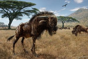
A remarkable example of convergent evolution, the wildebeest-related Rusingoryx shares a unique cranial shape with the “duck-billed” hadrosaur, despite evolving 100 million years after dinosaurs roamed the earth. Credit: Artist’s rendering/Todd S. Marshall
With a distinctive, bony crest that dominates much of its forehead, scientists have long felt that Rusingoryx atopocranion—a distant, extinct relative of the wildebeest—was, to put it mildly, unusual.
But until Assistant Professor of Anthropology Christian Tryon and colleagues, including Haley O’Brien of Ohio University, got their hands on a number of complete Rusingoryx skulls, it wasn’t clear just how strange the animal was.
Despite being separated by more than 100 million years of evolution, tests showed the crest was remarkably similar to the structure of the skulls of “duck-billed” crested hadrosaur dinosaurs. Like hadrosaurs, Rusingoryx likely used it as a resonating chamber to communicate with others or warn of predators. The study is described in a paper published earlier this year in Current Biology.
“Some aspects of the shape of the skull jumped out right away as something that was unusual. As my colleague put it, only a fossil unicorn would have been more surprising,” Tryon said. “Rusingoryx had been described by other researchers in the ’80s, but only from a partial skull missing many of the interesting parts. It turns out that the original skull was incorrectly oriented when described. Until now, that had been the only specimen, so this was not on anybody’s radar.”
What put the animal on Tryon’s radar was the region near Lake Victoria called Bovid Hill.
While working at the fossil-rich site supported by the National Geographic Society, Tryon and others unearthed the first complete Rusingoryx skeletons several years ago. Some sort of catastrophic event seems to have wiped out a herd of these creatures. Evidence at the site suggested that the animals were either driven into a small stream by hunters or were brought down as they tried to cross the water.
Armed with skulls collected from the site, researchers who were part of Tryon’s team in 2012 published a study that completed a taxonomic analysis that showed the animal was a distant relative of the wildebeest and corrected the earlier, incorrect orientation of the skull from earlier studies.
But it wasn’t until a chance encounter with O’Brien—an evolutionary biologist and functional morphologist—that Tryon and others understood how Rusingoryx and dinosaurs might be similar.
“Haley immediately recognized the similarities with a hadrosaur skull,” Tryon said. “None of us had made that connection until she came on board.”
To get a clearer idea of the function of the bony crest at the front of the animal’s skull, O’Brien used high-resolution CT scans of the skulls to peer into their interior structure.
“We were able to eliminate things like male aggression or heat regulation or moisture retention,” Tryon said. “It was the CT scans that really led us to figure out the function of the crest, because we reconstructed a highly detailed, 3-D model and used bioacoustics models that, in effect, blew air through the skull, and measured how it resonated.” The results suggest very low frequency and perhaps infrasonic sounds that would have traveled across long distances, useful for herd animals that lived in open grasslands like Rusingoryx and many of the hadrosaurs. “It turns out that these trumpeting creatures had a call that overlaps in frequency with the vuvuzela—a herd may have sounded like a South African soccer stadium.”
Aside from an interesting story of convergent evolution across millions of years, Tryon believes Rusingoryx can also serve to provide greater context into one of the most pressing questions in paleoanthropology—what did the world look like as early humans moved out of Africa?
“The Lake Victoria story is important because it’s … pretty clear that the largest lake in Africa was dry for much of the last 100,000 years,” Tryon said. “What that did was create the conditions where we saw a great deal of isolation, diversification, and evolutionary experimentation, and that’s part of why we see these very strange creatures.
“This becomes important in the grand scheme of human evolution because it shows modern humans evolved in some context that was non-modern,” he continued. “Many people had thought that the animals 100,000 to 200,000 years ago were pretty similar to modern fauna, but these sites have shown that isn’t quite true. For me, the big picture this fits into is the question of how we go from point A to point B—how do we go from 200,000 years ago, with one population in one part of the world, to today, with people living everywhere. For me, the trick is to understand the role of ecology in explaining human diversity.”
Reference:
Haley D. O’Brien et al. Unexpected Convergent Evolution of Nasal Domes between Pleistocene Bovids and Cretaceous Hadrosaur Dinosaurs, Current Biology (2016). DOI: 10.1016/j.cub.2015.12.050
Deposits of serpentinized rock such as this could be a previously overlooked source of free hydrogen gas, a new Duke study finds. Credit: NOAA Ocean Explorer
Rocks formed beneath the ocean floor by fast-spreading tectonic plates may be a large and previously overlooked source of free hydrogen gas (H2), a new Duke University study suggests.
The finding could have far-ranging implications since scientists believe H2 might be the fuel source responsible for triggering life on Earth. And, if it were found in large enough quantities, some experts speculate that it could be used as a clean-burning substitute for fossil fuels today because it gives off high amounts of energy when burned but emits only water, not carbon.
Recent discoveries of free hydrogen gas, which was once thought to be very rare, have been made near slow-spreading tectonic plates deep beneath Earth’s continents and under the sea.
“Our model, however, predicts that large quantities of H2 may also be forming within faster-spreading tectonic plates—regions that collectively underlie roughly half of the Mid-Ocean Ridge,” said Stacey L. Worman, a postdoctoral fellow at the University of Texas at Austin, who led the study while she was a doctoral student at Duke’s Nicholas School of the Environment.
Total H2 production occurring beneath the oceans is at least an order of magnitude larger than production occurring under continents, the model suggests.
“A major benefit of this work is that it provides a testable, tectonic-based model for not only identifying where free hydrogen gas may be forming beneath the seafloor, but also at what rate, and what the total scale of this formation may be, which on a global basis is massive,” said Lincoln F. Pratson, professor of earth and ocean sciences at Duke, who co-authored the study.
The scientists published their peer-reviewed study in the July 14 online edition of the journal Geophysical Research Letters.
The new model calculates the amount of free hydrogen gas produced and stored beneath the seafloor based on a range of parameters—including the ratio of a site’s tectonic spreading rate to the thickness of serpentinized rocks that might be found there.
Serpentinized rocks—so called because they often have a scaly, greenish-brown-patterned surface that resembles snakeskin—are rocks that have been chemically altered by water as they are lifted up by the spreading tectonic plates in Earth’s crust.
Molecules of free hydrogen gas are produced as a by-product of the serpentinization process.
“Most scientists previously thought all hydrogen production occurs only at slow-spreading lithosphere, because this is where most serpentinized rocks are found. Although faster-spreading lithosphere contains smaller quantities of this rock, our analysis suggests the amount of H2 produced there might still be large,” Worman said.
“Right now, the only way to get H2—to use in fuel cells, for example—is through secondary processes,” Worman explained. “You start with water, add energy to split the oxygen and hydrogen molecules apart, and get H2. You can then burn the H2, but you had to use energy to get energy, so it’s not very efficient.”
Mining free hydrogen gas as a primary fuel source could change that, but first scientists need to understand where the gas goes after it’s produced. “Maybe microbes are eating it, or maybe it’s accumulating in reservoirs under the seafloor. We still don’t know,” Worman said. “Of course, such accumulations would have to be quite significant to make hydrogen gas produced by serpentinization a viable fuel source.”
If further research confirms the model’s accuracy, it could also open new avenues for exploring the origin of life on Earth, and for understanding the role hydrogen gas might play in supporting life in a wide range of extreme environments, from the sunless deep-sea floor to distant planets.
Worman and Pratson conducted the study with Jeffrey Karson, professor of earth sciences at Syracuse University, and Emily Klein, professor of earth sciences at Duke.
Worman received her Ph.D. in earth and ocean sciences from Duke in 2015.
Reference:
Stacey L. Worman et al, Global rate and distribution of Hgas produced by serpentinization within oceanic lithosphere, Geophysical Research Letters (2016). DOI: 10.1002/2016GL069066
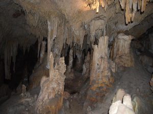
Stalactites and stalagmites at one of the sites (2a) in Yonderup cave where researchers collected dripwater. Credit: Andy Baker
When mineral-rich water drips from a cave’s ceiling over centuries and millennia, it forms rocky cones that hold clues to the Earth’s past climate. Now, researchers in Australia and the UK have found that these structures can also help trace past wildfires that burned above the cave. Their research is published today (21 July) in Hydrology and Earth System Sciences, an open access journal of the European Geosciences Union (EGU).
Pauline Treble, a researcher at the Australian Nuclear Science and Technology Organisation and the University of New South Wales, Sydney, first got interested in Yonderup Cave as an archive of past climate. She wanted to find out whether this shallow cave system in southwest Australia was a good site to reveal past changes in rainfall and temperatures.
“We monitored two drips in the cave expecting to see responses in the data that we could attribute to climate. But the results were surprising,” says Treble. The chemistry of the dripwater, and how it changed over time, was different in the two sites. The data could not be showing a regional climate change at the surface, but rather a local change that affected the ground above the two sites in different ways.
“This is when we started to consider whether the intense wildfire that had occurred six months before monitoring started was responsible for the inconsistent data,” Treble explains.
Treble’s student Gurinder Nagra, from the University of New South Wales, was excited by the idea of finding traces of wildfires in cave dripwater. “Not only does this open up a new avenue for the fire community, but it could hold the key to our understanding of fire and climate in the past, and how this influences our warming world,” he says.
But the signal that wildfires leave in cave formations can also present a problem, because it is remarkably similar to the signal for a change in climate.
Stalagmites (which grow from the ground up) and stalactites (which hang from the ceiling) form when water at the surface seeps through the soil and drips into underground chambers over hundreds or thousands of years. The dripwater contains minerals, which can gradually accumulate to form icicle-like rocky structures that preserve environmental information from the water within its growth layers. By looking into the chemistry of these growth layers, scientists can find clues about how rainfall and temperature were changing above ground when the water dripped into the cave. Due to the way stalagmites and stalactites grow, the layers in the middle of these structures preserve older environmental information, while those closer to the surface hold clues to the more recent past.
Oxygen is one of the key elements scientists look at to track past climate change. Specifically, they measure changes in the ratio (noted δ18O) of two oxygen isotopes: the heavier 18O, which takes more energy to evaporate, and the lighter 16O. Roughly speaking, a higher ratio signals warmer temperatures and less rainfall.
At Yonderup Cave, the researchers collected dripwater samples from two sites from August 2005 to March 2011 and analysed them for δ18O, as well as for trace metals such as magnesium. They then compared the oxygen isotope ratio in Yonderup dripwater with that predicted by a model (which simulated the dripwater δ18O based on measurements of rainwater δ18O), as well as that measured at a different cave in the region. They found that the oxygen isotope ratio in Yonderup dripwater was 2‰ (2 parts per thousand) higher than expected.
“This value means that the water was enriched in the heavier 18O isotope by two-parts per thousand,” Treble explains. “This may not sound like much, but if we were interpreting this change in a stalagmite record [of past climate], it would be equivalent to some of the largest interpreted climatic changes seen in the Quaternary record [the last 2.6 million years].”
Treble says the results could have implications for interpreting δ18O in fire-prone regions, such as Australia or the southern Mediterranean. A change that could be due to a local wildfire in the land above the cave could be wrongly attributed to a change in regional or global climate.
The Hydrology and Earth System Sciences study highlights the need to carefully interpret dripwater cave data, and to also look into changes in its trace metals, as opposed to only δ18O, when analysing it. But it also shows that we can learn more about the Earth’s past than we previously thought. “Our results show for the first time that wildfire changes cave dripwater chemistry, and this chemistry will be preserved in stalagmites,” says Nagra.
Reference:
Gurinder Nagra et al. A post-wildfire response in cave dripwater chemistry, Hydrology and Earth System Sciences (2016). DOI: 10.5194/hess-20-2745-2016
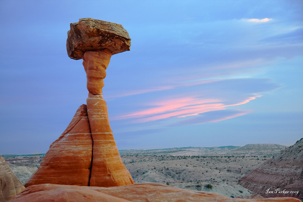
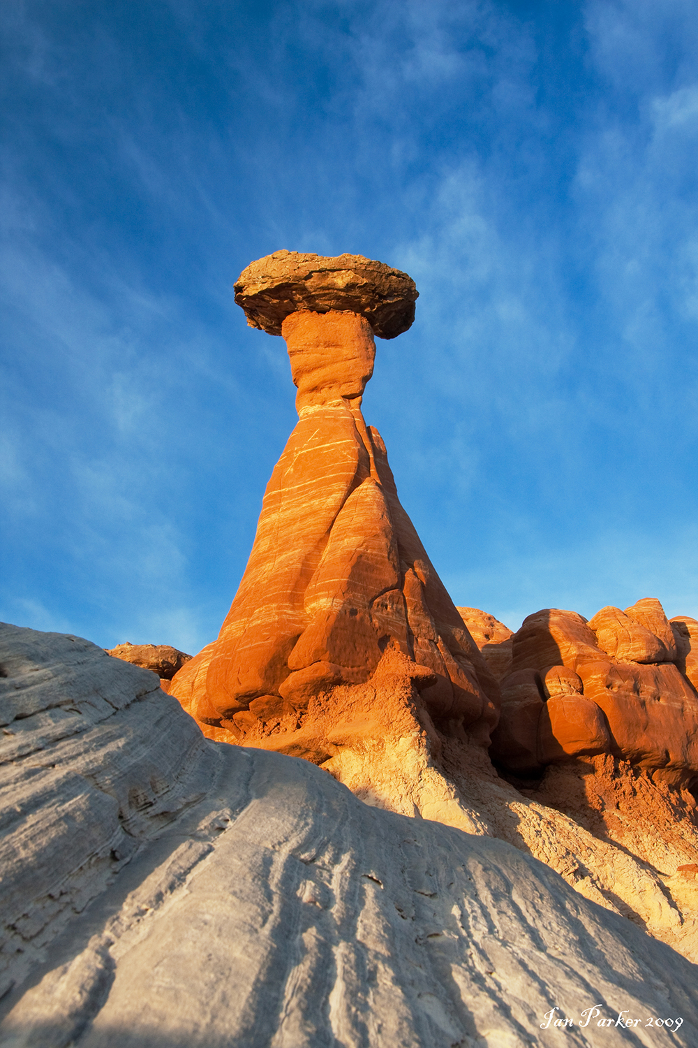
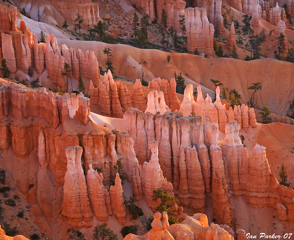
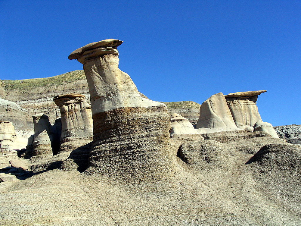
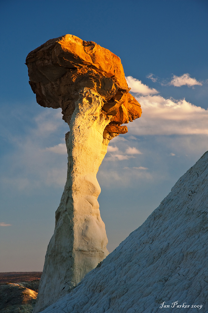
Thor’s Hammer at Sunset, very orange coloring Credit: National Park Service
What is Hoodoo?
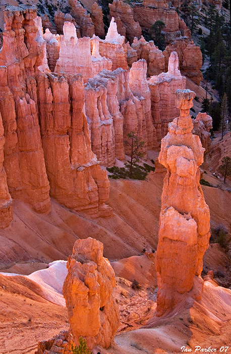
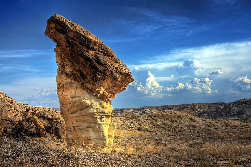
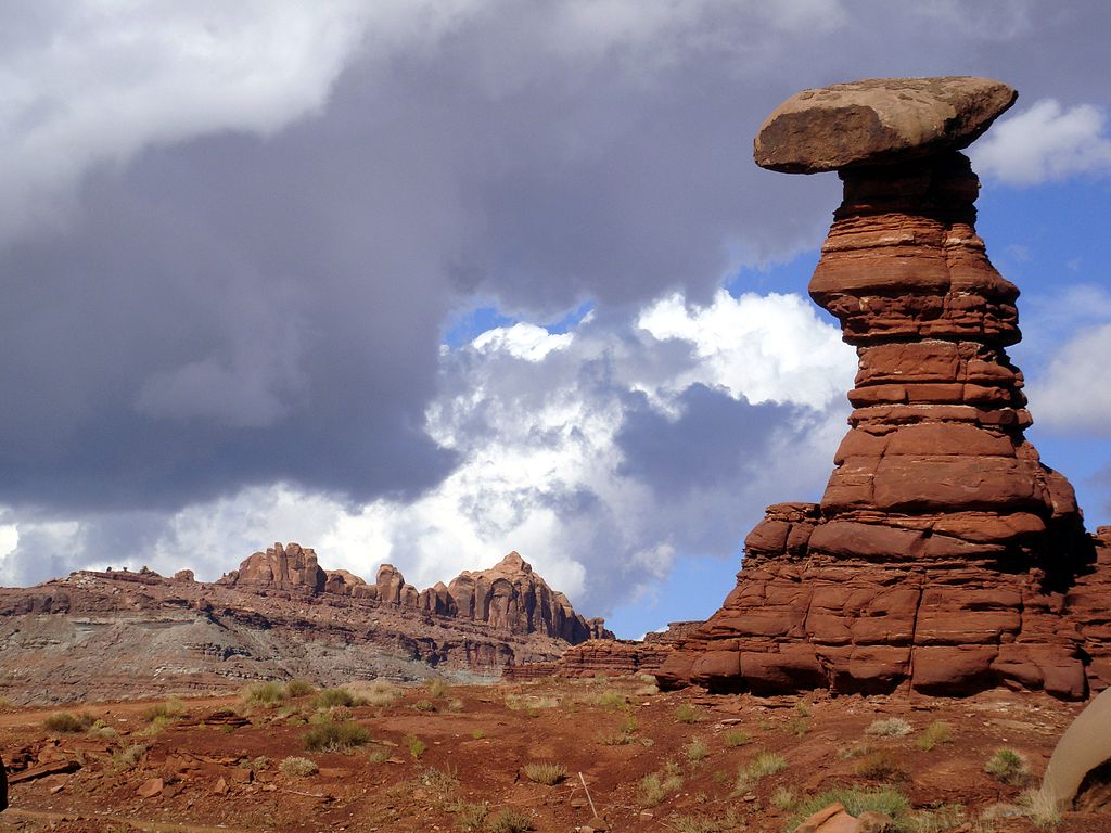
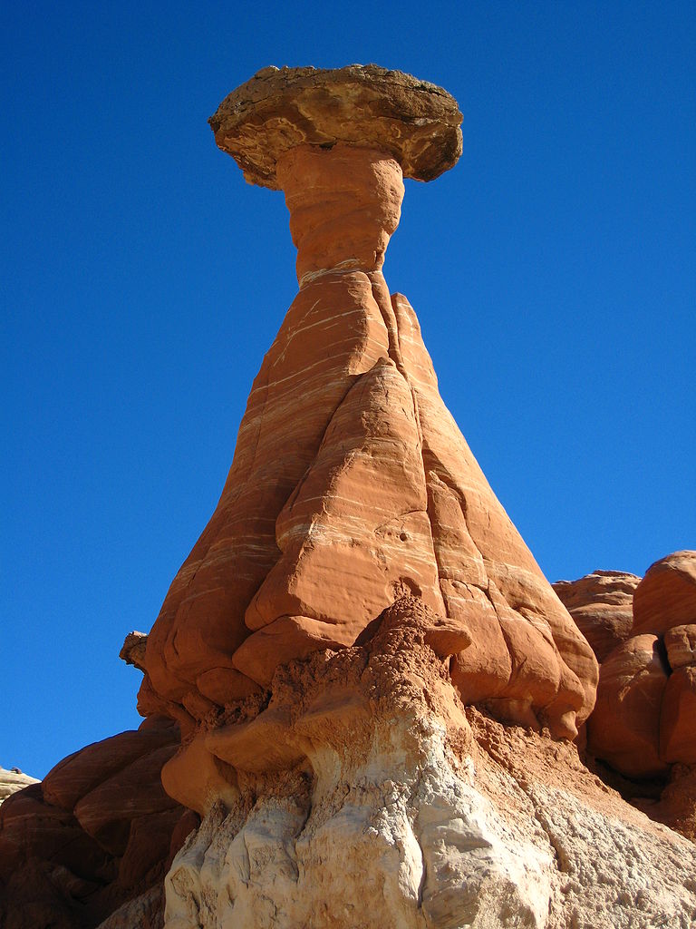
Hoodoos are tall skinny spires of rock that protrude from the bottom of arid basins and “broken” lands. Hoodoos are most commonly found in the High Plateaus region of the Colorado Plateau and in the Badlands regions of the Northern Great Plains. Hoodoos, which may range from 1.5 to 45 metres (4.9 to 147.6 ft), typically consist of relatively soft rock topped by harder, less easily eroded stone that protects each column from the elements. They generally form within sedimentary rock and volcanic rock formations.
Hoodoos are found mainly in the desert in dry, hot areas. In common usage, the difference between hoodoos and pinnacles (or spires) is that hoodoos have a variable thickness often described as having a “totem pole-shaped body”. A spire, on the other hand, has a smoother profile or uniform thickness that tapers from the ground upward. An example of a single spire, as an earth pyramid, is found at Aultderg Burn, near Fochabers, Scotland.
Hoodoos range in size from the height of an average human to heights exceeding a 10-story building. Hoodoo shapes are affected by the erosional patterns of alternating hard and softer rock layers. Minerals deposited within different rock types cause hoodoos to have different colors throughout their height.
Formational Process
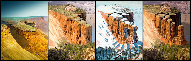
Formation of Hoodoos. Illustrated and updated by Brian B. Roanhorse NPS 2014
Hoodoos are formed by two weathering processes that continuously work together in eroding the edges of the Paunsaugunt Plateau. The primary weathering force at Bryce Canyon is frost wedging. Here we experience over 200 freeze/thaw cycles each year. In the winter, melting snow, in the form of water, seeps into the cracks and freezes at night. When water freezes it expands by almost 10%, bit by bit prying open cracks, making them ever wider in the same way a pothole forms in a paved road.
In addition to frost wedging, what little rain we get here also sculpts the hoodoos. Even the crystal clear air of Bryce Canyon creates slightly acidic rainwater. This weak carbonic acid can slowly dissolve limestone grain by grain. It is this process that rounds the edges of hoodoos and gives them their lumpy and bulging profiles. Where internal mudstone and siltstone layers interrupt the limestone, you can expect the rock to be more resistant to the chemical weathering because of the comparative lack of limestone. Many of the more durable hoodoos are capped with a special kind of magnesium-rich limestone called dolomite. Dolomite, being fortified by the mineral magnesium, dissolves at a much slower rate, and consequently protects the weaker limestone underneath it in the same way a construction worker is protected by his/her hardhat.
Rain is also the chief source of erosion (the actual removal of the debris). In the summer, monsoon type rainstorms travel through the Bryce Canyon region bringing short duration high intensity rain.
Erosion
Unfortunately hoodoos don’t last very long. The same processes that create hoodoos are equally aggressive and intent on their destruction. The average rate of erosion is calculated at 2-4 feet (0.6-1.3 m) every 100 years.
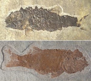
A specimen of the newly identified fossil species Ticinolepis crassidens (above) and of the species Ticinolepis longaeva. Credit: Adriana López-Arbarello
A new study of fossil fishes from Middle Triassic sediments on the shores of Lake Lugano provides new insights into the recovery of biodiversity following the great mass extinction event at the Permo-Triassic boundary 240 million years ago.
The largest episode of mass extinction in the history of the Earth, which led to the demise of about 90% of marine organisms and a majority of terrestrial species, took place between the Late Permian and Early Triassic, around 240 million years ago. How long it took for biological communities to recover from such a catastrophic loss of biodiversity remains the subject of controversial debate among paleontologists. A new study of fossil fishes from Middle Triassic strata on the shores of Lake Lugano throws new light on the issue.
The study, undertaken by researchers led by Dr. Adriana López-Arbarello, who is a member of the GeoBiocenter at Ludwig-Maximilians-Universitaet (LMU) in Munich and the Bavarian State Collection for Paleontology and Geology, suggests that the process of recovery was well underway within a few million years. The authors, including Dr. Heinz Furrer of Zurich University and Dr. Rudolf Stockar of the Museo Cantonale di Storia Naturale in Lugano, who led the excavations at the sites, and Dr. Toni Bürgin of the Naturmuseum St. Gallen report their findings in the journal PeerJ.
The fossil fishes analyzed by López-Arbarello and her colleagues originate from Monte San Giorgio in the canton Ticino in Switzerland, which is one of the most important sources of marine fossils from the Middle Triassic in the world. The Monte San Giorgio rises to an altitude of 1000 m on the promontory that separates the southern arms of Lake Lugano in the Southern Swiss Alps. But in the Middle Triassic, it was part of a shallow basin dotted with islands fringed by lagoons, which were separated by reefs from the open sea. ”
The particular significance of its fossil fauna lies in the careful stratigraphic work that has accompanied the excavations here. The positions of each of the fossil finds discovered here have been documented to the centimeter,” says Adriana López-Arbarello. On the basis of detailed anatomical studies of new material and a taxonomic re-evaluation of previously known specimens from the locality, she and her colleagues have identified a new genus of fossil neopterygians, which they name Ticinolepis. The Neopterygii include the teleost fishes, which account for more than half of all extant vertebrate species. However, the new fossil species are assigned to the second major group of neopterygians, the Holostei, of which only a handful of species survives today. The researchers assign two new fossil species to the genus Ticinolepis, namely T. longaeva and T. crassidens, which occur in different sedimentary beds within the so-called Besano Formation on Monte San Giorgio.
The two species coexisted side by side but they occupied distinct ecological niches. T. crassidens fed on mollusks and was equipped with jaws and teeth that could handle their hard calcareous shells. T. longaeva was more of a generalist, and was found in waters in which T. crassidens could not survive. The authors interpret the different distribution patterns as a reflection of changing environmental conditions following the preceding mass extinction event. The less specialized T. longaeva was able to exploit a broader range of food items, and could thus adapt more flexibly to fluctuating conditions. On the other hand, the dietary differentiation between the two species indicates that a variety of well-established ecosystems was available in the Besano Formation at this time. “This in turn suggests that the marine biota is likely to have recovered from the great mass extinction relatively quickly,” Adriana López-Arbarello concludes.
Reference:
Adriana López-Arbarello, Toni Bürgin, Heinz Furrer, Rudolf Stockar. New holostean fishes (Actinopterygii: Neopterygii) from the Middle Triassic of the Monte San Giorgio (Canton Ticino, Switzerland). PeerJ, 2016; 4: e2234 DOI: 10.7717/peerj.2234
A slab of rock from a study site in Nevada harbors many specimens of Metabolograptus extraordinarius, a shallow-water graptolite species, which together with some close relatives, replaced all the formerly dominant species following the end-Ordovician mass extinction. Credit: Charles E. Mitchell
A new study of nearly 22,000 fossils finds that ancient plankton communities began changing in important ways as much as 400,000 years before massive die-offs ensued during the first of Earth’s five great extinctions.
The research, published July 18 in the Early Edition of the Proceedings of the National Academy of Sciences, focused on large zooplankton called graptolites. It suggests that the effects of environmental degradation can be subtle until they reach a tipping point, at which dramatic declines in population begin.
“In looking at these organisms, what we saw was a disruption of community structures — the way in which the plankton were organized in the water column. Communities came to be less complex and dominated by fewer species well before the massive extinction itself,” says co-author H. David Sheets, PhD, professor of physics at Canisius College and associate research professor in the Evolution, Ecology and Behavior graduate program at the University at Buffalo.
This turmoil, occurring in a time of ancient climate change, could hold lessons for the modern world, says co-author Charles E. Mitchell, PhD, professor of geology in the University at Buffalo College of Arts and Sciences.
The shifts took place at the end of the Ordovician Period some 450 million years ago as the planet transitioned from a warm era into a cooler one, leading eventually to glaciation and lower sea levels.
“Our research suggests that ecosystems often respond in stepwise and mostly predictable ways to changes in the physical environment — until they can’t. Then we see much larger, more abrupt, and ecologically disruptive changes,” Mitchell says. “The nature of such tipping point effects are hard to foresee and, at least in this case, they led to large and permanent changes in the composition of the oceans’ living communities.
“I think we need to be quite concerned about where our current ocean communities may be headed or we may find ourselves at the tail end of a similar event — a sixth mass extinction, living in a very different world than we would like.”
The study was a partnership between Canisius, UB, St. Francis Xavier University, Dalhousie University and The Czech Academy of Sciences.
A long slide toward oblivion
In considering mass extinction, there is perhaps the temptation to think of such events as rapid and sudden: At one moment in history, various species are present, and the next they are not.
This might be the conclusion you’d draw if you examined only whether different species of graptolites were present in the fossil record in the years immediately preceding and following the Ordovician extinction.
“If you just looked at whether they were present — if they were there or not — they were there right up to the brink of the extinction,” Sheets says. “But in reality, these communities had begun declining quite a while before species started going extinct.”
The research teased out these details by using 21,946 fossil specimens from areas of Nevada in the U.S. and the Yukon in Canada that were once ancient sea beds to paint a picture of graptolite evolution.
The analysis found that as ocean circulation patterns began to shift hundreds of thousands of years before the Ordovician extinction, graptolite communities that previously included a rich array of both shallow- and deep-sea species began to lose their diversity and complexity.
Deep-water graptolites became progressively rarer in comparison to their shallow-water counterparts, which came to dominate the ocean.
“There was less variety of organisms, and the rare organisms got rarer,” Sheets says. “In the aftermath of a forest fire in the modern world, you might find that there are fewer organisms left — that the ecosystem just doesn’t have the same structure and richness as before. That’s the same pattern we see here.”
The dwindling deep-sea graptolites were species that specialized in obtaining nutrients from low-oxygen zones of the ocean. A decrease in the availability of such habitats may have sparked the creatures’ decline, Sheets and Mitchell say.
“Temperature changes drive deep ocean circulations, and we think the deep-water graptolites lost their habitats as the climate changed,” Sheets says. “As the nature of the oceans shifted, their way of life went away.”
Reference:
H. David Sheets, Charles E. Mitchell, Michael J. Melchin, Jason Loxton, Petr Štorch, Kristi L. Carlucci, Andrew D. Hawkins. Graptolite community responses to global climate change and the Late Ordovician mass extinction. Proceedings of the National Academy of Sciences, 2016; 201602102 DOI: 10.1073/pnas.1602102113
Note: The above post is reprinted from materials provided by University at Buffalo. The original item was written by Charlotte Hsu.
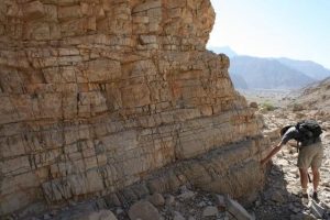
Analysis of rocks unearthed in Oman that were formed in an ancient ocean around the time of Earth’s greatest mass extinction have helped explain why life on Earth took so long to recover. Credit: D. Astratti
Scientists have shed light on why life on Earth took millions of years to recover from the greatest mass extinction of all time.
The study provides fresh insight into how Earth’s oceans became starved of oxygen in the wake of the event 252 million years ago, delaying the recovery of life by five million years.
Findings from the study are helping scientists to better understand how environmental change can have disastrous consequences for life on Earth.
Mass extinction
The Permian-Triassic Boundary extinction wiped out more than 90 per cent of marine life and around two thirds of animals living on land.
During the recovery period, Earth’s oceans became starved of oxygen – conditions known as anoxia.
Previous research suggested the mass extinction and delayed recovery were linked to the presence of anoxic waters that also contained high levels of harmful compounds known as sulphides.
However, researchers say anoxic conditions at the time were more complex, and that this toxic, sulphide-rich state was not present throughout all the world’s oceans.
Ancient rocks
The team, led by researchers in the University’s School of GeoSciences, used precise chemical techniques to analyse rocks unearthed in Oman that were formed in an ancient ocean around the time of the extinction.
Data from six sampling sites, spanning shallow regions to the deeper ocean, reveal that while the water was lacking in oxygen, toxic sulphide was not present. Instead, the waters were rich in iron.
The finding suggests that iron-rich, low oxygen waters were a major cause of the delayed recovery of marine life following the mass extinction.
Ocean chemistry
The study also shows how oxygen levels varied at different depths in the ocean.
While low oxygen levels were present at some depths and restricted the recovery of marine life, shallower waters contained oxygen for short periods, briefly supporting diverse forms of life.
The precise cause of the long recovery period remains unclear, but increased run-off from erosion of rocks on land – caused by high global temperatures – likely triggered anoxic conditions in the oceans, researchers say.
The study, published in the journal Nature Communications, was funded by the Natural Environment Research Council and the International Centre for Carbonate Reservoirs. The work is a contribution to the UNESCO International Geoscience Programme. It was carried out in collaboration with the Universities of Leeds, Gratz, Bremen and Vienna University.
Reference:
M. O. Clarkson, R. A. Wood, S. W. Poulton, S. Richoz, R. J. Newton, S. A. Kasemann, F. Bowyer, L. Krystyn. Dynamic anoxic ferruginous conditions during the end-Permian mass extinction and recovery. Nature Communications, 2016; 7: 12236 DOI: 10.1038/ncomms12236
Figure 1. Fossil of the 240-million-old reptile Euparkeria from South Africa. The red arrow indicates the position of the braincase, inside of which the inner ear is located. Credit: Federal University of Santa Catarina
Birds have a very successful history and rich fossil record that includes dinosaurs and dates back to 250 million years. They are famous for flying and singing and have complex ways of doing both. It is known that these two abilities are related to the inner ear, but researchers still did not understand how their inner ear evolved—until now. Application of computed-tomography techniques on a 245 million-year-old fossil allowed a team of researchers to see inside its inner ear. They have shown that bird ancestors were also agile animals and possessed a refined hearing sense.
The evolution of the bird ear
Application of computed-tomography techniques on the 245 million-year-old fossil of Euparkeria, a close relative of the common ancestor of birds, dinosaurs, and crocodiles, allowed researchers to see inside its skull. They found out that Euparkeria was an agile animal and possessed a well-adapted ear for detecting airborne sounds. They concluded that this was also the case for the bird ancestor. Slowly, the pieces of the evolution of the bird ear are starting to become clearer.
Birds and crocodiles are each other’s closest living relatives. Together, they comprise a group called Archosauria. With over 10,000 modern bird species, archosaurs are the most diverse group of land vertebrates. Archosaurs have an amazingly diverse evolutionary history, which is well demonstrated by their rich fossil record stretching back 250 million years. This includes the famous dinosaurs, as well as a number of less well-known groups. Birds can fly and can sing. Not only that, they are also known for being able to perform complex flight manoeuvring and for having elaborate behaviours based on sound communication. But how did this evolutionary success story begin?
Euparkeria capensis is a small cat-sized carnivorous reptile that comes from 245 million-yearold Middle Triassic rocks in South Africa. It is known from very complete fossil remains, and is the closest land-living relative to archosaurs. Since its discovery in 1913, Euparkeria has been used as a model taxon to understand the major anatomical changes that allowed early archosaurs to become so successful. Previous work on its braincase has been used as key evidence to support the dinosaur origin of birds and their close relationship with crocodylians. However, this was based primarily on a single, incompletely preserved specimen, and thus many uncertainties about the braincase and inner ear of Euparkeria remained. Now, for the first time, a group of international scientists led by researcher Dr. Gabriela Sobral from the Federal University of Santa Catarina, Brazil, has re-evaluated all available Euparkeria braincase material using micro computed-tomography (CT scanning).
In their study, published in the latest issue of Royal Society Open Science, Dr. Sobral and her colleagues were able to visualize inside the braincase of Euparkeria and understand how the evolution of the archosaur inner ear begun The team found that the cochlea of Euparkeria, the hearing organ that decodes sound waves into electrical impulses inside the brain, was very elongate. They also found specialized regions for pressure relief in the inner ear of Eupakeria. Elongating the cochlea is a way to extend your hearing range. “Also, avoiding dampening during sound transmission makes an ear more suited for detecting airborne sounds. It is thus likely that Euparkeria could detect a more diverse repertoire of sounds than other more primitive reptiles,” said Sobral. The researchers also showed that the semicircular canals of Euparkeria were long and thin. The semicircular canals are responsible for detecting head and body movements and provide information for neural networks controlling the muscles of the neck and the eye. These are important for stabilizing the gaze during rapid locomotion – such as in hunting. “Long and thin semicircular canals supports studies which suggested Euparkeria had an upright posture and that it had a more active lifestyle, probably active hunting,” says Sobral.
By investigating the inner ear of Euparkeria, the researchers were able to reconstruct how the ancestor of birds and crocodiles could hear and move in their environment. They confirmed these animals were active, agile hunters. “It is very exciting that we can dig so deep into the palaeobiology of an extinct animal just by looking at the anatomy of its inner ear,” she says. “Euparkeria has many transitional characteristics that can help us better understand how the highly specialized ear of birds came into being.”
View of Australia’s western continental margin, looking eastwards from the Indian Ocean. The margin’s topography illustrates a partitioning into shallow inner and deep outer portions, reflecting their two-phase evolutionary history. The outer margins have a record of extensive volcanism, illustrated by their rough surfaces. Credit: Dietmar Müller
Every now and then in Earth’s history, a pair of continents draws close enough to form one. There comes a time, however, when they must inevitably part ways.
Now scientists at Australia’s EarthByte research group, in collaboration with the German Research Centre for Geosciences, have revealed the underlying mechanics of a continental breakup when this time arrives in a supercontinent’s life cycle.
With the help of seismic data and sophisticated computer simulations, the team from the University of Sydney and the University of Potsdam uncovered a distinct two-phase separation process: at first, continents gradually inch apart as a hot, jagged rift is etched into the landscape.
Then, after many millions of years of strained, relentless pulling of the Earth’s crust, the continents lurch away from each other, beginning their steady march towards separate sides of the globe as a new ocean forms between them.
This work highlights a phenomenon that is otherwise difficult to explain within the conventional framework of plate tectonics.
The findings are published today in the journal Nature.
The research comes just over a month after a paper co-authored by researchers from the EarthByte Group — which explained why there are just a few large tectonic plates and many tiny plates — was highlighted on the cover of Nature.
“Plates tend to shift around quite slowly because they’re sitting on an otherwise very viscous mantle,” said co-author at the University of Sydney’s School of Geosciences, Professor Dietmar Müller, about the latest paper.
“However, throughout Earth’s history, there have been plenty of instances where plates have suddenly sped up during supercontinent breakup. This has puzzled us for decades, as this behaviour can’t easily be reconciled with our understanding of what drives plate motion.”
A simple analogy can help explain why plates are suddenly able to reach these high speeds, Professor Müller said: “Imagine you’re pulling apart a thick piece of dough. At first, separating it requires a lot of effort because the dough resists your pulling and stretches slowly between your hands.
“If you’re persistent, you’ll eventually reach a point where the dough becomes thin enough to separate quite easily and quickly. The same principle applies to rifting continents once the connection between them has been thinned sufficiently.”
The study involved a laborious task of analysing thousands of kilometres of seismic profiles in order to pinpoint areas where the continents had been vigorously stretched during their detachment. The researchers then designed computer simulations that independently verified this two-phase breakup.
Lead author Dr Sascha Brune, from the University of Potsdam, said the split did not tend to end amicably: “This breakup process leads to margin segmentation, where rapid subsidence, high heat flow, and enhanced volcanism characterise the outer margin.”
The result: a full-margin rupture that sends the outer rims of the continents plunging into the sea.
“The Earth’s submerged continental shelves play an indelible role in biogeochemical cycles such as carbon burial and nutrient cycling,” added Dr Brune.
“They are also favourable environments for cultivating and preserving the energy resources upon which our modern society still relies, for instance natural gas.”
This work comprises a core finding of the Australian Research Council and industry-funded Basin Genenis Hub, which Professor Müller heads at the University of Sydney. The five-year project aims to improve our understanding of the evolution of sedimentary basins and continental margins by connecting big data analysis and high-performance computing in an open-innovation framework.
Reference:
Sascha Brune, Simon E. Williams, Nathaniel P. Butterworth, R. Dietmar Müller. Abrupt plate accelerations shape rifted continental margins. Nature, 2016; 1 DOI: 10.1038/nature18319