Three species of Hipparion, that lived in the Iberian peninsula between 9 million years and 5 million years ago. Credit: MAURICIO ANTÓN
Changing environments and ecosystems were driving the evolution of horses over the past 20 million years. This is the main conclusion of a new study published in Science by a team of palaeontologists from Spain and Argentina. The team analysed 140 species of horses, most of them extinct, synthesising decades of research on the fossil history of this popular group of mammals.
Their conclusions challenge a classic theory, which links the evolutionary success of horses to several novel adaptations in response to the spread of grasslands around 18 million years ago. “According to the classic view, horses would have evolved faster in when grasslands appeared, developing teeth that were more resistant to the stronger wear that comes with a grass-dominated diet. They also became bigger to more effectively digest this low quality food, and as a strategy against predators in these new, open habitats”, explains Juan L. Cantalapiedra, researcher at the Museum für Naturkunde in Berlin, Germany.
But did teeth and body size indeed evolve that fast? It seems they didn’t. According to the new results, these evolutionary changes could have been much slower than previously assumed. In fact, Cantalapiedra and colleagues were able to show that all these newly evolved species of horses were ecologically very similar. Thus, rather than a multiplication of ecological roles, the new results point to external factors, such as increasing environmental heterogeneity, as the main evolutionary force.
“Environmental changes would have produced a lot more fragmented, mosaic-type ecosystems, where populations of horses with similar demands and adaptations could have evolved isolated from one another, resulting in different species but with a similar appearance”, points Manuel Hernández Fernández at the Complutense Univerity in Madrid. “This was probably only possible in ecosystems with a lot of energy and biomass, so that very similar species, which otherwise would have been in strong competition, were all able to survive”, adds Jose Luis Prado, at the National University of the Center of Buenos Aires Province.
Diversification accelerated again two more times, “when changes in sea level allowed their migration from North America into Eurasia and Africa, 11 and 4 million years ago”, explains María Teresa Alberdi, at the National Museum of Natural Sciences in Madrid. “Then, again, new species appeared very fast, but without showing dramatic changes in appearance”, concludes Cantalapiedra.
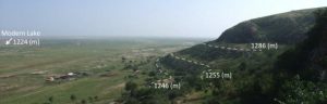
Dotted lines represent past highstands of Lake Dali. Credit: Yonaton Goldsmith
The annual summer monsoon that drops rain onto East Asia, an area with about a billion people, has shifted dramatically in the distant past, at times moving northward by as much as 400 kilometers and doubling rainfall in that northern reach. The monsoon’s changes over the past 10,000 years likely altered the course of early human cultures in China, say the authors of a new study.
Researchers from the Lamont-Doherty Earth Observatory and the Chinese Academy of Sciences in Xi’an studied ancient water levels for Lake Dali, a closed-basin lake in Inner Mongolia in the northeast of China. They found that the lake was six times larger and water levels were 60 meters higher than present during the early and middle Holocene — the period beginning about 11,700 years ago, and encompassing the development of human civilization.
“I think it is important to emphasize that these spatial fluctuations in the monsoon drive large changes in northern China,” said Yonaton Goldsmith, a graduate student at Lamont-Doherty Earth Observatory and lead author of the paper. “When the monsoon is strong, it shifts northward and northern China becomes green. When the monsoon is weak, the monsoon stays in the south and northern China dries out. Such large fluctuations must have altered the ecosystems in northern China dramatically.”
The study, appearing this week in the Proceedings of the National Academy of Sciences, also ties the shifting monsoon to changes in Earth’s orbit and other periodic changes in the climate system. The study should help scientists understand how the monsoon is affected by those natural cycles, and how a changing climate today might influence the monsoon in the future.
Goldsmith said it’s still unclear how the monsoon will react to global warming. One view is that the monsoon should grow stronger, but the area studied has been drying out over recent decades, he said, “so there is still a lot that needs to be done in that region before we can get definitive answers.”
Dali Lake is located near the northwestern limit of the East Asian monsoon, and so would reflect the changes brought about when the monsoon shifted north. The researchers studied outcrops of sediments left behind when the lake was far larger, and used those and other markers to construct a timeline of lake levels, and the fluctuation of rainfall over millennia.
They found that the lake reached peak levels around 123,000 years ago, again around 58,000 years ago, and once more between 11,000 and 5,500 years ago. They tie the periodic increases in rainfall to the range of the monsoon shifting north by as much as 400 kilometers. The lake record is “highly correlated” with measurements taken earlier from cave deposits in both northern and southern China.
Between 5,500 and 5,000 years ago, the monsoon weakened and rainfall over northern China decreased by 50 percent, the researchers found. They speculate that this drying triggered a major cultural transition in the region. As they describe it, two early Neolithic societies, the Hongshan culture in North China and the Yangshao culture in central China, collapsed around 5,000 years ago. In central China, the following period saw the rise of more stratified and socially and politically complex societies, including the Longshan culture. Previously unoccupied areas on the eastern margin of the Tibetan plateau were populated. Meanwhile, northeast China experienced a sharp population decline, represented by the Xiaoheyan culture.
“These findings show that climate change can have dramatic effects on human societies and highlight the necessity to understand the effect of global warming on rainfall patterns in China and all over the world,” the authors write.
Intense variations in rainfall may have played a role in the collapse of other civilizations. A study led by Lamont scientist Brendan Buckley, published several years ago, suggested that extended drought coupled with changes in the monsoon could have doomed Cambodia’s ancient Khmer civilization at Angkor nearly 600 years ago. Drought is thought to have played a role in the decline of the Classic Maya civilization, too, though in that case, another Lamont study suggests that the Maya themselves contributed to the drought by clearing forests for cities and crops.
The Lake Dali paper’s other authors are Wallace S. Broecker, Pratigya J. Polissar and Peter B. deMenocal of Lamont-Doherty; Hai Xu, Jianghu Lan, Peng Cheng, Weijian Zhou and Zhisheng An of the State Key Laboratory of Loess and Quaternary Geology, Institute of Earth Environment, Chinese Academy of Sciences; and Naomi Porat of the Geological Survey of Israel.
This work was supported by a Gary Comer Science and Education Foundation grant to Yonaton Goldsmith and Pratigya J. Polissar; Columbia’s Center for Climate and Life; the National Basic Research Program of China Grant 2013CB955900; the External Cooperation Program of Bureau of International Cooperation, Chinese Academy of Sciences Grant 132B61KYSB20130003; and Lamont-Doherty Earth Observatory Contribution no. 8084.
Reference:
Yonaton Goldsmith, Wallace S. Broecker, Hai Xu, Pratigya J. Polissar, Peter B. deMenocal, Naomi Porat, Jianghu Lan, Peng Cheng, Weijian Zhou, Zhisheng An. Northward extent of East Asian monsoon covaries with intensity on orbital and millennial timescales. Proceedings of the National Academy of Sciences, 2017; 201616708 DOI: 10.1073/pnas.1616708114
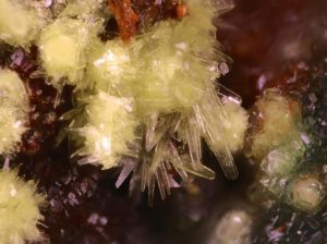
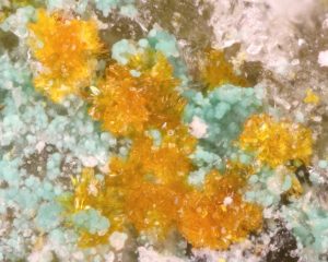
The mineral crystals of leószilárdite are only a couple millimeters long at most. Credit: With permission: Travis Olds
Three new minerals discovered by a Michigan Tech alumnus are secondary crusts found in old uranium mines. They’re bright, yellow and hard to find.
The mines closed four decades ago, but that doesn’t stop air and water from traveling the long tunnels of Red Canyon. The old opening at the mine—the adit—cuts straight into the hill and has helped make new minerals. The adit opens to a dry panorama in southern Utah.
“Have you ever seen The Hills Have Eyes? It’s that kind of creepy, barren desert landscape,” says Travis Olds ’12 and now a graduate student at Notre Dame studying uranyl mineral compounds. He adds that he and others find mineralogy so exciting because of “the idea that there are things we still don’t know—and someone can see a pretty crystal and appreciate it.”
Olds specifically studies uranyl minerals because, as radioactive materials, it is important to know where they are found and how they change in different environments. Within the past year, he found three new uranium minerals in Red Canyon: leesite, leószilárdite and redcanyonite. He characterized them along with a small team including alumnus Shawn Carlson ’91 and staff scientist Owen Mills ’08 who runs the Applied Chemical and Morphological Analysis Lab (ACMAL) at Michigan Tech.
Leesite
Uranyl minerals have distinct bright colors even after the uranium-rich ore interacts with air and water to form crusts like leesite.
Everyone is familiar with rust; in mineral-speak, rust is an iron oxide or oxyhydroxide, which means it’s a secondary mineral formed by the interaction of air and water. Leesite is like uranium rust.
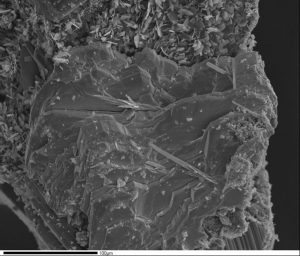
The glowing green stereotype of uranium is close—but not quite. Though small and barely visible to the naked eye, leesite occurs in bright yellow aggregates of stacked blades or radiating needles up to one millimeter in length. The mineral also forms powdery masses nestled against a backdrop of companion minerals, most notably gypsum.
A scanning electron microscope reveals the individual shape of crystals in a small aggregate of leesite.
At the atomic level, Olds explains, leesite piles up in stacks of uranium and oxide layers, and potassium is what sets it aside as a new mineral. Given its chemistry and structure, it’s a member of the schoepite mineral family; miners called the general mess of these minerals growing on the tunnel floors “gummites.”
Leószilárdite
The mineral crystals of leószilárdite are only a couple millimeters long at most. Credit: With permission: Travis Olds
Clustered in aggregates that are barely visible in hand samples, leószilárdite is pale yellow. A carbonate formed through uranium ore interacting with air, it’s also water soluble, so the dry desert air helps keep it around in the mine. The most distinctive feature of leószilárdite is its bladed crystals.
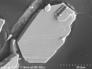
“If you look at leószilárdite in a picture, you can kind of pick out that they have an unusual shape,” Olds says. “But put them under the SEM (scanning electron microscope) and it’s obvious.”
A scanning electron microscope reveals the distinct shape of leoszilardite crystals.
Olds says leószilárdite is a particularly interesting find because of the Carbon Mineral Challenge. The challenge runs through September 2019, with the goal to discover as many new carbon-based minerals as possible. The Deep Carbon Observatory, the organization leading the project, predicts there are still at least 145 unknown carbon minerals. Leószilárdite is one of eight discovered and officially recognized by the International Mineralogical Association since December 2015.
Redcanyonite
Manganese and ammonium give redcanyonite a darker color than the other minerals discovered by Olds.
Named for the area where this rare mineral is found, redcanyonite varies in hue from orange to red-orange. The color comes from what chemically makes the mineral new—manganese and ammonium in its structure—and being a sulfate, it is not soluble in water, unlike leószilárdite.
Redcanyonite is one of the rarest uranyl minerals known because it can only grow within narrow constraints: access to manganese ions is the main driver, but it also can only form in organic-rich layers, the most likely source of ammonium.
All three specimens represent a small and unique slice of the earth’s crust where human activity spurred the formation of previously unknown minerals.
“The only way to better understand the chemistry of uranium is to go out and find new minerals—and describe their topology, their structures,” Olds says. “They teach us a lot about how uranium can then be moved in the environment.”
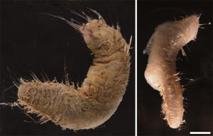
Two species of the Flabegraviera genus: Flabegraviera fujiae (left), the new species discovered in the study, and Flabegraviera mundata (right). Scale bar: 1cm.
A team of Japanese scientists has discovered a new species of polychaete, a type of marine annelid worm, 9-meters deep underwater near Japan’s Syowa Station in Antarctica, providing a good opportunity to study how animals adapt to extreme environments.
International efforts are currently underway in Antarctica to build long-term monitoring systems for land and coastal organisms from an ecological conservation standpoint. To this end, the accumulation of continent-wide fauna information is essential, but Japan is lagging behind in gathering and analyzing such data around Syowa Station, particularly in regard to coastal marine life.
To address this problem, in 2015 a team of researchers, including Keiichi Kakui, a lecturer at Hokkaido University, and Megumu Tsujimoto, a postdoctoral researcher at Japan’s National Institute of Polar Research, started researching marine specimens stored at the institute, as well as newly collected specimens. As a part of this process, they conducted microscopic analyses to examine two annelid worms that scuba divers collected 8-9 meters deep on January 16th, 1981, at Nishinoura near Syowa Station.
The worm found 9 meters deep turned out to be a new, unnamed polychaete – a variety with a thick, gel-like coat and conspicuous, long notochaeta. The team named the new species Flabegraviera fujiae, taking after the icebreaker ship “Fuji” used in the expedition in 1981. The specimen collected 8 meters deep was recognized as Flabegraviera mundata, and was deemed to have been collected at the shallowest depth ever recorded for the Flabegraviera genus.
“This study is a major step forward in understanding marine life in the coastal region near Syowa Station,” says Dr. Keiichi Kakui, “The Flabegraviera genus, to which the three species belong, is unique to the Antarctic and considered a good example for studying how polychaetes adapt to extreme environments.”
Now that it has become clear that polychaetes inhabit depths reachable by scuba divers, the researchers hope to conduct experiments using living specimens to gain a deeper understanding of marine life in the area, helping to create an information infrastructure vis-à-vis local biodiversity.
The present study forms a part of research carried out on polychaetes by Naoto Jimi, a first-year doctoral candidate at Hokkaido University.
This press release is jointly issued by Hokkaido University and the National Institute of Polar Research.
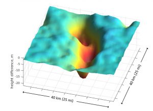
The ice surface above the lakes sank by as much as 20 meters (66 feet) in less than a year due to the drainage. Subglacial lakes are commonly seen with fast-flowing glaciers. Credit: Ben Smith/University of Washington
Thwaites Glacier on the edge of West Antarctica is one of the planet’s fastest-moving glaciers. Research shows that it is sliding unstoppably into the ocean, mainly due to warmer seawater lapping at its underside.
But the details of its collapse remain uncertain. The details are necessary to provide a timeline for when to expect 2 feet of global sea level rise, and when this glacier’s loss will help destabilize the much larger West Antarctic Ice Sheet. Recent efforts have used satellites to map the underlying terrain, which affects how quickly the ice mass will move, and measure the glacier’s thickness and speed to understand the physics of its changes.
Researchers at the University of Washington and the University of Edinburgh used data from the European Space Agency’s CryoSat-2 to identify a sudden drainage of large pools below Thwaites Glacier, one of two fast-moving glaciers at the edge of the ice sheet. The study published Feb. 8 in The Cryosphere finds four interconnected lakes drained in the eight months from June 2013 and January 2014. The glacier sped up by about 10 percent during that time, showing that the glacier’s long-term movement is fairly oblivious to trickles at its underside.
“This was a big event, and it confirms that the long-term speed-up that we’re observing for this glacier is probably driven by other factors, most likely in the ocean,” said corresponding author Ben Smith, a glaciologist with the UW’s Applied Physics Laboratory. “The water flow at the bed is probably not controlling the speed.”
Other glaciers, like some in Alaska and Greenland, can be very susceptible to changes in meltwater flow. Water there can pond beneath the glacier until it lifts off parts of its bed, and suddenly surges forward. This can increase a glacier’s speed by several times and account for most of its motion.
Researchers were not certain whether such an effect might be at play with Thwaites Glacier.
“It’s been difficult to see details about water flow under the ice,” Smith said.
For the new study, the authors use a new technique to discover drops at the glacier’s surface of up to 70 feet (20 meters) over a 20 kilometer by 40 kilometer area. Calculations show it was likely due to the emptying of four interconnected lakes, the largest about the size of Lake Washington, far below. The peak drainage rate was about 8,500 cubic feet (240 cubic meters) per second, about half the flow of the Hudson River—the largest meltwater outflow yet reported for subglacial lakes in this region.
“This lake drainage is the biggest water movement that you would expect to see in this area, and it didn’t change the glacier’s speed by that much,” Smith said.
The reason is likely that Thwaites Glacier is moving quickly enough, he said, that friction is heating up its underside to ice’s melting point. The glacier’s base is already wet and adding more water doesn’t make it much more slippery.
The new study supports previous UW research from 2014 showing that Thwaites Glacier will likely collapse within 200 to 900 years to cause seas to rise by 2 feet. Those calculations were made without detailed maps of how water flows at the glacier’s underbelly. The new results suggest that doesn’t really matter.
“If Thwaites Glacier had really jumped in response to this lake drainage, then that would have suggested that we need a more detailed model of where water is flowing at the bed,” Smith said. “Radar data from NASA’s Operation Ice Bridge program has told us a lot about the shape of Thwaites Glacier, but it’s very difficult to see how water is moving. Based on this result, that may not be a big problem”
Melting at the ice sheet base would refill the lakes in 20 to 80 years, Smith said. Over time meltwater gradually collects in depressions in the bedrock. When the water reaches a certain level it breaches a weak point, then flows through channels in the ice. As Thwaites Glacier thins near the coast, its surface will become steeper, Smith said, and the difference in ice pressure between inland regions and the coast may push water coastward and cause more lakes to drain.
He hopes to apply the same techniques to study lake drainage below other glaciers, to understand how water flow at the base affects overall glacier movement. When NASA’s ICESat-2 satellite launches in 2018 the calculations will be easy to do with high precision.
“In 2018 this changes from a hard project to an easy project, and I’m excited about that,” Smith said.
Reference:
Benjamin E. Smith et al, Connected subglacial lake drainage beneath Thwaites Glacier, West Antarctica, The Cryosphere (2017). DOI: 10.5194/tc-11-451-2017
A new scientific approach can now provide regional assessments of land recovery following oil and gas drilling activities, according to a new U.S. Geological Survey study published in the journal Science of the Total Environment.
When developing oil and gas well pads, the vegetation and soil are removed to level the areas for drilling and operations. The new assessment approach, called the disturbance automated reference toolset, or DART, is used to examine recovery patterns after well pads are plugged and abandoned to help resource managers make informed decisions for future well pad development.
“These results may assist land managers in deciding what areas might be best utilized for energy development while also minimizing the long-term environmental impacts,” said Travis Nauman, a USGS scientist and the lead author of the study.
The recovery of well pads following oil and gas development is an area of growing importance because recent technological advances such as hydraulic fracturing and horizontal drilling have initiated rapid increases in development and production. Previous studies estimate that about 11,583 square miles of land in central North America were cleared for oil and gas related purposes between 2000 and 2012.
USGS scientists examined oil and gas well pad recovery on the Colorado Plateau using a new approach that incorporates satellite imagery, digital soil mapping, predictive ecological modeling and field assessments to evaluate vegetation recovery following well pad abandonment. Scientists used DART to study 1,800 well pads in Utah, Colorado and New Mexico. Satellite imagery was used to compare vegetation cover of the abandoned sites to surrounding undisturbed areas with roughly equivalent climate, soil, topography and management histories.
Findings show that most abandoned oil and gas pads in the study are characterized by more bare ground and less vegetation than surrounding undisturbed areas, even after more than 9 years since abandonment. The majority of pads had 15-45 percent increases in bare ground exposure relative to comparable nearby areas. More exposed bare ground makes areas much more susceptible to soil erosion and dust emission.
Differing recovery across environmental gradients and land stewardship suggests that these can be useful for identifying conditions that may promote or hamper pad recovery. Well pads in grasslands, canyon complexes, blackbrush shrublands and shale badlands are not recovering as well as other ecotypes on the Colorado Plateau. Warmer areas with more summer-dominated precipitation were also associated with reduced well pad recovery. Well pads on federally and privately managed lands had the highest recovery index while state-administered lands had the lowest recovery of the ownership entities evaluated. These findings can help managers identify policies or procedures that may lead to improved well pad recovery.
It is still unclear exactly how long well pad disturbances persist on the landscape once well pads are abandoned, particularly in more arid regions like the Southwest, but it may take many years. Active management intervention, or rehabilitation, of vegetation and soils at abandoned well pads has become more common in recent years, but additional work could increase the success of these efforts. New technological advances like DART can help land managers better understand these disturbances by providing timely assessments to help inform management decisions.
Reference:
Travis W. Naumana, Michael C Duniway, Miguel L Villarreal, Travis B. Poitras. Disturbance automated reference toolset (DART): Assessing patterns in ecological recovery from energy development on the Colorado Plateau. DOI: 10.1016/j.scitotenv.2017.01.034
Changes in climate can rapidly impact even the deepest freshwater aquifers according to Penn State and Columbia University hydrologists.
The researchers found that responses to climate variations can be detected in deep groundwater aquifers faster than expected — in many cases within a year.
Because rain water may take years to reach deep aquifers through natural infiltration, the findings suggest another factor is involved, such as pumping of aquifers done by agricultural industries.
“We saw a rapid response in deep groundwater levels to both major climate cycles and local precipitation,” said Tess Russo, R.L. Slingerland Early Career Professor of Geosciences at Penn State. “These aquifers are so deep, we expect it takes years for precipitation to make its way down, so if it’s not natural recharge causing the response of groundwater to changes in precipitation, then it may be coming from pumping changes.”
The research, published in Nature Geoscience, sheds new light on groundwater budgets in the U.S. and better defines how water held in deep aquifers could change with the climate. Groundwater used by municipalities and industry is almost always drawn from deep wells, which provide a more reliable source of water than shallow aquifers, especially during times of drought.
Despite the importance of these deep aquifers, no one really knows how much water they contain or how they might react to climate change.
“Groundwater doesn’t move very fast so we typically think of deep aquifers as having a delayed response to what’s going on at the surface, including our changing climate,” said Russo, who is also an associate in Penn State’s Earth and Environment Systems Institute. “But we actually see a relatively rapid response.”
Russo and Upmanu Lall, of the Columbia Water Center at Columbia University, analyzed relationships between climate and groundwater data from across the United States, and used a small set of regional pumping data from wells in Kansas to demonstrate the potential connection.
Russo said evidence suggests that pumping represents an intermediate connection between precipitation and deep groundwater levels. Changes in temperature and rainfall can affect crop water requirements, for example, leading to changes in reliance on water from deep wells.
“If you look at agricultural areas where you have crop water demand changing as a function of precipitation, that is going to control pumping variability over time,” Russo said. “Pumping could be an intermediate connection between climate and groundwater — one that causes an immediate response.”
Though evidence suggests pumping causes the rapid response between deep groundwater and climate, scientists were not able to conclusively link them because of a lack of pumping data across the U.S.
“We need more data collection on human activities,” Russo said. “We need pumping records if we are really going to nail down the connection between climate and groundwater.”
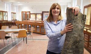
Jessica Mitchell, of the Steinmann Institute, University of Bonn with the thigh bone of the long-necked dinosaur Apatosaurus. Credit: Volker Lannert/Uni Bonn
How old were the oldest dinosaurs? This question remains largely unanswered. The natural life span of these long-extinct giants is of interest to scientists, in combination with questions regarding how fast they could grow and how they could obtain sufficient nutrients from their habitat. Palaeontologists at the University of Bonn estimate by means of bone structures whether a particular dinosaur fossil is a young, adult or very old animal. The results have now been published in the journal Paleobiology.
“Many animals show growth lines in their bones while they are growing—similar to annual rings in a tree trunk,” reports palaeontologist Jessica Mitchell from the Steinmann Institute of the University of Bonn. However, as bone ages, regular repair procedures are carried out to renew bone. These repair structures in the bone (osteons) are so small that they can only be detected with a microscope.
In adult dinosaurs, the bone is transformed such that the growth lines are completely destroyed. Instead, only the repair structures are visible in the bones, which eventually overlap each other. “We can see several generations of osteons in the bone of animals with advanced age,” says Jessica Mitchell. “Our research objective was to investigate whether these repair structures could be used as indicators of age.” The research team compared differently sized bones of 79 specimens of several long-necked dinosaurs, representing young to old individuals: the bones of an adolescent have a few repair structures, while bones of an older individual are completely rebuilt.
The researchers are able to roughly estimate whether the animals are young or adult in age. But is it possible to determine a higher age between two adult dinosaurs? This question can be answered by analysing the repair structures. For this, the researchers only need a small sample of the fossilized bone: a drill core is ground and polished until only a small, translucent plate remains. Under a light microscope, the bone plate can be examined and the structures of interest can be measured.
Bone reconstruction in dinosaurs is similar to humans
Despite the size difference, inside, the bones of aging dinosaurs are very similar to those of us humans: the repair processes in dinosaurs, humans and many vertebrate animals follow the same pattern. “This reconstruction process is continually taking place within us and ensures that we have a new skeleton more or less every ten years,” emphasizes the palaeontologist. In forensics and anthropology, bones are also examined to determine the age of humans. The bone structure analysis helped determine that “Ötzi” the 5,000-year-old ice man died roughly at the age of 45.
Although bones do not appear to be active organs, such as the heart or lungs, they are much more than just the solid structures inside our body. Bones contain blood vessels that supply nutrients and bone cells that signal to each other that a repair is necessary. The study showed that the number of osteon generations, which have gradually formed during the reconstruction of the bones, gives an important indication as to whether an animal is younger or older in a comparative study.
Great potential in extinct animals
“With this method an absolute value for age is not yet possible,” says Mitchell. Extending the study with more dinosaur bones could further improve the outcome. Another future approach is to compare the bone structures of dinosaurs with living vertebrate animals, the actual age of which can be known. This comparison might also allow for more specific ages for dinosaurs.
Reference:
Jessica Mitchell et al, Can secondary osteons be used as ontogenetic indicators in sauropods? Extending the histological ontogenetic stages into senescence, Paleobiology (2017). DOI: 10.1017/pab.2016.47
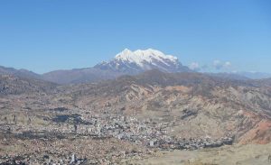
View of the Nevado Illimani glacier in Bolivia from La Paz. Credit: Paul Scherrer Institute/Theo Jenk
South America’s mining industry supplies half the world with copper. The world’s largest mines are located in the Andes. Yet just when copper production began there has remained unclear, until now. Very few artefacts from the early high cultures in Peru, Chile, and Bolivia have been preserved. Now, however, researchers of the Paul Scherrer Institute PSI in Villigen, Switzerland, are on the trail of this mystery. Through analysis of ice from the Illimani glacier in the Bolivian Andes, they found out that by around 700 BC, copper was already being mined and smelted in South America. Their findings are published in Scientific Reports, an online journal of the Nature Publishing Group.
In South America, copper has been mined and smelted for around 2700 years. This has now been determined by researchers of the Laboratory of Environmental Chemistry at the Paul Scherrer Institute PSI in Villigen, Switzerland, through analyses of glacier ice from Bolivia. Copper mining in South America has enormous importance: Chile and Peru are the two largest copper producers in the world; Chile alone accounts for more than 30 percent of global copper production. Yet the beginnings of this essential industrial sector have remained obscure. The only certain evidence came from the time of the Moche culture, which flourished on the northern coast of Peru between 200 and 800 AD. Numerous copper objects from this culture, such as jewelry and ritual tools, have been found. From earlier times, however, there are few finds and no written records.
The ice of a glacier is, in principle, a kind of archive; in its layers, as in the growth rings of a tree, records of the region’s climate development and air quality are stored away. Each year, a new layer of frozen precipitation is deposited on top. And every time, dust particles that were floating in the air at the time are embedded in the new layer. After drilling deep into the glacier and extracting a long column of ice, scientists can bring it—with great care and under refrigeration—into a laboratory for analysis. In just this way the team of Anja Eichler, the study’s first author, and project leader Margit Schwikowski took a 139 m-long ice core that had been drilled during a 1999 expedition, at an altitude of around 6,300 m on the Illimani glacier in Bolivia, and analysed the deposits of metallic dust in particular.
In a cold room of the PSI, the researchers continuously melted the ice core layer by layer, with a device they had developed themselves, and analysed the meltwater with a mass spectrometer. This instrument can separate different chemical elements from each other and determine their respective mass. Thus we worked our way back in time to roughly 4500 BC— the ice corresponding to this time was at a depth of around 134 m, Anja Eichler reports. And we determined that the first elevated copper concentrations that must trace back to human activity occurred around 700 BC. Living to the northwest of the glacier at that time were people of the Chavin culture, the first civilisation in the Peruvian Andes, while the Chiripa culture, a relatively simple society, lived in the immediate vicinity of Lake Titicaca. This is known from archaeological excavations. Hence it is possible that both practiced copper metallurgy, smelting copper ore to obtain pure copper for the production of artefacts. Copper particles emitted during this process made their way, on the wind, up to the glacier and were deposited there in the corresponding ice layers, says Margit Schwikowski. These particles added to the natural copper from mineral dust and thus produced the particularly high copper concentrations.
Following up on this, Anja Eichler looked into the archives of numerous museums and was able to find at least two copper artefacts from that time. One was a bent needle of the Chiripa culture, found in 1934 and kept since then in the American Museum of Natural History in New York. The second was a bracelet, which was found in Bolivia and is on exhibition but cannot be clearly assigned to any culture. In fact there are also copper objects from the time between 1400 and 1100 BC—much earlier. There, though, what you’re dealing with is hammered metal made from native copper, Margit Schwikowski explains. That is elementary copper, which also occurs naturally in this form. It is quite rare, though. For copper in larger quantities, ore must be mined and the pure copper must be extracted through smelting.
The earliest evidence of smelting furnaces comes from the later Moche culture for which, likewise, elevated copper concentrations can be detected in glacier ice. Moche people evidently used a type of ceramic oven, Anja Eichler says. This had several holes where air could be injected through blow-tubes to heat the fire to well over 1,000 degrees C. When exactly such ovens were used for the first time, however, is not known, adds archaeometallurgist Thilo Rehren of University College London (UCL), who took part in the study. But it is also possible that the smiths of the earlier cultures threw copper ore into simple pit furnaces dug into the ground. In these fires small cakes of metal were formed, which could be processed further in crucibles.
With their study, the researchers are correcting a picture that stems from another, earlier study. In this, a different research group postulated that copper metallurgy in South America might have begun still earlier, by around 2000 BC. That group had done a similar analysis on a peat bog drilled at Tierra del Fuego and detected a strong increase, already for this early period, in copper concentrations. Like ice, peat forms layers over the years and centuries, which preserve records of environmental pollution in past times. Tierra del Fuego lies around 3,000 km south of the centres of metallurgy in the Andes, says Anja Eichler. Besides that, the peat bog record only reaches a little farther back than 2000 BC—our ice core, in contrast, goes back beyond 4500 BC. That puts us in the position to quantify the natural fluctuations in the deposition of copper dust before the onset of metallurgy. And our results indicate that the increase at Tierra del Fuego at that time was a natural regional fluctuation.
Reference:
A. Eichler et al. Ice-core evidence of earliest extensive copper metallurgy in the Andes 2700 years ago, Scientific Reports (2017). DOI: 10.1038/srep41855
Pure iron grains in interstellar space are far rarer than previously thought, shedding new light on the evolution history of matters in the universe.
Scientists are unsure what form iron takes in outer space even though it is one of its most abundant refractory elements. Extensive analysis of meteorites and other measurements show only low levels of gaseous iron and solid iron compounds, such as iron oxides, sulfides and carbides. That leaves a substantial amount of iron missing, given how much is expected to exist in the universe. Scientists surmise that if iron is not combining with other particles, it might be forming pure metal which is invisible in outer space.
That theory now appears unlikely, according to a paper recently published in the journal Science Advances.
A research team led by Hokkaido University and the Japanese Aerospace Exploration Agency conducted a rocket-based experiment to simulate the formation of pure iron grains in space. Their measurements revealed grain formation is extremely rare, contrary to the previous theory.
In space, tiny solid grains are often formed following the epic explosion of a star, or supernova, which releases extremely hot gases full of different elements. As those gas molecules collide and start to cool, they might stick to each other and begin condensing into solid particles, a process called nucleation.
The researchers simulated supernova conditions by sending a rocket into sub-orbit, 321 kilometers above the ground, where it was mostly free from the effect of gravity, which can throw off experiments. They set up a nucleation chamber with iron gas, a heating element, lasers and an image-recording system in the rocket. The iron was heated to extremely hot temperatures until it evaporated, much like after a supernova. As the gas cooled, the group measured how much iron condensed into tiny grains by observing interference, or lack thereof, with the laser beam.
Only a few atoms stuck together per hundred thousand collisions; the sticking probability was only 0.002% while it was formerly thought to be 100%. The result shows that the nucleation of pure iron grains is very rare, even in an iron-rich environment following a supernova.
“This implies that most iron is locked up as grains of iron compounds or as impurities accreted onto other grains in the interstellar medium,” says Yuki Kimura, the lead author of the paper and associate professor at Hokkaido University’s Institute of Low Temperature Science. “As iron is a key element for clarifying the overall composition and amount of interstellar grains, our results should help understand the chemistry and evolution history of matters in the universe.”
Reference:
Yuki Kimura et al. Pure iron grains are rare in the universe, Science Advances (2017). DOI: 10.1126/sciadv.1601992
Algae making bubbles of O2 in a South African lake. Credit: University of St Andrews
Research led by the University of St Andrews and published yesterday (Monday 6 February) in Nature – provides new insight into how life evolved alongside changes in the chemistry of Earth’s surface. These researchers examined geochemical records of Earth’s ‘Great Oxidation Event’ 2.3 billion years ago, and captured for the first time the response of the nitrogen cycle to this major transition in Earth’s surface environment.
The study, which was led by Dr Aubrey Zerkle of the School of Earth & Environmental Sciences at St Andrews, fills a ~400 million year gap in geochemical records of a dramatic change that occurred halfway through Earth’s history, when oxygen (O2) first accumulated in the atmosphere.
Dr Zerkle explained: “The ‘Great Oxidation Event’ was arguably the most dramatic environmental change in Earth history. It was critical to the development of the hospitable environment that we inhabit today, as it was a prerequisite for the evolution of animals that universally require O2 to live.
“Catastrophic upheavals in past surface conditions such as these provide a critical window for Earth scientists to study how the biosphere responds to environmental change. Understanding how life on this planet responded to geochemical changes in the past will help us to more clearly predict the response to future changes, including Earth’s warming climate. It will also inform our search for habitable planets in other solar systems.”
The rock cores Dr Zerkle and her colleagues studied, from the National Core Library in Donkerhoek, South Africa, have recently been used to date the occurrence of the Great Oxidation Event, and offer key insights about how this event affected the availability of nitrogen. Nitrogen is an essential element in all living organisms, required for the formation of proteins, amino acids, DNA and RNA. As a key “nutrient”, nitrogen therefore controls global primary productivity, which in turn regulates climate, weathering, and the amount of oxygen at Earth’s surface.
Despite the importance of nitrogen to life, major gaps existed in the previous geochemical records of how the nitrogen cycle has responded to critical events in Earth history. The result of Dr Zerkle’s research is a unique set of high-resolution records of nitrogen isotopes in sedimentary rocks that record the environmental conditions during the Great Oxidation Event. These detailed records document the immediate onset of a modern-style nitrate-driven ecosystem, appearing simultaneously with the first evidence for O2 in the atmosphere.
She explained: “Our data shows the first occurrence of widespread nitrate, which could have stimulated the rapid diversification of complex organisms, hot on the heels of global oxygenation. The building blocks were apparently in place, the question that remains is why eukaryotic evolution was seemingly stalled for another billion or more years.”
The results are supported by a recent study of selenium isotopes across the same time interval by researchers including Dr Eva Stüeken from the University of St Andrews. Dr Stüeken and colleagues found that the selenium cycle was perturbed in a way that can only be explained by an expansion of oxygen in the surface ocean – enough to generate nitrate and potentially support complex life. Dr Andrey Bekker from UC-Riverside, who co-authored both studies, explained: “We now know that redox conditions were favourable for complex life to evolve immediately after the Great Oxidation Event. The question is if eukaryotes did not evolve in the early Paleoproterozoic, what are the other intrinsic controls that determine the evolution of life?”
Reference:
Aubrey L. Zerkle et al. Onset of the aerobic nitrogen cycle during the Great Oxidation Event, Nature (2017). DOI: 10.1038/nature20826
North-westerly view of the Gloria Knolls Slide and Gloria Knolls off Innisfail. Depths are coloured red (shallow) to blue (deep), over a depth range of about 1700 metres. Credit: deepreef.org/Creative Commons Attribution 4.0 International Licence.
James Cook University scientists have helped discover the remnants of a massive undersea landslide on the Great Barrier Reef, approximately 30 times the volume of Uluru.
JCU’s Dr Robin Beaman said the remains of the slip, known as the Gloria Knolls Slide, were discovered 75 kilometres off the north Queensland coast near the town of Innisfail while the scientists were working from the Marine National Facility’s blue-water research ship Southern Surveyor.
“This is all that remains after a massive collapse of sediment of about 32 cubic kilometres’ volume more than 300,000 years ago,” he said.
Dr Beaman said a debris field of large blocks, or knolls, and numerous smaller blocks, lies scattered over 30 kilometres from the main landslide remains, into the Queensland Trough, to a depth of 1350 metres.
“We were amazed to discover this cluster of knolls while 3D multibeam mapping the deep GBR seafloor. In an area of the Queensland Trough that was supposed to be relatively flat were eight knolls, appearing like hills with some over 100 m high and 3 km long.”
Associate Professor Jody Webster from the University of Sydney likened the research to a detective story, first finding the knolls, then using later mapping to reveal the landslide source of the knolls.
A sediment sample from a knoll at a depth of 1170 metres identified a remarkable cold-water coral community of both living and fossil cold-water coral species, gorgonian sea whips, bamboo corals, molluscs and stalked barnacles.
“The oldest fossil corals recovered off the top of the knoll was 302 thousand years,” says Dr Angel Puga-Bernabéu at the University of Granada and lead author on the study, “which means the landslide event that caused these knolls must be older”.
Modelling the potential tsunami for a sudden ‘mass failure’ on this scale yields a three-dimensional tsunami wave elevation of about 27 metres. However, the wave would likely be dampened significantly by the presence of any coral reefs.
Considerably more seabed mapping and sampling is needed to fully assess the tsunami hazard to the Queensland coast posed by these types of underwater landslides.
The scientists said one-third of the Great Barrier Reef lies beyond the seaward edge of the shallower reefs, and the discovery of this prominent undersea landslide and its vast debris field in the deep Great Barrier Reef reveals a far more complex landscape than previously known.
This research is a collaborative effort between James Cook University, University of Sydney, University of Granada, University of Edinburgh and the Australian Nuclear Science and Technology Organisation.
Reference:
Ángel Puga-Bernabéu et al, Gloria Knolls Slide: A prominent submarine landslide complex on the Great Barrier Reef margin of north-eastern Australia, Marine Geology (2017). DOI: 10.1016/j.margeo.2016.12.008
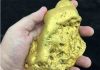
The finest uncut opal in existence, the Fire of Australia, has joined the South Australian Museum’s collection through the vision of a private donor and funding from the Federal Government’s National Cultural Heritage Account.
Valued at nearly $900,000 Australian dollars and weighing at 998 grams, the Fire of Australia is the world’s finest piece of opal of its kind on public display.
The Director of the South Australian Museum, Brian Oldman said the rarity of this piece of opal cannot be underestimated.
“Opal of this quality can only be created under certain climate conditions,” Mr Oldman said.
“90% of the world’s most precious opals are found in South Australia.
“When our state’s inland sea evaporated millions of years ago it provided a unique silica-rich environment for the creation of precious opal. It is these exceptional conditions that created the Fire of Australia.”
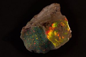
Still in the rough condition in which it was found, two faces of the Fire of Australia have been polished to reveal the gem’s exceptional quality, with its transitioning colour from green to yellow to red depending on the angle from which it is viewed.
Minister for the Arts the Hon Senator Mitch Fifield today announced $455,000 in federal funding for the Museum to secure the significant piece.
The Turnbull Government understands the importance of preserving and displaying Australia’s unique artefacts locally for current and future generations.
This funding helps Australia’s cultural institutions, such as the South Australian Museum, acquire significant objects for public display.
Walter Bartram’s son Alan said that the Fire of Australia was mined in 1946 by Walter Bartram at the Eight Mile field in Coober Pedy, South Australia and has been in his family for over 60 years.
“After loaning the Fire of Australia to the South Australian Museum for its Opals exhibition, we made the decision to place this family heirloom in safe hands.
“We’ve been long term supporters of the South Australian Museum and it seems fitting that it should be passed onto the people of South Australia to enjoy,” Mr. Bartram said.
Opals was the most visited paid for exhibition in the Museum’s history, resulting in donations of precious opals of more than $3 million, which includes the Fire of Australia.
The Fire of Australia opal will be on display in the South Australian Museum’s front foyer until February 28 2017.
Discovery
The gem was first discovered in 1946 by miner Walter Bartram at the Eight Mile opal field in Coober Pedy — a small desert town in South Australia famous for its opals.
(South Australia, which encompasses a vast arid area in the south and middle of Australia, produces more than 90% of the world’s precious opal, according to Oldman.)
Oldman said it would have been part of a larger seam of opal that ran underground, and would have been extracted in pieces.
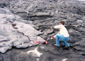
Lead author Matthew Jackson samples Hawaiian lava with a rock hammer. Credit: WHOI Geodynamics Program
Earth’s mantle — the layer between the crust and the outer core — is home to a primordial soup even older than the moon. Among the main ingredients is helium-3 (He-3), a vestige of the Big Bang and nuclear fusion reactions in stars. And the mantle is its only terrestrial source.
Scientists studying volcanic hotspots have strong evidence of this, finding high helium-3 relative to helium-4 in some plumes, the upwellings from Earth’s deep mantle. Primordial reservoirs in the deep Earth, sampled by a small number of volcanic hotspots globally, have this ancient He-3/4 signature.
Inspired by a 2012 paper that proposed a correlation between such hotspots and the velocity of seismic waves moving through Earth’s interior, UC Santa Barbara geochemist Matthew Jackson teamed with the authors of the original paper — Thorsten Becker of the University of Texas at Austin and Jasper Konter of the University of Hawaii — to show that only the hottest hotspots with the slowest wave velocity draw from the primitive reservoir formed early in the planet’s history. Their findings appear in the journal Nature.
“We used the seismology of the shallow mantle — the rate at which seismic waves travel through Earth below its crust — to make inferences about the deeper mantle,” said Jackson, an assistant professor in UCSB’s Department of Earth Science. “At 200 km, the shallow mantle has the largest variability of seismic velocities — more than 6 percent, which is a lot. What’s more, that variability, which we hypothesize relates to temperature, correlates with He-3.”
For their study, the researchers used the latest seismic models of Earth’s velocity structure and 35 years of helium data. When they compared oceanic hotspots with high levels of He-3/4 to seismic wave velocities, they found that these represent the hottest hotspots, with seismic waves that move more slowly than they do in cooler areas. They also analyzed hotspot buoyancy flux, which can be used to measure how much melt a particular hotspot produces. In Hawaii, the Galapagos Islands, Samoa and Easter Island as well as in Iceland, hotspots had high buoyancy levels, confirming a basic rule of physics: the hotter, the more buoyant.
“We found that the higher the hotspot buoyancy flux, the more melt a hotspot was producing and the more likely it was to have high He-3/4,” Jackson said. “Hotter plumes not only have slower seismic velocity and a higher hotspot buoyancy flux, they also are the ones with the highest He-3/4. This all ties together nicely and is the first time that He-3/4 has been correlated with shallow mantle velocities and hotspot buoyancy globally.”
Becker noted that correlation does not imply causality, “but it is pretty nifty that we found two strong correlations, which both point to the same physically plausible mechanism: the primordial stuff gets picked up preferentially by the most buoyant thermochemical upwellings.”
The authors also wanted to know why only the hottest, most buoyant plumes sample high He-3/4.
“The explanation that we came up with — which people who do numerical simulations have been suggesting for a long time — is that whatever this reservoir is with primitive helium, it must be really dense so that only the hottest, most buoyant plumes can entrain some of it to the surface,” Jackson said. “That makes sense and it also explains how something so ancient could survive in the chaotically convecting mantle for 4.5 billion years. The density contrast makes it more likely that the ancient helium reservoir is preserved rather than mixed away.”
“Since this correlation of geochemistry and seismology now holds from helium isotopes in this work to the compositions we examined in 2012, it appears that overall hotspot geochemical variations will need to be re-examined from the perspective of buoyancy,” Konter concluded.
Reference:
M. G. Jackson, J. G. Konter, T.W. Becker. Primordial helium entrained by the hottest mantle plumes. Nature, 2017; DOI: 10.1038/nature21023
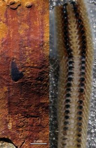
This is a close up of the radula preserved in Calvapilosa kroegeri next to a radula from a modern chiton. Credit: Luke Parry and Peter Van Roy
Scientists from the University of Bristol have uncovered a 480-million-year-old slug-like fossil in Morocco which sheds new light on the evolution of molluscs — a diverse group of invertebrates that includes clams, snails and squids.
One of the defining characteristics of the molluscs is the possession of a radula, a kind of toothed-tongue which is used to rake up or rasp food.
The radula houses hundreds of teeth, the patterns of which can be used to determine diet and identify species. Whilst not all molluscs have a radula, a radula cannot be found in any other group of animals. Dr Jakob Vinther, from the Schools of Biological Sciences and Earth Sciences, is lead author of the study, which is published today in Nature.
He said: “The molluscs are amongst the earliest animals identifiable in the fossil record, however determining what their ancestor looked like is difficult since many of the groups appear within a small window of time, making the sequence of evolutionary events difficult to piece together.”
The recent discovery of a new species of mollusc in the Anti-Atlas region in Morocco has enabled palaeontologists to revisit this problem and infer the appearance of the ancestor of all molluscs.
The new species discovered, Calvapilosa kroegeri, is part of the Fezouata Biota: a group of organisms from the early Ordovician period (485-470 million years ago) which are found in rocks in southeastern Morocco. The Fezouata Biota is famed for its exceptional preservation, allowing palaeontologists to identify details not preserved from any other fossil site.
Co-author Luke Parry, a PhD student at the University of Bristol, added: “Calvapilosa kroegeri resembles a slug covered with short spines all over its upper body and with a large ‘fingernail-like shell’ over its head. In the centre of the head of this species are two rows of teeth which we demonstrate is a radula.”
The discovery of this feeding structure firmly identifies Calvapilosa kroegeri as a mollusc. Additionally, it suggests that similar fossil forms, such as Halkieria¬ — a two plated slug-like fossil, are also molluscs and possessed a radula.
Following an analysis to determine the family tree of molluscs, Calvapilosa kroegeri was revealed to be the most primitive member of the lineage leading to chitons. Chitons can still be found today and are characterised by their possession of eight shell plates and spines around their margin, similar to what is seen covering the body of Calvapilosa.
Dr Vinther concluded: “If we trace back the evolution of chitons, we can see that the number of their shells has increased with time. It is therefore likely that the ancestor to all molluscs was single-shelled and covered in bristle-like spines, not dissimilar to Calvapilosa kroegeri.”
Reference:
Jakob Vinther, Luke Parry, Derek E. G. Briggs, Peter Van Roy. Ancestral morphology of crown-group molluscs revealed by a new Ordovician stem aculiferan. Nature, 2017; DOI: 10.1038/nature21055
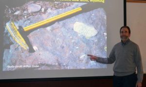
Kevin Chamberlain, a University of Wyoming professor of geology, points to a glacial diamictite exposed in the Snowy Range of Wyoming. Chamberlain is the second author of a PNAS paper that determined a “Snowball Earth” event actually took place 100 million years earlier than previously projected, and a rise in the planet’s oxidation resulted from a number of different continents — including what is now Wyoming — that were once connected. The inset photo was taken by Arthur Snoke. Credit: UW
A University of Wyoming researcher contributed to a paper that determined a “Snowball Earth” event actually took place 100 million years earlier than previously projected, and a rise in the planet’s oxidation resulted from a number of different continents—including what is now Wyoming—that were once connected.
“Isotopic dating of the Ongeluk large igneous province, South Africa, revealed that the first Paleoproterozoic global glaciation and the first significant step change in atmospheric oxygenation likely occurred between 2,460 and 2,426 million years ago, approximately 100 million years earlier than previous estimates,” says Kevin Chamberlain, a UW research professor in the Department of Geology and Geophysics. “And the rise of atmospheric oxygen was not monotonic but, instead, was characterized by significant oscillations before irreversible oxygenation of the atmosphere 2,250 million years ago.”
Chamberlain is the second author of a paper, titled “Timing and Tempo of the Great Oxidation Event,” which appears in the Feb. 6 (today’s) issue of the Proceedings of the National Academy of Sciences (PNAS). The journal is one of the world’s most prestigious multidisciplinary scientific serials, with coverage spanning the biological, physical and social sciences.
Ashley Gumsley, a doctoral student at Lund University in Lund, Sweden, is the paper’s lead author. Other contributors were from the Geological Survey of Canada in Ottawa; Swedish Museum of Natural History; University of Johannesburg, South Africa; and the University of California-Riverside.
The research relates to a period in Earth’s history about 2.45 billion years ago, when climate swung so extremely that the polar ice caps extended to the equator and the Earth was a snowball, and the atmosphere was largely isolated from the hydrosphere, Chamberlain says. Recovery from this Snowball Earth led to the first and largest, rapid rise in oxygen content in the atmosphere, known as the Great Oxygenation Event (GOE), setting the stage for the dominance of aerobic life, he says.
A later, and better known, Snowball Earth period occurred at about 700 million years ago, and led to multicellular life in the Cambrian period, Chamberlain says. The events show there was not one event, but an oscillation of oxygen over time that led to the Earth’s conditions today.
“So, both Snowball Earth periods had extreme impacts on the development of life,” he says. “It helps us understand the evolution of Earth and Earth’s atmosphere, and evolution of life, for that matter.”
Chamberlain’s contribution focuses on igneous rocks exposed in South Africa that record the existence of equatorial glaciers and contain chemical indicators for the rise of atmospheric oxygen. Chamberlain’s in situ method to determine the age of the rocks does not require removing baddeleyite crystals from the rock. This process allows for analysis of key samples with smaller crystals than previously allowed. Using a mass spectrometer, the age of the rocks is determined by measuring the buildup of lead from the radioactive decay of uranium, he says.
“The basic story had been worked out earlier by others, but our results have significantly refined the timing and duration of the ‘event,’ which is more of a transition actually,” Chamberlain explains. “With all the discussion of climate change in the present day, understanding how Earth responded and the effects on the atmosphere in the past may help us predict the future.”
Chamberlain points to a Wyoming connection in this research. From paleomagnetic data, many of the continents, at the time, including the basement rocks of Wyoming, were all connected into a single, large continent and situated near the equator. Other continents connected included parts of what are now Canada and South Africa. This situation is part of the trigger for the “Snowball Earth” conditions.
“There are glacial deposits exposed in the Medicine Bow Mountains and Sierra Madre that are from this same event,” he says.
These rocks, known as diamictites, have large drop stones that depress very fine-grained mudstone. The large stones dropped from the underside of glacial sheets as they spread out and melted over shallow seas, similar to sediments beneath the Ross sea ice sheet of Antarctica today.
“The fact that these sediments were at the equator at 2.45 billion years ago comes from the paleomagnetic data from associated igneous rocks,” Chamberlain says. “I think that it’s interesting that part of the story is just 40 miles away in the Snowies.”
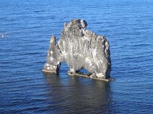
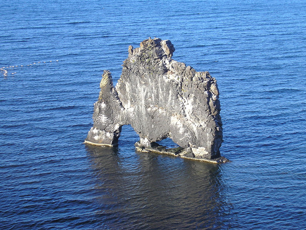
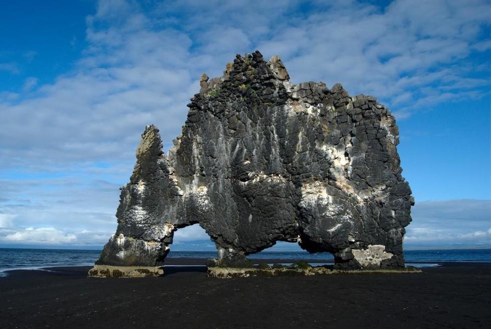
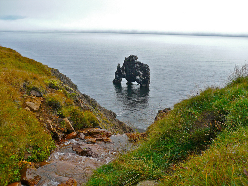
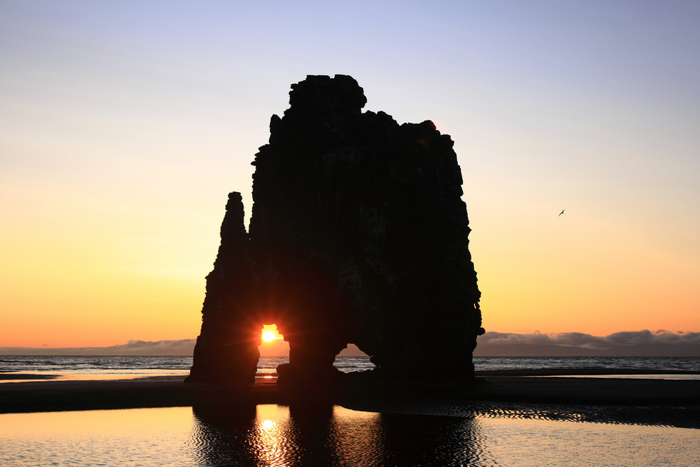
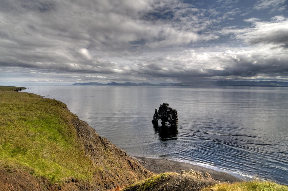
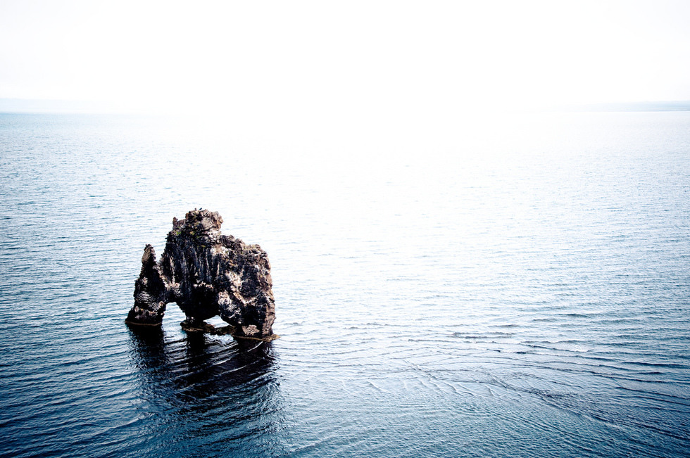
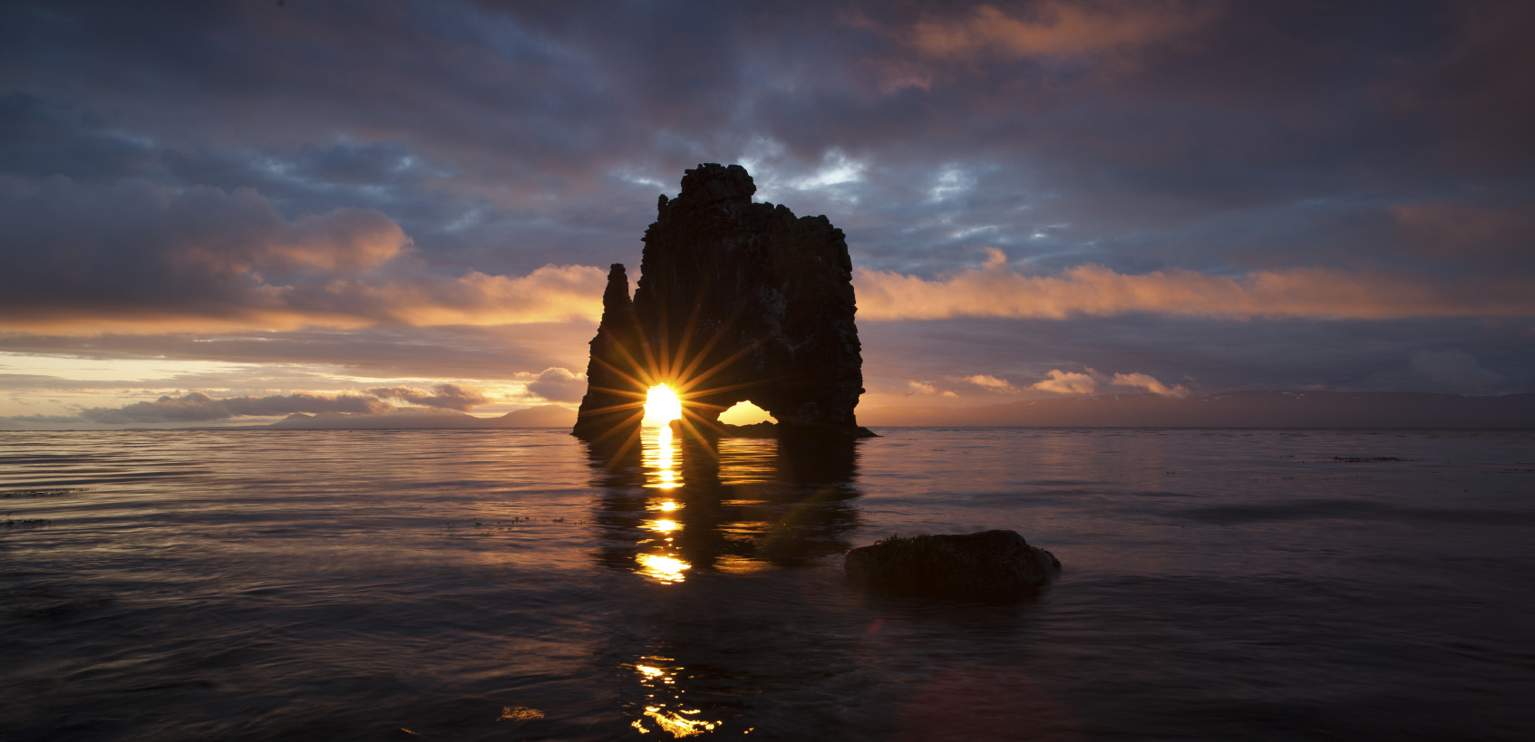
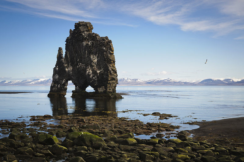
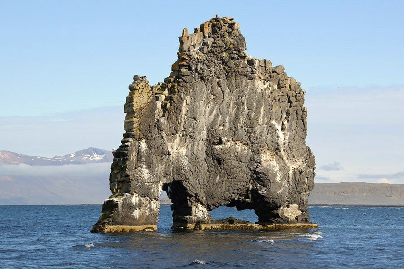
Hvítserkur is a 15 m high basalt stack along the eastern shore of the Vatnsnes peninsula, in northwest Iceland.
The rock has two holes at the base, which give it the appearance of a dragon who is drinking. The base of the stack has been reinforced with concrete to protect its foundations from the sea.
Some 470 million years ago, during the middle part of the geological period known as the Ordovician, an asteroid collision took place somewhere between Mars and Jupiter. The collision caused an explosion that sent a cascade of meteorites towards Earth. The heavy bombardment of Earth continued for millions of years, and even today some 20% of all meteorites that reach Earth originate from this asteroid break-up. At the same time Earth witnessed the greatest rise in marine biodiversity since the origin of multicellular life. So, the question is: was there a connection between these two fundamental events in Earth history, as has been proposed? A new study now demonstrates that the rise in biodiversity commenced long before the asteroid collision.
The link between these two fundamental events — the so-called Ordovician radiation and the sustained meteorite bombardment — has, for many years, presented a paradox in science. We are used to hearing the story of meteorite impacts that leads to the loss of species richness, such as when the dinosaurs went extinct 65 million years ago. But could the opposite scenario be a possibility as well? asks Assistant Professor Christian M. Ø. Rasmussen from the Natural History Museum of Denmark rhetorically. He is co-authoring the study in which an incidental finding of the rare mineral zircon within the meteorite-bearing rock layers led to an answer to the paradox.
Plus, minus 6 million years
Researchers have long known that the fossil meteorites are lying in rock layers that also witness the great increase in biodiversity, but could only date the asteroid break-up to occur within a time frame of 12 million years. This interval exactly overlaps the initiation of the great biodiversity increase. But, with the lucky finding of zircons in rock layers also containing fossil meteorites, the researchers suddenly had the opportunity to precisely determine when the asteroid collision took place, and thus, whether there was a link to the radiation event, or not.
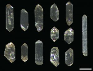
-Zircons are special as they can be used to date rocks. They come from magma chambers in the crust but are extruded onto Earth’s surface through volcanic eruptions. Thus, if you find zircons in the rock record you can date these zircons and thus get an age for when this eruption took place. In this case, this date would also define a precise age for the fossil meteorites, explains Anders Lindskog from the Geological Department, Lund University, who is the lead-author on the study. He was the one who recovered the zircons when studying the rock layers containing the fossil meteorites and subsequently sent them to the Natural History Museum of Denmark, which has the facilities and experience to conduct high-precision dating of rocks.
Calculating the age of the zircons
In Copenhagen, the zircons were handed over to postdoc Mafalda Costa from Centre for Star and planet Formation (StarPlan) at the Natural History Museum of Denmark, who processed and analyzed the minerals in the radiogenic isotope laboratory at the Geological Museum.
Mafalda Costa explains:
Zircons occur in a wide variety of rocks, including in ash layers associated with volcanic eruptions. The determination of the age of these crystals is based on the natural radioactivity of uranium, which is incorporated in the mineral upon crystallization, and that from that moment until today, at a known rate, has been spontaneously decaying to lead. We measure the amount of uranium and lead present in the zircons and from that it is possible to calculate an age that pinpoints the time when they erupted on the surface. In this case, on the same surface that also contained meteorites originating from the asteroid break-up. In this way, we could precisely define the age of the fossil meteorites, explains Mafalda Costa, and adds:
From other isotope analyses of minerals found in the fossil meteorites it had been previously estimated how much time the meteorites spent in space before reaching Earth. Hitherto it was not precisely known when this happened. With our new zircon age, we can determine that the rise in biodiversity occurred ~2.5 million years prior to the asteroid break-up took place.
This new study, which has just been published in the journal Nature Communications, therefore demonstrates that there is no link between the Ordovician rise in biodiversity and the asteroid break-up — thus, some other driver must have facilitated the Ordovician radiation.
Reference:
A. Lindskog, M. M. Costa, C.M.Ø. Rasmussen, J. N. Connelly, M. E. Eriksson. Refined Ordovician timescale reveals no link between asteroid breakup and biodiversification. Nature Communications, 2017; 8: 14066 DOI: 10.1038/ncomms14066
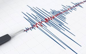
The Environmental Protection Agency has told Oklahoma regulators to do more to protect the state from a surge in earthquake activity that scientists have linked to the underground disposal of oil and gas wastewater.
An EPA administrator sent a letter in November to the Oklahoma Corporation Commission, saying a magnitude 5.0 earthquake happened despite state and federal action to curb wastewater injection. The Frontier first reported the contents of the letter.
Well-related pressure buildup can affect health and underwater drinking water sources, said the letter, dated Nov. 22.
The commission’s response to the EPA, dated Nov. 29, said Oklahoma will continue to work with federal officials and made note of a governor’s task force on wastewater. That group’s study is expected later this month.
Year-end data from the Corporation Commission show disposal well operators placed about 23 percent less wastewater into the earthquake zone in 2016 compared to the previous year.
Oklahoma Attorney General Scott Pruitt is President Donald Trump’s pick to head the EPA. His nomination is pending Senate approval.
Environmentalists have criticized Pruitt for not doing more to reduce seismic activity linked to oil and gas production in Oklahoma.
The EPA sent the letter to Oklahoma while President Barack Obama was in power. The Trump administration could take a different stance on scaling back on oil and gas wastewater disposal.
Note: The above post is reprinted from materials provided by The Associated Press.
Something slammed into the surface of Mars 1 million years ago, hitting a volcano or lava plain. This impact ejected rocks into space. Fragments of these rocks crossed Earth’s orbit and fell as meteorites. Credit: Image courtesy of University of Houston
Analysis of a Martian meteorite found in Africa in 2012 has uncovered evidence of at least 2 billion years of volcanic activity on Mars. This confirms that some of the longest-lived volcanoes in the solar system may be found on the Red Planet.
Shield volcanoes and lava plains formed from lava flowing over long distances, similar to the formation of the Hawaiian Islands. The largest Martian volcano, Olympus Mons, is nearly 17 miles high. That’s almost triple the height of Earth’s tallest volcano, Mauna Kea, at 6.25 miles.
Tom Lapen, a geology professor at the University of Houston and lead author of a paper published Feb. 1 in the journal Science Advances, said the findings offer new clues to how the planet evolved and insight into the history of volcanic activity on Mars.
Much of what we know about the composition of rocks from volcanoes on Mars comes from meteorites found on Earth. Analysis of different substances provides information about the age of the meteorite, its magma source, length of time in space and how long the meteorite was on Earth’s surface.
Something slammed into the surface of Mars 1 million years ago, hitting a volcano or lava plain. This impact ejected rocks into space. Fragments of these rocks crossed Earth’s orbit and fell as meteorites.
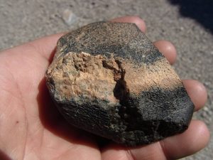
The meteorite, known as Northwest Africa 7635 and discovered in 2012, was found to be a type of volcanic rock called a shergottite. Eleven of these Martian meteorites, with similar chemical composition and ejection time, have been found.
“We see that they came from a similar volcanic source,” Lapen said. “Given that they also have the same ejection time, we can conclude that these come from the same location on Mars.”
Together, these meteorites provide information about a single location on Mars. Previously analyzed meteorites range in age from 327 million to 600 million years old. In contrast, the meteorite analyzed by Lapen’s research team was formed 2.4 billion years ago and suggests that it was ejected from one of the longest-lived volcanic centers in the solar system.
Reference:
Thomas J. Lapen, Minako Righter, Rasmus Andreasen, Anthony J. Irving, Aaron M. Satkoski, Brian L. Beard, Kunihiko Nishiizumi, A. J. Timothy Jull, Marc W. Caffee. Two billion years of magmatism recorded from a single Mars meteorite ejection site. Science Advances, 2017; 3 (2): e1600922 DOI: 10.1126/sciadv.1600922