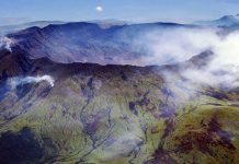
The Ijen volcano complex is a group of stratovolcanoes in the Bondowoso Regency of East Java, Indonesia. It is inside a larger caldera Ijen, which is about 20 kilometers wide. The Gunung Merapi stratovolcano is the highest point of that complex. The name “Gunung Merapi” means “mountain of fire” in the Indonesian language (api being “fire”); Mount Merapi in central Java and Marapi in Sumatra have the same etymology.
“This blue glow—unusual for a volcano—isn’t, of course, lava, as unfortunately can be read on many websites,” Grunewald told National Geographic in an email about Kawah Ijen, a volcano on the island of Java.
The glow is actually the light from the combustion of sulfuric gases, Grunewald explained.
Engineers from Imperial College London have dispelled a 100-year-old scientific law used to describe how fluid flows through rocks.
The discovery by researchers from Imperial could lead to a range of improvements including advances in Carbon Capture and Storage (CCS). This is where industrial emissions will be captured by CCS technology, before reaching the atmosphere, and safely stored in rock deep underground.
Miles below the surface of the Earth different types of fluids are flowing through the microscopic spaces between the grains inside rocks.
Scientists from the College have used the Diamond Light Source facility in the UK to make 3D videos that show in more detail than ever before how fluids move through rock.
For over one hundred years, engineers have been modelling how multiple fluids flow through rocks for a range of reasons. For example, modelling fluid flow enables engineers to determine how to extract oil and gas. Understanding how seawater flows through rocks provides insights into the volatility of Earth’s crust, and predicting how fresh water flows through rocks enables engineers to manage water resources. More recently, engineers have been modelling how CO? flows through rock as part of CCS.
Previously, scientists have used a formula for modelling how fluids move through rocks. It’s called Darcy’s Extended Law and the premise of it is that gases move through rock via their own separate, stable, complex, microscopic pathways. This has been the underpinning approach used by engineers to model fluid flow for the last 100 years.
However, the Imperial scientists have discovered that rather than flowing in a relatively stable pattern through rocks, the flows are in fact very unstable. The pathways that fluids flow through actually only last for a short period of time, tens of seconds at most, before re-arranging and forming into different ones. The team have called this process dynamic connectivity.
The importance of the discovery of dynamic connectivity is that engineers around the world will now be able to more accurately model how fluids flow through rock.
Dr Catriona Reynolds, lead author on the study who completed her PhD in the Department of Earth Science and Engineering at Imperial, said: “Trying to model how fluids flow through rock at large scales has proven to be a major scientific and engineering challenge. Our ability to predict how these fluids flow in the subsurface is not much better than it was 50 years ago despite major advances in computer modelling technology. Engineers have long suspected that there were some major gaps in our understanding of the underlying physics of fluid flow. Our new observations in this study will force engineers to re-evaluate their modelling techniques, increasing their accuracy.”
To create the 3D images the researchers in today’s study used the synchrotron particle accelerator at the Diamond Light Source. The synchrotron enables the researchers to take 3D image at speeds much faster than a conventional laboratory X-ray instrument – around 45 seconds compared to hours for a laboratory based instrument. This enabled them to see the dynamics, which had not been previously observed before.
However, an even higher time resolution would significantly enhance the observations. These fluid pathways re-arrange themselves quickly, so ideally the team would like the observations to capture every 100th of a second. This time resolution is only possible right now using optical light from microscopes combined with high-speed cameras. However, they are limited in their ability to observe fluids moving through real rocks.
The next steps will see the team attempting to overcome this technological obstacle using a combination of novel optical and X-ray imaging techniques. This could enable them to model fluid flow on a large scale, which would be of use for modelling CO2 storage, the production of oil and gas, and the migration of fluids deep in the Earth’s crust.
The research is published today in the journal Proceedings of the National Academy of Sciences and funded by Engineering and Physical Science Research Council’s Doctoral Training Scholarship Scheme and supported by the Qatar Carbonates and Carbon Storage Research Centre, funded jointly by Qatar Petroleum, Shell and the Qatar Science and Technology Park.
Reference:
Catriona Reynolds el al., “Dynamic connectivity – A new steady-state pore-scale flow mechanism,” PNAS (2017). DOI: 10.1073/pnas.1702834114
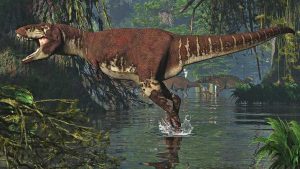
This is a life recreation of Albertavenator curriei. Credit: Illustrated by Oliver Demuth.
Scientists from the Royal Ontario Museum (ROM) and the Philip J Currie Dinosaur Museum have identified and named a new species of dinosaur in honour of renowned Canadian palaeontologist Dr. Philip J. Currie. Albertavenator curriei, meaning “Currie’s Alberta hunter.” It stalked Alberta, Canada, about 71 million years ago in what is now the famous Red Deer River Valley. The find recognizes Currie for his decades of work on predatory dinosaurs of Alberta. Research on the new species is published July 17 in the Canadian Journal of Earth Sciences.
Palaeontologists initially thought that the bones of Albertavenator belonged to its close relative Troodon, which lived around 76-million-years-ago — five million years before Albertavenator. Both dinosaurs walked on two legs, were covered in feathers, and were about the size of a person. New comparisons of bones forming the top of the head reveal that Albertavenator had a distinctively shorter and more robust skull than Troodon, its famously brainy relative.
“The delicate bones of these small feathered dinosaurs are very rare. We were lucky to have a critical piece of the skull that allowed us to distinguish Albertaventaor as a new species.” said Dr. David Evans, Temerty Chair and Senior Curator of Vertebrate Palaeontology at the Royal Ontario Museum, and leader of the project. “We hope to find a more complete skeleton of Albertavenator in the future, as this would tell us so much more about this fascinating animal.”
Identifying new species from fragmentary fossils is a challenge. Complicating matters of this new find are the hundreds of isolated teeth that have been found in Alberta and previously attributed to Troodon. Teeth from a jaw that likely pertains to Albertavenator appears very similar to the teeth of Troodon, making them unusable for distinguishing between the two species.
“This discovery really highlights the importance of finding and examining skeletal material from these rare dinosaurs,” concluded Derek Larson, co-author on the study and Assistant Curator of the Philip J. Currie Dinosaur Museum.”
The identification of a new species of troodontid in the Late Cretaceous of North America indicates that small dinosaur diversity in the latest Cretaceous of North America is likely underestimated due to the difficulty of identifying species from fragmentary fossils.
“It was only through our detailed anatomical and statistical comparisons of the skull bones that we were able to distinguish between Albertavenator and Troodon,” said Thomas Cullen, a Ph.D. student of Evans at the University of Toronto and co-author of the study.
The bones of Albertavenator were found in the badlands surrounding the Royal Tyrrell Museum, which Dr. Currie played a key role in establishing in the early 1980s. The rocks around the museum are the same age as some of the most fossiliferous rocks in the area of the newly erected Philip J. Currie Museum, also named in Dr. Currie’s honour. Although Dr. Currie has also had a several dinosaurs named after him, this is only the second one from Alberta, where he has made his biggest impact.
The fossils of Albertavenator studied by Evans and his team are housed in the collections of the Royal Tyrrell Museum. This is another example of a new species of dinosaur being discovered by re-examining museum research collections, which continually add to our understanding of the evolution of life on Earth. This study suggests that more detailed studies of fragmentary fossils may reveal additional, currently unrecognized, species.
Reference:
David C. Evans, Thomas M. Cullen, Derek W. Larson, Adam Rego. A new species of troodontid theropod (Dinosauria: Maniraptora) from the Horseshoe Canyon Formation (Maastrichtian) of Alberta, Canada. Canadian Journal of Earth Sciences, 2017; 813 DOI: 10.1139/cjes-2017-0034
Chinese paleontologists have discovered a large fossil site in southwest China’s Chongqing city, according to a press conference held Wednesday “June 28, 2017” by the city government.
More than 5,000 fossils have been excavated from a “fossil wall” in Pu’an Township, Yunyang County, since October last year, just a year after the site was spotted by a local farmer.
It is estimated that a large number of dinosaur fossils are buried at least 20 meters underground.
The unearthed fossils belong to at least five dinosaur categories, such as ornithopods, sauropods and stegosaurs, and date back to the Jurassic period, according to researcher Xu Xing with the Institute of Vertebrate Paleontology and Paleoanthropology of the Chinese Academy of Sciences.
Many fossils at Pu’an belong to the middle Jurassic period and dinosaur fossils from that time are scarce worldwide, Xu said.
“The Jurassic ‘wall’ at Pu’an is the largest in the world,” Xu said.
The Chongqing government has earmarked more than 17 million yuan (2.5 million U.S. dollars) for protection and excavation of the site.
Large dinosaur fossil site found in China
1 of 7
Note: The above post is reprinted from materials provided by Xinhua.
Reconstruction of an adult female of the species Alavatanais margulisae. Credit: University of Barcelona
A scientific team has found the first evidence of parental care in Tanaidaceans, dating back to more than 105 million years, according to a new study published in the journal Scientific Reports, from Nature group. These new findings are based on the study of three small crustaceans from different species of the Cretaceous -Alavatanais carabe, Alavatanais margulisae and Daenerytanais maieuticus- preserved in amber pieces from the sites in Peñacerrada (Álava, Spain) and La Buzinie (Charente, France), reference models in the study of fossil records in amber with bioinclusions of the Mesozoic in Europe.
The authors of the study are the researchers Alba Sánchez and Xavier Delclòs, from the Faculty of Earth Sciences and the Biodiversity Research Institute (IRBio) of the University of Barcelona; Enrique Peñalver, from the Geological and Mining Institute of Spain; Michael S. Engel, from the University of Kansas (United States); Graham Bird (New Zealand), and Vincent Perrichot, from the University Rennes 1 (France).
Parental care: protecting offspring millions of years ago
Lots of extant crustacean species show parental care, increasing survival possibilities in the natural habitat. This reproductive strategy, which evolved independently in different lineages, is common in terrestrial and water aquatic species (in oceans, lakes, etc.).
However, there is not a lot of fossil evidence of caring behaviours in crustaceans. Although parental care is documented in fossil records -for instance in ostracods from 450 million years ago- the published article in the journal Scientific Reports shows the first evidence of this behavior in Tanaidacea; a group of small crustaceans belonging to the superorder Peracarida.
“These new findings make up for the first fossil evidence of parental care in the order Tanaidacea. The findings show that certain caring behaviours and related morphological adaptations already existed during the Lower Cretaceous and were almost kept without changes for more than 105 million years” says the researcher Alba Sánchez (UB-IRBio), first author of the study.
Marsupial care of brood-offspring
A feature of Tanaidaceans -and other peracarid crustaceans- is that females have the marsupium, a ventral brood pouch to retain and protect the eggs. After the fertilization, eggs develop into embryos and then young individuals inside the marsupium.
According to the lecturer Xavier Delclòs (UB-IRBio), “The marsupium represents a safe environment for the offspring and may contribute to the success of tanaidaceans in different habitats (marine and freshwater environments, and even humid terrestrial areas), as proposed for some tanaidaceans found in Cretaceous amber.”
Daenerytanais maieuticus: the Khaleesi of crustaceans
According to the new study, the two tanaidacean specimens found in amber pieces from Álava (Spain) -two females of Alavatanais carabe and Alavatanais margulisae- show structures involved in the formation of a marsupium to carry eggs and offspring in sexually mature females.
Regarding the French site of La Buzinie, the specimen they identified is a female of Daenerytanais maieuticus, which was preserved in amber together with her marsupium full of eggs. This fossil, representing a new genus and species, is named after the fiction character Daenerys Targaryen, “Mother of Dragons,” from the series of fantasy novels A Song of Ice and Fire, written by George R. R. Martin, which inspired the well-known TV series Game of Thrones.
The article, published in the journal Scientific Reports is framed within the research studies of the group AMBARES (Ambers of Spain) and the UB Research Group Sedimentary Geology, and it has the financing of autonomous and national government funds and the collaboration of the Museum of Natural Sciences of Álava (Spain).
Reference:
Alba Sánchez-García, Xavier Delclòs, Michael S. Engel, Graham J. Bird, Vincent Perrichot, Enrique Peñalver. Marsupial brood care in Cretaceous tanaidaceans. Scientific Reports, 2017; 7 (1) DOI: 10.1038/s41598-017-04050-8
The tardigrade, also known as the water bear, is the toughest, most resilient, form of life on Earth. Image credit: Shutterstock
The world’s most indestructible species, the tardigrade, an eight-legged micro-animal, also known as the water bear, will survive until the Sun dies, according to a new Oxford University collaboration.
The new study published in Scientific Reports, has shown that the tiny creatures, will survive the risk of extinction from all astrophysical catastrophes, and be around for at least 10 billion years — far longer than the human race.
Although much attention has been given to the cataclysmic impact that an astrophysical event would have on human life, very little has been published around what it would take to kill the tardigrade, and wipe out life on this planet.
The research implies that life on Earth in general, will extend as long as the Sun keeps shining. It also reveals that once life emerges, it is surprisingly resilient and difficult to destroy, opening the possibility of life on other planets.
Tardigrades are the toughest, most resilient form of life on earth, able to survive for up to 30 years without food or water, and endure temperature extremes of up to 150 degrees Celsius, the deep sea and even the frozen vacuum of space. The water-dwelling micro animal can live for up to 60 years, and grow to a maximum size of 0.5mm, best seen under a microscope. Researchers from the Universities of Oxford and Harvard, have found that these life forms will likely survive all astrophysical calamities, such as an asteroid, since they will never be strong enough to boil off the world’s oceans.
Three potential events were considered as part of their research, including; large asteroid impact, and exploding stars in the form of supernovae or gamma ray bursts.
Asteroids
There are only a dozen known asteroids and dwarf planets with enough mass to boil the oceans (2×10^18 kg), these include (Vesta 2×10^20 kg) and Pluto (10^22 kg), however none of these objects will intersect Earth’s orbit and pose a threat to tardigrades.
Supernova
In order to boil the oceans an exploding star would need to be 0.14 light-years away. The closest star to the Sun is four light years away and the probability of a massive star exploding close enough to Earth to kill all forms of life on it, within the Sun’s lifetime, is negligible.
Gamma-Ray bursts
Gamma-ray bursts are brighter and rarer than supernovae. Much like supernovas, gamma-ray bursts are too far away from earth to be considered a viable threat. To be able to boil the world’s oceans the burst would need to be no more than 40 light-years away, and the likelihood of a burst occurring so close is again, minor.
Dr Rafael Alves Batista, Co-author and Post-Doctoral Research Associate in the Department of Physics at Oxford University, said: ‘Without our technology protecting us, humans are a very sensitive species. Subtle changes in our environment impact us dramatically. There are many more resilient species’ on earth. Life on this planet can continue long after humans are gone.
‘Tardigrades are as close to indestructible as it gets on Earth, but it is possible that there are other resilient species examples elsewhere in the universe. In this context there is a real case for looking for life on Mars and in other areas of the solar system in general. If Tardigrades are earth’s most resilient species, who knows what else is out there.’
Dr David Sloan, Co-author and Post-Doctoral Research Associate in the Department of Physics at Oxford University, said: ‘A lot of previous work has focused on ‘doomsday’ scenarios on Earth — astrophysical events like supernovae that could wipe out the human race. Our study instead considered the hardiest species — the tardigrade. As we are now entering a stage of astronomy where we have seen exoplanets and are hoping to soon perform spectroscopy, looking for signatures of life, we should try to see just how fragile this hardiest life is. To our surprise we found that although nearby supernovae or large asteroid impacts would be catastrophic for people, tardigrades could be unaffected. Therefore it seems that life, once it gets going, is hard to wipe out entirely. Huge numbers of species, or even entire genera may become extinct, but life as a whole will go on.’
In highlighting the resilience of life in general, the research broadens the scope of life beyond Earth, within and outside of this solar system. Professor Abraham Loeb, co-author and chair of the Astronomy department at Harvard University, said: ‘It is difficult to eliminate all forms of life from a habitable planet. The history of Mars indicates that it once had an atmosphere that could have supported life, albeit under extreme conditions. Organisms with similar tolerances to radiation and temperature as tardigrades could survive long-term below the surface in these conditions. The subsurface oceans that are believed to exist on Europa and Enceladus, would have conditions similar to the deep oceans of Earth where tardigrades are found, volcanic vents providing heat in an environment devoid of light. The discovery of extremophiles in such locations would be a significant step forward in bracketing the range of conditions for life to exist on planets around other stars.’
Reference:
David Sloan, Rafael Alves Batista, Abraham Loeb. The Resilience of Life to Astrophysical Events. Scientific Reports, 2017; 7 (1) DOI: 10.1038/s41598-017-05796-x
This image shows an eruption at Piton de la Fournaise on La Réunion Island in the Indian Ocean. Credit: U.S. Geological Survey
Researchers from the University of Hawai’i at Mānoa (UHM) School of Ocean and Earth Science and Technology (SOEST) recently discovered that infrared satellite data could be used to predict when lava flow-forming eruptions will end.
Using NASA satellite data, Estelle Bonny, a graduate student in the SOEST Department of Geology and Geophysics, and her mentor, Hawai’i Institute for Geophysics and Planetology (HIGP) researcher Robert Wright, tested a hypothesis first published in 1981 that detailed how lava flow rate changes during a typical effusive volcanic eruption. The model predicted that once a lava flow-forming eruption begins, the rate at which lava exits the vent quickly rises to a peak and then reduces to zero over a much longer period of time — when the rate reaches zero, the eruption has ended.
HIGP faculty developed a system that uses infrared measurements made by NASA’s MODIS sensors to detect and measure the heat emissions from erupting volcanoes — heat is used to retrieve the rate of lava flow.
“The system has been monitoring every square kilometer of Earth’s surface up to four times per day, every day, since 2000,” said Bonny. “During that time, we have detected eruptions at more than 100 different volcanoes around the globe. The database for this project contains 104 lava flow-forming eruptions from 34 volcanoes with which we could test this hypothesis.”
Once peak flow was reached, the researchers determined where the volcano was along the predicted curve of decreasing flow and therefore predict when the eruption will end. While the model has been around for decades, this is the first time satellite data was used with it to test how useful this approach is for predicting the end of an effusive eruption. The test was successful.
“Being able to predict the end of a lava flow-forming eruption is really important because it will greatly reduce the disturbance caused to those affected by the eruption, for example, those who live close to the volcano and have been evacuated.”
“This study is potentially relevant for the Hawai’i island and its active volcanoes,” said Wright. “A future eruption of Mauna Loa may be expected to display the kind of pattern of lava discharge rate that would allow us to use this method to try to predict the end of eruption from space.”
In the future, the researchers plan to use this approach during an ongoing eruption as a near-real time predictive tool.
Reference:
Estelle Bonny, Robert Wright. Predicting the end of lava flow-forming eruptions from space. Bulletin of Volcanology, 2017; 79 (7) DOI: 10.1007/s00445-017-1134-8
Before the low oxygen period, bivalves were larger and more numerous. Credit: The University of Texas at Austin/Rowan Martindale
Using a combination of fossils and chemical markers, scientists have tracked how a period of globally low ocean-oxygen turned an Early Jurassic marine ecosystem into a stressed community inhabited by only a few species.
The research was led by Rowan Martindale, an assistant professor at The University of Texas at Austin Jackson School of Geosciences, and published in print in Palaeogeography, Palaeoclimatology, Palaeoeconology on July 15. The study was co-authored by Martin Aberhan, a curator at the Institute for Evolution and Biodiversity Science at the Natural History Museum in Berlin, Germany.
The study zeroes in on a recently discovered fossil site in Canada located at Ya Ha Tinda Ranch near Banff National Park in southwest Alberta. The site records fossils of organisms that lived about 183 million years ago during the Early Jurassic in a shallow sea that once covered the region.
The fossil site broadens the scientific record of the Toarcian Oceanic Anoxic Event, a period of low oxygen in shallow ocean waters which is hypothesized to be triggered by massive volcanic eruptions. The Oceanic Anoxic Event was identified at this site by the geochemical record preserved in the rocks. These geochemical data were collected in a previous research project led by Benjamin Gill and Theodore Them of Virginia Tech. The oxygen level of the surrounding environment during the Early Jurassic influences the type and amount of carbon preserved in rocks, making the geochemical record an important method for tracking an anoxic event.
“We have this beautiful geochemical record that gives us a backbone for the timing of the Oceanic Anoxic Event,” said Martindale, a researcher in the Jackson School’s Department of Geological Sciences. “So with that framework we can look at the benthic community, the organisms that are living on the bottom of the ocean, and ask ‘how did this community respond to the anoxic event?”
The fossils show that before the anoxic event, the Ya Ha Tinda marine community was diverse, and included fish, ichthyosaurs (extinct marine reptiles that looked like dolphins), sea lilies, lobsters, clams and oysters, ammonites, and coleoids (squid-like octopods). During the anoxic event the community collapsed, restructured, and the organisms living in it shrunk. The clams that were most abundant in the community before the anoxic event were completely wiped out and replaced by different species.
The clams that survived during and after the event were much smaller than the clams from before the event, suggesting that low oxygen levels limited their growth.
The sea life recorded at Ya Ha Tinda before and during the anoxic event is similar to fossils found at European sites. Crispin Little, a senior lecturer in paleontology at The University of Leeds who was not involved with the research, said that the similarity between the sites underscores the widespread nature of the anoxic event.
“This confirms previous work suggesting that the T-OAE (anoxic event) was genuinely a global event,” Little said.
However, while other sites were recovering from the anoxic event, the environment at Ya Ha Tinda continued to face stress. Even for small, hardy bivalves, life was tough.
“One of the interesting things about the recovery [at Ya Ha Tinda] is that we actually see fewer individuals at a time when we’re supposed to be seeing community recovery,” Martindale said.
The fossils suggest that the environment was undergoing local stresses that kept oxygen low, Martindale said. More research is needed to untangle why life at Ya Ha Tinda didn’t recover at the same rate as other places.
Since the oceanic anoxic event was a side-effect of climate change, looking back at ancient marine communities could be a window into the potential impacts of ongoing and future climate change, said co-author Martin Aberhan.
“One lesson we can learn from this study is that, on a human time scale, climate-related stresses can have very long-lasting effects, with no signs of recovery for hundred thousands of years, and that the communities before and after a climatic crises can look quite different in composition and ecological functioning,” Aberhan said.
Reference:
Rowan C. Martindale, Martin Aberhan. Response of macrobenthic communities to the Toarcian Oceanic Anoxic Event in northeastern Panthalassa (Ya Ha Tinda, Alberta, Canada). Palaeogeography, Palaeoclimatology, Palaeoecology, 2017; 478: 103 DOI: 10.1016/j.palaeo.2017.01.009
Chen in the field at the first seismic site to study foreshock activities leading up to the Pawnee earthquake. Credit: University of Oklahoma
A University of Oklahoma geophysics professor, Xiaowei Chen, details the foreshock activities leading up to the Pawnee earthquake, and highlights the complicated relationship between seismicity and wastewater injection rates in a research study published this week in Scientific Reports. The study details the precursory earthquake (foreshock) sequences that culminated in the September 3, 2016, 5.8 magnitude earthquake near Pawnee, Oklahoma, which ruptured along the previously unmapped Sooner Lake Fault.
“In this study, we sought to better understand the nucleation processes of large earthquakes in Oklahoma, with the focus on the triggering process of the Pawnee earthquake. We began with an overview of occurrence patterns of earthquakes in Oklahoma, and their relationship with injection zones. Then, we focused on Pawnee County with a detailed analysis of the relationship between injection and precursory activities, as well as stress interactions between magnitude 3 plus foreshocks and the mainshock,” Chen said.
Chen, a professor in the OU School of Geology and Geophysics, led the study and collaborated with Nori Nakata, OU geophysics professor; Colin Pennington and Jackson Haffener, OU graduate students; Jefferson Chang and Jacob Walter, Oklahoma Geological Survey researchers; as well as collaborators Zhongwen Zhan, Caltech; and Sidao Ni and Xiaohui He, China. The study suggests that the Pawnee earthquake was a result of a complicated interplay among wastewater injection, faults and prior earthquakes in the region.
Within the broader Pawnee area, increased seismic activities started in 2014, but only until May 2016 did researchers detect microearthquakes in the immediate vicinity of the Pawnee magnitude 5.8 epicenter. The foreshocks from May to September 2016 occurred in two major episodes, and the seismicity rate correlates with wastewater injection rates from nearby wells. The pattern of foreshocks also reveals possible aseismic (or slow) slip near where the magnitude 5.8 occurred, which appears to drive foreshocks to “migrate” along the Sooner Lake Fault. Additionally, the three largest foreshocks were optimally-oriented so that their slip may have promoted failure along the Sooner Lake Fault.
Reference:
Xiaowei Chen, Nori Nakata, Colin Pennington, Jackson Haffener, Jefferson C. Chang, Xiaohui He, Zhongwen Zhan, Sidao Ni, Jacob I. Walter. The Pawnee earthquake as a result of the interplay among injection, faults and foreshocks. Scientific Reports, 2017; 7 (1) DOI: 10.1038/s41598-017-04992-z
Earth creates its own magnetic field, suggests new research. Credit: TU Wien
It only takes a simple compass to demonstrate that Earth has a magnetic field — but it is quite difficult to explain how exactly it is created. Without any doubt, our planet’s hot core, consisting mainly of iron, plays an important part. In combination with Earth’s rotation, it builds up a powerful “dynamo effect,” which creates a magnetic field.
But with iron alone, this effect cannot be explained. A team of researchers, led by Prof. Alessandro Toschi and Prof. Karsten Held (TU Wien) and Prof. Giorgio Sangiovanni (Würzburg University) has now published calculations in the journal “Nature Communications,” which show that the theory of the geodynamo has to be revised. As it turns out, it is crucial for the dynamo effect that Earth’s core contains up to 20% nickel — a metal, which under extreme conditions behaves quite differently from iron.
Extreme Heat and Pressure
Earth’s core is about as big as the moon and as hot as the surface of the sun. There is a pressure of hundreds of gigapascals — that is comparable to the pressure which several railway locomotives would exert if they could be balanced on one square millimetre. “Under these extreme conditions, materials behave in a way which may be quite different from what we are used to,” says Karsten Held. “It is hardly possible to recreate these conditions in a lab, but with sophisticated computer simulations, we are able to calculate the behaviour of metals in Earth’s core on a quantum mechanical level.”
The heat of Earth’s core has to find a way to escape. Hot material rises up to the outer layers of the globe, creating convection currents. At the same time, Earth’s rotation leads to strong Coriolis forces. In combination these effects produce a complicated spiralling flow of hot material. “When electrical currents are created in such a system of flows, they can cause a magnetic field which in turn increases the electrical current and so forth — and finally the magnetic field becomes so strong that we can measure it on the surface of Earth,” says Alessandro Toschi.
Conducting Heat
Up until now, however, nobody could really explain how these convection currents emerge in the first place: iron is a very good heat conductor and at high pressure its thermal conductivity increases even more. “If Earth’s core consisted only of iron, the free electrons in the iron could handle the heat transport by themselves, without the need for any convection currents,” says Karsten Held. “Then, earth would not have a magnetic field at all.”
However, our planet’s core also contains almost 20% nickel. For a long time, this fact was not considered to be particularly important. But as it turns out, nickel plays a crucial role: “Under pressure, nickel behaves differently from iron,” says Alessandro Toschi. “At high pressure, the electrons in nickel tend to scatter much more than the electrons in iron. As a consequence, the thermal conductivity of nickel and, thus, the thermal conductivity of Earth’s core is much lower than it would be in a core consisting only of iron.” Due to the significant proportion of nickel, the heat of the high-temperature earth core cannot flow towards the planet’s surface by means of the motion of the electrons alone. As a result, convection currents have to emerge, which eventually build up Earth’s magnetic field.
To obtain these results, different metallic structures had to be analysed in large-scale computer simulations, and the behaviour of their electrons had to be calculated. The many-particle-calculations were performed by Andreas Hausoel (University of Würzburg), some of them on the Vienna Scientific Cluster (VSC). “Together with our colleagues from Würzburg, we did not only have a look at iron and nickel, but also at alloys of these two materials. We also had to take imperfections and irregularities into account, which made the computer simulations even more challenging,” says Karsten Held.
These advanced simulation methods are not only important to obtain a better understanding of Earth’s magnetic field, they also provide new insights into the electronic scattering processes in different materials. Alessandro Toschi is convinced: “Soon, these improvements of computational material algorithms will also lead to exciting forefront applications in chemistry, biology, industry and technology.”
Reference:
A. Hausoel, M. Karolak, E. Şaşɩoğlu, A. Lichtenstein, K. Held, A. Katanin, A. Toschi, G. Sangiovanni. Local magnetic moments in iron and nickel at ambient and Earth’s core conditions. Nature Communications, 2017; 8: 16062 DOI: 10.1038/NCOMMS16062
Lenticular organic microfossils in the Kromberg Formation, Onverwacht Group, Barberton Mountain Land of South Africa. Image shown is an optical photomicrograph of a polished thin section, taken in transmitted light. Credit: Dorothy Oehler on a sample provided by Maud Walsh (Louisiana State University)
Large, robust, lens-shaped microfossils from the approximately 3.4 billion-year-old Kromberg Formation of the Kaapvaal Craton in eastern South Africa are not only among the oldest elaborate microorganisms known, but are also related to other intricate microfossils of the same age found in the Pilbara Craton of Australia, according to an international team of scientists.
The researchers report that the “Kromberg Formation (KF) forms are bona fide, organic Archean microfossils and represent some of the oldest morphologically preserved organisms on Earth,” in the July issue of Precambrian Research. They also state that the combination of morphology, occurrence and carbon isotope values argues that the lenticular forms represent microbes that had planktonic stages to their life cycles.
“We hoped to determine if, in fact, the South African examples could be linked with the Australian examples, as it would give us additional insight into the evolutionary history and significance of these unusual forms,” said Dorothy Z. Oehler, senior scientist, Planetary Science Institute, Tuscon Arizona. “Maud (M. Walsh, professor of plant, environmental and soil sciences, Louisiana State University) first discovered the lenticular forms in the Kromberg formation and sent us some samples and we all collaborated on the interpretation. We did isotopic analysis along with comparison of the South African and Australian examples in terms of their morphologies and the types of rocks and geologic settings in which the fossils occurred.”
These fossils all occur in sedimentary rocks — chert — in what was once shallow water. And, according to the researchers, it appears that the samples from two sites in Australia and one in South Africa are related.
“Many people believe that the Kaapvaal Craton of Southern Africa and the Pilbara Craton of Australia formed a single continent at that time,” said Christopher H. House, professor of geosciences and director, Penn State Astrobiology Research Center. “But we really don’t know.”
These microfossils are unusual not only because they are so old, appearing in the geologic record about a billion years after Earth formed 4.6 billion years ago, but because they are large, complex, plankton-like and autotrophs — organisms that can turn inorganic elements into organic material.
Familiar fossils such as trilobites were alive just 200 million years ago and first appeared 500 million years ago. The lenticular organisms appeared 3,450 million years ago, spread at least from where Australia was then to South Africa and then disappeared from the fossil record. They are larger and more elaborate than any other organism existing around at that time.
“These fossils don’t appear to relate to anything on Earth that we know of,” said House. “They seem to be an experiment in adaptation that does not leave a lineage.”
The researchers analyzed the fossils to determine the isotopic relationship between carbon 12 and carbon 13, two isotopes of carbon that exist in everything but whose ratios can indicate organic material. They used Secondary Ion Mass Spectroscopy, a process where an ion beam kicks ions off the surface of a substance so that those ions can be identified.
“When the carbon isotope data came back we were excited,” said Oehler. “It helped to confirm the biogenicity of the South African forms and told us that the organic microfossils from the three deposits were likely to represent organisms that were biologically related.”
The researchers also note that the isotopic make up and morphology of these fossils set them apart from other microfossils found from the Precambrian — 4,600 million years ago to 541 million years ago. These robust microorganisms existed for 400 million years and were abundant and widespread. Because they have thick robust walls and behave like plankton — floating in the ocean surface waters — they may have had an advantage for survival in the early Earth’s higher ultraviolet radiation and sometimes chaotic environment, which was still being bombarded by large impacts.
Reference:
Dorothy Z. Oehler, Maud M. Walsh, Kenichiro Sugitani, Ming-Chang Liu, Christopher H. House. Large and robust lenticular microorganisms on the young Earth. Precambrian Research, 2017; 296: 112 DOI: 10.1016/j.precamres.2017.04.031
Note: The above post is reprinted from materials provided by Penn State.
Following a discovery in 2015 in Alberta’s Dinosaur Provincial Park, Greg Funston puzzled for two years over a mysterious bone trying to identify the species of animal—as well as the part of the body—the bone belonged to.
“It confused us for a long time, because it’s such an unusual bone,” said Funston, a UAlberta PhD student in paleontology. “There are a lot of features to it, but none of them are like anything we’ve ever seen before.”
Funston initially thought the bone might belong to either a theropod dinosaur or a prehistoric bird. After exhaustive comparison to other known species and insight from pterosaur expert and UAlberta alumna Liz Martin-Silverstone, the team knew the bone was part of the pelvis that belonged to the pterosaur species, an ancient non-dinosaurian reptile species typically associated with flight.
They further identified the pelvis as belonging to an azhdarchid, a group of oddly proportioned pterosaurs with gigantic heads, long necks, and short wings proportionate to their body size.
Hindlimb provided essential clue
“By looking at their biomechanics, we can tell these animals were probably spending a considerable portion of their time on the ground,” Funston continued. “The smoking gun was the hindlimb. We typically find a lot of wing and vertebral bones of these animals, so finding a pelvis became important for understanding whether these animals were spending time on the ground.”
Funston explained that the features of the pelvis support previous suggestions that azhdarchids were well adapted for walking on land. Despite having long forelimbs and wings, on the ground, most of the propulsion would have come from their hind limbs, much like most land animals. Further evidence was provided by muscle scarring on the bone, which indicated the animals would have had strong musculature to support their land transport. Their ancestors, by comparison, probably spent very little time moving on the ground.
“If you compare this muscle reinforcement to other pterosaur pelvises, these azhdarchids are an order of magnitude stronger. Though they would have been able to fly, that’s not typically what they were doing. The shape of the pelvis tells us that this animal was better built to deal with forces on the ground,” said Funston.
He speculated that, unlike its flying ancestors, these pterosaurs likely adapted to land travel to accommodate not only larger bodies but also “terrestrial stalking,” hunting their prey by sticking close to their food source.
Enhanced recognition revealing rarer animals
Funston said he and his colleagues, led by his PhD supervisor, world-renowned paleontologist Phil Currie, UAlberta professor and Canada Research Chair in Dinosaur Paleobiology, are subtly shifting the focus of their field research to rare animals like pterosaurs. Notoriously hard to find because their bones are so fragile and therefore don’t preserve as easily, Funston said enhanced recognition is showing that answers to pterosaurs are more easily accessible underfoot than previously suspected.
Reference:
The first pterosaur pelvic material from the Dinosaur Park Formation (Campanian) and implications for azhdarchid locomotion, FACETS (2017). DOI: 10.1139/facets-2016-0067
Image shows tremor sources and low frequency earthquake distribution in the study region and historic large earthquakes in the Alaska-Aleutian subduction zone. Each red star represents the location of 1 min tremor signal determined by the beam back projection method, and the black stars show three visually detected low frequency earthquakes located using arrival times of body waves. Credit: Ghosh lab, UC Riverside.
Seismologists at the University of California, Riverside studying earthquakes in the seismically and volcanically active Alaska-Aleutian subduction zone have found that “slow earthquakes” are occurring continuously, and could encourage damaging earthquakes.
Slow earthquakes are quiet, can be as large as magnitude 7, and last days to years. Taking place mainly at the boundary between tectonic plates, they happen so slowly that people don’t feel them. A large slow earthquake is typically associated with abundant seismic tremor—a continuous weak seismic chatter—and low frequency (small and repeating) earthquakes.
“In the Alaska-Aleutian subduction zone, we found seismic tremor, and visually identified three low frequency earthquakes,” said Abhijit Ghosh, an assistant professor of Earth sciences, who led the research published recently in Geophysical Research Letters. “Using them as templates, we detected nearly 1,300 additional low frequency earthquakes. Slow earthquakes may play an important role in the earthquake cycles in this subduction zone.”
The Alaska-Aleutian subduction zone, which stretches from the Gulf of Alaska to the Kamchatka Peninsula in the Russian Far East, is one of the most active plate boundaries in the world. It is 3800 km long and forms the plate boundary between the Pacific and North American plates. In the last 80 years, four massive earthquakes (greater than magnitude 8) have occurred here.
Ghosh explained that tectonic tremor—which causes a weak vibration of the ground—and low frequency earthquakes are poorly studied in the Alaska-Aleutian subduction zone due to limited data availability, difficult logistics, and rugged terrain.
But using two months of high-quality continuous seismic data recorded from early July-September 2012 at 11 stations in the Akutan Island, Ghosh and his graduate student, Bo Li, detected near-continuous tremor activity with an average of 1.3?hours of tectonic tremor per day using a “beam back projection” method—an innovative array-based method Ghosh developed to automatically detect and locate seismic tremor. Using the seismic arrays the method continuously scans the subsurface for any seismic activity. Just like a radar antenna, it determines from which direction the seismic signal originates and uses that information to locate it. Practically, it can track slow earthquakes minute-by-minute.
Ghosh and Li found that tremor sources were clustered in two patches with a nearly 25?km gap in between them, possibly indicating that frictional properties determining earthquake activities change laterally along this area. Ghosh explained that this gap impacts the region’s overall stress pattern and can affect earthquake activity nearby.
“In addition, slow earthquakes seem to have ‘sweet spots’ along the subduction fault that produces majority of the tremor activity,” he said. “We found that the western patch has a larger depth range and shows higher tremor source propagation velocities. More frequent tremor events and low frequency earthquakes in the western patch may be a result of higher fluid activity in the region and indicate a higher seismic slip rate than the eastern region.”
Ghosh, Li, and their collaborators in multiple institutions in the United States have taken the next step by installing three additional seismic arrays in a nearby island to simultaneously image the subduction fault and volcanic system.
“This ambitious experiment will provide new insights into the seismic activity and subduction processes in this region,” Ghosh said.
Reference:
Bo Li et al. Near-continuous tremor and low-frequency earthquake activities in the Alaska-Aleutian subduction zone revealed by a mini seismic array, Geophysical Research Letters (2017). DOI: 10.1002/2016GL072088
The different spatial layout of the atoms in the iron lattice and in the nickel lattice is responsible for their different physical behavior under extreme conditions. The colored graphic shows the electronic dispersion of nickel in the region which is responsible for this behavior. Credit: Michael Karolak
Without a magnetic field life on Earth would be rather uncomfortable: Cosmic particles would pass through our atmosphere in large quantities and damage the cells of all living beings. Technical systems would malfunction frequently and electronic components could be destroyed completely in some cases.
Despite its huge significance for life on our planet, it is still not fully known what creates Earth’s magnetic field. There are various theories regarding its origin, but a lot of experts consider them to be insufficient or flawed. A discovery made by scientists from Würzburg might provide a new explanatory angle. Their findings were published in the current issue of the journal Nature Communications. Accordingly, the key to the effect could be hidden in the special structure of the element nickel.
Contradiction between theory and reality
“The standard models for Earth’s magnetic field use values for the electric and thermal conductivity of the metals inside our planet’s core that cannot square with reality,” Giorgio Sangiovanni says; he is a professor at the Institute for Theoretical Physics and Astrophysics at the University of Würzburg. Together with PhD student Andreas Hausoel and postdoc Michael Karolak, he is in charge of the international collaboration that was published recently. Among the participants are Alessandro Toschi and Karsten Held of TU Wien, who are long-term cooperation partners of Giorgio Sangiovanni, and scientists from Hamburg, Halle (Saale) and Yekaterinburg in Russia.
At Earth’s centre at a depth of about 6,400 km, there is a temperature of 6,300 degrees Celsius and a pressure of about 3.5 million bars. The predominant elements, iron and nickel, form a solid metal ball under these conditions which makes up the inner core of Earth. This inner core is surrounded by the outer core, a fluid layer composed mostly of iron and nickel. Flowing of liquid metal in the outer core can intensify electric currents and create Earth’s magnetic field — at least according to the common geodynamo theory. “But the theory is somewhat contradictory,” Giorgio Sangiovanni says.
Band-structure induced correlation effects
“This is because at room temperature iron differs significantly from common metals such as copper or gold due to its strong effective electron-electron interaction. It is strongly correlated,” he declares. But the effects of electron correlation are attenuated considerably at the extreme temperatures prevailing in Earth’s core so that conventional theories are applicable. These theories then predict a much too high thermal conductivity for iron which is at odds with the geodynamo theory.
With nickel things are different. “We found nickel to exhibit a distinct anomaly at very high temperatures,” the physicist explains. “Nickel is also a strongly correlated metal. Unlike iron, this is not due to the electron-electron interaction alone, but is mainly caused by the special band structure of nickel. We baptised the effect ‘band-structure induced correlation’.” The band structure of a solid is only determined by the geometric layout of the atoms in the lattice and by the atom type.
Iron and nickel in Earth’s core
“At room temperature, iron atoms will arrange in a way that the corresponding atoms are located at the corners of an imaginary cube with one central atom at the centre of the cube, forming a so-called bcc lattice structure,” Andreas Hausoel adds. But as temperature and pressure increase, this structure changes: The atoms move together more closely and form a hexagonal lattice, which physicists refer to as an hcp lattice. As a result, iron looses most of its correlated properties.
But not so with nickel: “In this metal, the atoms are as densely packed as possible in the cube structure already in the normal state. They keep this layout even when temperature and pressure become very large,” Hausoel explains. The unusual physical behaviour of nickel under extreme conditions can only be explained by the interaction of this geometric stability and the electron correlations originating from this geometry. Despite the fact that scientists have neglected nickel so far, it seems to play a major role in Earth’s magnetic field.
Decisive hint from geophysics
The goings-on inside Earth’s core are not the actual focus of research at the Departments of Theoretical Solid-state Physics of the University of Würzburg. Rather Sangiovanni, Hausoel and their colleagues concentrate on the properties of strongly correlated electrons at low temperatures. They study quantum effects and so-called multi-particle effects which are interesting for the next generation of data processing and energy storage devices. Superconductors and quantum computers are the keywords in this context.
Data from experiments are not used in this kind of research. “We take the known properties of atoms as input, include the insights from quantum mechanics and try to calculate the behaviour of large clusters of atoms with this,” Hausoel says. Because such calculations are highly complex, the scientists have to rely on external support such as the SUPERMUC supercomputer at the Leibniz Supercomputing Centre (LRZ) in Garching.
And what’s Earth’s core got to do with this? “We wanted to see how stable the novel magnetic properties of nickel are and found them to survive even very high temperatures,” Hausoel says. Discussions with geophysicists and further studies of iron-nickel alloys have shown that these discoveries could be relevant for what is happening inside Earth’s core.
Reference:
A. Hausoel, M. Karolak, E. Şaşɩoğlu, A. Lichtenstein, K. Held, A. Katanin, A. Toschi, G. Sangiovanni. Local magnetic moments in iron and nickel at ambient and Earth’s core conditions. Nature Communications, 2017; 8: 16062 DOI: 10.1038/ncomms16062
Kasatochi Island in the Aleutian Islands was formed by a volcano. Researchers at the University of Alaska Fairbanks are studying transitions in eruption styles in volcanoes such as this. Credit: Burke Mees
University of Alaska Fairbanks researchers have discovered that volcanoes have a unique way of dealing with pressure — through crystals.
According to a new study published in the Journal of Geology, a network of microscopic crystals can lessen the internal pressure of rising magma and reduce the explosiveness of eruptions.
Crystals can form in the rising molten rock in as little as 18 minutes. If the magma becomes more than 20 percent crystals, they can act like guard rails that funnel gas to possible cracks within the volcano or to the opening at the Earth’s surface.
“The problem is when the gas can’t get out,” said Amanda Lindoo, lead author and UAF geosciences doctoral student. “That causes a buildup in pressure that can lead to the very explosive eruptions that shoot ash plumes. The crystals can alleviate that.”
Co-author Jessica Larsen, a volcanologist with the UAF Geophysical Institute, said the findings challenge the prevailing assumption that the amount of silica in magma is the major driver in gas escape.
The usual rule of thumb, she said, is that magmas with lots of silica are slow-moving, which can make it hard for gas to escape. While scientists know that these magmas tend to form fewer crystals, she said not much research has focused on the crystal’s role in eruptions.
Volcanoes in the Aleutian Islands, the Cascade Range and Central America aroused Larsen’s curiosity. Some volcanoes in those regions have magma consistently high in silica, while others have low-silica magma.
“If you follow the rule of thumb, then the volcanoes with low-silica magma shouldn’t produce hazardous, explosive eruptions,” she said. “And yet they do. We wanted to know what was swinging the pendulum, because it’s important to understanding the hazards of eruptions.”
To study the crystals, Lindoo worked with Larsen in the Geophysical Institute’s Experimental Petrology Lab, which has a furnace that can superheat volcanic rocks up to 2,400 F and melt them back into molten lava. It also has pressurizing pumps, pressure lines and valves.
Lindoo created magma from eruptive materials from the Aleutian Islands. She applied extreme pressure to the magma to simulate pressures in the Earth, but then reduced pressure to mimic the way low-silica magma rises.
As the magma “rose,” dissolved water formed into gas bubbles — much as bubbles form when opening a bottle of pressurized soda. Crystals also grew in the molten part. Lindoo then compared lab samples to those taken from volcanic explosions and found patterns of crystal networks channeling gas where crystal formation was high.
Larsen said temperature, the amount of water in the magma and the speed of the magma’s rise all play a role in crystal formation.
“For awhile we’ve understood how crystals form,” said Larsen. “But we didn’t know how profoundly the crystals influenced gas escape.”
Larsen said she will continue the research, but the next phase will look at how the different sizes and shapes of crystals influence gas escape.
Reference:
A. Lindoo J.F. Larsen K.V. Cashman J. Oppenheimer. Crystal controls on permeability development and degassing in basaltic andesite magma. Journal of Geology, 2017 DOI: 10.1130/G39157.1
The planet is undergoing what scientists call a “mass extinction,” mostly due to human activity, unlike the other major wipeouts that have occurred over the past half-billion years. Credit: AFP / Laurence SAUBADU
Most scientists agree that a “mass extinction” event is underway with the Earth’s wildlife disappearing at an alarming rate, mainly due to human activity.
But this is not the first time: over the last half-billion years there have been five major wipeouts in which well over half of living creatures disappeared within a geological blink of the eye. All told, more than 90 percent of organisms that have ever strode, swam, soared or slithered on Earth are now gone.
Here are the biggest die-offs, each showing up in the fossil record at the boundary between two geological periods:
Ordovician extinction
When: about 445 million years ago
Species lost: 60-70 percent
Likely cause: Short but intense ice age
Most life at this time was in the oceans. It is thought that the rapid, planet-wide formation of glaciers froze much of the world’s water, causing sea levels to fall sharply. Marine organisms such as sponges and algae, along with primitive snails, clams, cephalopods and jawless fish called ostracoderms, all suffered as a consequence.
Devonian extinction
When: about 375-360 million years ago
Species lost: up to 75 percent
Likely cause: oxygen depletion in the ocean
Again, ocean organisms were hardest hit. Fluctuations in sea level, climate change, and asteroid strikes are all suspects. One theory holds that the massive expansion of plant life on land released compounds that caused oxygen depletion in shallow waters. Armoured, bottom-dwelling marine creatures called trilobites were among the many victims, though some species survived.
Permian extinction
When: about 252 million years ago
Species lost: 95 percent
Possible causes: asteroid impact, volcanic activity
The mother of all extinctions, the “Great Dying” devastated ocean and land life alike, and is the only event to have nearly wiped out insects as well. Some scientists say the die-off occurred over millions of years, while others argue it was highly concentrated in a 200,000-year period.
In the sea, trilobites that had survived the last two wipeouts finally succumbed, along with some sharks and bony fishes. On land, massive reptiles known as moschops met their demise. Asteroid impacts, methane release and sea level fluctuations have all been blamed.
Triassic extinction
When: about 200 million years ago
Species lost: 70-80 percent
Likely causes: multiple, still debated
The mysterious Triassic die-out eliminated a vast menagerie of large land animals, including most archosaurs, a diverse group that gave rise to dinosaurs, and whose living relatives today are birds and crocodiles. Most big amphibians were also eliminated.
One theory points to massive lava eruptions during the breakup of the super-continent Pangea, which might have released huge amounts of carbon dioxide, causing runaway global warming. Other scientists suspect asteroid strikes are to blame, but matching craters have yet to be found.
Cretaceous extinction
When: about 66 million years ago
Species lost: 75 percent
Likely cause: asteroid strike
An space rock impact is Suspect No. 1 for the extinction event that wiped out the world’s non-avian dinosaurs, from T-Rex to the three-horned Triceratops. A huge crater off Mexico’s Yucatan Peninsula supports the asteroid hypothesis.
But most mammals, turtles, crocodiles and frogs survived, along with birds as well as most sea life, including sharks, starfish and sea urchins. With dinosaurs out of the way, mammals flourished, eventually giving rise to the species—Homo sapiens—that has sparked the sixth mass extinction.
Note: The above post is reprinted from materials provided by AFP.
The iconic El Capitan at Yosemite National Park in California contains a long-running record of magma injections that never breached the surface, instead freezing into the Earth’s crust. Credit: Greg M. Stock, National Park Service
Volcanic eruptions such as Mount St. Helens’ in 1980 show the explosiveness of magma moving through Earth’s crust. Now geologists are excited about what uplifted granite bodies such as Yosemite’s El Capitan say about magma that freezes before it can erupt on the surface.
These granite structures, called magmatic intrusions, form incrementally over time by small pulses of magma that cool and crystalize 5 to 20 kilometers — 3 to 12 miles — underground. Many are uplifted and exposed by erosion. They also contain the history of magma injections that occurred tens to hundreds of millions of years ago, says Leif Karlstrom of the University of Oregon.
In a paper placed online July 10 by the journal Nature Geoscience, a three-member research team led by Karlstrom unveiled a new framework for understanding what the pattern of volcanoes seen at the surface implies about the structure of subsurface magma plumbing systems. Some 50 to 90 percent of magma, Karlstrom said, doesn’t get through the crust.
“Granitic landscapes in the Yosemite Valley in California and in the North Cascades are iconic, huge cliffs with exposed rock,” he said. “If you look closer, the structure of that landscape shows all kinds of intrusive bodies that record different pulses of magma coming into the crust. Our findings hopefully allow you to stare up at El Capitan and make sense of it in some new way.”
In the National Science Foundation-funded research, Karlstrom, Scott R. Paterson of the University of Southern California and A. Mark Jellinek of the University of British Columbia examined more than a decade of measurements of size distributions of igneous rock intrusions in the North American Cordillera.
Magma rising in active volcanic regions in places such as the Cascades, Hawaii and Iceland, Karlstrom said, often occurs as narrow, sheet-like intrusions commonly called dikes and sills. This occurs as a cracking process in brittle crustal rocks. Over long timescales, however, the process changes.
These changes are part of a transition into a “reverse energy cascade,” in which rising magma injections become trapped and lose energy, the researchers say.
Magma mixes and merges with surrounding rocks as it cools and crystalizes. Heat lost from repeated injections of magma continues to heat crustal rocks, building and the expanding granitic intrusive complexes formed by frozen magma in a viscous, rather than brittle, manner. The resulting structures are seen today where the formations are exposed.
“That act of dumping heat into the crust over time changes the nature of the mechanical response to injections of magma,” Karlstrom said. “Earth’s crust is a filter for rising melts. You have magma that is generated deep in Earth, and somehow it gets to the surface carrying heat and volatiles, such as carbon dioxide. How that happens is through the crustal magma transport system.”
Studying the processes behind magma injections over long timescales, he said, helps build better understanding of volcanoes, their impacts on global climate and where large volcanoes are likely to occur.
“This paper hits on one of the primary current research problems in volcanology,” Karlstrom said. “We are able to make a strong statement about the connection of deep intrusive magmatism to the surface expression of volcanism. We think that what we found provides a framework for understanding other kinds of problems related to magmatism on Earth and other planets.”
Reference:
Leif Karlstrom, Scott R. Paterson, A. Mark Jellinek. A reverse energy cascade for crustal magma transport. Nature Geoscience, 2017; DOI: 10.1038/ngeo2982
This is an artist’s impression of rangeomorphs. Credit: Jennifer Hoyal Cuthill
Why did life on Earth change from small to large when it did? Researchers from the University of Cambridge and the Tokyo Institute of Technology have determined how some of the first large organisms, known as rangeomorphs, were able to grow up to two metres in height, by changing their body size and shape as they extracted nutrients from their surrounding environment.
The results, reported in the journal Nature Ecology and Evolution, could also help explain how life on Earth, which once consisted only of microscopic organisms, changed so that huge organisms like dinosaurs and blue whales could ultimately evolve.
Rangeomorphs were some of the earliest large organisms on Earth, existing during a time when most other forms of life were microscopic in size. Some rangeomorphs were only a few centimetres in height, while others were up to two metres tall.
These organisms were ocean dwellers that lived during the Ediacaran period, between 635 and 541 million years ago. Their soft bodies were made up of branches, each with many smaller side branches, forming a geometric shape known as a fractal, which can be seen today in things like lungs, ferns and snowflakes.
Since rangeomorphs don’t resemble any modern organism, it’s difficult to understand how they fed, grew or reproduced, let alone how they might link with any modern group. However, although they look somewhat like plants, scientists believe that they may have been some of the earliest animals to live on Earth.
“What we wanted to know is why these large organisms appeared at this particular point in Earth’s history,” said Dr Jennifer Hoyal Cuthill of Cambridge’s Department of Earth Sciences and Tokyo Tech’s Earth-Life Science Institute, the paper’s first author. “They show up in the fossil record with a bang, at very large size. We wondered, was this simply a coincidence or a direct result of changes in ocean chemistry?”
The researchers used micro-CT scanning, photographic measurements and mathematical and computer models to examine rangeomorph fossils from south-eastern Newfoundland, Canada, the UK and Australia.
Their analysis shows the earliest evidence for nutrient-dependent growth in the fossil record. All organisms need nutrients to survive and grow, but nutrients can also dictate body size and shape. This is known as ‘ecophenotypic plasticity.’ Hoyal Cuthill and her co-author Professor Simon Conway Morris suggest that rangeomorphs not only show a strong degree of ecophenotypic plasticity, but that this provided a crucial advantage in a dramatically changing world. For example, rangeomorphs could rapidly “shape-shift,” growing into a long, tapered shape if the seawater above them happened to have elevated levels of oxygen.
“During the Ediacaran, there seem to have been major changes in Earth’s oceans, which may have triggered growth, so that life on Earth suddenly starts getting much bigger,” said Hoyal Cuthill. “It’s probably too early to conclude exactly which geochemical changes in the Ediacaran oceans were responsible for the shift to large body sizes, but there are strong contenders, especially increased oxygen, which animals need for respiration.”
This change in ocean chemistry followed a large-scale ice age known as the Gaskiers glaciation. When nutrient levels in the ocean were low, they appear to have kept body sizes small. But with a geologically sudden increase in oxygen or other nutrients, much larger body sizes become possible, even in organisms with the same genetic makeup. This means that the sudden appearance of rangeomorphs at large size could have been a direct result of major changes in climate and ocean chemistry.
However, while rangeomorphs were highly suited to their Ediacaran environment, conditions in the oceans continued to change and from about 541 million years ago the ‘Cambrian Explosion’ began — a period of rapid evolutionary development when most major animal groups first appeared in the fossil record. When the conditions changed, the rangeomorphs were doomed and nothing quite like them has been seen since.
Reference:
Jennifer F. Hoyal Cuthill, Simon Conway Morris. Nutrient-dependent growth underpinned the Ediacaran transition to large body size. Nature Ecology & Evolution, 2017; DOI: 10.1038/s41559-017-0222-7
Note: The above post is reprinted from materials provided by University of Cambridge. The original story is licensed under a Creative Commons License.
These are graphs showing data measured from two stalagmites from QK Cave in Iran in comparison with other proxy records. A: Blue line is ?18Oc from QK14 and green line is QK8. Both are from the same came but ~75m apart from one another. Primary driver for long scale climate change is orbital configuration. Colored diamonds represent U-Th age tie points with their associated error bars. B: Orange line is ?18Ow measured in the NGRIP ice core. C: Purple line is ?18Oc measured in Sanbao Cave, China, part of the Hulu Cave record (Wang et al., 2008). D: Dark blue line is ?18Oc measured in Soreq Cave, Israel (Bar-Matthews et al., 2003). E: Light blue line is ?18Oc measured in foraminifera collected from deep sea sediment cores (Lisiecki et al., 2005). Credit: Sevag Mehterian, UM Rosenstiel School of Marine and Atmospheric Science
The results, which include information during the last glacial and interglacial periods, showed that relief from the current dry spell across the interior of the Middle East is unlikely within the next 10,000 years.
“Local governments generally prefer the narrative that the region is only in a temporary dry spell and better prospects of water availability lay ahead,” said the study’s lead author Sevag Mehterian, a Ph.D. student at the UM Rosenstiel School. “Our study has found evidence to the contrary, suggesting that in fact, the future long-term trend based on paleoclimate reconstructions is likely towards diminishing precipitation, with no relief in the form of increased Mediterranean storms, the primary source of annual precipitation to the region, in the foreseeable future.”
Stalagmites are calcium carbonate deposits that slowly grow on cave floors and, under the right circumstances, record changes in the climate outside the cave in their chemical composition.
“We take what we have learned from the past climate and applied it to better understand what to expect moving forward with the current state of the changing global climate,” said study co-author Ali Pourmand, an associate professor of marine geosciences at the UM Rosenstiel School.”
The researchers found that climate during the last 70 to 130 thousand years, including during the last interglacial as recorded in the interior of the Middle East, is closely linked to the climate of the North Atlantic region. By comparing their findings with others, they saw a close connection between water availability and enhanced solar insolation across the mid-latitudes of Eurasia. The study showed that solar insolation is not returning to high values relative to today until another 10,000 years from now.
The researchers determined the depositional age of the two stalagmites, collected in Qal’e Kord Cave in central northern Iran, using a technique called uranium-thorium geochronometry conducted in the UM Rosenstiel School’s Neptune Isotope Lab. The paleoclimate data, which included mainly changes in the oxygen isotopes of the calcium carbonate deposits, were then compared to similar records from other caves, ice cores, and sediment records as well as model predictions for water availability in the Middle East and west central Asia today and into the future.
Reference:
Sevag Mehterian, Ali Pourmand, Arash Sharifi, Hamid A.K. Lahijani, Majid Naderi, Peter K. Swart. Speleothem records of glacial/interglacial climate from Iran forewarn of future Water Availability in the interior of the Middle East. Quaternary Science Reviews, 2017; 164: 187 DOI: 10.1016/j.quascirev.2017.03.028
Model of an island volcano. During the last transition to glacial conditions the decreasing pressure at the seafloor could have induced increased lava- and carbon dioxide emissions. Credit: Jörg Hasenclever
Climate evolution shows some regularities, which can be traced throughout long periods of earth’s history. One of them is that the global average temperature and the carbon dioxide concentration in the atmosphere usually go hand-in-hand. To put it simple: If the temperatures decline, the CO2 values also decrease and vice versa.
However, there are exceptions. An international team of scientists led by the GEOMAR Helmholtz Centre for Ocean Research Kiel and the Alfred-Wegener-Institute Helmholtz Centre for Polar and Marine Research has now discovered a possible cause for such irregularities. An example is the last transition to glacial conditions. At approximately 80,000 years ago the temperatures declined, but the amount of carbon dioxide in the atmosphere remained relatively stable for several thousand years. The reason for this could be enhanced volcanic activity in the oceans induced by a falling sea level. The study is being published today in the journal Nature Communications.
During the development of glacial conditions temperatures decrease and ice sheets form, resulting in the redistribution of water from the ocean to continental regions. Thus, the sea level falls and the pressure on the on the seabed and thereby in the earth’s crust decreases, which enhances magma production.
“To better understand and quantify these processes, we developed a comprehensive computer model that we integrated with geodynamic data. In addition to this we analyzed paleo-climate data and carried out simulations with a model of the global carbon cycle,” Dr. Jörg Hasenclever, the lead author of the study explains the approach of the team. The study investigated the response of mid-ocean ridges and of 43 ocean island volcanoes to glacial sea level changes.
“Our approach has shown that the decreasing pressure at the seafloor could have induced increased lava- and carbon dioxide emissions. The enhanced volcanic carbon dioxide flux may have stabilized the atmospheric carbon dioxide concentrations during the climate system’s descent into the last ice age,” adds Prof. Dr. Lars Rüpke of GEOMAR.
The investigations suggest that close interactions between the solid earth and the climate system exist also on geologically relatively short time scales of about 5,000 to 15,000 years. Co-author Dr. Gregor Knorr of the Alfred-Wegener-Institute further explains: “Such interactions could provide a novel component for earth system research to better understand the climate evolution at times of glacial sea level changes.”
Reference:
Jörg Hasenclever, Gregor Knorr, Lars H. Rüpke, Peter Köhler, Jason Morgan, Kristin Garofalo, Stephen Barker, Gerrit Lohmann, Ian R. Hall. Sea level fall during glaciation stabilized atmospheric CO2 by enhanced volcanic degassing. Nature Communications, 2017; 8: 15867 DOI: 10.1038/NCOMMS15867