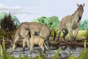
Image received from the American Museum of Natural History shows an artist’s impression of Macrauchenia patachonica, the creature Charles Darwin called the ‘strangest animal ever discovered’
Research led by The Australian National University (ANU) has solved the mystery of how the first animals appeared on Earth, a pivotal moment for the planet without which humans would not exist.
Lead researcher Associate Professor Jochen Brocks said the team found the answer in ancient sedimentary rocks from central Australia.
“We crushed these rocks to powder and extracted molecules of ancient organisms from them,” said Dr Brocks from the ANU Research School of Earth Sciences.
“These molecules tell us that it really became interesting 650 million years ago. It was a revolution of ecosystems, it was the rise of algae.”
Dr Brocks said the rise of algae triggered one of the most profound ecological revolutions in Earth’s history, without which humans and other animals would not exist.
“Before all of this happened, there was a dramatic event 50 million years earlier called Snowball Earth,” he said.
“The Earth was frozen over for 50 million years. Huge glaciers ground entire mountain ranges to powder that released nutrients, and when the snow melted during an extreme global heating event rivers washed torrents of nutrients into the ocean.”
Dr Brocks said the extremely high levels of nutrients in the ocean, and cooling of global temperatures to more hospitable levels, created the perfect conditions for the rapid spread of algae. It was the transition from oceans being dominated by bacteria to a world inhabited by more complex life, he said.
“These large and nutritious organisms at the base of the food web provided the burst of energy required for the evolution of complex ecosystems, where increasingly large and complex animals, including humans, could thrive on Earth,” Dr Brocks said.
The research is published in Nature, and the findings will be presented at the Goldschmidt Conference in Paris, France, this week.
Co-lead researcher Dr Amber Jarrett discovered ancient sedimentary rocks from central Australia that related directly to the period just after the melting of Snowball Earth.
“In these rocks we discovered striking signals of molecular fossils,” said Dr Jarrett, an ANU Research School of Earth Sciences PhD graduate.
“We immediately knew that we had made a ground-breaking discovery that snowball Earth was directly involved in the evolution of large and complex life.”
Reference:
Jochen J. Brocks, Amber J. M. Jarrett, Eva Sirantoine, Christian Hallmann, Yosuke Hoshino, Tharika Liyanage. The rise of algae in Cryogenian oceans and the emergence of animals. Nature, 2017; DOI: 10.1038/nature23457
New geochemical research indicates that existing theories of the formation of the Earth may be mistaken. The results of experiments to show how zinc (Zn) relates to sulphur (S) under the conditions present at the time of the formation of the Earth more than 4 billion years ago, indicate that there is a substantial quantity of Zn in the Earth’s core, whereas previously there had been thought to be none. This implies that the building blocks of the Earth must be different to what has been supposed. The work is presented at the Goldschmidt geochemistry conference in Paris.
The researchers, from the Institut de Physique du Globe de Paris (IPGP) melted mixtures of iron-rich metal and silicate compounds, containing Zn and S, at high temperatures and pressures up to 80 GPa and 4100K* to experimentally simulate core-mantle differentiation at the time of the Earth’s formation. They then measured how these elements were distributed (partitioned) between the core and mantle of their experiments. When they fed their results into computer models of the Earth’s formation, they found that none of the canonical models can sufficiently reproduce the S/Zn ratio of the present-day mantle. This means that the current estimates of the Earth’s composition, including its core, need to be modified, and therefore the way the core and mantle — i.e. the Earth — formed may also need to be revised.
“Most theories are based on the Earth being formed from only two types of stony meteorite, the CI chondrites or enstatite chondrites. However, this new work indicates that the Earth needs to have formed from a more S-poor source; in terms of the geochemistry, the best candidate for this material is the metal rich CH chondrites,” said Brandon Mahan (Institut de Physique du Globe de Paris).
“CH chondrites were first classified in 1985, and only a few dozen examples have been identified. They are rich in metallic iron and poor in easily vaporized elements, which indicates formation at very high temperatures, but they also contain a few percent of water-bearing minerals, which paradoxically indicates low temperatures.
This means that the CH chondrites — much like the Earth — have a very complex formation history which has given them features from both extremes of hot and cold. If our results are valid, this indicates that the building blocks of the Earth may be a bit more exotic than we thought” Existing theories of the Earth’s formation are largely based on geochemistry. One of the major geochemical clues to the Earth’s formation lies in the way elements such as Zn and S in meteorites are associated in a relatively well-known ratio, meaning that if you know the amount of Zn in a meteorite, you can estimate the amount of S. “We decided to test if that ratio was the same for the growing Earth as it is today using various possible source materials.,” said Brandon Mahan.
“We found that under conditions similar to those estimated when the Earth formed, Zn has a tendency to be distributed between the core and mantle differently than we had thought, i.e. there will be a significant amount of it bound up in the Earth’s core. Based on previous models, if we can place more Zn in the core, then by association you place more S in the core as well, much more in fact than most current observations suggest.
Most leading estimates cap the amount of sulphur in the Earth’s core at around 2%. If this is true, then using most known meteorites as a source material for Earth puts the S/Zn ratio of the mantle way above current accepted values, because too much S ends up in the mantle, indicating that perhaps the Earth cannot be made from any of the solar system materials that have previously been proposed as its source material.
But if the building blocks of the Earth were something like the CH Chondrites, this could give us an Earth pretty similar to the one we see today.”
*For comparison, 80GPa is around x1.5 the typical pressure needed to synthesise diamonds. The temperature of the surface of the Sun is around 5800K.
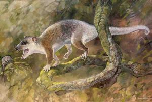
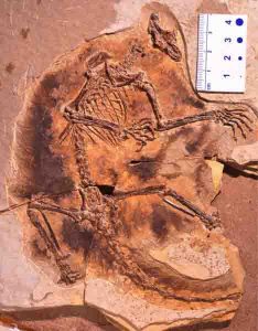
Reconstruction of the Anatoliadelphys maasae. Credit: Peter Schouten
A new marsupial-like carnivorous animal that lived more than 40 million years ago in what is now Turkey may have evolved in the absence of competition from placental mammals, according to a study published August 16, 2017 in the open-access journal PLOS ONE by Murat Maga from University of Washington, US and Robin Beck from University of Salford, UK.
At the beginning of the Cenozoic Era, eutherians (placental mammals and their relatives) coexisted and competed with metatherians (marsupials and their relatives) in both the northern and southern hemispheres. During the Cenozoic, metatherians diversified widely in South America, Antarctica and Australia, but eutherians radiated massively and are thought to have come to outcompete metatherians and dominate the northern hemisphere.
The authors of the present study describe a nearly-complete skull and skeleton of Anatoliadelphys maasae, a cat-sized metatherian from the Uzunçar??dere Formation in Turkey. Analysis of the skeleton indicates that the animal was agile, and able to climb and grasp, perhaps similarly to a modern-day spotted quoll. Its strong jaws and large, broad premolars suggest that it was carnivorous and capable of crushing hard objects—such as bone and hard-shelled invertebrates—which would make it the first known carnivorous metatherian in the northern hemisphere from the Cenozoic Era.
The northern hemisphere had numerous cat-sized carnivorous eutherians during the Cenozoic, which may have competed with A. maasae. However, carnivorous eutherians have yet to be found in the Uzunçar??dere Formation, which was likely an island during this era. This suggests that Anatoliadelphys may have evolved in the absence of eutherian competitors, supporting the hypothesis that eutherians could outcompete metatherians where the two existed side-by-side.
“Anatoliadelphys shows that northern hemisphere metatherians were far more diverse than we previously thought – they weren’t all small insect eaters,” says Robin Beck.
Reference:
Maga AM, Beck RMD (2017) Skeleton of an unusual, cat-sized marsupial relative (Metatheria: Marsupialiformes) from the middle Eocene (Lutetian: 44-43 million years ago) of Turkey. PLoS ONE 12(8): e0181712. DOI: 10.1371/journal.pone.0181712
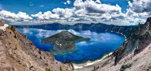
Stanford researchers detail a new method for locating lithium in lake deposits from ancient supervolcanoes, which appear as large holes in the ground that often fill with water to form a lake, such as Crater Lake in Oregon, pictured here. Image credit: Lindsay Snow / Shutterstock
Most of the lithium used to make the lithium-ion batteries that power modern electronics comes from Australia and Chile. But Stanford scientists say there are large deposits in sources right here in America: supervolcanoes.
In a study published today in Nature Communications, scientists detail a new method for locating lithium in supervolcanic lake deposits. The findings represent an important step toward diversifying the supply of this valuable silvery-white metal, since lithium is an energy-critical strategic resource, said study co-author Gail Mahood, a professor of geological sciences at Stanford’s School of Earth, Energy & Environmental Sciences.
“We’re going to have to use electric vehicles and large storage batteries to decrease our carbon footprint,” Mahood said. “It’s important to identify lithium resources in the U.S. so that our supply does not rely on single companies or countries in a way that makes us subject to economic or political manipulation.”
Supervolcanoes can produce massive eruptions of hundreds to thousands of cubic kilometers of magma—up to 10,000 times more than a typical eruption from a Hawaiian volcano. They also produce vast quantities of pumice and volcanic ash that are spread over wide areas. They appear as huge holes in the ground, known as calderas, rather than the cone-like shape typically associated with volcanoes because the enormous loss of magma causes the roof of the chamber to collapse following eruption.
The resulting hole often fills with water to form a lake—Oregon’s Crater Lake is a prime example. Over tens of thousands of years, rainfall and hot springs leach out lithium from the volcanic deposits. The lithium accumulates, along with sediments, in the caldera lake, where it becomes concentrated in a clay called hectorite.
Exploring supervolcanoes for lithium would diversify its global supply. Major lithium deposits are currently mined from brine deposits in high-altitude salt flats in Chile and pegmatite deposits in Australia. The supervolcanoes pose little risk of eruption because they are ancient.
“The caldera is the ideal depositional basin for all this lithium,” said lead author Thomas Benson, a recent PhD graduate at Stanford Earth, who began working on the study in 2012.
Since its discovery in the 1800s, lithium has largely been used in psychiatric treatments and nuclear weapons. Beginning in the 2000s, lithium became the major component of lithium-ion batteries, which today provide portable power for everything from cellphones and laptops to electric cars. Volvo Cars recently announced its commitment to only produce new models of its vehicles as hybrids or battery-powered options beginning in 2019, a sign that demand for lithium-ion batteries will continue to increase.
“We’ve had a gold rush, so we know how, why and where gold occurs, but we never had a lithium rush,” Benson said. “The demand for lithium has outpaced the scientific understanding of the resource, so it’s essential for the fundamental science behind these resources to catch up.”
Working backward
To identify which supervolcanoes offer the best sources of lithium, researchers measured the original concentration of lithium in the magma. Because lithium is a volatile element that easily shifts from solid to liquid to vapor, it is very difficult to measure directly and original concentrations are poorly known.
So, the researchers analyzed tiny bits of magma trapped in crystals during growth within the magma chamber. These “melt inclusions,” completely encapsulated within the crystals, survive the supereruption and remain intact throughout the weathering process. As such, melt inclusions record the original concentrations of lithium and other elements in the magma. Researchers sliced through the host crystals to expose these preserved magma blebs, which are 10 to 100 microns in diameter, then analyzed them with the Sensitive High Resolution Ion Microprobe in the SHRIMP-RG Laboratory at Stanford Earth.
“Understanding how lithium is transported in magmas and what causes a volcanic center to become enriched in lithium has never really systematically been done before,” Benson said.
The team analyzed samples from a range of tectonic settings, including the Kings Valley deposit in the McDermitt volcanic field located on the Nevada-Oregon border, which erupted 16.5 to 15.5 million years ago and is known to be rich in lithium. They compared results from this volcanic center with samples from the High Rock caldera complex in Nevada, Sierra la Primavera in Mexico, Pantelleria in the Strait of Sicily, Yellowstone in Wyoming and Hideaway Park in Colorado, and determined that lithium concentrations varied widely as a function of the tectonic setting of the supervolcano.
“If you have a lot of magma erupting, it doesn’t have to have as much lithium in it to produce something that is worthy of economic interest as we previously thought,” Mahood said. “You don’t need extraordinarily high concentrations of lithium in the magma to form lithium deposits and reserves.”
Improving identification
In addition to exploring for lithium, the researchers analyzed other trace elements to determine their correlations with lithium concentrations. As a result, they discovered a previously unknown correlation that will now enable geologists to identify candidate supervolcanoes for lithium deposits in a much easier way than measuring lithium directly in melt inclusions. The trace elements can be used as a proxy for original lithium concentration. For example, greater abundance of easily analyzed rubidium in the bulk deposits indicates more lithium, whereas high concentrations of zirconium indicate less lithium.
“We can essentially use the zirconium content to determine the lithium content within about 100 parts per million,” Benson said. “Now that we have a way to easily find more of these lithium deposits, it shows that this fundamental geological work can help solve societal problems—that’s really exciting.”
Reference:
“Lithium enrichment in intracontinental rhyolite magmas leads to Li deposits in caldera basins,” Nature Communications (2017). DOI: 10.1038/10.1038/s41467-017-00234-y
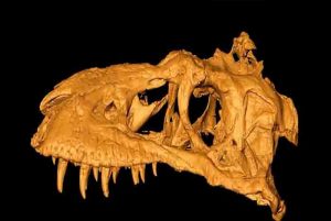
This is a 3-D image of Bistahieversor sealeyi, which was found in the Bisti Badlands in New Mexico and Imaged at Los Alamos’ unique facilities. Credit: Los Alamos National Laboratory
Researchers using Los Alamos’ unique neutron-imaging and high-energy X-ray capabilities have exposed the inner structures of the fossil skull of a 74-million-year-old tyrannosauroid dinosaur nicknamed the Bisti Beast in the highest-resolution scan of tyrannosaur skull ever done. The results add a new piece to the puzzle of how these bone-crushing top predators evolved over millions of years.
“Normally, we look at a variety of thick, dense objects at Los Alamos for defense programs, but the New Mexico Museum of Natural History and Science was interested in imaging a very large fossil to learn about what’s inside,” said Ron Nelson, of the Laboratory’s Physics Division. Nelson was part of a team that included staff from Los Alamos National Laboratory, the museum, the University of New Mexico and the University of Edinburgh. “It turns out that high energy neutrons are an interesting and unique way to image something of this size.”
The results helped the team determine the skull’s sinus and cranial structure. Initial viewing of the computed tomography (CT) slices showed preservation of un-erupted teeth, the brain cavity, internal structure in some bones, sinus cavities, pathways of some nerves and blood vessels, and other anatomical structures. These imaging techniques have revolutionized the study of paleontology over the past decade, allowing paleontologists to gain essential insights into the anatomy, development and preservation of important specimens. Team members will present their findings on the fossil, Bistahieversor sealeyi, August 23 at the annual Society of Vertebrate Paleontology meeting in Calgary, Alberta.
To peer inside the 40-inch skull, which was found in 1996 in the Bisti/De-Na-Zin Wilderness Area near Farmington, N.M. the Los Alamos team combined neutron and X-ray CT to extract anatomical information not accessible otherwise and without the risk of damaging the irreplaceable fossil. Los Alamos is one of a few places in the world that can perform both methods on samples ranging from the very small to the very large scale.
The thickness of the skull required higher energy X-rays than those typically available to adequately penetrate the fossil. The Lab’s microtron electron accelerator produced sufficiently high-energy X-rays.
To provide an alternate view inside the skull, the team also used a newly developed, high-energy neutron imaging technique with neutrons produced by the proton accelerator at the Los Alamos Neutron Science Center (LANSCE). The neutrons interact with the nuclei rather than the electrons in the skull, as X-rays do, and thus have different elemental sensitivity. This provides complementary information to that obtained with X-rays.
The team’s study illuminates the Bisti Beast’s place in the evolutionary tree that culminated in Tyrannosaurus rex.
“The CT scans help us figure out how the different species within the T. rex family related to each other and how they evolved,” said Thomas Williamson, Curator of Paleontology at the New Mexico museum. “The Bistahieversor represents the most basal tyrannosaur to have the big-headed, bone-crushing adaptations and almost certainly the small forelimbs. It was living alongside species more closely related to T. rex, the biggest and most derived tyrannosaur of all, which lived about 66 million years ago. Bistahieversor lived almost 10 million years before T. rex, but it also was a surviving member of a lineage that retained many of the primitive features from even farther back closer to when tyrannosaurs underwent their transition to bone-crushing.”
The Bisti Beast skull is the largest object to date for which full, high-resolution neutron and X-ray CT scans have been performed at the Laboratory and required innovations both to image the entire skull and to handle the image reconstruction from the resulting large data sets.
This work advances the state of the art in imaging capabilities at the Laboratory and is already proving useful in imaging larger programmatic items related to the Laboratory’s national security mission.
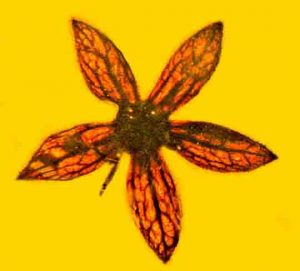
Tropidogyne pentaptera. 100-million-year-old fossilized flower identified and named by OSU researchers George Poinar Jr. and Kenton Chambers. Credit: Image courtesy of George Poinar Jr., Oregon State University
A Triceratops or Tyrannosaurus rex bulling its way through a pine forest likely dislodged flowers that 100 million years later have been identified in their fossilized form as a new species of tree.
George Poinar Jr., professor emeritus in Oregon State University’s College of Science, said it’s the first time seven complete flowers of this age have been reported in a single study. The flowers range from 3.4 to 5 millimeters in diameter, necessitating study under a microscope.
Poinar and collaborator Kenton Chambers, professor emeritus in OSU’s College of Agricultural Sciences, named the discovery Tropidogyne pentaptera based on the flowers’ five firm, spreading sepals; the Greek word for five is “penta,” and “pteron” means wing.
“The amber preserved the floral parts so well that they look like they were just picked from the garden,” Poinar said. “Dinosaurs may have knocked the branches that dropped the flowers into resin deposits on the bark of an araucaria tree, which is thought to have produced the resin that fossilized into the amber. Araucaria trees are related to kauri pines found today in New Zealand and Australia, and kauri pines produce a special resin that resists weathering.”
This study builds on earlier research also involving Burmese amber in which Poinar and Chambers described another species in the same angiosperm genus, Tropidogyne pikei; that species was named for its flower’s discoverer, Ted Pike. Findings were recently published in Paleodiversity.
“The new species has spreading, veiny sepals, a nectar disc, and a ribbed inferior ovary like T. pikei,” Poinar said. “But it’s different in that it’s bicarpellate, with two elongated and slender styles, and the ribs of its inferior ovary don’t have darkly pigmented terminal glands like T. pikei.”
Both species have been placed in the extant family Cunoniaceae, a widespread Southern Hemisphere family of 27 genera.
Poinar said T. pentaptera was probably a rainforest tree.
“In their general shape and venation pattern, the fossil flowers closely resemble those of the genus Ceratopetalum that occur in Australia and Papua-New Guinea,” he said. “One extant species is C. gummiferum, which is known as the New South Wales Christmas bush because its five sepals turn bright reddish pink close to Christmas.”
Another extant species in Australia is the coach wood tree, C. apetalum, which like the new species has no petals, only sepals. The towering coach wood tree grows to heights of greater than 120 feet, can live for centuries and produces lumber for flooring, furniture and cabinetwork.
So what explains the relationship between a mid-Cretaceous Tropidogyne from Myanmar, formerly known as Burma, and an extant Ceratopetalum from Australia, more than 4,000 miles and an ocean away to the southeast?
That’s easy, Poinar said, if you consider the geological history of the regions.
“Probably the amber site in Myanmar was part of Greater India that separated from the southern hemisphere, the supercontinent Gondwanaland, and drifted to southern Asia,” he said. “Malaysia, including Burma, was formed during the Paleozoic and Mesozoic eras by subduction of terranes that successfully separated and then moved northward by continental drift.”
Reference:
George O. Poinar, Kenton L. Chambers. Tropidogyne pentaptera, sp. nov., a new mid-Cretaceous fossil angiosperm flower in Burmese amber. Palaeodiversity, 2017; 10 (1): 135 DOI: 10.18476/pale.v10.a10
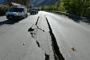
Cracks on the road outside the centre of Norcia, central Italy pictured a day after a 6.5-magnitude earthquake struck on October 30, 2016 . Credit: AFP/Alberto Pizzoli
By simulating earthquakes in a lab, engineers at Caltech have documented the evolution of friction during an earthquake—measuring what could once only be inferred, and shedding light on one of the biggest unknowns in earthquake modeling.
Before an earthquake, static friction helps hold the two sides of a fault immobile and pressed against each other. During the passage of an earthquake rupture, that friction becomes dynamic as the two sides of the fault grind past one another. Dynamic friction evolves throughout an earthquake, affecting how much and how fast the ground will shake and thus, most importantly, the destructiveness of the earthquake.
“Friction plays a key role in how ruptures unzip faults in the earth’s crust,” says Vito Rubino, research scientist at Caltech’s Division of Engineering and Applied Science (EAS). “Assumptions about dynamic friction affect a wide range of earthquake science predictions, including how fast ruptures will occur, the nature of ground shaking, and residual stress levels on faults. Yet the precise nature of dynamic friction remains one of the biggest unknowns in earthquake science.”
Previously, it commonly had been believed that the evolution of dynamic friction was mainly governed by how far the fault slipped at each point as a rupture went by—that is, by the relative distance one side of a fault slides past the other during dynamic sliding. Analyzing earthquakes that were simulated in a lab, the team instead found that sliding history is important but the key long-term factor is actually the slip velocity—not just how far the fault slips, but how fast.
Rubino is the lead author on a paper on the team’s findings that was published in Nature Communications on June 29. He collaborated with Caltech’s Ares Rosakis, the Theodore von Kármán Professor of Aeronautics and Mechanical Engineering at EAS, and Nadia Lapusta, professor of mechanical engineering and geophysics, who has joint appointments with EAS and the Caltech Division of Geological and Planetary Sciences.
The team conducted the research at a Caltech facility, directed by Rosakis, that has been unofficially dubbed the “seismological wind tunnel.” At the facility, researchers use advanced high-speed optical diagnostics and other techniques to study how earthquake ruptures occur.
“Our unique facility allows us to study dynamic friction laws by following individual, fast-moving shear ruptures and recording friction along their sliding faces in real time,” Rosakis says. “This allows us for the first time to study friction point-wise and without having to assume that sliding occurs uniformly, as is done in classical friction studies,” Rosakis adds.
To simulate an earthquake in the lab, the researchers first cut in half a transparent block of a type of plastic known as homalite, which has similar mechanical properties to rock. They then put the two pieces together under pressure, simulating the static friction that builds up along a fault line. Next, they placed a small nickel-chromium wire fuse at the location where they wanted the epicenter of the quake to be. Triggering the fuse produced a local pressure release, which reduced friction at that location, and allowed a very fast rupture to propagate up the miniature fault.
In this study, the team recorded these simulated earthquakes using a new diagnostic method that combines high-speed photography (at 2 million frames per second) with a technique called digital image correlation, in which individual frames are compared and contrasted with one another and changes between those images—indicating motion—are tracked with sub-pixel accuracy.
“Some numerical models of earthquake rupture, including the ones developed in my group at Caltech, have used friction laws with slip-velocity dependence, based on a collection of rock mechanics experiments and theories. It is gratifying to see those formulations validated by the spontaneous mini-earthquake ruptures in our study, ” Lapusta says.
In future work, the team plans to use its observations to improve the existing mathematical models about the nature of dynamic friction and to help create new ones that better represent the experimental observations; such new models would improve computer earthquake simulations.
The study is titled “Understanding dynamic friction through spontaneously evolving laboratory earthquakes.”
Reference:
V. Rubino et al, Understanding dynamic friction through spontaneously evolving laboratory earthquakes, Nature Communications (2017). DOI: 10.1038/ncomms15991
Note: The above post is reprinted from materials provided by California Institute of Technology.
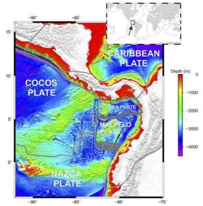
Misfit plates in the Pacific led Rice University scientists to the discovery of the Malpelo Plate between the Galapagos Islands and the South American coast. Credit: Illustration by Tuo Zhang/Rice University
A microplate discovered off the west coast of Ecuador adds another piece to Earth’s tectonic puzzle, according to Rice University scientists.
Researchers led by Rice geophysicist Richard Gordon discovered the microplate, which they have named “Malpelo,” while analyzing the junction of three other plates in the eastern Pacific Ocean.
The Malpelo Plate, named for an island and an underwater ridge it contains, is the 57th plate to be discovered and the first in nearly a decade, they said. They are sure there are more to be found.
The research by Gordon, lead author Tuo Zhang and co-authors Jay Mishra and Chengzu Wang, all of Rice, appears in Geophysical Research Letters.
How do geologists discover a plate? In this case, they carefully studied the movements of other plates and their evolving relationships to one another as the plates move at a rate of millimeters to centimeters per year.
The Pacific lithospheric plate that roughly defines the volcanic Ring of Fire is one of about 10 major rigid tectonic plates that float and move atop Earth’s mantle, which behaves like a fluid over geologic time. Interactions at the edges of the moving plates account for most earthquakes experienced on the planet. There are many small plates that fill the gaps between the big ones, and the Pacific Plate meets two of those smaller plates, the Cocos and Nazca, west of the Galapagos Islands.
One way to judge how plates move is to study plate-motion circuits, which quantify how the rotation speed of each object in a group (its angular velocity) affects all the others. Rates of seafloor spreading determined from marine magnetic anomalies combined with the angles at which the plates slide by each other over time tells scientists how fast the plates are turning.
“When you add up the angular velocities of these three plates, they ought to sum to zero,” Gordon said. “In this case, the velocity doesn’t sum to zero at all. It sums to 15 millimeters a year, which is huge.”
That made the Pacific-Cocos-Nazca circuit a misfit, which meant at least one other plate in the vicinity had to make up the difference. Misfits are a cause for concern — and a clue.
Knowing the numbers were amiss, the researchers drew upon a Columbia University database of extensive multibeam sonar soundings west of Ecuador and Colombia to identify a previously unknown plate boundary between the Galapagos Islands and the coast.
Previous researchers had assumed most of the region east of the known Panama transform fault was part of the Nazca plate, but the Rice researchers determined it moves independently. “If this is moving in a different direction, then this is not the Nazca plate,” Gordon said. “We realized this is a different plate and it’s moving relative to the Nazca.”
Evidence for the Malpelo plate came with the researchers’ identification of a diffuse plate boundary that runs from the Panama Transform Fault eastward to where the diffuse plate boundary intersects a deep oceanic trench just offshore of Ecuador and Colombia.
“A diffuse boundary is best described as a series of many small, hard-to-spot faults rather than a ridge or transform fault that sharply defines the boundary of two plates,” Gordon said. “Because earthquakes along diffuse boundaries tend to be small and less frequent than along transform faults, there was little information in the seismic record to indicate this one’s presence.”
“With the Malpelo accounted for, the new circuit still doesn’t close to zero and the shrinking Pacific Plate isn’t enough to account for the difference either,” Zhang said. “The nonclosure around this triple junction goes down — not to zero, but only to 10 or 11 millimeters a year.
“Since we’re trying to understand global deformation, we need to understand where the rest of that velocity is going,” he said. “So we think there’s another plate we’re missing.”
Plate 58, where are you?
Gordon is the W.M. Keck Professor of Geophysics. Zhang and Wang are Rice graduate students and Mishra is a Rice alumnus.
The National Science Foundation supported the research.
Reference:
Tuo Zhang, Richard G. Gordon, Jay K. Mishra, Chengzu Wang. The Malpelo Plate Hypothesis and Implications for Non-closure of the Cocos-Nazca-Pacific Plate Motion Circuit. Geophysical Research Letters, 2017; DOI: 10.1002/2017GL073704
Note: The above post is reprinted from materials provided by Rice University. Original written by Mike Williams.
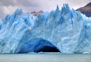
Representative Image: A Glacier cave on Perito Moreno Glacier, in Los Glaciares National Park, southern Argentina. Credit: Martin St-Amant/Wikipedia
West Antarctica’s vast ice sheet conceals what may be the largest volcanic region on earth, research has revealed.
The continent’s ice covers almost 100 newly discovered volcanoes, the largest of which is as tall as the Eiger in Switzerland, a study has found.
Geologists and ice experts say the range has many similarities to East Africa’s volcanic ridge, which is currently acknowledged to be the densest concentration of volcanoes in the world.
Researchers from the University of Edinburgh remotely surveyed the underside of the ice sheet for hidden peaks of basalt rock, like those of other volcanoes in the region whose tips push above the ice.
They analysed the shape of the land beneath the ice using measurements from ice-penetrating radar, and compared the findings with satellite and database records, as well as geological information from aerial surveys.
Scientists found 91 previously unknown volcanoes, ranging in height from 100 to 3850 metres. The peaks are concentrated in a region known as the West Antarctic Rift System, spanning 3,500 kilometres from Antarctica’s Ross Ice Shelf to the Antarctic Peninsula.
Results from the study, which is the first of its kind, will help scientists understand how volcanoes can influence long-term fluctuations in the ice sheet. They could also help improve understanding of how the continent has changed during past climates.
Their results do not indicate whether the volcanoes are active, but should inform ongoing research into seismic monitoring in the area. Volcanic activity may increase if Antarctica’s ice thins, which is likely in a warming climate, scientists say.
Previous studies and the concentration of volcanoes found in the region together suggest that activity may have occurred in previous warmer periods.
The study, published in the Geological Society Special Publications series, was proposed by a third-year undergraduate student at the University of Edinburgh.
Dr Robert Bingham, of the University of Edinburgh’s School of GeoSciences, said: “It is fascinating to uncover an extensive range of volcanoes in this relatively unexplored continent. Better understanding of volcanic activity could shed light on their impact on Antarctica’s ice in the past, present and future, and on other rift systems around the world.”
Max Van Wyk de Vries, a student at the University of Edinburgh’s School of GeoSciences, who conceived the study, said: “Antarctica remains among the least studied areas of the globe, and as a young scientist I was excited to learn about something new and not well understood. After examining existing data on West Antarctica, I began discovering traces of volcanism. Naturally I looked into it further, which led to this discovery of almost 100 volcanoes under the ice sheet.”
Reference:
Maximillian van Wyk de Vries, Robert G. Bingham, Andrew S. Hein. A new volcanic province: an inventory of subglacial volcanoes in West Antarctica. Geological Society, London, Special Publications, 2017; SP461.7 DOI: 10.1144/SP461.7
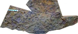
Newly-described fossil shows how brittle stars evolved in response to pressure from predators, and how an ‘evolutionary hangover’ managed to escape them.
Researchers have described a new species of brittle star, which are closely related to starfish, and showed how these sea creatures evolved in response to the rise of shell-crushing predators during the late Palaeozoic Era. The results, reported in the Journal of Systematic Palaeontology, also suggest that brittle stars evolved new traits before the largest mass extinction event in Earth’s history, and not after, as was the case with many other forms of life.
A fossilised ‘meadow’ of dancing brittle stars — frozen in time in the very spot that they lived — was found in Western Australia and dates from 275 million years ago. It contains several remarkably preserved ‘archaic’ brittle stars, a newly-described genus and species called Teleosaster creasyi. They are the last known complete brittle stars of their kind, an evolutionary hangover pushed to the margins of the world’s oceans by the threat from predators.
The researchers, from the University of Cambridge, suggest that while other species of brittle stars evolved in response to predators such as early forms of rays and crabs, these archaic forms simply moved to where the predators weren’t — namely the seas around Australia, which during the Palaeozoic era was pushed up against Antarctica. In these cold, predator-free waters, the archaic forms were able to grow much larger, and lived at the same time as the modern forms of brittle star, which still exist today.
Brittle stars consist of a central disc and five whip-like appendages, which are used for locomotion. They first appear in the fossil record about 500 million years ago, in the Ordovician Period, and today there are about 2,100 different species, mostly found in the deep ocean.
Early brittle stars were just that: brittle. During the Palaeozoic Era, when early shell-crushing predators first appeared, brittle stars made for easy prey. At this point, a split in the evolutionary tree appears to have occurred: the archaic, clunky brittle stars moved south to polar waters, while the modern form first began to emerge in response to the threat from predators, and was able to continue to live in the warmer waters closer to the equator. Both forms existed at the same time, but in different parts of the ocean.
“The threat from predation is an under-appreciated driver of evolutionary change,” said study co-author Dr Kenneth McNamara of Cambridge’s Department of Earth Sciences. “As more predators began to appear, the brittle stars started to evolve more flexible bodies, which enabled them to either burrow into the sediment, or to move more rapidly to escape.”
About 250 million years ago, the greatest mass extinction in Earth’s history — the Permian-Triassic extinction event, or the “Great Dying” — occurred. More than 90% of marine species and 70% of terrestrial species went extinct, and as a result, most surviving species underwent major evolutionary changes as a result.
“Brittle stars appear to have bucked this trend, however,” said co-author Dr Aaron Hunter, a visiting postdoctoral researcher in the Department of Earth Sciences. “They seem to have evolved before the Great Dying, into a form which we still see today.”
Meadows of brittle stars and other invertebrates such as sea urchins and starfish can still be seen today in the seas around Antarctica. As was the case during the Palaeozoic, the threat from predators is fairly low, although the warming of the Antarctic seas due to climate change has been linked to the recent arrival of armies of king crabs, which represent a real threat to these star-filled meadows.
Reference:
Aaron W. Hunter and Kenneth J. McNamara. Prolonged co-existence of “Archaic” and “Modern” Palaeozoic ophiuroids – evidence from the early Permian, Southern Carnarvon Basin, Western Australia. Journal of Systematic Palaeontology, 2017. DOI: 10.1080/14772019.2017.1353549
Note: The above post is reprinted from materials provided by University of Cambridge. The original story is licensed under a Creative Commons License.
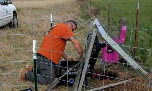
Isaac Woelfel of the Oklahoma Geological Survey installs a temporary seismometer near Quartz Mountain, OK. Scientists continue to evaluate the effects of reductions in wastewater injections on seismic activity in Oklahoma. Credit: Jacob Walter, OGS
The disposal of wastewater from oil and gas production by injecting it deep into the ground has been linked to a dramatic increase in earthquake activity in Oklahoma since 2009. Injection rates have declined recently because of regulatory actions and market forces, but seismologists say that has not yet significantly reduced the risk of potentially damaging earthquakes.
A new analysis led by seismologists at UC Santa Cruz, published August 9 in Science Advances, found that the probability of moderate earthquakes this year in the affected areas of Oklahoma is two times higher than was suggested by an earlier analysis. The earlier study, published in November 2016, predicted that reduced wastewater injection would lead to substantially less seismic activity, with widely felt earthquakes of magnitude 3 or more decreasing significantly by the end of 2016 and approaching historic levels within a few years.
“Although they were correct in saying that small earthquakes seemed to be decreasing, the moderate earthquakes are not decreasing. The problem has not been resolved to where we can stop worrying about it,” said coauthor Emily Brodsky, professor of Earth and planetary sciences at UC Santa Cruz.
As if to underscore the new findings, central Oklahoma experienced a series of earthquakes last week, including a magnitude 4.2 temblor Wednesday night (August 2) that knocked out power in Edmond, near Oklahoma City. State seismologist Jacob Walter, a coauthor of the new paper, said it was the fourth earthquake of magnitude 4 or greater in 2017. The rate of such earthquakes is somewhat lower than in 2016, he said, but they continue to pose a hazard.
“There is still a significant seismic hazard in Oklahoma, and it’s not going to taper off as fast as the earlier paper suggested,” Walter said.
First author Thomas Goebel, a postdoctoral fellow at UC Santa Cruz, said his interest was piqued by some strong statements in the earlier paper, such as the prediction that seismicity would fall to historic levels within a few years, which he found puzzling. He noted that there were two large earthquakes in late 2016, the magnitude 5.8 Pawnee and magnitude 5.0 Cushing earthquakes, and these and other large earthquakes occurred when injection rates were relatively low.
Given the important implications regarding seismic hazards, Goebel and Brodsky decided to take a closer look at the original data and do their own analysis. For expertise on the seismic conditions in Oklahoma, they worked with Walter and a hydrogeologist with the Oklahoma Geological Survey, Kyle Murray.
The researchers used the same statistical model of injection-induced seismicity that was used in the earlier paper, but their analysis suggested a much higher probability of moderate earthquakes in 2017 (80 percent versus 37 percent). They also found no evidence suggesting that earthquake probabilities would be as low as historic values by 2025.
Walter said the Oklahoma Geological Survey is continuing to evaluate the effects of the reductions in wastewater injections. He noted that studies of injection-induced seismicity have found that there can be a substantial lag between injections and the occurrence of earthquakes. “If there’s a lag in the occurrence of induced earthquakes, we expect there might be a similar lag in any effects of a reduction in injections,” Walter said.
Reference:
T.H.W. Goebel el al., “Comment on ‘How will induced seismicity in Oklahoma respond to decreased saltwater injection rates?’ by C. Langenbruch and M. D. Zoback,” Science Advances (2017). DOI: 10.1126/sciadv.1700441
Photograph of the fossil of gliding mammaliaform Maiopatagium furculiferum (type specimen from Beijing Museum of Natural History BMNH 2940). Credit: Zhe-Xi Luo/UChicago
Two 160 million-year-old mammal fossils discovered in China show that the forerunners of mammals in the Jurassic Period evolved to glide and live in trees. With long limbs, long hand and foot fingers, and wing-like membranes for tree-to-tree gliding, Maiopatagium furculiferum and Vilevolodon diplomylos are the oldest known gliders in the long history of early mammals.
The new discoveries suggest that the volant, or flying, way of life evolved among mammalian ancestors 100 million years earlier than the first modern mammal fliers. The fossils are described in two papers published this week in Nature by an international team of scientists from the University of Chicago and Beijing Museum of Natural History.
“These Jurassic mammals are truly ‘the first in glide,'” said Zhe-Xi Luo, PhD, professor of organismal biology and anatomy at the University of Chicago and an author on both papers. “In a way, they got the first wings among all mammals.”
“With every new mammal fossil from the Age of Dinosaurs, we continue to be surprised by how diverse mammalian forerunners were in both feeding and locomotor adaptations. The groundwork for mammals’ successful diversification today appears to have been laid long ago,” he said.
Adaptations in anatomy, lifestyle and diet
The ability to glide in the air is one of the many remarkable adaptations in mammals. Most mammals live on land, but volant mammals, including flying squirrels and bats that flap bird-like wings, made an important transition between land and aerial habitats. The ability to glide between trees allowed the ancient animals to find food that was inaccessible to other land animals. That evolutionary advantage can still be seen among today’s mammals such as flying squirrels in North America and Asia, scaly-tailed gliders of Africa, marsupial sugar gliders of Australia and colugos of Southeast Asia.
The Jurassic Maiopatagium and Vilevolodon are stem mammaliaforms, long-extinct relatives of living mammals. They are haramiyidans, an entirely extinct branch on the mammalian evolutionary tree, but are considered to be among forerunners to modern mammals. Both fossils show the exquisitely fossilized, wing-like skin membranes between their front and back limbs. They also show many skeletal features in their shoulder joints and forelimbs that gave the ancient animals the agility to be capable gliders. Evolutionarily, the two fossils, discovered in the Tiaojishan Formation northeast of Beijing, China, represent the earliest examples of gliding behavior among extinct mammal ancestors.
The two newly discovered creatures also share similar ecology with modern gliders, with some significant differences. Today, the hallmark of most mammal gliders is their herbivorous diet that typically consists of seeds, fruits and other soft parts of flowering plants.
But Maiopatagium and Vilevolodon lived in a Jurassic world where the plant life was dominated by ferns and gymnosperm plants like cycads, gingkoes and conifers — long before flowering plants came to dominate in the Cretaceous Period, and their way of life was also associated with feeding on these entirely different plants. This distinct diet and lifestyle evolved again some 100 million years later among modern mammals, in examples of convergent evolution and ecology.
“It’s amazing that the aerial adaptions occurred so early in the history of mammals,” said study co-author David Grossnickle, a graduate student at the University of Chicago. “Not only did these fossils show exquisite fossilization of gliding membranes, their limb, hand and foot proportion also suggests a new gliding locomotion and behavior.”
Thriving among dinosaurs
Early mammals were once thought to have differences in anatomy from each other, with limited opportunities to inhabit different environments. The new glider fossils from the dinosaur-dominated Jurassic Period, along with numerous other fossils described by Luo and colleagues in the last 10 years, however, provide strong evidence that ancestral mammals adapted to their wide-ranging environments despite competition from dinosaurs.
“Mammals are more diverse in lifestyles than other modern land vertebrates, but we wanted to find out whether early forerunners to mammals had diversified in the same way,” Luo said. “These new fossil gliders are the first winged mammals, and they demonstrate that early mammals did indeed have a wide range of ecological diversity, which means dinosaurs likely did not dominate the Mesozoic landscape as much as previously thought.”
Reference:
Qing-Jin Meng, David M. Grossnickle, Di Liu, Yu-Guang Zhang, April I. Neander, Qiang Ji, Zhe-Xi Luo. New gliding mammaliaforms from the Jurassic. Nature, 2017; DOI: 10.1038/nature23476
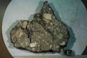
The Apollo 15 moon rock sample, which was analyzed by MIT and Rutgers University researchers, consists of basalt fragments welded together by a dark glassy matrix that was produced by melting from a meteorite impact. The black scale cube is 1 centimeter across. Credit: NASA
New evidence from ancient lunar rocks suggests that an active dynamo once churned within the molten metallic core of the moon, generating a magnetic field that lasted at least 1 billion years longer than previously thought. Dynamos are natural generators of magnetic fields around terrestrial bodies, and are powered by the churning of conducting fluids within many stars and planets. In a paper published today in Science Advances, researchers from MIT and Rutgers University report that a lunar rock collected by NASA’s Apollo 15 mission exhibits signs that it formed 1 to 2.5 billion years ago in the presence of a relatively weak magnetic field of about 5 microtesla. That’s around 10 times weaker than Earth’s current magnetic field but still 1,000 times larger than fields in interplanetary space today.
Several years ago, the same researchers identified 4-billion-year-old lunar rocks that formed under a much stronger field of about 100 microtesla, and they determined that the strength of this field dropped off precipitously around 3 billion years ago. At the time, the researchers were unsure whether the moon’s dynamo — the related magnetic field — died out shortly thereafter or lingered in a weakened state before dissipating completely.
The results reported today support the latter scenario: After the moon’s magnetic field dwindled, it nonetheless persisted for at least another billion years, existing for a total of at least 2 billion years.
Study co-author Benjamin Weiss, professor of planetary sciences in MIT’s Department of Earth, Atmospheric and Planetary Sciences (EAPS), says this new extended lifetime helps to pinpoint the phenomena that powered the moon’s dynamo. Specifically, the results raise the possibility of two different mechanisms — one that may have driven an earlier, much stronger dynamo, and a second that kept the moon’s core simmering at a much slower boil toward the end of its lifetime.
“The concept of a planetary magnetic field produced by moving liquid metal is an idea that is really only a few decades old,” Weiss says. “What powers this motion on Earth and other bodies, particularly on the moon, is not well-understood. We can figure this out by knowing the lifetime of the lunar dynamo.”
Weiss’ co-authors are lead author Sonia Tikoo, a former MIT graduate student who is now an assistant professor at Rutgers; David Shuster of the University of California at Berkeley; Clément Suavet and Huapei Wang of EAPS; and Timothy Grove, the R.R. Schrock Professor of Geology and associate head of EAPS.
Apollo’s glassy recorders
Since NASA’s Apollo astronauts brought back samples from the lunar surface, scientists have found some of these rocks to be accurate “recorders” of the moon’s ancient magnetic field. Such rocks contain thousands of tiny grains that, like compass needles, aligned in the direction of ancient fields when the rocks crystallized eons ago. Such grains can give scientists a measure of the moon’s ancient field strength.
Until recently, Weiss and others had been unable to find samples much younger than 3.2 billion years old that could accurately record magnetic fields. As a result, they had only been able to gauge the strength of the moon’s magnetic field between 3.2 and 4.2 billion years ago.
“The problem is, there are very few lunar rocks that are younger than about 3 billion years old, because right around then, the moon cooled off, volcanism largely ceased and, along with it, formation of new igneous rocks on the lunar surface,” Weiss explains. “So there were no young samples we could measure to see if there was a field after 3 billion years.”
There is, however, a small class of rocks brought back from the Apollo missions that formed not from ancient lunar eruptions but from asteroid impacts later in the moon’s history. These rocks melted from the heat of such impacts and recrystallized in orientations determined by the moon’s magnetic field.
Weiss and his colleagues analyzed one such rock, known as Apollo 15 sample 15498, which was originally collected on Aug. 1, 1971, from the southern rim of the moon’s Dune Crater. The sample is a mix of minerals and rock fragments, welded together by a glassy matrix, the grains of which preserve records of the moon’s magnetic field at the time the rock was assembled.
“We found that this glassy material that welds things together has excellent magnetic recording properties,” Weiss says.
Baking rocks
The team determined that the rock sample was about 1 to 2.5 billion years old — much younger than the samples they previously analyzed. They developed a technique to decipher the ancient magnetic field recorded in the rock’s glassy matrix by first measuring the rock’s natural magnetic properties using a very sensitive magnetometer.
They then exposed the rock to a known magnetic field in the lab, and heated the rock to close to the extreme temperatures in which it originally formed. They measured how the rock’s magnetization changed as they increased the surrounding temperature.
“You see how magnetized it gets from getting heated in that known magnetic field, then you compare that field to the natural magnetic field you measured beforehand, and from that you can figure out what the ancient field strength was,” Weiss explains.
The researchers did have to make one significant adjustment to the experiment to better simulate the original lunar environment, and in particular, its atmosphere. While the Earth’s atmosphere contains around 20 percent oxygen, the moon has only imperceptible traces of the gas. In collaboration with Grove, Suavet built a customized, oxygen-deprived oven in which to heat the rocks, preventing them from rusting while at the same time simulating the oxygen-free environment in which the rocks were originally magnetized.
“In this way, we finally have gotten an accurate measurement of the lunar field,” Weiss says.
From ice cream makers to lava lamps
From their experiments, the researchers determined that, around 1 to 2.5 billion years ago, the moon harbored a relatively weak magnetic field, with a strength of about 5 microtesla — two orders of magnitude weaker than the moon’s field around 3 to 4 billion years ago. Such a dramatic dip suggests to Weiss and his colleagues that the moon’s dynamo may have been driven by two distinct mechanisms.
Scientists have proposed that the moon’s dynamo may have been powered by the Earth’s gravitational pull. Early in its history, the moon orbited much closer to the Earth, and the Earth’s gravity, in such close proximity, may have been strong enough to pull on and rotate the rocky exterior of the moon. The moon’s liquid center may have been dragged along with the moon’s outer shell, generating a very strong magnetic field in the process.
It’s thought that the moon may have moved sufficiently far away from the Earth by about 3 billion years ago, such that the power available for the dynamo by this mechanism became insufficient. This happens to be right around the time the moon’s magnetic field strength dropped. A different mechanism may have then kicked in to sustain this weakened field. As the moon moved away from the Earth, its core likely sustained a low boil via a slow process of cooling over at least 1 billion years.
“As the moon cools, its core acts like a lava lamp — low-density stuff rises because it’s hot or because its composition is different from that of the surrounding fluid,” Weiss says. “That’s how we think the Earth’s dynamo works, and that’s what we suggest the late lunar dynamo was doing as well.”
The researchers are planning to analyze even younger lunar rocks to determine when the dynamo died off completely.
“Today the moon’s field is essentially zero,” Weiss says. “And we now know it turned off somewhere between the formation of this rock and today.”
This research was supported, in part, by NASA.
Reference:
Sonia M. Tikoo, Benjamin P. Weiss, David L. Shuster, Clément Suavet, Huapei Wang and Timothy L. Grove. A two-billion-year history for the lunar dynamo. Science Advances, 2017 DOI: 10.1126/sciadv.1700207
Small, seemingly insignificant mutations in fruit flies may actually hold clues as to how a species will evolve tens of millions of years in the future.
That’s the focus of a new study by a Florida State University researcher who raised 200 generations of fruit flies to examine how they changed both in the short and long term. What he found was quite surprising.
Small mutations in the wing of fruit flies — the drosophilids — predict up to 40 million years of evolution for this common household pest. The research was published in the journal Nature.
“The main point is mutation that’s happening now affects long-term evolution,” said Professor of Biological Science David Houle. “How this happens is not clear. Some scientists believe that the supply of mutation is what guides evolution. Others have suggested that the same processes that shape long-term evolution also shape mutation.”
Houle set out to investigate if there were parts of the fruit fly that couldn’t mutate or evolve and how quickly other parts did so.
“We wanted to see how the effects that mutation produces are related to evolution,” Houle said. “We were surprised that there was a very tight relationship.”
Fruit flies are considered an ideal species for scientists to investigate unsolved problems in evolution and genetics because it is easy to breed more than 20 generations each year. Their wings are also easy to measure, so scientists can easily identify even small changes.
“It’s a convenient system to investigate complex parts of an organism,” Houle said. “I’ve always been interested in evolutionary process, what’s going on and what’s limiting it. It’s the nuts and bolts.”
By examining fossil evidence and conducting DNA sequencing, Houle and his colleagues knew that fruit flies had been around for roughly 40 million years old. They also suspected that the pattern of mutation could have remained constant over that time period.
“It is often true that some things evolve very slowly, and it’s reasonable to conclude that mutational pattern may be one of those things,” he said. “The important thing is that the pattern of past evolution did not necessarily have to be similar to mutation. We are surprised at how similar they are.”
To measure the rate of mutation and evolution, Houle and co-author Kim van der Linde of the Tallahassee-based Animal Genetics Inc. gathered almost 120 different species of flies either by collecting them from nature or obtaining them from other scientists. Van der Linde studied how these flies were related to each other.
Houle then raised 200 generations of fruit flies — it takes four years to breed that many generations — and then individually raised some of the flies to see what, if any, changes occurred in the wings of the flies. In total, the researchers measured more than 50,000 fly wings in the course of this study and found changes in the overall shape of the wing, such as the ratio of width to length and vein locations.
Some types of changes evolved at a higher rate than others, such as the ratio of wing width and length. These evolutionary changes were also the most common mutational changes.
Through these observations and sophisticated statistical modeling, Houle and his team were able to determine that the small mutational changes occurred in the same pattern as evolution throughout the entire group of fly species.
The findings are likely applicable to how other plants and animal species evolved, Houle said. But they also are predictive of the next 40 million years of evolution as well, he added.
“What we are doing is more accurately known as a retrodiction — using something from the present to predict past events,” Houle said. “Of course, we can now make a prediction that Drosophila will evolve in this pattern in the future, as well.”
Reference:
David Houle, Geir H. Bolstad, Kim van der Linde, Thomas F. Hansen. Mutation predicts 40 million years of fly wing evolution. Nature, 2017; DOI: 10.1038/nature23473
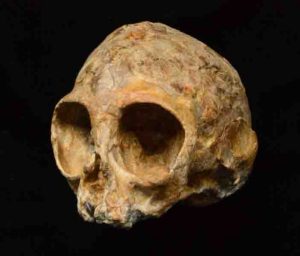
This is Alesi, the skull of the new extinct ape species Nyanzapithecus alesi (KNM-NP 59050). Credit: Fred Spoor
The discovery in Kenya of a remarkably complete fossil ape skull reveals what the common ancestor of all living apes and humans may have looked like. The find, announced in the scientific journal Nature on August 10th, belongs to an infant that lived about 13 million years ago. The research was done by an international team led by Isaiah Nengo of Stony Brook University-affiliated Turkana Basin Institute and De Anza College, U.S.A.
Among living primates, humans are most closely related to the apes, including chimpanzees, gorillas, orangutans and gibbons. Our common ancestor with chimpanzees lived in Africa 6 to 7 million years ago, and many spectacular fossil finds have revealed how humans evolved since then.
In contrast, little is known about the evolution of the common ancestors of living apes and humans before 10 million years ago. Relevant fossils are scarce, consisting mostly of isolated teeth and partial jaw bones. It has therefore been difficult to find answers to two fundamental questions: Did the common ancestor of living apes and humans originate in Africa, and what did these early ancestors look like?
Now these questions can be more fully addressed because the newly discovered ape fossil, nicknamed Alesi by its discoverers, and known by its museum number KNM-NP 59050, comes from a critical time period in the African past. In 2014, it was spotted by Kenyan fossil hunter John Ekusi in 13 million-year-old rock layers in the Napudet area, west of Lake Turkana in northern Kenya. “The Napudet locality offers us a rare glimpse of an African landscape 13 million years ago,” says Craig S. Feibel of Rutgers University-New Brunswick. “A nearby volcano buried the forest where the baby ape lived, preserving the fossil and countless trees. It also provided us with the critical volcanic minerals by which we were able to date the fossil.”
The fossil is the skull of an infant, and it is the most complete extinct ape skull known in the fossil record. Many of the most informative parts of the skull are preserved inside the fossil, and to make these visible the team used an extremely sensitive form of 3D X-ray imaging at the synchrotron facility in Grenoble, France. “We were able to reveal the brain cavity, the inner ears and the unerupted adult teeth with their daily record of growth lines,” says Paul Tafforeau of the European Synchrotron Radiation Facility. “The quality of our images was so good that we could establish from the teeth that the infant was about 1 year and 4 months old when it died.”
The unerupted adult teeth inside the infant ape’s skull also indicate that the specimen belonged to a new species, Nyanzapithecus alesi. The species name is taken from the Turkana word for ancestor “ales.” “Until now, all Nyanzapithecus species were only known from teeth and it was an open question whether or not they were even apes,” notes John Fleagle of Stony Brook University. “Importantly, the cranium has fully developed bony ear tubes, an important feature linking it with living apes,” adds Ellen Miller of Wake Forest University.
Alesi’s skull is about the size of a lemon, and with its notably small snout it looks most like a baby gibbon. “This gives the initial impression that it is an extinct gibbon,” observes Chris Gilbert of Hunter College, New York. “However, our analyses show that this appearance is not exclusively found in gibbons, and it evolved multiple times among extinct apes, monkeys, and their relatives.”
That the new species was certainly not gibbon-like in the way it behaved could be shown from the balance organ inside the inner ears. “Gibbons are well known for their fast and acrobatic behavior in trees,” says Fred Spoor of University College London and the Max Planck Institute of Evolutionary Anthropology, “but the inner ears of Alesi show that it would have had a much more cautious way of moving around.”
“Nyanzapithecus alesi was part of a group of primates that existed in Africa for over 10 million years,” concludes lead author Isaiah Nengo. “What the discovery of Alesi shows is that this group was close to the origin of living apes and humans and that this origin was African.”
Reference:
Isaiah Nengo, Paul Tafforeau, Christopher C. Gilbert, John G. Fleagle, Ellen R. Miller, Craig Feibel, David L. Fox, Josh Feinberg, Kelsey D. Pugh, Camille Berruyer, Sara Mana, Zachary Engle, Fred Spoor. New infant cranium from the African Miocene sheds light on ape evolution. Nature, 2017; 548 (7666): 169 DOI: 10.1038/nature23456
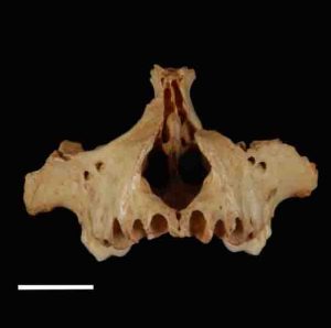
The roof of the mouth of X. mcgregori. Credit: Siobhán Cooke, Johns Hopkins Medicine
Radiocarbon dating of a fossilized leg bone from a Jamaican monkey called Xenothrix mcgregori suggests it may be the one of the most recent primate species anywhere in the world to become extinct, and it may solve a long-standing mystery about the cause of its demise. The short answer: human settlement of its island home.
Though the team of specialists who conducted the study says its evidence is indirect, it is consistent with the idea that humans sped the species’ extinction through some combination of predation, competition for resources, habitat destruction and introduction of invasive species.
“Understanding how this extinction happened and what role humans may have played could help us understand how extinctions are progressing today and what we can do to prevent them,” says Siobhán Cooke, M.Phil., Ph.D., assistant professor of functional anatomy and evolution at the Johns Hopkins University School of Medicine and lead author of the study, described online in the Journal of Mammalogy on August 1.
Cooke says the evidence supports the idea that the monkeys survived longer than monkey species on other Caribbean islands — long enough to have overlapped with the arrival of native people from South America, around 800 A.D.
According to fossil evidence, small primates — a group of mammals that includes humans and our closest monkey relatives — first arrived in Jamaica during the Miocene (23 million to 25 million years ago), probably on mats of vegetation that can form during major weather events, like hurricanes, that could have carried them from the American mainland. Once on the island, they began adapting to its habitat, which was likely free of major predators and competition for resources, since rodents were the only other mammals on the island. They probably grew in size over time, becoming stouter than South American mainland monkeys but remaining under about 11 pounds (5 kilograms) in weight. According to previously studied fossilized teeth and other bones first found in island caves in 1920, the monkeys likely survived on fruit and nuts, had long tails, and lived in trees, hanging from the branches like sloths.
Clues to the animals’ extinction emerged during the 1990s, when Ross MacPhee of the American Museum of Natural History discovered a new set of bones — cranial specimens and a leg bone — in a cave on the southern coast of Jamaica.
In the new study, a collaborator with Cooke, John Southon of the University of California, Irvine, used radiocarbon dating on a fragment of that leg bone to estimate that the monkey died 1,477 plus or minus 34 years ago, or somewhere between 505 and 573 A.D.
Cooke and her colleagues then put that date in the context of all other radiocarbon dates from Jamaica. “These new radiocarbon data make X. mcgregori the longest-surviving Caribbean primate, at least as far as we know,” says Cooke. “And its extinction was one of the most recent for any primate worldwide.”
In addition, Cooke says that X. mcgregori probably survived long enough to overlap on the island with non-European humans, whose archeological remains suggest they had already arrived from the American continent at least 1,208 plus or minus 121 years ago, or between 687 and 929 A.D.
“We already knew that these monkeys lived in the same area as the humans because remains of both have been found in the same caves,” says Cooke. “What we couldn’t be sure of is whether they overlapped in time, but the new study suggests they did.”
Other archeological and fossil evidence, Cooke says, suggests the earliest human populations in Jamaica were foragers who lived off of available local resources, together with some cultivation of native island and mainland plants.
And although there is no direct evidence — like cut marks on monkey bones or monkey bones found in trash heaps — of humans hunting the monkeys for food, Cooke says that in addition to hunting, the clearing of land for farming and the introduction of invasive species can all put a deadly strain on native island populations, which are adapted to a very specific environment and have nowhere else to go.
“At this time, we can’t say how much of a role humans played in the extinction of X. mcgregori on Jamaica, but the timing is too coincidental for there to be no role,” says Cooke.
Reference:
Siobhán B Cooke, Alexis M Mychajliw, John Southon, Ross D E MacPhee. The extinction of Xenothrix mcgregori, Jamaica’s last monkey. Journal of Mammalogy, 2017; 98 (4): 937 DOI: 10.1093/jmammal/gyw165
Amateur collectors in Japan are credited with the discovery of the country’s first and oldest fossil diving bird. Identified as a new species, it has been named Chupkaornis keraorum. Credit: Masato Hattori
During a walk near a reservoir in a small Japanese town, amateur collectors made the discovery of their lives – the first and oldest fossil bird ever identified in their country.
After sharing their mysterious find with paleontologists at Hokkaido University, brothers Masatoshi and Yasuji Kera later learned the skeletal remains were that of an iconic marine diving bird from the Late Cretaceous Period, one that is often found in the Northern Hemisphere but rarely in Asia. The remarkable specimen – which includes nine skeletal elements from one individual, including the thoracic vertebrae and the femoral bones – is being heralded as the “best preserved hesperornithiform material from Asia” and to be “the first report of the hesperorinthiforms from the eastern margin of the Eurasian Continent.”
Identified as a new species, it has been named Chupkaornis keraorum – Chupka is the Ainu word used by indigenous people from Hokkaido for ‘eastern,’ and keraorum is named after Masatoshi and Yasuji Kera, who discovered the specimen. The bird would have lived during the time when dinosaurs roamed the land.
The scientific paper describing the find – entitled “The oldest Asian Hesperornithiform from the Upper Cretaceous of Japan, and the phylogenetic reassessment of Hesperornithiformes” – has been posted today on the Journal of Systematic Palaeontology website, an internationally renowned, peer-reviewed journal published by the Trustees of the Museum of Natural History, London. The co-authors of the report are Tomonori Tanaka, Ph.D. student, Department of Natural History Sciences, Hokkaido University; Yoshitsugu Kobayashi, Ph.D., Hokkaido University Museum; Ken’ichi Kurihara, Ph.D., Hokkaido Museum; Anthony R. Fiorillo, Ph.D., Perot Museum of Nature and Science, Dallas, Texas, USA; and Manabu Kano, Ph.D., Mikasa City Museum.
“This amazing find illustrates the special relationship paleontologists and other scientists have with ordinary citizens who come upon interesting and unusual objects,” said Tanaka. “Thanks to the wisdom and willingness of Masatoshi and Yasuji Kera to share their discovery with us at Hokkaido University, they have made a major contribution to science, and we are very grateful.”
The bones, estimated to be anywhere from 90 million to 84 million years old, were unearthed from the Upper Cretaceous Kashima Formation of the Yezo Group in Mikasa City, Hokkaido. The fossil bird consists of four cervical vertebrae, two thoracic vertebrae, the distal end of the left and right femora, and the middle part of the right fibula. The specimen is currently housed in the collection of the Mikasa City Museum in Hokkaido, Japan.
“Hespeornithiforms is the oldest group of birds that succeeded to adapt for diving in ocean. This study provides better understanding in the early evolution of this group and the origin of diving in birds,” added Tanaka.
Chupkaornis has a unique combination of characteristics: finger-like projected tibiofibular crest of femur; deep, emarginated lateral excavation with the sharply defined edge of the ventral margin of that the thoracic vertebrae (those vertebrae in the upper back); and the heterocoelous articular surface of the thoracic vertebrae. Phylogenetic analysis of this study revealed that Chupkaornis is one of the basal hesperornithiforms, thereby providing details of the evolution of this iconic group of diving birds.
“In Japan, many important vertebrate fossils have been discovered by amateurs because most of the land is covered with vegetation, and there are few exposures of fossil-bearing Cretaceous rocks. This research is a result of collaboration with amateurs, and I am thankful to their help and understanding of science,” said Kobayashi.
Hesperornithiformes were toothed, foot-propelled diving birds and one of the most widely distributed groups of birds in the Cretaceous of the northern hemisphere. These birds had extremely reduced forelimbs and powerful hind limbs, suggesting that they were flightless sea-going predatory birds. Most of hesperornithiform fossils have been discovered from North America so far. The discovery of Chupkaornis, the oldest Asian hesperornithiform, suggests that basal hesperornithiform had dispersed to the eastern margin of Asia no later than 90 million to 84 million years old.
The discovery has broader aspects – and that’s why Dr. Fiorillo, curator and vice president of research and collections at the Perot Museum of Nature and Science, is involved. Dr. Fiorillo is considered one of the world’s preeminent experts on arctic dinosaurs for his decades of research in Alaska. He has deep interest in the Beringia land bridge that connects North America to Asia. He was asked to collaborate on this discovery because several of the co-authors of the paper, including Kobayashi and lead-author Tanaka, have been members of his field team during past Alaska expeditions.
“This study not only tells important new information about the evolution of this unusual group of birds, it also helps further our understanding of life in the ancient northern Pacific region, more specifically what was going on in the ocean while dinosaurs walked the land” said Fiorillo.
Reference:
Tomonori Tanaka et al, The oldest Asian hesperornithiform from the Upper Cretaceous of Japan, and the phylogenetic reassessment of Hesperornithiformes, Journal of Systematic Palaeontology (2017). DOI: 10.1080/14772019.2017.1341960
Life reconstruction of the newly discovered Latenivenatrix mcmasterae by Julius Csotonyi. Credit: Julius Csotonyi
New research from University of Alberta paleontologists shows one of North America’s most broadly identified dinosaur species, Troodon formosus, is no longer a valid classification, naming two others in its stead. The discovery by graduate student Aaron van der Reest leaves North America’s paleontology community in upheaval.
In June 2014, van der Reest discovered an intact troodontid pelvis in Dinosaur Provincial Park, leading him to take a closer look at previously collected troodontid cranial bones from southern Alberta.
“That’s when everything fell together and we were able to confirm that there were in fact two different species in the Dinosaur Park Formation, instead of just one,” said van der Reest.
He named one of the new species Latenivenatrix mcmasterae and resurrected another, Stenonychosaurus inequalis.
Setting the record straight
Up until then, the vast majority of troodontid specimens found in North America had been classified as Troodon formosus.
“Troodon formosus has been found from Mexico all the way to Alaska, spanning a 15 million year period—a fantastic and unlikely feat,” explained van der Reest, a graduate student of renowned paleontologist Philip Currie.
“The hips we found could ultimately open the door for dozens of new species to be discovered,” said van der Reest. “Researchers with other specimens now have two new species for comparison, widening our ability to understand the Troodontid family tree in North America.”
Aside from being a new species, Latenivenatrix is in a league of its own.
“This new species is the largest of the troodontids ever found anywhere in the world, standing nearly two metres at the head and close to 3.5 metres long,” van der Reest said. “It’s about fifty per cent larger than any other troodontids previously known, making it one of the largest deinonychosaurs (raptor like dinosaurs) we currently recognize.”
Personal connection
For van der Reest, naming a new dinosaur species has been an especially powerful experience. He has named his discovery Latenivenatrix mcmasterae, or L. mcmasterae, in honour of his late mother, Lynne (McMaster) van der Reest, whose encouragement was essential for his pursuit of paleontology.
“Having brought my first find full circle, from discovery to publishing my research three years later, has been really incredible,” he explained. “I can’t think of a better way to honour her memory.”
The paper, “Troodontids (Theropoda) from the Dinosaur Park Formation, Alberta, with a description of a unique new taxon: implications for deinonychosaur diversity in North America”is published in the Canadian Journal of Earth Sciences.
Reference:
Aaron J. van der Reest et al. Troodontids (Theropoda) from the Dinosaur Park Formation, Alberta, with a description of a unique new taxon: implications for deinonychosaur diversity in North America, Canadian Journal of Earth Sciences (2017). DOI: 10.1139/cjes-2017-0031
Hundreds of thousands of years ago, the ancestors of modern humans diverged from an archaic lineage that gave rise to Neanderthals and Denisovans. Yet the evolutionary relationships between these groups remain unclear.
A University of Utah-led team developed a new method for analyzing DNA sequence data to reconstruct the early history of the archaic human populations. They revealed an evolutionary story that contradicts conventional wisdom about modern humans, Neanderthals and Denisovans.
The study found that the Neanderthal-Denisovan lineage nearly went extinct after separating from modern humans. Just 300 generations later, Neanderthals and Denisovans diverged from each other around 744,000 years ago. Then, the global Neanderthal population grew to tens of thousands of individuals living in fragmented, isolated populations scattered across Eurasia.
“This hypothesis is against conventional wisdom, but it makes more sense than the conventional wisdom.” said Alan Rogers, professor in the Department of Anthropology and lead author of the study that will publish online on August 7, 2017 in the Proceedings of the National Academy of Sciences.
A different evolutionary story
With only limited samples of fossil fragments, anthropologists assemble the history of human evolution using genetics and statistics.
Previous estimates of the Neanderthal population size are very small — around 1,000 individuals. However, a 2015 study showed that these estimates underrepresent the number of individuals if the Neanderthal population was subdivided into isolated, regional groups. The Utah team suggests that this explains the discrepancy between previous estimates and their own much larger estimate of Neanderthal population size.
“Looking at the data that shows how related everything was, the model was not predicting the gene patterns that we were seeing,” said Ryan Bohlender, post-doctoral fellow at the M. D. Anderson Cancer Center at the University of Texas, and co-author of the study. “We needed a different model and, therefore, a different evolutionary story.”
The team developed an improved statistical method, called legofit, that accounts for multiple populations in the gene pool. They estimated the percentage of Neanderthal genes flowing into modern Eurasian populations, the date at which archaic populations diverged from each other, and their population sizes.
A family history in DNA
The human genome has about 3.5 billion nucleotide sites. Over time, genes at certain sites can mutate. If a parent passes down that mutation to their kids, who pass it to their kids, and so on, that mutation acts as a family seal stamped onto the DNA.
Scientists use these mutations to piece together evolutionary history hundreds of thousands of years in the past. By searching for shared gene mutations along the nucleotide sites of various human populations, scientists can estimate when groups diverged, and the sizes of populations contributing to the gene pool.
“You’re trying to find a fingerprint of these ancient humans in other populations. It’s a small percentage of the genome, but it’s there,” said Rogers.
They compared the genomes of four human populations: Modern Eurasians, modern Africans, Neanderthals and Denisovans. The modern samples came from Phase I of the 1000-Genomes project and the archaic samples came from the Max Planck Institute for Evolutionary Anthropology. The Utah team analyzed a few million nucleotide sites that shared a gene mutation in two or three human groups, and established 10 distinct nucleotide site patterns.
Against conventional wisdom
The new method confirmed previous estimates that modern Eurasians share about 2 percent of Neanderthal DNA. However, other findings questioned established theories.
Their analysis revealed that 20 percent of nucleotide sites exhibited a mutation only shared by Neanderthals and Denisovans, a genetic timestamp marking the time before the archaic groups diverged. The team calculated that Neanderthals and Denisovans separated about 744,000 years ago, much earlier than any other estimation of the split.
“If Neanderthals and Denisovans had separated later, then there ought to be more sites at which the mutation is present in the two archaic samples, but is absent from modern samples,” said Rogers.
The analysis also questioned whether the Neanderthal population had only 1,000 individuals. There is some evidence for this; Neanderthal DNA contains mutations that usually occur in small populations with little genetic diversity.
However, Neanderthal remains found in various locations are genetically different from each other. This supports the study’s finding that regional Neanderthals were likely small bands of individuals, which explains the harmful mutations, while the global population was quite large.
“The idea is that there are these small, geographically isolated populations, like islands, that sometimes interact, but it’s a pain to move from island to island. So, they tend to stay with their own populations,” said Bohlender.
Their analysis revealed that the Neanderthals grew to tens of thousands of individuals living in fragmented, isolated populations.
“There’s a rich Neanderthal fossil record. There are lots of Neanderthal sites,” said Rogers. “It’s hard to imagine that there would be so many of them if there were only 1,000 individuals in the whole world.”
Rogers is excited to apply the new method in other contexts.
“To some degree, this is a proof of concept that the method can work. That’s exciting,” said Rogers. “We have remarkable ability to estimate things with high precision, much farther back in the past than anyone has realized.”
Reference:
Alan R. Rogers, Ryan J. Bohlender, and Chad D. Huff. Early history of Neanderthals and Denisovans. PNAS, August 2017 DOI: 10.1073/pnas.1706426114
This is the Cotopaxi volcano, Andes Mountain region of Ecuador. Credit: B. Bernard, courtesy of IG
Researchers from the University of Miami (UM) Rosenstiel School of Marine and Atmospheric Science, the Italian Space Agency (ASI), and the Instituto Geofisico — Escuela Politecnica Nacional (IGEPN) of Ecuador, showed an increasing volcanic danger on Cotopaxi in Ecuador using a powerful technique known as Interferometric Synthetic Aperture Radar (InSAR).
The Andes region in which Cotopaxi volcano is located is known to contain some of the world’s most serious volcanic hazard. A mid- to large-size eruption has the potential to instantaneously melt the summit glacier, resulting in devastating mudflows that would intersect with several towns in the Inter-Andean valley — one of the most densely populated regions of Ecuador.
In August 2015, after four months of increasing seismic tremors and gas emissions, Cotopaxi began to erupt.
“Using the InSAR technique, we were able to detect three centimeters of ground inflation along one flank of the volcano during the pre-eruption period,” said Anieri Morales-Rivera, a UM Rosenstiel School graduate student and lead author of the study.
Ground inflation occurs when new magma moves closer to the surface.
The results of the study are supported by ground-based GPS instruments operated around the volcano by the IGEPN, the Ecuadorian agency responsible for monitoring Cotopaxi.
“From our instruments, we knew there was serious activity within Cotopaxi,” said Patricia Mothes, a chief volcanologist at the IGEPN and coauthor of the study. “The satellite data allowed us to pinpoint where the uplift took place, which in turn helped us better understand how the magma ascended prior to the eruption.”
ASI begun acquiring the SAR imagery in this region half a year before Cotopaxi’s unrest started. Although ASI did not know the eruption was imminent, they were aware of the high risks related to Cotopaxi because of their involvement with Geohazard Supersites and Natural Laboratories (GSNL), a recently formed international initiative between space agencies, volcano monitoring agencies and researchers. The objective of the initiative is to better utilize advanced satellite resources for the monitoring of geological activity and to mitigate the development of a crisis.
“Our work would not have been possible without the many images that ASI had acquired,” said Falk Amelung, a UM Rosenstiel School professor in the Department of Marine Geosciences and a coauthor of the study.
Amelung also noted that the accuracy of the InSAR technique improves with the increased availability of SAR images.
“This satellite data will play an increasingly important role for the monitoring and the study of Ecuadorian volcanoes, said Mothes. “Since it is not possible for us to place dense measurement networks on all potentially active sites in Ecuador — since there are about 40 potentially active volcanoes.”
Future eruptions of the Cotopaxi volcano are expected to be preceded by similar or greater ground inflation. With the GSNL framework in place, Cotopaxi continues to be monitored from space, making it easier to prepare for the next eruption.
Reference:
Anieri M. Morales Rivera, Falk Amelung, Patricia Mothes, Sang-Hoon Hong, Jean-Mathieu Nocquet, Paul Jarrin. Ground deformation before the 2015 eruptions of Cotopaxi volcano detected by InSAR. Geophysical Research Letters, 2017; 44 (13): 6607 DOI: 10.1002/2017GL073720