Home Blog Page 116

New Peruvian whale fossil discovery sheds light on whale lineages

Credit: Monash University

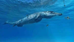
A new study led by a Monash biologist has provided fresh information on the origin of one of the major baleen whale lineages, which helps to connect living whales with their deep evolutionary past.

The new whale (Tiucetus rosae) bridges the gap between a family known as cetotheriids – today represented by the living pygmy right whale – and a poorly understood group of ancient whales living 10 to 25 million years ago.

“Tiucetus sheds light on what kind of animal cetotheriids, and thus one of the major modern baleen whale lineages, evolved from,” said lead study author Dr Felix Marx from the Monash School of Biological Sciences.

“We know from DNA and morphological studies how the living baleen whale families relate to each other, but the looks and whereabouts of their earliest ancestors remain largely in the dark.

“Our new whale is starting to change that, by filling in the blanks at the base of Cetotheriidae.”

The Peruvian whale fossil was found, collected and prepared by the study’s French co-author, Dr Christian de Muizon. Dr Marx is an expert on baleen whale evolution and was invited to describe and analyse the new specimen. His study, published in Royal Society Open Science, is part of an ongoing research program involving scientists from Peru and several countries in Europe.

There are four families of baleen whale in the modern ocean – 10 to 25 million years ago, the ocean looked rather different, and was dominated by a group of archaic whales scientists still know very little about, according to Dr Marx.

“It is generally thought that these ancient whales belong to one or more of the living families, but they are so different from their modern cousins that no one is quite sure where they fit,” he said.

“Our new fossil superficially looks like an archaic species, but also shares some very clear traits with Cetotheriidae.

The research team studied the shape of its bones in detail, and compared it to a broad variety of living and extinct species. Every comparison they made resulted in clear differences with known whales, which meant that the fossil represented a new species.

Reference:
Felix G. Marx et al. A new Miocene baleen whale from Peru deciphers the dawn of cetotheriids, Royal Society Open Science (2017). DOI: 10.1098/rsos.170560

Note: The above post is reprinted from materials provided by Monash University.

Lava flow at Hawaii Ocean Entry

Hawaiʻi Volcanoes National Park, established on August 1, 1916, is an American National Park located in the U.S. state of Hawaii on the island of Hawaii. It encompasses two active volcanoes: Kīlauea, one of the world’s most active volcanoes, and Mauna Loa, the world’s most massive shield volcano. The park delivers scientists insight into the birth of the Hawaiian Islands and ongoing studies into the processes of volcanism. For visitors, the park offers dramatic volcanic landscapes as well as glimpses of rare flora and fauna.

Hawaii emerged from the sea millions of years ago, forged by the power of volcanoes. Over time, volcanoes have formed some of our most iconic landscapes. Today, Hawaii Volcanoes National Park on the Island of Hawaii is one of the few places in the world where visitors can come face to face with an active volcano—a truly unforgettable experience.

Hawaii’s main volcanoes are “shield” volcanoes, which produce lava flows that form gently sloping, shield-like mountains. A good example is Maunaloa, the most massive mountain on earth, deceptively covering half of Hawaii Island. Standing with this sleeping giant beneath your feet will give you a greater respect for earth’s ever-changing landscapes.

Hawaii’s Active Volcanoes

There are currently three active volcanoes in Hawaii. On the Island of Hawaii, you’ll find Maunaloa and Kilauea in Hawaii Volcanoes National Park. Maunaloa last erupted in 1984, and Kilauea has been continuously erupting since 1983. Loihi is located underwater off the southern coast of Hawaii Island. Erupting since 1996, this emerging seamount may eventually break the surface, adding a new island to the Hawaiian chain.

Scientists track the brain-skull transition from dinosaurs to birds

These are CT scan images of the skull roof (front bone in pink, parietal in green) and brain (in blue) of, top to bottom, a chicken, the birdlike dinosaur Zanabazar, the primitive dinosaur Herrerasaurus, and Proterosuchus, an ancestral form that diverged before the bird/crocodile split. Credit: Yale University

The dramatic, dinosaur-to-bird transition that occurred in reptiles millions of years ago was accompanied by profound changes in the skull roof of those animals — and holds important clues about the way the skull forms in response to changes in the brain — according to a new study.

It is the first time scientists have tracked the link between the brain’s development and the roofing bones of the skull. The findings appear in the Sept. 11 edition of the journal Nature Ecology and Evolution.

“Across the dinosaur-bird transition, the skull transforms enormously and the brain enlarges. We were surprised that no one had directly addressed the idea that the underlying parts of the brain — the forebrain and midbrain — are correlated or somehow developmentally related to the overlying frontal and parietal bones,” said co-senior author Bhart-Anjan Singh Bhullar, an assistant professor of geology and geophysics at Yale University and assistant curator of vertebrate paleontology and vertebrate zoology at the Yale Peabody Museum of Natural History.

Matteo Fabbri, a graduate student in Bhullar’s lab, is the first author of the study.

Although previous studies have shown a general relationship between the brain and skull, associations between specific regions of the brain and individual elements of the skull roof have remained unclear. This has led to conflicting theories on some aspects of skull development.

Bhullar and his colleagues set out to trace the evolution of brain and skull shape not simply in the dinosaurs closest to birds, but in the entire lineage leading from reptiles to birds. They discovered that most reptile brains and skulls were markedly similar to each other. It was the dinosaurs most closely related to birds, as well as birds themselves, that were divergent, with enlarged brains and skulls ballooning out around them.

“We found a clear relationship between the frontal bones and forebrain and the parietal bones and midbrain,” Bhullar said. The researchers confirmed this finding by looking at embryos of lizards, alligators, and birds using a new contrast-stained CT scanning technique.

“We suggest that this relationship is found across all vertebrates with bony skulls and indicates a deep developmental relationship between the brain and the skull roof,” Bhullar said. “What this implies is that the brain produces molecular signals that instruct the skeleton to form around it, although we understand relatively little about the precise nature of that patterning.”

Bhullar added: “Ultimately, one of the important messages here is that evolution is simpler and more elegant than it seems. Multiple seemingly disparate changes — for instance to the brain and skull — could actually have one underlying cause and represent only a single, manifold transformation.”

Reference:
Matteo Fabbri, Nicolás Mongiardino Koch, Adam C. Pritchard, Michael Hanson, Eva Hoffman, Gabriel S. Bever, Amy M. Balanoff, Zachary S. Morris, Daniel J. Field, Jasmin Camacho, Timothy B. Rowe, Mark A. Norell, Roger M. Smith, Arhat Abzhanov, Bhart-Anjan S. Bhullar. The skull roof tracks the brain during the evolution and development of reptiles including birds. Nature Ecology & Evolution, 2017; DOI: 10.1038/s41559-017-0288-2

Note: The above post is reprinted from materials provided by Yale University. Original written by Jim Shelton.

Why your ancestors would have aced the long jump

This tiny ankle bone belonged to one of the earliest members of the primate family tree. The 52-million-year-old fossil suggests that the first primates were expert leapers. Discovered more than 30 years ago by paleontologist Marc Godinot, the fossil is now housed at the Muséum National d’Histoire Naturelle in Paris. Credit: Douglas Boyer, Duke University

A 52-million-year-old ankle fossil suggests our prehuman ancestors were high-flying acrobats.

These first primates spent most of their time in the trees rather than on the ground, but just how nimble they were as they moved around in the treetops has been a topic of dispute.

For years, scientists thought the ancestors of today’s humans, monkeys, lemurs and apes were relatively slow and deliberate animals, using their grasping hands and feet to creep along small twigs and branches to stalk insects or find flowers and fruits.

But a fossil study published in the October 2017 issue of the Journal of Human Evolution suggests the first primates were masters at leaping through the trees.

Paleontologists working in a quarry in southeastern France uncovered the quarter-inch-long bone, the lower part of the ankle joint.

The fossil matched up best with a chipmunk-sized creature called Donrussellia provincialis.

Previously only known from jaws and teeth, Donrussellia is thought be one of the earliest members of the primate family tree, on the branch leading to lemurs, lorises and bush babies.

Duke University assistant professor Doug Boyer and colleagues studied scans of Donrussellia’s ankle and compared it to other animals, using computer algorithms to analyze the 3-D digital shape of each tiny bone.

They were surprised to find that Donrussellia’s ankle was not like those of other primates, but was more similar to those of treeshrews and other nonprimate species.

The team’s analyses also suggest the animal didn’t just clamber or scurry along small branches. Instead, it may have been able to bound between trunks and branches, using its grasping feet to stick the landing.

The researchers say that — contrary to what many scientists thought — the first primates may have evolved their acrobatic leaping skills first, while anatomical changes that allowed them to cling to slender branch tips and creep from tree to tree came later.

“Being able to jump from one tree to another might have been important, especially if there were ground predators around waiting to snag them,” Boyer said.

Reference:
Doug M. Boyer, Séverine Toussaint, Marc Godinot. Postcrania of the most primitive euprimate and implications for primate origins. Journal of Human Evolution, 2017; 111: 202 DOI: 10.1016/j.jhevol.2017.07.005

Note: The above post is reprinted from materials provided by Duke University. Original written by Robin Ann Smith.

Half a billion year old fossils shed light animal evolution on Earth

X-ray microtomography image of trace fossil in sediment. Credit: Luke Parry – University of Bristol

Scientists have discovered traces of life more than half-a-billion years old that could change the way we think about how all animals evolved on earth.

The international team, including palaeontologist from The University of Manchester, found a new set of trace fossils left by some of the first ever organisms capable of active movement. Trace fossils are the tracks and burrows left by living organisms, not physical remains such as bones or body parts.

The fossils were discovered in sediment in the Corumbá region of western Brazil, near the border with Bolivia. The burrows measure from under 50 to 600 micrometres or microns (?m) in diameter, meaning the creatures that made them were similar in size to a human hair which can range from 40 to 300 microns in width. One micrometre is just one thousandth of a millimetre.

Dr Russell Garwood, from Manchester’s School of Earth and Environmental Sciences, said: ‘This is an especially exciting find due to the age of the rocks — these fossils are found in rock layers which actually pre-date the oldest fossils of complex animals — at least that is what all current fossil records would suggest.’

The fossils found date back to a geological and evolutionary period known as the Ediacaran-Cambrian transition. This was when the Ediacaran Period, which spanned 94 million years from the end of the Cryogenian Period, 635 million years ago, moved into the Cambrian Period around 541 million years ago. To put that into context, dinosaurs lived between 230 and 65 million years ago in the Mesozoic Era.

The Ediacaran-Cambrian transition is seen as extremely important period in evolutionary science and theory. Dr Garwood explains: ‘The evolutionary events during the Ediacaran-Cambrian transition are unparalleled in Earth history. That’s because current fossil records suggests that many animal groups alive today appeared in a really short time interval.’

However, the team suggest these burrows were created by ‘nematoid-like organisms’, similar to a modern-day roundworm, that used an undulating locomotion to move through the sediment, leaving these trace fossils behind. This is important because current DNA studies, known as ‘molecular clocks’, which are used to estimate how long ago a group animals originated, suggests the first animals appeared before these burrows. But this research, which has been published in Nature Ecology and Evolution, shows these trace fossils pre-date similar animals currently found in the fossil record.

Luke Parry, lead author from the University of Bristol, added: ‘Our new fossils show that complex animals with muscle control were around approximately 550 million years ago, and they may have been overlooked previously because they are so tiny’.

‘The fossils that we describe were made by quite complex animals that we call bilaterians. These are all animals that are more closely related to humans, rather than to simple creatures like jellyfish. Most fossils of bilaterian animals are younger, first appearing in the Cambrian period.’

To find such tiny fossils the team used X-ray microtomography, a special technique that uses X-rays to create a virtual, 3D model of something without destroying the original object.

Luke added: ‘Our discovery highlights an unexplored window for tracking animal evolution in deep time.’

Reference:
Luke A. Parry, Paulo C. Boggiani, Daniel J. Condon, Russell J. Garwood, Juliana de M. Leme, Duncan McIlroy, Martin D. Brasier, Ricardo Trindade, Ginaldo A. C. Campanha, Mírian L. A. F. Pacheco, Cleber Q. C. Diniz, Alexander G. Liu. Ichnological evidence for meiofaunal bilaterians from the terminal Ediacaran and earliest Cambrian of Brazil. Nature Ecology & Evolution, 2017; DOI: 10.1038/s41559-017-0301-9

Note: The above post is reprinted from materials provided by University of Manchester.

Earthquake triggers ‘slow motion’ quakes in New Zealand

The 7.8 magnitude Kaik?ura earthquake (marked by a red star) triggered a slow slip event (marked by red area) on New Zealand’s North Island. The slow slip spanned an area comparable to the state of New Jersey. Both events occurred along a subduction zone, an area where a tectonic plate dives or “subducts” beneath an adjacent tectonic plate. This type of fault is responsible for causing some of the world’s most powerful earthquakes. Credit: The University of Texas at Austin Jackson School of Geosciences

Slow slip events, a type of slow motion earthquake that occurs over days to weeks, are thought to be capable of triggering larger, potentially damaging earthquakes. In a new study led by The University of Texas at Austin, scientists have documented the first clear-cut instance of the reverse — a massive earthquake immediately triggering a series of large slow slip events.

Some of the slow slip events occurred as far away as 300 miles from the earthquake’s epicenter. The study of new linkages between the two types of seismic activity, published in Nature Geoscience on Sept. 11, may help promote better understanding of earthquake hazard posed by subduction zones, a type of fault responsible for some of the world’s most powerful earthquakes.

“This is probably the clearest example worldwide of long-distance, large-scale slow slip triggering,” said lead author Laura Wallace, a research scientist at the University of Texas Institute for Geophysics (UTIG). She also holds a joint position at GNS Science, a New Zealand research organization that studies natural hazards and resources.

Co-authors include other GNS scientists, as well as scientists from Georgia Tech and the University of Missouri. UTIG is a research unit of the UT Jackson School of Geosciences.

In November 2016, the second largest quake ever recorded in New Zealand — the 7.8 magnitude Kaik?ura quake — hit the country’s South Island. A GPS network operated by GeoNet, a partnership between GNS Science and the New Zealand Earthquake Commission, detected slow slip events hundreds of miles away beneath the North Island. The events occurred along the shallow part of the Hikurangi subduction zone that runs along and across New Zealand.

A subduction zone is an area where a tectonic plate dives or “subducts” beneath an adjacent tectonic plate. This type of fault is responsible for causing some of the world’s most powerful earthquakes, which occur when areas of built-up stress between the plates rupture.

Slow slip events are similar to earthquakes, as they involve more rapid than normal movement between two pieces of Earth’s crust along a fault. However, unlike earthquakes (where the movement occurs in seconds), movement in these slow slip events or “silent earthquakes” can take weeks to months to occur.

The GPS network detected the slow slip events occurring on the Hikurangi subduction zone plate boundary in the weeks and months following the Kaik?ura earthquake. The slow slip occurred at less than 9 miles deep below the surface (or seabed) and spanned an area of more than 6,000 square miles offshore from the Hawke’s Bay and Gisborne regions, comparable with the area occupied by the state of New Jersey. There was also a deeper slow slip event triggered on the subduction zone at 15-24 miles beneath the Kapiti Coast region, just west of New Zealand’s capital city Wellington. This deeper slow slip event near Wellington is still ongoing today.

“The slow slip event following the Kaik?ura earthquake is the largest and most widespread episode of slow slip observed in New Zealand since these observations started in 2002,” Wallace said.

The triggering effect was probably accentuated by an offshore “sedimentary wedge” — a mass of sedimentary rock piled up at the edge of the subduction zone boundary offshore from the North Island’s east coast. This layer of more compliant rock is particularly susceptible to trapping seismic energy, which promotes slip between the plates at the base of the sedimentary wedge where the slow slip events occur.

“Our study also suggests that the northward traveling rupture during the Kaik?ura quake directed strong pulses of seismic energy towards the North Island, which also influenced the long-distance triggering of the slow slip events beneath the North Island,” said Yoshihiro Kaneko, a seismologist at GNS Science.

Slow slip events in the past have been associated with triggering earthquakes, including the magnitude 9.0 Tohoku earthquake that struck Japan in 2011. The researchers have also found that the slow slip events triggered by the Kaik?ura quake were the catalyst for other quakes offshore from the North Island’s east coast, including a magnitude 6.0 just offshore from the town of Porangahau on Nov. 22, 2016.

Although scientists are still in the early stages of trying to understand the relationships between slow slip events and earthquakes, Wallace said that the study results highlight additional linkages between these processes.

Reference:
Laura M. Wallace, Yoshihiro Kaneko, Sigrún Hreinsdóttir, Ian Hamling, Zhigang Peng, Noel Bartlow, Elisabetta D’Anastasio, Bill Fry. Large-scale dynamic triggering of shallow slow slip enhanced by overlying sedimentary wedge. Nature Geoscience, 2017; DOI: 10.1038/ngeo3021

Note: The above post is reprinted from materials provided by University of Texas at Austin.

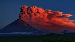
Volcano Calbuco Eruption “April 22, 2015”

Calbuco is a stratovolcano in southern Chile, located southeast of Llanquihue Lake and northwest of Chapo Lake, in the Los Lagos Region, and close to the cities of Puerto Varas and Puerto Montt. With an elevation of 2,015 meters above sea level, the volcano and the surrounding area are protected within the Llanquihue National Reserve.

The most recent eruption, a major VEI 4 event, happened with little warning on April 22–23, 2015, followed by a smaller eruption on April 30. This was Calbuco’s first activity since 1972.

Name and location

Calbuco is located partly in Puerto Varas Commune and partly in Puerto Montt Commune. It lies 49 km from the city of Puerto Varas and 69 km from Puerto Montt. Its name is thought to come from the Mapuche words “kallfü” (blue) and “ko” (water), meaning “blue water”. It shares the name with Calbuco Island in nearby Reloncaví Sound as well as the city and commune of Calbuco, although it is not located there.

Geology

Calbuco is a very explosive andesite volcano whose lavas usually contain 55 to 60% silicon dioxide (SiO2). It is elongated in a SW-NE direction and is capped by a 400-500 meter wide summit crater. Its complex evolution included the collapse of an intermediate edifice during the late Pleistocene that produced a debris avalanche that reached Llanquihue Lake.

What is Nephrite Jade? And Where are their Sources?

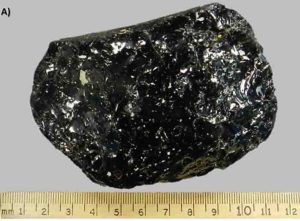
The Polar Pride boulder—called “the find of the millennium” by trade experts—was discovered in 2000. The 18-ton boulder was split in half for carving. Courtesy of Jade West Group.

Nephrite is a variety of the calcium, magnesium, and iron-rich amphibole minerals tremolite or actinolite (aggregates of which also make up one form of asbestos). The chemical formula for nephrite is Ca2(Mg, Fe)5Si8O22(OH)2. It is one of two different mineral species called jade. The other mineral species known as jade is jadeite, which is a variety of pyroxene. While nephrite jade possesses mainly grays and greens (and occasionally yellows, browns or whites), jadeite jade, which is rarer, can also contain blacks, reds, pinks and violets. Nephrite jade is an ornamental stone used in carvings, beads, or cabochon cut gemstones.

Nephrite can be found in a translucent white to very light yellow form which is known in China as mutton fat jade, in an opaque white to very light brown or gray which is known as chicken bone jade, as well as in a variety of green colors. Western Canada is the principal source of modern lapidary nephrite. Nephrite jade was used mostly in pre-1800 China as well as in New Zealand, the Pacific Coast and Atlantic Coasts of North America, Neolithic Europe, and southeast Asia.

Name

The name nephrite is derived from lapis nephriticus, which in turn is derived from Greek λίθος νεφριτικός; νεφρός λίθος, which means ‘kidney stone’ and is the Latin and Greek version of the Spanish piedra de ijada (the origin of “jade” and “jadeite”).[3] Accordingly, nephrite jade was once believed to be a cure for kidney stones.

Commercially Important Sources

Green nephrite occurs along the contacts between serpentinite units and more silicic (rich in silica) rocks such as granitic intrusive bodies, argillite, chert, or greywacke in obduction settings, where continental and oceanic crusts collide (Harlow at al., 2005). Its formation results from metasomatic reactions promoted by the presence of calcium-rich hydrous fluid along the contacts (Harlow et al., 2005).

Although deposits around the globe share a similar geological setting, there is no single formation model. Since serpentinite belongs to ophiolite belts and ophiolite is of oceanic origin, it’s only transported to land by subduction or obduction. Subduction and obduction occur during continental-oceanic collisions, so most ophiolite belts occur along old suture zones and current subduction zones.

The most economically important green nephrite sources are located in northwestern China, British Columbia, and Siberia. They are all major suppliers for the China market.

XINJIANG, CHINA

Hetian is generally considered a source of the best-quality nephrite, while Manasi produces most of the green nephrite from Xinjiang. Manasi County is located in northwestern Xingjiang, along the Kunlun Mountains.

Hetian, also known as Hotan, is located in northwestern China (Xinjiang Uygur Autonomous Region) and has always been synonymous with the best nephrite. The area is known for yielding the famous top-quality white “mutton fat” jade.

Traditionally named “Hetian Jade” is mainly from the Kunlun (Karakoram) and A’erjin (Altai) Mountains. Most of the production from these two areas is white, light greenish white, or light green. Nephrite with a very obvious green hue is called “green nephrite” (“Bi Yu” in Chinese). Most green jade production is from the Manasi River Valley in the south of Jungar Basin. Primary deposits are located on the north slope of the Tian Shan (or Tien Shan) Mountains. In the trade it is called “Manasi green jade.

The mining of Manasi green nephrite has a long history. During the Qing dynasty, it was completely controlled by the imperial court. In 1789, Emperor Qianlong ordered the closing of the area’s green nephrite mines. After that, the mines were dormant for more than 180 years. In 1973, the topic of green nephrite resources and mining was raised in a national meeting. This facilitated the reopening of the old mines and exploration in search of new resources.

Local government support led to the establishment of a nephrite carving factory in Manasi County in 1974. That year, green nephrite production reached several tens of tons. The rough was transported to carving factories in southern China. Finished products mainly supplied the domestic market.

BRITISH COLUMBIA, CANADA

Nephrite deposits are distributed along a belt of ultramafic (igneous, with very low silica content) rocks that extends over 1,000 miles from the Canada-US border northwest through central and northern British Columbia, all the way to the Yukon border. Three clusters of nephrite deposits formed along this belt: southern, central, and northern clusters.

There are more than 50 nephrite occurrences in British Columbia (Simandl et al., 2000 ogden mine article), all distributed along the Cordilleran belt that extends from Alaska to California at irregular intervals along the continent’s margins (Leaming, 1995). This belt includes different regions of oceanic origin that contain the rocks necessary for green nephrite formation. These regions became part of the continent during subduction that occurred in the Mesozoic (Davis et al., 1978).

Until the 1960s, almost all of the nephrite produced in British Columbia came from secondary deposits. With the rapid expansion of amateur lapidary activity after World War II, production in British Columbia’s jade fields picked up and they became the most important suppliers. About the same time, markets opened up in Germany and the Orient. Mining activity gradually depleted the secondary deposits, but increasing values led to further exploration. These efforts uncovered primary deposits adjacent to the Fraser River area in southern British Columbia, the Mount Ogden area in central British Columbia, and the Cassiar jade fields in the far north. Today, British Columbia is the main supplier for the China market.

Jade West Group, founded in 1981, is the biggest player in green nephrite mining and trading in British Columbia. Kirk Makepeace, the company’s founder, is an avid promoter of the stone. He started with a summer job as a jade driller. This involved flying into remote areas and spending summers in tents, with supplies brought by small planes every two weeks. Carrying drills in a backpack, he hiked the countryside in search of jade boulders. He drilled cores from them to determine potential quality. About three out of 100 boulders he drilled were of marketable quality.

More than thirty years later, Jade West has become one of the world’s leading producers and exporters of green nephrite jade. The company owns and operates three out of the four active nephrite mines in British Columbia, including the famous Polar Mine near Dease Lake, and the Kutcho and Ogden Mountain mines. The Polar Mine’s high-quality production is known as Polar Jade in the trade.

Nephrite mining in British Columbia is very challenging. Winters are long and harshly cold, and deposits are remote, so mining can only happen during the short summer season, about 60 days a year. Almost all of the secondary deposits are exhausted, so current mining is almost all from primary deposits. Transporting the heavy equipment to the mining sites is backbreaking work.

Jade West uses diamond-coated circular and wire saws and modern high-pressure hydraulic splitters to remove the nephrite from the mountain and saw it into pieces of a manageable size. Nephrite’s excellent toughness makes it extremely difficult to break out of the rock. While blasting had been used in the past, Jade West no longer uses explosives.

Nephrite deposits range from 12 inches to 12 feet wide. The wider deposits are very challenging to quarry. Nephrite boulders on the surface sometimes reach weights of 200 tons and are rarely under 100 pounds, but Jade West tries to limit the weight of its boulders to five tons, which is a reasonable size for them to mine, handle, and transport on trucks to the nearest town, about 100 miles away. The average weight is two tons, a size that satisfies most of the carving factories in China.

Sophisticated exploration techniques and an understanding of the area’s geology are the keys to successful mining operations and lengthening of a mine’s productive life. Jade West Group invests a lot of capital in its exploration projects. The company adopted core drilling in 1975, and it’s still their most powerful and reliable exploration tool. They drill into the mountain with water-cooled diamond-tipped drills, then extract the cores and examine them to determine if the nephrite is of suitable quality to turn into a marketable finished product. Since the mining season is short, the miners must call on a great deal of experience when determining the areas from which they will take core samples.

SIBERIA, RUSSIA

The main green nephrite deposits in the Eastern Sayan Mountains and Dzhida areas are located to the southwest of Lake Baikal. The entire area covers more than 250 square kilometers. Map adapted from Burtseva et al., 2015.

Although it entered the China market only about 10 to 15 years ago, green nephrite from Russia has gained a great reputation because of its bright color and good transparency. Both white and green nephrite are mined in Russia. Some of the white stones can be of equal quality to the most sought-after “mutton fat” jade and can be sold for high prices in China. Green nephrite is more readily available than the white varieties.

The first green nephrite boulders were discovered on riverbanks in Russia’s Sayan area in 1826. There were additional discoveries in 1851 along the Onot River. The first primary nephrite deposit was reportedly discovered in 1986 (Burtseva et al., 2015).

Siberian nephrite mines are located in extremely remote areas of Russia, in the Eastern Sayan Mountains and the Dzhida areas to the southwest of Lake Baikal, along with the Parama massif to the northeast of the lake. The Sayan Mountains are geographically and geologically related to the Altai Mountains that cross northwestern China, northern Mongolia, and Southwestern Russia. Many people believe that this connection is the reason for the similar qualities of nephrite from China and Russia.

The green nephrite mines that the Chinese are familiar with are almost all clustered in the Eastern Sayan Mountains. From 2005 until now, Chinese nephrite dealers have been sourcing much of their inventory from these mines. Located along the southern margin of the Siberian craton, this area covers over 250 square kilometers. The Russians have recognized and carefully studied more than 50 ultramafic rock units (Burtseva et al., 2015), almost all within the Ospa-Kitoi and Khara-Nur massifs.

The three largest green nephrite mines include Ospa (known to the Chinese as #7 and #11 mines), Gorlygol (known to the Chinese as #10 mine) and Ulankhoda. There are 15 recognized nephrite veins in the Ospa deposit, more than 30 in Gorlygol, and more than 20 in Ulankhoda (Burtseva et al., 2015). Green nephrite formation occurs along the contact between serpentinites and metasomatized mafic and felsic dikes (Burtseva et al., 2015).

The mining of Siberian green nephrite is extremely challenging due to a combination of harsh weather conditions and extremely rugged local terrain. The mining sites can best be accessed by helicopter in the summer or by heavy duty trucks along frozen rivers in winter. Explorers need to fly to Irkutsk, the nearest transitional city, and start from there. It takes at least four to five days to reach the mining sites. Retired six-wheel army trucks are the most available and reliable transport vehicles.

Russian geologist Dr. Sasha Sekerin was one of the earliest explorers of nephrite deposits in the Western and Eastern Sayan Mountains. Today, he remains a highly respected jade expert in Russia. Dr. Sekerin served as a research scientist in the Zemnoy Kory (Earth Crust) Institute in Irkutsk for over a decade until the Soviet Union fell apart. He then became a nephrite jade miner. Sasha and his colleagues began exploring the area in 1975 and have guided foreign explorers and nephrite investors to the area over the past decade.

To mine the nephrite, miners inject expansion agents into fractures in the giant rocks. They limit the use of explosives to protect the nephrite from damage. After injecting the agents, they wait a year, during which natural temperature changes help to fracture the rocks and get them ready for the mining season. The miners label the rocks to avoid conflicting claims, but due to increasing demand and skyrocketing prices, some locals will risk extracting the labeled claims during the winter. Large extracted nephrite is sawn on-site so it’s a reasonable size for transport.

Reference:

The Nephrite Jade Road: Evolution of the Green Nephrite Market
Wikipedia: Nephrite

2011 Tohoku-oki earthquake: Results from seismic reflection data

Earthquake. Credit: Victoria University

A striking finding of the 2011 Tohoku-oki earthquake (Mw 9.0) is that more than 50 meters of coseismic fault slip reached the trench axis. In addition to this, seismological studies found a clear depth-dependent variation in the source location between high- and low-frequency seismic energy radiation. However, structural features that may control the slip behavior in the rupture zone have not been well examined.

In their article for Geosphere, authors Shuichi Kodaira and colleagues processed seismic reflection data acquired in the rupture zone by a Japanese research vessel Kairei and examined depth-varying structural characteristics. The resultant characteristic structures were a frontal prism, which is a wedge-shaped sedimentary unit at the trench-ward tip of the overriding plate, a reflective zone at the seaward end of the coherent continental framework above subducted oceanic crust, and subducted horst-and-graben structures that could be traced down to ~25 km depth.

Kodaira and colleagues considered the size and distribution of the frontal prism together with data from a previous study and found that the frontal prism along the Japan Trench is well-developed from central to the northern end of the Japan Trench.

The association of the frontal prism and the large slip zone of the 2011 Tohoku-oki earthquake as well as the fault zone of the 1896 Sanriku earthquake indicates that tsunami earthquakes with large shallow slip have occurred where the frontal prism is well developed. Clear horst-and-graben structures, which were formed due to bending the oceanic plate at a subduction zone, were imaged beneath the frontal prism and the reflective zone. These images show that the throws of the normal faults associated with the horst-and-graben structures are larger by up to ~2 km beneath the reflective zone. This indicates continuous bending of the plate even after the oceanic plate is subducted.

By considering seismic images and seismicity observed by both on-land and ocean-bottom seismograph networks, Kodaira and colleagues identified the following depth-varying structural features: The shallow part of the rupture zone, where tsunami earthquakes occur, is characterized by low levels of short-period seismic energy radiation, a well-developed low-velocity frontal prism and reflective zone, and low seismicity along the plate interface. In the rupture zone from the reflective zone to 25 km deep, where large coseismic slips with low levels of short-period seismic energy are observed, subducted horst-and-graben structures are imaged and background seismicity along the plate interface is very low. In the rupture zone deeper than 25 km, clear seismic images were not obtained, but high landward-dipping background seismicity was observed. This is interpreted that the plate interface at this depth is characterized by high background seismicity.

Reference:
Shuichi Kodaira et al. Depth-varying structural characters in the rupture zone of the 2011 Tohoku-oki earthquake, Geosphere (2017). DOI: 10.1130/GES01489.1

Note: The above post is reprinted from materials provided by Geological Society of America.

The World’s First Recorded Opalised Pearls Discovered

The opalised pearls are not so valuable as gems but priceless to science, the SA Museum’s Dr Ben Grguric says.

The world’s first recorded opalised pearls, relics of creatures in an ancient inland sea dating back 65 million years, have been unearthed by two miners in the South Australian outback.

The “priceless” four-millimetre specimens were found in the Coober Pedy opal fields, an area famed for the colourful gems.

Dr Ben Grguric from the SA Museum, where the pearls have gone on display, said opal miners Dale Price and Tanja Burk were sorting through a spoil heap when they made the discovery.

“The miners pick out anything that glows with ultraviolet light, because even a small chip of opal might be worth something if it’s high quality with a high range of colours,” Dr Grguric.

“It turns out these resembled pearls.”

He said opals formed when seas dried up and alkaline soil dissolved the silica in certain rocks, as well as bones and shells – and in this case, pearls.

“A lot of the opal fossils, including bones and shells, were formed during the cretaceous period, which was an era earlier than 65 million years ago and the age of the dinosaurs,” Dr Grguric said.

To analyse and avoid damaging the gems, they were sent to be scanned by a neutron imaging instrument at the Australian Nuclear Science and Technology Organisation at Lucas Heights in Sydney.

“We decided to use a technique called neutron tomography, which is like a CT scan using neutrons,” Dr Grguric said.

“They established there was a concentric structure which is consistent with pearls as we know them today.”

The pearls are still owned by Mr Price and Ms Burk, and only on display for a short time at the SA Museum.

“It’s difficult to put a price on them, and from the point of view of a gem they’re not particularly valuable,” Dr Grguric said.

“But from a scientific view, you’d argue they were priceless.”

He said there were a lot of shell fossils in the Coober Pedy region, and those with a sharp eye may come across more opalised pearls in the future.

Note: The above post is reprinted from materials provided by ABC. The original article was written by Tom Fedorowytsch.

Plesiosaur fossil found 33 years ago yields new convergent evolution findings

Morturneria. Credit: Texas Tech University

In 1984, Sankar Chatterjee – curator of paleontology for the Museum of Texas Tech University – and his student, Bryan Small, made an astounding discovery.

Working on Seymour Island in Antarctica, they uncovered the fossilized skull of an animal they’d never seen before. While it was obviously a plesiosaur – a Cretaceous-period marine reptile scientists first discovered in the early 1600s – this plesiosaur was unlike any previously found. They named the new species Morturneria and brought its skeleton back to the Museum of Texas Tech.

Now, 33 years later, Chatterjee and his team have made a new discovery about Morturneria, one that adds a whole new dimension to science’s understanding of plesiosaurs – and larger than that, to the understanding of evolution itself.

More than 65 million years ago, the Earth’s oceans were populated with many animals still found there today, like fish, krill and sharks. But one of the oceans’ biggest predators, the plesiosaurs, went extinct at the same time as the dinosaurs on land.

“Often, plesiosaurs are called sea monsters,” said Chatterjee, a Horn Professor in the Department of Geosciences. “They were large – 50 feet long, superb swimmers and occupied the top of the marine food chain. Although dinosaurs are very familiar to everyone, during their days, the sea was ruled by these monster-like plesiosaurs. Like dinosaurs on land, they dominated the sea from Arctic to Antarctic waters. ”

Plesiosaurs had a broad, flat body and short tail, four long flippers they used to “fly” through the water, long necks and very sharp teeth.

“The teeth of most plesiosaurs are conical, stout, sharp, robust and ideal for stabbing and killing large animals,” Chatterjee said.

But as he wrote in his 1984 paper announcing Morturneria’s discovery, “the long, slender and delicate teeth may have formed a ‘trapping’ device that enabled (the animals) to feed on small fish and crustaceans that abound in the same deposits.”

This notation led an international team of Chilean, Argentinian and American paleontologists to take a closer look at Morturneria’s teeth.

“In our 1984 paper, we described the unusual teeth of Morturneria and their probable function,” he said. “However, our new international team, who had worked on plesiosaurs from many continents, found them fascinating and unique.”

Chatterjee and the team reconstructed Morturneria with a large, round head, a huge mouth and tiny teeth that point the wrong way. The teeth did not meet tip to tip as in all other plesiosaurs, but lay together in a battery that strained food particles from the water.

“When the jaw was closed, teeth from the upper and lower jaws formed a nice trap,” Chatterjee said. “Basically, the animal would swallow a school of krill, close the jaws to let the water out, but keep the krill inside for chewing and swallowing. With these kind of interdigitating delicate teeth, the animal could not tackle the large fish or shelled animals (called ammonites) that were the favorite foods of most plesiosaurs.”

The team’s finding, published in the new issue of the Journal of Vertebrate Paleontology, is that Morturneria used a filter-feeding method. This feeding style is unknown in other marine reptiles but is found in today’s baleen whales. F. Robin O’Keefe of Marshall University was the article’s lead author.

The identification of Morturneria’s whale-like filter feeding is a startling case of convergent evolution between reptiles and mammals. Plesiosaurs and whales shared many of the intervening steps in the evolution of this feeding style and their extreme morphologies are similar despite arising from different ancestors.

Chatterjee stresses convergent evolution does not imply Morturneria was in any way related to today’s baleen whales; it just means they both evolved the same way.

“They had adopted similar lifestyle and feeding,” he said. “For example, birds and bats fly, but birds are now considered dinosaurs and bats are mammals. These superficial similarities of lifestyles and behavior are called ‘convergent evolution.'”

Reference:
F. Robin O’Keefe et al. Cranial anatomy of Morturneria seymourensis from Antarctica, and the evolution of filter feeding in plesiosaurs of the Austral Late Cretaceous, Journal of Vertebrate Paleontology (2017). DOI: 10.1080/02724634.2017.1347570

Note: The above post is reprinted from materials provided by Texas Tech University.

Fossil footprints challenge established theories of human evolution

The footprints were discovered by Gerard Gierlinski (1st author of the study) by chance when he was on holiday on Crete in 2002. Gierlinski, a paleontologist at the Polish Geological Institute specialized in footprints, identified the footprints as mammal but did not interpret them further at the time. In 2010 he returned to the site together with Grzegorz Niedzwiedzki (2nd author), a Polish paleontologist now at Uppsala University, to study the footprints in detail. Together they came to the conclusion that the footprints were made by hominins. Credit: Andrzej Boczarowski

Newly discovered human-like footprints from Crete may put the established narrative of early human evolution to the test. The footprints are approximately 5.7 million years old and were made at a time when previous research puts our ancestors in Africa — with ape-like feet.

Ever since the discovery of fossils of Australopithecus in South and East Africa during the middle years of the 20th century, the origin of the human lineage has been thought to lie in Africa. More recent fossil discoveries in the same region, including the iconic 3.7 million year old Laetoli footprints from Tanzania which show human-like feet and upright locomotion, have cemented the idea that hominins (early members of the human lineage) not only originated in Africa but remained isolated there for several million years before dispersing to Europe and Asia. The discovery of approximately 5.7 million year old human-like footprints from Crete, published online this week by an international team of researchers, overthrows this simple picture and suggests a more complex reality.

Human feet have a very distinctive shape, different from all other land animals. The combination of a long sole, five short forward-pointing toes without claws, and a hallux (“big toe”) that is larger than the other toes, is unique. The feet of our closest relatives, the great apes, look more like a human hand with a thumb-like hallux that sticks out to the side. The Laetoli footprints, thought to have been made by Australopithecus, are quite similar to those of modern humans except that the heel is narrower and the sole lacks a proper arch. By contrast, the 4.4 million year old Ardipithecus ramidus from Ethiopia, the oldest hominin known from reasonably complete fossils, has an ape-like foot. The researchers who described Ardipithecus argued that it is a direct ancestor of later hominins, implying that a human-like foot had not yet evolved at that time.

The new footprints, from Trachilos in western Crete, have an unmistakably human-like form. This is especially true of the toes. The big toe is similar to our own in shape, size and position; it is also associated with a distinct ‘ball’ on the sole, which is never present in apes. The sole of the foot is proportionately shorter than in the Laetoli prints, but it has the same general form. In short, the shape of the Trachilos prints indicates unambiguously that they belong to an early hominin, somewhat more primitive than the Laetoli trackmaker. They were made on a sandy seashore, possibly a small river delta, whereas the Laetoli tracks were made in volcanic ash.

‘What makes this controversial is the age and location of the prints,’ says Professor Per Ahlberg at Uppsala University, last author of the study.

At approximately 5.7 million years, they are younger than the oldest known fossil hominin, Sahelanthropus from Chad, and contemporary with Orrorin from Kenya, but more than a million years older than Ardipithecus ramidus with its ape-like feet. This conflicts with the hypothesis that Ardipithecus is a direct ancestor of later hominins. Furthermore, until this year, all fossil hominins older than 1.8 million years (the age of early Homo fossils from Georgia) came from Africa, leading most researchers to conclude that this was where the group evolved. However, the Trachilos footprints are securely dated using a combination of foraminifera (marine microfossils) from over- and underlying beds, plus the fact that they lie just below a very distinctive sedimentary rock formed when the Mediterranean sea briefly dried out, 5.6 millon years ago. By curious coincidence, earlier this year, another group of researchers reinterpreted the fragmentary 7.2 million year old primate Graecopithecus from Greece and Bulgaria as a hominin. Graecopithecus is only known from teeth and jaws.

During the time when the Trachilos footprints were made, a period known as the late Miocene, the Sahara Desert did not exist; savannah-like environments extended from North Africa up around the eastern Mediterranean. Furthermore, Crete had not yet detached from the Greek mainland. It is thus not difficult to see how early hominins could have ranged across south-east Europe and well as Africa, and left their footprints on a Mediterranean shore that would one day form part of the island of Crete.

‘This discovery challenges the established narrative of early human evolution head-on and is likely to generate a lot of debate. Whether the human origins research community will accept fossil footprints as conclusive evidence of the presence of hominins in the Miocene of Crete remains to be seen,’ says Per Ahlberg.

Reference:
Gerard D. Gierlińskia et al. Possible hominin footprints from the late Miocene (c. 5.7 Ma) of Crete? Proceedings of the Geologists’ Association, 2017 DOI: 10.1016/j.pgeola.2017.07.006

Note: The above post is reprinted from materials provided by Uppsala University.

Massive Antarctic volcanic eruptions linked to abrupt Southern hemisphere climate changes

A 15-meter pan-sharpened Landsat 8 image of the Mount Takahe volcano rising more than 2,000 meters (1.2 miles) above the surrounding West Antarctic ice sheet in Marie Byrd Land, West Antarctica. Credit: Landsat Image Mosaic of Antarctica (LIMA). USGS and NASA, LIMA Viewer

New findings published today in the Proceedings of the National Academy of Sciences of the United States of America (PNAS) by Desert Research Institute (DRI) Professor Joseph R. McConnell, Ph.D., and colleagues document a 192-year series of volcanic eruptions in Antarctica that coincided with accelerated deglaciation about 17,700 years ago.

“Detailed chemical measurements in Antarctic ice cores show that massive, halogen-rich eruptions from the West Antarctic Mt. Takahe volcano coincided exactly with the onset of the most rapid, widespread climate change in the Southern Hemisphere during the end of the last ice age and the start of increasing global greenhouse gas concentrations,” according to McConnell, who leads DRI’s ultra-trace chemical ice core analytical laboratory.

Climate changes that began ~17,700 years ago included a sudden poleward shift in westerly winds encircling Antarctica with corresponding changes in sea ice extent, ocean circulation, and ventilation of the deep ocean. Evidence of these changes is found in many parts of the Southern Hemisphere and in different paleoclimate archives, but what prompted these changes has remained largely unexplained.

“We know that rapid climate change at this time was primed by changes in solar insolation and the Northern Hemisphere ice sheets,” explained McConnell. “Glacial and interglacial cycles are driven by the sun and Earth orbital parameters that impact solar insolation (intensity of the sun’s rays) as well as by changes in the continental ice sheets and greenhouse gas concentrations.”

“We postulate that these halogen-rich eruptions created a stratospheric ozone hole over Antarctica that, analogous to the modern ozone hole, led to large-scale changes in atmospheric circulation and hydroclimate throughout the Southern Hemisphere,” he added. “Although the climate system already was primed for the switch, we argue that these changes initiated the shift from a largely glacial to a largely interglacial climate state. The probability that this was just a coincidence is negligible.”

Furthermore, the fallout from these eruptions – containing elevated levels of hydrofluoric acid and toxic heavy metals – extended at least 2,800 kilometers from Mt. Takahe and likely reached southern South America.

How Were These Massive Antarctic Volcanic Eruptions Discovered and Verified?

McConnell’s ice core laboratory enables high-resolution measurements of ice cores extracted from remote regions of the Earth, such as Greenland and Antarctica. One such ice core, known as the West Antarctic Ice Sheet Divide (WAIS Divide) core was drilled to a depth of more than two miles (3,405 meters), and much of it was analyzed in the DRI Ultra-Trace Laboratory for more than 30 different elements and chemical species.

Additional analyses and modeling studies critical to support the authors’ findings were made by collaborating institutions around the U.S. and world.

“These precise, high-resolution records illustrate that the chemical anomaly observed in the WAIS Divide ice core was the result of a series of eruptions of Mt. Takahe located 350 kilometers to the north,” explained Monica Arienzo, Ph.D., an assistant research professor of hydrology at DRI who runs the mass spectrometers that enable measurement of these elements to as low as parts per quadrillion (the equivalent of 1 gram in 1,000,000,000,000,000 grams).

“No other such long-lasting record was found in the 68,000-year WAIS Divide record,” notes Michael Sigl, Ph.D., who first observed the anomaly during chemical analysis of the core. “Imagine the environmental, societal, and economic impacts if a series of modern explosive eruptions persisted for four or five generations in the lower latitudes or in the Northern Hemisphere where most of us live!”

Discovery of this unique event in the WAIS Divide record was not the first indication of a chemical anomaly occurring ~17,700 years ago.

“The anomaly was detected in much more limited measurements of the Byrd ice core in the 1990s,” notes McConnell, “but exactly what it was or what created it wasn’t clear. Most previous Antarctic ice core records have not included many of the elements and chemical species that we study, such as heavy metals and rare earth elements, that characterize the anomaly – so in many ways these other studies were blind to the Mt. Takahe event.”

DRI’s initial findings were confirmed by analysis of replicate samples from WAIS Divide, producing nearly identical results.

“We also found the chemical anomaly in ice from two other Antarctic ice cores including archived samples from the Byrd Core available from the University of Copenhagen and ice from Taylor Glacier in the Antarctic Dry Valleys,” said Nathan Chellman, a graduate student working in McConnell’s laboratory.

Extraction of the WAIS-Divide ice core and analysis in DRI’s laboratory were funded by the U.S. National Science Foundation (NSF).

“The WAIS Divide ice core allows us to identify each of the past 30,000 years of snowfall in individual layers of ice, thus enabling detailed examination of conditions during deglaciation,” said Paul Cutler, NSF Polar Programs’ glaciology program manager. “The value of the WAIS Divide core as a high-resolution climate record is clear in these latest results and is another reward for the eight-year effort to obtain it.”

Reference:
Joseph R. McConnell el al., “Synchronous volcanic eruptions and abrupt climate change ∼17.7 ka plausibly linked by stratospheric ozone depletion,” PNAS (2017). DOI: 10.1073/pnas.1705595114

Note: The above post is reprinted from materials provided by Desert Research Institute.

Fossil whales’ teeth shows what ferocious predators they were

The team of palaeontologists from Monash University and Museums Victoria. Credit: Ben Healley, Museums Victoria

International research involving Monash biologists has provided new insights into how the feeding habits of the whale — the biggest animal — have evolved.

The research, led by Monash University and Museums Victoria was published in the Royal Society Journal Biology Letters, and is the first to show that ancient whales had sharp teeth, suggesting they were ferocious predators.

“Contrary to what many people thought, it seems that that whales never used their teeth as a sieve, and instead evolved their signature filter feeding strategy only later — maybe after their teeth had already been lost,” said study lead co-author Associate Professor Alistair Evans, from the Monash School of Biological Sciences.

“Our findings provide crucial new insights into how the biggest animals ever evolved their most important trait: filter feeding,” he said.

“Filter feeding is the defining trait of modern whales — there are few ways in which this unique strategy could have evolved from tooth-bearing, predatory ancestors, and our study firmly rules out one of them.”

Researchers studied the 3D shape of fossil and modern teeth from museum collections in Australia and overseas.

They compared how sharp the teeth of ancient whales were relative to those of modern predators, like dingoes and lions.

Teeth are the main tool used during feeding and their shape reveals much about how and what animals eat.

“Predators that kill and chew their prey need sharp teeth with cutting blades,” Dr Evans said.

“By contrast, species that use their teeth as a sieve have blunt teeth with rounded edges that help to filter prey from water.

“We found that ancient whales had sharp teeth similar to lions and dingoes so it likely they used their teeth to kill rather than filter.”

Reference:
David P. Hocking, Felix G. Marx, Erich M. G. Fitzgerald, Alistair R. Evans. Ancient whales did not filter feed with their teeth. Royal Society Journal Biology Letters, August 2017 DOI: 10.1098/rsbl.2017.0348

Note: The above post is reprinted from materials provided by Monash University.

Volcanic eruptions drove ancient global warming event

Layered volcanic rocks in Eastern Greenland that are up to 4 miles thick were formed during ancient volcanic eruptions that caused a global warming event called the Palaeocene-Eocene Thermal Maximum (PETM). Credit: Michael Storey, Natural History Museum of Denmark

A natural global warming event that took place 56 million years ago was triggered almost entirely by volcanic eruptions that occurred as Greenland separated from Europe during the opening of the North Atlantic Ocean, according to an international team of researchers that includes Andy Ridgwell, a University of California, Riverside professor of earth sciences.

The findings, published today in Nature, refute the more commonly favored explanation that the event, called the Palaeocene-Eocene Thermal Maximum (PETM), was caused by the release of carbon from sedimentary reservoirs such as frozen methane.

“While it has long been suggested that the PETM was caused by injection of carbon into the atmosphere and ocean, the mechanism has remained elusive until now,” Ridgwell said. “By combining geochemical measurements and a global climate model that my group has been developing for over a decade, we have shown that this event was caused almost entirely by carbon emissions from the Earth’s interior.”

Scientists are interested in studying ancient warming events to understand how the Earth behaves when the climate system is dramatically perturbed. During the PETM, atmospheric carbon dioxide more than doubled and global temperatures rose by 5 degrees Celsius, an increase that is comparable with the change that may occur by later next century on modern Earth. While there was significant ecological disruption during the PETM, most species were able to avoid extinction via adaptation or migration. However, the rate of carbon addition during the onset of the PETM lasted for several thousand years, as described in a related Nature Communications paper by Sandra Kirtland Turner, an assistant professor of earth sciences at UCR, whereas current climate change is occurring on a century time-scale.

To identify the source of carbon during the PETM, the researchers studied the remains of tiny marine creatures called foraminifera, the shells of which shed light on the environmental conditions when they lived millions of years ago. By separating the different atomic masses (‘isotopes’) of the element boron in the foraminifera shells, they tracked how the pH of seawater changed during the PETM. By combining this data with Ridgwell’s global climate model, the team deduced the amount of carbon added to the ocean and atmosphere and concluded that volcanic activity during the opening of the North Atlantic was the dominant force behind the PETM.

“The amount of carbon released during this time was vast — more than 30 times larger than all the fossil fuels burned to date and equivalent to all the current conventional and unconventional fossil fuel reserves we could feasibly ever extract.” Ridgwell said.

An unexpected finding was that enhanced organic matter burial was important in ultimately sequestering the released carbon and accelerating the recovery of the Earth’s ecosystem without massive extinctions.

“Studying the PETM helps us understand the mechanisms that aid recovery from global warming, thereby helping researchers reduce the uncertainties surrounding the Earth’s response to global climate change,” Ridgwell said. “While it is encouraging that most ecosystems were able to adapt during the PETM, today’s global temperature could be increasing at a rate that is too fast for plants and animals to adjust.”

References:

  1. Marcus Gutjahr, Andy Ridgwell, Philip F. Sexton, Eleni Anagnostou, Paul N. Pearson, Heiko Pälike, Richard D. Norris, Ellen Thomas, Gavin L. Foster. Very large release of mostly volcanic carbon during the Palaeocene–Eocene Thermal Maximum. Nature, 2017; 548 (7669): 573 DOI: 10.1038/nature23646
  2. Sandra Kirtland Turner, Pincelli M. Hull, Lee R. Kump, Andy Ridgwell. A probabilistic assessment of the rapidity of PETM onset. Nature Communications, 2017; 8 (1) DOI: 10.1038/s41467-017-00292-2

Note: The above post is reprinted from materials provided by University of California – Riverside.

Sampling of the active alpine fault in New Zealand reveals extreme hydrothermal conditions

Distribution of the Alpine Fault. Star symbol, drilling site. Credit: Osaka University

A recent study published in Nature has demonstrated unusual heat generation and fluid movement in the Alpine Fault of New Zealand that has implications for understanding earthquakes in the region. Large plate-boundary faults, such as the Alpine Fault, are important areas of stress build-up and release, which can lead to earthquakes. There is increasing evidence that faults in such regions have lower than predicted frictional shear strength, and are subject to very limited heat generation during fault slippage.

The Deep Fault Drilling Project (DFDP) investigates fault strength and heat generation in the Alpine Fault. Naoki Kato of the Department of Earth and Space Science, Osaka University, who co-authored the work, says, “The primary motivation of the DFDP was to provide an understanding of the ambient conditions, rock properties and geophysical phenomena that occur immediately before a large earthquake, because we just don’t know enough about active faults before they rupture.”

The research team drilled to a depth of 893 m directly into the active Alpine Fault in Whataroa, New Zealand. The fault moves at about 26 mm per year, and has, over time, brought rocks to the near-surface from depths of 30 km. The researchers used various geophysical techniques and tools, including fiber optics, to obtain very precise temperature measurements. They revealed a pressure gradient almost 10 percent greater than expected, and temperature gradients (>80 °C.km-1) more typical of active volcanic regions.

The temperature structure of the fault was modeled in terms of heat conduction, rock advection and fluid advection related to topography. “Our models show that rock advection and thermal diffusion are the primary heat transport mechanisms in the principal slip zone, and it is fault slip itself that brings both rock and heat up from depth” Naoki Kato says. The models and drilling data both show that lateral fluid movement transports significant amounts of heat and fluids from depth, both of which concentrate into valleys.

Heat generation and fluid migration is important in active faults because both directly affect the stability of phyllosilicate minerals (clays), thermal rock expansion and the formation of physical and chemical reaction products in the fault slip zone. These in turn control the frictional and mechanical behavior of faults, and therefore the behavior of earthquakes that may occur during slippage. This study sheds new light on earthquake development in active fault regions because shallow temperature and hydrothermal anomalies, and their lateral variation, affect dynamic strength along the length of the fault.

Reference:
Rupert Sutherland et al, Extreme hydrothermal conditions at an active plate-bounding fault, Nature (2017). DOI: 10.1038/nature22355

Note: The above post is reprinted from materials provided by Osaka University.

Machine-learning earthquake prediction in lab shows promise

Researchers at Los Alamos National Laboratory have developed a two-dimensional tabletop simulator that models the buildup and release of stress along an artificial fault. In this image, the simulator is viewed through a polarized camera lens, photo-elastic plates reveal discrete points of stress buildup along both sides of the modeled fault as the far (upper) plate is moved laterally along the fault. Credit: Los Alamos National Laboratory

By listening to the acoustic signal emitted by a laboratory-created earthquake, a computer science approach using machine learning can predict the time remaining before the fault fails.

“At any given instant, the noise coming from the lab fault zone provides quantitative information on when the fault will slip,” said Paul Johnson, a Los Alamos National Laboratory fellow and lead investigator on the research, which was published today in Geophysical Research Letters.

“The novelty of our work is the use of machine learning to discover and understand new physics of failure, through examination of the recorded auditory signal from the experimental setup. I think the future of earthquake physics will rely heavily on machine learning to process massive amounts of raw seismic data. Our work represents an important step in this direction,” he said.

Not only does the work have potential significance to earthquake forecasting, Johnson said, but the approach is far-reaching, applicable to potentially all failure scenarios including nondestructive testing of industrial materials brittle failure of all kinds, avalanches and other events.

Machine learning is an artificial intelligence approach to allowing the computer to learn from new data, updating its own results to reflect the implications of new information.

The machine learning technique used in this project also identifies new signals, previously thought to be low-amplitude noise, that provide forecasting information throughout the earthquake cycle. “These signals resemble Earth tremor that occurs in association with slow earthquakes on tectonic faults in the lower crust,” Johnson said. “There is reason to expect such signals from Earth faults in the seismogenic zone for slowly slipping faults.”

Machine learning algorithms can predict failure times of laboratory quakes with remarkable accuracy. The acoustic emission (AE) signal, which characterizes the instantaneous physical state of the system, reliably predicts failure far into the future. This is a surprise, Johnson pointed out, as all prior work had assumed that only the catalog of large events is relevant, and that small fluctuations in the AE signal could be neglected.

To study the phenomena, the team analyzed data from a laboratory fault system that contains fault gouge, the ground-up material created by the stone blocks sliding past one another. An accelerometer recorded the acoustic emission emanating from the shearing layers.

Following a frictional failure in the labquake, the shearing block moves or displaces, while the gouge material simultaneously dilates and strengthens, as shown by measurably increasing shear stress and friction. “As the material approaches failure, it begins to show the characteristics of a critical stress regime, including many small shear failures that emit impulsive acoustic emissions,” Johnson described.

“This unstable state concludes with an actual labquake, in which the shearing block rapidly displaces, the friction and shear stress decrease precipitously, and the gouge layers simultaneously compact,” he said. Under a broad range of conditions, the apparatus slide-slips fairly regularly for hundreds of stress cycles during a single experiment. And importantly, the signal (due to the gouge grinding and creaking that ultimately leads to the impulsive precursors) allows prediction in the laboratory, and we hope will lead to advances in prediction in Earth, Johnson said.

Reference:
Bertrand Rouet-Leduc, Claudia L. Hulbert, Nicholas Lubbers, Kipton M. Barros, Colin J Humphreys, Paul A. Johnson. Machine learning predicts laboratory earthquakes. Geophysical Research Letters, 2017; DOI: 10.1002/2017GL074677

Note: The above post is reprinted from materials provided by DOE/Los Alamos National Laboratory.
Rare metals in the Himalayas

(a) These are beryl crystals observed in the outcrops. Euhedral, columnar beryl crystals are marked by the red circles. (b) BSE image of columbite with oscillatory zoning from the Himalaya. Credit: Science China Press

Two sub-parallel belts of Cenozoic aged Himalayan leucogranite on the Tibetan Plateau extend east to west over more than 1000 km, and are regarded as the largest granitic belts in the world. Rare-metal mineralization was identified in relation to these leucogranites.

The Himalayan leucogranite is unique, with petrological characteristics similar to well-known rare-metal granites worldwide. However, relatively few studies on the rare-metal mineralization in this region have been published. The research groups in Nanjing University and Institute of Geology and Geophysics, Chinese and Academy of Science, organized a field expedition in south Tibet in the summer of 2016 to constrain the distribution of mineralization in the region, which was published in the Science China Earth Sciences.

The first discovery identified in the field is the widespread Be-mineralization containing in most of leucogranitic plutons (Fig. 2a). The authors write, “Aquamarine, a variety of beryl, major precious mineral resource in Nepal, has been widely explored, exploited and traded for a long time, and they may also be Be-mineralization potential on the Chinese side of the Himalayas.”

Detailed microscope observation and microprobe analysis were conducted at the laboratories and 12 leucogranite plutons were found to contain rare-metal bearing minerals such as beryl (the representative of Be mineralization), columbite-group minerals (Fig. 2b), tapiolite, pyrochlore-microlite, fergusonite, Nb-Ta rutile (the representative of Nb-Ta mineralization), and cassiterite (the representative of Sn mineralization).

Based on the analytical results, the researchers revealed the distribution of the mineralization as: “Rare-metal mineralization was observed in both the Tethyan and Higher Himalayan belts. No clear differences between the two belts were identified. However differences are clear when comparing the eastern and western parts of the belts. The eastern plutons are characterized by Nb, Ta, Sn, and Be mineralization and Sn mineralization is notably absent in western plutons. These results suggest that rare-metal mineralization in the Himalayan leucogranites is regionally variable, but does not appear to be controlled by tectonic characteristics of granite emplacement and the pluton size.”

Petrogenesis was also prepared for the Himalayan rare-metal leucogranite. The model of “magmatic fractionation” and the abundance of fluxing components in the melt (e.g., H2O, Li, F, B, and P) are very important for the formation of the granite and enrichment of rare metal in the melt and/or fluids.

Rare metal has the widespread application value in the strategic development of new industries. “China ranks high in resources and production of rare-metal mineral, especially in two granitic belts in the Nanling range and the Altai district (Xinjiang) with several world- class deposits”, the authors in the article pointed out the immense value of the investigation in the Himalaya: “Our preliminary study on the Himalayan region shows additional enormous potential for the rare-metal mineralization in what may become the country’s economically important metallogenic belt.”

Simplified geological map showing the distribution of Himalayan leucogranites. Credit: Science China Press

Reference:
RuCheng Wang et al, A preliminary study of rare-metal mineralization in the Himalayan leucogranite belts, South Tibet, Science China Earth Sciences (2017). DOI: 10.1007/s11430-017-9075-8

Note: The above post is reprinted from materials provided by Science China Press.

Woolly rhino neck ribs provide clues about their decline and eventual extinction

Arrows indicate large articulation facets of cervical ribs on a fossil cervical vertebra of a woolly rhino of Naturalis, Leiden. Credit: Frietson Galis, CC BY 4.0

Researchers from the Naturalis Biodiversity Center in Leiden examined woolly rhino and modern rhino neck vertebrae from several European and American museum collections and noticed that the remains of woolly rhinos from the North Sea often possess a ‘cervical’ (neck) rib — in contrast to modern rhinos.

The study, published in the open access journal PeerJ today, reports on the incidence of abnormal cervical vertebrae in woolly rhinos, which strongly suggests a vulnerable condition in the species. Given the considerable birth defects that are associated with this condition, the researchers argue it is very possible that developmental abnormalities contributed towards the eventual extinction of these late Pleistocene rhinos.

In modern animals, the presence of a ‘cervical rib’ (a rib attached to a cervical vertebra) is an unusual event, and is cause for further investigation. Though the rib itself is relatively harmless, this condition is often associated with inbreeding and adverse environmental conditions during pregnancy.

Frietson Galis, one of the authors of the peer-reviewed study, found a remarkably high percentage of these neck ribs in the woolly mammoth, published in a previous study.

“This aroused our curiosity to also check the woolly rhino, a species that, like the woolly mammoth lived during the late Pleistocene and similarly died out,” said Alexandra van der Geer, one of the authors of the study. “The woolly rhino bones were all dredged from the North Sea and river deltas in the Netherlands. We knew these were just about the last rhinos living there, so we suspected something could be wrong here as well. Our work now shows that there was indeed a problem in the woolly rhino population.”

The absence of cervical ribs in the modern sample is by no means evidence that rhino populations today are healthy. Museum collections are based on rhino specimens that were collected at least five decades ago. Rhinoceros numbers are dwindling extremely fast, especially the last two decades, resulting in near extinction for some species and the total extinction of the western black rhinoceros.

“Our study suggests that monitoring the health of the vertebrae in rhinos has the potential to timely detect developmental errors that indicate the level of extinction risk,” said Frietson Galis.

Reference:
van der Geer and Galis. High incidence of cervical ribs indicates vulnerable condition in Late Pleistocene woolly rhinoceroses. PeerJ, 2017 DOI: 10.7717/peerj.3684

Note: The above post is reprinted from materials provided by PeerJ.

Ice age era bones recovered from underwater caves in Mexico

This is a diver with a human skull, found in Hoyo Negro. Credit: Daniel Riordan Araujo

When the Panamanian land bridge formed around 3 million years ago, Southern Mexico was in the middle of a great biotic interchange of large animals from North and South America that crossed the continents in both directions. However, fossil animals from this time have been rare for the in-between environments of Central America and southern Mexico. Recently, a team technical cave divers are helping fill in this gap by discovering remains of large animals that once roamed the Yucatán Peninsula, during the end of the last Ice Age (around 13,000 years ago). Lead author, Dr. Blaine Schubert will present the team’s findings at this year’s annual meeting of the Society of Vertebrate Paleontology held this year in Calgary, Alberta (Canada) on Saturday, Aug. 26th at 9:00am.

The team of divers descended into the flooded passageways to an underground pit known as “Hoyo Negro” (Spanish for “Black Hole”), reaching down 180 ft (55 m) into the darkness. During the last Ice Age, sea level was much lower, and the prehistoric animals were able to walk to Hoyo Negro through horizontal passageways, only to fall into the inescapable pit within the cave. Divers have been photo-documenting the material before extraction, using re-breathing SCUBA equipment to prevent bubbles from disturbing the site. Dr. Blaine Schubert of East Tennessee State University, one of the lead researchers on the project says, “preservation of the fossil material is extraordinary, and will allow us to reconstruct various aspects of anatomy, evolutionary relationships, and behavior. The diversity of the fauna gives us an exciting new picture of this region in the midst of rapid climatic and environmental change.”

Thus far the crew has recovered remains of three different giant ground sloths (including an entirely new species), short-faced bears, mountain lions, sabertooth cats, a bizarre relative of elephants called a gomphothere, tapirs, and even a human. “This represents the oldest and most complete early human skeleton in the Americas, and she co-existed with a variety of megafauna” says Schubert. “The remains of the short-faced bear Arctotherium are particularly significant, representing not only the most complete and abundant material from one location, but also the first evidence that they crossed from South America into North America.” This fossil fauna is fleshing out a larger ecosystem for southern North America, which has typically been thought of as more of a bridge between landmasses than its own thriving community of local inhabitants. As the international collaboration of U.S. and Mexican researchers continues its work, the scientists hope to better understand the nature of this bridge and its own ecological complexities.

Note: The above post is reprinted from materials provided by Society of Vertebrate Paleontology.

Related Articles