Different mountain ranges are bound to experience climate change differently. Researchers from ETH Zurich and Utrecht University have shown this to be the case in a recent study, which was funded by the Swiss National Science Foundation and published in the specialist journal PNAS. In the course of their study, the researchers examined the full water balance of two comparable mountainous regions – one in Nepal, the other in Chile – in the context of climate change.
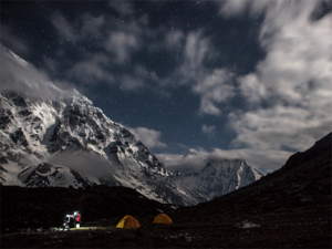
To calculate and compare each region’s water balance, the researchers created a new and very extensive model of the upper Langtang valley in Nepal and the Juncal region of the central Andes in Chile. Both are important water catchment areas for the millions of people who live in the surrounding lowlands. The areas being studied feature peaks that ascend to over 6,000 metres and also glaciers. Climate models for the remainder of the century indicate that both regions will experience similar increases in annual mean temperatures – the milder scenarios predict a rise of one to three degrees, the more extreme as much as four to six degrees.
Drier, and less river discharge
Using their model, the researchers can now show that despite these similarities, the water balance in the two regions is likely to develop differently.
The Juncal region is set to become even drier in the future. During the dry season, which is already quite long, river water will become scarce. According to their calculations, the researchers still expect water discharge to remain at current levels in the period from 2010 to 2030. However, after that, there will be a steady decline in the amount of water available. So in an extreme scenario, water discharge from the entire catchment area in the Juncal region could shrink to a third of the current level by the year 2100.
Over in the upper Langtang valley, the picture looks quite different. Using data from 2001 to 2010 as a comparison, all climate scenarios indicate that in the first half of this century, water discharge will increase; in the extreme scenario, by as much as 70 percent. Maximum discharge could be reached by around 2050 to 2060, after which discharge is expected to remain the same or drop steadily as we move towards the year 2100.
Glaciers are key for discharge levels
Just how much water is carried by streams and rivers ultimately depends on the fates of the local glaciers. Glaciers in both test areas are going to shrink. Depending on the climate scenario, those in the Juncal region could diminish by up to 70 percent; in Langtang, the more extreme predictions indicate a loss of “only” 55 percent.
In turn, the different degrees of glacial melt will also lead to differing scenarios in terms of water discharge: in Langtang, the proportion of glacial melt in the discharge will increase and peak by 2050 before receding. In Juncal, glacial melt already peaked before 2010, and now the proportion of discharge from glacial melt is dropping steadily – a trend that is set to continue until the end of the century.
The researchers put this down to the fact that the two glaciers are not at the same distance above sea level. In Langtang, many glaciers are situated at very high altitudes. Once they melt at some point in the future, this meltwater will then replace that which today comes from glaciers lower down. What’s more, the tongues of many glaciers in Langtang are covered in massive layers of rock debris; these insulate the glaciers, which then recede less quickly. In Juncal, however, the highest glaciers are already melting, as they are situated lower than those in the Himalayas.
Increased rain and less snow are leading to floods and seasonal dry spells
The new model also indicates that Langtang could be in for increased rainfall in the future, which will exacerbate the effect the increasing glacier melt is having on water discharge. But this is not the case in Chile, where the drought in the summer months of December to March will get worse. Today, farmers in Chile’s most fertile regions use meltwater to irrigate their fields. “If the upper basins of rivers deliver less water in the future, it will be essential to take action to encourage conservation of the country’s water reserves,” says corresponding author Silvan Ragettli, post-doctoral student at the Institute of Environmental Engineering at ETH Zurich.
In contrast, efforts in the Nepalese Himalayas will have to focus on flood management. Climate change will mean higher snow lines. This will increase the amount of rain that falls in high elevations. “Increased precipitation in the form of rain means that water runs off immediately, which in turn can lead to massive flooding,” says Ragettli.
New model also enables regional predictions
“What’s new and unique about our model is that it can realistically illustrate many different processes,” says Ragettli. For instance, it can take into account a whole range of factors that are decisive for hydrology, such as rain and snow volume, evaporation, groundwater and also the ways in which glaciers expand and experience changes in volume. In their intensive field work, the researchers gathered local measurement data so they could create the model for the areas they are studying. This enables them to make precise predictions for how the water balance is likely to shift.
The researchers began their study back in 2005, when they made the first ETH expedition to the Chilean Andes. Measurement work began in the Langtang valley in 2012 in collaboration with Utrecht University and ICIMOD, an international organisation based in Kathmandu that is committed to sustainable development in the Himalayan region. Up to now, there has been no systematic collection of climate and water measurement data in either test region, which is why the researchers first had to establish measurement stations there.
The Andes and the Himalayas were chosen because existing models for these regions were very imprecise. The study the researchers have now published showed that the previous models were too rough to provide reliable projections for the mountainous regions that surround urban centres in Chile and Nepal.
Reference:
Ragettli S, Immerzeel WW, Pellicciotti F. Contrasting climate change impact on river flows from high-altitude catchments in the Himalayan and Andes Mountains. PNAS,, 1 August 2016 DOI: 10.1073/pnas.1606526113
Note: The above post is reprinted from materials provided by ETH Zurich.


