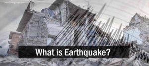
What is earthquake?
An earthquake is the shaking of the surface of the Earth, resulting from the sudden release of energy in the Earth’s lithosphere that creates seismic waves. Earthquakes can range in size from those that are so weak that they cannot be felt to those violent enough to toss people around and destroy whole cities. The seismicity or seismic activity of an area refers to the frequency, type and size of earthquakes experienced over a period of time.
At the Earth’s surface, earthquakes manifest themselves by shaking and sometimes displacement of the ground. When the epicenter of a large earthquake is located offshore, the seabed may be displaced sufficiently to cause a tsunami. Earthquakes can also trigger landslides, and occasionally volcanic activity.
In its most general sense, the word earthquake is used to describe any seismic event — whether natural or caused by humans — that generates seismic waves. Earthquakes are caused mostly by rupture of geological faults, but also by other events such as volcanic activity, landslides, mine blasts, and nuclear tests. An earthquake’s point of initial rupture is called its focus or hypocenter. The epicenter is the point at ground level directly above the hypocenter.
What causes earthquakes and where do they happen?
The earth has four major layers: the inner core, outer core, mantle and crust. The crust and the top of the mantle make up a thin skin on the surface of our planet. But this skin is not all in one piece – it is made up of many pieces like a puzzle covering the surface of the earth. Not only that, but these puzzle pieces keep slowly moving around, sliding past one another and bumping into each other. We call these puzzle pieces tectonic plates, and the edges of the plates are called the plate boundaries. The plate boundaries are made up of many faults, and most of the earthquakes around the world occur on these faults. Since the edges of the plates are rough, they get stuck while the rest of the plate keeps moving. Finally, when the plate has moved far enough, the edges unstick on one of the faults and there is an earthquake.
Why does the earth shake when there is an earthquake?
While the edges of faults are stuck together, and the rest of the block is moving, the energy that would normally cause the blocks to slide past one another is being stored up. When the force of the moving blocks finally overcomes the friction of the jagged edges of the fault and it unsticks, all that stored up energy is released. The energy radiates outward from the fault in all directions in the form of seismic waves like ripples on a pond. The seismic waves shake the earth as they move through it, and when the waves reach the earth’s surface, they shake the ground and anything on it, like our houses and us! (see P&S Wave inset)
How are earthquakes recorded?
Earthquakes are recorded by instruments called seismographs. The recording they make is called a seismogram. The seismograph has a base that sets firmly in the ground, and a heavy weight that hangs free. When an earthquake causes the ground to shake, the base of the seismograph shakes too, but the hanging weight does not. Instead the spring or string that it is hanging from absorbs all the movement. The difference in position between the shaking part of the seismograph and the motionless part is what is recorded.
How do scientists measure the size of earthquakes?
The size of an earthquake depends on the size of the fault and the amount of slip on the fault, but that’s not something scientists can simply measure with a measuring tape since faults are many kilometers deep beneath the earth’s surface. So how do they measure an earthquake? They use the seismogram recordings made on the seismographs at the surface of the earth to determine how large the earthquake was. A short wiggly line that doesn’t wiggle very much means a small earthquake, and a long wiggly line that wiggles a lot means a large earthquake. The length of the wiggle depends on the size of the fault, and the size of the wiggle depends on the amount of slip.
The size of the earthquake is called its magnitude. There is one magnitude for each earthquake. Scientists also talk about the intensity of shaking from an earthquake, and this varies depending on where you are during the earthquake.
How can scientists tell where the earthquake happened?
Seismograms come in handy for locating earthquakes too, and being able to see the P wave and the S wave is important. You learned how P & S waves each shake the ground in different ways as they travel through it. P waves are also faster than S waves, and this fact is what allows us to tell where an earthquake was. To understand how this works, let’s compare P and S waves to lightning and thunder. Light travels faster than sound, so during a thunderstorm you will first see the lightning and then you will hear the thunder. If you are close to the lightning, the thunder will boom right after the lightning, but if you are far away from the lightning, you can count several seconds before you hear the thunder. The further you are from the storm, the longer it will take between the lightning and the thunder.
P waves are like the lightning, and S waves are like the thunder. The P waves travel faster and shake the ground where you are first. Then the S waves follow and shake the ground also. If you are close to the earthquake, the P and S wave will come one right after the other, but if you are far away, there will be more time between the two. By looking at the amount of time between the P and S wave on a seismogram recorded on a seismograph, scientists can tell how far away the earthquake was from that location. However, they can’t tell in what direction from the seismograph the earthquake was, only how far away it was. If they draw a circle on a map around the station where the radius of the circle is the determined distance to the earthquake, they know the earthquake lies somewhere on the circle. But where?
Scientists then use a method called triangulation to determine exactly where the earthquake was (figure 6). It is called triangulation because a triangle has three sides, and it takes three seismographs to locate an earthquake. If you draw a circle on a map around three different seismographs where the radius of each is the distance from that station to the earthquake, the intersection of those three circles is the epicenter!
Can scientists predict earthquakes?
No, and it is unlikely they will ever be able to predict them. Scientists have tried many different ways of predicting earthquakes, but none have been successful. On any particular fault, scientists know there will be another earthquake sometime in the future, but they have no way of telling when it will happen.
Effects of earthquakes
Shaking and ground rupture
Shaking and ground rupture are the main effects created by earthquakes, principally resulting in more or less severe damage to buildings and other rigid structures. The severity of the local effects depends on the complex combination of the earthquake magnitude, the distance from the epicenter, and the local geological and geomorphological conditions, which may amplify or reduce wave propagation. The ground-shaking is measured by ground acceleration.
Specific local geological, geomorphological, and geostructural features can induce high levels of shaking on the ground surface even from low-intensity earthquakes. This effect is called site or local amplification. It is principally due to the transfer of the seismic motion from hard deep soils to soft superficial soils and to effects of seismic energy focalization owing to typical geometrical setting of the deposits.
Ground rupture is a visible breaking and displacement of the Earth’s surface along the trace of the fault, which may be of the order of several meters in the case of major earthquakes. Ground rupture is a major risk for large engineering structures such as dams, bridges and nuclear power stations and requires careful mapping of existing faults to identify any which are likely to break the ground surface within the life of the structure.
Landslides and avalanches
Earthquakes, along with severe storms, volcanic activity, coastal wave attack, and wildfires, can produce slope instability leading to landslides, a major geological hazard. Landslide danger may persist while emergency personnel are attempting rescue.
Fires
Earthquakes can cause fires by damaging electrical power or gas lines. In the event of water mains rupturing and a loss of pressure, it may also become difficult to stop the spread of a fire once it has started. For example, more deaths in the 1906 San Francisco earthquake were caused by fire than by the earthquake itself.
Soil liquefaction
Soil liquefaction occurs when, because of the shaking, water-saturated granular material (such as sand) temporarily loses its strength and transforms from a solid to a liquid. Soil liquefaction may cause rigid structures, like buildings and bridges, to tilt or sink into the liquefied deposits. For example, in the 1964 Alaska earthquake, soil liquefaction caused many buildings to sink into the ground, eventually collapsing upon themselves.
Tsunami
Tsunamis are long-wavelength, long-period sea waves produced by the sudden or abrupt movement of large volumes of water – including when an earthquake occurs at sea. In the open ocean the distance between wave crests can surpass 100 kilometers (62 mi), and the wave periods can vary from five minutes to one hour. Such tsunamis travel 600-800 kilometers per hour (373–497 miles per hour), depending on water depth. Large waves produced by an earthquake or a submarine landslide can overrun nearby coastal areas in a matter of minutes. Tsunamis can also travel thousands of kilometers across open ocean and wreak destruction on far shores hours after the earthquake that generated them.
Ordinarily, subduction earthquakes under magnitude 7.5 on the Richter magnitude scale do not cause tsunamis, although some instances of this have been recorded. Most destructive tsunamis are caused by earthquakes of magnitude 7.5 or more. “ex: Japan Tsunami 2011”
Floods
A flood is an overflow of any amount of water that reaches land. Floods occur usually when the volume of water within a body of water, such as a river or lake, exceeds the total capacity of the formation, and as a result some of the water flows or sits outside of the normal perimeter of the body. However, floods may be secondary effects of earthquakes, if dams are damaged. Earthquakes may cause landslips to dam rivers, which collapse and cause floods.
The terrain below the Sarez Lake in Tajikistan is in danger of catastrophic flood if the landslide dam formed by the earthquake, known as the Usoi Dam, were to fail during a future earthquake. Impact projections suggest the flood could affect roughly 5 million people.
Reference:
Wikipedia: Earthquake
USGS: The Science of Earthquakes
British Geological Survey: What is an earthquake?
Geoscience Australia: What is an Earthquake?


