Home Blog Page 65

Tooth enamel analyses offer insights into the diet and habitat of T.rex relative tarbosaurus

Fragment of Tarbosaurus lower jaw with teeth sampled (white stripes on tooth enamel)
Fragment of Tarbosaurus lower jaw with teeth sampled (white stripes on tooth enamel). Credit: Senckenberg

Together with an international team, Senckenberg scientist Hervé Bocherens studied the fossilized teeth of the carnivorous dinosaur Tarbosaurus bataar. Based on stable isotopes, the researchers were able to draw inferences regarding the habitat and feeding habits of this relative of T. rex, who lived around 70 million years ago. According to the results, the carnivores were not very picky in their prey selection. The study is published recently in the scientific journal Palaeogeography, Palaeoclimatology, Palaeoecology.

The Gobi Desert in southern Mongolia is a well-known discovery site of fossil dinosaurs. “These fossils from the Cretaceous also include Tarbosaurus bataar, a representative of the Tyrannosaurids and relative of the famous Tyrannosaurus rex,” explains Prof. Dr. Hervé Bocherens of the Senckenberg Centre for Human Evolution and Palaeoenvironment at the University of Tübingen.

Bocherens and his team of scientists examined the fossilized teeth of this up to twelve-meter-long dinosaur, using oxygen and carbon isotopes in the tooth enamel to draw inferences regarding the dinosaurs’ feeding habits and the environmental conditions at the time.

“It is amazing how much information is revealed by this approximately 70-million-year-old tooth enamel,” explains a delighted Bocherens, and he continues, “Our analyses show that the environment of these carnivorous reptiles was about 10 degrees Centigrade warmer than today and the amount of precipitation was subject to strong seasonal fluctuations. We assume that the dinosaurs inhabited closed forests—in a climate characterized by monsoons with cold, dry winters and hot, rainy summers.”

In addition, the researchers were able to reconstruct the Tarbosaurs’ diet based on the teeth from five differently aged individuals. According to the results, the carnivores were not very picky in their prey selection: their menu included both the Hadrosauridae, commonly known as “duck-billed dinosaurs,” as well as different species of vegetarian sauropods. “Our isotope studies therefore confirm the fossil discoveries and show that Tarbosaurus took up a position at the top of the food pyramid,” adds Bocherens in summary.

Reference:
Krzysztof Owocki et al. Diet preferences and climate inferred from oxygen and carbon isotopes of tooth enamel of Tarbosaurus bataar (Nemegt Formation, Upper Cretaceous, Mongolia), Palaeogeography, Palaeoclimatology, Palaeoecology (2019). DOI: 10.1016/j.palaeo.2019.05.012

Note: The above post is reprinted from materials provided by Senckenberg Research Institute and Natural History Museum.

Blue color tones in fossilized prehistoric feathers

Eocoracias brachyptera fossil sample used for this study.
Eocoracias brachyptera fossil sample used for this study. The rich black texture on the surface is fossilized plumage of the bird. Fossil is stored at Senckenberg Research Institute. Credit: Sven Traenkner, photographer at the Senckenberg Research Institute and Nature Museum in Frankfurt.

Examining fossilised pigments, scientists from the University of Bristol have uncovered new insights into blue colour tones in prehistoric birds.

For some time, paleontologists have known that melanin pigment can preserve in fossils and have been able to reconstruct fossil colour patterns.

Melanin pigment gives black, reddish brown and grey colours to birds and is involved in creating bright iridescent sheens in bird feathers.

This can be observed by studying the melanin packages called melanosomes, which are shaped like little cylindrical objects less than one-thousandth of a millimetre and vary in shape from sausage shapes to little meatballs.

However, besides iridescent colours, which is structural, birds also make non-iridescent structural colours.

Those are, for example, blue colour tones in parrots and kingfishers. Until now, it was not known if such colours could be discovered in fossils.

This blue structural colour is created by the dense arrangement of cavities inside feathers, which scatters the blue light. Underneath is a layer of melanin that absorbs unscattered light.

Paleontologists have shown that the feather itself, which is made of keratin, does not fossilise while the melanin does. Therefore, if a blue feather fossilised, the dark pigment may be the only surviving feature and the feather may be interpreted as black or brown.

Now researchers from the University of Bristol, led by Frane Barbarovic who is currently at the University of Sheffield, have shown that blue feather melanosomes are highly distinct from melanosomes that are from feathers expressing black, reddish-brown, brown and iridescent, but overlap significantly with some grey feather melanosomes.

By looking at plumage colourations of modern representatives of fossil specimen and reconstructing which colour was the most likely present in the fossil specimen, they were able to discriminate between melanosomes significant for grey and blue colour, leading to the reconstruction of prehistoric Eocoracias brachyptera as a predominantly blue bird.

Frane Barbarovic said: “We have discovered that melanosomes in blue feathers have a distinct range in size from most of colour categories and we can, therefore, constrain which fossils may have been blue originally.

“The overlap with grey colour may suggest some common mechanism in how melanosomes are involved in making grey colouration and how these structural blue colours are formed.

“Based on these results in our publication we have also hypothesized potential evolutionary transition between blue and grey colour.”

The research team now need to understand which birds are more likely to be blue based on their ecologies and modes of life. The blue colour is common in nature, but the ecology of this colour and its function in the life of birds is still elusive.

Frane Barbarovic added: “We also need to understand how grey colour is made. This is made in a very different way in birds than it is in mammals. We believe it is related to how the melanosome shape can result in a kind of self-assembling process in the feather and the surface tension of the melanosomes pull them into certain configurations inside a feather as it forms.”

Reference:
‘Characterization of melanosomes involved in the production of non-iridescent structural feather colours and their detection in the fossil record’ F. Babarovic, M. Puttick, M. Zaher, E. Learmonth, E.J Gallimore, F. Smithwick, G. Mayr and J. Vinther, Interface, rsif.royalsocietypublishing.or … .1098/rsif.2018.0921

Note: The above post is reprinted from materials provided by University of Bristol.

Study reveals key factor in Himalayan earthquake rupture

The velocity model showing a map view of the MHT and a cross-section passing through the Gorkha earthquake
The velocity model showing a map view of the MHT and a cross-section passing through the Gorkha earthquake Credit: BAI Ling

The Himalayan orogenic belt produces frequent large earthquakes that impact population centers for a distance of over 2500 km. In the central region, the 2015 Gorkha earthquake in Nepal, with moment magnitude (MW) 7.8, partially ruptured a ~120-km by 80-km patch of the Main Himalayan Thrust (MHT), the detachment that separates the underthrusting Indian plate from the overriding Himalayan orogeny.

The rupture highlights important scientific questions about Himalayan formation and seismic hazards. These questions include how to distinguish between different possible geometries of the MHT, and how to better define the structural causes and locations of rupture segmentation both across-strike and along-strike in the orogenic belt.

A study led by Prof. BAI Ling from the Institute of Tibetan Plateau Research (ITP) of the Chinese Academy of Sciences revealed that the rupture length of the 2015 MW 7.8 Gorkha earthquake was likely controlled by spatial (both along- and across-strike) variations in the Main Himalayan Thrust.

The researchers combined seismic waveforms from several different deployments, including 22 seismic stations ITP had deployed along the China-Nepal border with an average elevation of 4.5 km prior to the earthquake. Using arrival times and waveform modeling, they determined source parameters of earthquakes, velocity structures and discontinuity topography in and around the source area.

The study showed that the MHT exhibited clear lateral variation along the geologic strike, with the Lesser Himalayan ramp having moderate dip on the MHT beneath the mainshock area, and a flatter and deeper MHT beneath the eastern end of the aftershock zone.

Following these observations, the impetus now is to image the entire 2,500-km Himalayan front to determine the morphology of the MHT and the likely controls on the maximum magnitude of rupture that can be accommodated in different parts of this convergence zone.

The study, entitled “Lateral variation of the Main Himalayan Thrust controls the rupture length of the 2015 Gorkha earthquake in Nepal,” was published in Science Advances.

Reference:
“Lateral variation of the Main Himalayan Thrust controls the rupture length of the 2015 Gorkha earthquake in Nepal” Science Advances (2019). DOI: 10.1126/sciadv.aav0723

Note: The above post is reprinted from materials provided by Chinese Academy of Sciences.

Desert-dwelling carnivorous dinosaur found in Brazil

A hitherto unknown type of carnivorous dinosaur measuring just over a meter and a half long that lived 90 million years ago has been identified in the Cruzeiro do Oeste municipality of southern Brazil

A desert-based carnivorous dinosaur that used claws to capture small prey 90 million years ago has been unearthed in southern Brazil, scientists said Wednesday.

Just over a meter and a half in length (five feet), the fossil remains of the Vespersaurus paranaensis were found in Cruzeiro do Oeste municipality of Parana state, a team of paleontologists from Brazil and Argentina said in a statement.

The Vespersaurus was a theropod, a group of two-footed, meat-eating dinosaurs that included the better known tyrannosaurus and velociraptor.

Footprints now believed to belong to this new species of dinosaur were discovered in Cruzeiro do Oeste in the 1970s.

“It’s incredible that, nearly 50 years later, it seems that we have discovered what type of dinosaur would have produced those enigmatic footprints,” said Paulo Manzig of the Paleontology Museum of Cruzeiro do Oeste.

The northeastern region of Parana was once a desert and the dinosaur’s remains suggest that the Vespersaurus was well adapted to that type of climate.

Other dinosaur species have been found there and, according to the scientists, the latest discovery must “catapult” paleontological investigations in the region.

“It is a rich but little explored area that would surely bring great news to the world of paleontology,” said Neurides Martins of the Paleontology Museum of Cruzeiro do Oeste.

Note: The above post is reprinted from materials provided by AFP.

Contradictory effect of earthquakes on submarine slopes

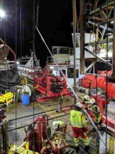
Scientists and shipboard crew await the arrival of a new sediment core onboard research vessel RV Sonne in 2016.
Scientists and shipboard crew await the arrival of a new sediment core onboard research vessel RV Sonne in 2016. Credit: T. Schwestermann

Active margins, where an oceanic plate slides under a continental plate, may cause earthquakes and tsunamis. Further, they are known for shifting sediments from margin slopes into deep ocean trenches. Geologists now found evidence of earthquake-triggered surface sediment erosion on a submarine slope close to the area of the 2011 Tohoku-Oki earthquake.

Whereas most previous research assumed that sediment transport by earthquakes only happened by sliding of sediment packages (i.e. submarine landslides), that are several meters thick, the recently-discovered process of surficial remobilization involves the stripping of only a thin veneer of sediment over an extensive area. At first view a few missing centimeters of sediment do not look very spectacular. However, the fact that it affects a vast area has tremendous implications for all studies based on the remobilization of marine sediment by earthquakes, such as research on pre-historical earthquakes, deposition of organic carbon into the deep ocean and even the potential tsunami hazard by submarine landslides. “Surficial remobilization was hypothesized based on studies of basin deposits. However, to really understand this important process it is crucial to investigate the place where it takes place: the submarine slopes,” explains Jasper Moernaut, Assistant Professor at the Institute of Geology.

Mind the gap

The researchers combined chemical and physical analyses to detect small centimeter scale gaps in the sediment taken from a slope offshore Japan. Subsequent dating then revealed the potential of the gaps being caused by seismic shaking. “We were quite amazed when we found that not only one, but three gaps were present in this small 15 cm section of sediment core,” says Ariana Molenaar, PhD student at the Institute of Geology. “When we dated these three gaps we found that they link to the three strongest regional earthquakes with a magnitude larger than eight, indicating that this is a systematically repeating process.”

No one before has examined deep sea slopes with this method. A slope site where erosion takes place is surely the last place one would take a sediment core. “Our pilot study is the first to target a submarine slope to investigate this process, showing the potential of this method,” says Michael Strasser, Professor at the Institute of Geology. The research team is now applying their strategy in different settings – even in lakes − to further advance their understanding of this newly-discovered process.

Contrasting effect on submarine slopes

Besides the shedding of the uppermost few centimeters, earthquake shaking has another very contrasting effect on the submarine slope: the sediments that remain actually get stronger. This process, called “seismic strengthening”, occurs due to the compaction of sediments by violent shaking. “In the ocean, this leads to very stable slope sequences and thus a remarkable absence of submarine landslides,” says Jasper Moernaut. So the good news is that − despite the frequent occurrence of strong earthquakes at active ocean margins − tsunamis triggered by submarine landslides are relatively uncommon in these regions.

Reference:
Ariana Molenaar et al. Earthquake Impact on Active Margins: Tracing Surficial Remobilization and Seismic Strengthening in a Slope Sedimentary Sequence, Geophysical Research Letters (2019). DOI: 10.1029/2019GL082350

Note: The above post is reprinted from materials provided by University of Innsbruck.

New study of the 2014 Oso landslide

The March 22, 2014 SR530 landslide near Oso, Washington
The March 22, 2014 SR530 landslide near Oso, Washington, caused 43 fatalities, destroyed a neighborhood, blocked a state highway, and temporarily dammed the North Fork Stillaguamish River. This photo was taken the day after the catastrophic slide, before the river cut through the landslide deposit. Here, several geomorphological components of the landslide are visible, with a hummock field in the foreground transitioning upslope to larger slices of deposit separated by multiple scarps, which then transition to a fallen-tree covered, back-rotated block downdropped from the headscarp in the far field. Nearly the entire landslide deposit exhibits indications of extension. Collins and Reid attribute extensional hummock formation to widespread basal liquefaction of underlying alluvial sediments in the river valley. Photo by Stephen Slaughter (Washington Geological Survey, Washington Department of Natural Resources). Credit: Stephen Slaughter (Washington Geological Survey, Washington Department of Natural Resources)

As a compelling example of a large-mobility landslide, the 22 March 2014 landslide near Oso, Washington, USA, was particularly devastating, traveling across a 1-km-plus-wide river valley, killing 43 people, destroying dozens of homes, and temporarily closing a well-traveled highway.

To resolve causes for the landslide’s behavior and mobility, Brian Collins and Mark Reid of the U.S. Geological Survey conducted detailed post-event field investigations and material testing of soils involved in the failure.

How far a landslide moves from the site where it began can, of course, vastly amplify the consequences of slope failure. Some landslides stop moving close to where they began, and others are very mobile and can travel long distances, affecting not only what is located at the base of the slope, but also farther away.

Collins and Reid mapped the geology and structure of the Oso landslide deposit by making multiple visits to the site over the course of three years. Some of the data they collected were highly ephemeral, being obscured by erosion and vegetation within one year of the landslide and highlighting the need to record many observations within a few months of the disaster.

Using “boots-on-the-ground” geologic mapping techniques, combined with high-resolution orthoimagery and airborne LiDAR data, they reconstructed the likely sequence of events that led to the landslide’s large mobility. Their mapping and analyses show that the approximately nine-million-cubic-meter landslide underwent rapid extension or stretching in a closely timed sequence of events that led to the landslide overrunning the, at-the-time, saturated flood plain forming the valley floor.

The large and rapid failure of the landslide caused the flood plain, composed of alluvial sands and gravels, to liquefy through a process of pore-pressure generation and consequent liquefaction. Liquefaction greatly reduced the strength along the base of the landslide and enabled it to travel over 1 km across the valley flats.

Collins and Reid found extensive evidence of high soil-water pore pressure during their field work by identifying and mapping of hundreds of “sand boils”—typically decimeter-sized cones of sand that indicated locations where liquefied alluvium tried to escape from a weakened base beneath the landslide. In their new GSA Bulletin article, Collins and Reid present their mapping and interpreted landslide sequence, as well as analyses that show how the basal liquefaction mechanism likely occurred at the site of the Oso landslide. They hypothesize that this mechanism might enhance mobility of other landslides in similar settings.

Reference:
Brian D. Collins et al, Enhanced landslide mobility by basal liquefaction: The 2014 State Route 530 (Oso), Washington, landslide, GSA Bulletin (2019). DOI: 10.1130/B35146.1

Note: The above post is reprinted from materials provided by Geological Society of America.

Ice-squeezed aquifers might create marsquakes

A view from the “Kimberley” formation on Mars taken by NASA’s Curiosity rover.
A view from the “Kimberley” formation on Mars taken by NASA’s Curiosity rover. The strata in the foreground dip towards the base of Mount Sharp, indicating flow of water toward a basin that existed before the larger bulk of the mountain formed. Credit: NASA/JPL-Caltech/MSSS

As the Mars InSight lander begins listening to the interior of Mars, some scientists are already proposing that some marsquakes could be signals of groundwater beneath the frozen surface of the Red Planet.

The idea, proposed by Michael Manga, a planetary scientist at the University of California at Berkeley, and his colleagues, is that Mars could be experiencing quakes a lot like those being felt in Oklahoma and Texas due to wastewater injections from fracking.

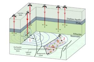
On Earth, water from fracking is injected deep into the ground where it increases the pressure in the pores—tiny spaces between the grains that make up the ground. That pressure can loosen up faults and cause them to slip and send vibrations—the shaking of an earthquake—far and wide.

On Mars, it might also be about the pore pressure, said Manga who is the lead author of a paper describing their hypothesis in the AGU journal Geophysical Research Letters. But instead of fracking, Manga proposes that the wintry temperatures of Mars’s surface might penetrate downward into liquid groundwater, freezing the top layers of groundwater and compressing the still-liquid groundwater below. That pressurized groundwater could be loosening faults on Mars and causing just the sorts of shallow marsquakes that have already been detected by the Insight lander, he said.

That’s not the entire story, however, because marsquakes need triggers. By modeling their hypothetical ice-squeezed aquifers, Manga and his colleagues found that the two likely triggers of marsquakes are the tidal tugs of Mars’s moon Phobos and the Sun, as well as barometric pressure changes. The last is caused by the warming and cooling of its thin atmosphere by the Sun.

If Manga and his colleagues are correct, Insight should start to detect a pattern to marsquakes which match changes in the tidals forces and the barometric pressure. If that happens it could be taken by some as evidence of deep, pressurized groundwater. If that water really exists, future Mars explorers might be able to drill down to it and the water would come shooting out of the ground under its own pressure, like an artesian spring, Manga said.

The hypothesis might also explain some of the features—like icy ridges and ice volcanoes—seen on icy moons in the solar system, he said.

And if the patterns of marquakes do not fit the pattern of pressurized groundwater? “Either way, the answer is fascinating,” said Manga.

Reference:
Michael Manga et al. Squeezing Marsquakes out of groundwater, Geophysical Research Letters (2019). DOI: 10.1029/2019GL082892

Note: The above post is reprinted from materials provided by American Geophysical Union.

The ancient croc that preyed on dinosaurs

Artist’s reconstruction of Isisfordia molnari.
Artist’s reconstruction of Isisfordia molnari. Credit: Josè Vitor Silva.

A new species of crocodile has been described from opalised fossils found at Lightning Ridge in NSW, Australia, from a fossil unearthed more than a century ago, and a second one found more than 70 years later.

Dating back 100 million years, the new species, Isisfordia molnari, is one of the oldest known direct ancestors of today’s living crocodiles. The species was named after Ralph Molnar, a palaeontologist whose many valuable contributions to Australian science include research on fossil crocodiles. This is the second species of Isisfordia discovered, with Isisfordia duncani named in 2006 from fossils found near the Queensland outback town of Isisford.

Isisfordia molnari grew to between 1.5 and 2 metres in length, and is thought to have been a semi-aquatic ambush predator, like modern crocodiles. Its prey probably included small dinosaurs such as Weewarrasaurus.

Lead researcher Lachlan Hart, a Master of Science student at the University of New England in Armidale, explained how the new species was discovered.

“The first crocodile fossil from Lightning Ridge, a partial jaw bone with teeth, was discovered in 1917, at a time when little was known about fossil crocodiles from the Australia’s age of dinosaurs. It found its way to the Australian Museum and was given a name that turned out to be incorrect. Then, in the early 2000s, opal buyers Peter and Lisa Carroll found a piece of fossil crocodile braincase (the rear section of the skull) from Lightning Ridge, and sold it to the Australian Museum; but still, there were so few Australian crocodile fossils known of this age that scientists also found this new piece difficult to interpret.

“After Isisfordia duncani was discovered in Queensland in 2006, it allowed us to make more sense of the earlier Lightning Ridge discoveries. Although they were similar, we found several differences that set the Lightning Ridge species apart.”

Like other fossils from Lightning Ridge, the Isisfordia molnari fossils are opalised, meaning that the original bone and tooth material has been replaced by opal. Other famous opalised fossils from Lightning Ridge include those of the recently announced herbivorous dinosaurs Fostoria dhimbangunmal and Weewarrasaurus pobeni, fossils of which are at the Australian Opal Centre, a public museum that earlier in 2019 secured $20 million to construct a new building at Lightning Ridge for its world-leading collections and programs.

“Lightning Ridge is one of the most important fossil sites in Australia,” said Australian Opal Centre palaeontologist and Special Projects Officer Jenni Brammall. “This new research is adding to a complex and intriguing picture not only of the dinosaurs of the time, but the animals and plants they lived with and the ecosystems they were part of.”

The new crocodile species was published this week in the journal PeerJ, by scientists from the University of New England, Australian Opal Centre and University of Queensland.

Reference:
Lachlan J. Hart et al. Isisfordia molnari sp. nov., a new basal eusuchian from the mid-Cretaceous of Lightning Ridge, Australia, PeerJ (2019). DOI: 10.7717/peerj.7166

Note: The above post is reprinted from materials provided by University of New England.

Peacock rock : What is Peacock rock? Where is peacock rock found?

Peacock rock
Peacock rock

Peacock rock

Chemical Formula: Cu5FeS4
Composition: Copper iron sulfide
Color: Copper-red to yellowish brown on fresh surfaces. Quickly tarnishes to a multicolored purple, blue, and red.
Streak: Dark gray to black
Hardness: 3 – 3.5
Crystal System: Orthorhombic
Rock Type: Igneous, Metamorphic

What is Peacock rock?

Bornite is a sulfide mineral with a chemical composition Cu5FeS4 that crystallizes in the orthorhombic (pseudo-cubic) scheme, also recognized as peacock ore.

On fresh surfaces, bornite has a brown to copper-red color that tarnishes in places in different iridescent shades of blue to purple. Its striking iridescence gives it the peacock copper or peacock ore nickname.

Bornite is an significant mineral copper ore and happens commonly together with the more prevalent chalcopyrite in porphyry copper deposits. In the supergene enrichment area of copper deposits, chalcopyrite and bornite are both typically substituted by chalcocite and covellite. In mafic igneous rocks, in contact metamorphic skarn beds, in pegmatites and sedimentary cupriferous shales, bornite is also discovered as spread. For its carbon content of about 63 percent by volume, it is essential as an element.

What is Peacock rock Structure?

The structure is isometric at temperatures above 228 ° C (442 ° F) with a unit cell around 5.50 Å on the bottom. This design is focused on cubic closed sulfur atoms, with randomly dispersed copper and iron atoms in six of the eight tetrahedral locations situated in the cube’s octants. The Fe and Cu are ordered with cooling, so that 5.5 Å subcells where all eight tetrahedral locations are formed alternate with subcells where only four of the tetrahedral locations are fulfilled; symmetry is decreased to orthorhombic.

What is Peacock rock Composition?

Significant change is feasible in the comparative quantities of copper and iron and solid solution spreads to chalcopyrite (CuFeS2) and digenite (Cu9S5). Blebs and lamellae are commonly removed from chalcopyrite, digenite, and chalcocite.

Where is peacock rock found?

It occurs globally in copper ores with significant crystal locations in Butte, Montana, and U.S. Bristol, Connecticut. It is also gathered in Cornwall, England from the Carn Brea mine, Illogan, and elsewhere. Large crystals can be discovered in the Frossnitz Alps, East Tyrol, Austria; Mangula mine, Lomagundi district, Zimbabwe; N’ouva mine, Talate, Morocco, Tasmania’s West Coast and Dzhezkazgan, Kazakhstan. Traces of it are also discovered among the hematite in Western Australia’s Pilbara area.

New ‘king’ of fossils discovered on Kangaroo Island

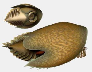
An artists impression of a Redlichia trilobite on the Cambrian seafloor.
An artists impression of a Redlichia trilobite on the Cambrian seafloor. Artwork by Katrina Kenny

Fossils of a giant new species from the long-extinct group of sea creatures called trilobites have been found on Kangaroo Island, South Australia.

The finding is adding important insights to our knowledge of the Cambrian explosion, the greatest diversification event in the history of life on Earth, when almost all animal groups suddenly appeared over half-a-billion years ago.

Trilobites, which had hard, calcified, armour-like skeletons over their bodies, are related to modern crustaceans and insects. They are one of the most successful fossil animal groups, surviving for about 270 million years (521 to 252 million years ago). Because of their abundance in the fossil record, they are considered a model group for understanding this evolutionary period.

“We decided to name this new species of trilobite Redlichia rex (similar to Tyrannosaurus rex) because of its giant size, as well as its formidable legs with spines used for crushing and shredding food—which may have been other trilobites,” says James Holmes, Ph.D. student with the University of Adelaide’s School of Biological Sciences, who led the research.

The preservation of trilobite soft parts such as the antennae and legs is extremely rare. The new species was discovered at the Emu Bay Shale on Kangaroo Island, a world-renowned deposit famous for this type of preservation. The findings have been published in the Journal of Systematic Palaeontology by a team of scientists from the University of Adelaide, South Australian Museum and the University of New England.

The new species is about 500 million years old, and is the largest Cambrian trilobite discovered in Australia. It grew to around 30 cm in length, which is almost twice the size of other Australian trilobites of similar age.

“Interestingly, trilobite specimens from the Emu Bay Shale—including Redlichia rex—exhibit injuries that were caused by shell-crushing predators,” says senior study author Associate Professor Diego García-Bellido, from the University of Adelaide and the South Australian Museum.

“There are also large specimens of fossilized poo (or coprolites) containing trilobite fragments in this fossil deposit. The large size of injured Redlichia rex specimens and the associated coprolites suggests that either much bigger predators were targeting Redlichia rex, such as Anomalocaris—an even larger shrimp-like creature—or that the new species had cannibalistic tendencies.”

One of the major drivers of the Cambrian explosion was likely an evolutionary “arms race” between predators and prey, with each developing more effective measures of defense (such as the evolution of shells) and attack.

“The overall size and crushing legs of Redlichia rex are a likely consequence of the arms race that occurred at this time” says James Holmes. “This giant trilobite was likely the terror of smaller creatures on the Cambrian seafloor.”

Specimens of Redlichia rex and other Emu Bay Shale fossils are currently on display in the South Australian Museum.

Reference:
James D. Holmes et al. The trilobite Redlichia from the lower Cambrian Emu Bay Shale Konservat-Lagerstätte of South Australia: systematics, ontogeny and soft-part anatomy, Journal of Systematic Palaeontology (2019). DOI: 10.1080/14772019.2019.1605411

Note: The above post is reprinted from materials provided by University of Adelaide.

Stresses from past earthquakes explain location of seismic events

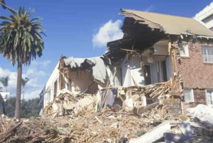
 Earthquake damage in the centre of Amatrice, Italy, in 2016 (
Earthquake damage in the centre of Amatrice, Italy, in 2016 (Credit Zoe Mildon)

The cumulative stresses caused by historic earthquakes could provide some explanation as to why and where they occur, according to new research.

Scientists have previously struggled to identify patterns for earthquakes happening in hazardous areas around the world, with the suggestion that they appear to strike largely at random.

However, a study published in Nature Communications suggests that Coulomb pre-stress—the static stress present on a fault plane prior to rupture—can go some way to explaining both historical and modern series of earthquakes.

The study was led by Dr. Zoë Mildon, Lecturer in Earth Sciences at the University of Plymouth, and features research conducted during her Ph.D. at University College London (UCL). It also involved researchers from UCL, Birkbeck, University of London and Tohoku University in Japan, and was funded by the Natural Environment Research Council and the Japan Society for the Promotion of Science.

It combines centuries of written evidence of earthquake damage to towns and villages with state-of-the-art modelling, through which scientists demonstrate that positive stresses—a legacy of previous earthquakes in the region—are present on faults before the majority of earthquakes occur.

Dr. Mildon recently presented some of her findings at the 2019 General Assembly of the European Geophysics Union, and said: “Earthquakes are caused by rock sliding past each other along fault lines which causes the forces and stress in the surrounding rocks to change after a big earthquake. It is often assumed that the nearest fault to a particular earthquake will be the next to rupture. However, our study shows this is never the case so typical approaches to modelling Coulomb stress transfer (CST) have limited potential to improve seismic hazard assessment.

“Our model adds the stresses of lots of earthquakes together and shows that in the majority of cases fault lines are positively stressed when they rupture. It is a step change in modelling CST and shows this is an ignored yet vital factor when trying to explain earthquake triggering.”

The research focuses on the central Apennines region of Italy, which has regularly been struck by earthquakes over the past 700 years.

These historical earthquakes are known about from written records started in 1349 that detail the amount of damage and lives lost in individual towns and villages throughout the region. By looking at the locations and amount of damage, scientists can work out where, when and how large historical earthquakes occurred.

Looking at the locations of earthquakes over the last 700 years, it would be easy to assume these incidents occurred at random as they jump around the region.

But using their new method, they were able to demonstrate that 97 per cent (28 out of 29) of the earthquakes between 1703 and 2016 occurred on faults that were either wholly or partially positively stressed.

This includes the series of earthquakes that destroyed the town of Amatrice and Norcia in 2016, leaving almost 300 people dead and whole towns reduced to rubble.

Dr. Mildon added: “Earthquakes are hugely destructive to both people and property, and the Holy Grail of earthquake science would be to predict where they are going to happen and when. We are a very long way from that, and indeed it may never be possible to accurately predict the location, time and size of future earthquakes. Our research, however, could be a starting point in helping us develop better forecasts of which fault lines might be more susceptible based on previous tremors.”

Reference:
Mildon et al: Coulomb pre-stress and fault bends: ignored yet vital factors for earthquake triggering and seismic hazard, Nature Communications (2019). DOI: 10.1038/s41467-019-10520-6

Note: The above post is reprinted from materials provided by University of Plymouth.

Earthquake swarms reveal missing piece of tectonic plate-volcano puzzle

Deep earthquake swarms show the path of fluids released from the subducted Pacific Plate.
Deep earthquake swarms show the path of fluids released from the subducted Pacific Plate. Credit: Lloyd White, University of Wollongong

Deep under the ocean bed, a sinking tectonic plate causes a “swarm” of earthquakes, feeding molten rock into newly forming volcanoes, new research has discovered.

Earthquake swarms are when a large number of earthquakes occur close together over a short period. Researchers found two such swarms while studying the Mariana and Izu-Bonin arc system in the Pacific Ocean.

By plotting each earthquake swarm on a three-dimensional map, the researchers found the earthquakes defined a pipe-like structure through which the molten rock travelled, rising from a sinking tectonic plate at depths of around 200km to a magma chamber underneath a volcano.

The discovery solves a missing piece of the tectonic puzzle: revealing the path that fluids and molten rock move through the deep Earth to volcanoes at the surface.

The international team included scientists from the University of Wollongong (UOW), Royal Holloway University of London, University of Cambridge, Australian National University, Columbia University, Cardiff University and Durham University.

The Mariana and Izu-Bonin arc system lies on the ocean bed, stretching 2800 kilometres from Japan south to Guam and beyond. It marks where two tectonic plates—the Philippine Sea Plate and the Pacific Plate—meet.

As the Pacific Plate subducts, sinking into the Earth’s mantle, it carries water deep down into the Earth. The plate gets hotter and experiences more pressure the deeper it goes, until superheated water tries to escape, causing the rock to fracture and melt and creating a pathway for the molten rock to rise.

Lead author Dr. Lloyd White from UOW’s School of Earth, Atmospheric and Life Sciences described the process as a natural hydro-fracking effect.

“In fracking used by the petroleum industry, they drill into the Earth up to a few kilometres deep, and then continue to pump liquid down until the pressure grows and the rocks crack, creating a path for the petroleum or natural gas to flow through the rocks and into a pipe back to the surface,” Dr. White said.

“In this case, the tectonic plate carries the water down very deep into the Earth, down to around 200 kilometres below the surface. As the plate goes down it gets hotter and the pressure gets higher, driving water out of subducted plate.

“It’s ultimately the water that causes those slowly moving rocks to melt as well as to cause these rare earthquakes. The water gets so hot and is under so much pressure that it needs to get away. As it moves upwards it causes the rocks to fracture and melt, forming magma, and that magma is what feeds to volcano at the top of the system.

“It is similar to fracking, but at a much grander scale and completely driven by Earth’s natural processes, rather than being human induced.”

The two earthquake swarms occurred deep in the Earth in a zone that doesn’t usually have any earthquakes. The simplest explanation is they were caused by a process similar to fracking, either by the rock breaking ahead of the superheated fluid, or by the pipe collapsing after the fluid had moved through the system.

“Geologists have always assumed that the water in this system goes upwards, but we’ve never had a good way of imaging that. These examples—a freak occurrence that we’ve stumbled on—show very clearly where the water must be travelling,” Dr. White said.

Co-author Dr. Dominique Tanner, also from UOW’s School of Earth, Atmospheric and Life Sciences, said: “We can actually use the earthquakes to figure out how quickly these fluids travel. We know exactly when and where the earthquakes occur, so we can estimate how quickly the fluid moves through the deep Earth, which is faster than one kilometre an hour—much faster than we previously thought.”

While a lot more research is needed, the discovery may help scientists in monitoring which volcanoes are being primed with increasing amounts of magma from the deep Earth.

Reference:
Lloyd T. White et al. Earth’s deepest earthquake swarms track fluid ascent beneath nascent arc volcanoes, Earth and Planetary Science Letters (2019). DOI: 10.1016/j.epsl.2019.05.048

Note: The above post is reprinted from materials provided by University of Wollongong.

Zipingpu Reservoir reveals climate-tectonics interplay around 2008 Wenchuan earthquake

Zipingpu Reservoir
Fig 1. Chronology of the Zipingpu reservoir sediment core based on the correlation between reservoir water level and sedimentary MS. Credit: Jin Zhangdong, et al.

The roles of “climate change” versus “tectonics” that dominate erosion and sediment transport over geological time scales have long been a hot topic in Earth science. How to effectively separate their respective roles is a big challenge, like the famous “chicken or egg” question.

A new study led by Prof. Jin Zhangdong from the Institute of Earth Environment (IEE) of the Chinese Academy of Sciences provided a new insight on the interplay between climate and tectonics from a sediment record in the Zipingpu Reservoir around the 2008 Wenchuan earthquake. The findings were published in Science Advances on June 12.

Infrequent extreme events such as large earthquakes pose hazards and have lasting impacts on landscapes and biogeochemical cycles. Sediments provide valuable records of past events, but unambiguously identifying event deposits is challenging because of nonlinear sediment transport processes and poor age control.

The Zipingpu Reservoir, with annually resolved sediments, provides a unique opportunity to document the link between a large earthquake and its sedimentary signature, because it was completed in September 2004 and is located downstream of the area impacted by the 2008 Wenchuan earthquake.

In October 2016, a 10.89-m sediment core back to the river bed was recovered from the Zipingpu Reservoir. An age model for the core was developed based on the correlation between sedimentary magnetic susceptibility and reservoir water level. The boundary of the 2008 Wenchuan earthquake was then assigned to the core depth of 6.20 m (Fig. 1). This is the first time that a 10-year sediment core was dated to annual resolution.

Based on the precise annual chronology, the roles of a single large earthquake and climate on erosion and sediment transfer were evaluated along with sedimentary and hydrometeorological data. The records demonstrated that the grain size and Rb/Sr ratios of the sediments in the Zipingpu Reservoir responded immediately to the earthquake. However, the changes were muted until two years after the event.

The most obvious seismic signals occurred in 2010 when intense monsoonal runoff facilitated fast material export and drove accumulation of coarser grains and lower Rb/Sr sediments, which were then sustained for several years (Fig. 2).

The results indicated that, although the earthquake mobilized very large amounts of sediment by landsliding, hydrological forcing was necessary to transport this debris from hillslopes to downstream sediment stores, even in a location proximal to the mountain front.

The delayed response highlighted the role of intense monsoonal rainfall in propagating tectonic signals into sedimentary archives.

This study provides direct evidence that can inform the interpretation of paleorecords and help to illuminate the ways in which sedimentary archives reflect the complex interaction of tectonics and climate in controlling sediment transfer in tectonically active mountain ranges.

Reference:
Fei Zhang et al, Monsoonal control on a delayed response of sedimentation to the 2008 Wenchuan earthquake, Science Advances (2019). DOI: 10.1126/sciadv.aav7110

Note: The above post is reprinted from materials provided by Chinese Academy of Sciences.

Deep-Sea Fish Do Not Signal Upcoming Earthquake in Japan

Oarfish specimen
Oarfish specimen, Natural History Museum of San Diego. | Patrick Emerson

The unusual appearance of deep-sea fish like the oarfish or slender ribbonfish in Japanese shallow waters does not mean that an earthquake is about to occur, according to a new statistical analysis.

The study published in the Bulletin of the Seismological Society of America contradicts long-held Japanese folklore that deep sea fish sightings are a sign of an imminent earthquake, say Yoshiaki Orihara of Tokai University in Japan and colleagues.

When the researchers examined the relationship between deep-sea fish appearances and earthquakes in Japan, however, they found only one event that could have been plausibly correlated, out of 336 fish sightings and 221 earthquakes.

“As a result, one can hardly confirm the association between the two phenomena,” the authors write in the BSSA paper.

The study included data from November 1928 to March 2011, looking at records of deep-sea fish appearances 10 and 30 days ahead of earthquakes that occurred 50 and 100 kilometers away from the fish sighting.

They confined their search to earthquakes of magnitude 6.0 or larger, since these are the earthquakes that have been linked to “precursor phenomena like unusual animal behavior in previous reports,” said Orihara.

There were no recorded deep-sea fish appearances before an earthquake of magnitude 7.0, and no earthquakes with a magnitude greater than 6.0 occurred within 10 days of a deep-sea fish appearance.

Orihara became interested in the deep-sea fish stories after the 2011 magnitude 9.0 Tohoku earthquake in Japan. If the stories were true, he said, deep-sea fish appearances could be used in disaster mitigation efforts.

“From this motivation, we started compiling the event catalog for statistical study,” said Orihara. “There were some previous papers to survey deep-sea fish appearances. However, their reports were insufficient for a statistical study. To collect a lot of events, we focused on local newspapers that have often reported the events.”

The researchers scoured a digitized database of newspaper articles to find mentions of the unusual appearance of deep-sea fish that folklore says will appear before an earthquake, including oarfish, several kinds of ribbonfish, dealfish and the unicorn crestfish.

Orihara said that he and his colleagues expect that their results “will have an influence on people who believe the folklore,” and they hope that their findings will be shared throughout Japan.

Reference:
Yoshiaki Orihara et al, Is Japanese Folklore Concerning Deep‐Sea Fish Appearance a Real Precursor of Earthquakes?, Bulletin of the Seismological Society of America (2019). DOI: 10.1785/0120190014

Note: The above post is reprinted from materials provided by Seismological Society of America.

The secret of platinum deposits revealed by novel field observations in the Bushveld Complex

Dr Sofya Chistyakova
Dr Sofya Chistyakova. Credit: Wits University

Research from the Wits School of Geoscience shows how platinum deposits form in the Bushveld Complex of South Africa.

Most of the world’s economically viable platinum deposits occur as “reefs” in layered intrusions—thin layers of silicate rocks that contain sulphides enriched in platinum group elements which are so vital for the sustainable development of modern human society.

There are two competing ideas of how platinum deposits formed: the first involves gravity-induced settling of crystals on the chamber floor, while the second idea implies that the crystals grow in situ, directly on the floor of the magmatic chamber.

Through examining the Merensky Reef of the Bushveld Complex in South Africa, which hosts the lion’s share of the world’s platinum and other noble metals, Dr. Sofya Chistyakova from the School of Geosciences of the University of the Witwatersrand and her collaborators have established that the crystals grow in situ, with its high platinum status being attained while all its minerals were crystallizing along the cooling margins of the magma chamber. Their research was published in a paper in Scientific Reports.

One of the remarkable features of the Bushveld Complex is that at the time when the Merensky Reef was forming, some portions of its chamber floor were highly irregular due to circular depressions (potholes). Such potholes with the Merensky Reef are best exposed in underground exposures of platinum mines.

“Our key discovery is that the entire Merensky Reef package in these potholes may develop as a ‘rind’ covering all the chamber floor depressions and culminations, even where these are vertical or overhanging” says Chistyakova.

This finding points to no possibility for the Merensky Reef to be formed by crystal settling on the chamber floor because sinking crystals cannot penetrate the solid rocks that form the pothole’s overhangs. This strongly supports the concept that the silicate minerals and sulphides of platinum deposits grow directly at the floor of magmatic chambers.

“This is the most fundamental conclusion of our work and it can probably be applied to platinum deposits in other layered intrusions as well as potentially extended to other types of magmatic deposits, for example, chromite and Fe-Ti-V magnetite ores in mafic-ultramafic complexes” says Chistyakova.

Reference:
Sofya Chistyakova et al. Merensky-type platinum deposits and a reappraisal of magma chamber paradigms, Scientific Reports (2019). DOI: 10.1038/s41598-019-45288-8

Note: The above post is reprinted from materials provided by Wits University.
Plate tectonics may have driven ‘Cambrian Explosion’

Plate Tectonics
The outer layer of modern Earth is a collection of interlocking rigid plates, as seen in this illustration. These plates grind together, sliding past or dipping beneath one another, giving rise to earthquakes and volcanoes. But new research suggests that plate tectonics did not begin until much later in Earth’s history. Credit: USGS

The quest to discover what drove one of the most important evolutionary events in the history of life on Earth has taken a new, fascinating twist.

A team of scientists have given a fresh insight into what may have driven the “Cambrian Explosion” — a period of rapid expansion of different forms of animal life that occurred over 500 million years ago.

While a number of theories have been put forward to explain this landmark period, the most credible is that it was fuelled by a significant rise in oxygen levels which allowed a wide variety of animals to thrive.

The new study suggests that such a rise in oxygen levels was the result of extraordinary changes in global plate tectonics.

During the formation of the supercontinent ‘Gondwana’, there was a major increase in continental arc volcanism — chains of volcanoes often thousands of miles long formed where continental and oceanic tectonic plates collided. This in turn led to increased ‘degassing’ of CO2 from ancient, subducted sedimentary rocks.

This, the team calculated, led to an increase in atmospheric CO2 and warming of the planet, which in turn amplified the weathering of continental rocks, which supplied the nutrient phosphorus to the ocean to drive photosynthesis and oxygen production.

The study was led by Josh Williams, who began the research as an MSc student at the University of Exeter and is now studying for a PhD at the University of Edinburgh.

During his MSc project he used a sophisticated biogeochemical model to make the first quantification of changes in atmospheric oxygen levels just prior to this explosion of life.

Co-author and project supervisor Professor Tim Lenton, from the University of Exeter’s Global Systems Institute said: “One of the great dilemmas originally recognised by Darwin is why complex life, in the form of fossil animals, appeared so abruptly in what is now known as the Cambrian explosion.

“Many studies have suggested this was linked to a rise in oxygen levels — but without a clear cause for such a rise, or any attempt to quantify it.”

Not only did the model predict a marked rise in oxygen levels due to changes in plate tectonic activity, but that rise in oxygen — to about a quarter of the level in today’s atmosphere — crossed the critical levels estimated to be needed by the animals seen in the Cambrian explosion.

Williams added: “What is particularly compelling about this research is that not only does the model predict a rise in oxygen to levels estimated to be necessary to support the large, mobile, predatory animal life of the Cambrian, but the model predictions also show strong agreement with existing geochemical evidence.”

“It is remarkable to think that our oldest animal ancestors — and therefore all of us — may owe our existence, in part, to an unusual episode of plate tectonics over half a billion years ago” said Professor Lenton.

Reference:
Joshua J. Williams, Benjamin J. W. Mills, Timothy M. Lenton. A tectonically driven Ediacaran oxygenation event. Nature Communications, 2019; 10 (1) DOI: 10.1038/s41467-019-10286-x

Note: The above post is reprinted from materials provided by University of Exeter.

Some of Earth’s oldest animals could take trips

The fossilized remains of Dickinsonia found at the Nilpena Heritage site in Australia. Credit: Scott Evans / UCR

New UC Riverside-led research settles a longstanding debate about whether the most ancient animal communities were deliberately mobile. It turns out they were, because they were hungry.

“This is the first time in the fossil record we see an animal moving to get food,” said study lead Scott Evans, a UCR paleontology doctoral candidate.

Evans’ team demonstrated that the 550-million-year-old ocean-dwelling creatures moved on their own rather than being pushed around by waves or weather. The research answers questions about when, why and how animals first developed mobility.

The team searched for evidence of movement in more than 1,300 fossils of Dickinsonia, dinner-plate-shaped creatures up to a meter long that lived and fed on a layer of ocean slime.

Details of the team’s analysis were published this month in the journal Geobiology. It found that Dickinsonia move like worms, constricting and relaxing their muscles to go after their next meal of microorganisms.

Dickinsonia were first discovered in the 1940s and since then, scientists have debated whether the fossils showed evidence of self-directed movement. To test this, it was crucial that Evans be able to analyze how multiple creatures living in the same area behaved relative to one another.

Evans and study co-author Mary Droser, a UCR professor of paleontology, reasoned that if Dickinsonia were riding waves or caught in storms, then all the individuals in the same area would have been moved in the same direction. However, that isn’t what the evidence shows.

“Multiple fossils within the same community showed random movement not at all consistent with water currents,” Evans said.

Critically, Evans was able to use fossil communities in the Australian outback unearthed by Droser and paper co-author James Gehling of the South Australian Museum. The duo systematically excavated large bed surfaces containing as many as 200 Dickinsonia fossils, allowing Evans to test whether the groups of the animals moved in the same or different directions, Evans said.

The team also analyzed the directions traveled by individual Dickinsonia.

“Something being transported by current should flip over or be somewhat aimless,” Evans said. “These movement patterns clearly show directionality based on the animals’ biology, and that they preferred to move forward.”

Future studies at UCR will try to determine what Dickinsonia bodies were made of. “The tissues of the animals are not preserved, so it’s not possible to directly analyze their body composition,” he said. “But we will look at other clues they left behind.”

Understanding Dickinsonia’s capabilities offers insight not only into the evolution of animal life on Earth, but also about the Earth itself and possibly about life on other planets.

“If we want to search for complex life on other planets, we need to know how and why complex life evolved here,” Evans said. “Knowing the conditions that enabled large mobile organisms to move during the Ediacaran era, 550 million years ago, gives us a clue about the habitable zone elsewhere.”

That Dickinsonia could move helps confirm a large amount of oxygen was available in Earth’s oceans during that time period, since it would have been required to fuel their movement. In a related study, Evans explored a spike in ocean oxygen levels during the Ediacaran period. Later, when oxygen levels dropped, Evans said that Dickinsonia — and things like them — went extinct.

Reference:
Scott D. Evans, James G. Gehling, Mary L. Droser. Slime travelers: Early evidence of animal mobility and feeding in an organic mat world. Geobiology, 2019; DOI: 10.1111/gbi.12351

Note: The above post is reprinted from materials provided by University of California – Riverside. Original written by Jules Bernstein.

Marine life recovery following the dinosaurs’ extinction

Fossils
The team studied nearly 3000 fossils. Photo credit: Rowan Whittle

A new study shows how marine life around Antarctica returned after the extinction event that wiped out the dinosaurs.

A team led by British Antarctic Survey studied just under 3000 marine fossils collected from Antarctica to understand how life on the sea floor recovered after the Cretaceous-Paleogene (K-Pg) mass extinction 66 million years ago. They reveal it took one million years for the marine ecosystem to return to pre-extinction levels. The results are published today (19 June 2019) in the journal Palaeontology.

The K-Pg extinction wiped out around 60% of the marine species around Antarctica, and 75% of species around the world. Victims of the extinction included the dinosaurs and the ammonites. It was caused by the impact of a 10 km asteroid on the Yucatán Peninsula, Mexico, and occurred during a time period when the Earth was experiencing environmental instability from a major volcanic episode. Rapid climate change, global darkness, and the collapse of food chains affected life all over the globe.

The K-Pg extinction fundamentally changed the evolutionary history of life on Earth. Most groups of animals that dominate modern ecosystems today, such as mammals, can trace the roots of their current success back to the aftermath of this extinction event.

A team of scientists from British Antarctic Survey, the University of New Mexico and the Geological Survey of Denmark & Greenland show that in Antarctica, for over 320,000 years after the extinction, only burrowing clams and snails dominated the Antarctic sea floor environment. It then took up to one million years for the number of species to recover to pre-extinction levels.

Author Dr Rowan Whittle, a palaeontologist at British Antarctic Survey says:

“This study gives us further evidence of how rapid environmental change can affect the evolution of life. Our results show a clear link in the timing of animal recovery and the recovery of Earth systems.”

Author Dr James Witts, a palaeontologist at University of New Mexico says:

“Our discovery shows the effects of the K-Pg extinction were truly global, and that even Antarctic ecosystems, where animals were adapted to environmental changes at high latitudes like seasonal changes in light and food supply, were affected for hundreds of thousands of years after the extinction event.”

Reference:
Rowan J. Whittle, James D. Witts, Vanessa C. Bowman, J. Alistair Crame, Jane E. Francis, Jon Ineson. Nature and timing of biotic recovery in Antarctic benthic marine ecosystems following the Cretaceous-Palaeogene mass extinction. Palaeontology, 2019; DOI: 10.1111/pala.12434

Note: The above post is reprinted from materials provided by British Antarctic Survey.

Site of biggest ever meteorite collision in the UK discovered

laminar beds of sandstone

Scientists believe they have discovered the site of the biggest meteorite impact ever to hit the British Isles.

Evidence for the ancient, 1.2 billion years old, meteorite strike, was first discovered in 2008 near Ullapool, NW Scotland by scientists from Oxford and Aberdeen Universities. The thickness and extent of the debris deposit they found suggested the impact crater — made by a meteorite estimated at 1km wide — was close to the coast, but its precise location remained a mystery.

In a paper published today in Journal of the Geological Society, a team led by Dr Ken Amor from the Department of Earth Sciences at Oxford University, show how they have identified the crater location 15-20km west of a remote part of the Scottish coastline. It is buried beneath both water and younger rocks in the Minch Basin.

Dr Ken Amor said: ‘The material excavated during a giant meteorite impact is rarely preserved on Earth, because it is rapidly eroded, so this is a really exciting discovery. It was purely by chance this one landed in an ancient rift valley where fresh sediment quickly covered the debris to preserve it.

‘The next step will be a detailed geophysical survey in our target area of the Minch Basin.’

Using a combination of field observations, the distribution of broken rock fragments known as basement clasts and the alignment of magnetic particles, the team was able to gauge the direction the meteorite material took at several locations, and plotted the likely source of the crater.

Dr Ken Amor said: ‘It would have been quite a spectacle when this large meteorite struck a barren landscape, spreading dust and rock debris over a wide area.’

1.2 billion years ago most of life on Earth was still in the oceans and there were no plants on the land. At that time Scotland would have been quite close to the equator and in a semi-arid environment. The landscape would have looked a bit like Mars when it had water at the surface.

Earth and other planets may have suffered a higher rate of meteorite impacts in the distant past, as they collided with debris left over from the formation of the early solar system.

However, there is a possibility that a similar event will happen in the future given the number of asteroid and comet fragments floating around in the solar system. Much smaller impacts, where the meteorite is only a few meters across are thought to be relatively common perhaps occurring about once every 25 years on average.

It is thought that collisions with an object about 1 km (as in this instance) across occur between once every 100,000 years to once every one million years — but estimates vary.

One of the reasons for this is that our terrestrial record of large impacts is poorly known because craters are obliterated by erosion, burial and plate tectonics.

Reference:
Kenneth Amor, Stephen P. Hesselbo, Don Porcelli, Adam Price, Naomi Saunders, Martin Sykes, Jennifer Stevanović, Conal MacNiocaill. The Mesoproterozoic Stac Fada proximal ejecta blanket, NW Scotland: constraints on crater location from field observations, anisotropy of magnetic susceptibility, petrography and geochemistry. Journal of the Geological Society, 2019; jgs2018-093 DOI: 10.1144/jgs2018-093

Note: The above post is reprinted from materials provided by University of Oxford.

Building blocks of the Earth

Earth
Earth. Photo credit: Pr3t3nd3r/Getty Images Plus

Chemical analyses of meteorites allow for a better estimation of the chemical composition of the Earth and its potential building blocks. That is the result of a study conducted by a research team from the Institutes of Geology and Mineralogy at the Universities of Cologne and Bonn. The results have appeared in the current issue of Nature Geoscience.

The study focuses on the distribution and origin of so-called volatile elements such as zinc, lead and sulphur, which have low boiling temperatures in space. The newly determined distribution of these volatile elements in the Earth shows that some of these building blocks have a chemical composition similar to carbonaceous chondrites, an aqueous group of primitive meteorites. These meteorites come closest to the composition of the original solar nebula from which our solar system formed. Thus, the study also indirectly provides another valuable indication of the source of vital components such as water, carbon and nitrogen on Earth.

The chemical composition of the Earth is not easy to determine. Geological processes such as the formation of the metallic core and the outer crust led to a redistribution of the elements composing our planet. For example, elements attracted to iron have migrated into the Earth’s core, while elements attracted to silicate compose the rocks of the Earth’s mantle and crust. ‘Today, we only have access to samples from the silicate part of the Earth, which is why we can only estimate the chemical composition of the entire Earth through the additional analysis of primitive meteorites — the potential building blocks of the Earth,’ said Professor Carsten Münker from the University of Cologne. The recent publication makes an important contribution to understanding the chemical composition of the deeper layers of the Earth.

The research team focused on the distribution of volatile trace elements such as the rare metals indium, cadmium and tellurium. This is a particular challenge since a proportion of these metals was lost already at the beginning of the solar system due to their volatility. Today, they are extremely rare both in meteorites and in the Earth — less than one gram per ton of rock. ‘So far, we have always assumed that the distribution of these elements decreases linearly the more volatile they are,’ said the geochemist Dr Frank Wombacher, one of the initiators of the study.

By using high-precision methods, however, the scientists arrived at a surprising result. ‘While the frequencies initially decrease linearly, contrary to expectations the most volatile elements are all equally depleted,’ explains Ninja Braukmüller, a doctoral researcher who carried out the study in Cologne. Indium and zinc, the volatile elements attracted to silicate in the Earth’s mantle, also show this pattern. ‘This seems to be unique among the potential building blocks of the Earth,’ says Dr Claudia Funk, a co-author of the study. The results allow the scientists to conclude that the building blocks that have brought volatile elements to Earth are similar in their chemical composition to that of primitive carbonaceous chondrites.

Reference:
Ninja Braukmüller, Frank Wombacher, Claudia Funk, Carsten Münker. Earth’s volatile element depletion pattern inherited from a carbonaceous chondrite-like source. Nature Geoscience, 2019; DOI: 10.1038/S41561-019-0375-X

Note: The above post is reprinted from materials provided by University of Cologne.

Related Articles