Home Blog Page 38

Volcanic eruptions have more effect in summer

The team has developed a simulation of the Mount Pinatubo eruption in 1991. The blue shading represents sulfur dioxide, the white shading represents sulfate aerosols and the orange area represents volcanic ash. Credit: KAUST

Detailed modeling of the effect of volcanic eruptions on the El Niño Southern Oscillation (ENSO) has shown that the climate response to these events depends on the timing of the eruption and the preceding conditions. The research, led by KAUST researchers Evgeniya Predybaylo and Georgiy Stenchikov, settles a long-standing debate about the role of volcanic eruptions in global climate perturbations.

“The ENSO is a feature of the tropical Pacific Ocean climate, with patterns of temperature, precipitation and wind that oscillate between warmer El Niño and cooler La Niña phases every two to seven years,” explains Predybaylo. “Due to the vast size of the tropical Pacific, the ENSO controls the climate in many other parts of the globe and is responsible for droughts, floods, hurricanes, heat waves and other severe weather events. To evaluate these risks, it is essential to have proper projections and predictions of future ENSO behavior.”

Climate modeling indicates that the ENSO is very sensitive to external perturbations, such as increased carbon dioxide in the atmosphere or volcanic eruptions. Even though major volcanic eruptions, like the Mount Pinatubo eruption in 1991, are known to have caused widespread cooling due to the reflection of solar radiation, such effects have been difficult to prove by modeling.

“There was previously no modeling consensus on how the Pacific Ocean responds to such climatologically large volcanic eruptions, with climate models predicting diverse and often contradictory responses,” says Sergey Osipov from the research team.

Because the tropical Pacific climate is itself highly variable, the modeling needs to be performed carefully to separate the eruption-driven ocean response from random variations. This requires a large number of climate simulations using a model that can simulate both the radiative impact of volcanic eruptions and a realistic ENSO cycle. To achieve this, the team collaborated with Andrew Wittenberg from Princeton University, US, to run the CM2.1 climate model using KAUST’s supercomputer.

“After running more than 6,000 climate simulations covering nearly 20,000 model years and analyzing the data,” says Predybaylo, “we found that the ENSO response to stratospheric volcanic eruptions strongly depends on the seasonal timing of the eruption and the state of the atmosphere and ocean in the Pacific at the time.”

In particular, the research showed that even very large eruptions seem to have little discernible effect on the ENSO in winter or spring, while summer eruptions almost always produce a strong climate response.

“The principles and techniques developed in our study could also be applied to various types of observational data and multimodel studies of future climate change, including the effects of global warming,” says Predybaylo.

Reference:
Evgeniya Predybaylo et al, El Niño/Southern Oscillation response to low-latitude volcanic eruptions depends on ocean pre-conditions and eruption timing, Communications Earth & Environment (2020). DOI: 10.1038/s43247-020-0013-y

Note: The above post is reprinted from materials provided by King Abdullah University of Science and Technology.

Researchers discover ‘missing’ piece of Hawaii’s formation

The journey of Hawaii’s pancake from its creation at the mantle plume to where it slipped under the Pacific plate and sunk deep into the Earth’s mantle. Credit: Michigan State University

An oceanic plateau has been observed for the first time in the Earth’s lower mantle, 800 kilometers deep underneath Eastern Siberia, pushing Hawaii’s birthplace back to 100 million years, says a Michigan State University geophysicist.

The discovery came when Songqiao “Shawn” Wei, an Endowed Assistant Professor of Geological Sciences in MSU’s Department of Earth and Environmental Sciences, noticed something unusual in his data using groundbreaking techniques. Wei’s research will be published on Nov. 20 in the journal Science.

The Earth’s mantle is mostly solid, but at a mid-ocean ridge it melts creating new oceanic crust between two tectonic plates such as the Pacific Plate. Typically, this new Pacific Ocean crust has a uniform thickness of four miles, Wei said.

As the plates continue to move, a hot plume of solid rocks slowly rises in the mantle melting the tectonic plate to create volcanoes like the Hawaiian Islands. The mantle plume has a mushroom-like shape with a wide head that is thousands of miles across and a thin tail that is only of a few hundred miles across.

Wei said once this mushroom head reaches the Earth’s surface in the ocean, it stretches and flattens out, while it melts the overriding tectonic plate to form a pancake-shaped 20-mile-thick oceanic plateau. This process continues as more of the mantle reaches the surface and the overriding plate continues to move. Over time, what remains is a dotted trail of islands.

“Normally, you would see a pancake-shaped oceanic plateau created by the mushroom’s head followed by a dotted chain of islands created by the mushroom’s tail,” Wei said. “The Hawaiian Islands are the end of the tail but where is Hawaii’s pancake head?”

There are still debates on whether every mantle plume creates a “pancake” during its earliest history, and the ultimate destination of these pancake-shaped oceanic plateaus. Trying to find ancient oceanic crust, including old oceanic plateaus, is difficult because the crust might have subducted or slid into or underneath an oceanic trench and disappeared from the Earth’s surface.

Although scientists generally believe the oceanic crust is preserved in the Earth’s mantle after subduction, it is usually too thin to be observed using conventional technology, such as seismic tomography. Up until now, this is what Wei thought happened to Hawaii’s “pancake” until he detected a surprising signal in the data.

“I spotted an unusually thick chunk of oceanic crust about 500 miles beneath the Earth’s surface,” he said. “The thickness of this piece of crust made it distinguishable, but it was still too thin and too deep to be easily found.”

Wei and his team compiled the largest dataset of a specific type of seismograms and conducted big data analysis and numerical simulations on the High-Performance Computing Cluster managed by the MSU Institute for Cyber-Enabled Research. His collaborators include: Peter M. Shearer from Scripps Institute of Oceanography; Carolina Lithgow-Bertelloni and Lars Stixrude from the University of California, Los Angeles; and Dongdong Tian from MSU.

The team also combined the strengths of seismic tomography, seismic reflection and mineral physics. Seismic tomography from previously published work creates a 3-D image which revealed a vague image of the ancient Pacific Plate in the mantle. Seismic reflection results —the core observation of this work—helped the researchers find the thick crust at great depths. Mineral physics was used by the team to prove that the detected signal indicates a piece of oceanic plateau.

Plate reconstruction modeling helped the researchers link the newly found oceanic plateau to the Hawaiian “pancake” that was created during the formation of the Hawaii hotspot approximately 100 million years ago.

One hypothesis is that the Hawaii “pancake” broke into two pieces.

One piece was part of the Izanagi Plate which subducted into the Aleutian Trench and disappeared about 70-80 million years ago. The other piece was part of the Pacific Plate and after it entered the Kamchatka Trench 20-30 million years ago, the heavy oceanic crust sunk deep into the Earth’s mantle later until Wei and his team spotted it.

This discovery not only provides clues of Hawaii’s early history, but also sheds light on the evolution of other hotspots, seamounts and oceanic plates.The researchers plan to use this new technique combining seismic tomography, seismic reflection and mineral physics to find other “missing pancakes” and to continue looking for evidence of older pieces of Earth’s oceanic crust in the deep Earth.

Reference:
Songqiao Shawn Wei et al. Oceanic plateau of the Hawaiian mantle plume head subducted to the uppermost lower mantle, Science (2020). DOI: 10.1126/science.abd0312

Note: The above post is reprinted from materials provided by Michigan State University.

New placement for one of Earth’s largest mass extinction events

End Triassic vs Anthropocene

Curtin University research has shed new light on when one of the largest mass extinction events on Earth occurred, which gives new meaning to what killed Triassic life and allowed the ecological expansion of dinosaurs in the Jurassic period.

The research, published in the prestigious journal PNAS, examined biomarkers (molecular fossils) and their stable isotopic compositions which suggest the end-Triassic mass extinction of prehistoric creatures such as conodonts and phytosaurs began after a volcanic eruption spewed carbon dioxide into the atmosphere, disrupting the Earth’s natural carbon cycle and sparking a chain reaction of environmental events.

That carbon disruption led to acidic ocean waters which then affected delicate marine ecosystems, and led to other unfavorable planetary changes.

Lead author, Curtin Ph.D. graduate Dr. Calum Peter Fox, from the WA-Organic and Isotope Geochemistry Center (WA-OIGC) in Curtin’s School of Earth and Planetary Sciences, said the team analyzed biomarkers extracted from rocks collected in the United Kingdom’s Bristol Channel and found evidence of ancient microbial mats, which are complex communities of microorganisms.

“Through our analysis of the chemical signature of these microbial mats, in addition to seeing sea-level change and water column freshening, we discovered the end-Triassic mass extinction occurred later than previously thought,” Dr. Fox said.

Dr. Fox explained that previous research suggests the extinction took place where we now know microbial mats flourished and the chemical signatures left by these ancient microbes complicated the rock record, leading others to believe this is where the extinction took place.

“The microbial mats recorded in UK samples are comparable to extant microbial mats such as in Shark Bay of Western Australia. It’s amazing to consider that similar microbial communities that confounded the timing of one of Earth’s largest extinctions millions of years ago are on our shorelines and so easy to observe for ourselves,” Dr. Fox said.

John Curtin Distinguished Professor Kliti Grice, also from WA-OIGC in Curtin’s School of Earth and Planetary Sciences, said the research findings not only presented a new theory of what started the end-Triassic extinction, but also provided a type of warning for future potential mass extinction events on Earth.

“Our recent research shows that microbial mats played important functions in several mass extinction events as well as a role in preserving remains of life including soft tissue of dead organisms under exceptional circumstances,” Professor Grice said.

“Knowing more about the carbon dioxide levels present during the end-Triassic mass extinction event provides us with important details that could help protect our environment and health of our ecosystems for future generations.”

The paper is titled “Molecular and isotopic evidence reveals the end-Triassic carbon isotope excursion is not from massive exogenous light carbon.”

Reference:
Fox et al., Molecular and isotopic evidence reveals the end-Triassic carbon isotope excursion is not from massive exogenous light carbon, PNAS (2020). DOI: 10.1073/pnas.1917661117

Note: The above post is reprinted from materials provided by Curtin University.

International Chronostratigraphic Chart (v2020/03)

International Chronostratigraphic Chart (v2020/03)

Click here (PDF or JPG) to download the latest version (v2020/03) of the International Chronostratigraphic Chart. The explanatory article was published in September 2013 issue of Episodes (download from Episodes or ICS website).

Translations

  • Spanish (v2020/03: PDF or JPG)
  • American Spanish (v2020/03: PDF or JPG)
  • Hungarian (v2020/03: PDF or JPG)
  • Finnish (v2019/05: PDF or JPG)
  • Japanese (v2019/05: PDF)
  • French (v2019/05: PDF or JPG)
  • Chinese (v2018/08: PDF or JPG)
  • Spanish (v2018/08: PDF or JPG)
  • Belgium Dutch (v2018/08: PDF or JPG)
  • Turkish (v2018/08: PDF or JPG)
  • Netherlands Dutch (v2018/08: PDF or JPG)
  • Catalan (v2018/08: PDF or JPG)
  • American Spanish (v2017/02: PDF or JPG)
  • Iberian Portuguese (v2017/02: PDF or JPG)
  • Brazilian Portuguese (v2017/02: PDF or JPG)
  • Russian (v2017/02: PDF or JPG)
  • German (v2017/02: PDF or JPG)
  • Basque (v2015/01: PDF or JPG)
  • Norwegian (v2015/01: PDF or JPG)
  • Lithuanian (v2015/01: PDF or JPG)

Copyright © International Commission on Stratigraphy www.stratigraphy.org – ALL RIGHTS RESERVE

Hormuz Island, Iran

Hormuz Island, Iran
Hormuz Island, Iran

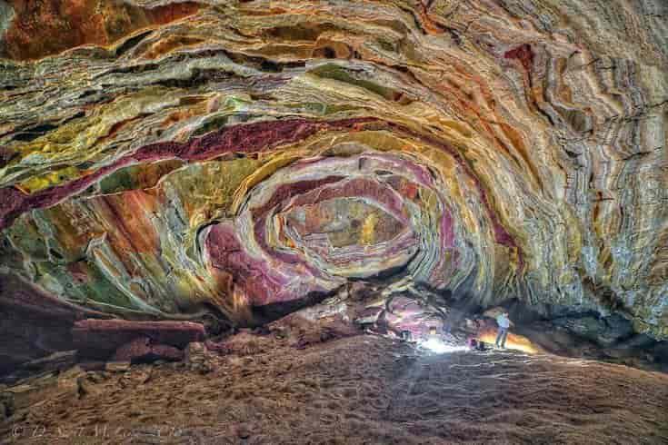
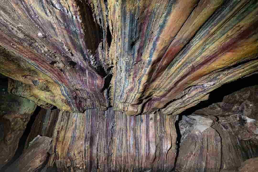
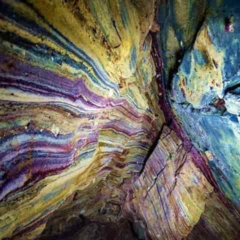
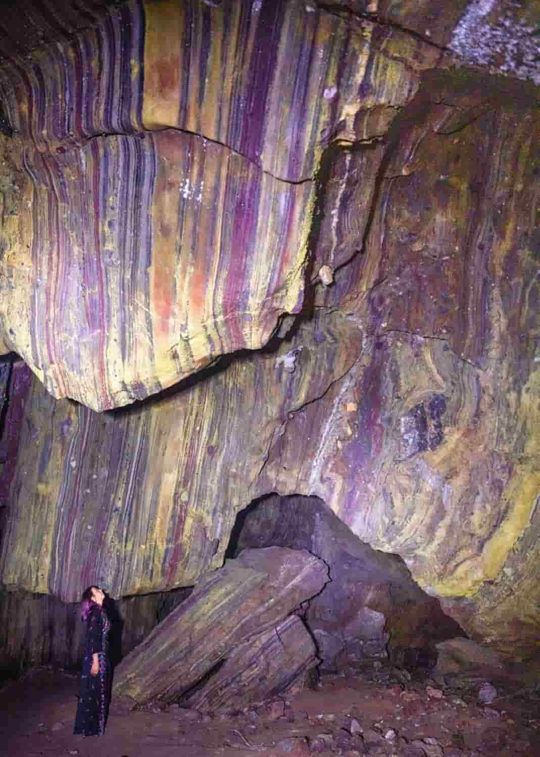
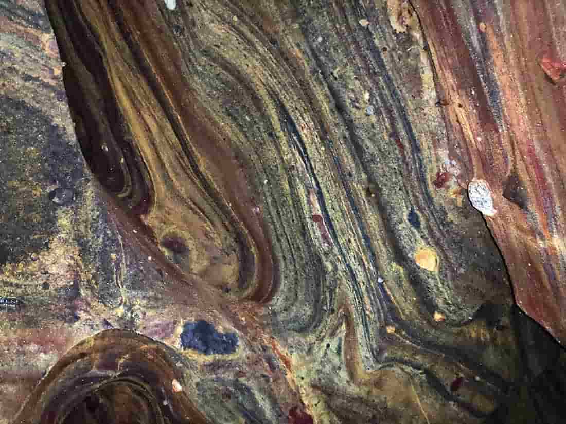
Hormuz Island, also known as Hormoz, is an Iranian island in the Persian Gulf. Located in the Strait of Hormuz, 8 kilometres (5 mi) from the coast of Iran, the island is part of the Hormozgan Province. Reddish ocher on the island and its beaches.

The area of Hormuz Island is 42 km2 (16 sq mi). It is riddled with sedimentary rock and layers of volcanic ash on its surface. The highest point of the island is about 186 metres (610 ft ) above sea level. The soil and water are salty due to lack of precipitation.

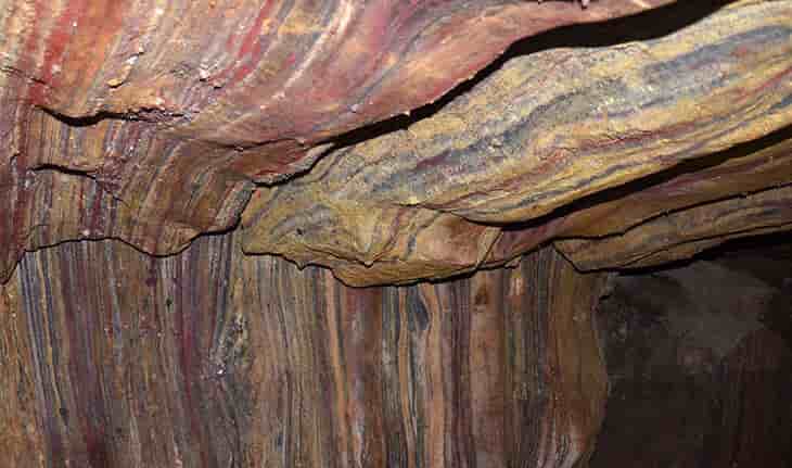
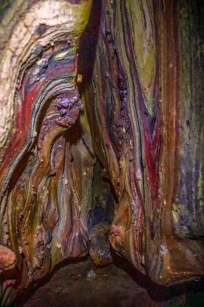
The soil of Hormuz has a high concentration of iron oxide which gives the landscape a characteristic reddish hue. Where the sand is reddish, the waves in the sea become tinged with pink. This has been used for decades in the dyeing, cosmetics, glass and ceramics industries – with plenty of exports going on from areas like this.

A 520-million-year-old, five-eyed fossil reveals arthropod origin

Fossil specimen of Kylinxia, holotype. Credit: ZENG Han

Arthropods have been among the most successful animals on Earth since the Cambrian Period, about 520 million years ago. They are the most familiar and ubiquitous, and constitute nearly 80% of all animal species today, far more than any other animals.

But how did arthropods evolve, and what did their ancestors look like? These have been a major conundrum in animal evolution puzzling generations of scientists for more than a century.

Now, researchers from the Nanjing Institute of Geology and Paleontology of the Chinese Academy of Sciences (NIGPAS) have discovered a shrimp-like fossil with five eyes, which has provided important insights into the early evolutionary history of arthropods. The study was published in Nature on Nov. 4.

The fossil species, Kylinxia, was collected from the Chengjiang fauna in southwest China’s Yunnan Province. The fauna documents the most complete early animal fossils in the Cambrian time.

Prof. Huang Diying, corresponding author for the study from NIGPAS, said, “Kylinxia is a very rare chimeric species. It combines morphological features from different animals, which is analogous to ‘kylin,’ a chimeric creature in traditional Chinese mythology.”

“Owing to very special taphonomic conditions, the Kylinxia fossils exhibit exquisite anatomical structures. For example, nervous tissue, eyes and digestive system—these are soft body parts we usually cannot see in conventional fossils,” said Prof. Zhao Fangchen, co-corresponding author of the study.

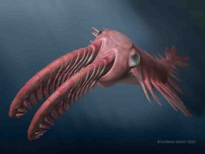
Kylinxia shows distinctive features of true arthropods, such as a hardened cuticle, a segmented trunk and jointed legs. However, it also integrates the morphological characteristics present in very ancestral forms, including the bizarre five eyes of Opabinia, known as the Cambrian “weird wonder,” as well as the iconic raptorial appendages of Anomalocaris, the giant apex predator in the Cambrian ocean.

Among the Chengjiang fauna, Anomalocaris is a top predator that can reach two meters in body length, and has been regarded as an ancestral form of arthropod. But huge morphological differences exist between Anomalocaris and true arthropods. There is a great evolutionary gap between the two that can hardly be bridged. This gap has become a crucial “missing link” in the origin of arthropods.

The research team conducted detailed anatomical examinations of the fossils of Kylinxia. They demonstrated that the first appendages in Anomalocaris and true arthropods were homologous. The phylogenetic analyses suggested that there was affinity between the front appendages of Kylinxia, small predatory appendages in front of the mouth of Chelicerata (a group that includes spiders and scorpions) and the antennae of Mandibulata (a subdivision of arthropods including insects such as ants and bees).

“Our results indicate that the evolutionary placement of Kylinxia is right between Anomalocaris and the true arthropods. Therefore, our finding reached the evolutionary root of the true arthropods,” said Prof. Zhu Maoyan, a co-author of the study.

“Kylinxia represents a crucial transitional fossil predicted by Darwin’s evolutionary theory. It bridges the evolutionary gap from Anomalocaris to true arthropods and forms a key “missing link” in the origin of arthropods, contributing strong fossil evidence for the evolutionary theory of life,” said Dr. Zeng Han, first author of the study.

Reference:
An early Cambrian euarthropod with radiodont-like raptorial appendages, Nature (2020). DOI: 10.1038/s41586-020-2883-7

Note: The above post is reprinted from materials provided by Chinese Academy of Sciences.

Donwilhelmsite : New mineral from the moon could explain what happens in the Earth’s mantle

Fragments of the Oued Awlitis 001 meteorites acquired by the Ludovic-Ferrière. Credit: University of Manchester

A team of European researchers discovered a new high-pressure mineral in a lunar meteorite which is helping to explain what happens to materials within the extreme pressures of the Earth’s mantle.

The new mineral donwilhelmsite is the first high-pressure mineral found in meteorites with application for terrestrial sediments dragged deep into the Earth mantle by plate tectonics. Mainly composed of calcium, aluminum, silicon, and oxygen atoms, donwilhelmsite was discovered within the lunar meteorite Oued Awlitis 001 found in 2014 in the Western Sahara.

The meteorite is compositionally similar to rocks comprising the Earth’s continents. Eroded sediments from these continents are transported by wind and rivers to the oceans, and subducted into the Earth’s mantle as part of the dense oceanic crust. Once dragged to depths of about 460-700 km, their constituent minerals transform at high pressures and high temperatures existing at those depths into denser mineral phases, including the newly discovered mineral donwilhelmsite. In the terrestrial rock cycle, donwilhelmsite is therefore an important agent for transporting continental crustal sediments through the transition zone of the Earth’s mantle (460-700 km depth).

Around 382 kilograms of rocks and soils have been collected by the Apollo and Luna missions, lunar meteorites allow valuable insights into the formation and evolution of the moon. Ejected by impacts onto the lunar surface and subsequently delivered to Earth, some of these meteorites experienced particularly high temperatures and pressures.

Dr. Vera Assis Fernandes of The University of Manchester measured the Argon isotopic composition of lunar rocks to date their complex history including magmatic formation, multiple impact bombardments, and the exposure to cosmic rays on the lunar surface, over billions of years. Dr. Fernandes explains: “During impact bombardment rocks like the lunar meteorite Oued Awlitis 001 experience extreme physical conditions. This often led to shock melting of microscopic areas forming veins or melt pockets within these meteorites.

“These shocked areas are of great relevance as they mirror pressure and temperature regimes similar to those prevailing in the Earth’s mantle, and therefore are natural crucibles hosting minerals that are otherwise naturally inaccessible at the Earth’s surface.”

The new discovery is published in the journal American Mineralogist.

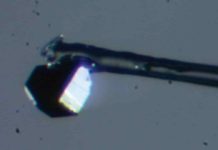
Mariana Klementova applied the cutting edge 3-D electron diffraction (3DED) technique, together with a specially developed software to solve, for the first time, the crystal structure of an extraterrestrial mineral. Dr. Vera Assis Fernandes determined the ages of various events in the complex history of this meteorite, including the formation of the new mineral donwilhlemsite. The new mineral was named in honor of the lunar geologist Don E. Wilhelms, an American scientist involved in landing site selection and data analyses of the Apollo space missions that brought to Earth the first rock samples from the moon. Part of the meteorite Oued Awlitis 001 is now on display at the Natural History Museum Vienna.

Reference:
Jörg Fritz et al. Donwilhelmsite, [CaAl4Si2O11], a new lunar high-pressure Ca-Al-silicate with relevance for subducted terrestrial sediments, American Mineralogist (2020). DOI: 10.2138/am-2020-7393

Note: The above post is reprinted from materials provided by University of Manchester.

Giant lizards learnt to fly over millions of years

Rhamphohynchus - one of 75 pterosaur species studied by the researchers Credit: Mark Witton
Rhamphohynchus – one of 75 pterosaur species studied by the researchers Credit: Mark Witton

Pterodactyls and other related winged reptiles that lived alongside the dinosaurs steadily improved their ability to fly to become the deadly masters of the sky over the course of millions of years.

A new study published in the journal Nature has shown that pterosaurs — a group of creatures that became Earth’s first flying vertebrates — evolved to improve their flight performance over their 150 million-year existence, before they went extinct at the same time as the dinosaurs 66 million years ago.

Scientists from the Universities of Reading, Lincoln and Bristol carried out the most detailed study yet into how animals evolve to become better suited to their environments over time. They combined fossil records with a new model of flight based on today’s living birds to measure their flight efficiency and fill in the gaps in our knowledge of their evolutionary story.

This allowed the scientists to track the gradual evolution of pterosaurs and demonstrate that they became twice as good at flying over the course of their history. It also showed that their evolution was caused by consistent small improvements over a long period, rather than sudden evolutionary bursts as had been previously suggested.

Professor Chris Venditti, an evolutionary biologist at the University of Reading and lead author of the study, funded by the Leverhulme Trust, said: “Pterosaurs were a diverse group of winged lizards, with some the size of sparrows and others with the wingspan of a light aircraft. Fans of the movie Jurassic World will have seen a dramatisation of just how huge and lethal these creatures would have been. Their diet consisted mostly of other animals, from insects to smaller dinosaurs.

“Despite their eventual prowess in the air being well-known, the question of whether pterosaurs got better at flying and whether this gave them an advantage over their ancestors has puzzled scientists for decades. There are many examples of how natural selection works on relatively short time scales, but until now it has been very difficult to demonstrate whether plants or animals adapt to become more efficient over a long period.

“Our new method has allowed us to study long-term evolution in a completely new way, and answer this question at last by comparing the creatures at different stages of their evolutionary sequence over many millions of years.”

Pterosaurs evolved from land-based animals and first emerged as flyers in the Early Triassic period, around 245 million years ago. The first fossils are from 25 million years later.

The scientists monitored changes to pterosaur flight efficiency by using fossils to measure their wingspan and body size at different stages. Their new model based on living birds was applied to the data for 75 pterosaur species, which showed that pterosaurs gradually got better at flying over millions of years.

The models showed that pterosaurs adapted their body shape and size to use 50% less energy when flying over their 150 million-year history. They showed that the creatures increased in mass by 10 times, some to eventually weigh more than 300kg.

The new method also revealed that one group of pterosaurs — azhdarchoids — was an exception to the rule. Scientists have disagreed over how well these animals flew, but the new study showed that they did not get any better throughout their existence.

The enlarged size of azhdarchoids appeared to provide their survival advantage instead, with one animal — Quetzlcoatlus — growing to the height of a giraffe.

Dr Joanna Baker, evolutionary biologist and co-author at the University of Reading said: “This is unique evidence that although these animals were competent fliers, they probably spent much of their time on the ground. Highly efficient flight probably didn’t offer them much of an advantage, and our finding that they had smaller wings for their body size is in line with fossil evidence for their reduced reliance on flight.”

Professor Stuart Humphries, biophysicist and author from the University of Lincoln said: “One of the few things that haven’t changed over the last 300 million years are the laws of physics, so it has been great to use those laws to understand the evolution of flight in these amazing animals.”

Professor Mike Benton at the University of Bristol said, “Until recently, paleontologists could describe the anatomy of creatures based on their fossils and work out their functions. It’s really exciting now to be able to calculate the operational efficiency of extinct animals, and then to compare them through their evolution to see how efficiency has changed. We don’t just have to look at the fossils with amazement, but can really get to grips with what they tell us.”

Reference:
Chris Venditti, Joanna Baker, Michael J. Benton, Andrew Meade, Stuart Humphries. 150 million years of sustained increase in pterosaur flight efficiency. Nature, 2020; DOI: 10.1038/s41586-020-2858-8

Note: The above post is reprinted from materials provided by University of Reading.

Geologist helps confirm date of earliest land plants on Earth

Planet Earth. and You!
Planet Earth

A new UO study confirms what earth scientists have long suspected: Plants first appeared on land about 460 million years ago, in the middle of a 45-million-year-long geologic period known as the Ordovician.

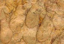
Authored by geologist Greg Retallack and published in the international journal The Palaeobotanist, the study describes a series of plant impressions in an Ordovician rock deposit from Douglas Dam in Tennessee. While previous studies have revealed fossil evidence of invertebrate animals in the deposit, Retallack’s is the first to identify whole fossil plants, including mosses, liverworts and lichens.

Retallack, director of the Condon Fossil Collection at the Museum of Natural and Cultural History, said those whole-plant impressions offer a key support to Ordovician land plant theories.

“Fossil spores liberated from rocks have indicated a likely presence of nonvascular plants like these, and soil analysis and carbon isotope studies have all pointed to the likely presence of land plants during this period, but this is the first line of direct evidence,” he said.

If land plants emerged and proliferated 460 million years ago, they may have directly contributed to a decrease in atmospheric carbon dioxide and, in turn, to the global cooling that fueled an explosion of new marine life during the Ordovician and eventually ushered an ice age that occurred about 445 million years ago.

The deposit under study, comprised of rocks formed when most of Earth’s land mass was combined into the supercontinent Gondwana, was removed when Douglas Dam was constructed for the Tennessee Valley Authority in 1942. Sections of the deposit have since been preserved at the University of Cincinnati and the Smithsonian Institution, where Retallack conducted parts of the study.

“It’s another example of how dusty old museum collections can produce truly extraordinary new finds,” he said.

One of the newly identified fossil moss species, Dollyphyton boucotii, has been named for legendary singer Dolly Parton, whose Dollywood theme park is located a few miles away from the original rock deposit.

Note: The above post is reprinted from materials provided by University of Oregon.

Ancient marine predator had a built-in float

An illustration of Brevicaudosaurus. Credit: Tyler Stone BA '19, art and cinema; see his website tylerstoneart.wordpress.com
An illustration of Brevicaudosaurus. Credit: Tyler Stone BA ’19, art and cinema; see his website tylerstoneart.wordpress.com

About 240 million years ago, when reptiles ruled the ocean, a small lizard-like predator floated near the bottom of the edges in shallow water, picking off prey with fang-like teeth. A short and flat tail, used for balance, helps identify it as a new species, according to research published in the Journal of Vertebrate Paleontology.

Paleontologists at the Chinese Academy of Scientists and Canadian Museum of Nature have analysed two skeletons from a thin layer of limestone in two quarries in southwest China. They identified the skeletons as nothosaurs, Triassic marine reptiles with a small head, fangs, flipper-like limbs, a long neck, and normally an even longer tail, probably used for propulsion. However, in the new species, the tail is short and flat.

“Our analysis of two well-preserved skeletons reveals a reptile with a broad, pachyostotic body (denser boned) and a very short, flattened tail. A long tail can be used to flick through the water, generating thrust, but the new species we’ve identified was probably better suited to hanging out near the bottom in shallow sea, using its short, flattened tail for balance, like an underwater float, allowing it to preserve energy while searching for prey,” says Dr Qing-Hua Shang from the Chinese Academy of Sciences, in Beijing.

The scientists have named the new species Brevicaudosaurus jiyangshanensis, from the Latin ‘brevi’ for ‘short,’ ‘caudo’ for ‘tail,’ and the Greek ‘sauros’ for ‘lizard.’ The most complete skeleton of the two was found in Jiyangshan quarry, giving the specimen its species name. It’s just under 60cm long.

The skeleton gives further clues to its lifestyle. The forelimbs are more strongly developed than the hind limbs, suggesting they played a role in helping the reptile to swim. However, the bones in the front feet are short compared to other species, limiting the power with which it could pull through the water. Most of its bones, including the vertebrae and ribs, are thick and dense, further contributing to the stocky, stout appearance of the reptile, and limiting its ability to swim quickly but increasing stability underwater.

However, thick, high-mass bones act as ballast. What the reptile lost in speed, it gained in stability. Dense bones, known as pachyostosis, may have made it neutrally buoyant in shallow water. Together with the flat tail, this would have helped the predator to float motionless underwater, requiring little energy to stay horizontal. Neutral buoyancy should also have enabled it to walk on the seabed searching for slow-moving prey.

Highly dense ribs may also suggest the reptile had large lungs. As suggested by the lack of firm support of the body weight, nothosaurs were oceanic nut they needed to come to the water surface for oxygen. They have nostrils on the snout through which they breathed. Large lungs would have increased the time the species could spend under water.

The new species features a bar-shaped bone in the middle ear called the stapes, used for sound transmission. The stapes was generally lost in other nothosaurs or marine reptiles during preservation. Scientists had predicted that if a stapes was found in a nothosaur, it would be thin and slender like in other species of this branch of the reptilian family tree. However, in B. jiyangshanensis it is thick and elongate, suggesting it had good hearing underwater.

“Perhaps this small, slow-swimming marine reptile had to be vigilante for large predators as it floated in the shallows, as well as being a predator itself,” says co-author Dr. Xiao-Chun Wu from the Canadian Museum of Nature.

Reference:
Qing-Hua Shang, Xiao-Chun Wu, Chun Li. A New Ladinian Nothosauroid (Sauropterygia) from Fuyuan, Yunnan Province, China. Journal of Vertebrate Paleontology, 2020; e1789651 DOI: 10.1080/02724634.2020.1789651

Note: The above post is reprinted from materials provided by Taylor & Francis Group.

Researchers reconstruct the first complete brain of one of the oldest dinosaurs

Buriolestes schultzi brain. Credit: Márcio L. Castro

The study of the brain of extinct organisms sheds lights on their behaviors. However, soft tissues, like the brain, are not usually preserved for long periods. Hence, researchers reconstruct the brains of dinosaurs by analyzing the cranial cavities under computed tomography. It demands well-preserved braincases, which is the region that envelops the brain tissues. To date, complete and well-preserved neurocrania from the oldest dinosaurs worldwide have not been found.

In 2015, a Brazilian paleontologist from the Universidade Federal de Santa Maria, Dr. Rodrigo Temp Müller, unearthed an exceptionally well-preserved skeleton from a fossiliferous locality in southern Brazil. The skeleton, approximately 233 million years old (Triassic period), belongs to a small carnivorous dinosaur named Buriolestes schultzi and the entire braincase was preserved. Now, Brazilian researchers have reconstructed the first complete brain of one of the oldest dinosaurs worldwide.

The study was published in Journal of Anatomy and performed by Rodrigo T. Müller, José D. Ferreira, Flávio A. Pretto, and Leonardo Kerber from the Universidade Federal de Santa Maria and Mario Bronzati from the Universidade de São Paulo.

The brain of Buriolestes schultzi is relatively small and weighed approximately 1.5 grams, which is slightly lighter than a pea. The shape was primitive, resembling the general morphology of a crocodile brain. In addition, the presence of well-developed structures in the cerebellum indicates the capability to track moving prey. Conversely, the olfactory sense was not high; therefore, it is more likely that Buriolestes schultzi hunted and tracked prey based on optical capability rather than its olfactory sense.

Despite the carnivorous feeding behavior of this dinosaur, it belongs to the lineage of giant, long-necked, herbivorous sauropods, the largest land animals that ever lived. However, Buriolestes schultzi is considered the earliest member of this lineage. So, the new brain reconstruction allows researchers to analyze the brain evolution of this impressive lineage.

One of the most conspicuous trends is the increase of the olfactory bulbs. Whereas these structures responsible for the sense of smell are relatively small in Buriolestes schultzi, they become very large in later sauropods and closely related forms. The development of a strong sense of smell could be related to the acquisition of a more complex social behavior, which relies on the olfactory sense in several vertebrate groups. Alternatively, it has also been observed that high olfactory capabilities played an important role in foraging, helping animals to better discriminate between digestible and indigestible plants. Finally, another putative explanation for the increase in the olfactory sense of sauropods relies on the capability to detect predator chemical cues.

The scientists also calculated the cognitive capability, or intelligence, of Buriolestes schultzi based on the brain volume and body weight. The values obtained are higher than that of the giant sauropods, like Diplodocus and Brachiosaurus, suggesting a decrease in encephalization in the lineage. This is interesting because several other lineages present an increase in the encephalization through time. Nevertheless, the cognitive capability of Buriolestes schultzi is lower than that of theropod dinosaurs, the lineage that includes Tyrannosaurus, Velociraptor, and birds.

Reference:
Alex Schiller Aires et al. Development and evolution of the notarium in Pterosauria, Journal of Anatomy (2020). DOI: 10.1111/joa.13319

Note: The above post is reprinted from materials provided by Universidade Federal de Santa Maria .

Fossil poop shows fishy lunches from 200 million years ago

CT scan of coprolite specimen, BRSMG Cf15546, in different views, showing tuberculated bone (blue) from a fish skull, and two vertebrae from the tail of the marine reptile Pachystropheus, in yellow and green. Credit: Marie Cueille, and Palaeobiology Research Group, University of Bristol

A new study of coprolites, fossil poop, shows the detail of food webs in the ancient shallow seas around Bristol in south-west England. One hungry fish ate part of the head of another fish before snipping off the tail of a passing reptile.

Marie Cueille, a visiting student at the University of Bristol’s School of Earth Sciences, was working on a collection of hundreds of fish poops from the Rhaetian bone bed near Chipping Sodbury in South Gloucestershire, dated at 205 million years ago.

She applied new scanning technology to look inside these coprolites and found an amazing array of food remains.

Marie said: “The ancient fishes and sharks of the Rhaetian seas were nearly all carnivores. Their coprolites contain scales, teeth, and bones, and these tell us who was eating whom. In fact, all the fish seem to have been snapping at each other, although the general rule of the sea probably applied: if it’s smaller than you, eat it.”

The CT scans of one tiny coprolite, measuring only a centimeter or so in length, contained only three bones, one a highly tuberculated skull bone of another fish, and two vertebrae from the tail of a small marine reptile called Pachystropheus.

Dr. Chris Duffin, who collaborated on the project added: “This shark probably snapped at another fish or scavenged some flesh from the head region of a dead fish. But it didn’t just strip off the flesh but swallowed great chunks of bone at the same time. Then it snapped at a Pachystropheus swimming by and had a chunk of its tail.”

Professor Mike Benton, who co-supervised the study, said: “What amazed us was that the bones and scales inside the coprolites were almost completely undamaged. Today, most predators that swallow their prey whole, such as sharks, crocodiles or killer whales, have powerful stomach acids that dissolve the bone away. These ancient fishes must have had a painful time passing their feces which were absolutely bristling with relatively large chunks of bone.”

The researchers also identified for the first time some coprolites of crabs and lobsters, so this completes the food web. The marine reptiles and sharks were feeding on smaller fishes, which in turn fed on even smaller fishes and lobsters. Some also had crushing teeth adapted to feeding on oysters and other molluscs.

The study has a classical resonance as well, because Rhaetian coprolites from bonebeds near Bristol were some of those studied by William Buckland (1784–1856) in the 1820s when he invented the name coprolite. Buckland was professor of geology at Oxford University, but also Dean of Christ Church, and known for his unusual eating habits. Possibly his interest in eating exotic animals (he would serve his guests roasted dormice or potted panther but declared that moles and house flies were inedible) gave him an interest in animal diets.

Buckland pioneered the use of coprolites to reconstruct ancient food webs. He also collected specimens from the Jurassic around Lyme Regis, and many were supplied by famous fossil collector Mary Anning (1799–1847). Buckland even had these larger coprolites cut across and set into the top of a table, which was highly polished and doubtless formed a conversation opener during lunch and tea parties in the Dean’s lodgings.

The new work also sheds light on the Mesozoic Marine Revolution, the time when marine ecosystems modernized. The coprolites from Bristol show a complex, modern-style ecosystem with lobsters, bony fishes, sharks and marine reptiles at the top of the food web. Reconstructing the timing of the event is of current interest, and the new work suggests the process began earlier than had been thought.

Reference:
Marie Cueille et al. Fish and crab coprolites from the latest Triassic of the UK: From Buckland to the Mesozoic Marine Revolution, Proceedings of the Geologists’ Association (2020). DOI: 10.1016/j.pgeola.2020.07.011

Note: The above post is reprinted from materials provided by University of Bristol.

New species of ancient cynodont, 220 million years old, discovered

A Photoshop-created image of how Kataigidodon venetus may have looked, illustrated by Ben Kligman, a Ph.D. student in the Department of Geosciences and Hannah R. Kligman. Credit: Virginia Tech

Fossilized jaw bone fragments of a rat-like creature found at the Petrified Forest National Park in Arizona last year by a Virginia Tech College of Science Ph.D. candidate are in fact a newly discovered 220-million-year-old species of cynodont or stem-mammal, a precursor of modern-day mammals.

The finding of this new species, Kataigidodon venetus, has been published today in the journal Biology Letters by lead author Ben Kligman, a doctoral student in the Department of Geosciences.

“This discovery sheds light on the geography and environment during the early evolution of mammals,” Kligman said. “It also adds to evidence that humid climates played an important role in the early evolution of mammals and their closest relatives. Kataigidodon was living alongside dinosauromorphs and possibly early dinosaurs related to Coelophysis—a small bipedal predator—and Kataigidodon was possibly prey of these early dinosaurs and other predators like crocodylomorphs, small coyote-like quadrupedal predators related to living crocodiles.”

Kligman added that finding a fossil that is part of Cynodontia, which includes close cousins of mammals, such as Kataigidodon, as well as true mammals, from Triassic rocks is an extremely rare event in North America. Prior to Kligman’s discovery, the only other unambiguous cynodont fossil from the Late Triassic of western North America was the 1990 discovery of a braincase of Adelobasileus cromptoni in Texas. Note that 220 million years ago, modern day Arizona and Texas were located close to the equator, near the center of the supercontinent Pangaea. Kataigidodon would have been living in a lush tropical forest ecosystem.

Kligman made the discovery while working as a seasonal paleontologist at Petrified Forest National Park in 2019. The two fossil lower jaws of Kataigidodon were found in the Upper Triassic Chinle Formation. Because only the lower jaws were discovered and are quite small—half an inch, the size of a medium grain of rice—Kligman only has a semi-picture of how the creature looked, roughly 3.5 inches in total body size, minus the tail.

Along with the jawbone fossils, Kligman found incisor, canine, and complex-postcanine teeth, similar to modern day mammals. Given the pointed shape of its teeth and small body size, it likely fed on a diet of insects, Kligman added. (Why are jaw fossils commonly found, even among small specimens? According to Kligman, the fossil record is “biased” toward only preserving the largest and most robust bones in a skeleton. The other smaller or more fragile bones—ribs, arms, feet—disappear.)

Kligman carried out field work, specimen preparation, CT scanning, conception, and design of the studyand drafting of the manuscript. He added that he and his collaborators only discovered the fossils were of a new species after reviewing the CT scan dataset of the jaws and comparing it to other related species.

“It likely would have looked like a small rat or mouse. If you were to see it in person you would think it is a mammal,” Kligman added. Does it have fur? Kligman and the researchers he worked with to identify and name the creature actually don’t know. “Triassic cynodonts have not been found from geological settings which could preserve fur if it was there, but later nonmammalian cynodonts from the Jurassic had fur, so scientists assume that Triassic ones did also.”

The name Kataigidodon venetus derives from the Greek words for thunderstorm, “kataigidos,” and tooth, “odon,” and the Latin word for blue, “venetus,” all referring to the discovery location of Thunderstorm Ridge, and the blue color of the rocks at this site. Kligman didn’t name the creature, though. That task fell to Hans Dieter-Sues, coauthor and curator of vertebrate paleontology at the Smithsonian National Museum.

Additional collaborators include Adam Marsh, park paleontologist at Petrified Forest National Park, who found the jaw fossils with Kligman, and Christian Sidor, an associate professor at the University of Washington’s Department of Biology. The research was funded by the Petrified Forest Museum Association, the Friends of Petrified Forest National Park, and the Virginia Tech Department of Geosciences.

“This study exemplifies the idea that what we collect determines what we can say,” said Michelle Stocker, an assistant professor of geosciences and Kligman’s doctoral advisor. “Our hypotheses and interpretations of past life on Earth depend on the actual fossil materials that we have, and if our search images for finding fossils only focuses on large-bodied animals, we will miss those important small specimens that are key for understanding the diversification of many groups.”

With Kataigidodon being only the second other unambiguous cynodont fossil from the Late Triassic found in western North America, could there be more new species out there waiting to be found?

Kligman said most likely. “We have preliminary evidence that more species of cynodonts are present in the same site as Kataigidodon, but we are hoping to find better fossils of them,” he added.

Reference:
A new non-mammalian eucynodont from the Chinle Formation (Triassic: Norian), and implications for the early Mesozoic equatorial cynodont record, Biology Letters (2020). royalsocietypublishing.org/doi … .1098/rsbl.2020.0631

Note: The above post is reprinted from materials provided by Virginia Tech.

Lizard skull fossil is new and ‘perplexing’ extinct species

Kopidosaurus perplexus skull in left lateral view. Credit: Simon Scarpetta

In 2017, while browsing the fossil collections of Yale’s Peabody Museum of Natural History, University of Texas at Austin graduate student Simon Scarpetta came across a small lizard skull, just under an inch long.

The skull was beautifully preserved, with a mouth full of sharp teeth — including some with a distinctive curve.

Much to Scarpetta’s surprise, no one had studied it. Since being discovered in 1971 on a museum fossil hunting trip to Wyoming, the 52 million-year-old skull had sat in the specimen drawer.

“Lizards are small and prone to breaking apart, so you mostly get these individual, isolated fragmented bones,” said Scarpetta, who is studying paleontology at the UT Jackson School of Geosciences. “Anytime you find a skull, especially when you’re trying to figure out how things are related to each other, it’s always an exciting find.”

Scarpetta decided to bring the skull back to the Jackson School for a closer look. And on September 2020, the journal Scientific Reports published a study authored by Scarpetta describing the lizard as a new species, which he named Kopidosaurus perplexus.

The first part of the name references the lizard’s distinct teeth; a “kopis” is a curved blade used in ancient Greece. But the second part is a nod to the “perplexing” matter of just where the extinct lizard should be placed on the tree of life. According to an analysis conducted by Scarpetta, the evidence points to a number of plausible spots.

The spots can be divided into two groups of lizards, representing two general hypotheses of where the new species belongs. But adding to the uncertainty is that how those two groups relate to one another can shift depending on the particular evolutionary tree that’s examined. Scarpetta examined three of these trees — each one built by other researchers studying the evolutionary connections of different reptile groups using DNA — and suggests that there could be a forest of possibilities where the ancient lizard could fit.

The case of where exactly to put the perplexing lizard highlights an important lesson for paleontologists: just because a specimen fits in one place doesn’t mean that it won’t fit equally well into another.

“The hypothesis that you have about how different lizards are related to each other is going to influence what you think this one is,” Scarpetta said.

Paleontologists use anatomical details present in bones to discern the evolutionary relationships of long-dead animals. To get a close look at the lizard skull, Scarpetta created a digital scan of it in the Jackson School’s High-Resolution X-Ray CT Lab. However, while certain details helped identify the lizard as a new species, other details overlapped with features from a number of different evolutionary groups.

All of these groups belonged to a larger category known as Iguania, which includes a number of diverse species, including chameleons, anoles and iguanas. To get a better idea of where the new species might fit into the larger Iguania tree, Scarpetta compared the skull data to evolutionary trees for Iguania that were compiled by other researchers based on DNA evidence from living reptiles.

On each tree, the fossil fit equally well into two general spots. What’s more, the lizard groupings in each spot varied from tree to tree. If Scarpetta had just stopped at one spot or one tree, he would have missed alternative explanations that appear just as plausible as the others.

Scarpetta said that Kopidosaurus perplexus is far from the only fossil that could easily fit onto multiple branches on the tree of life. Paleontologist Joshua Lively, a curator at the Utah State University Eastern Prehistoric Museum, agrees and said that this study epitomizes why embracing uncertainty can lead to better, more accurate science.

“Something that I think the broader scientific community should pull from this is that you have to be realistic about your data and acknowledge what we can actually pull from our results and conclude and where there are still uncertainties,” Lively said. “Simon’s approach is the high bar, taking the high road. It’s acknowledging what we don’t know and really embracing that.”

The research was funded by the Jackson School of Geosciences and the Geological Society of America.

Reference:
Simon G. Scarpetta. Effects of phylogenetic uncertainty on fossil identification illustrated by a new and enigmatic Eocene iguanian. Scientific Reports, 2020; 10 (1) DOI: 10.1038/s41598-020-72509-2

Note: The above post is reprinted from materials provided by University of Texas at Austin.

New fault zone measurements could help us to understand subduction earthquakes

The outcrop of the pseudotachylyte-bearing fault zone in pelagic sedimentary rocks.

A research team from the University of Tsukuba has conducted detailed structural analyses of a fault zone located in central Japan, with the aim to help identify the specific conditions that lead to earthquake faulting, a hazard that can cause enormous social damage. Subduction is a geological process that takes place in areas where two tectonic plates meet, such as the Japan Trench, in which one plate moves under another and is forced to sink.

Regions in which this process occurs are known as subduction zones and the seismic activity that they produce causes devastating damage through ground shaking and tsunamis. However, understanding these seismic processes can be difficult because of the problems associated with taking measurements from their deepest sections, where much of the activity occurs.

“To overcome this problem, we examined fault rocks exhumed from source depths of subduction earthquakes, which are now exposed at the land surface at the Jurassic accretionary complex in central Japan,” explains study lead author Professor Kohtaro Ujiie. “At this complex, we were able to examine pseudotachylyte, a solidified frictional melt produced during subduction earthquakes, to help us to infer what may occur in the subduction zones deep beneath the oceans.”

The exposed fault zone was characterized through a range of measurements such as scanning electron microscope and Raman spectroscopy to provide a detailed picture of the pseudotachylytes and make some constraints about the heating conditions at the time of formation.

“The pseudotachylyte at the site derived from the frictional melting of black carbonaceous mudstone together with chert, which accumulated under low-oxygen conditions,” says Ujiie. “Thermal fracturing tends to occur along slip zones flanked by rocks with high thermal diffusivities such as chert, and may happen during seismic slip within the Jurassic accretionary complex. This thermal fracturing could lead to a fluid pressure drop in the slip zone and reduction in stiffness of surrounding rocks, potentially contributing to the generation of frictional melt and acceleration of seismic slip.”

The seismic slip processes recorded in the studied complex may be applicable to other fault zones with similar rock layers, such as the Japan Trench subduction zone. Therefore, the data gathered from this area could be useful in future attempts to describe or model the subduction earthquakes that lead to ground shaking and tsunami risk.

Reference:
Kohtaro Ujiie, Keisuke Ito, Ayaka Nagate, Hiroki Tabata. Frictional melting and thermal fracturing recorded in pelagic sedimentary rocks of the Jurassic accretionary complex, central Japan. Earth and Planetary Science Letters, 2020; 116638 DOI: 10.1016/j.epsl.2020.116638

Note: The above post is reprinted from materials provided by University of Tsukuba.

Magma ‘conveyor belt’ fuelled world’s longest erupting supervolcanoes

Representative Image : Lava "Volcanic Eruption"
Representative Image : Lava “Volcanic Eruption”

International research led by geologists from Curtin University has found that a volcanic province in the Indian Ocean was the world’s most continuously active — erupting for 30 million years — fuelled by a constantly moving ‘conveyor belt’ of magma.

It’s believed this magma ‘conveyor belt,’ created by shifts in the seabed, continuously made space available for the molten rock to flow for millions of years, beginning around 120 million years ago.

Research lead Qiang Jiang, a PhD candidate from Curtin’s School of Earth and Planetary Sciences, said the studied volcanoes were in the Kerguelen Plateau, located in the Indian Ocean, about 3,000 kilometres south west of Fremantle, Western Australia.

“Extremely large accumulations of volcanic rocks — known as large volcanic provinces — are very interesting to scientists due to their links with mass extinctions, rapid climatic disturbances, and ore deposit formation,” Mr Jiang said.

“The Kerguelen Plateau is gigantic, almost the size of Western Australia. Now imagine this area of land covered by lava, several kilometres thick, erupting at a rate of about 20 centimetres every year.

“Twenty centimetres of lava a year may not sound like much but, over an area the size of Western Australia, that’s equivalent to filling up 184,000 Olympic-size swimming pools to the brim with lava every single year. Over the total eruptive duration, that’s equivalent to 5.5 trillion lava-filled swimming pools!

“This volume of activity continued for 30 million years, making the Kerguelen Plateau home to the longest continuously erupting supervolcanoes on Earth. The eruption rates then dropped drastically some 90 million years ago, for reasons that are not yet fully understood.

“From then on, there was a slow but steady outpouring of lava that continued right to this day, including the 2016 eruptions associated with the Big Ben volcano on Heard Island, Australia’s only active volcano.”

Co-researcher Dr Hugo Olierook, also from Curtin’s School of Earth and Planetary Sciences, explained such a long eruption duration requires very peculiar geological conditions.

“After the partial breakup of the supercontinent Gondwana, into the pieces now known as Australia, India and Antarctica, the Kerguelen Plateau began forming on top of a mushroom-shaped mantle upwelling, called a mantle plume, as well as along deep sea, mid-oceanic mantle ridges,” Dr Olierook said.

“The volcanism lasted for so long because magmas caused by the mantle plume were continuously flowing out through the mid-oceanic ridges, which successively acted as a channel, or a ‘magma conveyor belt’ for more than 30 million years.

“Other volcanoes would stop erupting because, when temperatures cooled, the channels became clogged by ‘frozen’ magmas.

“For the Kerguelen Plateau, the mantle plume acts as a Bunsen burner that kept allowing the mantle to melt, resulting in an extraordinarily long period of eruption activity.”

Research co-author, Professor Fred Jourdan, Director of the Western Australia Argon Isotope Facility at Curtin University, said the team used an argon-argon dating technique to date the lava flows, by analysing a range of black basaltic rocks taken from the bottom of the sea floor.

“Finding this long, continuous eruption activity is important because it helps us to understand what factors can control the start and end of volcanic activity,” Professor Jourdan said.

“This has implications for how we understand magmatism on Earth, and on other planets as well.”

The Curtin-led research was a collaboration with Uppsala University in Sweden and the University of Tasmania.

Reference:
Qiang Jiang, Fred Jourdan, Hugo K.H. Olierook, Renaud E. Merle, Joanne M. Whittaker. Longest continuously erupting large igneous province drivenby plume-ridge interaction. Geology, 2020; DOI: 10.1130/G47850.1

Note: The above post is reprinted from materials provided by Curtin University.

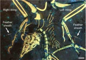
These two bird-sized dinosaurs evolved the ability to glide, but weren’t great at it

This illustration shows a reconstruction of Ambopteryx in a glide. Credit: Gabriel Ugueto

Despite having bat-like wings, two small dinosaurs, Yi and Ambopteryx, struggled to fly, only managing to glide clumsily between the trees where they lived, researchers report October 22 in the journal iScience. Unable to compete with other tree-dwelling dinosaurs and early birds, they went extinct after just a few million years. The findings support that dinosaurs evolved flight in several different ways before modern birds evolved.

“Once birds got into the air, these two species were so poorly capable of being in the air that they just got squeezed out,” says first author Thomas Dececchi, Assistant Professor of Biology at Mount Marty University. “Maybe you can survive a few million years underperforming, but you have predators from the top, competition from the bottom, and even some small mammals adding into that, squeezing them out until they disappeared.”

Yi and Ambopteryx were small animals from Late Jurassic China, living about 160 million years ago. Weighing in at less than two pounds, they are unusual examples of theropod dinosaurs, the group that gave rise to birds. Most theropods were ground-loving carnivores, but Yi and Ambopteryx were at home in the trees and lived on a diet of insects, seeds, and other plants.

Curious about how these animals fly, Dececchi and his collaborators scanned fossils using laser-stimulated fluorescence (LSF), a technique that uses laser light to pick up soft-tissue details that can’t be seen with standard white light. Later, the team used mathematical models to predict how they might have flown, testing many different variables like weight, wingspan, and muscle placement.

“They really can’t do powered flight. You have to give them extremely generous assumptions in how they can flap their wings. You basically have to model them as the biggest bat, make them the lightest weight, make them flap as fast as a really fast bird, and give them muscles higher than they were likely to have had to cross that threshold,” says Dececchi. “They could glide, but even their gliding wasn’t great.”

While gliding is not an efficient form of flight, since it can only be done if the animal has already climbed to a high point, it did help Yi and Ambopteryx stay out of danger while they were still alive.

“If an animal needs to travel long distances for whatever reason, gliding costs a bit more energy at the start, but it’s faster. It can also be used as an escape hatch. It’s not a great thing to do, but sometimes it’s a choice between losing a bit of energy and being eaten,” says Dececchi. “Once they were put under pressure, they just lost their space. They couldn’t win on the ground. They couldn’t win in the air. They were done.”

The researchers are now looking at the muscles that powered Yi and Ambopteryx to construct an accurate image of these bizarre little creatures. “I’m used to working with the earliest birds, and we sort of have an idea of what they looked like already,” Dececchi says. “To work where we’re just trying to figure out the possibilities for a weird creature is kind of fun.”

The authors were supported by Mount Marty University and The University of Hong Kong.

Reference:
Dececchi et al. Aerodynamics show membranous-winged theropods were a poor gliding dead-end. iScience, 2020 DOI: 10.1016/j.isci.2020.101574

Note: The above post is reprinted from materials provided by Cell Press.

A new way of looking at the Earth’s interior

Structure layers of the earth.

There are places that will always be beyond our reach. The Earth’s interior is one of them. But we do have ways of gaining an understanding of this uncharted world. Seismic waves, for instance, allow us to put important constraints about the structure of our planet and the physical properties of the materials hidden deep within it. Then there are the volcanic rocks that emerge in some places on the Earth’s surface from deep within and provide important clues about the chemical composition of the mantle. And finally there are lab experiments that can simulate the conditions of the Earth’s interior on a small scale.

A new publication by Motohiko Murakami, Professor of Experimental Mineral Physics, and his team was featured recently in the journal PNAS and shows just how illuminating such experiments can be. The researchers’ findings suggest that many geoscientists’ understanding of the Earth’s interior may be too simplistic.

Dramatic change

Below the Earth’s crust, which is only a few kilometres thick, lies its mantle. Also made of rock, this surrounds the planet’s core, which begins some 2,900 kilometres below us. Thanks to seismic signals, we know that a dramatic change occurs in the mantle at a depth of around 660 kilometres: this is where the upper mantle meets the lower mantle and the mechanical properties of the rock begin to differ, which is why the propagation velocity of seismic waves changes dramatically at this border.

What is unclear is whether this is merely a physical border or whether the chemical composition of the rock also changes at this point. Many geoscientists presume that the Earth’s mantle as a whole is composed relatively consistently of magnesium-rich rock, which in turn has a composition similar to that of peridotite rock found on the Earth’s surface. These envoys from the upper mantle, which arrive on the Earth’s surface by way of events like volcanic eruptions, exhibit a magnesium-silicon ratio of ~1.3.

“The presumption that the composition of the Earth’s mantle is more or less homogeneous is based on a relatively simple hypothesis,” Murakami explains. “Namely that the powerful convection currents within the mantle, which also drive the motion of the tectonic plates on the Earth’s surface, are constantly mixing it through. But it’s possible that this view is too simplistic.”

Where’s the silicon

There really is a fundamental flaw in this hypothesis. It is generally agreed that the Earth was formed around 4.5 billion years ago through the accretion of meteorites that emerged from the primordial solar nebula, and as such has the same overall composition of those meteorites. The differentiation of the Earth into core, mantle and crust happened as part of a second step.

Leaving aside the iron and nickel, which are now part of the planet’s core, it becomes apparent that the mantle should actually contain more silicon than the peridotite rock. Based on these calculations, the mantle should have a magnesium-silicon ratio closer to ~1 rather than ~1.3.

This moves geoscientists to ask the following question: where is the missing silicon And there is an obvious answer: the Earth’s mantle contains so little silicon because it is in the Earth’s core. But Murakami reaches a different conclusion, namely that the silicon is in the lower mantle. This would mean that the composition of the lower mantle differs to that of the upper mantel.

Winding hypothesis

Murakami’s hypothesis takes a few twists and turns: First, we already know precisely how fast seismic waves travel through the mantle. Second, lab experiments show that the lower mantle is made mostly of the siliceous mineral bridgmanite and the magnesium-rich mineral ferropericlase. Third, we know that the speed the seismic waves travel depends on the elasticity of the minerals that make up the rock. So if the elastic properties of the two minerals are known, it is possible to calculate the proportions of each mineral required to correlate with the observed speed of the seismic waves. It is then possible to derive what the chemical composition of the lower mantle must be.

While the elastic properties of ferropericlase are known, those of bridgmanite are as yet not. This is because this mineral’s elasticity depends greatly on its chemical composition; more specifically, it varies according to how much iron the bridgmanite contains.

Time-consuming measurements

In his lab, Murakami and his team have now conducted high-pressure tests on this mineral and experimented with different compositions. The researchers began by clamping a small specimen between two diamond tips and using a special device to press them together. This subjected the specimen to extremely high pressure, similar to that found in the lower mantle.

The researchers then directed a laser beam at the specimen and measured the wave spectrum of the light dispersed on the other side. Using the displacements in the wave spectrum, they were able to determine the mineral’s elasticity at different pressures. “It took a very long time to complete the measurements,” Murakami reports. “Since the more iron bridgmanite contains the less permeable to light it becomes, we needed up to fifteen days to complete each individual measurement.”

Silicon discovered

Murakami then used the measurement values to model the composition that best correlates with the dispersal of seismic waves. The results confirm his theory that the composition of the lower mantle differs to that of the upper mantel. “We estimate that bridgmanite makes up 88 to 93 percent of the lower mantle,” Murakami says, “which gives this region a magnesium-silicon ratio of approximately 1.1.” Murakami’s hypothesis solves the mystery of the missing silicon.

But his findings raise new questions. We know for instance that within certain subduction zones, the Earth’s crust gets pushed deep into the mantle — sometimes even as far as the border to the core. This means that the upper and lower mantles are actually not hermetically separated entities. How the two areas interact and exactly how the dynamics of the Earth’s interior work to produce chemically different regions of mantle remains to be seen.

Reference:
Izumi Mashino, Motohiko Murakami, Nobuyoshi Miyajima, Sylvain Petitgirard. Experimental evidence for silica-enriched Earth’s lower mantle with ferrous iron dominant bridgmanite. Proceedings of the National Academy of Sciences, 2020; 201917096 DOI: 10.1073/pnas.1917096117

Note: The above post is reprinted from materials provided by ETH Zurich. Original written by Felix Würsten.

Deep magma facilitates the movement of tectonic plates

Three-dimensional visualisation of partial melting at the base of tectonic plates. The orange iso-surfaces show the regions where, at a depth of between 100 and 300 km, the quantity of molten rock is greater than 0.2%. The white sphere in the centre of the globe represents the Earth’s core. Credit © Stéphanie Durand, Laboratoire de géologie de Lyon: Terre, planètes et environnement (CNRS/ENS de Lyon/Université Claude Bernard Lyon 1).

A small amount of molten rock located under tectonic plates encourages them to move. This is what scientists from the Laboratoire de géologie de Lyon: Terre, planètes et environnement (CNRS/ENS de Lyon/Université Claude Bernard Lyon 1) have recently discovered. Their new model takes into account not only the velocity of seismic waves but also the way in which they are attenuated by the medium they pass through. The velocity of tectonic plates near the surface is thus directly correlated with the quantity of magma present. This research is published on October 21, 2020 in Nature.

The lithosphere, the outer part of the Earth, is made up of the crust and part of the upper mantle. It is subdivided into rigid plates, known as tectonic or lithospheric plates. These move on a more fluid layer of the mantle, the asthenosphere. The lower viscosity of the asthenosphere allows the tectonic plates to move around on the underlying mantle, but until today the origin of this low viscosity remained unknown.

Seismic tomography produces three-dimensional images of the Earth’s interior by analysing millions of seismic waves recorded at seismological stations spread across the surface of the globe. Since the 1970s, seismologists have analysed these waves with a view to identifying a single parameter: their propagation speed. This parameter varies with temperature (the colder the medium, the faster the waves arrive), composition, and the possible presence of molten rocks in the medium the waves pass through. Seismologists from the Laboratoire de géologie de Lyon: Terre, planètes et environnement (CNRS/ENS de Lyon/Université Claude Bernard Lyon 1) instead studied another parameter, wave attenuation, alongside the variation in wave propagation speeds. This analysis, which provides new information on the temperature of the medium traversed by the waves, makes it possible to ascertain the quantity of molten rock in the medium the waves pass through.

Their new model made it possible, for the first time, to map the amount of molten rock under tectonic plates. This work reveals that a small amount of molten rock (less than 0.7% by volume) is present in the asthenosphere under the oceans, not only where this was expected, i.e. under ocean ridges and some volcanoes such as Tahiti, Hawaii or Reunion, but also under all oceanic plates. The low percentage of molten rock observed is enough to reduce the viscosity by one or two orders of magnitude underneath the tectonic plates, thus “decoupling” them from the underlying mantle. Moreover, the seismologists from Lyon observed that the amount of molten rock is higher under the fastest-moving plates, such as the Pacific plate. This suggests that the melting of the rocks encourages the plates to move and the deformation at their bases. This research improves our understanding of plate tectonics and how it works.

Reference:
Eric Debayle, Thomas Bodin, Stéphanie Durand, et Yanick Ricard. Seismic evidence for partial melt below tectonic plates. Nature, October 21, 2020 DOI: 10.1038/s41586-020-2809-4

Note: The above post is reprinted from materials provided by CNRS.

Lost and found: Geologists ‘resurrect’ missing tectonic plate

A 3D block diagram across North America showing a mantle tomography image reveals the Slab Unfolding method used to flatten the Farallon tectonic plate. By doing this, Fuston and Wu were able to locate the lost Resurrection plate.

The existence of a tectonic plate called Resurrection has long been a topic of debate among geologists, with some arguing it was never real. Others say it subducted — moved sideways and downward — into the earth’s mantle somewhere in the Pacific Margin between 40 and 60 million years ago.

A team of geologists at the University of Houston College of Natural Sciences and Mathematics believes they have found the lost plate in northern Canada by using existing mantle tomography images — similar to a CT scan of the earth’s interior. The findings, published in Geological Society of America Bulletin, could help geologists better predict volcanic hazards as well as mineral and hydrocarbon deposits.

Volcanoes form at plate boundaries, and the more plates you have, the more volcanoes you have,” said Jonny Wu, assistant professor of geology in the Department of Earth and Atmospheric Sciences. “Volcanoes also affect climate change. So, when you are trying to model the earth and understand how climate has changed since time, you really want to know how many volcanoes there have been on earth.”

Wu and Spencer Fuston, a third-year geology doctoral student, applied a technique developed by the UH Center for Tectonics and Tomography called slab unfolding to reconstruct what tectonic plates in the Pacific Ocean looked like during the early Cenozoic Era. The rigid outermost shell of Earth, or lithosphere, is broken into tectonic plates and geologists have always known there were two plates in the Pacific Ocean at that time called Kula and Farallon. But there has been discussion about a potential third plate, Resurrection, having formed a special type of volcanic belt along Alaska and Washington State.

“We believe we have direct evidence that the Resurrection plate existed. We are also trying to solve a debate and advocate for which side our data supports,” Fuston said.

Using 3D mapping technology, Fuston applied the slab unfolding technique to the mantle tomography images to pull out the subducted plates before unfolding and stretching them to their original shapes.

“When ‘raised’ back to the earth’s surface and reconstructed, the boundaries of this ancient Resurrection tectonic plate match well with the ancient volcanic belts in Washington State and Alaska, providing a much sought after link between the ancient Pacific Ocean and the North American geologic record,” explained Wu.

This study is funded by a five-year, $568,309 National Science Foundation CAREER Award led by Wu.

Reference:
Spencer Fuston, Jonny Wu. Raising the Resurrection plate from an unfolded-slab plate tectonic reconstruction of northwestern North America since early Cenozoic time. GSA Bulletin, 2020; DOI: 10.1130/B35677.1

Note: The above post is reprinted from materials provided by University of Houston. Original written by Sara Tubbs.

Related Articles