Home Blog Page 32

Dinosaurs’ ascent driven by volcanoes powering climate change

Ecological changes following intense volcanic activity 230 million years ago paved the way for dinosaur dominance

The rise of dinosaurs coincided with environmental changes driven by major volcanic eruptions over 230 million years ago, a new study reveals.

The Late Triassic Carnian Pluvial Episode (CPE) saw an increase in global temperature and humidity — creating a major impact on the development of animal and plant life, coinciding with the establishment of modern conifers.

Researchers analysed sediment and fossil plant records from a lake in northern China’s Jiyuan Basin, matching pulses of volcanic activity with significant environmental changes, including the CPE’s ‘mega monsoon’ climate, some 234 million to 232 million years ago.

The international research team, including experts at the University of Birmingham, today published their findings in Proceedings of the National Academy of Sciences (PNAS) — revealing four distinct episodes of volcanic activity during this time period, with the most likely source being major volcanic eruptions from the Wrangellia Large Igneous Province, the remnants of which are preserved in western North America.

Co-author Jason Hilton, Professor of Palaeobotany and Palaeoenvironments at the University of Birmingham’s School of Geography, Earth and Environmental Sciences, commented: “Within the space of two million years the world’s animal and plant life underwent major changes including selective extinctions in the marine realm and diversification of plant and animal groups on land. These events coincide with a remarkable interval of intense rainfall known as the Carnian Pluvial Episode.

“Our research shows, in a detailed record from a lake in North China, that this period can actually be resolved into four distinct events, each one driven by discrete pulses of powerful volcanic activity associated with enormous releases of carbon dioxide into the atmosphere. These triggered an increase in global temperature and humidity.”

The researchers found that each phase of volcanic eruption coincided with large perturbation of the global Carbon cycle, major climatic changes to more humid conditions, as well the lake’s deepening with a corresponding decrease in oxygen and animal life.

Geological events from a similar timeframe in Central Europe, East Greenland, Morocco, North America, and Argentina, among other locations indicate that increased rainfall resulted in widespread expansion of drainage basins converging into lakes or swamps, rather than rivers or oceans.

“Our results show that large volcanic eruptions can occur in multiple, discrete pulses -demonstrating their powerful ability to alter the global carbon cycle, cause climate and hydrological disruption and drive evolutionary processes,” added co-author Dr Sarah Greene, Senior Lecturer also in the School of Geography, Earth and Environmental Sciences at the University of Birmingham.

Dr Emma Dunne, a Palaeobiologist also at the the University of Birmingham, who was not involved in the study, commented:

“This relatively long period of volcanic activity and environmental change would have had considerable consequences for animals on land. At this time, the dinosaurs had just begun to diversify, and it’s likely that without this event, they would never have reached their ecological dominance we see over the next 150 million years.”

Professor Hilton also added “In addition to dinosaurs, this remarkable period in Earth history was also important for the rise of modern conifer groups and had a major impact on the evolution of terrestrial ecosystems and animal and plant life — including ferns, crocodiles, turtles, insects and the first mammals.”

The research team investigated terrestrial sediments from the ZJ-1 borehole in the Jiyuan Basin of North China. They used uranium-lead zircon dating, high-resolution chemostratigraphy, palynological and sedimentological data to correlate terrestrial conditions in the region with synchronous large-scale volcanic activity in North America.

Reference:
Jing Lu, Peixin Zhang, Jacopo Dal Corso, Minfang Yang, Paul B. Wignall, Sarah E. Greene, Longyi Shao, Dan Lyu, Jason Hilton. Volcanically driven lacustrine ecosystem changes during the Carnian Pluvial Episode (Late Triassic). Proceedings of the National Academy of Sciences, 2021; 118 (40): e2109895118 DOI: 10.1073/pnas.2109895118

Note: The above post is reprinted from materials provided by University of Birmingham.
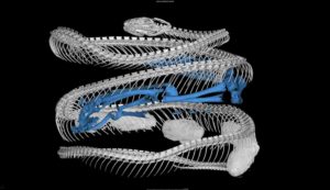
Mammals on the menu: Snake dietary diversity exploded after mass extinction 66 million years ago

CT scan of a cat-eyed snake (Leptodeira septentrionalis) reveals a frog (blue skeleton) in its digestive tract. Snake specimen from U-M's Museum of Zoology. Image credit: Ramon Nagesan, University of Michigan Museum of Zoology.
CT scan of a cat-eyed snake (Leptodeira septentrionalis) reveals a frog (blue skeleton) in its digestive tract. Snake specimen from U-M’s Museum of Zoology. Image credit: Ramon Nagesan, University of Michigan Museum of Zoology.

Modern snakes evolved from ancestors that lived side by side with the dinosaurs and that likely fed mainly on insects and lizards.

Then a miles-wide asteroid wiped out nearly all the dinosaurs and roughly three-quarters of the planet’s plant and animal species 66 million years ago, setting the stage for the spectacular diversification of mammals and birds that followed in the early Cenozoic Era.

A new University of Michigan study shows that early snakes capitalized on that ecological opportunity and the smorgasbord that it presented, rapidly and repeatedly evolving novel dietary adaptations and prey preferences.

The study, which combines genetic evidence with ecological information extracted from preserved museum specimens, is scheduled for online publication Oct. 14 in the journal PLOS Biology.

“We found a major burst of snake dietary diversification after the dinosaur extinction — species were evolving quickly and rapidly acquiring the ability to eat new types of prey,” said study lead author Michael Grundler, who did the work for his doctoral dissertation at U-M and who is now a postdoctoral researcher at UCLA.

Mammals and birds, which were also diversifying in the wake of the extinction, began to appear in snake diets at that time. Specialized diets also emerged, such as snakes that feed only on slugs or snails, or snakes that eat only lizard eggs.

Similar outbursts of dietary diversification were also seen when snakes arrived in new places, as when they colonized the New World.

“What this suggests is that snakes are taking advantage of opportunities in ecosystems,” said U-M evolutionary biologist and study co-author Daniel Rabosky, who was Grundler’s doctoral adviser. “Sometimes those opportunities are created by extinctions and sometimes they are caused by an ancient snake dispersing to a new land mass.”

Those repeated transformational shifts in dietary ecology were important drivers of what evolutionary biologists call adaptive radiation, the development of a variety of new forms adapted for different habitats and ways of life, according to Grundler and Rabosky.

Modern snakes are impressively diverse, with more than 3,700 species worldwide. And they display a stunning variety of diets, from tiny leaf-litter snakes that feed only on invertebrates such as ants and earthworms to giant constrictors like boas and pythons that eat mammals as big as antelope.

So, how did legless reptiles that can’t chew come to be such important predators on land and sea? To find out, Grundler and Rabosky first assembled a dataset on the diets of 882 modern-day snake species.

The dataset includes more than 34,000 direct observations of snake diets, from published accounts of scientists’ encounters with snakes in the field and from the analysis of the stomach contents of preserved museum specimens. Many of those specimens came from the U-M Museum of Zoology, home to the world’s second-largest collection of reptiles and amphibians.

All species living today are descended from other species that lived in the past. But because snake fossils are rare, direct observation of the ancient ancestors of modern snakes — and the evolutionary relationships among them — is mostly hidden from view.

However, those relationships are preserved in the DNA of living snakes. Biologists can extract that genetic information and use it to construct family trees, which biologists call phylogenies.

Grundler and Rabosky merged their dietary dataset with previously published snake phylogenetic data in a new mathematical model that allowed them to infer what long-extinct snake species were like.

“You might think it would be impossible to know things about species that lived long ago and for which we have no fossil information,” said Rabosky, an associate professor in the U-M Department of Ecology and Evolutionary Biology and an associate curator at the Museum of Zoology.

“But provided that we have information about evolutionary relationships and data about species that are now living, we can use these sophisticated models to estimate what their long-ago ancestors were like.”

In addition to showing a major burst of snake dietary diversification following the demise of the dinosaurs in what’s known as the K-Pg mass extinction, the new study revealed similar explosive dietary shifts when groups of snakes colonized new locations.

For example, some of the fastest rates of dietary change — including an increase of roughly 200% for one subfamily — occurred when the Colubroidea superfamily of snakes made it to the New World.

The colubroids account for most of the world’s current snake diversity, with representatives found on every continent except Antarctica. They include all venomous snakes and most other familiar snakes; the group does not include boas, pythons and several obscure snakes such as blind snakes and pipe snakes.

Grundler and Rabosky also found a tremendous amount of variability in how fast snakes evolve new diets. Some groups, such as blind snakes, evolved more slowly and maintained similar diets — mostly ants and termite larvae — for tens of millions of years.

On the other extreme are the dipsadine snakes, a large subfamily of colubroid snakes that includes more than 700 species. Since arriving in the New World roughly 20 million years ago, they have experienced a sustained burst of dietary diversification, according to the new study.

The dipsadines include goo-eaters, false water cobras, forest flame snakes and hognose snakes. Many of them imitate deadly coral snakes to ward off predators and are known locally as false coral snakes.

“In a relatively short period of time, they’ve had species evolve to specialize on earthworms, on fishes, on frogs, on slugs, on snakelike eels — even other snakes themselves,” Grundlersaid.

“A lot of the stories of evolutionary success that make it into the textbooks — such as Darwin’s famous finches — are nowhere near as impressive as some groups of snakes. The dipsadines of South and Central America have just exploded in all aspects of their diversity, and yet they are almost completely unknown outside the community of snake biologists.”

Rabosky and Grundler stressed that their study could not have been done without the information gleaned from preserved museum specimens.

“Some people think that zoology collections are just warehouses for dead animals, but that stereotype is completely inaccurate,” Rabosky said. “Our results highlight what a tremendous, world-class resource these collections are for answering questions that are almost impossible to answer otherwise.”

Funding for the study was provided by the National Science Foundation and the David and Lucile Packard Foundation.

Reference:
Michael C. Grundler, Daniel L. Rabosky. Rapid increase in snake dietary diversity and complexity following the end-Cretaceous mass extinction. PLOS Biology, 2021; 19 (10): e3001414 DOI: 10.1371/journal.pbio.3001414

Note: The above post is reprinted from materials provided by University of Michigan.

Primates’ ancestors may have left trees to survive asteroid

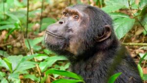
A chimpanzee in Kibale National Park, Uganda.

When an asteroid struck 66 million years ago and wiped out dinosaurs not related to birds and three-quarters of life on Earth, early ancestors of primates and marsupials were among the only tree-dwelling (arboreal) mammals that survived, according to a new study.

Arboreal species were especially at risk of extinction due to global deforestation caused by wildfires from the asteroid’s impact.

In the study, computer models, fossil records and information from living mammals revealed that most of the surviving mammals did not rely on trees, though the few arboreal mammals that lived on — including human ancestors — may have been versatile enough to adapt to the loss of trees.

The study points to the influence of this extinction event, known as the Cretaceous-Paleogene (K-Pg) boundary, on shaping the early evolution and diversification of mammals.

“One possible explanation for how primates survived across the K-Pg boundary, in spite of being arboreal, might be due to some behavioral flexibility, which may have been a critical factor that let them survive,” said Jonathan Hughes, the paper’s co-first author and a doctoral student in the lab of Jeremy Searle, professor of ecology and evolutionary biology in the College of Agriculture and Life Sciences. Co-first author Jacob Berv, Ph.D. ’19, is currently a Life Sciences Fellow at the University of Michigan.

The study, “Ecological Selectivity and the Evolution of Mammalian Substrate Preference Across the K-Pg Boundary,” published October 11 in the journal Ecology and Evolution.

The earliest mammals appeared roughly 300 million years ago and may have diversified in tandem with an expansion of flowering plants about 20 million years prior to the K-Pg event. When the asteroid struck, many of these mammal lineages died off, Hughes said.

“At the same time, the mammals that did survive diversified into all the new ecological niches that opened up when dinosaurs and other species became extinct,” Hughes said.

In the study, the researchers used published phylogenies (branching, tree-like diagrams that show evolutionary relatedness among groups of organisms) for mammals. They then classified each living mammal on those phylogenies into three categories — arboreal, semi-arboreal and non-arboreal — based on their preferred habitats. They also designed computer models that reconstructed the evolutionary history of mammals.

Mammal fossils from around the K-Pg are very rare and are difficult to use to interpret an animal’s habitat preference. The researchers compared information known from living mammals against available fossils to help provide additional context for their results.

Generally, the models showed that surviving species were predominantly non-arboreal through the K-Pg event, with two possible exceptions: ancestors of primates and marsupials. Primate ancestors and their closest relatives were found to be arboreal right before the K-Pg event in every model. Marsupial ancestors were found to be arboreal in half of the model reconstructions.

The researchers also examined how mammals as a group may have been changing over time.

“We were able to see that leading up to the K-Pg event, around that time frame, there was a big spike in transitions from arboreal and semi-arboreal to non-arboreal, so it’s not just that we are seeing mostly non-arboreal [species], but things were rapidly transitioning away from arboreality,” Hughes said.

Co-authors include Daniel Field, a vertebrate paleontologist at the University of Cambridge; Eric Sargis, a professor of anthropology at Yale University; and Stephen Chester, an associate professor of anthropology at Brooklyn College.

The study was funded by the National Science Foundation.

Reference:
Jonathan J. Hughes, Jacob S. Berv, Stephen G. B. Chester, Eric J. Sargis, Daniel J. Field. Ecological selectivity and the evolution of mammalian substrate preference across the K–Pg boundary. Ecology and Evolution, 2021 DOI: 10.1002/ece3.8114

Note: The above post is reprinted from materials provided by Cornell University. Original written by Krishna Ramanujan, courtesy of the Cornell Chronicle.

New Fossil: A new species of otter discovered in Germany

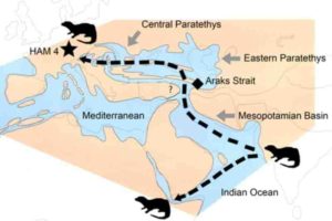
The dispersal of the Vishnuonyx otters from the Indian subcontinent to Africa and Europe about 13 million years ago. The star (HAM 4) shows the position of the Hammerschmiede fossil site. Image: Nikos Kargopoulos

Researchers from the Universities of Tübingen and Zaragoza have discovered a previously unknown species of otter from 11.4-million-year-old strata at the Hammerschmiede fossil site.

The excavation site in the Allgäu region of Germany became world-renowned in 2019 for discoveries of the bipedal ape Danuvius guggenmosi. The new species, published today in the Journal of Vertebrate Palaeontology, was named Vishnuonyx neptuni, meaning Neptune’s Vishnu otter. The Vishnu otter genus was previously known only from Asia and Africa.

The research team is conducting excavations at the Hammerschmiede under the direction of Professor Madelaine Böhme from the Senckenberg Centre for Human Evolution and Palaeoenvironment at the University of Tübingen. It has already recovered more than 130 different species of extinct vertebrates from river deposits attributed to the Ancient Guenz. Many of these species are adapted to life in and around water. However, the detection of a Vishnu otter in Bavaria was unexpected, since representatives of this genus had previously only been known from regions outside Europe.

Dispersal of the Vishnu otters

One in six species of today’s predatory mammals lives aquatically, either in the oceans, such as seals, or in freshwater, such as otters. The evolutionary history of the 13 otter species that occur today is still comparatively unexplored. Vishnu otters (Vishnuonyx) are mid-sized predators with a weight of ten to 15 kilograms that were first discovered in sediments in the foothills of the Himalayas. They lived 14 to 12.5 million years ago in the major rivers of Southern Asia.

Recent finds showed that Vishnu otters reached East Africa about 12 million years ago. The discovery in the now 11.4-million-year-old layers of the Hammerschmiede is the first evidence that they also occurred in Europe — possibly spreading from India throughout the entire Old World. Like all otters, the Vishnu otter depends on water; it cannot travel long distances over land. Its enormous dispersal of more than 6,000 kilometers across three continents was made possible by the geographic situation 12 million years ago: newly formed mountain ranges from the Alps in the west to the Iranian Elbrus Mountains in the east separated a large ocean basin from the Tethys Ocean, the forerunner of the Mediterranean and the Indian Ocean.

This created the Paratethys, a vast Eurasian body of water that extended from Vienna to beyond today’s Aral Sea in Kazakhstan. Twelve million years ago, it had only a narrow connection to the Indian Ocean, the so-called Araks Strait in the area of modern-day Armenia. The researchers assume that Neptune’s Vishnu otter followed this connection to the west and reached southern Germany, the Ancient Guenz, and the Hammerschmiede via the emerging delta of the Ancient Danube to the west of what is now the city of Vienna.

The fish predator’s teeth

At the recently founded Center for Visualization, Digitization, and Replication in the Department of Geosciences at the University of Tübingen, researchers used computer-tomographic methods to visualize the finest details in the fossils’ tooth structure. This technique allowed the precise observation of very small structures in the otter’s dentition. The pointed cusps, cutting blades, and restricted grinding areas suggest a diet based primarily on fish. Ecologically, Neptune’s Vishnu otter is thus more similar to the Eurasian otter than to the Pacific sea otter or the African and Asian clawless otters — both groups prefer crustaceans or shellfish over fish in their diet.

Reference:
Nikolaos Kargopoulos, Alberto Valenciano, Panagiotis Kampouridis, Thomas Lechner, Madelaine Böhme. New early late Miocene species of Vishnuonyx (Carnivora, Lutrinae) from the hominid locality of Hammerschmiede, Bavaria, Germany. Journal of Vertebrate Paleontology, 2021; DOI: 10.1080/02724634.2021.1948858

Note: The above post is reprinted from materials provided by Taylor & Francis Group.

What lies beneath: Volcanic secrets revealed

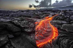
 Molten lava from a Hawaiian volcano. Image: Willyam/Adobe
Molten lava from a Hawaiian volcano. Image: Willyam/Adobe

Lava samples have revealed a new truth about the geological make-up of the Earth’s crust and could have implications for volcanic eruption early warning systems, a University of Queensland-led study has found.

UQ volcanologist Dr Teresa Ubide said it was previously understood that cooled lava from so-called ‘hot spot’ volcanoes was ‘pristine’ magma from the melting mantle, tens of kilometres under the Earth’s surface.

“This isn’t quite the case — we’ve been misled, geologically deceived,” Dr Ubide said.

“For decades, we have considered hot spot volcanoes to be messengers from the earth’s mantle, offering us a glimpse into what’s happening deep under our feet.

“But these volcanoes are extremely complex inside and filter a very different melt to the surface than what we’ve been expecting.

“This is due to the volcano’s intricate plumbing system that forces many minerals in the magma to crystallise.”

Dr Ubide said the minerals are being recycled by the rising magma, changing their overall chemistry to ‘appear’ pristine, which is an important new piece of the jigsaw to better understand how ocean island volcanoes work.

“We have discovered that hot spot volcanoes filter their melts to become highly eruptible at the base of the Earth’s crust, situated several kilometres below the volcano,” she said.

“The close monitoring of volcanoes can indicate when magma reaches the base of the crust, where this filtering processes reaches the ‘tipping point’ that leads to eruption.

“Our results support the notion that detection of magma at the crust-mantle boundary could indicate an upcoming eruption.

“This new information takes us one step closer to improving the monitoring of volcanic unrest, which aims to protect lives, infrastructure and crops.”

Hot spot volcanoes make up some of the world’s most beautiful landscapes, such as the Canary Islands in the Atlantic and Hawaii in the Pacific.

The international team of researchers analysed new rock samples from the island of El Hierro, in Spain’s Canary Islands, just south-west of Morocco.

This data was combined with hundreds of published geochemical data from El Hierro, including the underwater eruption in 2011 and 2012.

The team then tested the findings on data from ocean island hot spot volcanoes around the world, including Hawaii.

Dr Ubide said hot spot volcanoes are also found in Australia.

“South-east Queenslanders would be very familiar with the Glass House Mountains or the large Tweed shield volcano, which includes Wollumbin (Mount Warning) in New South Wales,” she said.

“Hot spot volcanoes can pop up ‘anywhere’, as opposed to most other volcanoes that occur due to tectonic plates crashing into each other, like the Ring of Fire volcanoes in Japan or New Zealand, or tectonic plates moving away from each other, creating for example the Atlantic Ocean.

“South-east Queensland hot spot volcanoes were active millions of years ago.

“They produced enormous volumes of magma and make excellent laboratories to explore the roots of volcanism.

“There are even dormant volcanoes in South Australia, that could erupt with little warning, that would benefit from better geological markers for early detection.”

Reference:
Teresa Ubide, Patricia Larrea, Laura Becerril, Carlos Gal�. Volcanic plumbing filters on ocean-island basalt geochemistry. Geology, 2021; DOI: 10.1130/G49224.1

Note: The above post is reprinted from materials provided by University of Queensland.

Giant Waikato penguin: School kids discover new species

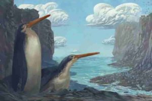
The Kawhia giant penguin Kairuku waewaeroa. Image credit: Simone Giovanardi. Permission for use of the image by media is granted by the artist, with credit.

A giant fossilized penguin discovered by New Zealand school children has been revealed as a new species in the peer-reviewed Journal of Vertebrate Paleontology by Massey University researchers.

Penguins have a fossil record reaching almost as far back as the age of the dinosaurs, and the most ancient of these penguins have been discovered in Aotearoa. Fossil penguins from Zealandia (ancient Aotearoa) are mostly known from Otago and Canterbury although important discoveries have recently been made in Taranaki and Waikato.

In 2006 a group of school children on a Hamilton Junior Naturalist Club (JUNATS) fossil hunting field trip in Kawhia Harbour, led by the club’s fossil expert Chris Templer, discovered the bones of a giant fossil penguin.

Researchers from Massey University and Bruce Museum (Connecticut, United States) visited Waikato Museum Te Whare Taonga o Waikato to analyse the fossil bones of the ancient penguin. The team used 3D scanning as part of their investigation and compared the fossil to digital versions of bones from around the world. 3D scanning also meant the team could produce a 3D-printed replica of the fossil for the Hamilton Junior naturalists. The actual penguin fossil was donated by the club to the Waikato Museum in 2017.

Dr Daniel Thomas, a Senior Lecturer in Zoology from Massey’s School of Natural and Computational Sciences, says the fossil is between 27.3 and 34.6 million years old and is from a time when much of the Waikato was under water.

“The penguin is similar to the Kairuku giant penguins first described from Otago but has much longer legs, which the researchers used to name the penguin waewaeroa — Te reo M?ori for ‘long legs’. These longer legs would have made the penguin much taller than other Kairuku while it was walking on land, perhaps around 1.4 metres tall, and may have influenced how fast it could swim or how deep it could dive,” Dr Thomas says.

“It’s been a real privilege to contribute to the story of this incredible penguin. We know how important this fossil is to so many people,” he adds.

“Kairuku waewaeroa is emblematic for so many reasons. The fossil penguin reminds us that we share Zealandia with incredible animal lineages that reach deep into time, and this sharing gives us an important guardianship role. The way the fossil penguin was discovered, by children out discovering nature, reminds us of the importance of encouraging future generations to become kaitiaki [guardians].”

Mike Safey, President of the Hamilton Junior Naturalist Club says it is something the children involved will remember for the rest of their lives.

“It was a rare privilege for the kids in our club to have the opportunity to discover and rescue this enormous fossil penguin. We always encourage young people to explore and enjoy the great outdoors. There’s plenty of cool stuff out there just waiting to be discovered.”

Steffan Safey was there for both the discovery and rescue missions. “It’s sort of surreal to know that a discovery we made as kids so many years ago is contributing to academia today. And it’s a new species, even! The existence of giant penguins in New Zealand is scarcely known, so it’s really great to know that the community is continuing to study and learn more about them. Clearly the day spent cutting it out of the sandstone was well spent!”

Dr Esther Dale, a plant ecologist who now lives in Switzerland, was also there.

“It’s thrilling enough to be involved with the discovery of such a large and relatively complete fossil, let alone a new species! I’m excited to see what we can learn from it about the evolution of penguins and life in New Zealand.”

Alwyn Dale helped with the recovery of the fossil. “It was definitely one of those slightly surreal things to look back on — absolute bucket list moment for me. After joining JUNATS there were some pretty iconic stories of amazing finds and special experiences — and excavating a giant penguin fossil has got to be up there! A real testament to all the parents and volunteers who gave their time and resources to make unique and formative memories for the club members.”

Taly Matthews, a long-time member of the Hamilton Junior Naturalist Club, and who works for the Department of Conservation in Taranaki, says, “Finding any fossil is pretty exciting when you think about how much time has passed while this animal remained hidden away, encased in rock. Finding a giant penguin fossil though is on another level. As more giant penguin fossils are discovered we get to fill in more gaps in the story. It’s very exciting.”

The research was led by PhD student Simone Giovanardi, with Dr Daniel Ksepka, Bruce Museum and Dr Daniel Thomas, Massey University.

Reference:
Simone Giovanardi, Daniel T. Ksepka, Daniel B. Thomas. A giant Oligocene fossil penguin from the North Island of New Zealand. Journal of Vertebrate Paleontology, 2021; DOI: 10.1080/02724634.2021.1953047

Note: The above post is reprinted from materials provided by Taylor & Francis Group.

A journey into an Alaskan volcano

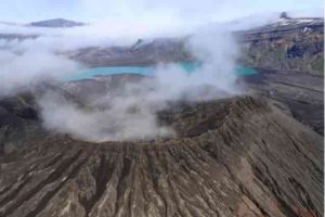
The rim of Cone D—inside the Okmok Volcano caldera—with the blue lake in the background. Credit: Nick Frearson

I’m writing this note from the Steadfast; an old 108 ft long crabber boat equipped with a helipad, crane, five state rooms, kitchen, living room, two skiffs, and a science laboratory. The ship was acquired by the Alaska Volcano Observatory and renovated to serve as a research vessel for assisting in volcano monitoring and fieldwork. The Steadfast has a calm charm to it and is smoothly run by Captain John Whittier, deckhands Angus and Mark, Kait the engineer, and Robert the cook.

The reason I find myself on this boat, anchored along a blurry boundary between the Bering Sea and Pacific Ocean, is because I am a Ph.D. student at Columbia University’s Lamont-Doherty Earth Observatory studying volcanology. I am working on the AVERT (Anticipating Volcanic Eruptions in Real Time) project lead by Dr. Terry Plank, Dr. Einat Lev and Nick Frearson. The mission of this project is to study two volcanoes in the Aleutian Islands off of Alaska by deploying an advance array of instrumentation that will transmit data via satellite in real time. This information will provide scientists the means to anticipate a volcanic eruption before one occurs.

The expedition has been an incredible mesh of new landscapes, modes of transport, people, and experiences. For starters, this is my first time in Alaska. It is also my first time living on a research vessel, flying in helicopters, riding an ATV, eating fresh halibut caught that very afternoon, and being chased by a herd of bulls. While all of these firsts are stories unto themselves, on July 15th, I entered my first caldera at Okmok Volcano on Umnak Island located approximately 4,200 miles away from New York in the Aleutian Island volcanic chain. A caldera is a large depression at the summit of a volcano formed when the ground collapses above a magma chamber.

Okmok’s caldera is impressively large; a crater that spans over six miles in diameter from rim to rim. The eruption that created Okmok’s caldera in 43 BCE was so massive that scientists argue it was a potential factor in the collapse of the Roman Republic, inducing a volcanic winter that contributed to crop failures, famine, and disease. Inside the caldera, there are six smaller volcanic cones, marking where magma and ash from the depths of the Earth breached the surface in the past. Although the last time Okmok erupted was in 2008, it is still considered an active volcano and is expected to erupt again in the near future. During the 2008 eruption, it produced a massive tuff (ash) cone named Ahmanilix, that sits in the northwest region of the caldera.

The objective of today’s mission was to go inside of Okmok’s caldera and take measurements of carbon dioxide along a walking transect. Sometimes, volcanoes let out excess gas in the surrounding area. This process is called diffuse degassing. Dr. Társilo Girona, one of the scientists on the trip, and a professor at University of Alaska Fairbanks, wanted to investigate whether these areas of excess gas correlate with an increase in volcanic activity. My job was to help record the measurements, take water samples of the blue lake located in the caldera, and assist Girona with soil temperature measurements.

After taking a helicopter flight from the Steadfast over the scenic island, passing over roaming cattle, rusted out WWII bunkers, and yellow wildflowers, we made it to the gates of the caldera. The ‘gates’ of Okmok are essentially the drainage system of the volcano, where a large stream called Crater Creek cuts through the 2500 ft rim, providing a cinematic and convenient pathway into the caldera. Once through the gates, a Martian landscape ensues with massive blocky lava flow deposits, blue and beige lakes, and colorful volcanic cones from historic eruptions. It’s beautiful, but a difficult place to work, with its own weather system that teeters between low lying clouds, sandy gusts, fog, and the occasional bit of sunshine.

Today we were lucky, and the caldera was only clouded on the south side, providing us the opportunity to complete our planned transect between the turquoise lake and the murkier sediment filled lake to the base of Cone D (the volcanic cone located right next to Ahmanilix).

Once the helicopter departed, we wasted no time, condensed our packs, and started hiking towards our target. The easiest route to the base of the cone was through a stream bed that weaved right between the two lakes. After about an hour of hiking we reached the intersection of the base of Cone D and Ahmanilix, where we started collecting data for our walking transect.

Possibly the most shocking feature I witnessed inside the caldera was the deeply incised gullies eroding the ash cones. Ahmanilix, which is a mere 13 years old, was so deeply incised with dendritic (vein-like) patterns that it appears as though the cone has been in existence for thousands of years. These erosional features illuminate the battle between volcanic forces with rain, wind, and snow in shaping the caldera morphology and how, over time, even volcanoes can be eroded away.

For the CO2 data collection, we stopped every 50 m to take a new measurement. At each stop, we pressed a metal cylinder into the ground to make an air tight seal that minimizes atmospheric influences in order to capture the escaping gases of the caldera. We also took note of the coordinates and soil and air temperatures. This particular type of measurement has never been done at Okmok so we were not sure what to expect.

After the transect was complete, we analyzed the signatures in the ship’s laboratory and didn’t find anything out of the ordinary. Despite the non-groundbreaking findings, however, preliminary diffuse gas measurements are still important to provide a baseline for the future.

After the data was collected, we had to hurry back to the helicopter drop off spot, making sure to avoid the wetter, quicksand ridden areas near the edges of the lakes. We successfully completed the mission and boarded the helicopter, flying back out through the gates towards the Steadfast. I had a warm meal on my mind, and an incredible first caldera experience under my belt. Studying volcanoes this last year, particularly lava flows and volcanic plumes, made the trip into the caldera even more special, and brought to life the countless hours of reading and online classes trying to describe volcanic systems and their otherworldly features.

Note: The above post is reprinted from materials provided by Earth Institute at Columbia University.

Modern snakes evolved from a few survivors of dino-killing asteroid

The extinction of their competitors allowed snakes to move into new niches and diversify enormously (Credit: Joschua Knüppe).

A new study suggests that all living snakes evolved from a handful of species that survived the giant asteroid impact that wiped out the dinosaurs and most other living things at the end of the Cretaceous. The authors say that this devastating extinction event was a form of ‘creative destruction’ that allowed snakes to diversify into new niches, previously filled by their competitors.

The research, published in Nature Communications, shows that snakes, today including almost 4000 living species, started to diversify around the time that an extra-terrestrial impact wiped out the dinosaurs and most other species on the planet.

The study, led by scientists at the University of Bath and including collaborators from Bristol, Cambridge and Germany, used fossils and analysed genetic differences between modern snakes to reconstruct snake evolution. The analyses helped to pinpoint the time that modern snakes evolved.

Their results show that all living snakes trace back to just a handful of species that survived the asteroid impact 66 million years ago, the same extinction that wiped out the dinosaurs.

The authors argue that the ability of snakes to shelter underground and go for long periods without food helped them survive the destructive effects of the impact. In the aftermath, the extinction of their competitors — including Cretaceous snakes and the dinosaurs themselves — allowed snakes to move into new niches, new habitats and new continents.

Snakes then began to diversify, producing lineages like vipers, cobras, garter snakes, pythons, and boas, exploiting new habitats, and new prey. Modern snake diversity — including tree snakes, sea snakes, venomous vipers and cobras, and huge constrictors like boas and pythons — emerged only after the dinosaur extinction.

Fossils also show a change in the shape of snake vertebrae in the aftermath, resulting from the extinction of Cretaceous lineages and the appearance of new groups, including giant sea snakes up to 10 metres long.

“It’s remarkable, because not only are they surviving an extinction that wipes out so many other animals, but within a few million years they are innovating, using their habitats in new ways,” said lead author and recent Bath graduate Dr Catherine Klein, who now works at Friedrich-Alexander-Universität Erlangen-Nürnberg (FAU) in Germany.

The study also suggests that snakes began to spread across the globe around this time. Although the ancestor of living snakes probably lived somewhere in the Southern Hemisphere, snakes first appear to have spread to Asia after the extinction.

Dr Nick Longrich, from the Milner Centre for Evolution at the University of Bath and the corresponding author, said: “Our research suggests that extinction acted as a form of ‘creative destruction’- by wiping out old species, it allowed survivors to exploit the gaps in the ecosystem, experimenting with new lifestyles and habitats.

“This seems to be a general feature of evolution — it’s the periods immediately after major extinctions where we see evolution at its most wildly experimental and innovative.

“The destruction of biodiversity makes room for new things to emerge and colonize new landmasses. Ultimately life becomes even more diverse than before.”

The study also found evidence for a second major diversification event around the time that the world shifted from a warm ‘Greenhouse Earth’ into a cold ‘Icehouse’ climate, which saw the formation of polar icecaps and the start of the Ice Ages.

The patterns seen in snakes hint at a key role for catastrophes — severe, rapid, and global environmental disruptions — in driving evolutionary change.

Reference:
Catherine G. Klein, Davide Pisani, Daniel J. Field, Rebecca Lakin, Matthew A. Wills, Nicholas R. Longrich. Evolution and dispersal of snakes across the Cretaceous-Paleogene mass extinction. Nature Communications, 2021; 12 (1) DOI: 10.1038/s41467-021-25136-y

Note: The above post is reprinted from materials provided by University of Bath.

Oldest known mammal cavities discovered in 55-million-year-old fossils suggests a sweet tooth for fruit

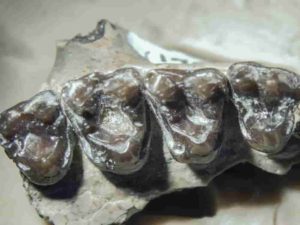
fossilized teeth from M. Latidens showing where cavities formed.

A new U of T study has discovered the oldest known cavities ever found in a mammal, the likely result of a diet that included eating fruit.

The cavities were discovered in fossils of Microsyops latidens, a pointy-snouted animal no bigger than a racoon that was part of a group of mammals known as stem primates. It walked the earth for about 500,000 years before going extinct around 54 million years ago.

“These fossils were sitting around for 54 million years and a lot can happen in that time,” says Keegan Selig, lead author of the study who recently completed his PhD student in Professor Mary Silcox’s lab at U of T Scarborough.

“I think most people assumed these holes were some kind of damage that happened over time, but they always occurred in the same part of the tooth and consistently had this smooth, rounded curve to them.”

Very few fossils of M. latidens’ body have been found, but a large sample of fossilized teeth have been unearthed over the years in Wyoming’s Southern Bighorn Basin. While they were first dug up in the 1970s and have been studied extensively since, Selig is the first to identify the little holes in their teeth as being cavities.

Cavities form when bacteria in the mouth turns foods containing carbohydrates into acids. These acids erode tooth enamel (the hard protective coating on the tooth) before eating away at dentin, the softer part of the tooth beneath the enamel. This decay slowly develops into tiny holes.

For the research, published in the journal Scientific Reports, Selig looked at the fossilized teeth of a thousand individuals under a microscope and was able to identify cavities in 77 of them. To verify the results, he also did micro-CT scans (a type of X-ray that looks inside an object without having to break it apart) on some of the fossils.

As for what caused the cavities, Selig says the likely culprit was the animal’s fruit-rich diet. While primates would have been eating fruit for quite some time before M. Latidens, for a variety of reasons fruit became more abundant around 65 million years ago and primates would have started eating more of it.

An interesting discovery was that out the fossil teeth studied, seven per cent from the oldest group contained cavities while 17 per cent of the more recent group contained cavities. This suggests a shift in their diet over time that included more fruit or other sugar-rich foods.

“Eating fruit is considered one of the hallmarks of what makes early primates unique,” says Selig, whose research looks on reconstructing the diets of fossil mammals.

He adds that M. Latidens would naturally want to eat fruit since its full of sugar and contains a lot of energy. “If you’re a little primate scurrying around in the trees, you would want to eat food with a high energy value. They also likely weren’t concerned about getting cavities.”

The study, which received funding from the Natural Sciences and Engineering Research Council of Canada (NSERC), not only includes the largest and earliest known sample of cavities in an extinct mammal, it also offers some clues into how the diet of M. Latidens changed over time. It also offers a framework to help researchers look for cavities in the fossils of other extinct mammals.

Selig says identifying cavities in fossils can tell us a lot about the biology of these animals. It can help figure out what they were eating and how they evolved over time based on their diet. For example, while evolutionary changes in the structure of a jaw or teeth suggest broader changes in diet over time, cavities also offer a window into what that specific animal was eating in their lifetime.

“It might be surprising to some that cavities are not a modern phenomenon, and they certainly are not unique to only humans,” he says.

“I think it’s interesting that here we have evidence of cavities that are more than 54 million years old, and that its teeth can tell us so much about this ancient animal that we couldn’t get anywhere else.”

Reference:
Keegan R. Selig, Mary T. Silcox. The largest and earliest known sample of dental caries in an extinct mammal (Mammalia, Euarchonta, Microsyops latidens) and its ecological implications. Scientific Reports, 2021; 11 (1) DOI: 10.1038/s41598-021-95330-x

Note: The above post is reprinted from materials provided by University of Toronto. Original written by Don Campbell.

500-million-year-old fossil represents rare discovery of ancient animal in North America

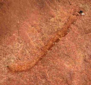
Researchers at the University of Missouri have found a rare, 500-million-year-old “worm-like” fossil called a palaeoscolecid, which is an uncommon fossil group in North America.

Many scientists consider the “Cambrian explosion” — which occurred about 530-540 million years ago — as the first major appearance of many of the world’s animal groups in the fossil record. Like adding pieces to a giant jigsaw puzzle, each discovery dating from this time period has added another piece to the evolutionary map of modern animals. Now, researchers at the University of Missouri have found a rare, 500-million-year-old “worm-like” fossil called a palaeoscolecid, which is an uncommon fossil group in North America. The researchers believe this find, from an area in western Utah, can help scientists better understand how diverse the Earth’s animals were during the Cambrian explosion.

Jim Schiffbauer, an associate professor of geological sciences in the MU College of Arts and Science and one of the study’s co-authors, said that while this fossil has the same anatomical organization as modern worms, it doesn’t exactly match with anything we see on modern Earth.

“This group of animals are extinct, so we don’t see them, or any modern relatives, on the planet today,” Schiffbauer said. “We tend to call them ‘worm-like’ because it’s hard to say that they perfectly fit with annelids, priapulids, or any other types of organism on the planet today that we would generally call a “worm.” But palaeoscolecids have the same general body plan, which in the history of life has been an incredibly successful body plan. So, this is a pretty cool addition because it expands the number of worm-like things that we know about from 500 million years ago in North America and adds to our global occurrences and diversity of the palaeoscolecids.”

At the time, this palaeoscolecid was likely living on an ocean floor, said Wade Leibach, an MU graduate teaching assistant in the College of Arts and Science, and lead author on the study.

“It is the first known palaeoscolecid discovery in a certain rock formation — the Marjum Formation of western Utah — and that’s important because this represents one of only a few palaeoscolecid taxa in North America,” Leibach said. “Other examples of this type of fossil have been previously found in much higher abundance on other continents, such as Asia, so we believe this find can help us better understand how we view prehistoric environments and ecologies, such as why different types of organisms are underrepresented or overrepresented in the fossil record. So, this discovery can be viewed from not only the perspective of its significance in North American paleontology, but also broader trends in evolution, paleogeography and paleoecology.”

Leibach, who switched his major from biology to geology after volunteering to work with the invertebrate paleontology collections at the University of Kansas, began this project as an undergraduate student by analyzing a box of about a dozen fossils in the collections of the KU Biodiversity Institute. Initially, Leibach and one of his co-authors, Anna Whitaker, who was a graduate student at KU at the time and now is at the University of Toronto-Mississauga, analyzed each fossil using a light microscope, which identified at least one of the fossils to be a palaeoscolecid.

Leibach worked with Julien Kimmig, who was at the KU Biodiversity Institute at the time and is now at Penn State University, to determine that, in order to be able to confirm their initial findings, he would need the help of additional analyses provided by sophisticated microscopy equipment located at the MU X-ray Microanalysis Core, which is directed by Schiffbauer. Using the core facility at MU, Leibach focused his analysis on the indentations left in the fossil by the ancient animal’s microscopic plates, which are characteristic of the palaeoscolecids.

“These very small mineralized plates are usually nanometers-to-micrometers in size, so we needed the assistance of the equipment in Dr. Schiffbauer’s lab to be able to study them in detail because their size, orientation and distribution is how we classify the organism to the genus and species levels,” Leibach said.

Leibach said the team found a couple reasons about why this particular fossil may be found in limited quantities in North America as compared to other parts of the world. They are:

  • Geochemical limitations or different environments that may be more predisposed to preserving these types of organisms.
  • Ecological competition, which may have driven this type of organism to be less competitive or less abundant in certain areas.

The new taxon is named Arrakiscolex aasei after the fictional planet Arrakis in the novel “Dune” by Frank Herbert, which is inhabited by a species of armored worm and the collector of the specimens Arvid Aase.

The study, “First palaeoscolecid from the Cambrian (Miaolingian, Drumian) Marjum Formation of western Utah,” was published in Acta Palaeontologica Polonica, an international quarterly journal which publishes papers from all areas of paleontology. Funding was provided by a National Science Foundation CAREER grant (1652351), a National Science Foundation Earth Sciences Instrumentation and Facilities grant (1636643), a University of Kansas Undergraduate Research grant, a student research grant provided by the South-Central Section of the Geological Society of America, and the J. Ortega-Hernández Laboratory for Invertebrate Palaeobiology at Harvard University. The study’s authors would like to thank Arvid Aase and Thomas T. Johnson for donating the specimens analyzed in the study.The new taxon is named Arrakiscolex aasei after the fictional planet Arrakis in the novel “Dune” by Frank Herbert, which is inhabited by a species of armored worm and the collector of the specimens Arvid Aase.

Reference:
Wade Leibach, Rudy Lerosey-Aubril, Anna Whitaker, James Schiffbauer, Julien Kimmig. First palaeoscolecid from the Cambrian (Miaolingian, Drumian) Marjum Formation of western Utah. Acta Palaeontologica Polonica, 2021; 66 DOI: 10.4202/app.00875.2021

Note: The above post is reprinted from materials provided by University of Missouri-Columbia.

Who was king before Tyrannosaurus? Uzbek fossil reveals new top dino

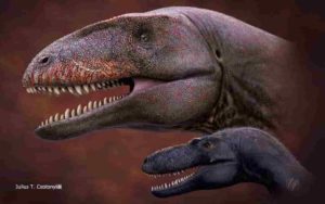
University of Tsukuba researchers have described a new apex predator from the lower Upper Cretaceous of Central Asia, Ulughbegsaurus uzbekistanensis, which coexisted with a smaller tyrannosauroid

Iconic tyrannosauroids like T. rex famously dominated the top of the food web at the end of the reign of the dinosaurs. But they didn’t always hold that top spot.

In a new study published in Royal Society Open Science, a research team led by the University of Tsukuba has described a new genus and species belonging to the Carcharodontosauria, a group of medium- to large-sized carnivorous dinosaurs that preceded the tyrannosauroids as apex predators.

The new dinosaur, named Ulughbegsaurus uzbekistanensis, was found in the lower Upper Cretaceous Bissekty Formation of the Kyzylkum Desert in Uzbekistan, and therefore lived about 90 million years ago. Two separate evolutionary analyses support classification of the new dinosaur as the first definitive carcharodontosaurian discovered in the Upper Cretaceous of Central Asia.

“We described this new genus and species based on a single isolated fossil, a left maxilla, or upper jawbone,” explains study first author Assistant Professor Kohei Tanaka. “Among theropod dinosaurs, the size of the maxilla can be used to estimate the animal’s size because it correlates with femur length, a well-established indicator of body size. Thus, we were able to estimate that Ulughbegsaurus uzbekistanensis had a mass of over 1,000 kg, and was approximately 7.5 to 8.0 meters in length, greater than the length of a full-grown African elephant.”

This size greatly exceeds that of any other carnivore known from the Bissekty Formation, including the small-sized tyrannosauroid Timurlengia described from the same formation. Therefore, the newly named dinosaur likely topped the food web in its early Late Cretaceous ecosystem.

The genus’s namesake is fittingly regal; Ulughbegsaurus is named for Ulugh Beg, the 15th century mathematician, astronomer, and sultan of the Timurid Empire of Central Asia. The species is named for the country where the fossil was discovered.

Before the Late Cretaceous, carcharodontosaurians like Ulughbegsaurus disappeared from the paleocontinent that included Central Asia. This disappearance is thought to have been related to the rise of tyrannosauroids as apex predators, but this transition has remained poorly understood because of the scarcity of relevant fossils.

Senior author Professor Yoshitsugu Kobayashi at the Hokkaido University Museum explains “The discovery of Ulughbegsaurus uzbekistanensis fills an important gap in the fossil record, revealing that carcharodontosaurians were widespread across the continent from Europe to East Asia. As one of the latest surviving carcharodontosaurians in Laurasia, this large predator’s coexistence with a smaller tyrannosauroid reveals important constraints on the transition of the apex predator niche in the Late Cretaceous.”

Reference:
Kohei Tanaka, Otabek Ulugbek Ogli Anvarov, Darla K. Zelenitsky, Akhmadjon Shayakubovich Ahmedshaev, Yoshitsugu Kobayashi. A new carcharodontosaurian theropod dinosaur occupies apex predator niche in the early Late Cretaceous of Uzbekistan. Royal Society Open Science, 2021; 8 (9): 210923 DOI: 10.1098/rsos.210923

Note: The above post is reprinted from materials provided by University of Tsukuba.

Massive new animal species discovered in half-billion-year-old Burgess Shale

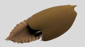
Titanokorys gainesi reconstruction. Illustration by Lars Fields, © Royal Ontario Museum.

Palaeontologists at the Royal Ontario Museum (ROM) have uncovered the remains of a huge new fossil species belonging to an extinct animal group in half-a-billion-year-old Cambrian rocks from Kootenay National Park in the Canadian Rockies. The findings were announced on September 8, 2021, in a study published in Royal Society Open Science.

Named Titanokorys gainesi, this new species is remarkable for its size. With an estimated total length of half a meter, Titanokorys was a giant compared to most animals that lived in the seas at that time, most of which barely reached the size of a pinky finger.

“The sheer size of this animal is absolutely mind-boggling, this is one of the biggest animals from the Cambrian period ever found,” says Jean-Bernard Caron, ROM’s Richard M. Ivey Curator of Invertebrate Palaeontology.

Evolutionarily speaking, Titanokorys belongs to a group of primitive arthropods called radiodonts. The most iconic representative of this group is the streamlined predator Anomalocaris, which may itself have approached a metre in length. Like all radiodonts, Titanokorys had multifaceted eyes, a pineapple slice-shaped, tooth-lined mouth, a pair of spiny claws below its head to capture prey and a body with a series of flaps for swimming. Within this group, some species also possessed large, conspicuous head carapaces, with Titanokorys being one of the largest ever known.

“Titanokorys is part of a subgroup of radiodonts, called hurdiids, characterized by an incredibly long head covered by a three-part carapace that took on myriad shapes. The head is so long relative to the body that these animals are really little more than swimming heads,” added Joe Moysiuk, co-author of the study, and a ROM-based Ph.D. student in Ecology & Evolutionary Biology at the University of Toronto.

Why some radiodonts evolved such a bewildering array of head carapace shapes and sizes is still poorly understood and was likely driven by a variety of factors, but the broad flattened carapace form in Titanokorys suggests this species was adapted to life near the seafloor.

“These enigmatic animals certainly had a big impact on Cambrian seafloor ecosystems. Their limbs at the front looked like multiple stacked rakes and would have been very efficient at bringing anything they captured in their tiny spines towards the mouth. The huge dorsal carapace might have functioned like a plough,” added Dr. Caron, who is also an Associate Professor in Ecology & Evolutionary Biology and Earth Sciences at the University of Toronto, and Moysiuk’s Ph.D. advisor.

All fossils in this study were collected around Marble Canyon in northern Kootenay National Park by successive ROM expeditions. Discovered less than a decade ago, this area has yielded a great variety of Burgess Shale animals dating back to the Cambrian period, including a smaller, more abundant relative of Titanokorys named Cambroraster falcatusin reference to its Millennium Falcon-shaped head carapace. According to the authors, the two species might have competed for similar bottom-dwelling prey.

The Burgess Shale fossil sites are located within Yoho and Kootenay National Parks and are managed by Parks Canada. Parks Canada is proud to work with leading scientific researchers to expand knowledge and understanding of this key period of earth history and to share these sites with the world through award-winning guided hikes. The Burgess Shale was designated a UNESCO World Heritage Site in 1980 due to its outstanding universal value and is now part of the larger Canadian Rocky Mountain Parks World Heritage Site.

The discovery of Titanokorys gainesi was profiled in the CBC’s The Nature of Things episode “First Animals.” These and other Burgess Shale specimens will be showcased in a new gallery at ROM, the Willner Madge Gallery, Dawn of Life, opening in December 2021.

Major funding support for the research and fieldwork came from the Polk Milstein Family, ROM, the National Geographic Society (#9475-14 to JBC), the Swedish Research Council (to Michael Streng), the National Science Foundation (NSF-EAR-1556226, 1554897) and Pomona College (to Robert R. Gaines). This research is also supported by a National Science and Engineering Research Council (NSERC) Discovery grant to J.-B.C and a Vanier Canada Graduate Scholarship through the University of Toronto (Dept. of Ecology and Evolution) to J.M.

Reference:
J.-B. Caron, J. Moysiuk. A giant nektobenthic radiodont from the Burgess Shale and the significance of hurdiid carapace diversity. Royal Society Open Science, 2021; 8 (9): 210664 DOI: 10.1098/rsos.210664

Note: The above post is reprinted from materials provided by Royal Ontario Museum.

Researchers identify new source for earthquakes and tsunamis in the Greater Tokyo Region

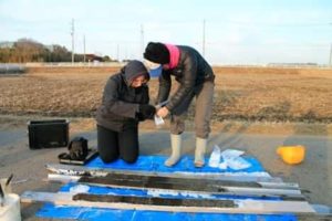
Jessica Pilarczyk (SFU) and collaborator Tina Dura (Virginia Tech) sample sediment cores from rice paddies of the Greater Tokyo Region that contain evidence for an earthquake from 1,000 years ago that potentially originated from a historically unconsidered earthquake source. Credit: SFU

Researchers have discovered geologic evidence that unusually large earthquakes and tsunamis from the Tokyo region — located near tectonic plate boundaries that are recognized as a seismic hazard source — may be traceable to a previously unconsidered plate boundary. The team, headed by Simon Fraser University Earth scientist Jessica Pilarczyk, has published its research today in Nature Geoscience.

The team’s ground-breaking discovery represents a new and unconsidered seismic risk for Japan with implications for countries lining the Pacific Rim, including Canada.

Pilarczyk points to low-lying areas like Delta, Richmond and Port Alberni as potentially vulnerable to tsunamis originating from this region.

In 2011, eastern Japan was hit with a massive magnitude 9 quake — creating the largest rupture area of any earthquake originating from the Japan Trench. It triggered the Fukushima Daiichi nuclear disaster and a tsunami that travelled thousands of miles away — impacting the shores of British Columbia, California, Oregon, Hawaii and Chile.

For the past decade, Pilarczyk and an international team of collaborators have been working with the Geological Survey of Japan to study Japan’s unique geologic history. Together, they uncovered and analyzed sandy deposits from the Boso Peninsula region (50 km east of Tokyo) that they attribute to an unusually large tsunami that occurred about 1,000 years ago.

Until now, scientists did not have historical records to ascertain if a portion of the Philippine Sea/Pacific plate boundary near the Boso Peninsula was capable of generating large tsunamis similar in size as the Tohoku event in 2011.

Using a combination of radiocarbon dating, geologic and historical records, and paleoecology, the team used 13 hypothetical and historical models to assess each of the three plate boundaries, including the Continental/Philippine Sea plate boundary (Sagami Trough), the Continental/Pacific plate boundary (Japan Trench) and the Philippine Sea/Pacific plate boundary (Izu-Bonin Trench) as sources of the 1,000-year-old earthquake.

Pilarczyk reports that the modeled scenarios suggest that the source of the tsunami from 1,000 years ago originated from the offshore area off the Boso Peninsula — the smallest of which (for example, possible earthquakes with the lowest minimum magnitude), are linked to the previously unconsidered Izu-Bonin Trench at the boundary of the Philippine Sea and Pacific plates.

“Earthquake hazard assessments for the Tokyo region are complicated by the ‘trench-trench triple junction’, where the oceanic Philippine Sea Plate not only underthrusts a continental plate but is also being subducted by the Pacific Plate,” says Pilarczyk, an assistant professor of Earth sciences at SFU who holds a Canada Research Chair in Natural Hazards. “Great thrust earthquakes and associated tsunamis are historically recognized hazards from the Continental/Philippine Sea (Sagami Trough) and Continental/Pacific (Japan Trench) plate boundaries but not from the Philippine Sea/Pacific boundary alone.”

Pilarczyk hopes that these findings will be used to produce better informed seismic hazard maps for Japan. She also says that this information could be used by far-field locations, including Canada, to inform building practices and emergency management strategies that would help mitigate the destructive consequences of an earthquake similar to the one of 1,000 years ago.

Reference:
Jessica E. Pilarczyk, Yuki Sawai, Yuichi Namegaya, Toru Tamura, Koichiro Tanigawa, Dan Matsumoto, Tetsuya Shinozaki, Osamu Fujiwara, Masanobu Shishikura, Yumi Shimada, Tina Dura, Benjamin P. Horton, Andrew C. Parnell, Christopher H. Vane. A further source of Tokyo earthquakes and Pacific Ocean tsunamis. Nature Geoscience, Sept. 2, 2021; DOI: 10.1038/s41561-021-00812-2

Note: The above post is reprinted from materials provided by Simon Fraser University. Original written by Diane Mar-Nicolle.

Volcanic eruptions may have spurred first ‘whiffs’ of oxygen in Earth’s atmosphere

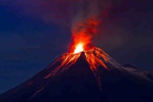
Volcanic eruption
Volcanic eruption

A new analysis of 2.5-billion-year-old rocks from Australia finds that volcanic eruptions may have stimulated population surges of marine microorganisms, creating the first puffs of oxygen into the atmosphere. This would change existing stories of Earth’s early atmosphere, which assumed that most changes in the early atmosphere were controlled by geologic or chemical processes.

Though focused on Earth’s early history, the research also has implications for extraterrestrial life and even climate change. The study led by the University of Washington, the University of Michigan and other institutions was published in August in the Proceedings of the National Academy of Sciences.

“What has started to become obvious in the past few decades is there actually are quite a number of connections between the solid, nonliving Earth and the evolution of life,” said first author Jana Meixnerová, a UW doctoral student in Earth and space sciences. “But what are the specific connections that facilitated the evolution of life on Earth as we know it?”

In its earliest days, Earth had no oxygen in its atmosphere and few, if any, oxygen-breathing lifeforms. Earth’s atmosphere became permanently oxygen-rich about 2.4 billion years ago, likely after an explosion of lifeforms that photosynthesize, transforming carbon dioxide and water into oxygen.

But in 2007, co-author Ariel Anbar at Arizona State University analyzed rocks from the Mount McRae Shale in Western Australia, reporting a short-term whiff of oxygen about 50 to 100 million years before it became a permanent fixture in the atmosphere. More recent research has confirmed other, earlier, short-term oxygen spikes, but hasn’t explained their rise and fall.

In the new study, researchers at the University of Michigan, led by co-corresponding author Joel Blum, analyzed the same ancient rocks for the concentration and number of neutrons in the element mercury, emitted by volcanic eruptions. Large volcanic eruptions blast mercury gas into the upper atmosphere, where today it circulates for a year or two before raining out onto Earth’s surface. The new analysis shows a spike in mercury a few million years before the temporary rise in oxygen.

“Sure enough, in the rock below the transient spike in oxygen we found evidence of mercury, both in its abundance and isotopes, that would most reasonably be explained by volcanic eruptions into the atmosphere,” said co-author Roger Buick, a UW professor of Earth and Space Sciences.

Where there were volcanic emissions, the authors reason, there must have been lava and volcanic ash fields. And those nutrient-rich rocks would have weathered in the wind and rain, releasing phosphorus into rivers that could fertilize nearby coastal areas, allowing oxygen-producing cyanobacteria and other single-celled lifeforms to flourish.

“There are other nutrients that modulate biological activity on short timescales, but phosphorus is the one that is most important on long timescales,” Meixnerová said.

Today, phosphorus is plentiful in biological material and in agricultural fertilizer. But in very ancient times, weathering of volcanic rocks would have been the main source for this scarce resource.

“During weathering under the Archaean atmosphere, the fresh basaltic rock would have slowly dissolved, releasing the essential macro-nutrient phosphorus into the rivers. That would have fed microbes that were living in the shallow coastal zones and triggered increased biological productivity that would have created, as a byproduct, an oxygen spike,” Meixnerová said.

The precise location of those volcanoes and lava fields is unknown, but large lava fields of about the right age exist in modern-day India, Canada and elsewhere, Buick said.

“Our study suggests that for these transient whiffs of oxygen, the immediate trigger was an increase in oxygen production, rather than a decrease in oxygen consumption by rocks or other nonliving processes,” Buick said. “It’s important because the presence of oxygen in the atmosphere is fundamental — it’s the biggest driver for the evolution of large, complex life.”

Ultimately, researchers say the study suggests how a planet’s geology might affect any life evolving on its surface, an understanding that aids in identifying habitable exoplanets, or planets outside our solar system, in the search for life in the universe.

Other authors of the paper are co-corresponding author Eva Stüeken, a former UW astrobiology graduate student now at the University of St. Andrews in Scotland; Michael Kipp, a former UW graduate student now at the California Institute of Technology; and Marcus Johnson at the University of Michigan. The study was funded by NASA, the NASA-funded UW Virtual Planetary Laboratory team and the MacArthur Professorship to Blum at the University of Michigan.

Reference:
Jana Meixnerová, Joel D. Blum, Marcus W. Johnson, Eva E. Stüeken, Michael A. Kipp, Ariel D. Anbar, Roger Buick. Mercury abundance and isotopic composition indicate subaerial volcanism prior to the end-Archean “whiff” of oxygen. Proceedings of the National Academy of Sciences, 2021; 118 (33): e2107511118 DOI: 10.1073/pnas.2107511118

Note: The above post is reprinted from materials provided by University of Washington. Original written by Hannah Hickey.

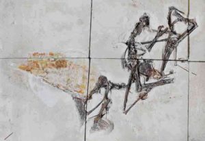
Confiscated fossil turns out to be exceptional flying reptile from Brazil

Entombed in limestone blocks, the newly studied fossil is the first nearly complete skeleton of a pterosaur species that was first described in 2003. Photograph by Victor Beccari

A fossil acquired in a police raid has turned out to be one of the best-preserved flying reptiles ever found, according to a study published August 11, 2021 in the open-access journal PLOS ONE by Victor Beccari of the University of São Paulo and colleagues.

Tapejarids (an Early Cretaceous subgroup of flying reptiles called pterosaurs) are known for their enormous head crests and their abundance in the fossil record of Brazil, but most Brazilian tapejarid fossils preserve only partial remains. In this study, researchers describe an exceptional tapejarid specimen which includes nearly the entire body, mostly intact and even including remnants of soft tissue alongside the bones, making it the most complete tapejarid skeleton ever found in Brazil.

This fossil belongs to a species called Tupandactylus navigans, and it has a dramatic history. It is preserved across six square-cut limestone slabs which were confiscated during a police raid at Santos Harbour in São Paulo. It is now among the collections of the University of São Paulo, where researchers were able to reunite the slabs and examine the entire fossil, even CT-scanning to reveal the bones concealed within the stone. This is the first time that paleontologists have been able to study more than just the skull of this species.

The description suggests this species had a terrestrial foraging lifestyle, due to its long neck and the proportions of its limbs, as well as its large head crest that could negatively influence long-distance flight. However, the specimen possesses all the necessary adaptation for powered flight, such as the presence of a notarium and a developed muscle anchoring region in the arm bones. This specimen also has an unusually large crest on its chin, part of its already impressive skull ornamentation. Precisely how all these factors contributed to the flight performance and lifestyle of these animals will be a subject of future research, among the many other questions that can be answered through study of this exceptional fossil.

The authors add: “We described the most complete tapejarid fossil from Brazil, a partially articulated skeleton of Tupandactylus navigans with soft tissue preservation. This specimen brings new insights into the anatomy of this animal and its constraints for flight, arguing for terrestrial foraging ecology.”

Reference:
Victor Beccari, Felipe Lima Pinheiro, Ivan Nunes, Luiz Eduardo Anelli, Octávio Mateus, Fabiana Rodrigues Costa. Osteology of an exceptionally well-preserved tapejarid skeleton from Brazil: Revealing the anatomy of a curious pterodactyloid clade. PLOS ONE, 2021; 16 (8): e0254789 DOI: 10.1371/journal.pone.0254789

Note: The above post is reprinted from materials provided by PLOS.

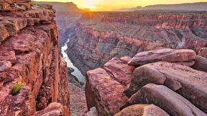
Geologists dig into Grand Canyon’s mysterious gap in time

Grand Canyon, Arizona

A new study led by the University of Colorado Boulder reveals the complex history behind one of the Grand Canyon’s most well-known geologic features: A mysterious and missing gap of time in the canyon’s rock record that covers hundreds of millions of years.

The research comes closer to solving a puzzle, called the “Great Unconformity,” that has perplexed geologists since it was first described nearly 150 years ago.

Think of the red bluffs and cliffs of the Grand Canyon as Earth’s history textbook, explained Barra Peak, lead author of the new study and a graduate student in geological sciences at CU Boulder. If you scale down the canyon’s rock faces, you can jump back almost 2 billion years into the planet’s past. But that textbook is also missing pages: In some areas, more than 1 billion years’ worth of rocks have disappeared from the Grand Canyon without a trace.

Geologists want to know why.

“The Great Unconformity is one of the first well-documented geologic features in North America,” Peak said. “But until recently, we didn’t have a lot of constraints on when or how it occurred.”

Now, she and her colleagues think they may be narrowing in on an answer in a paper published this month in the journal Geology. The team reports that a series of small yet violent faulting events may have rocked the region during the breakup of an ancient supercontinent called Rodinia. The resulting havoc likely tore up the earth around the canyon, causing rocks and sediment to wash away and into the ocean.

The team’s findings could help scientists fill in missing pieces of what happened during this critical period for the Grand Canyon — today one of North America’s foremost natural wonders.

“We have new analytical methods in our lab that allow us to decipher the history in the missing window of time across the Great Unconformity,” said Rebecca Flowers, coauthor of the new study and a professor of geological sciences. “We are doing this in the Grand Canyon and at other Great Unconformity localities across North America.”

Beautiful lines

It’s a mystery that goes back a long way. John Wesley Powell, the namesake of today’s Lake Powell, first saw the Great Unconformity during his famed 1869 expedition by boat down the rapids of the Colorado River.

Peak, who completed a similar research rafting trip through the Grand Canyon in spring 2021, said that the feature is stark enough that you can see it from the river.

“There are beautiful lines,” Peak said. “At the bottom, you can see very clearly that there are rocks that have been pushed together. Their layers are vertical. Then there there’s a cutoff, and above that you have these beautiful horizontal layers that form the buttes and peaks that you associate with the Grand Canyon.”

The difference between those two types of rocks is significant. In the western part of the canyon toward Lake Mead, the basement stone is 1.4 to 1.8 billion years old. The rocks sitting on top, however, are just 520 million years old. Since Powell’s voyage, scientists have seen evidence of similar periods of lost time at sites around North America.

“There’s more than a billion years that’s gone,” Peak said. “It’s also a billion years during an interesting part of Earth’s history where the planet is transitioning from an older setting to the modern Earth we know today.”

A continent splits

To explore the transition, Peak and her colleagues employed a method called “thermochronology,” which tracks the history of heat in stone. Peak explained that, when geologic formations are buried deep underground, the pressure building on top of them can cause them to get toasty. That heat, in turn, leaves a trace in the chemistry of minerals in those formations.

Using this approach, the researchers conducted a survey of samples of rock collected from throughout the Grand Canyon. They discovered that the history of this feature may be more convoluted than scientists have assumed. In particular, the western half of the canyon and its eastern portion (the part that tourists are most familiar with) may have undergone different geologic contortions throughout time.

“It’s not a single block with the same temperature history,” Peak said.

Roughly 700 million years ago, basement rock in the west seems to have risen to the surface. In the eastern half, however, that same stone was under kilometers of sediment.

The difference likely came down to the breakup of Rodinia, a gigantic land mass that began to pull apart at about the same time, Peak said. The researchers results suggest that this major upheaval may have torn at the eastern and western halves of the Grand Canyon in different ways and at slightly different times — producing the Great Unconformity in the process.

Peak and her colleagues are now looking at other sites of the Great Unconformity in North America to see how general this picture might be. For now, she’s excited to watch geologic history play out in one of the country’s most picturesque landscapes.

“There are just so many things there that aren’t present anywhere else,” she said. “It’s a really amazing natural lab.”

Other coauthors of the new study included John Cottle and Francis Macdonald of the University of California, Santa Barbara.

Reference:
B.A. Peak, R.M. Flowers, F.A. Macdonald, J.M. Cottle. Zircon (U-Th)/He thermochronology reveals pre-Great Unconformity paleotopography in the Grand Canyon region, USA. Geology, 2021; DOI: 10.1130/G49116.1

Note: The above post is reprinted from materials provided by University of Colorado at Boulder. Original written by Daniel Strain.

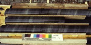
Volcanism drove rapid ocean deoxygenation during the time of the dinosaurs

Core samples for Oceanic Anoxic Event 1a. Credit: Elisabetta Erba.

Ocean deoxygenation during the Mesozoic Era was much more rapid than previous thought, with CO2 induced environmental warming creating ocean ‘dead zones’ over timescales of only tens of thousands of years.

The research from University of British Columbia (UBC) and University of Hong Kong (HKU) Earth scientists paints a new picture of severe ocean deoxygenation events in our planet’s geologic history.

“Physical drivers, in particular ocean warming linked to volcanic activity during the Cretaceous Period, played key roles in triggering and maintaining oceanic anoxia,” says lead researcher Dr. Kohen Bauer, who began the work while at UBC and completed the study with HKU’s Department of Earth Sciences.

“The same mechanisms are also critically important drivers of modern ocean deoxygenation and expanding marine dead zones. Today, in addition to volcanoes releasing CO2 into the atmosphere, humans are as well.”

Previous research tended to focus on the role ocean nutrient cycles played in causing so called ‘dead zones’ — a process that would have driven ocean deoxygenation over much longer timescales of hundreds of thousands of years. However, it’s now clear that massive volcanism and its associated feedbacks was a more direct trigger for the rapid development of oceanic anoxia.

The research delved into the causes of Oceanic Anoxic Event 1a — an interval 120 million years ago when large swaths of Earth’s oceans became anoxic. Those conditions likely persisted for almost a million years, causing climate perturbations, and biotic turnover.

The scientists reconstructed the period’s environmental conditions using novel geochemical methods and ancient sediments deposited in both the paleo-Tethys and paleo-Pacific oceans.

“Mesozoic oceanic anoxic events are some of the most important analogs for unlocking lessons about warm-Earth climate states in the geological record,” says UBC’s Dr. Sean Crowe, author on the paper and Canada Research Chair in Geomicrobiology with UBC’s departments of Microbiology and Immunology, and Earth, Ocean and Atmospheric Sciences.

“These events provide enormous potential to help us better understand the sensitivity of the Earth system to perturbations in global biogeochemical cycles, marine biology, and climate on timescales relevant to humankind.”

Reference:
Kohen W. Bauer, Cinzia Bottini, Robert Frei, Dan Asael, Noah J. Planavsky, Roger Francois, N. Ryan McKenzie, Elisabetta Erba, Sean A. Crowe. Pulsed volcanism and rapid oceanic deoxygenation during Oceanic Anoxic Event 1a. Geology, 2021; DOI: 10.1130/G49065.1

Note: The above post is reprinted from materials provided by University of British Columbia.

Volcanoes acted as a safety valve for Earth’s long-term climate

Continental volcanic arcs such as this one in Kamchatka, Russia, are rapidly weathered, driving CO2 removal from the atmosphere over geological time. Credit: Tom Gernon, University of Southampton

Scientists at the University of Southampton have discovered that extensive chains of volcanoes have been responsible for both emitting and then removing atmospheric carbon dioxide (CO2) over geological time. This stabilised temperatures at Earth’s surface.

The researchers, working with colleagues at the University of Sydney, Australian National University (ANU), University of Ottawa and University of Leeds, explored the combined impact of processes in the solid Earth, oceans and atmosphere over the past 400 million years. Their findings are published in the journal Nature Geoscience.

Natural break-down and dissolution of rocks at Earth’s surface is called chemical weathering. It is critically important because the products of weathering (elements like calcium and magnesium) are flushed via rivers to the oceans, where they form minerals that lock up CO2. This feedback mechanism regulates atmospheric CO2 levels, and in turn global climate, over geological time.

“In this respect, weathering of the Earth’s surface serves as a geological thermostat,” says lead author Dr Tom Gernon, Associate Professor in Earth Science at the University of Southampton, and a Fellow of the Turing Institute. “But the underlying controls have proven difficult to determine due to the complexity of the Earth system.”

“Many Earth processes are interlinked, and there are some major time lags between processes and their effects,” explains Eelco Rohling, Professor in Ocean and Climate Change at ANU and co-author of the study. “Understanding the relative influence of specific processes within the Earth system response has therefore been an intractable problem.”

To unravel the complexity, the team constructed a novel “Earth network,” incorporating machine-learning algorithms and plate tectonic reconstructions. This enabled them to identify the dominant interactions within the Earth system, and how they evolved through time.

The team found that continental volcanic arcs were the most important driver of weathering intensity over the past 400 million years. Today, continental arcs comprise chains of volcanoes in, for example, the Andes in South America, and the Cascades in the US. These volcanoes are some of the highest and fastest eroding features on Earth. Because the volcanic rocks are fragmented and chemically reactive, they are rapidly weathered and flushed into the oceans.

Martin Palmer, Professor of Geochemistry at the University of Southampton and co-author of the study, said: “It’s a balancing act. On one hand, these volcanoes pumped out large amounts of CO2 that increased atmospheric CO2 levels. On the other hand, these same volcanoes helped remove that carbon via rapid weathering reactions.”

The study casts doubt on a long-held concept that Earth’s climate stability over tens to hundreds of millions of years reflects a balance between weathering of the seafloor and continental interiors. “The idea of such a geological tug of war between the landmasses and the seafloor as a dominant driver of Earth surface weathering is not supported by the data,” Dr Gernon states.

“Unfortunately, the results do not mean that nature will save us from climate change,” stresses Dr Gernon. “Today, atmospheric CO2 levels are higher than at any time in the past 3 million years, and human-driven emissions are about 150 times larger than volcanic CO2 emissions. The continental arcs that appear to have saved the planet in the deep past are simply not present at the scale needed to help counteract present-day CO2 emissions.”

But the team’s findings still provide critical insights into how society might manage the current climate crisis. Artificially enhanced rock weathering — where rocks are pulverised and spread across land to speed up chemical reaction rates — could play a key role in safely removing CO2 from the atmosphere. The team’s findings suggest that such schemes may be deployed optimally by using calc-alkaline volcanic materials (those containing calcium, potassium and sodium), like those found in continental arc environments.

“This is by no means a silver bullet solution to the climate crisis — we urgently need to reduce CO2 emissions in line with IPCC mitigation pathways, full stop. Our assessment of weathering feedbacks over long timescales may help in designing and evaluating large-scale enhanced weathering schemes, which is just one of the steps needed to counteract global climate change,” Dr Gernon concludes.

Reference:
Thomas M. Gernon, Thea K. Hincks, Andrew S. Merdith, Eelco J. Rohling, Martin R. Palmer, Gavin L. Foster, Clément P. Bataille, R. Dietmar Müller. Global chemical weathering dominated by continental arcs since the mid-Palaeozoic. Nature Geoscience, 2021; DOI: 10.1038/s41561-021-00806-0

Note: The above post is reprinted from materials provided by University of Southampton.

Geologists take Earth’s inner temperature using erupted sea glass

A map of the World Ocean Floor. Credit: Library of Congress, Geography and Map Division

If the Earth’s oceans were drained completely, they would reveal a massive chain of undersea volcanoes snaking around the planet. This sprawling ocean ridge system is a product of overturning material in the Earth’s interior, where boiling temperatures can melt and loft rocks up through the crust, splitting the sea floor and reshaping the planet’s surface over hundreds of millions of years.

Now geologists at MIT have analyzed thousands of samples of erupted material along ocean ridges and traced back their chemical history to estimate the temperature of the Earth’s interior.

Their analysis shows that the temperature of the Earth’s underlying ocean ridges is relatively consistent, at around 1,350 degrees Celsius—about as hot as a gas range’s blue flame. There are, however, “hotspots” along the ridge that can reach 1,600 degrees Celsius, comparable to the hottest lava.

The team’s results, appearing today in the Journal of Geophysical Research: Solid Earth, provide a temperature map of the Earth’s interior around ocean ridges. With this map, scientists can better understand the melting processes that give rise to undersea volcanoes, and how these processes may drive the pace of plate tectonics over time.

“Convection and plate tectonics have been important processes in shaping Earth history,” says lead author Stephanie Brown Krein, a postdoc in MIT’s Department of Earth, Atmospheric and Planetary Sciences (EAPS). “Knowing the temperature along this whole chain is fundamental to understanding the planet as a heat engine, and how Earth might be different from other planets and able to sustain life.”

Krein’s co-authors include Zachary Molitor, an EAPS graduate student, and Timothy Grove, the R.R. Schrock Professor of Geology at MIT.

A chemical history

The Earth’s interior temperature has played a critical role in shaping the planet’s surface over hundreds of millions of years. But there’s been no way to directly read this temperature tens to hundreds of kilometers below the surface. Scientists have applied indirect means to infer the temperature of the upper mantle—the layer of the Earth just below the crust. But estimates thus far are inconclusive, and scientists disagree about how widely temperatures vary beneath the surface.

For their new study, Krein and her colleagues developed a new algorithm, called ReversePetrogen, that is designed to trace a rock’s chemical history back in time, to identify its original composition of elements and determine the temperature at which the rock initially melted below the surface.

The algorithm is based on years of experiments carried out in Grove’s lab to reproduce and characterize the melting processes of the Earth’s interior. Researchers in the lab have heated up rocks of various compositions, reaching various temperatures and pressures, to observe their chemical evolution. From these experiments, the team has been able to derive equations—and ultimately, the new algorithm—to predict the relationships between a rock’s temperature, pressure, and chemical composition.

Krein and her colleagues applied their new algorithm to rocks collected along the Earth’s ocean ridges—a system of undersea volcanoes spanning more than 70,000 kilometers in length. Ocean ridges are regions where tectonic plates are spread apart by the eruption of material from the Earth’s mantle—a process that is driven by underlying temperatures.

“You could effectively make a model of the temperature of the entire interior of the Earth, based partly on the temperature at these ridges,” Krein says. “The question is, what is the data really telling us about the temperature variation in the mantle along the whole chain?”

Mantle map

The data the team analyzed include more than 13,500 samples collected along the length of the ocean ridge system over several decades, by multiple research cruises. Each sample in the dataset is of an erupted sea glass—lava that erupted in the ocean and was instantly chilled by the surrounding water into a pristine, preserved form.

Scientists previously identified the chemical compositions of each glass in the dataset. Krein and her colleagues ran each sample’s chemical compositions through their algorithm to determine the temperature at which each glass originally melted in the mantle.

In this way, the team was able to generate a map of mantle temperatures along the entire length of the ocean ridge system. From this map, they observed that much of the mantle is relatively homogenous, with an average temperature of around 1,350 degrees Celsius. There are however, “hotspots,” or regions along the ridge, where temperatures in the mantle appear significantly hotter, at around 1,600 degrees Celsius.

“People think of hotspots as regions in the mantle where it’s hotter, and where material may be melting more, and potentially rising faster, and we don’t exactly know why, or how much hotter they are, or what the role of composition is at hotspots,” Krein says. “Some of these hotspots are on the ridge, and now we may get a sense of what the hotspot variation is globally using this new technique. That tells us something fundamental about the temperature of the Earth now, and now we can think of how it’s changed over time.”

Krein adds: “Understanding these dynamics will help us better determine how continents grew and evolved on Earth, and when subduction and plate tectonics started—which are critical for complex life.”

Note: The above post is reprinted from materials provided by Massachusetts Institute of Technology.

Giant friction experiment at Kilauea volcano

A wide-angle aerial view looks southeast over Kīlauea’s summit caldera on July 22, 2021. Large cliffs formed during the 2018 collapses are visible on the left side of the photo. A recently active lava lake is visible in the lower right. (Image credit: M. Patrick, USGS)

On April 30, 2018, on the eastern flank of Hawaii’s Kīlauea volcano, lava suddenly drained from a crater that had been spewing lava for more than three decades. Then the floor of the crater, named Pu’u’ō’ō, dropped out.

Within 48 hours, the lava lake at Kīlauea’s summit 12 miles northwest of Pu’u’ō’ō began to fall as magma drained into the volcano’s plumbing. Soon, new cracks opened 12 miles east of Pu’u’ō’ō and molten lava spurted out, crept over roads, burned trees and torched power poles.

Over three months, Kīlauea spat out enough lava to fill 320,000 Olympic-sized swimming pools, destroyed more than 700 homes and displaced thousands of people. The summit landscape itself was transformed as its crater collapsed by as much as 1,500 feet throughout the summer in a way that scientists are only beginning to understand.

“In the entire 60 years of modern geophysical instrumentation of volcanoes, we’ve had only half a dozen caldera collapses,” said Stanford University geophysicist Paul Segall, lead author of a new study in Proceedings of the National Academy of Sciences that helps explain how these events unfold and finds evidence confirming the reigning scientific paradigm for how friction works on earthquake faults.

The results may help to inform future hazard assessments and mitigation efforts around volcanic eruptions. “Improving our understanding of the physics governing caldera collapses will help us to better understand the conditions under which collapses are possible and forecast the evolution of a collapse sequence once it begins,” said co-author Kyle Anderson, PhD ’12, a geophysicist with the U.S. Geological Survey who was part of the team working on-site at Kīlauea during the 2018 eruption.

The nature of friction

A key factor controlling the collapse of volcanic calderas — and the rupture of earthquake faults around the world — is friction. It’s ubiquitous in nature and our everyday lives, coming into play any time two surfaces move relative to each other. But interactions between surfaces are so complex that, despite centuries of study, scientists still don’t completely understand how friction behaves in different situations. “It’s not something that we can entirely predict using only equations. We also need data from experiments,” Segall said.

Scientists seeking to understand the role of friction in earthquakes usually run these experiments in labs using rock slabs barely larger than a door and often closer to the size of a deck of cards. “One of the big challenges in earthquake science has been to take these friction laws and the values that were found in the laboratory, and apply them to, say, the San Andreas Fault, because it’s such an enormous jump in scale,” said Segall, the Cecil H. and Ida M. Green Professor of Geophysics at Stanford’s School of Earth, Energy & Environmental Sciences (Stanford Earth).

In the new study, published July 23, Segall and Anderson examine the slipping and sticking of Kīlauea volcano’s collapse block — a chunk of crust five miles around and half a mile deep — to characterize friction at a much larger scale. “We set out to develop a mathematical model of that collapse, highly simplified, but using modern understanding of friction,” Segall said.

Kīlauea’s collapse

Kīlauea’s caldera collapsed not in one smooth descent, but rather like a sticky piston. Roughly every day and a half, the collapse block dropped by nearly eight feet in a matter of seconds, then stopped. That’s because as magma in the chamber below the caldera surged out to fissures in Kīlauea’s lower eastern flank, it took away support for the overlying rock. “Eventually, the pressure becomes low enough that the floor falls in and it starts collapsing, like a sinkhole,” Segall said.

By the time the 2018 Kīlauea eruption ended, the volcano’s piston-like collapse events repeated 62 times — with each one triggering an earthquake and every move tracked down to the millimeter every five seconds by an array of 20 global positioning system (GPS) instruments. During the first few dozen collapse events, the geometry of the rock surfaces changed, but they held stable for the final 30 halting descents.

The new research shows that for this type of eruption, when the eruptive vent is at a lower elevation, it leads to a bigger drop in pressure below the caldera block — which then makes it more likely that a collapse event will start. Once collapse initiates, the weight of the massive caldera block maintains pressure on the magma, forcing it to the eruption site. “If not for the collapse, the eruption would have undoubtedly ended much sooner,” Segall said.

Evolving friction

Segall and Anderson’s analysis of the trove of data from Kīlauea’s caldera collapse confirms that, even at the vast scale of this volcano, the ways different rock surfaces slip and slide past one another or stick at different speeds and pressures over time are very similar to what scientists have found in small-scale laboratory experiments.

Specifically, the new results provide an upper bound for an important factor in earthquake mechanics known as slip-weakening distance, which geophysicists use to calculate how faults become unstuck. This is the distance over which the frictional strength of a fault weakens before rupturing — something that’s central to accurate modeling of the stability and buildup of energy on earthquake faults. Laboratory experiments have suggested this distance could be as short as tens of microns — equivalent to the width of a hair spliced into a few dozen slivers — while estimates from real earthquakes indicate it could be as long as 20 centimeters.

The new modeling now shows this evolution occurs over no more than 10 millimeters, and possibly much less. “The uncertainties are bigger than they are in the lab, but the friction properties are completely consistent with what’s measured in the laboratory, and that’s very confirming,” Segall said. “It tells us that we’re okay taking those measurements from really small samples and applying them to big tectonic faults because they held true in the behavior we observed in Kīlauea’s collapse.”

The new work also adds realistic complexity to a mathematical piston model, proposed a decade ago by Japanese volcanologist Hiroyuki Kumagai and colleagues, to explain a large caldera collapse on Miyake Island, Japan. While the widely embraced Kumagai model assumed the volcano’s rock surfaces changed as if by flipping a switch from being stationary relative to each other to slipping past one another, the new modeling recognizes that the transition between “static” and “dynamic” friction is more complex and gradual. “Nothing in nature occurs instantaneously,” Segall said.

Reference:
Paul Segall, Kyle Anderson. Repeating caldera collapse events constrain fault friction at the kilometer scale. Proceedings of the National Academy of Sciences, 2021; 118 (30): e2101469118 DOI: 10.1073/pnas.2101469118

Note: The above post is reprinted from materials provided by Stanford University.

MOST POPULAR

MORE ARTICLES