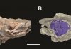
U of T researchers recently reconstructed two endocasts of Paramys, the oldest and best-preserved rodent skulls on record. Credit: U of T Scarborough
If new U of T research on the brains of an ancient rodent tells us anything, it’s that bigger does not necessarily mean better.
U of T Scarborough PhD candidate Ornella Bertrand along with Associate Professor Mary Silcox and undergraduate student Farrah Amador-Mughal recently reconstructed two endocasts of Paramys, the oldest and best-preserved rodent skulls on record. What they found was surprising.
“The brain was certainly larger than we expected considering the time period,” says Bertrand. “Even more surprising is that it was almost as large, and in some cases larger, than primitive primates of the same time period.”
The key difference is that Paramys was relatively smaller than even the most primitive primates in the neocortex region, the part of the brain that deals with “higher” brain functions like sight and hearing.
“This tells us that something is going on in the neocortex of early primates that is not observable in early rodents. ” says Bertrand. “The changes in the neocortex of rodents occurred later in time and with less intensity than in primates.”
“It also sheds some light on what’s unique about primate brains – they were not always exceptionally large, but they were certainly ‘smart’,'” adds Silcox.
One of the specimens of Paramys was a large rodent by modern standards – about three kilograms, roughly the size of a small cat – that lived during the mid-Eocene, some 47 to 49 million years ago. Bertrand and Silcox also examined the skull of another with a body mass of about one kilogram that lived around 50 to 52 million years ago.
The goal of the research was to better understand brain evolution in early rodents. While there’s been some research looking at how the neocortical surface of primates has increased over time, practically nothing prior to this has been done on rodents.
What fascinates both Bertrand and Silcox is that Paramys’s brain was larger than some later occurring rodents, which contradicts the idea that brains generally increase in size over time.
“It’s been assumed for a while that mammal brain size increases over time. The idea is that it’s probably an evolutionary arms race because if prey become smarter predators have to adapt. But these animals were already pretty smart prey items to begin with,” says Silcox.
The research also shows that the obsession with brain size, especially in the human paleontological literature, makes little sense since size is not the only indicator of intelligence.
“Size is certainly important, but we’re starting to look at different measures that give us a more nuanced understanding of how brains, especially in primates, evolved over time,” says Silcox.
The research is available online in the journal Royal Society B.
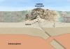
San Andreas Fault in the Carrizo Plain, aerial view from 8500 feet altitude Credit: Ikluft
Seismologists working along California’s San Andreas Fault near Cholame and Parkfield now have a better idea of how and where friction changes along the fault to produce both shallow earthquakes and the deeper earth tremors called low-frequency earthquakes (LFEs).
In their report published online 26 January in the Bulletin of the Seismological Society of America (BSSA), the team led by Rebecca Harrington of McGill University shows that the depth of this boundary between earthquakes and LFEs varies along the San Andreas strike, but roughly follows along a zone deep in the crust where temperatures hover around 350 degrees Celsius.
There is also a somewhat puzzling, five-kilometer wide gap of seismic quiet between the deepest earthquakes and the shallowest LFEs analyzed in the study, the researchers noted. If this gap holds up under further scrutiny, seismologists will study its possible role in transferring seismic stress during a large earthquake, said Harrington.
Slip along the San Andreas occurs through either aseismic creep or earthquakes in the shallow parts of the fault (less than 15 kilometers deep) while slip takes the form of stable sliding in the deeper part of the fault lying 35 kilometers below the surface. The zone between these two regions–where LFEs occur–is called the brittle-ductile transition zone, where increasing heat and pressure cause rocks to become less prone to fracture and more prone to bending and flowing deformation.
“Our study illuminates a possible gap in activity at the top of the transition zone, between the deeper LFEs and shallower earthquakes, which may be important to the transfer of stress into the seismogenic part of the fault,” Harrington noted. “We need to better understand how slip evolves across this boundary throughout the seismic cycle.”
Cholame may be best known as the site where iconic actor James Dean died in a 1955 car crash, but the Cholame section of the San Andreas Fault is also where the last major Southern California earthquake on the fault may have originated. The 1857 Fort Tejon earthquake measured magnitude 7.8, causing the fault to rupture the earth continuously for over 350 kilometers (225 miles).
Harrington and her colleagues deployed a temporary network of 13 seismic stations near Cholame to look more closely at the relationship between LFEs and earthquakes, since the area has been the site of vigorous LFE and tremor activity. Analyzing data collected by the temporary network and other permanent seismic stations, the scientists were able to precisely locate 34 earthquakes and 34 LFEs that occurred in the area between May 2010 and July 2011.
The depth at which fault slip changes from earthquake to LFE varies along the strike of the fault, they concluded. These variations could be caused by differences in the type of rock, the presence of fluids or other factors that affect the frictional properties of the fault along its strike.
In their analysis, the seismologists also identified two clusters of small earthquakes, one near the 2004 magnitude 6.0 Parkfield earthquake and one near the northern boundary of the Fort Tejon rupture, just south of Cholame. These clusters may represent areas of mixed frictional properties along the fault, adding support to the idea that earthquakes may originate in these types of frictional environments.
As for the mysterious gap separating earthquakes and LFEs, Harrington said it’s puzzling why there wouldn’t be more of a gradual transition between the two types of events as the fault deepens. One possibility, she says, is that the slip is aseismic in this zone. It might also be that the gap is accumulating strain, and won’t show signs of seismic slip until the strain rates are higher.
Harrington and her colleagues are working on further studies that could help detect more different types of LFEs, and to determine whether the gap is a real one, she said.
On Saturdays in the fall, cleats pound the turf at Reser Stadium at Oregon State University. But new evidence dug up during an expansion of the Valley Football Center has revealed that some much larger creatures once roamed this location more than 10,000 years ago.
Construction crews digging in the north end zone in Reser Stadium on Monday uncovered a large femur bone, likely from a mammoth. Further discovery revealed more bones from several extinct mammals.
“There are quite a few bones, and dozens of pieces,” said Loren Davis, an associate professor of anthropology at OSU who was called to the site after the initial discovery was made. “Some of the bones are not in very good shape, but some are actually quite well preserved.”
There don’t appear to be any signs of human bones or artifacts at the site, Davis said. Further testing will be needed to determine the bones’ exact age.
The discovery of the ancient mammal bones is not unusual in the Willamette Valley, Davis said. The bones, including mammoth, bison and some kind of camel or horse, were discovered in a 10-foot deep plot in an area that could once have been a bog or marsh, Davis said.
“Animals who were sick would often go to a body of water and die there, so it’s not unusual to find a group of bones like this,” Davis said. “We had all of these types of animals in the Willamette Valley back then.”
Crews are digging up a portion of the north end zone as part of the Valley Football Center expansion and renovation project. Work began after the fall football season ended and is slated for completion by the start of the 2016 home season.
A worker digging in the area made the initial discovery of the large femur bone and immediately stopped work in the area, said Tim Sissel, senior project manager for Hunt/Fortis, a joint venture, the general contractor on the project.
Company officials notified OSU officials, who brought in Davis and other experts to examine the bones and the site. Crews have moved to other areas of the construction project while Davis and others take a closer look at the find. The delay has been minimal so far, Sissel said.
The animals do not appear to have been killed, Davis said, and there is no other evidence of humans at the site. Since the find does not appear to involve humans or human artifacts, the bones are not considered part of an archaeological site, Davis said. Nonetheless, we can learn a great deal about what the ancient environment of the Willamette Valley was like from this discovery, he said.
The find does not appear to involve humans or human artifacts and there are no special rules or regulations in Oregon governing the preservation or protection of paleontology finds, Davis said.
In the short term, Davis plans to soak the discovered bones in water to prevent further deterioration, and hopes to send some out for carbon dating to determine more about their age. He and his students will also continue excavating a large pile of dirt pulled from the site, where more bones are believed to be buried.
“It’ll be a great learning experience for them, to learn how to identify extinct animal bones,” Davis said. “It’s really an amazing find.”
Fossile crustacean predator. Credit: Image courtesy of University of Cologne
A team of researchers, among them a zoologist from the University of Cologne, has succeeded in reconstructing a 160 million year old compound eye of a fossil crustacean found in southeastern France visible. With the reconstruction of the eye, the scientists succeeded in making the structure of soft tissue visible — which was long considered to be impossible.
Zoologists from Cologne and Lyon have succeeded in discovering the internal structure of an approximately 160 million year old compound eye (Dollocaris ingens van Straelen, 1923, Thylacocephala) from the Middle Jurassic period. It was discovered at the La Voulte deposit in southeastern France. The eyes of this crustacean consist of approximately 18,000 facets, and because each of these facets contributes to the entire image as pixels contribute to a computer graphic, the eye of this crustacean belongs to the most accurate in the arthropod realm.
With the reconstruction of the eye’s structure, the scientists succeeded in making the structure of soft tissue visible — which was long considered to be impossible. Together with the palaeontologist Jean Vannier (CNRS/Université Claude Bernard Lyon 1/ENS de Lyon) and other colleagues, the zoologist Brigitte Schoenemann from the University of Cologne played a leading role in this research.
The construction of the crustacean’s high-performance eye most closely resembles that of a bee or a dragonfly. Most likely it also functioned in a similar way. A physical analysis revealed that this crustacean was active during the day and lived in the light-flooded parts of the ocean. An analysis of its stomach showed that it obviously chased smaller sea organisms and fed on them.
This research work is important because up to now researchers thought that only the hard parts of an animal, such as shells or bones, could be preserved. Hence the findings of the research team on soft tissue are ground-breaking — and they describe fossil sensory cells older than those preserved in the relatively young amber. Recently, computer-tomography has revealed that even individual sensory cells can be documented. The recent research work shows for the first time that the complete structure of a compound eye can be analysed and resolved. Thus, the team was able to open up completely new perspectives — not just for the investigation of fossilised sensory systems. It also showed that in contrast to earlier opinions, the fossil record can contribute important facts to the discussion of the evolution of visual and other internal systems.
Reference:
Jean Vannier, Brigitte Schoenemann, Thomas Gillot, Sylvain Charbonnier, Euan Clarkson. Exceptional preservation of eye structure in arthropod visual predators from the Middle Jurassic. Nature Communications, 2016; 7: 10320 DOI: 10.1038/ncomms10320
When clayey materials are compressed and sheared, they commonly develop a “scaly fabric” wherein the clay is divided by braided shear surfaces into lentil-shaped chips. Although such scaly fabrics are found at the bed of glaciers, the base of landslides, and in gougey faults, little is known about how they form or how they deform. In their article for Geology, Matthew Tarling and Christina Rowe use dry lentils to help explore this process.
Tarling and Rowe built a shear box with a sliding floor and filled it with lentils. In a series of experiments, they show that the lentils have a tendency to shift constantly against one another when the bulk is shearing, prohibiting the development of long-lasting faults.
Each lentil follows a slightly different path, at different speeds, to accomplish the broad deformation of the whole. This “delocalization” behavior seems to be intrinsic to the system. This observation suggests an explanation for why scaly layers of clay may grow so broad in faults, landslides, and the beds of glaciers, and why these types of shear networks do not grow into localized fault zones.
Refeence:
Experimental slip distribution in lentils as an analog for scaly clay fabrics, Matthew S. Tarling, DOI:10.1130/G37306.1
This is a picture of an Ampliagus tomidai. Credit: José Antonio Peñas (Sinc)
The species Amphilagus tomidai was recently discovered — an ancestor of the rabbit which lived in present-day Siberia during the Miocene, about 14 million years ago. The discovery of this mammal, belonging to a family which was thought to only exist in Europe, reveals that the two continents were connected ‑free of natural barriers‑ due to the disappearance of the ancient Paratethys Sea.
A study led by the Institute of Geology of the Russian Academy of Sciences presents a new species, the Amphilagus tomidai, found in south-eastern Siberia (Russia) and dating back to the Middle Miocene, about 14 million years ago. The discovery of this mammal, an ancestor of the present-day rabbit, represents an important biogeographic link that confirms the widespread distribution of this group as well as the relationship between Asia and Europe during this period.
“Amphilagus is a genus that was traditionally thought to only exist in Europe, but remains of this mammal were recently located in Asia. The discovery of this mammal on the continent of Asia indicates that there were some paleogeographic and environmental conditions that favoured the expansion of this species towards the east,” explains Chiara Angelone, a researcher at the Catalan Institute of Palaeontology Miquel Crusafont and co-author of the study published in the journal Historical Biology.
According to the study, the Miocene -which began 23 million years ago and ended 5.3 million years ago- gave rise to the barrier-free linking of Europe and Asia which would have allowed for the spread of this animal.
An ancestor of the present-day rabbit The Paratethys Sea -which was located to the south of Europe and spanned from the northern Alps to the Aral Sea in western Asia- had disappeared, and a lack of high mountains here meant that there were no barriers to hinder this animal’s expansion. This situation favoured the spread of the mammal among open landscapes, aided by a cool, dry climate.
“These ancient animals help us to better understand the climatic and paleogeographic conditions of that period in time. Some discoveries add new insight into what we already know. Others, such as this one, uncover remarkable stories,” explains Angelone.
The mammal that was unearthed is the northern — most Eurasian specimen of the Amphilagus genus ‑- a large lagomorph with primitive features. Its teeth have roots and do not continuously grow as do the teeth of present-day lagomorphs, an animal order that includes the families of rabbits, hares and pikas.
This newly discovered animal also possesses a simple, lower third premolar and a hypoconulid -an additional cusp at the back of the mouth- among the lower molariform teeth.
The Amphilagus genus, which appeared in Europe during the Upper Oligocene, is not free from controversy. According to the authors of the study, all European lagomorphs whose teeth had roots are considered part of the Amphilagus genus, thus making it necessary to re-evaluate this genus.
Reference:
Margarita Erbajeva, Chiara Angelone, Nadezhda Alexeeva. A new species of the genusAmphilagus(Lagomorpha, Mammalia) from the Middle Miocene of south-eastern Siberia. Historical Biology, 2015; 28 (1-2): 199 DOI: 10.1080/08912963.2015.1034119
Fig.1 Female specimen of Venusichthys comptus before (a) and after coated with ammonium chloride. Credit: XU Guanghui
Secondary sexual characteristics are features that appear at sexual maturity and distinguish the two sexes of a species. Studies of secondary sexual characteristics in a species are vital for fully understanding its behavior, reproduction, and evolution. Secondary sexual characteristics are easily observed and studied in living animals, but the situation is rather more complicated in extinct animals, primarily due to inadequacies of sample size or the fragmentary nature of fossil remains.
Neopterygii are the most diverse group of extant ray-finned fishes, which underwent a rapid radiation in the aftermath of end-Permian mass extinction. In a paper published online 23 January in the journal of Science Bulletin, Dr. XU Guanghui, Institute of Vertebrate Paleontology and Paleoanthropology (IVPP), Chinese Academy of Sciences, and his collaborator reported a new sexually dimorphic primitive neopterygian fish, Venusichthys comptus, based on 30 exceptionally well-preserved specimens from the Middle Triassic (Pelsonian, Anisian) Luoping Lagerstätte of eastern Yunnan, China. The discovery represents the oldest known secondary sexual characteristics in Neopterygii, and provides an important addition for understanding the behavior, reproduction, and early diversification of Neopterygii.
The Luoping Lagerstätte fossil beds are composed of thinly laminated micritic limestone alternating with silty limestone, indicating a semi-enclosed intraplatform depositional environment. This new species has a blunt snout, an elongate and fusiform body, and an almost homocercal caudal fin with a forked profile. All 30 specimens represent a small-sized primitive neopterygian with a standard length ranging from 25 to 38 mm.
The genus name is derived from the Latin venus, meaning goddess of love, and ichthys, meaning fish. The species name comes from Latin comptus, meaning ornamental. Venusichthys comptus shows a unique character combination distinguished from any other neopterygian families and represents a new family.
“The superb preservation of skeletal details demonstrates a differentiation of phenotypic traits between presumed males and females”, said lead author XU Guanghui of the IVPP, “Among 30 cataloged specimens, one-third of the individuals bear pointed tubercles on cranial bones, scales and fins, and a hook-like contact organ anterior to the anal fin and are interpreted as being males”.
Similar secondary sexual characteristics (pointed tubercles on the skull and dorsal fin) are known from presumed males of the primitive neopterygian Peltopleurus nuptialis from the late Ladinian (latest Middle Triassic) of Europe. As the age of the Luoping fossil beds has been well constrained by conodont biostratigraphy (Pelsonian, Anisian, Middle Triassic, about 244 million years ago), these new specimens represent the oldest known secondary sexual characteristics in the Neopterygii.
The living sexually dimorphic ray-finned fishes, including several families of cypriniform fishes and a few gonorynchiform and salmonoid fishes, bear breeding tubercles and contact organs on the head, scales and fins of the male that come in direct contact with the female during prespawning behavior or during the spawning, or that come into contact with other males during fights and defense of territories. Therefore, the secondary sexual characteristics of Venusichthys are similar in shape and distribution, to the breeding tubercles and contact organs of living sexually dimorphic ray-finned fishes, and consequently, they may have had similar functions.
The research was supported by the National Natural Science Foundation of China and the State Key Laboratory of Palaeobiology and Stratigraphy.
Fig.1 Upper and lower dentition (in color) of Ptilocercus kylin, compared with P. lowii (in gray-scale). Credit: NI Xijun
Treeshrews are widely considered a “living model” of an ancestral primate, and have long been called”living fossils”. Actual fossils of treeshrews, however, are extremely rare. In a paper published 14 January in Scientific Reports (6), Drs. LI Qiang and NI Xijun, Institute of Vertebrate Palaeontology and Palaeoanthropology (IVPP), Chinese Academy of Sciences, reported a new fossil species of Ptilocercus treeshrew from the early Oligocene (over 34 million years ago) of China that represents the oldest definitive fossil record of the crown group of treeshrews and nearly doubles the temporal length of their fossil record.
These new treeshrew fossils were discovered at the Lijiawa mammalian fossil locality near Qujing City in Yunnan Province, China. Among the numerous fossil mammal specimens recovered from this fossil site are those belonging to a large form of Gigantamynodon giganteus, an unnamed species of Cricetops, and a primitive Eucricetodon comparable with Eucricetodon caducus from the earliest Oligocene of Xinjiang, China. Those species all indicate an early Oligocene age for this fauna.
The fossil species is strikingly similar to the extant pen-tailed treeshrew (Ptilocercus lowii), a species generally recognized as the most primitive extant treeshrew. It demonstrates that Ptilocercus treeshrews have undergone little evolutionary change in their morphology since the early Oligocene.
Morphological comparisons and phylogenetic analysis support the long-standing idea that Ptilocercus treeshrews are morphologically conservative and have probably retained many characters present in the common stock that gave rise to archontans, which include primates, flying lemurs, plesiadapiforms and treeshrews.
“This discovery provides an exceptional example of slow morphological evolution in a mammalian group over a period of 34 million years, and it supports the suggestion that the extant P. lowii gives us a living glimpse of the first ancestor of the Archonta, our own superordinal group”, said lead author NI Xijun of the IVPP, “The persistent and stable tropical environment in Southeast Asia through the Cenozoic likely played a critical role in the survival of such a morphologically conservative lineage”.
This project was supported by the Strategic Priority Research Program of Chinese Academy of Sciences, the National Basic Research Program of China, the CAS 100-talent Program, and the National Natural Science Foundation of China.
Reference:
Qiang Li et al. An early Oligocene fossil demonstrates treeshrews are slowly evolving “living fossils”, Scientific Reports (2016). DOI: 10.1038/srep18627
Gujarat, sometimes dubbed India’s Jurassic Park, is home to one of the world’s largest collections of dinosaur remains Credit: AFP Photo/John Macdougall
A geologist said Saturday his team has discovered what it believes are dinosaur fossils in the western Indian state of Gujarat that could be millions of years old.
The team, of 10 mainly German and Indian archaeologists and researchers, dug up the fossils during excavations in Gujarat’s marshy coastal district of Kutch, Gaurav Chauhan said.
“We have found three portions of hip bones of (a) dinosaur,” Chauhan, a geologist from Gujarat’s Kutch University and a member of the excavation team, told AFP.
“We have been working on this site since (the) last 10 days or so,” he said.
Chauhan said carbon-dating tests would need to be carried out to try to determine the age of the bones, while more examinations were needed to identify the type.
Gujarat, sometimes dubbed India’s Jurassic Park, is home to one of the world’s largest collections of dinosaur remains.
In 2003, a National Geographic team discovered a new dinosaur species in Gujarat after examining fossils found scattered along the Narmada River.
The dinosaur was named “Rajasaurus Narmadensis” or the regal reptile from Narmada, which was a 30-foot-long, carnivorous and stocky animal, with an unusual head crest.
And a large dinosaur egg hatchery has been discovered in the town of Balasinor, some 90 kilometres (55 miles) south of the state’s main city of Ahmedabad.
Note: The above post is reprinted from materials provided by AFP.
Analyzing seismic waves generated by an Accurately Controlled Routinely Operated Signal System (ACROSS) unit can reveal information about the amount and location of CO2 leakage from an underground store. Credit: International Institute for Carbon-Neutral Energy Research (I²CNER), Kyushu University
Fukuoka, Japan – Carbon capture and storage projects rely on effective monitoring of injected CO2. However, the high number of necessary surveys makes this a costly endeavor. A team of Japanese researchers may have found a means of achieving easier and lower-cost monitoring for leaks of CO2 stored in underground reservoirs. A recently published article from a team led by researchers at Kyushu University’s International Institute for Carbon-Neutral Energy Research (I2CNER) shows how underground CO2 storage sites could be continuously monitored for leaks–a breakthrough for monitoring applications.
Underground storage of CO2 produced from fossil fuel burning, rather than releasing it into the atmosphere, could play an important role in suppressing climate change. However, to safeguard those living at the surface and regulate the climate, ensuring that the CO2 does not leak from the storage site is key.
Current monitoring methods are costly and only carried out periodically, but by using techniques more often used to study earthquakes and volcanic eruptions, the team used analysis of seismic waves to show it is possible to detect movement of subterranean fluids and to identify leaks before they reach the surface.
“One of the main issues” lead author Tatsunori Ikeda says, “was that we had to be sure we could distinguish between seismic wave signals from a CO2 leak and noise from other near-surface disturbances.”
Drawing on previous work across multiple disciplines, the method was developed and rigorously analyzed using computer simulations, before being field-tested near a busy road in central Japan’s Tokai region. “We used an ACROSS unit and a series of geophones to test the method,” coauthor Takeshi Tsuji says. Given the success of the experiment, “a real opportunity for application of this work is that microseismic monitoring arrays typically installed at storage sites could provide the data needed to identify any leakages and decrease the need for more costly 4D seismic studies that are the industry norm.”
Additional testing to refine the method and further improve its accuracy is one branch of work being carried out as part of I2CNER’s interdisciplinary efforts to advance the development of carbon capture and storage and boost efforts for achieving a carbon-neutral society.
Reference:
Tatsunori Ikeda, Takeshi Tsuji, Toshiki Watanabe, Koshun Yamaoka, Development of surface-wave monitoring system for leaked CO2 using a continuous and controlled seismic source. DOI:10.1016/j.ijggc.2015.11.030
Last week, North Korea tested what it claimed to be a hydrogen bomb, or as the North Korean government declared in its official statement, an “H-Bomb of justice.” However, it’s not likely that North Korea has actually developed a hydrogen bomb and successfully tested it on 6 January local time (the evening of 5 January on the U.S. East Coast), as announced. The U.S. Geological Survey recorded the subsequent seismic event as having a 5.1 magnitude, which is much lower than would be expected from such a powerful weapon.
But even if North Korea or anyone else conducting a clandestine nuclear test makes no announcement, seismologists can still figure out if an underground bomb test or an earthquake took place by analyzing how energy propagates from the seismic event in question.
Explosions Send Compression Waves in All Directions
P waves are the fastest-moving type of seismic waves. They alternately compress or dilate the material they move through. When an explosion, such as a nuclear test, occurs within the Earth, all of the force of the blast strikes the surrounding material.
“As the bomb is detonating, it’s compressing the rock immediately adjacent to it, and that propagates out to the recording stations” as P waves, said Douglas Dreger, a seismologist at the University of California, Berkeley. The first wave to reach the seismometer generates an “up” signal. Seismologists use the term “up” because the ground actually moves up when the compression phase of a P wave arrives and the squeezed underground rock and soil juts upward at the surface.
Seismologists then plot the up signals from P wave compressions and down signals from dilations on black-and-white diagrams called focal mechanism plots. They divide these diagrams into four regions representing directions in which seismic waves travel from a shock. A focal mechanism plot would appear completely white before an earthquake and then shaded black in some spots once seismic detectors register an up signal in a region.
Each type of earthquake generates a different plot pattern in which there are some black and some white regions. By contrast, concussive signals propagating in all directions from an explosion would shade the entire plot black. Dreger’s focal mechanism plot for the North Korean nuclear test is entirely shaded.
Bigger Interior Waves Suggest an Explosion
The relative amplitudes of an event’s seismic waves that zip through the Earth’s interior, when compared to the amplitudes of its surface waves that radiate more slowly from the shock, can also indicate if an explosion or earthquake triggered the event. Explosions produce larger internally propagating waves than surface waves, whereas an earthquake doesn’t cause the same discrepancy.
Looking at only the waveforms from the North Korean test, Dreger said, “It’s very obviously an explosion.” So even if a less outspoken country tried to secretly test an atomic or hydrogen bomb, scientists could still uncover the truth.
Seismology Alone Can’t Determine What Type of Bomb Detonated
Once scientists know an underground explosion or bomb test occurred and they know the magnitude of the seismic event it caused, they can calculate how big of an explosive force caused that quake. This latest test, registering at 5.1, most likely falls below the magnitude a hydrogen bomb would produce, said Brian Stump, a seismologist at Southern Methodist University in Dallas, Texas.
But, Stump said, drawing a firm conclusion concerning what type of bomb was detonated requires radionuclide measurements that specially designed aircraft can make. Some news media outlets reported that U.S. Air Force planes will sample the air near the North Korean test area to determine what radioactive material, if any, leaked out of the underground blast site.
The remains of the dinosaur are on display in McWane Science Center. Credit: Jun Ebersole, McWane Science Center
An international team of researchers has identified and named a new species of dinosaur that is the most complete, primitive duck-billed dinosaur to ever be discovered in the eastern United States.
This new discovery also shows that duck-billed dinosaurs originated in the eastern United States, what was then broadly referred to as Appalachia, before dispersing to other parts of the world. The research team outlined its findings in the Journal of Vertebrate Paleontology.
“This is a really important animal in telling us how they came to be and how they spread all over the world,” said Florida State University Professor of Biological Science Gregory Erickson, one of the researchers on the team.
They named the new dinosaur Eotrachodon orientalis, which means “dawn rough tooth from the east.” The name pays homage to “Trachodon,” which was the first duck-billed dinosaur named in 1856.
This duck-billed dinosaur—also known as a Hadrosaurid—was probably 20 to 30 feet long as an adult, mostly walked on its hind legs though it could come down on all four to graze on plants with its grinding teeth, and had a scaly exterior. But what set it apart is that it had a large crest on its nose.
“This thing had a big ugly nose,” Erickson said.
That large crest on the nose, plus indentations found in the skull and its unique teeth alerted Erickson and his colleagues from McWane Science Center in Birmingham, Ala., and the University of Bristol in the United Kingdom that the skeleton they had was something special.
The skeletal remains of this 83-million-year-old dinosaur were originally found by a team of amateur fossil enthusiasts alongside a creek in Montgomery County, Alabama in marine sediment. Dinosaurs from the South are extremely rare. A set with a complete skull is an even more extraordinary find. The dinosaur likely was washed out to sea by river or stream sediments after it died.
When the group realized they had potentially discovered something of scientific importance, they contacted McWane Science Center in Birmingham, which dispatched a team to the site to carefully remove the remains from the surrounding rock.
After the bones were prepared and cleaned at McWane Science Center and the University of West Alabama, they were studied by a team of paleontologists including Erickson, former FSU doctoral student Albert Prieto-Marquez who is now at the University of Bristol, and Jun Ebersole, director of collections at McWane Science Center.
Among the recovered remains of this new dinosaur are a complete skull, dozens of backbones, a partial hip bone and a few bones from the limbs.
It is one of the most complete dinosaur skeletons ever to be found in the eastern United States. Its teeth, which show this dinosaur’s remarkable ability to grind up plants in a manner like cows or horses, were present in early hadrosaurids, allowing them to consume a wide variety of plants as the group radiated around the world.
During the late Cretaceous Period, roughly 85 million years ago, North America was divided in half by a 1,000 mile ocean that connected the Gulf of Mexico to the Arctic Ocean. This body of water created two North American landmasses, Laramidia to the west and Appalachia to the east.
The area of what was considered Appalachia is a bit wider than what we call Appalachia today. It began roughly in Georgia and Alabama and stretched all the way north into Canada.
“For roughly 100 million years, the dinosaurs were not able to cross this barrier,” Ebersole said. “The discovery of Eotrachodon suggests that duck-billed dinosaurs originated in Appalachia and dispersed to other parts of the world at some point after the seaway lowered, opening a land corridor to western North America.”
Added Erickson: “They just needed to get off the island. From there, they became the cows of the Cretaceous.”
Erickson brought some bone samples and teeth back to his lab at Florida State for further analysis. He found it difficult to pinpoint the exact age of the dinosaur because no growth lines appeared in the bone samples. However, the highly vascularized bones show that it was growing very rapidly at the time of death, akin to a teenager, and stood to get much larger—perhaps 20-30 feet in length, which is typical of duck-billed dinosaurs found elsewhere.
Video
Reference:
Albert Prieto-Marquez et al. A primitive hadrosaurid from southeastern North America and the origin and early evolution of ‘duck-billed’ dinosaurs, Journal of Vertebrate Paleontology (2016). DOI: 10.1080/02724634.2015.1054495
Rallus aquaticus skull (above) and Rallus “minutus” (below). Scale: 2 cm. / Alcover et al.
When Charles Darwin visited the Azores islands in the 19th Century, the birds he observed were familiar to him. However, if he had travelled there 500 years before, he would have found an ornithofauna as particular as that of the Galápagos. The recent discovery in these Portuguese islands and in Madeira of five extinct species of rail, which lost the ability to fly due to having evolved on islands, confirms how fragile they are in the face of changes to their habitat like the ones that must have occurred after the first visits by humans over 500 years ago.
In September 1826, the British naturalist Charles Darwin visited the Azores archipelago during the HMS Beagle’s return voyage to the United Kingdom after more than four years travelling the world. In his diary he only mentions the existence of starlings, wagtails, finches and blackbirds; however, on the islands also lay the remains of other birds which populated the islands a few centuries before his visit. A new study, published in ‘Zootaxa’, now highlights the discovery of five extinct rail species, two in Madeira and three in the Azores.
“The species of birds very probably disappeared following the arrival of humans and the animals that came with them, like mice, rats and cats,” told Josep Antoni Alcover
Paleontological exploration by Spanish, German and Portuguese researchers has made it possible to “discover new species of birds that very probably disappeared following the arrival of humans and the animals that came with them, like mice, rats and cats,” according to Josep Antoni Alcover, a CSIC researcher working at the Mediterranean Institute for Advanced Studies (IMEDEA-CSIC/UIB) and co-author of the paper.
The new species are: the Madeira rail (Rallus lowei), a flightless species with a very stout body; the Porto Santo rail (Rallus adolfocaesaris), graceful and probably not a very able flier; the São Miguel rail (Rallus carvaoensis), quite small, stout, flightless and with a somewhat curved beak; the Pico rail (Rallus montivagorum), larger than the São Miguel rail (but smaller than the continental species), graceful and with reduced flying capability; and the São Jorge rail (Rallus “minutus”), diminutive, relatively stout, with short legs, flightless and which does not have a definitive scientific name.
According to dating obtained from the bones of these birds, or from those of other species found which were associated to them, these five extinct species lived until fairly recently, especially the Azores rails. “At least one of these species survived until the 15th Century, so we are looking at a very recent extinction process,” stresses Alcover.
According to the scientist, in Madeira the extinction may have been related to a possible visit by the Vikings (whether it was a colonisation is still not verified), who could have transported mice to the island. These would have brought about the disappearance of rails and other birds.
“The bone remains of native bird species which are now appearing show that if Darwin had been able to study the fossils hidden on these islands, or if he had visited 500 years earlier, he would have found a much more singular ornithofauna, with many indigenous bird species, like that which was found on the Galápagos islands,” Alcover highlights.
Ground-dwelling birds
Today, there are only 13 living rail species of the Rallus genus. “This is because other species, which only lived on islands, have disappeared recently,” the expert clarifies. Two or three thousand insular rail species (rallids) are thought to have lived in the Pacific. In the Atlantic, only on the most remote islands, such as Tristan da Cunha and Gough, are there surviving indigenous rail species today; however, in the Antilles, Bermuda and on the islands of Ascension and Saint Helena, extinct species have been found.
The extinct birds found on the islands of Macaronesia “were smaller in size than today’s continental rails, such as the water rail (Rallus aquaticus), from which they very probably originate,” says Alcover. Fossils uncovered also make it possible to verify that all these species had a reduced flying capability. “Some were completely incapable of regular flight,” the researcher reveals.
While on continents, rails live near water, on islands, they occupy more terrestrial habitats. The reason for this is that in order to live on islands, they evolve differently, to the point where they become indigenous insular species. This evolution implies changes in their size and body proportions and a reduction or complete loss of their ability to fly; this is why they tend to walk.
“For that reason, the rails that reach islands and evolve on them lose their dispersive capacity: they cannot leave the islands and they are trapped in limited insular territories, which is why we observe an extremely reduced distribution area,” the scientist explains.
“The history of insular rails is an intense story of evolution, and frequently, extinction,” Alcover highlights.
This circumstance also makes them very prone to extinction when there are changes to the islands’ ecology (for example, when they are colonised by humans). “The history of insular rails is an intense story of evolution, and frequently, extinction,” Alcover says.
The tip of the iceberg of diversity
The fossil remains surfacing on the Madeira and Azores archipelagos represent one part of all the diversity of animals that used to inhabit these islands, and are now beginning to be discovered.
In addition to the five rail species the paper describes, there are other species, for example two indigenous species of scops owl. “This is only the tip of the iceberg of what is to come in terms of knowledge about the ornithological fauna native to these islands,” according to the authors.
“The existence in the past of indigenous species of scops owls and rails points to the great magnitude of the devastation birds suffered on Atlantic islands after the arrival of humans and the fauna that came with them,” the scientists conclude.
Reference:
Josep Antoni Alcover, Harald Pieper, Fernando Pereira, Juan Carlos Rando.
Five new extinct species of rails (Aves: Gruiformes: Rallidae) from the Macaronesian Islands (North Atlantic Ocean), Zootaxa, 2015; 4057 (2): 151 DOI: 10.11646/zootaxa.4057.2.1
Gridded data set of surface free-air gravity anomalies in Antarctica.
A unique dataset of gravity anomalies has been released for Antarctica representing a significant step forward in the investigation of the largest ice-covered continent on Earth. More than 50 scientists from research institutions in eight countries, among others Germany, UK, USA and Russia have been actively collaborating since 2003 to make this gravity data compilation possible, coordinated by Mirko Scheinert of Technische Universität Dresden, Germany.
Gravity anomalies are based on highly accurate measurements of the Earth’s gravity field and are used in geodesy and geophysics to determine for example height measurements with respect to mean global sea level (geoid) and as a tool to probe deep into the Earth’s interior. Detailed gravity data measurements have been collected over most of the globe augmented by recent satellite-derived missions. However, performing terrestrial gravity measurements has proven significantly more challenging in Antarctica due its extension, remoteness and thick ice sheet cover.
Over the last decade, in particular, the international research community has deployed aircrafts equipped with gravity meters to collect a huge amount of new gravity data over Antarctica. The latest gravity anomaly dataset is based on 13 million data points and covers an area of 10 million km2, corresponding to 73% of the Antarctic continent (equal to the entire area of Europe).
Using these Antarctic gravity datasets new global models of Earth’s gravity field with a resolution of up to 10 km can be constructed said Mirko Scheinert. Before we put together all the available terrestrial Antarctic gravity data we had to rely mainly on lower resolution (ca 100 km) satellite observations to construct such models.
Fausto Ferraccioli from the British Antarctic Survey and a co-author of the study said: “what is exciting for me is that these data provide geoscientists with a new tool to investigate the deep structure of the least understood continent on Earth and study how subglacial geology and tectonic structures can influence the topography hidden beneath the Antarctic ice sheets. Gravity data, for example, can help us study the extent of subglacial sedimentary basins in both West and East Antarctica and estimate geothermal heat flux, which in turn can influence ice sheet dynamics.”
Overall, the new dataset of gravity anomalies will therefore help improve our knowledge of the state and evolution of the Antarctic continent further underpinning current research to better understand Antarctica’s role in climate change and global sea-level rise.
Reference:
M. Scheinert, F. Ferraccioli, J. Schwabe, R. Bell, M. Studinger, D. Damaske, W. Jokat, N. Aleshkova, T. Jordan, G. Leitchenkov, D. D. Blankenship, T. M. Damiani, D. Young, J. R. Cochran, T. D. Richter. New Antarctic Gravity Anomaly Grid for Enhanced Geodetic and Geophysical Studies in Antarctica. Geophysical Research Letters, 2016; DOI: 10.1002/2015GL067439
Renewed focus on Greenland gemstones has been experienced since the turn of the century.
Two gemstone companies have demonstrated solid and continued interest in the potential of classical gemstones in Greenland in this period. Diamonds and rubies are definitely now in focus with the size of diamonds growing almost with every new exploration event. The largest diamond to date has just been reported at 0.122 carats.
Rubies and pink sapphires are now at hand with large, high-quality stones in faceting as well as in carving types. Exploration activity targeted at both commodities may be approaching the next stage, with pre-feasibility studies and production considerations. A number of other species of coloured gemstones and generally lower-priced semi-precious gem material have also been found, and these are often very much in demand locally as well as internationally. Well-known examples are kornerupine, tugtupite, lazurite and amazonite. Several multi- coloured rock types have been produced on a small scale locally for many years and have gained high popularity among tourists and collectors, with the famous nuummite, greenlandite and ‘ice blue’ chalcedony being the most favoured.
A number of additional classical coloured gemstones such as beryl, cordierite, peridote, tourmaline, garnet, spinel and topaz are known from scattered occurrences, but their potential has never been tested. The variety in the Greenland geological environment, not least the pegmatite occurrence, is definite justification for more systematic exploration for such stones.
The image at left depicts what Earth might have looked like more than 3 billion years ago in the early Archean. The orange shapes represent the magnesium-rich proto-continents before plate tectonics started–although it is impossible to determine their precise shapes and locations. The ocean appears green due to a high amount of iron (Fe[II]) ions in the water at that time. The timeline traces the transition from a magnesium-rich (mafic) upper continental crust (UCC) to a magnesium-poor (felsic) UCC. Credit: Ming Tang/UMDEarth has some special features that set it apart from its close cousins in the solar system, including large oceans of liquid water and a rich atmosphere with just the right ingredients to support life as we know it. Earth is also the only planet that has an active outer layer made of large tectonic plates that grind together and dip beneath each other, giving rise to mountains, volcanoes, earthquakes and large continents of land.
Geologists have long debated when these processes, collectively known as plate tectonics, first got underway. Some scientists propose that the process began as early as 4.5 billion years ago, shortly after Earth’s formation. Others suggest a much more recent start within the last 800 million years. A study from the University of Maryland provides new geochemical evidence for a middle ground between these two extremes: An analysis of trace element ratios that correlate to magnesium content suggests that plate tectonics began about 3 billion years ago. The results appear in the January 22, 2016 issue of the journal Science.
“By linking crustal composition and plate tectonics, we have provided first-order geochemical evidence for the onset of plate tectonics, which is a fundamental Earth science question,” said Ming Tang, a graduate student in geology at UMD and lead author of the study. “Because plate tectonics is necessary for the building of continents, this work also represents a further step in understanding when and how Earth’s continents formed.”
The study zeros in on one key characteristic of Earth’s crust that sets it apart geochemically from other terrestrial planets in the solar system. Compared with Mars, Mercury, Venus and even our own moon, Earth’s continental crust contains less magnesium. Early in its history, however, Earth’s crust more closely resembled its cousins, with a higher proportion of magnesium.
At some point, Earth’s crust evolved to contain more granite, a magnesium-poor rock that forms the basis of Earth’s continents. Many geoscientists agree that the start of plate tectonics drove this transition by dragging water underneath the crust, which is a necessary step to make granite.
“You can’t have continents without granite, and you can’t have granite without taking water deep into the Earth,” said Roberta Rudnick, former chair of the Department of Geology at UMD and senior author on the study. Rudnick, who is now a professor of earth sciences at the University of California, Santa Barbara, conducted this research while at UMD. “So at some point plate tectonics began and started bringing lots of water down into the mantle. The big question is when did that happen?”
A logical approach would be to look at the magnesium content in ancient rocks formed across a wide span of time, to determine when this transition toward low-magnesium crustal rocks began. However, this has proven difficult because the direct evidence—magnesium—has a pesky habit of washing away into the ocean once rocks are exposed to the surface.
Tang, Rudnick and Kang Chen, a graduate student at China University of Geosciences on a one and a half-year research visit to UMD, sidestepped this problem by looking at trace elements that are not soluble in water. These elements—nickel, cobalt, chromium and zinc—stay behind long after most of the magnesium has washed away. The researchers found that the ratios of these elements hold the key: higher ratios of nickel to cobalt and chromium to zinc both correlate to higher magnesium content in the original rock.
“To our knowledge, we are the first to discover this correlation and use this approach,” Tang said. “Because the ratios of these trace elements correlate to magnesium, they serve as a very reliable ‘fingerprint’ of past magnesium content.”
Tang and his coauthors compiled trace element data taken from a variety of ancient rocks that formed in the Archean eon, a time period between 4 and 2.5 billion years ago, and used it to determine the magnesium content in the rocks when they were first formed. They used these data to construct a computer model of the early Earth’s geochemical composition. This model accounted for how magnesium (specifically, magnesium oxide) content in the crust changed over time.
The results suggest that 3 billion years ago, the Earth’s crust had roughly 11 percent magnesium oxide by weight. Within a half billion years, that number had dropped to about 4 percent, which is very close to the 2 or 3 percent magnesium oxide seen in today’s crust. This suggested that plate tectonics began about 3 billion years ago, giving rise to the continents we see today.
“It’s really kind of a radical idea, to suggest that continental crust in Archean had that much magnesium,” said Rudnick, pointing out that Tang was the first to work out the correlation between trace element ratios and magnesium. “Ming’s discovery is powerful because he found that trace insoluble elements correlate with a major element, allowing us to address a long-standing question in Earth history.”
“Because the evolution of continental crust is linked to many major geological processes on Earth, this work may provide a basis for a variety of future studies of Earth history,” Tang said. “For example, weathering of this magnesium-rich crust may have affected the chemistry of the ancient ocean, where life on Earth evolved. As for the onset of plate tectonics, I don’t think this study will close the argument, but it certainly adds a compelling new dimension to the discussion.”
Reference:
“Archean upper crust transition from mafic to felsic marks the onset of plate tectonics” DOI: 10.1126/science.aad5513
Artist’s impression of Dracoraptor hanigani. Credit: Bob Nicholls
A new carnivorous dinosaur species named Dracoraptor hanigani uncovered in the south of Wales is possibly the oldest known Jurassic dinosaur from the UK, according to a study published January 20, 2016 in the open-access journal PLOS ONE by David Martill from the University of Portsmouth, England, and colleagues from National Museum Wales and University of Manchester.
The authors of this study that analyzed the dinosaur skull and bones, discovered in 2014 on a beach near Penarth, Wales, conclude it is a new species that they have named Dracoraptor hanigani. The name Dracoraptor means ‘dragon robber.’ Draco, meaning dragon, is the national symbol of Wales. The species name honors Nick and Rob Hanigan, who discovered the fossil.
From their analysis, the researchers believe this dinosaur was meat-eating, from the theropod group. They also suggested that it may have been a juvenile animal, as most of its bones were not yet fully formed or fused. Compared to its distant relative the T. rex, it appears to be a small, agile animal, probably only about 70 cm tall and about 200 cm long, with a long tail, likely to help it balance. It lived at the beginning of the Jurassic Period (201 million years ago), at the time when south Wales was a coastal region like it is today. However, at the time, the climate was much warmer, and dinosaurs were just starting to diversify. The new specimen represents the most complete theropod from Wales, and may possibly represent one of the oldest known Jurassic dinosaurs in the UK or even in the world.
Co-author Mr. Vidovic adds, “The Triassic-Jurassic extinction event is often credited for the later success of dinosaurs through the Jurassic and Cretaceous, but previously we knew very little about dinosaurs at the start of this diversification and rise to dominance. Now we have Dracoraptor, a relatively complete two meter long juvenile theropod from the very earliest days of the Jurassic in Wales.”
Reference:
Martill DM, Vidovic SU, Howells C, Nudds JR (2016) The Oldest Jurassic Dinosaur: A Basal Neotheropod from the Hettangian of Great Britain. PLoS ONE 11(1): e0145713. DOI: 10.1371/journal.pone.0145713
The nesting grounds of sauropod dinosaurs where absolutely astonishing, covering hundreds of square miles in cases, forming vast playgrounds to rear their young. Some of the most exquisitely preserved sauropod hatcheries are from Jabalpur in India, and offer a unique window into investigating the reproductive and parental behaviour of these magnificent giants.
Recently, researchers have revisited old discoveries, and uncovered a mysterious stranger among the sauropod nesting sites from the Cretaceous Lameta Ghat locality.
At a superficial level, the eggs of reptiles might all appear to be quite similar to each other. However, we can actually gain a lot of insight from detailed examination of their chemistry and ultrastructure, and scientists now know that different groups of reptiles have very different egg types.
In 2013, fossilised eggs were reported from the Lameta Ghat nesting site. The eggshells were originally thought to belong to a large fossilised lizard. However, reanalysis of them shows that they more likely come from a crocodylomorph – the ancestors of modern crocodilians. This is based on several delicate details of the eggshell, including a sub-spherical to ellipsoid shape, a smooth and uneven external surface texture, and distinctly shaped shell units typically found in crocodilian eggs.
The eggshells might have belonged to dyrosaurid crocodyliforms. These are typically regarded as having lived out to sea, but like modern saltwater crocodiles, might have been able to come out onto land for short spells. Dyrosaurids were quite common in South-East Asia towards the closing of the Cretaceous, and even survived the mass extinction that saw the demise of the non-avian dinosaurs. The nesting site is fossilised in rocks that represent an ancient estuarine environment, not too far from the shoreline, so perhaps young dyrosaurids were born on land, taking to the waters only at a later age when they had levelled up their swimming abilities.
Fossilised crocodile nests are remarkably rare in the fossil record, with only around 20 known to date. What this new finding tells us is that sauropod hatchery sites were also used by other large reptiles, including crocodylomorphs, for laying their eggs. How cool is that!
Reference:
Rahul Srivastava , Rajeev Patnaik, U. K. Shukla, Ashok Sahni. Crocodilian Nest in a Late Cretaceous Sauropod Hatchery from the Type Lameta Ghat Locality, Jabalpur, India. DOI: 10.1371/journal.pone.0144369.
Left: Skull of a man found lying prone in the lagoons sediments. The skull has multiple lesions consistent with wounds from a blunt implement. Right: The skull in situ. Credit: Marta Mirazón Lahr
The fossilised bones of a group of prehistoric hunter-gatherers who were massacred around 10,000 years ago have been unearthed 30km west of Lake Turkana, Kenya, at a place called Nataruk.
Researchers from Cambridge University’s Leverhulme Centre for Human Evolutionary Studies found the partial remains of 27 individuals, including at least eight women and six children.
Twelve skeletons were in a relatively complete state, and ten of these showed clear signs of a violent death: including extreme blunt-force trauma to crania and cheekbones, broken hands, knees and ribs, arrow lesions to the neck, and stone projectile tips lodged in the skull and thorax of two men.
Several of the skeletons were found face down; most had severe cranial fractures. Among the in situ skeletons, at least five showed “sharp-force trauma,” some suggestive of arrow wounds. Four were discovered in a position indicating their hands had probably been bound, including a woman in the last stages of pregnancy. Fetal bones were uncovered.
The bodies were not buried. Some had fallen into a lagoon that has long since dried; the bones preserved in sediment.
The findings suggest these hunter-gatherers, perhaps members of an extended family, were attacked and killed by a rival group of prehistoric foragers. Researchers believe it is the earliest scientifically-dated historical evidence of human conflict — an ancient precursor to what we call warfare.
The origins of warfare are controversial: whether the capacity for organised violence occurs deep in the evolutionary history of our species, or is a symptom of the idea of ownership that came with the settling of land and agriculture.
The Nataruk massacre is the earliest record of inter-group violence among prehistoric hunter-gatherers who remained largely nomadic.
“The deaths at Nataruk are testimony to the antiquity of inter-group violence and war,” said Dr Marta Mirazon Lahr, from Cambridge’s LCHES, who directs the IN-AFRICA Project and led the Nataruk study, published today in the journal Nature.
“These human remains record the intentional killing of a small band of foragers with no deliberate burial, and provide unique evidence that warfare was part of the repertoire of inter-group relations among some prehistoric hunter-gatherers,” she said.
The site was first discovered in 2012. Following careful excavation, the researchers used radiocarbon and other dating techniques on the skeletons — as well as on samples of shell and sediment surrounding the remains — to place Nataruk in time. They estimate the event occurred between 9,500 to 10,500 years ago, around the start of the Holocene: the geological epoch that followed the last Ice Age.
Now scrubland, 10,000 years ago the area around Nataruk was a fertile lakeshore sustaining a substantial population of hunter-gatherers. The site would have been the edge of a lagoon near the shores of a much larger Lake Turkana, likely covered in marshland and bordered by forest and wooded corridors.
This lagoon-side location may have been an ideal place for prehistoric foragers to inhabit, with easy access to drinking water and fishing — and consequently, perhaps, a location coveted by others. The presence of pottery suggests the storage of foraged food occurred.
“The Nataruk massacre may have resulted from an attempt to seize resources — territory, women, children, food stored in pots — whose value was similar to those of later food-producing agricultural societies, among whom violent attacks on settlements became part of life,” said Mirazon Lahr.
“This would extend the history of the same underlying socio-economic conditions that characterise other instances of early warfare: a more settled, materially richer way of life. However, Nataruk may simply be evidence of a standard antagonistic response to an encounter between two social groups at that time.”
Antagonism between hunter-gatherer groups in recent history often resulted in men being killed, with women and children subsumed into the victorious group. At Nataruk, however, it seems few, if any, were spared.
Of the 27 individuals recorded, 21 were adults: eight males, eight females, and five unknown. Partial remains of six children were found co-mingled or in close proximity to the remains of four adult women and of two fragmentary adults of unknown sex.
No children were found near or with any of the men. All except one of the juvenile remains are children under the age of six; the exception is a young teenager, aged 12-15 years dentally, but whose bones are noticeably small for his or her age.
Ten skeletons show evidence of major lesions likely to have been immediately lethal. As well as five — possibly six — cases of trauma associated with arrow wounds, five cases of extreme blunt-force to the head can be seen, possibly caused by a wooden club. Other recorded traumas include fractured knees, hands and ribs.
Three artefacts were found within two of the bodies, likely the remains of arrow or spear tips. Two of these are made from obsidian: a black volcanic rock easily worked to razor-like sharpness. “Obsidian is rare in other late Stone Age sites of this area in West Turkana, which may suggest that the two groups confronted at Nataruk had different home ranges,” said Mirazon Lahr.
One adult male skeleton had an obsidian ‘bladelet’ still embedded in his skull. It didn’t perforate the bone, but another lesion suggests a second weapon did, crushing the entire right-front part of the head and face. “The man appears to have been hit in the head by at least two projectiles and in the knees by a blunt instrument, falling face down into the lagoon’s shallow water,” said Mirazon Lahr.
Another adult male took two blows to the head — one above the right eye, the other on the left side of the skull — both crushing his skull at the point of impact, causing it to crack in different directions.
The remains of a six-to-nine month-old fetus were recovered from within the abdominal cavity of one of the women, who was discovered in an unusual sitting position — her broken knees protruding from the earth were all Mirazon Lahr and colleagues could see when they found her. The position of the body suggests that her hands and feet may have been bound.
While we will never know why these people were so violently killed, Nataruk is one of the clearest cases of inter-group violence among prehistoric hunter-gatherers, says Mirazon Lahr, and evidence for the presence of small-scale warfare among foraging societies.
For study co-author Professor Robert Foley, also from Cambridge’s LCHES, the findings at Nataruk are an echo of human violence as ancient, perhaps, as the altruism that has led us to be the most cooperative species on the planet.
“I’ve no doubt it is in our biology to be aggressive and lethal, just as it is to be deeply caring and loving. A lot of what we understand about human evolutionary biology suggests these are two sides of the same coin,” Foley said.
Video
Reference:
M. Mirazón Lahr, F. Rivera, R. K. Power, A. Mounier, B. Copsey, F. Crivellaro, J. E. Edung, J. M. Maillo Fernandez, C. Kiarie, J. Lawrence, A. Leakey, E. Mbua, H. Miller, A. Muigai, D. M. Mukhongo, A. Van Baelen, R. Wood, J.-L. Schwenninger, R. Grün, H. Achyuthan, A. Wilshaw, R. A. Foley. Inter-group violence among early Holocene hunter-gatherers of West Turkana, Kenya. Nature, 2016; 529 (7586): 394 DOI: 10.1038/nature16477
Note: The above post is reprinted from materials provided by University of Cambridge. The original story is licensed under a Creative Commons Licence.
The consolidation of the ancient supercontinent Pangea 300 million years ago played a key role in the formation of the coal that powered the Industrial Revolution and that is still burned for energy in many parts of the world today, Stanford scientists say.
The findings, published in this week’s issue of the journal for the Proceedings of the National Academy of Sciences, contradicts a popular hypothesis, first formally proposed in the 1990s, that attributes the formation of Carboniferous coal to a 60-million-year gap between the appearance of the first forests and the wood-eating microbes and bacteria that could break them down.
“Much of the scientific community was really enamored with this simple, straightforward explanation,” said Kevin Boyce, a geobiologist at Stanford’s School of Earth, Energy & Environmental Sciences. “So, it has not only refused to die, it has become a conventional wisdom.”
In the new study, Boyce and his colleagues took a closer look at this “evolutionary lag” hypothesis, examining the idea from various biochemical and geological perspectives. “Our analysis demonstrates that an evolutionary lag explanation for the creation of ancient coal is inconsistent with geochemistry, sedimentology, paleontology, and biology,” said Matthew Nelsen, a postdoctoral researcher in Boyce’s lab and first author on the new paper.
The scientists examined ancient, organic-rich sediments from North America and showed that not all of the plants that existed during the Carboniferous period, which began about 360 million years ago, possessed high concentrations of lignin, a cell wall polymer that helps give plant tissues their rigidity. Lignin is the biochemical component that, according to the evolutionary lag hypothesis, ancient bacteria and fungi were unable to break down.
The researchers also showed that shifts in lignin abundance in ancient plant fossils had no obvious impact on coal formation. In fact, many Carboniferous coal layers were dominated by the remains of lycopsids, an ancient group of largely unlignified plants. “Central to the evolutionary lag model is the assumption that lignin is the dominant biochemical constituent of coal,” Nelsen said. “However, much of the plant matter that went into forming these coals contained low amounts of lignin.”
The scientists instead argue that the waxing and waning of coal deposits during the Carboniferous period was closely tied to a unique combination of tectonics and climate conditions that existed during the assembly of Pangea.
Synthesizing findings from across various scientific fields, the scientists argue that during the Carboniferous, massive amounts of organic debris accumulated in warm, humid equatorial wetlands.
“If you want to generate coal, you need a productive environment where you’re making lots of plant matter and you also need some way to prevent that plant matter from decaying. Where that happens is in wet environments,” Boyce said.
The other key element that is required to form large coal deposits is an “accommodation space”-essentially a large hole-where organic matter can accumulate over long periods without being eroded away.
“So you need both a wet tropics and a hole to fill. We have an ever-wet tropics now, but we don’t have a hole to fill,” Boyce said. “There’s only a narrow band in time in the Earth’s history where you had both a wet tropics and widespread holes to fill in the tropics, and that’s the Carboniferous.”
During the Carboniferous, amphibian-like creatures were still getting used to life on land, and hawk-sized insects flitted through forests very different from what exists today. “In the modern world, all trees are seed plants more or less. Back then, the trees resembled giant versions of ferns and other groups of plants that are now only small herbs. Conifers were just beginning to appear,” Boyce said.
The Carboniferous was also a time when geologic forces were herding several large land masses together into what would eventually become the massive supercontinent Pangea. Along geologic fault lines where tectonic plates ground against one another, mountain ranges developed, and deep basins formed alongside the new peaks.
The ponderous pace at which the basins were created meant there was plenty of time for organic matter to accumulate, and as the mountains rose, the basins deepened, and even more plant material could pile up.
“With enough time,” Boyce said, “that plant matter was eventually transformed into the coal that powered the Industrial Revolution and helped usher in the modern age. Coal, as dead plant matter, is obviously based in short-term biological processes. And yet, as an important part of the long-term carbon cycle, coal accumulation is largely dictated by geological processes that operate on timescales of many millions of years that are entirely independent of the biology.”
Reference:
Delayed fungal evolution did not cause the Paleozoic peak in coal production, PNAS, DOI: 10.1073/pnas.1517943113
Note: The above post is reprinted from materials provided by Stanford University.