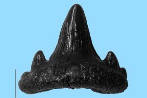
Tooth of the late Triassic predatory shark, Rhomphaiodon minor. Scale bar denotes 1 mm. Credit: Tiffany Slater
Research on rocks beneath one of the West Country’s busiest motorway junctions has revealed unexpected evidence of major flooding events across southern England millions of years ago.
University of Worcester student Tiffany Slater analysed a series of underground samples taken 25 years ago along the M4-M5 junction near Bristol containing thousands of fossils.
She did the work as part of a summer project at the University of Bristol.
By comparing species in the different layers of rock, her study concluded that, contrary to some academic thought, they were not caused by a one-off flood but by separate flooding events.
Some 205 million years ago, Europe was flooded by the sea, which spread over Germany and much of France and England.
This event, the Rhaetian Transgression, possibly triggered by major earth movements, brought an end to the tropical, desert-like land conditions in Europe, a time when the dinosaurs originated.
Tiffany, 24, a second year undergraduate Biology student at Worcester, studied tiny fossils of bony fish and sharks taken from nine boreholes surrounding the intersection of the M4 and M5 motorways at the Almondsbury junction in South Gloucestershire.
The boreholes were drilled by Geotechnical Engineering Ltd. to explore the underlying geology when motorway signs were being erected.
Tiffany, who moved to the UK for her university studies from Kentucky, USA, found a number of beds rich in fossils that were spaced through several metres of rock, documenting the progress of the Rhaetian Transgression.
The studied material consisted of more than 2,600 fossils and contained teeth, scales, and jaw fragments of large carnivorous fish, teeth from exotic sharks and ichthyosaurs, and even a gill raker from the early basking shark, Pseudocetorhinus pickfordi.
Tiffany’s investigation was under the direction of Professor Michael Benton, a Professor of Vertebrate Palaeontology at the University of Bristol as part of a series of summer internships last year titled ‘At the Feet of the Dinosaurs’.
It revealed that two bone beds originated from independent and energetic shoreward storms during the Rhaetian Transgression.
This was demonstrated by a dramatic difference in biodiversity and fossil sizes between the beds, separated by between approximately 0.3 – 1 million years.
Tiffany said: “It has never quite been determined whether these bone beds were linked to the same event or whether they were separate events.
“We knew there were several flooding events, however it was thought that this upper bone bed happened when storms came in and ripped up the bottom bed and worked it into higher sediments.
“It’s clear now that’s not the case. This bottom bone bed stayed put and the next bed was new organic material swept in by the sea.”
Tiffany, who is hoping to work in paleobiology research, added: “It’s very exciting to see an ecosystem change from mostly sharks to mostly bony fish over 200 million years ago, all right underneath the M4-M5 motorway junction.”
Reference:
Tiffany S. Slater et al. Microvertebrates from multiple bone beds in the Rhaetian of the M4–M5 motorway junction, South Gloucestershire, U.K., Proceedings of the Geologists’ Association (2016). DOI: 10.1016/j.pgeola.2016.07.001
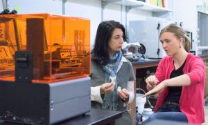
Dulcie Head, right, and Professor Tiziana Vanorio discuss the physical models of digitally scanned rock samples made on the 3-D printer at left. Credit: L.A. Cicero
A new 3-D printing technique being developed at Stanford could one day allow scientists to study rocks from afar, without needing to have actual samples in hand.
By combining two techniques—remote 3-D imaging and 3-D printing—scientists could create physical models of digitally scanned rocks that are either too delicate to handle or too difficult to obtain in person, such as rocks from the moon or Mars.
“You could use 3-D printed digital rock models to help screen and select the most scientifically interesting samples to return to Earth for research,” said Tiziana Vanorio, an assistant professor of geophysics at Stanford’s School of Earth, Energy & Environmental Sciences. “Our study provides a first step in that direction.”
For now, though, 3-D printing could help scientists better understand how changes to a rock’s microscopic structure affects its large-scale, or “bulk,” properties, such as porosity and permeability. These characteristics can reveal intimate details about the rocks, such as the physical processes that formed them, or how fluids such as oil or water move through them, which could inform more efficient extraction techniques.
“The advent of modern 3-D printing provides an unprecedented opportunity to link the micro- and macro-scales by combining the strengths of both digital and laboratory experiments,” Vanorio said. “Three-D printing allows us to digitally manipulate changes at the pore scale and then print the rock at the scale that is suitable for laboratory tests.”
Scientists have used 3-D printing on rocks before, but mostly as a means of enlarging the tiny structural details in rock interiors to make them easier to visualize. “No one else has done what we did, which is digitally modify parts of a natural rock microstructure and then physically measure in a laboratory how those changes affect fluid flow in the rock,” said Dulcie Head, a Stanford doctoral candidate in Vanorio’s lab.
Vanorio said she got the idea to print rocks in three dimensions after purchasing a pair of customized ballerina shoes a few years ago.
“The company used a digital scanner to determine the exact size and shape of your feet and then 3-D printed shoes that fit you like a glove,” Vanorio said. “Geophysicists already digitally scan rocks, so I thought to myself ‘Why not print them, too?'”
In a new study, to be published in an upcoming issue of the journal Geophysical Research Letters, Head and Vanorio tested whether current 3-D printers were up to the task of re-creating the microscopic channels and hollows in a small carbonate rock sample that had been digitally imaged using a CAT scanner.
The pair tested two different 3-D printers: a high-end commercial model costing a few thousand dollars and an industrial model that cost about ten times more. Both printers layered light-sensitive resin that is then hardened using ultraviolet light, but the industrial model had a higher printer resolution and used a wax-assisted technology to enhance the rendering of small pore spaces.
The Stanford scientists demonstrated that it was possible to manipulate the digital model of the rock sample and then print the altered version in 3-D. The research, which was selected as an Editor’s Choice by the journal Science, could for the first time allow scientists to directly link changes in a rock’s microstructure to its bulk properties such as porosity and permeability.
“A fundamental problem for geophysicists who want to understand rock properties is that our samples are not naturally comparable,” Head said. “You can take two rock cores from right next to each other that have very similar bulk properties, but when you look at them under a microscope, their pore structures might be completely different. By manipulating something that we couldn’t manipulate before, 3-D printing allows us to understand the role of those tiny differences in the pore structure.”
Vanorio and Head are optimistic that as 3-D printing technology improves, scientists will be able to recreate finer details of rock structures and even be able to mix different materials together to better replicate the diverse minerals that make up rocks.
“There are currently printers that work with glass, metal and ceramics,” Head said. “All of those are emergent technologies, but we are hopeful that we will be able to experiment with other materials in the future.”
Reference:
D. Head et al. Effects of changes in rock microstructures on permeability: 3-D printing investigation, Geophysical Research Letters (2016). DOI: 10.1002/2016GL069334
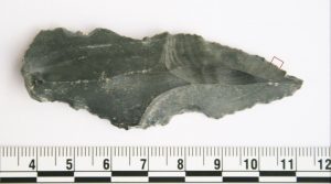
One of the stone tools (a blade that tested positive for rhino residue). Credit: Courtesy of April Nowell
How smart were human-like species of the Stone Age? New research published in the Journal of Archaeological Science by a team led by paleoanthropologist April Nowell of the University of Victoria reveals surprisingly sophisticated adaptations by early humans living 250,000 years ago in a former oasis near Azraq, Jordan.
The research team from UVic and partner universities in the US and Jordan has found the oldest evidence of protein residue — the residual remains of butchered animals including horse, rhinoceros, wild cattle and duck — on stone tools. The discovery draws startling conclusions about how these early humans subsisted in a very demanding habitat, thousands of years before Homo sapiens first evolved in Africa.
The team excavated 10,000 stone tools over three years from what is now a desert in the northwest of Jordan, but was once a wetland that became increasingly arid habitat 250,000 years ago. The team closely examined 7,000 of these tools, including scrapers, flakes, projectile points and hand axes (commonly known as the “Swiss army knife” of the Paleolithic period), with 44 subsequently selected as candidates for testing. Of this sample, 17 tools tested positive for protein residue, i.e. blood and other animal products.
“Researchers have known for decades about carnivorous behaviours by tool-making hominins dating back 2.5 million years, but now, for the first time, we have direct evidence of exploitation by our Stone Age ancestors of specific animals for subsistence,” says Nowell. “The hominins in this region were clearly adaptable and capable of taking advantage of a wide range of available prey, from rhinoceros to ducks, in an extremely challenging environment.”
“What this tells us about their lives and complex strategies for survival, such as the highly variable techniques for prey exploitation, as well as predator avoidance and protection of carcasses for food, significantly diverges from what we might expect from this extinct species,” continues Nowell. “It opens up our ability to ask questions about how Middle Pleistocene hominins lived in this region and it might be a key to understanding the nature of interbreeding and population dispersals across Eurasia with modern humans and archaic populations such as Neanderthals.”
Another result of this study is the potential to revolutionize what researchers know about early hominin diets. “Other researchers with tools as old or older than these tools from sites in a variety of different environmental settings may also have success when applying the same technique to their tools, especially in the absence of animal remains at those sites,” adds Nowell.
Reference:
A. Nowell, C. Walker, C.E. Cordova, C.J.H. Ames, J.T. Pokines, D. Stueber, R. DeWitt, A.S.A. al-Souliman. Middle Pleistocene subsistence in the Azraq Oasis, Jordan: Protein residue and other proxies. Journal of Archaeological Science, 2016; 73: 36 DOI: 10.1016/j.jas.2016.07.013
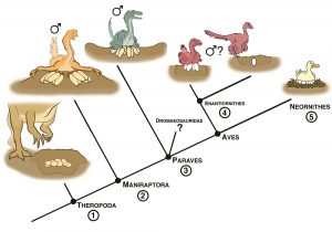
Birds’ reproductive strategies have gone through a series of stages, from dinosaurs to today. Credit: D. Anduza
What really did come first—the chicken or the egg? Birds’ reproductive biology is dramatically different from that of any other living vertebrates, and ornithologists and paleontologists have long wondered how and when the unique features of bird reproduction originated. A new Review in The Auk: Ornithological Advances examines answers from three sources—modern birds, fossils of primitive birds, and fossils of the dinosaurs from which birds are descended—to shed new light on the subject.
All modern birds share certain reproductive features, such as a single functional ovary and the practice of incubating their eggs through direct contact. Analysis of the bird family tree also suggests that early birds built simple, open nests on the ground and that their young were “precocial,” meaning they were well-developed and almost ready to fend for themselves when they hatched. Those dinosaurs close to the ancestry of birds shared some of these traits, but they had two functional reproductive tracts, and their eggs were smaller relative to their body size and more elongated than those of modern birds.
Fossils of primitive birds and eggs from the Mesozoic era place them midway between their dinosaur ancestors and their modern descendants, with eggs between those of pre-avian dinosaurs and modern birds in term of size and shape. In this way, David Varricchio and Frankie Jackson of the Montana State University are able to trace the evolution of bird reproduction through a series of distinct stages, from pre-avian dinosaurs to the birds of today.
“Reproduction in modern birds is distinct among living vertebrates. Many aspects of this reproduction mode trace their origin to theropod dinosaurs such as Oviraptors and Troodontids, but not really beyond them to more distantly related dinosaurs,” according to Varricchio. “Interestingly, reproduction in the most common group of Mesozoic birds is very similar to that of these dinosaurs, and so still differs from modern birds. Consequently, modern birds stand apart from Mesozoic birds, and perhaps this contributed to their surviving the end-Cretaceous extinction event.”
There are approximately 1,550 potentially active volcanoes around the world. VDAP works to reduce loss of life and property, limit economic impact and prevent volcanic crises from becoming disasters.
On June 15, 1991, Mt. Pinatubo in the Philippines erupted in a massive explosion. Science and international cooperation enabled officials to evacuate more than 75,000 people through advance notification.
In the fall of 2010, Indonesia’s Mt. Merapi had its largest eruption in over 100 years. More than 70,000 people were able to get to safety before flows of hot rocks, ash and volcanic gas rushed down the mountain toward their villages.
There are approximately 1,550 potentially active volcanoes around the world, but only one international volcano crisis response team that can rapidly deploy experts, donate and install monitoring equipment and work with counterparts to prevent eruptions from becoming disasters: the Volcano Disaster Assistance Program (VDAP).
This is a joint program between the USGS and U.S. Agency for International Development’s Office of U.S. Foreign Disaster Assistance (USAID/OFDA).
August 6th marks the 30-year anniversary for VDAP. To recognize this milestone, we are highlighting some of the major responses, showing how the program has helped save countless lives.
Out of Tragedy Came Thousands of Lives Saved
VDAP was established in 1986 in response to the tragic eruption of the Nevado del Ruiz volcano in Colombia that killed more than 23,000 people. Recognizing that the tragedy could have been averted with assistance before the eruption, the USGS and USAID/OFDA formed VDAP.
The USGS provides scientific and technical expertise for volcano monitoring, eruption forecasting and response. USAID/OFDA is responsible for leading the U.S. government’s response to disasters overseas and has provided more than $33 million in support for VDAP since it was established.
VDAP works to support in-country scientists and agencies at the invitation of a host country. Since the program began, teams have deployed in response to 30 major crises, assisted counterparts with hundreds of additional volcanic events and strengthened monitoring and response capacity in 12 countries.
Science Diplomacy: Collaboration among Nations
VDAP brings nations together in scientific collaboration to address common problems. In doing so, the program builds international partnerships and enhances relations between the United States and other nations.
Both crisis response and capacity building are fundamental components of VDAP. During a crisis, affected countries may request VDAP assistance either on-the-ground or remotely. Depending on the situation, VDAP will supply satellite data, donate monitoring equipment and provide many more support functions. The program also trains counterparts and helps countries establish and/or enhance their own technical and intellectual capability to prepare in advance and manage future volcano crises. Additionally, VDAP supports infrastructure development, such as installing scientific instruments and monitoring networks.
Mutual Benefit to America
This work also has an important domestic return. The United States and its territories have more active volcanoes than any country except Indonesia. Access to volcanoes worldwide and collaborating with international scientists improves our nation’s capabilities to understand potential threats and develop mitigation strategies that are most effective in preventing disasters here at home.
Reflecting on the Past 30 Years
A few examples of past and ongoing efforts are outlined below, and you can learn more by visiting the VDAP website.
Nicaragua
Momotombo volcano in Nicaragua had its first eruption in 110 years on December 1, 2015. An increased eruptive period began in February with two vigorous explosions that caused ash to fall on nearby communities. Of high concern is the geothermal plant located on the flank of the volcano, and VDAP’s help was requested by the Instituto Nicaragüense de Estudios Territoriales to evaluate and address the potential dangers. VDAP assistance has also included advising local scientists on eruption forecasting and sulfur dioxide volcanic gas monitoring as well as training and providing equipment to ensure real-time delivery of volcano monitoring data.
Indonesia
Indonesia is the world’s most volcanically active nation, with numerous eruptions each year and several million people living directly on the flanks of the volcanoes. VDAP has been assisting the Indonesian Center for Volcanology and Geologic Hazard Mitigation (CVGHM) since 2004 to improve its monitoring networks. VDAP seismologists have provided training both in Indonesia and at the USGS Cascades Volcano Observatory in Washington State.
In October of 2010, Mt. Merapi had its largest eruption in more than 100 years. Thousands of lives were saved thanks to preemptive evacuations. VDAP assisted with situational analysis, including the use of satellite data to identify the imminent hazard and help Indonesian officials decide to evacuate those nearby.
“The work done by VDAP in Indonesia is not only focusing on instrumental development, but VDAP has also been very important in developing scientific capacity of the Indonesian volcanologists and thus helpful for a better decision making process during a volcanic crisis,” said Pak Kasbani, head of CVGHM. “The work of VDAP within our cooperation is therefore deeply appreciated and will make a positive difference for the future of volcano monitoring development in Indonesia.”
Chile
In 2008, Chaitén volcano in Chile re-activated and an entire town of about 5,000 people evacuated within 48 hours of the eruption onset. Soon after, VDAP collaborated with Chile’s Servicio Nacional de Geología y Minería to install the first radio-telemetered monitoring instruments at Chaitén, allowing for transmission of information to scientists for rapid analysis. Chile has more than 122 active volcanoes and this eruption prompted a new national plan to ensure adequate monitoring of the country’s hazards. This plan was funded by the government of Chile and is based on the USGS’s U.S. National Volcano Early Warning System.
Colombia
After being dormant for hundreds of years, Nevado del Huila in Colombia erupted in 2007 and 2008. Before both eruptions, Colombian officials at the Servicio Geologico Colombiano reached out to VDAP for assistance. Collaboratively, they improved monitoring and established warnings that enabled evacuations before mudflows raced down into populated valleys. The resulting success demonstrates the dramatic progress made in Colombia since the 1985 disaster at Nevado del Ruiz.
Philippines
In the spring of 1991, VDAP assistance was requested to help monitor Mt. Pinatubo in the Philippines. VDAP shipped an entire volcano monitoring network and worked with the Philippine Institute of Volcanology and Seismology to install the network and issue warnings prior to the eruption. Before Mt. Pinatubo’s massive eruption in June of the same year, this network allowed for timely evacuations that saved thousands of lives and several billions of dollars in U.S. equipment. Evacuations were carried out by the government of the Philippines and U.S. military officials at Clark Air Base and nearby U.S. Naval Base Subic Bay.
“Oscars” for Government
VDAP is one of several finalists nominated for the 2016 Service to America Medals. These awards honor excellence in our federal workforce and are known as the “Oscars” of government service. The final winners will be announced September 20 and VDAP’s nomination is listed under the name of the current Chief of the program, John Pallister. Go online to learn more and vote for the People’s Choice Award.
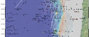
Core samples of sediments on the ocean floor were taken at these locations. Credit: Image courtesy of Oregon State University
A new analysis suggests that massive earthquakes on northern sections of the Cascadia Subduction Zone, affecting areas of the Pacific Northwest that are more heavily populated, are somewhat more frequent than has been believed in the past.
The chance of one occurring within the next 50 years is also slightly higher than previously estimated.
The findings, published this week in the journal Marine Geology, are based on data that is far more detailed and comprehensive than anything prior to this. It used measurements from 195 core samples containing submarine landslide deposits caused by subduction zone earthquakes, instead of only about a dozen such samples in past research.
The work was done by researchers from Oregon State University, Camosun College in British Columbia and Instituto Andaluz de Ciencias de la Tierra in Spain. The research was supported by the National Science Foundation and the U.S. Geological Survey.
“These new results are based on much better data than has been available before, and reinforce our confidence in findings regarding the potential for major earthquakes on the Cascadia Subduction Zone,” said Chris Goldfinger, a professor in the College of Earth, Ocean and Atmospheric Sciences at OSU, and one of the world’s leading experts on tectonic activity of this subduction zone.
“However, with more detailed data we have also changed somewhat our projections for the average recurrence interval of earthquakes on the subduction zone, especially the northern parts. The frequency, although not the intensity, of earthquakes there appears to be somewhat higher than we previously estimated.”
The Cascadia Subduction Zone runs from northern California to British Columbia, and scientists say it can be roughly divided into four segments. There have been 43 major earthquakes in the past 10,000 years on this subduction zone, sometimes on the entire zone at once and sometimes only on parts of it. When the entire zone is involved, it’s believed to be capable of producing a magnitude 9.1 earthquake.
It’s been known for some time, and still believed to be accurate, that the southern portions of the subduction zone south of Newport, Oregon, tend to rupture more frequently — an average of about every 300-380 years from Newport to Coos Bay, and 220-240 years from Coos Bay to Eureka, California.
The newest data, however, have changed the stakes for the northern sections of the zone, which could have implications for major population centers such as Portland, Tacoma, Seattle and Vancouver, B.C.
A section of the zone from Newport to Astoria, Oregon, was previously believed to rupture on average about every 400-500 years, and that average has now been reduced to 350 years. A section further north from Astoria to Vancouver Island was previously believed to rupture about every 500-530 years, and that average has now been reduced to 430 years.
The last major earthquake on the Cascadia Subduction Zone — pinpointed in time because it caused a tsunami that raced all the way across the Pacific Ocean to Japan — occurred in January, 1700, more than 315 years ago.
“What this work shows is that, contrary to some previous estimates, the two middle sections of the Cascadia Subduction Zone that affect most of Oregon have a frequency that’s more similar than different,” said Goldfinger, who directs the Active Tectonics and Seafloor Mapping Laboratory at OSU.
Based on these findings, the chances of an earthquake in the next 50 years have also been slightly revised upwards. Of the part of the zone off central and northern Oregon, the chance of an event during that period has been changed to 15-20 percent instead of 14-17 percent. On the furthest north section of the zone off Washington and British Columbia, the chance of an event has increased to 10-17 percent from 8-14 percent.
The study also increased the frequency of the most massive earthquakes, where the entire subduction zone ruptures at once. It had previously been believed this occurred about half the time. Now, the data suggest that several partial ruptures were more complete than previously thought, and that complete ruptures occur slightly more than half the time.
“Part of what’s important is that these findings give us more confidence about what’s coming in our future,” Goldfinger said.
“We believed these earthquakes were possible when the hypothesis was first developed in the late 1980s. Now we have a great deal more certainty that the general concern about earthquakes caused by the Cascadia Subduction Zone is scientifically valid, and we also have more precise information about the earthquake frequency and behavior of the subduction zone.”
Based in part on the growing certainty about these issues, OSU has developed the Cascadia Lifelines Program, an initiative working with Pacific Northwest business and industry to help prepare for the upcoming subduction zone earthquake, mitigate damage and save lives. Many other programs are also gaining speed.
The new measurements in this research were made with cores that showed the results of massive amounts of sediments released by subsea landslides during a subduction zone earthquake — a catastrophic event beneath the sea as well as on land. New technology is helping researchers to actually simulate these underwater landslides, better understand their behavior, and more accurately identify the “turbidite” or sediment layers they leave behind.
The large amounts of additional data, researchers say, has helped refine previous work, fill holes in the data coverage, and also to rule out other possible causes of some sediment deposits, such as major storms, random landslides or small local earthquakes.
Core samples of sediments on the ocean floor were taken at these locations.
Credit: Image courtesy of Oregon State University
References:
Chris Goldfinger, Steve Galer, Jeffrey Beeson, Tark Hamilton, Bran Black, Chris Romsos, Jason Patton, C. Hans Nelson, Rachel Hausmann, Ann Morey. The importance of site selection, sediment supply, and hydrodynamics: A case study of submarine paleoseismology on the northern Cascadia margin, Washington USA. Marine Geology, 2016; DOI: 10.1016/j.margeo.2016.06.008
Chris Goldfinger, Steve Galer, Jeffrey Beeson, Tark Hamilton, Bran Black, Chris Romsos, Jason Patton, C. Hans Nelson, Rachel Hausmann, Ann Morey. The importance of site selection, sediment supply, and hydrodynamics: A case study of submarine paleoseismology on the northern Cascadia margin, Washington USA. Marine Geology, 2016; DOI: 10.1016/j.margeo.2016.06.008
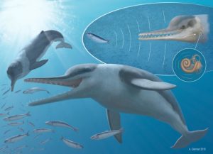
Sound is produced by Echovenator, which bounces off prey to create echoes. This illustration shows how these echoes are detected via conduction of vibrations through the mandible and received by the inner ear. Credit: A. Gennari 2016.
All living toothed whales rely upon echoes of their own calls to navigate and hunt underwater, a skill that works best in conjunction with high-frequency hearing. Now, researchers reporting in the Cell Press journal Current Biology on August 4 who studied one of the best-preserved ears of any ancient whale ever discovered find that whales’ high-frequency hearing abilities arose earlier than anticipated.
“Our study suggests that high-frequency hearing may have preceded the emergence of echolocation,” says Morgan Churchill of New York Institute of Technology in Old Westbury, New York.
Churchill and his colleagues made their discovery in studies of a new fossil whale species (Echovenator sandersi) found in a drainage ditch in South Carolina. The researchers CT scanned the ancient whale’s remarkably complete fossilized ear and compared it to those of two hippos and 23 fossil and living whales. Those analyses uncovered many features found today in dolphins, which can hear at ultrasonic frequencies.
The anatomy of Echovenator’s ear suggests that high-frequency hearing evolved early in whale evolution, about 27 million years ago and that traits associated with this ability actually predate the emergence of toothed whales. It also suggests that the evolutionary ancestors of toothed whales could hear at higher frequencies than their relatives on land.
Churchill says that the inner ear of Echovenator is surprisingly similar to that of modern whales. In fact, only one trait of the ancient whale’s ear was more similar to primitive whales than to modern whales, suggesting a very rapid evolution of hearing abilities in early whales.
Echovenator is remarkable in other ways too, Churchill notes. For instance, the ancient whale was remarkably small compared to its ancestors, suggesting a drastic change in body size early in toothed whale evolution that most likely influenced a range of variables, from brain size to ecology.
Echovenator is just one of many fossil whales from South Carolina that Churchill and colleagues are in the process of studying. Those fossils represent some of the earliest known ancestors of toothed whales. And that means there’s much more to come on the evolution of intelligence, body size, foraging ecology, and diversity in modern whales.
Reference:
Churchill et al. The Origin of High-Frequency Hearing in Whales. Current Biology, 2016 DOI: 10.1016/j.cub.2016.06.004
Note: The above post is reprinted from materials provided by Cell Press.
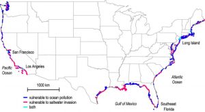
Researchers at The Ohio State University and NASA’s Jet Propulsion Laboratory have created the first-ever map of key regions of “submarine groundwater discharge,” where freshwater and seawater mix unseen below ground. The previously hidden sites mark areas of vulnerability for ocean contamination and drinking water contamination. Areas in dark blue are vulnerable to pollution from land to sea. Areas in pink are vulnerable to pollution from sea to land in the form of saltwater intrusion. Areas in light blue are vulnerable to both. Credit: Image courtesy of The Ohio State University.
Researchers have uncovered previously hidden sources of ocean pollution along more than 20 percent of America’s coastlines.
The study, published online Aug. 4 in the journal Science, offers the first-ever map of underground drainage systems that connect fresh groundwater and seawater, and also pinpoints sites where drinking water is most vulnerable to saltwater intrusion now and in the future.
Audrey Sawyer, assistant professor of earth sciences at The Ohio State University and leader of the study, said that while scientists have long known that freshwater and seawater mix unseen below ground, until now they hadn’t been able to pinpoint exactly where it was happening, or how much.
Together with partners at NASA’s Jet Propulsion Laboratory, Sawyer was able to learn more about the previously hidden water exchanges via computer analysis, and without extensive and costly field surveys.
“We’re all pretty familiar with the idea that rain falls on land and flows out to the ocean in rivers, but there’s another, hidden component of rainfall that infiltrates the ground near the coast and spills into the ocean below sea level,” Sawyer said. “If you’ve ever been swimming in the ocean and felt a cold spot, there’s a good chance that the cold spot is due to groundwater seeping out from underfoot.”
“We call it ‘submarine groundwater discharge,'” she continued. “Freshwater flows out to sea, and vice versa. Urbanization, agricultural development, climate, and topography all affect how much water flows in either direction, and the exchange has a big impact on both onshore groundwater that we drink and offshore seawater where we swim and fish.”
The study identified 12 percent of the continental U.S. coastline — including the northern Gulf Coast from Mississippi to the Florida Panhandle, northern Atlantic Coast and Pacific Northwest — where the once-hidden drainage systems make the ocean most susceptible to freshwater contamination from septic tanks and fertilizer runoff. There, excess nutrients in the water can cause harmful algal blooms to form and remove vital oxygen from the water. This contamination from land to sea endangers fisheries and coral reefs as well as water recreation and tourism.
In contrast, another 9 percent of coastline — including Southeastern Florida, Southern California, and Long Island — are especially susceptible to the opposite threat: contamination from sea to land, the study found. In these areas, saltwater intrudes inland and infiltrates the fresh groundwater supply.
“It takes only a small amount of saltwater to render drinking water non-potable, so saltwater invasion is a big concern for water resource management in coastal areas,” Sawyer said.
Among the sites on the map with the worst impacts are Los Angeles and San Francisco, which the study found to be vulnerable to both ocean contamination and saltwater intrusion simultaneously.
Overall, more than 15 billion tons of freshwater flows through invisible underground networks into the ocean along the continental U.S. coastline every year, the researchers found.
That sounds like a lot of water, but it’s less than 1 percent of the total amount that flows from the continental United States into the ocean, pointed out study co-author Cédric David of JPL. The other 99 percent comes from rivers and surface runoff.
Still, David explained, the study is significant because it provides the first continental-scale high-resolution estimate of that 1 percent — a portion which, when compared to the other 99 percent, can be particularly rich in nutrients and other contaminants.
“This Ohio State-JPL collaboration has removed the cloak from hidden groundwater transfers between land and sea,” he said.
Sawyer, David and James Famiglietti, also of JPL, combined U.S. topography and climate models to identify key inland regions that contribute groundwater and contaminants to the coast. They examined rainfall, evaporation rates and the amount of known surface runoff to calculate the missing portion of water that was running out below ground, and melded those results with terrain and land-use data to identify where the water ended up.
For example, precipitation is similar in the Pacific Northwest and the mid-Atlantic regions, but the study found that underground drainage rates into the ocean were approximately 50 percent higher in the Pacific Northwest because the steep terrain there carries more groundwater to the coastline.
Land use was critical to discharge in Florida, the study found, and Sawyer said that she was surprised by the big effect that canals had there.
Since the early 20th century, Floridians have constructed thousands of miles of canals along the state’s coasts for transportation, irrigation and recreation. The study found that the canals capture water that would otherwise flow underground and out to sea.
As an example, Sawyer cited four adjacent counties along the Gulf Coast that have dramatically different amounts of discharge depending on the number of canals: Pinellas and Hillsborough counties, which have many canals, had about half as much below-ground drainage as Pasco and Hernando counties, which don’t.
The researchers commented that increased urbanization — and the extensive pavement that goes along with it — will also decrease submarine groundwater drainage in coastal regions where the population is growing, which increases the likelihood of saltwater intrusion.
“That’s why we hope others will use our analysis to better plan strategies for coastal land development and groundwater management that help preserve water quality,” Sawyer said. “Right now, we’ve created a map of American coastlines, but we hope to be able to do it for the world shortly, as data become available.”
Reference:
Audrey H. Sawyer, Cédric H. David, James S. Famiglietti. Continental patterns of submarine groundwater discharge reveal coastal vulnerabilities. Science, 2016 DOI: 10.1126/science.aag1058
Note: The above post is reprinted from materials provided by Ohio State University. The original item was written by Pam Frost Gorder.
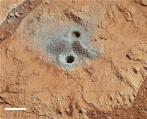
Drill hole into the John Klein target within Sheepbed Member of Yellowknife Bay, with a light-toned sulfate veinlet visible on the back wall. The light-toned veins have been identified as sulfates by ChemCam (Nachon et al.; Schroeder et al.) and CheMin (Vaniman et al.). Drill hole is 1.6 cm diameter. Image is white balanced. Scale bar is 2 cm. Credit: Image courtesy of University of Leicester
Mineral veins found in Mars’s Gale Crater were formed by the evaporation of ancient Martian lakes, a new study has shown.
The research, by Mars Science Laboratory Participating Scientists at The Open University and the University of Leicester, used the Mars Curiosity rover to explore Yellowknife Bay in Gale Crater on Mars, examining the mineralogy of veins that were paths for groundwater in mudstones.
The study suggests that the veins formed as the sediments from the ancient lake were buried, heated to about 50 degrees Celsius and corroded.
Professor John Bridges from the University of Leicester Department of Physics and Astronomy said: “The taste of this Martian groundwater would be rather unpleasant, with about 20 times the content of sulphate and sodium than bottled mineral water for instance!
“However as Dr Schwenzer from The Open University concludes, some microbes on Earth do like sulphur and iron rich fluids, because they can use those two elements to gain energy. Therefore, for the question of habitability at Gale Crater the taste of the water is very exciting news.”
The researchers suggest that evaporation of ancient lakes in the Yellowknife Bay would have led to the formation of silica and sulphate-rich deposits.
Subsequent dissolution by groundwater of these deposits — which the team predict are present in the Gale Crater sedimentary succession — led to the formation of pure sulphate veins within the Yellowknife Bay mudstone.
The study predicts the original precipitate was likely gypsum, which dehydrated during the lake’s burial.
The team compared the Gale Crater waters with fluids modelled for Martian meteorites shergottites, nakhlites and the ancient meteorite ALH 84001, as well as rocks analysed by the Mars Exploration rovers and with terrestrial ground and surface waters.
The aqueous solution present during sediment alteration associated with mineral vein formation at Gale Crater was found to be high in sodium, potassium and silicon, but had low magnesium, iron and aluminium concentrations and had a near neutral to alkaline pH level.
The mudstones with sulphate veins in the Gale Crater were also found to be close in composition to rocks in Watchet Bay in North Devon, highlighting a terrestrial analogue which supports the model of dissolution of a mixed silica and sulphate-rich shallow horizon to form pure sulphate veins.
Ashwin Vasavada, Curiosity Project Scientist from the NASA Jet Propulsion Laboratory said: “These result provide further evidence for the long and varied history of water in Gale Crater. Multiple generations of fluids, each with a unique chemistry, must have been present to account for what we find in the rock record today.”
Reference:
S. P. Schwenzer, J. C. Bridges, R. C. Wiens, P. G. Conrad, S. P. Kelley, R. Leveille, N. Mangold, J. Martín-Torres, A. McAdam, H. Newsom, M. P. Zorzano, W. Rapin, J. Spray, A. H. Treiman, F. Westall, A. G. Fairén, P.-Y. Meslin. Fluids during diagenesis and sulfate vein formation in sediments at Gale crater, Mars. Meteoritics & Planetary Science, 2016; DOI: 10.1111/maps.12668
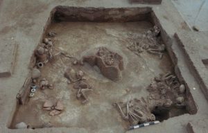
Fourteen skeletons of victims killed by earthquake in Cave dwelling F4 at Lajia site excavated in 2000. This material relates to a paper that appeared in the 5 August 2016 issue of Science, published by AAAS. The paper, by A. Qinglong Wu at institution in location, and colleagues was titled, “Outburst flood at 1920 BCE supports historicity of China’s Great Flood and the Xia dynasty.” Credit: Cai Linhai
Researchers have provided geological evidence for China’s “Great Flood,” a disastrous event on the Yellow River from which the Xia dynasty is thought to have been born. The flood occurred in roughly 1920 BC, they say, which is several centuries later than traditionally thought — meaning the Xia dynasty, and its renowned Emperor Yu, likely had a later start than Chinese historians have thought, too. According to Chinese legend, Emperor Yu gained notoriety through his handling of the country’s Great Flood.
By dredging the destructive floodwaters, he tamed them, “earning him the divine mandate to establish the Xia dynasty … and marking the beginning of Chinese civilization,” Wu Qinglong and colleagues write.
Yu’s story was handed down for a millennium before entering the historical record, yet, geological evidence for the flood he mastered has always been lacking. Thus, “some scholars have argued that the story is either a historicized version of an older myth,” David Montgomery explains in a related Perspective, “or propaganda to justify the centralized power of imperial rule.”
Here, by reconstructing a sequence of events along the Yellow River — including a landslide that created a dam from which water built up and burst forth — Wu Qinglong and colleagues provide geological evidence for a catastrophic flood event that may be the basis of the Great Flood.
The researchers mapped and dated distinctive sediments that were deposited downstream of a Qinghai Province dam when the dam broke. In further work, they determined that the flood that broke the dam was of enormous proportions. Using radiocarbon dating techniques on samples that included human bone, they dated the flood to 1920 BC.
“The … flood shares the main characteristics of the Great Flood described in ancient texts,” the authors say. If their flood is indeed the event that came to be known as the Great Flood, researchers could propose a new start date for the Xia dynasty, at 1900 BC.
This date not only coincides with the major transition from the Neolithic to the Bronze Age in the Yellow River valley, possibly resolving a longstanding contradiction among Chinese historians about when Xia started in relation to this critical period in history, but it also coincide with the beginning of the Erlitou culture that dominated China in the early Bronze Age — supporting arguments that this culture is the archaeological remains of the Xia dynasty.
Taken together, these results reveal how the concurrence of these major natural and sociopolitical events may be an “illustration of a profound and complicated cultural response to an extreme natural disaster that connected many groups living along the Yellow River.
Reference:
Q. Wu, Z. Zhao, L. Liu, D. E. Granger, H. Wang, D. J. Cohen, X. Wu, M. Ye, O. Bar-Yosef, B. Lu, J. Zhang, P. Zhang, D. Yuan, W. Qi, L. Cai, S. Bai. Outburst flood at 1920 BCE supports historicity of Chinas Great Flood and the Xia dynasty. Science, 2016; 353 (6299): 579 DOI: 10.1126/science.aaf0842
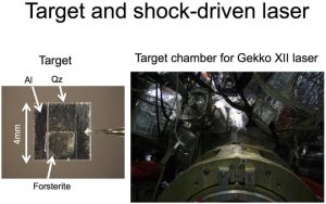
High-powered lasers melt mineral for planet formation experiments. Researchers observed the melting of forsterite, the most common constituent of Earth’s mantle, to understand how the cores of planets form and develop. The laser is able to create pressures representative of the extreme collisions between objects in space. The target is a 4 millimeter square. Al is aluminum and Qz is quartz. Image by Toshimori Sekine, Hiroshima University. Image may only be re-used with attribution. Credit: Image courtesy of Hiroshima University
New experiments provide insight into how Earth-type planets form when giant asteroids or planetesimals collide and how the interiors of such planets develop. Researchers at Hiroshima University, Osaka University, Ehime University, University of Tokyo, and the Chiba Institute of Technology collaborated to publish their research in the August 3, 2016 issue of Science Advances.
“Our results provide a better understanding how impact-generated magmas evolve and allow us to model Earth-type planets’ inner structures. Collisions at these extreme temperatures and pressures created our own Earth and may have also formed the mantles of other Super Earth planets, for example CoRoT-7b and Kepler-10b,” said Toshimori Sekine, Ph.D., first author of the research paper and Professor at Hiroshima University.
These powerful collisions cause chemical reactions within the giant rocks and knowing what types of reactions occur under what conditions gives researchers a better understanding of the development of planets too far away for satellites to explore. Many of the rocks include forsterite, a representative mineral that makes up much of the matter in space. Forsterite, known to scientists as Mg2SiO4, is a combination of Magnesium, Silicone, and Oxygen and is the most abundant constituent of Earth’s mantle, the layer between the surface crust and molten core.
The research team of geophysicists and engineers successfully measured the melting of forsterite. However, replicating the intense collisions that can turn minerals into magma in Earth-based experiments was a challenge.
“The laser shock technique was first used in the 1990s, but the results were not precise. Recent technical advances enable us to measure precisely the laser-shocked states,” said Sekine.
The laser shock technique uses a high-power laser to irradiate a target, which was a block of forsterite in the experiments by Sekine’s team. The energy of the irradiation causes an abrupt expansion of the target’s molecules and the inertia of this expansion generates a shock wave. The energy from the shock wave can create heat and light that melts and reflects off of the forsterite.
Previous studies without the laser shock technique only measured the properties of forsterite at shock pressures below 200 Giga Pascals (GPa). The new experiments put forsterite crystals under pressures between approximately 250 and 970 GPa. For comparison, the pressure at the center of Earth is estimated to be 360 GPa.
Researchers measured the pressure, temperature, density, and reflectivity of laser-shocked forsterite. These parameters did not increase at a constant rate as the pressure steadily increased, revealing that both energy producing and energy absorbing reactions occur in shocked forsterite melt at pressures between 250 GPa and 344 GPa.
Earlier research has connected magnesium oxide, one of the minerals that is formed from forsterite, to the reactions necessary for a planet to develop a magnetic field that persists for a long geological time, such as the magnetic field of Earth. With these new details of forsterite’s melting behavior, researchers may be able to predict how minerals separate into different layers of magma and which minerals may be close enough to react.
“Our results can support the possibility that violent, large-scale collisions between space bodies containing enough forsterite and moving faster than about 13 kilometers per second (8.1 miles per second) could lead to chemical layering in the mantels of massive terrestrial planets. Melting forsterite may have produced a sufficiently high concentration of magnesium oxide in early Earth’s core to power a magnetic field around the planet,” said Sekine.
Reference:
Sekine T, Ozaki N, Miyanishi K, Asaumi Y, Kimura T, Albertazzi, Yuya Sato, Sakawa Y, Sano T, Sugita S, Matsui T, Kodama R. Shock compression response of forsterite above 250 GPa. Science Advances, August 2016 DOI: 10.1126/sciadv.1600157
Note: The above post is reprinted from materials provided by Hiroshima University.
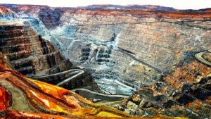
Kalgoorlieite, originally found in the Super Pit, was added to the International Mineralogical Association’s list of known minerals at the end of March. Credit: iStock
Kalgoorlie-Boulder’s famous Golden Mile and Super Pit has not only produced more than 50 million ounces of gold but it has now produced one more precious nugget in the form of a new mineral unique to Kalgoorlie-Boulder, called kalgoorlieite.
Kalgoorlieite was discovered by Curtin University’s Department of Applied Geology researcher Kirsten Rempel in January last year.
Dr Rempel was making detailed examinations of historic samples at the WA School of Mines’ Kalgoorlie campus when she found the mineral.
“I first found the mineral using a scanning electron microscope (SEM) which showed me the basic chemical composition of the mineral” Dr Rempel says.
“The spectra showed a combination of elements arsenic (As) and tellurium (Te) which had never been reported before, so that was when I began to think this was something new.”
A further test using a more advanced SEM in the John de Laeter Centre in Perth verified the composition.
“The chemistry needed to declare a new mineral is very detailed,” Dr Rempel says.
“So I took kalgoorlieite to an electron microprobe at UWA and got the composition further analysed down to fractions of a per cent, and found traces of gold, silver and other metals.”
She then had to detect kalgoorlieite’s structure using a technique called Kikuchi diffraction and by comparing it with an already known synthetic compound with the same structure currently used in thermoelectric applications, she was able to match and confirm a formula for kalgoorlieite, As2Te3.
The final step before submission was to determine how much light kalgoorlieite reflects.
“We couldn’t measure this in Australia so it had to be done at the Natural History Museum in London,” Dr Rempel says.
Kalgoorlieite was added to the International Mineralogical Association’s list of known minerals at the end of March.
“You’re not allowed to name the mineral after yourself so I called it kalgoorlieite,” she says.
“This mineral could provide important information about the widely contested genesis of the Golden Mile.”
Kalgoorlieite’s simple composition and the fact that it has a limited stability in terms of pressure, temperature and chemistry of its surroundings gives more precise constraints on the conditions under which the Golden Mile deposit was formed.
It’s unlikely that natural kalgoorlieite will have any commercial value because of it’s rarity and a synthetic compound has been produced for several years for thermoelectric applications.
Note: The above post is reprinted from materials provided by Science Network WA. This article first appeared on ScienceNetwork Western Australia a science news website based at Scitech.
Fig.1 Reconstruction of Mioneophron longirostris. Credit: XU Yong
Neogene fossils of Old World vultures (Aegypiinae and Gypaetinae) are known from Africa, Eurasia, and North America. The evolution of Old World Vultures is closely tied to the expansion of grasslands and open woodlands and appearance of large, grazing mammals. While there are no extant Old World vultures in the Americas today, a large diversity of Gypaetinae are known from Miocene to late Pleistocene fossil deposits. Despite a comparatively large number of North American Gypaetinae fossils, complete specimens have rarely been reported from Eurasia and Africa.
In a recent study published online on July 20 in the journal Auk, LI Zhiheng and Clarke Julia from the University of Texas at Austin and their collaborators ZHOU Zhonghe and DENG Tao from IVPP described the exceptional skeleton of a new Gypaetinae vulture, Mioneophron longirostris, from the late Miocene deposits of the Linxia Basin in northwestern China. In comparison with other extant and extinct Old World vultures, the new specimen has a slender and elongated rostrum, similar to the beaks of the Egyptian Vulture (Neophron percnopterus; Gypaetinae) and the Hooded Vulture (Necrosyrtes monachus; Aegypiinae). Based on the comprehensive examination of Old World vulture records and their skeletal features, the new specimen was identified as the oldest record of Gypaetinae from Eurasia or Africa.
A re-examination of the geographic and temporal distribution of Old World vultures from Neogene deposits indicates that the Gypaetinae diversified during the expansion of grasslands in the early-mid Miocene. The diversification of Aegypiinae is linked to the later transition from C3 to C4 grasslands during the late Miocene and early Pliocene. The ranges of Old World vultures retracted from North America, Southeast Asian islands, and east China with the extinction of mammalian megafauna at the end of the Pleistocene.
To date, only a handful of bird fossils have been reported from late Miocene deposits in the Linxia Basin, including a large–bodied and flightless ostrich (Struthio linxiaensis), an Aegypiinae vulture (Gansugyps linxiaensis) and an early kestrel (Falco hezhengensis). Mioneophron represents the fourth bird species from the region and reveals a savanna-like environment in northwest China during the late Miocene.
Reference:
Zhiheng Li et al. A new Old World vulture from the late Miocene of China sheds light on Neogene shifts in the past diversity and distribution of the Gypaetinae, The Auk (2016). DOI: 10.1642/AUK-15-240.1
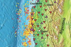
A network of broadband seismometers (indicated by triangles) is tracking seismic activity (indicated by circles) in the area of Illapel, Chile
Later this year, seismology geophysicist Steve Roecker will travel to Illapel, Chile, to remove instruments which have been tracking the struggle between two tectonic plates that caused a magnitude 8.3 earthquake on September 16, 2015. While areas to the north and south of Illapel – where the Nazca plate dives beneath the South American plate – have been studied, until now the complexity of the boundary in the area of Illapel has deterred research.
“Researchers have studiously avoided this part of the boundary because the Nazca plate changes dip – curving from 45 degrees in one area to about 10 degrees in another – which makes it hard to interpret results,” said Roecker, a professor of earth and environmental sciences in the School of Science at Rensselaer Polytechnic Institute. “But with the 2015 earthquake we knew we had an opportunity to collect a really good dataset that we can use to learn more about the dynamics in this environment.”
Researchers will use the open-source data to determine how much energy the 8.3 magnitude earthquake released, where it was released, and how much may yet remain to be released. Using tomography techniques, researchers can also create images of the subsurface which, when analyzed, may reveal subsurface temperatures or geologic composition. This information will help predict where future earthquakes may strike, and what their strength may be.
Like many other areas in the Pacific Ocean “Ring of Fire,” Illapel is a subduction zone, an area where one plate pushes beneath another, producing some of the world’s biggest and most destructive earthquakes. Subduction of the Nazca plate has generated high magnitude megathrust earthquakes more frequently than any other subduction zone in the past 100 years, including the largest magnitude earthquake yet recorded – a magnitude 9.5 earthquake in 1960 near Valdivia, Chile.
“These are where you have the megathrusts; if you look at the top 10 earthquakes for energy release and damage, they’re all along these types of boundaries,” Roecker said. “And that’s why it’s important to study them.”
Roecker’s research exemplifies the work being done at The New Polytechnic, addressing difficult and complex global challenges, the need for interdisciplinary and true collaboration, and the use of the latest tools and technologies, many of which are developed at Rensselaer.
To study the area around Illapel, Roecker and his team installed a network of broadband seismometers in November 2015 knowing that, after the magnitude 8.3 earthquake, aftershocks generating good data would be abundant. Between the 20 temporary seismometers researchers installed, and 10 additional existing seismometers, the network is able to collect data on a stretch of land about 150 kilometers from north to south, and 50 kilometers from the coast inland.
Roecker said the team expects the data will allow researchers to map out the release of strain on the boundary, which provides insights into where active faults may lie in the upper plate close to the surface, and how large they are. Researchers will also be able to describe the deformation of the top plate as a result of the subduction of the bottom plate, which can help establish what portions of the boundary have not yet ruptured and must eventually do so. And researchers will process the data using tomographic techniques to identify the location of magma and the types of rock that lie beneath the surface.
“A good analogy, and one that shares origins with this technique, is a CAT scan. Using a source of energy (in a CAT scan it’s an x-ray), you collect data from a variety of different angles, and based on the changes of exposure you can re-create the distribution of whatever’s attenuating the x-ray,” Roecker said. “In this case, we use earthquakes as the source of energy, and we derive our angles by placing receivers in multiple locations at the surface of the Earth.”
Roecker was part of a team of researchers who used a similar approach in 2010 after a magnitude 8.8 earthquake centered on Maule, Chile, just south of Illapel. Data collected from that deployment, known as the International Maule Aftershock Deployment (IMAD), has been used by a large number of scientists from a broad range of disciplines. Researchers expect that the Illapel data along with the IMAD data will provide the first “modern-instrumentation observation of along-strike rupture terminations of two clearly temporally related and spatially adjacent megathrust earthquake rupture zones.”
“There are quite a few questions we want to answer, and the more you know, the more you can do to protect people,” Roecker said.
The research is supported with a $275,000 grant from the National Science Foundation, and is a collaboration between Rensselaer, the University of Florida, and groups at the Universidad de Chile.
Researchers from the University of Manchester have teamed up with the New Jersey State Museum and the University of Massachusetts to diagnose a dinosaur from the USA with a horrific medical condition.
The prehistoric patient is a Hadrosaur—a duck-billed dinosaur—which seems to have suffered from septic arthritis, a condition seen in modern birds and crocodiles as well as humans. The septic arthritis affected the elbow joint, resulting in a fused joint covered in bony growths.
“The condition would have made it almost impossible for the animal to move its elbow, making it look a bit like the hobbling pigeons you see today. It’s almost humbling to think that the same conditions that affect the pigeons on the street might have also affected their impressive dinosaur relatives,” said Dr. Jennifer Anné, lead author of the study.
Paleopathologies – ancient diseases and injuries – are fairly rare in the fossil record. Even rarer are dinosaurs from the East Coast of North America. The combination of both is an extremely significant find, which allows for a look at the harsher side of life for dinosaurs on the eastern seaboard 70 million years ago.
The specimen was found was found in a former New Jersey quarry by David Parris of New Jersey State Museum. Like many fossils from this site, the specimen suffers from a geological condition called pyrite disease which makes it very fragile and can lead to it crumbling into dust. Therefore, the team used the microCT scanning facilities at Harvard University’s Center for Nanoscale Systems to do an internal diagnosis without the need for saws.
“By microCTing the specimen, we not only ensured an accurate diagnosis of the pathology, but also the preservation of the specimen for future scientific studies” said co-author Dr Brandon Hedrick.
“The fact that such a fossil was preserved is difficult to comprehend” said co-author Jason Schein of the New Jersey State Museum. “It’s exciting to think that New Jersey is still producing scientifically important finds after over 200 years of paleontological discoveries.”
Reference:
Jennifer Anné et al. First diagnosis of septic arthritis in a dinosaur, Royal Society Open Science (2016). DOI: 10.1098/rsos.160222
The fossil of a 300 million year old primitive jawless fish – a lamprey – about 6 cm in length. The eyes are the two dark circles on the right-hand side and are so well-preserved the retina and lens can be seen in high magnification. Its head terminates in an oral sucker: today lamprey use this to cling on to larger fish and suck their blood. It has dark–coloured stripes along its back. Credit: Rober Sansom
New research led by the University of Leicester has overturned a long-standing theory on how vertebrates evolved their eyes by identifying remarkable details of the retina in the eyes of 300 million year-old lamprey and hagfish fossils.
The study, published in the journal Proceedings of the Royal Society B, led by Professor Sarah Gabbott from the University of Leicester Department of Geology, shows that fossil hagfish eyes were well-developed, indicating that the ancient animal could see, whereas their living counterparts are completely blind after millions of years of eye degeneration — a kind of reverse evolution.
The researchers examined the eye tissue in two fossil jawless fish species — Mayomyzon (a lamprey) and Myxinikela (a hagfish) found in the Carboniferous age Mazon Creek fossil bed, Illinois.
Using a high-powered scanning electron microscope to magnify the eye 5,000 times they could see that the fossil retina is composed of minute structures called melanosomes — the same structures that occur in human eyes and prevent stray light bouncing around in the eye allowing us to form a clear visual image.
This is the first time that such details in fossil vertebrate eyes have been brought to bear on the tricky problem of how their eyes evolved.
The eye is a complex structure and must have evolved through small step-by-step changes but these are not recorded in living animals and until now it was thought that these anatomical details could not be preserved in fossils.
Professor Gabbott explains: “To date models of vertebrate eye evolution focus only on living animals and the blind and ‘rudimentary’ hagfish eye was held-up as critical evidence of an intermediate stage in eye evolution. Living hagfish eyes appeared to sit between the simple light sensitive eye ‘spots’ of non-vertebrates and the sophisticated camera-style eyes of lampreys and most other vertebrates.”
The details of the retina in the fossil hagfish indicates that it had a functional visual system, meaning that living hagfish eyes have been lost through millions of years of evolution, and these animals are not as primitively simple as we originally believed. As a result they are not the most appropriate model for understanding eye evolution.
Professor Gabbott added: “Sight is perhaps our most cherished sense but its evolution in vertebrates is enigmatic and a cause célèbre for creationists. We bring new fossil evidence to bear on an iconic evolutionary problem: the early evolution of the vertebrate eye. We will now scrutinize the eyes of other ancient vertebrate fossils to see if we can finally build a picture of the sequence of events that took place in early vertebrate eye evolution.”
The team also found the earliest evidence of skin pigment patterning in a fossil.
She added: “This heralds the realistic possibility of inferring details of the ecology and behavior of our ancient ancestors. Animals today have stripes for many reasons from camouflage to sexual display- we now have the potential to understand behavior in long extinct vertebrates.”
The study was funded by the Natural Environment Research Council (NERC).
Professor Gabbott worked with researchers from the University of Bristol, University of Manchester and University of Texas at Austin.
Reference:
Sarah E. Gabbott, Philip C. J. Donoghue, Robert S. Sansom, Jakob Vinther, Andrei Dolocan, Mark A. Purnell. Pigmented anatomy in Carboniferous cyclostomes and the evolution of the vertebrate eye. Proceedings of the Royal Society B: Biological Sciences, 2016; 283 (1836): 20161151 DOI: 10.1098/rspb.2016.1151
A gene for red color vision that originated in the reptile lineage around 250m years ago has resulted in the bright red bird feathers and ‘painted’ turtles we see today, and may be evidence that dinosaurs could see as many shades of red as birds — and perhaps even displayed more red than we might think.
Earlier this year, scientists used zebra finches to pinpoint the gene that enables birds to produce and display the color red.
Now, a new study shows the same ‘red gene’ is also found in turtles, which share an ancient common ancestor with birds. Both share a common ancestor with dinosaurs.
The gene, called CYP2J19, allows birds and turtles to convert the yellow pigments in their diets into red, which they then use to heighten color vision in the red spectrum through droplets of red oil in their retinas.
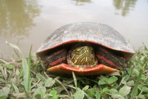
Birds and turtles are the only existing tetrapods, or land vertebrates, to have these red retinal oil droplets. In some birds and a few turtle species, red pigment produced by the gene is also used for external display: red beaks and feathers, or the red neck patches and rims of shells seen in species such as the painted turtle.
The scientists mined the genetic data of various bird and reptile species to reconstruct an evolutionary history of the CYP2J19 gene, and found that it dated back hundreds of millions of years in the ancient archelosaur genetic line — the ancestral lineage of turtles, birds and dinosaurs.
The findings, published in the journal Proceedings of the Royal Society B, provide evidence that the ‘red gene’ originated around 250 million years ago, predating the split of the turtle lineage from the archosaur line, and runs right the way through turtle and bird evolution.
Scientists say that, as dinosaurs split from this lineage after turtles, and were closely related to birds, this strongly suggests that they would have carried the CYP2J19 gene, and had the enhanced ‘red vision’ from the red retinal oil.
This may have even resulted in some dinosaurs producing bright red pigment for display purposes as well as color vision, as seen in some birds and turtles today, although researchers say this is more speculative.
“These findings are evidence that the red gene originated in the archelosaur lineage to produce red for color vision, and was much later independently deployed in both birds and turtles to be displayed in the red feathers and shells of some species, going from seeing red to being red,” says senior author Dr Nick Mundy, from the University of Cambridge’s Department of Zoology.
“This external redness was often sexually selected as an ‘honest signal’ of genuine high quality in a mate,” he says.
The previous research in zebra finches showed a possible link between red beaks and the ability to break down toxins in the body, suggesting external redness signals physiological quality, and there is some evidence that coloration in red-eared terrapins is also linked to honest signalling.
“The excellent red spectrum vision provided by the CYP2J19 gene would help female birds and turtles pick the brightest red males,” says Hanlu Twyman, the PhD student who is lead author on the work.
The structure of retinas in the eye includes cone-shaped photoreceptor cells. Unlike mammals, avian and turtle retinal cones contain a range of brightly-colored oil droplets, including green, yellow and red.
These oil droplets function in a similar way to filters on a camera lens. “By filtering the incoming light, the oil droplets lead to greater separation of the range of wavelengths that each cone responds to, creating much better color sensitivity,” explains Mundy.
“Humans can distinguish between some shades of red such as scarlet and crimson. However, birds and turtles can see a host of intermediate reds between these two shades, for example. Our work suggests that dinosaurs would have also had this ability to see a wide spectrum of redness,” he says.
Over hundreds of millennia of evolution, the CYP2J19 gene was independently deployed to generate the red pigments in the external displays of some bird species and a few turtle species. The scientists say their data indicate that co-option of CYP2J19 for red coloration in dinosaurs would also have been possible.
The ancestral lineage that led to scaly lizards and snakes split from the archosaur line before turtles, and, as the findings suggest, before the origin of the red gene. These reptiles either lack retinal oil droplets, or have yellow and green but not red.
However, the crocodilian lineage split from the archelosaur line after turtles, yet crocodiles appear to have lost the CYP2J19 gene, and have no oil droplets of any color in their retinal cones.
Mundy says there is some evidence that oil droplets were lost from the retinas of species that were nocturnal for long periods of their genetic past, and that this hypothesis fits for mammals and snakes, and may also be the case with crocodiles.
Reference:
Hanlu Twyman, Nicole Valenzuela, Robert Literman, Staffan Andersson, Nicholas I. Mundy. Seeing red to being red: conserved genetic mechanism for red cone oil droplets and co-option for red coloration in birds and turtles. Proceedings of the Royal Society B: Biological Sciences, 2016; 283 (1836): 20161208 DOI: 10.1098/rspb.2016.1208
Note: The above post is reprinted from materials provided by University of Cambridge. The original story is licensed under a Creative Commons Licence.
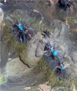
The Chao volcano in northern Chile with a lava coulée approx. 14.5 km long (centre of picture). The composition of the lava matches that of deposits of adjacent supervolcanic calderas. Chao erupted about 75,000 years ago, but zircon crystals in the lava were already forming in a subterranean magma reservoir for nearly three million years. Credit: Landsat 8, U.S. Geological Survey
Geoscientists from Heidelberg University have discovered accumulations of magma in the Andes sufficient to have set off a super-eruption but which, in fact, did not. Such eruptions, which expel enormous quantities of magma, are the largest volcanic events on earth. Together with colleagues from the USA, researchers from the Institute of Earth Sciences discovered that magma volumes of supervolcanic proportions have been continuously accumulating in the Altiplano-Puna region since the last super-eruption nearly 2.9 million years ago. These magmas, however, did not reach the surface to trigger a catastrophic eruption but instead slowly cooled at depth and hardened into plutonic rock. The results of the research were published in the journal Geology.
“A supervolcanic eruption spews out more than 1,000 cubic kilometres of magma, which accumulated over time in reservoirs close the earth’s surface,” explains Prof. Dr Axel Schmitt of the Institute of Earth Sciences. “In turn, these reservoirs are fed from deeper layers in the earth’s crust and the underlying mantle. During an eruption, the overlying rock layers collapse into the empty magma chamber and form depressions, known as calderas, of up to 100 kilometres in diameter.” Axel Schmitt indicates that there have been at least seven super-eruptions in the Altiplano-Puna region within the last ten million years, the most recent one about 2.9 million years ago. What remains unclear is why no further major eruptions have occurred since then and whether the region can now be considered inactive for such events.
Using samples from five comparatively small lava domes in northern Chile and southeast Bolivia, the Heidelberg researchers and their American colleagues investigated the most recent eruptions whose chemical composition matches the supervolcanic magmas from the region. They determined the age of very small zircon crystals from these lava flows with the aid of a high-spatial-resolution mass spectrometer. “The mineral zircon forms almost exclusively in magmas, so its age revealss when those magmas were present under the volcano,” explains Axel Schmitt. “The astonishing result was that the ages of the zircons measured from all five of the smaller volcanoes extended continuously from the time of the eruption 75,000 years ago back to the last supervolcanic eruption.”
Prof. Schmitt reports that model calculations demonstrated that zircon formation is only possible over such protracted durations if the inflow of magma amounted to approx. one cubic kilometre over 1,000 years, which is unusually high for a relatively small volcano. “This means that over a long period of time a magma volume of supervolcanic proportions must have accumulated under the five lava domes, which then solidified into plutonic rock at depth.” The volcanologist explains that the lack of a major volcanic eruption does not necessarily indicate that magmatic activity has come to a complete halt. Perhaps the rise in magma from deeper regions merely slowed during the last 2.9 million years, forming an enormous body of rock known as a pluton.
“However, our results also show that a relatively small increase in the long-term magma recharge from about one to five cubic kilometres in 1,000 years would recreate conditions favouring a catastrophic supervolcanic eruption. A new super-eruption in the Altiplano-Puna region would be possible, but only after a long lead time,” explains Prof. Schmitt.
Researchers from Oregon State University and the University of California in Los Angeles also contributed to the research.
Reference:
Casey R. Tierney, Axel K. Schmitt, Oscar M. Lovera, Shanaka L. de Silva. Voluminous plutonism during volcanic quiescence revealed by thermochemical modeling of zircon. Geology, 2016; 44 (8): 683 DOI: 10.1130/G37968.1
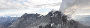
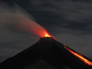
Eruptions at three volcanoes in Indonesia have darkened skies in parts of the archipelago and disrupted some flights.
Mount Rinjani on Lombok Island near Bali, the Sinabung volcano on Sumatra Island and Mount Gamalama in the Moluccas chain of islands have all erupted in the past couple of days.
No one has been injured, but flights at two airports have been disrupted.
Sultan Babullah airport in Ternate, the capital of North Maluku province, was closed Wednesday and Lombok’s international airport was closed for several hours on Tuesday.
The three mountains are among about 130 active volcanoes in Indonesia. The archipelago of 250 million people is prone to earthquakes and volcanoes because it sits along the Pacific “Ring of Fire,” a string of faults that lines the Pacific Ocean.
Sutopo Purwo Nugroho, the spokesman for Indonesia’s Disaster Mitigation Agency, said that Gamalama and Sinabung erupted again late Tuesday, blasting debris high into the air. Hot ash tumbled down the Sinabung slopes as far as 2,000 meters (yards) southward into a river.
Nugroho said that farms and trees around the three volcanoes were covered in gray ash, but nearby towns and villages were not in danger.
More than 13,000 people have been evacuated due to volcanic eruptions since last year, mostly from around the slopes of Sinabung.
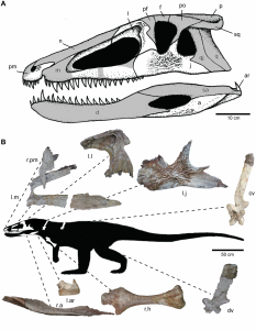
Skeletal reconstruction of Carnufex. Credit: Public Library of Science
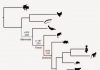
Did you know that birds and crocodiles are practically cousins? Around 230 million years ago, you wouldn’t have been able to tell the difference between the two different lineages. This is because birds and crocodilians (which includes alligators, caiman, and gharials) are part of a much larger group called Archosauria, or ruling lizards, which means they share a common ancestor far back in time. When they split from each other, they formed two major evolutionary pathways: the bird-line archosaurs, which also includes all dinosaurs, and the crocodile-line archosaurs, which includes crocodilians and their ancestors, the crocodylomorphs.
Back at around the time of this split, during a time known as the Late Triassic, the world was much more different than it was today. Small crocodylomorphs prowled the land, along with the earliest dinosaurs. There were a host of other bizarre reptiles, such as the predatory rauisuchids, which might be closely related to the first crocodylomorphs, and small, fox-like sphenosuchians.
One of these was an animal known as Carnufex. Not only is that an awesome name, but it was also an impressive beasty to withhold, coming in at around 3 metres in length. It had serrated teeth for tearing apart its prey, and a long, slender body for rapid movement. Importantly, it is from around the time when this dinosaur-crocodile split occurred, and therefore should hold important clues to the evolutionary history of these groups.
Susan Drymala and Lindsay Zanno from North Carolina recognised the importance of Carnufex in helping to solve the dinosaur-crocodile divergence issue, and set out to conduct an impressive anatomical assessment of the well-preserved fossils. The fossils belonging to Carnufex also come from North Carolina, and were first discovered in 2003. They consist mostly of skull material, which is important for determining diagnostic relationships in archosaurs, and several bits of the spine and limbs.
By analysing the anatomy of Carnufex along with a large range of other similar animals, they were able to work out its evolutionary relationships. What they found is that, quite like many early diverging species, Carnufex had a mosaic of features, some more crocodilian, some more dinosaurian.
What this implies is that Carnufex is actually one of the earliest diverging crocodylomorphs, and therefore was highly important in determining the early fate of this ancient group. It was closely related to another crocodylomorph called Redondavenator, which was also fairly hefty in size.
This is important for several reasons. Carnufex was no tiddly croc, but a pretty large and fearsome predator. Other crocodylomorphs around at this time were usually small, nimble hunters, quite different from Carnufex. What this means is that the very first crocodylomorphs, such as Carnufex, were much larger than we previously thought, and developed their smaller body size later on, something which we can trace based on their evolutionary relationships. This also means that evolution of a smaller body size was something that occurred subsequent to the acquisition of features defining crocodylomorphs, rather than before.
In the Late Triassic, this means that Carnufex would have been one of the top predators roaming the plains of North America. This is quite exceptional, as other crocodylomorphs at the time were by no means top tier predators, with this role usually taken on by other now extinct archosaurs. Shortly after (geologically speaking..) Carnufex, this top predator tier was taken by theropod dinosaurs, which went on to dominate for around 150 million years.
What is clear is that Carnufex was a key stage in crocodylomorph evolution, and may have been critical in helping them survive the end-Triassic mass extinction, which took out almost all other archosaur groups around at the time.
Reference:
Susan M. Drymala et al. Osteology of Carnufex carolinensis (Archosauria: Psuedosuchia) from the Pekin Formation of North Carolina and Its Implications for Early Crocodylomorph Evolution, PLOS ONE (2016). DOI: 10.1371/journal.pone.0157528