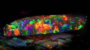
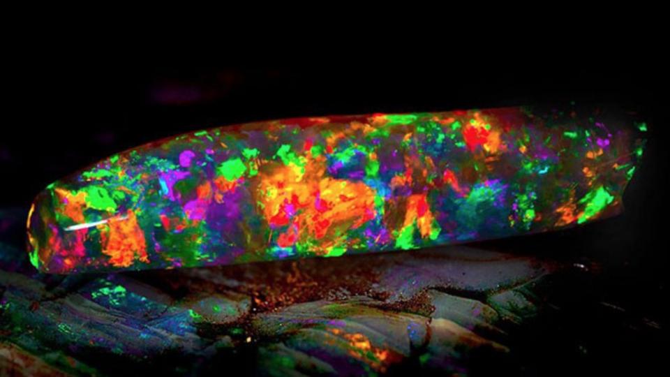
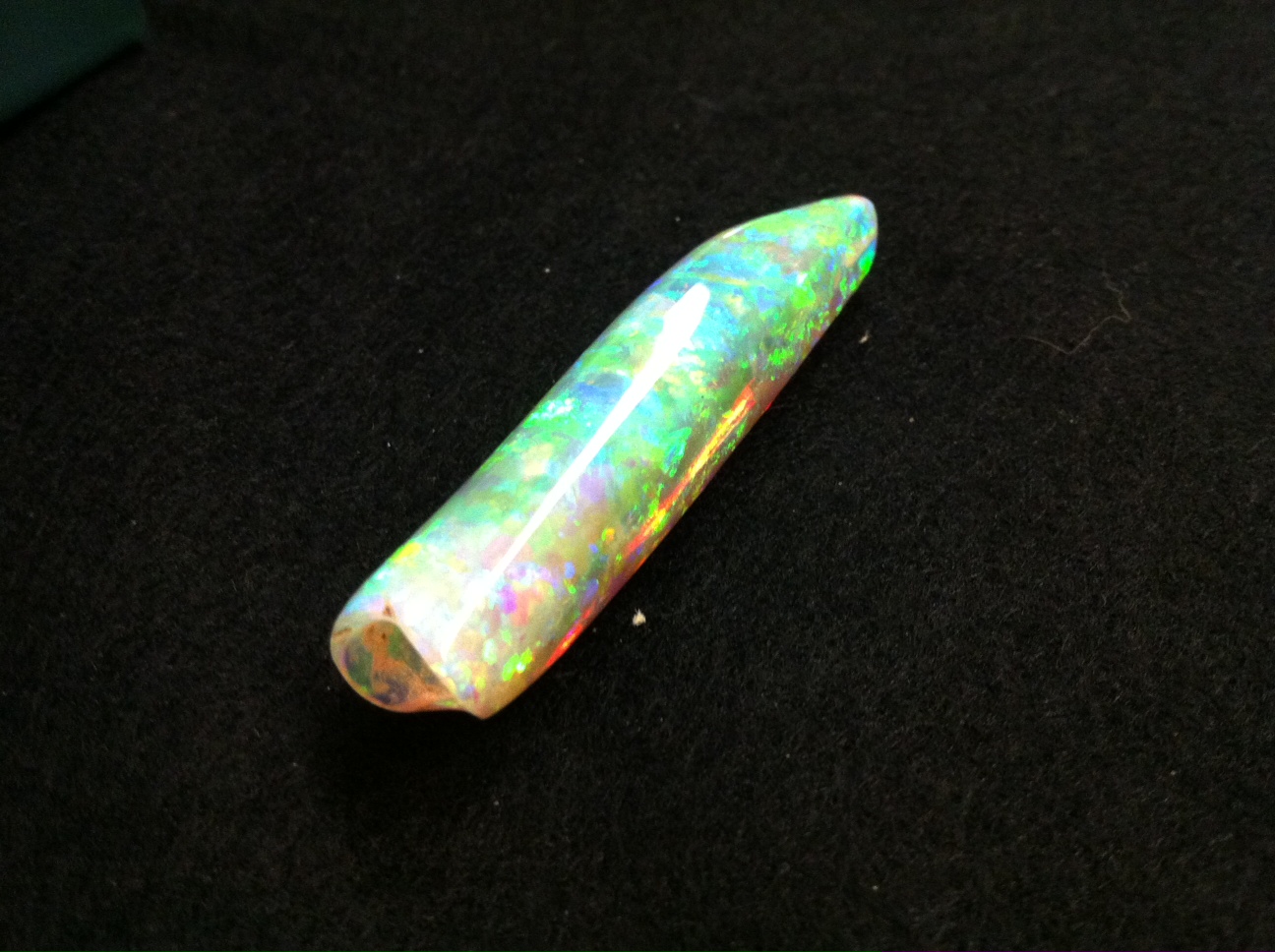
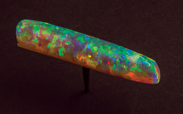
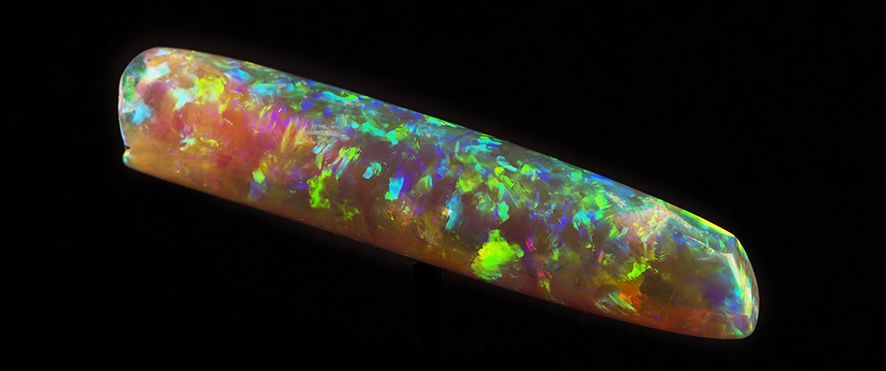
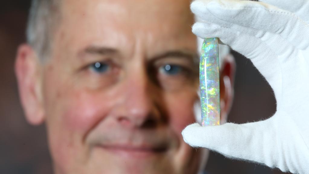
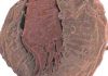
The Virgin Rainbow opal from the South Australian Museum opal exhibition. Credit: South Australian Museum.
How the excavation of a disused mineshaft lead to the discovery of the million-dollar Virgin Rainbow, the “most spectacular piece of opal ever unearthed”.
John Dunstan has been mining for opals out in the desert soil of Coober Pedy for nearly 50 years, but he has never found a gemstone better than the one he uncovered in 2003.
The Virgin Rainbow, as it’s now known, goes on display at the South Australian Museum in Adelaide as the centrepiece of an exhibition created to celebrate this year’s centenary of opal mining in Australia.
It is said to glow with an internal fire, catching the available light and sending it back in a brilliant rainbow.
The Belemnite “pipe” – an opal formed over millions of years in the skeleton of an extinct ancestor of the modern cuttlefish – was dislodged while John was digging into the workings of an old mineshaft with an excavator.
But he said it took a while for the gem’s beauty to reveal itself among the rubble.
“It showed this beautiful colour on the tip, but it was still in this hard lump of sandstone,” John explained.
“So we cleaned it off and we could see it was a nice piece, but we didn’t know if it was solid, because a lot of time they’ve got sand in them or intrusions.
“There was a thick skin on it, like a rusty band around it, so we cleaned that off, and every time we touched it some more colour would come out. It was a true gemstone.”
John said it wasn’t until he took the opal home and began working it over and cleaning it with a grinding wheel that its true significance hit home.
“I knew it was one of the best ever,” he said.
“You’ll never see another piece like that one, it’s so special.
“That opal actually glows in the dark – the darker the light, the more colour comes out of it, it’s unbelievable.
“I’ve done a lot of cutting and polishing [of opals], I’ve been doing it for 50 years, but when you compare it to the other pieces that claim to be the best ever, this one just killed it.”
The Virgin Rainbow was first put up for auction, but John said none of the bids received matched what he expected for such a precious stone now valued at more than $1 million.
He said the eventual offer from the South Australian Museum was ultimately the best option, as it would keep the opal in Australia.
As part of the museum’s exhibition next month, the Virgin Rainbow will join a collection of opalised fossils from the inland sea which once covered outback South Australia, including the skeleton of a 6m long Addyman Plesiosaur.
Coober Pedy District Council tourism officer Duncan McLaren said there are hopes the exhibition will drive tourism to the remote South Australian town, perhaps with some of the visitors looking to find the next Virgin Rainbow.
“It would be a hope it would whet the appetite of people to learn more about opals, to come and see where the opal actually comes from and to see the real thing in the flesh, so to speak,” he said.
“So the value is really the quality of the exhibition in terms of its educational abilities, to show people a little bit of Coober Pedy without them actually having to come up to Coober Pedy.”
Even though he pulled it from its ancient home, John said will still have to get in line with the rest of the public to catch a glimpse of the opal’s vibrant colours. “Fire Opal : What Is Fire Opal? How Is Fire Opal Formed?”
“I urge all people to go have a look at it, because it’s a once in a lifetime piece,” he said.
“I’ll be going down to see it for sure.”
Virgin Rainbow
1 of 5
The Virgin Rainbow opal from the South Australian Museum opal exhibition. Credit: South Australian Museum.
virgin rainbow opal, worth over $1 million Photo Credit: Michael Clements
Photo Credit: Denis Smith/South Australian Museum
SA Museum director Brian Oldman with the Virgin Rainbow Opal, estimated worth in excess of $1 million. Photo credit: Stephen Laffer
Note: The above post is reprinted from materials provided by ABC. The original article was written by Michael Dulaney.
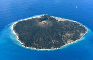
A aerial views shows the pacific island of Nishinoshima, also known as Rosario Island, where researchers started surveillance activities for the first time since its eruption in 2013, some 1,000 kilometers south of Tokyo, Japan October 20, 2016. Mandatory credit Kyodo/via REUTERS
Japanese scientists are getting an up-close lesson on how volcanic islands are formed.
Last week, they landed on Nishinoshima, which was just a rocky outcropping in the Pacific Ocean until two years ago, when spectacular eruptions spewed lava and ash, expanding it to 12 times its size.
Aerial footage of the island, about 1,000 km (620 miles) south of Tokyo, showed a cone in the middle surrounded by vegetation.
Researchers from the Environment Ministry who swam the final distance from a small boat to the island to minimize biological contamination were the first people to set foot on the expanded island on Oct. 20.
They collected rock, plant and insect samples and observed the first colonization of the island by masked gannets, a large seafaring bird.
In 2013, an eruption next to Nishinoshima, a cluster of rocks barely 650 meters long and 200 meters wide (2,132 ft by 656 ft), swallowed the outcropping and grew into a 2.7 square kilometer (1.04 square mile) island, bigger than the city state of Monaco.
Aside from ecological research, the team hopes to collect samples of lava and ash to learn more about the growth process of a volcanic island.
They also planted several seismic monitors around the uninhabited island.
Studying volcanoes is high priority for Japan, which lies on the “Ring of Fire”, a horseshoe-shaped band of fault lines and volcanoes around the Pacific Ocean.
Note: The above post is reprinted from materials Reporting by Reuters Television, Writing by Malcolm Foster.
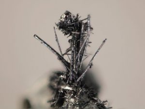
The tiny whiskers, which look to the naked eye like very fine hairs on other larger crystals, have probably been regularly cleaned off their host rocks. Credit: Michigan Tech, John Jaszczak
In the age of fast-paced global communication, it’s no wonder that teasing apart the anatomy of the new mineral merelaniite took a team from around the world. Most mineral discoveries start with boots on the ground—or, rather, below the ground. The Merelani mining district is a well-known locale. Not only for prized tanzanite and tsavorite used in jewelry, but also for hosting a suite of other minerals increasingly prized by mineral collectors.
“The Merelani district has been famous since the late 1960s for the blue gem variety of zoisite known as tanzanite, but this is really a mineral collector’s paradise and an exciting place to look for new minerals,” says John Jaszczak, a physics professor at Michigan Tech and the lead author on a new study published in Minerals that describes the new mineral. “The importance of the area is the reason we wanted to give tribute to the miners and name merelaniite for the district.”
There are 5,179 minerals listed by the International Mineralogical Association and their Commission on New Minerals, Nomenclature and Classification (CNMNC) receive more than 80 proposals each year for new ones. Many turn out to be variations of existing minerals. To discern the new from the variable, Jaszzak and his team put the tiny merelaniite whiskers through a battery of rigorous tests, particularly to discern its chemistry and crystal structure.
“It is one thing to find a mineral that is probably new, it is quite another thing to be able to perform all of the required analyses to satisfy the CNMNC for approval of its status and a new name,” Jaszczak says.
Atomic Details
Jaszczak teamed up with Mike Rumsey and John Spratt at the Natural History Museum in London to determine the chemical composition of the new mineral with precision. To help with understanding the crystal structure, Steve Hackney, professor of materials science at Michigan Tech, was able to provide crucial high-resolution images and diffraction patterns using transmission electron microscopy on ultrathin samples prepared with a diamond knife by Owen Mills, director of Michigan Tech’s Applied Chemical & Morphological Analysis Laboratory.
The growing team then sought out the help of Luca Bindi, a professor at the Università di Firenze in Italy and an expert in solving complicated crystals structures. He helped run x-ray diffraction studies to put all of the pieces together. The results revealed a complex structure made up of layers of molybdenum disulfide alternating at the atomic scale with layers of lead sulfide, along with other elements, including vanadium, antimony, bismuth, and selenium. The layers curve inward, growing into a scroll-like cylinder.
Although it is not a showcase gem, merelaniite is attractive, and as the analyses show, it has an intricate, microscopic internal beauty as well. A better understanding of the crystal chemistry of these exotic materials may eventually find useful applications.
Echoing physicist Richard Feynman, Jaszczak notes, “Science is about taking pleasure in finding things out and we’re delighted to have uncovered and described this beautiful new mineral.”
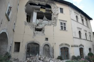
A building in the village of Visso, central Italy, is damaged following twin earthquakes on October 26, 2016
The powerful tremors which shook central Italy on Wednesday were the product of a new earthquake rather than aftershocks from one that devastated the town of Amatrice in August, Italian experts say.
“It wasn’t an aftershock, it was a new earthquake,” Mario Tozzi of the national institute for environmental geology and geo-engineering (IGAG) told AFP.
“What we do not know is whether it was a dormant section of the Amatrice fault or a parallel structure, a close cousin of this fault,” he added.
Tozzi said Wednesday’s ‘double-hit’ quake, in which an initial tremor of 5.5 magnitude was followed by one of 6.1, was typical of the central Appenine mountains.
He recalled the 1997 Assisi earthquake in which four workers were killed when a second shock struck while they inspecting buildings damaged the previous day.
“In the coming months we can expect a series of after shocks but they should get progressively weaker,” Tozzi said, while stressing it was impossible to rule out another major quake in the short term.
Much of Italy’s land mass and some of its surrounding waters are prone to seismic activity with the highest risk concentrated along its mountainous central spine.
Nearly 300 died in the Amatrice disaster in August and just over 300 perished when a quake struck near the city of L’Aquila in 2009.
In 1980 tremors near Naples left 3,000 dead and an estimated 95,000 died in the 1908 Messina disaster, when a quake in the waters between mainland Italy and Sicily sent massive waves crashing into both coasts.
Italy straddles the Eurasian and African tectonic plates, making it vulnerable to seismic activity when they move.
The movement of the plates is slowly pushing the country northwards at a rate which, experts predict, could result in it becoming attached to what is now Croatia in around 20 million years time.
Note: The above post is reprinted from materials provided by AFP.
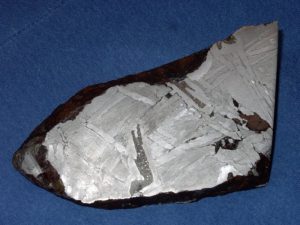
This 15cm wide fragment of the Seymchan meteorite found in Russia in 1967 is an iron-nickel pallasite. The long filament of dark grey material in the center is schreibersite. Credit: University of South Florida.
Meteorites that crashed onto Earth billions of years ago may have provided the phosphorous essential to the biological systems of terrestrial life. The meteorites are believed to have contained a phosphorus-bearing mineral called schreibersite, and scientists have recently developed a synthetic version that reacts chemically with organic molecules, showing its potential as a nutrient for life.
Phosphorus is one of life’s most vital components, but often goes unheralded. It helps form the backbone of the long chains of nucleotides that create RNA and DNA; it is part of the phospholipids in cell membranes; and is a building block of the coenzyme used as an energy carrier in cells, adenosine triphosphate (ATP).
Yet the majority of phosphorus on Earth is found in the form of inert phosphates that are insoluble in water and are generally unable to react with organic molecules. This appears at odds with phosphorus’ ubiquity in biochemistry, so how did phosphorus end up being critical to life?
In 2004, Matthew Pasek, an astrobiologist and geochemist from the University of South Florida, developed the idea that schreibersite [(Fe, Ni)3P], which is found in a range of meteorites from chondrites to stony–iron pallasites, could be the original source of life’s phosphorus. Because the phosphorus within schreibersite is a phosphide, which is a compound containing a phosphorus ion bonded to a metal, it behaves in a more reactive fashion than the phosphate typically found on Earth.
Finding naturally-formed schreibersite to use in laboratory experiments can be time consuming when harvesting from newly-fallen meteorites and expensive when buying from private collectors. Instead, it has become easier to produce schreibersite synthetically for use in the laboratory.
Natural schreibersite is an alloy of iron, phosphorous and nickel, but the common form of synthetic schreibersite that has typically been used in experiments is made of just iron and phosphorus, and is easily obtainable as a natural byproduct of iron manufacturing. Previous experiments have indicated it reacts with organics to form chemical bonds with oxygen, the first step towards integrating phosphorous into biological systems.
However, since natural schreibersite also incorporates nickel, some scientific criticism has pointed out that the nickel could potentially alter the chemistry of the mineral, rendering it non-reactive despite the presence phosphides. If this were the case it would mean that the experiments with the iron–phosphorous synthetic schreibersite would not represent the behavior of the mineral in nature.
Since the natural version incorporates nickel, there has always been the worry that the synthetic version is not representative of how schreibersite actually reacts and that the nickel might somehow hamper those chemical reactions.
“There was always this criticism that if we did include nickel it might not react as much,” says Pasek.
Pasek and his colleagues have addressed this criticism by developing a synthetic form of schreibersite that includes nickel.
Nickel-flavored schreibersite
In a recent paper published in the journal Physical Chemistry Chemical Physics, Pasek and lead author and geochemist Nikita La Cruz of the University of Michigan show how a form of synthetic schreibersite that includes nickel reacts when exposed to water. The work was supported by the Exobiology and Evolutionary Biology element of the NASA Astrobiology Program. As the water evaporates, it creates phosphorus–oxygen (P–O) bonds on the surface of the schreibersite, making the phosphorus bioavailable to life. The findings seem to remove any doubts as to whether meteoritic schreibersite could stimulate organic reactions.
“Biological systems have a phosphorus atom surrounded by four oxygen atoms, so the first step is to put one oxygen atom and one phosphorous atom together in a single P–O bond,” Pasek explains.
Terry Kee, a geochemist at the University of Leeds and president of the Astrobiology Society of Britain, has conducted his own extensive work with schreibersite and, along with Pasek, is one of the original champions of the idea that it could be the source of life’s phosphorus.
“The bottom line of what [La Cruz and Pasek] have done is that it appears that this form of nickel-flavored synthetic schreibersite reacts pretty much the same as the previous synthetic form of schreibersite,” he says.
This puts to rest any criticism that previous experiments lacked nickel.
Shallow pools and volcanic vents
Pasek describes how meteors would have fallen into shallow pools of water on ancient Earth. The pools would then have undergone cycles of evaporation and rehydration, a crucial process for chemical reactions to take place. As the surface of the schreibersite dries, it allows molecules to join into longer chains. Then, when the water returns, these chains become mobile, bumping into other chains. When the pool dries out again, the chains bond and build ever larger structures.
“The reactions need to lose water in some way in order to build the molecules that make up life,” says Pasek. “If you have a long enough system with enough complex organics then, hypothetically, you could build longer and longer polymers to make bigger pieces of RNA. The idea is that at some point you might have enough RNA to begin to catalyze other reactions, starting a chain reaction that builds up to some sort of primitive biochemistry, but there’s still a lot of steps we don’t understand.”
Demonstrating that nickel-flavored schreibersite, of the sort contained in meteorites, can produce phosphorus-based chemistry is exciting. However, Kee says further evidence is needed to show that the raw materials of life on Earth came from space.
“I wouldn’t necessarily say that the meteoric origin of phosphorus is the strongest idea,” he says. “Although it’s certainly one of the more pre-biotically plausible routes.”
Despite having co-developed much of the theory behind schreibersite with Pasek, Kee points out that hydrothermal vents could rival the meteoritic model. Deep sea volcanic vents are already known to produce iron-nickel alloys such as awaruite and Kee says that the search is now on for the existence of awaruite’s phosphide equivalent in the vents: schreibersite.
“If it could be shown that schreibersite can be produced in the conditions found in vents — and I think those conditions are highly conducive to forming schreibersite — then you’ve got the potential for a lot of interesting phosphorylation chemistry to take place,” says Kee.
Pasek agrees that hydrothermal vents could prove a good environment to promote phosphorus chemistry with the heat driving off the water to allow the P–O bonds to form. “Essentially it’s this driving off of water that you’ve got to look for,” he adds.
Pasek and Kee both agree that it is possible that both mechanisms — the meteorites in the shallow pools and the deep sea hydrothermal vents — could have been at work during the same time period and provided phosphorus for life on the young Earth.
Meanwhile David Deamer, a biologist from the University of California, Santa Cruz, has gone one step further by merging the two models, describing schreibersite reacting in hydrothermal fields of bubbling shallow pools in volcanic locations similar to those found today in locations such as Iceland or Yellowstone.
Certainly, La Cruz and Pasek’s results indicate that schreibersite becomes more reactive the warmer the environment in which it exists.
“Although we see the reaction occurring at room temperature, if you increase the temperature to 60 or 80 degree Celsius, you get increased reactivity,” says Pasek. “So, hypothetically, if you have a warmer Earth you should get more reactivity.”
One twist to the tale is the possibility that phosphorus could have bonded with oxygen in space, beginning the construction of life’s molecules before ever reaching Earth. Schreibersite-rich grains coated in ice and then heated by shocks in planet-forming disks of gas and dust could potentially have provided conditions suitable for simple biochemistry. While Pasek agrees in principle, he says he has “a hard time seeing bigger things like RNA or DNA forming in space without fluid to promote them.”
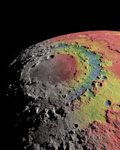
The Moon’s Orientale basin is surrounded by distinct right structures. The image shows the basin’s gravitational signature (red indicates excess mass, blue indicates mass deficits), which scientists used to reconstruct the formation of the basin and its rings. Ernest Wright, NASA/GSFC Scientific Visualization Studio.)
The Moon’s Orientale basin is an archetype of “multi-ring” basins found throughout the solar system. New research reveals how those rings were formed.
Using data from NASA’s Gravity Recovery and Interior Laboratory (GRAIL) mission, scientists have shed new light on the formation of a huge bull’s-eye-shaped impact feature on the Moon. The findings, described in two papers published in the journal Science, could help scientists better understand how these kinds of giant impacts influenced the early evolution of the Moon, Mars and Earth.
Formed about 3.8 billion years ago, the Orientale basin is located on the southwestern edge of the Moon’s nearside, just barely visible from Earth. The basin’s most prominent features are three concentric rings of rock, the outermost of which has a diameter of nearly 580 miles.
Scientists have debated for years about how those rings formed. Thanks to targeted close passes over Orientale by the twin GRAIL spacecraft in 2012, mission scientists think they’ve finally figured it out. The GRAIL data revealed new details about the interior structure of Orientale. Scientists used that information to calibrate a computer model that, for the first time, was able to recreate the rings’ formation.
“Big impacts like the one that formed Orientale were the most important drivers of change on planetary crusts in the early solar system,” said Brandon Johnson, a geologist at Brown University, lead author of one of the papers and a co-author of the other. “Thanks to the tremendous data supplied by GRAIL, we have a much better idea of how these basins form, and we can apply that knowledge to big basins on other planets and moons.”
In one of the Science papers, a research team led by MIT’s Maria Zuber, a Brown Ph.D. graduate, performed a detailed examination of the data returned by GRAIL.
“In the past, our view of Orientale basin was largely related to its surface features, but we didn’t know what the subsurface structure looked like in detail. It’s like trying to understand how the human body works by just looking at the surface,” said Jim Head, a geologist at Brown, GRAIL science team member and co-author of the research. “The beauty of the GRAIL data is that it is like putting Orientale in an x-ray machine and learning in great detail what the surface features correspond to in the subsurface.”
One of the key mysteries the data helped to solve involves the size and location of Orientale’s transient crater, the initial depression created when the impactor blasted material away from the surface. In smaller impacts, that initial crater is left behind. But in larger collisions, the rebound of the surface following the impact can sometimes obliterate any trace of that initial impact point.
Some researchers had thought that one of Orientale’s rings might represent the remains of the transient crater. But the GRAIL data showed that’s not the case. Instead Orientale’s gravity signature suggests the transient crater was somewhere between its two inner rings, measuring between 200 and 300 miles across. Any recognizable surface remnants of that crater were erased by the aftermath of the collision.
Constraining the size of the transient crater enabled to team to estimate how much material was blasted out of the surface during the collision. The team calculates that about 816,000 cubic miles of rock was blasted away. For Head, those findings helped to tie together years for research on Orientale.
“I wrote my first paper on the Orientale Basin in 1974, over forty years ago, and I have been studying it ever since,” he said. “We now know what parts of the crust were removed, what parts of the mantle and deeper interior were uplifted, and how much ejecta was redistributed over the whole Moon.”
Modeling Orientale’s rings
For the other paper, Johnson led a team of researchers who used the GRAIL data to develop a computer model of the impact and its aftermath. The model that best fit the GRAIL data estimates that Orientale was formed by an object about 40 miles across traveling at about 9 miles per second.
The model was able to recreate Orientale’s rings and explain how they formed. It showed that as the crust rebounded following the impact, warm and ductile rocks in the subsurface flowed inward toward the impact point. That inward flow caused the crust above to crack and slip, forming the cliffs, several kilometers high, that compose the outer two rings.
The innermost ring was formed by a different process. In smaller impacts, the rebound of the crust can form a mound of material in the center of a crater, called a central peak. But Orientale’s central peak was too large to be stable. That material flowed back outward, eventually mounding in a circular fashion, forming the inner ring.
“This was a really intense process,” Johnson said. “These several-kilometer cliffs and the central ring all formed within minutes of the initial impact.”
This is the first time a model has been able to reproduce these rings, Johnson said.
“GRAIL provided the data we needed to provide a foundation for the models,” he said. “That gives us confidence that we’re capturing the processes that actually formed these rings.”
Ring basins elsewhere
Orientale is the youngest and best-preserved example of a multi-ring basin anywhere in the solar system, but it’s certainly not the only one. Armed with an understanding of Orientale, scientists can investigate how these processes play out elsewhere.
“There are several basins of this kind on Mars,” Johnson said “But compared to the Moon, there’s a lot more geology that happened after these impacts that degrades them. Now that we have a better understanding of how the basins formed, we can make better sense of the processes that came after.”
Head says that this research is yet another example of how our own Moon helps us understand the rest of the solar system.
“The Moon in some ways is a laboratory full of well-preserved features that we can analyze in great detail,” Head said. “Thanks to Maria Zuber’s leadership, GRAIL continues to help us understand how the Moon evolved and how those processes relate to other planets and moons.”
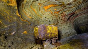
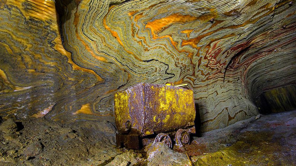
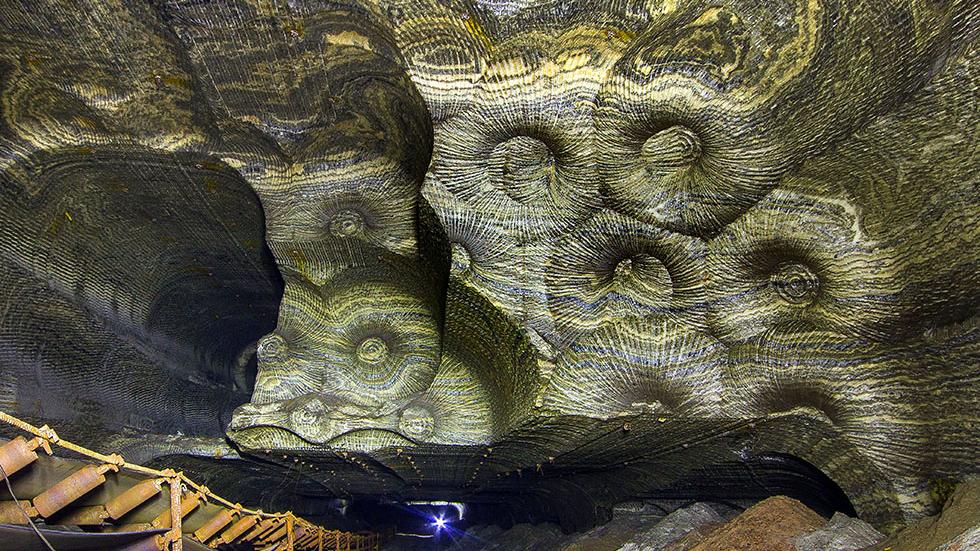
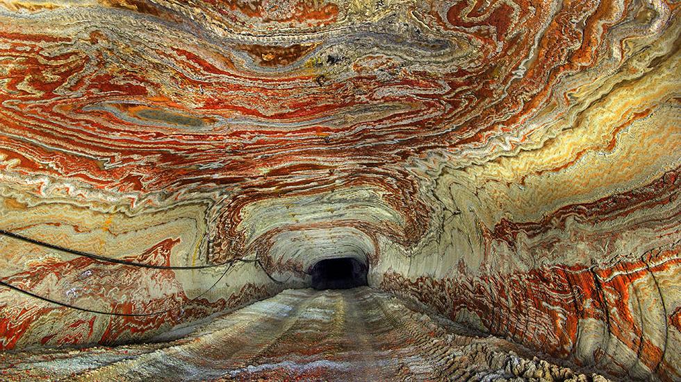
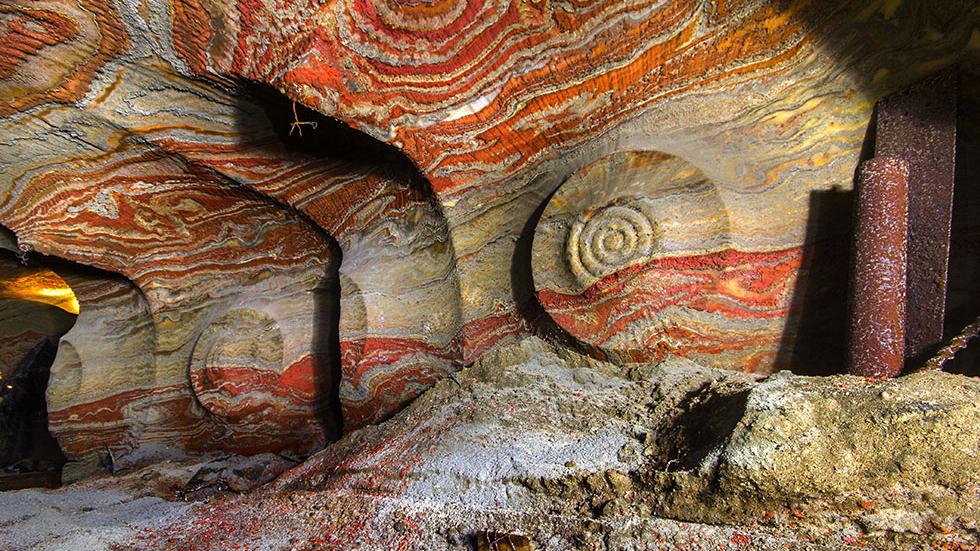
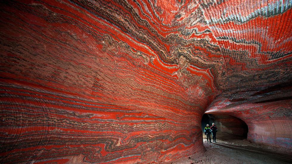
Hundreds of feet below a Russian city is an abandoned salt mine which might as well be the inside of a rave.
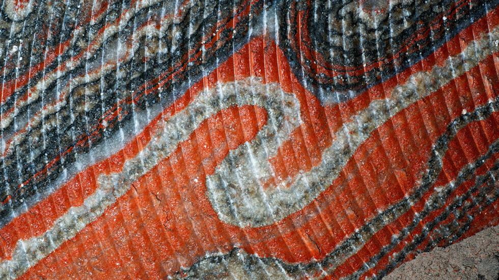
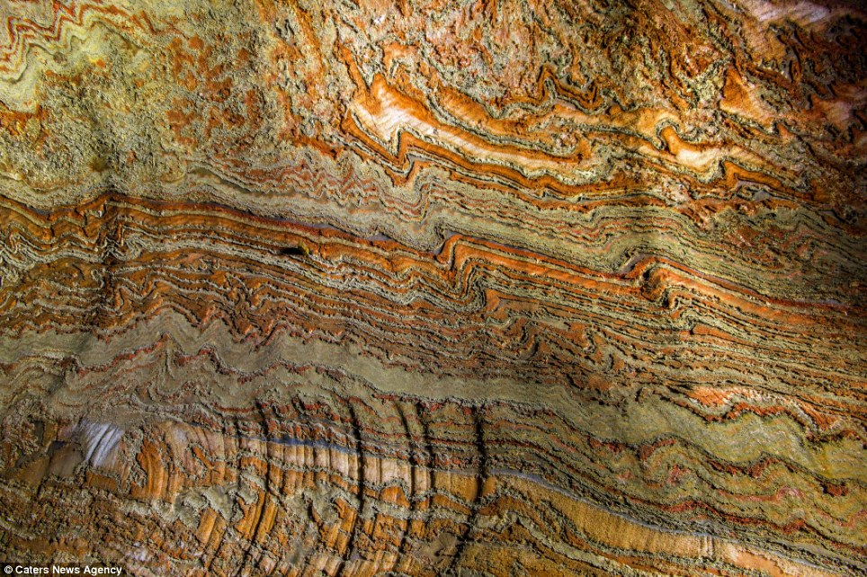
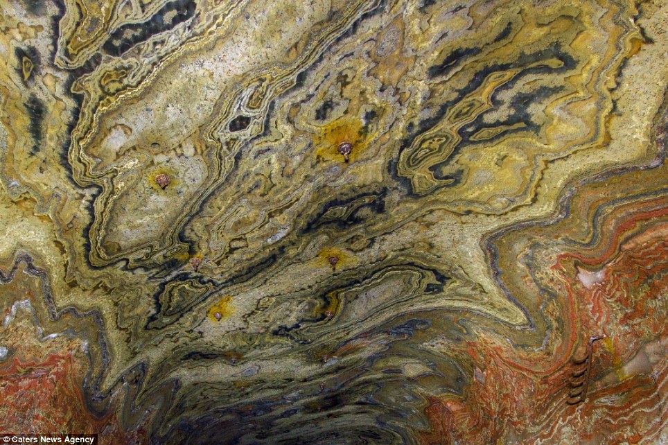
The walls are covered with psychedelic patterns, caused by the natural layers of mineral carnallite creating swirls throughout the coloured rock.
Carnallite is used in the process of plant fertilisation, and is most often yellow to white or reddish, but can sometimes be blue or even completely colourless.
These photos were taken deep underground within the miles of abandoned mines beneath Yekaterinburg, Russia. Layers of carnallite — a mineral used in fertilizers — band the tunnel walls, producing these technicolor masterpieces. Think a subterranean version of China’s stunning rainbow mountains.
Researchers have identified the first known example of fossilised brain tissue in a dinosaur from Sussex. The tissues resemble those seen in modern crocodiles and birds.
An unassuming brown pebble, found more than a decade ago by a fossil hunter in Sussex, has been confirmed as the first example of fossilised brain tissue from a dinosaur.
The fossil, most likely from a species closely related to Iguanodon, displays distinct similarities to the brains of modern-day crocodiles and birds. Meninges — the tough tissues surrounding the actual brain — as well as tiny capillaries and portions of adjacent cortical tissues have been preserved as mineralised ‘ghosts’.
The results are reported in a Special Publication of the Geological Society of London, published in tribute to Professor Martin Brasier of the University of Oxford, who died in 2014. Brasier and Dr David Norman from the University of Cambridge co-ordinated the research into this particular fossil during the years prior to Brasier’s untimely death in a road traffic accident.
The fossilised brain, found by fossil hunter Jamie Hiscocks near Bexhill in Sussex in 2004, is most likely from a species similar to Iguanodon: a large herbivorous dinosaur that lived during the Early Cretaceous Period, about 133 million years ago.
Finding fossilised soft tissue, especially brain tissue, is very rare, which makes understanding the evolutionary history of such tissue difficult. “The chances of preserving brain tissue are incredibly small, so the discovery of this specimen is astonishing,” said co-author Dr Alex Liu of Cambridge’s Department of Earth Sciences, who was one of Brasier’s PhD students in Oxford at the time that studies of the fossil began.
According to the researchers, the reason this particular piece of brain tissue has been so well-preserved is that the dinosaur’s brain was essentially ‘pickled’ in a highly acidic and low-oxygen body of water — similar to a bog or swamp — shortly after its death. This allowed the soft tissues to become mineralised before they decayed away completely, so that they could be preserved.
“What we think happened is that this particular dinosaur died in or near a body of water, and its head ended up partially buried in the sediment at the bottom,” said Norman. “Since the water had little oxygen and was very acidic, the soft tissues of the brain were likely preserved and cast before the rest of its body was buried in the sediment.”
Working with colleagues from the University of Western Australia, the researchers used scanning electron microscope (SEM) techniques in order to identify the tough membranes, or meninges, that surrounded the brain itself, as well as strands of collagen and blood vessels. Structures that could represent tissues from the brain cortex (its outer layer of neural tissue), interwoven with delicate capillaries, also appear to be present. The structure of the fossilised brain, and in particular that of the meninges, shows similarities with the brains of modern-day descendants of dinosaurs, namely birds and crocodiles.
In typical reptiles, the brain has the shape of a sausage, surrounded by a dense region of blood vessels and thin-walled vascular chambers (sinuses) that serve as a blood drainage system. The brain itself only takes up about half of the space within the cranial cavity.
In contrast, the tissue in the fossilised brain appears to have been pressed directly against the skull, raising the possibility that some dinosaurs had large brains which filled much more of the cranial cavity. However, the researchers caution against drawing any conclusions about the intelligence of dinosaurs from this particular fossil, and say that it is most likely that during death and burial the head of this dinosaur became overturned, so that as the brain decayed, gravity caused it to collapse and become pressed against the bony roof of the cavity.
“As we can’t see the lobes of the brain itself, we can’t say for sure how big this dinosaur’s brain was,” said Norman. “Of course, it’s entirely possible that dinosaurs had bigger brains than we give them credit for, but we can’t tell from this specimen alone. What’s truly remarkable is that conditions were just right in order to allow preservation of the brain tissue — hopefully this is the first of many such discoveries.”
“I have always believed I had something special. I noticed there was something odd about the preservation, and soft tissue preservation did go through my mind. Martin realised its potential significance right at the beginning, but it wasn’t until years later that its true significance came to be realised,” said paper co-author Jamie Hiscocks, the man who discovered the specimen. “In his initial email to me, Martin asked if I’d ever heard of dinosaur brain cells being preserved in the fossil record. I knew exactly what he was getting at. I was amazed to hear this coming from a world renowned expert like him.”
The research was funded in part by the Natural Environment Research Council (NERC) and Christ’s College, Cambridge.
Reference:
Martin D. Brasier, David B. Norman, Alexander G. Liu, Laura J. Cotton, Jamie E. H. Hiscocks, Russell J. Garwood, Jonathan B. Antcliffe, and David Wacey. Remarkable preservation of brain tissues in an Early Cretaceous iguanodontian dinosaur. Earth System Evolution and Early Life: a Celebration of the Work of Martin Brasier, Geological Society, London, Special Publications. 2016; 448 DOI: 10.1144/SP448.3
Note: The above post is reprinted from materials provided by University of Cambridge. The original story is licensed under a Creative Commons Licence.
An illustration by Jacob Biewer Credit: Society of Vertebrate Paleontology
The ancient coastal waters of the Pacific, roughly 11 to 5 million years ago, were home to a bizarre and fascinating species of giant salmon with large spike-like teeth. This spike-toothed salmon reached sizes of 3 to 9 feet in length (1-3 meters), much larger than the typical salmon found in the Pacific today. These hefty spike-toothed fish would have made for a difficult catch at nearly 400 pounds (177 kg). The spike-like teeth of the salmon could be over an inch long (3 cm), much longer than modern Pacific salmon teeth, even after compensating for their larger size. Researchers from California State University in Turlock, California have been studying the strange teeth of these unusual fish and discovered some tantalizing clues into their past behavior and life history.
Much like modern Pacific salmon, the giant salmon was likely primarily a filter-feeder, so the spike teeth were probably not part of catching prey. Modern salmon go through physical changes in their body, especially their skull, before migrating upriver to spawn where males will fight to defend the eggs they have fertilized. To see if these teeth played an important role in breeding of the giant fossil salmon, the team of researchers, led by Dr. Julia Sankey, compared 51 different fossils from ancient deposits of both freshwater and saltwater environments. The teeth of these salmon found in past freshwater environments consistently had longer, more recurved teeth with much larger bases, as well as showed clear signs of wear. Fossil salmon teeth from saltwater deposits were much smaller and less worn. This indicates that they changed prior to migration upriver to spawn.
These results help show that these impressive spike-like teeth of the giant salmon are indeed used as part of the breeding process in these extinct fish. Researchers think it is likely these hefty bruisers were using their spike-like teeth for fighting and display against each other during the spawning season, up in the ancient rivers of California. “These giant, spike-toothed salmon were amazing fish. You can picture them getting scooped out of the Proto-Tuolumne River [near Modesto, California] by large bears 5 million years ago.” said Dr. Sankey “Scientifically, our research on the giant salmon is filling in a gap in our knowledge about how these salmon lived, and specifically, if they developmentally changed prior to migration upriver like modern salmon do today. This research is also helping paint the picture of this area 5 million years ago for the general public and my college students, and it excites them to think of this giant salmon swimming up our local rivers 5 million years ago!”. Dr.Sankey and colleagues presented their research at this year’s meeting of the Society of Vertebrate Paleontology in Salt Lake City, Utah.
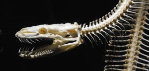
Snakes are a very diverse group of present-day reptiles, with nearly 3,600 known species. They are readily recognized by their long bodies and lack of limbs. The origin of snakes from lizard-like precursors with paired limbs has long been a controversial subject. This reflects the lack of fossils and conflicting results from phylogenetic assessments using molecules and anatomy, respectively. Thus a 2015 report announcing discovery of a 110-million-year-old skeleton of a snake-like reptile from the Cretaceous of Brazil generated worldwide interest.
Many researchers relate snakes to land-dwelling lizards such as monitor lizards and infer a burrowing or semi-burrowing ancestral mode of life to account for the evolution of the snake body plan. Some paleontologists noted a suite of anatomical features that links snakes to a group of Cretaceous-age marine lizards, the mosasaurs, and argue that snakes originally evolved in an aquatic setting.
The subject of the 2015 report is an articulated 20 cm long skeleton of a snake-like reptile from the Cretaceous of Brazil. Named Tetrapodophis (“four-footed snake”), this fossil has a long body with some 160 vertebrae in front of the tail but also four very small limbs. Such a combination of features had never been observed in any lizard or snake. Tetrapodophis purportedly showed that body elongation preceded loss of limbs in the evolution of snakes and thus gained international attention as a “transitional fossil.”
Recently a team of researchers led by Michael W. Caldwell (University of Alberta) has carefully re-examined the only known fossil of Tetrapodophis. They found that this reptile lacks many key features of snakes in its skull and vertebral column. Instead its long skull has large eye sockets and its teeth are not recurved, unlike those of snakes. Caldwell and his colleagues also observed that the limbs of the Brazilian specimen share traits with those of a number of water-dwelling reptiles. They concluded that Tetrapodophis probably used its long body for eel-like swimming or crawling.
Caldwell concludes: “This specimen challenges a number of long held ideas about the evolution of elongation and limb reduction in tetrapods—it displays anatomical features that seem to break all the rules. To make it more complicated, the skull is poorly preserved and the animal is extremely small, thus making it hard to pinpoint morphological features linking it to any one particular group of squamates [the group comprising lizards and snakes]. It is a perfect paleontological storm in every way.”
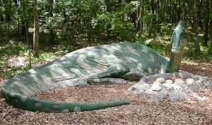
Representative Image: A parasaurolophus guarding her eggs at The Dinosaur Place
The reproductive behaviors of birds are some of their most conspicuous and endearing qualities. From the colorful mating display of some birds, like peacocks, to the building of nests by nearly all birds, these are the characters we use to define birds and make them popular study subjects. One peculiar aspect of some birds is communal nesting, where multiple breeding pairs lay eggs in the same nest. This most famously occurs in ostriches, who can have several females lay their eggs in one nest that is tended by one dominant female.
The reasons why this behavior may have evolved are unclear, especially when it’s known that the females who share a nest are often unrelated. Knowing when this behavior evolved may help elucidate its evolutionary history. Now, thanks to research by Tzu-Ruei Yang and his colleagues, we know this behavior may have its origins back in the ancestors of birds, dinosaurs.
Dr. Yang, of the Universita?t Bonn in Germany, and his colleagues, Jasmina Wiemann and Beate Spiering also of Universita?t Bonn, Anneke Van Heteren of the Zoologische Staatssammlung Mu?nchen in Germany, and Chun-Jung Chen of the National Museum of Natural Sciences in Taiwan, used the chemical composition of the fossil eggs shells in one nest to determine if they were laid by different mothers. This had been proposed before, but wasn’t backed by multiple lines of evidence. “Dinosaur behaviors that are unlikely to be preserved in fossilization could be elucidated by chemical analysis more unambiguously”, said Yang.
The team used a peculiarity of egg laying physiology: birds of different ages lay eggs with different phosphorous content in their shells. Also, different birds lay eggs of different shapes. It turns out that the same was true for dinosaurs. So by examining the eggs from one nest, they could determine if they were laid by different mothers, and they were. The nests that were examined were of oviraptorid dinosaurs, two-legged carnivorous dinosaurs (theropods) closely related to the group that evolved into modern birds. Said Dr. van Heteren, “This research shows how important interdisciplinary collaborations are to unveal the truth about the past.”
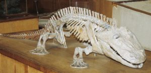
The skeleton of Eryops, one of the earliest land-walking tetrapods. Credit: Christine M. Janis
Early tetrapods, such as Ichthyostega, moved onto land from aquatic environments over 350 million years ago. Skeletal anatomy demonstrates that the front and hind limbs of these early tetrapods correspond to the pectoral and pelvic fins of fishes. Much study has gone into how these primitive tetrapods were able to pull themselves up onto land and move using both their primitive limbs and tail.
A new study led by researchers at Clemson and Carnegie Mellon Universities, the University of California Berkeley, and Georgia Tech, and being presented at the 76th Annual Society of Vertebrate Paleontology Meeting, models the locomotion of early tetrapods using the living mudskipper along with a robot simulator, called the MuddyBot.
This research was recently published in the journal Science (McInroe et al. 2016. Science 353:154-158).
Previous research has shown that some early tetrapods likely could not walk on land like a modern salamander but, instead, had to resort to using their front limbs to raise themselves up and pull themselves along, a locomotion method similar to the living mudskipper called crutching. Therefore, these early land-dwelling vertebrates could not maneuver very well on dry land.
The use of tail movements has long been thought to contribute to locomotion without quantitative analysis. Researchers created the Muddybot to mimic the movement patterns of the mudskipper and to mimic the potential ‘walking’ of these early tetrapods. Results show that the use of coordinated limb and tail movements would have greatly improved locomotion on land, especially on slopes and sandy surfaces that were likely adjacent to the aquatic habitats from which early land invaders emerged.
“Measuring how animals move on natural surfaces can give us new ideas about how vertebrates first invaded land, because it helps us understand the challenges of the habitats they encountered. Using a robot was also important, because we could make it use movements that animals don’t do naturally. This let us understand why some strategies work, and other ones don’t work” said presenter Richard Blob. Although often overlooked, the tail of early tetrapods, which was originally adapted for swimming, could have provided a much needed ‘push’ for the invasion of land.
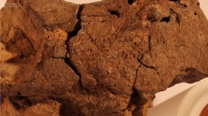
Surface scanned image of the unassuming ‘pebble’ recently revealed to be a roughly 133 million-year-old fossil dinosaur brain, discovered in Sussex, England. Credit: Society of Vertebrate Paleontology
Soft tissues such as hearts and muscles are very rarely preserved in the fossil record. For that reason, nearly all study of dinosaur soft tissue has to be reconstructed from fossil bones. However, researchers in the United Kingdom recently identified a genuine fossilized brain from a roughly 133 million-year-old dinosaur in Sussex, England. The brain likely belonged to a close relative of the Iguanodon, a spike-handed herbivorous dinosaur. According to the researchers, this is the first example of a natural endocast (in-filling) of the braincase that preserves fossilized brain tissue from any dinosaur.
The unassuming small fossil was originally discovered in 2004 on a beach in the town of Bexhill, but without the rest of the skeleton to help identify it. Only recently was a team of researchers, including Dr David Norman of the University of Cambridge, able to determine it was a fossilized dinosaur brain. Martin Brasier, of the University of Oxford, led the early work on this fossil, before his untimely death in 2014. In order to visualize very small features of the fossil brain Professor Brasier brought in researchers from the University of Western Australia to obtain high resolution images of parts of the brain, revealing its outer layers (meninges) as well as remnants of capillaries (tiny blood vessels) within the cortex of the brain itself. The brain structure and in particular the arrangement of meninges, shows remarkable similarity to modern birds and crocodilians, and likely functioned in fairly similar ways.
In regard to the truly rare preservation of the fossilized dinosaur brain, Dr Norman said “Brain tissues are incredibly fragile and it is quite incredible that the animal died in circumstances that uniquely led to their preservation – through a process of ‘pickling’ and then mineral replacement”. Dr Norman continued, “What we think happened is that this particular dinosaur died in or near a body of stagnant water, and its head ended up partially buried in the sediment at the bottom. Since the water had so little oxygen and was so acidic, the soft tissues of the brain were likely preserved and cast before the rest of its body was buried in the sediment.” Circumstances such as these are astonishingly rare in fossilization, meaning this discovery can provide unique insight into the mind of this 133 million-year-old dinosaur.
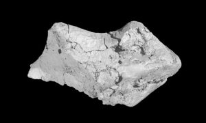
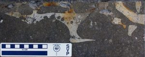
The skull of Prototherium exposed on the paving slab, in cross-section, showing parts of snout and tooth sockets. Image by Manja Voss and Oliver Hampe Credit: Society of Vertebrate Paleontology
Have you ever spotted something unexpected while walking down the street? Last December, paleontologists literally stumbled upon a new discovery of a fossil sea cow in a very unexpected place – in a limestone paving stone in Spain! Research presented this week at the Society of Vertebrate Paleontology meeting in Salt Lake City, Utah, describes this remarkable find and how it is changing our understanding of sea cow evolution.
The unusual pavement was spotted in the picturesque town of Girona, northern Spain. A local geologist first noticed the fossil and submitted it to the website ‘http://www.paleourbana.com’, an online database of urban fossils worldwide. As word of the fossil spread, paleontologists Dr. Manja Voss and Dr. Oliver Hampe, from the Museum für Naturkunde, Berlin, visited Girona to take a look.
Closer inspection of the paving stones by Dr. Voss and Dr. Hampe revealed that the complex array of shapes was slices of the backbone and skull of an ancient marine mammal. Based on the skull and teeth, they concluded that it was a sirenian, or sea cow, a member of a group of large, plant-eating marine mammals represented today by the living manatee and dugong.
Once the significance of the fossil was understood, Dr. Voss and Dr. Hampe worked with the mayoralty of Girona and local geologists to have the 50x30cm large paving stones removed for study. Since the rock was cut into slices to form the paving stones, the paleontologists had a cross-sectional view of the sea cow’s skull, revealing many details of its anatomy. However, they also wanted to see inside the stones, so they took them to a medical hospital, the Clinica Girona, where they were CT-scanned.
The scientists discovered that the ‘Girona Sea Cow’ is most likely a representative of Prototherium, a genus of extinct sea cows from Spain and Italy. However, this find is particularly important because the rocks from which the paving slabs were quarried are 40 million years old, explains Voss. “Hence the find represents one of the oldest sea cows in Europe, making it a unique opportunity to enhance our knowledge on the evolution and diversity of this marine mammal group that arose about 50 million years ago.”
Next the scientists will use the CT scans to try to digitally piece together the separate skull slices of Prototherium. This can help them answer more questions, such as the animals’ age when it died and its potential relationship to other fossil sea cows.
The Girona Sea Cow, which is providing clues into the evolution of sea cows in the ancient oceans of Europe, shows that fossils can be found in surprising locations. Voss says “While the limestone used to build the city of Girona are enriched by fossils—it is quite common to identify invertebrates for example—finding a marine mammal on which thousands of people walked over for the last two decades is indeed very peculiar.”
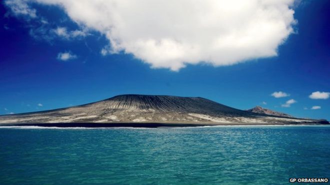
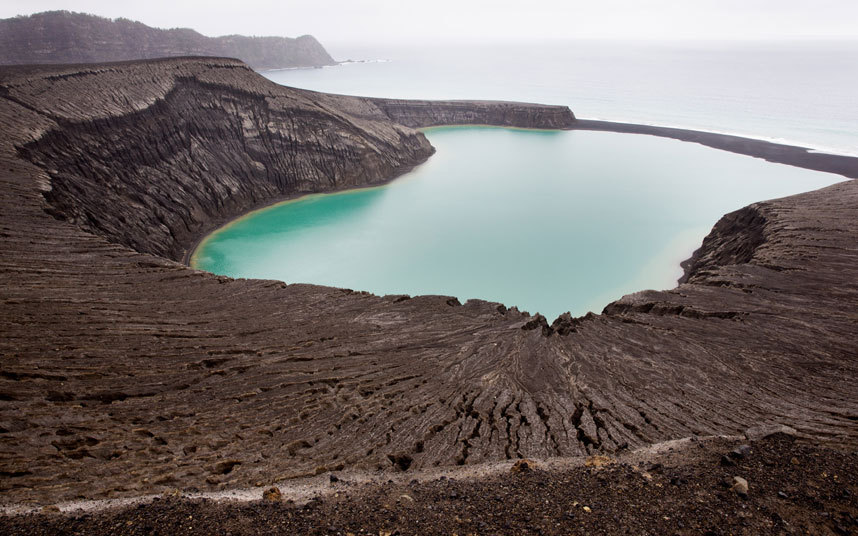
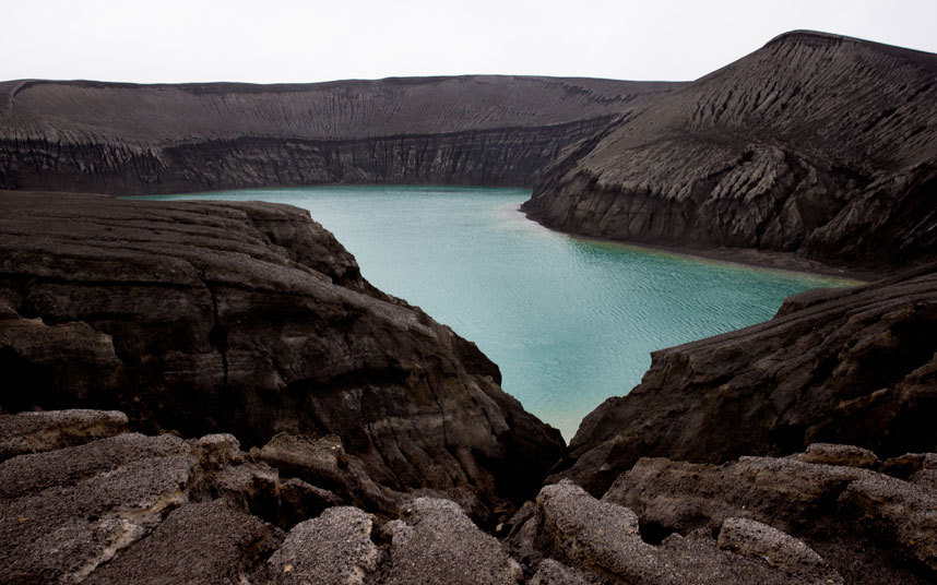
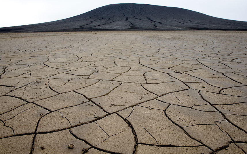
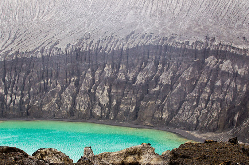
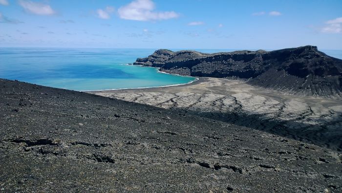
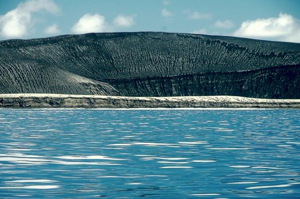
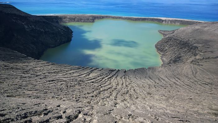
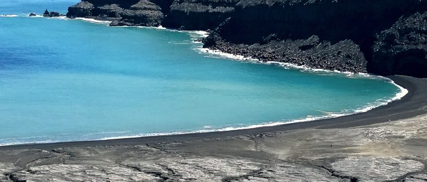
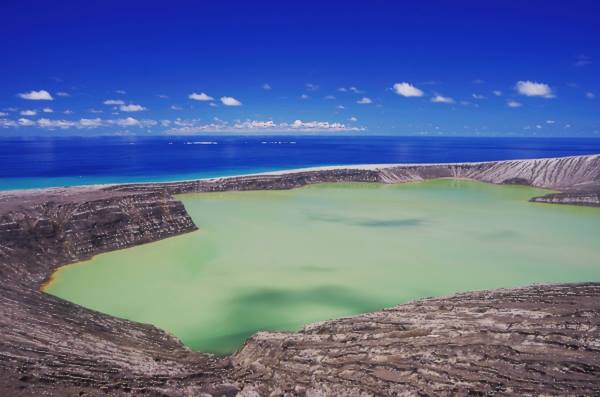
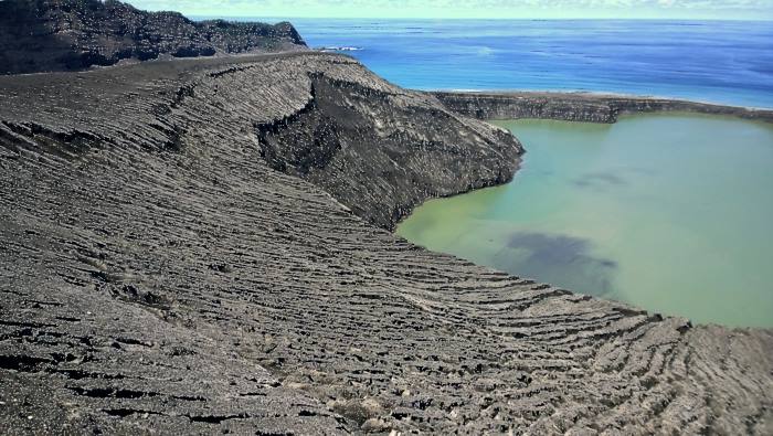
A new island has been formed in the South Pacific after the eruption of an underwater volcano in Tonga.
Images have emerged of the island’s surface, 45km (28 miles) north-west of Tonga’s capital, Nuku’alofa.
The island – which is 500m (1,640 feet) long – was formed after an eruption at the Hunga Tonga volcano that started in December.
One scientist said the island was likely to be highly unstable, and dangerous to visitors.
The volcano – the full name of which is Hunga Tonga-Hunga Ha’apai – erupted for the second time in five years in December. “Watch: Underwater volcano erupts off Tonga”
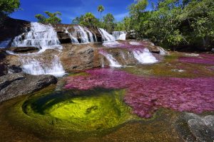
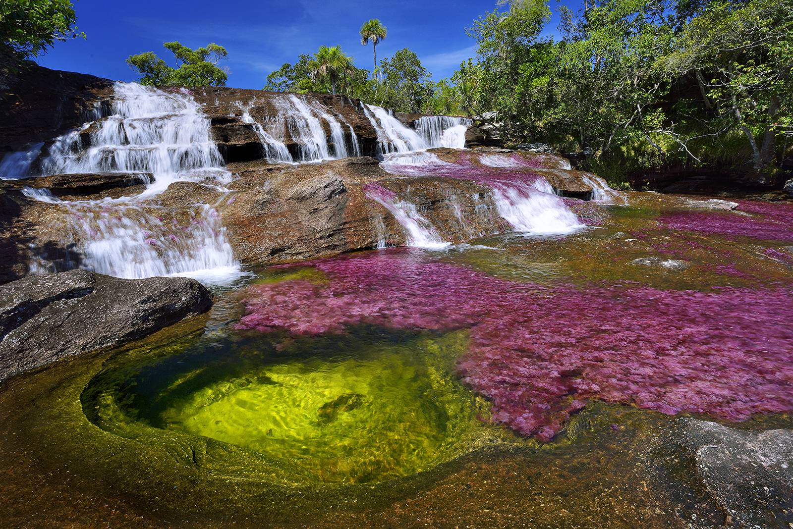
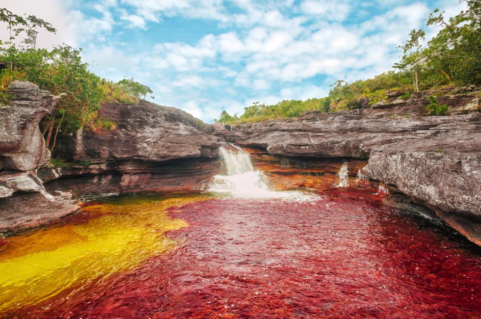
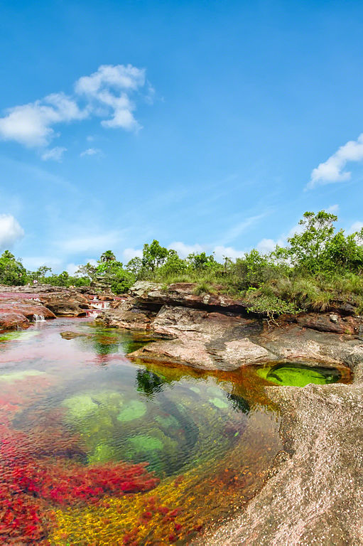
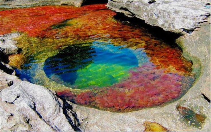
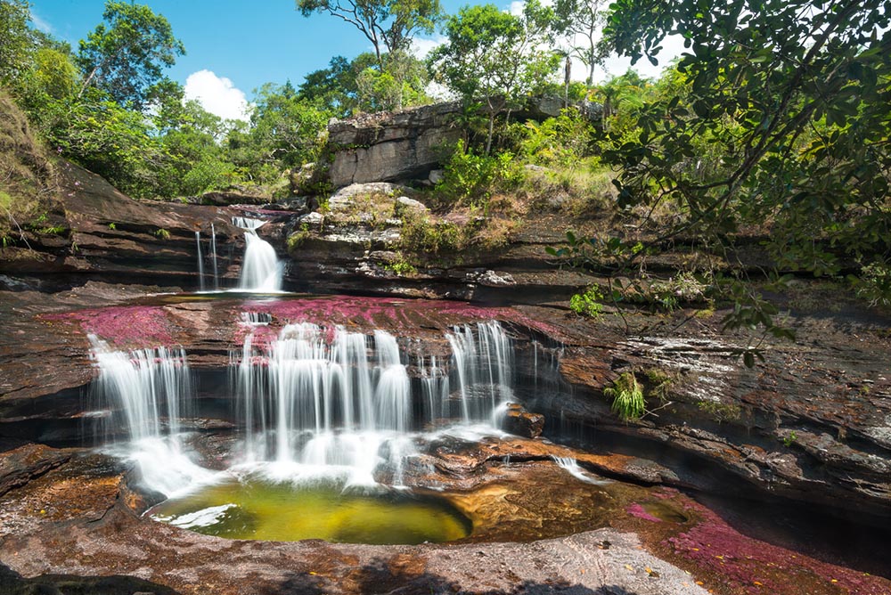
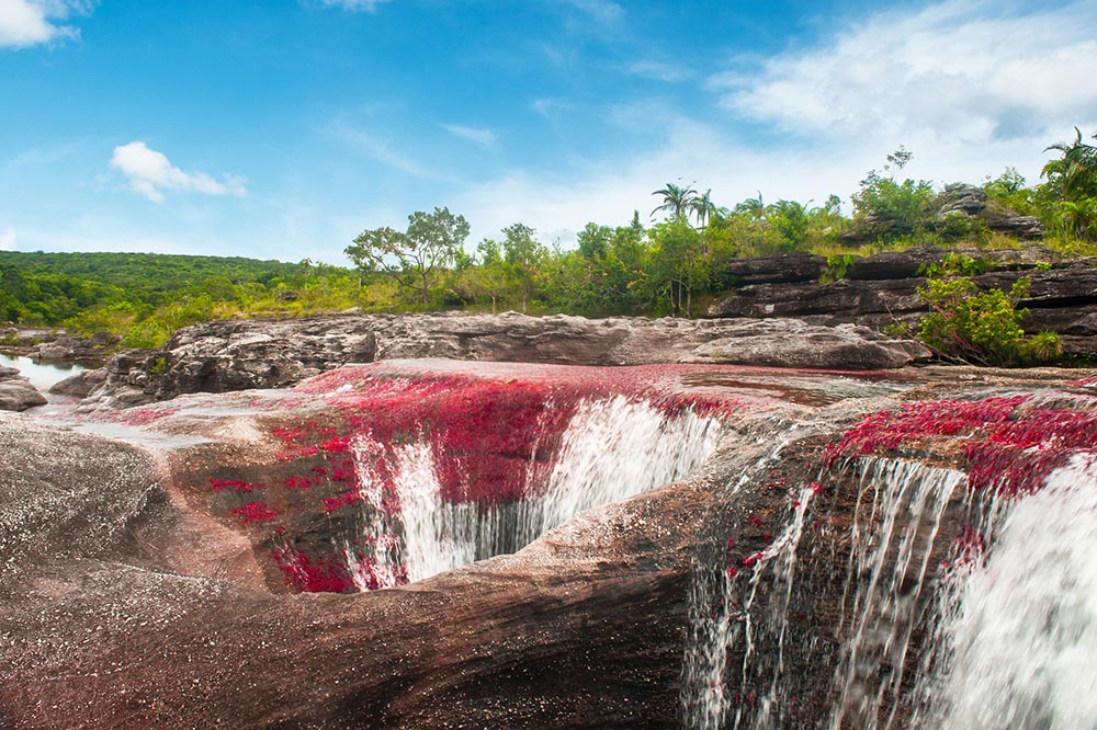
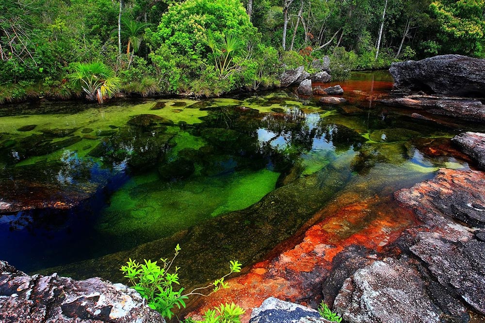
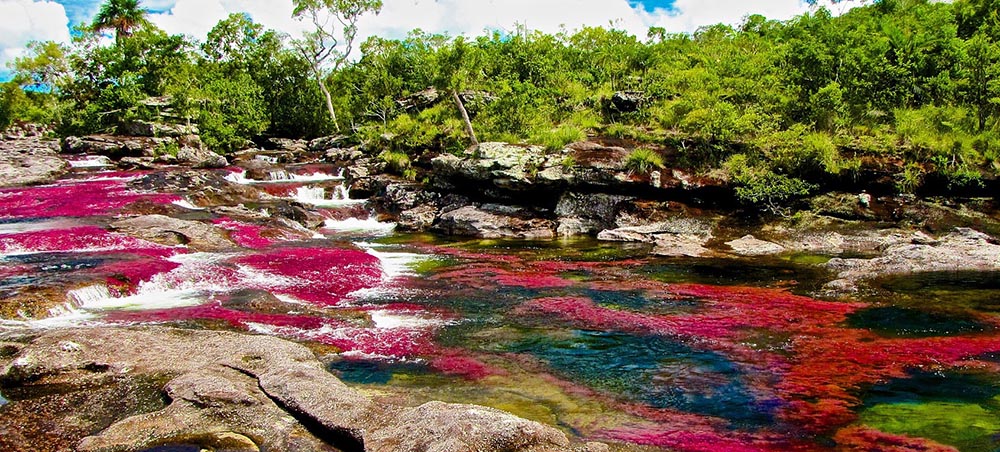
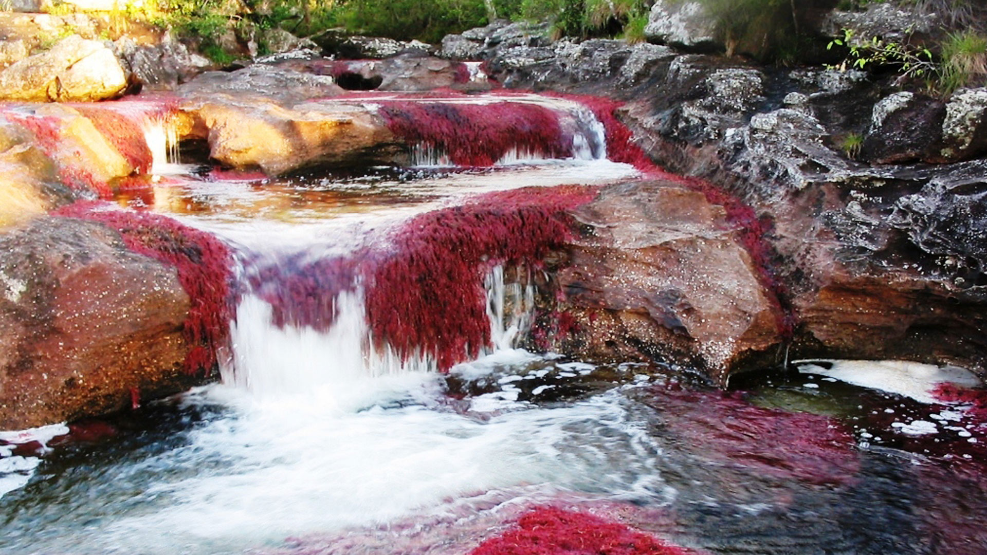
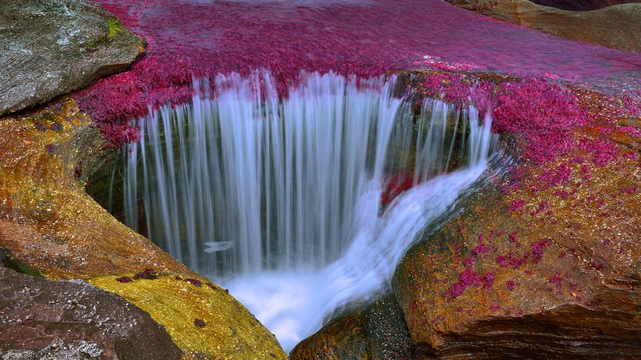
Caño Cristales is a Colombian river located in the Serrania de la Macarena province of Meta. It’s a tributary of the Guayabero River. The river is commonly called the “River of Five Colors” or the “Liquid Rainbow”, and is even referred to as the most beautiful river in the world due to its striking colors. The bed of river in the end of July through November is variously colored yellow, green, blue, black, and especially red, the last caused by the Macarenia clavigera (Podostemaceae) on the bottom of the river.
The quartzite rocks of the Serrania de la Macarena tableland formed approximately 1.2 billion years ago. They are a western extension of the Guiana Shield of Venezuela. Guyana and Brazil belong to the oldest exposed rocks in the world.
Caño Cristales is a fast river with many rapids and waterfalls. Often in the bed have formed small circular pits – giant’s kettles, which have been formed by pebbles or chunks of harder rocks. Once one of these harder rock fragments falls into one of the cavities, it is rotated by the water current and begins to carve at the cavity wall and increases the dimensions of the pit.
Experience the power of a glowing river of molten rock as lava flows toward the sea from the Puʻu ʻŌʻō vent of Hawaii’s Kilauea volcano over the buried Royal Gardens Subdivision.
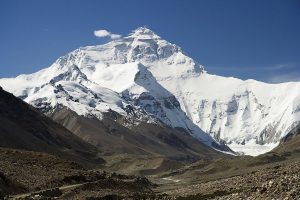
Mount Everest North Face as seen from the path to the base camp, Tibet. Credit: Luca Galuzzi/Wikipedia
The main fault at the foot of the Himalayan mountains can likely generate destructive, major earthquakes along its entire 2,400-kilometer (1,500-mile) length, a new study finds. Combining historical documents with new geologic data, the study shows the previously unstudied portion of the fault in the country Bhutan is capable of producing a large earthquake and did so in 1714.
“We are able for the first time to say, yes, Bhutan is really seismogenic, and not a quiet place in the Himalayas,” said György Hetényi, a geophysicist at the University of Lausanne, Switzerland and lead author of the new study accepted for publication in Geophysical Research Letters, a journal of the American Geophysical Union.
The Himalayas have produced some of the world’s largest earthquakes, like the April 2015 Gorkha earthquake that devastated Nepal. But scientists had not been able to prove whether every region along the 2,400-kilometer arc was seismogenic, or capable of producing quakes. Bhutan was one of the last open gaps along the mountain chain: the country had no records of recent major earthquakes and no major seismological work had been done there.
Confining a major earthquake to Bhutan in 1714, like the new study does, means the entire Himalayan arc has experienced a major earthquake in the past 500 years, according to the study’s authors. By filling this gap, the new study helps the millions of residents in the region understand its potential for natural hazards, according to Hetényi.
“We provide a longer and therefore more representative record of seismicity in Bhutan, and this makes better hazard estimates,” he said.
A nation apart
The highest mountain range on Earth, the Himalayas are the product of the Indian tectonic plate subducting under the Eurasian Plate. The mountains span a northwest to southeast arc roughly 2,400 kilometers (1,500 miles) long, nearly the distance between the U.S. East and West coasts.
Throughout the 20th century, Bhutan, a small nation east of Nepal sandwiched between India and China, had been relatively isolated from the outside world and scientists were rarely allowed inside its borders. Until recently, researchers thought Bhutan could be the only major segment of the Himalayas not to have experienced a major earthquake in the last 500 years, according to Hetényi.
But, after a magnitude 6 earthquake struck the country in 2009, the government opened the door for scientists to perform geophysical research, Hetényi said.
Hetényi and his colleagues made several trips to the country from 2010 to 2015 to catalog small earthquakes in the area and study how the structure of the Indian Plate changes as it subducts below the crushing belt of mountains. One question they were hoping to answer was whether Bhutan had historically experienced any major destructive earthquakes.
Historical records of earthquakes in Bhutan are rare, but by luck Hetényi stumbled upon a biography of famous 18th century Buddhist monk and temple builder Tenzin Lekpai Dondup. The biography described a quake in early May of 1714 that destroyed the Gangteng monastery Dondup helped build.
The biography and other historical records indicated there were many aftershocks, meaning it could have been a major quake, according to Hetényi.
However, this description alone did not pinpoint where the quake occurred.
“When you only have very local devastation descriptions, you never know whether this devastation is due to an intermediate earthquake that occurred locally, nearby the chronicler, or whether it’s the result of a bigger earthquake that occurred over greater distances,” said Laurent Bollinger, a geologist at the French Alternative Energies and Atomic Energy Commission who was not involved in the new study.
While in Bhutan, several of Hetényi’s colleagues dug trenches around the fault line to see if one side of it had moved vertically with respect to the other side — which would be considered evidence of a major earthquake. That study, led by Romain Le Roux-Mallouf, a geologist at the University of Montpellier, France, found evidence of rock uplift on one side of the fault had taken place between 1642 and 1836. Hetényi combined the results from that study with historical records of the 1714 earthquake to pinpoint where the 1714 quake happened and how large it was.
Hetényi’s analysis revealed the 1714 quake likely caused the rock uplift his colleagues observed around the fault. The earthquake likely occurred in west central Bhutan, where most of the population lives, and had a magnitude of at least 7.5 to 8.5, Hetényi said. By comparison, the April 2015 Gorkha earthquake had a magnitude of 7.8.
“It’s a really significant event that happened 300 years ago,” he said.
The results suggest the 1714 quake was significant enough to unzip a large segment of the thrust — possibly between 100 to 300 kilometers (60 to 200 miles) of the fault. The new study closes the seismic gap in the Himalayan arc and could help scientists better understand the earthquake potential in the densely populated Himalaya region, according to Hetényi.
Reference:
György Hetényi, Romain Le Roux-Mallouf, Théo Berthet, Rodolphe Cattin, Carlo Cauzzi, Karma Phuntsho, Remo Grolimund. Joint approach combining damage and paleoseismology observations constrains the 1714 AD Bhutan earthquake at magnitude 8 ± 0.5. Geophysical Research Letters, 2016; DOI: 10.1002/2016GL071033
Aerial photo of the endless Arctic ice sheet just off Greenland’s west coast, close to the Polar circle. The sheet is broken up in millions of pieces, forming a scattered pattern of white against a dark blue Atlantic ocean and sky. Photo taken from the cockpit of an airliner flying at an altitude of 12 kilometers.
This mysterious phenomena, dubbed the ‘100,000 year problem’, has been occurring for the past million years or so and leads to vast ice sheets covering North America, Europe and Asia. Up until now, scientists have been unable to explain why this happens.
Our planet’s ice ages used to occur at intervals of every 40,000 years, which made sense to scientists as the Earth’s seasons vary in a predictable way, with colder summers occurring at these intervals. However there was a point, about a million years ago, called the ‘Mid-Pleistocene Transition’, in which the ice age intervals changed from every 40,000 years to every 100,000 years.
New research published today in the journal Geology has suggested the oceans may be responsible for this change, specifically in the way that they suck carbon dioxide (CO2) out of the atmosphere.
By studying the chemical make-up of tiny fossils on the ocean floor, the team discovered that there was more CO2 stored in the deep ocean during the ice age periods at regular intervals every 100,000 years.
This suggests that extra carbon dioxide was being pulled from the atmosphere and into the oceans at this time, subsequently lowering the temperature on Earth and enabling vast ice sheets to engulf the Northern Hemisphere.
Lead author of the research Professor Carrie Lear, from the School of Earth and Ocean Sciences, said: “We can think of the oceans as inhaling and exhaling carbon dioxide, so when the ice sheets are larger, the oceans have inhaled carbon dioxide from the atmosphere, making the planet colder. When the ice sheets are small, the oceans have exhaled carbon dioxide, so there is more in the atmosphere which makes the planet warmer.
“By looking at the fossils of tiny creatures on the ocean floor, we showed that when ice sheets were advancing and retreating every 100,000 years the oceans were inhaling more carbon dioxide in the cold periods, suggesting that there was less left in the atmosphere.”
Marine algae play a key role in removing CO2 from the atmosphere as it is an essential ingredient of photosynthesis.
CO2 is put back into the atmosphere when deep ocean water rises to the surface through a process called upwelling, but when a vast amount of sea ice is present this prevents the CO2 from being exhaled, which could make the ice sheets bigger and prolong the ice age.
“If we think of the oceans inhaling and exhaling carbon dioxide, the presence of vast amounts of ice is like a giant gobstopper. It’s like a lid on the surface of the ocean,” Prof Lear continued.
The Earth’s climate is currently in a warm spell between glacial periods. The last ice age ended about 11,000 years ago. Since then, temperatures and sea levels have risen, and ice caps have retreated back to the poles. In addition to these natural cycles, humanmade carbon emissions are also having an effect by warming the climate.
Reference:
Caroline H. Lear, Katharina Billups, Rosalind E.M. Rickaby, Liselotte Diester-Haass, Elaine M. Mawbey, Sindia M. Sosdian. Breathing more deeply: Deep ocean carbon storage during the mid-Pleistocene climate transition. Geology, 2016; G38636.1 DOI: 10.1130/G38636.1
This is an illustration of microbes inside a fracking well. Credit: Illustration courtesy of PNNL
Microbes have a remarkable ability to adapt to the extreme conditions in fracking wells, according to a study published in the October issue of Nature Microbiology.
Scientists led by researchers at Ohio State University found that microbes actually consume some of the chemical ingredients commonly used in the fracking process, creating new compounds which in turn support microbial communities below ground. The process allows the microbes to survive in very harsh environments that include very high temperatures, pressures, and salinity.
The work, based on samples from hydraulically fractured wells in Pennsylvania and Ohio, helps scientists understand the complex interactions among microbes — important for understanding the planet’s environment and subsurface. The findings also help scientists understand what is happening in fracking wells and could offer insight into processes such as corrosion.
David Hoyt, a scientist within the Environmental Molecular Sciences Laboratory (EMSL) at the Department of Energy’s Pacific Northwest National Laboratory, was part of the team that ferreted out the geochemical indicators of microbial activity.
The team studied microbes in fracking fluid from more than a mile and a half below the ground surface. Researchers measured the metabolic byproducts excreted by the microbes, which can tell scientists what compounds the microbes are producing, where they are drawing energy from, and what they need to stay alive.
The sampling of a microbial community’s byproducts or metabolites gives insight into the community the same way a blood test yields information about a person’s health, eating habits, and lifestyle.
“A thorough look at the metabolites of a community allows us to detect what chemical changes are occurring over time, how they support microbial life in the deep subsurface and what are the common biochemical strategies for these microbes that prevail across different shale formations,” said Hoyt, a biochemist.
Consequences for methane levels, corrosion
Using multiple samples drawn from the two wells over a 10-month period, the team identified 31 different microbes in fluids produced from hydraulically fractured shales. The team found that fractured shales contained similar microbial communities even though they came from wells hundreds of miles apart in different kinds of shale formations.
The complex mix – with some microbes producing compounds that others use or feed upon – produces some interesting outcomes. One particularly interesting compound, glycine betaine, is what allows the microbes to thrive by protecting them against the high salinity found in the wells. Other microbes can subsequently degrade the compound to generate more food for the bacteria that produce methane. Yet another process may produce substances that contribute to the corrosion of the steel infrastructure in wells.
The scientists even discovered a new strain of bacteria inside the wells which it dubbed “Frackibacter.”
The scientists say more work is needed to understand the implications of the study. Microbial action is central to how much carbon enters Earth’s atmosphere and for understanding how chemicals in the ground change and move. Studies like this one that contribute new information about microbial communities could have implications beyond fracking.
“The study highlights the resilience of microbial life to adapt to and colonize a habitat structured by physical and chemical features very different from their origin,” said corresponding author Kelly Wrighton, assistant professor of microbiology and biophysics at Ohio State.
To do the study, researchers drew upon resources at two DOE Office of Science User Facilities. At EMSL, Hoyt used nuclear magnetic resonance instruments to analyze the metabolic byproducts of the microbes. Resources at the Joint Genome Institute at Lawrence Berkeley National Laboratory helped researchers unravel the genetic sequences of microorganisms within the communities.
Reference:
Rebecca A. Daly, Mikayla A. Borton, Michael J. Wilkins, David W. Hoyt, Duncan J. Kountz, Richard A. Wolfe, Susan A. Welch, Daniel N. Marcus, Ryan V. Trexler, Jean D. MacRae, Joseph A. Krzycki, David R. Cole, Paula J. Mouser and Kelly C. Wrighton, Microbial metabolisms in a 2.5-km-deep ecosystem created by hydraulic fracturing in shales, Nature Microbiology, Sept. 5, 2016, DOI: 10.1038/NMICROBIOL.2016.146