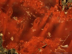
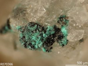
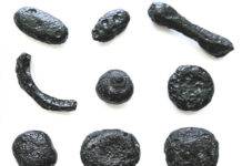
Haematite tubes from the NSB hydrothermal vent deposits that represent the oldest microfossils and evidence for life on Earth. The remains are at least 3,770 million years old. Credit: Matthew Dodd
Remains of microorganisms at least 3,770 million years old have been discovered by an international team led by UCL scientists, providing direct evidence of one of the oldest life forms on Earth.
Tiny filaments and tubes formed by bacteria that lived on iron were found encased in quartz layers in the Nuvvuagittuq Supracrustal Belt (NSB), Quebec, Canada.
The NSB contains some of the oldest sedimentary rocks known on Earth which likely formed part of an iron-rich deep-sea hydrothermal vent system that provided a habitat for Earth’s first life forms between 3,770 and 4,300 million years ago. “Our discovery supports the idea that life emerged from hot, seafloor vents shortly after planet Earth formed. This speedy appearance of life on Earth fits with other evidence of recently discovered 3,700 million year old sedimentary mounds that were shaped by microorganisms,” explained first author, PhD student Matthew Dodd (UCL Earth Sciences and the London Centre for Nanotechnology).
Published today in Nature and funded by UCL, NASA, Carnegie of Canada and the UK Engineering and Physical Sciences Research Council, the study describes the discovery and the detailed analysis of the remains undertaken by the team from UCL, the Geological Survey of Norway, US Geological Survey, The University of Western Australia, the University of Ottawa and the University of Leeds.
Prior to this discovery, the oldest microfossils reported were found in Western Australia and dated at 3,460 million years old but some scientists think they might be non-biological artefacts in the rocks. It was therefore a priority for the UCL-led team to determine whether the remains from Canada had biological origins.
The researchers systematically looked at the ways the tubes and filaments, made of haematite — a form of iron oxide or ‘rust’ — could have been made through non-biological methods such as temperature and pressure changes in the rock during burial of the sediments, but found all of the possibilities unlikely.
The haematite structures have the same characteristic branching of iron-oxidising bacteria found near other hydrothermal vents today and were found alongside graphite and minerals like apatite and carbonate which are found in biological matter including bones and teeth and are frequently associated with fossils.
They also found that the mineralised fossils are associated with spheroidal structures that usually contain fossils in younger rocks, suggesting that the haematite most likely formed when bacteria that oxidised iron for energy were fossilised in the rock.
“We found the filaments and tubes inside centimetre-sized structures called concretions or nodules, as well as other tiny spheroidal structures, called rosettes and granules, all of which we think are the products of putrefaction. They are mineralogically identical to those in younger rocks from Norway, the Great Lakes area of North America and Western Australia,” explained study lead, Dr Dominic Papineau (UCL Earth Sciences and the London Centre for Nanotechnology).
“The structures are composed of the minerals expected to form from putrefaction, and have been well documented throughout the geological record, from the beginning until today. The fact we unearthed them from one of the oldest known rock formations, suggests we’ve found direct evidence of one of Earth’s oldest life forms. This discovery helps us piece together the history of our planet and the remarkable life on it, and will help to identify traces of life elsewhere in the universe.”
Matthew Dodd concluded, “These discoveries demonstrate life developed on Earth at a time when Mars and Earth had liquid water at their surfaces, posing exciting questions for extra-terrestrial life. Therefore, we expect to find evidence for past life on Mars 4,000 million years ago, or if not, Earth may have been a special exception.”
Reference:
Matthew S. Dodd, Dominic Papineau, Tor Grenne, John F. Slack, Martin Rittner, Franco Pirajno, Jonathan O’Neil, Crispin T. S. Little. Evidence for early life in Earth’s oldest hydrothermal vent precipitates. Nature, 2017; 543 (7643): 60 DOI: 10.1038/nature21377
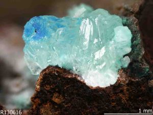
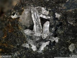
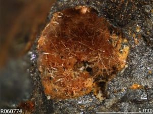
Simonkolleite [Zn5(OH)8Cl2·H2O] is an anthropogenic mineral, found on a copper mining artifact, Rowley mine, Maricopa County, Arizona. Credit: RRUFFHuman industry and ingenuity has done more to diversify and distribute minerals on Earth than any development since the rise of oxygen over 2.2 billion years ago, experts say in a paper published today.
The work bolsters the scientific argument to officially designate a new geological time interval distinguished by the pervasive impact of human activities: the Anthropocene Epoch.
In the paper, published by American Mineralogist, a team led by Robert Hazen of the Carnegie Institution for Science identifies for the first time a group of 208 mineral species that originated either principally or exclusively due to human activities. That’s almost 4% of the roughly 5,200 minerals officially recognized by the International Mineralogical Association (IMA).
Most of the recognized minerals attributed to human activities originated through mining—in ore dumps, through the weathering of slag, formed in tunnel walls, mine water or timbers, or through mine fires.
Six were found on the walls of smelters; three formed in a geothermal piping system.
Some minerals formed due to human actions can also occur naturally. Three in that category were discovered on corroded lead artifacts aboard a Tunisian shipwreck, two on bronze artifacts in Egypt, and two on tin artifacts in Canada. Four were discovered at prehistoric sacrificial burning sites in the Austrian mountains.
Unparalleled pace of diversification
According to the paper, the first great ‘punctuation event’ in the history of Earth’s mineral diversity occurred more than 2 billion years ago when the increase of oxygen in the atmosphere—’the Great Oxidation’—gave rise to as many as two-thirds of the more than 5,200 mineral species officially recognized today.
Says Dr. Hazen, who co-wrote the paper with Edward Grew of the University of Maine, and Marcus Origlieri and Robert Downs of the University of Arizona: “Mineral evolution has continued throughout Earth’s history. It has taken 4.5 billion years for combinations of elements to meet naturally on Earth at a specific location, depth and temperature, and to form into the more than 5,200 minerals officially recognized today. The majority of these have arisen since the Great Oxidation event 2 billion years ago. ”
“Within that collection of 5,200 are 208 minerals produced directly or indirectly by human activities, mostly since the mid-1700s, and we believe that others continue to be formed at that same relatively blazing pace. To imagine 250 years relative to 2 billion years, that’s the difference between the blink of an eye (one third of a second) and one month.”
“Simply put, we live in an era of unparalleled inorganic compound diversification,” says Dr. Hazen. “Indeed, if the Great Oxidation eons ago was a ‘punctuation event’ in Earth’s history, the rapid and extensive geological impact of the Anthropocene is an exclamation mark.”
Anthropogenic minerals
A mineral species is defined as a naturally occurring crystalline compound that has a unique combination chemical composition and crystal structure. As of February, 2017, the IMA had approved 5,208 species (see rruff.info/ima for a complete list).
The authors of the recent paper argue that with so many minerals and mineral-like compounds owing their origin to human activities, “a more comprehensive understanding and analysis of the mineralogical nature of the Anthropocene Epoch is warranted.”
Humanity has had a major impact on diversity and distribution in the mineral world in three principal ways, according to the paper:
1) Manufacturing synthetic “mineral-like” compounds, and b) causing minerals to form as an unintentional byproduct of human activity
Fiedlerite
a) Directly creating synthetic mineral-like compounds such as YAG (yttrium aluminum garnet) crystals used in lasers, silicon “chips” for semi-conductors, carbide grits for abrasives, and various specialty metals and alloys for magnets, machine parts, and tools. Other examples include bricks, earthenware, porcelain, glass and limestone-based Portland cement—the world’s most common form of cement, used in concrete, mortar, stucco and grout—a combination of calcium silicates, calcium sulfates, and other compounds
b) Indirectly contributing to the formation of new minerals through mining, with new compounds appearing on mine walls or in mine dumps, for example. Of special interest are minerals found associated with ancient lead-zinc mining localities, including some possibly dating from the Bronze Age, and others from as far back as 300 AD.?
2) Large scale movement of rocks, sediments, and minerals
In addition to creating new compounds, human activities such as mining and the transport of stone blocks, rocks, sediments, and minerals from their original location to help build roads, bridges, waterways, monuments, kitchen counters, and other human infrastructure, rivals in scale nature’s redistribution such as via glaciers.
Mining operations, meanwhile, have stripped the near-surface environment of ores and fossil fuels, leaving large open pits, tunnel complexes, and, in the case of strip mining, sheared off mountaintops.
Road cuts, tunnels, and embankments represent further distinctively human planetary modifications.
3) Global redistribution of highly valued natural minerals
Diamonds, rubies, emeralds, sapphires, and a host of semi-precious stones, accompanied by concentrations of gold, silver, and platinum, are found in shops and households in every corner of the globe.
Collections of fine mineral specimens juxtapose mineral species that would not occur naturally in combination. From modest beginner collector sets of more common minerals to the world’s greatest museums, these collections, if buried in the stratigraphic record and subsequently unearthed in the distant future, “would reveal unambiguously the passion of humans for the beauty and wonder of the mineral kingdom,” the paper says.
New compounds forming
Nealite
Says Dr. Downs: “Given humanity’s pervasive influences on the environment, there must be hundreds of as yet unrecognized ‘minerals’ in old mines, smelters, abandoned buildings, and other sites. Meanwhile, new suites of compounds may now be forming in, for example, solid waste dumps where old batteries, electronics, appliances, and other high-tech discards are exposed to weathering and alteration.”
Adds Dr. Origlieri: “In the sediment layers left behind from our age, future mineralogists will find plentiful building materials such as bricks, cinder blocks, and cement, metal alloys such as steel, titanium, and aluminum, along with many lethal radioactive byproducts of the nuclear age. They might also marvel at some beautiful manufactured gemstones, like cubic zirconia, moissanite, synthetic rubies, and many others.”
Says Dr. Grew: “These minerals and mineral-like compounds will be preserved in the geological record as a distinctive, globally-distributed horizon of crystalline novelty—a persistent marker that marks our age as different from all that came before.”
Some anthropogenic minerals wouldn’t be officially recognized today
Calclacite, described by a Belgium-based scientist in 1959, and which originated in an old oak storage cabinet for mineral specimens at the Royal Museum of Natural History, Brussels, is an officially recognized mineral that wouldn’t qualify today; in 1998 the IMA decided to disallow any substance “made by Man.”
Other recognized anthropogenic minerals in this category include several slag-related minerals as well as a pair from Russia, niobocarbide and tantalcarbide, which some experts believe may have been a hoax—”a laboratory product … deliberately passed off as a natural material” in the early 1900s.
Though unlikely to pass scrutiny today, says Dr. Grew, previously recognized minerals such as these, rather than being invalidated, have been allowed to remain in the IMA catalog.
The IMA did agree to recognize a mineral in cases “in which human intervention in the creation of a substance is less direct.”
The origin of up to 29 forms of carbon: humanity
Chalconatronite
Of the 208 human-mediated minerals identified by the Deep Carbon Observatory researchers, 29 contain carbon.
Origins and forms, along with movements and quantities, are four themes of the DCO (deepcarbon.net). Dr. Hazen is the DCO’s Executive Director.
Now we know that as many as 29 carbon minerals originated with human activities, of which 14 have no recorded natural occurrences. It is fair, therefore, to consider the 14 as the youngest carbon mineral species. Among the 14, candidates for the very youngest include a dozen minerals related to uranium mines.
The mineral andersonite, for example, is found in the tunnels of certain abandoned uranium mines in the American Southwest. At places along the tunnel walls, sandstone becomes saturated with water that contains elements that form a beautiful crust of yellow, orange and green crystals. Prized for its bright green fluorescent glow under a black light, a good sample of andersonite will fetch up to $500 from a collector.
Another notable carbon-bearing mineral is tinnunculite, determined to be a product of hot gases reacting with the excrement of the Eurasian kestrel (Falco tinnunculus) at a burning coal mine in Kopeisk, Chelyabinsk, Russia. It was subsequently discovered also on Russia’s Mt. Rasvumchorr—an entirely natural occurrence.
Tinnunculite is one of eight new minerals identified as part of the Deep Carbon Observatory’s Carbon Mineral Challenge, launched in 2015 to track down an estimated 145 carbon-bearing minerals yet to be formally recognized. The IMA recognized tinnunculite as a mineral in 2015.
Dr Mark Kendrick with a sample of volcanic glass. Credit: Stuart Hay, ANU
A new study led by The Australian National University (ANU) has found seawater cycles throughout Earth’s interior down to 2,900km, much deeper than previously thought, reopening questions about how the atmosphere and oceans formed.
A popular theory is that the atmosphere and oceans formed by releasing water and gases from Earth’s mantle through volcanic activity during the planet’s first 100 million years.
But lead researcher Dr Mark Kendrick from ANU said the new study provided evidence to question this theory.
“Our findings make alternative theories for the origin of the atmosphere and oceans equally plausible, such as icy comets or meteorites bringing water to Earth,” said Dr Kendrick from the ANU Research School of Earth Sciences.
Seawater is introduced into Earth’s interior when two tectonic plates converge and one plate is pushed underneath the other into the mantle.
The study has overturned the notion that seawater only makes it about 100km into the mantle before it is returned to Earth’s surface through volcanic arcs, such as those forming the Pacific Ring of Fire that runs through the western America’s, Japan and Tonga.
The team analysed samples of volcanic glass from the Atlantic, Pacific and Indian oceans that contained traces of seawater that had been deeply cycled throughout Earth’s interior.
“The combination of water and halogens found in the volcanic glasses enables us to preclude local seawater contamination and conclusively prove the water in the samples was derived from the mantle,” Dr Kendrick said.
Reference:
M. A. Kendrick, C. Hémond, V. S. Kamenetsky, L. Danyushevsky, C. W. Devey, T. Rodemann, M. G. Jackson, M. R. Perfit. Seawater cycled throughout Earth’s mantle in partially serpentinized lithosphere. Nature Geoscience, 2017; DOI: 10.1038/ngeo2902
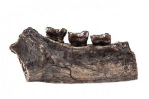
The new species Ramadapis sahnii existed 11 to 14 million years ago and is a member of the ancient Sivaladapidae primate family. It consumed leaves and was about the size of a house cat. Credit: Sheena Lad
Fossil hunters have found part of an ancient primate jawbone related to lemurs — the primitive primate group distantly connected to monkeys, apes and humans, a USC researcher said.
Biren Patel, an associate professor of clinical cell and neurobiology at the Keck School of Medicine of USC, has been digging for fossils in a paleontologically rich area of Kashmir in northern India for six years. Although paleontologists have scoured this region for a century, relics of small extinct primates were rarely found or studied.
Scientists named the new species Ramadapis sahnii and said that it existed 11 to 14 million years ago. It is a member of the ancient Sivaladapidae primate family, consumed leaves and was about the size of a house cat, said Patel, co-author of the new study in the Journal of Human Evolution.
“Among the primates, the most common ones in the Kashmir region are from a genus called Sivapithecus, which were ancestral forms of orangutans,” Patel said. “The fossil we found is from a different group on the primate family tree — one that is poorly known in Asia. We are filling an ecological and biogeographical gap that wasn’t really well documented. Every little step adds to the understanding of our human family tree because we’re also primates.”
The last primate found in the area was 38 years ago. So, in addition to being a new species, this is the first primate fossil found in the area in decades.
“In the past, people were interested in searching for big things — things they could show off to other people,” Patel said. “A lot of the small fossils were not on their radar.”
The inch-and-a-quarter partial mandible belongs to a primate weighing less than 11 pounds that had outlived its other adapidae cousins found in North America, Europe and Africa by millions of years.
“New primates are always a hot topic, and this one is the first of its kind from its area in Asia, which has significant consequences for understanding primate evolution in the Old World,” said Michael Habib, an assistant professor of clinical cell and neurobiology at the Keck School of Medicine who was not involved in the study.
The question that remains is how the ecosystem in northern India supported this species when its relatives elsewhere were disappearing or had already gone extinct. Future fieldwork and recovering more fossil primates will help answer this question.
“People want to know about human origins, but to fully understand human origins, you need to understand all of primate origins, including the lemurs and these Sivaladapids,” Patel said. “Lemurs and sivaladapids are sister groups to what we are — the anthropoids — and we are all primates.”
Researchers from Hunter College of the City University of New York, New York Consortium in Evolutionary Primatology, Arizona State University, Stony Brook University and Panjab University also contributed to this study, which was supported by the Wenner-Gren Foundation, the American Association of Physical Anthropologists, the Institute of Human Origins and funding from some of the involved universities.
Reference:
Christopher C. Gilbert, Biren A. Patel, N. Premjit Singh, Christopher J. Campisano, John G. Fleagle, Kathleen L. Rust, Rajeev Patnaik. New sivaladapid primate from Lower Siwalik deposits surrounding Ramnagar (Jammu and Kashmir State), India. Journal of Human Evolution, 2017; 102: 21 DOI: 10.1016/j.jhevol.2016.10.001
A one-year seismic hazard model for 2017, from the U.S. Geological Survey, forecasts lower damaging ground shaking levels in the central and eastern U.S. compared to the previous forecast, in areas where there have been numerous earthquakes induced by wastewater disposal from industrial activities.
Despite the recent drop in earthquake rates, Oklahoma and southern Kansas still face a significant risk of induced earthquake damage in 2017, according to the USGS report published March 1 in the journal Seismological Research Letters.
For more than 3 million people in Oklahoma and southern Kansas, the chance of damage in the next year from induced earthquakes is similar to that of natural earthquakes in high-hazard areas of California, the report concludes. Ground shaking caused by a quake is considered damaging if it is strong enough to crack plaster and weak masonry.
The 2017 forecast is the follow-up to a similar report in 2016, which was the first to consider seismic hazards from both induced and natural earthquakes in the central and eastern U.S. over a one-year timeframe. USGS’ Mark Petersen and colleagues found that there were lower rates of earthquakes in 2016 compared to 2015 in five key areas: Oklahoma-Kansas, the Raton Basin along the Colorado-New Mexico border, north Texas, north Arkansas, and the New Madrid seismic zone (which ruptures in natural earthquakes) extending from Illinois to Mississippi.
The decreased rate may be due to a decrease in wastewater injection from oil and gas production, the USGS researchers noted. When wastewater produced by oil and gas production is returned to the ground, it creates changes in pressure along faults, unclamping them and allowing them to slip. Seismologists think that the volume of wastewater, along with the rate at which it is injected back into the ground, are important factors in whether an earthquake is triggered by the activity.
Wastewater injection in this region may have decreased in 2016 due to new regulations for its disposal, or slowed due to lower oil prices and less overall production.
“We understand, for example, that there were industry regulations introduced in Oklahoma [in 2016] by the Oklahoma Corporation Commission, that reduced the amount of injection in some areas by up to 40 percent,” Petersen explained.
Last year’s forecast performed well in many respects, said Petersen. In Oklahoma, for instance, all 21 of the magnitude 4 or larger earthquakes in the catalog occurred within the area designated as the highest hazard area of the 2016 forecast. Oklahoma experienced three M 5+ earthquakes in 2016, including the magnitude 5.8 earthquake near Pawnee that was the largest earthquake ever recorded in the state.
The model also correctly forecasted that there would be damaging shaking in the Raton Basin, where two magnitude 4 or larger quakes took place in 2016.
In north Texas and north Arkansas, however, where the researchers expected damaging induced earthquakes, there were no earthquakes in 2016 larger than magnitude 2.7. Petersen said the USGS team will be working with researchers in north Texas to find out whether there were any changes in injection practices in the area in the past year.
Petersen said the 2016 hazard forecast has been used by risk modelers, the U.S Army Corps of Engineers, and state geological surveys and city and county emergency managers, among others.
The one-year forecasts may become less relevant if induced earthquake rates continue to fall as the result of wastewater injection regulations, Petersen said. “But as long as the earthquake rates in the central and eastern U.S. remain elevated and cause a significant chance for damaging ground shaking, it will be important to make these types of forecasts. Continuing collaborations between regulators, industry, and scientists will be important in reducing hazard, improving forecasts, and enhancing preparedness.”
Reference:
“2017 One-Year Seismic-Hazard Forecast for the Central and Eastern United States from Induced and Natural Earthquakes,” DOI: 10.1785/0220170005
Mount Etna has erupted in a fiery show of lava in eastern Sicily.
The volcano’s latest eruptions, which can last days and even weeks, began on Monday evening. The giant orange fountains of lava, spewing toward the sky, could be seen in the city of Catania and the resort town of Taormina.
Although volcanic ash clouds can cause flight disruptions, the nearby Catania airport was operating normally Tuesday.
Authorities reported no danger to the towns that dot the mountain’s slopes.
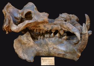
Skull of an individual of the family of Hippopotamidae from the pleistocene. In the 20 million years before, bigger species of ungulates such as this one became more common, so that ungulates as a group increased in body size through the process of species selection. Credit: Copyright: Senckenberg
The observed increase of body size in ungulates during the 20 million years before the Pleistocene is driven by the process of species selection, according to researchers from the Senckenberg, Germany. Bigger ungulate species became more common because of a higher origination and lower extinction rate. The study, published recently in Proceedings of Royal Society B, is the first to compare the evolution of two mammalian clades during the Neogene on two continents. The researchers point out that this biogeographic perspective yields complex explanations for apparently shared patterns.
What does the future hold for mammals? In the past, bigger was indeed better as several studies have shown an increasing trend of body size in mammals (including ungulates) until the great extinction events during the ice ages; coinciding with a cooling climate. Today it seems populations of larger-bodied species are threatened to a greater degree. Some researchers even consider dwarfing as a possible consequence of the ongoing temperature rise. Insights into the patters of body size evolution might help to predict the changes that lie ahead for mammals.
In order to understand how body size evolves in mammals, Dr. Shan Huang, Senckenberg Biodiversity and Climate Research Centre, and her colleagues analyzed a fossil data set of large herbivores (ungulates: orders Artiodactyla und Perissodactyla). The fossil remains, which include around 500 species of animals such as giraffes and hippos as well as rhinoceros and chalicotheres, cover the period between 23 to two million years ago. This is the first time the evolutionary patterns of body size in ungulates during this period were analyzed and compared between Europe and North America.
Whereas studies on body size had primarily investigated trends of mean body size increase, Huang highlighted changes in the minimum body size. “Overall, we saw a significant increase in minimum (and maximum) body size during this time. This indicates active evolution, meaning that the animals did not evolve to bigger sizes in the course of time by chance. On the contrary, bigger species had an evolutionary advantage when competing for natural resources. This is what we call species selection,” says Huang.
According to the researchers, species selection is supported by two results. First of all, in the course of time artiodactyl species that had comparatively large bodies were more likely to diversify into new species compared to smaller artiodactyl species. This explains why in sum this order increased in body size on both continents. “It may be due to the fact that being bigger made it easier to adopt a new lifestyle and occupy new niches that appeared at that time — the basis for rapid diversification,” co-author of the study, Dr. Susanne Fritz, Senckenberg Biodiversity and Climate Research Centre, explains.
Secondly, larger-bodied artiodactyl species in North America were less likely to go extinct than small-bodied species; a pattern which also emerged when the researchers compared perissodactyl species (odd-toed ungulates) in North America. The researchers speculate that this might be due to the fact that the North American continent lacked an easy southern pathway, restricting dispersal towards lower latitudes when the climate became colder towards the end of the Neogene. Larger-bodied species might have been more capable of coping with the new conditions and the associated changes in food sources.
“Our study demonstrates that similar macroevolutionary trends across regions might be generated by different processes. Even one single trait — like body size — can associate with origination and extinction rates differently in different regions and orders, perhaps even differently at different levels of taxonomic hierarchy” Huang sums up and adds: “It also highlights that the regional environment within which evolution takes place must be considered when disentangling the underlying mechanisms. To use this knowledge as a basis for future projections, we suggest doing more comparisons between continents in macroevolutionary studies.”
Reference:
Shan Huang, Jussi T. Eronen, Christine M. Janis, Juha J. Saarinen, Daniele Silvestro, Susanne A. Fritz. Mammal body size evolution in North America and Europe over 20 Myr: similar trends generated by different processes. Proceedings of the Royal Society B: Biological Sciences, 2017; 284 (1849): 20162361 DOI: 10.1098/rspb.2016.2361
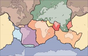
The outer layer of modern Earth is a collection of interlocking rigid plates, as seen in this illustration. These plates grind together, sliding past or dipping beneath one another, giving rise to earthquakes and volcanoes. But new research suggests that plate tectonics did not begin until much later in Earth’s history. Credit: USGS
Today’s Earth is a dynamic planet with an outer layer composed of giant plates that grind together, sliding past or dipping beneath one another, giving rise to earthquakes and volcanoes. Others separate at undersea mountain ridges, where molten rock spreads out from the centers of major ocean basins.
But new research suggests that this was not always the case. Instead, shortly after Earth formed and began to cool, the planet’s first outer layer was a single, solid but deformable shell. Later, this shell began to fold and crack more widely, giving rise to modern plate tectonics.
The research, described in a paper published February 27, 2017 in the journal Nature, is the latest salvo in a long-standing debate in the geological research community: did plate tectonics start right away—a theory known as uniformitarianism—or did Earth first go through a long phase with a solid shell covering the entire planet? The new results suggest the solid shell model is closest to what really happened.
“Models for how the first continental crust formed generally fall into two groups: those that invoke modern-style plate tectonics and those that do not,” said Michael Brown, a professor of geology at the University of Maryland and a co-author of the study. “Our research supports the latter—a ‘stagnant lid’ forming the planet’s outer shell early in Earth’s history.”
To reach these conclusions, Brown and his colleagues from Curtin University and the Geological Survey of Western Australia studied rocks collected from the East Pilbara Terrane, a large area of ancient granitic crust located in the state of Western Australia. Rocks here are among the oldest known, ranging from 3.5 to about 2.5 billion years of age. (Earth is roughly 4.5 billion years old.) The researchers specifically selected granites with a chemical composition usually associated with volcanic arcs—a telltale sign of plate tectonic activity.
Brown and his colleagues also looked at basalt rocks from the associated Coucal formation. Basalt is the rock produced when volcanoes erupt, but it also forms the ocean floor, as molten basalt erupts at spreading ridges in the center of ocean basins. In modern-day plate tectonics, when ocean floor basalt reaches the continents, it dips—or subducts—beneath the Earth’s surface, where it generates fluids that allow the overlying mantle to melt and eventually create large masses of granite beneath the surface.
Previous research suggested that the Coucal basalts could be the source rocks for the granites in the Pilbara Terrane, because of the similarities in their chemical composition. Brown and his collaborators set out to verify this, but also to test another long-held assumption: could the Coucal basalts have melted to form granite in some way other than subduction of the basalt beneath Earth’s surface? If so, perhaps plate tectonics was not yet happening when the Pilbara granites formed.
To address this question, the researchers performed thermodynamic calculations to determine the phase equilibria of average Coucal basalt. Phase equilibria are precise descriptions of how a substance behaves under various temperature and pressure conditions, including the temperature at which melting begins, the amount of melt produced and its chemical composition.
For example, one of the simplest phase equilibria diagrams describes the behavior of water: at low temperatures and/or high pressures, water forms solid ice, while at high temperatures and/or low pressures, water forms gaseous steam. Phase equilibria gets a bit more involved with rocks, which have complex chemical compositions that can take on very different mineral combinations and physical characteristics based on temperature and pressure.
“If you take a rock off the shelf and melt it, you can get a phase diagram. But you’re stuck with a fixed chemical composition,” Brown said. “With thermodynamic modeling, you can change the composition, pressure and temperature independently. It’s much more flexible and helps us to answer some questions we can’t address with experiments on rocks.”
Using the Coucal basalts and Pilbara granites as a starting point, Brown and his colleagues constructed a series of modeling experiments to reflect what might have transpired in an ancient Earth without plate tectonics. Their results suggest that, indeed, the Pilbara granites could have formed from the Coucal basalts.
More to the point, this transformation could have occurred in a pressure and temperature scenario consistent with a “stagnant lid,” or a single shell covering the entire planet.
Plate tectonics substantially affects the temperature and pressure of rocks within Earth’s interior. When a slab of rock subducts under the Earth’s surface, the rock starts off relatively cool and takes time to gain heat. By the time it reaches a higher temperature, the rock has also reached a significant depth, which corresponds to high pressure—in the same way a diver experiences higher pressure at greater water depth.
In contrast, a “stagnant lid” regime would be very hot at relatively shallow depths and low pressures. Geologists refer to this as a “high thermal gradient.”
“Our results suggest the Pilbara granites were produced by melting of the Coucal basalts or similar materials in a high thermal gradient environment,” Brown said. “Additionally, the composition of the Coucal basalts indicates that they, too, came from an earlier generation of source rocks. We conclude that a multi-stage process produced Earth’s first continents in a ‘stagnant lid’ scenario before plate tectonics began.”
“Earth’s first stable continents did not form by subduction,” Tim Johnson, Michael Brown, Nicholas Gardiner, Christopher Kirkland and Hugh Smithies, was published February 27, 2017 in the journal Nature.
Reference:
Earth’s first stable continents did not form by subduction, Nature, DOI:10.1038/nature21383
Results of a massive new project to map and classify the earthquake shaking potential across most of the Las Vegas metropolitan area will help developers there build in safer and less expensive ways.
The “Parcel Map” described 28 February in the Bulletin of the Seismological Society of America is the most extensive effort to date in the United States to map and classify soils based on their effects on earthquake shaking across an entire urban area with systematic, direct measurements at high density. These “site classifications” are a key part of the building codes that structural engineers use to design new buildings—or to retrofit older buildings—to withstand earthquake damage.
How much a building might be damaged by an earthquake depends in part on the stiffness (strength) of the ground on which it is built. This stiffness is dependent on the seismic shear-wave velocity of the underlying soil and/or rock. Seismic waves create less shaking when they pass through hard rock which has a high shear-wave velocity, for instance, compared to loose soils which have low shear-wave velocities. The building code bases site classifications on shear-wave velocity that vary with ground conditions.
One of the most important findings of the parcel map study is that much of the ground in the Las Vegas area is actually stiffer (stronger) and potentially safer for building than the current default site classifications for the region indicate.
The default classification used for the Las Vegas metro area is “Class D,” indicating the presence of relatively weak and potentially hazardous soils for building. But the new parcel map suggests that 84% of the mapped region is stiffer than Class D.
Until now, developers in the Las Vegas area had to assume that their building sites were Class D if no other classification had been made. As a result, some developers were requiredto build to more stringent earthquake standards than necessary, potentially increasing the cost of design and construction.
The new Parcel Map could reduce some of these costs, while offering a better way to identify which existing buildings may be prone to shaking in an earthquake. “City officials can then plan retrofit campaigns and ensure buildings meet requisite safety standard on the basis of knowledge, rather than guesswork,” Aasha Pancha and her colleagues write in the BSSA paper.
The parcel map was drawn from more than 10,000 seismic-array measurements taken about every 300 meters, to cover most of urban Las Vegas. This density of measurement was necessary to characterize the natural variability of the observed site class values due to different soils throughout the city. A big factor in developing the map was high demand for building permits and reviews by Clark County, Nevada and the city of Henderson, Nevada, which commissioned the project, said Pancha, now a researcher at Victoria University of Wellington, New Zealand and part of the geotechnical investigation team at Aurecon New Zealand Ltd. Rather than research driven, the project was driven by the practical needs of the planners, developers, builders, and engineers.
“There was an element of serendipity as well,” Pancha added. “Most of the building was going on in an area where measurements were proving the ground to be much stiffer and less hazardous than the defaults allowed in the building code. So there was the prospect of saving money for developers in such areas.”
Property owners, designers, city planners, and developers can now determine the site classification for any particular parcel by consulting the “soil guidelines” map accessible online through the Clark County website.
“What has made Parcel Mapping unique so far to Clark County and the City of Henderson in southern Nevada is that it was an entirely locally-supported project,” Pancha said. “Between the 1970s and today the population of southern Nevada has grown tenfold, and federal allocations for earthquake research and hazard mitigation have in no way kept up with this explosive growth rate.”
“In earthquake-prone areas that are growing rapidly now that the recession has ended, this local commitment to earthquake-hazard mitigation is more likely,” she added.
Reference:
“Large scale earthquake hazard class mapping by parcel in Las Vegas Valley, Nevada,” Bulletin of the Seismological Society of America, 2017.
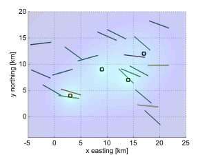
Four wells increase pressure in nearby faults. If a fault is stable, it is green. If a fault is pushed toward slipping, it is colored yellow or red depending on how sensitive it is, how much pressure is put on it, operational uncertainties and the tolerance of the operator. Credit: Rall Walsh
A new, freely available software tool developed by Stanford scientists will enable energy companies and regulatory agencies to calculate the probability of triggering manmade earthquakes from wastewater injection and other activities associated with oil and gas production.
“Faults are everywhere in the Earth’s crust, so you can’t avoid them. Fortunately, the majority of them are not active and pose no hazard to the public. The trick is to identify which faults are likely to be problematic, and that’s what our tool does,” said Mark Zoback, professor of geophysics at Stanford’s School of Earth, Energy & Environmental Sciences. Zoback developed the approach with his graduate student Rall Walsh.
Four wells increase pressure in nearby faults. If a fault is stable, it is green. If a fault is pushed toward slipping, it is colored yellow or red depending on how sensitive it is, how much pressure is put on it, operational uncertainties and the tolerance of the operator.
Oil and gas operations can generate significant quantities of “produced water” – brackish water that needs to be disposed of through deep injection to protect drinking water. Energy companies also dispose of water that flows back after hydraulic fracturing in the same way. This process can increase pore pressure – the pressure of groundwater trapped within the tiny spaces inside rocks in the subsurface – which, in turn, increases the pressure on nearby faults, causing them to slip and release seismic energy in the form of earthquakes.
The Fault Slip Potential (FSP) tool that Walsh and Zoback developed uses three key pieces of information to help determine the probability of a fault being pushed to slip. The first is how much wastewater injection will increase pore pressure at a site. The second is knowledge of the stresses acting in the earth. This information is obtained from monitoring earthquakes or already drilled wells in the area. The final piece of information is knowledge of pre-existing faults in the area. Such information typically comes from data collected by oil and gas companies as they explore for new resources.
Testing the tool
Zoback and Walsh have started testing their FSP tool in Oklahoma, which has experienced a sharp rise in the number of earthquakes since 2009, due largely to wastewater injection operations. Their analysis suggests that some wastewater injection wells in Oklahoma were unwittingly placed near stressed faults already primed to slip.
“Our tool provides a quantitative probabilistic approach for identifying at-risk faults so that they can be avoided,” Walsh said. “Our aim is to make using this tool the first thing that’s done before an injection well is drilled.”
Regulators could also use the tool to identify areas where proposed injection activities could prove problematic so that enhanced monitoring efforts can be implemented.
The FSP software program will be made freely available for download at SCITS.stanford.edu on March 2.
Funding for the development of the software was provided by the Stanford Center for Induced and Triggered Seismicity (SCITS), an industrial affiliates program involving 10 Stanford professors. The Fault Slip Potential software was developed in collaboration with ExxonMobil.
Zoback is also a senior fellow at Stanford’s Precourt Institute for Energy, an affiliate of the Stanford Woods Institute for the Environment and the director of the Stanford Natural Gas Initiative.
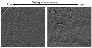
The dietary pattern of the Homo antecessor could be related to an environment with significant fluctuations in climate and food availability. Credit: Universidad de Barcelona
The Homo antecessor, a hominin species that inhabited the Iberian Peninsula around 800,000 years ago, would have a mechanically more demanding diet than other hominin species in Europe and the African continent. This unique pattern, which would be characterized by the consumption of hard and abrasive foods, may be explained by the differences in food processing in a very demanding environment with fluctuations in climate and food resources, according to a study published in the journal Scientific Reports and led by a team from the Faculty of Biology of the University of Barcelona, the Catalan Institute of Human Paleoecology and Social Evolution (IPHES) and the University of Alicante.
This new research, which reveals for the first time the evidence on the diet of these hominines with the study of the microscopic traces left by food in the dental enamel, counts with the participation of the researchers Alejandro Pérez-Pérez and his team, formed by the doctors Laura Martínez, Ferrán Estebaranz, and Beatriz Pinilla (UB), Marina Lozano (Catalan Institute of Human Paleoecology and Social Evolution, IPHES), Alejandro Romero (University of Alicante), Jordi Galbany (George Washington University, United States) and the co-directors of Atapuerca, José María Bermúdez de Castro (National Research Centre on Human Evolution, CENIEH), Eudald Carbonell (IPHES) and Juan Luís Arsuaga (Universidad Complutense de Madrid).
Prior to this research, the diet of the hominines of the Lower Pleistocene of Atapuerca (Burgos, Spain), our most remote European ancestors, had been inferred from animal remains -a great variety of large mammals and even turtles- found in the same levels in which the human remains were found. Evidence of cannibalism has also been suggested in some of these fossils.
Foods that leave a mark on the dental enamel
The study is based on the analysis of the buccal microwear pattern of the fossils from Trinchera Elefante and Gran Dolina in the Atapuerca site. The examined microwear features are small marks on the buccal teeth enamel surface , whose density and length depend on the types of chewed food. “The usefulness of this methodology has been proved by the study of the microwear patterns of present populations, both hunter-gatherer and agricultural, showing that different feeding patterns correlate with specific microwear patterns in the vestibular surface of the dental crown,” explains Professor Alejandro Pérez-Pérez, professor at the Zoology and Biological Anthropology Unit of theof the Department of Evolutionary Biology, Ecology and Environmental Sciences at the University of Barcelona.
In the new study, the Atapuerca fossils have been compared with samples from other Lower Pleistocene populations: with fossils of the African Homo ergaster, ancestors of all Europeans dated from 1.8 million years ago; and also with Homo heidelbergensis, which appeared more than 500,000 years ago in Europe and lasted until at least 200,000 years ago, and finally with Homo neanderthalensis, specimens from the Iberian Peninsula that lived between 200,000 and 40,000 years ago.
Higher striation densities in Homo antecessor
The results of the study show that the teeth of H. antecessor show higher striation densities than the rest of the analyzed species. “Our findings do not allow us to say exactly what foods they ate, since the abrasive materials that cause the marks on the teeth may have different origins, but they do allow us to point out that H. antecessor would have had a diet largely based on hard and abrasive foods, such as plants containing phytoliths (which are silica particles produced by plants that are as hard as enamel), tubers with traces of soil particles, collagen or connective tissue and bone or raw meat,” says the researcher.
The researchers suggest that differences in the Gran Dolina microwear patterns among the compared samples could reflect cultural differences in the way food was processed. “Hunting and gathering activities are consistent with the highly-abrasive wear pattern we have encountered, but it is very difficult to think that the available food in the Atapuerca area was very different from that available to other hunter-gatherer hominins. Therefore, it would be the different ways of processing the food that would give rise to these differences in the dental microwear patterns. That is to say, they obtained, processed and consumed the food in different ways,” explains Alejandro Pérez-Pérez, who leads a team that has also applied this methodology in the study of feeding behaviors of the hominins of the Pleistocene of East Africa, including the species Paranthropus boisei and Homo habilis.
A more primitive lithic industry
This pattern of great abrasiveness, observed on the enamel teeth surfaces in Gran Dolina contrasts with what has been observed in the compared species in the study. “Unlike H. neanderthalensis, which had a more advanced lithic industry (called Mode 3 or Mousterian), the tools that have been found related to Homo antecessor are primitive (Mode 1). These industries would not facilitate food processing, as also suggested by evidence that they used teeth to chew bones. In addition, the lack of evidence of the use of fire in Atapuerca suggests that they would surely eat everything raw, causing more dental wear, including plant foods, meat, tendons or skin.
For the researchers, a diet with a high meat consumption could have evolutionary implications. “Meat in the diet could have contributed to the necessary energy gain to sustain a large brain like that of H. antecessor, with a brain volume of approximately 1,000 cubic centimeters, compared to the 764 of H. ergaster, but it would also represent a significant source of food in a highly demanding environment where preferred foods, such as ripe fruits and tender vegetables, would vary seasonally.”
The research contributes significantly to the better understanding of the dietary adaptations of our ancestors and highlights the importance of the ecological and cultural factors that have conditioned our biological evolution.
Reference:
Alejandro Pérez-Pérez, Marina Lozano, Alejandro Romero, Laura M. Martínez, Jordi Galbany, Beatriz Pinilla, Ferran Estebaranz-Sánchez, José María Bermúdez de Castro, Eudald Carbonell, Juan Luís Arsuaga. The diet of the first Europeans from Atapuerca. Scientific Reports, 2017; 7: 43319 DOI: 10.1038/srep43319
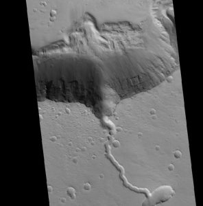
This is a solidified lava flow over the side of a crater rim of Elysium. Credit: NASA HiRISE image, David Susko, LSU.
Mars’ mantle may be more complicated than previously thought. In a new study published today in the Nature-affiliated journal Scientific Reports, researchers at LSU document geochemical changes over time in the lava flows of Elysium, a major martian volcanic province.
LSU Geology and Geophysics graduate researcher David Susko led the study with colleagues at LSU including his advisor Suniti Karunatillake, the University of Rahuna in Sri Lanka, the SETI Institute, Georgia Institute of Technology, NASA Ames, and the Institut de Recherche en Astrophysique et Planétologie in France.
They found that the unusual chemistry of lava flows around Elysium is consistent with primary magmatic processes, such as a heterogeneous mantle beneath Mars’ surface or the weight of the overlying volcanic mountain causing different layers of the mantle to melt at different temperatures as they rise to the surface over time.
Elysium is a giant volcanic complex on Mars, the second largest behind Olympic Mons. For scale, it rises to twice the height of Earth’s Mount Everest, or approximately 16 kilometers. Geologically, however, Elysium is more like Earth’s Tibesti Mountains in Chad, the Emi Koussi in particular, than Everest. This comparison is based on images of the region from the Mars Orbiter Camera, or MOC, aboard the Mars Global Surveyor, or MGS, Mission.
Elysium is also unique among martian volcanoes. It’s isolated in the northern lowlands of the planet, whereas most other volcanic complexes on Mars cluster in the ancient southern highlands. Elysium also has patches of lava flows that are remarkably young for a planet often considered geologically silent.
“Most of the volcanic features we look at on Mars are in the range of 3-4 billion years old,” Susko said. “There are some patches of lava flows on Elysium that we estimate to be 3-4 million years old, so three orders of magnitude younger. In geologic timescales, 3 million years ago is like yesterday.”
In fact, Elysium’s volcanoes hypothetically could still erupt, Susko said, although further research is needed to confirm this. “At least, we can’t yet rule out active volcanoes on Mars,” Susko said. “Which is very exciting.”
Susko’s work in particular reveals that the composition of volcanoes on Mars may evolve over their eruptive history. In earlier research led by Karunatillake, assistant professor in LSU’s Department of Geology and Geophysics, researchers in LSU’s Planetary Science Lab, or PSL, found that particular regions of Elysium and the surrounding shallow subsurface of Mars are geochemically anomalous, strange even relative to other volcanic regions on Mars. They are depleted in the radioactive elements thorium and potassium. Elysium is one of only two igneous provinces on Mars where researchers have found such low levels of these elements so far.
“Because thorium and potassium are radioactive, they are some of the most reliable geochemical signatures that we have on Mars,” Susko said. “They act like beacons emitting their own gamma photons. These elements also often couple in volcanic settings on Earth.”
In their new paper, Susko and colleagues started to piece together the geologic history of Elysium, an expansive volcanic region on Mars characterized by strange chemistry. They sought to uncover why some of Elysium’s lava flows are so geochemically unusual, or why they have such low levels of thorium and potassium. Is it because, as other researchers have suspected, glaciers located in this region long ago altered the surface chemistry through aqueous processes? Or is it because these lava flows arose from different parts of Mars’ mantle than other volcanic eruptions on Mars?
Perhaps the mantle has changed over time, meaning that more recent volcanic eruption flows differ chemically from older ones. If so, Susko could use Elysium’s geochemical properties to study how Mars’ bulk mantle has evolved over geologic time, with important insights for future missions to Mars. Understanding the evolutionary history of Mars’ mantle could help researchers gain a better understanding of what kinds of valuable ores and other materials could be found in the crust, as well as whether volcanic hazards could unexpectedly threaten human missions to Mars in the near future. Mars’ mantle likely has a very different history than Earth’s mantle because the plate tectonics on Earth are absent on Mars as far as researchers know. The history of the bulk interior of the red planet also remains a mystery.
Susko and colleagues at LSU analyzed geochemical and surface morphology data from Elysium using instruments on board NASA’s Mars Odyssey Orbiter (2001) and Mars Reconnaissance Orbiter (2006). They had to account for the dust that blankets Mars’ surface in the aftermath of strong dust storms, to make sure that the shallow subsurface chemistry actually reflected Elysium’s igneous material and not the overlying dust.
Through crater counting, the researchers found differences in age between the northwest and the southeast regions of Elysium — about 850 million years of difference. They also found that the younger southeast regions are geochemically different from the older regions, and that these differences in fact relate to igneous processes, not secondary processes like the interaction of water or ice with the surface of Elysium in the past.
“We determined that while there might have been water in this area in the past, the geochemical properties in the top meter throughout this volcanic province are indicative of igneous processes,” Susko said. “We think levels of thorium and potassium here were depleted over time because of volcanic eruptions over billions of years. The radioactive elements were the first to go in the early eruptions. We are seeing changes in the mantle chemistry over time.”
“Long-lived volcanic systems with changing magma compositions are common on Earth, but an emerging story on Mars,” said James Wray, study co-author and associate professor in the School of Earth and Atmospheric Sciences at Georgia Tech.
Wray led a 2013 study that showed evidence for magma evolution at a different martian volcano, Syrtis Major, in the form of unusual minerals. But such minerals could be originating at the surface of Mars, and are visible only on rare dust-free volcanoes.
“At Elysium we are truly seeing the bulk chemistry change over time, using a technique that could potentially unlock the magmatic history of many more regions across Mars,” he said.
Susko speculates that the very weight of Elysium’s lava flows, which make up a volcanic province six times higher and almost four times wider than its morphological sister on Earth, Emi Koussi, has caused different depths of Mars’ mantle to melt at different temperatures. In different regions of Elysium, lava flows may have come from different parts of the mantle. Seeing chemical differences in different regions of Elysium, Susko and colleagues concluded that Mars’ mantle might be heterogeneous, with different compositions in different areas, or that it may be stratified beneath Elysium.
Overall, Susko’s findings indicate that Mars is a much more geologically complex body than originally thought, perhaps due to various loading effects on the mantle caused by the weight of giant volcanoes.
“It’s more Earth-like than moon-like,” Susko said. “The moon is cut and dry. It often lacks the secondary minerals that occur on Earth due to weathering and igneous-water interactions. For decades, that’s also how we envisioned Mars, as a lifeless rock, full of craters with a number of long inactive volcanoes. We had a very simple view of the red planet. But the more we look at Mars, the less moon-like it becomes. We’re discovering more variety in rock types and geochemical compositions, as seen across the Curiosity Rover’s traverse in Gale Crater, and more potential for viable resource utilization and capacity to sustain a human population on Mars. It’s much easier to survive on a complex planetary body bearing the mineral products of complex geology than on a simpler body like the moon or asteroids.”
Susko plans to continue clarifying the geologic processes that cause the strange chemistry found around Elysium. In the future, he will study these chemical anomalies through computational simulations, to determine if recreating the pressures in Mars’ mantle caused by the weight of giant volcanoes could affect mantle melting to yield the type of chemistry observed within Elysium.
National Geographic VR takes you flying in 360° to the rim of a spectacular erupting volcano. Over 15,500 feet tall, Klyuchevskoy “Kamchatka Volcano” is one of the tallest and most active volcanoes on the planet.
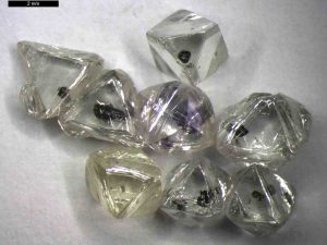
A selection of unprocessed inclusion-bearing gem quality diamonds from Letlhakane. The dark areas surrounding the shiny metal like inclusions (sulphide) are graphite in cracks that from due to the differential expansion of the sulphide and diamond when brought to the surface from a depth of over 150 km. Bottom left diamond contains an orange garnet and a green clinopyroxene. Credit: M. Gress, VU Amsterdam
A study of tiny mineral ‘inclusions’ within diamonds from Botswana has shown that diamond crystals can take billions of years to grow. One diamond was found to contain silicate material that formed 2.3 billion years ago in its interior and a 250 million-year-old garnet crystal towards its outer rim, the largest age range ever detected in a single specimen. Analysis of the inclusions also suggests that the way that carbon is exchanged and deposited between the atmosphere, biosphere, oceans and geosphere may have changed significantly over the past 2.5 billion years.
‘Although a jeweller would consider diamonds with lots of inclusions to be flawed, for a geologist these are the most valuable and exciting specimens,’ said Prof Gareth Davies, of Vrije Universiteit (VU) Amsterdam, who co-authored the study. ‘We can use the inclusions to date different parts of an individual diamond, and that allows us to potentially look at how the processes that formed diamonds may have changed over time and how this may be related to the changing carbon cycle on Earth.’
Sixteen diamonds from two mines in north eastern Botswana were analysed in the study: seven specimens from the Orapa mine and nine from the Letlhakane mine. A team at VU Amsterdam measured the radioisotope, nitrogen and trace element contents of inclusions within the diamonds. Although the mines are located just 40 kilometres apart, the diamonds from the two sources had significant differences in the age range and chemical composition of inclusions.
The Orapa diamonds contained material dating from between around 400 million and more than 1.4 billion years ago. The Letlhakane diamond inclusions ranged from less than 700 million and up to 2-2.5 billion years old. In every case, the team were able to link the age and composition of material in the inclusions to distinct tectonic events occurring locally in the Earth’s crust, such as a collision between plates, continental rifting or magmatism. This suggests that diamond formation is triggered by heat fluctuations and magma fluid movement associated with these events.
The Letlhakane diamonds also provided a rare opportunity to look back in time to the early Earth. The oldest inclusions date back to before the Great Oxidation Event (GOE) around 2.3 billion years ago, when oxygen produced by multicellular cyanobacteria started to fill the atmosphere, radically changing the weathering and sediment formation processes and thus altering the chemistry of rocks.
‘The oldest inclusions in the diamonds contain a higher proportion of the lighter carbon isotope. As photosynthesis favours the lighter isotope, carbon 12, over the heavier carbon 13, this ‘light’ ratio finding suggests that organic material from biological sources may have been more abundant in diamond-forming zones early in the Earth’s history than we find today,’ explained Suzette Timmerman, lead author on the study. ‘Higher temperatures in the Earth’s interior before the GOE may have affected the way that carbon was released into the diamond forming regions beneath the Earth’s continental plates and may be evidence of a fundamental change in tectonic processes. However, we are currently working with a very small dataset and need further studies to establish if this is a global phenomenon.’
Reference:
S. Timmerman et al. Dated eclogitic diamond growth zones reveal variable recycling of crustal carbon through time, Earth and Planetary Science Letters (2017). DOI: 10.1016/j.epsl.2017.02.001
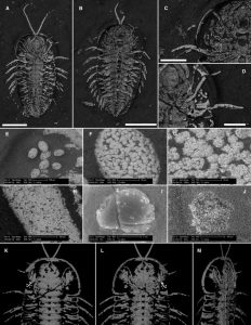
Pyritized trilobite specimens (Triarthrus eatoni) are from the Ordovician Whetstone Gulf Formation (Lorraine Group), upstate New York (USA). Credit: The authors and Copyright The Geological Society of America
Despite a plethora of exceptionally preserved trilobites, trilobite reproduction has remained a mystery. No previously described trilobite has had unambiguous eggs or genitalia preserved. This study by Thomas A. Hegna and colleagues reports the first occurrence of in situ preserved trilobite eggs from the Lorraine Group in upstate New York, USA.
Like other exceptionally preserved trilobites from the Lorraine Group, the complete exoskeletons are replaced with pyrite. The eggs are spherical to elliptical in shape and nearly 200 micrometers in size.
The location of the eggs is consistent with where modern female horseshoe crabs release their unfertilized eggs from the ovarian network within their head. Trilobites likely released their eggs and sperm through a genital pore of as-yet-unknown location (but probably near the posterior boundary of the head).
Because pyrite preferentially preserves the external features of fossils, there is probably a bias in the fossil record toward the preservation of arthropods that brood eggs externally. If the reproductive biology of these trilobites is representative of other trilobites, they likely spawned with external fertilization as well, which may be the ancestral mode of reproduction for early arthropods.
Reference:
Thomas A. Hegna, Markus J. Martin, Simon A.F. Darroch. Pyritizedin situtrilobite eggs from the Ordovician of New York (Lorraine Group): Implications for trilobite reproductive biology. Geology, 2017; 45 (3): 199 DOI: 10.1130/G38773.1
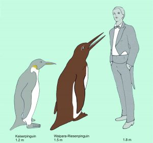
The Waipara giant penguin compared to an Emperor Penguin (the largest extant penguin species) and a human. Credit: Senckenberg
Together with colleagues from New Zealand, Senckenberg scientist Dr. Gerald Mayr described a recently discovered fossil of a giant penguin with a body length of around 150 centimeters. The new find dates back to the Paleocene era and, with an age of approx. 61 million years, counts among the oldest penguin fossils in the world. The bones differ significantly from those of other discoveries of the same age and indicate that the diversity of Paleocene penguins was higher than previously assumed. In their study, published in the Springer scientific journal The Science of Nature, the team of scientists therefore postulates that the evolution of penguins started much earlier than previously thought, probably already during the age of dinosaurs.
The fossil sites along the Waipara River in New Zealand’s Canterbury region are well known for their avian fossils, which were embedded in marine sand a mere 4 million years after the dinosaurs became extinct. “Among the finds from these sites, the skeletons of Waimanu, the oldest known penguin to date, are of particular importance,” explains Dr. Gerald Mayr of the Senckenberg Research Institute in Frankfurt.
Together with colleagues from the Canterbury Museum in New Zealand, Mayr now described a newly discovered penguin fossil from the famous fossil site. “What sets this fossil apart are the obvious differences compared to the previously known penguin remains from this period of geological history,” explains the ornithologist from Frankfurt, and he continues, “The leg bones we examined show that during its lifetime, the newly described penguin was significantly larger than its already described relatives. Moreover, it belongs to a species that is more closely related to penguins from later time periods.”
According to the researchers, the newly described penguin lived about 61 million years ago and reached a body length of approx. 150 centimeters — making it almost as big as Anthropornis nordenskjoeldi, the largest known fossil penguin, which lived in Antarctica around 45 to 33 million years ago, thus being much younger in geological terms. “This shows that penguins reached an enormous size quite early in their evolutionary history, around 60 million years ago,” adds Mayr.
In addition, the team of scientists from New Zealand and Germany assumes that the newly discovered penguin species also differed from their more primitive relatives in the genus Waimanu in their mode of locomotion: The large penguins presumably already moved with the upright, waddling gait characteristic for today’s penguins.
“The discoveries show that penguin diversity in the early Paleocene was clearly higher than we previously assumed,” says Mayr, and he adds, “In turn, this diversity indicates that the first representatives of penguins already arose during the age of dinosaurs, more than 65 million years ago.”
Reference:
Gerald Mayr, Vanesa L. De Pietri, R. Paul Scofield. A new fossil from the mid-Paleocene of New Zealand reveals an unexpected diversity of world’s oldest penguins. The Science of Nature, 2017; 104 (3-4) DOI: 10.1007/s00114-017-1441-0
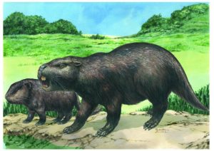
This is an artist’s impression of the giant rodent. Credit: Taylor and Francis
Adult and juvenile remains of a giant rodent species (Isostylomys laurdillardi) have been uncovered by researchers, in the Río de la Plata coastal region of southern Uruguay, raising questions about classification within dinomids.
The study, detailed in Journal of Systematic Palaeontology, consisted of examining teeth structure and development, and comparing the fossils to previously found examples and the largest living rodent — the capybara. It was proposed that, due to similarities in the adult’s and the juvenile’s teeth structure, previously found fossils, which were smaller and thought to belong to a different species, were in fact from the same species.
The authors have consequently proposed that members of the subfamily Gyriabrinae could represent juveniles belonging to other subfamilies of Dinomyidae and that three known species of the genus Isostylomys should be merged into just one species, Isostylomys laurillardi.
Author of the study Andres Rinderknecht commented, “Our study shows how the world’s largest fossil rodents grow and we describe fossil remains of a giant rodent baby and an adult. Comparing them we conclude that from very young the giant rodents already were very similar to the adults which allows us to deduce that the great majority of the hypotheses before posed were wrong. The juvenile and the adult analyzed here represent some of the largest rodents known to science with some of these animals weighing almost a ton.”
The adult remains found consist of an almost complete skull with a partial jaw, while the juvenile’s remains are of a complete lower jaw and right heel. Almost all previous discoveries of this kind have consisted of isolated teeth, and small fragments of skulls or jaws, which make this discovery some of the best-preserved remains of giant dinomids known to date.
Reference:
Andrés Rinderknecht, Enrique Bostelmann, Martín Ubilla. Making a giant rodent: cranial anatomy and ontogenetic development in the genus Isostylomys (Mammalia, Hystricognathi, Dinomyidae). Journal of Systematic Palaeontology, 2017; 1 DOI: 10.1080/14772019.2017.1285360
The samples are heated under pressure to high temperatures of the core (about 4000 kelvins and higher) by being irradiated by a laser through diamonds. Credit: Tokyo Institute of Technology
The Earth’s core consists mostly of a huge ball of liquid metal lying at 3000 km beneath its surface, surrounded by a mantle of hot rock. Notably, at such great depths, both the core and mantle are subject to extremely high pressures and temperatures. Furthermore, research indicates that the slow creeping flow of hot buoyant rocks — moving several centimeters per year — carries heat away from the core to the surface, resulting in a very gradual cooling of the core over geological time. However, the degree to which the Earth’s core has cooled since its formation is an area of intense debate amongst Earth scientists.
In 2013 Kei Hirose, now Director of the Earth-Life Science Institute (ELSI) at the Tokyo Institute of Technology (Tokyo Tech), reported that the Earth’s core may have cooled by as much as 1000 degrees Celsius since its formation 4.5 billion years ago. This large amount of cooling would be necessary to sustain the geomagnetic field, unless there was another as yet undiscovered source of energy. These results were a major surprise to the deep Earth community, and created what Peter Olson of Johns Hopkins University referred to as, “the New Core Heat Paradox,” in an article published in Science.
Core cooling and energy sources for the geomagnetic field were not the only difficult issues faced by the team. Another unresolved matter was uncertainty about the chemical composition of the core. “The core is mostly iron and some nickel, but also contains about 10% of light alloys such as silicon, oxygen, sulfur, carbon, hydrogen, and other compounds,” Hirose, lead author of the new study to be published in the journal Nature. “We think that many alloys are simultaneously present, but we don’t know the proportion of each candidate element.”
Now, in this latest research carried out in Hirose’s lab at ELSI, the scientists used precision cut diamonds to squeeze tiny dust-sized samples to the same pressures that exist at the Earth’s core. The high temperatures at the interior of the Earth were created by heating samples with a laser beam. By performing experiments with a range of probable alloy compositions under a variety of conditions, Hirose’s and colleagues are trying to identify the unique behavior of different alloy combinations that match the distinct environment that exists at the Earth’s core.
The search of alloys began to yield useful results when Hirose and his collaborators began mixing more than one alloy. “In the past, most research on iron alloys in the core has focused only on the iron and a single alloy,” says Hirose. “But in these experiments we decided to combine two different alloys containing silicon and oxygen, which we strongly believe exist in the core.”
The researchers were surprised to find that when they examined the samples in an electron microscope, the small amounts of silicon and oxygen in the starting sample had combined together to form silicon dioxide crystals — the same composition as the mineral quartz found at the surface of the Earth.
“This result proved important for understanding the energetics and evolution of the core,” says John Hernlund of ELSI, a co-author of the study. “We were excited because our calculations showed that crystallization of silicon dioxide crystals from the core could provide an immense new energy source for powering the Earth’s magnetic field.” The additional boost it provides is plenty enough to solve Olson’s paradox.
The team has also explored the implications of these results for the formation of the Earth and conditions in the early Solar System. Crystallization changes the composition of the core by removing dissolved silicon and oxygen gradually over time. Eventually the process of crystallization will stop when then core runs out of its ancient inventory of either silicon or oxygen.
“Even if you have silicon present, you can’t make silicon dioxide crystals without also having some oxygen available,” says ELSI scientist George Helffrich, who modeled the crystallization process for this study. “But this gives us clues about the original concentration of oxygen and silicon in the core, because only some silicon:oxygen ratios are compatible with this model.”
Reference:
Kei Hirose, Guillaume Morard, Ryosuke Sinmyo, Koichio Umemoto, John Hernlund, George Helffrich, Stéphane Labrosse. Crystallization of silicon dioxide and compositional evolution of the Earth’s core. Nature, 2017; DOI: 10.1038/nature21367
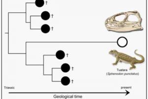
The living tuatara tracks back to the Triassic, over 200 million years ago, and shows little change from that time. Credit: Tom Stubbs/University of Bristol
A team of researchers from the University of Bristol studying the ‘living fossil’ Sphenodon — or tuatara — have identified a new way to measure the evolutionary rate of these enigmatic creatures, giving credence to Darwin’s theory of ‘living fossils’.
The tuatara is a relatively large lizard-like animal that once lived on the main islands of New Zealand but has been pushed to smaller, offshore islands by human activity. Tuataras are not lizards, although they share a common ancestor from about 240 million years ago, and have survived as an independent evolutionary line for all that time.
In the study, researchers measured jaw bones from all fossil relatives of the living tuatara, and compared these as evidence of dietary adaptation. They also examined rates of morphological evolution in the living tuatara and its extinct fossil relatives.
The study confirms two key points: the tuatara has shown very slow evolution, as expected, and importantly, its anatomy is very conservative.
Lead author, PhD student, Jorge Herrera-Flores, said: “The fossil relatives of the tuatara included plant eaters and even aquatic forms, and were much more diverse than today. We found the living tuatara shares most in common with its oldest relatives from the Triassic.”
When Charles Darwin invented the term ‘living fossils’ in 1859, he was thinking of living species that look just like their ancestors of millions of years ago. His explanation was they occupied small parts of the world, escaping competition, and therefore did not change.
“Darwin’s wasn’t a testable definition. By using modern numerical methods we have now shown that living fossils should show unusually slow rates of evolution compared to relatives,” said co-author, Dr Tom Stubbs.
“Many biologists do not like the term ‘living fossil’ because they say it is too vague. However, we have presented a clear, computational way to measure evolutionary rate. More importantly, we discovered a second fact about the living tuatara: its adaptations are central among all its fossil relatives. We can truly say that, numerically, the tuatara is conservative and just like its relatives from over 200 million years ago,” said Mike Benton, Professor of Vertebrate Palaeontology and Head of School of Biological Sciences at the University of Bristol and co-author of the report.
“We are with Darwin — we now have a numerical test of what is, and what is not, a living fossil. Importantly, these tests can be applied to other classic examples,” said Professor Benton.
Reference:
Jorge A. Herrera-Flores, Thomas L. Stubbs, Michael J. Benton. Macroevolutionary patterns in Rhynchocephalia: is the tuatara (Sphenodon punctatus) a living fossil? Palaeontology, 2017; DOI: 10.1111/pala.12284
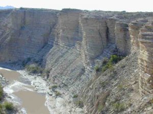
The layer cake of sedimentary rock near Big Bend, Texas, shows the alternating layers of shale and limestone characteristic of the rock laid down at the bottom of a shallow ocean during the late Cretaceous period. The rock holds the 87 million-year-old signature of a ‘resonance transition’ in the orbits of Mars and Earth, definitive geologic evidence that the orbits of the planets in our solar system behave differently than prevailing theory, which held that the planets orbit like clockwork in a quasiperiodic manner. Credit: Bradley Sageman, Northwestern University
Plumbing a 90 million-year-old layer cake of sedimentary rock in Colorado, a team of scientists from the University of Wisconsin-Madison and Northwestern University has found evidence confirming a critical theory of how the planets in our solar system behave in their orbits around the sun.
The finding, published Feb. 23, 2017 in the journal Nature, is important because it provides the first hard proof for what scientists call the “chaotic solar system,” a theory proposed in 1989 to account for small variations in the present conditions of the solar system. The variations, playing out over many millions of years, produce big changes in our planet’s climate — changes that can be reflected in the rocks that record Earth’s history.
The discovery promises not only a better understanding of the mechanics of the solar system, but also a more precise measuring stick for geologic time. Moreover, it offers a better understanding of the link between orbital variations and climate change over geologic time scales.
Using evidence from alternating layers of limestone and shale laid down over millions of years in a shallow North American seaway at the time dinosaurs held sway on Earth, the team led by UW-Madison Professor of Geoscience Stephen Meyers and Northwestern University Professor of Earth and Planetary Sciences Brad Sageman discovered the 87 million-year-old signature of a “resonance transition” between Mars and Earth. A resonance transition is the consequence of the “butterfly effect” in chaos theory. It plays on the idea that small changes in the initial conditions of a nonlinear system can have large effects over time.
In the context of the solar system, the phenomenon occurs when two orbiting bodies periodically tug at one another, as occurs when a planet in its track around the sun passes in relative proximity to another planet in its own orbit. These small but regular ticks in a planet’s orbit can exert big changes on the location and orientation of a planet on its axis relative to the sun and, accordingly, change the amount of solar radiation a planet receives over a given area. Where and how much solar radiation a planet gets is a key driver of climate.
“The impact of astronomical cycles on climate can be quite large,” explains Meyers, noting as an example the pacing of Earth’s ice ages, which have been reliably matched to periodic changes in the shape of Earth’s orbit, and the tilt of our planet on its axis. “Astronomical theory permits a very detailed evaluation of past climate events that may provide an analog for future climate.”
To find the signature of a resonance transition, Meyers, Sageman and UW-Madison graduate student Chao Ma, whose dissertation work this comprises, looked to the geologic record in what is known as the Niobrara Formation in Colorado. The formation was laid down layer by layer over tens of millions of years as sediment was deposited on the bottom of a vast seaway known as the Cretaceous Western Interior Seaway. The shallow ocean stretched from what is now the Arctic Ocean to the Gulf of Mexico, separating the eastern and western portions of North America.
“The Niobrara Formation exhibits pronounced rhythmic rock layering due to changes in the relative abundance of clay and calcium carbonate,” notes Meyers, an authority on astrochronology, which utilizes astronomical cycles to measure geologic time. “The source of the clay (laid down as shale) is from weathering of the land surface and the influx of clay to the seaway via rivers. The source of the calcium carbonate (limestone) is the shells of organisms, mostly microscopic, that lived in the water column.”
Meyers explains that while the link between climate change and sedimentation can be complex, the basic idea is simple: “Climate change influences the relative delivery of clay versus calcium carbonate, recording the astronomical signal in the process. For example, imagine a very warm and wet climate state that pumps clay into the seaway via rivers, producing a clay-rich rock or shale, alternating with a drier and cooler climate state which pumps less clay into the seaway and produces a calcium carbonate-rich rock or limestone.”
The new study was supported by grants from the National Science Foundation. It builds on a meticulous stratigraphic record and important astrochronologic studies of the Niobrara Formation, the latter conducted in the dissertation work of Robert Locklair, a former student of Sageman’s at Northwestern.
Dating of the Mars-Earth resonance transition found by Ma, Meyers and Sageman was confirmed by radioisotopic dating, a method for dating the absolute ages of rocks using known rates of radioactive decay of elements in the rocks. In recent years, major advances in the accuracy and precision of radioisotopic dating, devised by UW-Madison geoscience Professor Bradley Singer and others, have been introduced and contribute to the dating of the resonance transition.
The motions of the planets around the sun has been a subject of deep scientific interest since the advent of the heliocentric theory — the idea that Earth and planets revolve around the sun — in the 16th century. From the 18th century, the dominant view of the solar system was that the planets orbited the sun like clockwork, having quasiperiodic and highly predictable orbits. In 1988, however, numerical calculations of the outer planets showed Pluto’s orbit to be “chaotic” and the idea of a chaotic solar system was proposed in 1989 by astronomer Jacques Laskar, now at the Paris Observatory.
Following Laskar’s proposal of a chaotic solar system, scientists have been looking in earnest for definitive evidence that would support the idea, says Meyers.
“Other studies have suggested the presence of chaos based on geologic data,” says Meyers. “But this is the first unambiguous evidence, made possible by the availability of high-quality, radioisotopic dates and the strong astronomical signal preserved in the rocks.”
Reference:
Chao Ma, Stephen R. Meyers, Bradley B. Sageman. Theory of chaotic orbital variations confirmed by Cretaceous geological evidence. Nature, 2017; 542 (7642): 468 DOI: 10.1038/nature21402