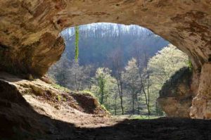
This is an entrance to the archaeological site of Vindija Cave, Croatia. Credit: MPI f. Evolutionary Anthropology/ J. Krause
While there are numerous prehistoric sites in Europe and Asia that contain tools and other human-made artefacts, skeletal remains of ancient humans are scarce. Researchers of the Max Planck Institute for Evolutionary Anthropology in Leipzig, Germany, have therefore looked into new ways to get hold of ancient human DNA. From sediment samples collected at seven archaeological sites, the researchers “fished out” tiny DNA fragments that had once belonged to a variety of mammals, including our extinct human relatives. They retrieved DNA from Neandertals in cave sediments of four archaeological sites, also in layers where no hominin skeletal remains have been discovered. In addition, they found Denisovan DNA in sediments from Denisova Cave in Russia. These new developments now enable researchers to uncover the genetic affiliations of the former inhabitants of many archaeological sites which do not yield human remains.
By looking into the genetic composition of our extinct relatives, the Neandertals, and their cousins from Asia, the Denisovans, researchers can shed light on our own evolutionary history. However, fossils of ancient humans are rare, and they are not always available or suitable for genetic analyses. “We know that several components of sediments can bind DNA,” says Matthias Meyer of the Max Planck Institute for Evolutionary Anthropology. “We therefore decided to investigate whether hominin DNA may survive in sediments at archaeological sites known to have been occupied by ancient hominins.”
To this aim Meyer and his team collaborated with a large network of researchers excavating at seven archaeological sites in Belgium, Croatia, France, Russia and Spain. Overall, they collected sediment samples covering a time span from 14,000 to over 550,000 years ago. Using tiny amounts of material the researchers recovered and analyzed fragments of mitochondrial DNA — genetic material from the mitochondria, the “energy factories” of the cell — and identified them as belonging to twelve different mammalian families that include extinct species such as the woolly mammoth, the woolly rhinoceros, the cave bear and the cave hyena.
The researchers then looked specifically for ancient hominin DNA in the samples. “From the preliminary results, we suspected that in most of our samples, DNA from other mammals was too abundant to detect small traces of human DNA,” says Viviane Slon, Ph.D. student at the Max Planck Institute in Leipzig and first author of the study. “We then switched strategies and started targeting specifically DNA fragments of human origin.” Nine samples from four archaeological sites contained enough ancient hominin DNA for further analyses: Eight sediment samples contained Neandertal mitochondrial DNA from either one or multiple individuals, while one sample contained Denisovan DNA. Most of these samples originated from archaeological layers or sites where no Neandertal bones or teeth were previously found.
A new tool for archaeology
“By retrieving hominin DNA from sediments, we can detect the presence of hominin groups at sites and in areas where this cannot be achieved with other methods,” says Svante Pääbo, director of the Evolutionary Genetics department at the Max Planck Institute for Evolutionary Anthropology and co-author of the study. “This shows that DNA analyses of sediments are a very useful archaeological procedure, which may become routine in the future.”
Even sediment samples that were stored at room temperature for years still yielded DNA. Analyses of these and of freshly-excavated sediment samples recovered from archaeological sites where no human remains are found will shed light on these sites’ former occupants and our joint genetic history.
Reference:
Viviane Slon, Charlotte Hopfe, Clemens L. Weiß, Fabrizio Mafessoni, Marco de la Rasilla, Carles Lalueza-Fox, Antonio Rosas, Marie Soressi, Monika V. Knul, Rebecca Miller, John R. Stewart, Anatoly P. Derevianko, Zenobia Jacobs, Bo Li, Richard G. Roberts, Michael V. Shunkov, Henry de Lumley, Christian Perrenoud, Ivan Guši?, ?eljko Ku?an, Pavao Rudan, Ayinuer Aximu-Petri, Elena Essel, Sarah Nagel, Birgit Nickel, Anna Schmidt, Kay Prüfer, Janet Kelso, Hernán A. Burbano, Svante Pääbo, Matthias Meyer. Neandertal and Denisovan DNA from Pleistocene sediments. Science, 27 April, 2017 DOI: 10.1126/science.aam9695
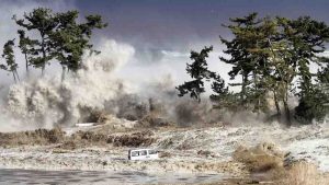
Photo taken March 11, 2011, by Sadatsugu Tomizawa and released via Jiji Press on March 21, 2011, showing tsunami waves hitting the coast of Minamisoma in Fukushima prefecture, Japan. Credit: Sadatsugu Tomizawa CC BY-NC-ND 2.0
A new NASA study is challenging a long-held theory that tsunamis form and acquire their energy mostly from vertical movement of the seafloor.
An undisputed fact was that most tsunamis result from a massive shifting of the seafloor — usually from the subduction, or sliding, of one tectonic plate under another during an earthquake. Experiments conducted in wave tanks in the 1970s demonstrated that vertical uplift of the tank bottom could generate tsunami-like waves. In the following decade, Japanese scientists simulated horizontal seafloor displacements in a wave tank and observed that the resulting energy was negligible. This led to the current widely held view that vertical movement of the seafloor is the primary factor in tsunami generation.
In 2007, Tony Song, an oceanographer at NASA’s Jet Propulsion Laboratory in Pasadena, California, cast doubt on that theory after analyzing the powerful 2004 Sumatra earthquake in the Indian Ocean. Seismograph and GPS data showed that the vertical uplift of the seafloor did not produce enough energy to create a tsunami that powerful. But formulations by Song and his colleagues showed that once energy from the horizontal movement of the seafloor was factored in, all of the tsunami’s energy was accounted for. Those results matched tsunami data collected from a trio of satellites -the NASA/Centre National d’Etudes Spatiales (CNES) Jason, the U.S. Navy’s Geosat Follow-on and the European Space Agency’s Environmental Satellite.
Further research by Song on the 2004 Sumatra earthquake, using satellite data from the NASA/German Aerospace Center Gravity Recovery and Climate Experiment (GRACE) mission, also backed up his claim that the amount of energy created by the vertical uplift of the seafloor alone was insufficient for a tsunami of that size.
“I had all this evidence that contradicted the conventional theory, but I needed more proof,” Song said.
His search for more proof rested on physics — namely, the fact that horizontal seafloor movement creates kinetic energy, which is proportional to the depth of the ocean and the speed of the seafloor’s movement. After critically evaluating the wave tank experiments of the 1980s, Song found that the tanks used did not accurately represent either of these two variables. They were too shallow to reproduce the actual ratio between ocean depth and seafloor movement that exists in a tsunami, and the wall in the tank that simulated the horizontal seafloor movement moved too slowly to replicate the actual speed at which a tectonic plate moves during an earthquake.
“I began to consider that those two misrepresentations were responsible for the long-accepted but misleading conclusion that horizontal movement produces only a small amount of kinetic energy,” Song said.
Building a Better Wave Tank
To put his theory to the test, Song and researchers from Oregon State University in Corvallis simulated the 2004 Sumatra and 2011 Tohoku earthquakes at the university’s Wave Research Laboratory by using both directly measured and satellite observations as reference. Like the experiments of the 1980s, they mimicked horizontal land displacement in two different tanks by moving a vertical wall in the tank against water, but they used a piston-powered wave maker capable of generating faster speeds. They also better accounted for the ratio of how deep the water is to the amount of horizontal displacement in actual tsunamis.
The new experiments illustrated that horizontal seafloor displacement contributed more than half the energy that generated the 2004 and 2011 tsunamis.
“From this study, we’ve demonstrated that we need to look at not only the vertical but also the horizontal movement of the seafloor to derive the total energy transferred to the ocean and predict a tsunami,” said Solomon Yim, a professor of civil and construction engineering at Oregon State University and a co-author on the study.
The finding further validates an approach developed by Song and his colleagues that uses GPS technology to detect a tsunami’s size and strength for early warnings.
The JPL-managed Global Differential Global Positioning System (GDGPS) is a very accurate real-time GPS processing system that can measure seafloor movement during an earthquake. As the land shifts, ground receiver stations nearer to the epicenter also shift. The stations can detect their movement every second through real-time communication with a constellation of satellites to estimate the amount and direction of horizontal and vertical land displacement that took place in the ocean. They developed computer models to incorporate that data with ocean floor topography and other information to calculate the size and direction of a tsunami.
“By identifying the important role of the horizontal motion of the seafloor, our GPS approach directly estimates the energy transferred by an earthquake to the ocean,” Song said. “Our goal is to detect a tsunami’s size before it even forms, for early warnings.”
The study is published in Journal of Geophysical Research — Oceans.
Reference:
Y. Tony Song, Ali Mohtat, Solomon C. Yim. New insights on tsunami genesis and energy source. Journal of Geophysical Research: Oceans, 2017; DOI: 10.1002/2016JC012556
Images courtesy: David Nunuk/IBCSP, Global Forest Watch Canada
A team of researchers has discovered that many Canadian lakes can provide new insights into ancient oceans, and their findings could advance research about greenhouse gas emissions, harmful algal blooms, and early life forms.
Scientists from the University of Waterloo led the team of microbiologists, geochemists, and freshwater specialists in a surprising finding that lakes of the Boreal Shield may be similar to oceans of the Archean Eon, a period more than 2.5 billion years ago when microbial life thrived in a world without oxygen.
This finding is important because there are millions of Boreal Shield lakes in Canada that likely share key properties with the Archean oceans. Until now, scientists have relied on only four so-called analogue lakes — ones with similar primordial conditions — most of which are found in remote or ecologically sensitive locations.
“With so many lakes to study, this discovery changes how we approach this field of research,” said co-author Jackson Tsuji, a doctoral student in the Department of Biology in the Faculty of Science. “It’s exciting that these lakes, which are basically in our backyard, hold information that could have implications for global climate, past and present, and water management.”
Published in Scientific Reports, the findings have the potential to transform how scientists carry out research about Earth’s earliest life forms, which originated in oxygen-free oceans thought to be low in sulphur and high in iron. Many Boreal Shield lakes, also low in sulphur and high in iron, develop oxygen-free layers each summer. Although these layers mix in the spring and fall, they re-establish quickly.
“We used to think finding a suitable Archean ocean analogue meant that you had to find a lake that didn’t mix. For example, current analogues are hundreds of metres deep and completely stratified,” said Josh Neufeld, a professor in the Department of Biology. “An important discovery here was how robust this oxygen-free community is, despite the mixing.”
Researchers can use these lakes as living laboratories to study how microbes of the past might have functioned. The microbes detected in the sampled lakes are thought to metabolize iron compounds with the help of sunlight, which may help researchers understand how to predict and control harmful algal blooms because iron plays a key role in algal bloom formation.
In addition, the unique and previously unknown microbial communities, specifically methane-consuming microbes at the bottom of these lakes, have broad implications for greenhouse gas emissions.
The study compared aspects of the four current Archean-ocean analogues to two Boreal Shield lakes using water chemistry, microbial community profiles, and stable isotope patterns. The researchers’ unique application of the latest biological and isotopic tools shows that similar biological processes to existing analogues are not only present, but active in the water, reoccurring every year.
“This groundbreaking discovery was possible because we had the flexibility to pursue some unexpected results with a multi-disciplinary team using state-of-the-art tools and techniques,” said Sherry Schiff, a professor in the Department of Earth and Environmental Sciences.
Boreal Shield lakes are widespread across the Boreal Shield, the largest of the Canadian ecozones, which extends across more than 20 per cent of Canada’s land mass. Similar lakes are found in Finland, Norway, Sweden, and Russia.
Reference:
S. L. Schiff, J. M. Tsuji, L. Wu, J. J. Venkiteswaran, L. A. Molot, R. J. Elgood, M. J. Paterson, J. D. Neufeld. Millions of Boreal Shield Lakes can be used to Probe Archaean Ocean Biogeochemistry. Scientific Reports, 2017; 7: 46708 DOI: 10.1038/srep46708
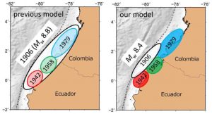
(Left) The previous source model of the large earthquakes in this subduction zone. The 1906 earthquake has been interpreted as a megathrust event (Mw 8.8) ruptured all segments of 1942, 1958, and 1979 earthquakes. (Right) Our source model of the large earthquakes in this subduction zone. Our analysis of the 1906 earthquake indicated Mw 8.4 and the occurrence of the large slip near the trench (black triangles with line) off the source areas of the three earthquakes. Credit: Masahiro Yoshimoto
A Nagoya University-led team reveals the mechanisms behind different earthquakes at a plate boundary on the west coast of South America, shedding light on historical seismic events and potentially aiding prediction of the future risk from these natural disasters.
When tectonic plates that have been sliding past each other get stuck, a huge amount of energy builds up, and is eventually released in the form of an earthquake. Although much is known about the mechanisms behind this process, more needs to be understood about what happens at particular plate boundaries to determine the risk of earthquakes and tsunamis at specific sites and potentially to predict when these events might occur.
In a breakthrough in this field, researchers at Nagoya University and their colleagues in South America have studied several earthquakes that occurred at the Ecuador-Colombia subduction zone over the last hundred years, revealing the relationships between different earthquakes and the size and location of the ruptures at plate boundaries that caused them. The findings were published in Geophysical Research Letters.
The team used a combination of data sources and models to study large earthquakes that struck the west coast of South America in 1906, 1942, 1958, 1979, and 2016. These included information on tsunami waveforms recorded at sites across the Pacific, data on seismic waves obtained by monitoring stations in Ecuador and Colombia, and previous work on the intensity of coupling, or locking together, of adjacent plates and the distance that they slipped past each other to cause each earthquake.
“The Ecuador-Colombia subduction zone, where the Nazca plate passes underneath the South American plate, is particularly interesting because of the frequency of large earthquakes there,” says study author Hiroyuki Kumagai of the Graduate School of Environmental Studies, Nagoya University. “It’s also a good site to investigate whether the ruptures at plate boundaries causing huge earthquakes are linked to subsequent large earthquakes years or decades later.”
By carefully modeling the fault area where these earthquakes arose in combination with the other data, the team showed that the strongest of the earthquakes, that of 1906, involved a rupture at a different site than the other earthquakes. They also used data on the known speed at which the plates are moving past each other and the simulated “slip” of a plate associated with the 2016 earthquake to show that the 1942 and 2016 earthquakes were triggered by ruptures at the same site.
“Now that we can precisely link previous earthquakes to ruptures at specific sites along plate boundaries, we can gauge the risks associated with the build-up of pressure at these sites and the likely frequency of earthquakes there,” lead author Masahiro Yoshimoto says. “Our data also reveal for the first time differences in rupture mechanisms between oceanic trenches and deeper coastal regions in this subduction zone.”
The findings provide a foundation for risk prediction tools to assess the likelihood of earthquakes and tsunamis striking this region and their potential periodicity and intensity.
Reference:
Masahiro Yoshimoto, Hiroyuki Kumagai, Wilson Acero, Gabriela Ponce, Freddy Vásconez, Santiago Arrais, Mario Ruiz, Alexandra Alvarado, Patricia Pedraza García, Viviana Dionicio, Orlando Chamorro, Yuta Maeda, Masaru Nakano. Depth-dependent rupture mode along the Ecuador-Colombia subduction zone. Geophysical Research Letters, 2017; DOI: 10.1002/2016GL071929
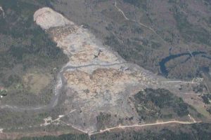
An aerial image of the Oso landslide on April 13, 2014. Credit: Photo courtesy Tim Stark
Late in the morning of March 22, 2014, a huge chunk of land cut loose and roared down a hillside in the Stillaguamish River Valley just east of Oso, Washington, about 60 miles northeast of Seattle. In a matter of minutes, 43 people lost their lives as a wall of mud, sand, clay, water and trees cascaded down the hillside into the Steelhead Haven neighborhood, a relatively new housing tract.
This was the deadliest landslide on record in the continental United States. A new report details the factors leading to the disaster, the hazards that accompany landslides and steps that can be taken to mitigate landslide consequences and risk in the Pacific Northwest, with the aim of preventing future tragedies.
The area has seen its share of landslides, but this one was different. It traveled much farther across the valley than any other recent slides for the site.
“Every 30 to 40 years, the area would have a small slide that would come down and block the river,” University of Illinois civil and environmental engineering professor Tim Starkk said. “But the 2014 slide was like a huge squeegee pushed the prior slide debris across the valley.”
Stark and his team were among the first scientists on the scene after the disaster, and it was immediately apparent to them that something different had occurred here.
“Most of the slides in this area originate from about halfway up the slope, but this flow contained sediments and vegetation from the top of the slope,” Stark said, “The higher up the slope the landslide starts, the more potential energy it will have.”
In their report in the Journal of Geotechnical and Geoenvironmental Engineering of the American Society of Civil Engineers, Stark and his team found that height or potential energy was the primary element responsible for the destructive force of this landslide, but noted that other observable factors were at play, as well. These include the shape of the upper slope, sediment type, precipitation and erosion.
“LIDAR (Light Detection and Ranging) imaging is a great tool for looking at these geographic factors because it gives us a view of the land from above without all of the vegetation in the way,” Stark said. “It allows us to quickly spot other potential high-elevation slide hazards.”
In April 2015, the state increased funding for the use of LIDAR by the Washington Department of Natural Resources to spot potential landslide hazards. Researchers hope that particular attention will be paid to these high-elevation slide areas.
“Almost all of the valleys in the area have rivers cutting into glacial plateaus with potential for other high-elevation slides,” Stark said.
Another factor contributing to landslide potential is precipitation. The researchers reviewed precipitation data and found that the Oso area experienced record-breaking rainfall in the weeks leading up to the slide. Wet sediments are not as strong as dry ones, Stark said, and accounting for this detail will be an integral part of the next phase of this research, which was awarded a National Science Foundation grant.
“We are working on a new model that will help us account for soil moisture and other factors like the impact of timber harvesting on rainwater infiltration and the location of communities,” Stark said. “That will help us better assess hazards and, importantly, determine the level of risk to current and future population areas.”
Reference:
Timothy D. Stark et al, Case Study: Oso, Washington, Landslide of March 22, 2014—Material Properties and Failure Mechanism, Journal of Geotechnical and Geoenvironmental Engineering (2017). DOI: 10.1061/(ASCE)GT.1943-5606.0001615
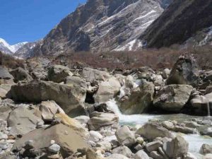
This is an image of the Modi Khola river, Nepal. Credit: Henry Pinder
Scientists have shown how earthquakes and storms in the Himalaya can increase the impact of deadly floods in one of Earth’s most densely populated areas.
Large volumes of hard rock dumped into rivers by landslides can increase flood risk up to hundreds of kilometres downstream, potentially affecting millions of people, researchers say.
The findings could help researchers improve flood risk maps for the Ganga Plain, a low-lying region covering parts of India, Nepal and Pakistan. They could also provide fresh insight into the long-term impacts of earthquakes and storms in the region.
Until now, little was known about how landslides in the Himalaya could affect flood risk downstream on the Ganga Plain.
For the first time, scientists at the University of Edinburgh have traced the path of rocks washed down from the Himalayan mountains onto the Plain.
They found that large landslides in the southern, lower elevation ranges of the Himalaya are more likely to increase flood risk than those in the high mountains further north.
Rocks in the south are extremely hard and travel only a short distance — less than 20 km — to reach the Plain. This means much of this rock — such as quartzite — reaches the Plain as gravel or pebbles, which can build up in rivers, altering the natural path of the water, the team says.
Rocks from more northerly regions of the Himalaya tend to be softer, and the team found they often travel at least 100 km to reach the Plain. These types of rock — including limestone and gneiss — are gradually broken down into sand which, unlike gravel and pebbles, is dispersed widely as it travels downstream.
Understanding whether landslides will produce vast quantities of gravel or sand is crucial for predicting how rivers on the Ganga Plain will be affected, researchers say.
The study is published in the journal Nature. The research was funded by the Natural Environment Research Council.
Elizabeth Dingle, PhD student in the University of Edinburgh’s School of GeoSciences, who led the study, said: “Our findings help to explain how events in the Himalaya can have drastic effects on rivers downstream and on the people who live there. Knowing where landslides take place in the mountains could help us better predict whether or not large deposits of gravel will reach the Ganga Plain and increase flood risk.”
Reference:
Elizabeth H. Dingle, Mikaël Attal, Hugh D. Sinclair. Abrasion-set limits on Himalayan gravel flux. Nature, 2017; 544 (7651): 471 DOI: 10.1038/nature22039
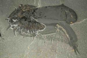
This specimen of Tokummia katalepsis shows a number of strong legs on the left partially protruding from the body, the shape of the bivalved carapace and dozens of small paddle-like limbs below the trunk at the lower right. This nearly complete fossil was chosen as the main reference for the new genus Tokummia and new species katalep. Credit: Photo courtesy of Jean-Bernard Caron; Copyright: Royal Ontario Museum
Paleontologists at the University of Toronto (U of T) and the Royal Ontario Museum (ROM) have uncovered a new fossil species that sheds light on the origin of mandibulates, the most abundant and diverse group of organisms on Earth, to which belong familiar animals such as flies, ants, crayfish and centipedes. The finding was announced in a study published today in Nature.
The creature, named Tokummia katalepsis by the researchers, is a new and exceptionally well-preserved fossilized arthropod — a ubiquitous group of invertebrate animals with segmented limbs and hardened exoskeletons. Tokummia documents for the first time in detail the anatomy of early “mandibulates,” a hyperdiverse sub-group of arthropods which possess a pair of specialized appendages known as mandibles, used to grasp, crush and cut their food. Mandibulates include millions of species and represent one of the greatest evolutionary and ecological success stories of life on Earth.
“In spite of their colossal diversity today, the origin of mandibulates had largely remained a mystery,” said Cédric Aria, lead author of the study and recent graduate of the PhD program in the Department of Ecology & Evolutionary Biology at U of T, now working as a post-doctoral researcher at the Nanjing Institute for Geology and Palaeontology, in China. “Before now we’ve had only sparse hints at what the first arthropods with mandibles could have looked like, and no idea of what could have been the other key characteristics that triggered the unrivaled diversification of that group.”
Tokummia lived in a tropical sea teeming with life and was among the largest Cambrian predators, exceeding 10 cm in length fully extended. An occasional swimmer, the researchers conclude its robust anterior legs made it a preferred bottom-dweller, as lobsters or mantis shrimps today. Specimens come from 507 million-year-old sedimentary rocks near Marble Canyon in Kootenay national park, British Columbia. Most specimens at the basis of this study were collected during extensive ROM-led fieldwork activities in 2014.
“This spectacular new predator, one of the largest and best preserved soft-bodied arthropods from Marble Canyon, joins the ranks of many unusual marine creatures that lived during the Cambrian Explosion, a period of rapid evolutionary change starting about half a billion years ago when most major animal groups first emerged in the fossil record,” said co-author Jean-Bernard Caron, senior curator of invertebrate paleontology at the ROM and an associate professor in the Departments of Ecology & Evolutionary Biology and Earth Sciences at U of T.
Analysis of several fossil specimens, following careful mechanical preparation and photographic work at the ROM, showed that Tokummia sported broad serrated mandibles as well as large but specialized anterior claws, called maxillipeds, which are typical features of modern mandibulates.
“The pincers of Tokummia are large, yet also delicate and complex, reminding us of the shape of a can opener, with their couple of terminal teeth on one claw, and the other claw being curved towards them,” said Aria. “But we think they might have been too fragile to be handling shelly animals, and might have been better adapted to the capture of sizable soft prey items, perhaps hiding away in mud. Once torn apart by the spiny limb bases under the trunk, the mandibles would have served as a revolutionary tool to cut the flesh into small, easily digestible pieces.”
The body of Tokummia is made of more than 50 small segments covered by a broad two-piece shell-like structure called a bivalved carapace. Importantly, the animal bears subdivided limb bases with tiny projections called endites, which can be found in the larvae of certain crustaceans and are now thought to have been critical innovations for the evolution of the various legs of mandibulates, and even for the mandibles themselves.
The many-segmented body is otherwise reminiscent of myriapods, a group that includes centipedes, millipedes, and their relatives. “Tokummia also lacks the typical second antenna found in crustaceans, which illustrates a very surprising convergence with such terrestrial mandibulates,” said Aria.
The study also resolves the affinities of other emblematic fossils from Canada’s Burgess Shale more than a hundred years after their discovery. “Our study suggests that a number of other Burgess Shale fossils such as Branchiocaris, Canadaspis and Odaraia form with Tokummia a group of crustacean-like arthropods that we can now place at the base of all mandibulates,” said Aria.
The animal was named after Tokumm Creek, which flows through Marble Canyon in northern Kootenay National Park, and the Greek for “seizing.” The Marble Canyon fossil deposit was first discovered in 2012 during prospection work led by the Royal Ontario Museum and is part of the Burgess Shale fossil deposit, which extends to the north into Yoho National Park in the Canadian Rockies. All specimens are held in the collections of the Royal Ontario Museum on behalf of Parks Canada.
The Burgess Shale fossil sites are located within Yoho and Kootenay national parks in British Columbia. The Burgess Shale was designated a UNESCO World Heritage Site in 1980. Parks Canada is proud to protect these globally significant paleontological sites, and to work with leading scientific researchers to expand knowledge and understanding of this key period of earth history. New information from ongoing scientific research is continually incorporated into Parks Canada’s Burgess Shale education and interpretation programs, which include guided hikes to these outstanding fossil sites.
Reference:
Cédric Aria, Jean-Bernard Caron. Burgess Shale fossils illustrate the origin of the mandibulate body plan. Nature, 2017; DOI: 10.1038/nature22080
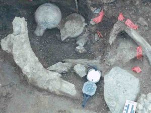
A concentration of fossil bone and rock. The unusual positions of the femur heads, one up and one down, broken in the same manner next to each other is unusual. Mastodon molars are located in the lower right hand corner next to a large rock comprised of andesite which is in contact with a broken vertebra. Upper left is a rib angled upwards resting on a granitic pegmatite rock fragment. Credit: Image courtesy of San Diego Natural History Museum
An Ice Age paleontological-turned-archaeological site in San Diego, Calif., preserves 130,000-year-old bones and teeth of a mastodon that show evidence of modification by early humans. Analysis of these finds dramatically revises the timeline for when humans first reached North America, according to a paper to be published in the April 27 issue of the journal Nature.
The fossil remains were discovered by Museum paleontologists during routine paleontological mitigation work at a freeway expansion project site managed by the California Department of Transportation (Caltrans). The bones, tusks, and molars, many of which are sharply broken, were found deeply buried alongside large stones that appeared to have been used as hammers and anvils, making this the oldest in situ, well-documented archaeological site in the Americas.
“This discovery is rewriting our understanding of when humans reached the New World. The evidence we found at this site indicates that some hominin species was living in North America 115,000 years earlier than previously thought,” said Judy Gradwohl, president and CEO of the San Diego Natural History Museum, whose paleontology team discovered the fossils, managed the excavation, and incorporated the specimens into the Museum’s research collection. “This raises intriguing questions about how these early humans arrived here and who they were.”
Until recently, the oldest records of human sites in North America generally accepted by archaeologists were about 14,000 years old. But the fossils from the Cerutti Mastodon site (as the site was named in recognition of field paleontologist Richard Cerutti who discovered the site and led the excavation), were found embedded in fine-grained sediments that had been deposited much earlier, during a period long before humans were thought to have arrived on the continent.
“When we first discovered the site, there was strong physical evidence that placed humans alongside extinct Ice Age megafauna. This was significant in and of itself and a ‘first’ in San Diego County,” said Dr. Tom Deméré, curator of paleontology and director of PaleoServices at the San Diego Natural History Museum and corresponding author on the paper. “Since the original discovery, dating technology has advanced to enable us to confirm with further certainty that early humans were here significantly earlier than commonly accepted.”
Since its initial discovery in late 1992, this site has been the subject of research by top scientists to date the fossils accurately and evaluate microscopic damage on bones and rocks that authors now consider indicative of human activity. In 2014, Dr. James Paces, a research geologist with the U.S. Geological Survey, used state-of-the-art radiometric dating methods to determine that the mastodon bones — which were still fresh when they were broken by strategically-placed blows from hammerstones — were 130,000 years old, with a conservative error of plus or minus 9,400 years. “The distributions of natural uranium and its decay products both within and among these bone specimens show remarkably reliable behavior, allowing us to derive an age that is well within the wheelhouse of the dating system,” explained Paces, a co-author of the paper.
The finding poses a lot more questions than answers: Who were these people? Are they part of an early — but failed — colonization attempt? Or is there a long, but as of yet, scarcely recognized presence of humans in this hemisphere?
“There’s no doubt in my mind this is an archaeological site,” said Dr. Steve Holen, director of research at the Center for American Paleolithic Research, former curator of archaeology at the Denver Museum of Nature & Science, and the lead author of the paper. “The bones and several teeth show clear signs of having been deliberately broken by humans with manual dexterity and experiential knowledge. This breakage pattern has also been observed at mammoth fossil sites in Kansas and Nebraska, where alternative explanations such as geological forces or gnawing by carnivores have been ruled out.”
The specimens recovered from the Cerutti mastodon site will be on display on Level 2 of the Museum beginning Wednesday, April 26, and a public lecture featuring several of the Nature article authors will take place on Saturday, April 29 at 7 PM.
Digital 3D models of a selection of specimens pointing toward human association at this site can be viewed interactively at the University of Michigan Online Repository of Fossils. Animations featuring these models are also presented as supplementary information associated with the published version of this research.
Eleven authors contributed to the manuscript that is scheduled to be published in Nature: Dr. Steve Holen, director of research at the Center for American Paleolithic Research; Dr. Tom Deméré, curator of paleontology and director of PaleoServices at the San Diego Natural History Museum; Dr. Daniel Fisher, professor of paleontology and director and curator of the Museum of Paleontology at the University of Michigan; Dr. Richard Fullagar, professorial research fellow at the Centre for Archaeological Science at the University of Wollongong, Australia; Dr. James Paces, research geologist at the U.S. Geological Survey; Kathleen Maule Holen, administrative director at the Center for American Paleolithic Research; Dr. Jared Beeton, professor of physical geography at Adams State University; Dr. Adam Rountrey, collection manager in the Museum of Paleontology at the University of Michigan; George T. Jefferson, district staff paleontologist at
Anza-Borrego Desert State Park; Dr. Lawrence Vescera, volunteer paleontologist at the California State Parks Colorado Desert District Stout Research Center in Borrego Springs; and Richard Cerutti, former paleontological monitor at the San Diego Natural History Museum.
Recovery of the fossils was supported by Caltrans District 11. Major funding for research and display of the artifacts was provided by the National Geographic Society, the Walton Family Fund, Pat Boyce and Debbie Fritsch, the James Hervey Johnson Charitable Educational Trust, and the Downing Family Foundation.
Reference:
Steven R. Holen, Thomas A. Deméré, Daniel C. Fisher, Richard Fullagar, James B. Paces, George T. Jefferson, Jared M. Beeton, Richard A. Cerutti, Adam N. Rountrey, Lawrence Vescera, Kathleen A. Holen. A 130,000-year-old archaeological site in southern California, USA. Nature, 2017; 544 (7651): 479 DOI: 10.1038/nature22065
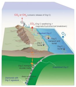
This schematic depicts the efficient deep subduction of organic (reduced) carbon, a process that could have locked significant amounts of carbon in Earth’s mantle and resulted in a higher percentage of atmospheric oxygen. Based on new high-pressure, high-temperature experiments, Rice University petrologists argue that the long-term sequestration of organic carbon from this process began as early as 2.5 billion years ago and helped bring about a well-known buildup of oxygen in Earth’s atmosphere — the “Great Oxidation Event” — about 2.4 billion years ago. Credit: Image courtesy of R. Dasgupta/Rice University
Rice University petrologists who recreated hot, high-pressure conditions from 60 miles below Earth’s surface have found a new clue about a crucial event in the planet’s deep past.
Their study describes how fossilized carbon — the remains of Earth’s earliest single-celled creatures — could have been subsumed and locked deep in Earth’s interior starting around 2.4 billion years ago — a time when atmospheric oxygen rose dramatically. The paper appears online this week in the journal Nature Geoscience.
“It’s an interesting concept, but in order for complex life to evolve, the earliest form of life needed to be deeply buried in the planet’s mantle,” said Rajdeep Dasgupta, a professor of Earth science at Rice. “The mechanism for that burial comes in two parts. First, you need some form of plate tectonics, a mechanism to carry the carbon remains of early life-forms back into Earth. Second, you need the correct geochemistry so that organic carbon can be carried deeply into Earth’s interior and thereby removed from the surface environment for a long time.”
At issue is what caused the “great oxidation event,” a steep increase in atmospheric oxygen that is well-documented in countless ancient rocks. The event is so well-known to geologists that they often simply refer to it as the “GOE.” But despite this familiarity, there’s no scientific consensus about what caused the GOE. For example, scientists know Earth’s earliest known life, single-celled cyanobacteria, drew down carbon dioxide from the atmosphere and released oxygen. But the appearance of early life has been pushed further and further into the past with recent fossil discoveries, and scientists now know that cyanobacteria were prevalent at least 500 million years before the GOE.
“Cyanobacteria may have played a role, but the GOE was so dramatic — oxygen concentration increased as much as 10,000 times — that cyanobacteria by themselves could not account for it,” said lead co-author Megan Duncan, who conducted the research for her Ph.D. dissertation at Rice. “There also has to be a mechanism to remove a significant amount of reduced carbon from the biosphere, and thereby shift the relative concentration of oxygen within the system,” she said.
Removing carbon without removing oxygen requires special circumstances because the two elements are prone to bind with one another. They form one of the key components of the atmosphere — carbon dioxide — as well as all types of carbonate rocks.
Dasgupta and Duncan found that the chemical composition of the “silicate melt” — subducting crustal rock that melts and rises back to the surface through volcanic eruptions — plays a crucial role in determining whether fossilized organic carbon, or graphite, sinks into the mantle or rises back to the surface through volcanism.
Duncan, now a research scientist at the Carnegie Institution in Washington, D.C., said the study is the first to examine the graphite-carrying capacity of a type of melt known as rhyolite, which is commonly produced deep in the mantle and carries significant amounts of carbon to the volcanoes. She said the graphite-carrying capacity of rhyolitic rock is crucial because if graphite is prone to hitching a ride back to the surface via extraction of rhyolitic melt, it would not have been buried in sufficient quantities to account for the GOE.
“Silicate composition plays an important role,” she said. “Scientists have previously looked at carbon-carrying capacities in compositions that were much more magnesium-rich and silicon-poor. But the compositions of these rhyolitic melts are high in silicon and aluminum and have very little calcium, magnesium and iron. That matters because calcium and magnesium are cations, and they change the amount of carbon you can dissolve.”
Dasgupta and Duncan found that rhyolitic melts could dissolve very little graphite, even when very hot.
“That was one of our motivations,” said Dasgupta, professor of Earth science. “If subduction zones in the past were very hot and produced a substantial amount of melt, could they completely destabilize organic carbon and release it back to the surface?
“What we showed was that even at very, very high temperatures, not much of this graphitic carbon dissolves in the melt,” he said. “So even though the temperature is high and you produce a lot of melt, this organic carbon is not very soluble in that melt, and the carbon gets buried in the mantle as a result.
“What is neat is that with the onset and the expected tempo of crustal burial into the deep mantle starting just prior to the GOE, and with our experimental data on the efficiency of deep burial of reduced carbon, we could model the expected rise of atmospheric oxygen across the GOE,” Dasgupta said.
The research supports the findings of a 2016 paper by fellow Rice petrologist Cin-Ty Lee and colleagues that suggested that plate tectonics, continent formation and the appearance of early life were key factors in the development of an oxygen-rich atmosphere on Earth.
Duncan, who increasingly focuses on exoplanetary systems, said the research could provide important clues about what scientists should look for when evaluating which exoplanets could support life.
Reference:
Megan S. Duncan, Rajdeep Dasgupta. Rise of Earth’s atmospheric oxygen controlled by efficient subduction of organic carbon. Nature Geoscience, 2017; DOI: 10.1038/ngeo2939
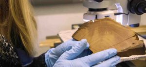
The late Andrew Douglass, who was an astronomer at the UA’s Steward Observatory, invented tree ring science. Credit: Mari Cleven
For decades, radiocarbon dating has been a way for scientists to get a rough picture of when once-living stuff lived. The method has been revolutionary and remains one of the most commonly used dating methods to study the past.
Charlotte Pearson says it’s ready for a makeover.
Pearson, an assistant professor of dendrochronology at the University of Arizona, studies the past lives of trees to better understand the history of civilizations. Dendrochronology and radiocarbon dating have intertwined histories, she explains, with roots firmly planted at the UA.
A 1929 edition of National Geographic boasts, “The Secret Of The Southwest Solved By Talkative Tree Rings.” The 35-page article, penned in whimsical prose, was written by Andrew Douglass, the UA scientist who invented tree ring science.
Douglass was a polymath. In addition to his work as an astronomer at the UA’s Steward Observatory, Douglass was the first to discover that tree rings record time.
“Every year the trees in our forests show the swing of Time’s pendulum and put down a mark. They are chronographs, recording clocks, by which the succeeding seasons are set down through definite imprints,” he wrote in the pages of National Geographic.
In its most conventional form, dendrochronology works like this. A contemporary tree—that is, a tree that was either just cut down or still living—can tell you not just how many years it has lived, but which years in which it lived. If a Bigtooth Maple were cut down on Mount Lemmon in 2016 and it had 400 rings, you would know the tree started growing in 1616. Simple enough.
But what if the wood is older? What if it’s been used to build a home or a ship or a bonfire?
The rings could still tell how many years the tree lived, but not necessarily when. This didn’t sit well with Douglass. He set out on a series of expeditions across the southwest to bridge the gap between contemporary wood and wood beams from the ruins of civilizations long gone.
He noticed that trees across the same region, in the same climate, develop rings in the same patterns. Douglass, with his knack for pattern-recognition, discovered that he could take younger wood with a known date, and then match its rings alongside the pattern of an older sample. In 1929, with a beam from Show Low, Arizona, Douglass was able to bridge the gap for the first time ever. Dates were assigned to Southwestern ruins with certainty.
Indeed, the “Secret Of The Southwest” was revealed.
An Isotope Called Carbon-14
But alas, pattern-matching in order to date when a tree was cut isn’t always possible. Sometimes a wood sample doesn’t have enough tree rings or rings with growth patterns that match an already dated sample. Sometimes important and large groups of matching samples, called “floating chronologies,” remain undated. A decade after Douglass’s big discovery, two Berkeley scientists took the first step towards an alternative way to date floating chronologies and indeed any other “once-living” thing.
They were studying a little atom called carbon-14. Also known as radiocarbon, carbon-14 is a radioactive isotope of carbon with an atomic nucleus of six protons and eight neutrons. Radiocarbon is in every living thing. They discovered its half-life, or the time it takes for its radioactivity to fall by half once the living thing dies, is 5,730 years (give or take 40). It’s unusually long and consistent half-life made it great for dating.
Willard Libby from the University of Chicago put it to the test. By 1949, he had published a paper in Science showing that he had accurately dated samples with known ages, using radiocarbon dating. Douglass passed away just two years after Libby received the Nobel Prize for his work in 1960.
Radiocarbon Dating Tree Rings Today
Today, dendrochronologists all over the world follow in Douglass’ footsteps, and whenever it is not possible to use tree-ring dating to place wood samples in time, they use radiocarbon to date wood samples. All of this dating information comes together to produce a chronological backdrop for studying past interactions between people and their environment.
“We can use the annual precision of tree rings in combination with carbon-14 to underpin some big questions in terms of the rise and fall of civilizations,” says Pearson. “We can look at the tree rings as a timeline and connect with people that lived in the past, and I think that gives us more of a sense of who we are, but also a sense of where we’re going and perhaps ways to deal with some of the issues that we might collectively face.
“Radiocarbon dating has been a revolution in terms of the way stuff is dated in the past and is used by scientists all over the world,” Pearson adds. “It can get us to within 20, 50, 100 years or so of dating accuracy.”
On the scale of the universe, 20, 50 or even 100 years is, for all intents and purposes, nothing.
The universe is 13.8 billion years old. Our galaxy, the Milky Way, is slightly younger, at 13.2 billion years old. The Earth and our moon are both more than four-and-a-half billion years old. The first single-celled organisms on Earth did not appear until about a billion years later. Dinosaurs did not appear until 230 million years ago, and ruled the planet for 135 million years. The first modern humans did not evolve in Africa until about 1.8 million years ago. The time between then and now is just a single tick on the universe’s clock.
In other words, life in the universe moves inconceivably slowly. But for individual humans—and entire civilizations—it does not. Fifty, 20, or 100 years is a lot of time, wherein a lot can happen.
Fifty years is the difference between Alexander Graham Bell’s telephone and television. The 18-year space race between the Soviet Union and United States yielded the first moon landing. It took just short of 10 years for the Ancient Greeks to build the Parthenon on the Acropolis of Athens. Michelangelo spent only four years painting the ceiling of the Sistine Chapel in Vatican City. In 1887, Vincent Van Gogh had two ears. In 1888, he had one. Charles Darwin spent just five weeks in the Galapagos, a voyage without which he would have never written On the Origin of Species. In little more than a day, the entire population of Pompeii was wiped out by a volcanic eruption of Vesuvius in 79 A.D.
Human life moves fast, and because the 20- to 50-year ballpark of radiocarbon dating doesn’t quite keep up with it, Pearson and collaborators are developing a new radiocarbon method to place floating chronologies in an exact point in time.
Her team at the UA includes: bristlecone pine expert Matthew Salzer; radiocarbon experts Greg Hodgins, Tim Jull, Peter Brewer, Richard Cruz and Todd Lange; dendrochronologists Tomasz Wazny and Peter Kuniholm; and archaeologist Steven Kuhn.
“It’s a really privileged situation to be in—the project is building on this fantastic legacy of the creation of tree ring research and its historic role in shaping the radiocarbon dating method and we also have this unique archive of tree-ring samples to work with,” says Pearson.
A New Method
According to Pearson, recent discoveries of large-scale “spikes” of radiocarbon in certain years have led to a growing need to revisit the way radiocarbon dates are calibrated.
Radiocarbon dating, as of now, dates samples to within a few decades using a calibration curve made up of groups of ten tree rings plotted as series of single points on a graph. The points represent an average amount of radiocarbon present in those rings. This doesn’t account for spikes in the data —individual rings with unusually high or low amounts of carbon-14. These spikes in radiocarbon can come from a number of short-term events, such as solar flares, volcanic eruptions and changes in oceanic circulation. By lumping 10 years’ worth of radiocarbon data into a single data point, spikes in radiocarbon may inadvertently skew the curve, making dates less accurate.
“Spikes are a potential limitation to how well the current radiocarbon calibration curve works, and we want to investigate that for time periods of archaeological controversy. But they also offer enormous potential to act as a sort of chronological anchor for our floating chronologies,” Pearson said.
With funding from the Malcolm Hewitt Wiener Foundation, Pearson is targeting a period in the Bronze Age from 2,400 to 1,400 BC, getting measurements of carbon-14 in single tree rings from a range of growth locations. What this reveals about yearly radiocarbon variation during this time period will then be applied to archaeological controversies and floating chronologies from the East Mediterranean and beyond.
“Tree rings just record. They are impartial recorders of change over time. They have no bias, and they have no political agenda; they just stand at locations all over the world,” Pearson says. “They capture a moment. We still have many discoveries, I believe, to make about what they can teach us.”
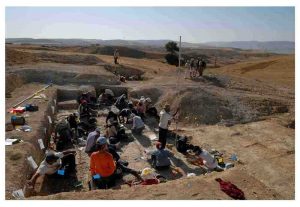
Mohamed Sahnouni, coordinator of the Prehistoric Technology Program at the Centro Nacional de Investigación sobre la Evolución Humana (CENIEH), leads a study, published online in the journal L’Anthropologie, using fossil fauna and carbon stable isotope to reconstruct paleoenvironments of the newly discovered site of El Kherba (Algeria) dated to 1.7 million years ago, in relation with hominid behavioral activities.
The results of this paleoecological study indicate the occurrence of an increasingly open landscape, which is supported by the pedogenic carbonate data showing a climate change that is consistent with the documented Plio-Pleistocene continental trend of increasing aridification and grassland expansion.
The climate change likely impacted hominid foraging activities, particularly in the Archaeological level A. The level A witnessed a drastic decrease in hominid activities characterized by a considerably lower density in stone tools and fossil bones as opposed to the lower level B, characterized by a closed habitat and abundant archaeological materials.
“The open habitat in level A would have caused major constraints for early hominids, such as limitations for access to food supply and water as a result to their diffusion and shortage on the landscape, as well as riskier possibilities for meat acquisition due to competition with carnivores,” explains Mohamed Sahnouni.
Reference:
Mohamed Sahnouni et al. Mise en évidence d’un changement climatique dans le site pléistocène inférieur d’El Kherba (Algérie), et son possible impact sur les activités des hominidés, il y a 1,7 Ma, L’Anthropologie (2017). DOI: 10.1016/j.anthro.2017.03.015
Note: The above post is reprinted from materials provided by CENIEH.
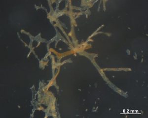
A clump of vessel-like structures Mary Schweitzer’s team extracted from a Tyrannosaurus rex bone that was almost completely demineralized (broken down). Credit: Mary Schweitzer, North Carolina State University
DNA might get all the attention, but proteins do the work. The recent confirmation that it is possible to extract proteins — which are encoded by DNA and perform all of the functions that keep living cells alive — from 80-million-year-old dinosaur bones has provided fodder for big questions about everything from evolution to biomaterials to extraterrestrial life.
Mary Schweitzer, PhD, professor of biology at North Carolina State University, will present her work on refining methods to extract and responsibly use dinosaur proteins at the American Association of Anatomists annual meeting during the Experimental Biology 2017 meeting, to be held April 22-26 in Chicago.
“When you think about it, it is the message of DNA — the proteins — that are actually the stuff on which natural selection works,” said Schweitzer. “The sequences of proteins can be used to generate ‘family trees’ of organisms, just like DNA. But modifications to proteins, which are not found in DNA and can’t be reliably predicted from DNA sequence alone, can tell us how a protein functioned, because the function of a protein is determined by its 3-D structure.”
For example, if you find a proline amino acid with an extra OH (oxygen + hydrogen) group attached, you can be almost certain you have collagen, the stuff that holds together skin and other connective tissues throughout the body. From the standpoint of function and evolutionary fitness, changes in DNA over time don’t really matter unless the protein changes; as a result, studying changes in proteins over time can yield richer information about evolution than studying DNA alone, Schweitzer explained.
Proteins also can yield clues about the age of a sample or about the environment in which an animal lived or was buried. Researchers are also keen to understand what makes some proteins break down while others persist for eons. Conveniently, Schweitzer and others have found that proteins (or at least some types of them) are more likely to remain stable over tens of millions of years than DNA is, making them low-hanging fruit for extracting new information from old bones.
Now that she and her colleagues have demonstrated repeatedly that proteins can be extracted from dino bones, Schweitzer is focusing on new research directions. First, she is turning her attention toward refining methods for studying these ancient proteins so that paleontologists can get more information with less damage to specimens. Mass spectrometry, central to her team’s current methods, is time-intensive and necessarily destroys the sample, so Schweitzer’s team is working to build a database of methods and criteria that other researchers might employ to get as much information as they can from other fossils and optimize the use of mass spectrometry when it is truly worthwhile. She also is working on ways to broaden the search for proteins to different dinosaur tissues, specimens and environments.
A second area of focus is to explore what, exactly, proteins can tell us about the organism that produced them. For example, can they reveal more about the animal’s physiology and not just evolutionary relationships? Can they tell us more about the functions, not only of proteins, but of the tissues they comprise? What about reproductive behavior? Or maybe proteins can be used to help pin down the timing of when various evolutionary novelties emerged at different points in Earth’s history.
Paleontologists, of course, are interested in what life was like in the era of the dinosaurs, but Schweitzer believes this research also can have implications for our own times and even our future. Given that the dinosaurs lived through numerous periods of global change, for example, perhaps we can learn something from how they responded to those shifts on a molecular level as we face our own global changes. In addition, understanding what makes some proteins break down quickly or persist indefinitely could help researchers identify exciting new opportunities in drug development or the development of biomaterials.
“We have transparent, flexible, hollow polymers that have lasted for 80 million years,” Schweitzer pointed out. “Someone surely can find a use for that!”
Refining the research methods used to extract proteins from ancient bones could even come in handy in the quest for extraterrestrial life, she noted. After all, sifting through bone buried in the sediments of Montana for infinitesimally small, fragmented biomolecules might not be so very different from sifting through the sediments of Mars for signs of life.
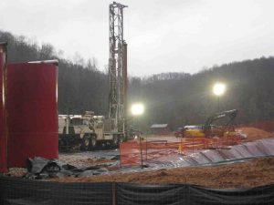
Fracking sites like this apparently have not harmed groundwater after three years of operation in northwestern West Virginia, but their spills may pose a threat to surface water, according to a new Duke-led study. Credit: Avner Vengosh, Duke University
Fracking has not contaminated groundwater in northwestern West Virginia, but accidental spills of fracking wastewater may pose a threat to surface water in the region, according to a new study led by scientists at Duke University.
“Based on consistent evidence from comprehensive testing, we found no indication of groundwater contamination over the three-year course of our study,” said Avner Vengosh, professor of geochemistry and water quality at Duke’s Nicholas School of the Environment. “However, we did find that spill water associated with fracked wells and their wastewater has an impact on the quality of streams in areas of intense shale gas development.”
“The bottom-line assessment,” he said, “is that groundwater is so far not being impacted, but surface water is more readily contaminated because of the frequency of spills.”
The peer-reviewed study was published this month in the European journal Geochimica et Cosmochimica Acta.
The Duke team collaborated with researchers from The Ohio State University, Pennsylvania State University, Stanford University and the French Geological Survey to sample water from 112 drinking wells in northwestern West Virginia over a three-year period.
Twenty of the water wells were sampled before drilling or fracking began in the region, to provide a baseline for later comparisons.
Samples were tested for an extensive list of contaminants, including salts, trace metals and hydrocarbons such as methane, propane and ethane. Each sample was systematically analyzed using a broad suite of geochemical and isotopic forensic tracers that allowed the researchers to determine if contaminants and salts in the water stemmed from nearby shale gas operations, from other human sources, or were naturally occurring.
The tests showed that methane and saline groundwater were present in both the pre-drilling and post-drilling well water samples, but that they had a chemistry that was subtly but distinctly different from the isotopic fingerprints of methane and salts contained in fracking fluids and shale gas. This indicated that they occurred naturally in the region’s shallow aquifers and were not the result of the recent shale gas operations.
“The integrated suite of tracers we used — which were developed at Duke in recent years — provides us with tools sensitive enough to accurately distinguish these subtle differences, which might be missed if you only used a handful of simple measurement techniques,” explained Jennifer Harkness, a recent PhD graduate of Duke’s Nicholas School, who led the new study.
Some of the tracers have never been used together before, Vengosh noted. “To our knowledge, we are the first to report a broadly integrated use of these various geochemical techniques in studying groundwater contamination before and after the installation and fracking of shale gas wells.”
“What we found in the new study in West Virginia is different from what we have found in previous studies in northeastern Pennsylvania and Texas but similar to what we found in Arkansas,” Vengosh said. “That’s because geology varies by region, as do the drilling operators and conditions. Time also plays a factor. What we found in the study area in West Virginia after three years may be different from what we see after 10 years, because the impact on groundwater isn’t necessarily immediate.”
“Using this integrated toolbox, we can conduct similar tests in as many other regions as possible, over longer time frames, to determine both the unique short-term local impacts on water quality, and the broad, cumulative long-term impacts,” he said.
Reference:
“The Geochemistry of Naturally Occurring Methane and Saline Groundwater in an Area of Unconventional Shale Gas Development,: Jennifer S. Harkness, Thomas H. Darrah, Nathaniel R. Warner, Colin J. Whyte, Myles T. Moore, Romain Millot, Woldfram Kloppman, Robert B. Jackson, and Avner Vengosh; Geochimica et Cosmochimica Acta, July, 2017 (available online, April 2017): DOI: 10.1016/j.gca.2017.03.039
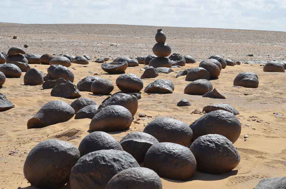
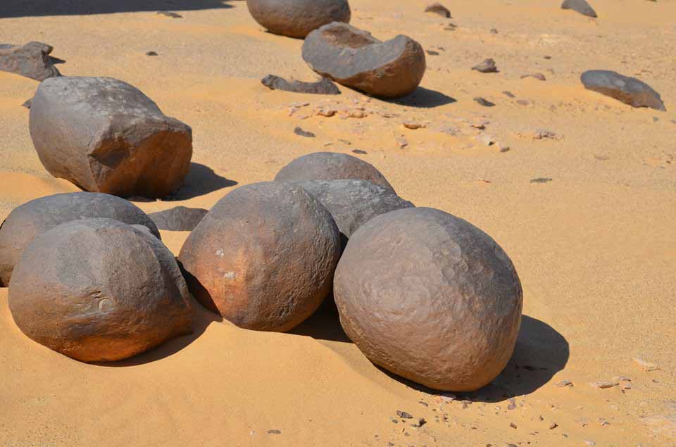
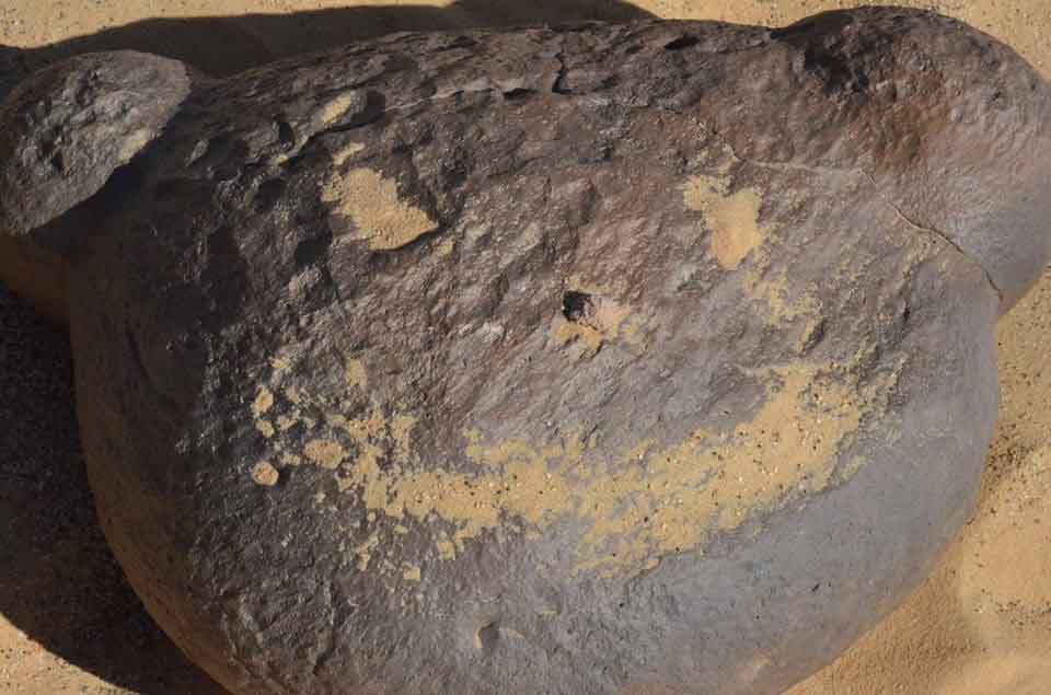
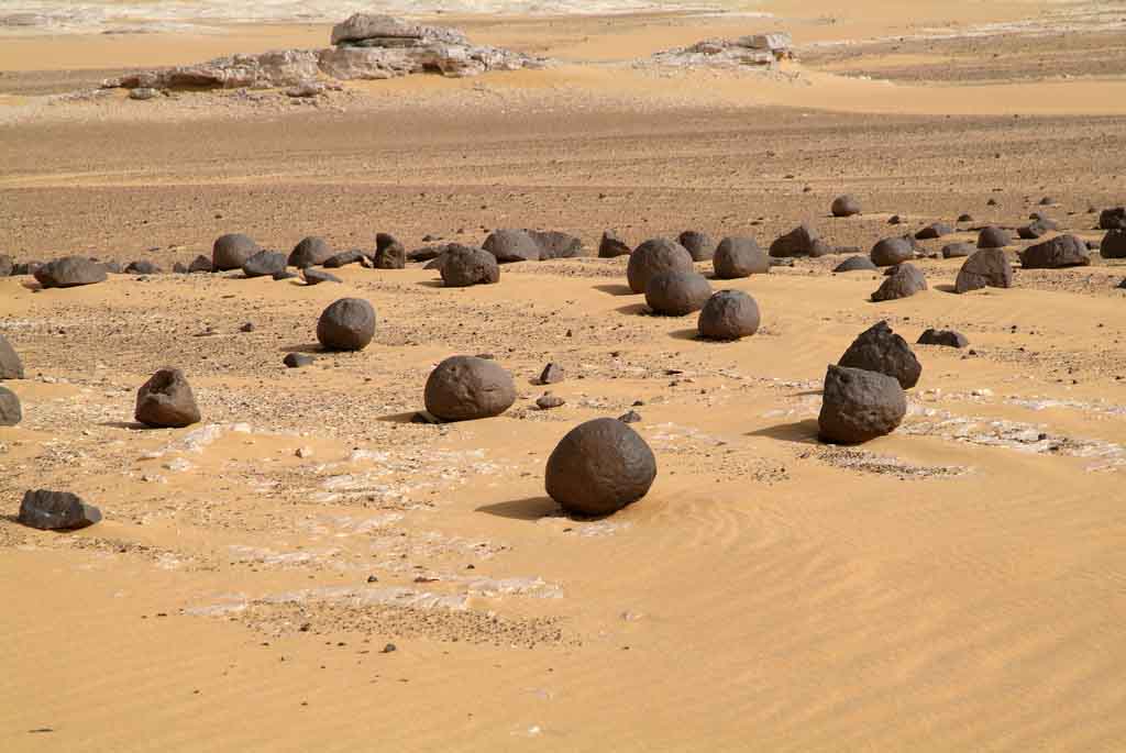
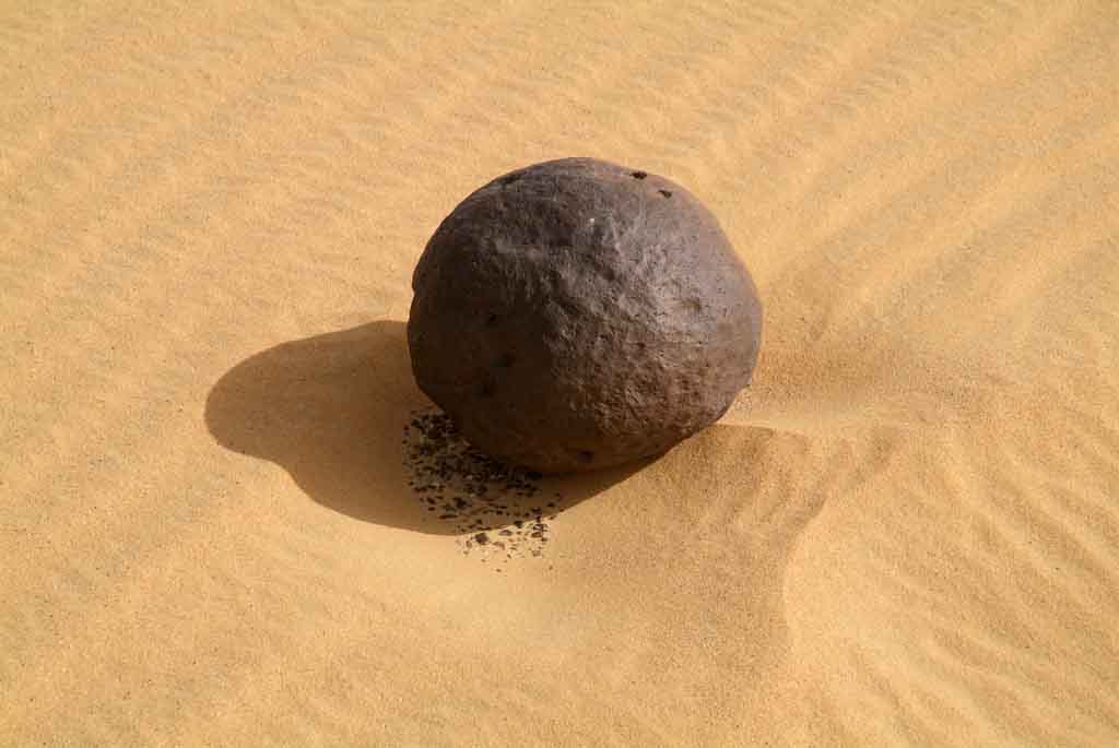
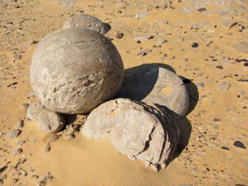
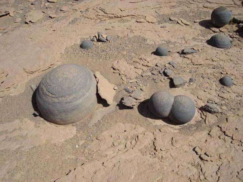
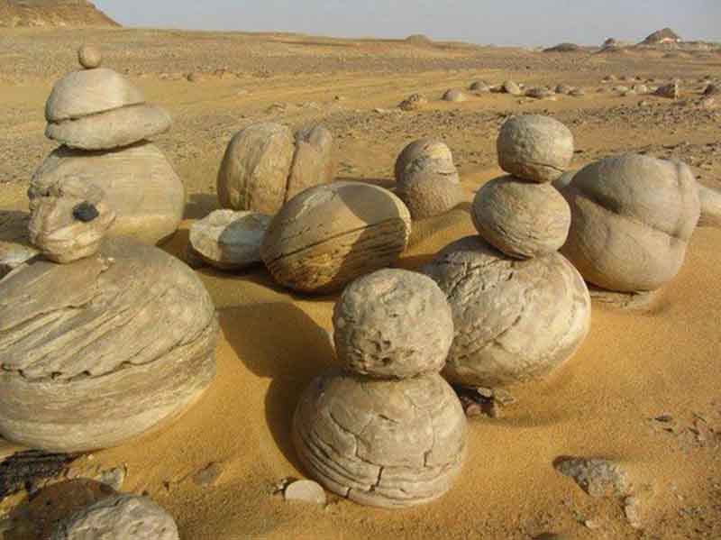
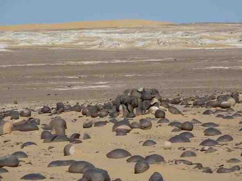
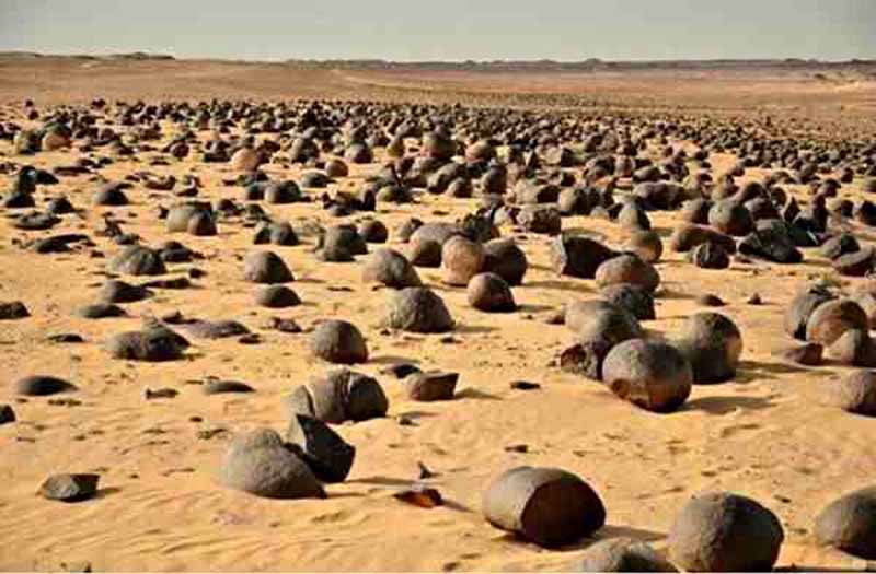
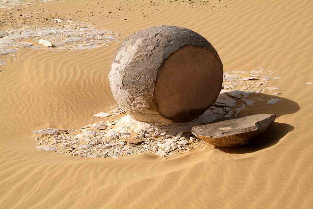
Name: Watermelon Valley “Wadi El Battikh” Locality: New Valley Governorate, Egypt
Chert nodules of the Drunka Formation (Lower Eocene) are mostly spherical, have diameters from 40 to 120 cm, are quasi-uniformly spaced 2–3 m apart in the plane of bedding, have concentric internal structure and, except for rare small (<6 cm) solid chert nodules, are less than 85% chertified.
Nodules formed after moderate alteration of limestone by meteoric water at shallow (<100 m) burial depths; more extensive alteration of limestone by meteoric water followed nodule growth. Chertification was by low-temperature meteoric water at shallow burial depths.
Meteoric water may have invaded the Drunka Formation in association with shelf progradation during the Early Eocene, or during the development of a Middle Eocene unconformity. Replacement of carbonate mud by microcrystalline quartz was the dominant chertification process, but fossils were replaced in part by fine-grained equant megaquartz, quartzine and chalcedony; the last of these occurs in places as beekite. Opal A-secreting marine organisms are the inferred source of silica, but none are preserved.
There is no compelling evidence of an opal-CT precursor, so quartz may have formed by direct precipitation. Self-organization processes of enigmatic character established the spacing pattern of the nodules and also the Liesegang-banded internal structure of the chert nodules.
Nodules grew chiefly by diffusive supply of silica, although one locality has elongate nodules that grew when there was some porewater advection. Chertification patterns and δ18O values of both calcite and quartz indicate that nodule growth was complex and variable. Some nodules probably grew from the centre outwards. Many nodules, however, initially grew simultaneously across the entire nodule, but late-stage growth was predominantly at the outer margins or at selective internal sites.
There are over 4,000 known minerals, and approximately 80-100 new ones are discovered each year. Of all these, only a few hundred are considered common.
To help with identification, geologists must look closely at the physical properties of a mineral. These properties can include: color, streak, hardness, cleavage, specific gravity, crystal form, and others.
Color
The color of a mineral is the most important identifying characteristic for the amateur mineralogist. Many minerals exhibit various colors; the varieties are mainly due to impurities or a slight change in chemical composition. For example, calcite can be white, blue, yellow, pink, or fluorescent. Surface tarnish may have changed the color of the specimen; therefore, a fresh surface should be examined.
Hardness
Hardness is a measure of a mineral’s resistance to abrasion. A numerical value for hardness is determined using a scale that ranges from 1 (softest) to 10 (hardest). Developed by a German mineralogist, Friedrich Mohs, the Mohs Hardness Scale assigns hardness values to 10 representative minerals as well as other common materials (penny, knife blade, etc.). Talc is the softest mineral and diamond is the hardest mineral.
Most of the minerals you will encounter will be between 2 and 7.
If a mineral can be scratched with a copper penny, but cannot scratch glass, then your mineral has a hardness between 3-6.
Luster
Luster refers to the brightness of light reflected from the mineral’s surface. The main types of luster are metallic and nonmetallic. Some of the more important nonmetallic lusters are:
Adamantine: brilliant, like that of a diamond.
Earthy: dull, like kaolin.
Silky: having the sheen of silk, like satin spar, a variety of gypsum.
Greasy: oily appearance.
Resinous: waxy appearance, like sphalerite.
Vitreous: the appearance of broken glass, like quartz.
Nacreous (pearly): like mother of pearl; for example, pearly luster on fossil gastropods and cephalopods.
Specific Gravity
Specific gravity is the relative weight of the mineral to an equal volume of water. For example, gold has a specific gravity of 15-19.3 and is thus 15 to 19.3 times as heavy as water. It is possible to make a fairly good estimate of specific gravity by checking the mineral’s weight in your hand.
Follow these simple instructions to determine the specific gravity of your mineral:
Push the “Power” button on the digital scale. The scale should read 0.0 with nothing on it.
Place your dry mineral on the scale and record its weight.
Remove the mineral.
Place a water-filled container on the scale and push the “tare” button to “zero” it out.
Unwind paper clip and wrap it around the mineral, leaving enough of the paper clip to hold with your two fingers.
Submerge the mineral in the water, but do not let it touch the bottom (important: be sure that your fingers are not touching or submerged in the water with your mineral specimen).
Record the weight of the mineral submerged in the water.
Take the original weight of the mineral and divide it by the weight of the mineral submerged in the water.
The quotient (answer) of the two weights is a mineral’s specific gravity.
Streak
A streak test is accomplished by rubbing the mineral on a porcelain plate, also known as a streak plate. The color of the streak left by the mineral is sometimes different from the color of the mineral itself. A streak test comes in handy when identifying minerals such as hematite. Hematite can be found in various colors from black to red, but it always leaves a red streak.
This can be produced by taking the mineral and scrapping it across the surface of a streak plate or something harder depending on the hardness of your mineral. The mineral’s color in powdered form can be a better indicator than its original color. When you have successfully achieved a powdered streak from your mineral.
Smell
Once you successfully get a streak from a mineral now is a good time to smell it. Some minerals that contain sulfur, for instance, have a very distinct smell (rotten eggs).
Taste
Minerals that are translucent or transparent are good candidates for a taste test. Halite, for example, has a very salty taste. It is made up of sodium and chlorine (NaCl), which is also referred to as rock salt.
To taste the mineral simply stick out your tongue and touch the tip of it to the mineral.
Magnetism
A few minerals, such as magnetite and pyrrhotite, are attracted by a magnet and are said to be magnetic. Magnetic minerals are rare in Kentucky, but do occur in the kimberlite in Elliott County. If you find a large piece of highly magnetic material, it may be a meteorite or a furnace product.
Use a small magnet and run it across the mineral. If the magnet is attracted to the mineral then your mineral is magnetic.
Acid Test
When carbonates (especially calcite) are treated with cold, dilute hydrochloric acid, they will effervesce, foam, and bubble, and give off carbon dioxide gas. When sulfides, such as galena, pyrite, and sphalerite, are treated with dilute hydrochloric acid, they will give off the rotten-egg odor of hydrogen sulfide.
Cleavage and Fracture
Cleavage can be observed in minerals that tend to break along one or more flat surfaces or planes. The number of cleavage planes, and their orientations relative to each other, can be diagnostic of particular minerals. Minerals that display cleavage include: calcite, halite, fluorite, topaz, and galena. However, not all minerals have cleavage, such as quartz and pyrite.
Minerals may have one, two, three, four, or six directions of cleavage. These cleavage forms are (1) cubic, (2) octahedral, (3) dodecahedral, (4) rhombohedral, (5) prismatic, and (6) pinacoidal. Minerals that break easily along these lines of weakness yield shiny surfaces. Many crystals do not cleave, but fracture or break instead. Quartz, for example, forms well-developed crystal faces but does not cleave at all; instead it fractures or breaks randomly with a conchoidal fracture.
Cleavage Types:
Perfect: produces smooth surfaces
Imperfect: produces planes that are not smooth
Poor: less regular
Some minerals do not readily break along its cleavage planes. This type of breakage is called a fracture. How a mineral fractures can also be used an indicator.
Fracture Types:
Conchoidal: fracture surface is a smooth curve, often bowl-shaped (common in glass)
Hackly: produces sharp jagged edges
Uneven: surface is rough and irregular
Fibrous: surface shows fibers or splinters
Crystal Form & Mineral Habit
Crystal form is responsible for the mineral’s geometric shape and arrangement of crystal faces. The crystal form will always remain the same in every sample found of the same mineral, although the crystal form is better displayed in some samples than in others. Sometimes, growth patterns, called the mineral habit, disguise the ideal form of the crystal. However, these habits can also aid in identification. Some commonly found habits include: botryoidal (which resembles a cluster of grapes), striated (parallel grooves on crystal faces), and acicular (needlelike).
Fluorescence
Some minerals, such as calcite, gypsum, halite, uranium minerals, and fluorite, will fluoresce in brilliant colors when viewed with an ultraviolet (UV) light. UV light is not normally visible to the human eye, and you should avoid looking directly at the UV source, as it can damage eyesight.
Tenacity
Tenacity is the measure of a mineral’s cohesiveness or toughness. Tenacity terms are:
Brittle: breaks or powders easily; for example, pyrite or marcasite.
Ductile: can be drawn into a wire; for example, copper.
Elastic: bends and resumes its original position or shape when pressure is released; for example, biotite or muscovite.
Malleable: can be hammered into thin plates or sheets; for example, gold or copper.
Sectile: can be cut or shaved with a knife; for example, gypsum or galena.
Washington’s Museum of Natural History is the new home of the Dom Pedro — the world’s largest aquamarine gem, cut from what was believed to have been the largest gem-quality crystal ever found. Discovered in Brazil, the crystal was then taken to Germany where it was transformed into its current shape by world-renowned gem artist Bernd Munsteiner.
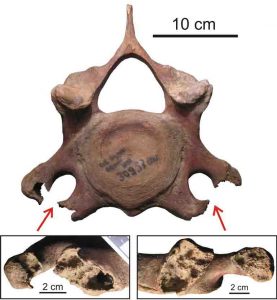
The openness of the transverse apertures of the cervical vertebrae. Credit: TSU
Sergey Leshchinskiy, paleontologist, head of TSU’s Laboratory of Mesozoic and Cenozoic Continental Ecosystems, has studied the remains of Yakut mammoths collected on one of the world’s largest paleontological sites of mammoth fauna, Berelyokh. His study showed that almost half of the bones of these ancient mammals have signs of serious pathologies typical for the human skeletal system.
According to the scientist, the remains of mammoths that lived about 12,000 to 13,000 years ago (ca BP) in the area of modern Yakutia are perfectly preserved. Bones carried to the Berelyokh site were covered by sediments, and this saved them from weathering and damage by predators. In permafrost conditions, the decomposition of tissues is slow, so even after millennia, the cartilage on some bones survived.
During work with the collection, the research team found that 42 percent of the samples showed signs of diseases of the skeletal system. Among them there were two pathologies that no one in the world had ever detected on the remains of this species.
One of these conditions is known in medicine as “articular mouse,” or “rice grain.” It occurs when a fragment of bone or cartilaginous tissue is located freely in the joint cavity, explains Sergei Leschinskiy. Quite often, this pathology is observed in humans. When such a fragment enters the articular cavity, severe joint pain occurs. This indicates a serious disease such as subchondral bone necrosis. An animal with this ailment is restricted in movement and often became an easy target for predators.
Another anomaly, described for the first time in mammoths, is the openness of the transverse apertures of the cervical vertebrae, where blood vessels and nerve plexuses are normally located. The researchers uncovered several vertebrae with such a deviation, and it is obvious that they are the bones of different individuals. However, in most cases, the mammoths have signs of destructive changes, osteoporosis, osteolysis, osteofibrosis, osteomalacia, articular diseases, and other diseases caused by metabolic disorders by a lack or excess of vital macro and micro elements.
These results confirm the hypothesis of TSU paleontologists that the cause of mass extinction of mammoths was the geochemical stress that arose due to mineral starvation or major ecological changes on the planet.
The results of the research are available in one of the prestigious journals in quaternary sciences, from the Elsevier publishing house—Quaternary International.
Reference:
Sergey V. Leshchinskiy, Strong evidence for dietary mineral imbalance as the cause of osteodystrophy in Late Glacial woolly mammoths at the Berelyokh site (Northern Yakutia, Russia), Quaternary International (2017). DOI: 10.1016/j.quaint.2017.02.036
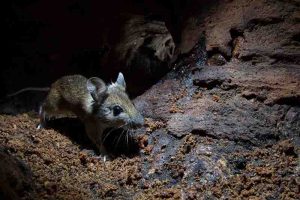
Many modern mammals, like this wood rat, are nocturnal, thanks to evolutionary developments such as night vision in their distant ancestors, Stanford researchers say. Credit: Damian Kuzdak / Getty Images
Our earliest mammalian ancestors likely skulked through the dark, using their powerful night-time vision to find food and avoid reptilian predators that hunted by day. This conclusion, published by Stanford researchers April 21 in Scientific Reports, used genetic data to support existing fossil evidence suggesting that our distant relatives may have adapted to life in the dark.
The team, led by Liz Hadly, professor of biology and senior author on the paper, examined genes involved in night vision in animals throughout the evolutionary tree, looking for places where those genes became enhanced.
“This method is like using the genome as a fossil record, and with it we’ve shown when genes involved in night vision appear,” Hadly said. “It’s a very powerful way of corroborating a story that has been, up to now, only hypothesized.”
Mammals versus reptiles
Mammals and reptiles share a common ancestor, with the earliest mammal-like animals appearing in the Late Triassic (about 200 million years ago). Fossil evidence suggests that early mammals had excellent hearing and sense of smell and were likely also warm-blooded. All of these features are common in their descendants, the living mammals, most of whom are nocturnal. Therefore, experts have hypothesized that early mammals were also nocturnal. This study offers direct, genetic evidence for that hypothesis.
To trace the evolution of nocturnality, the researchers studied genes that the lead author, visiting scholar Yonghua Wu, had previously found associated with night vision in certain birds, such as owls. The team members examined those night-vision genes in many mammals and reptiles, including snakes, alligators, mice, platypuses and humans. Using what they know about how those animals are related, they figured out when in their evolutionary histories, if ever, the function of these genes was enhanced.
From this, they deduced that the earliest common ancestor did not have good night vision and was instead active during the day. However, soon after the split, mammals began enhancing their night vision genes, allowing them to begin to roam at night, thus avoiding the reptiles that hunted during the day.
“Early mammals coexisted with early reptiles in the Age of the Dinosaurs and somehow escaped extinction,” Wu said. “This research further supports the hypothesis that diurnal reptiles, such as lizards, snakes and their relatives, competed with mammals and may have led them to better adapt to dim light conditions.”
In the millions of years that have elapsed since mammals and reptiles diverged, natural selection and evolution haven’t stopped. Not all mammals are still nocturnal. Some groups of mammals have reoccupied the day, adapting in various ways to daylight activity. These animals include cheetahs, pikas, camels, elephants, and, of course, humans.
“Understanding the constant pressure to get better at seeing the world at night for over 100 million years is a beautiful way of thinking about evolution,” Hadly said. “We think of it as something simple — seeing in the light or the dark — but these genes are being constantly refined and altered by natural selection.”
Filling in our history
The methods used by these researchers could be applied to different areas of the animal evolutionary tree to learn more about the evolution of vision, including how humans made the switch to bright-light vision. This study is also an example of how little information we have about the first mammals, compared to what we know about our ancient and more compelling reptile cousins, the dinosaurs.
“When people talk about the dinosaur age, even when you look at cartoons, the focus is mainly on dinosaurs,” said Haifeng Wang, co-author of the paper and postdoctoral research fellow with Stanley Qi, an assistant professor of bioengineering. “This ancient period is an important piece of the story of our evolution too. We want to know better what the mammals were like then.”
Reference:
Yonghua Wu, Haifeng Wang, Elizabeth A. Hadly. Invasion of Ancestral Mammals into Dim-light Environments Inferred from Adaptive Evolution of the Phototransduction Genes. Scientific Reports, 2017; 7: 46542 DOI: 10.1038/srep46542
Note: The above post is reprinted from materials provided by Stanford University. Original written by Taylor Kubota.
The latest scientific drilling by the Oman Drilling Project at Wadi Manasah in the Wilayat of Bidbid has ended the season with a collection of samples from 300-metre cored hole that is expected to throw more light on oceanic plates and most interestingly on the microbial ecosystem in extreme environments. This is one of the eight holes that will be drilled during 2016 to 2018.
Dr Peter Kelemen, one of the lead project proponents who is from Columbia University, explained by pointing across the wadi and the mountains, “The red rocks you see in the background are part of the earth’s mantle that was thrust onto the Arabian Continent and as it came onto the Arabian Continent, carbon dioxide and other things from the sediments beneath percolated up into the bottom of the mantle and converted these rocks to what they are now — the Co2 from the sediments is now incorporated in solid carbonate minerals.”
The first 70 metres of the study of total 300 metres where the red rocks that is visible and then the team drilled unaltered rocks from the earth’s interior.
The scientists are interested in the chemical processes where the sediments rest beneath the mantle. “We call this subduction. It is a very important part of the global geochemistry, global geochemical cycles and in addition, perhaps we can learn from these processes how to capture carbon dioxide and store them in solid form. So scientific results from the study that can be used sometime in the future not in Oman but may be somewhere else.
But during this project we are not doing any research or experiments on engineered carbon dioxide capture and storage. On the other hand, we hope that someday, somewhere people might try this because it could offer a helpful part of the solution to the climate change problem,” explained Dr Kelemen.
Scientists from 11 countries are participating in the study and 133 scientists signed up to participate and are all involved in different ways.
One large group of the scientists is interested in the subsurface biosphere.
There are microbial organisms that live in the subsurface and unlike on the surface where the bottom of the food chain is photosynthesis, which is the energy from the sun, the bottom of the food chain for the subsurface biosphere is chemosynthesis — they are microbes that basically eat rocks and in turn supports a varied ecosystem underground.
Some of the samples collected (the archive half) will remain in Oman and the working half will be at the Museum of Natural History in New York City, where any scientist from anywhere in the world can request for samples to study.
The studies had revealed an unexpected reservoir of carbon derived from subducted sediments and precipitated as carbonate minerals in the mantle wedge. This they believe could form an important so far unrecognised part of the global carbon cycle.
The left picture shows uraninite (uranium ore) that surrounds gold. In the right picture, a computer programme was used the remove the uraninite to illustrate the large volume hidden in the uranium ore. Credit: S. Fuchs, GEOMAR.
At a first glance, the Witwatersrand basin, the largest known gold resource on our planet, is not automatically related to ocean research. However, in its 3 billion years old geological history, the Witwatersrand basin in South Africa has been covered by seawater, but experienced also episodes of drying out, flooding and erosion by rivers and the repeated coverage by seawater. In 1852, the English prospector J.H. Davis discovered the first gold in the Witwatersrand, leading to the South African gold rush and the discovery of much more gold deposits within the basin. Although the Witwatersrand has been subject for decades of research, the genesis of gold and uranium ore is still unclear.
A group of scientists from Canada and the GEOMAR Helmholtz Centre of Ocean Research Kiel, successfully unravelled some mechanisms of the ore-forming process using complex analytical techniques. The results were recently published in the scientific journal Precambrian Research.
In this study, the scientists analysed samples from the Witwatersrand ore deposits with high-resolution scanning- and transmission-electron microscopes, and the processed their data using novel 2D and 3D software. “We were able to find out that fossil oil, that has been formed by organic matter derived from the first living organisms on Earth, mobilized uranium in the basin. Uraninite nanoparticles flocculated in the oil and formed uranium ore”, explains Dr. Sebastian Fuchs from the GEOMAR, the first author of the study. “Hot hydrothermal fluids, similar to those fluids that we find today in modern seafloor Black Smoker systems, transported dissolved gold and formed oil-in-water emulsions at the site of the deposits. The oil droplets in the hydrothermal fluids initiated the efficient chemical precipitation of native gold and the formation of very complex-structured gold and uranium ore.”
Using high-resolution imaging techniques, the researchers were able to visualize a to date unknown ore-forming process, in which migrating oil plays the dominant role in the distribution and concentration of metals. “With our method we have been able to show remnants of fossil oil entrapped in gold for the very first time” says Dr. Sebastian Fuchs.
“We are surprised to see such an intimate spatial relationship between the oil products and the metals”, reports Dr. Fuchs. “We hope that our study gives new impulses to industry and science to explore new mineral deposits. Perhaps it is possible at some day to extract gold and other metals from mined crude oil”.
With the methods used, it is now possible to study not only ore particles on the ocean floor in the range of millimetre to nanometre, but also the smallest fossils and living organisms, such as micro-organisms. “We are curious about what else we might discover on the ocean floor in the future”, Fuchs concludes.
Reference:
Sebastian H.J. Fuchs et al, Gold and uranium concentration by interaction of immiscible fluids (hydrothermal and hydrocarbon) in the Carbon Leader Reef, Witwatersrand Supergroup, South Africa, Precambrian Research (2017). DOI: 10.1016/j.precamres.2017.03.007