Home Blog Page 125

Extinct early whales listened like their relatives on land, fossil evidence shows

Illustration of one of the two protocetid species from Togo. Credit: Drawing © M.J. Orliac, based on the reconstruction of the skull drawn by Róisín Mourlam.

Whales rely on a keen sense of hearing for their underwater existence. But whales show surprisingly vast differences in hearing ability. Baleen whales tune into infrasonic sounds — at frequencies too low for humans to hear — to communicate over long distances. Toothed whales do just the opposite, relying on ultrasonic frequencies too high for humans to hear.

Now researchers reporting in Current Biology on June 8 have fossil evidence from extinct early whale species to suggest that those differences in hearing arose only after whales evolved into the fully aquatic animals we know today. That’s based on their findings that whales known as protocetes, which spent time both in water and on land, appear to have hearing more like their terrestrial, even-toed ungulate relatives, including pigs, hippos, and camels.

“We found that the cochlea of protocetes was distinct from that of extant whales and dolphins and that they had hearing capacities close to those of their terrestrial relatives,” says Maeva Orliac of CNRS and Université de Montpellier in France.

Protocetes’ lack of hearing specialization suggests that the early whales were unable to echolocate and communicate through long-distance calls in the way that modern-day cetaceans, the group including whales and dolphins, do.

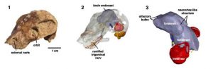
The researchers came to those conclusions based on studies of 45-million-year-old protocetid whale remains found in marine deposits from Togo in West Africa. The researchers studied the bony labyrinth, a hollow cavity that would have housed the hearing organ, in two species of early whales.

Orliac and her colleague Mickaël Mourlam used micro-CT scanning to peer inside the internal structures of rocks and fossils, in much the same way that an X-ray scanner makes it possible to see bones inside a person’s body. Those images allowed them to analyze the internal cavities of the petrosal bone, which shelters the organs of hearing and balance.

“Based on the scans provided by the scanner, we could extract a virtual mold of the hollow cavity that used to contain the hearing organ when the animal was alive,” Orliac says. “This process was long and difficult because this cavity was filled with sediments and partly recrystallized and because the petrosal bone in cetaceans is particularly thick and dense, which lowers the quality of the images and sometimes impedes analyzing them.”

Nevertheless, the scans suggest that early cetaceans had hearing closer to that of their terrestrial relatives. Specialization to infrasonic or ultrasonic hearing as seen in modern whales came only later, in whales that had already found their way back to the sea.

The findings highlight the importance of studying these early cetaceans to get an accurate picture of whales’ evolutionary history. It also suggests that whales’ evolutionary past is more complicated than had previously been described, the researchers say.

Orliac says they’ll be back in field in Togo in December to search for additional protocetid whale specimens. They’ve so far described two of three species identified in Togo based on dental remains. They hope to find a specimen that will allow them to explore the ear of the third.

Reference:
Mourlam and Orliac. Infrasonic and Ultrasonic Hearing Evolved after the Emergence of Modern Whales. Current Biology, 2017 DOI: 10.1016/j.cub.2017.04.061

Note: The above post is reprinted from materials provided by Cell Press.

Which extinct ducks could fly?

Fossils such as this partial skeleton of a Hawaiian species called Ptaiochen pau were used to determine whether extinct ducks and geese could fly. Credit: J. Watanabe

We’re all familiar with flightless birds: ostriches, emus, penguins — and ducks? Ducks and geese, part of a bird family called the anatids, have been especially prone to becoming flightless over the course of evolutionary history. However, it can be difficult to determine from fossils whether an extinct anatid species could fly or not. A new study from The Auk: Ornithological Advances takes a fresh approach, classifying species as flightless or not based on how far their skeletal proportions deviate from the expected anatomy of a flying bird and offering a glimpse into the lives of these extinct waterfowl.

Kyoto University’s Junya Watanabe painstakingly measured 787 individual birds representing 103 modern duck and goose species. From this data, he developed a mathematical model that was able to separate flightless and flying species based on their wing and leg bones — flightless species, the math confirmed, have relatively small wings and relatively large legs. Applying the model to fossil specimens from 16 extinct species identified 5 of the species as flightless, ranging from a land-dwelling duck from New Zealand to a South American duck that propelled itself underwater with its feet.

“I really enjoyed measuring bones in museums and appreciate the hospitality given to me by museum staff. One of the most exciting things was to find interesting fossils that were previously unidentified in museum drawers,” says Watanabe. “What is interesting in fossil flightless anatids is their great diversity; they inhabited remote islands and continental margins, some of them were specialized for underwater diving and others for grazing, and some were rather gigantic while others were diminutive.”

“Dr. Watanabe has developed a valuable statistical tool for evaluating whether a bird was capable of powered flight or not, based on measurements of the lengths of only four different long bones. His method at present applies to waterfowl, but it could be extended to other bird groups like the rails,” according to Helen James, Curator of Birds at the Smithsonian Institution’s National Museum of Natural History. “Other researchers will appreciate that he offers a way to assess limb proportions even in fossil species where the bones of individual birds have become disassociated from each other. Disassociation of skeletons in fossil sites has been a persistent barrier to these types of sophisticated statistical analyses, and Dr. Watanabe has taken an important step towards overcoming that problem.”

Reference:
Junya Watanabe. Quantitative discrimination of flightlessness in fossil Anatidae from skeletal proportions. The Auk: Ornithological Advances, June 2017 DOI: 10.1642/AUK-17-23

Note: The above post is reprinted from materials provided by American Ornithological Society Publications Office.

New evidence reveals source of 1586 Sanriku, Japan tsunami

Makauwahi sinkhole. Credits: R. Butler (L), Gerard Fryer (R), GoogleMaps.

A team of researchers, led by Dr. Rhett Butler, geophysicist at the University of Hawai’i at M?noa (UHM), re-examined historical evidence around the Pacific and discovered the origin of the tsunami that hit Sanriku, Japan in 1586 — a mega-earthquake from the Aleutian Islands that broadly impacted the north Pacific. Until now, this was considered an orphan tsunami, a historical tsunami without an obvious local earthquake source, likely originating far away.

Butler and scientists from the National Tropical Botanical Garden, UHM School of Ocean and Earth Science and Technology, and NOAA’s Pacific Tsunami Warning Center analyzed material deposited into Makauwahi Cave, Kauai during a tsunami — specifically, coral fragments that were previously dated to approximately the sixteenth century using carbon-14. Using specific isotopes of naturally-occurring thorium and uranium in the coral fragments, they determined a very precise age of the tsunami event that washed the coral ashore. Prior carbon-14 dates had an uncertainty of ±120 years, whereas the uranium-thorium date is more precise, 1572±21 years. This increased precision allowed better comparison with dated, known tsunamis and earthquakes throughout the Pacific.

“Although we were aware of the 1586 Sanriku tsunami, the age of the Kauai deposit was too uncertain to establish a link,” said Butler. “Also, the 1586 Sanriku event had been ascribed to an earthquake in Lima, Peru. After dating the corals, their more precise date matched with that of the Sanriku tsunami.”

Further, re-analysis of the Peruvian evidence showed that the 1586 Peruvian earthquake was not large enough to create a measurable tsunami hitting Japan. They found additional corroborative evidence around the Pacific which strengthened the case. Earthquakes from Cascadia, the Alaskan Kodiak region, and Kamchatka were incompatible with the Sanriku data in several ways. However, a mega-earthquake (magnitude greater than 9.25) in the Aleutians was consistent with evidence from Kauai and the northeast coast of Japan.

“Hawaii is surrounded by the ‘ring of fire’ where mega-earthquakes generate great tsunamis impacting our island shores — the 2011 Tohoku Japan is the most recent example,” said Butler. “Even though there was no seismic instrumentation in the 16th century, we offer a preponderance of evidence for the occurrence of a magnitude 9 earthquake in the Aleutian Islands. Our knowledge of past events helps us to forecast tsunami effects and thereby enable us to assess this risk for Hawaii.”

Forecast models of a great Aleutian event inform the development of new maps of extreme tsunami inundation zones for the State of Hawai’i. By linking evidence on Kauai to other sites around the Pacific, we can better understand the Aleutian earthquake that generated the tsunami.

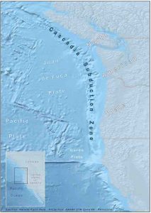
Butler and colleagues at UHM are now working to determine how frequently great earthquakes along the Cascadia margin of the Pacific Northwest might occur. These events have the potential to devastate the coasts of Oregon and Washington, and send a dangerous tsunami to Hawai’i’s shores.

Reference:
Rhett Butler, David A. Burney, Kenneth H. Rubin, David Walsh. The orphan Sanriku tsunami of 1586: new evidence from coral dating on Kaua‘i. Natural Hazards, 2017; DOI: 10.1007/s11069-017-2902-7

Note: The above post is reprinted from materials provided by University of Hawaii at Manoa.

World’s oldest fossil mushroom found

The mushroom was uncovered in the Araripe Basin, in northeast Brazil, in a limestone layer called the Crato Formation. Credit: Graphic by Danielle Ruffatto

Roughly 115 million years ago, when the ancient supercontinent Gondwana was breaking apart, a mushroom fell into a river and began an improbable journey. Its ultimate fate as a mineralized fossil preserved in limestone in northeast Brazil makes it a scientific wonder, scientists report in the journal PLOS ONE.

The mushroom somehow made its way into a highly saline lagoon, sank through the stratified layers of salty water and was covered in layer upon layer of fine sediments. In time — lots of it — the mushroom was mineralized, its tissues replaced by pyrite (fool’s gold), which later transformed into the mineral goethite, the researchers report.

“Most mushrooms grow and are gone within a few days,” said Illinois Natural History Survey paleontologist Sam Heads, who discovered the mushroom when digitizing a collection of fossils from the Crato Formation of Brazil. “The fact that this mushroom was preserved at all is just astonishing.

“When you think about it, the chances of this thing being here — the hurdles it had to overcome to get from where it was growing into the lagoon, be mineralized and preserved for 115 million years — have to be minuscule,” he said.

Before this discovery, the oldest fossil mushrooms found had been preserved in amber, said INHS mycologist Andrew Miller, a co-author of the new report. The next oldest mushroom fossils, found in amber in Southeast Asia, date to about 99 million years ago, he said.

“They were enveloped by a sticky tree resin and preserved as the resin fossilized, forming amber,” Heads said. “This is a much more likely scenario for the preservation of a mushroom, since resin falling from a tree directly onto the forest floor could readily preserve specimens. This certainly seems to have been the case, given the mushroom fossil record to date.”

The mushroom was about 5 centimeters (2 inches) tall. Electron microscopy revealed that it had gills under its cap, rather than pores or teeth, structures that release spores and that can aid in identifying species.

“Fungi evolved before land plants and are responsible for the transition of plants from an aquatic to a terrestrial environment,” Miller said. “Associations formed between the fungal hyphae and plant roots. The fungi shuttled water and nutrients to the plants, which enabled land plants to adapt to a dry, nutrient-poor soil, and the plants fed sugars to the fungi through photosynthesis. This association still exists today.”

The researchers place the mushroom in the Agaricales order and have named it Gondwanagaricites magnificus.

Reference:
Sam W. Heads, Andrew N. Miller, J. Leland Crane, M. Jared Thomas, Danielle M. Ruffatto, Andrew S. Methven, Daniel B. Raudabaugh, Yinan Wang. The oldest fossil mushroom. PLOS ONE, 2017; 12 (6): e0178327 DOI: 10.1371/journal.pone.0178327

Note: The above post is reprinted from materials provided by University of Illinois at Urbana-Champaign. Original written by Diana Yates.

Diandongosuchus: the Strange-Faced Transitional Phytosaur

The skull of the phytosaur Rutiodon, (AMNH 1), on display at the American Museum of Natural History in New York City. Credit: David Moscato

The Triassic Period was a time of fantastic reptilian experimentation. Among archosaurs, there were the armored aetosaurs, the predatory rauisuchians, an abundance of early dinosaurs and near-dinosaurs, the ancestors of crocodilians, and more. Amidst all of this diversity, one of the most famous and widespread groups were the phytosaurs.

Phytosaurs are deceptively crocodile-like, with large bodies up to 6 meters or more, long toothy snouts, and sprawling limbs. But a closer examination reveals that they aren’t crocodilian at all – their nostrils are near their eyes instead of at the tip of their snouts, for example – but exactly where they fit on the archosaur family tree is uncertain. And exactly how they came to be so croc-like is mysterious as well. Like many Triassic reptile groups, phytosaurs are preserved almost exclusively in Late Triassic rocks, and by that time they had already evolved their iconic features and become widespread across the Pangaean supercontinent. Their earlier years are unknown.

But the fog hanging over the early evolution of phytosaurs has lifted slightly with the discovery of a new species: Diandongosuchus fuyuanensis, the first known Middle Triassic phytosaur.

As its name suggests, Diandongosuchus was discovered in Fuyuan County in the Yunnan Province of China. It’s an unusual animal, and was originally described in a 2012 paper as a member of another group of reptiles, the poposaurs. But Dr. Michelle Stocker of Virginia Tech wanted a closer look. “I had seen it in print first,” she told me, “and realized from all of the figures that were in the paper that this looks really similar to phytosaurs.”

Stocker spoke with me after presenting her research at the Triassic-Jurassic Research Symposium at the Bruce Museum last month.

Sure enough, detailed inspection of the new fossil, published earlier this year, reveals that the limbs, shoulders, skull, and teeth all exhibit classic phytosaur features. But Diandongosuchus has a weird face. For one thing, its snout is noticeably shorter than those of Late Triassic phytosaurs. For another, its nostrils are not positioned up by the eyes as in its later cousins, but they also aren’t out at the tip of the snout as in other archosaurs (and presumably the phytosaurs’ earliest ancestors). Instead, they’re located in between, partway along the snout.

With its unusual combination of traits, Diandongosuchus represents the first known transitional phytosaur.

Dating to the Ladinian stage of the Middle Triassic, it lived about 10 million years earlier than the next-oldest phytosaurs. Its post-cranium (everything behind the skull) and the back of its skull were already very much like what we see in Late Triassic phytosaurs, indicating that those features evolved early. But the familiar features of long snouts and larger body size seem to have been later innovations.

Stocker suspects this pattern of change reflects a change in phytosaurs’ lifestyle. “In both crocodilians and phytosaurs there seems to be a trend of going from small-ish species that maybe aren’t the top of the food chain to being very large semi-aquatic predators.”

Notably, another feature that Diandongosuchus lacks is the zig-zag connection between upper jaw bones (the maxillary and premaxillary) that provides extra strength to the jaw, something seen only in later phytosaurs and crocodilians.

“We suspect that phytosaurs occupied near-shore marine environments,” Stocker explained. “kind of like a Nile crocodile or saltwater crocodile does today.” Diandongosuchus was discovered in the marine sediments of the Falang Formation – it even had the remains of fish in its stomach! – which suggests that these aquatic habits arose early in the phytosaur lineage. Following coastlines or even open water may have allowed them to reach the far corners of Pangea, from North America to China, early on in their history.

I should mention that there was another fossil, a partial skull from Germany named Mesorhinosuchus, which was at one time thought to be an Early Triassic phytosaur. However, the age of the specimen has been debated, and the fossil itself was unfortunately destroyed during World War II. For now, Diandongosuchus is the only window we have into early phytosaur history.

No doubt further early phytosaurs await discovery. Stocker and colleagues have been searching for many years in Early and Middle Triassic terrestrial sediments in the southwestern United States and Tanzania – indeed, I spoke to her just two days before she headed back out to the field – and are now thinking about adding more oceanic sites to the list.

“Expanding our search to other Early-Middle Triassic marine deposits might be a good idea to look for more of those early members of the group,” she said.

Reference:

  1. Chun Li et al. A new archosaur (Diapsida, Archosauriformes) from the marine Triassic of China, Journal of Vertebrate Paleontology (2012). DOI: 10.1080/02724634.2012.694383
  2. Michelle R. Stocker et al. A Short-Snouted, Middle Triassic Phytosaur and its Implications for the Morphological Evolution and Biogeography of Phytosauria, Scientific Reports (2017). DOI: 10.1038/srep46028

Note: The above post is reprinted from materials provided by Public Library of Science. This story is republished courtesy of PLOS Blogs

Rapid uplift of Southern Tibet

Rice University geophysicists conducted a seismic CT scan of the upper mantle beneath the Tibetan Plateau and concluded that that most of the uplift across Southern Tibet occurred within 10 million years due to the breakaway of a thickened segment of lithosphere that today extends at least 660 kilometers below the plateau. Credit: Image courtesy of M. Chen/Rice University

Using seismic data and supercomputers, Rice University geophysicists have conducted a massive seismic CT scan of the upper mantle beneath the Tibetan Plateau and concluded that the southern half of the “Roof of the World” formed in less than one-quarter of the time since the beginning of India-Eurasia continental collision.

The research, which appears online this week in the journal Nature Communications, finds that the high-elevation of Southern Tibet was largely achieved within 10 million years. Continental India’s tectonic collision with Asia began about 45 million years ago.

“The features that we see in our tomographic image are very different from what has been seen before using traditional seismic inversion techniques,” said Min Chen, the Rice research scientist who headed the project. “Because we used full waveform inversion to assimilate a large seismic data set, we were able to see more clearly how the upper-mantle lithosphere beneath Southern Tibet differs from that of the surrounding region. Our seismic image suggests that the Tibetan lithosphere thickened and formed a denser root that broke away and sank deeper into the mantle. We conclude that most of the uplift across Southern Tibet likely occurred when this lithospheric root broke away.”

The research could help answer longstanding questions about Tibet’s formation. Known as the “Roof of the World,” the Tibetan Plateau stands more than three miles above sea level. The basic story behind its creation — the tectonic collision between the Indian and Eurasian continents — is well-known to schoolchildren the world over, but the specific details have remained elusive. For example, what causes the plateau to rise and how does its high elevation impact Earth’s climate?

“The leading theory holds that the plateau rose continuously once the India-Eurasia continental collision began, and that the plateau is maintained by the northward motion of the Indian plate, which forces the plateau to shorten horizontally and move upward simultaneously,” said study co-author Fenglin Niu, a professor of Earth science at Rice. “Our findings support a different scenario, a more rapid and pulsed uplift of Southern Tibet.”

It took three years for Chen and colleagues to complete their tomographic model of the crust and upper-mantle structure beneath Tibet. The model is based on readings from thousands of seismic stations in China, Japan and other countries in East Asia. Seismometers record the arrival time and amplitude of seismic waves, pulses of energy that are released by earthquakes and that travel through Earth. The arrival time of a seismic wave at a particular seismometer depends upon what type of rock it has passed through. Working backward from instrument readings to calculate the factors that produced them is something scientists refer to as an inverse problem, and seismological inverse problems with full waveforms incorporating all kinds of usable seismic waves are some of the most complex inverse problems to solve.

Chen and colleagues used a technique called full waveform inversion, “an iterative full waveform-matching technique that uses a complicated numerical code that requires parallel computing on supercomputers,” she said.

“The technique really allows us to use all the wiggles on a large number of seismographs to build up a more realistic 3-D model of Earth’s interior, in much the same way that whales or bats use echo-location,” she said. “The seismic stations are like the ears of the animal, but the echo that they are hearing is a seismic wave that has either been transmitted through or bounced off of subsurface features inside Earth.”

The tomographic model includes features to a depth of about 500 miles below Tibet and the Himalaya Mountains. The model was computed on Rice’s DAVinCI computing cluster and on supercomputers at the University of Texas that are part of the National Science Foundation’s Extreme Science and Engineering Discovery Environment (XSEDE).

“The mechanism that led to the rise of Southern Tibet is called lithospheric thickening and foundering,” Chen said. “This happened because of convergence of two continental plates, which are each buoyant and not easy to subduct underneath the other plate. One of the plates, in this case on the Tibetan side, was more deformable than the other, and it began to deform around 45 million years ago when the collision began. The crust and the rigid lid of upper mantle — the lithosphere — deformed and thickened, and the denser lower part of this thickened lithosphere eventually foundered, or broke off from the rest of the lithosphere. Today, in our model, we can see a T-shaped section of this foundered lithosphere that extends from a depth of about 250 kilometers to at least 660 kilometers.”

Chen said that after the denser lithospheric root broke away, the remaining lithosphere under Southern Tibet experienced rapid uplift in response.

“The T-shaped piece of foundered lithosphere sank deeper into the mantle and also induced hot upwelling of the asthenosphere, which leads to surface magmatism in Southern Tibet,” she said.

Such magmatism is documented in the rock record of the region, beginning around 30 million years ago in an epoch known as the Oligocene.

“The spatial correlation between our tomographic model and Oligocene magmatism suggests that the Southern Tibetan uplift happened in a relatively short geological span that could have been as short as 5 million years,” Chen said.

Reference:
Min Chen, Fenglin Niu, Jeroen Tromp, Adrian Lenardic, Cin-Ty A. Lee, Wenrong Cao, Julia Ribeiro. Lithospheric foundering and underthrusting imaged beneath Tibet. Nature Communications, 2017; 8: 15659 DOI: 10.1038/NCOMMS15659

Note: The above post is reprinted from materials provided by Rice University. Original written by Jade Boyd.

Geology and biology agree on Pangaea supercontinent breakup dates

Representative Image

Scientists at The Australian National University (ANU) have found that independent estimates from geology and biology agree on the timing of the breakup of the Pangaea supercontinent into today’s continents.

When continents break up, single species are divided into two and drift apart – physically and genetically.

Lead researcher Sarah McIntyre said geologic dating of the continental drift and biological dating of the genetic drift provided independent estimates of the break-up dates over the past 180 million years.

“This is by far the most comprehensive comparison of genetic tree-based dates and the geological dates of the continental breakups,” said Ms McIntyre, a PhD scholar at the ANU Research School of Astronomy and Astrophysics.

“After excluding species that could easily move between continents, a new comparison of these two independent dating methods, applied to the breakup of Pangaea over the past 180 million years, finds good agreement between the two methods.

“Geological dating provides important independent support for the relatively new field of using genetic trees to date biological divergences.”

The research is published in Proceedings of the Royal Society B.

“In collaboration with biologist Professor Colin Groves, we came up with a vetting procedure that excluded species that could easily migrate from one continent to another,” Ms McIntyre said.

Co-author Associate Professor Charley Lineweaver said as genetic sequence data accumulates, dates from biology are becoming increasingly robust.

“Our original goal was to quantify how long continents had been isolated from each other, to see if some species would evolve into the hypothetical ‘intelligence niche’,” said Dr Lineweaver from the Research School of Astronomy and Astrophysics and the Research School of Earth Sciences at ANU.

“Along the way, we had to verify if geological and biological dating methods agree. We found that they do.”

“This concordance between biology and geology gives phylogenetic dating more street cred,” Dr Lineweaver said.

Dr Lineweaver said the result was only the tip of the iceberg of what can be done with all the new sequence data and the divergence dates that can be extracted.

Reference:
Sarah R. N. McIntyre et al, Global biogeography since Pangaea, Proceedings of the Royal Society B: Biological Sciences (2017). DOI: 10.1098/rspb.2017.0716

Note: The above post is reprinted from materials provided by Australian National University.

Moroccan fossils show human ancestors’ diet of game

Jaw bone of a gazelle from Jebel Irhoud, Morocco. The site contains the oldest-known skeletons of modern humans. UC Davis anthropologist Teresa Steele studied animal bones from the site, showing that our ancestors ate lots of gazelle and other game as well as ostrich eggs. Credit: Photo by Teresa Steele, UC Davis

New fossil finds from the Jebel Irhoud archaeological site in Morocco do more than push back the origins of our species by 100,000 years. They also reveal what was on the menu for our oldest-known Homo sapiens ancestors 300,000 years ago:

Plenty of gazelle meat, with the occasional wildebeest, zebra and other game and perhaps the seasonal ostrich egg, says Teresa Steele, a paleoanthropologist at the University of California, Davis, who analyzed animal fossils at Jebel Irhoud.

Steele, who studies how food sources and environmental change influenced human evolution and migration, was part of the international research team that began excavating at the site in 2004. She is the co-author of one of two papers featured on the cover of the June 8 issue of Nature: “Human origins: Moroccan remains push back date for the emergence of Homo sapiens.”

Jebel Irhoud has been well known since the 1960s for its human fossils and for its Middle Stone Age artifacts, but the geological age of those fossils was uncertain.

The new excavation project — led by Jean-Jacques Hublin of the Max Planck Institute for Evolutionary Anthropology in Leipzig, Germany, and Abdelouahed Ben-Ncer of the National Institute for Archaeology and Heritage (INSAP) in Rabat, Morocco — uncovered 16 new Homo sapiens fossils along with stone tools and animal bones. The remains comprise skulls, teeth, and long bones of at least 5 individuals.

Thermoluminescence dating of heated flints yielded an age of approximately 300,000 years ago — 100,000 years earlier than the previously oldest Homo sapiens fossils.

Analysis of the animal fossils provided additional evidence to support the date. Dating of rodent remains suggested they were 337,000 to 374,000 years old.

Gazelle Bones Common

Steele sifted through hundreds of fossil bones and shells, identifying 472 of them to species as well as recording cut marks and breaks indicating which ones had been food for humans.

Most of the animal bones came from gazelles. Among the other remains, Steele also identified hartebeests, wildebeests, zebras, buffalos, porcupines, hares, tortoises, freshwater molluscs, snakes and ostrich egg shells.

Small game was a small percentage of the remains. “It really seemed like people were fond of hunting,” she said.

Cuts and breaks on long bones indicate that humans broke them open, likely to eat the marrow, she said. Leopard, hyena and other predators’ fossils were among the finds, but Steele found little evidence that the nonhuman predators had gnawed on the gazelle and other prey.

Steele said the findings support the idea that Middle Stone Age began just over 300,000 years ago, and that important changes in modern human biology and behaviour were taking place across most of Africa then.

“In my view, what it does is to continue to make it more feasible that North Africa had a role to play in the evolution of modern humans.”

Reference:
Jean-Jacques Hublin, Abdelouahed Ben-Ncer, Shara E. Bailey, Sarah E. Freidline, Simon Neubauer, Matthew M. Skinner, Inga Bergmann, Adeline Le Cabec, Stefano Benazzi, Katerina Harvati, Philipp Gunz. New fossils from Jebel Irhoud, Morocco and the pan-African origin of Homo sapiens. Nature, 2017; 546 (7657): 289 DOI: 10.1038/nature22336

Note: The above post is reprinted from materials provided by University of California – Davis.

Japan’s largest complete dinosaur skeleton discovered

The bones of the dinosaur Mukawaryu which have been cleaned so far. These likely represent more than half of the bones the dinosaur had. Credit: Hobetsu Musem/The Hokkaido University Museum

The complete skeleton of an 8-meter-long dinosaur has been unearthed from marine deposits dating back 72 million years at Japan’s northern island of Hokkaido, making it the largest dinosaur skeleton ever found in Japan, according to researchers.

Excavations to uncover a fossilized duck-billed dinosaur (Hadrosauridae) in the Hobetsu district of Mukawa Town have been underway since 2013. It is the third time a complete skeleton of a Hadrosaurid from a marine stratum has ever been discovered, according to the research team from Hokkaido University and Hobetsu Museum in Mukawa.

Hadrosaurids, or duck-billed dinosaurs, were common herbivores during the Late Cretaceous Period (about 100 million to 66 million years ago) and thrived on the Eurasian, North and South American continents as well as at Antarctica. Complete hadrosaur skeletons have been unearthed on these continents, but it is extremely rare for a complete skeleton of a land dinosaur to be discovered in a marine stratum.

In 1936, a complete hadrosaur skeleton was unearthed from a marine stratum in Sakhalin and named Nipponosaurus by Professor Takumi Nagao of Hokkaido Imperial University (predecessor of Hokkaido University). It had been the only such fossilized dinosaur from a marine stratum that was assigned a name. The latest discovery of the fossilized skeleton, nicknamed “Mukawaryu” (Mukawa dragon), represents the third such discovery in the world, including a complete skeleton of an undescribed specimen.

If a complete skeleton is defined as a skeleton containing more than 50 percent of the bones, Mukawaryu represents the second complete dinosaur skeleton unearthed in Japan after Fukuivenator, a 2.5-meter carnivore from the Early Cretaceous Period (about 145 million to 100 million years ago) discovered in Katsuyama City, Fukui Prefecture. Mukawaryu is the first complete skeleton of a herbivore from the Late Cretaceous Period and from a marine stratum in Japan.

Dr. Yoshitsugu Kobayashi of the research team said “We first discovered a part of the fossilized Mukawaryu skeleton in 2013, and after a series of excavations, we believe we have cleaned more than half of the bones the dinosaur had, making it clear that it is a complete skeleton.”

There are more than 50 kinds of dinosaurs in the hadrosaurid dinosaurs, which is grouped into two groups: uncrested (Hadrosaurinae) and crested members (Lambeosaurinae). “Although Mukawaryu has some characteristics of both groups, our preliminary analysis indicated it might belong to the Hadrosaurinae. Further cleaning of the fossils and detailed research should make it clearer which group the Mukawaryu skeleton belongs to,” says Kobayashi.

Note: The above post is reprinted from materials provided by Hokkaido University.

New data for old bones: How the famous Cleveland-Lloyd dinosaur bone bed came to be

A size comparison between the theropod dinosaur Allosaurus and a human. Credit: Wikipedia – Marmelad (CC BY SA)

The Cleveland-Lloyd Dinosaur Quarry is the densest collection of Jurassic dinosaur fossils. Unlike typical Jurassic bone beds, it is dominated by the famous predatory dinosaur Allosaurus.

Since its discovery in the 1920s, numerous hypotheses have been proposed to explain the origin of the quarry. Were the dinosaurs poisoned? Did they die due to drought? Were they trapped in thick mud?

A new study published in the peer-reviewed journal PeerJ introduces modern techniques to better understand the landmark site’s history, suggesting that the quarry represents numerous mortality events which brought the dinosaurs to the site over time, rather than a single fatal event.

This study reveals that the small bone fragments were created during drought periods by weathering and erosion of bones disintegrating at the surface. During flood periods, however, the carcasses of Allosaurus and other dinosaurs washed in and rotted in a small pond, creating an environment in which fish, turtles, and crocodiles could not survive, and other dinosaurs would not eat the carcasses.

The data generated from new and innovative methods, including chemical analyses and the study of microscopic bone fragments, suggest that dinosaur bones were introduced to the deposit after death. This would also explain the unusual lack of typical pond fossils at the site, as well as the near lack of gnaw marks on bones and calcite and barite concretions found on bones excavated from the quarry.

The new hypothesis helps paleontologists understand the setting of the quarry, and to begin to unravel the mystery that led to this unique, Allosaurus-dominated bone bed.

Reference:
Shou-Qing Ni, Ning Yang. Evaluation of granular anaerobic ammonium oxidation process for the disposal of pre-treated swine manure. PeerJ, 2014; 2: e336 DOI: 10.7717/peerj.336

Note: The above post is reprinted from materials provided by PeerJ.

3-D modelling shows food residues in 230 million years old fossil faeces

Semi-articulated fish with ganoid scales, probably a redfieldiid, from coprolite ZPAL AbIII/3401. Credit: Uppsala University

Synchrotron scanning can produce high-quality 3D models of well-preserved food residues from fossil faeces. That’s the result of a new study, by palaeontologists from Uppsala University and from ESRF Grenoble, which is presented in a new article in Scientific Reports.

Examples from two faeces of Triassic age (230 million years old) include delicate remains of beetles in one, and a half-complete fish and fragments of crushed bivalves in the other.

Large and impressive fossils from carnivorous dinosaurs like Tyrannosaurus rex are famous the world over. Fossilized faeces do not have the same iconic status, but in fact faeces are often preserved as fossils, when they are known as coprolites. Coprolites contain information about the lifestyle and diet of the animal that cannot be obtained from studying its skeleton.

The true nature of coprolites was described by the Englishman William Buckland already in the 19th century, but since then they have not become as well-studied as other types of fossils. However, in recent years, several astonishing fossil remains from food, parasites or other involuntarily swallowed objects have been described from coprolites. A major problem has nevertheless persisted: most of these findings are based on 2-dimensional cross-sections of the coprolites, obtained by cutting them into slices, and thus a large part of the specimen is not analyzed and many inclusions remain unrecognizable.

Researchers from Uppsala University in Sweden and the European Synchrotron Radiation Facility (ESRF) in France decided to try imaging coprolite contents in three dimensions, non-destructively, by means of synchrotron tomography. This works much like a CT scanner in a hospital, with the difference that the energy in the x-ray beams is thousands of times stronger. In this way, it is possible to visualize the internal structure of fossil faeces and reconstruct their contents, which has never previously been possible.

The contents of two 230 million year old coprolites from Poland are presented as examples of the technique. One contains only beetle remains. Two wing cases and part of a leg, representing three different species, are all beautifully preserved and three-dimensional. It seems that the coprolite producer was an animal specialized in eating beetles. The second specimen contains crushed clam shells and a partial body of a fish. A large lungfish known from the site is the most likely candidate for producing this coprolite.

“We have so far only seen the top of the iceberg” says PhD student Martin Qvarnström, lead author of the study; “The next step will be to analyze all types of coprolites from the same fossil locality in order to work out who ate what (or whom) and understand the interactions within the ecosystem”.

Reference:
Martin Qvarnström et al. Synchrotron phase-contrast microtomography of coprolites generates novel palaeobiological data, Scientific Reports (2017). DOI: 10.1038/s41598-017-02893-9

Note: The above post is reprinted from materials provided by Uppsala University.

Genetic study shakes up the elephant family tree

A new study reconfigures the elephant family tree, placing the giant extinct elephant Palaeoloxodon antiquus closer to the African forest elephant, Loxodonta cyclotis, than to the Asian elephant, Elephas maximus, which was once thought to be its closest living relative. Credit: Graphic by Asier Larramendi Eskorza and Julie McMahon

New research reveals that a species of giant elephant that lived 1.5 million to 100,000 years ago — ranging across Eurasia before it went extinct — is more closely related to today’s African forest elephant than the forest elephant is to its nearest living relative, the African savanna elephant.

The study challenges a long-held assumption among paleontologists that the extinct giant, Palaeoloxodon antiquus, was most closely related to the Asian elephant. The findings, reported in the journal eLife, also add to the evidence that today’s African elephants belong to two distinct species, not one, as was once assumed.

Understanding their genetic heritage is key to keeping today’s elephants from going extinct, said University of Illinois animal sciences professor Alfred Roca, a co-author of the new study. Roca led research in the early 2000s that provided the first genetic evidence that African elephants belonged to two distinct species. Subsequent studies have confirmed this, as does the new research.

“We’ve had really good genetic evidence since the year 2001 that forest and savanna elephants in Africa are two different species, but it’s been very difficult to convince conservation agencies that that’s the case,” Roca said. “With the new genetic evidence from Palaeoloxodon, it becomes almost impossible to argue that the elephants now living in Africa belong to a single species.”

For the new analysis, scientists looked at two lines of evidence from African and Asian elephants, woolly mammoths and P. antiquus. They analyzed mitochondrial DNA, which is passed only from mothers to their offspring, and nuclear DNA, which is a blend of paternal and maternal genes.

The researchers relied on the most sensitive laboratory techniques to extract and amplify the DNA in P. antiquus bones from two sites in Germany — among the first DNA successfully collected from such ancient bones from a temperate climate.

“Up until now, genetic research on bones that are hundreds of thousands of years old has almost exclusively relied on fossils collected in permafrost,” said Matthias Meyer, a researcher from the Max Planck Institute for Evolutionary Anthropology and first author of the paper. “It is encouraging to see that recent advances in laboratory methods are now enabling us to recover very old DNA sequences also from warmer places, where DNA degrades at a much faster rate.”

The mitochondrial analysis revealed that a shared ancestor of P. antiquus and the African forest elephant lived sometime between 1.5 million and 3.5 million years ago. Their closest shared ancestor with the African savanna elephant lived between 3.9 and 7 million years ago.

The nuclear DNA told the same story, the researchers report.

“From the study of bone morphology, people thought Palaeoloxodon was closer to the Asian elephant. But from the molecular data, we found they are much closer to the African forest elephant,” said research scientist Yasuko Ishida, who led the mitochondrial sequencing of modern elephants with Roca.

“Palaeoloxodon antiquus is a sister to the African forest elephant; it is not a sister to the Asian elephant or the African savanna elephant,” Roca said.

“Paleogenomics has already revolutionized our view of human evolution, and now the same is happening for other mammalian groups,” said study co-author Michael Hofreiter from the University of Potsdam, an expert on evolutionary genomics. “I am sure elephants are only the first step and in the future, we will see surprises with regard to the evolution of other species as well.”Michael

Understanding the genetic heritage of elephants is vital to protecting the living remnant populations in Africa and beyond, Roca said.

“More than two-thirds of the remaining forest elephants in Africa have been killed over the last 15 years or so,” Roca said. “Forest elephants are among the most endangered elephant populations on the planet. Some conservation agencies don’t recognize African forest elephants as a distinct species, and these animals’ conservation needs have been neglected.”

Reference:
Matthias Meyer, Eleftheria Palkopoulou, Sina Baleka, Mathias Stiller, Kirsty E H Penkman, Kurt W Alt, Yasuko Ishida, Dietrich Mania, Swapan Mallick, Tom Meijer, Harald Meller, Sarah Nagel, Birgit Nickel, Sven Ostritz, Nadin Rohland, Karol Schauer, Tim Schüler, Alfred L Roca, David Reich, Beth Shapiro, Michael Hofreiter. Palaeogenomes of Eurasian straight-tusked elephants challenge the current view of elephant evolution. eLife, 2017; 6 DOI: 10.7554/eLife.25413

Note: The above post is reprinted from materials provided by University of Illinois at Urbana-Champaign.

Scientists discover why rocks flow slowly in Earth’s middle mantle

As slabs of Earth’s crust decend into the mantle, they encounter a zone about 1,100 kilometers down where the mantle rock abruptly becomes stiffer, flowing less easily. Similarly, rising plumes of molten rock encounter the same layer and have difficulty punching through from below. Credit: Dan Shim

For decades, researchers have studied the interior of the Earth using seismic waves from earthquakes. Now a recent study, led by Arizona State University’s School of Earth and Space Exploration Associate Professor Dan Shim, has re-created in the laboratory the conditions found deep in the Earth, and used this to discover an important property of the dominant mineral in Earth’s mantle, a region lying far below our feet.

Shim and his research team combined X-ray techniques in the synchrotron radiation facility at the U.S. Department of Energy’s National Labs and atomic resolution electron microscopy at ASU to determine what causes unusual flow patterns in rocks that lie 600 miles and more deep within the Earth. Their results have been published in the Proceedings of the National Academy of Sciences.

Slow flow, down deep

Planet Earth is built of layers. These include the crust at the surface, the mantle and the core. Heat from the core drives a slow churning motion of the mantle’s solid silicate rocks, like slow-boiling fudge on a stove burner. This conveyor-belt motion causes the crust’s tectonic plates at the surface to jostle against each other, a process that has continued for at least half of Earth’s 4.5 billion-year history.

Shim’s team focused on a puzzling part of this cycle: Why does the churning pattern abruptly slow at depths of about 600 to 900 miles below the surface?

“Recent geophysical studies have suggested that the pattern changes because the mantle rocks flow less easily at that depth,” Shim said. “But why? Does the rock composition change there? Or do rocks suddenly become more viscous at that depth and pressure? No one knows.”

To investigate the question in the lab, Shim’s team studied bridgmanite, an iron-containing mineral that previous work has shown is the dominant component in the mantle.

“We discovered that changes occur in bridgmanite at the pressures expected for 1,000 to 1,500 km depths,” Shim said. “These changes can cause an increase in bridgmanite’s viscosity—its resistance to flow.”

The team synthesized samples of bridgmanite in the laboratory and subjected them to the high-pressure conditions found at different depths in the mantle.

Mineral key to the mantle

The experiments showed the team that, above a depth of 1,000 kilometers and below a depth of 1,700 km, bridgmanite contains nearly equal amounts of oxidized and reduced forms of iron. But at pressures found between those two depths, bridgmanite undergoes chemical changes that end up significantly lowering the concentration of iron it contains.

The process starts with driving oxidized iron out of the bridgmanite. The oxidized iron then consumes the small amounts of metallic iron that are scattered through the mantle like poppy seeds in a cake. This reaction removes the metallic iron and results in making more reduced iron in the critical layer.

Where does the reduced iron go? The answer, said Shim’s team, is that it goes into another mineral present in the mantle, ferropericlase, which is chemically prone to absorbing reduced iron.

“Thus the bridgmanite in the deep layer ends up with less iron,” explained Shim, noting that this is the key to why this layer behaves the way it does.

“As it loses iron, bridgmanite becomes more viscous,” Shim said. “This can explain the seismic observations of slowed mantle flow at that depth.”

Reference:
Sang-Heon Shim el al., “Stability of ferrous-iron-rich bridgmanite under reducing midmantle conditions,” PNAS (2017). DOI: 10.1073/pnas.1614036114

Note: The above post is reprinted from materials provided by Arizona State University.

Types of Mineral Inclusions

An inclusion is any material that is trapped inside a mineral during its formation. In gemology, an inclusion is a characteristic enclosed within a gemstone, or reaching its surface from the interior.

Inclusions are one of the most important factors when it comes to gem valuation. In many gemstones, such as diamonds, inclusions affect the clarity of the gem, diminishing the value. In some gems, however, such as star sapphires, the inclusion actually increases the value of the gem.

Many colored gemstones, such as amethyst, emerald, and sapphire, are expected to have inclusions, and the inclusions do not greatly affect the stone’s value.

Basic “Types” of Inclusions

Protogenetic Inclusions: These inclusions were already present before the host mineral was formed. The host mineral grew around them. Therefore they are older than the host crystal. An example of a protogenetic inclusion is Rutile needles in Quartz crystals. The Quartz crystals formed around the already existing Rutile needles.

Syngenetic Inclusions: These inclusions were formed at the same time as the host mineral. These inclusions can be solids, liquids, or gases, or combinations of any of the three forms of matter. These inclusions are therefore the same age as the host crystal. There is one other type of syngenetic growth seen often in quartz crystals.

It is called a “syngenetical formation that got overgrown.” This can be seen in quartz crystals containing “phantoms.” The quartz crystal might have been partially encrusted by another mineral when growth halted transiently, and then resumed.

Some phantoms, as are most often seen with quartz crystals, can be caused by natural irradiation of the crystal during its growth cycle. They will appear as darker zoned brown smoky areas. Differently colored phantoms and wisps may also be seen, such as Amethyst phantoms in Clear Quartz.

Epigenetic Inclusions: These inclusions were formed after the host crystal was formed. These inclusions are usually either formed by exsolution or from the recrystallization of a fracture in a host mineral. They may also be liquid, solid, or gaseous.

These inclusions are therefore younger than the host crystal. Some of these inclusions affect the structure of the crystal and may create aesthetic features, such as “rainbows” within the crystal.

The features formed from cracks and fractures may be referred to as feathers, lily pads, foils, and many other names. Some unscrupulous manufacturers may even use artificial methods to create these features in otherwise dull looking crystals, which are sometimes referred to as “crackles,” or “crackled ice quartz.”

Types of Inclusions

Solid Inclusion

A solid inclusion is any enclosed inclusion, which can pretty much mean any other mineral specimen, including the host mineral. For example, solid inclusions can include pyrite deposits found in lapis lazuli, green mica deposits in aventurine and rutile deposits found in sapphire. Other solid inclusions could be needles, minerals and crystal growths such as calcite.

Liquid Inclusion

Some gemstone specimens have unique internal cavities within their structure. Typically these cavities are very small, but some specimens may have quite large cavities. These cavities are often occupied by a liquid, such as water or saline.

Cavities can also contain liquid carbon dioxide or even natural hydrocarbon compounds. Topaz, beryl and quartz are gem types known to have frequent occurrences of liquid inclusions and opals have an extremely high water content, sometimes up to 30% liquid silica gel or hydrated silicon dioxide. This liquid is responsible for producing the vivid rainbow hues in opal’s play of color.

Gaseous Inclusions

As with liquid inclusions, gaseous inclusions are gasses that occupy a cavity within a gemstone. Typically cavity gasses are composed of air, but they can also be filled with carbon dioxide or compound gasses. It is even possible for gasses to be within a liquid inclusion as well. Gaseous inclusions can be easily identified since they appear as bubbles in a gemstone.

Optical Inclusions

One type of optical illusion is where the host crystal’s external shape can be seen in a gemstone. As a host crystal grows, stops, and then starts to re-grow again, it coats previous surface layers. During this repeated process, preexisting layers are coated with new substances. The resulting formation is what is referred to as a phantom inclusion. Another type of optical inclusion is caused when changes in the structure or composition of a crystal result in color zoning. Additionally, radiation halos are caused by radioactive minerals in crystals.

Photos

Extreme geothermal activity discovered beneath New Zealand’s Southern Alps

The Deep Fault Drilling Project borehole. Credit: John Townend, Victoria University, NZ

An international team, including University of Southampton scientists, has found unusually high temperatures, greater than 100°C, close to Earth’s surface in New Zealand — a phenomenon typically only seen in volcanic areas such as Iceland or Yellowstone, USA.

The researchers made the discovery while boring almost a kilometre into the Alpine Fault, the major tectonic boundary between the Australian and Pacific plates -running the length of the country’s South Island. The team was working to better understand what happens at a tectonic plate boundary in the build-up to a large earthquake.

The Deep Fault Drilling Project (DFDP) borehole, was drilled at Whataroa to the north of Franz Josef Glacier and discovered extremely hot, highly pressured groundwater flowing near to the fault line. Water at temperatures of more than 100°C is normally only found at depths of over three kilometres, but in this case was encountered at just over 600m depth.

In an article published in the international journal Nature, computer models are used show these high temperatures result from a combination of the uplift of hot rocks along the tectonic plate boundary and groundwater flow caused by high mountains close to the Alpine Fault.

Professor Damon Teagle, who leads the Southampton group involved in the project, says: “The Alpine Fault extends over such a massive distance, it is visible from space. It is potentially New Zealand’s greatest geohazard, failing in the form of large earthquakes about every 300 years. With the last event occurring in 1717 AD, there is a high probability of a major (magnitude 7 to 8) earthquake in the next 50 years — making research into its behaviour all the more important.”

Thermal and hydrological computer modelling pre-drilling by University of Southampton PhD student Jamie Coussens, supervisor Dr Nick Woodman and other colleagues, helped predict the high temperatures and borehole fluid pressures to enable the safe drilling of this borehole. Their models, now calibrated against real sub-surface observations, explain how such high temperatures occur at shallow depths.

“The Southern Alps receive a lot of rain and snow — about ten times more than the UK. Much of this water flows into the ground, down beneath the high mountain ridges, before being heated and returning to the surface in valleys,” says Jamie Coussens. “The rocks that this water flows through are being moved upwards at about 10 mm a year on the Alpine Fault. This slip is very fast in geological terms and has carried up hot rocks from 30 km depth, faster than they can cool.”

Although warm springs are common in the region most of the hot groundwater flows up into, or near, the gravely beds of large rivers and becomes diluted at the surface by cooler river waters.

The result has implications for our understanding of the strength of the Alpine Fault and fault zones in general, as failure properties of fault rocks are influenced by temperature and geothermal fluids.

Professor Teagle comments: “The temperature profile of the DFDP borehole is really exciting. These very high shallow temperatures prove early theoretical models of rapid tectonic uplift first suggested in the 1980s for the Southern Alps by profound thinkers such as Peter Koons and Rick Allis. I was inspired by these theories as an undergraduate at the University of Otago in southern New Zealand — it is wonderful to see these early conceptual predictions proven with borehole observations.”

Reference:
Rupert Sutherland, John Townend, Virginia Toy, Phaedra Upton, Jamie Coussens, Michael Allen, Laura-May Baratin, Nicolas Barth, Leeza Becroft, Carolin Boese, Austin Boles, Carolyn Boulton, Neil G. R. Broderick, Lucie Janku-Capova, Brett M. Carpenter, Bernard Célérier, Calum Chamberlain, Alan Cooper, Ashley Coutts, Simon Cox, Lisa Craw, Mai-Linh Doan, Jennifer Eccles, Dan Faulkner, Jason Grieve, Julia Grochowski, Anton Gulley, Arthur Hartog, Jamie Howarth, Katrina Jacobs, Tamara Jeppson, Naoki Kato, Steven Keys, Martina Kirilova, Yusuke Kometani, Rob Langridge, Weiren Lin, Timothy Little, Adrienn Lukacs, Deirdre Mallyon, Elisabetta Mariani, Cécile Massiot, Loren Mathewson, Ben Melosh, Catriona Menzies, Jo Moore, Luiz Morales, Chance Morgan, Hiroshi Mori, Andre Niemeijer, Osamu Nishikawa, David Prior, Katrina Sauer, Martha Savage, Anja Schleicher, Douglas R. Schmitt, Norio Shigematsu, Sam Taylor-Offord, Damon Teagle, Harold Tobin, Robert Valdez, Konrad Weaver, Thomas Wiersberg, Jack Williams, Nick Woodman, Martin Zimmer. Extreme hydrothermal conditions at an active plate-bounding fault. Nature, 2017; 546 (7656): 137 DOI: 10.1038/nature22355

Note: The above post is reprinted from materials provided by University of Southampton.

Volcanoes: Referees for the life on Earth

This is a view of a cliff near Tarabuco, in Bolivia. The sedimentary rocks of the Triassic are red whereas the grey rocks at the top of the cliff reveal the sill. Credit: Hervé Bertrand

At the Triassic-Jurassic boundary, 200 million years ago, some 60% of species living on Earth disappeared. Scientists suspected that magmatic activity and the release of CO2 were responsible for this environmental disaster. To corroborate this, one would need to find and to precisely date traces of this activity and make sure that it coincides with this mass extinction. The precise determination of this timing has been achieved by scientists at the University of Geneva, and is published in Nature Communications.

Scientists have often linked the annihilation of life at the Triassic-Jurassic boundary with the emission of gas during the volcanic activity of the Central Atlantic Magmatic Province, a huge volcanic province that erupted around the same time. Geological studies, however, have questioned this hypothesis since the flood basalt eruptions from the igneous province are too young to be responsible for the mass extinction. The scientists, among them a team from UNIGE, therefore went to look for traces of magmatic activity that may be older, proving the role of magmatic activity in mass extinctions that hit the history of Earth during this period of time.

The geologists identified large areas covered by flood basalts assigned to the Central Atlantic Magmatic Province (CAMP), which extends over several million km2 from Northern to Southern America, and from Europe to Africa. They also discovered vertical fissures that extend over hundreds of kilometres and large intrusions. “We therefore erected the hypothesis that these fissures and intrusions are older or coeval to the mass extinction at the Triassic-Jurassic boundary, and we have verified this applying our high-precision dating techniques,” explains Joshua Davies, research fellow at the Department of Earth Sciences of the Faculty of Science at the University of Geneva (UNIGE).

The basalts enclose the mineral zircon in tiny quantities, which itself contains uranium. Uranium has the particularity of disintegrating itself over time into lead at a known rate. “It’s because of this, by measuring relative concentrations of uranium and lead, we can determine the age of crystallization of minerals in a rock to about 30’000 years, which is extremely precise for a period of time 200 million years ago,” adds Urs Schaltegger, professor at the Department of Earth Sciences of the Faculty of Science at the University of Geneva (UNIGE).

To carry out precise age determinations is a complicated exercise, only around four laboratories are capable of at this level of precision, among them the laboratory at UNIGE. The geologists were particularly interested to date basalts that can be found in the Amazonian sedimentary basin, an huge reservoir of coal and oil. And indeed, the results of their age determinations confirm that the age of these basalts correlates with the mass extinction at the Triassic-Jurassic boundary. This result allows the scientists to link this magmatic activity with the thermally induced release of immense volumes of CO2 originating from coal and hydrocarbons which likely caused the climate change the drove the disappearance of 60% of the species that were living at this time.

Reference:
J.H.F.L. Davies, A. Marzoli, H. Bertrand, N. Youbi, M. Ernesto, U. Schaltegger. End-Triassic mass extinction started by intrusive CAMP activity. Nature Communications, 2017; 8: 15596 DOI: 10.1038/ncomms15596

Note: The above post is reprinted from materials provided by Université de Genève.

Rover findings indicate stratified lake on ancient Mars

Sedimentary Signs of a Martian Lakebed (Shallow Part): This evenly layered rock imaged in 2014 by the Mastcam on NASA’s Curiosity Mars rover shows a pattern typical of a lake-floor sedimentary deposit near where flowing water entered a lake. Shallow and deep parts of an ancient Martian lake left different clues in mudstone formed from lakebed deposits. Credit: NASA/JPL-Caltech/MSSS

A long-lasting lake on ancient Mars provided stable environmental conditions that differed significantly from one part of the lake to another, according to a comprehensive look at findings from the first three-and-a-half years of NASA’s Curiosity rover mission. While previous work had revealed the presence of a lake more than three billion years ago in Mars’ Gale Crater, this study defines the lake’s chemical conditions and uses Curiosity’s powerful payload to determine that the lake was stratified.

Stratified bodies of water exhibit sharp chemical or physical differences between deep water and shallow water. In Gale’s lake, the shallow water was richer in oxidants than deeper water was.

“We’re learning that in parts of the lake and at certain times, the water carried more oxygen,” said Roger Wiens, a planetary scientist at Los Alamos National Laboratory and co-author of the study, published today in the journal Science. “This matters because it affects what minerals are deposited in the sediments, and also because oxygen is important for life. But we have to remember that at the time of Gale Lake, life on our planet had not yet adapted to using oxygen — photosynthesis had not yet been invented. Instead, the oxidation state of certain elements like manganese or iron may have been more important for life, if it ever existed on Mars. These oxidation states would be controlled by the dissolved oxygen content of the water.”

“These were very different, co-existing environments in the same lake,” said Joel Hurowitz of Stony Brook University, lead author of the report. “This type of oxidant stratification is a common feature of lakes on Earth, and now we’ve found it on Mars. The diversity of environments in this Martian lake would have provided multiple opportunities for different types of microbes to survive.”

Whether Mars has ever hosted any life is still unknown, but seeking signs of life on any planet, whether Earth, Mars or more-distant icy worlds, begins with reconstruction of the environment to determine if it was capable of supporting life. NASA is using Curiosity to explore habitable environments on the ancient surface of Mars.

Over more than 1,700 sols (martian days, which are 24 hours, 39 minutes long), Curiosity has traveled more than 16 km from the bottom of Gale crater part way up Mount Sharp near the center of the crater. Los Alamos National Laboratory developed the laser-shooting Chemistry and Camera (ChemCam) instrument that sits atop Curiosity in conjunction with the French space agency. Los Alamos’ work on discovery-driven instruments like ChemCam stems from the Laboratory’s experience building and operating more than 500 spacecraft instruments for national security. Scientists are using all the data collected by ChemCam and other on-board instruments to put together a more complete picture of the geological history of Mars.

Reference:
J. A. Hurowitz et al. Redox stratification of an ancient lake in Gale crater, Mars. Science, 2017 DOI: 10.1126/science.aah6849

Note: The above post is reprinted from materials provided by DOE/Los Alamos National Laboratory.

Expert Says Defunding the Earthquake Early Warning System Puts Lives at Risk

Seismogram being recorded by a seismograph at the Weston Observatory in Massachusetts, USA. Credit: Wikipedia

Timothy Krantz, Ph.D. is a professor of environmental science at the University of Redlands who can speak on the Trump administration’s decision to defund the Earthquake Early Warning system.

“The Trump administration’s failure to fund the Earthquake Early Warning (EEW) system threatens this vital program and potentially the lives of hundreds or even thousands of people on the West Coast from California to Alaska. Seismic waves emanating from an earthquake travel at only a few miles per second. The EEW system could detect a seismic event originating at the Salton Sea and send an alert to public safety, hospitals or your cell phone, giving one precious seconds or even up to a few minutes warning prior to the shaking,” Krantz says. “This could give school children time to “duck and cover” or surgical rooms time to stop and stabilize the patient before things start to move. For the cost of less than $10 million, the Trump administration’s budget proposal would defund the EEW and put tens of thousands of people’s lives at greater risk.”

An internationally recognized expert on a broad scope of environmental issues—including California geography, hydraulic fracturing or “fracking”, climate change, sustainability, renewable energy and environmental impact assessment and planning—Krantz is a Fulbright Ambassador and served as a Distinguished Fulbright Lecturer in 2010 to facilitate environmental technology and policy exchange between the U.S., European Union, California, and Austria. As a known authority on the Salton Sea in California, Krantz oversaw a multi-million dollar grant to develop a regional geographic database for the area. Before returning to his alma mater, the University of Redlands, as a faculty member in 1997, Krantz ran his own environmental consultancy business.

Krantz is a graduate of the University of Redlands (B.A., ethnobotany), Stanford University (M.A., Latin American Studies), and University of California, Berkeley (Ph.D., Geography). He has been interviewed by the Los Angeles Times, Huff Post, KPBS, CBS News, Japan Times and others.

Note: The above post is reprinted from materials provided by University of Redlands.

T. rex gets a protein shake-up – prehistoric collagen identified as modern contaminant

Credit: University of Manchester

Palaeontologists at the University of Manchester have definitively proven there will never be a Jurassic Park after re-analysing collagen from a Tyrannosaurus rex bone discovered more than a decade ago.

It is probably the most common question Palaeontologists are asked by the public, “Could Jurassic Park become a reality?” The claims of protein sequences (peptides) surviving from a 68 million year old Tyrannosaurus rex fossil discovered ten years ago sparked the imagination of many scientists worldwide that, potentially, there may be hope one day.

Prehistoric proteins might well have supplied the first possible glimpse of the steps toward rebuilding dinosaurs. This discovery, however, was not met with universal acceptance and caused much debate among the scientific community. Subsequent analyses by the same team furthered this work with another dinosaur, this time the hadrosaur (duck-billed dinosaur), Brachylophosaurus. The main argument against this prior work was levelled at the possibility of bacterial contamination, but a more fundamental concern was the possibility of modern contamination from bones analysed in the laboratory.

Dr. Mike Buckley, from The University of Manchester’s School of Earth and Environmental Sciences, said: “The discovery of proteins in dinosaur bones sent a shockwave around the world, both among scientists and the public. It appeared that fiction was now being converted to fact through the application of new techniques.”

So a team based at the University of Manchester and at the National Museums Scotland, led by Dr Buckley, set out to explore the possibility of whether the claimed dinosaur peptides could have come from modern animals, given that ostriches and alligators that were known to be used by the labs in the original studies.

The Manchester team analysed samples of bone from three different ostriches, finding strong matches to all of the originally reported fossil peptides from both T. rex and Brachylophosaurus. These results highlight the need for robust authentication criteria when attempting to identify biomolecular sequence information from truly ancient fossilised material.

Dr. Buckley added: “Our work set out to identify the collagen fingerprints for both Ostrich and Alligator and was not intending to debunk the previous studies. However, we soon realised that our results were pulling the rug from beneath the paradigm that collagen might survive the ravages of deep time”.

Collagen is the key protein within bone that provides the flexibility in the skeleton and is intimately locked within the minerals that comprise bone. This ubiquitous material dominates both the archaeological and palaeontological record and can provide important information on both living and extinct organisms. However, the survival of collagen sequences beyond 3.5 million years old has not been achieved and validated by any other team.

Co-author and Professor of Natural History at The University of Manchester, Prof. Phil Manning, added: “The fossil record is offering new information on a daily basis through the application of new technology, but we must never forget that when results show us something that we really want to see, that we make sure of our interpretation. The alleged discovery of protein sequences in dinosaur bones has led many unsuccessful attempts to repeat these remarkable claims. It seems we were trying to reproduce something that was beyond the current detection limits of our science”.

The controls that are used to constrain the evolutionary relationships between extinct and existing orgranisms have to be completely isolated from the subject of study (i.e. the dinosaur bone), so that the highly sensitive techniques do not pick-up residues of misleading contaminants. This leading to a false ceiling for other scientists to achieve, which in reality is highly challenging.

Finally, Dr. Buckley added, “We are seeing something similar in our study, as to what happened with the ancient DNA world over 20 years ago when the scientific world had to recalibrate their aspirations when it came to the survival of this delicate molecule of life through deep time. It seems that the idiom that exceptional claims require exceptional evidence remains.”

Note: The above post is reprinted from materials provided by University of Manchester.

Paleobiologists make intriguing new discoveries about dinosaur ancestors

Credit: Kazan Federal University

An international group of researchers has discovered that the most ancient dinosaurs’ ancestors were quadrupedal.

Dinosaurs emerged in Triassic, a geological period of the Mesozoic era which started 252 Mya. It was then that archosaurs split into two evolutionary branches—bird-like and crocodile-like. Dinosaurs’ closest ancestors were at the base of the bird branch. Many scientists have pictured them in as somewhat chicken-like, bipedal, quite quick and agile in comparison with crocodiles. By slowly evolving their forelimbs into wings, they finally became birds. However, this logical construct was recently upended by the research group, which found a new candidate for an early dinosaur predecessor: Teleocrater rhadinus, whose bone fragments were discovered in Tanzania in the 1930s.

Teleocrater was for a long time in a systematic limbo because researchers couldn’t exactly place it on the ancient reptilians’ evolutionary tree. Eighty-two years later, though, new fossils were found. In particular, fragments of tibiotarsus, which shed light on Teleocrater’s anatomical features—both those of bird-like archosaurs and crocodilians. It was approximately three meters long, with long neck and tail, and moved on four crocodile-like limbs, contradicting the earlier hypotheses of paleontologists.

Sterling Nesbitt, assistant professor at Virginia Tech, said that this discovery dramatically changed the current picture of early dinosaur evolution. Judith Skog, program director at the National Science Foundation, added that the research makes everyone rethink their ideas about dinosaur ancestry. The work first appeared in Nature.

One of the Stratigraphy Lab’s main areas of expertise is paleoclimatology and paleobiology, the latter being Dr. Andrey G. Sennikov’s field of study. He says that early archosaurs have been his primary focus for some time, “During the 1980s I discussed similarities between different Eastern European thecodonts, such as Dongusuchus, and Eastern African ones, including Teleocrater, with Dr. Alan J. Charig of the Natural History Museum. He was the first to describe Teleocrater. In 1994, I personally studied Teleocrater materials in the British Museum and was convinced that those are two very close taxons. Based on this, I pointed at this relationship in my monograph by putting Teleocrater and Dongusuchus in a separate group.”

Dr. Sennikov’s work on Dongusuchus is still underway. Recently, he published an internationally co-authored paper about the extinct archosaur’s systematic position and relative links. This and other materials were used to prepare the latest publication in Nature.

New anatomy analysis allowed the scientists to separate a new group of archosaurs under the name Aphanosauria. The group is placed on the evolutionary tree right after the split into birds and crocodiles at the very root of the former class.

Sennikov added that this research showed the more complex diversity of early archosaurs than had previously been considered. Paleontologists plan a new trip to Tanzania soon to find more remains of Teleocrater and construct its full skeleton.

Reference:
Sterling J. Nesbitt et al, The earliest bird-line archosaurs and the assembly of the dinosaur body plan, Nature (2017). DOI: 10.1038/nature22037

Note: The above post is reprinted from materials provided by Kazan Federal University.

Related Articles