Home Blog Page 114

Meet Madagascar’s oldest animal lineage, a whirligig beetle with 206-million-year-old origins

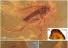
This is an image of H. milloti dorsal habitus. Credit: KU News Service

There are precious few species today in the biodiversity hotspot of Madagascar that scientists can trace directly back to when all of Earth’s continents were joined together as part of the primeval supercontinent Pangea.

But a new study in the journal Scientific Reports suggests the Malagasy striped whirligig beetle Heterogyrus milloti is an ultra-rare survivor among contemporary species on Madagascar, boasting a genetic pedigree stretching back at least 206 million years to the late Triassic period.

“This is unheard of for anything in Madagascar,” said lead author Grey Gustafson, a postdoctoral research fellow in ecology & evolutionary biology and affiliate of the Biodiversity Institute at the University of Kansas. “It’s the oldest lineage of any animal or plant known from Madagascar.”

Gustafson and his co-authors’ research compared the living striped whirligig found in Madagascar with extinct whirligig beetles from the fossil record. They then used a method called “tip dating” to reconstruct and date the family tree of whirligig beetles.

“You examine and code the morphology of extinct species the same as you would living species, and where that fossil occurs in time is where that tip of the tree ends,” he said. “That’s how you time their evolutionary relationships. We really wanted the fossils’ placement in the tree to be backed by analysis, so we could say these are the relatives of the striped whirligig as supported by analysis, not just that they looked similar.”

Gustafson noted one major hurdle for the team was the “painful” incompleteness of the fossil record for establishing all the places where relatives of the striped whirligig beetle once lived.

“All of the fossils come from what is today Europe and Asia — we don’t have any deposits from Madagascar or Africa for this group of insects,” he said. “But they likely were very widespread.”

Today, whirligig beetles are a family of carnivorous aquatic beetles with about 1,000 known species dominated by members of a subfamily called the Gyrininae. But the Gyrininae are young upstarts compared with the striped whirligig beetle, the last remaining species of a group dominant during the time of the dinosaurs. This group according to Gustafson was decimated by the same asteroid impact that cut down the dinosaurs and caused the Cretaceous-Paleogene extinction event.

“The remoteness of Madagascar is what may have saved this beetle,” Gustafson said. “It’s the only place that still has the striped whirligig beetle because it was already isolated at the time of the Cretaceous-Paleogene extinction event — so the lineage was able to persist, and now it’s surviving in a marginal environment.”

Even today, the ageless striped whirligig beetle keeps its own company, preferring to skitter atop the surface of out-of-the-way forest streams in southeastern Madagascar — not mixing with latecomers of the subfamily Gyrininae who have become the dominant whirligig beetles on Madagascar and abroad.

Indeed, Gustafson is one of the few researchers to locate them during a 2014 fieldwork excursion in Madagascar’s Ranomafana National Park.

“This one is pretty hard to find,” he said. “They like these really strange habitats that other whirligigs aren’t found in. We have video of them in a gulch in a mountain range clogged with branches and debris — there are striped whirligigs all over it.”

Unfortunately, the KU researcher said the remote habitats of the striped whirligig beetle in Malagasy national parks were threatened today by human activity on Madagascar.

“It’s a socioeconomic issue,” Gustafson said. “In the national park where first specimens of the striped whirligig beetle were discovered, there are local people who use the forest as a refuge for zebu cattle because they’re concerned about zebu being robbed. Their defecation can disturb the nutrient lode in aquatic ecosystems. Part of the problem is finding a way for local people to be able to make their livelihood while preserving natural ecosystems. But it’s a hard balance to strike. A lot of original forest cover also has been slashed and burned for rice-field patties to feed people.”

Gustafson hopes the primal origins of the striped whirligig beetle can draw attention to the need for protecting aquatic habitats while conceding that conservation efforts usually are aimed at bigger and more cuddly species, like Madagascar’s famous lemurs, tenrecs and other unique carnivorans.

“One of the things that invertebrate species suffer from is a lack of specific conservation efforts,” he said. “It’s usually trickle-down conservation where you find a charismatic vertebrate species to get protected areas started. But certain invertebrates will have different requirements, and right now invertebrate-specific conservation efforts are lacking. We propose the striped whirligig beetle would make for an excellent flagship species for conservation.”

Reference:
Grey T. Gustafson, Alexander A. Prokin, Rasa Bukontaite, Johannes Bergsten, Kelly B. Miller. Tip-dated phylogeny of whirligig beetles reveals ancient lineage surviving on Madagascar. Scientific Reports, 2017; 7 (1) DOI: 10.1038/s41598-017-08403-1

Note: The above post is reprinted from materials provided by University of Kansas.

Assessing regional earthquake risk and hazards in the age of exascale

Researchers at Berkeley Lab, LLNL and UC Davis are utilizing ground motion estimates from a regional-scale geophysics model to drive infrastructure assessments. Credit: Image Courtesy of David McCallen

With emerging exascale supercomputers, researchers will soon be able to accurately simulate the ground motions of regional earthquakes quickly and in unprecedented detail, as well as predict how these movements will impact energy infrastructure — from the electric grid to local power plants — and scientific research facilities.

Currently, an interdisciplinary team of researchers from the Department of Energy’s (DOE’s) Lawrence Berkeley (Berkeley Lab) and Lawrence Livermore (LLNL) national laboratories, as well as the University of California at Davis are building the first-ever end-to-end simulation code to precisely capture the geology and physics of regional earthquakes, and how the shaking impacts buildings. This work is part of the DOE’s Exascale Computing Project (ECP), which aims to maximize the benefits of exascale — future supercomputers that will be 50 times faster than our nation’s most powerful system today — for U.S. economic competitiveness, national security and scientific discovery.

“Due to computing limitations, current geophysics simulations at the regional level typically resolve ground motions at 1-2 hertz (vibrations per second). Ultimately, we’d like to have motion estimates on the order of 5-10 hertz to accurately capture the dynamic response for a wide range of infrastructure,” says David McCallen, who leads an ECP-supported effort called High Performance, Multidisciplinary Simulations for Regional Scale Seismic Hazard and Risk Assessments. He’s also a guest scientist in Berkeley Lab’s Earth and Environmental Sciences Area.

One of the most important variables that affect earthquake damage to buildings is seismic wave frequency, or the rate at which an earthquake wave repeats each second. Buildings and structures respond differently to certain frequencies. Large structures like skyscrapers, bridges, and highway overpasses are sensitive to low frequency shaking, whereas smaller structures like homes are more likely to be damaged by high frequency shaking, which ranges from 2 to 10 hertz and above. McCallen notes that simulations of high frequency earthquakes are more computationally demanding and will require exascale computers.

In preparation for exascale, McCallen is working with Hans Johansen, a researcher in Berkeley Lab’s Computational Research Division (CRD), and others to update the existing SW4 code — which simulates seismic wave propagation — to take advantage of the latest supercomputers, like the National Energy Research Scientific Computing Center’s (NERSC’s) Cori system. This manycore system contains 68 processor cores per chip, nearly 10,000 nodes and new types of memory. NERSC is a DOE Office of Science national user facility operated by Berkeley Lab. The SW4 code was developed by a team of researchers at LLNL, led by Anders Petersson, who is also involved in the exascale effort.

With recent updates to SW4, the collaboration successfully simulated a 6.5 magnitude earthquake on California’s Hayward fault at 3-hertz on NERSC’s Cori supercomputer in about 12 hours with 2,048 Knights Landing nodes. This first-of-a-kind simulation also captured the impact of this ground movement on buildings within a 100-square kilometer (km) radius of the rupture, as well as 30km underground. With future exascale systems, the researchers hope to run the same model at 5-10 hertz resolution in approximately five hours or less.

“Ultimately, we’d like to get to a much larger domain, higher frequency resolution and speed up our simulation time, ” says McCallen. “We know that the manner in which a fault ruptures is an important factor in determining how buildings react to the shaking, and because we don’t know how the Hayward fault will rupture or the precise geology of the Bay Area, we need to run many simulations to explore different scenarios. Speeding up our simulations on exascale systems will allow us to do that.”

This work was published in the recent issue of Institute of Electrical and Electronics Engineers (IEEE) Computer Society’s Computers in Science and Engineering.

Predicting Earthquakes: Past, Present and Future

Historically, researchers have taken an empirical approach to estimating ground motions and how the shaking stresses structures. So to predict how an earthquake would affect infrastructure in the San Francisco region, researchers might look at a past event that was about the same size — it might even have happened somewhere else — and use those observations to predict ground motion in San Francisco. Then they’d select some parameters from those simulations based on empirical analysis and surmise how various buildings may be affected.

“It is no surprise that there are certain instances where this method doesn’t work so well,” says McCallen. “Every single site is different — the geologic makeup may vary, faults may be oriented differently and so on. So our approach is to apply geophysical research to supercomputer simulations and accurately model the underlying physics of these processes.”

To achieve this, the tool under development by the project team employs a discretization technique that divides Earth into billions of zones. Each zone is characterized with a set of geologic properties. Then, simulations calculate the surface motion for each zone. With an accurate understanding of surface motion in a given zone, researchers also get more precise estimates for how a building will be affected by shaking.

The team’s most recent simulations at NERSC divided a 100km x 100km x 30km region into 60 billion zones. By simulating 30km beneath the rupture site, the team can capture how surface-layer geology affects ground movements and buildings. Eventually, the researchers would like to get their models tuned up to do hazard assessments. As Pacific Gas & Electric (PG&E) begins to implement a very dense array of accelerometers into their SmartMeters — a system of sensors that collects electric and natural gas use data from homes and businesses to help the customer understand and reduce their energy use — McCallen is working with the utility company about potentially using that data to get a more accurate understanding of how the ground is actually moving in different geologic regions.

“The San Francisco Bay is an extremely hazardous area from a seismic standpoint and the Hayward fault is probably one of the most potentially risky faults in the country,” says McCallen. “We chose to model this area because there is a lot of information about the geology here, so our models are reasonably well-constrained by real data. And, if we can accurately measure the risk and hazards in the Bay Area, it’ll have a big impact.”

He notes that the current seismic hazard assessment for Northern California identifies the Hayward Fault as the most likely to rupture with a magnitude 6.7 or greater event before 2044. Simulations of ground motions from large — magnitude 7.0 or more — earthquakes require domains on the order of 100-500 km and resolution on the order of about one to five meters, which translates into hundreds of billions of grid points. As the researchers aim to model even higher frequency motions between 5 to 10 hertz, they will need denser computational grids and finer time-steps, which will drive up computational demands. The only way to ultimately achieve these simulations is to exploit exascale computing, McCallen says.

Reference:
Hans Johansen, Arthur Rodgers, N. Anders Petersson, David McCallen, Bjorn Sjogreen, Mamun Miah. Toward Exascale Earthquake Ground Motion Simulations for Near-Fault Engineering Analysis. Computing in Science & Engineering, 2017; 19 (5): 27 DOI: 10.1109/MCSE.2017.3421558

Note: The above post is reprinted from materials provided by DOE/Lawrence Berkeley National Laboratory.

Ancient humans left Africa to escape drying climate

The Lamont-Doherty Core Repository contains a unique and important collection of scientific samples from the deep sea. Sediment cores from every major ocean and sea are archived here. Credit: Courtesy Lamont-Doherty Earth Observatory

Humans migrated out of Africa as the climate shifted from wet to very dry about 60,000 years ago, according to research led by a University of Arizona geoscientist.

Genetic research indicates people migrated from Africa into Eurasia between 70,000 and 55,000 years ago. Previous researchers suggested the climate must have been wetter than it is now for people to migrate to Eurasia by crossing the Horn of Africa and the Middle East.

“There’s always been a question about whether climate change had any influence on when our species left Africa,” said Jessica Tierney, UA associate professor of geosciences. “Our data suggest that when most of our species left Africa, it was dry and not wet in northeast Africa.”

Tierney and her colleagues found that around 70,000 years ago, climate in the Horn of Africa shifted from a wet phase called “Green Sahara” to even drier than the region is now. The region also became colder.

The researchers traced the Horn of Africa’s climate 200,000 years into the past by analyzing a core of ocean sediment taken in the western end of the Gulf of Aden. Tierney said before this research there was no record of the climate of northeast Africa back to the time of human migration out of Africa.

“Our data say the migration comes after a big environmental change. Perhaps people left because the environment was deteriorating,” she said. “There was a big shift to dry and that could have been a motivating force for migration.”

“It’s interesting to think about how our ancestors interacted with climate,” she said.

The team’s paper, “A climatic context for the out-of-Africa migration,” is published online in Geology this week. Tierney’s co-authors are Peter deMenocal of the Lamont-Doherty Earth Observatory in Palisades, New York, and Paul Zander of the UA.

The National Science Foundation and the David and Lucile Packard Foundation funded the research.

Tierney and her colleagues had successfully revealed the Horn of Africa’s climate back to 40,000 years ago by studying cores of marine sediment. The team hoped to use the same means to reconstruct the region’s climate back to the time 55,000 to 70,000 years ago when our ancestors left Africa.

The first challenge was finding a core from that region with sediments that old. The researchers enlisted the help of the curators of the Lamont-Doherty Core Repository, which has sediment cores from every major ocean and sea. The curators found a core collected off the Horn of Africa in 1965 from the R/V Robert D. Conrad that might be suitable.

Co-author deMenocal studied and dated the layers of the 1965 core and found it had sediments going back as far as 200,000 years.

At the UA, Tierney and Paul Zander teased out temperature and rainfall records from the organic matter preserved in the sediment layers. The scientists took samples from the core about every four inches (10 cm), a distance that represented about every 1,600 years.

To construct a long-term temperature record for the Horn of Africa, the researchers analyzed the sediment layers for chemicals called alkenones made by a particular kind of marine algae. The algae change the composition of the alkenones depending on the water temperature. The ratio of the different alkenones indicates the sea surface temperature when the algae were alive and also reflects regional temperatures, Tierney said.

To figure out the region’s ancient rainfall patterns from the sediment core, the researchers analyzed the ancient leaf wax that had blown into the ocean from terrestrial plants. Because plants alter the chemical composition of the wax on their leaves depending on how dry or wet the climate is, the leaf wax from the sediment core’s layers provides a record of past fluctuations in rainfall.

The analyses showed that the time people migrated out of Africa coincided with a big shift to a much drier and colder climate, Tierney said.

The team’s findings are corroborated by research from other investigators who reconstructed past regional climate by using data gathered from a cave formation in Israel and a sediment core from the eastern Mediterranean. Those findings suggest that it was dry everywhere in northeast Africa, she said.

“Our main point is kind of simple,” Tierney said. “We think it was dry when people left Africa and went on to other parts of the world, and that the transition from a Green Sahara to dry was a motivating force for people to leave.”

Reference:
Jessica E. Tierney, Peter B. deMenocal, Paul D. Zander. A climatic context for the out-of-Africa migration. Geology, 2017; DOI: 10.1130/G39457.1

Note: The above post is reprinted from materials provided by University of Arizona.

Earth’s tectonic plates are weaker than once thought

Representative Image: The Earth has fifteen tectonic plates (pictured) that together have molded the shape of the landscape we see around us today. Credit: SPL/mediadrumworld.com

No one can travel inside Earth to study what happens there. So scientists must do their best to replicate real-world conditions inside the lab.

“We are interested in large-scale geophysical processes, like how plate tectonics initiates and how plates move underneath one another in subduction zones,” said David Goldsby, an associate professor at the University of Pennsylvania. “To do that, we need to understand the mechanical behavior of olivine, which is the most common mineral in the upper mantle of Earth.”

Goldsby, teaming with Christopher A. Thom, a doctoral student at Penn, as well as researchers from Stanford University, the University of Oxford and the University of Delaware, has now resolved a long-standing question in this area of research. While previous laboratory experiments resulted in widely disparate estimates of the strength of olivine in Earth’s lithospheric mantle, the relatively cold and therefore strong part of Earth’s uppermost mantle, the new work, published in the journal Science Advances, resolves the previous disparities by finding that, the smaller the grain size of the olivine being tested, the stronger it is.

Because olivine in Earth’s mantle has a larger grain size than most olivine samples tested in labs, the results suggest that the mantle, which comprises up to 95 percent of the planet’s tectonic plates, is in fact weaker than once believed. This more realistic picture of the interior may help researchers understand how tectonic plates form, how they deform when loaded with the weight of, for example, a volcanic island such as Hawaii, or even how earthquakes begin and propagate.

For more than 40 years, researchers have attempted to predict the strength of olivine in Earth’s lithospheric mantle from the results of laboratory experiments. But tests in a lab are many layers removed from the conditions inside Earth, where pressures are higher and deformation rates are much slower than in the lab. A further complication is that, at the relatively low temperatures of earth’s lithosphere, the strength of olivine is so high that it is difficult to measure its plastic strength without fracturing the sample. The results of existing experiments have varied widely, and they don’t align with predictions of olivine strength from geophysical models and observations.

In an attempt to resolve these discrepancies, the researchers employed a technique known as nanoindentation, which is used to measure the hardness of materials. Put simply, the researchers measure the hardness of a material, which is related to its strength, by applying a known load to a diamond indenter tip in contact with a mineral and then measuring how much the mineral deforms. While previous studies have employed various high-pressure deformation apparatuses to hold samples together and prevent them from fracturing, a complicated set-up that makes measurements of strength challenging, nanoindentation does not require such a complex apparatus.

“With nanoindentation,” Goldsby said, “the sample in effect becomes its own pressure vessel. The hydrostatic pressure beneath the indenter tip keeps the sample confined when you press the tip into the sample’s surface, allowing the sample to deform plastically without fracture, even at room temperature.”

Performing 800 nanoindentation experiments in which they varied the size of the indentation by varying the load applied to the diamond tip pressed into the sample, the research team found that the smaller the size of the indent, the harder, and thus stronger, olivine became.

“This indentation size effect had been seen in many other materials, but we think this is the first time it’s been shown in a geological material,” Goldsby said.

Looking back at previously collected strength data for olivine, the researchers determined that the discrepancies in those data could be explained by invoking a related size effect, whereby the strength of olivine increases with decreasing grain size of the tested samples. When these previous strength data were plotted against the grain size in each study, all the data fit on a smooth trend which predicts lower-than-thought strengths in Earth’s lithospheric mantle.

In a related paper by Thom, Goldsby and colleagues, published recently in the journal Geophysical Research Letters, the researchers examined patterns of roughness in faults that have become exposed at Earth’s surface due to uplifted plates and erosion.

“Different faults have a similar roughness, and there’s an idea published recently that says you might get those patterns because the strength of the materials on the fault surface increases with the decreasing scale of roughness,” Thom said. “Those patterns and the frictional behavior they cause might be able to tell us something about how earthquakes nucleate and how they propagate.”

In future work, the Penn researchers and their team would like to study size-strength effects in other minerals and also to focus on the effect of increasing temperature on size effects in olivine.

Reference:
Angus J. Wilkinson et al. Size effects resolve discrepancies in 40 years of work on low-temperature plasticity in olivine. Science Advances, September 2017 DOI: 10.1126.sciadv.1701338

Note: The above post is reprinted from materials provided by University of Pennsylvania.

Study sheds new light on earth’s evolution

This is a figure showing the Earth’s Mantle. Credit: Assist Basu

Research from the University of Texas at Arlington and the Wadia Institute of Himalayan Geology suggests that hydrogen, oxygen, water and carbon dioxide are being generated in the earth’s mantle hundreds of kilometers below the earth’s surface.

“This discovery is important as it shows how earth’s planetary evolution may have happened,” said Asish Basu, UTA professor of earth and environmental sciences and co-author of the cover paper published in Geology in August.

The researchers focused their attention on a seven-kilometer thick portion of the earth’s upper mantle now found in the High Himalayas, at altitudes between 12,000 and 16,000 feet. This section of the mantle was pushed upwards to the top of the mountains as a result of the Indian Plate pushing north into Asia, displacing the ancient Tethys ocean floor and underlying mantle to create the Himalayan Mountain Belt around 55 million years ago.

“This is important as it means that we can analyze the nature of the mantle under the earth’s crust, at depths where drilling cannot reach,” Basu explained. “One key initial discovery was finding microdiamonds whose host rocks originated in the mantle transition zone, at depths between 410 and 660 kilometers below the earth’s surface.”

By studying the host rocks and associated minerals, the scientists had a unique opportunity to probe the nature of the deep mantle. They found primary hydrocarbon and hydrogen fluid inclusions along with microdiamonds by using Laser Ramon Spectroscopic study. The discovery also showed that the environment in the deep mantle transition zone depths where the diamond is formed is devoid of oxygen.

The researchers suggest that during the advective transport or mantle up-welling into shallower mantle zones, the hydrocarbon fluids become oxidized and precipitate diamond, a mechanism that may also be responsible for forming larger diamonds like the world’s most valuable, Koh-i-Noor or Mountain of Light diamond, now in the Queen of England’s crown.

“We also found that the deep mantle upwelling can oxidize oxygen-impoverished fluids to produce water and carbon dioxide that are well-known to produce deep mantle melting,” said Souvik Das, UTA post-doctoral research scholar.

“This means that many of the key compounds affecting evolution like carbon dioxide and water are generated within the mantle,” he added.

The paper was published as “In situ peridotitic diamond in Indus ophiolite sourced from hydrocarbon fluids in the mantle transition zone,” in The Geological Society of America’s Geology journal August 2017 edition as a cover article. B. K. Mukherjee, scientist from the Wadia Institute of Himalayan Geology is the other coauthor.

This research forms part of UTA’s strategic theme of global environmental impact.

Reference:
S. Das, A.R. Basu, B.K. Mukherjee. In situ peridotitic diamond in Indus ophiolite sourced from hydrocarbon fluids in the mantle transition zone. Geology, 2017; G39100.1 DOI: 10.1130/G39100.1

Note: The above post is reprinted from materials provided by University of Texas at Arlington.

Ancient petrified salamander reveals its last meal

Synchrotron tomography permitted access to the inside of the “mummy”. The skeleton and several organs are perfectly preserved. Credit: Jérémy Tissier; CC BY

A new study on an exceptionally preserved salamander from the Eocene of France reveals that its soft organs are conserved under its skin and bones. Organs preserved in three dimensions include the lung, nerves, gut, and within it, the last meal of the animal, according to a study published in the peer-reviewed journal PeerJ by a team of palaeontologists from France and Switzerland.

Accessing the complete anatomy of an extinct animal, i.e. both its external and internal aspects, has often been the dream of palaeontologists. Indeed, in 99% of cases, fossils are only represented by hard parts: bones, shells, etc. Fossils preserving soft tissues exist, but they are extremely rare. However, their significance for science is enormous. What did the animal look like? What did they eat? How did they live? Most of these questions can be answered by exceptionally preserved fossils.

The newly studied fossil externally looks like a present-day salamander, but it is made of stone. This fossil “mummy” is the only known specimen of Phosphotriton sigei, a 40-35 million years old salamander and belongs to the same family as the famous living fire salamander (Salamandra salamandra).

It is unfortunately incomplete: only the trunk, hip and part of hind legs and tail are preserved. Until very recently, the only thing palaeontologists could tell about this specimen was visible anatomical details, such as the cloaca, the orifice used for reproduction and by digestive and urinary canals. Indeed, though it was discovered in the 1870s, it was never studied in detail.

Thanks to recent synchrotron technology, its skeleton1 and various organs2 could be studied. The specimen was scanned at the ID19 beamline of the European Synchrotron Radiation Facility (ESRF) in Grenoble (France). This modern technology gave access to an incredible level of details that could never have been achieved before without slicing the specimen into a series of thin sections.

The quality of preservation is such that looking at the tomograms (equivalent of radiograms) feels like going through an animal in the flesh. At least six kinds of organs are preserved in almost perfect condition, in addition to the skin and skeleton: muscles, lung, spinal cord, digestive tract, nerves, and glands.

But the most incredible is the preservation of frog bones within the stomach of the salamander. Salamanders almost never eat frogs or other salamanders, though they are known to be quite opportunistic. Was it a last resort meal or a customary choice for this species? This, unfortunately, will probably never be known.

These new results are described by Jérémy Tissier from the Jurassica Museum and the University of Fribourg in Switzerland, and Jean-Claud Rage and Michel Laurin, both from the CNRS/Museum national d’histoire naturelle/UPMC in Paris.

Author Michel Laurin notes, “This fossil, along with a few others from the same lost site, is the most incredibly well-preserved that I have seen in my entire career. And now, 140 years after its discovery, and 35 million years after the animal died, we can finally study it, thanks to modern technology. The mummy returns!”

Reference:
Jérémy Tissier, Jean-Claude Rage, Michel Laurin. Exceptional soft tissues preservation in a mummified frog-eating Eocene salamander. PeerJ, 2017; 5: e3861 DOI: 10.7717/peerj.3861

Note: The above post is reprinted from materials provided by PeerJ.

Large volcanic eruptions in Tropics can trigger El Niño events

Mount Pinatubo in the Philippines erupting on June 12, 1991. A much larger eruption occurred three days later. Credit: U.S. Geological Survey

Explosive volcanic eruptions in the tropics can lead to El Niño events, those notorious warming periods in the Pacific Ocean with dramatic global impacts on the climate, according to a new study.

Enormous eruptions trigger El Niño events by pumping millions of tons of sulfur dioxide into the stratosphere, which form a sulfuric acid cloud, reflecting solar radiation and reducing the average global surface temperature, according to the study co-authored by Alan Robock, a distinguished professor in the Department of Environmental Sciences at Rutgers University-New Brunswick.

The study, published online today in Nature Communications, used sophisticated climate model simulations to show that El Niño tends to peak during the year after large volcanic eruptions like the one at Mount Pinatubo in the Philippines in 1991.

“We can’t predict volcanic eruptions, but when the next one happens, we’ll be able to do a much better job predicting the next several seasons, and before Pinatubo we really had no idea,” said Robock, who has a doctorate in meteorology. “All we need is one number — how much sulfur dioxide goes into the stratosphere — and you can measure it with satellites the day after an eruption.”

The El Niño Southern Oscillation (ENSO) is nature’s leading mode of periodic climate variability. It features sea surface temperature anomalies in the central and eastern Pacific. ENSO events (consisting of El Niño or La Niña, a cooling period) unfold every three to seven years and usually peak at the end of the calendar year, causing worldwide impacts on the climate by altering atmospheric circulation, the study notes.

Strong El Niño events and wind shear typically suppress the development of hurricanes in the Atlantic Ocean, the National Oceanic and Atmospheric Administration says. But they can also lead to elevated sea levels and potentially damaging cold season nor’easters along the East Coast, among many other impacts.

Sea surface temperature data since 1882 document large El Niño-like patterns following four out of five big eruptions: Santa María (Guatemala) in October 1902, Mount Agung (Indonesia) in March 1963, El Chichón (Mexico) in April 1982 and Pinatubo in June 1991.

The study focused on the Mount Pinatubo eruption because it’s the largest and best-documented tropical one in the modern technology period. It ejected about 20 million tons of sulfur dioxide, Robock said.

Cooling in tropical Africa after volcanic eruptions weakens the West African monsoon, and drives westerly wind anomalies near the equator over the western Pacific, the study says. The anomalies are amplified by air-sea interactions in the Pacific, favoring an El Niño-like response.

Climate model simulations show that Pinatubo-like eruptions tend to shorten La Niñas, lengthen El Niños and lead to unusual warming during neutral periods, the study says.

If there’s a big volcanic eruption tomorrow, Robock said he could make predictions for seasonal temperatures, precipitation and the appearance of El Niño next winter.

“If you’re a farmer and you’re in a part of the world where El Niño or the lack of one determines how much rainfall you will get, you could make plans ahead of time for what crops to grow, based on the prediction for precipitation,” he said.

Reference:
Myriam Khodri, Takeshi Izumo, Jérôme Vialard, Serge Janicot, Christophe Cassou, Matthieu Lengaigne, Juliette Mignot, Guillaume Gastineau, Eric Guilyardi, Nicolas Lebas, Alan Robock, Michael J. McPhaden. Tropical explosive volcanic eruptions can trigger El Niño by cooling tropical Africa. Nature Communications, 2017; 8 (1) DOI: 10.1038/s41467-017-00755-6

Note: The above post is reprinted from materials provided by Rutgers University.

Meteorites may have brought building blocks of life to Earth

Life on Earth began somewhere between 3.7 and 4.5 billion years ago, after meteorites splashed down and leached essential elements into warm little ponds, say scientists at McMaster University and the Max Planck Institute in Germany. Their calculations suggest that wet and dry cycles bonded basic molecular building blocks in the ponds’ nutrient-rich broth into self-replicating RNA molecules that constituted the first genetic code for life on the planet.

The researchers base their conclusion on exhaustive research and calculations drawing in aspects of astrophysics, geology, chemistry, biology and other disciplines. Though the “warm little ponds” concept has been around since Darwin, the researchers have now proven its plausibility through numerous evidence-based calculations.

Lead authors Ben K.D. Pearce and Ralph Pudritz, both of the McMaster’s Origins Institute and its Department of Physics and Astronomy, say available evidence suggests that life began when the Earth was still taking shape, with continents emerging from the oceans, meteorites pelting the planet — including those bearing the building blocks of life — and no protective ozone to filter the Sun’s ultraviolet rays.

“No one’s actually run the calculation before,” says Pearce. “This is a pretty big beginning. It’s pretty exciting.”

“Because there are so many inputs from so many different fields, it’s kind of amazing that it all hangs together,” Pudritz says. “Each step led very naturally to the next. To have them all lead to a clear picture in the end is saying there’s something right about this.”

Their work, with collaborators Dmitry Semenov and Thomas Henning of the Max Planck Institute for Astronomy, has been published today in the Proceedings of the National Academy of Science.

“In order to understand the origin of life, we need to understand Earth as it was billions of years ago. As our study shows, astronomy provide a vital part of the answer. The details of how our solar system formed have direct consequences for the origin of life on Earth,” says Thomas Henning, from the Max Planck Institute for Astronomy and another co-author.

The spark of life, the authors say, was the creation of RNA polymers: the essential components of nucleotides, delivered by meteorites, reaching sufficient concentrations in pond water and bonding together as water levels fell and rose through cycles of precipitation, evaporation and drainage. The combination of wet and dry conditions was necessary for bonding, the paper says.

In some cases, the researchers believe, favorable conditions saw some of those chains fold over and spontaneously replicate themselves by drawing other nucleotides from their environment, fulfilling one condition for the definition of life. Those polymers were imperfect, capable of improving through Darwinian evolution, fulfilling the other condition.

“That’s the Holy Grail of experimental origins-of-life chemistry,” says Pearce.

That rudimentary form of life would give rise to the eventual development of DNA, the genetic blueprint of higher forms of life, which would evolve much later. The world would have been inhabited only by RNA-based life until DNA evolved.

“DNA is too complex to have been the first aspect of life to emerge,” Pudritz says. “It had to start with something else, and that is RNA.”

The researchers’ calculations show that the necessary conditions were present in thousands of ponds, and that the key combinations for the formation of life were far more likely to have come together in such ponds than in hydrothermal vents, where the leading rival theory holds that life began in roiling fissures in ocean floors, where the elements of life came together in blasts of heated water. The authors of the new paper say such conditions were unlikely to generate life, since the bonding required to form RNA needs both wet and dry cycles.

The calculations also appear to eliminate space dust as the source of life-generating nucleotides. Though such dust did indeed carry the right materials, it did not deposit them in sufficient concentration to generate life, the researchers have determined. At the time, early in the life of the solar system, meteorites were far more common, and could have landed in thousands of ponds, carrying the building blocks of life. Pearce and Pudritz plan to put the theory to the test next year, when McMaster opens its Origins of Life laboratory that will re-create the pre-life conditions in a sealed environment.

“We’re thrilled that we can put together a theoretical paper that combines all these threads, makes clear predictions and offers clear ideas that we can take to the laboratory,” Pudritz says.

Reference:
Ben K. D. Pearce, Ralph E. Pudritz, Dmitry A. Semenov, and Thomas K. Henning. Origin of the RNA world: The fate of nucleobases in warm little ponds. PNAS, October 2, 2017 DOI: 10.1073/pnas.1710339114

Note: The above post is reprinted from materials provided by McMaster University. Original written by Wade Hemsworth.

Siberian volcanic eruptions caused extinction 250 million years ago

Kamchatka Volcano

A team of scientists has found new evidence that the Great Permian Extinction, which occurred approximately 250 million years ago, was caused by massive volcanic eruptions that led to significant environmental changes.

The study, which appears in the journal Scientific Reports, reports a global spike in the chemical element nickel at the time of extinction. The anomalous nickel most likely came from emanations related to the concurrent huge volcanic eruptions in what is now Siberia. These eruptions, the researchers say, are associated with nickel-rich magmatic intrusions — rocks formed from the cooling of magma — that contain some of the greatest deposits of nickel ore on the planet.

Using an Inductively Coupled Plasma Mass Spectrometer, which measures the abundance of rare elements at their atomic level, the scientists documented anomalous peaks of nickel in regions ranging from the Arctic to India at the time of the Great Permian Extinction — distributions that suggest these nickel anomalies were a worldwide phenomenon.

This new evidence of a nickel fingerprint at the time of the extinctions convinced the scientists that it was the volcanic upheaval in Siberia that produced intense global warming and other environmental changes that led to the disappearance of more than 90 percent of all species.

“The Siberian volcanic eruptions and related massive intrusions of nickel-rich magmas into Earth’s crust apparently emitted nickel-rich volatiles into the atmosphere, where they were distributed globally,” explains New York University geologist Michael Rampino, the paper’s senior author. “At the same time, explosive interactions of the magma with older coal deposits could have released large amounts of carbon dioxide and methane, two greenhouse gases, which would explain the intense global warming recorded in the oceans and on land at the time of the mass extinctions. The warm oceans also became sluggish and depleted in dissolved oxygen, contributing to the extinction of many forms of life in the sea.”

“This new finding, which contributes further evidence that the Siberian Trap eruptions were the catalyst for the most extensive extinction event Earth has ever endured, has exciting implications,” says Sedelia Rodriguez, a co-author of the paper and lecturer in the department of Environmental Science at Barnard College. “We look forward to expanding our research on nickel and other elements to delineate the specific areas affected by this eruption. In doing so, we hope to learn more about how these events trigger massive extinctions that affect both land and marine animals. Additionally, we hope this research will contribute to determining whether an event of this magnitude is possible in the future.”

Reference:
Michael R. Rampino, Sedelia Rodriguez, Eva Baransky, Yue Cai. Global nickel anomaly links Siberian Traps eruptions and the latest Permian mass extinction. Scientific Reports, 2017; 7 (1) DOI: 10.1038/s41598-017-12759-9

Note: The above post is reprinted from materials provided by New York University.

Human impact on planet has changed course of Earth’s history

Technosphere includes physical human-made structures such as houses, factories, smartphones, computers and landfill.
Credit: Image courtesy of University of Leicester

The significant scale of human impact on our planet has changed the course of Earth history, an international team of scientists led by the University of Leicester has suggested.

The researchers suggest that a multitude of human impacts have changed the course of Earth’s geological history, and the scale of these justifies developing a formal proposal that the Anthropocene — a concept improvised by the Nobel Prize-winning scientist Paul Crutzen in 2000 — should be made part of the Geological Time Scale.

Rapid changes to the planet include acceleration of rates of erosion and sedimentation; large-scale chemical perturbations to the cycles of carbon, nitrogen, phosphorus and other elements; the inception of significant change to global climate and sea level; and biotic changes including unprecedented levels of species invasions across the Earth.

This is a summary of the findings and interim recommendations of the international working group that has been studying the Anthropocene since 2009. Initially reported to the 2016 International Geological Congress at Cape Town, South Africa, the findings and recommendations have just been published online in the journal Anthropocene.

Professor Jan Zalasiewicz from the University of Leicester’s School of Geography, Geology and the Environment, said: “Our findings suggest that the Anthropocene should follow on from the Holocene Epoch that has seen 11.7 thousand years of relative environmental stability, since the retreat of the last Ice Age, as we enter a more unstable and rapidly evolving phase of our planet’s history.”

Professor Mark Williams, from the University of Leicester’s School of Geography, Geology and the Environment, said: “Geologically, the mid-20th century represents the most sensible level for the beginning of the Anthropocene — as it brought in large global changes to many of the Earth’s fundamental chemical cycles, such as those of carbon, nitrogen and phosphorus, and also very large amounts of novel materials such as plastics, concrete and aluminium, which will help build the strata of the future.”

The Anthropocene Working Group — which includes University of Leicester geologists Jan Zalasiewicz, Mark Williams and honorary chair, Colin Waters, and archaeologist Matt Edgeworth — has been active since 2009, analysing the case for formalisation of the Anthropocene, a potential new epoch of geological time dominated by human impact on the Earth.

Professor Waters said: “The Anthropocene Working Group is now working on such a proposal, based upon finding a ‘golden spike’ — a reference level within recent strata somewhere in the world that will best characterize the changes of the Anthropocene. Once this detailed work is completed, it will be submitted for scrutiny by the Subcommission on Quaternary Stratigraphy of the International Commission on Stratigraphy.

“There is no guarantee of the success of this process — the Geological Time Scale is meant to be stable, and is not easily changed. Whatever decision is ultimately made, the geological reality of the Anthropocene is now clear.”

Reference:
Jan Zalasiewicz, Colin N. Waters, Colin P. Summerhayes, Alexander P. Wolfe, Anthony D. Barnosky, Alejandro Cearreta, Paul Crutzen, Erle Ellis, Ian J. Fairchild, Agnieszka Gałuszka, Peter Haff, Irka Hajdas, Martin J. Head, Juliana A. Ivar do Sul, Catherine Jeandel, Reinhold Leinfelder, John R. McNeill, Cath Neal, Eric Odada, Naomi Oreskes, Will Steffen, James Syvitski, Davor Vidas, Michael Wagreich, Mark Williams. The Working Group on the Anthropocene: Summary of evidence and interim recommendations. Anthropocene, 2017; 19: 55 DOI: 10.1016/j.ancene.2017.09.001

Note: The above post is reprinted from materials provided by University of Leicester.

Fossil points to early rise of ancient crocodiles

The Melksham Monster closely resembled the species shown (Plesiosuchus manselii), which also belongs to the Geosaurini group. Credit: Fabio Manucci

The little-studied specimen – acquired by the museum in 1875 – was identified as a new species based on distinctive features of its skull, lower jaw and, in particular, its teeth.

The study, published in the Journal of Systematic Palaeontology, was carried out in collaboration with the Natural History Museum, London. The research was funded by Marie Sklodowska-Curie Actions.

Davide Foffa, a PhD student in the University of Edinburgh’s School of GeoSciences, who led the study, said: “It’s not the prettiest fossil in the world, but the Melksham Monster tells us a very important story about the evolution of these ancient crocodiles and how they became the apex predators in their ecosystem. Without the amazing preparation work done by our collaborators at the Natural History Museum, it would not have been possible to work out the anatomy of this challenging specimen.”

Dr Steve Brusatte, of the University of Edinburgh’s School of GeoSciences, who was involved in the study, said: “The Melksham Monster would have been one of the top predators in the oceans of Jurassic Britain, at the same time that dinosaurs were thundering across the land.”

Mark Graham, Senior Fossil Preparator at the Natural History Museum, said: “The specimen was completely enclosed in a super-hard rock nodule with veins of calcite running through, which had formed around it during the process of fossilisation. This unyielding matrix had to be removed by force, using carbon steel tipped chisels and grinding wheels encrusted with industrial diamonds. The work took many hours over a period of weeks, and great care had to be taken to avoid damaging the skull and teeth as they became exposed. This was one tough old croc in life and death!”

Note: The above post is reprinted from materials provided by University of Edinburgh.

Prehistoric squid was last meal of newborn ichthyosaur 200 million years ago

The artist Julien Kiely has kindly reconstructed the newborn in this fantastic scene. Credit: Julian Kiely

Scientists from the UK have identified the smallest and youngest specimen of Ichthyosaurus communis on record and found an additional surprise preserved in its stomach.

The ichthyosaur fossil has a total length of just around 70 cm and had the remains of a prehistoric squid in its stomach. Ichthyosaurus communis was the first species of ichthyosaur, a group of sea-going reptiles, to be properly recognised by science, in 1821.

The University of Manchester palaeontologist and ichthyosaur expert, Dean Lomax, said: “It is amazing to think we know what a creature that is nearly 200 million years old ate for its last meal. We found many tiny hook-like structures preserved between the ribs. These are from the arms of prehistoric squid. So, we know this animal’s last meal before it died was squid.

“This is interesting because a study by other researchers on a different type of ichthyosaur, called Stenopterygius, which is from a geologically younger age, found that the small – and therefore young – examples of that species fed exclusively on fish. This shows a difference in prey-preference in newborn ichthyosaurs.”

Many early ichthyosaur examples were found by Victorian palaeontologist, Mary Anning, along the coast at Lyme Regis, Dorset. It is one of the most common Early Jurassic fossil reptiles in the UK.

The new specimen is from the collections of the Lapworth Museum of Geology, University of Birmingham. Palaeontologist Nigel Larkin, a research associate of The University of Cambridge, cleaned and studied the specimen in 2016, and recognised that it was important. The cleaning provided Dean with the opportunity to examine the fossil in detail.

Dean, who recently described the largest Ichthyosaurus on record, identified this specimen as a newborn Ichthyosaurus communis, based on the arrangement of bones in the skull. He added: “There are several small Ichthyosaurus specimens known, but most are incomplete or poorly preserved. This specimen is practically complete and is exceptional. It is the first newborn Ichthyosaurus communis to be found, which is surprising considering that the species was first described almost 200 years ago.”

Unfortunately, no record of the specimen’s location and age exists. However, with permission, Nigel removed some of the rock from around the skeleton. He passed this on to Ian Boomer (University of Birmingham) and Philip Copestake (Merlin Energy, Resources Ltd) so that they could analyse the rock for microscopic fossils. Based on the types of microfossil preserved, they were able to identify that this ichthyosaur was around 199-196 million years old, from the Early Jurassic.

Nigel added, “Many historic ichthyosaur specimens in museums lack any geographic or geological details and are therefore undated. This process of looking for microfossils in their host rock might be the key to unlocking the mystery of many specimens. Thus, this will provide researchers with lots of new information that otherwise is lost. Of course, this requires some extensive research, but it is worth the effort.”

As part of the study, the skeleton was Micro CT-scanned and a three-dimensional digital model was created by Steve Dey of ThinkSee3D Ltd. Using medical imaging software, Steve converted the 3 sets of CT cross-sectional images (from scans of the tail, middle section and head) into a single digital 3D model of the whole animal then digitally measured key metrics as required by the science.

The perfect newborn ichthyosaur is on display in the recently refurbished Lapworth Museum of Geology, University of Birmingham.

Note: The above post is reprinted from materials provided by University of Manchester.

Meet the hominin species that gave us genital herpes

This is a cast of a P. boisei skull, used for teaching at Cambridge University. Credit: Louise Walsh

Two herpes simplex viruses infect primates from unknown evolutionary depths. In modern humans these viruses manifest as cold sores (HSV1) and genital herpes (HSV2).

Unlike HSV1, however, the earliest proto-humans did not take HSV2 with them when our ancient lineage split from chimpanzee precursors around 7 million years ago. Humanity dodged the genital herpes bullet — almost.

Somewhere between 3 and 1.4 million years ago, HSV2 jumped the species barrier from African apes back into human ancestors — probably through an intermediate hominin species unrelated to humans. Hominin is the zoological ‘tribe’ to which our species belongs.

Now, a team of scientists from Cambridge and Oxford Brookes universities believe they may have identified the culprit: Parathropus boisei, a heavyset bipedal hominin with a smallish brain and dish-like face.

In a study published today in the journal Virus Evolution, they suggest that P. boisei most likely contracted HSV2 through scavenging ancestral chimp meat where savannah met forest — the infection seeping in via bites or open sores.

Hominins with HSV1 may have been initially protected from HSV2, which also occupied the mouth. That is until HSV2 “adapted to a different mucosal niche” say the scientists. A niche located in the genitals.

Close contact between P. boisei and our ancestor Homo erectus would have been fairly common around sources of water, such as Kenya’s Lake Turkana. This provided the opportunity for HSV2 to boomerang into our bloodline.

The appearance of Homo erectus around 2 million years ago was accompanied by evidence of hunting and butchery. Once again, consuming “infected material” would have transmitted the virus — only this time it was P. boisei being devoured.

“Herpes infect everything from humans to coral, with each species having its own specific set of viruses,” said senior author Dr Charlotte Houldcroft, a virologist from Cambridge’s Department of Archaeology.

“For these viruses to jump species barriers they need a lucky genetic mutation combined with significant fluid exchange. In the case of early hominins, this means through consumption or intercourse — or possibly both.”

“By modelling the available data, from fossil records to viral genetics, we believe that Parathropus boisei was the species in the right place at the right time to both contract HSV2 from ancestral chimpanzees, and transmit it to our earliest ancestors, probably Homo erectus.”

When researchers from University of California, San Diego, published findings suggesting HSV2 had jumped between hominin species, Houldcroft became curious.

While discussing genital herpes over dinner at Kings College, Cambridge, with fellow academic Dr Krishna Kumar, an idea formed. Kumar, an engineer who uses Bayesian network modelling to predict city-scale infrastructure requirements, suggested applying his techniques to the question of ancient HSV2.

Houldcroft and her collaborator Dr Simon Underdown, a human evolution researcher from Oxford Brookes, collated data ranging from fossil finds to herpes DNA and ancient African climates. Using Kumar’s model, the team generated HSV2 transmission probabilities for the mosaic of hominin species that roamed Africa during “deep time.”

“Climate fluctuations over millennia caused forests and lakes to expand and contract,” said Underdown. “Layering climate data with fossil locations helped us determine the species most likely to come into contact with ancestral chimpanzees in the forests, as well as other hominins at water sources.”

Some promising leads turned out to be dead ends. Australopithecus afarensis had the highest probability of proximity to ancestral chimps, but geography also ruled it out of transmitting to human ancestors.

Ultimately, the researchers discovered the key player in all the scenarios with higher probabilities to be Parathropus boisei. A genetic fit virally who was found in the right places to be the herpes intermediary, with Homo erectus — and eventually us — the unfortunate recipients.

“Once HSV2 gains entry to a species it stays, easily transferred from mother to baby, as well as through blood, saliva and sex,” said Houldcroft.

“HSV2 is ideally suited to low density populations. The genital herpes virus would have crept across Africa the way it creeps down nerve endings in our sex organs — slowly but surely.”

The team believe their methodology can be used to unravel the transmission mysteries of other ancient diseases — such as human pubic lice, also introduced via an intermediate hominin from ancestral gorillas over 3 million years ago.

Reference:
Simon J. Underdown, Krishna Kumar, Charlotte Houldcroft. Network analysis of the hominin origin of Herpes Simplex virus 2 from fossil data. Virus Evolution, 2017; 3 (2) DOI: 10.1093/ve/vex026

Note: The above post is reprinted from materials provided by University of Cambridge. The original story is licensed under a Creative Commons License.

Geologists determine the breadth and depth of erosion from an ancient tsunami in Northern California

Digital elevation model and aerial photograph of the study area illustrating the location of the ground-penetrating radar profiles. Credit: University of California – Santa Barbara

When you’re investigating complex questions, you’ve often got to dig deep to find answers. A group of UC Santa Barbara geologists and their colleagues studying tsunamis did exactly that.

The team used ground-penetrating radar (GPR) to search for physical evidence of a large tsunami that pounded the Northern California coast near Crescent City some 900 years ago. They discovered that the giant wave removed three to five times more sand than any historical El Niño storm across the Pacific Coast of the United States. The researchers also estimated how far inland the coast eroded. Their findings appear in the journal Marine Geology.

“We found a very distinct signature in the GPR data that indicated a tsunami and confirmed it with independent records detailing a tsunami in the area 900 years ago,” explained lead author Alexander Simms, an associate professor in UCSB’s Department of Earth Science and the campus’s Earth Research Institute. “By using GPR, we were able to see a much broader view of the damage caused by that tsunami and measure the amount of sand removed from the beach.”

According to Simms, the magnitude and geography of that epic wave were similar to the one that occurred in Japan in 2011. Geologic records show that these large tsunamis hit the northwestern United States (Northern California through Washington state) every 300 to 500 years. The last one occurred in January 1700, which means another tsunami could happen any time in the next 200 to 300 years.

“People have tried to figure out how far inland these waves hit, but our analysis provides concrete evidence of just how far inland the coast was eroded,” Simms said. “Any structures would not only have been inundated, they would have been eroded away by the tsunami wave.”

When a tsunami recedes from land, it removes sand and reshapes the coastline. In the case of the event 900 years ago, the beach was eroded more than 6 feet down and more than 360 feet inland.

“That’s a big wedge of sand that moved from the beach,” Simms explained. “But because there is so much sand in the system along the coast right after a tsunami, the beach heals pretty quickly on geological timescales. Some of the sand returns from being taken out to sea by the tsunami, but some comes from river catchments that deliver additional sand to the beach as a result of the concomitant earthquake.”

While the erosional scar can heal rather quickly, Simms noted, initially the coast is reshaped due to newly formed channels, cuts and scarps. Once the beach fills in, he added, the coastline straightens and returns to what it looked like prior to the tsunami. The paper demonstrates this process after the Dec. 26, 2004, Sumatra tsunami, with satellite imagery taken before the event, one month after and four years later.

“The important thing to remember is that these tsunamis can erode the beach up to 360 feet inland,” Simms said. “That means you have to be far inland to be safe when one of them occurs.”

Reference:
Alexander R. Simms et al, Coastal erosion and recovery from a Cascadia subduction zone earthquake and tsunami, Marine Geology (2017). DOI: 10.1016/j.margeo.2017.08.009

Note: The above post is reprinted from materials provided by University of California – Santa Barbara.

Researcher unearths hottest rock on record

Credit: University of Western Ontario

It was a stroke of serendipity that led to Michael Zanetti’s discovery of the hottest rock on Earth.

In 2011, Zanetti, now a postdoctoral researcher in Earth Sciences at Western, was on an analog mission with Earth Sciences professor Gordon Osinski at 28-kilometre-wide Mistastin Lake crater in Labrador – a Canadian Space Agency (CSA)-funded endeavour using the impact structure as a test bed for exploration strategies and field equipment for use on the moon and Mars.

A PhD student at Washington University in St. Louis at the time, Zanetti’s eye honed in on something that stood out within the crater.

“My role was basically to assist the mock astronauts and take notes. Being a wide-eyed graduate student, I kept my eyes open for interesting rocks and things like that,” he said.

“Being an impact crater guy and being in one, I was super excited. When I was out there, I found a rock that didn’t look in place. It was essentially glass – which, in geotechnical terms, is a rock – that didn’t have any crystals in it. It melted. Before it had a chance to form any little crystals in it – which form slowly as things cool – it cooled rapidly and quenched a glass,” he explained.

When a city-sized asteroid hits the ground at 15 km/second, an enormous amount of energy is released, like “a billion hydrogen bombs worth of energy,” Zanetti said.

This produces a lot of heat – so much heat, you could vaporize rocks. The rapid cooling that follows impact ‘freezes’ in place whatever is inside the rock. In the case of the glass rock that caught Zanetti’s eye, small zircon grains from the host rocks were frozen in place.

Zircon – a mineral known by many as a cheap diamond substitute – doesn’t break easily and doesn’t melt, even at temperatures hot enough to melt surrounding rocks. Instead, the zircon grains present in host rocks recorded the heat at the time of the asteroid’s impact 38 million years ago.

The rock Zanetti found recorded the hottest temperature in a rock formation on Earth as a result of the asteroid impact – a whopping 2,370 C.

“The big picture here is this – very hot temperature is at the centre of the Earth; it is unusual here. There are hot temperatures and high pressures down deep in the Earth but not at the surface of the Earth,” Zanetti said.

“You’ve got these little zircons floating around (in this rock). They’re feeling the effects of this heat and one of the effects of this very high heat on zircon is to change its crystal structure to cubic zirconia. This little zircon inside this little sample I found records that; it got frozen in place by quenching to glass halfway through. If it had gone on another couple of seconds, the heat might have just completely engulfed this grain. But this is just kind of a rare happenstance that it got frozen halfway completed.”

An analysis of the rock, and this record-breaking temperature, led by Nicholas Timms at Curtin University in Perth, Australia, co-authored by Zanetti and colleagues in Switzerland and the United States, was recently published in the journal Earth and Planetary Science Letters.

The crux of the science behind this discovery is that it closes the gap between computer models, Zanetti explained.

“We can do the math on what happens, and how much energy is really released when a giant asteroid hits the ground really fast, and we can get estimates on what these temperatures should be, and where in the crater these temperatures should be found. But what we have now is an actual hand specimen that we can say, ‘This came from this place and it got this hot,” he said.

The entire reason this rock was found was because of a Western-led CSA-funded expedition for something completely unrelated, Zanetti stressed.

“I didn’t set out to find a hot rock. The other part of this is how lucky things can get. One, I was lucky to get on that mission, lucky to get this rare sample, lucky when I cut into it that I cut across one of these rare zircons, lucky that I was with a team of people who could identify it for what it was and lucky to find the right people to analyze it,” he noted.

“Sometimes it takes just a bit of happenstance to find some cool things.”

Reference:
Nicholas E. Timms et al. Cubic zirconia in >2370 °C impact melt records Earth’s hottest crust, Earth and Planetary Science Letters (2017). DOI: 10.1016/j.epsl.2017.08.012

Note: The above post is reprinted from materials provided by University of Western Ontario.

Study Confirms Large Earthquakes along Olympic Mountain Faults

Eastern and western sections of Lake Creek-Boundary Creek fault/ Nelson et al., BSSA, 2017

A comprehensive study of faults along the north side of the Olympic Mountains of Washington State emphasizes the substantial seismic hazard to the northern Puget Lowland region. The study examined the Lake Creek-Boundary Creek and Sadie Creek faults along the north flank the Olympic Mountains, and concludes that there were three to five large, surface-rupturing earthquakes along the faults within the last 13,000 years.

The study published September 27 in the Bulletin of the Seismological Society of America estimates that the two most recent earthquakes on the faults, one occurring around 2900 years ago and one occurring 1300 years ago, were likely of magnitude 7 and magnitude 6 to 7, respectively. Based on an analysis of fault scarps mapped with airborne lidar imagery (a remote sensing method used to examine the Earth’s surface) and the dating of earthquake stratigraphy in trenches, fault slip rates are about one to two millimeters per year, and as much as 56 kilometer lengths of the faults may have ruptured during earthquakes.

While the presence of large earthquakes in the region is not surprising, given the ongoing tectonic deformation in the region, said Alan Nelson and Steve Personius of the U.S. Geological Survey, the Lake Creek-Boundary Creek fault, and other young, active faults like it, pose a significant earthquake hazard for the northern Puget Lowland region. The Puget Lowland includes Seattle and extends through western Washington from Bellingham in the north to Olympia and Tacoma in the south.

The threat of a magnitude 8 to 9 megathrust earthquake and tsunami in the Pacific Northwest at the Cascadia subduction zone offshore, where the Juan de Fuca tectonic plate is pushed underneath the North American plate, often steals the seismic hazard spotlight in the region. But much shallower, upper-plate earthquakes also can produce strong ground shaking and damage. At least nine active upper-plate faults, like the Lake Creek-Boundary Creek fault, have been documented in the Puget Lowland, said Nelson.

“If you consider the hazard from these upper-plate faults, whose earthquake epicenters are only 10 or 15 kilometers deep, future upper-plate earthquakes will be much closer to large population centers in the Puget Lowland region,” Nelson said, “than will larger earthquakes on the plate boundary of the Cascadia subduction zone.”

Even if the time intervals between earthquakes on each upper-plate fault are thousands of years, Nelson noted, “when you put all those faults together, the chances of a damaging earthquake on one of those many faults is higher than it is for a megathrust earthquake, at least on average, over the last few thousands of years.”

The researchers studied airborne lidar imagery collected in 2002 and 2015 to identify fault scarps along the heavily forested areas of the Lake Creek-Boundary Creek and Sadie Creek faults. Mapping and dating of the stratigraphy in five trenches across scarps of the eastern section of the fault shows that there have been at least three earthquakes over the past 8000 years, and the lidar mapping also shows evidence for multiple earthquakes on the western section of the fault.

To gain a better understanding of the age, number, and magnitude of earthquakes on the faults, Elizabeth Schermer at Western Washington University and her colleagues plan additional trenching of fault scarps and coring of swampy areas along some scarps later this year.

The new BSSA study suggests that the Olympic Mountains have been moving westward, relative to the Coast Range and Puget Lowland, since the late Pleistocene, said Schermer.

Under this scenario, although an accretionary wedge in Earth’s crust underneath the Olympic Mountains is being pushed eastward, the mountains also form a triangular block between the Lake-Creek-Boundary-Creek fault on the north and faults on their southeast flank. Because the Olympic block is being squeezed between the northward moving Oregon Coast Range and Vancouver Island, the block moves or “escapes” westward. The two types of movements working together produce the uplift that created the mountain range, she noted.

This westward “escape” model for the Olympics “predicts different rates of slip and therefore different sizes and frequencies of earthquakes on the other faults that interact with each other in the region,” said Schermer.

Data on the history of the Lake-Creek-Boundary Creek fault and others in the region can help seismologists test their models of how the dynamics of the Cascadia subduction zone and the northward movement of the Oregon Coast Range may affect upper-plate earthquakes in the Puget Lowland.

“We’re looking at one small part of a complex jigsaw puzzle with the Lake Creek-Boundary Creek fault, but we need to figure out slip rates and earthquake histories on a lot of different pieces to really be able to put it all together,” Schermer said.

Reference:
Alan R. Nelson, Stephen F. Personius, Ray E. Wells, Elizabeth R. Schermer, Lee‐Ann Bradley, Jason Buck, Nadine Reitman. Holocene Earthquakes of Magnitude 7 during Westward Escape of the Olympic Mountains, Washington. Bulletin of the Seismological Society of America, 2017 DOI: 10.1785/0120160323

Note: The above post is reprinted from materials provided by Seismological Society of America.

Database of earthquakes triggered by human activity is growing—with some surprises

The Human-Induced Earthquake Database (HiQuake), the world’s most complete database of earthquake sequences proposed to have been triggered by human activity, now includes approximately 730 entries, according to a report published October 4 in the “Data Mine” column of the journal Seismological Research Letters.

Mining projects (37%) and water impounded behind dams (23%) are the most commonly reported causes of induced earthquakes, but unconventional oil and gas extraction projects using hydraulic fracturing, are now a frequent addition to the database, said Miles Wilson, a geophysicist at Durham University working on the HiQuake research effort.

“Any successful hydraulic fracturing operation induces microseismicity because the rock is fractured. The number of hydraulically fractured boreholes has increased in recent years, so there is obviously going to be a trend between the number of successfully hydraulically fractured boreholes and the amount of associated microseismicity,” Wilson said. “The more important trend is that between hydraulically fractured boreholes and unusually large earthquakes, most likely related to the reactivation of pre-existing geological faults.”

Other human activities related to unconventional extraction contribute to induced earthquakes as well, Wilson noted. “The most obvious induced seismicity trend in HiQuake is the recent increase in the number of waste-fluid disposal projects reported to have induced earthquakes. This increase is consistent with increased waste-fluid disposal activities in the USA.”

HiQuake, which is freely available at http://www.inducedearthquakes.org, was first developed in 2016 by a group of researchers from Durham and Newcastle Universities, who were funded by the Dutch oil and gas company Nederlandse Aardolie Maatschappij to review the full global extent of induced earthquakes.

To build the database, Wilson and his colleagues analyzed peer-reviewed literature, academic presentations, media articles, and industry and government reports for projects where scientific evidence suggests that the human activity was the cause of an earthquake sequence. Each entry in the database corresponds to a project, or phase of a project. The projects extend back almost 150 years, with most maximum observed magnitude earthquakes falling between magnitude 3 and 4.

The largest proposed induced earthquake in the database was the 2008 magnitude 7.9 Wenchuan earthquake that occurred in China in response to the impoundment of the Zipingpu Reservoir only a few kilometers away from the mainshock epicenter. The HiQuake researchers were initially surprised to find that such large magnitude earthquakes were proposed as induced, Wilson said, “but most of the stress released in these cases is of natural tectonic origin. The anthropogenic activity is just the final straw that releases this built-up stress.”

At first, Wilson and colleagues were also surprised by the variety of proposed causes for these quakes, including nuclear explosions and the building of heavy skyscrapers. “With hindsight we probably shouldn’t be surprised by any anthropogenic cause. All anthropogenic projects influence forces acting in the Earth’s crust, for example by adding or removing mass, so we shouldn’t be surprised that the Earth responds to these changes and that in some cases earthquakes are the response.”

Human activities that act on the crust are likely to multiply in the future, Wilson noted, as projects to tap into geothermal sources of energy and to store carbon dioxide emissions become more widespread.

“Additionally, mines may become larger, deeper, and more extensive, surface water reservoir impoundments more common, and buildings on larger scales could be built to meet a growing world population and resource demand,” he said. “Perhaps one day a balance will need to be struck between earthquake hazard and resource demand.”

Reference:
“HiQuake: The Human-Induced Earthquake Database,” Seismological Research Letters (2017). DOI: 10.1785/0220170112

Note: The above post is reprinted from materials provided by Seismological Society of America.

New light shed on how Earth and Mars were created

This is a snapshot of a computer simulation of two (relatively small) planets colliding with each other. The colours show how the rock of the impacting body (dark grey, in centre of impact area) accretes to the target body (rock; light grey), while some of the rock in the impact area is molten (yellow to white) or vaporized (red). Credit: Philip J. Carter

Analysing a mixture of earth samples and meteorites, scientists from the University of Bristol have shed new light on the sequence of events that led to the creation of the planets Earth and Mars.

Planets grow by a process of accretion — a gradual accumulation of additional material — in which they collisionally combine with their neighbours.

This is often a chaotic process and material gets lost as well as gained.

Massive planetary bodies impacting at several kilometres per second generate substantial heat which, in turn, produces magma oceans and temporary atmospheres of vaporised rock.

Before planets get to approximately the size of Mars, gravitational attraction is too weak to hold onto this inclement silicate atmosphere.

Repeated loss of this vapour envelope during continued collisional growth causes the planet’s composition to change substantially.

Dr Remco Hin from the University of Bristol’s School of Earth Sciences, led the research which is published today in Nature.

He said: “We have provided evidence that such a sequence of events occurred in the formation of the Earth and Mars, using high precision measurements of their magnesium isotope compositions.

“Magnesium isotope ratios change as a result of silicate vapour loss, which preferentially contains the lighter isotopes. In this way, we estimated that more than 40 per cent of the Earth’s mass was lost during its construction.

“This cowboy building job, as one of my co-authors described it, was also responsible for creating the Earth’s unique composition.”

The research was carried out in an effort to resolve a decades long debate in Earth and planetary sciences about the origin of distinctive, volatile poor compositions of planets.

Did this result from processes that acted in the mixture of gas and dust in the nebula of the earliest solar system or is it consequence of their violent growth?

Researchers analysed samples of the Earth together with meteorites from Mars and the asteroid Vesta, using a new technique to get higher quality (more accurate and more precise) measurements of magnesium isotope ratios than previously obtained.

The main findings are three-fold:

  • Earth, Mars and asteroid Vesta have distinct magnesium isotope ratios from any plausible nebula starting materials
  • The isotopically heavy magnesium isotope compositions of planets identify substantial (~40 per cent) mass loss following repeated episodes of vaporisation during their accretion
  • This slipshod construction process results in other chemical changes during growth that generate the unique chemical characteristics of Earth.

Dr Hin added: “Our work changes our views on how planets attain their physical and chemical characteristics.

“While it was previously known that building planets is a violent process and that the compositions of planets such as Earth are distinct, it was not clear that these features were linked.

“We now show that vapour loss during the high energy collisions of planetary accretion has a profound effect on a planet’s composition.

“This process seems common to planet building in general, not just for Earth and Mars, but for all planets in our Solar System and probably beyond, but differences in the collision histories of planets will create a diversity in their compositions.”

Reference:
Remco C. Hin, Christopher D. Coath, Philip J. Carter, Francis Nimmo, Yi-Jen Lai, Philip A. E. Pogge von Strandmann, Matthias Willbold, Zoë M. Leinhardt, Michael J. Walter, Tim Elliott. Magnesium isotope evidence that accretional vapour loss shapes planetary compositions. Nature, 2017; 549 (7673): 511 DOI: 10.1038/nature23899

Note: The above post is reprinted from materials provided by University of Bristol.

Life on Earth may date back 3.95 bn years”Study”

Rudimentary life may have existed on Earth 3.95 billion years ago, a time when our infant planet was being bombarded by comets and had hardly any oxygen, researchers said Wednesday.

A team presented what they say is the oldest-known fossil evidence for life on the Blue Planet—grains of graphite, a form of carbon, wedged into ancient sedimentary rocks in Labrador, Canada.

The previous most ancient life traces were reported in March, from a site in Quebec estimated at between 3.8 billion and 4.3 billion years old, though an author of the new study called that dating process “highly controversial.”

“This is the oldest evidence,” Tsuyoshi Komiya of The University of Tokyo insisted in an email exchange with AFP.

“Our samples are also the oldest supracrustal rocks preserved on Earth”—a type similar to the formation which contained the Quebec samples.

Fossil evidence for early organisms is scarce, and rocks that remain from that period are often poorly preserved.

A key difficulty for scientists on a quest to find the oldest life on Earth is proving that organic remains were produced by living organisms rather than geological processes.

This field of study is aimed not only at pinpointing the start of life on our planet, but also to shed light on the possibility of life having existed—or still existing—on other planets such as Mars.

For the new study, Komiya and a team studied graphite, a form of carbon used in pencil lead, in rocks at Saglek Block in Labrador, Canada.

They measured its isotope composition, the signature of chemical elements, and concluded the graphite was “biogenic”—meaning it was produced by living organisms.

The identity of the organisms, or what they looked like, remains a mystery.

“We will analyse other isotopes such as nitrogen, sulphur and iron of the organic matter and accompanied minerals to identify the kinds of organisms,” said Komiya of the next step.

“In addition, we can estimate the environment” in which the organisms lived by analysing the chemical composition of the rock itself.

If the findings are accurate, it means life took hold on Earth just a geological second after its formation some 4.5 billion years ago.

Before the Quebec fossils, which were also described in Nature, the oldest traces of life were found in Greenland’s ice cap and dated to 3.7 billion years ago.

Reference:
Takayuki Tashiro et al. Early trace of life from 3.95 Ga sedimentary rocks in Labrador, Canada, Nature (2017). DOI: 10.1038/nature24019

Note: The above post is reprinted from materials provided by AFP.

The volatile processes that shaped Earth

This is an image illustrating the late-stage building blocks of planetary formation (planetessimals and proto-planets) and the extensive volatile degassing that took place. Credit: Ashley Norris, Oxford University

Oxford University scientists have shed new light on how Earth was first formed.

Based on observations of newly-forming stars, scientists know that the solar system began as a disc of dust and gas surrounding the centrally-growing sun. The gas condensed to solids which accumulated into larger rocky bodies like asteroids and mini-planets. Over a period of 100 million years these mini-planets collided with one another and gradually accumulated into the planets we see today, including Earth.

Although it is widely understood that Earth was formed gradually, from much smaller bodies, many of the processes involved in shaping our growing planet are less clear. In a new study featured on the cover of the latest edition of Nature, researchers from the University of Oxford’s Department of Earth Sciences untangle some of these processes, revealing that the mini-planets added to Earth had previously undergone melting and evaporation. They also address another scientific conundrum: Earth’s depletion in many economically important chemical elements.

It is well known that Earth is strongly depleted, relative to the solar system as a whole, in those elements which condensed from the early gas disc at temperatures less than 1000°C (for example, lead, zinc, copper, silver, bismuth, and tin). The conventional explanation is that Earth grew without these volatile elements and small amounts of an asteroidal-type body were added later. This idea cannot, however, explain the “over abundance” of several other elements — notably, indium, which is now used in semiconductor technologies, as well as TV and computer screens.

Postgraduate student Ashley Norris and Bernard Wood, Professor of Mineralogy at Oxford’s Department of Earth Sciences, set out to uncover the reasons behind the pattern of depletion of these volatile elements on Earth and for the “overabundance” of indium. They constructed a furnace in which they controlled the temperature and atmosphere to simulate the low oxidation state of the very early Earth and planetesimals. In a particular series of experiments they melted rocks at 1300°C in oxygen-poor conditions and determined how the different volatile elements were evaporated from the molten lava.

During the experiments each of the elements of interest evaporated by different amounts. The lava samples were then rapidly cooled and the patterns of element loss determined by chemical analysis. The analyses revealed that the relative losses (volatilities) measured in the molten lava experiments agree very closely with the pattern of depletion observed in Earth. In particular, indium volatility agrees exactly with its observed abundance in Earth — its abundance, turns out not to be an anomaly.

Professor Bernard Wood said: “Our experiments indicate that the pattern of volatile element depletion in the Earth was established by reaction between molten rock and an oxygen-poor atmosphere. These reactions may have occurred on the early-formed planetesimals which were accreted to Earth or possibly during the giant impact which formed the moon and which is believed to have caused large-scale melting of our planet.”

Having focused their original experiments on 13 key elements, the team are in the process of looking at how other elements, such as chlorine and iodine, behave under the same conditions.

Ashley Norris said: “Our work shows that interpretation of volatile depletion patterns in the terrestrial planets needs to focus on experimental measurement of element volatillities.”

Reference:
C. Ashley Norris, Bernard J. Wood. Earth’s volatile contents established by melting and vaporization. Nature, 2017; 549 (7673): 507 DOI: 10.1038/nature23645

Note: The above post is reprinted from materials provided by University of Oxford.

Related Articles