In a new article for GSA Today, authors Benjamin DeJong and colleagues write that sea-level rise (3.4 mm/yr) is faster in the Chesapeake Bay region than any other location on the Atlantic coast of North America, and twice the global average (1.7 mm/yr). They have found that dated interglacial deposits suggest that relative sea levels in the Chesapeake Bay region deviate from global trends over a range of timescales.
According to DeJong and colleagues, “Glacio-isostatic adjustment of the land surface from loading and unloading of continental ice is likely responsible for these deviations, but our understanding of the scale and timeframe over which isostatic response operates in this region remains incomplete because dated sea-level proxies are mostly limited to the Holocene and to deposits 80 ka or older.”
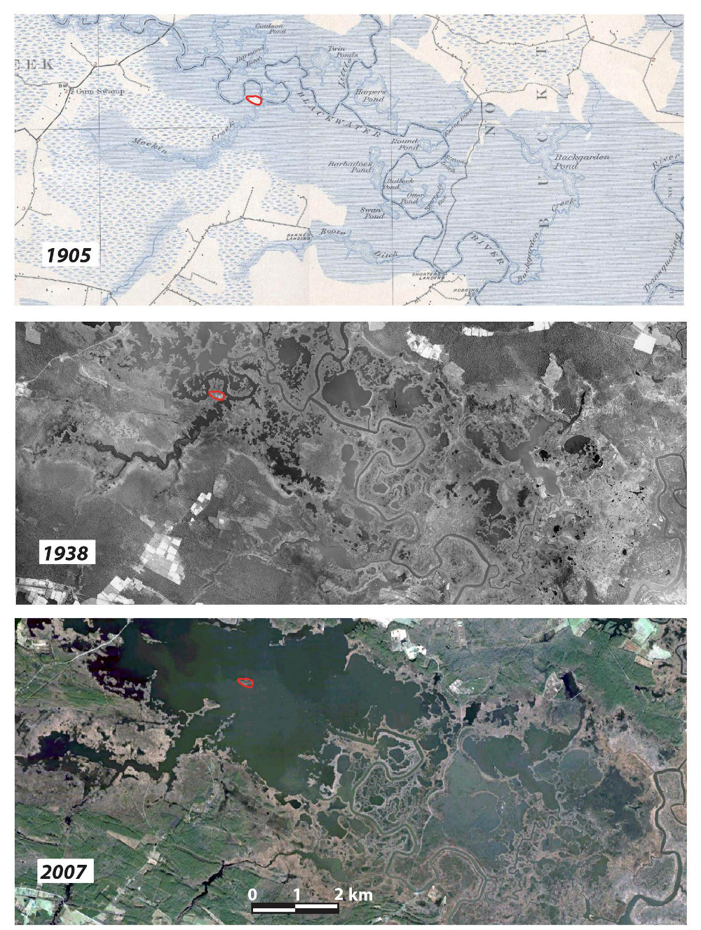
To better understand glacio-isostatic control over past and present relative sea level, DeJong and colleagues applied a suite of dating methods to the stratigraphy of the Blackwater National Wildlife Refuge, one of the most rapidly subsiding and lowest-elevation surfaces bordering Chesapeake Bay. Their data indicate that the region was submerged at least for portions of marine isotope stage (MIS) 3 (about 30 to 60 thousand years ago), although, they note, multiple proxies suggest that global sea level was 40 to 80 meters lower than today.
Today, MIS 3 deposits are above sea level because they were raised by the Last Glacial Maximum forebulge, but decay of that same forebulge is causing ongoing subsidence. “These results,” they write, “suggest that glacio-isostasy controlled relative sea level in the mid-Atlantic region for tens of thousands of years following retreat of the Laurentide Ice Sheet and continues to influence relative sea level in the region.”
The study finds that isostatically driven subsidence of the Chesapeake Bay region will continue for millennia, exacerbating the effects of global sea-level rise and impacting the region’s large population centers and valuable coastal natural resources.
Note: The above post is reprinted from materials provided by Geological Society of America.


 is faster in the Chesapeake Bay region than any)