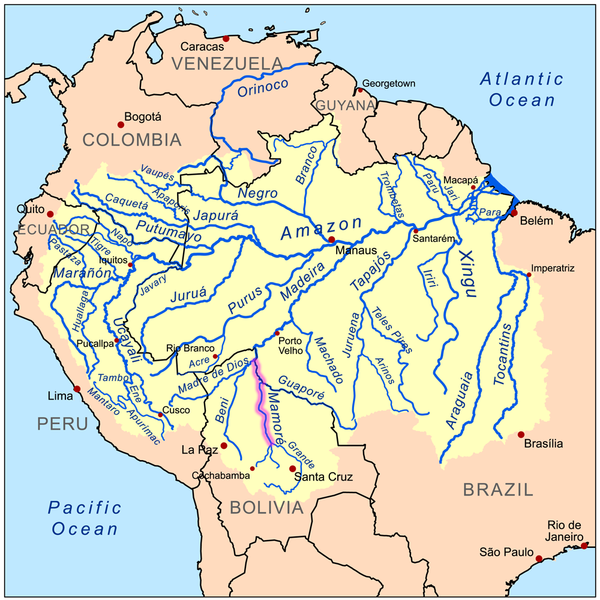
The Mamoré is a large river in Bolivia and Brazil, which unites with the Beni to form the Madeira, one of the largest tributaries of the Amazon. It rises on the northern slope of the Sierra de Cochabamba, east of the city of Cochabamba, and is known as the Chimoré down to its junction with the Chapare. Its larger tributaries are the Chapare, Secure, Apere, and Yacuma from the west, and the Ichilo, Guapay, Ivari, Manique, and Guapore from the east.
Taking into account its length only, the Guapay should be considered the upper part of the Mamore; but it is shallow and obstructed, and carries a much smaller volume of water. The Guapore also rivals the Mamore in length and volume, having its source in the Parecis plateau, Mato Grosso, Brazil, a few miles from streams flowing north-ward to the Tapajos and Amazon, and southward to the Paraguay and Paraná rivers. The Mamore is interrupted by rapids a few miles above its junction with the Beni, but a railway 300 km long has been undertaken from below the rapids of the Madeira. Above the rapids the river is navigable to Chimore, at the foot of the sierra, and most of its tributaries are navigable for long distances. In 1874, Franz Keller gave the outflow of the Mamoré at mean water level, and not including the Guapore, as 41,459 cm3/sec (2,530 cub. in. per second), and the area of its drainage basin, also not including the Guapore, as 24,299 km2 (9,382 square miles).
Note : The above story is based on materials provided by Wikipedia


