Mark Jessell has travelled half way around the world to help develop 3D software technology that will allow us to scratch beneath the earth’s surface and tell us more about such things as our mineral and water resources.
Professor Jessell is an internationally renowned structural geologist who recently moved to Perth to take up one of three prestigious WA Research Fellowships.
He is now based at the Centre for Exploration Targeting at the University of Western Australia.
He says good data is the key to unlocking the earth’s secrets.
“One of the problems is that we don’t have enough data,” he says.
“Even though we have lots of data, it’s not enough.
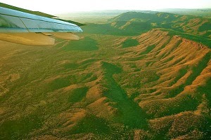
“We can a have a photograph of the surface, but what’s going on beneath the surface is much less sure.
“One of the problems we have is that the software at the moment isn’t really adapted to take in that uncertainty.”
As part of his research over the next few years, Prof Jessell will be looking at modifying and re-writing existing 3D software to tweak it to WA conditions.
“What we’re going to try to do is develop things that sit on top of existing packages that are specifically aimed at solving our problems,” he says.
Part of the work will focus on what is called geological inversion, which involves using geophysical data in 3D models and showing what is under the earth’s surface.
It is innovative technology – and the high-powered computing facilities such as those at the recently-opened Pawsey Centre was one of the things that attracted him to Perth.
“For the geophysical inversion side of our project, the access to that supercomputing facility is a big draw[card],” he says.
The work is expected to help discover new mineral deposits in WA, but the technique isn’t just limited to mining.
“The 3D geology of Western Australia is important to lots of other groups apart from the minerals industry,” he says.
“It’s also important to anybody who is worried about water in WA because the water we have comes from beneath the surface.
“And where it’s stored and where it goes and how it interacts with runoff from agriculture is all controlled by the 3D distribution of the geology.
“This is a big topic and its not something we’re going to be able to do alone.
“I’ve got colleagues at the CSIRO and the Geological Survey of WA and what we hope to do is have a critical mass of people working together on this problem.”
Note : The above story is based on materials provided by Science Network WA


