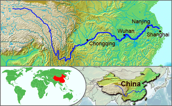
The Yangtze River, or Chang Jiang is the longest river in Asia, and the third longest in the world. It flows for 6,418 kilometres (3,988 mi) from the glaciers on the Qinghai-Tibet Plateau in Qinghai eastward across southwest, central and eastern China before emptying into the East China Sea at Shanghai. It is also one of the biggest rivers by discharge volume in the world. The Yangtze drains one-fifth of the land area of the People’s Republic of China (PRC) and its river basin is home to one-third of the PRC’s population.
Along with the Yellow River, the Yangtze is the most important river in the history, culture and economy of China. The prosperous Yangtze River Delta generates as much as 20% of the PRC’s GDP. The Yangtze River flows through a wide array of ecosystems and is itself habitat to several endemic and endangered species including the Chinese alligator and the Yangtze sturgeon. For thousands of years, people have used the river for water, irrigation, sanitation, transportation, industry, boundary-marking and war. The Three Gorges Dam on the Yangtze River is the largest hydro-electric power station in the world.
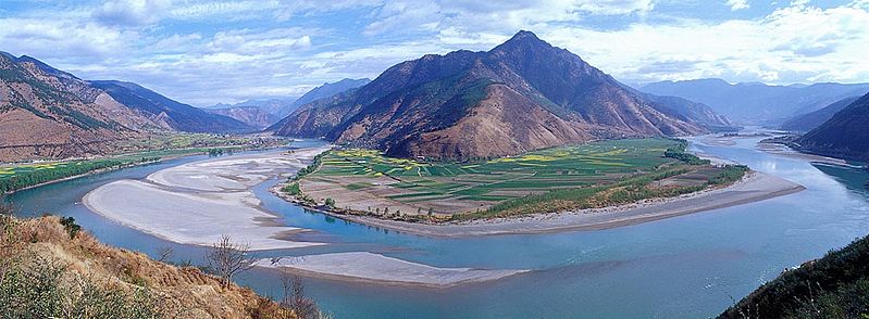
In recent years, the river has suffered from industrial pollution, agricultural run-off, siltation, and loss of wetland and lakes, which exacerbates seasonal flooding. Some sections of the river are now protected as nature reserves. A stretch of the Yangtze flowing through deep gorges in western Yunnan is part of the Three Parallel Rivers of Yunnan Protected Areas, a UNESCO World Heritage Site.
Geography
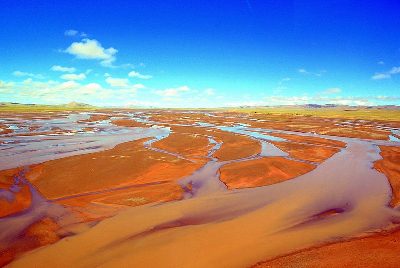
The river originates from several tributaries, two of which have claims to be the source. The Chinese
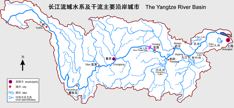
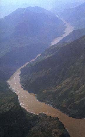
government has recognized the source of the Tuotuo tributary at the base of a glacier lying on the west of Geladandong Mountain in the Dangla Mountain Range on the eastern part of the Qinghai-Tibet Plateau. However, the geographical source (i.e., longest river distance from the sea) lies in wetlands at 32°36′14″N 94°30′44″E and 5,170 m (16,960 ft) above sea level at the head of the Dan Qu tributary. These tributaries join and the river then runs eastward through Qinghai, turning southward down a deep valley at the border of Sichuan and Tibet to reach Yunnan. In the course of this valley, the river’s elevation drops from above 5,000 m (16,000 ft) to less than 1,000 m (3,300 ft). The headwaters of the Yangtze are situated at an elevation of about 4,900 m (16,100 ft). In its descent to sea level, the river falls to an altitude of 305 m (1,001 ft) at Yibin, Sichuan, the head of navigation for riverboats, and to 192 m (630 ft) at Chongqing. Between Chongqing and Yichang (I-ch’ang), at an altitude of 40 m (130 ft) and a distance of about 320 km (200 mi), it passes through the spectacular Yangtze Gorges, which are noted for their natural beauty but are dangerous to shipping.
It enters the basin of Sichuan at Yibin. While in the Sichuan basin, it receives several mighty tributaries, increasing its water volume significantly. It then cuts through Mount Wushan bordering Chongqing and Hubei to create the famous Three Gorges. Eastward of the Three Gorges, Yichang is the first city on the Yangtze Plain.
After entering Hubei, the Yangtze receives more water from thousands of lakes. The largest of these lakes is Dongting Lake, which is located on the border of Hunan and Hubei provinces, and is the outlet for most of the rivers in Hunan. At Wuhan, it receives its biggest tributary, the Han River, bringing water from its northern basin as far as Shaanxi.
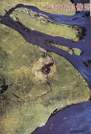
At the northern tip of Jiangxi, Lake Poyang, the biggest freshwater lake in China, merges into the river. The river then runs through Anhui and Jiangsu provinces, receiving more water from innumerable smaller lakes and rivers, and finally reaches the East China Sea at Shanghai.
Four of China’s five main freshwater lakes contribute their waters to the Yangtze River. Traditionally, the upstream part of the Yangtze River refers to the section from Yibin to Yichang; the middle part refers to the section from Yichang to Hukou County, where Lake Poyang meets the river; the downstream part is from Hukou to Shanghai. It is home to many thousands of people.
Photo :
.


 from the glacie)