back to top
Facebook Instagram Linkedin TikTok X Youtube
  • Contribute
  • Advertising
  • FAQs
Search

Logo

27.8 C
New York
Wednesday, November 11, 2026
Facebook
Instagram
Linkedin
TikTok
X
Youtube

Logo

  • Home
  • List of Minerals
  • Geologic Time Scale
  • Geology Tools
  • Geology Adventure Tours
  • Plate Tectonics Map
    • Plate Boundary Map
  • Top Posts
  • Geology Jobs
  • GEO Courses
  • Geology Field Camps
  • Geology Field Camps in United States
  • Worldwide Geological Surveys
More
    Evidence suggests an asteroid impact that killed off most dinosaurs might have happened in spring. Credit: Joschua Knüppe

    The reign of the dinosaurs ended in spring

    February 27, 2022
    Researchers discover first evidence indicating dinosaur respiratory infection

    First evidence indicating dinosaur respiratory infection

    February 27, 2022
    Illustration by Cindy Joli, Julio Francisco Garza Lorenzo, and René Dávila Rodríguez.

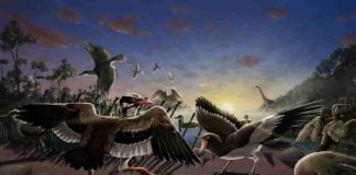
    New fossil birds discovered near China’s Great Wall – one had...

    February 27, 2022
    Credit: UC Davis

    Ridgecrest shows how earthquakes damage Earth’s crust

    February 27, 2022
    Nearly 10 yrs of drone surveys at Merapi volcano highlights the importance of hydrothermal weakening and structures hidden beneath younger lavas. A fracture system that formed in 2012 was subsequently buried under new lava in 2018. Only a year later, the new lava dome that formed in 2018 showed signs of instability and collapse along the previously buried fracture system, implying that hidden weaknesses may be a key factor in controlling hazardous volcano collapse. Credit: Darmawan et al., (2022)

    Hidden weaknesses within volcanoes may cause their collapse

    February 27, 2022
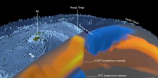
    The astonishing force of the Tonga volcanic eruption in January 2022 shocked the world, but the fact that this underwater volcano actually erupted came as less of a surprise to geoscientists using satellite data to study changes in the temperature deep below Earth’s surface. As part of the effort to understand the complexities of Earth’s interior, scientists working within ESA’s Science for Society 3D Earth project, have developed a state-of-the art model of the lithosphere, which is a term to describe Earth’s brittle crust and the top part of the upper mantle, and the sub-lithospheric upper mantle down to 400 km depth. The model combines different satellite data, such as gravity data from ESA’s GOCE mission, with in-situ observations, primarily seismic tomography. The model that show differences in temperature, or thermal structures, indicated that the Tonga volcano was due to erupt at some point. Credit: ESA/Planetary Visions

    Deep down temperature shifts give rise to eruptions

    February 18, 2022
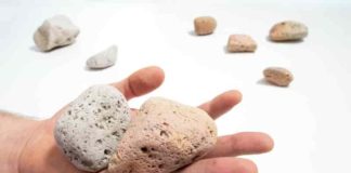
    The pink pumice, and its thermal history, provides an insight into underwater eruptions.

    Pink pumice key to revealing explosive power of underwater volcanic eruptions

    February 18, 2022
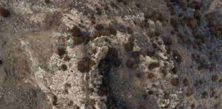
    Drone images of craters formed at Sheep Mountain. Credit: Kent Sundell, Casper College.

    Secondary cratering on Earth: The Wyoming impact crater field

    February 18, 2022
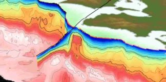
    The Kumano Pluton in southern Japan appears as a red bulge (indicating dense rock) in the center of a new 3D visualization by The University of Texas at Austin. The pluton is large enough to interfere with the nearby Nankai subduction zone and the region’s earthquakes. Credit: Adrien Arnulf

    Big data imaging shows rock’s big role in channeling earthquakes in...

    February 18, 2022
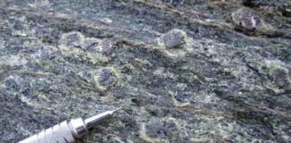
    Minerals are visible in rock samples from the coast of Oman. Scientists said these rocks may reveal new information about subduction, an important tectonic process on Earth. Credit: Joshua Garber / Penn State.

    Mineral dating reveals new clues about important tectonic process

    February 18, 2022
    1...565758...688Page 57 of 688

    MOST POPULAR

    Rocks Can Restore Our Climate … After 300,000 Years

    July 28, 2013

    Test aims to identify shale gas hazard in groundwater

    April 23, 2016
    An orthophoto of Wolfe Creek Crater. An orthophoto is an aerial photograph that has been geometrically corrected so that the scale is uniform and the photo has the same lack of distortion as a map. Credit: University of Wollongong

    New study reveals secrets of Wolfe Creek Crater

    November 21, 2019
    Photograph of a T. rex skeletal cast at Senckenberg Museum Frankfurt, Germany. T. rex lived at the end of the Cretaceous (about 66 million years ago) and was exclusive to western North America. Credit: Kai R. CasparKai R. Caspar

    T. Rex not as smart as previously claimed

    May 28, 2024
    Load more

    MORE ARTICLES

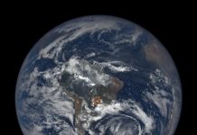
    NASA’s EPIC view spots flashes on Earth

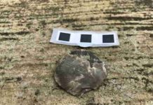
    Rafinesquina, seen in this close-up shot, was an ancient genus of brachiopod belonging to order Strophomenida. This order survived two mass extinction events, but the second represented a ‘death sentence’ from which they were unable to recover diversity, persisting for another hundred million years as a ‘dead clade walking’ before their eventual extinction. IMAGE: Provided by Benjamin Barnes

    New insights into mass extinctions

    Researchers find new cause of strong earthquakes

    Don’t build your model on sand

    Facebook Instagram Linkedin TikTok X Youtube
    • Privacy Policy
    • Advertising
    • Contribute
    • FAQs
    © 2011-2026. All Rights Reserved.