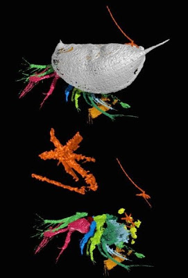
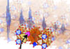
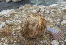
This image shows two pentastomids (in orange) attached externally to the ostracod; one of the pentastomids; the ostracod with its shell removed, showing the external pentastomids and a pentastomid near the eggs of the ostracod. Credit: Siveter, Briggs, Siveter and Sutton
An international team of scientists led by the University of Leicester has discovered a new species of fossil in England — and identified it as an ancient parasitic intruder.
The fossil species found in 425-million year old rocks in Herefordshire, in the Welsh borderland, is described as ‘exceptionally well preserved.’ The specimens range from about 1 to 4 millimeters long.
The fossil species — a ‘tongue worm’, which has a worm-like body and a head and two pairs of limbs — is actually a parasite whose representatives today live internally in the respiratory system of a host, which it enters when it is eaten.
The new fossil, which was originally entirely soft-bodied, is the first fossil tongue worm species to be found associated with its host, which in this case is a species of ostracod — a group of micro-arthropods (crabs, spiders and insects are also arthropods) with two shells that are joined at a hinge.
Professor David Siveter, of the Department of Geology at the University of Leicester made the discovery working alongside researchers from the Universities of Oxford, Imperial College London and Yale, USA. Their research is published in the journal Current Biology and was supported by The Natural Environmental Research Council, together with the Leverhulme Trust, the John Fell Oxford University Press (OUP) Research Fund and Yale Peabody Museum of Natural History.
Professor Siveter said: “This discovery is important not only because examples of parasites are exceptionally rare in the fossil record, but also because the possible host of fossil tongue worms — and the origin of the lifestyle of tongue worms — has been the subject of much debate.
“This discovery affirms that tongue worms were ‘external’ parasites on marine invertebrate animals at least 425 million years ago; it also suggests that tongue worms likely found their way into land-based environments and associated hosts in parallel with the movement of vertebrates onto the land by some 125 million years later.”
Professor Siveter said tongue worms — technically termed pentastomids — are in fact not worms at all; they are an unusual group of tiny and widespread parasitic arthropods. Their fossils are exceptionally rare and until now are known only from a handful of isolated juvenile specimens.
Today they are known from about 140 species, nearly all of which are parasitic on vertebrate animals, particularly reptiles and including humans. Some of the fossil tongue worm specimens occur inside the shell, near the eggs of the ostracod; others are attached to the external surface of its shell, a unique position for any fossil or living tongue worm.
Professor Siveter added: “The tongue worm and its host lived in a sea that 425 million years ago — during the Silurian period of geological time — covered much of southern Britain, which was positioned then in warm southerly subtropical latitudes. The animals died and were preserved when a volcanic ash rained down upon them. The new species has been named Invavita piratica, which means an ‘ancient intruder’ and ‘piracy’, referring to its parasitic lifestyle in the sea.”
The fossils have been reconstructed as virtual fossils by 3D computer modelling.
Reference:
David J. Siveter, Derek E.G. Briggs, Derek J. Siveter, Mark D. Sutton. A 425-Million-Year-Old Silurian Pentastomid Parasitic on Ostracods. Current Biology, 2015 DOI: 10.1016/j.cub.2015.04.035
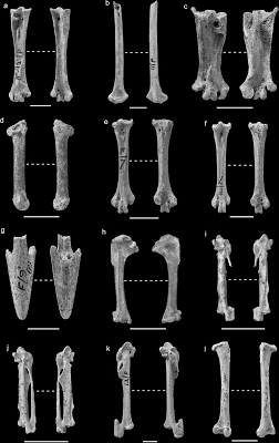
Further representative skeletal elements of taxa in the MIS 3 deposits at Pin Hole. a) Asio flammeus left tarsometatarsus PH(F) 7837/38; b) Bubo sp. distal left radius PH(F) 7801/00; c) Surnia ulula right tarsometatarsus PH(F) 8476; d) Tachymarptis melba right ulna PH(F) 18600; e) Lagopus muta right tarsometarsus PH(F) 9; f) Lagopus lagopus right tarsometarsus PH(F) 266; g) Anthropoides virgo premaxilla PH(F) 30; h) Alaudidae left humerus PH(F) 8064–8068; i) Turdus sp. right carpometacarpus PH(F) 9069–9071; j) Sturnus sp. right carpometacarpus PH(F) 7374; k) Corvus corax right carpometacarpus PH(F) 13075–13076; l) Corvus cf. monedula right femur PH(F) 8069.
A new study focusing on the birds of the Ice Age has shed light on the long term response of birds to climate change.
The study, published in PLOS ONE, has revealed that many of the birds were larger at this time reflecting the richness and greater productivity of the environment in the Ice Age.
Conducted by Bournemouth University’s John Stewart alongside research from Roger Jacobi, a picture emerges of an unusual mix of birds in one space and a distinct Neanderthal Dawn Chorus.
John Stewart said, “During the Ice Age just over 40 thousand years ago in the north of England Neanderthals were living in an environment which included extinct animals like woolly mammoths, woolly rhinos and cave hyenas as well as the more familiar horses and reindeer. These mammals are well known to science and many studies have illuminated the spectacular fauna that lived at this early stage. Not so well known are the birds.”
Another finding was that the mixtures of birds that lived together were different from anywhere in the world today. Birds exotic to Britain, such as species normally expected in the tundra to the north (like skuas, and hawk owls), the Mediterranean to the South (like alpine swifts) or the Eastern steppes (like demoiselle cranes and long-legged buzzards) lived together with birds expected in the region today (such as grey herons and wood pigeons).
John Stewart continued, “It is clear the birds of the time of Neanderthals have changed in a way that is almost as dramatic as the change we have seen in mammals. It also signifies that the dawn chorus witnessed by the Neanderthals at that time and place has no parallels anywhere today.”
Reference:
John R. Stewart, Roger M. Jacobi. The Long Term Response of Birds to Climate Change: New Results from a Cold Stage Avifauna in Northern England. PLOS ONE, 2015; 10 (5): e0122617 DOI: 10.1371/journal.pone.0122617
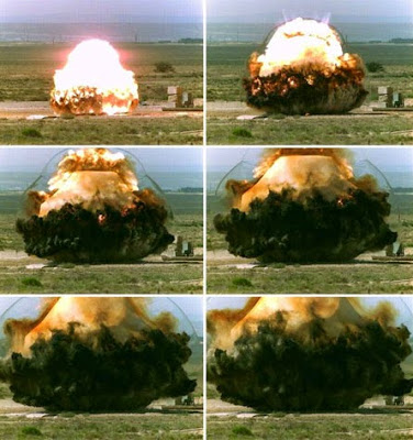
High-speed photographs of a controlled surface explosion at Kirtland Air Force Base in Albuquerque, New Mexico, similar to the explosions at White Sands Missile Range were used in a study of seismic signals to detect above-ground explosions. Credit: Defense Threat Reduction Agency (DTRA) Counter-WMD Test Support Division (CXT).
Lawrence Livermore researchers have determined that a tunnel bomb explosion by Syrian rebels was less than 60 tons as claimed by sources.
Using seismic stations in Turkey, Livermore scientists Michael Pasyanos and Sean Ford created a method to determine source characteristics of near earth surface explosions. They found the above-ground tunnel bomb blast under the Wadi al-Deif Army Base near Aleppo last spring was likely not as large as originally estimated and was closer to 40 tons.
Seismology has long been used to determine the source characteristics of underground explosions, such as yield and depth, and plays a prominent role in nuclear explosion monitoring. But now some of the same techniques have been modified to determine the strength and source of near and above-ground blasts.
The new method to track above-ground explosions serves as a forensic tool for investigators and governmental agencies seeking to understand the precise cause of an explosion.
“The technique accounts for the reduction in amplitudes as the explosion depth approaches the free surface and less energy is coupled into the ground,” said Michael Pasyanos, an LLNL geophysicist and lead author of a paper appearing in an upcoming issue of Geophysical Research Letters.
The team, also made up LLNL scientist Sean Ford, used the method on a series of shallow explosions in New Mexico where the yields and depths were known.
Pasyanos and Ford’s examination of source characteristics of near-surface explosions is an extension of the regional amplitude envelope method. This technique was developed and applied to North Korean nuclear explosions, then applied to chemical explosions and nuclear tests in Nevada.
“The technique takes an earthquake or explosion source model and corrects for the wave propagation to generate predicted waveform envelopes at any particular frequency band,” Pasyanos said.
Methods for determining the yields of contained events range from teleseismic amplitudes and P-wave spectra to regional P-wave amplitudes and magnitudes. Pasyanos developed a method to characterize underground explosions based on regional amplitude envelopes across a broad range of frequencies. One advantage of the method is that examining the signal over a wide frequency band can reduce some of the strong tradeoffs between yield and depth, Pasyanos said
“By allowing the methodology to consider shallow, uncontained events just below, at, or even above the Earth’s surface, we make the method relevant to new classes of events including mining events, military explosions, industrial accidents, plane crashes or potential terrorist attacks.” Pasyanos said. “A yield estimate is often very important to investigators and governmental agencies seeking to understand the precise cause of an explosion.”
For the Syrian explosion, the team did not have local seismic data from Syria, but it was well recorded by regional stations from the Continental Dynamics: Central Anatolian Tectonics (CD-CAT) deployment in Turkey.
If the explosion occurred well above the surface, a yield of 100 tons TNT equivalent would be required to produce the observed seismic signal.
“Given the video footage of the explosion, however, we know that it was neither at nor above the free surface, nor fully coupled,” Ford said. “We estimate a chemical yield ranging from 6 and 50 tons depending on the depth, with the best estimate between 20-40 tons. Including independent information on the depth, we could narrow this considerably. If, for instance, we definitively knew that the explosion occurred at 2 meters below the surface, then we would estimate the yield at 40 tons.”
The team found that though there are expected tradeoffs between yield and depth/height, when constrained by other information, the yields are consistent with ground truth yields in tests in New Mexico and reasonable values from what Pasyanos and Ford know about in Syria.
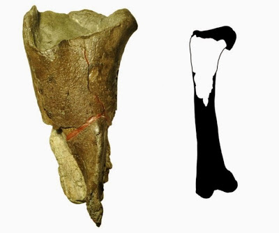
The first dinosaur fossil described from Washington state (left) is a portion of a femur leg bone (full illustration right) from a theropod dinosaur. Theropods are a group of meat-eating, two-legged dinosaurs, including T. rex and Velociraptor. The fossil was discovered by Burke Museum paleontologists at Sucia Island State Park in the San Juan Islands. Credit: Illustration courtesy of PLOS ONE, modified by the Burke Museum.
Burke Museum paleontologists have published a description of the first dinosaur fossil from Washington state. The fossil was collected by a Burke Museum research team along the shores of Sucia Island State Park in the San Juan Islands.
Burke Museum researchers discovered the fossil while collecting ammonite fossils (a creature with a spiral shell) from a marine rock unit known as the Cedar District Formation. The researchers first noticed a small section of exposed bone on the surface of the rocks, then returned with a team of paleontologists to help excavate the fossil so it could be studied at the Burke Museum.
A new study by Burke Museum Curator of Vertebrate Paleontology Dr. Christian Sidor and University of Washington graduate student Brandon Peecook describes the find in the journal PLOS ONE. The fossil is a partial left femur of a theropod dinosaur, the group of two-legged, carnivorous dinosaurs that includes Velociraptor, Tyrannosaurus rex and modern birds.
The fossil is 16.7 inches long and 8.7 inches wide. Because the fossil is incomplete, paleontologists aren’t able to identify the exact family or species it belonged to. However, Sidor and Peecook compared the fossil to other museums’ specimens and were able to calculate that the complete femur would have been over 3 feet long — slightly smaller than T. rex. The fossil is from the Late Cretaceous period and is approximately 80 million years old.
Although incomplete, Sidor and Peecook were able to determine the femur is from a theropod dinosaur for two reasons: First, the hollow middle cavity of the bone (where marrow was present) is unique to theropods during this time period; and second, a feature on the surface of the bone (the fourth trochanter) is prominent and positioned relatively close to the hip, which is a combination of traits known only in some theropods among dinosaurs.
“This fossil won’t win a beauty contest,” Sidor said. “But fortunately it preserves enough anatomy that we were able to compare it to other dinosaurs and be confident of its identification.”
“The fossil record of the West Coast is very spotty when compared to the rich record of the interior of North America,” Peecook said. “This specimen, though fragmentary, gives us insight into what the West Coast was like 80 million years ago, plus it gets Washington into the dinosaur club.”
Washington is now the 37th state where dinosaurs have been found.
Fossilized prehistoric clams were also found inside the hollow part of the bone, which indicates the dinosaur fossilized in marine rock. These additional fossils are a rare occurrence and provide scientists with a snapshot of other lifeforms that were present where the dinosaur fossilized.
The accompanying fossilized clams are so well preserved that Burke paleontologists were able to identify the species, Crassatellites conradiana. These clams lived in shallow water, so it’s likely the dinosaur died near the sea, was tossed by the waves, and eventually came to rest among the clams.
Why have no dinosaurs been found in Washington state until now?
Dinosaurs are found in rocks from the time periods in which they lived (240-66 million years ago). Washington state was mostly underwater during this period, so Washington has very little exposed rock of the right age. Because dinosaurs were land animals, it is very unusual to find dinosaur fossils in marine rocks–making this fossil a rare and lucky discovery.
How did the dinosaur get to Sucia Island State Park?
Eighty million years ago, the rocks that today form Sucia Island were likely deposited farther south. How much farther south is a topic of scientific debate, with locations ranging between present-day Baja California, Mexico, and Northern California. Earthquakes and other geologic forces that constantly reshape our planet moved the rocks north to their present-day location.
Reference:
Brandon R. Peecook , Christian A. Sidor. The First Dinosaur from Washington State and a Review of Pacific Coast Dinosaurs from North America. PLoS One, 2015 DOI: 10.1371/journal.pone.0127792
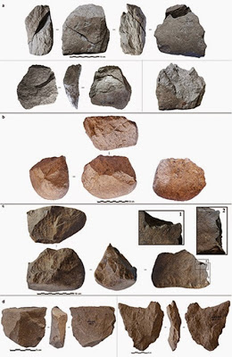
Photos of selected Lomekwi 3 stones accompanying the paper show both cores and flakes knapped from the cores that the authors say illustrate various techniques. Credit: West Turkana Archaeological Project
Scientists working in the desert badlands of northwestern Kenya have found stone tools dating back 3.3 million years, long before the advent of modern humans, and by far the oldest such artifacts yet discovered. The tools, whose makers may or may not have been some sort of human ancestor, push the known date of such tools back by 700,000 years; they also may challenge the notion that our own most direct ancestors were the first to bang two rocks together to create a new technology.
The discovery is the first evidence that an even earlier group of proto-humans may have had the thinking abilities needed to figure out how to make sharp-edged tools. The stone tools mark “a new beginning to the known archaeological record,” say the authors of a new paper about the discovery, published today in the leading scientific journal Nature.
“The whole site’s surprising, it just rewrites the book on a lot of things that we thought were true,” said geologist Chris Lepre of the Lamont-Doherty Earth Observatory and Rutgers University, a co-author of the paper who precisely dated the artifacts.
The tools “shed light on an unexpected and previously unknown period of hominin behavior and can tell us a lot about cognitive development in our ancestors that we can’t understand from fossils alone,” said lead author Sonia Harmand, of the Turkana Basin Institute at Stony Brook University and the Universite Paris Ouest Nanterre.
Hominins are a group of species that includes modern humans, Homo sapiens, and our closest evolutionary ancestors. Anthropologists long thought that our relatives in the genus Homo — the line leading directly to Homo sapiens — were the first to craft such stone tools. But researchers have been uncovering tantalizing clues that some other, earlier species of hominin, distant cousins, if you will, might have figured it out.
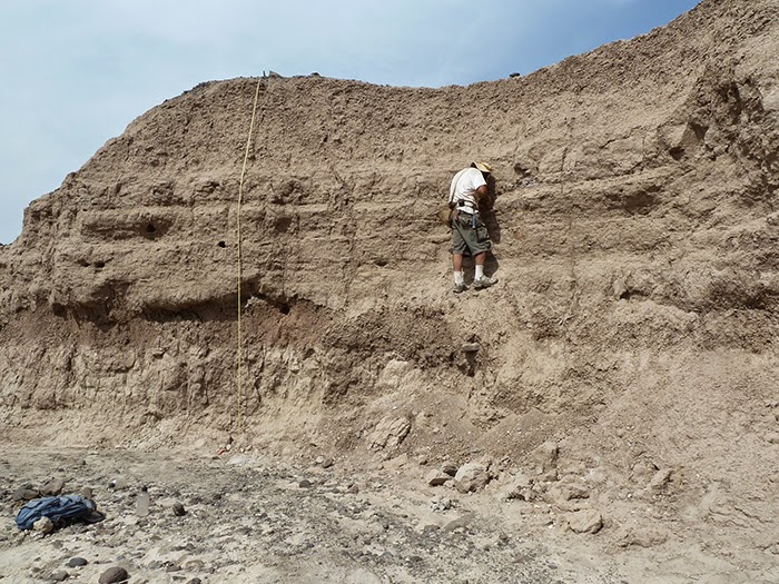
Chris Lepre from Lamont-Doherty Earth Observatory takes sediment samples to help date the age of the Lomekwi site. Credit: West Turkana Archaeological Project
The researchers do not know who made these oldest of tools. But earlier finds suggest a possible answer: The skull of a 3.3-million-year-old hominin, Kenyanthropus platytops, was found in 1999 about a kilometer from the tool site. A K. platyops tooth and a bone from a skull were discovered a few hundred meters away, and an as-yet unidentified tooth has been found about 100 meters away.
The precise family tree of modern humans is contentious, and so far, no one knows exactly how K. platyops relates to other hominin species. Kenyanthropus predates the earliest known Homo species by a half a million years. This species could have made the tools; or, the toolmaker could have been some other species from the same era, such as Australopithecus afarensis, or an as-yet undiscovered early type of Homo.
Lepre said a layer of volcanic ash below the tool site set a “floor” on the site’s age: It matched ash elsewhere that had been dated to about 3.3 million years ago, based on the ratio of argon isotopes in the material. To more sharply define the time period of the tools, Lepre and co-author and Lamont-Doherty colleague Dennis Kent examined magnetic minerals beneath, around and above the spots where the tools were found.
The Earth’s magnetic field periodically reverses itself, and the chronology of those changes is well documented going back millions of years. “We essentially have a magnetic tape recorder that records the magnetic field … the music of the outer core,” Kent said. By tracing the variations in the polarity of the samples, they dated the site to 3.33 million to 3.11 million years.
Lepre’s wife and another co-author, Rhoda Quinn of Rutgers, studied carbon isotopes in the soil, which along with animal fossils at the site allowed researchers to reconstruct the area’s vegetation. This led to another surprise: The area was at that time a partially wooded, shrubby environment. Conventional thinking has been that sophisticated tool-making came in response to a change in climate that led to the spread of broad savannah grasslands, and the consequent evolution of large groups of animals that could serve as a source of food for human ancestors.
One line of thinking is that hominins started knapping — banging one rock against another to make sharp-edged stones — so they could cut meat off of animal carcasses, said paper co-author Jason Lewis of the Turkana Basin Institute and Rutgers. But the size and markings of the newly discovered tools “suggest they were doing something different as well, especially if they were in a more wooded environment with access to various plant resources,” Lewis said. The researchers think the tools could have been used for breaking open nuts or tubers, bashing open dead logs to get at insects inside, or maybe something not yet thought of.
“The capabilities of our ancestors and the environmental forces leading to early stone technology are a great scientific mystery,” said Richard Potts, director of the Human Origins Program at the Smithsonian’s National Museum of Natural History, who was not involved in the research. The newly dated tools “begin to lift the veil on that mystery, at an earlier time than expected,” he said.
Potts said he had examined the stone tools during a visit to Kenya in February.
“Researchers have thought there must be some way of flaking stone that preceded the simplest tools known until now,” he said. “Harmand’s team shows us just what this even simpler altering of rocks looked like before technology became a fundamental part of early human behavior.”
Ancient stone artifacts from East Africa were first uncovered at Olduvai Gorge in Tanzania in the mid-20th century, and those tools were later associated with fossil discoveries in the 1960s of the early human ancestor Homo habilis. That species has been dated to 2.1 million to 1.5 million years ago.
Subsequent finds have pushed back the dates of humans’ evolutionary ancestors, and of stone tools, raising questions about who first made that cognitive leap. The discovery of a partial lower jaw in the Afar region of Ethiopia, announced on March 4, pushes the fossil record for the genus Homo to 2.8 million years ago. Evidence from recent papers, the authors note, suggests that there is anatomical evidence that Homo had evolved into several distinct lines by 2 million years ago.
There is some evidence of more primitive tool use going back even before the new find. In 2009, researchers at Dikika, Ethiopia, dug up 3.39 million-year-old animal bones marked with slashes and other cut marks, evidence that someone used stones to trim flesh from bone and perhaps crush bones to get at the marrow inside. That is the earliest evidence of meat and marrow consumption by hominins. No tools were found at the site, so it’s unclear whether the marks were made with crafted tools or simply sharp-edged stones. The only hominin fossil remains in the area dating to that time are from Australopithecus afarensis.
The new find came about almost by accident: Harmand and Lewis said that on the morning of July 9, 2011, they had wandered off on the wrong path, and climbed a hill to scout a fresh route back to their intended track. They wrote that they “could feel that something was special about this particular place.” They fanned out and surveyed a nearby patch of craggy outcrops. “By teatime,” they wrote, “local Turkana tribesman Sammy Lokorodi had helped [us] spot what [we] had come searching for.”
By the end of the 2012 field season, excavations at the site, named Lomekwi 3, had uncovered 149 stone artifacts tied to tool-making, from stone cores and flakes to rocks used for hammering and others possibly used as anvils to strike on.
The researchers tried knapping stones themselves to better understand how the tools they found might have been made. They concluded that the techniques used “could represent a technological stage between a hypothetical pounding-oriented stone tool use by an earlier hominin and the flaking-oriented knapping behavior of [later] toolmakers.” Chimpanzees and other primates are known to use a stone to hammer open nuts atop another stone. But using a stone for multiple purposes, and using one to crack apart another into a sharper tool, is more advanced behavior.
The find also has implications for understanding the evolution of the human brain. The toolmaking required a level of hand motor control that suggests that changes in the brain and spinal tract needed for such activity could have occurred before 3.3 million years ago, the authors said.
“This is a momentous and well-researched discovery,” said paleoanthropologist Bernard Wood of George Washington University, who was not involved in the study. “I have seen some of these artifacts in the flesh, and I am convinced they were fashioned deliberately.” Wood said he found it intriguing to see how different the tools are from so-called Oldowan stone tools, which up to now have been considered the oldest and most primitive.
Lepre, who has been conducting fieldwork in eastern Africa for about 15 years, said he arrived at the dig site about a week after the discovery. The site is several hours’ drive on rough roads from the nearest town, located in a hot, dry landscape he said is reminiscent of Arizona and New Mexico. Lepre collected chunks of sediment from a series of depths and brought them back to Lamont-Doherty for analysis. He and Kent used a bandsaw to trim the samples into sugar cube-size blocks and inserted them into a magnetometer, which measured the polarity of tiny grains of the minerals hematite and magnetite contained in the sediment.
“The magnetics pretty much clinches that the age is something like 3.3 million years old,” said Kent, who also is a professor at Rutgers.
Earlier dating work by Lepre and Kent helped lead to another landmark paper in 2011: a study that suggested Homo erectus, another precursor to modern humans, was using more advanced tool-making methods 1.8 million years ago, at least 300,000 years earlier than previously thought.
Reference:
Sonia Harmand, Jason E. Lewis, Craig S. Feibel, Christopher J. Lepre, Sandrine Prat, Arnaud Lenoble, Xavier Boës, Rhonda L. Quinn, Michel Brenet, Adrian Arroyo, Nicholas Taylor, Sophie Clément, Guillaume Daver, Jean-Philip Brugal, Louise Leakey, Richard A. Mortlock, James D. Wright, Sammy Lokorodi, Christopher Kirwa, Dennis V. Kent, Hélène Roche. 3.3-million-year-old stone tools from Lomekwi 3, West Turkana, Kenya. Nature, 2015; 521 (7552): 310 DOI: 10.1038/nature14464
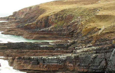
The Bay of Stoer region in north-west Scotland, where ancient lake sediments have revealed high levels of molybdenum, a key element in the evolution of complex life.
An ancient lake could hold the key to our understanding of how complex life evolved on Earth, according to research carried out by the University of Aberdeen.
Scientists have studied samples of lake sediments deposited 1.5 billion years ago in the Bay of Stoer region in north-west Scotland, and discovered high levels of the metal molybdenum, a key element in the evolution of multicellular life.
The discovery challenges the commonly held view that an important stage of evolution, leading eventually to human life, occurred in the deep ocean, as opposed to a continental environment.
Professor John Parnell, from the University’s School of Geosciences, explains: “Molybdenum was required to support nitrogen fixation, which allowed simple life to flourish and support a food chain. It was also being incorporated into enzymes used by complex life.
“Previous research has measured the amount of molybdenum in rocks from ancient oceans to assess its supply, but found that it was only available sparsely at the time when complex life was expanding about 1.5 billion years ago.
“This new data, gathered from a site in north-west Scotland over the last year, shows that greater quantities of molybdenum were available in a continental environment at this time. This supports a growing theory that this important stage of evolution was advanced on the continents and not in the ocean.”
The site from which the sediments were recovered is already considered a highly-prized scientific resource, having provided evidence of how a critical point in evolution took place several hundred years earlier than scientists had previously understood .
This latest discovery further underlines the importance of the site, whose geographic location makes it ideal for research purposes, as Professor Parnell explains:
“When carrying out this kind of research there are very few rocks that you can study that have been deposited in a terrestrial setting, which is what makes this site in north-west Scotland special.
“There are other possible locations around the world, but these aren’t easy to get to and you can’t travel back and forth to carry out serious research at them.
“The difference with this site is that it’s so well-preserved and easily accessible, which makes it an excellent place to look for the kind of evidence that we have uncovered.
“This research is part of a bigger body of work on these rocks which is ongoing. It is clear that the site is a very important archive to help us understand the earth’s early history, so we will continue to develop that work at Aberdeen.”
More information: “High Molybdenum availability for evolution in a Mesoproterozoic lacustrine environment.” Nature Communications 6, Article number: 6996 DOI: 10.1038/ncomms7996
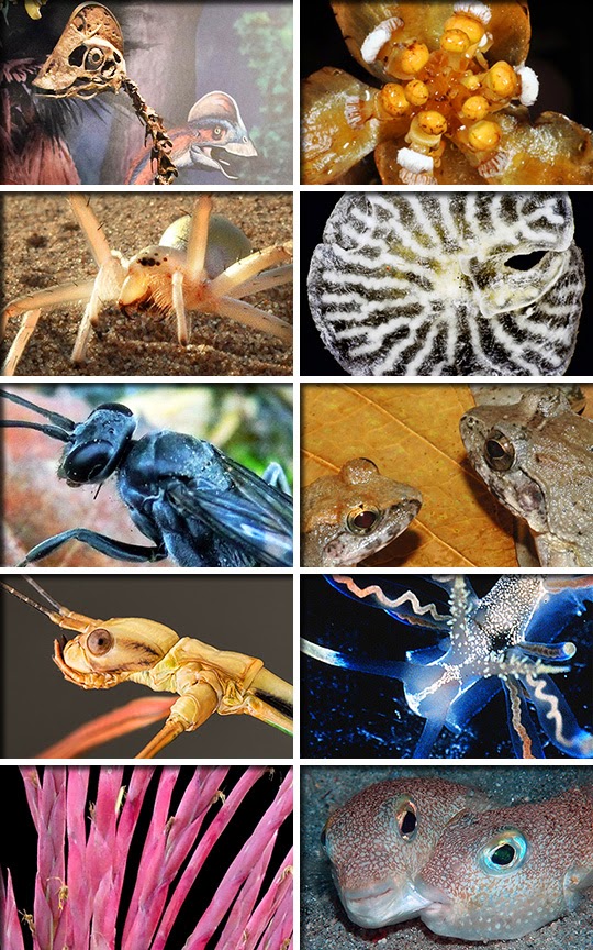
A cartwheeling spider, a bird-like dinosaur and a fish that wriggles around on the sea floor to create a circular nesting site are among the species identified by the SUNY College of Environmental Science and Forestry (ESF) as the Top 10 New Species for 2015.
Two animals — a frog that gives birth to tadpoles and a wasp that uses dead ants to protect its nest — are unusual because of their parenting practices. Also on the list are an animal that might surpass the new species distinction to be an entirely new phylum, a 9-inch walking stick and a photogenic sea slug. Rounding out the top 10 are a coral plant described as endangered almost as soon as it was discovered and a red-and-green plant used during Christmas celebrations in Mexico.
The list is compiled annually by ESF’s International Institute for Species Exploration (IISE). The institute’s international committee of taxonomists selected the Top 10 from among the approximately 18,000 new species named during the previous year. ESF released this year’s list May 21 to recognize the birthday, May 23, of Carolus Linnaeus, an 18th century Swedish botanist who is considered the father of modern taxonomy. The annual list, established in 2008, calls attention to discoveries that are made even as species are going extinct faster than they are being identified.
“The last vast unexplored frontier on Earth is the biosphere. We have only begun to explore the astonishing origin, history, and diversity of life,” said Dr. Quentin Wheeler, ESF president and founding director of the IISE. Scientists believe 10 million species await discovery, five times the number that are already known to science.
“An inventory of plants and animals begun in the 18th century continues apace with the discovery of about 18,000 additional species each year. The nearly 2 million species named to date represent a small fraction of an estimated 12 million. Among the remaining 10 million are irreplaceable clues to our own origins, a detailed blueprint of how the biosphere self-organized, and precious clues to better, more efficient, and more sustainable ways to meet human needs while conserving wild living things. It is time to mount a mission to planet Earth to distinguish, describe, name and classify its life-forms before it is too late. The Top 10 is a reminder of the wonders awaiting us,” Wheeler said.
The Top 10 Species of 2015
Feathered Dinosaur: ‘Chicken from Hell’
Anzu wyliei Location: U.S.A.
How it made the Top 10: With a mixture of bird and dinosaur features, Anzu wyliei is from a bird-like group of dinosaurs that lived in North America. A contemporary of the more famous T. rex and Triceratops, this species made nests and sat on the eggs until they hatched. Among their bird-like features were feathers, hollow bones and a short snout with a parrot-like beak. These omnivores appear to have lived on floodplains eating vegetation, small animals and possibly eggs. Three well-preserved partial skeletons were discovered in North and South Dakota, in the Hell Creek Formation. Because some caenagnathids were chicken-sized, this new dinosaur was dubbed “chicken from Hell.” However, at more than 10 feet in length (3.5m), 5 feet in height (1.5m) and 600 pounds (200-300kg), this was no chicken.
Coral Plant: Atypical Tubers
Balanophora coralliformis Location: Philippines
How it made the Top 10: This parasitic plant, discovered and almost immediately considered endangered, has elongated, repeatedly branching, and rough-textured aboveground tubers. These peculiar tubers give this root parasite from the Philippines a coral-like appearance distinct from the more typical underground tubers of related species. Parasitic plants do not contain chlorophyll and are incapable of photosynthesis, so they draw their nutrition from other living plants. This species is, so far, known from fewer than 50 plants, all found between 4,800 and 5,600 feet (1,465 and 1,735 m) elevation on the southwestern slopes of Mt. Mingan in mossy forest areas. Because so few plants are known to exist, and the narrow area in which they live is unprotected, the scientists who described it consider the plant critically endangered.
Cartwheeling Spider: Spinning in the Sand
Cebrennus rechenbergi Location: Morocco
How it made the Top 10: This agile arachnid from the desert uses a gymnast’s trick to escape from threatening situations: It cartwheels its way out of danger. When danger comes calling, the spider first assumes a threatening posture. If the danger persists, the spider runs and, about half the time that running turns into cartwheeling which is twice as fast. Terrain is not a challenge: the spider can spin across flat ground as well as up and down hills. Rather than attempting to cartwheel away, the spider propels itself toward the source of the threat, perhaps invoking the theory that the best defense is a good offense. In the barren sand dunes where the spider lives, running away can prove pointless because there is no place to hide. The high temperatures of its desert habitat would be fatal to the spider if it persisted in this high-energy routine for long, so cartwheeling is thought to be an escape option of last resort. Even before the spider had been officially named, its behavior inspired a biomimetic robot that can similarly walk or roll.
The X-Phyla: Mysterious Newcomers
Dendrogramma enigmatica Location: Australia
How it made the Top 10: Dendrogramma enigmatica and a second new species, D. discoids, are multicellular animals that look rather like mushrooms, with a mouth at the end of the “stem” and the other end in the form of a flattened disc. The best information suggests that they are related to the phylum Cnidaria (jellyfish, corals, sea anemones and hydras) or Ctenophora (comb jellies) or both, but the new animals lack evolutionary novelties unique to either and could be an entirely new phylum. They also resemble fossils from Precambrian time, perhaps making them living fossils of sorts. The mystery surrounding this animal accounts for its name, and its relationships are likely to remain enigmatic until specimens can be collected suitable for DNA analysis. The new animal is small, with a stalk less than a third of an inch (8 mm) in length and a “cap” that measures less than a half-inch (11mm) across. It was found on the sea floor, at a depth of about 3,200 feet (1,000 meters), off Point Hicks, Victoria.
Bone-house Wasp: Morbid Motherhood
Deuteragenia ossarium Location: China
How it made the Top 10: This insect, which tops out at about a half-inch (15mm) in length, has a unique way to protect its offspring. The wasp constructs nests in hollow stems with several cells, each separated by soil walls. The wasp kills and deposits one spider in each cell to provide nourishment for her developing young. Once her egg is laid, she seals off the cell and hunts a spider for the next cell. Rather than provisioning the final or vestibule cell with a spider, she fills it with as many as 13 bodies of dead ants, thus creating a chemical barrier to the nest. This is the first animal known to take this approach to securing the front door to a nest. This species, found in Gutianshan National Nature Reserve in eastern China, has significantly lower parasitism rates than similar cavity-nesting wasps. Camouflage is supplied by a veil of volatile chemicals emitted by the dead ants, thwarting enemies that hunt wasp larvae by scent.
Indonesian Frog: A Tad Unusual
Limnonectes larvaepartus Location: Indonesia
How it made the Top 10: There’s an exception to every rule and the newest species of fanged frog is such an exception. Unlike other frogs, Limnonectes larvaepartus from Sulawesi Island, Indonesia, gives birth to tadpoles that are deposited in pools of water. On one occasion, a female gave birth to a tadpole in the hand of a scientist at the moment she was captured. Fewer than a dozen of the world’s 6,455 frog species have internal fertilization and all except this new species lay fertilized eggs or give birth to tiny froglets. The species, about 1.5 inches long (40mm), is found in the island’s Northern Peninsula on the western edge of the Central Core. The region has not been fully explored for frogs, so the extent of this species’ range is not yet known. The frogs live in natural and disturbed forest habitats, often in areas occupied by one to five other species of the same genus. The frogs are found above flowing streams in leaf litter, grassy vegetation, or on rocky substrates.
Walking Stick: Not So Giant
Phryganistria tamdaoensis Location: Vietnam
How it made the Top 10: While this new stick insect is not the world’s longest, it belongs to a family known as giant sticks. At 9 inches in length, Phryganistria tamdaeoensis is compelling evidence that, in spite of their size, more giant sticks remain to be discovered and our knowledge of these masters of camouflage is far from complete. This giant stick is common in the town of Tam Dao visited by many entomologists, yet it escaped notice until now. If you would like to see one of these big bugs up close, you are in luck. Living specimens are on display at the vivarium of the Royal Belgian Institute of Natural Sciences in Brussels. The newcomer gets its name from the beautiful Tam Dao National Park in a mountainous area in the northwestern part of Vietnam. By the way, the record is held by Chan’s megastick, Phobaeticus chani, at more than 22 inches (567 mm), named in 2008 from Borneo.
Sea Slug: Beauty of the Deep
Phyllodesmium acanthorhinum Location: Japan
How it made the Top 10: For this sea slug, the Top 10 competition was more than a beauty contest. It is a “missing link” between sea slugs that feed on hydroids and those specializing on corals. Gastropods do not get more photogenic than sea slugs whose graceful lines and vivid coloration make them beauties of the deep. This new species, which photographs in shades of blue, red and gold, also contributed to a better understanding of the origin of an unusual symbiosis in other species of the genus. Related sea slugs have multi-branched guts in which algae called zooanthellae live. These algae have a primary symbiotic relationship with the corals on which the sea slugs feed. Once sequestered in the gut, the photosynthetic algae produce nutrients of benefit to the host. The newly identified species is an inch long, more or less (17-28 mm), and resides in the Japanese islands.
Bromeliad: Feliz Navidad
Tillandsia religiosa Location: Mexico
How it made the Top 10: During Christmas celebrations in Mexico, elaborate altar scenes or “nacimientos” depicting the birth of Christ are assembled by villagers. In Sierra de Tepoztlán, Tlayacapan, San José de los Laureles, and Tepoztlán, a beautiful bromeliad plant is frequently incorporated in the display. The plant turned out to be new to science. Tillandsia religiosa, with its rose-colored spikes and flat green leaves, can be found growing up to 5 feet tall (1.5m) in rocky habitat in northern regions of Morelos, Mexico. Stemless, solitary plants are found on cliffs and vertical walls in deciduous, coniferous, oak and cloud forests at altitudes between 6,000 and 7,000 feet (1,800 to 2,100 m) elevation, where they flower from December to March. The bromeliad is an example of a species long known to local inhabitants but only recently discovered by science.
Pufferfish: ‘Crop Circles’ under the Sea
Torquigener albomaculosus Location: Japan
How it made the Top 10: Scientists recently solved a 20-year-old mystery under the sea and discovered a new fish. Intricate circles with geometric designs about six feet (2 meters) in diameter, found on the seafloor off the coast of Amami-Ōshima Island, were as weird and unexplained as crop circles. They turn out to be the work of a new species of pufferfish, Torquigener albomaculosus. Males construct these circles as spawning nests by swimming and wriggling in the seafloor sand. The nests, used only once, are made to attract females. The nests have double edges and radiating troughs in a spoke-like geometry. The design isn’t just for show. Scientists discovered the ridges and grooves of the circle serve to minimize ocean current at the center of the nest. This protects the eggs from the turbulent waters and possibly predators too. Yoji Okata, an underwater photographer, first observed the artistic behavior. Subsequently, a team of ichthyologists and a television crew carried out an expedition to record the phenomenon.
Video
A cartwheeling spider, a bird-like dinosaur and a fish that wriggles around on the sea floor to create a circular nesting site are among the species identified by the SUNY College of Environmental Science and Forestry (ESF) as the Top 10 New Species for 2015.
Credit: ESF
John Hurts tells the stories of the biggest, deadliest and weirdest Dinosaurs ever to walk the Earth. Massive carnivorous hunter Spinosaurus hunts the giant fresh water fish Onchopristis.
Planet Dinosaur tells the stories of the biggest, deadliest and weirdest creatures ever to walk the Earth, using the latest fossil evidence and immersive computer graphics. Narrated by John Hurt.
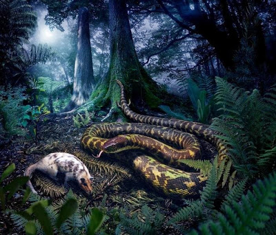
This is a reconstruction of the ancestral crown-group snake, based on this study. Artwork by Julius Csotonyi. Credit: Julius Csotonyi
Snakes have long captured the human imagination. Their instantly recognizable slithering bodies, flickering tongues, and fearsome reputations have rendered them icons of fascination and fear throughout human history.
The intrigue surrounding snakes has also attracted attention from the scientific community. Herpetologists have long debated the origin and evolution of snakes. Several major questions have shaped this debate, including whether snakes originated on land or in the seas, and whether snakes originated on the Mesozoic supercontinent of Gondwana or Laurasia. Additionally, scientists have wondered how, when, and why snakes became so diverse (living snakes comprise over 3,000 species).
Historically, these questions have been difficult to answer, due in no small part to a lack of informative snake fossils. Fossils are essential for reconstructing the evolutionary history of organisms. They are our only means of catching a glimpse, however brief and incomplete, of how life actually evolved on Earth. Summarily inferring the history of life with only living species would be simply impossible: after all, how would we ever have postulated the existence of dinosaurs if we had only their closest living relatives – birds – to work with?
Luckily, a host of significant fossil snakes have come to light over the last decade, which together reveal new insights into how and why modern snakes came to be. These include better-preserved, more complete specimens of previously known fossil snakes, as well as entirely new fossil taxa such as Kataria anisodonta and Sanajeh indicus.
Thanks to these recent paleontological advances, the stage was primed for addressing big questions about snake evolutionary history. We, along with our colleagues at Yale University, assembled the most comprehensive dataset to date combining genetic and anatomical data from living and fossil snakes. This dataset allowed us to evaluate the early evolutionary history of snakes using cutting edge computational techniques, in order to generate the first analytical reconstruction of the common ancestor of all snakes.
Our results strongly suggest that snakes originated on land, rather than in the seas, as the oldest snake fossils currently known – Coniophis, Najash, and Dinilysia – are all terrestrial.
As for whether snakes evolved on Gondwana or Laurasia, our results suggest an intriguing possibility: while the most recent common ancestor of living snakes likely originated in the southern hemisphere around 100 million years ago, the most recent common ancestor of all animals, living or extinct, that is more closely related to living snakes than to any other group may have inhabited Laurasia around 128 million years ago. (Laurasia is the Mesozoic supercontinent made up of the land masses that we call North America, Europe, and Asia today).
Based on the results of our study, we are developing a picture of how these ancestral snakes would have lived and behaved alongside the dinosaurs during the Cretaceous period.
They likely lived in warm, well-watered, well-vegetated environments – not unlike today’s forests, although the composition of plants and animals in these environments would have been entirely different from what we see today.
The ancestral snakes were also nocturnal in their habits, widely foraging for soft-bodied prey that were about the same size as their heads – for instance, small mammals such as Yanoconodon, as depicted in the painting by Julius Csotonyi accompanying our study. Unlike modern snakes such as the boa constrictor, the ancestral snake had yet to evolve the ability to manipulate prey items much larger than its head, and could not yet constrict its prey.
Snakes were around during the latter portion of the age of dinosaurs, which means that they, too, experienced the catastrophic bolide impact that marked the end of the Mesozoic era, resulting in the complete extinction of non-avian dinosaurs.
However, our results suggest that snakes actually did quite well for themselves in the wake of this extinction event: henophidian snakes – which comprise the lion’s share of snake diversity today – seem to undergo a major and extensive radiation following the extinction event.
Most likely, the ancestors of modern henophidian snakes were able to take advantage of the relatively empty landscape left behind by the dinosaurs. They had free reign to fill up whatever empty niches they could, just as mammals did, after the demise of the formerly ecologically dominant dinosaurs.
We now have a much clearer picture of the early evolutionary history of snakes, both in terms of how and when they became so diverse, and how they behaved and flourished during the Mesozoic. Of course, as with any field of science, there’s always more to know. As paleontologists, we always hope for future exciting fossil discoveries that will shed even more light on the evolution of these fascinating organisms.
Reference:
Allison Y Hsiang, Daniel J Field, Timothy H Webster, Adam DB Behlke, Matthew B Davis, Rachel A Racicot, Jacques A Gauthier. The origin of snakes: revealing the ecology, behavior, and evolutionary history of early snakes using genomics, phenomics, and the fossil record. BMC Evolutionary Biology, 2015; 15 (1) DOI: 10.1186/s12862-015-0358-5
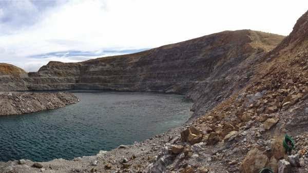
Golden Bar pit where samples were collected. Credit: Siyu Hu
Modern science is shining light on Jurassic rock, associating the organic remains of ancient bacteria with an increased likelihood of striking gold.
Curtin University researcher Siyu Hu has discovered a link between million-year-old rocks containing certain types of organic matter and the prehistoric deposition of gold.
In her work, Ms Hu combined traditional techniques—such as optical microscopy and scanning electron microscopy—with a technique called Raman spectroscopy, which can map the way different types of organic matter reflect laser light.
It works by associating tiny changes in the frequency of reflected light with molecular differences in matter.
Ms Hu gathered her samples from New Zealand’s largest gold mine, the Macraes mine in Otago, which contains a grab-bag of rock types created by exposure to different temperatures and pressures, all formed in a melting pot up to eight kilometres beneath the Earth’s surface.
“These rocks were metamorphosed in the Jurassic, several hundred million years ago, and they’ve been uplifted by the Earth’s movement, so they lift up and explode onto the surface,” Ms Hu says.
With this rock, Ms Hu says, comes two types of gold:
“The first is gold captured in quartz veins…this is very common, because gold is always transported by fluid and then deposits, mostly in quartz veins,” she says.
“The second kind is more interesting, because the gold is captured in graphitic rock in the host rock, which means there are no veins.”
Ms Hu found this second kind of gold often coexists with organic matter.
“The host rock contained a lot of organic matter, and probably, when the gold fluid passed through this area millions of years ago, this organic matter very slowly trapped the gold.”
Organic alchemy at work
Ms Hu’s work identified four types of organic matter in host rock samples from Macraes, each typified by characteristic Raman spectra and associated with rock created at a particular temperature.
Two of these types—Type 1 and Type 4—coexisted with gold-bearing sulfide minerals, indicating they may have played a role in forming the gold deposit.
While the origin of Type 4 is at yet unknown, Ms Hu associates Type 1 with ancient bacteria, suggesting the action of sulphide-reducing bacteria may have helped extract or adsorb gold, concentrating it for future reaction into gold and sulphide mineral deposits.
Ms Hu is continuing to investigate the link between Types 1 and 4 organic matter and the presence of gold.
Predictions of where planes can safely fly following volcanic eruptions could be improved, thanks to fresh discoveries about ash clouds.
To study the size of ash grains and how far they can travel, scientists at the Met Office and the Universities of Leeds, Edinburgh and Iceland, compared grains recovered from recent Icelandic eruptions – including samples recovered in Yorkshire – with satellite measurements of ash clouds.
Their findings, published today in Atmospheric Measurement Techniques, will help to improve methods of mapping ash concentration in order to identify zones where it is safe to fly during future eruptions.
Hundreds of flights were cancelled in 2010 and 2011 following volcanic activity in Iceland because of the danger that volcanic ash posed to aircraft and their engines.
In the new study, researchers studied volcanic ash recovered in the UK from the recent Eyjafjallajökull and Grímsvötn eruptions, as well as prehistoric samples from peat bogs in Yorkshire, Scotland and Ireland. Another sample, from an 1875 eruption, had been in a museum for 140 years.
The researchers found that grains were much larger than what had been typically estimated by satellite measurements of ash clouds – even moderately-sized eruptions could disperse large grains as far as the UK.
Study co-author Dr Graeme Swindles, from the School of Geography at the University of Leeds, said: “Microscopic volcanic ash layers preserved in Yorkshire peat bogs and mud at the bottom of lakes, far from volcanoes, are providing much needed information on the characteristics of ash clouds. These records show us that Europe was hit by volcanic ash clouds very frequently in the past.”
The group also used computer models to simulate how clouds of various ash particle sizes would appear to satellite sensors. They found that sensors can underestimate the size of larger particles.
Dr John Stevenson, from the University of Edinburgh, who led the study, said: “Mapping volcanic ash clouds and their risk to aircraft is hard. Large regions of airspace can be contaminated by particles that are invisible to the naked eye. Combining the expertise of volcanologists and atmospheric scientists should help improve forecasts.”
Reference:
“Big grains go far: understanding the discrepancy between tephrochronology and satellite infrared measurements of volcanic ash.” Atmos. Meas. Tech., 8, 2069-2091, 2015 DOI: 10.5194/amt-8-2069-2015
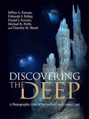
“Discovering the Deep” is now available for pre-order.
A University of Washington oceanographer has helped create the first full-color photographic atlas of the ocean floor. “Discovering the Deep: A Photographic Atlas of the Seafloor and Ocean Crust” (Cambridge University Press, 2015) was almost a decade in the making and contains more than 500 original illustrations and color photos, and access to online educational resources and high-definition videos.
Its pages contain a history of deep-sea science and a global tour of the volcanoes, hot springs, rocks and animals that exist in extreme environments in the ocean depths.
“This book lets people see parts of the Earth that most of them have never seen or thought about before, and the processes that form fundamental parts of our planet—and it does it in a very illustrative way,” said co-lead author Deborah Kelley, a professor in the UW School of Oceanography.
The book comes with endorsements from ocean explorer Robert Ballard; Kathy Sullivan, the head administrator of the National Oceanic and Atmospheric Administration; and filmmaker James Cameron.
“This is the book I wish I’d had on my eight deep-ocean expeditions, to better understand the wonders I was gazing upon,” Cameron writes. He calls it “a must-own for anyone in the ocean sciences, and for those simply curious about what lies down there in the most remote realm on our planet.”
The book covers the history of exploration of the deep sea, and the geology and biology of the roughly 40,000-mile mountain chain of underwater volcanoes that cross the world’s oceans.
Kelley was lead author of the chapter on hydrothermal vents, including the black smokers venting metal-rich fluids of more than 700 F that she has studied for decades. Local examples include the Endeavour vent fields and Axial Seamount, off the Pacific Northwest coast.
Also described is the Lost City vent field, a completely distinct type of hot spring environment in the Atlantic Ocean that Kelley helped discover in 2000. There, limestone chimneys tower 180 feet above the seafloor hosting bizarre lifeforms she and her students have since studied.
“The life in these systems is very diverse, and in many ways we’ve just touched the tip of what’s down there,” Kelley said.
Other authors are Jeffrey Karson of Syracuse University, Michael Perfit of the University of Florida, and Daniel Fornari and Timothy Shank of Woods Hole Oceanographic Institution.
A veteran of the deep sea, Kelley has traveled to the seafloor more than 50 times to depths of more than 2 miles (4 kilometers) in the specialized submersible called Alvin, built to protect passengers from the bone-crushing pressures and near-freezing temperatures of the abyss.
She has seen ocean imaging technology evolve from grainy images to the high-definition photos contained in the book, and the HD video available on an accompanying website.
“When I was first going to sea, we were still using 35 mm cameras, and one of my first jobs at sea was processing film on a rolling ship,” Kelley said. “Where we are now, the technology is exponentially increasing.”
Kelley is part of a current National Science Foundation project that recently wired the largest underwater volcano off Washington’s coast and surrounding areas of the seafloor. More than 100 instruments will use Internet and high-voltage power to observe these dynamic environments in real time.
The entire ocean circulates through the seafloor every 8 to 10 million years, and so the seafloor composition is closely connected to the waters above.
It is not yet known how volcanic eruptions on the seafloor affect the life and chemistry of the oceans, and how the biological communities of the deep sea originate and evolve. The unexpected discovery of life on seafloor volcanoes, that survive off toxic gases instead of sunlight, has raised questions that have yet to be answered.
“These systems have really changed how we think about the oceans, and life on Earth and on other planets,” Kelley said.
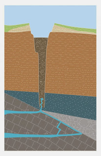
This shows the scheme of Crazy Crater. Credit: ETH Zurich / based on Reusch et al. 2015
Anna Reusch, a doctoral student at ETH’s Geological Institute, was utterly amazed one morning: during a routine measuring run with her research vessel on Lake Neuchâtel, she suddenly saw an unusual shape on the control panel screen. Beneath the boat, at a depth of over 100 metres, had to be something no one had ever seen before. She immediately informed her professor, Michael Strasser: “We’ve found something that you absolutely have to see.”
An initial rough data analysis on board indicated that Reusch and her colleagues were looking at a scientific sensation: an enormous crater, measuring 10 metres deep and 160 metres in diameter. “I’ll remember this day for a long time – I never expected anything like this,” recalls Reusch, adding: “It just goes to show that even in the 21st century, there are still thrilling and exciting discoveries to be made in Switzerland!”
Searching for signs of earthquakes
Reusch made this discovery as part of “Dynamite,” a project sponsored by the Swiss National Science Foundation. The objective of her subproject is to investigate the sediment in the lakes on the western Swiss Plateau for traces of past earthquakes. Her work involves taking high-resolution measurements of the floor of Lake Neuchâtel to find evidence of tectonically active zones that could trigger major earthquakes. The period Reusch is looking at is geologically speaking very recent: sometime in the past 12,000 years.
But the discovery of the enormous crater and subsequently of other similar structures has turned her doctoral dissertation almost completely upside down. “The craters were so interesting that we simply had to take a closer look at this phenomenon,” she explained.
Four lake craters
All in all, the research team located four craters on the lake bed. All are off the northwest shore at a depth of over 100 metres, with most of them in an area extending from known tectonic fault zones. The researchers have described the four craters in a paper that was recently published in Geophysical Research Letters.
The craters measure 80 to 160 metres in diameter and between 5.5 and 30 metres in depth. Researchers nicknamed the largest of them “Crazy Crater”, not just because of its uncommonly generous proportions, but also because of its unusual shape: whereas comparable structures on the ocean floor usually lose their shape through the action of currents, this one is perfectly round.
Filled with mud
At the foot of the 10-metre-deep Crazy Crater, the researchers were able to make out a mud covering. Beneath it lies a 60-metre-deep vent, filled with a thick suspension of water and sediment. The team was unable to take core samples because the material was too fluid, due to water welling up into the vent from below. This keeps the sediments in the vent in motion, ensuring that they can’t settle into a solid state as normal lake sediment does.
By measuring the isotope fingerprint plus the temperature of the water, suspension and sediment, the scientists were able to show that it was water flowing up into these craters as opposed to, say, gas. Whilst the suspension had a temperature of 8.4 degrees Celsius, both the deep water and the sediment surrounding the crater measured just 5.8 degrees. This corresponds to the normal temperature of the water at that depth in these lakes. By contrast, the temperature of the suspension is comparable to that of the surface water in the bordering karst area.
The suspension inside the vent also contains a smaller proportion of the heavy oxygen-18 isotope than does the surrounding lake water. “The difference in these oxygen signals indicates that we’re talking about two distinct bodies of water here,” says Reusch.
Gigantic spring
For this reason, Reusch believes it is most likely that the craters are linked to the karst systems of the neighbouring Jura Mountains. Water there seeps underground, flows beneath the bed of Lake Neuchâtel and seeks out the path of least resistance up to the surface. That takes the water up through sediment layers over several tens of metres thick that have been deposited on the lake bed over the millennia. “In other words, these craters are in fact springs,” explains Reusch.
Furthermore, the researchers were able to use sediment core samples taken from the area directly surrounding the craters to show that the suspension spills over the lip of the crater from time to time, similar to a volcanic eruption. This has happened at least four times over the past 12,000 years – and yet despite today’s active water flow, it has been more than 1,600 years since Crazy Crater discharged any sediment on the crater levee. Exactly what triggers these eruptions still needs to be investigated. “Researching the dynamics of the craters requires long-term monitoring to keep an eye on the water level of the suspension in the crater,” says Reusch.
Explorer fever
All of the craters explored so far lie 100 metres or more beneath the lake’s surface. Reusch cannot say whether or not there are similar “pockmarks” in the shallows, as she has used sonar to sound only the deep parts of Lake Neuchâtel (30 metres and deeper). The shallow zones have not yet been mapped.
When taking measurements in the lakes, the researchers use a sophisticated multibeam echo sounder, a device used primarily for surveying the ocean floor. Depending on the water depth and the angle of the beams, the device achieves a resolution of up to 20×20 centimetres. At the moment, the sounder has plenty to do: the floor of Switzerland’s lakes remains relatively poorly researched in comparison to the terrain on land. Researchers began examining the bottom of many Swiss lakes with high-resolution methods only a few years ago, and have discovered phenomena in their depths that no one suspected even existed.
Reference:
Reusch A, Loher M, Bouffard D, Moernaut J, Hellmich F, Anselmetti FS, Bernasconi SM, Hilbe M, Kopf A, Lilley MD, Meinecke G, Strasser M: Giant lacustrine pockmarks with subaqueous groundwater discharge and subsurface sediment mobilization, Geophysical Research Letters, 13 May 2015. DOI:10.1002/2015GL064179
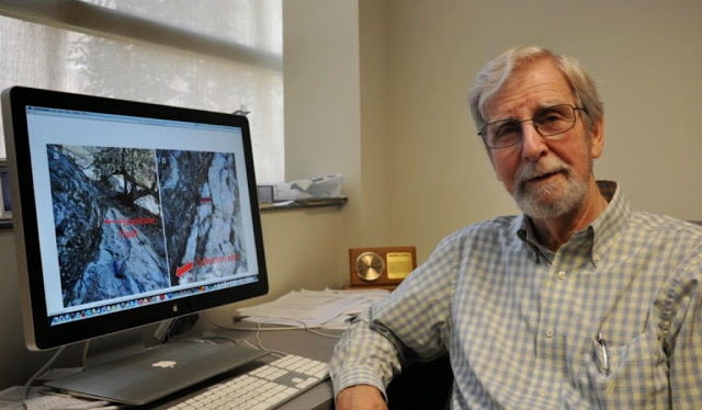
Deep-earthquake expert Harry W. Green II is a distinguished professor of the Graduate Division in UC Riverside’s Department of Earth Sciences. Credit: I. Pittalwala, UC Riverside.
Earthquakes are labeled “shallow” if they occur at less than 50 kilometers depth. They are labeled “deep” if they occur at 300-700 kilometers depth. When slippage occurs during these earthquakes, the faults weaken. How this fault weakening takes place is central to understanding earthquake sliding.
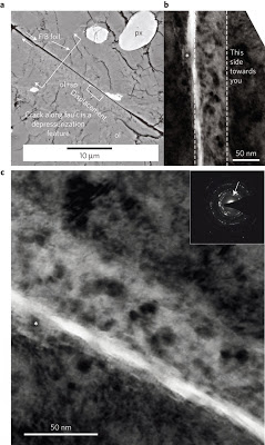
A new study published online in Nature Geoscience today by a research team led by University of California, Riverside geologists now reports that a universal sliding mechanism operates for earthquakes of all depths — from the deep ones all the way up to the crustal ones.
“Although shallow earthquakes — the kind that threaten California — must initiate differently from the very deep ones, our new work shows that, once started, they both slide by the same physics,” said deep-earthquake expert Harry W. Green II, a distinguished professor of the Graduate Division in UC Riverside’s Department of Earth Sciences, who led the research project. “Our research paper presents a new, unifying model of how earthquakes work. Our results provide a more accurate understanding of what happens during earthquake sliding that can lead to better computer models and could lead to better predictions of seismic shaking danger.”
The physics of the sliding is the self-lubrication of the earthquake fault by flow of a new material consisting of tiny new crystals, the study reports. Both shallow earthquakes and deep ones involve phase transformations of rocks that produce tiny crystals of new phases on which sliding occurs.
“Other researchers have suggested that fluids are present in the fault zones or generated there,” Green said. “Our study shows fluids are not necessary for fault weakening. As earthquakes get started, local extreme heating takes place in the fault zone. The result of that heating in shallow earthquakes is to initiate reactions like the ones that take place in deep earthquakes so they both end up lubricated in the same way.”
Green explained that at 300-700 kilometers depth, the pressure and temperature are so high that rocks in this deep interior of the planet cannot break by the brittle processes seen on Earth’s surface. In the case of shallow earthquakes, stresses on the fault increase slowly in response to slow movement of tectonic plates, with sliding beginning when these stresses exceed static friction. While deep earthquakes also get started in response to increasing stresses, the rocks there flow rather than break, except under special conditions.
“Those special conditions of temperature and pressure induce minerals in the rock to break down to other minerals, and in the process of this phase transformation a fault can form and suddenly move, radiating the shaking — just like at shallow depths,” Green said.
The research explains why large faults like the San Andreas Fault in California do not have a heat-flow anomaly around them. Were shallow earthquakes to slide by the grinding and crunching of rock, as geologists once imagined, the process would generate enough heat so that major faults like the San Andreas would be a little warmer along their length than they would be otherwise.
“But such a predicted warm region along such faults has never been found,” Green said. “The logical conclusion is that the fault must move more easily than we thought. Extreme heating in a very thin zone along the fault produces the very weak lubricant. The volume of material that is heated is very small and survives for a very short time — seconds, perhaps — followed by very little heat generation during sliding because the lubricant is very weak.”
The new research also explains why faults with glass on them (reflecting the fact that during the earthquake the fault zone melted) are rare. As shallow earthquakes start, the temperature rises locally until it is hot enough to start a chemical reaction — usually the breakdown of clays or carbonates or other hydrous phases in the fault zone. The reactions that break down the clays or carbonates stop the temperature from climbing higher, with heat being used up in the reactions that produce the nanocrystalline lubricant.
If the fault zone does not have hydrous phases or carbonates, the sudden heating that begins when sliding starts raises the local temperature on the fault all the way to the melting temperature of the rock. In such cases, the melt behaves like a lubricant and the sliding surface ends up covered with melt (that would quench to a glass) instead of the nanocrystalline lubricant.
“The reason this does not happen often, that is, the reason we do not see lots of faults with glass on them, is that the Earth’s crust is made up to a large degree of hydrous and carbonate phases, and even the rocks that don’t have such phases usually have feldspars that get crushed up in the fault zone,” Green explained. “The feldspars will ‘rot’ to clays during the hundred years or so between earthquakes as water moves along the fault zone. In that case, when the next earthquake comes, the fault zone is ready with clays and other phases that can break down, and the process repeats itself.”
The research involved the study of laboratory earthquakes — high-pressure earthquakes as well as high-speed ones — using electron microscopy in friction and faulting experiments. It was Green’s laboratory that first conducted a serendipitous series of experiments, in 1989, on the right kind of mantle rocks that give geologists insight into how deep earthquakes work. In the new work, Green and his team also investigated the Punchbowl Fault, an ancestral branch of the San Andreas Fault that has been exhumed by erosion from several kilometers depth, and found nanometric materials within the fault — as predicted by their model.
Video
Reference:
H. W. Green Ii, F. Shi, K. Bozhilov, G. Xia & Z. Reches. Phase transformation and nanometric flow cause extreme weakening during fault slip. Nature Geoscience, 2015 DOI: 10.1038/ngeo2436
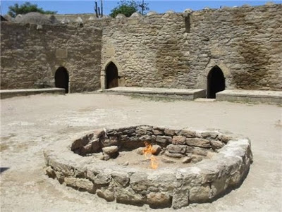
The “eternal flame” at the Zoroastrian Ateshgah “Fire Temple” near Baku, Azerbaijan. The temple was built over natural burning seeps that are today extinct. The flame in the photo is now artificially fed via a gas pipe. Active natural flames are instead found at Yanardag, located approximately 9 km NE. Credit: Guisepe Etiope
Gas and oil seeps have been part of religious and cultural practices for thousands of years.
Seeps from which gas and oil escape were formative to many ancient cultures and societies. They gave rise to legends surrounding the Delphi Oracle, Chimaera fires and “eternal flames” that were central to ancient religious practices – from Indonesia and Iran to Italy and Azerbaijan. Modern geologists and oil and gas explorers can learn much by delving into the geomythological stories about the religious and social practices of the Ancient World, writes Guiseppe Etiope of the National Institute of Geophysics and Volcanology in Italy. His research is published in the new Springer book Natural Gas Seepage.
“Knowing present-day gas fluxes from a seep and knowing that a seep was active and vigorous two thousand years ago, we can estimate the total amount of gas that has been released to the atmosphere thus far. What can be measured today is probably also valid, at least in terms of orders of magnitude, for the past,” writes Etiope. “Such information may not only be relevant for atmospheric methane budget studies but may also be important for understanding the leaking potential of petroleum systems, whether they are commercial or not.”
Gas-oil seeps have been the source of mythological tales, and many a Biblical and historic event. The observations of ancient naturalists and historians such as Pliny the Elder, who lived two millennia ago, helped to chronicle many of these occurrences, especially in the Mediterranean area. For example, he wrote about Chimaera, a large burning gas seep in modern day Turkey.. In ancient times, the temple of Hephaestus, the Greek god of fire, was built next to it.
Similar “eternal fires” integrated gas and flame emissions into ancient religious practices in many cultures. For instance, the Zoroastrians worshiped the “Pillars of Fire” near modern Baku in Azerbaijan. In Iraq, the Baba Gurgur seep was probably the “burning fiery furnace” into which King Nebuchadnezzar cast the Jews. A legend of ancient Rome reports a stream of crude oil issuing from the ground around 38 BC. It became a meeting spot for the first Roman converts to Christianity, and is now the site for the Basilica of Santa Maria in Trastevere. The sacred Manggarmas flame in Indonesia, which has been active at least since the 15th century, is still used in an annual Buddhist ceremony.
“Knowing that a certain ‘eternal fire’ observed today was already active in Biblical times indicates that it was not triggered by the recent drilling and production of petroleum,” adds Etiope.
Etiope writes that hydrocarbon seeps also influenced the social and technological development of many ancient populations. It not only contributed to global civilization, but was often the source of wars. The first evidence for petroleum usage comes from Syria, where the Neanderthal used natural bitumen on stone tools some 40,000 years ago.
Reference:
Giuseppe Etiope. Seeps in the Ancient World: Myths, Religions, and Social Development. Natural Gas Seepage, 2015 DOI: 10.1007/978-3-319-14601-0_9
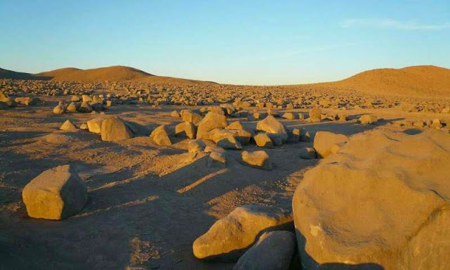
María Elena South: Mars on Earth in the Atacama Desert, Chile. Credit: Armando Azua-Bustos
Researchers have pinpointed the driest location on Earth in the Atacama Desert, a region in Chile already recognised as the most arid in the world. They have also found evidence of life at the site, a discovery that could have far-reaching implications for the search for life on Mars.
For more than a decade, the Yungay region has been established as the driest area of the hyper-arid Atacama desert, with conditions close to the so-called “dry limit” for life on Earth. Several academic papers have been published reporting on the extraordinary characteristics of the site and its relevance to astrobiologists as an analogue of conditions on Mars. However, following a more systematic search of the desert, a Chilean research team has now found a new site, María Elena South (MES), which it describes as “much drier” than Yungay.
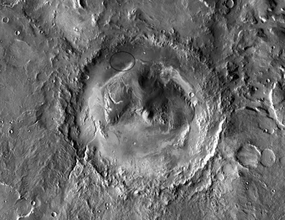
Lead author Armando Azua-Bustos, an environmental biologist and research scientist at the Blue Marble Space Institute of Science in Seattle, says the team discovered that MES has a mean atmospheric relative humidity (RH) of 17.3 percent and a soil RH of a constant 14 percent at a depth of one meter. This soil value matches the lowest RH measurements taken by the Mars Science Laboratory at Gale Crater on Mars, establishing the fact that conditions at the site are as dry as those found recently on the Martian surface.
“Remarkably, we found a number of viable bacterial species in the soil profile at MES using a combination of molecular dependent and independent methods, unveiling the presence of life in the driest place on the Atacama Desert reported to date,” Azua-Bustos says.
Microsensors
The team used microsensors, including atmospheric temperature and relative humidity loggers, to take detailed measurements of the microenvironmental conditions at the MES site. It also characterized the geochemical composition of the soils at the site to unveil the presence and type of microbial species able to survive under these conditions. The results are presented in the paper, “Discovery and microbial content of the driest site of the hyperarid Atacama Desert, Chile,” published in March in the journal Environmental Microbiology Reports.
Azua-Bustos has spent the last 12 years studying the Atacama Desert and developing the field of astrobiology in Chile, and in so doing earned the nickname “astrobiologist of the desert.” He first became interested in the region after reading what he describes as a “pivotal paper” published in the journal Science in 2003 by a research team led by Chris McKay, a planetary scientist at NASA Ames Research Center.
The paper proposed the Yungay region in the Atacama as a “pertinent Mars analogue model,” mainly due to its extreme dryness, the characteristics of its soils, the presence of organic species at trace levels and extremely low levels of culturable bacteria.
However, based on his experience as a native of the Atacama who was born and raised in the desert, Azua-Bustos was convinced that there were drier places than Yungay, so he decided to set RH sensors in several places that were potentially drier.
“We found at least three such places, the driest of which we describe in this paper,” he says.
Implications for Astrobiology
For Azua-Bustos, the fact that the conditions at MES site, in terms of dryness, are the closest to Mars as it is possible to get means that it is one of the best analogue models on Earth to understand and investigate the potential existence, and type of, microbial life in the Martian subsurface.
“This also implies that if you want to test the next generation of robots, instruments and other detection techniques and technologies in a Mars-like environment, this is one of the best you can find as it possesses many of the key characteristics that you will find on the Red Planet,” he says.
The site could also be used to conduct experiments that might inform future work carried out by the Mars Science Laboratory (MSL) at Gale Crater in its search for extant life on Mars. In Azua-Bustos’ view, one interesting experiment would be to test the same instruments being used by MSL at the MES site to compare results with the Martian data and to “further detail how similar both sites may be in terms of habitability, having the advantage of this new site in the Atacama as a positive control.”
For Azua-Bustos, the fact that we already know that there is life in the soil at María Elena South means that it would also be interesting to test if the sample analysis at Mars (SAM) instrument (a suite of three instruments, including a mass spectrometer, gas chromatograph, and tuneable laser spectrometer carried onboard the MSL rover), as well as similar detection instruments scheduled to be sent to Mars, are also able to detect life at a similarly dry terrestrial site.
“[K]nowing the amount, location in the subsoil and type of microbial life present in María Elena South, it would be of interest to test the SAM instruments here, in order to test its sensitivity in a site which you know is inhabited. In other words, if SAM or any other instrument were not able to detect life in Maria Elena soils, one could argue that SAM would not be sensitive enough to detect life on Mars,” he adds.
Reference:
“Mars-like soils in the Atacama Desert, Chile, and the dry limit of microbial life.” Science. 2003 Nov 7;302(5647):1018-21. www.ncbi.nlm.nih.gov/pubmed/14605363
“Discovery and microbial content of the driest site of the hyperarid Atacama Desert, Chile.” Environmental Microbiology Reports, 7: 388–394. DOI: 10.1111/1758-2229.12261
Note : The above story is based on materials provided by Astrobio.net. This story is republished courtesy of NASA’s Astrobiology Magazine. Explore the Earth and beyond at www.astrobio.net.
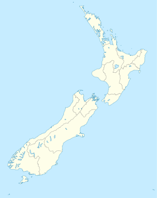
Researchers have uncovered the first geologic evidence that New Zealand’s southern Hikurangi margin can rupture during large earthquakes. The two earthquakes took place within the last 1000 years, and one was accompanied by a tsunami, according to the study published in the Bulletin of the Seimological Society of America (BSSA).
The earthquakes took place roughly 350 years apart, according to the analysis by Kate Clark of GNS Science and colleagues. This may mean that the time between large earthquakes in this region is shorter than scientists have thought. The current seismic models account for these types of earthquakes every 500 to 1000 years.
A worst-case, M8.9 Hikurangi earthquake could cause about 3350 deaths and 7000 injuries, and lead to $13 billion in costs in New Zealand’s capital Wellington alone, according to a calculation made in 2013 by a different set of scientists. The Hikurangi margin marks the area where the Pacific and Australian tectonic plates collide to the east of New Zealand. The margin is one of the few places around the Pacific where a major subduction interface earthquake—which occurs deep in the crust where one plate is thrust under another—has not occurred in historic times.
However, “subduction earthquakes are not a ‘new’ risk for New Zealand, as we have always assumed they can occur, and they are accounted for in our seismic hazard models,” Clark said. “This study is significant in that it confirms that risk.
“We have a record of three to five past earthquakes on most of the major upper plate faults in the [New Zealand] lower North Island and upper South Island, but there was previously no evidence of past subduction earthquakes on the southern Hikurangi margin,” Clark explained. “Subduction earthquakes have the potential to be significantly larger in magnitude than upper plate fault ruptures, affect a much larger spatial area and are much more likely to trigger tsunami.”
To look for evidence of past earthquakes on the margin, the researchers performed a painstaking examination of the geologic layers contained within a salt marsh at Big Lagoon in the southeastern Wairau River valley on South Island. They analyzed cores drilled from the marsh to look at differences in the kinds of sediment and the shells from tiny marine animals called foraminifera, deposited throughout a stretch of the lagoon’s history.
These data revealed that the lagoon sank relatively suddenly twice during the past 1000 years, suggesting that the land was subsiding as a result of significant earthquakes. The more recent earthquake occurred between 520 and 470 years ago.
Another earlier earthquake probably took place between 880 and 800 years ago. Judging by the sedimentary debris found at that time, this earthquake was accompanied by a tsunami that swept more than 360 meters inland at the study site.
Clark said the findings will help researchers better understand the risks posed by large subduction interface earthquakes in the region. Studies have shown, for example, that there have been subduction earthquakes on the central Hikurangi margin, “and we wanted to understand if the central and southern Hikurangi margins are likely to rupture in the same earthquake,” said Clark.
“We can see that the [southern Hikurangi margin] subduction earthquake at about 500 years before present possibly correlates with a central Hikurangi margin earthquake, implying both segments may have ruptured in the same earthquake,” she continued, “but the radiocarbon dating is not yet precise enough to be certain—possibly there were two earthquake closely spaced in time.”
Clark said that she and other scientists are looking at other locations in the lower North Island to find evidence of the same paleoearthquakes, which could help provide a better picture of how big these quakes might have been and how they impacted the region.
“In addition we would like to go further back in time and find evidence of older subduction earthquakes,” Clark said.”With a longer record of past subduction earthquakes we can get a better constraint on the recurrence of such earthquakes, which will help to forecast future subduction earthquakes.”
Figure 3: Fault in Mg2GeO4 olivine (1.3 GPa, 1,200 K).
A University of Oklahoma structural geologist and collaborators are studying earthquake instability and the mechanisms associated with fault weakening during slip. The mechanism of this weakening is central to understanding earthquake sliding.
Ze’ev Reches, professor in the OU School of Geology and Geophysics, is using electron microscopy to examine velocity and temperature in two key observations: (1) a high-speed friction experiment on carbonate at conditions of shallow earthquakes, and (2) a high-pressure/high-temperature faulting experiment at conditions of very deep earthquakes.
Reches and his collaborators have shown phase transformation and the formation of nano-size (millionth of a millimeter) grains are associated with profound weakening and that fluid is not necessary for such weakening. If this mechanism operates in major earthquakes, it resolves two major conflicts between laboratory results and natural faulting–lack of a thermal zone around major faults and the rarity of glassy rocks along faults.
Image Caption (Fig3):
a, Backscatter SEM image of polished section shows the sense of shear, displacement and location of FIB-cut foil. White, MgGeO3 pyroxene (px); mottled regions, (ol+sp) partially transformed before faulting. b, TEM image of FIB cross-section. Fault zone (dashed lines) ~70 nm thick, grain size ≤15 nm. Wall rock both sides of the fault (black) is single large, deformed olivine crystal oriented for strong diffraction. c, Detail of b tilted to a slightly different orientation, showing fault boundaries. Diffraction pattern (inset) shows olivine from the fault wall (arrow) and rings of spinel. Asterisks in b,c identify the same location.
Reference:
Reches co-authored the study with H.W. Green II, University of California, Riverside; F. Shi, China University of Geosciences; K. Bozhilov, University of California, Riverside; and G. Xia, University of Queensland. A paper on this study, “Phase transformation and nanometric flow cause extreme weakening during fault slip,”. DOI: 10.1038/ngeo2436
The newly-created Nishinoshima island at the Ogasawara island chain, 1,000 kilometres south of Tokyo, pictured on March 25, 2015
A brand new island emerging off the coast of Japan offers scientists a rare opportunity to study how life begins to colonise barren land—helped by rotting bird poo and hatchling vomit.
Researchers say bird waste will be the secret ingredient to kickstart Mother Nature’s grand experiment on what is a still active volcano that only poked its head above the waves in November 2013.
That speck of land, some 1,000 kilometres (620 miles) south of Tokyo, has grown to engulf its once larger neighbour, Nishinoshima, a part of Japan’s Ogasawara island chain known for the wealth and variety of its ecosystem.
The new Nishinoshima, a respectable 2.46 square kilometres (0.95 square miles), the Japan Coast Guard said in February—roughly the size of 345 football pitches—is currently almost all bare rock, formed from cooling lava.
But scientists say it will one day be humming with plant—and possibly animal—life, as nature moves in to what is being called a “natural laboratory” on one of the latest bits of real estate in the Pacific Ocean.
“We biologists are very much focusing on the new island because we’ll be able to observe the starting point of evolutionary processes,” said Naoki Kachi, professor and leader of Tokyo Metropolitan University’s Ogasawara Research Committee.
After the volcanic activity calms down, “what will probably happen first will be the arrival of plants brought by ocean currents and attached to birds’ feet,” he said.
Those seabirds, who could use the remote rock as a temporary resting place, could eventually set up home there.
Their excreta—along with their dropped feathers, regurgitated bits of food and rotting corpses—will eventually form a nutrient-rich soil that offers fertile ground for seeds carried by the wind, or brought in the digestive systems of overflying birds.
“I am most interested in the effects of birds on the plants’ ecosystem—how their bodily wastes-turned-organic fertilisers enrich the vegetation and how their activities disturb it,” Kachi told AFP.
The old Nishinoshima, measuring just 0.22 square kilometres, was home to bird colonies until the eruptions scared the creatures away.
A small number have clung on to the only patch of the old island that is still visible, making their nests among ash-covered plants.
Pristine
Japan, which sits at the junction of several tectonic plates, is home to more than 100 active volcanoes.
Scientists have no idea when Nishinoshima will stop spewing lava, but its expansion is being offset by erosion around the edges.
The island is expected to follow a route laid out by Surtsey, an island that emerged from the sea in 1963, around 30 kilometres from the coast of Iceland.
The UN Educational, Scientific and Cultural Organization (UNESCO) World Heritage spot is known globally as an outstanding example of a pristine natural laboratory where researchers have been able to trace the evolution of a habitat.
“Since they began studying the island in 1964, scientists have observed the arrival of seeds carried by ocean currents, the appearance of moulds, bacteria and fungi, followed in 1965 by the first vascular plant,” UNESCO says on its website.
“By 2004, (vascular plants) numbered 60, together with 75 bryophytes, 71 lichens and 24 fungi. Eighty-nine species of birds have been recorded on Surtsey, 57 of which breed elsewhere in Iceland. The 141 hectare island is also home to 335 species of invertebrates.”
Not bad for somewhere that has only existed for half a century.
Nishinoshima might not be quite as quick as Surtsey to establish itself as a teeming wildlife haven—it is a long way from mainland Japan and not too close to its neighbours in the Ogasawara island chain, which limits the number of species of birds and seeds that will make it that far.
Nonetheless, it is an exciting blank canvas, said Kachi, and needs to be treated with respect—which means keeping out foreign invaders that would not naturally drift or fly in.
“I’d like to call on anyone who lands on the island to pay special attention to keeping it the way it is—not to take external species there,” he warned.
He said when he conducted a field study on another island in the chain in 2007, his team prepared a fumigated clean room where they packed all research equipment, after making sure everything they had was either brand new or scrupulously clean.
While Nishinoshima is currently only being monitored from the air, the first field researchers will need to take similar precautions.
“Biologists know the business, but probably the first batch of scientists who will land on the island will be geologists and vulcanologists—who may not be familiar with the problems,” he said.
“I’d be pleased to offer advice on this to scientists in other fields.”
Note : The above story is based on materials provided by AFP.
Gale crater, Mars. Flowing water appears to have carved channels in both the mound and the crater wall. (The Curiosity rover landed at the foot of a layered mountain within this massive crater.) Credit: Courtesy NASA/JPL-Caltech
Data collected on Mars by NASA’s Curiosity rover and analyzed by University of Arkansas researchers indicate that water, in the form of brine, may exist under certain conditions on the planet’s surface.
The finding, published in the May 2015 issue of the journal Nature Geoscience, is based on almost two years of weather data collected from an impact crater near the planet’s equatorial region. Vincent Chevrier, an assistant professor at the University of Arkansas Center for Space and Planetary Sciences, and Edgard G. Rivera-Valentin, a former Doctoral Academy Fellow at the center who is now a scientist at the Arecibo Observatory in Puerto Rico, were members of the team that analyzed the data as part of a grant from NASA.
“What we demonstrated is that under specific circumstances, for a few hours per day, you can have the right conditions to form liquid brines on the surface of Mars,” Chevrier said.
The existence of briny water may explain a phenomenon observed by Mars orbiters called “recurring slope lineae,” which are dark streaks on slopes that appear and grow during the planet’s warm season.
Water is also necessary for the existence of life as we know it, and on Earth, organisms adapt and thrive in extremely briny conditions. Chevrier, however, believes that conditions on Mars are too harsh to support life.
“If we combine observations with the thermodynamics of brine formation and the current knowledge about terrestrial organisms, is it possible to find a way for organisms to survive in Martian brines? My answer is no,” he said.
Mars is cold, extremely dry, and has 200 times lower atmospheric pressure than Earth. Any pure water on the surface would freeze or boil away in minutes. If it sounds alien for water to both freeze and boil, that’s because it is alien to Earth, but not so much for Mars because of the planet’s very low atmospheric pressure.
However, in 2008, NASA’s Phoenix lander identified perchlorate salts in polar soil samples. Perchlorates are rare on Earth, but they are known to absorb moisture from the atmosphere and lower the freezing temperature of water. The widespread existence of perchlorates makes liquid water possible on Mars.
The Curiosity rover confirmed the existence of perchlorates in equatorial soil, and provided detailed observations of relative humidity and ground temperature in all Martian seasons. With that data in hand, Chevrier and Rivera-Valentin were able to conclude that liquid brines can exist today on Mars. Future Mars missions could sample for the brines directly.
Though the briny water on Mars may not support life, it does have implications for future manned missions that would need to create life-sustaining resources such as water and oxygen on the planet, Chevrier said. There is also the possibility that life once existed on ancient Mars.
“We need to understand the earliest environment,” he added. “What was happening 4 billion years ago?”
Reference:
F. Javier Martín-Torres, María-Paz Zorzano, Patricia Valentín-Serrano, Ari-Matti Harri, Maria Genzer, Osku Kemppinen, Edgard G. Rivera-Valentin, Insoo Jun, James Wray, Morten Bo Madsen, Walter Goetz, Alfred S. McEwen, Craig Hardgrove, Nilton Renno, Vincent F. Chevrier, Michael Mischna, Rafael Navarro-González, Jesús Martínez-Frías, Pamela Conrad, Tim McConnochie, Charles Cockell, Gilles Berger, Ashwin R. Vasavada, Dawn Sumner, David Vaniman. Transient liquid water and water activity at Gale crater on Mars. Nature Geoscience, 2015; 8 (5): 357 DOI: 10.1038/ngeo2412