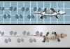
Antillothrix bones and skull are displayed. Credit: Journal of Human Evolution
An international team of scientists have dated a species of fossil monkey found across the Caribbean to just over 1 million years old.
The discovery was made after the researchers recovered a fossil tibia (shin bone) belonging to the species of extinct monkey Antillothrix bernensis from an underwater cave in Altagracia Province, Dominican Republic. The fossil was embedded in a limestone rock that was dated using the Uranium-series technique.
In a paper published this week in the well international journal, the Journal of Human Evolution, the team use three-dimensional geometric morphometrics to confirm that the fossil tibia does indeed belong to Antillothrix bernensis, a primate that we now know existed on Hispaniola relatively unchanged for over a million years. This monkey, roughly the size of a small cat, was tree-dwelling and lived largely on a diet of fruit and leaves.
Dr Helen Green of Melbourne University’s School of Earth Sciences, a lead researcher involved in the dating of the limestone surrounding the fossils, said the question of the age of primate fossils from this region has puzzled scientists since the days of Darwin and Wallace.
‘The presence of endemic new world monkeys on the Caribbean islands is one the great questions of bio-geography and our work on these fossils shows Antillothrix existed on Hispaniola relatively morphologically unchanged for over a million years. By establishing the age of these fossils we have changed the understanding of primate evolution in this region.’ said Dr Green.
At Brooklyn College, part of the City University New York, and Northeastern Illinois University researchers, Prof. Alfred Rosenberger and Dr Siobhán Cooke have been working in the Dominican Republic since 2009, searching for rare fossil remains of endemic mammals to investigate how these animals were adapted to their unique, island environments. ‘Very little was known about the native monkey from this island’ said Dr Cooke, ‘Prior to our discoveries in Altagracia we knew almost nothing even though this species was first described by Renato Rímoli back in 1977’.
To better understand how this primate was uniquely adapted to its environment, Dr. Melissa Tallman and her student Andrea Morrow, from the Grand Valley State University, used a specialized technique to model the three-dimensional shape of the monkey’s leg bone. This helped them to reconstruct how the small primate might have moved about in its environment and allowed the comparison of relatively young examples of Antillothrix bones to the newly discovered million year old specimens.
At the University of Melbourne, Dr Helen Green and Dr Robyn Pickering worked in the state of the art Isotope Chronology Laboratory in the School of Earth Sciences, where they measured the levels of uranium, thorium and lead present in the limestone rocks today using the results to calculate an age of 1.3+-0.11 million years.
Reference:
Alfred L. Rosenberger, Robyn Pickering, Helen Green, Siobhán B. Cooke, Melissa Tallman, Andrea Morrow, Renato Rímoli. 1.32 ± 0.11 Ma age for underwater remains constrain antiquity and longevity of the Dominican primate Antillothrix bernensis. Journal of Human Evolution, 2015; DOI: 10.1016/j.jhevol.2015.05.015
In this photo taken Saturday, Aug. 8, 2015 and released by the National Parks Service, a group of citizens digs for fossils at Petrified Forest National Park near Holbrook, Ariz. One of the amateur paleontologists discovered a jaw bone from a long-snouted fish that lived more than 220 million years ago. Credit: National Park Service via AP
Growing up, Stephanie Leco often would dig in her backyard and imagine finding fossils of a tyrannosaurus rex. She was fascinated with the idea of holding something in her hand that was millions of years old and would give her insight on how the world evolved.
Safe to say, she hit a paleontology jackpot this summer with the discovery of a jaw bone from a long-snouted fish at Petrified Forest known to exist more than 220 million years ago.
Leco was part of the first dig for citizens held last month at the national park near Holbrook that routinely turns up fossils from the dawning age of dinosaurs and has vast expanses of rainbow-colored desert.
The fossil about the size of a pinky fingernail was unearthed from the site of what was a lake or pond during the Late Triassic period when the fish were thought to be extinct in North America. Scientists knew closely related fish were present around the world in the Early Triassic period, about 10 million years earlier, but the fossils were found only in China in the Late Triassic, said park paleontologist Bill Parker.
“People who actually study this group of fish might start setting their sights in our direction now,” he said.
Leco was sifting through loose dirt on a barren hillside using her background in art to differentiate the colors, patterns and textures among bones, rocks and charcoal when she zoomed in on an area looking for smaller objects. She already had several small teeth in her collection and was marveling at the tibia of a plant lizard that another participant found before coming across the jaw bone. Not knowing what it was, she handed over the fossil that had broken teeth to Matt Smith, the park’s lead fossil preparer, and asked what it was.
“I don’t know, that’s why it’s cool,” he responded.
They wrapped up the jaw bone, placed it in a tin and took it to the lab, looking at it more closely under a microscope, she said. The park later emailed her to say it was a fish closely related to the genus Saurichthys.
“Okay, it wasn’t a T-Rex,” the Phoenix resident wrote in an email to The Associated Press. “But, honestly, I feel like this is much cooler!”
Leco, 26, said she’s since developed an even deeper fascination with paleontology and bought a couple of books on the Triassic period so that she can speak with authority about her find. The period, which started about 250 million years ago and lasted 50 million years, followed the largest extinction of life on Earth when the land mass was a single continent and had the first dinosaurs.
The full jaw of the fish would be about three to four times longer than the fossil Leco discovered, Parker said. He said other fossils of the fish might also be found on the East Coast and on the Colorado Plateau where similar rock is exposed.
Ben Kligman, a senior at the University of California, Berkley, has been studying the pond site preserved in a six-inch layer of rock. He plans to return to Petrified Forest next summer to look for a full fossil of the fish to determine whether or not it’s a new species. What he didn’t know before Leco found the jaw bone is that he already had smaller pieces of the fish that he couldn’t identify as such, he said.
“Although it’s probably a new species, we can’t say that it is yet because we don’t have enough specimens,” Kligman said.
Other citizens participating in the August digs found the vertebrae of a long-necked lizard first uncovered in the park last year and the teeth of a large carnivorous reptile, both considered rare in the park’s fossil record. Their names will accompany the collections at the park, which will use them to reconstruct the habitat of the pond and get a better idea of where the animals fell in the food chain, Parker said.
“Anytime we can fill in gaps in the fossil record, it’s really important,” he said. “People who don’t study Triassic fish may not be excited. The fact you can find new stuff is the real takeaway.”
3-D reconstruction showing the fossil sea urchin and the boring bivalves inside it. Credit: Dr Imran Rahman
A sophisticated imaging technique has allowed scientists to virtually peer inside a 10-million-year-old sea urchin, uncovering a treasure trove of hidden fossils.
The international team of researchers from the United Kingdom, Spain and Germany, including Dr Imran Rahman from the University of Bristol, studied the exceptional specimen with the aid of state-of-the-art X-ray computed tomography (CT).
Their results show that the sea urchin fossil was riddled with borings made by shelled invertebrates called bivalves. These fossilized boring bivalves were preserved inside the sea urchin in very large numbers, proving that the bivalves were using the sea urchin as an ‘island’ habitat on the seafloor, as occurs in modern oceans.
The new information provided by the CT scan allowed the scientists to assign the bivalves to the genus Rocellaria, members of which are known to bore into rocks and shells today.
Lead author, Dr Rahman, a palaeontologist in Bristol’s School of Earth Sciences said: “We had no idea there would be so many bivalves inside the sea urchin. This goes to show the importance of CT scanning for understanding long-dead organisms and their ecosystems.”
Co-author Dr Zain Belaústegui, a researcher at the University of Barcelona, added: “The study confirms that the skeletons of dead animals, such as sea urchins, have been important island habitats for boring and encrusting organisms for tens of millions of years. This work also highlights how studying the traces left behind by animals, coupled with the processes that led to the formation of fossils in deep time, can provide new insights into the biology of ancient organisms and past environments.”
Co-author Professor Dr James Nebelsick from the University of Tübingen said: “This demonstrates the importance of ancient organisms not only as key members of fossil ecosystems, but also how the shells of these organisms contribute to and influence the nature of the sediments which ultimately make up the rock record.”
Reference:
Imran A. Rahman, Zain Belaústegui, Samuel Zamora, James H. Nebelsick, Rosa Domènech, Jordi Martinell. Miocene Clypeaster from Valencia (E Spain): Insights into the taphonomy and ichnology of bioeroded echinoids using X-ray micro-tomography. Palaeogeography, Palaeoclimatology, Palaeoecology, 2015; 438: 168 DOI: 10.1016/j.palaeo.2015.07.021
A three-dimensional reconstruction of the adult skull of Eunotosaurus africanus Computerized tomography scanning and digital dissection allows the skull to be studied inside and out
A research team led by NYIT scientist Gaberiel Bever has determined that a 260-million year-old fossil species found in South Africa’s Karoo Basin provides a long awaited glimpse into the murky origins of turtles.
Bever, describes the extinct reptile, named Eunotosaurus africanus, as the earliest known branch of the turtle tree of life.
“Eunotosaurus is a critical link connecting modern turtles to their evolutionary past,” said Bever, an assistant professor of anatomy at the NYIT College of Osteopathic Medicine. “This is the fossil for which science has been searching for more than 150 years. You can think of it as a turtle, before turtles had a shell.”
While Eunotosaurus lacks the iconic turtle shell, its extremely wide ribs and distinctively circular torso are the first indications that this fossil represents an important clue in a long unsolved mystery: the origin of turtles. In a new study published in Nature, Bever and his colleagues from the Denver Museum of Nature and Science, Yale University, and the University of Chicago focus their attention on the skull of Eunotosaurus. Their findings indicated that the complex anatomy of the head houses convincing evidence of the important role played by Eunotosaurus in the deep history of turtle evolution.
“Our previous studies showed that Eunotosaurus possessed structures that likely represent the first steps in the evolution of the turtle shell” added Tyler Lyson of the Denver Museum of Science and Nature and a coauthor of the study, “but what those studies lacked was a detailed analysis of the skull.”
Using high-resolution computed tomography, Bever digitally dissected the bones and internal structures of multiple Eunotosaurus skulls, all of which are housed in South African museums. He then incorporated his observations into a new analysis of the reptile tree of life. The process took the better part of four years, but according to Bever, the results were well worth the effort.
“Imaging technology gave us the opportunity to take the first look inside the skull of Eunotosaurus,” said Bever, “and what we found not only illuminates the close relationship of Eunotosaurus to turtles, but also how turtles are related to other modern reptiles.”
One of the study’s key findings is that the skull of Eunotosaurus has a pair of openings set behind the eyes that allowed the jaw muscles to lengthen and flex during chewing. Known as the diapsid condition, this pair of openings is also found in lizards, snakes, crocodilians, and birds. The skull of modern turtles is anapsid — without openings — with the chamber housing the jaw muscles fully enclosed by bone.
The anapsid-diapsid distinction strongly influenced the long-held notion that turtles are the remnants of an ancient reptile lineage and not closely related to modern lizards, crocodiles, and birds. The new data from Eunotosaurus rejects this hypothesis.
“If turtles are closely related to the other living reptiles then we would expect the fossil record to produce early turtle relatives with diapsid skulls,” said Bever. “That expectation remained unfulfilled for a long time, but with some help from technology and a lot of hard work on our part, we can now draw the well-supported and satisfying conclusion that Eunotosaurus is the diapsid turtle that earlier studies predicted would be discovered.”
In linking turtles to their diapsid ancestry, the skull of Eunotosaurus also reveals how the evidence of that ancestry became obscured during later stages of turtle evolution.
“The skull of Eunotosaurus grows in such a way that its diapsid nature is obvious in juveniles but almost completely obscured in adults. If that same growth trajectory was accelerated in subsequent generations, then the original diapsid skull of the turtle ancestor would eventually be replaced by an anapsid skull, which is what we find in modern turtles.”
Although the new study represents a major step towards understanding the reptile tree of life, Bever emphasizes that it will not be the final chapter in the science of turtle origins.
“The beauty of scientific discoveries is that they tend to reveal more questions than they answer” said Bever, “and there is still much we don’t know about the origin of turtles. Which of the other diapsid groups form their closest cousin? What were the ecological conditions that led to the evolution of the turtle’s shell and anapsid skull? And how much of the deep history of turtle evolution can be discovered by studying the genes and developmental pathway of modern turtles?”
Other authors contributing to the study include Daniel J. Field, Ph.D. candidate in the Department of Geology & Geophysics at Yale University, and Bhart-Anjan S. Bhullar, former postdoctoral scholar in the Department of Organismal Biology and Anatomy at University of Chicago and currently assistant professor in the Department of Geology & Geophysics at Yale University.
Video
Gaberiel Bever, Ph.D., assistant professor of anatomy in NYIT College of Osteopathic Medicine, produced this animation of a three-dimensional reconstruction of the adult skull of Eunotosaurus africanus, a 260-million-year-old relative of modern turtles. Computerized tomography scanning and digital dissection allows the skull to be studied inside and out.
Reference:
G. S. Bever, Tyler R. Lyson, Daniel J. Field, Bhart-Anjan S. Bhullar. Evolutionary origin of the turtle skull. Nature, 2015; DOI: 10.1038/nature14900
Research into 430,000-year-old fossils collected in northern Spain found that the evolution of the human body’s size and shape has gone through four main stages, according to a paper published this week.
A large international research team including Binghamton University anthropologist Rolf Quam studied the body size and shape in the human fossil collection from the site of the Sima de los Huesos in the Sierra de Atapuerca in northern Spain. Dated to around 430,000 years ago, this site preserves the largest collection of human fossils found to date anywhere in the world. The researchers found that the Atapuerca individuals were relatively tall, with wide, muscular bodies and less brain mass relative to body mass compared to Neanderthals.
The Atapuerca humans shared many anatomical features with the later Neanderthals not present in modern humans, and analysis of their postcranial skeletons (the bones of the body other than the skull) indicated that they are closely related evolutionarily to Neanderthals.
“This is really interesting since it suggests that the evolutionary process in our genus is largely characterized by stasis (i.e. little to no evolutionary change) in body form for most of our evolutionary history,” wrote Quam.
Comparison of the Atapuerca fossils with the rest of the human fossil record suggests that the evolution of the human body has gone through four main stages, depending on the degree of arboreality (living in the trees) and bipedalism (walking on two legs). The Atapuerca fossils represent the third stage, with tall, wide and robust bodies and an exclusively terrestrial bipedalism, with no evidence of arboreal behaviors. This same body form was likely shared with earlier members of our genus, such as Homo erectus, as well as some later members, including the Neanderthals. Thus, this body form seems to have been present in the genus Homo for over a million years.
It was not until the appearance of our own species, Homo sapiens, when a new taller, lighter and narrower body form emerged. Thus, the authors suggest that the Atapuerca humans offer the best look at the general human body shape and size during the last million years before the advent of modern humans.
Reference:
Juan Luis Arsuaga et al. Postcranial morphology of the middle Pleistocene humans from Sima de los Huesos, Spain. Proceedings of the National Academy of Sciences, 2015 DOI: 10.1073/pnas.1514828112
Fossil of frond-like Ediacaran species found in Namibia. Credit: Sarah Tweedt, Smithsonian Institution
In the popular mind, mass extinctions are associated with catastrophic events, like giant meteorite impacts and volcanic super-eruptions.
But the world’s first known mass extinction, which took place about 540 million years ago, now appears to have had a more subtle cause: evolution itself.
“People have been slow to recognize that biological organisms can also drive mass extinction,” said Simon Darroch, assistant professor of earth and environmental sciences at Vanderbilt University. “But our comparative study of several communities of Ediacarans, the world’s first multicellular organisms, strongly supports the hypothesis that it was the appearance of complex animals capable of altering their environments, which we define as ‘ecosystem engineers,’ that resulted in the Ediacaran’s disappearance.”
The study is described in the paper “Biotic replacement and mass extinction of the Ediacara biota” published Sept. 2 in the journal Proceedings of the Royal Society B.
“There is a powerful analogy between the Earth’s first mass extinction and what is happening today,” Darroch observed. “The end-Ediacaran extinction shows that the evolution of new behaviors can fundamentally change the entire planet, and we are the most powerful ‘ecosystem engineers’ ever known.”
The earliest life on Earth consisted of microbes — various types of single-celled microorganisms. They ruled the Earth for more than 3 billion years. Then some of these microorganisms discovered how to capture the energy in sunlight. The photosynthetic process that they developed had a toxic byproduct: oxygen. Oxygen was poisonous to most microbes that had evolved in an oxygen-free environment, making it the world’s first pollutant.
But for the microorganisms that developed methods for protecting themselves, oxygen served as a powerful new energy source. Among a number of other things, it gave them the added energy they needed to adopt multicellular forms. Thus, the Ediacarans arose about 600 million years ago during a warm period following a long interval of extensive glaciation.
“We don’t know very much about the Ediacarans because they did not produce shells or skeletons. As a result, almost all we know about them comes from imprints of their shapes preserved in sand or ash,” said Darroch.
What scientists do know is that, in their heyday, Ediacarans spread throughout the planet. They were a largely immobile form of marine life shaped like discs and tubes, fronds and quilted mattresses. The majority were extremely passive, remaining attached in one spot for their entire lives. Many fed by absorbing chemicals from the water through their outer membranes, rather than actively gathering nutrients.
Paleontologists have coined the term “Garden of Ediacara” to convey the peace and tranquility that must have prevailed during this period. But there was a lot of churning going on beneath that apparently serene surface.
After 60 million years, evolution gave birth to another major innovation: animals. All animals share the characteristics that they can move spontaneously and independently, at least during some point in their lives, and sustain themselves by eating other organisms or what they produce. Animals burst onto the scene in a frenzy of diversification that paleontologists have labeled the Cambrian explosion, a 25-million-year period when most of the modern animal families — vertebrates, molluscs, arthropods, annelids, sponges and jellyfish — came into being.
“These new species were ‘ecological engineers’ who changed the environment in ways that made it more and more difficult for the Ediacarans to survive,” said Darroch.
He and his colleagues performed an extensive paleoecological and geochemical analysis of the youngest known Ediacaran community exposed in hillside strata in southern Namibia. The site, called Farm Swartpunt, is dated at 545 million years ago, in the waning one to two million years of the Ediacaran reign.
“We found that the diversity of species at this site was much lower, and there was evidence of greater ecological stress, than at comparable sites that are 10 million to 15 million years older,” Darroch reported. Rocks of this age also preserve an increasing diversity of burrows and tracks made by the earliest complex animals, presenting a plausible link between their evolution and extinction of the Ediacarans.
The older sites were Mistaken Point in Newfoundland, dating from 579 to 565 million years ago; Nilpena in South Australia, dating from 555 to 550 million years ago; and the White Sea in Russia, dating also from 555 to 550 million years ago million years ago.
Darroch and his colleagues made extensive efforts to ensure that the differences they recorded were not due to some external factor.
For example, they ruled out the possibility that the Swartpunt site might have been lacking in some vital nutrients by closely comparing the geochemistry of the sites.
It is a basic maxim in paleontology that the more effort that is made in investigating a given site, the greater the diversity of fossils that will be found there. So the researchers used statistical methods to compensate for the variation in the differences in the amount of effort that had been spent studying the different sites.
Having ruled out any extraneous factors, Darroch and his collaborators concluded that “this study provides the first quantitative palaeoecological evidence to suggest that evolutionary innovation, ecosystem engineering and biological interactions may have ultimately caused the first mass extinction of complex life.”
Reference:
Simon A. F. Darroch, Erik A. Sperling, Thomas H. Boag, Rachel A. Racicot, Sara J. Mason, Alex S. Morgan, Sarah Tweedt, Paul Myrow, David T. Johnston, Douglas H. Erwin, Marc Laflamme. Biotic replacement and mass extinction of the Ediacara biota. Proc. R. Soc. B, 2015 DOI: 10.1098/rspb.2015.1003
Note: The above post is reprinted from materials provided by Vanderbilt University. The original item was written by David Salisbury.
This panel shows the change in surface air temperature between a historical period from 1980-1999 to future projections from 2080-2099. Credit: Timothy Cronin
Fifty million years ago, the Cowboy State was crawling with crocodiles. Fossil records show that crocs lounged in the shade of palm trees from southwestern Wyoming to southern Canada during the Cretaceous and Eocene. Exactly how the middle of the North American continent — far from the warming effects of the ocean — stayed so temperate even in winter months has long eluded scientists.
In recent decades, researchers have observed those same high-latitude regions in North America and Asia warming much faster than the rest of the world.
New work by researchers at Harvard John A. Paulson School of Engineering and Applied Science (SEAS) and the Harvard University Center for the Environment (HUCE) suggests that increased amount of low clouds in the Arctic, due to rising Arctic temperatures, could amplify winter warming in high-latitude regions. This mechanism offers a possible explanation to both past and future continental warming in winter.
Timothy Cronin, a NOAA Climate and Global Change postdoctoral fellow at HUCE, and Eli Tziperman, the Pamela and Vasco McCoy, Jr. Professor of Oceanography and Applied Physics at SEAS and Department of Earth and Planetary Sciences, described the model recently in the Proceedings of the National Academy of Science (PNAS).
Most people who live in Canada and the northern United States are intimately familiar with the biting cold of Arctic air. These frigid air masses form as cool but temperate air from high-latitude oceans moves over the sunless Arctic in winter months. The air masses radiate heat to space, cool strongly at the ice and snow-covered surface, and then often move south, leaving bitter cold in their wake.
Cronin and Tziperman asked the simple question: Would these Arctic air masses form more or less rapidly if the high-latitude oceans over which they begin their continental journey were much warmer? In the present day, the initial ocean surface temperature is near freezing — 0 degrees Celsius. Using a simplified model of a single air column, Cronin and Tziperman raised the initial ocean surface temperature to 20 degrees Celsius, mimicking the temperature during the Eocene and Cretaceous periods. In their simulation, when this air column moved over the Arctic and cooled, a thick layer of low clouds and fog formed. The clouds acted as insulators, significantly slowing the cooling process.
At the end of the simulation, the surface air temperature was 40 degrees higher, despite the initial increase of only 20 degrees.
“High-latitude clouds have a strong heating effect at the surface,” said Cronin. “We’ve all seen how a cloudy night cools off slower than a clear night. The same process is in effect here. Increased low cloud cover with warming would slow the formation of Arctic air. If the Pacific Ocean were very warm, low clouds could help these air masses to make it all the way across North America without ever dropping below freezing at the surface.”
This insulating effect could suppress the formation of frigid Arctic air altogether, said Cronin, which may explain the crocodiles in Wyoming. The reduced surface cooling rates at high latitudes would also explain fewer and less severe extreme cold events at mid-latitudes, which has been observed recently — notwithstanding Boston’s recent winter.
Because the single-column model is relatively simple and fast to run, the team was able to simulate a broad range of initial ocean temperatures and use several different model assumptions about how clouds form. Their overall finding — that increasing low cloud amount with warming slows the formation of Arctic air — held up across the range of temperatures and cloud model assumptions.
The next steps of the research are to explore more complex models of this system.
“If we take into account factors related to climate change, such as reduced winter sea ice and snow cover, we may find ever stronger suppression of Artic air formation in the future,” said Cronin.
The research was supported by National Oceanic and Atmospheric Administration Climate and Global Change Postdoctoral Fellowship and by the Harvard University Center for the Environment and by the National Science Foundation.
Reference:
Timothy W. Cronin, Eli Tziperman. Low clouds suppress Arctic air formation and amplify high-latitude continental winter warming. Proceedings of the National Academy of Sciences, 2015; 201510937 DOI: 10.1073/pnas.1510937112
The major fault line, which runs almost the entire length of the South Island, has been assumed to be a near vertical crack. However, studies of seismic data have revealed the fault line becomes flatter at depth.
“What we’ve found is that for approximately 350 kilometres of the length of the South Island, the land mass of the Pacific Plate is actually sitting and sliding right on top of the Australian Plate,” says Associate Professor Simon Lamb from the School of Geography, Environment and Earth Sciences.
“So, rather than thinking of the fault line as a vertical crack, we should be thinking of it as a nearly horizontal one that curves up to the surface where the fault line is exposed.”
The region where the Pacific Plate is stacked on top of the Australian Plate is believed to be up to 100 kilometres wide in some places.
“As well as vastly increasing the area where the two plates are in contact with each other, the research tells us that the effects of earthquakes may be quite different, and in some big earthquakes, the rupture zone may never break the surface.”
According to Dr Lamb, although more research needs to be done to better define the possible rupture zone, this poses a very different geological problem when assessing earthquake risk.
“Someone in the centre of the South Island, for instance, might think they are miles away from the fault line, when, in actual fact, the fault could be right underneath them, making these regions more vulnerable than first thought.”
The conclusions were drawn from research into both the thickness of the South Island’s crust and the speed of seismic waves.
“The crust is very thick beneath the South Island, which is not what you would expect if the two tectonic plates were just sliding past each other on a near vertical fault. Also, seismic waves generally travel faster the deeper down you go, and yet the wave speeds get slower beneath the Southern Alps,” says Dr Lamb.
“The seismic data made complete sense from a recalculation of the physical relationship between the two plates.”
The research findings have been published in the American Geophysical Union journal G3.
The 1,800-mile thick mantle under the Pacific Ocean contains rising plumes of hot rock that fan out at the surface to stationary hotspots, where they generate island chains as Earth’s crust moves due to plate tectonics. Credit: Scott French image.
University of California, Berkeley, seismologists have produced for the first time a sharp, three-dimensional scan of Earth’s interior that conclusively connects plumes of hot rock rising through the mantle with surface hotspots that generate volcanic island chains like Hawaii, Samoa and Iceland.
Essentially a computed tomography, or CT scan, of Earth’s interior, the picture emerged from a supercomputer simulation at the Department of Energy’s National Energy Research Scientific Computing Center (NERSC) at the Lawrence Berkeley National Laboratory.
While medical CTs employ X-rays to probe the body, the scientists mapped mantle plumes by analyzing the paths of seismic waves bouncing around Earth’s interior after 273 strong earthquakes that shook the globe over the past 20 years.
Previous attempts to image mantle plumes have detected pockets of hot rock rising in areas where plumes have been proposed, but it was unclear whether they were connected to volcanic hotspots at the surface or the roots of the plumes at the core mantle boundary 2,900 kilometers (1,800 miles) below the surface.
The new, high-resolution map of the mantle—the hot rock below Earth’s crust but above the planet’s iron core—not only shows these connections for many hotspots on the planet, but reveals that below about 1,000 kilometers the plumes are between 600 and 1,000 kilometers across, up to five times wider than geophysicists thought. The plumes are likely at least 400 degrees Celsius hotter than surrounding rock.
“No one has seen before these stark columnar objects that are contiguous all the way from the bottom of the mantle to the upper part of the mantle,” said first author Scott French, a computational scientist at NERSC who recently received his Ph.D. from UC Berkeley.
Senior author Barbara Romanowicz, a UC Berkeley professor of earth and planetary science, noted that the connections between the lower-mantle plumes and the volcanic hotspots are not direct because the tops of the plumes spread out like the delta of a river as they merge with the less viscous upper mantle rock.
“These columns are clearly separated in the lower mantle and they go all the way up to about 1,000 kilometers below the surface, but then they start to thin out in the upper part of the mantle, and they meander and deflect,” she said. “So while the tops of the plumes are associated with hotspot volcanoes, they are not always vertically under them.”
Ancient anchors
The new picture also shows that the bases of these plumes are anchored at the core-mantle boundary in two huge blobs of hot rock, each about 5,000 kilometers in diameter, that are likely denser than surrounding rock. Romanowicz estimates that those two anchors—directly opposite one another under Africa and the Pacific Ocean—have been in the same spots for 250 million years.
French and Romanowicz, who also is affiliated with the Institut de Physique du Globe and the Collège de France in Paris, will publish their findings in the Sept. 3 issue of the British journal Nature.
The Earth is layered like an onion. An exterior crust contains the oceans and continents, while under the crust lies a thick mantle of hot but solid rock 2,900 kilometers thick. Below the mantle is the outer core, composed of liquid, molten iron and nickel, which envelopes an inner core of solid iron at the center of the planet.
Heated by the hot core, the rock in the mantle rises and falls like water gently simmering in a pan, though this convection occurs much more slowly. Seismologists proposed some 30 years ago that stationary plumes of hot rock in the mantle occasionally punched through the crust to produce volcanoes, which, as the crust moved, generated island chains such as the Galapagos, Cape Verde and Canary islands.
The Hawaiian Islands, for example, consist of 5 million-year-old Kauai to the west but increasingly younger islands to the east, because the Pacific Plate is moving westward. The newest eruption, Loihi, is still growing underwater east of the youngest island in the chain, Hawaii.
Until now, evidence for the plume and hotspot theory had been circumstantial, and some seismologists argued instead that hotspots are very shallow pools of hot rock feeding magma chambers under volcanoes.
Romanowicz, who uses seismic waves to study Earth’s interior, had previously worked with French, then a graduate student, on a tomographic model of the upper 800 kilometers of the mantle, which showed periodic hot and cold regions of rock underlying hotspot volcanoes. The new study completes that picture down to the core-mantle boundary.
She noted that if higher temperature alone were responsible for the rising plumes, they would be only 100-200 kilometers wide, ballooning out only when they approach the surface. The fact that they appear to be five times wider in the lower mantle suggests that they also differ chemically from the surrounding cooler rock.
This supports models where the material in the plume is a mixture of normal mantle rock and primordial rock from the dense rock anchoring the plume at the core-mantle boundary. In fact, lava emerging from hotspot volcanoes is known to differ chemically and isotopically from lava from other volcanoes, such as those erupting at subduction zones where Earth’s crust dives into the upper mantle.
The supercomputer analysis did not detect plumes under all hotspot volcanoes, such as those in Yellowstone National Park. The plumes that feed them may be too thin to be detected given the computational limits of the global modeling technique, French said.
Millions of hours of computer time
To create a high-resolution CT of Earth, French used very accurate numerical simulations of how seismic waves travel through the mantle, and compared their predictions to the ground motion actually measured by detectors around the globe. Earlier attempts by other researchers often approximated the physics of wave propagation and focused mainly on the arrival times of only certain types of seismic waves, such as the P (pressure) and S (shear) waves, which travel at different speeds. French used numerical simulations to compute all components of the seismic waves, such as their scattering and diffraction, and tweaked the model repeatedly to fit recorded data using a method similar to statistical regression. The final computation required 3 million CPU hours on NERSC’s supercomputers, though parallel computing shrank this to a couple of weeks.
Romanowicz hopes eventually to obtain higher resolution supercomputer images of Earth’s interior, perhaps by zooming in on specific areas, such as that under the Pacific Ocean, or by using new data.
“Tomography is the most powerful method to get this information, but in the future it will be combined with very sensitive gravity measurements from satellites and maybe electromagnetic sounding, where people do conductivity measurements of the interior,” she said.
Video
Reference:
Broad plumes rooted at the base of the Earth’s mantle beneath major hotspots, DOI: 10.1038/nature14876
Geoscientists at the University of St Andrews are part of a project team awarded one of Europe’s premier research grants for a ground-breaking project to reconstruct an ancient landscape now hidden beneath the North Sea.
They will work with archaeologists, molecular biologists and computer scientists from across the UK to digitally re-construct a prehistoric country approaching the size of Ireland that, following climate change after the last Ice Age, was covered by rising sea levels and now lies beneath the North Sea.
The project team, led by archaeologists at the University of Bradford, will see researchers use modern genetics and computing technologies to digitally repopulate this ancient country, called Doggerland, monitoring its development over 5000 years to reveal important clues about how our ancestors made the critical move from hunter-gathering into farming.
Dr Richard Bates, Senior Lecturer in Earth and Environmental Sciences at the University of St Andrews, said: “Using new technologies – DNA and agent-based modelling – from core samples, together with wide-area seismic data, we will be able to unlock the environmental sequence background to key periods of pre-history. This heralds a completely new approach to both offshore and land archaeological investigations that has the potential to revolutionise the way in which archaeological prospecting is conducted.”
Funded by a prestigious €2.5 million Advanced Research Grant from the European Research Council the project will transform our understanding of how humans lived in this area from around 10,000 BC until it was flooded at the end of the last Ice Age, around 7500 years ago.
Project leader Professor Vince Gaffney, Anniversary Chair in Landscape Archaeology at the University of Bradford, said: “The only populated lands on earth that have not yet been explored in any depth are those which have been lost underneath the sea. Although archaeologists have known for a long time that ancient climatic change and sea level rise must mean that Doggerland holds unique and important information about early human life in Europe, until now we have lacked the tools to investigate this area properly.”
The team will be using the vast remote sensing data sets generated by energy companies to reconstruct the past landscape now covered by the sea. This will help to produce a detailed 3D map that will show rivers, lakes, hills and coastlines in a country which had previously been a heartland of human occupation in Europe but was lost to the sea as a consequence of past climate change, melting ice caps and rising sea levels.
Alongside this work, specialist survey ships will recover core sediment samples from selected areas of the landscape. Uniquely, the project team will use the sediments to extract millions of fragments of ancient DNA from plants and animals that occupied Europe’s ancient coastal plains. The cool, underwater environment means that DNA is better preserved here and offers archaeologists a unique view of how society and the environment evolved during a period of catastrophic climate change and in a prehistoric country that had previously been lost to science and history.
The data from seismic mapping and sedimentary DNA, along with conventional environmental analysis, will be combined within computer simulations, using a technique called ‘agent-based modelling, that will build a comprehensive picture showing the dynamic interaction between the environment and the animals and plants that inhabit it throughout the period – around 5000 years.
The greater North Sea project is part of ongoing work being conducted by Dr Bates that includes lost landscapes around coasts in the Arabian Gulf, off Tanzania and closer to home around the Scottish Islands. In particular, the new DNA techniques and digital reconstructions have been used around Orkney near to the Neolithic World Heritage sites to understand the environments that our earliest ancestors experienced.
This is an artist’s rendering of Pentecopterus. Credit: Patrick Lynch/Yale University
You don’t name a sea creature after an ancient Greek warship unless it’s built like a predator.
That’s certainly true of the recently discovered Pentecopterus, a giant sea scorpion with the sleek features of a penteconter, one of the first Greek galley ships. A Yale University research team says Pentecopterus lived 467 million years ago and could grow to nearly six feet, with a long head shield, a narrow body, and large, grasping limbs for trapping prey. It is the oldest described eurypterid — a group of aquatic arthropods that are ancestors of modern spiders, lobsters, and ticks.
A detailed description of the animal appears in the Sept. 1 online edition of the journal BMC Evolutionary Biology.
“This shows that eurypterids evolved some 10 million years earlier than we thought, and the relationship of the new animal to other eurypterids shows that they must have been very diverse during this early time of their evolution, even though they are very rare in the fossil record,” said James Lamsdell, a postdoctoral associate at Yale University and lead author of the study.
“Pentecopterus is large and predatory, and eurypterids must have been important predators in these early Palaeozoic ecosystems,” Lamsdell said.
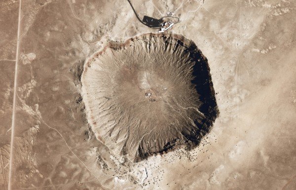
Geologists with the Iowa Geological Survey at the University of Iowa discovered the fossil bed in a meteorite crater by the Upper Iowa River in northeastern Iowa. Fossils were then unearthed and collected by temporarily damming the river in 2010. Researchers from Yale and the University of Iowa have led the analysis.
The fossil-rich site yielded both adult and juvenile Pentecopterus specimens, giving the researchers a wealth of data about the animal’s development. In addition, the researchers said, the specimens were exceptionally well preserved.
“The Winneshiek site is an extraordinary discovery,” said Yale paleontologist Derek Briggs, co-author of the study. “The fossils are preserved in fine deposits of sediments where the sea flooded a meteorite impact crater just over 5 km in diameter.” Briggs is the G. Evelyn Hutchinson Professor of Geology and Geophysics at Yale and curator of invertebrate paleontology at the Yale Peabody Museum of Natural History.
“What’s amazing is the Winneshiek fauna comprise many new taxa, including Pentecopterus, which lived in a shallow marine environment, likely in brakish water with low salinity that was inhospitable to typical marine taxa,” said Huaibao Liu of the Iowa Geological Survey and the University of Iowa, who led the fossil dig and is a co-author of the paper. “The undisturbed, oxygen-poor bottom waters within the meteorite crater led to the fossils’ remarkable preservation. So this discovery opens a new picture of the Ordovician community that is significantly different from normal marine faunas.”
The National Science Foundation supported the research. Additional co-authors of the study were Robert M. McKay and Brian Witzke of the Iowa Geological Survey and the University of Iowa.
Reference:
James C. Lamsdell, Derek E. G. Briggs, Huaibao P. Liu, Brian J. Witzke, Robert M. McKay. The oldest described eurypterid: a giant Middle Ordovician (Darriwilian) megalograptid from the Winneshiek Lagerstätte of Iowa. BMC Evolutionary Biology, 2015; 15 (1) DOI: 10.1186/s12862-015-0443-9
This is an artistic reconstruction of Isthminia panamensis, a new fossil dolphin from Panama, feeding on a flatfish. Many features of this new species appear similar to today’s ocean dolphins, yet the new fossil species is more closely related to the living Amazon River dolphin. The fossils of Isthminia panamensis were collected from marine rocks that date to a time (around 6 million years ago) before the Isthmus of Panama formed and a productive Central American Seaway connected the Atlantic and Pacific oceans. Credit: Julia Molnar / Smithsonian Institution
The careful examination of fossil fragments from Panama has led Smithsonian scientists and colleagues to the discovery of a new genus and species of river dolphin that has been long extinct. The team named it Isthminia panamensis. The specimen not only revealed a new species to science, but also shed new light onto the evolution of today’s freshwater river dolphin species. The team’s research was published Sept. 1 in the scientific journal PeerJ.
The fossil, which dates from 5.8-6.1 million years ago, was found on the Caribbean coast near the town of Piña, Panama. It consists of half a skull, lower jaw with an almost entire set of conical teeth, right shoulder blade and two small bones from the dolphin’s flipper. In comparison with other river dolphins–both fossil and living–the shape and size of these parts suggests that the full specimen may have been more than 9 feet in length.
Today there are only four species of river dolphins — all living in freshwater or coastal ecosystems and all endangered, including the Chinese river dolphin, which is likely now extinct. Each of the modern river dolphin species show a common solution to the problem of adapting away from marine to freshwater habitats by converging upon a body plan that includes broad, paddle-like flippers, flexible necks and heads with particularly long, narrow snouts–all the better to navigate and hunt in winding, silty rivers.
But fossil evidence suggests that river dolphins’ ancestors were widespread around the globe. I. panamensis was clearly one of them, and its fossil remains have helped the team understand something less clear: When in their evolutionary tract did river dolphins transition from the saltwater of the ocean to the freshwater of rivers?
“We discovered this new fossil in marine rocks, and many of the features of its skull and jaws point to it having been a marine inhabitant, like modern oceanic dolphins,” said the study’s lead author Nicholas D. Pyenson, curator of fossil marine mammals at the Smithsonian’s National Museum of Natural History. “Many other iconic freshwater species in the Amazon, such as manatees, turtles and stingrays have marine ancestors, but until now, the fossil record of river dolphins in this basin has not revealed much about their marine ancestry. Isthminia now gives us a clear boundary in geologic time for understanding when this lineage invaded Amazonia.”
Other fossilized animals found at the same site as I. panamensis were marine species, indicating that unlike river dolphins living today, I. panamensis lived in the salty waters of a food-rich Caribbean Sea, before the full closure of the Panama Isthmus.
“Isthminia is actually the closest relative of the living Amazon river dolphin,” said study co-author Aaron O’Dea, staff scientist at the Smithsonian Tropical Research Institute in Panama. “While whales and dolphins long ago evolved from terrestrial ancestors to fully marine mammals, river dolphins represent a reverse movement by returning inland to freshwater ecosystems. As such, fossil specimens may tell stories not just of the evolution these aquatic animals, but also of the changing geographies and ecosystems of the past.”
The Smithsonian’s Digitization Program Office collaborated with the scientific team to create a high resolution 3-D scan of the fossil, allowing the scientists to create 3-D prints of the delicate specimen, whose bones are too fragile to be molded and casted by traditional approaches. A 3-D print of the fossil is on permanent display at Panama’s BioMuseo–the original specimen will remain in the Smithsonian’s collection at the National Museum of Natural History.
The name of the new genus, Isthminia, recognizes both the Panama Isthmus and the fossil specimen’s living relative, the Amazon river dolphin, Inia geoffrensis. The study’s authors chose the species name, panamensis, to recognize “the Republic of Panama, its people, and the many generations of scientists who have studied its geological and biological histories.”
Reference:
Nicholas D. Pyenson, Jorge Vélez-Juarbe, Carolina S. Gutstein, Holly Little, Dioselina Vigil, Aaron O’Dea. Isthminia panamensis, a new fossil inioid (Mammalia, Cetacea) from the Chagres Formation of Panama and the evolution of ‘river dolphins’ in the Americas. PeerJ, 2015; 3: e1227 DOI: 10.7717/peerj.1227
Scientist found mummified microbial life in rocks from a seafloor hydrothermal system that was active more than 100 million years ago during the Early Cretaceous when the supercontinent Pangaea was breaking apart and the Atlantic ocean was just about to open. Buried under almost 700 meters of sediment, the samples were recovered by the seafloor drilling vessel JOIDES Resolution near the coast of Portugal. Hydrothermal fluids rich in hydrogen and methane mixed with seawater about 65 meters below the seafloor. This process supported bacteria and archaea in what scientists call ‘the deep biosphere’ in rocks from Earth’s mantle. Conditions for microbial life were nearly ideal, the study showed, in this seemingly inhospitable environment. Credit: Illustration by Jack Cook, Woods Hole Oceanographic Institution. Inset paleogeographic reconstruction by Ron Blakey, Colorado Plateau Geosystems
Ancient rocks harbored microbial life deep below the seafloor, reports a team of scientists from the Woods Hole Oceanographic Institution (WHOI), Virginia Tech, and the University of Bremen. This new evidence was contained in drilled rock samples of Earth’s mantle — thrust by tectonic forces to the seafloor during the Early Cretaceous period. The new study was published in the Proceedings of the National Academy of Sciences.
The discovery confirms a long-standing hypothesis that interactions between mantle rocks and seawater can create potential for life even in hard rocks deep below the ocean floor. The fossilized microbes are likely the same as those found at the active Lost City hydrothermal field, providing potentially important clues about the conditions that support ‘intraterrestrial’ life in rocks below the seafloor.
“We were initially looking at how seawater interacts with mantle rocks, and how that process generates hydrogen,” said Frieder Klein, an associate scientist at WHOI and lead author of the study. “But during our analysis of the rock samples, we discovered organic-rich inclusions that contained lipids, proteins and amino acids — the building blocks of life — mummified in the surrounding minerals.”
This study, which was a collaborative effort between Klein, WHOI scientists Susan Humphris, Weifu Guo and William Orsi, Esther Schwarzenbach from Virginia Tech and Florence Schubotz from the University of Bremen, focused on mantle rocks that were originally exposed to seawater approximately 125 million years ago when a large rift split the massive supercontinent known as Pangaea. The rift, which eventually evolved into the Atlantic Ocean, pulled mantle rocks from Earth’s interior to the seafloor, where they underwent chemical reactions with seawater, transforming the seawater into a hydrothermal fluid.
“The hydrothermal fluid likely had a high pH and was depleted in carbon and electron acceptors,” Klein said. “These extreme chemical conditions can be challenging for microbes. However, the hydrothermal fluid contained hydrogen and methane and seawater contains dissolved carbon and electron acceptors. So when you mix the two in just the right proportions, you can have the ingredients to support life.”
According to Dr. Everett Shock, a professor at Arizona State University’s School of Earth and Science Exploration, the study underscores the influence major geologic processes can have on the prospect for life.
“This research makes the connection all the way from convection of the mantle to the break-up of the continents to ultimately providing geochemical options for microbiology,” Shock said. “It’s just such a nice demonstration of real-world geobiology with a lot of ‘geo’ in it.”
Drilling Deep
The rock samples analyzed in the study were originally drilled from the Iberian continental margin off the coast of Spain and Portugal in 1993. During the expedition aboard the research vessel JOIDES Resolution operated by the Ocean Drilling Program (ODP) — researchers drilled through 690 meters of mud and sediment deposited onto to the ocean floor to reach the ancient seafloor created during the break-up of the supercontinent Pangaea and the opening of the Atlantic Ocean. The drill samples had been stored in core repositories at room temperature for more than two decades, before Klein and his colleagues began their investigation and discovered the fossilized microbial remains.
“Colonies of bacteria and archaea were feeding off the seawater-hydrothermal fluid mix and became engulfed in the minerals growing in the fractured rock,” Klein said. “This kept them completely isolated from the environment. The minerals proved to be the ultimate storage containers for these organisms, preserving their lipids and proteins for over 100 million years.”
“It’s exciting that the research team was able to go back and examine samples that had been collected years ago for other reasons and find new discoveries,” Shock said. “There will always be active new drilling, but this study raises the possibility of there being a lot more out there in the way of existing samples that could be analyzed.”
In the lab, samples from the rock interior had to be extracted since the outside of the drill core was stored under non-sterile conditions. So Klein and his colleagues took a number of careful steps to ensure the integrity of the sample interior wasn’t compromised, and then analyzed the rocks with high-resolution microscopes, a confocal Raman spectrometer and a range of isotope techniques.
A Link to the Lost City
While Raman spectroscopy enabled Klein to verify the presence of amino acids, proteins and lipids in the samples, it did not provide enough detailed information to correlate them with other hydrothermal systems. The lipids were of particular interest to Klein since they tend to be better preserved over long timescales, and have been studied in a wide range of seafloor environments. This prompted Klein to ask Schubotz, an expert in lipid biomarker analysis at the University of Bremen, if she could tease out further information about the lipids from these ancient rocks.
Schubotz ran the lipids through an advanced liquid chromatography-based mass spectrometer system to separate out and identify their biochemical components. The analysis led to a remarkable discovery: the lipids from the Iberian margin match up with those from the Lost City hydrothermal field, which was discovered in 2000 in the Mid-Atlantic Ridge during an expedition on board the WHOI-operated research vessel Atlantis. This is significant because researchers believe the Lost City is a present-day analog to ancient hydrothermal systems on early Earth where life may have emerged.
“I was stoked when I saw Dr. Schubotz’s email detailing the analytical results,” Klein said. “It was fascinating to find these particular biological substances — which had previously been found only at the Lost City hydrothermal field and in cold seeps — in rocks below the seafloor where life is extremely challenging. At that point we knew we were onto something really cool!”
A Deeper Understanding
According to Klein, confirmation that life is possible in mantle rocks deep below the seafloor may have important implications for understanding subseafloor life across a wide range of geologic environments.
“All the ingredients necessary to drive these ecosystems were made entirely from scratch,” he said. “Similar systems have likely existed throughout most of Earth’s history to the present day and possibly exist(ed) on other water-bearing rocky planetary bodies, such as Jupiter’s moon Europa.”
The study reinforces the idea that life springs up anywhere there is water, even in seemingly hostile geological environments — a tantalizing prospect as scientists find more and more water elsewhere in the solar system. But Klein contends that, while scientists have long understood many of the forces driving microbial life above the seafloor, there is still a great deal of uncertainty when it comes to understanding biogeochemical processes occurring in the oceanic basement.
“In the future, we’ll be trying to learn more about these particular microorganisms and what the environmental conditions were in the mixing zone in that location. We also plan to go to different places where we think similar processes may have taken place, such as along the Newfoundland margin, and analyze samples to see if we find similar signatures. Broadening this research could provide additional insights about Earth’s history and the search for life in the solar system.”
Reference:
Frieder Klein, Susan E. Humphris, Weifu Guo, Florence Schubotz, Esther M. Schwarzenbach, and William D. Orsi. Fluid mixing and the deep biosphere of a fossil Lost City-type hydrothermal system at the Iberia Margin. PNAS, August 2015 DOI: 10.1073/pnas.1504674112
Lake Fryxell, Antarctica is permanently covered in ice, and the waters at the bottom are oxygen-free but still receive some sunlight. Scientists have discovered a thin layer of oxygen created by photosynthetic bacteria at the bottom of the lake. This could be a model for conditions on Earth 2.4 billion years ago, before oxygen became common in the atmosphere. Credit: Tyler Mackey, UC Davis
At the bottom of a frigid Antarctic lake, a thin layer of green slime is generating a little oasis of oxygen, a team including UC Davis researchers has found. It’s the first modern replica discovered of conditions on Earth two and a half billion years ago, before oxygen became common in the atmosphere. The discovery is reported in a paper in the journal Geology.
The switch from a planet with very little available oxygen to one with an atmosphere much like today’s was one of the major events in Earth’s history, and it was all because some bacteria evolved the ability to photosynthesize. By about 2.4 billion years ago, geochemical records show that oxygen was present all the way to the upper atmosphere, as ozone.
What is not clear is what happened in between, or how long the transition – called the Great Oxidation Event – lasted, said Dawn Sumner, professor and chair of earth and planetary sciences at UC Davis and an author on the paper. Scientists have speculated that here may have been “oxygen oases,” local areas where was abundant before it became widespread around the planet.
The new discovery in Lake Fryxell in the McMurdo Dry Valleys could be a modern example of such an ancient oxygen oasis, and help geochemists figure out what to look for in ancient rocks, Sumner said.
Sumner and collaborators including Ian Hawes of the University of Canterbury, New Zealand have been studying life in these ice-covered lakes for several years. The microbes that survive in these remote and harsh environments are likely similar to the first forms of life to appear on Earth, and perhaps on other planets.
The discovery occurred “a little by accident,” Sumner said. Hawes and Tyler Mackey, a UC Davis graduate student working with Sumner, were helping out another research team by diving in Lake Fryxell. The lakes of the Dry Valleys typically contain oxygen in their upper layers, but are usually anoxic further down, Sumner said. Lake Fryxell is unusual because it becomes anoxic at a depth where light can still penetrate.
During their dives below the oxygen zone, Hawes and Mackey noticed some bright green bacteria that looked like they could be photosynthesizing. They took measurements and found a thin layer of oxygen, just one or two millimeters thick, being generated by the bacteria.
Something similar could have been happening billions of years ago, Sumner said.
“The thought is, that the lakes and rivers were anoxic, but there was light available, and little bits of oxygen could accumulate in the mats,” she said.
The researchers now want to know more about the chemical reactions between the “oxygen oasis” and the anoxic water immediately above it and sediments below. Is the oxygen absorbed? What reactions occur with minerals in the water?
Understanding how this oxygen oasis reacts with the environment around it could help identify chemical signatures preserved in rocks. Researchers could then go looking for similar signatures in rocks from ancient lake beds to find “whiffs of oxygen” prior to the Great Oxidation Event.
Reference:
Antarctic microbial mats: A modern analog for Archean lacustrine oxygen oases. First published online August 21, 2015, DOI: 10.1130/G36966.1
Note: The above post is reprinted from materials provided by UC Davis.
The crystal structure of magnesium peroxide, MgO2, courtesy of Sergey Lobanov, created using K. Momma’s program for drawing crystal structures. Credit: Image courtesy of Carnegie Institution
As astronomers continue finding new rocky planets around distant stars, high-pressure physicists are considering what the interiors of those planets might be like and how their chemistry could differ from that found on Earth. New work from a team including three Carnegie scientists demonstrates that different magnesium compounds could be abundant inside other planets as compared to Earth. Their work is published by Scientific Reports.
Oxygen and magnesium are the two most-abundant elements in Earth’s mantle. However, when scientists are predicting the chemical compositions of rocky, terrestrial planets outside of our own Solar System, they shouldn’t assume that other rocky planets would have Earth-like mantle mineralogy, according to a research team including Carnegie’s Sergey Lobanov, Nicholas Holtgrewe, and Alexander Goncharov.
Stars that have rocky planets are known to vary in chemical composition. This means that the mineralogies of these rocky planets are probably different from each other and from our own Earth, as well. For example, elevated oxygen contents have been observed in stars that host rocky planets. As such, oxygen may be more abundant in the interiors of other rocky planets, because the chemical makeup of a star would affect the chemical makeups of the planets that formed around it. If a planet is more oxidized than Earth, then this could affect the composition of the compounds found in its interior, too, including the magnesium compounds that are the subject of this study.
Magnesium oxide, MgO, is known to be remarkably stable, even under very high pressures. And it isn’t reactive under the conditions found in Earth’s lower mantle. Whereas magnesium peroxide, MgO2, can be formed in the laboratory under high-oxygen concentrations, but it is highly unstable when heated, as would be the case in a planetary interior.
Previous theoretical calculations had indicated that magnesium peroxide would become stable under high-pressure conditions. Taking that idea one step further, the team set out to test whether stable magnesium peroxide could be synthesized under extreme conditions mimicking planetary interiors.
Using a laser-heated, diamond-anvil cell, they brought very small samples of magnesium oxide and oxygen to different pressures meant to mimic planetary interiors, from ambient pressure to 1.6 million times normal atmospheric pressure (0-160 gigapascals), and heated them to temperatures above 3,140 degrees Fahrenheit (2,000 Kelvin). They found that under about 950,000 times normal atmospheric pressure (96 gigapascals) and at temperatures of 3,410 degrees Fahrenheit (2,150 Kelvin), magnesium oxide reacted with oxygen to form magnesium peroxide.
“Our findings suggest that magnesium peroxide may be abundant in extremely oxidized mantles and cores of rocky planets outside our Solar System,” said Lobanov, the paper’s lead author “When we develop theories about distant planets, it’s important that we don’t assume their chemistry and mineralogy is Earth-like.”
“These findings provide yet another example of the ways that high-pressure laboratory experiments can teach us about not only our own planet, but potentially about distant ones as well,” added Goncharov.
Because of its chemical inertness, MgO has also long been used as a conductor that transmits heat and pressure to an experimental sample. “But this new information about its chemical reactivity under high pressure means that such experimental uses of MgO need to be revised, because it they could be creating unwanted reactions and affecting results,” Goncharov added.
The other co-authors are Qiang Zhu and Artem Oganov of Stony Brook University and Clemens Prescher and Vitali Prakapenka of University of Chicago.
This study was funded by the Deep Carbon Observatory, the National Science Foundation, DARPA, the Government of the Russian Federation, and the Foreign Talents Introduction and Academic Exchange Program. Calculations were performed on XSEDE facilities and on the cluster of the Center for Functional Nonomaterials Brookhaven National Laboratory, which is supported by the DOE-BES.
Reference:
Sergey S. Lobanov, Qiang Zhu, Nicholas Holtgrewe, Clemens Prescher, Vitali B. Prakapenka, Artem R. Oganov, Alexander F. Goncharov. Stable magnesium peroxide at high pressure. Scientific Reports, 2015; 5: 13582 DOI: 10.1038/srep13582
A team of researchers led by scientists at the National Geospatial-Intelligence Agency published a new map Sept. 1 that characterizes the Earth’s radioactivity and offers new and potential future applications for basic science research and nonproliferation efforts. The Antineutrino Global Map 2015, or AGM2015, is an unprecedented experimentally-informed model of the Earth’s natural and manmade antineutrino flux.
The map uses open-source geophysical data sets and publicly available international antineutrino detection observational data to depict varying levels of radioactivity on Earth.
“The open access availability of these antineutrino maps represents the next generation of cartography and gives important insights into the basic understanding about the interior of our planet,” said Shawn Usman, NGA R&D scientist and lead author of the study.
The neutrino and its antimatter cousin, the antineutrino, are subatomic particles produced by stars of all types, including the Sun, as well as Earth’s atmosphere, supernovae, nuclear reactors, and radioactive materials.
The research team is comprised of neutrino physicists and geophysicists from the National Geospatial-Intelligence Agency, the University of Hawaii, Hawaii Pacific University, the University of Maryland and Virginia-based Ultralytics, LLC.
Antineutrinos were first detected as emissions from nuclear reactors in the mid-1950s two decades after their existence was proposed. More than 99 percent of all terrestrial antineutrinos come from within the Earth, with the remainder coming from nuclear reactors. The detection of antineutrinos from nuclear reactors continues to provide insights into their oscillatory behavior and potential future applications for nuclear nonproliferation
Naturally occurring radioisotopes in the Earth produce geophysical antineutrinos, or geo-neutrinos, and reveal information about the planet’s interior. The study of geo-neutrinos, needed to support nuclear reactor detection, is a gateway to meaningful geologic research into the Earth’s heat sources and geodynamics.
“Geo-neutrino measurements are essential in characterizing the Earth’s radiogenic power across geologic time and in improving our understanding of planetary formation processes in the early solar nebula.” Usman said. “Our vision at NGA is to ‘Know the Earth…Show the Way…Understand the World.’ This map enhances our fundamental understanding of the planet by mapping out Earth’s natural and anthropogenic radioactivity.”
Life illustration of Gobisaurus, an ankylosaur with a stiff tail but no knob of bone at the end. Credit: Artist/ Sydney Mohr.
How did the ankylosaur get its tail club? According to research from North Carolina State University and the North Carolina Museum of Natural Sciences that traces the evolution of the ankylosaur’s distinctive tail, the handle arrived first on the scene, and the knot at the end of the tail followed.
The typical ankylosaur had a wide armored body and a flexible tail. But one group of ankylosaurs — ankylosaurids — also had a tail club that could have served as a useful weapon. These “weaponized” ankylosaurids lived about 66 million years ago, during the Cretaceous period. But ankylosaurian dinosaurs were around well before that time — over 145 million years ago, during the Jurassic.
Victoria Arbour, a postdoctoral researcher at NC State and the North Carolina Museum of Natural Sciences, was a Ph.D. candidate at the University of Alberta when she began studying how the ankylosaur developed its unique tail. In a paper published in the Journal of Anatomy, Arbour compared Jurassic ankylosaur specimens to those from the early and late Cretaceous period, tracing the tail’s evolution from flexible to fearsome.
An ankylosaur’s tail is composed of a handle and a knob. The knob is made up of osteoderms, a special kind of bone formed in the skin that’s unique to armored dinosaurs. The handle is the lower portion of the tail which supports the knob.
“In order for an ankylosaur to be able to support the weight of a knob and swing it effectively, the tail needs to be stiff, like an ax handle,” says Arbour. “For that to occur, the vertebrae along the tail had to become less flexible, otherwise the momentum generated by the knob’s weight could tear muscle or dislocate vertebrae.”
Arbour looked at a number of early ankylosaurids including: Liaoningosaurus which lived 122 million years ago; Gobisaurus, which lived 90 million years ago; and Pinacosaurus, which lived 75 million years ago and is the earliest specimen with a complete tail club, to determine which of three possible evolutionary paths was most likely.
“There are three ways the tail could have evolved,” Arbour says. “The knob could have evolved first, in which case you’d see ankylosaurids with osteoderms enveloping the end of the tail, but with the tail remaining flexible. The handle could have evolved first, meaning you would see early ankylosaurids with overlapping or fused tail vertebrae. Or the knob and handle could have evolved in tandem, in which case you’d see ankylosaurids with both structures, but there could have been other differences like shorter handles or smaller knobs.”
By comparing the tails of the specimens, Arbour saw that by the early Cretaceous, ankylosaurs had begun to develop stiff tails with fused vertebrae. The knob appeared in the late Cretaceous.
“While it’s possible that some of the species could still have developed the handle and knob in tandem, it seems most likely that the tail stiffened prior to the growth of the osteoderm knob, in order to maximize the tail’s effectiveness as a weapon,” Arbour says.
Reference:
Victoria Arbour and Philip Currie. Ankylosaurid dinosaur tail clubs evolved through stepwise acquisition of key features. Journal of Anatomy, 2015 DOI: 10.1111/joa.12363
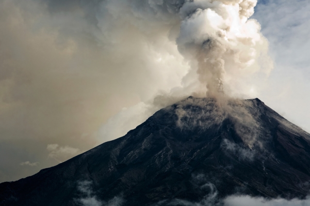
Plinian column of the eruption of Sarychev (Russia) on 12 June 2009. Credit: NASA
Large volcanic eruptions inject considerable amounts of sulphur in the stratosphere which, once converted into aerosols, block sun rays and tend to cool the surface of the Earth down for several years. An international team of researchers has just developed a method, published in Nature Geoscience, to accurately measure and simulate the induced drop in temperature.
Considered the most important volcanic event of the 20th century, the eruption of Mount Pinatubo (June 1991) injected 20 million tons of sulphur dioxide in the stratosphere and provoked a global cooling of 0.4°C on average.
To quantify the temporary cooling induced by the largest eruptions over the last 1500 years, whose magnitude exceeded Mount Pinatubo’s, scientists usually adopt two approaches : dendroclimatology which relies on the analysis of tree-ring based proxies and climate model simulations in response to the volcanic particles effect. But until now these two approaches delivered results that were quite contradictory, and this prevented scientists from accurately assessing the impact of major volcanic eruptions on climate. Simulations showed greater (between two and four times higher) and longer cooling than dendroclimatic reconstructions. This gap even led some geophysicists to doubt the capacity of tree-ring based proxies to measure the impact of past major volcanic events on climate and to question the models’ ability in simulating precisely the climate response to strong volcanic forcings.
Reconciliation of observational proxy and model evidence
Today, researchers from the University of Geneva (UNIGE), Switzerland, the Institut Pierre Simon Laplace, IRD, the French Alternative Energies Commission (CEA) and the National Center for Scientific Research (CNRS), France, have managed to reconcile the two approaches and developed a method to evaluate accurately the consequences of future high-magnitude eruptions on climate to better anticipate their impact on our societies.
In this multidisciplinary team, dendrochronologists came up with a new reconstruction of the Northern Hemisphere summer temperature in the last 1’500 years. This reconstruction is mainly based on maximum latewood density, a parameter which is very sensitive to temperature variations. Data has been collected throughout the Northern Hemisphere, from Scandinavia and Siberia all the way to Quebec, including Alaska, the Alps and the Pyrenees. The inclusion of density allowed clear detection of all major eruptions. Results show that the year following a large eruption is characterised by a greater cooling than asserted in previous reconstructions and that this cooling does not last for more than three years at an hemispheric scale.
In parallel, using a sophisticated climate model, climate physicists calculated the drop in temperature caused by the two largest volcanic events of the last millennium, the Samalas and Tambora eruptions which both occured in Indonesia in 1257 and 1815. This model combines data about volcanoes location, the period of the eruption, the amount of sulphur dioxide injected, and integrates results from a microphysical model which simulates the volcanic aerosol life cycle from their formation, following the oxidation of sulphur dioxide, to their sedimentation and elimination from the atmosphere. ” This unusual approach enables to realistically simulate the size of the volcanic aerosols particles and hence their life expectancy in the atmosphere, which directly influences both the extent and persistence of the cooling induced by an eruption “, explains Markus Stoffel, researcher at UNIGE. These new simulations show that disruption in ray exchange, caused by volcanic activity, were largely overestimated in previous climate simulations, used in the latest IPCC (Intergovernmental Panel on Climate Change) report.
For the first time, results provided by reconstructions and climate models about the intensity of cooling converge and demonstrate that the Tampora and Samalas eruptions generated an average drop in temperature in the Northern Hemisphere fluctuating between 0.8 and 1.3°C during the summer 1258 and 1816. Both approaches also agree on the average persistence of the significant cooling which is estimated at two to three years. These results pave the way to a better assessment of the role played by volcanism on climate change.
Reference:
Estimates of volcanic-induced cooling in the Northern Hemisphere over the past 1,500 years, DOI: 10.1038/ngeo2526
Note: The above post is reprinted from materials provided by University of Geneva.
Many volcanoes are located in densely settled areas. Every time one of these becomes active, large populations are put at risk. Hence, one of the primary goals of the current generation of volcanologists is to develop tools that can accurately predict when volcanoes will erupt. In the case of an impending eruption, these tools are of key importance to those charged with making decisions about what action to take and when. “However, the tools available for predicting eruptions are still in their infancy. We can’t always successfully predict an eruption as we lack an understanding of how the warning signs that signal a coming catastrophe are generated, says Donald Dingwell, Director of the Department of Earth and Environmental Sciences at LMU
Under Prof. Dingwell’s supervision, a team of geophysicists has now simulated volcanic eruptions in the laboratory, and asked how well current forecasting models succeed in predicting their properties. “To this end, we have carefully monitored the behavior of samples of synthetic magmas under pressure and recorded the micro-signals that herald their ultimate failure,” says Jeremie Vasseur, a PhD student in Dingwell’s group and first author of the study. “Analyzing these precursory signals and how they evolve is akin to analyzing the seismic signals prior to an eruption.”
Vasseur and his colleagues found that the more heterogeneous the synthetic magma, the more accurately one can predict its failure. Conversely, the forecast becomes progressively less precise as the starting material becomes more homogeneous. The properties of the magma in real volcanoes also vary widely, depending on the extent to which gas-bubbles and crystalline inclusions are trapped in the otherwise homogeneous liquid. “Our results imply that the key to forecasting eruptions lies in knowing just how heterogeneous the magma is,” says Dingwell. “We will continue our efforts to understand the behavior of magmas in the hope that a comprehensive forecasting tool will someday be within our grasp, he adds.
Reference:
Jérémie Vasseur, Fabian B. Wadsworth, Yan Lavallée, Andrew F. Bell, Ian G. Main, Donald B. Dingwell. Heterogeneity: The key to failure forecasting. Scientific Reports, 2015; 5: 13259 DOI: 10.1038/srep13259
The pattern of discovery of new dinosaur species and new dinosaur-bearing formations, as they accumulated through research time, from 1820 to the present day
Everyone is excited by discoveries of new dinosaurs – or indeed any new fossil species. But a key question for palaeontologists is ‘just how good is the fossil record?’ Do we know fifty per cent of the species of dinosaurs that ever existed, or ninety per cent or even less than one per cent? And how can we tell?
It all depends on how we read the fossil record – the sum total of all the fossils in rocks and in museums. In a new study published today, Professor Mike Benton of the University of Bristol has explored how knowledge about dinosaurs has accumulated over the past 200 years, since the first dinosaur was named in 1824. His research does not answer the question once and for all, but it suggests that strong caution is needed with some popular methods to ‘correct’ the fossil record.
Professor Benton said: “In the past ten years, many palaeontologists have tried to find the true pattern of evolution by using measures of sampling to estimate where the fossil record is well known or poorly known. But it turns out that many of the popular methods are not doing what they are supposed to.’
Professor Benton reconstructed year-by-year, through the history of research on dinosaurs, from 1820 to 2015, how palaeontologists have discovered new species of dinosaurs, and how the patterns of discovery match the patterns of discovery of new geological formations. In fact, the patterns of discovery are closely linked: one or two new dinosaurs for each fossil-bearing geological formation that is newly explored.
This close linkage has been explained in two ways: either rocks drive fossils, or fossils drive rocks. The usual view was that rocks drive fossils: palaeontologists were keen to find new dinosaurs, but could only find them if they looked at new rocks in a new part of the world. Therefore, it could be said that the availability of appropriate rocks biases our knowledge of dinosaurs (or any other fossil group).
The opposite view is that fossils drive rocks, and that palaeontologists usually go out looking for dinosaurs in a very focused way,, and when they find them they would often add a new dinosaur-bearing formation to the list. In this case, the limiting factor is not simply the rocks, because palaeontologists do not search steadily and evenly over the ground, but they go straight to spots where they hear there are bones to be found.
“I have been worried for a while that some of the popular correction methods actually make things worse,” Professor Benton said. “By removing the numerical signal of the formations, localities, or collections they were actually removing a huge amount of real information, and producing a resulting curve that is meaningless.
“The fossil record is clearly incomplete, and it is clearly biased by many factors, but many of the supposedly ‘corrected’ diversity curves we have seen recently may actually be further from the truth than the raw data.”
The new work does not answer the question of whether we know 50 per cent of dinosaur species or less than one per cent. But it does provide a clearer picture of why there is such a close correlation between dinosaur species numbers with formations, localities or collections. The numbers of all four are connected because they are all telling pretty much the same story, and they are measuring the same history of knowledge. It is not possible to separate one or other of these measures from the others and then try to use it as an independent yardstick of sampling.
Reference:
“Palaeodiversity and formation counts: redundancy or bias?” Palaeontology, DOI: 10.1111/pala.12191