back to top
Facebook Instagram Linkedin TikTok X Youtube
  • Contribute
  • Advertising
  • FAQs
Search

Logo

27.8 C
New York
Thursday, November 12, 2026
Facebook
Instagram
Linkedin
TikTok
X
Youtube

Logo

  • Home
  • List of Minerals
  • Geologic Time Scale
  • Geology Tools
  • Geology Adventure Tours
  • Plate Tectonics Map
    • Plate Boundary Map
  • Top Posts
  • Geology Jobs
  • GEO Courses
  • Geology Field Camps
  • Geology Field Camps in United States
  • Worldwide Geological Surveys
More
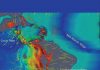
    Map shows earthquake epicenters (surrounded in light red) offshore where the Cocos and North American tectonic plates meet. The newer fault zone is inland, the black lines mark the changing trajectories of abyssal hills atop the descending Cocos Plate. Blue-shaded areas in this zone are where subduction angles remain steep. The pink area, below Mexico City, is a transition zone where another earthquake could occur. The 2017, 1999 and 1980 quake epicenters are in a red-shaded zone to the southeast that is considered to be at most risk for quakes.

    Mexico’s 2017 earthquake emerged from a growing risk zone

    March 12, 2018
    Reconstruction of the late Ediacaran (ca. 550 million years ago) sea floor with burrows of a worm-like animal.This was the first discovery of such deeply penetrating burrows.

    Digging up the Precambrian: Fossil burrows show early origins of animal...

    March 12, 2018
    Diamond crystal

    Unique diamond impurities indicate water deep in Earth’s mantle

    March 11, 2018
    IODP Expedition 381 collected 1.6 kilometers of sediment core from the Corinth Rift in Greece.

    International ocean drilling expedition obtains unique record of plate tectonic rifting...

    March 9, 2018
    On its current expedition, the drillship JOIDES Resolution is working off the coast of New Zealand.

    Deep-sea observatories to offer new view of seabed earthquakes

    March 9, 2018

    Vermilion Cliffs

    March 7, 2018
    Diamond

    Diamond discovery under pressure

    March 7, 2018
    paleoseismological record of the Liquiñe-Ofqui Fault Zone (LOFZ)

    Researchers discover evidence of earthquakes that affected Chilean coast in the...

    March 7, 2018
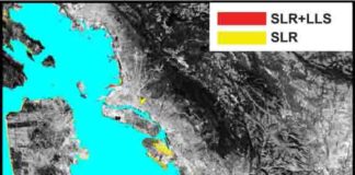
    The San Francisco Bay shoreline, where yellow indicates areas where a projected rise in sea level (SLR) will result in flooding by 2100. Red shows where local land subsidence (LLS) will combine with SLR to increase the flood-prone areas.

    Sinking land will exacerbate flooding from sea level rise in Bay...

    March 7, 2018
    Chinese loess plateau

    Desertification and monsoon climate change linked to shifts in ice volume...

    March 7, 2018
    1...199200201...688Page 200 of 688

    MOST POPULAR

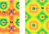
    This illustration shows how the changes in the electromagnetic properties of xenon, iron, and nickel under these intense pressures allow for the formation of XeFe3 and XeNi3.

    Do you know where your xenon is?

    March 1, 2018

    Diamonds could one day replace GPS

    January 8, 2017

    Supercomputing helps researchers understand Earth’s interior

    May 23, 2017

    Fundamentals of Geomorphology

    December 14, 2012
    Load more

    MORE ARTICLES

    Scientists find likely cause for recent southeast U.S. earthquakes

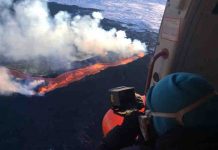
    Volcanic ‘plumerang’ could impact human health

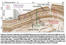
    This is seismic reflection data.

    Tiny fossils, huge slides: Are diatoms the key to Earth’s biggest...

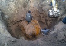
    World’s second-largest meteorite discovered in Argentina

    Facebook Instagram Linkedin TikTok X Youtube
    • Privacy Policy
    • Advertising
    • Contribute
    • FAQs
    © 2011-2026. All Rights Reserved.