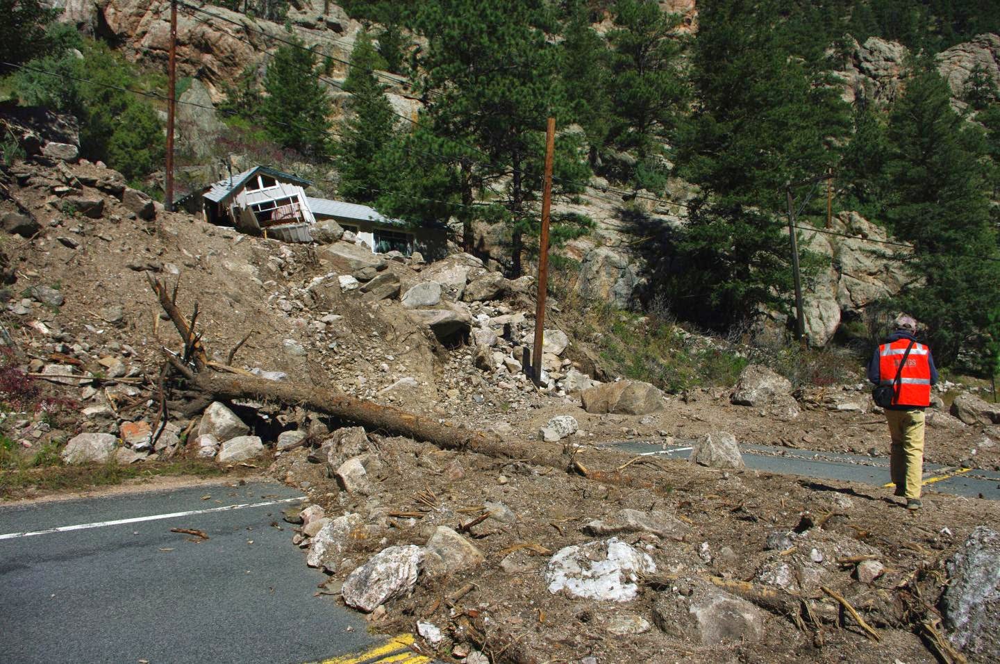
Scott W. Anderson and colleagues use repeat aerial LiDAR to quantify the erosional impact of the heavy rains that inundated the Colorado Front Range in September 2013. The five-day storm triggered more than 1,100 landslides and debris flows in a 3,430-square-kilometer area due to 200-450 mm of heavy, steady rainfall. This number of hillslope failures in a single event represents unprecedented activity for the region in its ~150 years of written history.
This study for Geology addresses the role of such large, rare events in shaping landscapes by documenting the location and size of landslides and debris flows. Anderson and colleagues use before-and-after high-resolution topographic data from airborne laser mapping (LiDAR) to quantify landslide erosion.
The “before” LiDAR mapping of Boulder Creek was completed in 2010. With a few weeks of the storm, the authors repeated the aerial survey. They then subtracted the 2013 topographic data from the 2010 topographic data where the datasets overlapped — west of Boulder, Colorado — to produce a digital elevation model (DEM) of difference.
They located 120 landslides and debris flows ranging in size from 10 to 21,000 cubic meters, all on slopes greater than 20 degrees. On average, about 15 mm of lowering occurred in basins in which landslides occurred.
Other methods have shown that it takes hundreds to thousands of years to loosen this much sediment from rock. These results therefore show that it is these rare debris flows that transport the sediment off the steep hillslopes along the eastern edge of the Front Range.
This study both highlights the importance of rare events in long-term erosion of this landscape and helps to explain why modern sediment yields may greatly underestimate long-term denudation rates in such settings. Debris flows dominate sediment export from storage on the steep hillslopes that bound the canyons draining the Colorado Front Range. Landscapes evolve over time scales that greatly exceed the period of historical records. It is therefore important to understand the degree to which modern observations capture the full range of geologically formative processes and process rates.
Refernce:
Scott W. Anderson et al., Dept. of Geography and Institute of Arctic and Alpine Research (INSTAAR), University of Colorado, Boulder, Colorado, USA; currently at U.S. Geological Survey, Tacoma, Washington 98402, USA. Published online ahead of print on 27 Mar. 2015; DOI: 10.1130/G36507.1
Note : The above story is based on materials provided by Geological Society of America.


