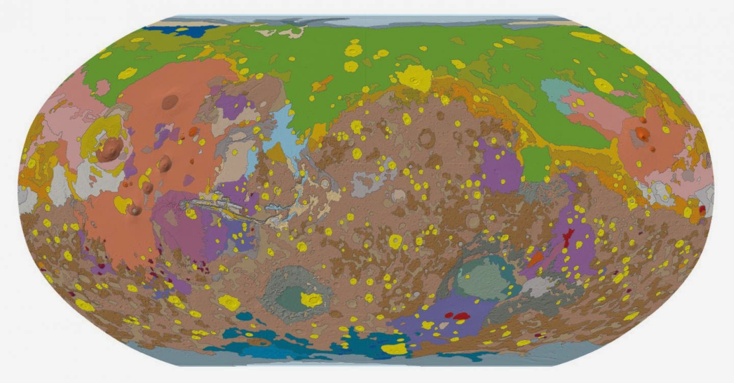
From this week’s Eos: The New Geologic Map of Mars: Guiding Research and Education
Currently, five spacecraft are investigating Mars, and a swarm of new missions to the Red Planet either have been launched or are in development. They are designed to probe the surface, subsurface, and atmosphere with a host of scientific instruments. Where will they make new discoveries? Clues to where they should focus investigations can be gleaned from the planet’s new geologic map.
From AGU’s journals: History of storm surge in Florida strongly underestimated
The observational hurricane record for northwestern Florida is just 160 years long, yet hurricane activity is known to vary strongly over thousands of years. Digging back into the prehistorical hurricane record, Lin et al. find that scientists’ reliance on such a narrow slice of observations has led them to sorely underestimate the frequency with which large hurricanes have slammed into Florida’s Gulf Coast.
Based on historical records, northwestern Florida gets hit by a hurricane packing a five-meter (16-foot) storm surge every 400 years. Incorporating long-term paleohurricane records, the authors find that the frequency of such a storm is actually closer to every 40 years.
When strong storms batter the shore, waves can carry sediment far inland. Digging down into the sediment record, researchers can reproduce the occurrence of past storm surge. Using a hurricane model and storm surge sediment observations, the authors calculated the intensity and frequency of past hurricanes in Florida’s Apalachee Bay. They find that while the frequency of hurricanes hitting the Gulf Coast has remained relatively the same over the past few thousand years, the storms’ average intensities have been, at times, much higher than during the past 160 years.
Based on their paleohurricane storm surge observations, the authors suggest that, historically, northwestern Florida would see a storm surge of 6.3 meters (20.7 feet) every 100 years, 8.3 meters (27.2 feet) every 500 years, and 11.3 meters (37.1 feet) in a worst case scenario event. A storm surge of eight meters (26 feet), they say, would push tens of kilometers inland.
The authors suggest that assessments of hurricane risk in other coastal regions may also be biased by relatively short observational records, though the direction and magnitude of that bias is not obvious.
Note : The above story is based on materials provided by American Geophysical Union


