Home Blog Page 77

Brimham Rocks, England

Brimham Rocks
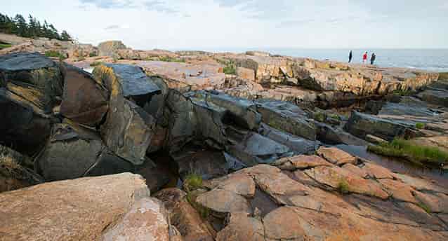
Brimham Rocks are balancing rock formations on Brimham Moor in North Yorkshire, England.

Site Name: Brimham Rocks
County: North Yorkshire

Brimham Rocks, near Pateley Bridge, consists of a series of Millstone Grit tors together with amosaic of upland plant communities including dry and wet heath, birch woodland and acid bog.The tors and the various associated rock weathering forms in Millstone Grit (Upper Carboniferous) make this a classic geomorphological site, significant for studies of past and present weathering processes and their contribution to landscape evolution. The heath and bog habitats represent important examples of plant communities, formerly more widespread, which have been reduced by agricultural improvement, drainage and afforestation.

The areas of open heathland adjacent to the rocks consist primarily of heather Calluna vulgaris, bilberry Vaccinium myrtillus, and wavy hair-grass Deschampsia flexuosa with scattered birch Betula sp., rowan Sorbus aucuparia and oak Quercus robur. Bracken Pteridium aquilinum occurs around the stacks, and cowberry Vaccinium vitis-idaea is found on the eastern side of the site. The presence of a population of the uncommon chickweed wintergreen Trientalis europaea is of note. On the north-eastern edge birch is regenerating freely in the absence of fires and grazing pressures.

Pockets of wet heath comprise common cotton-grass Eriophorum angustifolium, deer grass Trichophorum cespitosum, purple moor-grass Molinia caerulea, bog mosses Sphagnum spp. and cross-leaved heath Erica tetralix, and occasionally, cranberry Vaccinium oxycoccus. Bog asphodel Narthecium ossifragum and marsh violet Viola palustris together with water blinks Montia fontana, marsh thistle Cirsium palustre and wood horsetail Equisetum sylvaticum occur in a water-logged area associated with a small beck in the south of the site

Also of note is the occurrence of the local Holly Blue Celastrina argiolus and Green Hairstreak Callophrys rubi butterflies.

Debris Flow Dynamics

Debris flows are fast moving, liquefied landslides of mixed and unconsolidated water and debris that look like flowing concrete. They are defined by their non-newtonian flow dynamics, and behave as Bingham plastics. This characteristic can lead to the formation of levees at the margins of unconstrained debris flows as the margins of the flow freeze.

They are differentiated from mudflows by their coarser and more poorly sorted sediment load. Flows can carry material ranging in size from clay to boulders, and may contain a large amount of woody debris such as logs and tree stumps. Flows can be triggered by intense rainfall, glacial melt, or a combination of the two. Speed of debris flows can vary from 5 km/h to up to 80 km/h in extreme cases.

Volumes of material delivered by single events vary from less than 100 to more than 100,000 cubic metres. Variables considered important in debris flow initiation include slope angle, available loose sediment, and degree of land disturbance by activities such as forest harvesting.

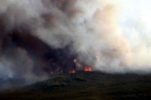
Debris flows are often more frequent following forest and brush fires, as experience in southern California clearly demonstrates. Debris flows are extremely destructive to life and property, and claim thousands of lives world-wide in any given year.

They are a particular problem in steep mountainous areas subjected to intense rainstorms, and have received particular attention from researchers in Japan, Western USA, Western Canada, New Zealand, the European Alps, and Kazakhstan.

Massive Bolivian earthquake reveals mountains 660 kilometers below our feet

Graphic showing the Transition Zone inside the Earth Princeton seismologist Jessica Irving worked with then-graduate student Wenbo Wu and another collaborator to determine the roughness at the top and bottom of the transition zone, a layer within the mantle, using scattered earthquake waves. They found that the top of the transition zone, a layer located 410 kilometers down, is mostly smooth, but the base of the transition zone, 660 km down, in some places is much rougher than the global surface average. “In other words, stronger topography than the Rocky Mountains or the Appalachians is present at the 660-km boundary,” said Wu. NOTE: This graphic is not to scale. Credit: Kyle McKernan, Office of Communications

Most schoolchildren learn that the Earth has three (or four) layers: a crust, mantle and core, which is sometimes subdivided into an inner and outer core. That’s not wrong, but it does leave out several other layers that scientists have identified within the Earth.

In a study published this week in Science, Princeton geophysicists Jessica Irving and Wenbo Wu, in collaboration with Sidao Ni from the Institute of Geodesy and Geophysics in China, used data from an enormous earthquake in Bolivia to find mountains and other topography on a layer located 660 kilometers (410 miles) straight down, which separates the upper and lower mantle. (Lacking a formal name for this layer, the researchers simply call it “the 660-km boundary.”)

To peer deep into the Earth, scientists use the most powerful waves on the planet, which are generated by massive earthquakes. “You want a big, deep earthquake to get the whole planet to shake,” said Irving, an assistant professor of geosciences.

Big earthquakes are vastly more powerful than small ones — energy increases 30-fold with every step up the Richter scale — and deep earthquakes, “instead of frittering away their energy in the crust, can get the whole mantle going,” Irving said. She gets her best data from earthquakes that are magnitude 7.0 or higher, she said, as the shockwaves they send out in all directions can travel through the core to the other side of the planet — and back again. For this study, the key data came from waves picked up after a magnitude 8.2 earthquake — the second-largest deep earthquake ever recorded — that shook Bolivia in 1994.

“Earthquakes this big don’t come along very often,” she said. “We’re lucky now that we have so many more seismometers than we did even 20 years ago. Seismology is a different field than it was 20 years ago, between instruments and computational resources.”

Seismologists and data scientists use powerful computers, including Princeton’s Tiger supercomputer cluster, to simulate the complicated behavior of scattering waves in the deep Earth.

The technology depends on a fundamental property of waves: their ability to bend and bounce. Just as light waves can bounce (reflect) off a mirror or bend (refract) when passing through a prism, earthquake waves travel straight through homogenous rocks but reflect or refract when they encounter any boundary or roughness.

“We know that almost all objects have surface roughness and therefore scatter light,” said Wu, the lead author on the new paper, who just completed his geosciences Ph.D. and is now a postdoctoral researcher at the California Institute of Technology. “That’s why we can see these objects — the scattering waves carry the information about the surface’s roughness. In this study, we investigated scattered seismic waves traveling inside the Earth to constrain the roughness of the Earth’s 660-km boundary.”

The researchers were surprised by just how rough that boundary is — rougher than the surface layer that we all live on. “In other words, stronger topography than the Rocky Mountains or the Appalachians is present at the 660-km boundary,” said Wu. Their statistical model didn’t allow for precise height determinations, but there’s a chance that these mountains are bigger than anything on the surface of the Earth. The roughness wasn’t equally distributed, either; just as the crust’s surface has smooth ocean floors and massive mountains, the 660-km boundary has rough areas and smooth patches. The researchers also examined a layer 410 kilometers (255 miles) down, at the top of the mid-mantle “transition zone,” and they did not find similar roughness.

“They find that Earth’s deep layers are just as complicated as what we observe at the surface,” said seismologist Christine Houser, an assistant professor at the Tokyo Institute of Technology who was not involved in this research. “To find 2-mile (1-3 km) elevation changes on a boundary that is over 400 miles (660 km) deep using waves that travel through the entire Earth and back is an inspiring feat. … Their findings suggest that as earthquakes occur and seismic instruments become more sophisticated and expand into new areas, we will continue to detect new small-scale signals which reveal new properties of Earth’s layers.”

What it means

The presence of roughness on the 660-km boundary has significant implications for understanding how our planet formed and continues to function. That layer divides the mantle, which makes up about 84 percent of the Earth’s volume, into its upper and lower sections. For years, geoscientists have debated just how important that boundary is. In particular, they have investigated how heat travels through the mantle — whether hot rocks are carried smoothly from the core-mantle boundary (almost 2,000 miles down) all the way up to the top of the mantle, or whether that transfer is interrupted at this layer. Some geochemical and mineralogical evidence suggests that the upper and lower mantle are chemically different, which supports the idea that the two sections don’t mix thermally or physically. Other observations suggest no chemical difference between the upper and lower mantle, leading some to argue for what’s called a “well-mixed mantle,” with both the upper and lower mantle participating in the same heat-transfer cycle.

“Our findings provide insight into this question,” said Wu. Their data suggests that both groups might be partially right. The smoother areas of the 660-km boundary could result from more thorough vertical mixing, while the rougher, mountainous areas may have formed where the upper and lower mantle don’t mix as well.

In addition, the roughness the researchers found, which existed at large, moderate and small scales, could theoretically be caused by heat anomalies or chemical heterogeneities. But because of how heat in transported within the mantle, Wu explained, any small-scale thermal anomaly would be smoothed out within a million years. That leaves only chemical differences to explain the small-scale roughness they found.

What could cause significant chemical differences? The introduction of rocks that used to belong to the crust, now resting quietly in the mantle. Scientists have long debated the fate of the slabs of sea floor that get pushed into the mantle at subduction zones, the collisions happening found all around the Pacific Ocean and elsewhere around the world. Wu and Irving suggest that remnants of these slabs may now be just above or just below the 660-km boundary.

“It’s easy to assume, given we can only detect seismic waves traveling through the Earth in its current state, that seismologists can’t help understand how Earth’s interior has changed over the past 4.5 billion years,” said Irving. “What’s exciting about these results is that they give us new information to understand the fate of ancient tectonic plates which have descended into the mantle, and where ancient mantle material might still reside.”

She added: “Seismology is most exciting when it lets us better understand our planet’s interior in both space and time.”

Reference:
Wenbo Wu, Sidao Ni and Jessica Irving. Inferring Earth’s discontinuous chemical layering from the 660-kilometer boundary topography. Science, 2019 DOI: 10.1126/science.aav0822

Note: The above post is reprinted from materials provided by Princeton University. Original written by Liz Fuller-Wright.

Satellite images reveal interconnected plumbing system that caused Bali volcano to erupt

Mount Agung
View of Mount Agung on November 10, 2017 from the Rendang Volcano Observatory, operated by CVGHM. Photo by Jake Lowenstern, US Geological Survey

A team of scientists, led by the University of Bristol, has used satellite technology provided by the European Space Agency (ESA) to uncover why the Agung volcano in Bali erupted in November 2017 after 50 years of dormancy.

Their findings, published today in the journal Nature Communications, could have important implications for forecasting future eruptions in the area.

Two months prior to the eruption, there was a sudden increase in the number of small earthquakes occurring around the volcano, triggering the evacuation of 100,000 people.

The previous eruption of Agung in 1963 killed nearly 2,000 people and was followed by a small eruption at its neighboring volcano, Batur.

Because this past event was among the deadliest volcanic eruptions of the 20th Century, a great effort was deployed by the scientific community to monitor and understand the re-awakening of Agung.

During this time, a team of scientists from the University of Bristol’s School of Earth Sciences, led by Dr Juliet Biggs used Sentinel-1 satellite imagery provided by the ESA to monitor the ground deformation at Agung.

Dr Biggs said: “From remote sensing, we are able to map out any ground motion, which may be an indicator that fresh magma is moving beneath the volcano.”

In the new study, carried out in collaboration with the Center for Volcanology and Geological Hazard Mitigation in Indonesia (CVGHM), the team detected uplift of about 8-10 cm on the northern flank of the volcano during the period of intense earthquake activity.

Dr Fabien Albino, also from Bristol’s School of Earth Sciences, added: “Surprisingly, we noticed that both the earthquake activity and the ground deformation signal were located five kilometres away from the summit, which means that magma must be moving sideways as well as vertically upwards.

“Our study provides the first geophysical evidence that Agung and Batur volcanoes may have a connected plumbing system.

“This has important implications for eruption forecasting and could explain the occurrence of simultaneous eruptions such as in 1963.”

Reference:
Fabien Albino, Juliet Biggs, Devy Kamil Syahbana. Dyke intrusion between neighbouring arc volcanoes responsible for 2017 pre-eruptive seismic swarm at Agung. Nature Communications, 2019; 10 (1) DOI: 10.1038/s41467-019-08564-9

Note: The above post is reprinted from materials provided by University of Bristol.

How undersea gases once helped superheat our planet

Bubbles of liquid carbon dioxide float out of the seafloor at a vent on Northwest Eifuku volcano off the coast of Japan.
Bubbles of liquid carbon dioxide float out of the seafloor at a vent on Northwest Eifuku volcano off the coast of Japan. Credit: Bob Embley, NOAA Office of Ocean Exploration

The world’s oceans could harbor an unpleasant surprise for global warming, based on new research that shows how naturally occurring carbon gases trapped in reservoirs atop the seafloor escaped to superheat the planet in prehistory.

Scientists say events that began on the ocean bottom thousands of years ago so disrupted the Earth’s atmosphere that it melted away the ice age. Those new findings challenge a long-standing paradigm that ocean water alone regulated carbon dioxide in the atmosphere during glacial cycles. Instead, the study shows geologic processes can dramatically upset the carbon cycle and cause global change.

For today’s world, the findings could portend an ominous development. The undersea carbon reservoirs released greenhouse gas to the atmosphere as oceans warmed, the study shows, and today the ocean is heating up again due to humanmade global warming.

If undersea carbon reservoirs are upset again, they would emit a huge new source of greenhouse gases, exacerbating climate change. Temperature increases in the ocean are on pace to reach that tipping point by the end of the century. For example, a big carbon reservoir beneath the western Pacific near Taiwan is already within a few degrees Celsius of destabilizing.

Moreover, the phenomenon is a threat unaccounted for in climate model projections. Undersea carbon dioxide reservoirs are relatively recent discoveries and their characteristics and history are only beginning to be understood.

Those findings come from a new research paper produced by an international team of Earth scientists led by USC and published in January in the journal Environmental Research Letters.

“We’re using the past as a way to anticipate the future,” said Lowell Stott, professor of Earth sciences at the USC Dornsife College of Letters, Arts and Sciences and lead author of the study. “We know there are vast reservoirs of carbon gas at the bottom of the oceans. We know when they were disrupted during the Pleistocene it warmed the planet.

“We have to know if these carbon reservoirs could be destabilized again. It’s a wild card for which we need to account,” Stott said.

At issue are expanses of carbon dioxide and methane accumulating underwater and scattered across the seafloor. They form as volcanic activity releases heat and gases that can congeal into liquid and solid hydrates, which are compounds stuck together in an icy slurry that encapsulates the reservoirs.

These undersea carbon reservoirs largely stay put unless perturbed, but the new study shows the natural reservoirs are vulnerable in a warming ocean and provides proof the Earth’s climate has been affected by rapid release of geologic carbon.

The scientists say it occurred in the distant past when the Earth was much warmer, and it’s happened more recently — about 17,000 years ago at the end of the Pleistocene epoch when glaciers advanced and receded, which is the focus on the new study. Warming was evident due to changes in atmospheric greenhouse gas concentrations, based on ice cores, marine and continental records.

But how did that happen? What forced such dramatic change in the first place? Scientists have been searching for that answer for 40 years, with focus on oceans because they’re a giant carbon sink and play a central role in carbon dioxide variations.

They soon realized that processes that regulate carbon to the ocean operated too slowly to account for the surge in atmospheric greenhouse gases that led to warming that ended the ice age. So, scientists around the world began examining the role of Earth’s hydrothermal systems and their impact on deep-ocean carbon to see how it affected the atmosphere.

The new study by scientists at USC, the Australian National University and Lund University in Sweden, focused on the Eastern Equatorial Pacific (EEP) hundreds of miles off the coast of Ecuador. The EEP is a primary conduit through which the ocean releases carbon to the atmosphere.

The scientists report evidence of deep-sea hydrothermal systems releasing greenhouse gases to the ocean and atmosphere at the end of the last ice age, just as the oceans were beginning to warm. They measured increased deposition of hydrothermal metals in ancient marine sediments. They correlated glaciation intervals with variations in atmospheric carbon dioxide with differences in marine microorganism ages. They found a four-fold increase in zinc in protozoa (foraminifera) shells, a telltale sign of widespread hydrothermal activity.

Taken together, the new data show that there were major releases of naturally occurring carbon from the EEP, which contributed to dramatic change in Earth’s temperature as the ice age was ending, the study says.

Elsewhere around the world, more and more deep-ocean carbon reservoirs are being discovered. They mostly occur near hydrothermal vents, of which scores have been identified so far, especially in the Pacific, Atlantic and Indian oceans. They occur where the Earth’s crust spreads or collides, creating ideal conditions for the formation of deep-sea carbon dioxide reservoirs. Only about one-third of the ocean’s volcanic regions have been surveyed.

One such reservoir of undersea carbon dioxide, seen in the accompanying video, was discovered about 4,000 feet deep off the coast of Taiwan. Similar discoveries of carbon gas reservoirs have been made off the coast of Okinawa, in the Aegean Sea, in the Gulf of California and off the west coast of Canada.

“The grand challenge is we don’t have estimates of the size of these or which ones are particularly vulnerable to destabilization,” Stott said. “It’s something that needs to be determined.”

In many cases, the carbon reservoirs are bottled up by their hydrate caps. But those covers are sensitive to temperature changes. As oceans warm, the caps can melt, a development the paper warns would lead to a double wallop for climate change — a new source of geologic carbon in addition to the humanmade greenhouse gases.

Oceans absorb nearly all the excess energy from the Earth’s atmosphere, and as a result they have been warming rapidly in recent decades. Over the past quarter-century, Earth’s oceans have retained 60 percent more heat each year than scientists previously had thought, other studies have shown. Throughout the marine water column, ocean heat has increased for the last 50 years. The federal government’s Climate Science Special Report projected a global increase in average sea surface temperatures of up to 5 degrees Fahrenheit by the end of the century, given current emissions rates. Temperature gains of that magnitude throughout the ocean could eventually destabilize the geologic hydrate reservoirs, Stott said.

“The last time it happened, climate change was so great it caused the end of the ice age. Once that geologic process begins, we can’t turn it off,” Stott said.

Moreover, other similar events have happened in the distant past, helping shape the Earth’s environment over and over again. In earlier research, Stott discovered a large, carbon anomaly that occurred 55 million years ago. It disrupted the ocean’s chemistry, causing extensive dissolution of marine carbonates and the extinction of many marine organisms. The ocean changes were accompanied by a rapid rise in global temperatures, an event called the Paleocene-Eocene Thermal Maxima (PETM), a period lasting less than 20,000 years during which so much carbon was released to the atmosphere that Earth’s temperatures surged to about 8 degrees Celsius hotter than today.

“Until quite recently, we had no idea these events occurred. The PETM event is a good analog for what can happen when undersea carbon escapes through the water column to the atmosphere. And now we know the PETM event was not a unique event, that this has happened more recently,” Stott said.

The study comes with some caveats. Much of the ocean floor is unexplored, so scientists don’t know the full extent of the carbon dioxide reservoirs. There is no inventory of greenhouse gases from these geologic sources. And ocean warming is not uniform, making it difficult to predict when and where the undersea carbon reservoirs will be affected. It would take much more study to answer those questions.

Nonetheless, the study makes clear the undersea carbon reservoirs are vulnerable to ocean warming.

“Geologic carbon reservoirs such as these are not explicitly included in current marine carbon budgets” used to model the impacts of climate change, the study says. Yet, “even if only a small percentage of the unsampled hydrothermal systems contain separate gas or liquid carbon dioxide phases, it could change the global marine carbon budget substantially.”

Said Stott: “Discoveries of accumulations of liquid, hydrate and gaseous carbon dioxide in the ocean has not been accounted for because we didn’t know these reservoirs existed until recently, and we didn’t know they affected global change in a significant ways.

“This study shows that we’ve been missing a critical component of the marine carbon budget. It shows these geologic reservoirs can release large amounts of carbon from the oceans. Our paper makes the case that this process has happened before and it could happen again.”

The study authors are Lowell Stott of USC, Kathleen M. Harazin of the Australian National University and Nadine B. Quintana Krupinski of Lund University, Sweden. U.S. funding for the study comes from a National Science Foundation Marine Geology and Geophysics Grant (1558990).

Reference:
Lowell Douglas Stott, Kathleen M. Harazin, Nadine B. Quintana Krupinski. Hydrothermal carbon release to the ocean and atmosphere from the Eastern Equatorial Pacific during the Last Glacial Termination. Environmental Research Letters, 2019; DOI: 10.1088/1748-9326/aafe28

Note: The above post is reprinted from materials provided by University of Southern California.

New dinosaur with heart-shaped tail provides evolutionary clues for African continent

This is an illustration depicting Mnyamawamtuka in its environmental setting.
This is an illustration depicting Mnyamawamtuka in its environmental setting. Credit: Mark Witton

A new dinosaur that wears its “heart” on its tail provides new clues to how ecosystems evolved on the African continent during the Cretaceous period according to researchers at Ohio University.

The OHIO team identified and named the new species of dinosaur in an article published this week in PLOS ONE. The new dinosaur, the third now described from southwestern Tanzania by the NSF-funded team, is yet another member of the large, long-necked titanosaur sauropods. The partial skeleton was recovered from Cretaceous-age (~100 million years ago) rocks exposed in a cliff surface in the western branch of the great East African Rift System.

The new dinosaur is named Mnyamawamtuka moyowamkia (Mm-nya-ma-wah-mm-too-ka mm-oh-yo-wa-mm-key-ah), a name derived from Swahili for “animal of the Mtuka (with) a heart-shaped tail” in reference to the name of the riverbed (Mtuka) in which it was discovered and due to the unique shape of its tail bones.

The initial discovery of Mnyamawamtuka took place in 2004, when part of the skeleton was discovered high in a cliff wall overlooking the seasonally dry Mtuka riverbed, with annual excavations continuing through 2008. “Although titanosaurs became one of the most successful dinosaur groups before the infamous mass extinction capping the Age of Dinosaurs, their early evolutionary history remains obscure, and Mnyamawamtuka helps tell those beginnings, especially for their African-side of the story,” said lead author Dr. Eric Gorscak, a recent Ph.D. graduate of Ohio University, current research associate at the Field Museum of Natural History (Chicago) and new assistant professor at the Midwestern University in Downers Grove, just outside of Chicago. “The wealth of information from the skeleton indicates it was distantly related to other known African titanosaurs, except for some interesting similarities with another dinosaur, Malawisaurus, from just across the Tanzania-Malawi border,” noted Dr. Gorscak.

Titanosaurs are best known from Cretaceous-age rocks in South America, but other efforts by the team include new species discovered in Tanzania, Egypt, and other parts of the African continent that reveal a more complex picture of dinosaurian evolution on the planet. “The discovery of dinosaurs like Mnyamawamtuka and others we have recently discovered is like doing a four-dimensional connect the dots,” said Dr. Patrick O’Connor, professor of anatomy at Ohio University and Gorscak’s advisor during his Ph.D. research. “Each new discovery adds a bit more detail to the picture of what ecosystems on continental Africa were like during the Cretaceous, allowing us to assemble a more holistic view of biotic change in the past.”

The excavation process spanned multiple years, and included field teams suspended by ropes and large-scale mechanical excavators to recover one of the more complete specimens from this part of the sauropod dinosaur family tree. “Without the dedication of several field teams, including some whose members donned climbing gear for the early excavations, the skeleton would have eroded away into the river during quite intense wet seasons in this part of the East African Rift System,” added O’Connor.

“This latest discovery is yet another fine example of how Ohio University researchers work the world over in their pursuit of scientific research,” Ohio University President M. Duane Nellis said. “This team has turned out a number of notable discoveries which collectively contribute significantly to our understanding of the natural world.”

Mnyamawamtuka and the other Tanzanian titanosaurs are not the only animals discovered by the research team. Remains of bizarre relatives of early crocodiles, the oldest evidence for “insect farming,” and tantalizing clues about the early evolution of monkeys and apes have been discovered in recent years. Such findings from the East African Rift provide a crucial glimpse into ancient ecosystems of Africa and provide the impetus for future work elsewhere on the continent.

“This new dinosaur gives us important information about African fauna during a time of evolutionary change,” said Judy Skog, a program director in the National Science Foundation’s Division of Earth Sciences, which funded the research. “The discovery offers insights into paleogeography during the Cretaceous. It’s also timely information about an animal with heart-shaped tail bones during this week of Valentine’s Day.”

Recent findings by the research team in the Rukwa Rift Basin include:

· Shingopana songwensis — titanosaurian sauropod dinosaur, Rukwa Rift Basin

· Rukwatitan bisepultus — titanosaurian sauropod dinosaur, Rukwa Rift Basin

· Pakasuchus kapilimai — mammal-like crocodile, Rukwa Rift Basin

· Early evidence for monkey-ape split, Rukwa Rift Basin Project

· Early evidence of insect farming — Fossil Termite Nests, Rukwa Rift Basin

“The Tanzanian story is far from over but we know enough to start asking what paleontological and geological similarities and dissimilarities there are with nearby rock units. Revisiting Malawi is my top priority to address these broader, regional questions,” said Gorscak, who also participates in ongoing projects in Egypt and Kenya. “With Mnyamawamtuka and other discoveries, I’m not sure to view it as writing or reading the next chapters in the paleontological book of Africa. I’m just excited to see where this story is going to take us.”

Reference:
Eric Gorscak, Patrick M. O’Connor. A new African Titanosaurian Sauropod Dinosaur from the middle Cretaceous Galula Formation (Mtuka Member), Rukwa Rift Basin, Southwestern Tanzania. PLOS ONE, 2019; 14 (2): e0211412 DOI: 10.1371/journal.pone.0211412

Note: The above post is reprinted from materials provided by Ohio University.

New study of fossil plants shows the emergence of the Pacific Northwest’s temperate forests

A fossil of a conifer called Cunninghamia.
A fossil of a conifer called Cunninghamia. Credit: Dr. David Greenwood

The iconic evergreen forests of the Pacific Northwest haven’t always been here.

In a recent study published in the journal Palaeogeography, Palaeoclimatology, and Palaeoecology, scientists describe the emergence of these ecosystems about 51-53 million-years-ago—a time with the highest-known global temperatures in the past 66-million-years—when the Pacific Northwest was a subtropical climate similar to today’s southern Florida.

So how did temperate forests emerge during a hot, humid climate? The answer lies within the fossil record and is made possible by another icon of the Pacific northwest—volcanic mountain chains.

Alexander Lowe, graduate of Brandon University in Manitoba, Canada, and current graduate student at the University of Washington and Burke Museum, and co-authors analyzed 3,700 fossils from a unique paleontological site called the McAbee Fossil Beds in southern British Columbia, Canada. The site is an ancient lakebed formed by the surrounding active volcanoes. The ash from multiple eruptions and other sediment washing into the lake preserved an abundance of beautiful plant and insect fossils, and also micro-fossils like pollen and spores.

The team sampled fossils from two different geologic layers, representing two different snapshots in time that are estimated to be only 10,000 – 100,000 years apart. This geologic rarity allowed for the authors to look at forest dynamics operating over thousands to tens of thousands of years of time. More often, paleontologists are drawing comparisons across millions of years of time and different locations.

Lowe and co-authors found the ancient forests consisted of several plants iconic to today’s Pacific Northwest region: cedars, firs, and other conifers, maples, birch and even ferns. A blooming of diversity of many species of both flowering plants and conifers were found in these layers. The most prevalent conifer found was Metasequoia occidentalis, the dawn redwood that is now native to eastern China. Of the flowering plants, Ulmus okanganensis (a species of elm), Fagus langevinii (a species of beech) and Alnus parvifolia (a species of alder) were the most abundant broadleaf species at the site.

“It is interesting that the plants we see dominating these ancient forests represent a mix of plants we find today in the Pacific Northwest, southeastern U.S., and eastern China. This mixture of plants resulted in a high diversity, probably comparable to that seen in modern tropics, despite these forests having existed then at higher elevations, and the fact there was cold hardy plants around, firs for example,” Lowe said. “It is also interesting that despite volcanic eruptions that were frequent and dynamic through time, the forest didn’t change much between the two layers we analyzed, so these forests were apparently quite resilient to volcanic eruptions.”

The team reconstructed the ancient temperature and precipitation using the shape and size of fossil leaves, and found it to be similar to modern day Seattle, despite then existing at higher elevations. Apparently, some of the iconic temperate plants of the Pacific Northwest thrived in this cooler high elevation pocket, when the rest of the region was a subtropical Florida-like climate. Volcanic activity that was frequent (but not devastating enough to wipe out all plants with each eruption) provided fertile soil. Also, lower elevations in the foothills of the mountains created zones where the temperate, cooler plants could mingle with the warm-loving plants, providing an environment for both groups of plants to coexist in a highly diverse mix of plant species.

In addition to better understanding the ecosystem of these early temperate forests, this study provides clues to what may happen with today’s concerns about climate change. By understanding how Pacific Northwest plants lived in subtropical condition of the past, we can better understand what may happen as temperatures rise in the region today.

“As we see in upland sites like McAbee, and increasingly today, cooler climate plant and animal species are pushed to higher elevations as the climate warms. But what happens when there is no higher to go? We lose those species,” Dr. David Greenwood said, Lowe’s previous advisor and coauthor on the McAbee study.

In the upcoming years as part of his Ph.D. research, Lowe is going to look at the fossil record during another, more recent warm period (17–15 million years ago) to see how plants and regional climates responded. Along with other Burke paleontologists, he plans to analyze fossils from Washington, Oregon, and Idaho.

This study provides ecological context in which to understand the diversification and evolution of plant families that now dominate temperate latitudes in the Northern Hemisphere, and what could potentially happen to this important ecosystem in the face of warming climates today.

Reference:
Alexander J. Lowe et al. Plant community ecology and climate on an upland volcanic landscape during the Early Eocene Climatic Optimum: McAbee Fossil Beds, British Columbia, Canada, Palaeogeography, Palaeoclimatology, Palaeoecology (2018). DOI: 10.1016/j.palaeo.2018.09.010

Note: The above post is reprinted from materials provided by Burke Museum.

Indonesia’s devastating 2018 earthquake was a rare supershear, UCLA study finds

The devastating 7.5 magnitude earthquake that struck the Indonesian island of Sulawesi last September was a rare “supershear” earthquake, according to a study led by UCLA researchers.

Only a dozen supershear quakes have been identified in the past two decades, according to Lingsen Meng, UCLA’s Leon and Joanne V.C. Knopoff Professor of Physics and Geophysics and one of the report’s senior authors. The new study was published Feb. 4 in the journal Nature Geoscience.

Meng and a team of scientists from UCLA, France’s Geoazur Laboratory, the Jet Propulsion Laboratory at Caltech, and the Seismological Laboratory at Caltech analyzed the speed, timing and extent of the Palu earthquake. Using high-resolution observations of the seismic waves caused by the temblor, along with satellite radar and optical images, they found that the earthquake propagated unusually fast, which identified it as a supershear.

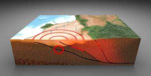
Supershear earthquakes are characterized by the rupture in Earth’s crust moving very fast along a fault, causing the up-and-down or side-to-side waves that shake the ground — called seismic shear waves — to intensify. Shear waves are created in standard earthquakes, too, but in supershear quakes, the rupture moving faster than the shear waves produces more energy in a shorter time, which is what makes supershears even more destructive.

“That intense shaking was responsible for the widespread landslides and liquefactions [the softening of soil caused by the shaking, which often causes buildings to sink into the mud] that followed the Palu earthquake,” Meng said.

In fact, he said, the vibrations produced by the shaking of supershear earthquakes is analogous to the sound vibrations of the sonic boom produced by supersonic jets.

UCLA graduate student Han Bao, the report’s first author, gathered publicly available ground-motion recordings from a sensor network in Australia — about 2,500 miles away from where the earthquake was centered — and used a UCLA-developed source imaging technique that tracks the growth of large earthquakes to determine its rupture speed. The technique is similar to how a smartphone user’s location can be determined by triangulating the times that phone signals arrive at cellphone antenna towers.

“Our technique uses a similar idea,” Meng said. “We measured the delays between different seismic sensors that record the seismic motions at set locations.”

The researchers could then use that to determine the location of the rupture at different times during the earthquake.

They determined that the minute-long quake moved away from the epicenter at 4.1 kilometers per second (or about 2.6 miles per second), faster than the surrounding shear-wave speed of 3.6 kilometers per second (2.3 miles per second). By comparison, non-shear earthquakes move at about 60 percent of that speed — around 2.2 kilometers per second (1.3 miles per second), Meng said.

Previous supershear earthquakes — like the magnitude 7.8 Kunlun earthquake in Tibet in 2001 and the magnitude 7.9 Denali earthquake in Alaska in 2002 — have occurred on faults that were remarkably straight, meaning that there were few obstacles to the quakes’ paths. But the researchers found on satellite images of the Palu quake that the fault line had two large bends. The temblor was so strong that the rupture was able to maintain a steady speed around these bends.

That could be an important lesson for seismologists and other scientists who assess earthquake hazards.

“If supershear earthquakes occur on nonplanar faults, as the Palu earthquake did, we have to consider the possibility of stronger shaking along California’s San Andreas fault, which has many bends, kinks and branches,” Meng said.

Supershear earthquakes typically start at sub-shear speed and then speed up as they continue. But Meng said the Palu earthquake progressed at supershear speed almost from its inception, which would imply that there was high stress in the rocks surrounding the fault — and therefore stronger shaking and more land movement in a compressed amount of time than would in standard earthquakes.

“Geometrically irregular rock fragments along the fault plane usually act as barriers preventing earthquakes,” Meng said. “However, if the pressure accumulates for a long time — for decades or even hundreds of years — an earthquake will eventually overcome the barriers and will go supershear right away.”

Among the paper’s other authors are Tian Feng, a UCLA graduate student, and Hui Huang, a UCLA postdoctoral scholar. The UCLA researchers were supported by the National Science Foundation and the Leon and Joanne V.C. Knopoff Foundation. The other authors are Cunren Liang of the Seismological Laboratory at Caltech; Eric Fielding and Christopher Milliner of JPL at Caltech and Jean-Paul Ampuero of Geoazur.

Reference:
Han Bao, Jean-Paul Ampuero, Lingsen Meng, Eric J. Fielding, Cunren Liang, Christopher W. D. Milliner, Tian Feng, Hui Huang. Early and persistent supershear rupture of the 2018 magnitude 7.5 Palu earthquake. Nature Geoscience, 2019; DOI: 10.1038/s41561-018-0297-z

Note: The above post is reprinted from materials provided by University of California – Los Angeles.

Discovery of the oldest evidence of mobility on Earth

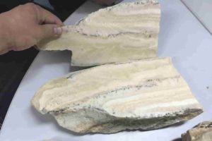
Previously, the oldest traces of this kind found dated to approximately 600 million years ago: the Ediacaran period, also characterized by a peak in dioxygen and a proliferation in biodiversity. Scale bar: 1 cm. Credit: A. El Albani / IC2MP / CNRS - Université de Poitiers
Previously, the oldest traces of this kind found dated to approximately 600 million years ago: the Ediacaran period, also characterized by a peak in dioxygen and a proliferation in biodiversity. Scale bar: 1 cm. Credit: A. El Albani / IC2MP / CNRS – UniversitĂ© de Poitiers

An international and multi-disciplinary team coordinated by Abderrazak El Albani at the Institut de chimie des milieux et matériaux de Poitiers (CNRS/Université de Poitiers) has uncovered the oldest fossilised traces of motility. Whereas previous remnants were dated to 570 million years ago, this new evidence is 2.1 billion years old. They were discovered in a fossil deposit in Gabon, where the oldest multicellular organisms have already been found (1). These results appear in the 11 February 2019 edition of PNAS.

A few years ago, geologist Abderrazak El Albani and his team at the Institut de chimie des milieux et matĂ©riaux de Poitiers (CNRS/UniversitĂ© de Poitiers) discovered the oldest existing fossils of multicellular organisms in a deposit in Gabon. Located in the Franceville Basin, the deposit allowed scientists to re-date the appearance of multicellular life on Earth to 2.1 billion years — approximately 1.5 billion years earlier than previously thought (600 million). At the time, researchers showed that this rich biodiversity co-occurred with a peak in dioxygenation of the atmosphere (2), and developed in a calm and shallow marine environment.

In this same geological deposit, the team has now uncovered the existence of fossilised traces of motility. This shows that certain multicellular organisms in this primitive marine ecosystem were sophisticated enough to move through its mud, rich in organic matter.

The traces were analysed and reconstructed in 3D using X-ray computed micro-tomography, a non-destructive imaging technique. The more or less sinuous structures are tubular, of a generally consistent diameter of a few millimetres, and run through fine layers of sedimentary rock. Geometrical and chemical analysis reveals that they are biological in origin and appeared at the same time the sediment was deposited.

The traces are located next to fossilised microbial biofilms (3), which formed carpets between the superficial sedimentary layers. It is plausible that the organisms behind this phenomenon moved in search of nutritive elements and the dioxygen, both produced by cyanobacteria.

What did these living elements look like? Though difficult to know for certain, they may have been similar to colonial amoebae, which cluster together when resources become scarce, forming a type of slug, which moves in search of a more favourable environment.

Until now, the oldest traces of recognised movement were dated to 570 million years ago; an estimate that appeared to be confirmed by the molecular clock (4). Evidence of motility found in rock that is 2.1 billion years old raises new questions regarding the history of life: was this biological innovation the prelude to more perfected forms of movement, or an experiment cut short by the drastic drop in atmospheric oxygen rates which occurred approximately 2.083 billion years ago?

Notes:

(1) Nature, 2010 and PLOS ONE, 2014.

(2) PNAS, 2013.

(3) Geobiology, 2018.

(4) The principle is to explore variations between two species observed in similar regions of their DNA in order to estimate the time lapse since the era in which their nearest common ancestor lived.

Reference:
Abderrazak El Albani, M. Gabriela Mangano, Luis A. Buatois, Stefan Bengtson, Armelle Riboulleau, Andrey Bekker, Kurt Konhauser, Timothy Lyons, Claire Rollion-Bard, Olabode Bankole, Stellina Gwenaelle Lekele Baghekema, Alain Meunier, Alain Trentesaux, Arnaud Mazurier, Jeremie Aubineau, Claude Laforest, Claude Fontaine, Philippe Recourt, Ernest Chi Fru, Roberto Macchiarelli, Jean Yves Reynaud, François Gauthier-Lafaye, Donald E. Canfield. Organism motility in an oxygenated shallow-marine environment 2.1 billion years ago. Proceedings of the National Academy of Sciences, 2019; 201815721 DOI: 10.1073/pnas.1815721116

Note: The above post is reprinted from materials provided by CNRS.

Giant ‘megalodon’ shark extinct earlier than previously thought

Megalodon extinction graphical abstract.
Megalodon extinction graphical abstract. Credit: Robert Boessenecker

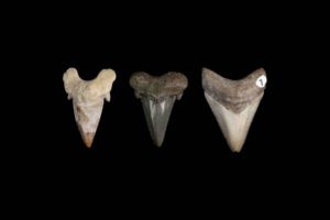
Megalodon — a giant predatory shark that has inspired numerous documentaries, books and blockbuster movies — likely went extinct at least one million years earlier than previously thought, according to new research published Feb. 13 in PeerJ — the Journal of Life and Environmental Sciences.

Earlier research, which used a worldwide sample of fossils, suggested that the 50-foot-long, giant shark Otodus megalodon went extinct 2.6 million years ago. Another recent study attempted to link this extinction (and that of other marine species) with a supernova known to have occurred at about this time.

However, a team of researchers led by vertebrate paleontologist Robert Boessenecker with the College of Charleston, Charleston, South Carolina, noted that in many places there were problems with the data regarding individual fossils in the study estimating the extinction date.

In the new study, the researchers reported every fossil occurrence of O. megalodon from the densely sampled rock record of California and Baja California (Mexico) in order to estimate the extinction.

Besides Boessenecker, the research team included Dana Ehret, of New Jersey State Museum; Douglas Long, of the California Academy of Sciences; Morgan Churchill, of the University of Wisconsin Oshkosh; Evan Martin, of the San Diego Natural History Museum; and Sarah Boessenecker, of the University of Leicester, United Kingdom.

They found that genuine fossil occurrences were present until the end of the early Pliocene epoch, 3.6 million years ago. All later fossils either had poor data provenance and likely came from other fossil sites or showed evidence of being eroded from older deposits. Until 3.6 million years ago, O. megalodon had a continuous fossil record on the West Coast.

“We used the same worldwide dataset as earlier researchers but thoroughly vetted every fossil occurrence, and found that most of the dates had several problems-fossils with dates too young or imprecise, fossils that have been misidentified, or old dates that have since been refined by improvements in geology; and we now know the specimens are much younger,” Boessenecker said.

“After making extensive adjustments to this worldwide sample and statistically re-analyzing the data, we found that the extinction of O. megalodon must have happened at least one million years earlier than previously determined.”

This is a substantial adjustment as it means that O. megalodon likely went extinct long before a suite of strange seals, walruses, sea cows, porpoises, dolphins and whales all disappeared sometime about 1-2.5 million years ago.

“The extinction of O. megalodon was previously thought to be related to this marine mass extinction-but in reality, we now know the two are not immediately related,” Boessenecker said.

It also is further unclear if this proposed mass extinction is actually an extinction, as marine mammal fossils between 1 and 2 million years old are extraordinarily rare-giving a two-million- year-long period of “wiggle room.”

“Rather, it is possible that there was a period of faunal turnover (many species becoming extinct and many new species appearing) rather than a true immediate and catastrophic extinction caused by an astronomical cataclysm like a supernova,” Boessenecker said.

The researchers speculate that competition with the newly evolved modern great white shark (Carcharodon carcharias) is a more likely reason for megalodon’s extinction.

Great whites first show up with serrated teeth about 6 million years ago and only in the Pacific; by 4 million years ago, they are finally found worldwide.

“We propose that this short overlap (3.6-4 million years ago) was sufficient time for great white sharks to spread worldwide and outcompete O. megalodon throughout its range, driving it to extinction-rather than radiation from outer space,” Boessenecker said.

Reference:
Robert W. Boessenecker, Dana J. Ehret, Douglas J. Long, Morgan Churchill, Evan Martin, Sarah J. Boessenecker. The Early Pliocene extinction of the mega-toothed shark Otodus megalodon: a view from the eastern North Pacific. PeerJ, 2019; 7: e6088 DOI: 10.7717/peerj.6088

Note: The above post is reprinted from materials provided by University of Wisconsin Oshkosh.

Neanderthal footprints found in Gibraltar

The place where the footprint was found
The place where the footprint was found. Credit: Universdad de Sevilla

The international journal Quaternary Science Reviews has just published a paper which has involved the participation of Gibraltarian scientists from The Gibraltar National Museum alongside colleagues from Spain, Portugal and Japan. The results which have been published come from an area of the Catalan Bay Sand Dune.

This work started ten years ago, when the first dates using the OSL method were obtained. It is then that the first traces of footprints left by vertebrates were found. In subsequent years the successive natural collapse of sand has revealed further material and has permitted a detailed study including new dates.

The sand sheets in the rampant dunes above Catalan Bay are a relic of the last glaciation, when sea level was up to 120 metres below present levels and a great field of dunes extended eastwards from the base of the Rock. The identified footprints correspond to species which are known, from fossil material, to have inhabited Gibraltar. The identified footprints correspond to Red Deer, Ibex, Aurochs, Leopard and Straight-tusked Elephant. In addition the scientists have found the footprint of a young human (106-126 cm in height), possibly Neanderthal, which dates to around 29 thousand years ago. It would coincide with late Neanderthal dates from Gorham’s Cave.

If confirmed to be Neanderthal, these dunes would become only the second site in the world with footprints attributed to these humans, the other being Vartop Cave in Romania. These findings add further international importance to the Gibraltar Pleistocene heritage, declared of World Heritage Value in 2016.

The research was supported by HM Government of Gibraltar under the Gibraltar Caves Project and the annual excavations in the Gibraltar Caves, with additional support to the external scientists from the Spanish EU project MICINN-FEDER: CGL2010-15810/BTE.

Minister for Heritage John Cortes MP commented, “This is extraordinary research and gives us an incredible insight into the wildlife community of Gibraltar’s past. We should all take a moment to imagine the scene when these animals walked across our landscape. It helps us understand the importance of looking after our heritage. I congratulate the research team on uncovering this fascinating, hidden evidence of our Rock’s past.”

Reference:
Fernando Muñiz, Luis M. Cáceres, Joaquín Rodríguez-Vidal, Carlos Neto de Carvalho, João Belo, Clive Finlayson, Geraldine Finlayson, Stewart Finlayson, Tatiana Izquierdo, Manuel Abad, Francisco J. Jiménez-Espejo, Saiko Sugisaki, Paula Gómez, Francisco Ruiz. Following the last Neanderthals: Mammal tracks in Late Pleistocene coastal dunes of Gibraltar (S Iberian Peninsula). Quaternary Science Reviews, 2019; DOI: 10.1016/j.quascirev.2019.01.013

Note: The above post is reprinted from materials provided by University of Seville.

Life thrived on Earth 3.5 billion years ago

Electron microscopy image of microbial cells which respire sulfate.
Electron microscopy image of microbial cells which respire sulfate. Credit: Guy Perkins and Mark Ellisman, National Center for Microscopy and Imaging Research

3.5 billion years ago Earth hosted life, but was it barely surviving, or thriving? A new study carried out by a multi institutional team with leadership including the Earth-Life Science Institute (ELSI) of Tokyo Institute of Technology (Tokyo Tech) provides new answers to this question. Microbial metabolism is recorded in billions of years of sulfur isotope ratios that agree with this study’s predictions, suggesting life throve in the ancient oceans. Using this data, scientists can more deeply link the geochemical record with cellular states and ecology.

Scientists want to know how long life has existed on Earth. If it has been around for almost as long as the planet, this suggests it is easy for life to originate and life should be common in the Universe. If it takes a long time to originate, this suggests there were very special conditions that had to occur. Dinosaurs, whose bones are presented in museums around the world, were preceded by billions of years by microbes. While microbes have left some physical evidence of their presence in the ancient geological record, they do not fossilize well, thus scientists use other methods for understanding whether life was present in the geological record.

Presently, the oldest evidence of microbial life on Earth comes to us in the form of stable isotopes. The chemical elements charted on the periodic are defined by the number of protons in their nuclei, for example, hydrogen atoms have one proton, helium atoms have two, carbon atoms contain six. In addition to protons, most atomic nuclei also contain neutrons, which are about as heavy as protons, but which don’t bear an electric charge. Atoms which contain the same number of protons, but variable numbers of neutrons are known as isotopes. While many isotopes are radioactive and thus decay into other elements, some do not undergo such reactions; these are known as “stable” isotopes. For example, the stable isotopes of carbon include carbon 12 (written as 12C for short, with 6 protons and 6 neutrons) and carbon 13 (13C, with 6 protons and 7 neutrons).

All living things, including humans, “eat and excrete.” That is to say, they take in food and expel waste. Microbes often eat simple compounds made available by the environment. For example, some are able to take in carbon dioxide (CO2) as a carbon source to build their own cells. Naturally occurring CO2 has a fairly constant ratio of 12C to 13C. However, 12CO2 is about 2 % lighter than 13CO2, so 12CO2 molecules diffuse and react slightly faster, and thus the microbes themselves become “isotopically light,” containing more 12C than 13C, and when they die and leave their remains in the fossil record, their stable isotopic signature remains, and is measurable. The isotopic composition, or “signature,” of such processes can be very specific to the microbes that produce them.

Besides carbon there are other chemical elements essential for living things. For example, sulfur, with 16 protons, has three naturally abundant stable isotopes, 32S (with 16 neutrons), 33S (with 17 neutrons) and 34S (with 18 neutrons). Sulfur isotope patterns left behind by microbes thus record the history of biological metabolism based on sulfur-containing compounds back to around 3.5 billion years ago. Hundreds of previous studies have examined wide variations in ancient and contemporary sulfur isotope ratios resulting from sulfate (a naturally occurring sulfur compound bonded to four oxygen atoms) metabolism. Many microbes are able to use sulfate as a fuel, and in the process excrete sulfide, another sulfur compound. The sulfide “waste” of ancient microbial metabolism is then stored in the geological record, and its isotope ratios can be measured by analyzing minerals such as the FeS2 mineral pyrite.

This new study reveals a primary biological control step in microbial sulfur metabolism, and clarifies which cellular states lead to which types of sulfur isotope fractionation. This allows scientists to link metabolism to isotopes: by knowing how metabolism changes stable isotope ratios, scientists can predict the isotopic signature organisms should leave behind. This study provides some of the first information regarding how robustly ancient life was metabolizing. Microbial sulfate metabolism is recorded in over a three billion years of sulfur isotope ratios that are in line with this study’s predictions, which suggest life was in fact thriving in the ancient oceans. This work opens up a new field of research, which ELSI Associate Professor Shawn McGlynn calls “evolutionary and isotopic enzymology.” Using this type of data, scientists can now proceed to other elements, such as carbon and nitrogen, and more completely link the geochemical record with cellular states and ecology via an understanding of enzyme evolution and Earth history.

Reference:
Min Sub Sim, Hideaki Ogata, Wolfgang Lubitz, Jess F. Adkins, Alex L. Sessions, Victoria J. Orphan, Shawn E. McGlynn. Role of APS reductase in biogeochemical sulfur isotope fractionation. Nature Communications, 2019; 10 (1) DOI: 10.1038/s41467-018-07878-4

Note: The above post is reprinted from materials provided by Tokyo Institute of Technology.

Fate of the subducted oceanic crust revealed by laboratory experiments

subducted oceanic crust inferred from this study.
A schematic image of subducted oceanic crust inferred from this study. Basalt and harzburgite layers of the oceanic crust accumulate beneath and above the 660 km discontinuity, respectively. Credit: Ehime University

Professor Tetsuo Irifune of the Geodynamics Research Center (GRC) of Ehime University heads a research group investigating the Earth’s interior by means of experiments at extreme pressures and temperatures, simulating those expected in the deepest regions of our planet.

Using a combination of ultrasonic techniques and a large volume press apparatus, GRC researchers were successful in measuring the sound velocities of CaSiO3 perovskite (CaPv), an important mineral of the mantle at depths below 560 km. This result allowed them to directly interpret seismic observations by a comparison with their velocity profiles obtained in the laboratory, and derived some composition models for the regions across the 660 km depth discontinuity that marks the boundary between the upper and lower mantle.

The scientific article that presents their results was published on January 10 in the journal Nature.

CaPv constitutes 7-10 vol% of the pyrolitic mantle and up to 30 vol% of subducted basaltic rocks below ~560 km depth and therefore is an important constituent mineral in both the mantle transition region (MTR; 410-660 km in depth) and lower mantle (660-2900 km in depth). CaPv also plays an important role in immobilizing heavy elements such as rare earth elements or actinides in the mantle due to its large calcium site, which can easily accommodate such large elements. But despite such importance, no measurements of sound velocities have been made CaPv at high temperatures, because this phase is unstable at ambient conditions and hence there was no adequate sample for such measurements.

“Because CaPv is only stable at pressure and temperature conditions of the mantle, we designed an experiment that allows us to synthesize this phase with the adequate shape and dimension under high pressure, then subsequently send an acoustic wave directly into the pressurized sample. Using this new approach, we can study high-pressure minerals, which are not stable at atmospheric conditions, such as CaPv.” says Steeve GrĂ©aux, the researcher leading this project.

Professor Irifune and his team already demonstrated in 2008, that pyrolite, a hypothetical rock composition derived as a mixture of basalt and peridotite agree well with geophysical observations at depths down to 560 km, which was also reported in Nature. However, at that time, they could not draw further conclusions at depths lower than 560 km because there was no available data on CaPv. Their 2019 results became the last piece of a puzzle and allowed them to complete their hypotheses for the seismic structure of the mantle in between the depths of 560 km and 800 km.

“We did find that the cubic form of CaPv, which is most likely to be present in the mantle, has lower velocities than what was formerly predicted by theoretical studies. This result refutes previous models that proposed formation of CaPv in pyrolite could explain the steep velocity gradient above a depth of 660 km. On the other hand, it is in good agreement with a former study proposing the presence of basalts beneath a depth of 660 km on the basis of density measurements.” says Tetsuo Irifune.

These new results indeed show that the presence of subducted oceanic crust can explain the magnitude of the reduction of shear velocity below a depth of 660 km, as observed beneath North America. Incidentally, the model they proposed is very consistent with the recent discovery, in 2018, of CaPv in a natural diamond, which provides evidence for the presence of oceanic crust material in the uppermost lower mantle. It is also compatible with global-scale geodynamics calculations that predicted basalt enrichment beneath 660 km would stabilize the subducted slab in this region.

The authors conclude “CaPv, which was once called “invisible” in the lower mantle as this phase was predicted to have velocities similar to those of the most abundant mineral (MgSiO3 perovskite or bridgmanite) in fact holds velocities substantially lower than those of bridgmanite at depths of 660-800 km, which should greatly contribute to tracing the existence and recycling of the former oceanic crust in the Earth’s lower mantle..”

Reference:
Steeve Gréaux, Tetsuo Irifune, Yuji Higo, Yoshinori Tange, Takeshi Arimoto, Zhaodong Liu, Akihiro Yamada. Sound velocity of CaSiO3 perovskite suggests the presence of basaltic crust in the Earth’s lower mantle. Nature, 2019; 565 (7738): 218 DOI: 10.1038/s41586-018-0816-5

Note: The above post is reprinted from materials provided by Ehime University.

New oviraptorosaur species discovered in Mongolia

Gobiraptor reconstruction.
Gobiraptor reconstruction. Credit: Do Yoon Kim (2019)

A new oviraptorosaur species from the Late Cretaceous was discovered in Mongolia, according to a study published in February 6, 2019 in the open-access journal PLOS ONE by Yuong-Nam Lee from Seoul National University, South Korea, and colleagues.

Oviraptorosaurs were a diverse group of feathered, bird-like dinosaurs from the Cretaceous of Asia and North America. Despite the abundance of nearly complete oviraptorosaur skeletons discovered in southern China and Mongolia, the diet and feeding strategies of these toothless dinosaurs are still unclear. In this study, Lee and colleagues described an incomplete skeleton of an oviraptorosaur found in the Nemegt Formation of the Gobi desert of Mongolia.

The new species, named Gobiraptor minutus, can be distinguished from other oviraptorosaurs in having unusual thickened jaws. This unique morphology suggests that Gobiraptor used a crushing feeding strategy, supporting previous hypotheses that oviraptorosaurs probably fed on hard food items such as eggs, seeds or hard-shell mollusks. Histological analyses of the femur revealed that the specimen likely belonged to a very young individual.

The finding of a new oviraptorosaur species in the Nemegt Formation, which consists mostly of river and lake deposits, confirms that these dinosaurs were extremely well adapted to wet environments. The authors propose that different dietary strategies may explain the wide taxonomic diversity and evolutionary success of this group in the region.

The authors add: “A new oviraptorid dinosaur Gobiraptor minutus gen. et sp. nov. from the Upper Cretaceous Nemegt Formation is described here based on a single holotype specimen that includes incomplete cranial and postcranial elements. The unique morphology of the mandible and the accordingly inferred specialized diet of Gobiraptor also indicate that different dietary strategies may be one of important factors linked with the remarkably high diversity of oviraptorids in the Nemegt Basin.”

Reference:
Sungjin Lee, Yuong-Nam Lee, Anusuya Chinsamy, Junchang LĂĽ, Rinchen Barsbold, Khishigjav Tsogtbaatar. A new baby oviraptorid dinosaur (Dinosauria: Theropoda) from the Upper Cretaceous Nemegt Formation of Mongolia. PLOS ONE, 2019; 14 (2): e0210867 DOI: 10.1371/journal.pone.0210867

Note: The above post is reprinted from materials provided by PLOS.

Earliest known seed-eating perching bird discovered in Fossil Lake, Wyoming

Eofringillirostrum boudreauxi
The 52-million-year-old fossil of Eofringillirostrum boudreauxi, the earliest known perching bird with a beak for eating seeds. Credit: Copyright Lance Grande, Field Museum

Most of the birds you’ve ever seen — sparrows, finches, robins, crows — have one crucial thing in common: they’re all what scientists refer to as perching birds, or “passerines.” The passerines make up about 6,500 of the 10,000 bird species alive today. But while they’re everywhere now, they were once rare, and scientists are still learning about their origins. In a new paper in Current Biology, researchers have announced the discovery of one of the earliest known passerine birds, from 52 million years ago.

“This is one of the earliest known perching birds. It’s fascinating because passerines today make up most of all bird species, but they were extremely rare back then. This particular piece is just exquisite,” says Field Museum Neguanee Distinguished Service Curator Lance Grande, an author of the paper. “It is a complete skeleton with the feathers still attached, which is extremely rare in the fossil record of birds.”

The paper describes two new fossil bird species — one from Germany that lived 47 million years ago, and another that lived in what’s now Wyoming 52 million years ago, a period known as the Early Eocene. The Wyoming bird, Eofringillirostrum boudreauxi, is the earliest example of a bird with a finch-like beak, similar to today’s sparrows and finches. This legacy is reflected in its name; Eofringilllirostrum means “dawn finch beak.” (Meanwhile, boudreauxi is a nod to Terry and Gail Boudreaux, longtime supporters of science at the Field Museum.)”

The fossil birds’ finch-like, thick beaks hint at their diet. “These bills are particularly well-suited for consuming small, hard seeds,” says Daniel Ksepka, the paper’s lead author, curator at the Bruce Museum in Connecticut. Anyone with a birdfeeder knows that lots of birds are nuts for seeds, but seed-eating is a fairly recent biological phenomenon. “The earliest birds probably ate insects and fish, some may have been eating small lizards,” says Grande. “Until this discovery, we did not know much about the ecology of early passerines. E. boudreauxi gives us an important look at this.”

“We were able to show that a comparable diversity of bill types already developed in the Eocene in very early ancestors of passerines,” says co-author Gerald Mayr of the Senckenberg Research Institute in Frankfurt. “The great distance between the two fossil sites implies that these birds were widespread during the Eocene, while the scarcity of known fossils suggests a rather low number of individuals,” adds Ksepka.

While passerine birds were rare 52 million years ago, E. boudreauxi had the good luck to live and die near Fossil Lake, a site famous for perfect fossilization conditions.

“Fossil Lake is a really graphic picture of an entire community locked in stone — it has everything from fishes and crocs to insects, pollen, reptiles, birds, and early mammals,” says Grande. “We have spent so much time excavating this locality, that we have a record of even the very rare things.”

Grande notes that Fossil Lake provides a unique look at the ancient world — one of the most detailed pictures of life on Earth after the extinction of the dinosaurs (minus the birds) 65 million years ago. “Knowing what happened in the past gives us a better understanding of the present and may help us figure out where we are going for the future.”

With that in mind, Grande plans to continue his exploration of the locale. “I’ve been going to Fossil Lake every year for the last 35 years, and finding this bird is one of the reasons I keep going back. It’s so rich,” says Grande. “We keep finding things that no one’s ever seen before.”

Reference:
Daniel T. Ksepka, Lance Grande, Gerald Mayr. Oldest Finch-Beaked Birds Reveal Parallel Ecological Radiations in the Earliest Evolution of Passerines. Current Biology, 2019 DOI: 10.1016/j.cub.2018.12.040

Note: The above post is reprinted from materials provided by Field Museum.

Unusual microbes hold clues to early life

Scientists use the deep-diving robot Jason to collect water samples from oceanic crust at a subseafloor observatory off the coast of Washington. A recent study found that a group of unusual microbes living below the seafloor provides clues to the evolution of life on Earth, and potentially other planets. Credit: Woods Hole Oceanographic Institution, courtesy of University of California, Santa Cruz, US National Science Foundation, ROV Jason dive J2-711, 2013, AT26-03 cruise chief scientist Andrew Fisher

A new study has revealed how a group of deep-sea microbes provides clues to the evolution of life on Earth, according to a recent paper in The ISME Journal. Researchers used cutting-edge molecular methods to study these microbes, which thrive in the hot, oxygen-free fluids that flow through Earth’s crust.

Called Hydrothermarchaeota, this group of microbes lives in such an extreme environment that they have never been cultivated in a laboratory for study. A research team from Bigelow Laboratory for Ocean Sciences, the University of Hawai’i at Manoa, and the Department of Energy Joint Genome Institute bypassed the problem of cultivation with genetic sequencing methods called genomics, a suite of novel techniques used to sequence large groups of genetic information. They found that Hydrothermarchaeota may obtain energy by processing carbon monoxide and sulfate, which is an overlooked metabolic strategy. The microbes use energy from this process to grow as a form of chemosynthesis.

“The majority of life on Earth is microbial, and most microbes have never been cultivated,” said Beth Orcutt, a senior research scientist at Bigelow Laboratory and one of the study’s senior authors. “These findings emphasize why single cell genomics are such important tools for discovering how a huge proportion of life functions.”

Analyzing Hydrothermarchaeota genomes revealed that these microbes belong to the group of single-celled life known as archaea and evolved early in the history of life on Earth — as did their unusual metabolic processes. These observations suggest that the subsurface ocean crust is an important habitat for understanding how life evolved on Earth, and potentially other planets.

The researchers also found genetic evidence that Hydrothermarchaeota have the ability to move on their own. Motility offers a valuable survival strategy for the extreme environment they call home, which has a limited supply of nutrients essential to life.

“Studying these unique microbes can give us insights into both the history of Earth and the potential strategies of life on other planets,” said Stephanie Carr, first author on the paper and a former postdoctoral researcher with Orcutt who is now an assistant professor at Hartwick College. “Their survival strategies make them incredibly versatile, and they play an important, overlooked role in the subsurface environments where they live.”

In 2011, Orcutt and other project scientists sailed to the flank of the Juan de Fuca Ridge, a mid-ocean ridge off the coast of Washington where two ocean plates are separating and generating new oceanic crust. They used Woods Hole Oceanographic Institution’s deep-diving robot Jason to travel 2.6 km to the seafloor and collect samples of the fluid that flows through the deep crust.

These crustal fluids contained microbes that had never before been studied. Working in partnership with the Department of Energy Joint Genome Institute, the researchers sorted and analyzed the microbes in the Single Cell Genomics Center at Bigelow Laboratory. This cutting-edge research facility is directed by Ramunas Stepanauskas, a senior research scientist and study author. The project team also analyzed the microbes using metagenomics, a technique that extracts genomic information directly from environmental samples. These analyses yielded insights into the genetic blueprints of Hydrothermarchaeota, their relationship to other archaea, and the strategies they have evolved to survive in the subseafloor.

The researchers will build upon this discovery when they return to the Juan de Fuca Ridge in May 2019 to continue investigating the extreme microbes thriving below the seafloor. Orcutt will lead a cruise using ROV Jason with this team of researchers to further explore the subseafloor environment, leveraging funding from the National Science Foundation and NASA.

“The microbes living ‘buried alive’ below the seafloor are really intriguing to us, since they can survive on low amounts of energy,” Orcutt said. “We hope that our experiments on these weird microbes can show how they do this, so we can imagine how life might exist on other planets.”

Reference:
Stephanie A. Carr, Sean P. Jungbluth, Emiley A. Eloe-Fadrosh, Ramunas Stepanauskas, Tanja Woyke, Michael S. Rappé, Beth N. Orcutt. Carboxydotrophy potential of uncultivated Hydrothermarchaeota from the subseafloor crustal biosphere. The ISME Journal, 2019; DOI: 10.1038/s41396-019-0352-9

Note: The above post is reprinted from materials provided by Bigelow Laboratory for Ocean Sciences.

Researchers help define Southern Ocean’s geological features

pillow basalts from undersea volcanic eruptions,
Pillow basalts from undersea volcanic eruptions. Credit: National Science Foundation

New data collected by University of Wyoming researchers and others point to a newly defined mantle domain in a remote part of the Southern Ocean.

UW Department of Geology and Geophysics Professor Ken Sims and recent Ph.D. graduate Sean Scott are co-authors of an article, “An isotopically distinct Zealandia-Antarctic mantle domain in the Southern Ocean,” published by the scientific journal Nature Geoscience in January.

“The Australian-Antarctic Ridge is the remotest mid-ocean ridge in the world’s oceans and one of the last explored ridge segments, and, lo and behold, our isotope measurements of the samples we collected provided us with quite a surprise — an entirely new domain in the Earth’s mantle,” Sims says.

The two were part of a group investigating the Australian-Antarctic Ridge (AAR) that included researchers from the United States, South Korea and France. Known as the last gap in the mapping and sampling of seafloor spreading centers, AAR is a 1,200-mile expanse in the most remote parts of the ocean ridge system. Specifically, the team was looking to resolve questions surrounding the boundaries of Earth’s mantle domains as seen in ocean basalt formations created during mantle melting.

Those basalt formations are pushed up from the Earth’s mantle beneath the Indian and Pacific oceans through the ridges and have distinct isotopic compositions. That has created a long-accepted boundary at the Australian-Antarctic Discordance along the Southeast Indian Ridge. This boundary has been widely used to place constraints on large-scale patterns of the mantle flow and composition in the Earth’s upper mantle. However, sampling between the Indian and Pacific ridges was lacking, because of difficulty in obtaining samples.

Now, Sims, Scott and company present data from the region that show the ridge has isotopic compositions distinct from both the Pacific and Indian mantle domains. The data define a separate Zealandia-Antarctic domain that appears to have formed in response to the deep mantle upwelling and ensuing volcanism that led to the breakup of ancient supercontinent Gondwana around 90 million years ago. The Zealandia-Antarctic domain currently persists at the margins of the Antarctic continent.

The group surmises that the relatively shallow depths of the AAR may be the result of this deep mantle upwelling, and large offset transformations to the east may be its boundary with the Pacific domain.

Reference:
Sung-Hyun Park, Charles H. Langmuir, Kenneth W. W. Sims, Janne Blichert-Toft, Seung-Sep Kim, Sean R. Scott, Jian Lin, Hakkyum Choi, Yun-Seok Yang, Peter J. Michael. An isotopically distinct Zealandia–Antarctic mantle domain in the Southern Ocean. Nature Geoscience, 2019; DOI: 10.1038/s41561-018-0292-4

Note: The above post is reprinted from materials provided by University of Wyoming.

T. rex possessed a unique flexible skull

T. rex had an unusually flexible skull. Credit: Senckenberg

Senckenberg scientist Ingmar Werneburg, together with an international team, re-examined the skull structure of Tyrannosaurus rex. Using an “anatomical network analysis,” the researchers showed that the carnivorous dinosaur had an extremely flexible skull structure. Different bone modules led to a highly flexible muzzle that aided in tearing apart prey animals. The study was published today in the journal Scientific Reports.

Tyrannosaurus rex – the “King of the Tyrant Lizards” – owes its name in part to its impressive teeth and skull. The latter was subject to closer scrutiny by an international team of scientists from Germany, Switzerland, Great Britain, Spain, and the USA. “We compared the skull of T. rex with the skull construction of modern terrestrial vertebrates and used an anatomical network analysis to examine which skull bones are connected to each other,” explains the study’s lead author, PD Dr. Ingmar Werneburg of the Senckenberg Centre for Human Evolution and Palaeoenvironment at the University of TĂĽbingen.

The analysis revealed that, among all groups of animals analyzed in the study, the large carnivore possessed the highest number of “skull modules” – skull bones that form units with adjacent bones. This resulted in a particularly high mobility of the skull. “We were most surprised to discover the presence of separate upper and lower muzzle modules, which probably could move independent of each other,” adds the scientist from TĂĽbingen.

The researchers hypothesize that the feeding habits of Tyrannosaurus rex may have led to the complexity of its skull. The division into a lower and an upper muzzle module may have provided a certain amount of flexibility to the tooth-bearing part of the muzzle that aided in the forceful tearing of prey animals. “This trait, combined with teeth anchored within tooth pockets and two large temporal fenestrae (openings) as attachment points for the strong jaw muscles, made T. rex the ‘ideal carnivore,’ adds Werneburg in summary.

Reference:
Ingmar Werneburg et al. Unique skull network complexity of Tyrannosaurus rex among land vertebrates, Scientific Reports (2019). DOI: 10.1038/s41598-018-37976-8

Note: The above post is reprinted from materials provided by Senckenberg Research Institute and Natural History Museum.

First discovered fossil feather did not belong to iconic bird Archaeopteryx

The isolated Archaeopteryx feather is the first fossil feather ever discovered. Top image, the feather as it looks today under white light. Middle image, the original drawing from 1862 by Hermann von Meyer. Bottom image, Laser-Stimulated Fluorescence (LSF) showing the halo of the missing quill. Scale bar is 1cm. Credit: Copyright The University of Hong Kong

A 150-year-old fossil feather mystery has been solved by an international research team including Dr Michael Pittman from the Department of Earth Sciences, The University of Hong Kong. Dr Pittman and his colleagues applied a novel imaging technique, Laser-Stimulated Fluorescence (LSF), revealing the missing quill of the first fossil feather ever discovered, dethroning an icon in the process.

This fossil feather was found in the Solnhofen area of southern Germany in 1861. The isolated feather was used to name the iconic fossil bird Archaeopteryx and was closely identified with its skeletons. Unlike the feather impressions preserved in some Archaeopteryx fossils, the isolated feather is preserved as a dark film. The detailed 1862 description of the feather mentions a rather long quill visible on the fossil, but this is unseen today. Even recent x-ray fluorescence and UV imaging studies did not end the debate of the “missing quill.” The original existence of this quill has therefore been debated and it was unclear if the single feather represented a primary, secondary, or primary covert feather.

The results of this study are described in the journal Scientific Reports, and underscore the potential and scientific importance of Laser-Stimulated Fluorescence, which is being developed by Thomas G Kaye of the Foundation for Scientific Advancement, USA and Dr Pittman. “My imaging work with Tom Kaye demonstrates that important discoveries remain to be made even in the most iconic and well-studied fossils,” says Dr Pittman.

With the help of the LSF images, the team finally solved the 150-year-old missing quill mystery. The now completely visible feather allowed detailed comparisons with the feather impressions of Archaeopteryx and with living birds. Before this LSF work, the feather was thought to represent a primary covert from Archaeopteryx, but this study shows that it differs from coverts of modern birds by lacking a distinct s-shaped centerline. The team also ruled out that the feather represented a primary, secondary, or tail feather of Archaeopteryx. Instead, the new data indicates that the isolated feather came from an unknown feathered dinosaur and that its attribution to Archaeopteryx was wrong. “It is amazing that this new technique allows us to resolve the 150-year-old mystery of the missing quill,” says Daniela Schwarz, co-author in the study and curator for the fossil reptiles and bird collection of the Museum fĂĽr Naturkunde, Berlin. This discovery also demonstrates that the diversity of feathered dinosaurs was likely higher around the ancient Solnhofen Archipelago than previously thought. “The success of the LSF technique here is sure to lead to more discoveries and applications in other fields. But, you’ll have to wait and see what we find next!” added Tom Kaye, the study’s lead author.

Reference:
Thomas G. Kaye, Michael Pittman, Gerald Mayr, Daniela Schwarz, Xing Xu. Detection of lost calamus challenges identity of isolated Archaeopteryx feather. Scientific Reports, 2019; 9 (1) DOI: 10.1038/s41598-018-37343-7

Note: The above post is reprinted from materials provided by The University of Hong Kong.

These strange fossils are closely related to sea urchins

Stunningly well-preserved fossilized soft tissues of a stylophoran have recently been discovered
Stunningly well-preserved fossilized soft tissues of a stylophoran have recently been discovered. Shown here is the reconstruction of an individual of the stylophoran genus Thoralicystis. Stylophorans measured 0.5 to 4 cm and had flat, massive bodies or tests with paddle-like extensions, analogous to snowshoes, which allowed them to stay over soft seafloors. Credit: Rich Mooi / California Academy of Science

Just a few centimeters long, these animals thrived in the ocean roughly half a billion years ago. Because of their odd morphology, scientists have long struggled to find their branch on the tree of life.

Was their long appendage similar to a tail? That would make them ancestors of the vertebrates. However, their skeletons are made up of many calcite plates, suggestive of the bodies of echinoderms like sea urchins and starfish, even though they lack the characteristic symmetry of these animals.

A team led by Bertrand Lefebvre, a CNRS researcher at the Laboratoire de Géologie de Lyon, could finally settle this 150-year-old debate, using exceptionally preserved fossils from the Bou Izargane excavation in Morocco. Very unusually, the soft tissues of the fossilized creatures were preserved as pyrite, a ferrous mineral. By mapping the distribution of iron within the fossils, the researchers were able to clarify the fine structure of the appendage, which turns out to be comparable to that of a starfish arm. So these organisms had neither a head nor a tail, but rather a feeding arm.

Reference:
Bertrand Lefebvre et al. Exceptionally preserved soft parts in fossils from the Lower Ordovician of Morocco clarify stylophoran affinities within basal deuterostomes, Geobios (2018). DOI: 10.1016/j.geobios.2018.11.001

Note: The above post is reprinted from materials provided by CNRS.

Related Articles