back to top
Facebook Instagram Linkedin TikTok X Youtube
  • Contribute
  • Advertising
  • FAQs
Search

Logo

27.8 C
New York
Thursday, November 12, 2026
Facebook
Instagram
Linkedin
TikTok
X
Youtube

Logo

  • Home
  • List of Minerals
  • Geologic Time Scale
  • Geology Tools
  • Geology Adventure Tours
  • Plate Tectonics Map
    • Plate Boundary Map
  • Top Posts
  • Geology Jobs
  • GEO Courses
  • Geology Field Camps
  • Geology Field Camps in United States
  • Worldwide Geological Surveys
More

    Debris Flow Dynamics

    February 19, 2019
    Graphic showing the Transition Zone inside the Earth Princeton seismologist Jessica Irving worked with then-graduate student Wenbo Wu and another collaborator to determine the roughness at the top and bottom of the transition zone, a layer within the mantle, using scattered earthquake waves. They found that the top of the transition zone, a layer located 410 kilometers down, is mostly smooth, but the base of the transition zone, 660 km down, in some places is much rougher than the global surface average. “In other words, stronger topography than the Rocky Mountains or the Appalachians is present at the 660-km boundary,” said Wu. NOTE: This graphic is not to scale. Credit: Kyle McKernan, Office of Communications

    Massive Bolivian earthquake reveals mountains 660 kilometers below our feet

    February 16, 2019
    Mount Agung

    Satellite images reveal interconnected plumbing system that caused Bali volcano to...

    February 16, 2019
    Bubbles of liquid carbon dioxide float out of the seafloor at a vent on Northwest Eifuku volcano off the coast of Japan.

    How undersea gases once helped superheat our planet

    February 16, 2019
    This is an illustration depicting Mnyamawamtuka in its environmental setting.

    New dinosaur with heart-shaped tail provides evolutionary clues for African continent

    February 16, 2019
    A fossil of a conifer called Cunninghamia.

    New study of fossil plants shows the emergence of the Pacific...

    February 16, 2019

    Indonesia’s devastating 2018 earthquake was a rare supershear, UCLA study finds

    February 16, 2019
    Previously, the oldest traces of this kind found dated to approximately 600 million years ago: the Ediacaran period, also characterized by a peak in dioxygen and a proliferation in biodiversity. Scale bar: 1 cm. Credit: A. El Albani / IC2MP / CNRS - Université de Poitiers

    Discovery of the oldest evidence of mobility on Earth

    February 16, 2019
    Megalodon extinction graphical abstract.

    Giant ‘megalodon’ shark extinct earlier than previously thought

    February 16, 2019
    The place where the footprint was found

    Neanderthal footprints found in Gibraltar

    February 16, 2019
    1...156157158...688Page 157 of 688

    MOST POPULAR

    This image depicts a reconstruction of what the extinct monitor lizard might have looked like.

    Extinct monitor lizard had four eyes, fossil evidence shows

    April 2, 2018

    Erosion may trigger earthquakes

    November 22, 2014
    Seismogram

    Researchers seek new ways to improve earthquake risk communications

    April 12, 2017
    This is a roundnose grenadier at 1,300m off the Hebrides, Scotland.

    Deep-sea fish choose habitat according to genotype, new research says

    March 5, 2018
    Load more

    MORE ARTICLES

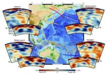
    Cross-sections of Earth’s mantle down to 1,400 km depth showing changes in its flow as ancient ocean beds fall into Earth’s deep interior.

    Earth’s deep mantle flows dynamically

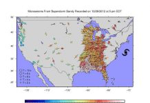
    Superstorm Sandy Shook the U. S., Literally

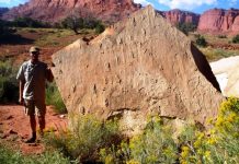
    Swimming reptiles make their mark in the Early Triassic

    New element tracking method a boon for geoscientists

    Facebook Instagram Linkedin TikTok X Youtube
    • Privacy Policy
    • Advertising
    • Contribute
    • FAQs
    © 2011-2026. All Rights Reserved.