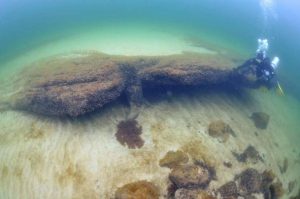
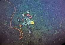
Discoveries indicate mass fishing and therefore a semi-permanent settlement. Credit: Arne Sjöström
Six years ago divers discovered the oldest known stationary fish traps in northern Europe off the coast of southern Sweden. Since then, researchers at Lund University in Sweden have uncovered an exceptionally well-preserved Stone Age site. They now believe the location was a lagoon environment where Mesolithic humans lived during parts of the year.
Other spectacular finds include a 9,000 year-old pick axe made out of elk antlers. The discoveries indicate mass fishing and therefore a semi-permanent settlement.
“As geologists, we want to recreate this area and understand how it looked. Was it warm or cold? How did the environment change over time?” says Anton Hansson, PhD student in Quaternary geology at Lund University.
Changes in the sea level have allowed the findings to be preserved deep below the surface of Hanö Bay in the Baltic Sea.
The researchers have drilled into the seabed and radiocarbon dated the core, as well as examined pollen and diatoms. They have also produced a bathymetrical map that reveals depth variations.
“These sites have been known, but only through scattered finds. We now have the technology for more detailed interpretations of the landscape,” says Anton Hansson.
“If you want to fully understand how humans dispersed from Africa, and their way of life, we also have to find all their settlements. Quite a few of these are currently underwater, since the sea level is higher today than during the last glaciation. Humans have always prefered coastal sites,” concludes Hansson.
Reference:
Anton Hansson, Björn Nilsson, Arne Sjöström, Svante Björck, Sofia Holmgren, Hans Linderson, Ola Magnell, Mats Rundgren, Dan Hammarlund. A submerged Mesolithic lagoonal landscape in the Baltic Sea, south-eastern Sweden – Early Holocene environmental reconstruction and shore-level displacement based on a multiproxy approach. Quaternary International, 2016; DOI: 10.1016/j.quaint.2016.07.059
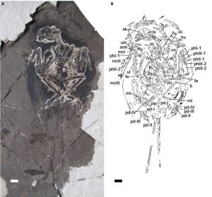
FIG. 1.Ventral view of the new bohaiornithid specimen (CUGB P1202, primary slab). A, photograph of the primary slab. B, inter-pretive drawing.Abbreviations: co, coracoid; cv, cervical vertebrae; fe, femur; fu, furcula; hu, humerus; il, ilium; mcI–III, metacarpalsI–III; mt, metatarsals; pd I–IV, pedal digits I–IV; phI-1, first phalanx of digit I; phII/III-1/2, first/second phalanx of digit II/III; pu,pubis; py, pygostyle; ra, radius; sc, scapula; sk, skull; sml, semilunate carpal; st, sternum; sy, synsacrum; th, thoracic vertebrae; ti, tibia;ul, ulna; uln, ulnare. Scale bar represents 1 cm. Colour online
Scientists have recently discovered a new bohaiornithid bird specimen from the Early Cretaceous Period of China with remarkably preserved feathers. Bohaiornithid birds belonged to enantiornithes, a group of avian dinosaurs that lived millions of years ago.
Our current knowledge of prehistoric plumage is limited, but the new findings provide valuable insights related to structure and colouration.
“Many enantiornithine birds possessed ornate feathers. This new specimen shows that some enantiornithines also had iridescent feathers and unlike most modern birds, these flashy ornaments developed before the animal was fully grown,” said Jennifer Peteya, lead author of the Palaentology study.
Reference:
The plumage and colouration of an enantiornithine bird from the early cretaceous of china. DOI: 10.1111/pala.12270
Note: The above post is reprinted from materials provided by Wiley.
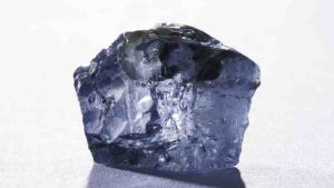
The gem was dug up at a lucrative site near Pretoria. Credit: Petra Diamonds
A massive diamond with a possible price tag of more than £36m has been discovered at a mine in South Africa.
The 29.6 carat blue diamond, described as being “exceptional”, was dug up at the Cullinan mine near Pretoria – owned by Petra Diamonds.
Chief executive Johan Dippenaar said: “The stones in the last year or so are selling well above $2m (£1.2m) per carat. That’s not my quote, that’s updates in the market.”
However, analyst Cailey Barker at brokers Numis said it could expect to fetch less – between $15m (£9m) and $20m (£12m) – at auction.
The mine, owned by the firm since 2008, was also where the Cullinan Diamond was found in 1905 – described as the largest rough gem diamond ever recovered and weighing 3,106 carats.
Other notable diamonds found in the mine include a 25.5 carat Cullinan blue diamond, found in 2013 and sold for $16.9m (£10m), and a diamond found in 2008, known as the Star of Josephine, which was sold for $9.49m (£5.7m).
Note: The above post is reprinted from materials provided by Sky UK.
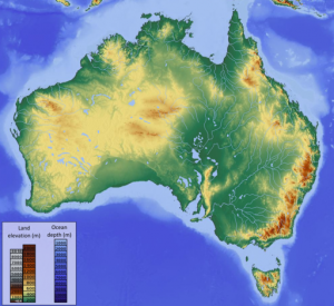
Australia shifts and tilts back and forth by several millimeters each year because of changes to the Earth’s center of mass, according to a new study. Credit: Hans Braxmeier via Wikimedia Commons.
Australia shifts and tilts back and forth by several millimeters each year because of changes to Earth’s center of mass, according to a new study. The findings could help scientists better track the precise location of Earth’s center of mass, which is important for GPS and other satellite measurements, according to the study’s author.
All bodies have a center of mass, or the average position of the mass of an object. Earth’s center of mass lies roughly at the center of the planet’s molten core, about 6,000 kilometers (about 3,700 miles) beneath the surface.
Seasonal changes to the distribution of water on Earth’s surface — largely through precipitation and evaporation — shift the planet’s center of mass a few millimeters in different directions.
The new study finds these movements cause Earth’s smallest continent to move back and forth with the seasons. Australia moves northwest by about 1 millimeter during its summer (winter in the Northern Hemisphere). At the same time, its northwestern edge tilts downwards by 2 to 3 millimeters, while the southeastern edge is lifted up by 2 to 3 millimeters. During its winter (summer in the Northern Hemisphere), the trend reverses, and the continent shifts southeast and reverses its tilt.
These changes are not enough to be felt by the country’s inhabitants but are enough to be detected by satellites.
“[Water] migrates every season,” said Shin-Chan Han, a professor of engineering at the University of Newcastle in Australia, and lead author of the new study published in the Journal of Geophysical Research: Solid Earth, a journal of the American Geophysical Union. “That motion causes quite a detectable, sizable deformation in Australia.”
Down under
Earth is roughly spherical, but the distribution of mass on its surface is not perfectly balanced. Water moves around the globe through precipitation and evaporation, and its average location depends largely on the seasons. At certain times, water accumulates more in some areas than in others, which causes slight changes to the planet’s center of mass.
When snowpacks in the Northern Hemisphere are at their peaks, the weight of water is strong enough to shift Earth’s center of mass a few millimeters closer to Europe. But six months later, when much of the rain and snow has returned to the atmosphere through evaporation, the center of mass moves closer to the south Pacific Ocean.
Han was looking to see if local changes in water near Australia might cause the continent to shift or move. The tectonic plate underneath Australia rests on a conveyor belt of molten rock called the asthenosphere. Convection in the asthenosphere moves each plate several centimeters every year, but the plates can also shift from other forces, including changes in where water is located.
To track Australia’s motion, Han measured changes in the locations of 14 land-based GPS stations across the continent. Although they orbit about 20,000 kilometers (12,500 miles) above Earth’s surface, GPS satellites can detect changes to land-based stations that are smaller than a millimeter.
Han then used data from the Gravity Recovery and Climate Experiment (GRACE), which uses two satellites to measure changes in the strength of gravitational pull over Earth, to measure the location of water.
By combining the new GPS and GRACE data, Han could measure how much the seasonal movement of water affected Australia. He found the continent shifts and tilts by several millimeters in response to the changes in water location far from Australia. These changes to water location affect Earth’s center of mass. All continents move slightly with the change in center of mass, but Australia experiences this more because it is directly in between Europe and the south Pacific Ocean, according to Han.
From Australia’s motion, Han was able to calculate the motion of Earth’s center of mass. The movement of the continent corresponded the movement of Earth’s center of mass. Although other methods can measure this movement, Han’s method is a secondary, independent check.
Han’s study shows GPS measurements across Australia are likely a millimeter or two off. While this may not amount to much of a difference on a day-to-day basis, it could be a concern for precision measurements, like those taken to determine sea level, he said.
“If our [GPS] station has some systematic distortion — deformation — it will impact our precise positioning calculation,” Han said. “So we need to know any systematic bias in our station to better understand our position.”
“This new way of determining the Earth’s [center of mass] … is a new and novel approach and will be taken up by others,” said Richard Gross, a researcher at NASA’s Jet Propulsion Laboratory in Pasadena, California, who was not involved with the new study. According to Gross, other scientists are likely to see if they can determine the motion of Earth’s center of mass using other continents besides Australia.
Reference:
Shin-Chan Han. Seasonal clockwise gyration and tilt of the Australian continent chasing the center of mass of the Earth’s system from GPS and GRACE. Journal of Geophysical Research: Solid Earth, 2016; DOI: 10.1002/2016JB013388
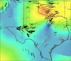
New stress maps of Texas and Oklahoma, with black lines indicating stress orientation. Blue-green colors indicate regions of extension in the crust, while yellow-orange areas are indicative of crustal compression. Credit: Jens-Erik Lund Snee
Stanford geophysicists have compiled the most detailed maps yet of the geologic forces controlling the locations, types and magnitudes of earthquakes in Texas and Oklahoma.
These new “stress maps,” published in the journals Geophysical Research Letters and Bulletin of the Seismological Society of America, provide insight into the nature of the faults associated with recent temblors, many of which appear to have been triggered by the injection of wastewater deep underground.
“These maps help explain why injection-induced earthquakes have occurred in some areas, and provide a basis for making quantitative predictions about the potential for seismic activity resulting from fluid injection,” said study co-author Mark Zoback, the Benjamin M. Page Professor of Geophysics in Stanford’s School of Earth, Energy & Environmental Sciences.
To create these stress maps, Zoback and his graduate students Jens-Erik Lund Snee and Richard Alt interpreted data from different parts of Texas and Oklahoma donated by oil and gas companies. “Companies routinely collect data that can be used for assessing the state of stress in the Earth as part of their normal oil and gas operations,” Lund Snee said.
When combined with information about the faults present in a given area, the scientists were able to assess which faults are likely to be problematic and why. In the areas where induced earthquakes have occurred in Texas and Oklahoma, the Stanford scientists show that a relatively small increase of pore pressure – the pressure of fluids within the fractures and cavities of rocks – would have been sufficient to trigger slip.
In a related paper published recently in the journal Geology, graduate student F. Rall Walsh and Zoback present a methodology for assessing which faults are susceptible for earthquake triggering and which are not.
The Stanford scientists also found that many of the recent earthquakes in Texas that have been suspected as being triggered by wastewater injection occurred on faults that – according to the new map – have orientations that are nearly ideal for producing earthquakes. Hence, doing this kind of study in advance of planned injection activities could be very helpful.
“By identifying which faults are potentially active in advance, companies and regulators can avoid problematic faults during fluid injection and prevent the induced earthquakes from happening before they do,” Zoback said.
Reference:
Jens-Erik Lund Snee et al. State of stress in Texas: Implications for induced seismicity, Geophysical Research Letters (2016). DOI: 10.1002/2016GL070974
F. Rall Walsh et al. Probabilistic assessment of potential fault slip related to injection-induced earthquakes: Application to north-central Oklahoma, USA, Geology (2016). DOI: 10.1130/G38275.1
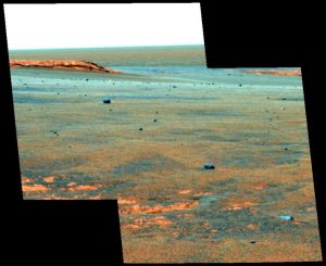
Meteorite accumulation at Victoria Crater. Credit: Image courtesy of University of Stirling
The lack of liquid water on the surface of Mars today has been demonstrated by new evidence in the form of meteorites on the Red Planet examined by an international team of planetary scientists.
In a study led by the University of Stirling, an international team of researchers has found the lack of rust on the meteorites indicates that Mars is incredibly dry, and has been that way for millions of years.
The discovery, published in Nature Communications, provides vital insight into the planet’s current environment and shows how difficult it would be for life to exist on Mars today.
Mars is a primary target in the search for life outside Earth, and liquid water is the most important pre-requisite for life.
Dr Christian Schröder, Lecturer in Environmental Science and Planetary Exploration at the University of Stirling and Science Team Collaborator for the Mars Exploration Rover Opportunity mission, said:
“Evidence shows that more than 3 billion years ago Mars was wet and habitable. However, this latest research reaffirms just how dry the environment is today. For life to exist in the areas we investigated, it would need to find pockets far beneath the surface, located away from the dryness and radiation present on the ground.”
A study published last year, which used data from the Curiosity Rover investigating Gale crater on Mars, suggested that very salty liquid water might be able to condense in the top layers of Martian soil overnight.
“But, as our data show, this moisture is much less than the moisture present even in the driest places on Earth,” explains Dr Schröder.
Using data from the Mars Exploration Rover Opportunity, the scientists examined a cluster of meteorites at Meridiani Planum — a plain just south of the planet’s equator and at a similar latitude to Gale crater.
Dr Schröder and his team have for the first time calculated a chemical weathering rate for Mars, in this case how long it takes for rust to form from the metallic iron present in meteorites.
This chemical weathering process depends on the presence of water. It takes at least 10 and possibly up to 10,000 times longer on Mars to reach the same levels of rust formation than in the driest deserts on Earth and points to the present-day extreme aridity that has persisted on Mars for millions of years.
Reference:
Christian Schröder, Phil A. Bland, Matthew P. Golombek, James W. Ashley, Nicholas H. Warner, John A. Grant. Amazonian chemical weathering rate derived from stony meteorite finds at Meridiani Planum on Mars. Nature Communications, 2016; 7: 13459 DOI: 10.1038/ncomms13459
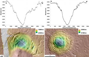
(Left) A graph charting the depth of the Hellas depression at different points, and a topographic map of the depression. (Right) A graph charting the depth of the Galaxias Fossae depression at different points, and a topographic map of the depression. Credit: Joseph Levy/NASA
A strangely shaped depression on Mars could be a new place to look for signs of life on the Red Planet, according to a University of Texas at Austin-led study. The depression was probably formed by a volcano beneath a glacier and could have been a warm, chemical-rich environment well suited for microbial life.
The findings were published this month in Icarus, the International Journal of Solar System Studies.
“We were drawn to this site because it looked like it could host some of the key ingredients for habitability — water, heat and nutrients,” said lead author Joseph Levy, a research associate at the University of Texas Institute for Geophysics, a research unit of the Jackson School of Geosciences.
The depression is inside a crater perched on the rim of the Hellas basin on Mars and surrounded by ancient glacial deposits. It first caught Levy’s attention in 2009, when he noticed crack-like features on pictures of depressions taken by the Mars Reconnaissance Orbiter that looked similar to “ice cauldrons” on Earth, formations found in Iceland and Greenland made by volcanos erupting under an ice sheet. Another depression in the Galaxias Fossae region of Mars had a similar appearance.
“These landforms caught our eye because they’re weird looking. They’re concentrically fractured so they look like a bulls-eye. That can be a very diagnostic pattern you see in Earth materials,” said Levy, who was a postdoctoral researcher at Portland State University when he first saw the photos of the depressions.
But it wasn’t until this year that he and his research team were able to more thoroughly analyze the depressions using stereoscopic images to investigate whether the depressions were made by underground volcanic activity that melted away surface ice or by an impact from an asteroid. Study collaborator Timothy Goudge, a postdoctoral fellow at the institute, used pairs of high-resolution images to create digital elevation models of the depressions that enabled in-depth analysis of their shape and structure in 3-D. Researchers from Brown University and Mount Holyoke College also participated in the study.
“The big contribution of the study was that we were able to measure not just their shape and appearance, but also how much material was lost to form the depressions. That 3-D view lets us test this idea of volcanic or impact,” Levy said.
The analysis revealed that both depressions shared an unusual funnel shape, with a broad perimeter that gradually narrowed with depth.
“That surprised us and led to a lot of thinking about whether it meant there was melting concentrated in the center that removed ice and allowed stuff to pour in from the sides. Or if you had an impact crater, did you start with a much smaller crater in the past, and by sublimating away ice, you’ve expanded the apparent size of the crater,” Levy said.
After testing formation scenarios for the two depressions, researchers found that they probably formed in different ways. The debris spread around the Galaxias Fossae depression suggests that it was the result of an impact — but the known volcanic history of the area still doesn’t rule out volcanic origins, Levy said. In contrast, the Hellas depression has many signs of volcanic origins. It lacks the surrounding debris of an impact and has a fracture pattern associated with concentrated removal of ice by melting or sublimation.
The interaction of lava and ice to form a depression would be an exciting find, Levy said, because it could create an environment with liquid water and chemical nutrients, both ingredients required for life on Earth. He said that the Hellas depression and, to a lesser extent, the Galaxias Fossae depression, should be kept in mind when looking for habitats on Mars.
Gro Pedersen, a volcanologist at the University of Iceland who was not involved with the study, agrees that the depressions are promising sites for future research.
“These features do really resemble ice cauldrons known from Earth, and just from that perspective they should be of great interest,” Pedersen said. “Both because their existence may provide information on the properties of subsurface material — the potential existence of ice — and because of the potential for revealing ice-volcano interactions.”
Reference:
Joseph S. Levy, Timothy A. Goudge, James W. Head, Caleb I. Fassett. Candidate volcanic and impact-induced ice depressions on Mars. Icarus, 2016; DOI: 10.1016/j.icarus.2016.10.021
A well preserved fossil of a new species of winged dinosaur, known as Tongtianlong or Mud Dragon, is giving scientists vital clues on a late flurry of evolution before the mass exctinction event. Credit: Junchang Lu
A dinosaur fossil that almost went undiscovered is giving scientists valuable clues about a family of creatures that flourished just before the mass extinction.
The bird-like species, found at a building site in southern China and nicknamed the ‘Mud Dragon’, was preserved almost intact, lying on its front with its wings and neck outstretched. Scientists speculate that the creature may have died in this pose after becoming mired in mud about 66-72 million years ago.
Scientists have named the new species Tongtianlong limosus, meaning ‘muddy dragon on the road to heaven’.
The two-legged animal belongs to a family of feathered dinosaurs called oviraptorosaurs, characterised by having short, toothless heads and sharp beaks. Some, including the newly found species, had crests of bone on their heads that were probably used as display structures to attract mates and intimidate rivals, like modern-day cassowaries.
Fossil discoveries in recent decades suggest that this group of flightless animals was experiencing a population boost, diversifying into new species, during the 15 million years before the dinosaurs went extinct. The group was probably one of the last groups of dinosaurs to diversify before the asteroid impact 66 million years ago, which killed off all of the non-bird dinosaurs.
The skeleton was found during excavations using explosives at a school construction site near Ganzhou. The fossil remains remarkably well preserved and almost complete, despite some harm caused by a dynamite blast at the construction site.
Researchers from the University of Edinburgh and China, who carried out the study, say the finding helps better understand how the last-surviving dinosaurs were flourishing before tragedy struck.
The study, published in Scientific Reports, was carried out in collaboration with the Institute of Geology, Chinese Academy of Geological Sciences and the Dongyang Museum, China, and is the latest in a fruitful collaboration between Edinburgh and the Chinese Academy of Geological Sciences.
It was supported by the National Natural Science Foundation of China, the Fundamental Research Funds for the Chinese Academy of Geological Sciences, the EU Erasmus Mundus Experts Sustain Program and a Marie Curie Career Integration Grant.
Dr Steve Brusatte, of the University of Edinburgh’s School of GeoSciences, said: “This new dinosaur is one of the most beautiful, but saddest, fossils I’ve ever seen. But we’re lucky that the ‘Mud Dragon’ got stuck in the muck, because its skeleton is one of the best examples of a dinosaur that was flourishing during those final few million years before the asteroid came down and changed the world in an instant.”
Dr Junchang Lü, of the Institute of Geology, Chinese Academy of Geological Sciences, said: “The discovery of the new oviraptorid dinosaur further indicates that the Ganzhou area of Southern China is a most productive locality of oviraptorid dinosaurs and has a huge diversity of oviraptorosaurs from the late Cretaceous. It will provide important information on the study of evolution, distribution and behaviour of oviraptorid dinosaurs.”
Reference:
Junchang Lü et al, A Late Cretaceous diversification of Asian oviraptorid dinosaurs: evidence from a new species preserved in an unusual posture, Scientific Reports (2016). DOI: 10.1038/srep35780
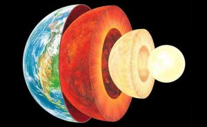
Representative Image : The Earth’s layers, showing the Inner and Outer Core, the Mantle, and Crust
Scientists have found a key indicator in determining whether the presence of carbon, found in the Earth’s mantle, is derived from continental crust — a step toward better understanding the history of crustal formation on Earth’s surface and the rate at which tectonic plates have moved throughout geologic time, which can be linked to the cooling of Earth’s mantle.
Results of a new study published in the journal Nature Geoscience show evidence of varying ratios of boron isotopes in igneous rocks, known as carbonatites, of different ages. The research was led by Antonio Simonetti, associate professor in the Department of Civil and Environmental Engineering and Earth Sciences at the University of Notre Dame.
Three theories exist regarding the source of carbon found within the Earth’s mantle: It is of primordial origin, formed during the creation of the planet 4.56 billion years ago; it is a result of planetary collision; or it had been present in marine environments or continental crust, and recycled back into the mantle in areas of subduction, where tectonic plates shifted, one diving beneath the other.
“Our most important finding is that the Boron isotope ratios are highly variable, indicating that the source of carbon within the mantle changed with geological time on Earth,” Simonetti said. Studying the ratios of boron isotopes within carbonatites, researchers are closer to determining which hypothesis applies to specific moments in geological time.
“During the past 4.56 billion years, the subduction rate has varied,” said Simonetti. “Early on, during the first 2 billion years or so, Earth’s mantle was much hotter than it is today, so when subduction did occur, the diving plate did not penetrate as deep into the mantle as it does today because of the higher temperature. During the last 2 billion years or so, a cooler mantle has allowed the subducting plate to dive deeper into the mantle and provide the opportunity to store recycled crustal materials at greater depths, and possibly all the way down to the core-mantle boundary.”
This preliminary investigation into the boron isotope compositions of carbonatites from significant periods in Earth’s history allows Simonetti and his team to monitor long-term temporal variations — creating a clearer picture of crustal formation over time, with the potential to go as far back as several billion years.
The study was co-authored by Samuel R.W. Hulett in the Department of Civil and Environmental Engineering and Earth Sciences at Notre Dame, E. Troy Rasbury of Stony Brook University N. Gary Hemming of Queens College — CUNY.
Reference:
Samuel R. W. Hulett, Antonio Simonetti, E. Troy Rasbury, N. Gary Hemming. Recycling of subducted crustal components into carbonatite melts revealed by boron isotopes. Nature Geoscience, 2016; DOI: 10.1038/ngeo2831
Researchers have discovered two small dinosaurs together with a lagerpetid, a group of animals that are recognized as precursors of dinosaurs. The discovery made in Brazil and reported in the Cell Press journal Current Biology on November 10 represents the first time that a dinosaur and a dinosaur precursor have ever been found together.
The new lagerpetid (Ixalerpeton) and saurischian dinosaur (Buriolestes) were unearthed from the ~230-million-year-old Carnian Santa Maria Formation—one of the oldest known rock units including dinosaur fossils anywhere in the world.
“We now know for sure that dinosaurs and dinosaur precursors lived alongside one another and that the rise of dinosaurs was more gradual, not a fast overtaking of other animals of the time,” says Max Langer of Brazil’s Universidade de São Paulo.
The discovery clearly shows that these animals were contemporaries of each other during the earliest stages of dinosaurs’ evolution. The new lagerpetid specimen also preserves the first skull, scapular, and forelimb elements, plus associated vertebrae, known for the group, the researchers report. Tooth evidence also shows that the first dinosaurs most likely fed on “all kinds of small animals, but most probably not plants,” Langer says.
Those details help to reveal how dinosaurs acquired some of their characteristic anatomical traits. Their analysis also suggests that Buriolestes is one of the oldest known Sauropodomorpha, the group of long-necked dinosaurs that includes sauropods.
The two new animals have already helped to fill important gaps in the evolution of the key anatomical features of dinosaurs. But Langer and his colleagues aren’t done with them yet. They are using CT scans to characterize and describe the animals’ anatomy in even greater detail. They also hope to get an even more precise radioisotopic date on the oldest dinosaur-bearing rocks, and the search for more Triassic fossils continues.
Reference:
Current Biology, Cabreira et al.: “A Unique Late Triassic Dinosauromorph Assemblage Reveals Dinosaur Ancestral Anatomy and Diet” http://www.cell.com/current-biology/fulltext/S0960-9822(16)31124-1 , DOI: 10.1016/j3.cub.2016.09.040
Note: The above post is reprinted from materials provided by Cell Press.
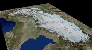
This is a 3-D ice-model of the Alps during Last Glacial Maximum. Credit: University of Potsdam, background model based on ESRI Germany data
The Alps are steadily “growing” by about one to two millimeters per year. Likewise, the formerly glaciated subcontinents of North America and Scandinavia are also undergoing constant upward movement. This is due to the fact that at the end of the Last Glacial Maximum (LGM) about 18,000 years ago the glaciers melted and with this the former heavy pressure on Earth’s surface diminished.
The ice reacted rapidly to climate change at that time whereas Earth’s crust is still responding today to this relatively sudden melting of ice. During the LGM the Alps were also coated with an ice cap that temporarily reached far into the alpine foreland. The extent of glaciation was much smaller here than on the subcontinents of North America and Scandinavia.
This is why it was assumed for a long time that the retreat of the ice cap back then did not play a significant role in the steady uplifting of the Alps today. However, an international team with the participation of the GFZ scientists Dirk Scherler and Taylor Schildgen have now been able to show that the loss of the LGM ice cap still accounts for 90 percent of today’s uplifting of the Alps.
Vertical motions of the Earth’s crust are mainly caused by tectonic deformation due to movements of tectonic plates, and by volcanism, and unloading of water, ice, and sediments. The movement of the crust can be measured by geodetic methods via satellites and ground stations. For old, tectonically stable continents like the subcontinents of North America and Scandinavia it has been known for a long time that vertical motion is almost exclusively caused by the so called postglacial “rebound effect” — i.e. the upward motion of the crust due to the thawing of the glaciers.
In young mountain belts such as the Alps, however, complex mechanisms come into play that mutually effect each other: The African Plate subducts below the Eurasian Plate, and the Adriatic Plate — a sub-plate of the African Plate — moves counterclockwise below the Eurasian Plate. Furthermore, as in Scandinavia and North America, there is unloading due to erosion and sediment transport, and “deglaciation.” The causes for today’s uplift of the Alps has been a matter of debate for over a quarter of a century.
For a long time it was assumed that the uplift is primarily caused by erosion and sediment transport, mainly by rivers, towards the foreland. The new study compares by how much erosion, ice unloading, and local tectonics contribute to the vertical motion of the Alps.
The scientists use models supported with drill core data to show that the better part of postglacially, and therewith after the end of the main glacial phase, eroded material was deposited within the orogen. Hence, this process can be excluded as a main cause for the alpine uplift.
The models, however, show that, just like in Scandinavia and America, the uplift-signal is best explained with a relieving compensatory movement after the decline of the LGM-glaciers: Within only 3,000 years the glaciation of the Alps decreased by about 80 percent. Only about 10 percent of today’s uplift can be attributed to sediment unloading.
Locally, especially in parts of Austria, tectonic effects add to the uplift, likely caused by the circular motion of the Adriatic sub-plate. With their models the scientists are able to show that the glacial load weighed about 62,000 gigatonnes, while the postglacial sedimentary unloading only accounts for about 4,000 gigatonnes.
Reference:
Jürgen Mey, Dirk Scherler, Andrew D. Wickert, David L. Egholm, Magdala Tesauro, Taylor F. Schildgen, Manfred R. Strecker. Glacial isostatic uplift of the European Alps. Nature Communications, 2016; 7: 13382 DOI: 10.1038/ncomms13382
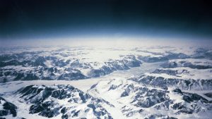
Photo of the south-east coast of greenland. Credit: Ringomassa/Wikipedia
Using ice-cores and a new isotopic method that can provide more precise temperature information, Marie Curie Fellow, Takuro Kobashi, has gained an insight into Greenland’s climate history. His data suggests Greenland’s temperatures and global-sea-levels may increase faster than current climate projections.
It is not easy to reconstruct past temperature changes beyond the 150 year time frame of recorded observations, but EU Marie Curie Fellow, Takuro Kobashi at the University of Bern has developed a tool that can do just this. In a two year fellowship, completed in April 2016, Kobashi reconstructed the precise temperature of Greenland over the past millennia using ice cores. In a contrast to conventional methods, he collected data from argon and nitrogen isotopes trapped in air bubbles within ice cores.
‘It has been known that Greenland temperature co-varies with North Atlantic temperature so understanding Greenland’s temperature variability provides information on North Atlantic temperature and changes in ocean current change in the past.’ explains Kobashi. The last period of glacial retreat occurred 6 000 years ago and so being able to probe temperature changes at that time could provide useful for understanding the impact of current climate changes.
The ice core samples used in his work were collected more than 10 years ago during from the North Greenland Ice Core Project (NGRIP) which extracted 11 cm diameter ice cores stretching back to the last ice age. Kobashi’s new technique measures nitrogen and argon isotope ratios within trapped air bubbles, rather than measuring oxygen isotopes ratio’s which is the standard method.
The method takes advantage of the changes in air occurring in the snow layer that fell on top of Greenland’s ice-sheets, which are eventually trapped in the bubbles at the bottom of the snow layer before themselves freezing into ice. Gravity and the temperature gradient that exists within the snow layer causes a variable distribution of air. The isotope ratio of two types of gasses (nitrogen and argon) in the bubbles can therefore be used to estimate the past temperature gradient of the snow layer, and the thickness of the layer, allowing Kobashi to reconstruct the past surface temperature changes.
‘We have reconstructed temperature over the past 4 000 years and our preliminary analyses show the variations of Greenland temperatures significantly correlate with solar activity’ says Kobashi but adds the interpretation is not what might be expected. ‘When solar activity increases, Greenland’s temperatures actually get colder, and vice versa’. The phenomenon seems to be related to atmospheric and oceanic changes, and is also reproduced in some climate models. Temperature changes can also be explained by changes in volcanic activity, orbital changes and greenhouse gas levels in the atmosphere.
‘Whilst natural variability may mask anthropogenic influence on Greenland temperature, eventually Greenland temperature will start rising by anthropogenic influence,’ Kobashi says. Greenland generally follows global temperature rises, but Kobashi’s work shows the link between solar activity and temperature could help predict future temperature changes. Solar activity will be decreasing over the next decades and that means Greenland’s temperature may increase faster than projected by climate models that use only greenhouse gas increases in their projections. In turn, that could result in faster melting of the polar ice-sheet, and increasing global sea-levels.
Kobashi’s new method is an improvement on previous methods because it provides seasonally unbiased and more precise temperatures in a multidecadal time scale, as long as the ice core are from high snow fall areas such as Greenland, Antarctica, and possibly alpine glaciers. ‘As the method is now established, we will likely be able to have highly precise temperature records from these areas in coming decades, which could revolutionise our understanding of climate changes over the past millennia,’ concludes Kobashi.
Note: The above post is reprinted from materials provided by CORDIS.
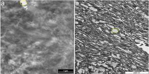
TEM micrographs of (a) ostrich claw sheath and (b) Citipati claw sheath. In both samples, parallel fibres can be seen running diagonally, and identical voids (yellow outlines) were observed among the fibres in both samples. Credit: Alison Moyer
New research from North Carolina State University shows that a 75-million-year-old Mongolian oviraptor, preserved while brooding its eggs, also preserved the original keratinous claw sheath that covered its digits. The work adds to the body of evidence that original organic materials can preserve over time.
Citipati osmolskae was an emu-sized dinosaur that lived in what is now Mongolia during the Cretaceous period. In 1995, a particularly well-preserved specimen of Citipati was recovered from the Djadokhta formation. The specimen was found in a brooding position on a nest of eggs. Paleontologists theorized that it was rapidly buried by a sand dune, which explained its excellent preservation.
During preparation of the specimen, the scientists noticed that there was a thin lens of white material extending beyond one of the bony claws on a forelimb that differed in texture and color from both the sediment and the bone. It was also located where a claw sheath would be.
In modern birds, claw sheaths cover the claw at the end of a digit much like fingernails in humans and serve a number of functions – aiding them in defense, movement, or catching and holding prey. The sheaths in modern birds are composed of two types of keratin: alpha-keratin, the softer form found on the interior of the sheath; and beta-keratin, a harder and more durable keratin that comprises the sheath’s exterior.
Alison Moyer, former Ph.D. student at NC State who is currently a postdoctoral researcher at Drexel University and lead author of a paper describing the research, wanted to find out if the material from Citipati was a claw sheath and if so, whether any original beta-keratin had preserved.
Moyer and her NC State colleagues first used scanning and transmission electron microscopy to get microscopic details of both the tissue’s surface and its internal structure. The results showed that the sample was structurally similar to claw sheaths from modern birds, so the team decided to proceed with immunohistochemical (IHC) testing.
IHC testing utilizes antibodies that react against a particular protein. If the protein is present, the antibodies bind to small regions of the protein and indicate where the protein is located in the tissue. Moyer used beta-keratin antibodies derived from modern bird feathers. In initial IHC testing, results were inconclusive, which led Moyer to look more closely at the specimen. She found an unusually high concentration of calcium in the fossil claw – much higher than would be found in claws from the living birds used in comparison or from the sediment surrounding the fossil. Theorizing that the calcium might be affecting results, Moyer removed the calcium and did further IHC testing on the claw sheath material.
After the calcium was removed, the antibodies reacted much more strongly, indicating the presence of beta-keratin and preservation of original molecules.
“It’s probable the incorporation of calcium in the tissue helped preserve it,” says Moyer, “but that same calcium had to be removed in order to see the underlying molecular composition. Because this study used multiple, well-tested methods, it not only supports the longevity of proteins in the rock record, it reveals a lot about how these might be preserved.”
Reference:
Microscopic and Immunohistochemical Analyses of the Claw of the Nesting Dinosaur, Citipati osmolskae, Proceedings of the Royal Society B, DOI: 10.1098/rspb.2016.1997
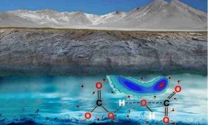
Carbon in the fluid of the Earth’s mantle is not in the form of carbon dioxide but rather in carbonate and bicarbonate ions, researchers found. Credit: Prof. Giulia Galli, et al.
Understanding how carbon dissolves in water at the molecular level under extreme conditions is critical to understanding the Earth’s deep carbon cycle—a process that ultimately influences global climate change.
Contrary to current geochemical models, the carbon dissolved in water-rich fluid at the bottom of the Earth’s upper mantle is not in the form of carbon dioxide but rather in carbonate and bicarbonate ions. That is the conclusion of scientists at UChicago’s Institute for Molecular Engineering, who simulated the fate of dissolved carbon dioxide under high pressures and temperatures in the upper mantle, about 410 miles below the surface of the Earth. Their results were published in the Oct. 12 issue of Science Advances.
“Experiments at these extreme conditions remain very difficult, both in execution and interpretation,” said Giulia Galli, senior investigator of the paper and the Liew Family Professor of Molecular Engineering. “Fortunately developments in theory and increases in computing power have recently made it possible to use molecular dynamics simulation to investigate water and carbon at extreme conditions.”
The work shows that carbon can assume unexpected forms in the fluids found in pores and cracks of rocks deep underground, said Russell J. Hemley, research professor at George Washington University, who was not involved in the research. Therefore, scientists cannot use observations at the surface of the Earth as a guide for how carbon behaves below the surface of the Earth.
“This is important because the different forms could lead to different kinds of reservoirs of carbon-containing materials at depth in the planet,” Hemley said. “Calculations such as the ones in this study, together with new experiments prompted by these theoretical results, may be key in determining how much carbon is in the planet.”
The researchers also determined that the carbonate and bicarbonate anions under extreme conditions exchange protons with water over picoseconds, or one trillionth of a second. The study suggests that in the upper mantle, water transports carbon mostly through highly active ions, not through dissolved carbon dioxide molecules.
“Our current research suggests the presence of more carbonate and bicarbonate ions than previously thought,” said Ding Pan, the paper’s first author and a former researcher at the Institute for Molecular Engineering, now assistant professor of physics and chemistry at the Hong Kong University of Science and Technology.
“This presence of ions rather than molecules is a game-changer,” said Craig E. Manning, professor of Earth and space sciences at the University of California Los Angeles, who was not involved in the research. “The addition of molecular CO2 to water makes the water less chemically reactive, suppressing the ability of water to strip elements from rock and move the elements to other localities. However, if CO2 reacts with H2O to form anions, then the same amount of carbon makes the water more chemically active, thereby promoting its ability to move elements.”
Whether carbon accumulates in the Earth’s interior is still a subject of debate, and the chemical reactions of carbon in the deep Earth are not yet fully understood. This research will cause scientists to re-evaluate the role of carbon dioxide in deep fluids and to rethink its mass transfer capability. It also will stimulate the development of new models.
Reference:
D. Pan et al. The fate of carbon dioxide in water-rich fluids under extreme conditions, Science Advances (2016). DOI: 10.1126/sciadv.1601278
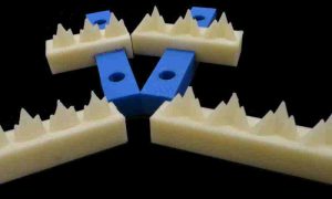
UMass Amherst researchers used 3-D-printed replicas of 200-million-year-old mammal teeth and polymers that mimic insect prey to provide the first laboratory-tested evidence that the ability for teeth to damage prey is a more significant factor driving evolutionary changes in tooth shape. Credit: UMass Amherst/Andrew Conith
Using 3D-printed replicas of 200-million-year-old mammal teeth and polymers that mimic insect prey, scientists at the University of Massachusetts Amherst this week provide the first laboratory-tested evidence that the ability for teeth to damage prey is a more significant factor driving evolutionary changes in tooth shape than either bite force or the animal’s energy expenditure.
This unexpected finding should change the way biologists view natural selection as it is studied through dental morphology, the authors say. Tooth shape is linked to diet and the biomechanics of feeding, and much of what is known about early mammalian evolution comes from their fossilized teeth, they point out. Details appear in the current online edition of the British Royal Society journal, Interface.
Evolutionary biology doctoral student Andrew John Conith and his advisor Elizabeth Dumont, with polymer scientists Alfred Crosby and graduate student Michael Imburgia, wanted to better understand how tooth shape influenced diet in early mammals. Dumont and Crosby are both members of the Center for Evolutionary Materials at UMass Amherst, where researchers apply biological thinking to engineering problems.
The team used 3D-printed replicas of 200-million-year-old molars in their tests to simulate a bite. The teeth came from two shrew-like early mammal species, the primitive Morganucodon and more advanced Kuehneotherium. Both species, considered exemplars of early mammal evolution, were underfoot when dinosaurs roamed the earth in the Triassic Period.
Conith says, “The big question here is why teeth look the way they do. Most of the work on early mammalian tooth evolution has been descriptions of what they look like and how they could potentially work as tools for biting and crushing insects. We took it one step further, to make these tools and test them. We merged two modern technologies and used 3D prints of teeth to ‘bite’ into polymer gels with a exoskeleton-like crust that accurately mimicked insects.”
He adds, “Based on these experiments, we think the factor that natural selection worked on was the ability to break apart food, and that selection for maximum damage is the primary determinant of tooth shape.”
Until now, most research has ignored damage in favor of investigating force and energy based on the assumption that selection favored animals that expend the least force and energy, Conith says. “But I think people will need to reconsider these typical parameters and now think more critically about damage. It’s an important consideration. We haven’t rewritten the book, but we have added a new chapter.”
To imitate insect prey for experiments documenting bite force, energy efficiency and damage by Morganucodon and Kuehneotherium jaws, the researchers constructed gel-filled, candy bar-shaped rectangles coated with a polymer shell to mimic an insect’s exoskeleton. Based on factors in the literature, they constructed two polymer “proxy insects,” one hard- and one softer-shelled, and ran 10 experiments for each type using both Morganucodon and Kuehneotherium molar shapes.
They used a force-testing machine to bite the proxy insects between 3D-printed teeth replicas from an upper and lower jaw. The researchers measured the force, work done (energy) and damage inflicted to the gels. To assess damage they measured the cracks and fractures in the polymer coating from digital photographs following a biting trial.
The authors report that the more primitive Morganucodon model required less force and energy to fracture hard gels while Kuehneotherium required less force and energy to fracture soft gels. “More importantly, Kuehneotherium also inflicted more damage to both the hard and the soft gels. These results suggest that changes in tooth shape in some early mammals was driven primarily by selection for maximizing damage, and secondarily for maximizing biomechanical parameters such as force or energy,” Conith and colleagues write.
He adds, “When we started this project we thought we’d only report the force and energy results, we never thought about damage. It wasn’t until we actually saw the destruction Kuehneotherium could inflict on our model insects that we thought it would be interesting to measure. In science your general ideas may be correct, but the details can be so much more complex.”
Reference:
The functional significance of morphological changes in the dentitions of early mammals, Journal of the Royal Society Interface, DOI: 10.1098/rsif.2016.0713
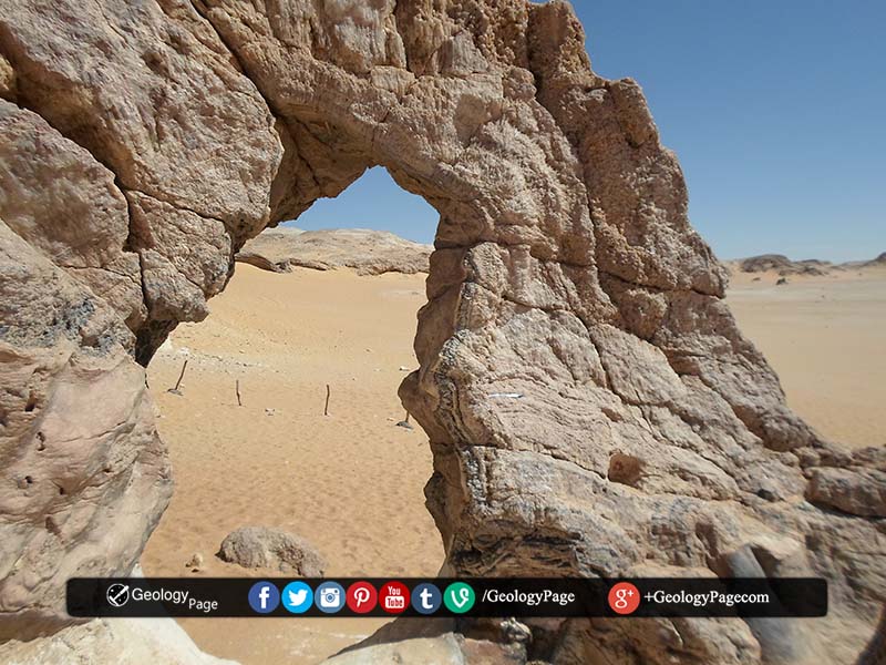
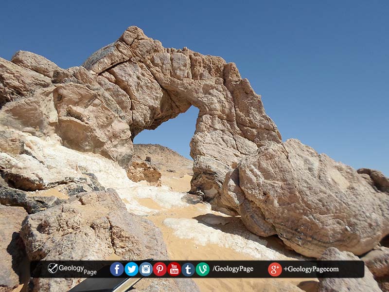
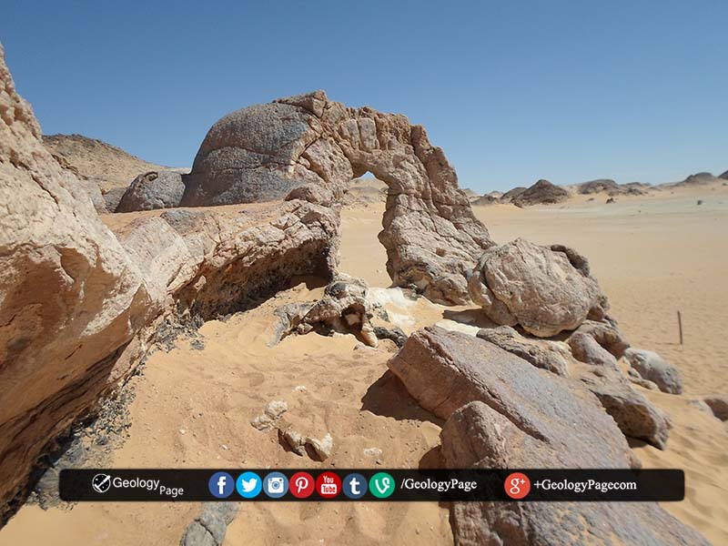
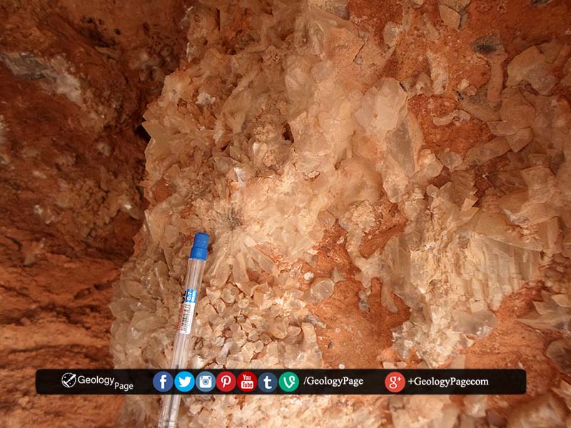
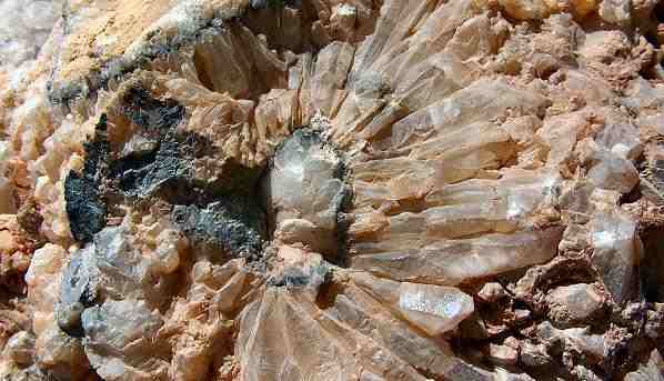
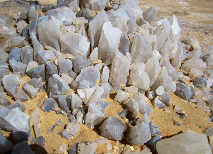
The Crystal Mountain is situated between the Baharyia Oasis and the Farafra Oasis, in the White Desert’s North. Despite its name, the Crystal Mountain is rather a ridge, a rock or a hill sparkling like a crystal.
The arch is natural and small and is situated in the centre of the structure.
Geology
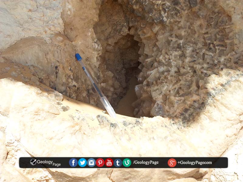
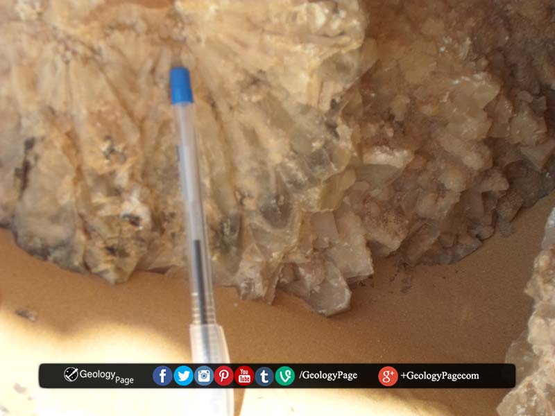
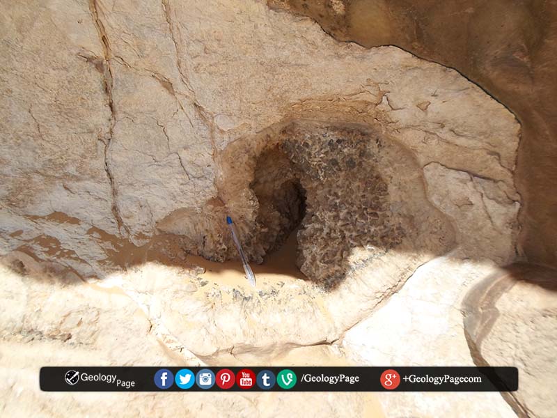
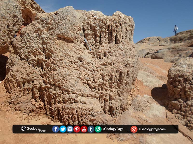
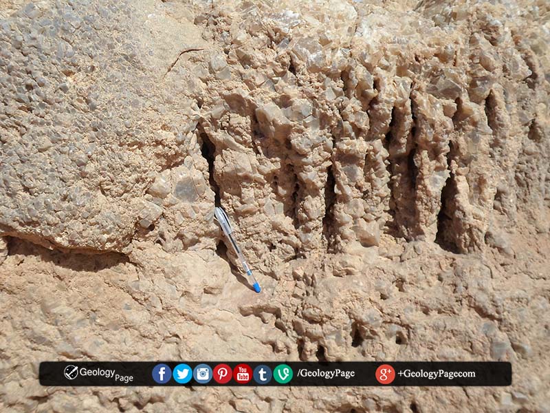
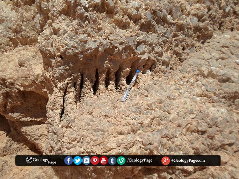
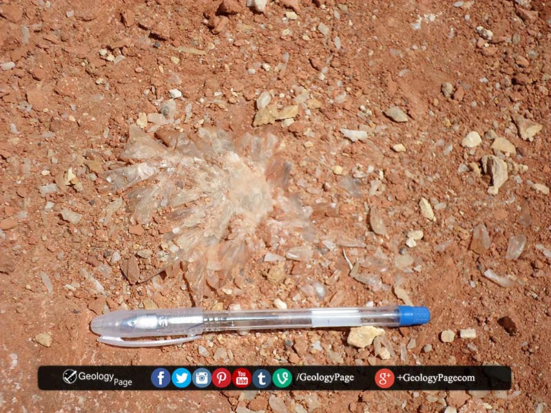
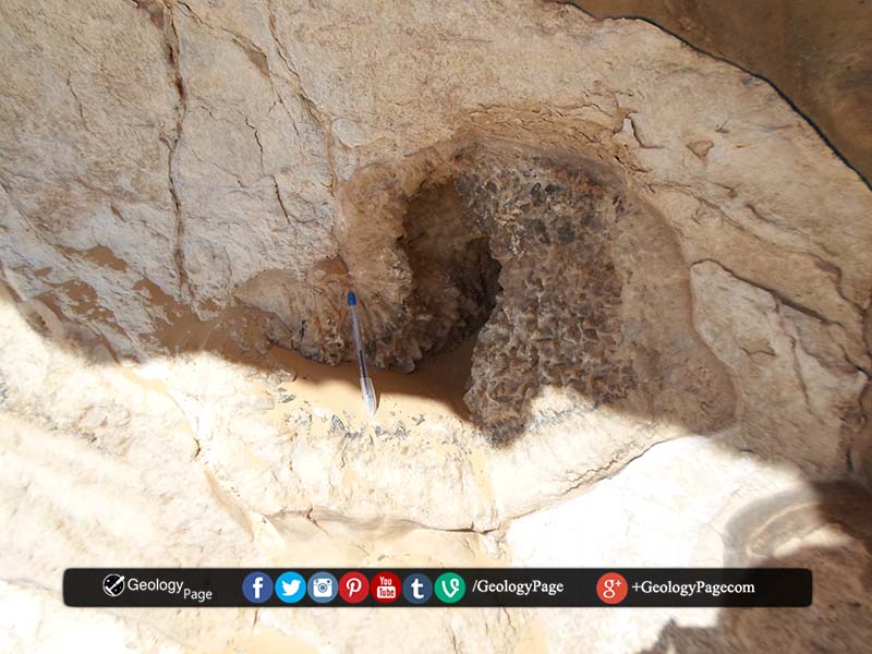
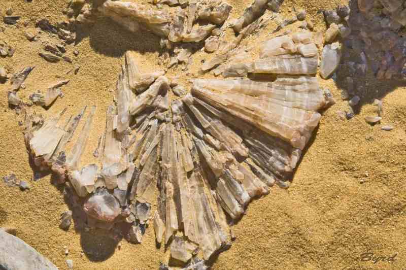
There are well-exposed caves and paleokarst topography developed within the Maastrichtian Khoman chalk. The paleokarst topography comprises huge collapsed breccias and paleocaves with columnar-shaped stalagmites. The collapsed breccias are composed of meter-sized rounded chalky limestone blocks within the massive Khoman Chalk, The outer surface of the breccias are surrounded concentric layers of stratified and centimeter-sized and triagonal clean calcite crystals. Black to dark brown impurities occur between and along the crystal boundaries.
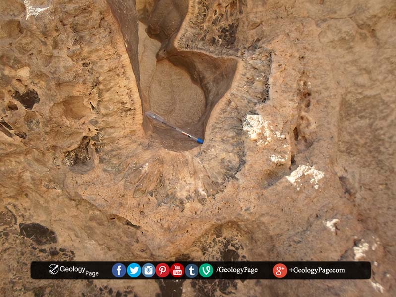
The paleocaves are composed rimmed with the calcite crystals. The caves seems to be developed around the brecciated blocks that later on dissolved leaving concentric layers of secondary coarse crystalline calcite around the leached blocks. Some of these caves are filled with laminated reddish colored clay, silt and coarse sand of channel origin (cave floor fill).
The caves were probably produced by episodes of subaerial exposure during multiple exposure events known from Maastrichtian through Oligocene time. The paleoclimate during this period in Egypt was considerably wetter, with monsoonal and even tropical rain forest climates during the late Eocene and Oligocene (Bown and Kraus, 1988).
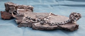
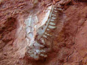
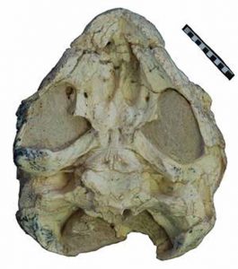
The well preserved palate of the previously unknown Sichuanchelys palatodentata with remnants of teeth
Today’s turtles don’t have teeth; they cut off their food using hard ridges on their jaws. But their ancestors were not so dentally challenged. A team of international researchers including Dr. Márton Rabi from the Biogeology Lab of the University of Tübingen has now discovered that turtles with remnants of teeth survived 30 million years later than previously thought.
The researchers found evidence of this at a major excavation site in China’s western Autonomous Region of Xinjiang. Up to now, the most recent finds of toothed turtles were 190 million years old. The new discovery also helps to fill in some of the puzzle pieces in the chelonian family tree and in the distribution of the family over many millions of years. The researchers have published their findings in the latest edition of BMC Evolutionary Biology.
The Xinjiang site of Wucaiwan is well known for the remarkable Middle to Late Jurassic dinosaur fossils found there. But among the extinct giants are the fossils of many other animals which shed light on the long evolutionary history of tortoises and turtles, of which more than 350 different species live around the world today.
A team headed by study co-author Dr. Xing Xu of the Institute of Vertebrate Paleontology and Paleoanthropology in Beijing identified a previously unknown extinct chelonian species, naming it Sichuanchelys palatodentata — the turtle with a toothed palate. “Scientists had previously known that the earliest turtles still had teeth in their palates, a primitive feature they inherited from their reptilian ancestors,” says lead author Dr. Walter Joyce from the University of Fribourg, Switzerland. “Previously, the last toothed turtle, however, was known from 30 million years older rocks. It is therefore a great surprise to find a toothed turtle that survived even longer.”
The researchers were able to classify the new turtle among the known families of chelonians — as well as learning more about the biogeographic history of turtles. “Our analysis revealed that the new turtle is the closest known relative of a large terrestrial turtle, Mongolochelys efremovi, that lived almost 100 million years later in central Asia,” says Dr. Rabi. “It seemed a bizarre turtle that previously had no known close relatives, but now we see that it represents the final links of a long lineage that persisted throughout Asia for much of the Mesozoic.”
“Although living turtles are not particularly mobile, people had not previously recognized significant links between the distribution of fossil and recent turtles and the configuration of the continents, as they did for frogs or other amphibians,” says Dr. Clark, a coauthor from George Washington University, USA. “Our analysis reveals that the initial diversification of turtles was controlled by the breakup of the super continent Pangea during the Jurassic to Cretaceous,” says Dr. Joyce. “Each continent thereby developed its own unique turtle fauna, like the extinct turtle lineage we newly discovered from Asia.”
Reference:
Walter G. Joyce, Márton Rabi, James M. Clark, Xing Xu. A toothed turtle from the Late Jurassic of China and the global biogeographic history of turtles. BMC Evolutionary Biology, 2016; 16 (1) DOI: 10.1186/s12862-016-0762-5
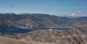
SkyTEM electromagnetic and magnetic survey flying over Spirit Lake, near Mt. St. Helens, Washington. Mt. Adams volcano is in the background.. Credit: Image courtesy of USGS
A new study providing an unprecedented regional view of the earth’s crust beneath Yellowstone National Park will begin with a helicopter electromagnetic and magnetic (HEM) survey on November 7, 2016. Scientists from the U.S. Geological Survey, University of Wyoming and Aarhus University in Denmark hope to distinguish zones of cold fresh water, hot saline water, steam, clay and unaltered rock from one another to understand Yellowstone’s myriad hydrothermal systems. The flights will continue for the next two to four weeks.
Although the park’s iconic hydrothermal systems are well mapped at the surface, their subsurface groundwater flow systems are almost completely unknown. The HEM survey, operated by SkyTEM, will provide the first subsurface view of Yellowstone’s hydrothermal systems, tracking the geophysical signatures of geysers, hot springs, mud pots, steam vents and hydrothermal explosion craters to depths in excess of 1,000 feet.
A low flying helicopter, about 200 feet above the ground’s surface, will travel along pre-planned flight grids focusing on the Mammoth-Norris corridor, Upper and Lower Geyser Basins and the northern part of Yellowstone Lake. An electromagnetic system, resembling a giant hula hoop, will be suspended from the helicopter’s base. The equipment senses and records tiny voltages that can be related to the ground’s electrical conductivity.
These observations, combined with existing geophysical, geochemical, geological and borehole data, will help close a major knowledge gap between the surface hydrothermal systems and the deeper magmatic system. For example, research shows that the hot water spurting from Yellowstone’s geysers originates as old precipitation, snow and rain that percolates down into the crust, is heated and ultimately returns to the surface. This process takes hundreds if not thousands of years. Little, however, is currently known about the paths taken by the waters.
The data collected from the flight will guide future ground-based geological, hydrological and geophysical studies.
Note: The above post is reprinted from materials provided by USGS.
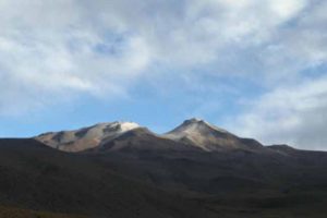
Cerro Uturuncu volcano in the Bolivian Altiplano. Credit: Jon Blundy
Scientists from the University of Bristol and partner universities in Germany, France, Canada and Wales, have discovered a huge magmatic lake, 15 kilometres below a dormant volcano in Bolivia, South America.
The body of water — which is dissolved into partially molten rock at a temperature of almost 1,000 degrees Celsius — is the equivalent to what is found in some of the world’s giant freshwater lakes, such as Lake Superior.
The find has now led scientists to consider if similar bodies of water may be ‘hiding’ under other volcanoes and could help explain why and how volcanoes erupt.
Professor Jon Blundy, from the School of Earth Sciences, took part in an international multidisciplinary research project at Cerro Uturuncu volcano in the Bolivian Altiplano.
He said: “The Bolivian Altiplano has been the site of extensive volcanism over past 10 million years, although there are no currently active volcanoes there.
“The Altiplano is underlain by a large geophysical anomaly at depths of 15 km below the surface of Earth.
“This anomaly has a volume of one-and-a-half million cubic kilometres or more and is characterised by reduced seismic wave speeds and increased electrical conductivity. This indicates the presence of molten rock.
“The rock is not fully molten, but partially molten. Only about 10 to 20 percent of the rock is actually liquid; the rest is solid. The rock at these depths is at a temperature of about 970°C.”
In order to characterise the partially molten region the team performed high temperature and pressure experiments at the University of Orléans in France.
This measured the electrical conductivity of the molten rock in the ‘anomalous’ region and concluded that there must be about eight to ten percent of water dissolved in the silicate melt.
Professor Blundy added: “This is a large value. It agrees with estimates made for the volcanic rocks of Uturuncu using high temperature and pressure experiments to match the chemical composition of crystals.
“Silicate melt can only dissolve water at high pressure; at lower pressure this water comes out of the solution and forms bubbles. Crucially — these bubbles can drive volcanic eruptions.
“The eight to ten percent of water dissolved in the massive anomaly region amounts to a total mass of water equivalent to what is found in some of the giant freshwater lakes of North America.”
Professor Fabrice Gaillard at University of Orléans explained: “Ten per cent by weight of dissolved water means that there is one molecule of water for every three molecules of silicate. This is an extraordinarily large fraction of water, helping to explain why these silicate liquids are so electrically conductive.”
The researchers hope that better understanding of how water can trigger volcanic eruptions can improve predictions of when it is going to erupt.
Reference:
Mickael Laumonier, Fabrice Gaillard, Duncan Muir, Jon Blundy, Martyn Unsworth. Giant magmatic water reservoirs at mid-crustal depth inferred from electrical conductivity and the growth of the continental crust. Earth and Planetary Science Letters, 2016; DOI: 10.1016/j.epsl.2016.10.023
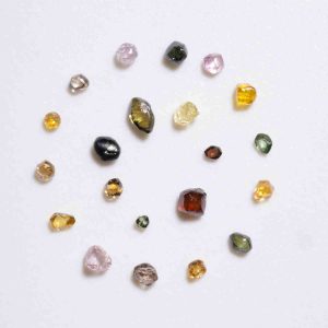
Analysis of diamonds from the Denver Museum of Nature & Science collection provide a look inside the earth’s mantle. Credit: Denver Museum of Nature & Science
Researchers at the Denver Museum of Nature & Science and University of British Columbia recently analyzed diamonds from the Museum’s collection and learned how an unusual chunk of Africa formed.
It takes incredible heat and pressure to form a diamond. And when these diamonds were formed, microscopic minerals were trapped inside. The chemistry of these minerals, or inclusions, provides a rare look at the processes that led to the formation of Earth’s crust. Inclusions found in the Museum’s diamonds from the Congo craton in central southern Africa illustrate an incredible 3-billion-year journey through tectonic collisions and volcanic eruptions.
The international scientific team, led by author Charles W. Kosman, used an electron microprobe, an infrared spectrometer and a secondary ion mass spectrometer to analyze these diamonds.
“These diamonds are special,” Kosman said. “They’re the ultimate time capsules from deep Earth.”
The researchers determined that the diamonds formed as thinner continental fragments and began their journey beneath the thick, buoyant continental crust of central Africa. Over 2.8 billion years, this part of the African continent repeatedly rammed into smaller and thinner fragments. These fragments slid downward back toward Earth’s core where they were dehydrated by extreme heat and pressure, triggering the formation of diamonds. The diamonds were then brought to the surface in volatile eruptions, which pierced the hide of the ancient African continent and eventually deposited the diamonds on the surface.
“The circumstances that led to the formation of these diamonds trapping invaluable information inside are incredible,” said James Hagadorn, Museum’s curator of geology. “Grueling conditions – temperatures five times hotter than your oven, and pressure 10 times that found below Mount Everest—are what it takes to freeze clues to Earth’s evolution for studies such as this one.”
By knowing how and where diamonds like these are formed, it also informs the ability to predict where to find future diamond deposits. Museum collections are often overlooked as a resource for clues to Earth’s delicate atmospheric history.
“Diamonds are a key part of our culture and industry. Not all diamonds end up on a ring or a saw-blade’s edge. The ugly ones often have the coolest scientific stories to tell,” said Hagadorn.
The results appear in the journal Lithos.
Reference:
Charles W. Kosman et al, Cretaceous mantle of the Congo craton: Evidence from mineral and fluid inclusions in Kasai alluvial diamonds, Lithos (2016). DOI: 10.1016/j.lithos.2016.07.004