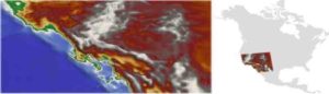
By using the latest computer numerical modeling technologies, combined with geologic compilations and seismic data, researchers in the Department of Geosciences at Stony Brook University have developed a complete geodynamic model that explains the forces behind the remarkable collapse of what were lofty mountains some 30 million years ago in what is now part of the American West.
The research, published in Nature Communications, includes visuals that reveal how the mountains were probably higher than the Rockies are today and how a complex system of faults chopped the region up, allowing mountains to expand bountifully and form the Basin and Range province and the now dangerous San Andreas fault system in California.
The article is authored by graduate student Ali Bahadori and William E. Holt, Ph.D., and the study was funded by the National Science Foundation.
Holt, who is the project leader, says that the results will be combined with climate and erosion models of the vast region to better explain this geologic evolution over millions of years and its impact on the fauna and flora found in the fossil record.
Reference:
Alireza Bahadori et al. Geodynamic evolution of southwestern North America since the Late Eocene, Nature Communications (2019). DOI: 10.1038/s41467-019-12950-8
Note: The above post is reprinted from materials provided by Stony Brook University.


