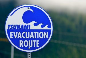
When an earthquake strikes a coastal area, it may just be the beginning of problems for nearby residents who must then seek higher ground in the event the shaking spawns a tsunami. Sacramento State Geography Professor Mathew Schmidtlein is part of a research effort aimed at giving those coastal residents a clearer path to safety.
The threat to a coastal community following an earthquake is not some longshot. More than 248,000 people have lost their lives in 155 tsunamis recorded worldwide over the last 12 years.
For the last five years, Schmidtlein and the study’s principal partner, Research Geographer Nathan Wood with the U.S. Geological Survey (USGS), have been looking at ways coastal residents can better protect themselves when a tsunami may be only minutes away.
Schmidtlein will present his team’s findings during the University’s first fall presentation in the STEM (Science, Technology, Engineering and Mathematics) series of lectures (csus.edu/nsm/successcenter). The free lecture will be presented at 6 p.m. Tuesday, Sept. 27, in the University Union, Redwood Room.
The team’s initial research expanded on previous work that created a model where the movements of individual evacuees were simulated, something like a computer game tracking what individuals might do in various scenarios.
That was a bit scenario-specific, and emergency managers were looking for something with more detail. “They essentially wanted a map that tells you how long it will take to get out of each area of a community,” Schmidtlein says.
Terrain is a major area of concern and the study looked at items such as what areas are impeded by overgrown vegetation, and how much time is added running over wet sand as compared to solid concrete. This information then is used to estimate the time needed to safely evacuate.
Demographics and the types of businesses in a given part of the community also have an impact on evacuations. For example, individuals at day care centers, retirement facilities, hospitals and tourist hotspots may face greater evacuation challenges than others.
Schmidtlein is especially proud of the real-life solutions the study can lead to. “It’s been gratifying to see people actually doing things with the research,” he says. “When you understand the relationship between how long it takes to evacuate and estimates of population, there are a number of things you can do with that.”
Mitigation measures may include keeping overgrown areas trimmed back or seeking easements through large swaths of private land to provide more direct routes to safety.
It also can determine what areas might be too far removed from safety and require a relatively new approach to tsunami protection: construction of a vertical evacuation structure, a building that will provide more immediate sanctuary above the flood waters. The first of its kind in the United States was built last year near Westport, Wash.
The tsunami project was funded by the USGS, and largely led by Schmidtlein and Wood. While it already has generated considerable information and guidelines, Schmidtlein says there’s more they can still do refining evacuation times.
“The hope is that the study results in something useful at the end,” he says. “And that’s what’s been most exciting.”
Video
Note: The above post is reprinted from materials provided by California State University, Sacramento.


